High Precision Applications with BeiDou
|
|
|
- Clifton Benson
- 5 years ago
- Views:
Transcription

1 High Precision Applications with BeiDou Lei HUANG Unicore Communications, Inc May 14, 2013
2 Contents Background Overview of BeiDou high precision products Applications of BeiDou high precision products Summary


3 Background BeiDou: Full Operational Capability for China and surrounding area since Dec 27, 2012.
4 Background BeiDou System Contributions Support tri-frequency applications New services on communications Short Message Service (RDSS function) More satellites and better frequency diversity 14 more satellites more signal components and more modulations GEO satellites can improve availability and TTFF


5 Overview of BeiDou high precision products Surveying CORS BDS B1/B2/B3 GPS L1/L2/L5 GLONASS L1/L2 GALILEO E1/E5a/E5b RTK Heading DGNSS GIS BDS B1 GPS L1 GLONASS L1 GALILEO E1 DGNSS


6 Overview of BeiDou high precision products CORS Rx RTK Rx GNSS BDS B1/B2/B3 GPS L1/L2 GLONASS L1/L2 BDS RNSS / RDSS GPS L1 DGNSS GIS Products


 GNSS")


7 Overview of BeiDou high precision products Unicore Rx Architecture BDS GPS GALILEO QZSS GLONASS IRNSS Signal Receiving Baseband PVT Any 4 (or more) GNSS satellites Unified and configurable baseband architecture - Code generation unit to support all types of PRN codes - Support BPSK, QPSK, BoC, mboc, AltBoC, etc. Unified GNSS coordinate and time system PVT with Embedded RAIM for security and integrity
8 Surveying, Mapping & GIS Continuously Operating Reference Stations Meteorological Applications Heading & Positioning Deformation monitoring

9 Surveying, Mapping & GIS Giving full play to the multi-constellation combined positioning accuracy advantage and BDS tri-frequency application advantages, it can provide more accurate, more reliable performance.


 CORS software:")

10 CORS: BeiDou Ground Base Enhancement System Consisting of 30 ground base stations GNSS Receiver: Unicore UR370 (BDS B1B2B3, GPS L1L2, GLONASS L1L2) CORS software: WHU PowerNetwork Positioning accuracy: Horizontal < 2cm; Vertical <5cm (RMS)

11 CORS: BeiDou Ground Base Enhancement System

12 CORS: BeiDou Ground Base Enhancement System


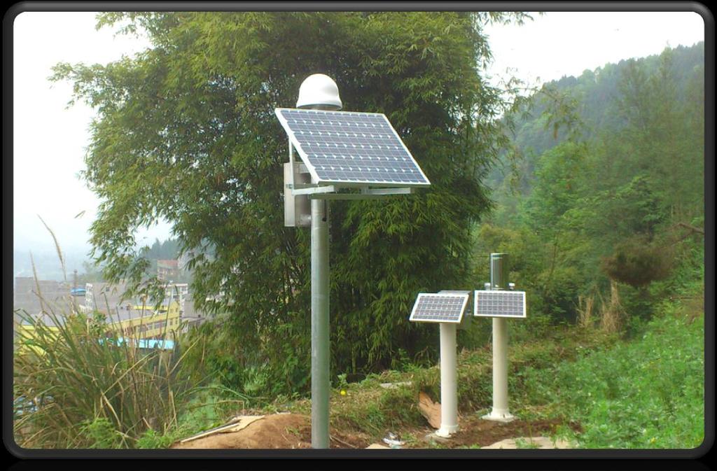
13 Meteorological Applications: water vapor monitoring & measurement system User: Requirements BDS B1/B2/B3 & GPS L1/L2 & GLONASS L1/L2 Range noise < 10cm RMS Carrier noise < 1mm RMS > 16GB flash for data storage Remote control and upgrade over TCP/IP Quantity 12 sets so far >200 sets in the coming years Unicore UR370


14 Meteorological Applications: water vapor monitoring & measurement system
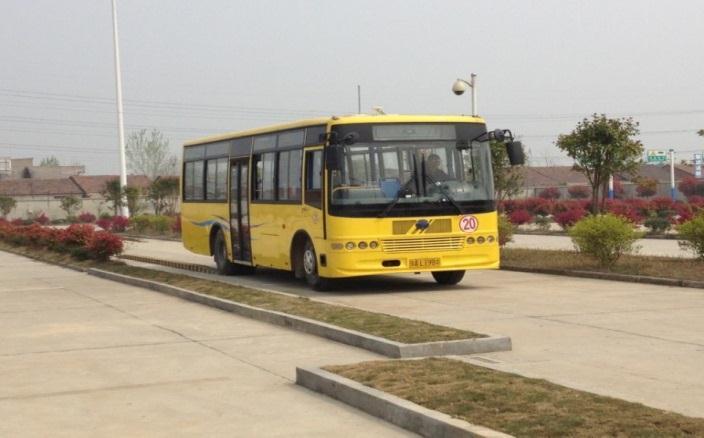
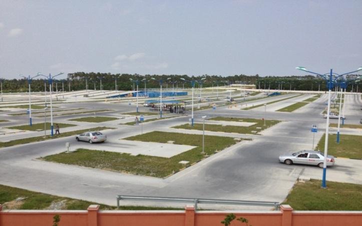
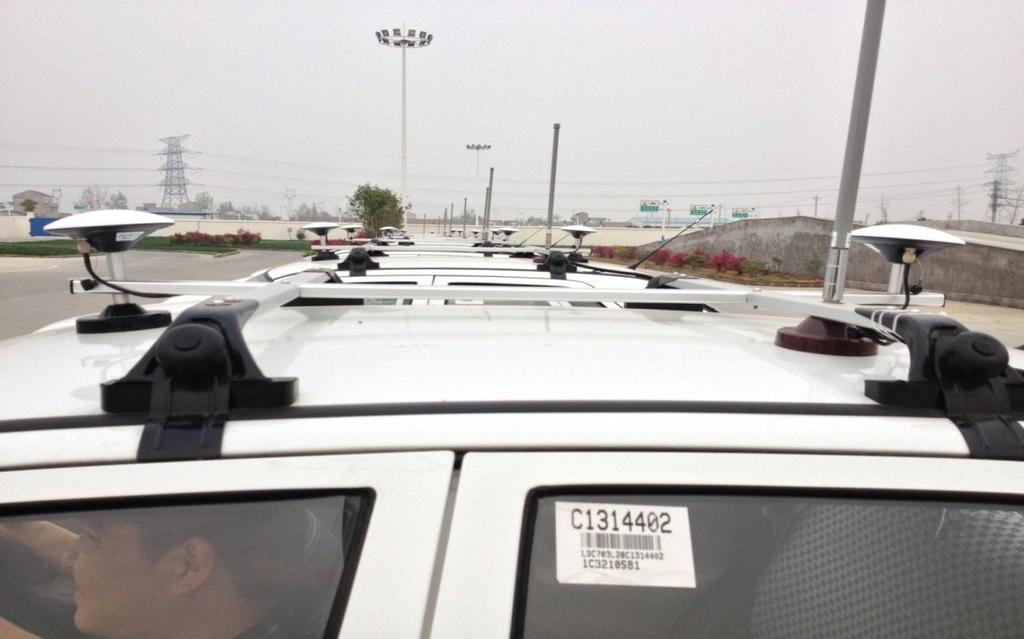
15 Heading & Positioning: Driving test The market vehicle positioning and heading market in China has great potential, especially in the field of driving test, due to the government requirements of layout specifications for driving test fields and facilities. With the use of dual-frequency or tri-frequency RTK and heading technology, BeiDou high precision receiver can achieve a position accuracy of 2cm, heading accuracy of 0.2, and a velocity accuracy of 0.03m/s, fully meet the requirement of driving test applications.
![Unicore Matched Position Errors [cm] Applications of BeiDou high precision products Heading & Positioning: Driving test 10 8 6 LAT: rms=0.623, = -0.005 LON: rms=0.532, = 0.](/docs-images/86/93509453/images/16-1.jpg "008 >Number:15588 HGT: rms=3.493, = 0.")
16 Unicore Matched Position Errors [cm] Applications of BeiDou high precision products Heading & Positioning: Driving test LAT: rms=0.623, = LON: rms=0.532, = >Number:15588 HGT: rms=3.493, = :36:39 13:23:39 14:10:39 14:57:39 15:44:39 16:31:39 GPS Time [sec] / Local Time [HH:MM:SS]
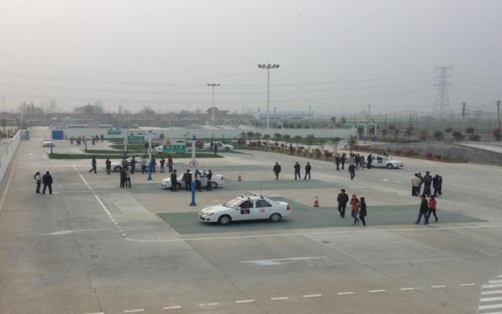
17


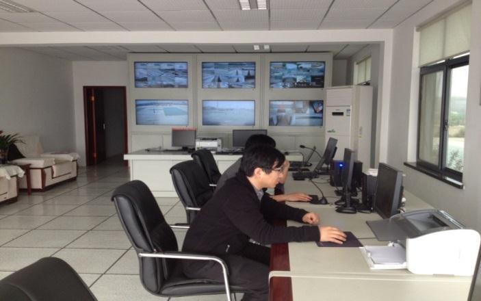
18 Vehicle subsystem Test software Test control centre Test field subsystem GNSS Base station Surveying system


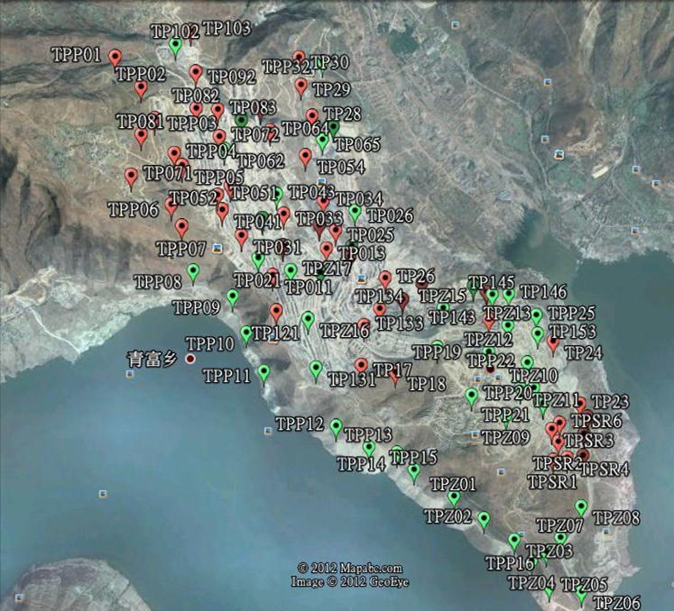
19 Deformation monitoring: Hanyuan, Sichuan
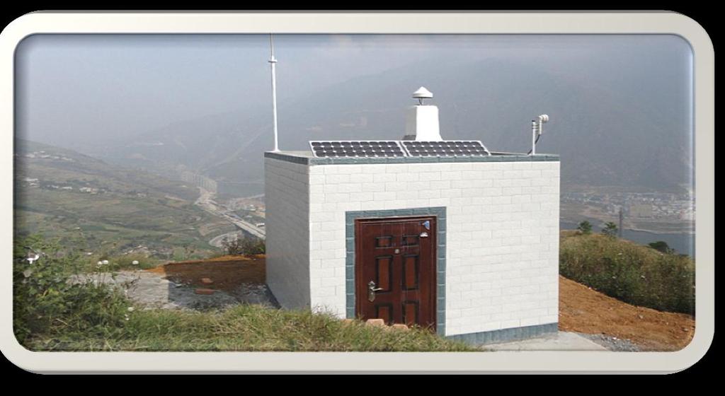
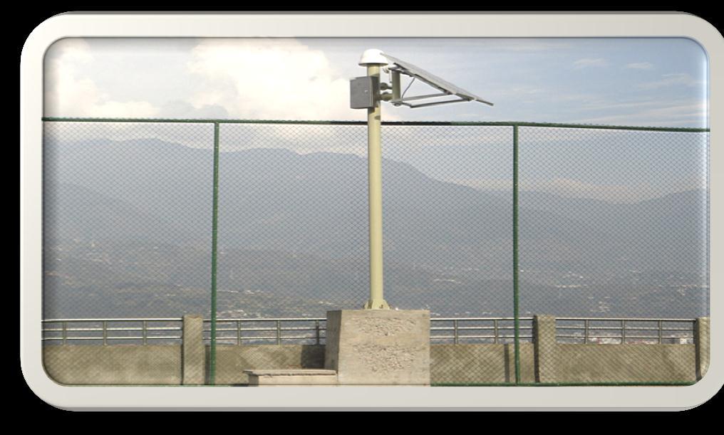
20 Deformation monitoring: Hanyuan, Sichuan


21 Deformation monitoring: Bazhong, Sichuan


22 Before and after the earthquake A 7.0-magnitude earthquake hit Lushan county of Ya'an city in southwest China's Sichuan Province, April 20, 2013
23 Summary BeiDou navigation system provides significant enhancements to GNSS. The BeiDou receivers has been already developed and also comprehensively used in high precision applications, such as surveying & GIS, CORS network, driving test system and deformation monitoring system, etc. Taking the advantages of BeiDou system and GNSS interoperability, wider applications will be explored not only in China and also worldwide.

24 Thank you! Dr. Lei HUANG
Future GNSS Precision Applications. Stuart Riley
 Future GNSS Precision Applications Stuart Riley Major Trimble Precision Markets Survey Mostly person portable equipment Construction Machine control and person carried equipment Includes Marine applications
BeiDou Next Generation Signal Design and Expected Performance
 International Technical Symposium on Navigation and Timing ENAC, 17 Nov 2015 BeiDou Next Generation Signal Design and Expected Performance Challenges and Proposed Solutions Zheng Yao Tsinghua University
BeiDou: Bring the World and China to Your Doorstep
 IGS Workshop 2012-ICG Working Group A BeiDou: Bring the World and China to Your Doorstep China Satellite Navigation Office 2012.7.25 Olsztyn, Poland 1 Contents I. Development Schemes II. Performance III.
New Signal Structures for BeiDou Navigation Satellite System
 Stanford's 2014 PNT Symposium New Signal Structures for BeiDou Navigation Satellite System Mingquan Lu, Zheng Yao Tsinghua University 10/29/2014 1 Outline 1 Background and Motivation 2 Requirements and
Status of COMPASS/BeiDou Development
 Status of COMPASS/BeiDou Development Stanford s 2009 PNT Challenges and Opportunities Symposium October 21-22,2009 Cao Chong China Technical Application Association for GPS Contents 1. Basic Principles
UB370. SupportBDS/GPS/GLONASSSatellites,andcan. morereliableandaccuratepositioningresult. LatestTri-System&Tri-frequencyRTK Engine
 Brief Introduction UB370 BDS/GPS/GLONASS Tri-System Hepta-Frequency High Precision OEM Board UB370isBDS/GPS/GLONASSTri-systemHepta-FrequencyOEMBoarddeveloped byunicorebasedonitsmaturebeidoucompatiblemulti-systemgnsssoc.ub370
Intro to GNSS & Teseo-LIV3F Module for IoT Positioning
 Intro to GNSS & Teseo-LIV3F Module for IoT Positioning Agenda 2 Presentation Speaker GPS Signal Overview GNSS Constellations Mike Slade Teseo3 Chipset Overview Multi-Constellation Benefit Teseo-LIV3F Module
GNSS Accuracy Improvements through Multipath Mitigation with New Signals and services
 GNSS Accuracy Improvements through Multipath Mitigation with New Signals and services Andrey Veytsel, Ph.D Moscow Technical University 10 Meeting of the International Committee on Global Navigation Satellite
Understanding GPS: Principles and Applications Second Edition
 Understanding GPS: Principles and Applications Second Edition Elliott Kaplan and Christopher Hegarty ISBN 1-58053-894-0 Approx. 680 pages Navtech Part #1024 This thoroughly updated second edition of an
Global Positioning Systems Directorate
 Space and Missile Systems Center Global Positioning Systems Directorate GPS Program Update to 8 th Stanford PNT Symposium 30 Oct 2014 Col Matt Smitham Deputy Director, GPS Directorate Global Positioning
Understanding GPS/GNSS
 Understanding GPS/GNSS Principles and Applications Third Edition Contents Preface to the Third Edition Third Edition Acknowledgments xix xxi CHAPTER 1 Introduction 1 1.1 Introduction 1 1.2 GNSS Overview
Geoscience & Positioning, Navigation and Timing Services for Canadians
 Geoscience & Positioning, Navigation and Timing Services for Canadians Calvin Klatt, Ph.D. Director and Chief Geodesist Natural Resources Canada / Directeur et géodésien principal Ressources naturelles
GNSS Signal Structures
 GNSS Signal Structures Tom Stansell Stansell Consulting Tom@Stansell.com Bangkok, Thailand 23 January 2018 S t a n s e l l C o n s u l t i n g RL Introduction It s a pleasure to speak with you this morning.
Introduction to Global Navigation Satellite System (GNSS) Signal Structure
 Signal Structure") Introduction to Global Navigation Satellite System (GNSS) Signal Structure Dinesh Manandhar Center for Spatial Information Science The University of Tokyo Contact Information: dinesh@iis.u-tokyo.ac.jp
Introduction to Global Navigation Satellite System (GNSS) Signal Structure Dinesh Manandhar Center for Spatial Information Science The University of Tokyo Contact Information: dinesh@iis.u-tokyo.ac.jp
Performance Evaluation of Differential Global Navigation Satellite System with RTK Corrections
 IOSR Journal of Electronics and Communication Engineering (IOSR-JECE) e-issn: 2278-2834,p- ISSN: 2278-8735.Volume 9, Issue 2, Ver. VI (Mar - Apr. 2014), PP 43-47 Performance Evaluation of Differential
GPS-Aided INS Datasheet Rev. 2.6
 GPS-Aided INS 1 GPS-Aided INS The Inertial Labs Single and Dual Antenna GPS-Aided Inertial Navigation System INS is new generation of fully-integrated, combined GPS, GLONASS, GALILEO and BEIDOU navigation
The International Scene: How Precise Positioning Will Underpin Critical GNSS Applications
 The International Scene: How Precise Positioning Will Underpin Critical GNSS Applications School of Civil & Environmental Engineering, UNSW, Sydney, Australia Chris Rizos Member of the IGS Governing Board
International Cooperation Research Center, China Satellite Navigation Office
 International Cooperation Research Center, ICG-8, Nov 10, 2013 Dubai Overview BeiDou Navigation Satellite System (hereinafter referred to as BDS") has provide regional service by the end of 2012, which
King AbdulAziz University. Faculty of Environmental Design. Geomatics Department. Mobile GIS GEOM 427. Lecture 3
 King AbdulAziz University Faculty of Environmental Design Geomatics Department Mobile GIS GEOM 427 Lecture 3 Ahmed Baik, Ph.D. Email: abaik@kau.edu.sa Eng. Fisal Basheeh Email: fbasaheeh@kau.edu.sa GNSS
The Global Positioning Sytem II 10/19/2017
 The Global Positioning System II Field Experiments 10/19/2017 5-1 Mexico DGPS Field Campaign Cenotes in Tamaulipas, MX, near Aldama 10/19/2017 5-2 Are Cenote Water Levels Related? 10/19/2017 5-3 M. Helper,
MOBNET Presentation to Inachus Group (MOBile NETwork for people s location in natural and man-made disasters)
") MOBNET Presentation to Inachus Group (MOBile NETwork for people s location in natural and man-made disasters) Project Framework Kick-off January 2016 Duration 26 months Customer GSA EC/H2020 Galileo SME
MOBNET Presentation to Inachus Group (MOBile NETwork for people s location in natural and man-made disasters) Project Framework Kick-off January 2016 Duration 26 months Customer GSA EC/H2020 Galileo SME
Webinar. 9 things you should know about centimeter-level GNSS accuracy
 Webinar 9 things you should know about centimeter-level GNSS accuracy Webinar agenda 9 things you should know about centimeter-level GNSS accuracy 1. High precision GNSS challenges 2. u-blox F9 technology
GPS-Aided INS Datasheet Rev. 2.7
 1 The Inertial Labs Single and Dual Antenna GPS-Aided Inertial Navigation System INS is new generation of fully-integrated, combined GPS, GLONASS, GALILEO, QZSS and BEIDOU navigation and highperformance
Prospect for Global Positioning Augmentation Service by QZSS
 Prospect for Global Positioning Augmentation Service by QZSS Global Positioning Augmentation Service Corporation Director, Yoshikatsu Iotake Feb. 6, 2018 Copyright 2018 Global Positioning Augmentation
CHC Navigation. July 2017 Haitham Haroun Africa Business Manager, CHC Nav
 CHC Navigation July 2017 Haitham Haroun Africa Business Manager, CHC Nav CHC - Overview 1. CHC Overview 2. GNSS New Technologies Overview 3. CHC Technology 4. Summary CHC - Overview Shanghai CHC Navigation
Field experience with future GNSS ranging signals (a review). A.Simsky, J.-M. Sleewaegen, W. De Wilde Septentrio, Belgium
. A.Simsky, J.-M. Sleewaegen, W. De Wilde Septentrio, Belgium") Field experience with future GNSS ranging signals (a review). A.Simsky, J.-M. Sleewaegen, W. De Wilde Septentrio, Belgium Technical University of Munich June 07 2010 Contents Septentrio: company profile
Field experience with future GNSS ranging signals (a review). A.Simsky, J.-M. Sleewaegen, W. De Wilde Septentrio, Belgium Technical University of Munich June 07 2010 Contents Septentrio: company profile
GPS-Aided INS Datasheet Rev. 3.0
 1 GPS-Aided INS The Inertial Labs Single and Dual Antenna GPS-Aided Inertial Navigation System INS is new generation of fully-integrated, combined GPS, GLONASS, GALILEO, QZSS, BEIDOU and L-Band navigation
BDS Real-time Precise Products from WHU and its application in NBASS
 BDS Real-time Precise Products from WHU and its application in NBASS Shi C., Lou YD., Li M., Gu SF., Zhang WX., Zheng F., Li XJ., Song WW., Dai XL., Yi WT. GNSS Research Center of Wuhan University, GRC
Development of BeiDou Navigation Satellite System
 The 8 th Meeting of the International Committee on GNSS Development of BeiDou Navigation Satellite System China Satellite Navigation Office Dubai, UAE November, 2013 Contents Contents 1. Objectives and
Introduction to Global Navigation Satellite System (GNSS) Module: 1
 Module: 1") Introduction to Global Navigation Satellite System (GNSS) Module: 1 Dinesh Manandhar Center for Spatial Information Science The University of Tokyo Contact Information: dinesh@iis.u-tokyo.ac.jp Slide :
Introduction to Global Navigation Satellite System (GNSS) Module: 1 Dinesh Manandhar Center for Spatial Information Science The University of Tokyo Contact Information: dinesh@iis.u-tokyo.ac.jp Slide :
The Global Positioning System II Field Experiments
 The Global Positioning System II Field Experiments 5-1 Mexico DGPS Field Campaign Cenotes in Tamaulipas, MX, near Aldama 5-2 Are Cenote Water Levels Related? 5-3 DGPS Static Survey of Cenote Water Levels
The report of Japan GNSS Interoperability Workshop. November 12th 2014 Quasi-Zenith Satellite System Services Inc.
 The report of Japan GNSS Interoperability Workshop November 12th 2014 Quasi-Zenith Satellite System Services Inc. Quasi-Zenith Satellite System Services Inc. 2014 Japan GNSS Interoperability Workshop Date
Challenges and Solutions for GPS Receiver Test
 Challenges and Solutions for GPS Receiver Test Presenter: Mirin Lew January 28, 2010 Agenda GPS technology concepts GPS and GNSS overview Assisted GPS (A-GPS) Basic tests required for GPS receiver verification
Operation and Development of BeiDou Navigation Satellite System
 Operation and Development of BeiDou Navigation Satellite System Jing Li IAIN 2015, 20 23 October Prague, Czech Republic 2 01 03 Plan and Policy 02 Status and Near-term Goal International Cooperation 3
Report of the Working Group B: Enhancement of Global Navigation Satellite Systems (GNSS) Services Performance
 Services Performance") Report of the Working Group B: Enhancement of Global Navigation Satellite Systems (GNSS) Services Performance 1. The Working Group on Enhancement of Global Navigation Satellite Systems (GNSS) Service Performance
Report of the Working Group B: Enhancement of Global Navigation Satellite Systems (GNSS) Services Performance 1. The Working Group on Enhancement of Global Navigation Satellite Systems (GNSS) Service Performance
An Industry View on Realistic Benefits for High Precision GNSS Applications due to GNSS Modernisation The Future of High Precision GNSS
 An Industry View on Realistic Benefits for High Precision GNSS Applications due to GNSS Modernisation The Future of High Precision GNSS Bernhard Richter GNSS Business Director at Leica Geosystems 1 Content
One Source for Positioning Success
 novatel.com One Source for Positioning Success RTK, PPP, SBAS OR DGNSS. NOVATEL CORRECT OPTIMIZES ALL CORRECTION SOURCES, PUTTING MORE POWER, FLEXIBILITY AND CONTROL IN YOUR HANDS. NovAtel CORRECT is the
Assessment of GNSS Ionospheric Scintillation and TEC Monitoring Using the Multi-constellation GPStation-6 Receiver
 Assessment of GNSS Ionospheric Scintillation and TEC Monitoring Using the Multi-constellation GPStation-6 Receiver Rod MacLeod Regional Manager Asia/Pacific NovAtel Australia Pty Ltd Outline Ionospheric
Fast convergence of Trimble CenterPoint RTX by regional augmentation
 Fast convergence of Trimble CenterPoint RTX by regional augmentation Dr. Ralf Drescher Trimble Terrasat GmbH, Munich EGU General Assembly 2015, Vienna Thursday, 16 April 2015 Outline Introduction CenterPoint
Signal Structures for Satellite-Based Navigation: Past, Present, and Future*
 Signal Structures for Satellite-Based Navigation: Past, Present, and Future* John W. Betz 23 April 2013 *Approved for Public Release; Distribution Unlimited. 13-0908. The contents of this material reflect
Jun Shen International Cooperation Center. China Satellite Navigation Office
 Jun Shen (shenjun@beidou.gov.cn) International Cooperation Center Tenth Meeting of the International Committee on Global Navigation Satellite Systems (ICG) November 1-6, 2015 1 Introduction and Background
GPS-Aided INS Datasheet Rev. 2.3
 GPS-Aided INS 1 The Inertial Labs Single and Dual Antenna GPS-Aided Inertial Navigation System INS is new generation of fully-integrated, combined L1 & L2 GPS, GLONASS, GALILEO and BEIDOU navigation and
Motion & Navigation Solution
 Navsight Land & Air Solution Motion & Navigation Solution FOR SURVEYING APPLICATIONS Motion, Navigation, and Geo-referencing NAVSIGHT LAND/AIR SOLUTION is a full high performance inertial navigation solution
NCS TITAN. The most powerful GNSS Simulator available. NCS TITAN Datasheet. Scalability. Extendability. In co-operation with
 NCS TITAN The most powerful GNSS Simulator available Scalability Fidelity Reliability Usability Extendability Flexibility Upgradability Features Signal Capabilities Support of all global (GNSS) and regional
Signals, and Receivers
 ENGINEERING SATELLITE-BASED NAVIGATION AND TIMING Global Navigation Satellite Systems, Signals, and Receivers John W. Betz IEEE IEEE PRESS Wiley CONTENTS Preface Acknowledgments Useful Constants List of
Dynamic Reconfiguration in a GNSS Software Defined Radio for Multi-Constellation Operation
 Dynamic Reconfiguration in a GNSS Software Defined Radio for Multi-Constellation Operation Alison K. Brown and D Arlyn Reed, NAVSYS Corporation BIOGRAPHY Alison Brown is the President and Chief Executive
Sokkia GNSS Receiver. Product Portfolio. Price GRX2 GCX2. GHX2 MESA Field Tablet SA300 S-10. Features
 Only from Sokkia GNSS Receiver Price Product Portfolio GRX2 GCX2 S-10 GHX2 MESA Field Tablet SA300 Features Product Overview Smallest and lightest GNSS integrated receiver Innovative and ergonomic shape
Future of GNSS Receivers. Éamonn Glennon
 Future of GNSS Receivers Éamonn Glennon Future of GNSS Receivers? What have we got now? What do customers want? What does government want? What are the problems with current receivers? What type of receivers?
Introduction to Total Station and GPS
 Introduction to Total Station and GPS Dr. P. NANJUNDASWAMY Professor of Civil Engineering J S S Science and Technology University S J College of Engineering Mysuru 570 006 Introduction History GPS Overview
Satellite-Based Augmentation System (SBAS) Integrity Services
 Integrity Services") Satellite-Based Augmentation System (SBAS) Integrity Services Presented To: Munich, Germany Date: March 8, 2010 By: Leo Eldredge, Manager GNSS Group, FAA FAA Satellite Navigation Program 2 Wide Area Augmentation
Satellite-Based Augmentation System (SBAS) Integrity Services Presented To: Munich, Germany Date: March 8, 2010 By: Leo Eldredge, Manager GNSS Group, FAA FAA Satellite Navigation Program 2 Wide Area Augmentation
CHC MINING DEFORMATION MONITORING SOLUTION
 CHC MINING DEFORMATION MONITORING SOLUTION Safety is first in mining. CHC offers solutions designed to improve safety for personnel on the ground and in the cab with 24/7 precision positioning for automatic
GNSS MONITORING NETWORKS
 SPACE GNSS MONITORING NETWORKS Satellite communications, earth observation, navigation and positioning and control stations indracompany.com GNSS MONITORING NETWORKS GNSS MONITORING NETWORKS Indra s solutions
Precise Positioning with Smartphones running Android 7 or later
 Precise Positioning with Smartphones running Android 7 or later * René Warnant, * Cécile Deprez, + Quentin Warnant * University of Liege Geodesy and GNSS + Augmenteo, Plaine Image, Lille (France) Belgian
GNSS Low-Cost High-Accuracy Receiver (L-CHAR)
") GNSS Low-Cost High-Accuracy Receiver (L-CHAR) Dinesh Manandhar Center for Spatial Information Science The University of Tokyo Contact Information: dinesh@iis.u-tokyo.ac.jp Slide : 1 High Accuracy Receivers
GNSS Low-Cost High-Accuracy Receiver (L-CHAR) Dinesh Manandhar Center for Spatial Information Science The University of Tokyo Contact Information: dinesh@iis.u-tokyo.ac.jp Slide : 1 High Accuracy Receivers
SLX-1 Multi-Application GNSS Receiver
 SLX-1 Multi-Application GNSS Receiver w w w.sa tla b g p s. c o m SLX-1 Multi-Application GNSS Receiver Designed for CORS Ready for Anything European Standards GPS GLONASS BEIDOU GALILEO SBAS QZSS Long
Update on BeiDou Navigation Satellite System
 Update on BeiDou Navigation Satellite System 1 BDS Development 2 Near-term Plans BD-2 System FOC services from December, 2012 (5GEO+5IGSO+4MEO) Two on-orbit backup satellites launched in 2016 (1 IGSO+1
Resection. We can measure direction in the real world! Lecture 10: Position Determination. Resection Example: Isola, Slovenia. Professor Keith Clarke
 Geography 12: Maps and Spatial Reasoning Lecture 10: Position Determination We can measure direction in the real world! Professor Keith Clarke Resection Resection Example: Isola, Slovenia Back azimuth
WHO S YOUR DADDY? WHY GPS RULES GNSS
 WHO S YOUR DADDY? WHY GPS RULES GNSS Frank van Diggelen, Broadcom and Stanford Aero-Astro Stanford PNT, 14 Nov 2013 Thanks for their contributions, edits & comments to: John Betz, Charlie Abraham, Sergei
Perspective of Eastern Global Satellite Navigation Systems
 POSTER 2015, PRAGUE MAY 14 1 Perspective of Eastern Global Satellite Navigation Systems Jiří SVATOŇ Dept. of Radioengineering, Czech Technical University, Technická 2, 166 27 Praha, Czech Republic svatoji2@fel.cvut.cz
Development of Hong Kong GNSS infrastructure
 Development of Hong Kong GNSS infrastructure Wu Chen Department of Land Surveying and Geoinformatics (LSGI) Hong Kong Polytechnic University Hong Kong 1 Research Areas Research Areas GNSS Positioning and
Establishment of Regional Navigation Satellite System Utilizing Quasi-Zenith Satellite System
 Establishment of Regional Navigation Satellite System Utilizing Quasi-Zenith Satellite System Authors: Masayuki Saito*, Junichi Takiguchi* and Takeshi Okamoto* 1. Introduction The Global Navigation Satellite
Positioning with Single and Dual Frequency Smartphones Running Android 7 or Later
 Positioning with Single and Dual Frequency Smartphones Running Android 7 or Later * René Warnant, *Laura Van De Vyvere, + Quentin Warnant * University of Liege Geodesy and GNSS + Augmenteo, Plaine Image,
TRIUMPH-LS. The Ultimate RTK Land Survey Machine
 The Ultimate RTK Land Survey Machine Introducing GUIDE data collection in the. Visual Stake-out, navigation, six parallel RTK engines, over 3,000 coordinate conversions, advanced CoGo features, rich attribute
Radio Navigation Aids Flight Test Seminar
 Radio Navigation Aids Flight Test Seminar FLIGHT INSPECTION IN THE NEW MILLENNIUM Curt Keedy FAA Flight Inspection Policy and Standards Change, Challenge, and Opportunity CHANGES Global Positioning system
Professional GNSS solutions in challenging environments
 Professional GNSS solutions in challenging environments Company history 2000 Septentrio is founded as a spin-off from IMEC, world s premier semiconductor research center and still a strong partner & shareholder.
PRELIMINARY PROGRAMME
 ICG EXPERTS MEETING: GLOBAL NAVIGATION SATELLITE SYSTEMS SERVICES 14-18 December 2015 Vienna International Centre, Vienna, Austria Organized by International Committee on Global Navigation Satellite Systems
Principal Investigator Co-Principal Investigator Co-Principal Investigator Prof. Talat Ahmad Vice-Chancellor Jamia Millia Islamia Delhi
 Subject Paper No and Title Module No and Title Module Tag Geology Remote Sensing and GIS Concepts of Global Navigation Satellite RS & GIS XXXIII Principal Investigator Co-Principal Investigator Co-Principal
Lecture-1 CHAPTER 2 INTRODUCTION TO GPS
 Lecture-1 CHAPTER 2 INTRODUCTION TO GPS 2.1 History of GPS GPS is a global navigation satellite system (GNSS). It is the commonly used acronym of NAVSTAR (NAVigation System with Time And Ranging) GPS (Global
GPS/WAAS Program Update
 GPS/WAAS Program Update UN/Argentina Workshop on the Applications of GNSS 19-23 March 2018 Cordoba, Argentina GNSS: A Global Navigation Satellite System of Systems Global Constellations GPS (24+3) GLONASS
Quasi-Zenith Satellite System (QZSS)
") Transmission of Augmentation Corrections using the Japanese QZSS for Real-Time Precise Point Positioning in Australia Ken Harima 1, Suelynn Choy 1, Mazher Choudhury 2, Chris Rizos 2, Satoshi Kogure 3 1
Transmission of Augmentation Corrections using the Japanese QZSS for Real-Time Precise Point Positioning in Australia Ken Harima 1, Suelynn Choy 1, Mazher Choudhury 2, Chris Rizos 2, Satoshi Kogure 3 1
Leica GRX1200+ Series High Performance GNSS Reference Receivers
 Leica GRX1200+ Series High Performance GNSS Reference Receivers Leica GRX1200+ Series For permanent reference stations The Leica GRX1200+ Series, part of Leica's future proof System 1200, is designed specifically
ICG GNSS Interoperability Workshop A Civil Aviation Perspective
 Approved for Public Release; Distribution Unlimited. 13-1907. ICG GNSS Interoperability Workshop A Civil Aviation Perspective C h r i s t o p h e r J. H e g a r t y A p r i l 2 0 1 3 Disclaimer: The contents
Space and Missile Systems Center
 Space and Missile Systems Center Global Positioning Systems Directorate GPS Status & Modernization Progress: Service, Satellites, Control Segment, and Military GPS User Equipment 3 Nov 2016 Col Steve Whitney,
Configuring the Global Navigation Satellite System
 Configuring the Global Navigation Satellite System Effective Cisco IOS-XE Release 3.17, the Cisco ASR 903 (with RSP3 module) and Cisco ASR 907 router uses a satellite receiver, also called the global navigation
GNSS 101 Bringing It Down To Earth
 GNSS 101 Bringing It Down To Earth Steve Richter Frontier Precision, Inc. UTM County Coordinates NGVD 29 State Plane Datums Scale Factors Projections Session Agenda GNSS History & Basic Theory Coordinate
GNSS Training for ITS Developers. 1 - GNSS Principles
 GNSS Training for ITS Developers 1 - GNSS Principles Table of Content Introduction to Satellite Navigation Systems Basics on GNSS Receivers Galileo, the European GNSS EGNOS, the European Augmentation System
Configuring the Global Navigation Satellite System
 Configuring the Global Navigation Satellite System Effective Cisco IOS-XE Release 3.17, the Cisco ASR-920-12SZ-IM router uses a satellite receiver, also called the global navigation satellite system (GNSS),
Progress of igmas and
 2017 ICG-12 Progress of igmas and IGMA Joint Trial Project igmas TEAM Kyoto Japan 2th Dec. 2017 Contents 1. Introduction 2. Progress of IGMA Joint Trial Project 3. Reference for Monitoring and Assessment
GPS Application. Global Positioning System. We provide GPS module ODM / OEM service, any GPS receiver you want, we can provide customized services.
 GPS Application Global Positioning System We provide GPS module ODM / OEM service, any GPS receiver you want, we can provide customized services. www.win-tec.com.tw sales@win-tec.com.tw GNSS Receiver WGM-303
WHITE PAPER ABSTARCT. The new Quantum TM Algorithm by ComNav Technology July 2016
 WHITE PAPER The new Quantum TM Algorithm by ComNav Technology July 206 ABSTARCT The latest Quantum TM algorithm, as an upgrade of ComNav Technology Quan tm Algorithm, is a brand new technology that improves
MGA Webinar Series : 1 Very Cheap RTK Receivers: Changing the Landscape of Positioning Services
 MGA Webinar Series : 1 Very Cheap RTK Receivers: Changing the Landscape of Positioning Services Dinesh Manandhar Center for Spatial Information Science The University of Tokyo Contact Information: dinesh@iis.u-tokyo.ac.jp
Bernhard Hofnlann-Wellenhof Herbert Lichtenegger Elmar Wasle. GNSS - Global Navigation Satellite Systenls. GPS, GLONASS, Galileo, and nl0re
 Bernhard Hofnlann-Wellenhof Herbert Lichtenegger Elmar Wasle GNSS - Global Navigation Satellite Systenls GPS, GLONASS, Galileo, and nl0re SpringerWienNewYork Contents Abbreviations xxi 1 Introduction 1
GFZ Analysis Centre: Multi-GNSS Processing and Products
 GFZ Analysis Centre: Multi-GNSS Processing and Products Mathias Fritsche, Zhiguo Deng, Maik Uhlemann,Thomas Nischan, Markus Bradke, Markus Ramatschi, Andre Brand, Gerda Beeskow DeutschesGeoforschungsZentrum
Trimble NetR9 Reference Receiver Series: Frequently Asked Questions
 July 2010 Trimble NetR9 Reference Receiver Series: Frequently Asked Questions What is the Trimble NetR9 GNSS reference receiver? The Trimble NetR9 GNSS (Global Navigation Satellite System) reference receiver
Compact multi-gnss PPP corrections messages for transmission through a 250 bps channel
 Compact multi-gnss PPP corrections messages for transmission through a 250 bps channel Ken Harima, School of Science, RMIT University Suelynn Choy, School of Science, RMIT University Chris Rizos, School
Status of the European EGNOS and Galileo Programmes. Frank Udnaes Galileo policy and Infrastructure group EC DG-TREN. June 2008
 Status of the European EGNOS and Galileo Programmes Frank Udnaes Galileo policy and Infrastructure group EC DG-TREN EUROPEAN COMMISSION z June 2008 Galileo An infrastructure 30 satellite Constellation
Monitoring Station for GNSS and SBAS
 Monitoring Station for GNSS and SBAS Pavel Kovář, Czech Technical University in Prague Josef Špaček, Czech Technical University in Prague Libor Seidl, Czech Technical University in Prague Pavel Puričer,
Trustworthy Positioning for Next Generation Intelligent Transport Systems Ahmed El-Mowafy
 Trustworthy Positioning for Next Generation Intelligent Transport Systems Ahmed El-Mowafy Contents Background on ITS and C-ITS Requirements Challenges RAIM Test and Results Utilisation Workshop, Sydney,
GNSS Technology Update
 GNSS Technology Update Speaker: Eric Gakstatter Contributing Editor GPS World Editor - Geospatial Solutions Presented at: Association of Petroleum Surveying & Geomatics Houston, TX April 7, 2015 Agenda
Precise Point Positioning with BeiDou
 Precise Point Positioning with BeiDou Ole Ørpen Fugro Satellite Positioning AS Geodesi- og Hydrografidagene Stavanger, 12-13 Nov. 2014 Fugro 2013 Contents The G2 service Galileo Testing 2013 BeiDou Testing
High Precision GNSS for Mapping & GIS Professionals
 High Precision GNSS for Mapping & GIS Professionals Agenda Address your needs for GNSS knowledge. GNSS Basics Satellite Ranging Fundamentals (Code $ Carrier) Differential Corrections (Post Processed $
International GNSS Monitoring & Assessment Service for OS (igmas) ICG September 2011, Tokyo, Japan
 ICG September 2011, Tokyo, Japan") Presentation on igmas FOR WORKING GROUP A International GNSS Monitoring & Assessment Service for OS (igmas) by Xurong Dong International Cooperation Research Centre, CSNO ICG 6 5 9 September 2011, Tokyo,
Presentation on igmas FOR WORKING GROUP A International GNSS Monitoring & Assessment Service for OS (igmas) by Xurong Dong International Cooperation Research Centre, CSNO ICG 6 5 9 September 2011, Tokyo,
Generation of Consistent GNSS SSR Corrections
 Generation of Consistent GNSS SSR Corrections for Distributed CORS Networks Jannes Wübbena, Martin Schmitz, Gerhard Wübbena Geo++ GmbH 30827 Garbsen, Germany www.geopp.de Abstract Generation of Consistent
TRIUMPH TECHNOLOGY. Javad Ashjaee
 TRIUMPH TECHNOLOGY Javad Ashjaee JAVAD GNSS www.javad.com International SatelliteNavigation Forum Moscow, April 7, 2008 TRIUMPH WE ARE BACK TO LEAD With TRIUMPH! 2 TRIUMPH Technology At the heart of our
Inertial Navigation System
 Apogee Series ULTIMATE ACCURACY MEMS Inertial Navigation System INS MRU AHRS ITAR Free 0.005 RMS Motion Sensing & Georeferencing APOGEE SERIES makes high accuracy affordable for all surveying companies.
Where Next for GNSS?
 Where Next for GNSS? Professor Terry Moore Professor of Satellite Navigation Nottingham The University of Nottingham Where Next for GNSS Back to the Future? Professor Terry Moore Professor of Satellite
Using Dual Frequency GPS Under Tree Canopy
 Using Dual Frequency GPS Under Tree Canopy Presented by: Jon Aschenbach Resource Supply, LLC PO Box 663 West Linn, OR 97068 503-521-0888 Field Technology Conference 11-2015 Four Scenarios Will Be Reviewed
European GNSS Evolution
 Ref. Ares(204)902599 - /06/204 European GNSS Evolution Hermann Ebner Galileo and EGNOS Programme Management DG Enterprise and Industry Content Introduction 2 2 Major Challenges for EGNSS Evolution 3 EGNSS
DESIGN AND IMPLEMENTATION OF INTEGRATED GLOBAL NAVIGATION SATELLITE SYSTEM (GNSS) RECEIVER. B.Tech Thesis Report
 RECEIVER. B.Tech Thesis Report") Indian Institute of Technology Jodhpur DESIGN AND IMPLEMENTATION OF INTEGRATED GLOBAL NAVIGATION SATELLITE SYSTEM (GNSS) RECEIVER B.Tech Thesis Report Submitted by Arun Balajee V, Aswin Suresh and Mahesh
Indian Institute of Technology Jodhpur DESIGN AND IMPLEMENTATION OF INTEGRATED GLOBAL NAVIGATION SATELLITE SYSTEM (GNSS) RECEIVER B.Tech Thesis Report Submitted by Arun Balajee V, Aswin Suresh and Mahesh
TEST YOUR SATELLITE NAVIGATION PERFORMANCE ON YOUR ANDROID DEVICE GLOSSARY
 TEST YOUR SATELLITE NAVIGATION PERFORMANCE ON YOUR ANDROID DEVICE GLOSSARY THE GLOSSARY This glossary aims to clarify and explain the acronyms used in GNSS and satellite navigation performance testing