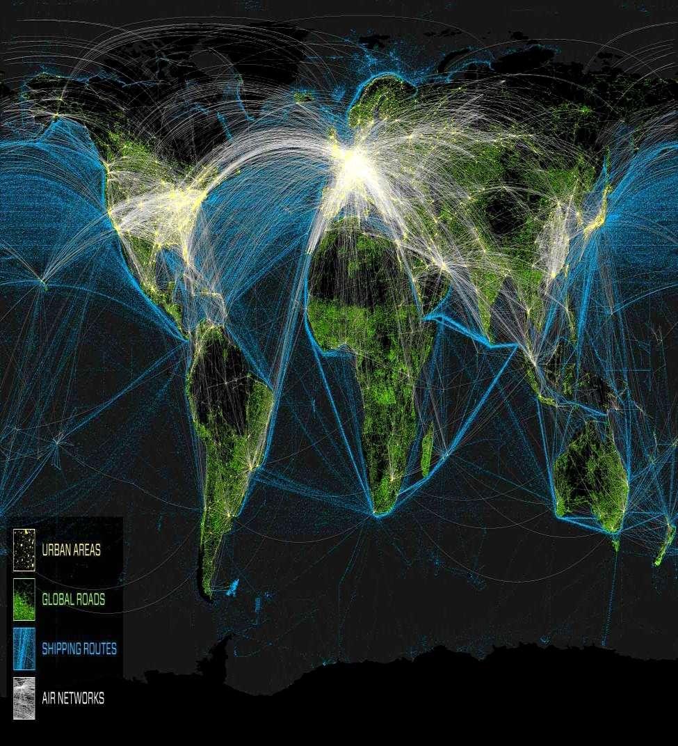
It is an Interconnected World. Except in the Maritime Domain In 2008 Satellite AIS (S-AIS) Changed All that!
|
|
|
- Delilah Hubbard
- 5 years ago
- Views:
Transcription
1 It is an Interconnected World Except in the Maritime Domain In 2008 Satellite AIS (S-AIS) Changed All that!

2 Background This brief is the result of that Research, which continues to this day.
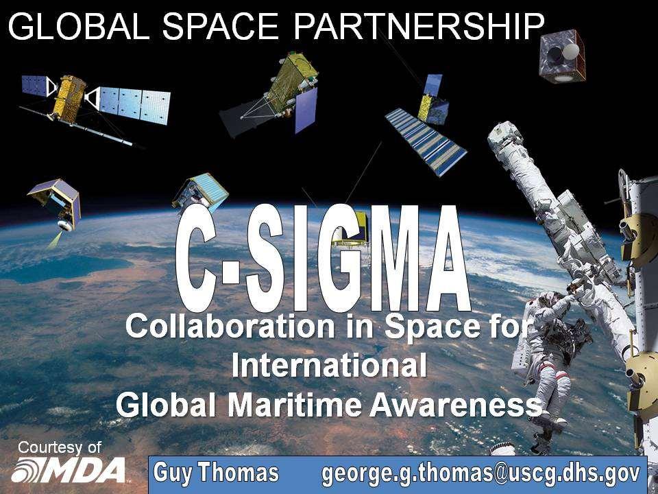
3 Makes Regional & Global Most Significant Change to Maritime Maritime Situational Awareness Operations since the Screw propeller (Yes, More Significant than GPS!) Guy Thomas
4

5 2002 The Collaborative Information Environment in the Maritime Domain 5 March 2002
6

7

8
9
10 Makes for a better, safer, more secure WORLD!
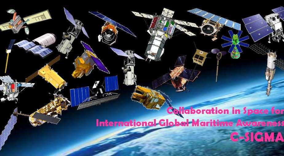
11 * Photo

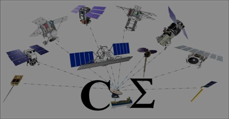
12 Satellite AIS Synthetic Aperture Radar Optical Imager Communications (M2M/SMS/LRIT)
13
14 S-AIS Created to provide Maritime Security to USA, its use has expanded far beyond Environmental Protection Maritime Resource Protection Safety Commodities Trading Route Planning Ship Maintenance + + +
 transceiver Mandated by the International Maritime Organization (IMO) to be Installed on")
15 WHAT IS AIS? A collision avoidance system that broadcasts a vessel s id, position and other data via VHF (line of sight) transceiver Mandated by the International Maritime Organization (IMO) to be Installed on hundreds of thousands of larger vessels ORBCOMM Worked on S-AIS concept from October 2001 with Johns Hopkins Applied Physics Laboratory (JHU/APL) ORBCOMM Pioneered the collection of AIS data from space in 2004 with the US Coast Guard ORBCOMM Launched first 6 Sat Constellation in ORBCOMM provides the industry s most comprehensive AIS service
16 ORBCOMM launched 11 next generation December now on orbit Reporting to 16+ Ground stations Time late down to just a few minutes, Globally exactearth plans to launch 30 + in the next 4 years (?), with cross-link reporting, taking time late to very near real time. Spire Global is in the process of launching 40+ which will also have reporting periods in the few minutes.
17 Sufficiency Latency is here now Latency = Time from Collection Opportunity-to-Collection-to-Report With completion of ORBCOMM constellation Latency < 10 minutes in the most populated areas of the world. < than a minute in many areas & instances due to global distribution of ORBCOMM Ground Station allow direct reporting from ship-to- satellite-to-ground station-to-user.

18 ORBCOMM s Satellite AIS System ORBCOMM leverages its established commercial M2M satellite business, recent satellite deployments and established infrastructure worldwide to provide global AIS data service ORBCOMM and GPS satellites ORBCOMM Gateway Earth Station AIS database AIS message broadcast Terrestrial AIS network Customer-specific tools Customer Display

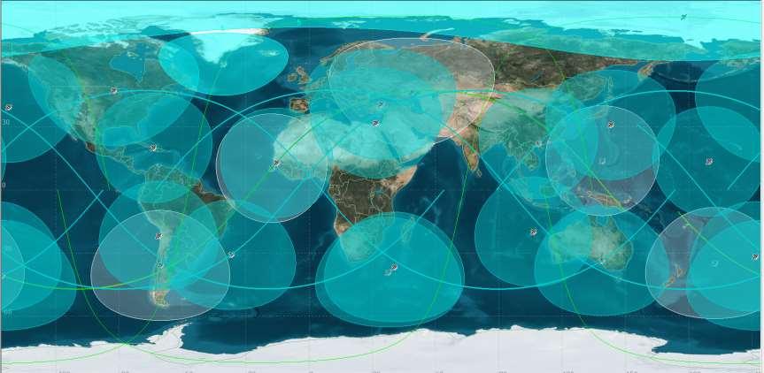
19 19 Satellites + 16 Global Ground Stations Multiple Best-in-Class Terrestrial AIS Data Partners 23+ Million Messages Daily and > 180,000 Vessels Daily OG2 provides near continuous coverage with average revisit rates of 8-15 minutes and less than 10-minute latency worldwide.

20 A snapshot in time: Orbiting satellites provide near continuous coverage


21 Washington Norway Kazakhstan Arizona New York Georgia Morocco Italy Korea Japan Curaçao Oman 2017 Malaysia Brazil Australia Argentina South Africa Gateway Earth Station


22 GLOBAL AIS DATA Terrestrial AIS provides real-time coverage in various locations around the world Satellite AIS data provides near-real-time complete global coverage


23 Commercial Government Commercial Government AIS APPLICATIONS BEYOND COLLISION AVOIDANCE Surveillance and security Search and rescue Data fusion with sensors Counter piracy Environmental monitoring Incident investigation Logistical tracking Energy/commodity tracking Fishing regulation compliance


24 Worldwide average fish consumption is 160 million tons per year, China consumes one-third. Regulations are required to prevent overfishing and allow replenishment of supply..
25 S-AIS Competition Heats Up Both Spire and exactearth/harris are planning S-AIS constellations with time latencies of < 1 minute. What are these new, faster systems worth? Better is the mortal enemy of good enough. Winston Churchill during the Battle of Britain ORBCOMM has added low cost 2 ways comms
26 hali


27 Combination of AIS Class B with ORBCOMM 2-way satellite network Comprehensive and economic solution for small vessel tracking Introduced March 2017 AIS Class B M2M Small Vessel Tracking Device
28 Since 2008, ORBCOMM has had wo complementary systems, M2M two way comms (used primarily for status reports) AIS HALI Self contained Optional battery or connection to shipboard power. HALI broadcasts its position on both M2M and AIS frequencies at the same time, Doubles chance of reception on 40+ OBBCOMM satellites Send preprogrammed safety and status messages containing name, position and status of sender.


29 How Hali works Local Global Reliable Class-B AIS is broadcast to nearby vessels and terrestrial AIS stations Class-B AIS is broadcast to both satellite AIS & M2M receivers ORBCOMM s entire 2- way proprietary global satellite network 1. Attach 2. Collect 3. Deliver Powerful and tamperproof hardware for vessels of all sizes Acknowledged AIS & M2M satellite data, anywhere in the world Web-based platform with 24/7 support in multiple languages
30 Now paired with space-based Imaging Day/Night, Good/Bad Weather High Definition

31 1 + 1 = 4 COLLABORATIVE COLLECTION A TRUE SYNERGISM
32


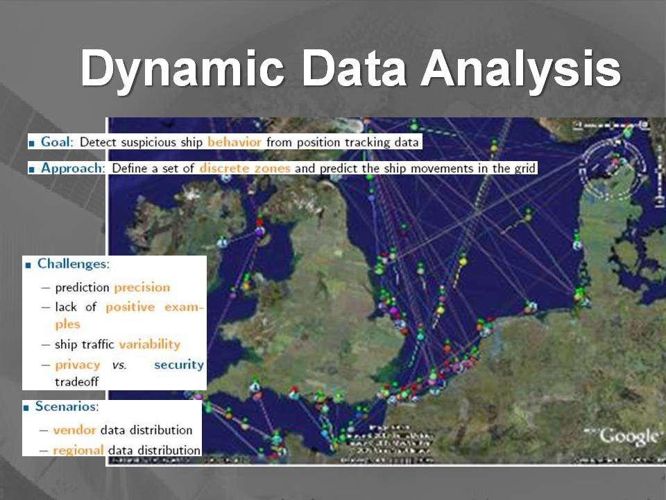
33 Over 12 organizations Very sophisticated DDA systems High Tech Race for Supremacy & The Winner is


34
35 German Aerospace Engineer
36
37

38 Sense - Decide - Act Cycle Maritime Domain Threat/ Target FOREIGN Sensors PRIVATE Sensors Civil Sensors DHS Sensors DOD Sensors CIE* USER DEFINABLE INTERFACE DECIDE CoComm FOREIGN Sensors PRIVATE Sensors Civil Sensors DHS Sensors DOD Processors FUSE/ ANALYZE FUSE/ ANALYZE NMIC FUSE/ ANALYZE JIATF FUSE/ ANALYZE MIFCs AMOC? 2 May 2005 PRE-DECISIONAL - FOR OFFICIAL USE ONLY * Collaborative Information Environment 38
39 US National Space Policy Presidential Policy Directive #4 (PPD-4) 28 June 2010 Implementation Task #1 Tasks Committee to Build C-SIGMA IGNORED No Money Very Shortsighted Frustrating! Bureaucracy is the BANE of us all
40 National Space Policy (PPD-4) Implementation Task #1 (U) Working through the National Maritime Domain Awareness Coordination structure, the Secretaries of Defense, Homeland Security, Transportation, State and Commerce, will develop an unclassified, international available program to foster international collaboration using civil and commercial space systems to enhance global maritime domain awareness to provide: enhanced safety of life at sea; increased mutual security of all users of the maritime domain; improved protection of the maritime environment and the resources of the sea; improved flow of commerce; and better monitoring of the condition and performance of the Marine Transportation System.

41 ORBCOMM Gateway Earth Stations
42
43


44 S O L D O U T!
45 The Information Continuum DATA UNDERSTANDING Display/ Decision Aids KNOWLEDGE Analysis INFORMATION Process/Fuse Collect WISDOM Leader s Input 45
46 Horizontal Fusion/Integration BBR SBU conf MIDB MISLE BBR The Way Ahead SSI SCI LES MAGNET UNCLAS Unclas SECRET INTERPOL JMIE Lloyds Smart Agents for Data Mining Common Distributed Virtual Data Base Information Extraction Smart Agents for Anomaly Detection Sense Process Fuse/Analyze Decide Act NCCT GNCST DCGS AADC Smart Agents for Sensor Control and Decision Assistance 46
ORBCOMM Machine-To-Machine (M2M)
") ORBCOMM Machine-To-Machine (M2M) Texas V & C-Sigma November 2012 Global M2M Connecting the World s Assets Machine-To-Machine (M2M) Applications Global M2M Wireless Network for Narrowband Data Applications
ORBCOMM Machine-To-Machine (M2M) Texas V & C-Sigma November 2012 Global M2M Connecting the World s Assets Machine-To-Machine (M2M) Applications Global M2M Wireless Network for Narrowband Data Applications
Understanding AIS. The technology, the limitations and how to overcome them with Lloyd s List Intelligence
 Understanding AIS The technology, the limitations and how to overcome them with Lloyd s List Background to AIS The Automatic Identification System (AIS) was originally introduced in order to improve maritime
*For International Stewardship of the Maritime Environment and its Resources. Photo
 *For International Stewardship of the Maritime Environment and its Resources *For Maritime Safety *For Security Photo # Providing Environmental Monitoring* # Increasing Security* # Enabling Safety Efforts*
*For International Stewardship of the Maritime Environment and its Resources. Photo
 *For International Stewardship of the Maritime Environment and its Resources *For Maritime Safety *For Security Photo # Providing Environmental Monitoring* # Increasing Security* # Enabling Safety Efforts*
An Introduction to INDUSTRY PARTNERS 25/05/2017. Military Army & Air Force. Government Defense & Rescue. Aviation Maritime Military. Other.
 An Introduction to 1 INDUSTRY PARTNERS Aviation Maritime Military Coast Guard & Navy Military Army & Air Force Government Defense & Rescue Other Commercial Commercial/Workboat Navy Air Force SAR Agencies
Ian D Souza (1), David Martin (2)
, David Martin (2)") NANO-SATTELITE DEMONSTRATION MISSION: THE DETECTION OF MARITIME AIS SIGNALS FROM LOW EARTH ORBIT SMALL SATELLITE SYSTEMS AND SERVICES SYMPOSIUM Pestana Conference Centre Funchal, Madeira - Portugal 31
NANO-SATTELITE DEMONSTRATION MISSION: THE DETECTION OF MARITIME AIS SIGNALS FROM LOW EARTH ORBIT SMALL SATELLITE SYSTEMS AND SERVICES SYMPOSIUM Pestana Conference Centre Funchal, Madeira - Portugal 31
COMMUNICATIONS FOR MARITIME SAFETY AND EFFICIENCY. Francis Zachariae, Secretary-General, IALA
 COMMUNICATIONS FOR MARITIME SAFETY AND EFFICIENCY Francis Zachariae, Secretary-General, IALA IALA and its Purpose Non profit, international technical association established in 1957 Two Goals aimed at
ESA IAP Blue Belt demonstration project:
 Page 1 ESA IAP Blue Belt demonstration project: supporting the European Maritime Safety Agency (EMSA) Blue Belt Project, by providing a service based on satellite based AIS data complementing the terrestrial
The Ability of a Small Satellite Constellation to Tip and Cue Other Commercial Assets
 Changing the economics of space The Ability of a Small Satellite Constellation to Tip and Cue Other Commercial Assets Becky Cudzilo - Surrey Satellite US, LLC K.C. Foley - GeoEye, Inc. Chandler Smith -
TACSAT-2 Target Indicator Experiment (TIE) AIS Payload Overview
 AIS Payload Overview") TACSAT-2 Target Indicator Experiment (TIE) AIS Payload Overview 2007 Maritime Domain Awareness Forum 29 October 2007 NRL_2007-MDAF-29OCT-TIE.1 Christopher Huffine Technical Staff, Code 8120 Naval Research
TACSAT-2 Target Indicator Experiment (TIE) AIS Payload Overview 2007 Maritime Domain Awareness Forum 29 October 2007 NRL_2007-MDAF-29OCT-TIE.1 Christopher Huffine Technical Staff, Code 8120 Naval Research
Graham Stickler Esri Ocean GIS Forum, Redlands, CA, 5-7 November 2013
 Graham Stickler Esri Ocean GIS Forum, Redlands, CA, 5-7 November 2013 Imagine.. A world with no horizons Coastal Coverage Space View Satellite Constellation 6 satellite polar orbiting + 1 equatorial constellation
Limitations of Satellite AIS: Time Machine Wanted!
 Limitations of Satellite AIS: Time Machine Wanted! Eric Meger CEO, Maerospace Corporation eric.meger@!maerospace.com 3 October 2013 Maritime Domain Awareness is one of the most significant national and
RF Monitoring Service Profile Based on AIS Binary Message
 , pp.55-59 http://dx.doi.org/10.14257/astl.2015.108.13 RF Monitoring Service Profile Based on AIS Binary Message Soyoung Hwang Catholic University of Pusan, 609-757 Busan, South Korea soyoung@cup.ac.kr
8 Anh Duong is head of our borders and maritime security. 9 division. She has years of experience with the U.S.
 8 Anh Duong is head of our borders and maritime security 9 division. She has years of experience with the U.S. 10 Navy. And I think we saw again from the Defense 11 Minister's movie the importance of maritime
Satellite services for maritime security
 Satellite services for ITS-T Sophia Antipolis 6 June 2007 Jean-Pierre Cauzac, CLS - Collecte Localisation Satellites 35 Are the seas becoming more dangerous? IMB report 2006 shows improvement: 239 piracy
Proud supporter of the IRMF and the G4 - International Maritime Mass Rescue Conference
 Proud supporter of the IRMF and the G4 - International Maritime Mass Rescue Conference - 2017 Corporate Presentation 6/27/2017 1 OROLIA PROFILE $100m Founded in October 2006 in France, Head Office in Washington
Development of Microsatellite to Detect Illegal Fishing MS-SAT
 Development of Microsatellite to Detect Illegal Fishing MS-SAT Ernest S. C. P. Bintang A.S.W.A.M. Department of Aerospace Engineering Faculty of Mechanical and Aerospace Engineering Institut Teknologi
Utilization of Radar data for Maritime Surveillance
 INDESO Project Utilization of Radar data for Maritime Surveillance DENDY MAHABROR MARINE RESEARCH CENTER INDESO RADAR GROUND STATION RADARSAT-2 AND COSMO-SKYMED BALI INDESO satelit VMS satelite radar vessel
Integration of AIS functionalities
 Integration of AIS functionalities by John O. Klepsvik FARGIS 05 March 01, 2005 WORLD CLASS through people, technology and dedication WORLD CLASS through people, technology and dedication KONGSBERG March
Space-Based AIS: Contributing to Global Safety and Security
 Space-Based AIS: Contributing to Global Safety and Security J.S. Cain 1, E. Meger 2, COM DEV Limited 155 Sheldon Ave, Cambridge, Ontario, Canada. Abstract Global trade continues to increase and today more
Coastal Surveillance. SCANTER Radar Solutions
 Coastal Surveillance SCANTER Radar Solutions Protecting Your Coastlines and Maritime Domain We provide radar coverage of the coastline to detect and track all types of surface vessels and air targets.
Satellite Technologies for Fisheries Monitoring, Control and Surveillance (MCS)
") JRC IPSC Maritime Affairs 1 Satellite Technologies for Fisheries Monitoring, Control and Surveillance (MCS) Juan Cicuendez, Marlene Alvarez JRC Info Day Madrid, 2 June 2010 IPSC - Institute for the Protection
JRC IPSC Maritime Affairs 1 Satellite Technologies for Fisheries Monitoring, Control and Surveillance (MCS) Juan Cicuendez, Marlene Alvarez JRC Info Day Madrid, 2 June 2010 IPSC - Institute for the Protection
AIS and SATAIS. AIS is a globally available, mandatory and thus unique information source of each sea going
 AIS and SATAIS AIS is a globally available, mandatory and thus unique information source of each sea going vessel above 299 GRT including MMSI, name, position, speed, direction, cargo type, port of destination
Littoral Operations Center Overview. OpTech East 1 December 2015
 Littoral Operations Center Overview OpTech East 1 December 2015 While staying grounded in tactics and operations, the LOC: Seeks to apply science and technology to better enable littoral operations in
Targeting a Safer World
 Targeting a Safer World INTRODUCTION Accipiter Radar is a global provider of high performance radar surveillance solutions built upon its patented Radar Intelligence Network (RIN) Platform Technology.
Using AIS to identify and investigate ferry accidents
 Using AIS to identify and investigate ferry accidents David Hewson Antenna Network Manager Genscape Vesseltracker info@genscape.com DE: +49 (0) 97 07 86 10 EU: +31 20 524 4089 Background Vesseltracker
PMAR Piracy, Maritime Awareness & Risks
 PMAR Piracy, Maritime Awareness & Risks Maritime Situational Awareness for Counter-Piracy European Commission Joint Research Centre 13 June 2012 GeoMaritime, London 1 MSA for counter-piracy study Key elements
Disruptive technologies and future trends of small satellites
 2016 SSTL Disruptive technologies and future trends of small satellites Luis Gomes Director of EO & science Surrey Satellite Technology Limited Radio Communication June 1978 2016 SSTL The DMC and RapidEye
Adaptation and Application of Aerospace and Defense Industry Technologies to the Oil and Gas Industry
 ELTA Systems Group & Subsidiary of ISRAEL AEROSPACE INDUSTRIES Adaptation and Application of Aerospace and Defense Industry Technologies to the Oil and Gas Industry Dr. Nathan Weiss Israel Aerospace Industries
Session 8: Maritime Safety and Security. Raymond Gilpin, Ph.D. Academic Dean. Impact through Insight
 Session 8: Maritime Safety and Security Raymond Gilpin, Ph.D. Academic Dean Impact through Insight Africa s Maritime Environment Abundant natural resources: Significant fishing grounds Growing interest
Multi Sensor Data Fusion
 Multi Sensor Data Fusion for improved maritime traffic monitoring in the Canadian Arctic Giulia Battistello*, Martin Ulmke*, Javier Gonzalez*, Camilla Mohrdieck** (*) Fraunhofer FKIE Sensor Data and Information
Canadian Coast Guard Review to Implement a Resilient Position, Navigation and Timing Solution for Canada. Mariners Workshop January 31 st, 2018
 Canadian Coast Guard Review to Implement a Resilient Position, Navigation and Timing Solution for Canada Mariners Workshop January 31 st, 2018 Outline Overview of GNSS use in the marine sector CCG Activities
Mr. Mike Pley. President and CEO,
 Interview with CEO Mr. Mike Pley President and CEO, COM DEV, Toronto Canada I n our interview, COM DEV President and CEO Mr. Mike Pley speaks passionately about his business strategies for worldwide satellite
Space Based Vessel Detection - Combining Earth Observation and AIS for Maritime surveillance TEXAS V and C-Σ III
 Space Based Vessel Detection - Combining Earth Observation and AIS for Maritime surveillance TEXAS V and C-Σ III Tony Bauna Director, Product and Service Development, Kongsberg Satellite Services, Tromsø,
Demonstrator of a Data Processing Centre (DPC) for satellite-based AIS services
 for satellite-based AIS services") Page 1 Demonstrator of a Data Processing Centre (DPC) for satellite-based AIS services 19/20 April 2012 gfabritius@cls.fr Overview of the presentation Page 2 Introducing CLS Introducing AIS / SAT-AIS Scope
Page 1 Demonstrator of a Data Processing Centre (DPC) for satellite-based AIS services 19/20 April 2012 gfabritius@cls.fr Overview of the presentation Page 2 Introducing CLS Introducing AIS / SAT-AIS Scope
GNSS Programme. Overview and Status in Europe
 GNSS Programme Overview and Status in Europe Inaugural Forum Satellite Positioning Research and Application Center 23 April 2007 Tokyo Presented by Thomas Naecke (European Commission) Prepared by Daniel
Civil GPS Service Interface Committee (CGSIC) International Committee on GNSS November 2016
 International Committee on GNSS November 2016") Civil GPS Service Interface Committee (CGSIC) International Committee on GNSS 06-11 November 2016 Russell Holmes CGSIC Deputy Chair U.S. Coast Guard Navigation Center 30 th Anniversary of the CGSIC CGSIC
Civil GPS Service Interface Committee (CGSIC) International Committee on GNSS 06-11 November 2016 Russell Holmes CGSIC Deputy Chair U.S. Coast Guard Navigation Center 30 th Anniversary of the CGSIC CGSIC
VHF Data Exchange System (VDES)
") VHF Data Exchange System (VDES) ETSI Workshop Future Evolution of Marine Communication 7-8 November 2017 Malcolm Lyman Marketing Manager CML Microcircuits UK With acknowledgments to the members of IALA
VHF Data Exchange System (VDES) ETSI Workshop Future Evolution of Marine Communication 7-8 November 2017 Malcolm Lyman Marketing Manager CML Microcircuits UK With acknowledgments to the members of IALA
How Automatic Identification System (AIS) Is Being Used to Improve Navigation Safety Lock Operations Management Application Michael Winkler
 Is Being Used to Improve Navigation Safety Lock Operations Management Application Michael Winkler") How Automatic Identification System (AIS) Is Being Used to Improve Navigation Safety Lock Operations Management Application Michael Winkler June 2016 LOMA system overview USCG AIS data capabilities: AIS
How Automatic Identification System (AIS) Is Being Used to Improve Navigation Safety Lock Operations Management Application Michael Winkler June 2016 LOMA system overview USCG AIS data capabilities: AIS
WRC-12 Implications for Terrestrial Services other than Mobile Broadband. John Mettrop BDT Expert. Scope
 WRC-12 Implications for Terrestrial Services other than Mobile Broadband John Mettrop BDT Expert Scope Areas addressed Aeronautical Amateur Maritime Radiodetermination Public protection & disaster relief
An Introduction to Airline Communication Types
 AN INTEL COMPANY An Introduction to Airline Communication Types By Chip Downing, Senior Director, Aerospace & Defense WHEN IT MATTERS, IT RUNS ON WIND RIVER EXECUTIVE SUMMARY Today s global airliners use
Remote Sensing Analysis Framework for Maritime Surveillance Application
 Remote Sensing Analysis Framework for Maritime Surveillance Application Olaf Frauenberger, Egbert Schwarz, Sergey Voinov Maritime Security Lab Neustrelitz (DFD) Maritime Big Data Workshop, 9-11 May, La
Author s Name Name of the Paper Session. DYNAMIC POSITIONING CONFERENCE October 10-11, 2017 SENSORS SESSION. Sensing Autonomy.
 Author s Name Name of the Paper Session DYNAMIC POSITIONING CONFERENCE October 10-11, 2017 SENSORS SESSION Sensing Autonomy By Arne Rinnan Kongsberg Seatex AS Abstract A certain level of autonomy is already
(In)security of smart transportation at sea
security of smart transportation at sea") Application Security: internet, mobile ed oltre (In)security of smart transportation at sea Dr. Marco Balduzzi Venezia, 3 ottobre 2014 (In)security of smart transportation at sea - DR. MARCO BALDUZZI 3.10.2014
Application Security: internet, mobile ed oltre (In)security of smart transportation at sea Dr. Marco Balduzzi Venezia, 3 ottobre 2014 (In)security of smart transportation at sea - DR. MARCO BALDUZZI 3.10.2014
Government Agency Perspectives & Initiatives Canadian Coast Guard Laurent Tardif, Director, Safe Shipping
 Unclassified Government Agency Perspectives & Initiatives Canadian Coast Guard Laurent Tardif, Director, Safe Shipping Mariner s Workshop January 23, 2019 1 Overview 1 Context 2 Marine Fees 3 4 5 Update
TRINITY Standard configuration for littoral defence
 Standard configuration for littoral defence Member of the Thales Mission Solution family Unrivalled tracking and fire control solution for small manoeuvring targets Innovative approach and easy to install
RESOLUTION MSC.278(85) (adopted on 1 December 2008) ADOPTION OF THE NEW MANDATORY SHIP REPORTING SYSTEM "OFF THE COAST OF PORTUGAL - COPREP"
 (adopted on 1 December 2008) ADOPTION OF THE NEW MANDATORY SHIP REPORTING SYSTEM OFF THE COAST OF PORTUGAL - COPREP") MSC 85/26/Add.1 RESOLUTION MSC.278(85) SYSTEM OFF THE COAST OF PORTUGAL COPREP THE MARITIME SAFETY COMMITTEE, RECALLING Article 28 of the Convention on the International Maritime Organization concerning
MSC 85/26/Add.1 RESOLUTION MSC.278(85) SYSTEM OFF THE COAST OF PORTUGAL COPREP THE MARITIME SAFETY COMMITTEE, RECALLING Article 28 of the Convention on the International Maritime Organization concerning
New advanced real time smart Search and Rescue RADAR Transponder (SART)
") Current Science International Volume : 07 Issue : 02 April- June 2018 Pages: 128-134 New advanced real time smart Search and Rescue RADAR Transponder (SART) M. S. Zaghloul Electronics and Communication
Current Science International Volume : 07 Issue : 02 April- June 2018 Pages: 128-134 New advanced real time smart Search and Rescue RADAR Transponder (SART) M. S. Zaghloul Electronics and Communication
KONGSBERG SATELLITE SERVICES 2017 Line Steinbakk, Director Programs. Himmel og hav - Ålesund 3. Oktober 2017
 KONGSBERG SATELLITE SERVICES 2017 Line Steinbakk, Director Programs Himmel og hav - Ålesund 3. Oktober 2017 KSAT HQ IN TROMSØ 69N Established in 1967 Kongsberg Satellite Services since 2002 World leading
The Future in Marine Radio Communication GMDSS. Department of Transportation United States Coast Guard
 The Future in Marine Radio Communication GMDSS Department of Transportation United States Coast Guard Do you use a Maritime Radio System? If so, the new Global Maritime Distress and Safety System (GMDSS)
e-navigation Underway International February 2016 Kilyong Kim(GMT Co., Ltd.) Co-author : Seojeong Lee(Korea Maritime and Ocean University)
 Co-author : Seojeong Lee(Korea Maritime and Ocean University)") e-navigation Underway International 2016 2-4 February 2016 Kilyong Kim(GMT Co., Ltd.) Co-author : Seojeong Lee(Korea Maritime and Ocean University) Eureka R&D project From Jan 2015 to Dec 2017 15 partners
e-navigation Underway International 2016 2-4 February 2016 Kilyong Kim(GMT Co., Ltd.) Co-author : Seojeong Lee(Korea Maritime and Ocean University) Eureka R&D project From Jan 2015 to Dec 2017 15 partners
MEMORANDUM NO MAY Directives Affected. Reference (a) is temporarily augmented by this policy letter.
 is temporarily augmented by this policy letter.") U.S. Department of Commandant 2100 Second Street, S.W. Homeland Security United States Coast Guard Washington, DC 20593-0001 Staff Symbol: -1 Phone: (202) 267-2735 United States Fax: (202) 267-4394 Coast
U.S. Department of Commandant 2100 Second Street, S.W. Homeland Security United States Coast Guard Washington, DC 20593-0001 Staff Symbol: -1 Phone: (202) 267-2735 United States Fax: (202) 267-4394 Coast
Marine Monitor (M ) A Low Cost Radar Solution for Monitoring Nearshore Marine Protected Areas
 A Low Cost Radar Solution for Monitoring Nearshore Marine Protected Areas") 2 Marine Monitor (M ) A Low Cost Radar Solution for Monitoring Nearshore Marine Protected Areas 1 Problem The number of Marine Protected Areas (MPAs) are increasing globally making it challenging to effectively
2 Marine Monitor (M ) A Low Cost Radar Solution for Monitoring Nearshore Marine Protected Areas 1 Problem The number of Marine Protected Areas (MPAs) are increasing globally making it challenging to effectively
Integrating Spaceborne Sensing with Airborne Maritime Surveillance Patrols
 22nd International Congress on Modelling and Simulation, Hobart, Tasmania, Australia, 3 to 8 December 2017 mssanz.org.au/modsim2017 Integrating Spaceborne Sensing with Airborne Maritime Surveillance Patrols
Sikorsky S-70i BLACK HAWK Training
 Sikorsky S-70i BLACK HAWK Training Serving Government and Military Crewmembers Worldwide U.S. #15-S-0564 Updated 11/17 FlightSafety offers pilot and maintenance technician training for the complete line
Linemaster Marine Electronics. Sky Technologies MARINE SERVICES AGENTS APAC
 MARINE SERVICES AGENTS APAC Linemaster Marine Electronics Linemaster was founded in 1992. The result of an idea to create a product to aid in the deployment of Longlines. Today the Linemaster Longline
Abstract. 1. Introduction
 Title: Satellite surveillance for maritime border monitoring Author: H. Greidanus Number: File: GMOSSBordMon1-2.doc Version: 1-2 Project: GMOSS Date: 25 Aug 2004 Distribution: Abstract Present day remote
(Beijing, China,25 May2017)
") Remarks by the Secretary General of the International Civil Aviation Organization (ICAO), Dr. Fang Liu, to the First Session of the 2017 China Civil Aviation Development Forum: New Opportunities for Aviation
Remarks by the Secretary General of the International Civil Aviation Organization (ICAO), Dr. Fang Liu, to the First Session of the 2017 China Civil Aviation Development Forum: New Opportunities for Aviation
LRIT spectrum, cybersecurity and other ITU related activities
 IMSO Seminar Effective Implementation and Management of the LRIT System 15 16 February 2018, London, UK LRIT spectrum, cybersecurity and other ITU related activities Nikolai Vassiliev Chief, Terrestrial
LUXEMBOURG AND KLEOS COOPERATION WITHIN THE SPACERESOURCES.LU INITIATIVE CONFÉRENCE DE PRESSE. 24 juillet 2017
 LUXEMBOURG AND KLEOS COOPERATION WITHIN THE SPACERESOURCES.LU INITIATIVE CONFÉRENCE DE PRESSE 24 juillet 2017 Video Intro https://vimeo.com/212878439 Introduction UK based, Space engineering services for
Introduction Objective and Scope p. 1 Generic Requirements p. 2 Basic Requirements p. 3 Surveillance System p. 3 Content of the Book p.
 Preface p. xi Acknowledgments p. xvii Introduction Objective and Scope p. 1 Generic Requirements p. 2 Basic Requirements p. 3 Surveillance System p. 3 Content of the Book p. 4 References p. 6 Maritime
Using satellite technology to monitor illegal, unreported, and unregulated (IUU) fishing
 fishing") Using satellite technology to monitor illegal, unreported, and unregulated (IUU) fishing Mark Richardson The Pew Charitable Trusts Blue Planet Symposium, June 2, 2017 The global threat of IUU fishing Illegal,
Using satellite technology to monitor illegal, unreported, and unregulated (IUU) fishing Mark Richardson The Pew Charitable Trusts Blue Planet Symposium, June 2, 2017 The global threat of IUU fishing Illegal,
MEO Satellite Applications to Support Mobility
 MEO Satellite Applications to Support Mobility Colloquium on Satellite Services for Global Mobility 14 October, 2013 David Burr, Director, Product Development O3b A revolutionary solution O3b Networks
Protection Augmentation Toughness and Alternatives of GNSS. Melaha 2016 Concord Al-Salam Hotel Cairo, April 25,2016 Refaat Rashad
 Protection Augmentation Toughness and Alternatives of GNSS Melaha 2016 Concord Al-Salam Hotel Cairo, April 25,2016 Refaat Rashad Road Map of the Presentation 1- How Good are GNSS 2- How Vulnerable are
GMDSS modernisation and e-navigation: spectrum needs
 ETSI Workshop "Future Evolution of Marine Communication", 7-8 November 2017, Sophia Antipolis, France GMDSS modernisation and e-navigation: spectrum needs Karlis Bogens BR Terrestrial Services Department
Science and Technology for Naval Warfare,
 Science and Technology for Naval Warfare, 2015--2020 Mark Lister Chairman, NRAC NDIA Disruptive Technologies Conference September 4, 2007 Excerpted from the Final Briefing Outline Terms of Reference Panel
Satellite data for Maritime Operations. Andreas Hay Kaljord Project Manager Energy, Environment & Security
 Satellite data for Maritime Operations Andreas Hay Kaljord Project Manager Energy, Environment & Security Kongsberg Satellite Services (KSAT) World leading provider within our business area Supports 85
NMEA 2000 Parameter Group Numbers and Description as of August 2007 NMEA 2000 DB Ver
 Category General & or Mandatory ISO Acknowledgment This message is provided by ISO 11783 for a handshake mechanism between transmitting and receiving devices. This message is the possible response to acknowledge
Doug Miller Milltech Marine Inc. Milltech Marine 1
 Doug Miller Milltech Marine Inc. www.milltechmarine.com Milltech Marine 1 What I ll Cover What is AIS? AIS Transponders AIS Receivers Typical Usage Scenarios What s new and what s coming Questions Milltech
EFBs and Operations: How Connectivity is Changing the Game
 EFBs and Operations: How Connectivity is Changing the Game Moderator: Mark Holmes, Conference Chair and Editorial Director, Avionics and Via Satellite Speakers: Roland Brenny, Principal, Information Technology,
1. Detect and locate potentially illegal fishing ship using satellite image, AIS data, and external sources.
 Title: Development of Microsatellite to Detect Illegal Fishing MS-SAT Primary Point of Contact (POC) & email: Dr. Ridanto Eko Poetro; ridanto@ae.itb.ac.id Co-authors: Ernest Sebastian C., Bintang A.S.W.A.M.
GMISS IALA and Maritime Information Sharing
 International Association of Marine Aids to Navigation and Lighthouse Authorities Association Internationale de Signalisation Maritime IALA and Maritime Information Sharing R.Adm. Jean-Charles Leclair
Workshop on Intelligent System and Applications (ISA 17)
") Telemetry Mining for Space System Sara Abdelghafar Ahmed PhD student, Al-Azhar University Member of SRGE Workshop on Intelligent System and Applications (ISA 17) 13 May 2017 Workshop on Intelligent System
Telemetry Mining for Space System Sara Abdelghafar Ahmed PhD student, Al-Azhar University Member of SRGE Workshop on Intelligent System and Applications (ISA 17) 13 May 2017 Workshop on Intelligent System
Maritime Geo-Fence Letter Report
 Report No. CG-D-10-16 Maritime Geo-Fence Letter Report Authors: Irene Gonin and Gregory Johnson Distribution Statement A: Approved for public release; distribution is unlimited. July 2016 Classification
IALA S WORK IN E-NAVIGATION. Michael Card
 IALA S WORK IN E-NAVIGATION Michael Card e-navigation origins The early work of IALA on e-navigation Multiple Initiatives EfficienSea 2 STM Validation IHO S-100 and IALA S-200 Smart Navigation VDES development
IHO Colours & Symbols Maintenance Working Group (C&SMWG) 15th Meeting, BSH, Rostock, Germany, 2-4 May 2005
 15th Meeting, BSH, Rostock, Germany, 2-4 May 2005") CSMWG15-INF2 IHO Colours & Symbols Maintenance Working Group (C&SMWG) 15th Meeting, BSH, Rostock, Germany, 2-4 May 2005 Ref: HA405/004/033-01 NOTE: this is an internal document of the UKHO and is supplied
CSMWG15-INF2 IHO Colours & Symbols Maintenance Working Group (C&SMWG) 15th Meeting, BSH, Rostock, Germany, 2-4 May 2005 Ref: HA405/004/033-01 NOTE: this is an internal document of the UKHO and is supplied
KOMPSAT Constellation. November 2012 Satrec Initiative
 KOMPSAT Constellation November 2012 Satrec Initiative KOMPSAT Constellation KOMPSAT National program Developed and operated by KARI (Korea Aerospace Research Institute) Dual use : Government & commercial
Lecture-1 CHAPTER 2 INTRODUCTION TO GPS
 Lecture-1 CHAPTER 2 INTRODUCTION TO GPS 2.1 History of GPS GPS is a global navigation satellite system (GNSS). It is the commonly used acronym of NAVSTAR (NAVigation System with Time And Ranging) GPS (Global
International Collaboration Tools for Industrial Development
 International Collaboration Tools for Industrial Development 6 th CSIR Conference 5-6 October, 2017 Dan Nagy Managing Director IMS International dnagy@ims.org U.S. DEPARTMENT OF COMMERCE (NIST) 28 Countries
SPACE-BASED SOLUTIONS & ANALYTICS
 SPACE-BASED SOLUTIONS & ANALYTICS Enable development and optimisation of airspace use, and no aircraft to be lost again wherever on Earth C N S S y m p o s i u m E u r o c o n t r o l 2 & 3 O c t o b e
Digital broadcasting systems under development within ITU-R of interest for the maritime community
 Digital broadcasting systems under development within ITU-R of interest for the maritime community Christian RISSONE ANFR rissone@anfr.fr IHO, WWNWS 5 Monaco, 2 nd October 2013 1 Background for the 500
Interoperability for Critical Situations
 Interoperability for Critical Situations Disaster: Relief and Management International Cooperation & Role of ICT Alexandria, Egypt, 16 April 2007 Virna Tomaselli, virna.tomaselli@selex-comms.com 16/04/2007
How industry can leverage CSIR platforms for innovation. Industry Associations Innovation Day May 2018 Kobus Roux
 How industry can leverage CSIR platforms for innovation Industry Associations Innovation Day 2018 24 May 2018 Kobus Roux 1 Contextual considerations Human capital National: Need for job creation against
Status of the European EGNOS and Galileo Programmes. Frank Udnaes Galileo policy and Infrastructure group EC DG-TREN. June 2008
 Status of the European EGNOS and Galileo Programmes Frank Udnaes Galileo policy and Infrastructure group EC DG-TREN EUROPEAN COMMISSION z June 2008 Galileo An infrastructure 30 satellite Constellation
Juan GAVIRIA, Sector Leader AFTTR
 Earth Observation in support of the Western Indian Ocean Marine Highway Development and Coastal and Marine Contamination Prevention Project - Oil spill detection & Coral reef monitoring Juan GAVIRIA, Sector
Western Indian Ocean Marine Highway Development and Coastal and Marine Contamination Prevention Project - Oil spill detection & Coral reef monitoring
 Earth Observation in support of the Western Indian Ocean Marine Highway Development and Coastal and Marine Contamination Prevention Project - Oil spill detection & Coral reef monitoring Juan GAVIRIA, Sector
Enhanced Maritime Traffic Picture for the Canadian Arctic
 Enhanced Maritime Traffic Picture for the Canadian Arctic Giulia Battistello*, Martin Ulmke*, Camilla Mohrdieck** (*) Fraunhofer FKIE - Sensor Data and Information Fusion Department - Wachtberg, Germany
Project BONUS ESABALT
 Project BONUS ESABALT Economic and Non-Economic Feasibility Analysis dr Paweł Banaś Maritime University of Szczecin Content Assumptions 1. Analysis of navigational systems and devices 2. Expected ESABALT
NMEA2000- Par PGN. Mandatory Request, Command, or Acknowledge Group Function Receive/Transmit PGN's
 PGN Number Category Notes - Datum Local geodetic datum and datum offsets from a reference datum. T The Request / Command / Acknowledge Group type of 126208 - NMEA - Request function is defined by first
Weatherdock explains: How does real DSC work in an emergency transmitter?
 explains: How does real DSC work in an emergency transmitter? 1 DSC Basics 2 AIS S.A.R.T. & DSC easyrescue-pro 3 DSC closed loop 4 DSC open loop 1 DSC Basics DSC is short cut for Digital Selective Call
Regional and Inter-Regional Seminar and Workshop on Search and Rescue
 Regional and Inter-Regional Seminar and Workshop on Search and Rescue Mahe, Seychelles 19-22 July 2016 1 Agenda Aireon Introduction Space-Based ADS-B Overview Aireon System Deployment Status Aireon ALERT
Development of Ultimate Seamless Positioning System for Global Cellular Phone Platform based on QZSS IMES
 Development of Ultimate Seamless Positioning System for Global Cellular Phone Platform based on QZSS IMES Dinesh Manandhar, Kazuki Okano, Makoto Ishii, Masahiro Asako, Hideyuki Torimoto GNSS Technologies
L AGENCE NATIONALE DES FREQUENCES (ANFR) From Titanic to satellite from Morse to digital Entry in a new era for the maritime community
 From Titanic to satellite from Morse to digital Entry in a new era for the maritime community") L AGENCE NATIONALE DES FREQUENCES (ANFR) From Titanic to satellite from Morse to digital Entry in a new era for the maritime community ITU regional seminar 6-8 June 2018 St-Petersburg, Russian Federation
L AGENCE NATIONALE DES FREQUENCES (ANFR) From Titanic to satellite from Morse to digital Entry in a new era for the maritime community ITU regional seminar 6-8 June 2018 St-Petersburg, Russian Federation
Inmarsat Maritime A different approach
 Inmarsat Maritime A different approach Digital Ship Cyprus, April 2013 Frank J. Coles President, Inmarsat Maritime Shannon s Capacity Theory Back to basics C = W log 2 1 + P N Where C = Transmit rate (bits
AIS Training. AIS Technology in Digital Yacht Products Explained. Digital Yacht Ltd TEL
 AIS Training AIS Technology in Digital Yacht Products Explained Digital Yacht Ltd www.digitalyacht.co.uk TEL + 44 1179 554474 What is AIS? The Automatic Identification System (AIS) is the biggest advance
A Space-Based Solution for Illegal, Unregulated & Unreported Fishing. Emmanouil Detsis, International Space University
 Project Catch A Space-Based Solution for Illegal, Unregulated & Unreported Fishing Emmanouil Detsis, International Space University Project Catch COPUOS Presentation Team Project Oceans International Intercultural
Deriving meteorological observations from intercepted Mode-S EHS messages.
 Deriving meteorological observations from intercepted Mode-S EHS messages. Edmund Keith Stone and Malcolm Kitchen July 28, 2016 Abstract The Met Office has deployed a network of five receivers in the UK
ESSnet pilot AIS data. Anke Consten, Eleni Bisioti and Olav Grøndal (23 February 2017, Sofia)
") ESSnet pilot AIS data Anke Consten, Eleni Bisioti and Olav Grøndal (23 February 2017, Sofia) Overview 1. Introduction 2. Deliverables ESSnet pilot AIS data 3. Data access and handling 4. Quality of AIS
ESSnet pilot AIS data Anke Consten, Eleni Bisioti and Olav Grøndal (23 February 2017, Sofia) Overview 1. Introduction 2. Deliverables ESSnet pilot AIS data 3. Data access and handling 4. Quality of AIS
"Are lessons truly learnt?"
 Author: Arti Chopra, Spill Response Specialist, Oil Spill Response Limited Abstract In a fiercely competitive energy industry, one area where the oil industry never normally competes is oil spill response.
Le témoignage d une multinationale française implantée en Piémont: Skylogic
 Le témoignage d une multinationale française implantée en Piémont: Skylogic Mr. Paolo Amadesi LYON 2011 Page - 1 > 4 new satellites in 12 months Executing a far-reaching in-orbit expansion programme >