Civil GPS Service Interface Committee (CGSIC) International Committee on GNSS November 2016
|
|
|
- Marybeth O’Connor’
- 5 years ago
- Views:
Transcription
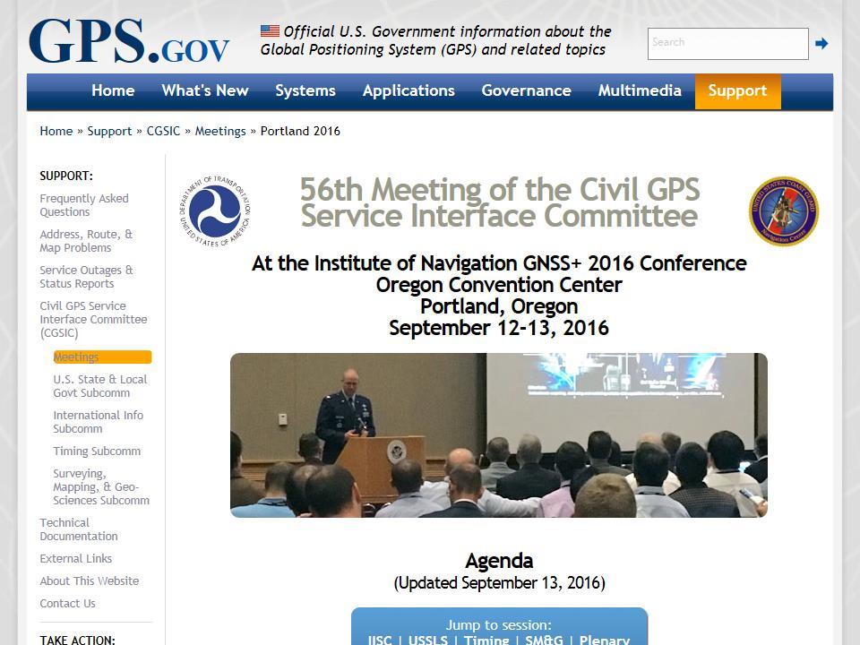
1 Civil GPS Service Interface Committee (CGSIC) International Committee on GNSS November 2016 Russell Holmes CGSIC Deputy Chair U.S. Coast Guard Navigation Center
2 30 th Anniversary of the CGSIC CGSIC Charter Civil GPS Service Interface Committee was chartered in 1986 to be the forum needed by civil users. Worldwide forum recognized for effective interaction between civil GPS users and U.S. GPS authorities. Established and chartered to identify civil GPS user needs (e.g. positioning, navigation, and timing). Used to exchange information concerning GPS with the worldwide civil user community. Reports activities to the Office of the Assistant Secretary for Research and Technology.
3

4 56th Meeting of the CGSIC Adjacent Band Compatibility Assessment results: Ms. Karen Van Dyke, Committee Chair UTC Offset event Impacts to civil community 16-UTC-offset-anomaly-impact.pdf GPS Forensics: Mr. Matt Peterson, Robson Forensics GPS/GNSS Interference Mitigation: Mr. Jan Van Hees, Septentrio GPS and Time Synchronization in the Electric Industry: Ms. Alison Silverstein, North American SynchroPhasor Initiative (NASPI) Using GPS Precise Point Positioning to Test the Theory of Relativity: Dr. Demetrios Matsakis, U.S. Naval Observatory Space Weather Action Plan and the GPS/GNSS User Community: Mr. Robert Steenburgh, NOAA, National Weather Service All presentations posted to

5 Our Economy Depends on Critical Infrastructure, & Our Infrastructure Depends on GPS Usage: Accurate position, navigation and timing (PNT) information is necessary for the functioning of many critical infrastructure sectors Precision timing is particularly important Primary source of distributed and accurate timing is currently through GPS Just released a best practices document on the Dec 31 Leap Second. Just completed first year of the Infrastructure Security and Resilience PNT Program Management Office, which is working to enhance resilience of PNT in critical infrastructure New Director, New staff 5


 against DoD complex GPS and commercial jamming Outcomes:")

6 Vulnerability Assessment & Awareness: WSMR Exercise Overview Purpose: Conducted live testing and demonstrations of first responder communications in electronic jamming threat environment provided by White Sands Missile Range, including: First responder communications systems against commercial jamming Anti-jamming technologies against commercial jamming Satellite communications against commercial jamming Unmanned Aircraft Systems (UAS) against DoD complex GPS and commercial jamming Fixed timing receivers (used in critical infrastructure) against DoD complex GPS and commercial jamming Outcomes: Understand impact of electronic threats on first responder communications and mission operations; identify training gaps and mitigation strategies; and share lessons learned and best practices with first responders nationwide 6

7 Awareness: Best Practices Time & Freq Sources Receiver Guidance: If the receiver has the capability, record average signal strength/automatic Gain Control level once the stabilization is complete as a benchmark to be checked during routine maintenance. Antenna Guidance: Place the antenna where it cannot be seen from publically accessible locations, or deny view of the antenna from public locations using an RF-transparent material place the antenna where a roof line or structure blocks direct line of sight to the antenna from publically accessible locations. 7

8 Modernize Delivery of Marine Safety Information Virtual Buoy San Francisco Entrance Buoy Dredging Operations Virtual Buoy Mile Rocks Digital virtual buoy using Automatic Identification System (AIS) AIS-A = Required VHF identification broadcast for certain size commercial vessels and all passenger vessels Future efforts Display maritime safety information on electronic chart/radar - Marine regatta (i.e. Americas Cup Racing) - Dredging operations - Bridge operation instructions - GPS authorized testing, etc.

9 List Server Transition to GovDelivery Major change in our service center role for GPS program information distribution (i.e.: GPS Almanacs, NANUs, and CGSIC list server messages Our list servers are transitioning to GovDelivery with some new functionality that we are still learning about: Automatic registration Auto delivery Web page tracking, etc.
10 Civil GPS Service Interface Committee (CGSIC) Contact Information U.S. Coast Guard Navigation Information Service Phone: Fax: Executive Secretariat 10
Global Positioning Systems Directorate
 Space and Missile Systems Center Global Positioning Systems Directorate GPS Program Update to 8 th Stanford PNT Symposium 30 Oct 2014 Col Matt Smitham Deputy Director, GPS Directorate Global Positioning
GPS Civil Interface Observations. Rick Hamilton CGSIC Executive Secretariat U.S. Coast Guard Navigation Center
 GPS Civil Interface Observations Rick Hamilton CGSIC Executive Secretariat U.S. Coast Guard Navigation Center ICD Compliance Issues Provide non attribution forum to Inform the users community of recent
PROTECTING GPS/GNSS-RELIANT MILITARY SYSTEMS
 PROTECTING GPS/GNSS-RELIANT MILITARY SYSTEMS John Fischer VP Advanced R&D Jon Sinden Product Manager, Rugged PNT 6/21/2018 ABOUT OROLIA A world leader in assured positioning, navigation and timing (PNT)
Canadian Coast Guard Review to Implement a Resilient Position, Navigation and Timing Solution for Canada. Mariners Workshop January 31 st, 2018
 Canadian Coast Guard Review to Implement a Resilient Position, Navigation and Timing Solution for Canada Mariners Workshop January 31 st, 2018 Outline Overview of GNSS use in the marine sector CCG Activities
United States Coast Guard Office of Navigation Systems
 United States Coast Guard Office of Navigation Systems Future of Navigation Initiatives & Operations R. David Lewald Program Analyst Navigation Systems Office of Navigation Systems U.S. Coast Guard Washington,
Wide Area Time distribution Via eloran. NASPI WG Meeting
 Wide Area Time distribution Via eloran NASPI WG Meeting March 22 2017 This work is supported through a Cooperative Research and Development Agreement (CRADA) with the Department of Homeland Security (DHS)
Providing a Resilient Timing and UTC Service Using eloran in the United States. Charles Schue - ION PTTI Monterey, CA
 Providing a Resilient Timing and UTC Service Using eloran in the United States Charles Schue - ION PTTI Monterey, CA January 27, 2016 Motivation For a Resilient Timing and UTC Service GPS/GNSS Vulnerabilities
Protection Augmentation Toughness and Alternatives of GNSS. Melaha 2016 Concord Al-Salam Hotel Cairo, April 25,2016 Refaat Rashad
 Protection Augmentation Toughness and Alternatives of GNSS Melaha 2016 Concord Al-Salam Hotel Cairo, April 25,2016 Refaat Rashad Road Map of the Presentation 1- How Good are GNSS 2- How Vulnerable are
GPS Adjacent Band Compatibility Assessment
 GPS Adjacent Band Compatibility Assessment Space-Based PNT Advisory Board Meeting May 18, 2016 EXCOM Co-Chair Letter to NTIA... without affecting existing and evolving uses of space-based PNT services
S a t e l l i t e T i m e a n d L o c a t i o n. N o v e m b e r John Fischer VP Advanced R&D
 STL - S a t e l l i t e T i m e a n d L o c a t i o n N o v e m b e r 2 0 1 7 John Fischer VP Advanced R&D jfischer@orolia.com 11/28/201 1 7 WHY AUGMENT GNSS? Recent UK Study Economic Input to UK of a
How Automatic Identification System (AIS) Is Being Used to Improve Navigation Safety Lock Operations Management Application Michael Winkler
 Is Being Used to Improve Navigation Safety Lock Operations Management Application Michael Winkler") How Automatic Identification System (AIS) Is Being Used to Improve Navigation Safety Lock Operations Management Application Michael Winkler June 2016 LOMA system overview USCG AIS data capabilities: AIS
How Automatic Identification System (AIS) Is Being Used to Improve Navigation Safety Lock Operations Management Application Michael Winkler June 2016 LOMA system overview USCG AIS data capabilities: AIS
GPS Interference Detection & Mitigation
 GPS Interference Detection & Mitigation GAARDIAN GNSS AVAILABILITY ACCURACY RELIABILITY and INTEGRITY ASSESSMENT for TIMING and NAVIGATION A Technology Strategy Board funded collaboration Charles Curry,
Experience with Radio Navigation Satellite Service (RNSS)
") Experience with Radio Navigation Satellite Service (RNSS) International Satellite Communication Symposium International Telecommunication Union (ITU) Geneva, 13-14 June 2016 MITOME, Takahiro Co-Chair of
Experience with Radio Navigation Satellite Service (RNSS) International Satellite Communication Symposium International Telecommunication Union (ITU) Geneva, 13-14 June 2016 MITOME, Takahiro Co-Chair of
MARITIME SAFETY INFORMATION
 Introduction 1. Maritime Safety Information (MSI) is defined as navigational and meteorological warnings, meteorological forecasts, and other urgent safety-related messages. This information is of vital
Space and Missile Systems Center
 Space and Missile Systems Center Global Positioning Systems Directorate GPS Status & Modernization Progress: Service, Satellites, Control Segment, and Military GPS User Equipment 3 Nov 2016 Col Steve Whitney,
RESOLUTION MSC.401(95) (Adopted on 8 June 2015) PERFORMANCE STANDARDS FOR MULTI-SYSTEM SHIPBORNE RADIONAVIGATION RECEIVERS
 (Adopted on 8 June 2015) PERFORMANCE STANDARDS FOR MULTI-SYSTEM SHIPBORNE RADIONAVIGATION RECEIVERS") ANNEX 17 MSC 95/22/Add.2 Annex 17, page 1 THE MARITIME SAFETY COMMITTEE, RECALLING Article 28(b) of the Convention on the International Maritime Organization concerning the functions of the Committee,
ANNEX 17 MSC 95/22/Add.2 Annex 17, page 1 THE MARITIME SAFETY COMMITTEE, RECALLING Article 28(b) of the Convention on the International Maritime Organization concerning the functions of the Committee,
GPS Civil Service Update & U.S. International GNSS Activities
 GPS Civil Service Update & U.S. International GNSS Activities International GNSS (IGNSS) Conference Sydney, Australia Jeffrey Auerbach Office of Space and Advanced Technology U.S. Department of State 06
RF Monitoring Service Profile Based on AIS Binary Message
 , pp.55-59 http://dx.doi.org/10.14257/astl.2015.108.13 RF Monitoring Service Profile Based on AIS Binary Message Soyoung Hwang Catholic University of Pusan, 609-757 Busan, South Korea soyoung@cup.ac.kr
Update from the United States Space-Based Positioning, Navigation, and Timing Advisory Board
 Update from the United States Space-Based Positioning, Navigation, and Timing Advisory Board John W. Betz, PhD PNTAB Member Presented to ICG-12, Kyoto, Japan December 2017 Approved for Public Release;
Three Wishes. and an elaboration. For Reception of. Professor Bradford Parkinson Stanford University. (these are my personal views)
") Three Wishes and an elaboration For Reception of Professor Bradford Parkinson Stanford University (these are my personal views) Three Wishes - Dr, Parkinson 2017 1 Good News: World-wide dependency on GNSS
Three Wishes and an elaboration For Reception of Professor Bradford Parkinson Stanford University (these are my personal views) Three Wishes - Dr, Parkinson 2017 1 Good News: World-wide dependency on GNSS
Outcome of World Radiocommunication Conference, 2015
 Outcome of World Radiocommunication Conference, 2015 Radiocommunication Bureau, International Telecommunication Union 2nd Asia Pacific Spectrum Management International Telecommunication Union Bangkok,
GPS Modernization and Program Update
 GPS Modernization and Program Update GPS Update to ION Southern California Chapter 22 Feb 2011 Colonel Bernie Gruber Director Global Positioning Systems Directorate Contents Current Constellation Modernization
GMDSS modernisation and e-navigation: spectrum needs
 ETSI Workshop "Future Evolution of Marine Communication", 7-8 November 2017, Sophia Antipolis, France GMDSS modernisation and e-navigation: spectrum needs Karlis Bogens BR Terrestrial Services Department
This circular summarizes the various important aspects of the LRIT system with a view to enabling companies to ensure compliance in a timely manner.
 Luxembourg, 29/10/2008 CIRCULAR CAM 02/2008 N/Réf. : AH/63353 Subject : Long-Range Identification and Tracking of Ships (LRIT) To : All ship owners, ship operators and designated persons of Luxembourg
WE SPECIALIZE IN MILITARY PNT Research Education Engineering
 Defense-Focused Autonomy & Navigation Anywhere, Anytime, Using Anything WE SPECIALIZE IN MILITARY PNT Research Education Engineering RESEARCH THRUST 1 RESEARCH THRUST 2 RESEARCH THRUST 3 Autonomous & Cooperative
Results from a GPS Timing Criticality Assessment
 Results from a GPS Timing Criticality Assessment European Navigation Conference, GNSS 2008 Session 2b - Timing James Carroll, DOT/RITA Volpe Center April 2008 Introduction Timing Criticality Assessment
Briefing for NPSTC DHS SCIENCE AND TECHNOLOGY 2017 FIRST RESPONDER ELECTRONIC JAMMING EXERCISE. September 6, 2017
 DHS SCIENCE AND TECHNOLOGY Briefing for NPSTC 2017 FIRST RESPONDER ELECTRONIC JAMMING EXERCISE September 6, 2017 Sridhar Kowdley Program Manager First Responders Group Science and Technology Directorate
UN ICG Experts Meeting: GNSS Services Vienna, Austria, December, 2015
 Vienna, Austria, 14 18 December, 2015 Methods and techniques for improvement of GNSS resilience against jamming-spoofingmeaconing Renato Filjar, SERDJO KOS Faculty of Maritime Studies, University of Rijeka,
GPS/WAAS Program Update
 GPS/WAAS Program Update UN/Argentina Workshop on the Applications of GNSS 19-23 March 2018 Cordoba, Argentina GNSS: A Global Navigation Satellite System of Systems Global Constellations GPS (24+3) GLONASS
Leadership in Resilient PNT
 www.ursanav.com www.nautelnav.com 29 November 2017 Leadership in Resilient PNT The Need for Resilient PNT Position, Navigation, and Timing, or PNT, is known as the hidden utility. Despite its widespread
Does Anyone Really Know What Time It Is? Dr. Michael L. Cohen, MITRE October 15, 2013
 Does Anyone Really Know What Time It Is? Dr. Michael L. Cohen, MITRE October 15, 2013 2013 The MITRE Corporation. All rights reserved Approved for Public Release; Distribution Unlimited 13-3392. The Problem:
CONSIDERATION OF THE OUTCOME OF WRC-12 AND PREPARATION OF INITIAL ADVICE ON A DRAFT IMO POSITION ON WRC-2015 AGENDA ITEMS
 E JOINT IMO/ITU EXPERTS GROUP ON MARITIME RADIOCOMMUNICATION MATTERS 8th session Agenda item 5 IMO/ITU EG 8/5/8 5 September 2012 ENGLISH ONLY CONSIDERATION OF THE OUTCOME OF WRC-12 AND PREPARATION OF INITIAL
02 Issue. e-navigation News. GNSS Vulnerability. Dublin Bay Digital Diamond. e-navigation. Demonstrator Update International. e-navigation.
 CORPORATE SECURITY TEAMWORK EVENTS 02 Issue e-navigation News GNSS Vulnerability Dublin Bay Digital Diamond e-navigation Demonstrator Update International e-navigation update June 2014 www.cil.ie +353
LRIT spectrum, cybersecurity and other ITU related activities
 IMSO Seminar Effective Implementation and Management of the LRIT System 15 16 February 2018, London, UK LRIT spectrum, cybersecurity and other ITU related activities Nikolai Vassiliev Chief, Terrestrial
Xihua University; Chengdu, Sichuan, China: 11 Jan. 2016
 Defence Science & Technology Agency; Singapore; 5 Jan. 2016 State Radio monitoring center Testing Center (SRTC) Beijing; 8 Jan.2016 Xihua University; Chengdu, Sichuan, China: 11 Jan. 2016 ATDT Warsaw 4
The Effect of Radio Frequency Interference on GNSS Signals and Mitigation Techniques Presented by Dr. Tarek Attia
 International Conference and Exhibition Melaha2016 GNSS WAY Ahead 25-27 April2016, Cairo, Egypt The Effect of Radio Frequency Interference on GNSS Signals and Mitigation Techniques Presented by Dr. Tarek
Status of COMPASS/BeiDou Development
 Status of COMPASS/BeiDou Development Stanford s 2009 PNT Challenges and Opportunities Symposium October 21-22,2009 Cao Chong China Technical Application Association for GPS Contents 1. Basic Principles
1
 12/20/2016 www.made-simplefor-cruisers.com 1 Emergency Position Indicating Radio Beacons (EPIRB) Only 406.0-406.1 EPIRBs with a built in GPS will be authorized for sale in the US. EPIRBs without position
GNSS Training for ITS Developers. Characterisation of EGNSS performances in relationship with the application requirements
 GNSS Training for ITS Developers Characterisation of EGNSS performances in relationship with the application requirements Table of Content egnss for Application: Main Challenges EGNOS and GALILEO Performances
EDA s PROJECT TEAM EUROPEAN MARITIME CAPABILITIES IN THE ARCTIC PT EMCA
 EDA s PROJECT TEAM EUROPEAN MARITIME CAPABILITIES IN THE ARCTIC PT EMCA WHY EU IN THE ARCTIC? - Climate Change still a puzzle -> to gain better understanding - Arctic s economical importance growing ->
Government Agency Perspectives & Initiatives Canadian Coast Guard Laurent Tardif, Director, Safe Shipping
 Unclassified Government Agency Perspectives & Initiatives Canadian Coast Guard Laurent Tardif, Director, Safe Shipping Mariner s Workshop January 23, 2019 1 Overview 1 Context 2 Marine Fees 3 4 5 Update
Black Swans, White Elephants and Delivering a New National Timescale with eloran
 Black Swans, White Elephants and Delivering a New National Timescale with eloran Charles Curry BEng, CEng, FIET Managing Director Chronos Technology Ltd SFR, Paris 18 th July 2014 PNT First Experiences
GPS Jamming Quantifying the Threat
 GPS Jamming Quantifying the Threat GNSS Vulnerability Countering the Threat 13 th Feb 2013 Prof. Charles Curry B.Eng, C.Eng, FIET Managing Director Chronos Technology Ltd NPL, Teddington, London Presentation
Standard Operating Procedures for: VHF Marine Radio
 Serenity Houseboat I. Overview Standard Operating Procedures for: VHF Marine Radio VHF, or Very High Frequency, marine radio is the standard method of communication between vessels. Marine radio equipment
Modernized LORAN-C Timing Test Bed Status and Results
 Modernized LORAN-C Timing Test Bed Status and Results Tom Celano and Casey Biggs Timing Solutions Corporation 4775 Walnut St Boulder, CO tpcelano@timing.com Benjamin Peterson Peterson Integrated Positioning
Future Dual Systems for Landing. The DGNSS PALS opportunity Marco Donfrancesco Intelligence & Cyber EW Sales & Mktg
 Future Dual Systems for Landing. The DGNSS PALS opportunity Marco Donfrancesco Intelligence & Cyber EW Sales & Mktg SG-175 DGNSS PALS study The study shall provide technical advice on the data link capabilities
SATELLITE BASED AUGMENTATION SYSTEM (SBAS) FOR AUSTRALIA
 FOR AUSTRALIA") SATELLITE BASED AUGMENTATION SYSTEM (SBAS) FOR AUSTRALIA AN AIN POSITION PAPER SUBMITTED TO VARIOUS GOVERNMENT DEPARTMENTS BY MR KYM OSLEY AM, CSC, EXEC SECRETARY AIN What are GNSS Augmentation Systems?
SATELLITE BASED AUGMENTATION SYSTEM (SBAS) FOR AUSTRALIA AN AIN POSITION PAPER SUBMITTED TO VARIOUS GOVERNMENT DEPARTMENTS BY MR KYM OSLEY AM, CSC, EXEC SECRETARY AIN What are GNSS Augmentation Systems?
Alternate Position, Navigation & Time APNT for Civil Aviation
 Alternate Position, Navigation & Time APNT for Civil Aviation For Working Group B of the International GNSS Committee Shanghai, May 2011 by Per Enge & Leo Eldredge Work supported by the Federal Aviation
The Space Millennium: Vienna Declaration on Space and Human Development *
 The Space Millennium: Vienna Declaration on Space and Human Development * The States participating in the Third United Nations Conference on the Exploration and Peaceful Uses of Outer Space (UNISPACE III),
Automatic identification system VHF data link loading
 Report ITU-R M.2287-0 (12/2013) Automatic identification system VHF data link loading M Series Mobile, radiodetermination, amateur and related satellite services ii Rep. ITU-R M.2287-0 Foreword The role
BookletChart. Sacramento River Andrus Island to Sacramento NOAA Chart A reduced-scale NOAA nautical chart for small boaters
 BookletChart Sacramento River Andrus Island to Sacramento NOAA Chart 18662 A reduced-scale NOAA nautical chart for small boaters When possible, use the full-size NOAA chart for navigation. Included Area
E-Navigation: Opening the door to the future
 International Association of Marine Aids to Navigation and Lighthouse Authorities E-Navigation: Opening the door to the future E-Navigation Underway North America November 2018 Secretary-General Francis
It is an Interconnected World. Except in the Maritime Domain In 2008 Satellite AIS (S-AIS) Changed All that!
 Changed All that!") It is an Interconnected World Except in the Maritime Domain In 2008 Satellite AIS (S-AIS) Changed All that! Background This brief is the result of that Research, which continues to this day. Makes Regional
It is an Interconnected World Except in the Maritime Domain In 2008 Satellite AIS (S-AIS) Changed All that! Background This brief is the result of that Research, which continues to this day. Makes Regional
Communications Sector. Use of Positioning, Navigation and Timing (PNT) Services
 Services") Communications Sector Use of Positioning, Navigation and Timing (PNT) Services These comments are based upon public and private assertions made by representatives of this Critical Infrastructure/Key Resource
Communications Sector Use of Positioning, Navigation and Timing (PNT) Services These comments are based upon public and private assertions made by representatives of this Critical Infrastructure/Key Resource
CLICK HERE TO KNOW MORE
 CLICK HERE TO KNOW MORE Should GNSS Become a National Critical Infrastructure? Ooi Wei Han, Noordin Ahmad, Shahrizal IM National Space Agency (ANGKASA) Ministry of Science, Technology and Innovation (MOSTI)
Note that MIFD II will also be influencing standards in the US.
 1 2 Why should the Financial Sector care? Note that MIFD II will also be influencing standards in the US. The best contingency solutions is one that includes a Resilience Triad : GPS/GNSS, eloran, and
Leadership built upon facts Cobham SATCOM Maritime communication solutions
 Friday, 10 April 2015 The most important thing we build is trust MARINE FleetBroadband VSAT solutions Satellite TV GMDSS VHF and MF/HF radios AIS, Navtex LAND BGAN Portable and Vehicular terminals VSAT
OPERATIONS SEAFARER CERTIFICATION GUIDANCE NOTE SA MARITIME QUALIFICATIONS CODE SHORT RANGE CERTIFICATE (SRC)
") Page 1 of 8 Compiled by Chief Examiner Approved by Senior Radio Examiner OPERATIONS SEAFARER CERTIFICATION GUIDANCE NOTE SA MARITIME QUALIFICATIONS CODE SHORT Page 2 of 8 SHORT : OUTLINE EXAMINATION SYLLABUS
Page 1 of 8 Compiled by Chief Examiner Approved by Senior Radio Examiner OPERATIONS SEAFARER CERTIFICATION GUIDANCE NOTE SA MARITIME QUALIFICATIONS CODE SHORT Page 2 of 8 SHORT : OUTLINE EXAMINATION SYLLABUS
Shared Use of DGPS for DP and Survey Operations
 Gabriel Delgado-Saldivar The Use of DP-Assisted FPSOs for Offshore Well Testing Services DYNAMIC POSITIONING CONFERENCE October 17-18, 2006 Sensors Shared Use of DGPS for Dr. David Russell Subsea 7, Scotland
Galileo. 7th ITFS, Rome, Italy, 3-5 November Dr. Stefan Bedrich. Kayser-Threde GmbH Wolfratshauser Str Munich
 Kayser-Threde GmbH Wolfratshauser Str. 48 81379 Munich spacetech@kayser-threde.com Galileo 7th ITFS, Rome, Italy, 3-5 November 2009 Dr. Stefan Bedrich w w w. k a y s e r - t h r e d e. c o m Outline Motivation
ASSEMBLY 37TH SESSION
 International Civil Aviation Organization WORKING PAPER A37-WP/195 1 22/9/10 (Information paper) ASSEMBLY 37TH SESSION TECHNICAL COMMISSION Agenda Item 35: The Global Air Traffic Management (ATM) System
GLObal Navigation Satellite System (GLONASS)
") FEDERAL SPACE AGENCY GLObal Navigation Satellite System (GLONASS) Sergey Revnivykh Deputy Director General Central Research Institute of Machine Building Head of PNT Center 4-th meeting of International
FEDERAL SPACE AGENCY GLObal Navigation Satellite System (GLONASS) Sergey Revnivykh Deputy Director General Central Research Institute of Machine Building Head of PNT Center 4-th meeting of International
COMMUNICATIONS FOR MARITIME SAFETY AND EFFICIENCY. Francis Zachariae, Secretary-General, IALA
 COMMUNICATIONS FOR MARITIME SAFETY AND EFFICIENCY Francis Zachariae, Secretary-General, IALA IALA and its Purpose Non profit, international technical association established in 1957 Two Goals aimed at
GPS (GNSS) Telecom Time Now and Future 2011 Telcordia-NIST-ATIS Workshop on Synchronization in Telecommunications Systems May 10-12, 2011
 Telecom Time Now and Future 2011 Telcordia-NIST-ATIS Workshop on Synchronization in Telecommunications Systems May 10-12, 2011") GPS (GNSS) Telecom Time Now and Future 2011 Telcordia-NIST-ATIS Workshop on Synchronization in Telecommunications Systems May 10-12, 2011 Marc A. Weiss, Ph.D. Time and Frequency Division National Institute
GPS (GNSS) Telecom Time Now and Future 2011 Telcordia-NIST-ATIS Workshop on Synchronization in Telecommunications Systems May 10-12, 2011 Marc A. Weiss, Ph.D. Time and Frequency Division National Institute
Dimov Stojče Ilčev. CNS Systems
 Stratospheric Platform Systems (SPS) Presentation by: Dimov Stojče Ilčev Durban University of Technology (DUT) Space Science Centre (SSC) CNS Systems August 2011 SPS for Mobile CNS Applications Stratospheric
Developing a GNSS resiliency framework for timing receivers. By Guy Buesnel and Adam Price Spirent Communications, October 2017
 Developing a GNSS resiliency framework for timing receivers By Guy Buesnel and Adam Price, October 2017 Overview of Spirent Positioning and Timing Mobile Devices Military Applications Commercial Air Travel
GNSS Threats at Airports and detecting them
 GNSS Threats at Airports and detecting them Guy Buesnel, Romain Zimmermann, October 2017 Overview of Spirent Positioning and Timing Mobile Devices Military Applications Commercial Air Travel Automotive
Results and implications of World Radiocommunication Conference, Omar KA BR/SSD/SSC
 Results and implications of World Radiocommunication Conference, 2015 Omar KA BR/SSD/SSC Omar.ka@itu.int 1 World Radiocommunication Conference, 2015 took place from 2 to 27 November 2015 in Geneva Purpose
Alternative Positioning, Navigation & Timing (APNT) Study Update
 Study Update") Alternative Positioning, Navigation & Timing (APNT) Study Update Why APNT? The transformation of the National Airspace System (NAS) to the Next Generation Air Transportation System (NextGen) relies on
Alternative Positioning, Navigation & Timing (APNT) Study Update Why APNT? The transformation of the National Airspace System (NAS) to the Next Generation Air Transportation System (NextGen) relies on
IALA S WORK IN E-NAVIGATION. Michael Card
 IALA S WORK IN E-NAVIGATION Michael Card e-navigation origins The early work of IALA on e-navigation Multiple Initiatives EfficienSea 2 STM Validation IHO S-100 and IALA S-200 Smart Navigation VDES development
Bill Kautz U.S. Coast Guard Telecommunications Manager IALA e NAV Committee AIS/COMMS WG Vice Chair
 Bill Kautz U.S. Coast Guard Telecommunications Manager IALA e NAV Committee AIS/COMMS WG Vice Chair Discussion WRC 12 Results WRC 15 Agenda Item 1.16 Resolution 360 (WRC 12) ITU R WP5B VHF Data Exchange
QK-A022 Dual Channel AIS Receiver
 Features QK-A022 Dual Channel AIS Receiver Two AIS receivers monitoring both AIS channels(161.975 MHz and 162.025 MHz) at the same time and decoding both channels simultaneously. Sensitivity up to -106
On Location at Stanford University
 Thank you for inviting me (back) to Deutsches Zentrum für Luft- und Raumfahrt On Location at Stanford University by Per Enge (with the help of many) July 27, 2009 My thanks to the Federal Aviation Administration
GNSS RFI/Spoofing: Detection, Localization, & Mitigation
 GNSS RFI/Spoofing: Detection, Localization, & Mitigation Stanford's 2012 PNT Challenges and Opportunities Symposium 14 - November - 2012 Dennis M. Akos University of Colorado/Stanford University with contributions
Multi GNSS Current Status and Future Session 2.3 Multi GNSS Environment
 Multi GNSS Current Status and Future Session 2.3 Multi GNSS Environment Larry D. Hothem Senior Advisor for GPS/GNSS Technical Issues Member US Delegation to the ICG DOI Lead Member, GPS International Working
Overview of the global GNSS market and status of Galileo
 2012 GNSS.asia workshop Overview of the global GNSS market and status of Galileo 6 November, 2012 Taipei Justyna Redelkiewicz, European GNSS Agency European GNNS Agency supports European Commission in
Digital Engineering Support to Mission Engineering
 21 st Annual National Defense Industrial Association Systems and Mission Engineering Conference Digital Engineering Support to Mission Engineering Philomena Zimmerman Dr. Judith Dahmann Office of the Under
46 th CMOS CONGRESS, MONTREAL, 29 MAY - 1 JUN C2.6, Satellite Data Assimilation in NWP-2, Abstract June 2012
 www.ec.gc.ca Outcomes of the World Radiocommunication Conference 2012 (WRC-12) Successes, Challenges and Opportunities for the National Meteorological and Hydrological Services (NMHS) 46 th CMOS CONGRESS,
Ensuring Robust Precision Time: Hardened GNSS, Multiband, and Atomic Clocks. Lee Cosart WSTS 2018
 Power Matters. Ensuring Robust Precision Time: Hardened GNSS, Multiband, and Atomic Clocks Lee Cosart lee.cosart@microsemi.com WSTS 2018 Outline Introduction The Challenge Time requirements increasingly
GNSS VULNERABILITY AND CRITICAL INFRASTRUCTURE
 GNSS VULNERABILITY AND CRITICAL INFRASTRUCTURE NNF CONFERENCE 24 MAY 2012 Brynjar Hansen Senior adviser Norwegian Space Centre Lars Giske Senior adviser Norwegian Space Centre MULTI GNSS EXTERNAL COOPERATION
BROADSHIELD CAPABILITIES OVERVIEW. Beyond the Frontier
 BROADSHIELD CAPABILITIES OVERVIEW Beyond the Frontier BROADSHIELD from Protecting GPS/GNSS critical infrastructure against emerging threats Detects Interference and Spoofing within the GPS signal and GPS
E-NAVIGATION AND BEYOND
 E-NAVIGATION AND BEYOND The Work of IALA e-navigation Committee and Future CDR. Hideki NOGUCHI, Chair, IALA ENAV Committee e-navigation (ENAV) Committee Established in 2010 by merging R-NAV and AIS Committee
ITU 'Young ICT Leaders Forum 2015' Maritime digital communication for e-navigation (WED) Daeho Kim ETRI
 Daeho Kim ETRI") ITU 'Young ICT Leaders Forum 2015' Maritime digital communication for e-navigation 2015. 12. 9. (WED) Daeho Kim ETRI 2 GMDSS GMDSS Communication 3 e-navigation Roadmap e-nav Proposal Adoption approval(imo)
ITU 'Young ICT Leaders Forum 2015' Maritime digital communication for e-navigation 2015. 12. 9. (WED) Daeho Kim ETRI 2 GMDSS GMDSS Communication 3 e-navigation Roadmap e-nav Proposal Adoption approval(imo)
GPS/QZSS Signal Authentication Concept
 GPS/QZSS Signal Authentication Concept Dinesh Manandhar, Koichi Chino, Ryosuke Shibasaki The University of Tokyo Satoshi Kogure, Jiro Yamashita, Hiroaki Tateshita Japan Aerospace Exploration Agency (JAXA)
Emergency Marine Communications
 Emergency Marine Communications Presented by: Steve Chamberlin Content:Chuck Hawley Safety at Sea Seminar US Sailing Goals of Emergency Communications To alert rescue services to your situation To get
Energy Sector. Use of Positioning, Navigation and Timing (PNT) Services
 Services") Energy Sector Use of Positioning, Navigation and Timing (PNT) Services These comments are based upon public and private assertions made by representatives of this Critical Infrastructure/Key Resource sector
Energy Sector Use of Positioning, Navigation and Timing (PNT) Services These comments are based upon public and private assertions made by representatives of this Critical Infrastructure/Key Resource sector
Doug Miller Milltech Marine Inc. Milltech Marine 1
 Doug Miller Milltech Marine Inc. www.milltechmarine.com Milltech Marine 1 What I ll Cover What is AIS? AIS Transponders AIS Receivers Typical Usage Scenarios What s new and what s coming Questions Milltech
Case Study: Land and Sea Demo v2.0 April 4 th, 2018 San Diego, CA
 Case Study: Land and Sea Demo v2.0 April 4 th, 2018 San Diego, CA Background In October 2016, Silvus conducted a demonstration of its StreamCaster 4200 2x2 MIMO MANET radios at the behest of the US NAVY.
HIGH PERFORMANCE MARITIME. em-trak S100 PRODUCTS. Antenna splitter. Product Manual. High Performance Maritime Products
 em-trak S100 MARITIME PRODUCTS HIGH PERFORMANCE Antenna splitter Product Manual High Performance Maritime Products www.em-trak.com 201-0206:3 Contents 1 - Notices...1 1.1 - Safety warnings...1 1.2 - General
Naval Combat Systems Engineering Course
 Naval Combat Systems Engineering Course Resume of Course Topics Introduction to Systems Engineering Lecture by Industry An overview of Systems Engineering thinking and its application. This gives an insight
RESOLUTION MSC.278(85) (adopted on 1 December 2008) ADOPTION OF THE NEW MANDATORY SHIP REPORTING SYSTEM "OFF THE COAST OF PORTUGAL - COPREP"
 (adopted on 1 December 2008) ADOPTION OF THE NEW MANDATORY SHIP REPORTING SYSTEM OFF THE COAST OF PORTUGAL - COPREP") MSC 85/26/Add.1 RESOLUTION MSC.278(85) SYSTEM OFF THE COAST OF PORTUGAL COPREP THE MARITIME SAFETY COMMITTEE, RECALLING Article 28 of the Convention on the International Maritime Organization concerning
MSC 85/26/Add.1 RESOLUTION MSC.278(85) SYSTEM OFF THE COAST OF PORTUGAL COPREP THE MARITIME SAFETY COMMITTEE, RECALLING Article 28 of the Convention on the International Maritime Organization concerning
GPS Jamming and its impact on maritime navigation
 GPS Jamming and its impact on maritime navigation Dr Alan Grant Research and Development - Special Interest Group 10 th May 2010 Use of GPS in the maritime sector GPS has become the normal means for maritime
GMDSS for Recreational Boaters
 GMDSS for Recreational Boaters OVERVIEW The Global Maritime Distress and Safety System (GMDSS) is an international system using advanced communications technology. Development of GMDSS was initiated by
Civil GPS Systems and Potential Vulnerabilities
 Civil GPS Systems and Potential Vulnerabilities Major David Hoey, 746 th Test Squadron Paul Benshoof, 746 th Test Squadron Distribution A: Approved for public release; distribution unlimited. AAC/PA 09-01-05-348
Recommendations on Differential GNSS
 Recommendations on Differential GNSS Mr. Joseph W. Spalding USCG Research & Development Center Dr. Jacques Beser S Navigation Inc. Dr. Frank van Diggelen Ashtech, Inc. BIOGRAPHY Mr. Joseph Spalding is
Maritime Electronics Supporting Unmanned Vessels
 EU-Japan Policy Workshop Maritime Electronics Supporting Unmanned Vessels November 11 th, 2016 TAKUO KASHIWA, Ph.D Furuno Electric Co., Ltd. Agenda Positioning Technologies for Vessel s position Technologies
Development of Ultimate Seamless Positioning System for Global Cellular Phone Platform based on QZSS IMES
 Development of Ultimate Seamless Positioning System for Global Cellular Phone Platform based on QZSS IMES Dinesh Manandhar, Kazuki Okano, Makoto Ishii, Masahiro Asako, Hideyuki Torimoto GNSS Technologies
Black Swans and White Elephants GPS Jamming and Resilient PNT
 Black Swans and White Elephants GPS Jamming and Resilient PNT Charles Curry BEng, CEng, FIET Managing Director Chronos Technology Ltd ITSF 2014 4-6 th Nov 2014 Budapest, Hungary Black Swan Events Nassim
GAGAN-Extension to the Gulf Region. Joint ACAC/ICAO MID Workshop on GNSS 7 th & 8 th November 2017
 GAGAN-Extension to the Gulf Region Joint ACAC/ICAO MID Workshop on GNSS 7 th & 8 th November 2017 P.N.S. KUSHWAHA EXECUTIVE DIRECTOR (CNS P) Airports Authority of India New Delhi Topics covered : 1. GAGAN
GPS Interference & Space Weather Real or Imagined Vulnerability?
 GPS Interference & Space Weather Real or Imagined Vulnerability? Prof. Charles Curry B.Eng, FIET Managing Director Chronos Technology Ltd 7 th Nov 2012 ITSF Nice, France Presentation Contents Background