SKPOS NOT ONLY POSITIONING SERVICE R&D PROJECTS SUPPORTER
|
|
|
- Bertram Randall
- 5 years ago
- Views:
Transcription


1 SKPOS NOT ONLY POSITIONING SERVICE R&D PROJECTS SUPPORTER Ing. Branislav Droščák, PhD. Geodetic and Cartographic Institute BRATISLAVA International scientific and methodological conference KOLOS 2014 The 1st conference within the project Space emergency system December , Stakčín & Kolonica saddle, Slovakia
2 Agenda Geodetic and Cartographic Institute Bratislava Geodetic controls department SKPOS what is it infrastructure status in December 2014 information about number of users, type of users etc. Contribution with SKPOS data to research and development projects Own activities Collaboration with other institutions Planned activities Conclusion

 193 employees 6 departments and")
3 Geodetic and Cartographic Institute (GKÚ) Budget organisation Under patronate of Geodetic, Cartographic and Cadastral authoroty of the Slovak republic (ÚGKK SR) 193 employees 6 departments and 20 sections


4 Geodetic controls department Structure Geodetic controls department Ing. Branislav Droščák, PhD. Geodetic controls administration Ing. Elena Beňová Geodetic controls networks Ing. Václav Bolech Geodetic controls analysis Ing. Emília Havlíkova ISGZ group Levelling Group 1 Border maintanance Group 1 GNSS a SKPOS data processing SKPOS group Maintanance Group 1 Maintanance Group 2 Levelling Group 2 Levelling Group 3 Border maintanance Group 2 Border maintanance Group 3 Gravimetry Group 1 Levelling processing
5 Geodetic controls department Main tasks Geodetic and Cartographic Institute Bratislava Geodetic controls department 1. Administration and realization of the geodetic reference systems in Slovakia 2. Providing of the reference base for correct work in geodetic reference systems Reference base Geodetic controls points of National spatial, National levelling, National gravimetric and National trigonometric networks Services which enable to work in or transform data between geodetic reference systems (SKPOS service, transformation service)
6 SKPOS Slovak real-time positioning service


7 SKPOS Slovak real-time positioning service SKPOS is Slovakian public real time positioning service which enables registered users to correctly work in ETRS89 and S-JTSK systems via transmitted corrections in RTCM or CMR data formats RINEX data files (for postprocessing)
 SKPOS composed")


8 SKPOS Fundaments (main elements) SKPOS composed of GNSS permanent stations National service center with service control software Private WAN network which joins permanent stations with National service center
 32 Slovakian permanent stations (14 individual")


9 SKPOS GNSS stations infrastructure (status in Dec 2014) 32 Slovakian permanent stations (14 individual calibrated) All stations with TRIMBLE receivers and antennas All stations observe GPS+GLONASS signals (few Galileo and BeiDou) 18 foreign permanent stations (APOS, gnssnet.hu, CZEPOS, ASG-EUPOS, ZAKPOS) NetR8 NetR9 Legend Trimble NetR8 receiver Trimble NetR9 receiver Trimble NetR5 receiver Individual calibrated antenna


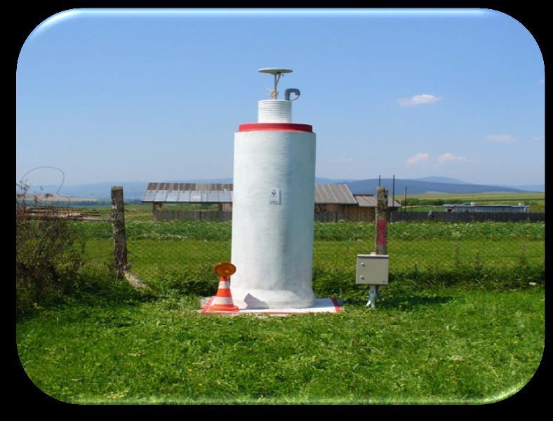
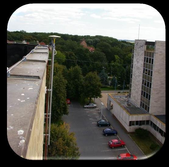
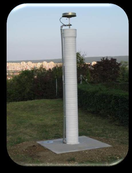
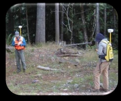
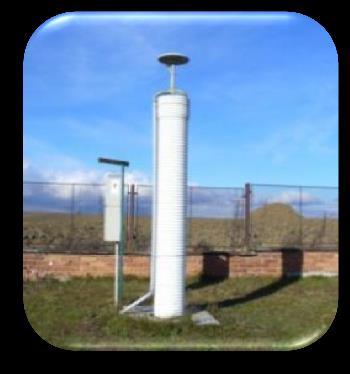
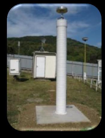
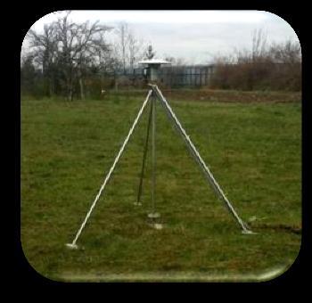
10 SKPOS permanent stations Types of monumentation


11 National service centre Web SKPOS National service center and its activities Situated on GKÚ Bratislava Routine activities Service administration Service quality monitoring Data archivation and service backups Users administration and contracts managment


12 SKPOS Control software Trimble Pivot Platform ver I-Scope modul


13 SKPOS Service principle SKPOS User SKPOS National service center
14 SKPOS Services (mountpoints) Only network solution (Network RTK in VRS concept) is provided! No single station! Service (mountpoint) name Accuracy Data format Interval SKPOS_MM for post-processing (VRS or permanent station data) mm - cm RINEX: 2.10, 2.11, 3.0 DAT, TGD, T01, T02 1 sec. x sec. SKPOS_CM_23 SKPOS_CM_31 SKPOS_CM_CMRX SKPOS_CM_CMR+ for RTK SKPOS_DM_SVK SKPOS_DM_SVK_23 for DGNSS 2 4 cm RTCM 2.3 RTCM 3.1 CMRX CMR+ 0,3 1 m RTCM 2.1 RTCM sec. 1 sec.
 1000 hours network RTK 50 hours")

15 SKPOS Charges Post processing 1000 hours RINEX files RINEX 2.x, 3.x 50 / 365 days Network RTK (year) 1000 hours network RTK 50 hours RINEX files Network RTK (month) RTCM 2.3, 3.1, CMRx, CMR+ RTCM 2.3, 3.1, CMRx, CMR+ 50 / 365 days (from ) 19 / 30 days DGNSS RTCM / 365 days
16 SKPOS Number of users (December 2014) over 950 users number is still increasing SKPOS RTK users April December


17 SKPOS Type of users

18 SKPOS Usage SKPOS usage Surveying fields (cadastre, surveying, mapping, GIS) - 92% Other fields - 8% surveying, cadastral, cartography geodesy and GIS other than surveying, cadastral, cartography geodesy and GIS

19 SKPOS Usage SKPOS usage Surveying fields (cadastre, surveying, mapping, GIS) - 92% Cadastre 24% Engineering - construction 19% Mapping thematic maps 15% Mapping different activity 14% Engineering road construction 9% Land consolidation 5% GIS data collection 4% Engineering control and deformation measurements 4% GIS - thematic maps 3% Terrestrial photogrammetry and scanning 1% Aerial photogrammetry and scanning 1% Other 1%

20 SKPOS Usage SKPOS usage Other fields - 8% Other than surveying, cadastre, cartography, geodesy, GIS etc. Precise farming 73% Other 7% Pipeline transport 7% Mining 2% Construction control of machines 3% Air transport 3%


21 SKPOS Portal and registration to the service
22 Contribution with SKPOS data to research and development Own (GKÚ) activities


23 GKU run SKPOS stations for geodynamics purposes 10 special Pilier/pier & deep drilled braced monumentation
 Antenna absolute phase center models Precise IGS ephemerids GPS+GLONASS Adjustment Minimal Constraint no net translation condition on the selected EPN stations Všeobecné spracovanie")
 -Troposférické parametre (TRO) Konverzia a synchronizácia dát -Riešenie siete (SINEX) Results SINEX")
24 Routine precise SKPOS data processing on GKÚ Precise GNSS data processing Scientific Bernese GNSS software v5.2 ITRS (ITRF2008) Antenna absolute phase center models Precise IGS ephemerids GPS+GLONASS Adjustment Minimal Constraint no net translation condition on the selected EPN stations Všeobecné spracovanie jedného dňa (1-day NEQ) Skopírovanie vstupných dát Tvorba redukovaných súboru Observačné dáta vo forme RINEX Súbory s redukovanými + normálnymi rovnicami súradnice pólu, dráhy družíc (orbity), parametre Ionosféry, diferencie kódov Tvorba výsledných denných súborov -Normálne rovnice (NQ0) -Troposférické parametre (TRO) Konverzia a synchronizácia dát -Riešenie siete (SINEX) Results SINEX files XYZ coordinates + covariancies Kódové spracovania Vytvorenie jednoduchých diferencií Predspracovanie fázových meraní Spracovanie siete na základe reálnočíselných (float) ambiguít Zobrazenie rezíduí Spracovanie siete (fixné) na základe vyriešených ambiguít Vyriešenie ambiguít Opätovné spracovanie siete na základe reálnočíselných (float) ambiguít Kontrola rezíduí -detekcia chybných družíc -detekcia chybných staníc
25 Precise SKPOS data processing Processing network SKPOS int 30/1 EPN SKPOS ext 2/2 EPN APOS 3/1 EPN GNSSnet.hu 8/2 EPN CZEPOS 6/3 EPN ASG-EUPOS 7/4 EPN ZAKPOS 3/1 EPN 2 - Total 61 stations
26 Contribution to geokinematics of Slovakia Scheme of processing 1. Trend estimation = interplate velocities estimation (Estimated station velocities represents motions of particular) 2. Velocities visualization via vector field Hz plane V plane 3. Motions interpretations SKTRF09 2 mm SKPOS


27 Slovakia geodynamics Example of the result Development of Interplate velocities (Horizontal)
28 Contribution with SKPOS data to research and development Collaboration with other institutions


29 SKPOS active part of EUPOS Follows EUPOS initiative standards Keeps information in EUPOS station database Contributes to EUPOS combination centre (SINEX GKU) Leads EUPOS working group on service monitoring


30 Contribution to European geokinematics GKU contributes to ECC = EUPOS Combination Center SINEX files with GKU acronym: GKUwwww7.SNX ECC aim Creation of European interplate velocity model = base for the new ETRS89 definition ECC leader: Ambrus Kenyeres (FOMI - Hungary)

31 Contribution to European geokinematics A.Kenyeres (from status report October 2013)
 ECC results: agreed with GKÚ solution confirm that permanent stations on buildings can help")
32 Contribution to European geokinematics A.Kenyeres (from status report October 2013) ECC results: agreed with GKÚ solution confirm that permanent stations on buildings can help to European geokinematics confirm that central Europe is stabile part of Eurasian tectonic plate


33 Activities related to EUREF Permanent Network SKPOS contribution to EPN and IGS Contribution to EPN, IGS Daily and hourly observation and navigation data - RINEX 2.11 including L5, RINEX 3.02 EUREF-IP project Observation data from GANP in Real-time NTRIP protocol, RTCM 3.1. GANP Od: 2003 GPS, GLONASS, Galileo, BeiDou EPN, IGS, EUREF-IP Admin: GKÚ MOP2 Od: 2008 GPS, GLONASS EPN Admin: STU BBYS Od: 2007 GPS, GLONASS, Galileo, BeiDou EPN Admin: GKÚ + TOPÚ


34 SKPOS contribution to National center for diagnosting the earth surface deformations in Slovakia project
35 Contribution with SKPOS data to research and development Planned activities


36 Planned collaboration with Vihorlatská hvezdáreň SES project Collaboration between GKÚ and Vihorlatska hvezdareň Agreement prepared for signature KOLS permanent station will be part of SKPOS GKU plan to support SES project with: KOLS permanent station data provision 8 SKPOS permanent stations


37 Planned contribution to E-GVAP programme E-GVAP = The EUMETNET GNSS water vapour programme GKU plan to contributs with SKPOS data to computation of water vapour above the SKPOS sites in NRT computes and sends ZTD data to E-GVAP centers for water vapour computations
 MGEX IGS scientific project to track, collate and analyze all available GNSS")

38 Planned contribution to MGEX project GKU plan to contributs with SKPOS station GANP to MGEX (Multi GNSS experiment project) MGEX IGS scientific project to track, collate and analyze all available GNSS signals. Analysis centers will attempt to estimate inter-system calibration biases, compare equipment performance and further develop processing software capable of handling multiple GNSS observation data
39 Conclusion As you could see in the slides before, SKPOS is not only the positioning service for Slovakian land surveyors but with its data from permanent stations also contributes to different research and developments projects and activities It is planned to continue in those activities, because there is no other public network in Slovakia which will be able to do this From this point of view we can said, that GKU (with SKPOS data) is successful supporter of different useful R&D projects and programmes
40 Thank you for your attention Geodetic and Cartographic Institute BRATISLAVA
SKPOS. Slovak real-time positioning service - a multifunctional tool for precise object and phenomena positioning
 SKPOS Slovak real-time positioning service - a multifunctional tool for precise object and phenomena positioning WHAT IS SKPOS AND HOW DOES IT WORK? Slovak real-time positioning service is a multifunctional
Monitoring tool for EUPOS countries network RTK quality
 Monitoring tool for EUPOS countries network RTK quality Dr. Branislav Droščák & Karol Smolík Geodetic and Cartographic Institute BRATISLAVA EUPOS WG on Service Quality Monitoring branislav.droscak@skgeodesy.sk,
PosKEN Related Activities in the Czech Republic
 Research Institute of Geodesy, Topography, and Cartography Geodetic Observatory Pecny Land Survey Office, Prague PosKEN Related Activities in the Czech Republic 2014-2015 National Report J. Šimek 1 and
ASG-EUPOS reference system
 Head Office of Geodesy and Cartography Department of Geodesy, Cartography and GIS ASG-EUPOS reference system Last year activities and future plans Szymon Wajda Prime specialist Bratislava, 21-22.11.2017
Integrated geodetic infrastructure at the Geodetic Observatory Pecný, Czech Republic, in service of national and international GNSS projects
 Integrated geodetic infrastructure at the Geodetic Observatory Pecný, Czech Republic, in service of national and international GNSS projects Pavel NOVÁK, Czech Republic Key words: geodesy, reference systems,
EUREF Related Activities in the Czech Republic
 Research Institute of Geodesy, Topography, and Cartography Geodetic Observatory Pecny Land Survey Office, Prague EUREF Related Activities in the Czech Republic 2014-2015 National Report J. Douša 1, V.
EUREF Permanent GNSS Network Carine Royal Observatory of Belgium
 ENEON first workshop Observing Europe: Networking the Earth Observation Networks in Europe EUREF Permanent GNSS Network Carine Bruyninx/C.Bruyninx@oma.be Royal Observatory of Belgium 1. About your network
EUPOS - EUROPEAN POSITION DETERMINATION SYSTEM INITIATIVE
 EUPOS - EUROPEAN POSITION DETERMINATION SYSTEM INITIATIVE Dr. Branislav Droščák EUPOS chairman & Geodetic and Cartographic institute Bratislava CLGE General Assembly March 22.-23. 2019. Sofia, Bulgaria
EUREF Related Activities in the Czech Republic
 Research Institute of Geodesy, Topography, and Cartography Geodetic Observatory Pecny Land Survey Office, Prague EUREF Related Activities in the Czech Republic 2012-2013 National Report J. Šimek 1, J.
EUREF Related Activities in the Czech Republic
 Research Institute of Geodesy, Topography, and Cartography Geodetic Observatory Pecny Land Survey Office, Prague EUREF Related Activities in the Czech Republic 2011-2012 National Report J. Šimek1, J. Douša1,
ASG-EUPOS DENSIFICATION OF EUREF PERMANENT NETWORK ON THE TERRITORY OF POLAND
 ASG-EUPOS DENSIFICATION OF EUREF PERMANENT NETWORK ON THE TERRITORY OF POLAND 1. INTRODUCTION Jarosław Bosy 1,2) Artur Oruba 1) Wieslaw Graszka 1) Marcin Leonczyk 1) Marcin Ryczywolski 1) 1) Head Office
Geodetic policy for Ireland and Northern Ireland
 Geodetic policy for Ireland and Northern Ireland Background Ordnance Survey Ireland (OSi) is the National Mapping Agency (NMA) of the Republic of Ireland. The Ordnance Survey of Northern Ireland (OSNI)
Towards a EUREF Service Providing Real-time GNSS Clock and Orbit Corrections
 Towards a EUREF Service Providing Real-time GNSS Clock and Orbit Corrections G. Weber 1), W. Söhne 1), A. Stürze 1), L. Mervart 2) 1) Federal Agency for Cartography and Geodesy, Frankfurt am Main, Germany
EUREF Related Activities in the Czech Republic
 Research Institute of Geodesy, Topography, and Cartography Geodetic Observatory Pecny Land Survey Office, Prague EUREF Related Activities in the Czech Republic 2015-2016 National Report J. Douša 1, V.
Multi-GNSS real-time troposphere delay estimation
 Multi-GNSS real-time troposphere delay estimation Jaroslaw Bosy, Tomasz Hadas, Jak Kaplon, Kamil Kazmierski The 7th China Satellite Navigation Conference, May 18-20 Changsha China, Session S1: BDS/GNSS
EUPOS: Unified GNSS Augmentation Infrastructure and International Cooperation in Central and Eastern Europe
 EUPOS: Unified GNSS Augmentation Infrastructure and International Cooperation in Central and Eastern Europe Senate Department for Urban Development Geodetic Reference Systems Fehrbelliner Platz 1, 10707
HEAD OFFICE OF GEODESY AND CARTOGRAPHY. Wspolna 2 Str., Warsaw, Poland ASG-EUPOS THE POLISH CONTRIBUTION TO THE EUPOS PROJECT
 HEAD OFFICE OF GEODESY AND CARTOGRAPHY Wspolna 2 Str., 00-926 Warsaw, Poland ASG-EUPOS THE POLISH CONTRIBUTION TO THE EUPOS PROJECT Project Part-Financed by European Union European Regional Development
EUREF Related Activities
 Symposium of the IAG Subcommission for Europe (EUREF) Chisinau, Moldova, 25 28 May, 2011 National Report of the Czech Republic EUREF Related Activities in the Czech Republic 2010-2011 National Report presented
OF POLAND TO EUREF 2009
 NATIONAL REPORT OF POLAND TO EUREF 2009 Jan Krynski Institute of Geodesy and Cartography, Warsaw Jerzy B. Rogowski Warsaw University of Technology, Warsaw Outline Main geodetic activities at the national
Cross-Border EUPOS Data Exchange First Experience
 Cross-Border EUPOS Data Exchange First Experience Eimuntas Paršeliūnas, Marius Petniūnas, Domantas Bručas (Institute of Geodesy of Vilnius Gediminas Technical University, Lithuania) Wieslaw Graszka (Head
The realization of a 3D Reference System
 The realization of a 3D Reference System Standard techniques: topographic surveying and GNSS Observe angles and distances either between points on the Earth surface or to satellites and stars. Do not observe
National Report of Greece to EUREF 2009
 National Report of Greece to EUREF 2009 M. Gianniou KTIMATOLOGIO S.A. (Hellenic Cadastre) 1 Introduction In 2007, KTIMATOLOGIO S.A (Hellenic Cadastre) established HEPOS, the HEllenic POsitioning System,
ROMPOS FOR CADASTRE APPLICATIONS
 International Symposium on Global Navigation Satellite Systems, Space-Based and Ground-Based Augmentation Systems and Applications 2009; Berlin, Germany, 30 November - 2 December 2009 ROMPOS FOR CADASTRE
EUPOS Central and Eastern European Differential (D)GNSS Infrastructure, and Cooperation
GNSS Infrastructure, and Cooperation") EUPOS Central and Eastern European Differential (D)GNSS Infrastructure, and Cooperation Office of the International EUPOS Steering Committee, Head Senate Department for Urban Development, State of Berlin,
EUPOS Central and Eastern European Differential (D)GNSS Infrastructure, and Cooperation Office of the International EUPOS Steering Committee, Head Senate Department for Urban Development, State of Berlin,
Alberding solutions for GNSS infrastructure operators
 Tamás Horváth Alberding solutions for GNSS infrastructure operators 21.11.2017 1/35 Alberding solutions for GNSS infrastructure operators Tamás Horváth Alberding GmbH 4 th EUPOS Technical Meeting 21-22
Accuracy assessment of free web-based online GPS Processing services and relative GPS solution software
 82 Accuracy assessment of free web-based online GPS Processing services and relative GPS solution software Khaled Mahmoud Abdel Aziz Department of Surveying Engineering, Shoubra Faculty of Engineering,
LONG-TERM POSITIONAL MONITORING OF STATION VYHL OF THE SNĚŽNÍK NETWORK
 Acta Geodyn. Geomater., Vol. 4, No. 4 (148), 201-206, 2007 LONG-TERM POSITIONAL MONITORING OF STATION VYHL OF THE SNĚŽNÍK NETWORK Otakar ŠVÁBENSKÝ * and Josef WEIGEL Brno University of Technology, Department
CROPOS as Support of Geodetic Infrastructure in Croatia
 CROPOS as Support of Geodetic Infrastructure in Croatia Dr. Sc. Danko Markovinović - Croatia CLGE VicePresident The Geodetic Infrastructure in Europe - today and tomorrow Sweden...Umeå...22-23 June 2011
Newsletter 01/2012. Content
 Newsletter 01/2012 Content Ten years of establishment of EUPOS reference stations in Central and Eastern Europe Some words about the International GNSS Symposium 2011, Berlin, Germany EUPOS news from HUNGARY
Real-Time and Multi-GNSS Key Projects of the International GNSS Service
 Real-Time and Multi-GNSS Key Projects of the International GNSS Service Urs Hugentobler, Chris Rizos, Mark Caissy, Georg Weber, Oliver Montenbruck, Ruth Neilan EUREF 2013 Symposium Budapest, Hungary, May
The International Scene: How Precise Positioning Will Underpin Critical GNSS Applications
 The International Scene: How Precise Positioning Will Underpin Critical GNSS Applications School of Civil & Environmental Engineering, UNSW, Sydney, Australia Chris Rizos Member of the IGS Governing Board
VESOG GNSS Network in Czech Republic
 1 VESOG GNSS Network in Czech Republic Jakub Kostelecký (RIGTC) JAKUB.KOSTELECKY@PECNY.CZ CzechGeo/EPOS Workshop November 16, 2016, GFU, Prague, Czech Republic VESOG GNSS network 2 VESOG = Research and
Trimble NetR9 Reference Receiver Series: Frequently Asked Questions
 July 2010 Trimble NetR9 Reference Receiver Series: Frequently Asked Questions What is the Trimble NetR9 GNSS reference receiver? The Trimble NetR9 GNSS (Global Navigation Satellite System) reference receiver
National Report of Greece to EUREF 2010
 National Report of Greece to EUREF 2010 M. Gianniou KTIMATOLOGIO S.A. (Hellenic Cadastre) 1 Introduction The HEllenic POsitioning System (HEPOS) is an RTK network consisting of 98 reference stations that
EUPOS - European Position Determination System Status and current issues
 EUPOS - European Position Determination System Status and current issues Office of the International EUPOS Steering Committee Senate Department for Urban Development, Land Berlin, Germany Symposium of
EUPOS European Position Determination System
 EUPOS European Position Determination System c/o Senate Department for Urban Development, State Berlin, Germany Umea, Sweden, 22 nd 23 rd 2011 The Geodetic Infrastructure in Europe today and tomorrow Slide
Trimble GNSS Infrastructure
 Trimble GNSS Infrastructure A History of Innovation Trimble, the first company to offer commercial GPS products company to integrate GPS with communications technology RTK system in the market in 1994
Terrestrial Reference Frame of Serbia and its temporal rate
 Belgrade University Faculty of Civil Engineering Terrestrial Reference Frame of Serbia and its temporal rate Sofija Naod, Sanja Grekulović, Violeta Vasilić Oleg Odalović, Dragan Blagojević Department of
European Position Determination System (EUPOS )
") European Position Determination System (EUPOS ) Georgi MILEV, Bulgaria, Gerd ROSENTHAL, Germany and Keranka VASSILEVA, Bulgaria Key words: ABSTRACT The project EUPOS is an initiative to establish a uniform
European Position Determination System (EUPOS ) Georgi MILEV, Bulgaria, Gerd ROSENTHAL, Germany and Keranka VASSILEVA, Bulgaria Key words: ABSTRACT The project EUPOS is an initiative to establish a uniform
LitPOS a part of EUPOS
 Project part-financed by the European Union LitPOS a part of EUPOS Eimuntas Parseliunas 1, Arunas Buga 1, Leonardas Marozas 1, Marius Petniunas 1, Saulius Urbanas 2 Abstract 1 Institute of Geodesy, Vilnius
European Position Determination System. Technical Standards
 European Position Determination System Technical Standards Revised 2 nd Edition 24 April 2008 Resolution of the International EUPOS Steering Committee 13 th Conference, Bucharest, Romania, 23 24 April
Real-time Water Vapor and TEC calculation using existing GNSS reference station infrastructure. Rana Charara Trimble Infrastructure
 Real-time Water Vapor and TEC calculation using existing GNSS reference station infrastructure Rana Charara Trimble Infrastructure GNSS Netwoks International GNSS Network and Meteorological Products IGS
TrigNet: The South African Network of Continuously Operating GNSS Base Stations
 TrigNet: The South African Network of Continuously Operating GNSS Base Stations R Wonnacott ESESA User Need Workshop Thread 2: Status of Current GNSS Applications in South Africa Somerset West 2 March
Philippine Geodetic Infrastructure Status, Challenges and Future Direction
 Philippine Geodetic Infrastructure Status, Challenges and Future Direction Engr. Charisma Victoria D. Cayapan National Mapping and Resource Information Authority PHILIPPINES Outline Evolution of Geodetic
CROPOS CROatian POsitioning System
 Željko BAČIĆ, Marijan MARJANOVIĆ and Marinko BOSILJEVAC, Croatia Key words: network of referential GNNS station, positioning service SUMMARY During 2008, the State Geodetic Administration was building
Global and Regional Real-Time Infrastructure for open access use
 Global and Regional Real-Time Infrastructure for open access use Axel Rülke Federal Agency for Cartography and Geodesy Branch Office Leipzig, Germany Tutorial on (Open) Real-Time Infrastructure and Applications
Establishment of Karadeniz Technical University Permanent GNSS Station As Reactivated of TRAB IGS Station
 Establishment of Karadeniz Technical University Permanent GNSS Station As Reactivated of TRAB IGS Station Selma Zengin Kazancı, Emine Tanır Kayıkçı Karadeniz Technical University, Department of Geomatics
Enhancing the Swiss Permanent GPS Network (AGNES) for GLONASS
 for GLONASS") Enhancing the Swiss Permanent GPS Network (AGNES) for GLONASS D. INEICHEN, E. BROCKMANN, S. SCHAER 1 1 Abstract Since 1998 swisstopo has been operating the Automated GPS Network of Switzerland (AGNES)
Enhancing the Swiss Permanent GPS Network (AGNES) for GLONASS D. INEICHEN, E. BROCKMANN, S. SCHAER 1 1 Abstract Since 1998 swisstopo has been operating the Automated GPS Network of Switzerland (AGNES)
Guidelines for EUREF Densifications
 Guidelines for EUREF Densifications Carine Bruyninx, ROB EUREF Tutorial May 24, 2016 San Sebastian, Spain EPN CB: www.epncb.oma.be ftp://epncb.oma.be/pub/general/guidelines_ for_euref_densifications.pdf
GNSS CORS in the Pacific
 GNSS CORS in the Pacific FIG References Frame in Practice Seminar Operational Aspects of GNSS CORS Technical Workshop Holiday Inn, Suva - Fiji PGSC Partnership Desk, GEM Division, Pacific Community (SPC)
EUROPEAN POSITION DETERMINATION SYSTEM (EUPOS )
") 1 EUROPEAN POSITION DETERMINATION SYSTEM (EUPOS ) G. ROSENTHAL 1, G. MILEV 2, K. VASSILEVA 2 EUPOS: European Position Determination System 1. General 2. For position fixing with higher accuracy many countries
1 EUROPEAN POSITION DETERMINATION SYSTEM (EUPOS ) G. ROSENTHAL 1, G. MILEV 2, K. VASSILEVA 2 EUPOS: European Position Determination System 1. General 2. For position fixing with higher accuracy many countries
NATIONAL REPORT OF POLAND TO EUREF 2012
 NATIONAL REPORT OF POLAND TO EUREF 2012 Jan Krynski Institute of Geodesy and Cartography, Warsaw Jerzy B. Rogowski Warsaw University of Technology, Warsaw Outline Main geodetic activities at the national
NTRIP Background History, Development & BKG. Networked Transport of RTCM via Internet Protocol
 Networked Transport of RTCM via Internet Protocol Networked Transport of RTCM via Internet Protocol Bundesamt für Kartographie und Geodäsie Motivation: Use Internet to transport GNSS corrections Communication
Monitoring of High-rise Building
 Monitoring of High-rise Building Anna HOSTINOVÁ and Alojz KOPÁČIK, Slovakia Key words: monitoring, movements, time series, GNSS, POS SUMMARY For engineering geodesy weren t technologies of global navigation
KOPOS (KOsovo POsitioning System) ANALYSIS IN THE TESTING PHASE
 ANALYSIS IN THE TESTING PHASE") KOPOS (KOsovo POsitioning System) ANALYSIS IN THE TESTING PHASE Murat Meha Muzafer Çaka Reshat Murati 3 CROPOS Conference, Opatija, 24-25 October 2013 1 Chronology of system development Owner of the system:
KOPOS (KOsovo POsitioning System) ANALYSIS IN THE TESTING PHASE Murat Meha Muzafer Çaka Reshat Murati 3 CROPOS Conference, Opatija, 24-25 October 2013 1 Chronology of system development Owner of the system:
What makes the positioning infrastructure work. Simon Kwok Chairman, Land Surveying Division Hong Kong Institute of Surveyors
 What makes the positioning infrastructure work The experience of the Hong Kong Satellite Positioning Reference Station Network Simon Kwok Chairman, Land Surveying Division Hong Kong Institute of Surveyors
Template for CORS Networks
 Template for CORS Networks This template gives an idea on what can be included in the document or poster to describe the national or regional CORs network that your organisation is responsible for. The
THE PERMANENT MODRA-PIESOK GPS STATION MODRA- PIESOK AND ITS LONG-TERM AND SHORT-TERM STABILITY
 Slovak Journal of Civil Engineering, Vol. IX, No. 1-2, 2001 THE PERMANENT MODRA-PIESOK GPS STATION MODRA- PIESOK AND ITS LONG-TERM AND SHORT-TERM STABILITY Ján Hefty, Ph.D, Assoc. Prof. Department of Theoretical
International Foundation HFSJG Activity Report 2016
 Name of research institute or organization: Bundesamt für Landestopografie / Swiss Federal Office of Topography (swisstopo) Title of project: Automated GNSS Network Switzerland (AGNES) Project leader and
Applications, Products and Services of GPS Technology
 Applications, Products and Services of GPS Technology Enrico C. Paringit. Dr. Eng. University of the Philippines Training Center for Applied Geodesy and Photogrammetry 1 Outline of this Presentation GPS
Exploiting the high precision capabilities of the Hellenic Positioning System - HEPOS
 Exploiting the high precision capabilities of the Hellenic Positioning System - HEPOS M. Gianniou, D. Mastoris, I. Stavropoulou Geodetic Department KTIMATOLOGIO S.A. 339 Mesogion Ave., 15562 Holargos Greece
Real-time PPP Results From Global Orbit and Clock Corrections
 BKG, Frankfurt a.m. Real-time PPP Results From Global Orbit and Clock Corrections Yüksel Altiner 1, Leos Mervart 2, Peter Neumaier 1, Wolfgang Söhne 1, Georg Weber 1 1 Federal Agency for Cartography and
Future of Reference Frames from Static to Dynamic? Markku Poutanen and Pasi Häkli
 Future of Reference Frames from Static to Dynamic? Markku Poutanen and Pasi Häkli Finnish Geospatial Research Institute, FGI Future of Reference Frames from Static to Dynamic? kinematic Markku Poutanen
RELEASE NOTES. Introduction. Trimble Infrastructure GNSS Series Receivers
 RELEASE NOTES Trimble Infrastructure GNSS Series Receivers These release notes describe the latest improvements made to the Trimble NetR9 GNSS Infrastructure series receivers. Introduction New Features
IGS workshop 2018 Multi-GNSS through Global Collaboration Datum: 29 October - 2 November 2018 Plats: Wuhan, China Deltagare: Tong Ning (I0101)
") 2018-11-19 RESERAPPORT IGS workshop 2018 Multi-GNSS through Global Collaboration Datum: 29 October - 2 November 2018 Plats: Wuhan, China Deltagare: Tong Ning (I0101) Syfte med mötet The workshop programme
2018-11-19 RESERAPPORT IGS workshop 2018 Multi-GNSS through Global Collaboration Datum: 29 October - 2 November 2018 Plats: Wuhan, China Deltagare: Tong Ning (I0101) Syfte med mötet The workshop programme
Updated Options and New Products of EPN Analysis
 EUREF Symposium in London, UK, 6 9 June 27 Updated Options and New Products of EPN Analysis H. Habrich EPN Analysis Coordinator Federal Agency for Cartography and Geodesy, Frankfurt, Germany Abstract The
IMO WORLDWIDE RADIONAVIGATION SYSTEM (WWRNS) Study on Communication Techniques for High Accuracy DGPS in the Republic of Korea
 Study on Communication Techniques for High Accuracy DGPS in the Republic of Korea") INTERNATIONAL MARITIME ORGANIZATION E IMO SUB-COMMITTEE ON SAFETY OF NAVIGATION 52nd session Agenda item 12 NAV 52/INF.8 12 May 2006 ENGLISH ONLY WORLDWIDE RADIONAVIGATION SYSTEM (WWRNS) Study on Communication
INTERNATIONAL MARITIME ORGANIZATION E IMO SUB-COMMITTEE ON SAFETY OF NAVIGATION 52nd session Agenda item 12 NAV 52/INF.8 12 May 2006 ENGLISH ONLY WORLDWIDE RADIONAVIGATION SYSTEM (WWRNS) Study on Communication
Tamás Horváth. 06 June 2012
 Tamás Horváth Software solutions for GNSS infrastructure monitoring 06 June 2012 1/18 Software solutions for GNSS infrastructure monitoring Tamás Horváth Alberding GmbH 06 June 2012 Tamás Horváth Software
GNSS Analysis with Galileo Observations in the Subnetwork of the BEK Analysis Centre
 GNSS Analysis with Galileo Observations in the Subnetwork of the BEK Analysis Centre Christof Völksen Bavarian Academy of Sciences and Humanities (BAdW) Tomasz Liwosz Warsaw University of Technology, Warsaw,
Precise Positioning GNSS Applications
 Precise Point Positioning: Is the Era of Differential GNSS Positioning Drawing to an End? School of Surveying & Spatial Information Systems, UNSW, Sydney, Australia Chris Rizos 1, Volker Janssen 2, Craig
GNSS Application trends in Central Asia
 GNSS Application trends in Central Asia GIS Open 2014, April 15-17, 2014, Székesfehérvár, Hungary Akylbek Chymyrov PhD Candidate, Faculty of Geoinformatics University of West-Hungary Docent of the Geodesy
al T TD ) ime D Faamily Products The RTD Family of products offers a full suite of highprecision GPS sensor positioning and navigation solutions for:
 ime D Faamily Products The RTD Family of products offers a full suite of highprecision GPS sensor positioning and navigation solutions for:") Reeal ynnamics al T amics (R TD ) ime D RTD) Time Dy Faamily mily ooff P roducts Products The RTD Family of products offers a full suite of highprecision GPS sensor positioning and navigation solutions
Reeal ynnamics al T amics (R TD ) ime D RTD) Time Dy Faamily mily ooff P roducts Products The RTD Family of products offers a full suite of highprecision GPS sensor positioning and navigation solutions
MGEX Clock Determination at CODE
 source: http://boris.unibe.ch/74079/ downloaded: 13.3.2017 MGEX Clock Determination at CODE E. Orliac, L. Prange, R. Dach, S. Schaer and A. Jäggi Astronomical Institute of University of Bern (AIUB) Bern,
IAG School on Reference Systems June 7 June 12, 2010 Aegean University, Department of Geography Mytilene, Lesvos Island, Greece SCHOOL PROGRAM
 IAG School on Reference Systems June 7 June 12, 2010 Aegean University, Department of Geography Mytilene, Lesvos Island, Greece SCHOOL PROGRAM Monday June 7 8:00-9:00 Registration 9:00-10:00 Opening Session
FieldGenius Technical Notes GPS Terminology
 FieldGenius Technical Notes GPS Terminology Almanac A set of Keplerian orbital parameters which allow the satellite positions to be predicted into the future. Ambiguity An integer value of the number of
MGA Webinar Series : 1 Very Cheap RTK Receivers: Changing the Landscape of Positioning Services
 MGA Webinar Series : 1 Very Cheap RTK Receivers: Changing the Landscape of Positioning Services Dinesh Manandhar Center for Spatial Information Science The University of Tokyo Contact Information: dinesh@iis.u-tokyo.ac.jp
National report of Ukraine
 National report of Ukraine O. Kucher (1), A. Marchenko (3), O. Renkevich (1), S. Savchuk (3), I. Zaiats (2) 1) Research Institute of Geodesy and Cartography, Kyiv, Ukraine 2) State Service of Geodesy,
GNSS Low-Cost High-Accuracy Receiver (L-CHAR)
") GNSS Low-Cost High-Accuracy Receiver (L-CHAR) Dinesh Manandhar Center for Spatial Information Science The University of Tokyo Contact Information: dinesh@iis.u-tokyo.ac.jp Slide : 1 High Accuracy Receivers
GNSS Low-Cost High-Accuracy Receiver (L-CHAR) Dinesh Manandhar Center for Spatial Information Science The University of Tokyo Contact Information: dinesh@iis.u-tokyo.ac.jp Slide : 1 High Accuracy Receivers
Datums and Tools to Connect Geospatial Data Accurately
 Datums and Tools to Connect Geospatial Data Accurately Pamela Fromhertz Colorado State Geodetic Advisor National Geodetic Survey National Oceanic and Atmospheric Administration GIS-T April 18, 2012 Loveland,
Monitoring of long-term changes in GBAS daily solutions for the maintenance of the Polish reference frame
 The 9 th International Conference ENVIRONMENTAL ENGINEERING 22 23 May 2014, Vilnius, Lithuania SELECTED PAPERS eissn 2029-7092 / eisbn 978-609-457-640-9 Available online at http://enviro.vgtu.lt Section:
Some Metrological Issues of GNSS Positioning: Case Study for the Czech Republic
 Some Metrological Issues of GNSS Positioning: Case Study for the Czech Republic Jaroslav Šimek Research Institute of Geodesy, Topography and Cartography - Geodetic Observatory Pecný The research is supported
SERVIR: The Portuguese Army CORS Network for RTK
 SERVIR: The Portuguese Army CORS Network for RTK António Jaime Gago AFONSO, Rui Francisco da Silva TEODORO and Virgílio Brito MENDES, Portugal Key words: GNSS, RTK, VRS, Network ABSTRACT Traditionally
Italian GNSS network: status of the processing and position/velocity results
 Italian GNSS network: status of the processing and position/velocity results J. Zurutuza (1), A. Caporali (2), N. Cenni (2), M. Bertocco (1) (1) Centro di Ateneo di Studi e Attività Spaziali "Giuseppe
Federico MORSUT 1, Raffaela CEFALO 2. DMG, University of Trieste; 2 GeoSNav Lab, University of Trieste
 Comparison between PPP and DD processing techniques using Bernese 5.2 Computation of displacements and velocities of Marussi FVG and FredNet GNSS networks and visualization on GeoServer: first results
NATIONAL REPORT OF SLOVENIA
 27th EUREF Symposium NATIONAL REPORT OF SLOVENIA Klemen Medved, Sandi Berk, Žarko Komadina, Jurij Režek (Surveying and Mapping Authority of the Republic of Slovenia, Ljubljana) Niko Fabiani, Katja Oven
Geodetic Reference Frame Theory
 Technical Seminar Reference Frame in Practice, Geodetic Reference Frame Theory and the practical benefits of data sharing Geoffrey Blewitt University of Nevada, Reno, USA http://geodesy.unr.edu Sponsors:
The International GNSS Service (IGS): Product and Services
: Product and Services") The International GNSS Service (IGS): Product and Services Ruth E. Neilan 1, Chris Rizos 2 1 Director, IGS Central Bureau, NASA/JPL, Pasadena, USA 2 VP IAG, IGS Governing Board, UNSW, Sydney, Australia
The International GNSS Service (IGS): Product and Services Ruth E. Neilan 1, Chris Rizos 2 1 Director, IGS Central Bureau, NASA/JPL, Pasadena, USA 2 VP IAG, IGS Governing Board, UNSW, Sydney, Australia
CROPOS positioning easier than ever
 CROPOS positioning easier than ever M. Marjanovic, T. Basic State Geodetic Administration INF-0002 University of Zagreb - Faculty of Geodesy Republic of Croatia Agenda Intro Croatia, State Geodetic Administration,
Real-Time GNSS EUREF-IP Pilot Project
 Real-Time GNSS EUREF-IP Pilot Project G. Weber, BKG, Frankfurt 1. Status: Network, coverage, contributors 2. White Paper: Real-time GNSS in Routine EPN Operations 3. Real-time GNSS tools: BNC, client for
Is neo-cadastral surveying on your smartphone feasible?
 Is neo-cadastral surveying on your smartphone feasible? School of Civil & Environmental Engineering Craig Roberts UNSW Paul Davis-Raiss, David Lofberg, Greg Goodman LandTeam Van der Vlugt, 2012 1 Cadastral
Trimble GPSNet 2.5 Software for GNSS Infrastructure: New Features. Martin Janousek - Trimble Technical Support - Infrastructure
 Trimble GPSNet 2.5 Software for GNSS Infrastructure: New Features Martin Janousek - Trimble Technical Support - Infrastructure GPSNet Users Seminar Munich, March 30 th /31 th 2006 Overview Support for
RELEASE NOTES. Introduction. Trimble NetR9 Infrastructure GNSS Series Receivers
 RELEASE NOTES Trimble NetR9 Infrastructure GNSS Series Receivers These release notes describe the latest improvements made to the Trimble Infrastructure GNSS series receivers. Introduction New Features
The Reasons to Succeed or to Fail a GNSS Network RTK Project
 The Reasons to Succeed or to Fail a GNSS Network RTK Project Joël van Cranenbroeck, Managing Director CGEOS Creative Geosensing sprl-s, Belgium Andy Yin, International Sales Director ComNav Technology
CONTRIBUTION OF EUPOS PERMANENT GPS NETWORK TO THE EUREF REFERENCE SYSTEM
 BERLIN SENATE, DEPARTMENT FOR URBAN DEVELOPMENT, GERMANY HEAD OFFICE OF GEODESY AND CARTOGRAPHY, WARSAW, POLAND FÖMI SATELLITE GEODETIC OBSERVATORY PENC, HUNGARY WARSAW UNIVERSITY OF TECHNOLOGY INSTITUTE
Performance Evaluation of Differential Global Navigation Satellite System with RTK Corrections
 IOSR Journal of Electronics and Communication Engineering (IOSR-JECE) e-issn: 2278-2834,p- ISSN: 2278-8735.Volume 9, Issue 2, Ver. VI (Mar - Apr. 2014), PP 43-47 Performance Evaluation of Differential
WHU s developments for the MGEX precise products and the GNSS ultra-rapid products
 IGS Workshop 2016 WHU s developments for the MGEX precise products and the GNSS ultra-rapid products Chuang Shi; Qile Zhao; Min Li; Jing Guo; Jingnan Liu Presented by Jianghui Geng GNSS Research Center,
Some Features of Pre-Processing of RTK Network LitPos (Lithuania) Data Applying Bernese Software
 Data Applying Bernese Software") Environmental Engineering 10th International Conference eissn 2029-7092 / eisbn 978-609-476-044-0 Vilnius Gediminas Technical University Lithuania, 27 28 April 2017 Article ID: enviro.2017.160 http://enviro.vgtu.lt
Environmental Engineering 10th International Conference eissn 2029-7092 / eisbn 978-609-476-044-0 Vilnius Gediminas Technical University Lithuania, 27 28 April 2017 Article ID: enviro.2017.160 http://enviro.vgtu.lt
A NEW GEOCENTRIC DATUM FOR NEW ZEALAND
 A NEW GEOCENTRIC DATUM FOR NEW ZEALAND Don Grant Graeme Blick Office of Surveyor-General Land Information New Zealand PO Box 5501 Wellington New Zealand Phone 04 4600100 Fax 04 4722244 dgrant@linz.govt.nz
PERSPECTIVES OF FREE GNSS POST-PROCESSING SOFTWARE USING
 XIII International forum «INTEREXPO GEO-Siberia 2017» PERSPECTIVES OF FREE GNSS POST-PROCESSING SOFTWARE USING S. Shevchuk, L. Lipatnikov, K. Malyutina (Siberian State University of Geosystems and Technologies)
GNSS High Precision Systems for Cadastre: development, experiences and Galileo perspectives
 GNSS High Precision Systems for Cadastre: development, experiences and Galileo perspectives CLGE Plenary Workshop 29 September 2017 Roberto Capua, Flavio Ferrante DO-11-DO-03 1 Agenda GNSS High Precision