Japan s Efforts to the Straits of Malacca and Singapore
|
|
|
- Shon Morton
- 5 years ago
- Views:
Transcription

1 Japan s Efforts to the Straits of Malacca and Singapore Maritime Bureau, MLIT-Japan October 5-6, 2015 The 8 th Co-operation Forum under the Co-operative Mechanism in the Straits of Malacca and Singapore Ministry of Land, Infrastructure, Transport and Tourism
2 Comparison of Transit Volumes among Vital International Shipping Passages (Number of Vessels) 140, , , ,000 80,000 X 8 X 10 93,755 75,061 60,000 40,000 20,000 17,993 17,799 17,224 14,684 14,544 13, Suez Canal 1 Straits of Malacca and Singapore 2 Panama Canal 3 1 Source: Suez Canal Authorty 2 Source: The Japan Association of Marine Safety 3 Source: Autoridad del Canal de Panama 1

3 Estimated Traffic Volume in SOMS 1,000Ton 20,000 Dead Weight Tonnage 18,491 15,000 10,000 5, , ,504 60% 3,989 6,938 12, Number of Passing Ships 74% 74% 53% % 94 35% % % Source : 2012 Survey by The Nippon Foundation 2
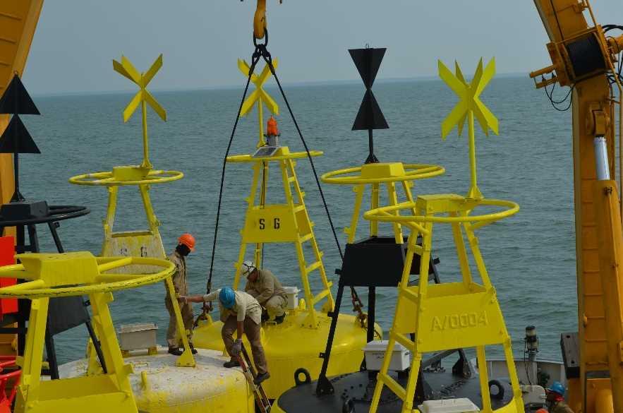
4 Japan s contributions before the Cooperative Mechanism in place Hydrographic Surveys ,1978 and Removal of 4 shipwrecks Cooperation for Maintenance & Replacement of Aids to Navigation Donations Buoy Tenders to Indonesia and Malaysia 1976, 2002 and 2003 Dredging works in the Strait of Singapore 1979 Revolving Fund 1981 Oil Skimming Vessel to Singapore 1973 In Total $150 Million 3
5 Japan s contributions Under the Cooperative Mechanism Project 3 (2011): Trial of AIS-B transponders on small vessels in the Singapore Strait Donated 10 AIS class B transponders Assessed reliability of AIS class B transponders Project 5 (2008- ): Maintenance and replacement of aids to navigation Supporting the project through in-kind cooperation Japanese private sectors have contributed $10 million to ANF 4

6 The Framework of Japan s Contribution to the Project 5 JSA 1 PAJ 2 FEPC 3 JGA 4 Others Government Nippon Foundation MSC 1. Japanese Shipowners Association 2. Petroleum Association of Japan 3. Federation of Electric Power Companies 4. Japan Gas Association $ 2.8M [ ] $ 6M [ ] $ 1.4M [2008] $ 2M [ ] Technical Co-operation Total JP Contribution $ 10M 60% out of the total budget contributed, $17.4 M [ ] In-Kind Cooperation - Pre-Study - Capacity Building Maintenance and Replacement of AtoN Japan ANF Action 5


 One Fathom Bank resilient light beacon (north) One Fathom Bank resilient light")


7 Japan s contribution to Project 5 N o. Name of aids to navigation Belong to 26 Mudah Selatan light beacon Malaysia 27 Panjang Selatan light beacon Malaysia 28 Mudah Utara light beacon Malaysia 29 Panjang Utara light beacon Malaysia 30 Bukit Segentin lighthouse Malaysia 31 Tanjung Tohor light beacon Malaysia 32 Tanjung Parit lighthouse Indonesia 33 Bengkalis resilient light beacon Indonesia 34 Plau Undan lighthouse Malaysia 35 Rob Roy Bank light beacon Indonesia 36 Raleigh Shoal light beacon Indonesia 37 Tanjung Medang lighthouse Indonesia 38 Cape Rachado lighthouse Malaysia 39 Off Tanjung Medang light buoy Indonesia 40 Pyramid Shoal light buoy Indonesia 41 Tanjung Gabang light beacon Malaysia 42 Sepat resilient light beacon Malaysia 43 Gosong Pasir light buoy Indonesia 44 Bukit Jugra lighthouse Malaysia 45 Tanjung Rhu light beacon Malaysia 46 One Fathom Bank lighthouse Malaysia One Fathom Bank resilient light beacon (south) One Fathom Bank resilient light beacon (north) One Fathom Bank resilient light beacon (south-west) Indonesia Indonesia Indonesia 50 One Fathom Bank light buoy Indonesia 51 One Fathom Bank resilient light beacon (south) Malaysia No. Name of aids to navigation Belong to 1 Tompok Utara light beacon Malaysia 2 Hosburgh lighthouse Singapore 3 Pulau Mungging light beacon Malaysia 4 Pulau Nongsa lighthouse Indonesia 5 Bedok lighthouse Singapore 6 Batu Berhanti light beacon Indonesia 7 Batu Berhanti light buoy Indonesia 8 Buffalo Rock light beacon Indonesia 9 Buffalo Rock light buoy Indonesia 10 Helen Mars light beacon Indonesia 11 Raffles lighthouse Singapore 12 Nipa resilient light beacon Indonesia 13 Nipa light beacon Indonesia 14 Takong lighthouse Indonesia 15 Takong resilient light beacon Indonesia 16 Takong light buoy Indonesia 17 Sultan Shoal lighthouse Singapore 18 Durian (north) light buoy Indonesia 19 Durian (south) light buoy Indonesia 20 Jangkat lighthouse Indonesia 21 Pulau Cula light beacon Indonesia 22 Tanjung Piai light beacon Malaysia 23 Piai ight buoy Malaysia 24 Pulau Iyu Kecil lighthouse Indonesia 25 Pulau Pisang lighthouse Singapore Lighthouse Light Beacon Resilient Light Beacon Light Buoy 6
8 Japan s contribution to Project 5 In-kind contributions to the Project 5 1. Technical workshops Once a year since participants from each littoral state 2. Preliminary survey works Since 2009 Done 15 sites 7

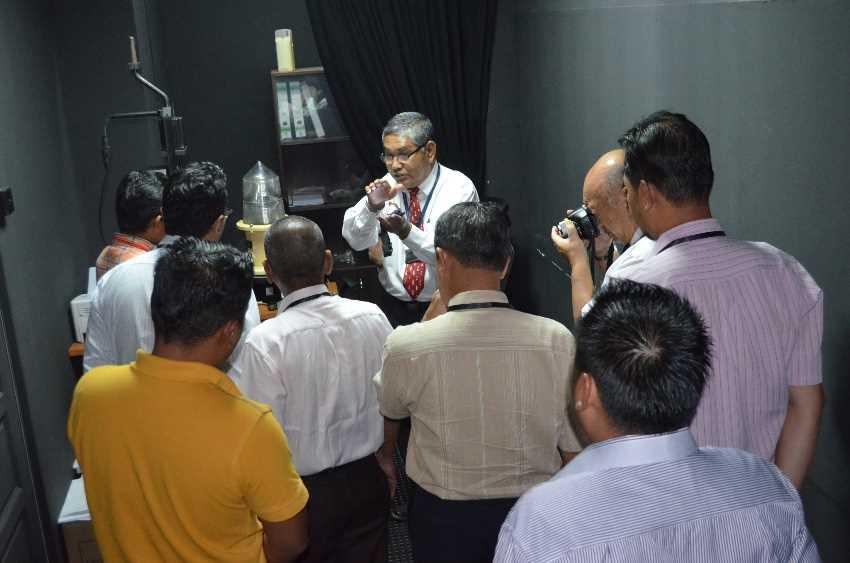
9 Japan s contribution to Project 5 (Technical workshop held in Port Kelang, Malaysia) 8

10 Japan s contribution to Project 5 (Location of preliminary survey works) 2012 One Fathom Bank resilient light beacon (north) 2012 One Fathom Bank resilient light beacon (south) 2010 Sepat resilient light beacon 2011 Raleigh Shoal light beacon 2011 Rob Roy Bank light beacon 2013 Pyramid Shoal light buoy 2010 Gosong Pasir light buoy 2013 Off Tanjung Medang light buoy 2009 Nipa resilient light beacon 2014 Helen Mars light Beacon 2014 Batu Berhanti light beacon 2014 Batu Berhanti light buoy 2015 Takon light Buoy 2010 One Fathom Bank resilient light beacon (south-west) 2015 Durian (North) light Buoy 9


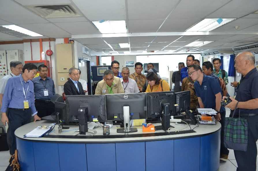
11 Other contribution (Joint Hydrographic Survey) High-level meeting and workshop on the Joint Hydrographic Survey in the SOMS Date: 18-19, December, 2014 Venue: Tokyo, Japan Participants: Indonesia, Malaysia, Singapore, Japan and MSC Signing ceremony High-level meeting Workshop 10
12 Thank you
New Trend of Japan on the Cooperative Mechanism. Maritime Bureau, MLIT-Japan September 22-23, 2014
 New Trend of Japan on the Cooperative Mechanism Japan s contribution Traffic Volume of Straits of Malacca and Singapore Joint Hydrographic Re-survey in the Straits of Malacca and Singapore Maritime Bureau,
Proposal of a New Study for the Enhancement of the Safety of Navigation in the Straits of Malacca and Singapore
 Proposal of a New Study for the Enhancement of the Safety of Navigation in the Straits of Malacca and Singapore The 8 th Co-operation Forum 5-6 October 2015 Malacca Strait Council, Japan 1 Content of Presentation
MARINE ELECTRONIC HIGHWAY IN STRAITS OF MALACCA AND SINGAPORE. Development of Supporting Element for Future & Sustainable Operation
 COOPERATION FORUM UNDER THE COOPERATIVE MECHANISM ON SAFETY OF NAVIGATION AND ENVIRONMENTAL PROTECTION IN THE STRAITS OF MALACCA AND SINGAPORE 7th SESSION Agenda Item... CF 7/... 22-23 September 2014 Original.
PROGRESS UPDATE AND FUTURE DIRECTIONS OF THE MARINE ELECTRONIC HIGHWAY (MEH)
") PROGRESS UPDATE AND FUTURE DIRECTIONS OF THE MARINE ELECTRONIC HIGHWAY (MEH) BACKGROUND 1. The Marine Electronic Highway Demonstration Project (MEH DP) was a 4- year regional project in the Straits of
PROGRESS UPDATE AND FUTURE DIRECTIONS OF THE MARINE ELECTRONIC HIGHWAY (MEH) BACKGROUND 1. The Marine Electronic Highway Demonstration Project (MEH DP) was a 4- year regional project in the Straits of
INTEGRATION SYSTEM OF AUTOMATIC IDENTIFICATION SYSTEM AND RADAR FOR PORT TRAFFIC MANAGEMENT
 Jurnal Mekanikal June 2015, Vol 38, 32-45 INTEGRATION SYSTEM OF AUTOMATIC IDENTIFICATION SYSTEM AND RADAR FOR PORT TRAFFIC MANAGEMENT NurAireenAmran 1,, Jaswar Koto*,1,2, AdiMaimun 1 1 Faculty of Mechanical
IMPLEMENTATION REVIEW STUDY REPORT ON THE PROJECT FOR ENHANCEMENT OF VESSEL TRAFFIC SYSTEM IN MALACCA AND SINGAPORE STRAITS IN INDONESIA STAGE-1
 Directorate General of Sea Transportation (DGST) Ministry of Transportation The Republic of Indonesia No. IMPLEMENTATION REVIEW STUDY REPORT ON THE PROJECT FOR ENHANCEMENT OF VESSEL TRAFFIC SYSTEM IN MALACCA
Integration System of Automatic Identification System (AIS) and Radar for Port Traffic Management
 and Radar for Port Traffic Management") Integration System of Automatic Identification System (AIS) and Radar for Port Traffic Management Nur Aireen Amran, a, Jaswar Koto, a* and Adi Maimun, a a) Department of Aeronautics, Automotive and Ocean
Integration System of Automatic Identification System (AIS) and Radar for Port Traffic Management Nur Aireen Amran, a, Jaswar Koto, a* and Adi Maimun, a a) Department of Aeronautics, Automotive and Ocean
By Parry Oei, MPA, Singapore
 Review of Recent Significant Technologies and Initiatives Implemented to Enhance Navigational Safety and Protect the Marine Environment in the Straits of Singapore and Malacca By Parry Oei, MPA, Singapore
Automatic identification system VHF data link loading
 Report ITU-R M.2287-0 (12/2013) Automatic identification system VHF data link loading M Series Mobile, radiodetermination, amateur and related satellite services ii Rep. ITU-R M.2287-0 Foreword The role
A study of the changing and future skill needs of the maritime and marine sectors. IMP-MED Project Alexandria 25 June 2014
 A study of the changing and future skill needs of the maritime and marine sectors 1 AASTMT & IMP-MED PROJECT 2 FEMIP & Blue Economy: AASTMT Communication April 2013 3 6th Regional Technical Workshop IMP-MED
IALA S WORK IN E-NAVIGATION. Michael Card
 IALA S WORK IN E-NAVIGATION Michael Card e-navigation origins The early work of IALA on e-navigation Multiple Initiatives EfficienSea 2 STM Validation IHO S-100 and IALA S-200 Smart Navigation VDES development
COMMUNICATIONS FOR MARITIME SAFETY AND EFFICIENCY. Francis Zachariae, Secretary-General, IALA
 COMMUNICATIONS FOR MARITIME SAFETY AND EFFICIENCY Francis Zachariae, Secretary-General, IALA IALA and its Purpose Non profit, international technical association established in 1957 Two Goals aimed at
11 th Co-operation Forum Co-operative Mechanism on Safety of Navigation and Environmental Protection in the Straits of Malacca and Singapore
 11 th Co-operation Forum Co-operative Mechanism on Safety of Navigation and Environmental Protection in the Straits of Malacca and Singapore 24 25 September 2018 Grand Hyatt Hotel, Singapore Report of
FOREWORD. IHO S-100 Working Group
 IHO International Hydrographic Organization KHOA Korea Hydrographic and Oceanographic Agency MUCH MORE THAN JUST NAUTICAL CHARTS IHO UNIVERSAL HYDROGRAPHIC data MODEL This document was produced with the
Market strategy update in Maritime segment. This presentation can be interpreted only together with the oral comments accompanying it
 Market strategy update in Maritime segment This presentation can be interpreted only together with the oral comments accompanying it 2 Market sub-segments and applications Recreational navigation: GNSS
PERFORMANCE ANALYSIS OF SISPELSAT MSK-DGNSS RADIO SIGNAL IN PENINSULAR MALAYSIA
 PERFORMANCE ANALYSIS OF MSK-DGNSS RADIO SIGNAL IN PENINSULAR MALAYSIA M. S. A. Razak 1, T. A., Musa 1, R. Othman 1, M. F. Yazair 1, A.Z. Sha ameri 2, A. Amirudin 3, R. M. Yusof 3 1 Geomatic Innovation
THE SINGAPORE STORY_. API/SPE Joint Meeting 9 December 2014
 THE SINGAPORE STORY_ API/SPE Joint Meeting 9 December 2014 EDB provides this presentation (including oral statements) gratuitously for information only and not for any other purpose. While care has been
DRAFT (3 December 2005)
") DRAFT (3 December 2005) CSCAP STUDY GROUP ON CAPACITY BUILDING FOR MARITIME SECURITY COOPERATION IN THE ASIA PACIFIC Study Group Objectives The agreed objectives of the CSCAP Study Group on Capacity Building
DRAFT (3 December 2005) CSCAP STUDY GROUP ON CAPACITY BUILDING FOR MARITIME SECURITY COOPERATION IN THE ASIA PACIFIC Study Group Objectives The agreed objectives of the CSCAP Study Group on Capacity Building
Updated Project Information Document (PID) Report No: AB93. EAST ASIA AND PACIFIC - 4E-Marine Electronic Highway Region.
 Report No: AB93. EAST ASIA AND PACIFIC - 4E-Marine Electronic Highway Region.") Public Disclosure Authorized Public Disclosure Authorized Public Disclosure Authorized Public Disclosure Authorized Updated Project Information Document () Report No: AB93 Project Name EAST ASIA AND PACIFIC
Public Disclosure Authorized Public Disclosure Authorized Public Disclosure Authorized Public Disclosure Authorized Updated Project Information Document () Report No: AB93 Project Name EAST ASIA AND PACIFIC
E-Navigation: Opening the door to the future
 International Association of Marine Aids to Navigation and Lighthouse Authorities E-Navigation: Opening the door to the future E-Navigation Underway North America November 2018 Secretary-General Francis
Using a Pilot Laptop with the AIS pilot plug - observed errors and difficulties
 Using a Pilot Laptop with the AIS pilot plug - observed errors and difficulties 2 nd November 2008 The following pages and images detail the errors found and experience in using his Pilot Laptop by a Australian
(P.27)
") (P.27) 27 7 210 120 8 * Navigation and Anchoring Prohibited Area has been changed since June, 2017. 9 Port of Osaka The Guidelines of Measures for preventing Typhoon Disaster ( Objective )
(P.27) 27 7 210 120 8 * Navigation and Anchoring Prohibited Area has been changed since June, 2017. 9 Port of Osaka The Guidelines of Measures for preventing Typhoon Disaster ( Objective )
IHO Colours & Symbols Maintenance Working Group (C&SMWG) 15th Meeting, BSH, Rostock, Germany, 2-4 May 2005
 15th Meeting, BSH, Rostock, Germany, 2-4 May 2005") CSMWG15-INF2 IHO Colours & Symbols Maintenance Working Group (C&SMWG) 15th Meeting, BSH, Rostock, Germany, 2-4 May 2005 Ref: HA405/004/033-01 NOTE: this is an internal document of the UKHO and is supplied
CSMWG15-INF2 IHO Colours & Symbols Maintenance Working Group (C&SMWG) 15th Meeting, BSH, Rostock, Germany, 2-4 May 2005 Ref: HA405/004/033-01 NOTE: this is an internal document of the UKHO and is supplied
The Future for the AIS AtoN. Michael Card Zeni Lite Buoy Co., Ltd., Japan
 The Future for the AIS AtoN Michael Card Zeni Lite Buoy Co., Ltd., Japan History Early work in USA and Europe Not compatible with UAIS First UAIS AIS AtoN was Akari-400 Launched at IALA Sydney, 8 years
GMDSS modernisation and e-navigation: spectrum needs
 ETSI Workshop "Future Evolution of Marine Communication", 7-8 November 2017, Sophia Antipolis, France GMDSS modernisation and e-navigation: spectrum needs Karlis Bogens BR Terrestrial Services Department
THE ELECTRONIC CHART DISPLAY AND INFORMATION SYSTEM (ECDIS) IN CHINA
 IN CHINA") International Hydrographic 'Review, Monaco, LXIX(2), September 1992 THE ELECTRONIC CHART DISPLAY AND INFORMATION SYSTEM (ECDIS) IN CHINA by The Research Group on ECDIS 1 Abstract This paper presents a
International Hydrographic 'Review, Monaco, LXIX(2), September 1992 THE ELECTRONIC CHART DISPLAY AND INFORMATION SYSTEM (ECDIS) IN CHINA by The Research Group on ECDIS 1 Abstract This paper presents a
The Automatic Identification System operating jointly with radar as the aid to navigation
 Scientific Journals Maritime University of Szczecin Zeszyty Naukowe Akademia Morska w Szczecinie 2013, 36(108) z. 1 pp. 156 161 2013, 36(108) z. 1 s. 156 161 ISSN 1733-8670 The Automatic Identification
ROUTEING OF SHIPS, SHIP REPORTING AND RELATED MATTERS. New traffic separation schemes and two-way routes in Norra Kvarken
 E SUB-COMMITTEE ON SAFETY OF NAVIGATION 57th session Agenda item 3 NAV 57/3/7 11 March 2011 Original: ENGLISH ROUTEING OF SHIPS, SHIP REPORTING AND RELATED MATTERS New traffic separation schemes and two-way
Arctic Shipping Navigating the Legal Landscape for marine infrastructure and Off-Shore Development
 Arctic Shipping Navigating the Legal Landscape for marine infrastructure and Off-Shore Development Peter G. Pamel Partner Connecticut Maritime Association SHIPPING 2012 Hilton Stamford March 21 st, 2012
Government Agency Perspectives & Initiatives Canadian Coast Guard Laurent Tardif, Director, Safe Shipping
 Unclassified Government Agency Perspectives & Initiatives Canadian Coast Guard Laurent Tardif, Director, Safe Shipping Mariner s Workshop January 23, 2019 1 Overview 1 Context 2 Marine Fees 3 4 5 Update
GUIDELINES ON ANNUAL TESTING OF THE AUTOMATIC IDENTIFICATION SYSTEM (AIS)
") INTERNATIONAL MARITIME ORGANIZATION 4 ALBERT EMBANKMENT LONDON SE1 7SR Telephone: 020 7735 7611 Fax: 020 7587 3210 IMO E Ref. T1/10 MSC.1/Circ.1252 22 October 2007 GUIDELINES ON ANNUAL TESTING OF THE AUTOMATIC
INTERNATIONAL MARITIME ORGANIZATION 4 ALBERT EMBANKMENT LONDON SE1 7SR Telephone: 020 7735 7611 Fax: 020 7587 3210 IMO E Ref. T1/10 MSC.1/Circ.1252 22 October 2007 GUIDELINES ON ANNUAL TESTING OF THE AUTOMATIC
PART II CANAL AND LAKES (CHARACTERISTICS) CHAPTER VI CANAL AND LAKES CHARACTERISTICS
 CHAPTER VI CANAL AND LAKES CHARACTERISTICS") PART II CANAL AND LAKES (CHARACTERISTICS) CHAPTER VI CANAL AND LAKES CHARACTERISTICS Art. 79- Canal and Approaches: A- THE NAVIGABLE CHANNEL: (1) North Approach Channel (Port Said) : (1.1) East: a) From
PART II CANAL AND LAKES (CHARACTERISTICS) CHAPTER VI CANAL AND LAKES CHARACTERISTICS Art. 79- Canal and Approaches: A- THE NAVIGABLE CHANNEL: (1) North Approach Channel (Port Said) : (1.1) East: a) From
GMISS IALA and Maritime Information Sharing
 International Association of Marine Aids to Navigation and Lighthouse Authorities Association Internationale de Signalisation Maritime IALA and Maritime Information Sharing R.Adm. Jean-Charles Leclair
About us. Our Purpose
 About us The Hydrographic Society UK is an independent, non-profit making, non-governmental, learned professional society. We provide a forum for all those involved in activities related to hydrography
AlaskaNor: Opportunities for Blue Growth in Alaska & North Norway. High North Center for Business and Governance, Nord University
 AlaskaNor: Opportunities for Blue Growth in Alaska & North Norway High North Center for Business and Governance, Nord University Institute of the North, Alaska 1 Introduction With the rapid changes taking
Civil GPS Service Interface Committee (CGSIC) International Committee on GNSS November 2016
 International Committee on GNSS November 2016") Civil GPS Service Interface Committee (CGSIC) International Committee on GNSS 06-11 November 2016 Russell Holmes CGSIC Deputy Chair U.S. Coast Guard Navigation Center 30 th Anniversary of the CGSIC CGSIC
Civil GPS Service Interface Committee (CGSIC) International Committee on GNSS 06-11 November 2016 Russell Holmes CGSIC Deputy Chair U.S. Coast Guard Navigation Center 30 th Anniversary of the CGSIC CGSIC
ESA IAP Blue Belt demonstration project:
 Page 1 ESA IAP Blue Belt demonstration project: supporting the European Maritime Safety Agency (EMSA) Blue Belt Project, by providing a service based on satellite based AIS data complementing the terrestrial
The Notices to Mariners (NMs) listed below apply to the latest edition of SC5622 (3 rd Edition) published on 4 th January 2018.
 listed below apply to the latest edition of SC5622 (3 rd Edition) published on 4 th January 2018.") SC5622 Ireland South Coast The Notices to Mariners (NMs) listed below apply to the latest edition of SC5622 (3 rd Edition) published on 4 th January 2018. Temporary/Preliminary NMs L3652(P)/17 IRELAND
SC5622 Ireland South Coast The Notices to Mariners (NMs) listed below apply to the latest edition of SC5622 (3 rd Edition) published on 4 th January 2018. Temporary/Preliminary NMs L3652(P)/17 IRELAND
Consolidation of Navigation Safety Regulations IMO - NCSR / MSC Updates
 Mariners Workshop - January 23 th and 24 th 2019: Consolidation of Navigation Safety Regulations IMO - NCSR / MSC Updates IMO UPDATE NCSR / MSC Sessions Outcome of the Navigation, Communications and Search
A guideline for establishing feature and symbol standard management system for national HOs
 A guideline for establishing feature and symbol standard management system for national HOs Joint 26th TSMAD and 5th DIPWG Meeting Silver Spring, Maryland, USA(10-14 June 2013) Republic of Korea (ROK)
Policy Research Corporation
 Policy Research Corporation SOUND SOLUTIONS BASED ON SCIENTIFIC RESEARCH The role of Maritime Clusters to enhance the strength and development of maritime sectors Country report Denmark INTRODUCTION TO
How Automatic Identification System (AIS) Is Being Used to Improve Navigation Safety Lock Operations Management Application Michael Winkler
 Is Being Used to Improve Navigation Safety Lock Operations Management Application Michael Winkler") How Automatic Identification System (AIS) Is Being Used to Improve Navigation Safety Lock Operations Management Application Michael Winkler June 2016 LOMA system overview USCG AIS data capabilities: AIS
How Automatic Identification System (AIS) Is Being Used to Improve Navigation Safety Lock Operations Management Application Michael Winkler June 2016 LOMA system overview USCG AIS data capabilities: AIS
GNSS in Maritime and Education in Egypt
 GNSS in Maritime and Education in Egypt GNSS IN MARITIME PORTS SHIPS PORTS WATERWAYS GNSS maritime applications will help to improve: navigation. Ship operations. Traffic management. Seaport operations.
This document describes the IMO e-navigation strategy and recommends a Danish strategy for e-navigation and associated action plan.
 Strategy and action plan for e-navigation This document describes the IMO e-navigation strategy and recommends a Danish strategy for e-navigation and associated action plan. Our reference: JKJ/MAF Case
ITS Radiocommunications in Japan Progress report and future directions
 ITS Radiocommunications in Japan Progress report and future directions 6 March 2018 Berlin, Germany Tomoaki Ishii Assistant Director, New-Generation Mobile Communications Office, Radio Dept., Telecommunications
The Accessible Arctic
 The Accessible Arctic As the Arctic loses its sea ice cover, it becomes ever more accessible, bringing both opportunities and potential conflicts between stakeholders I. Globalization, Climate Change &
Absolute Positioning by Radar
 Absolute Positioning by Radar Dr Nick Ward, Research Director General Lighthouse Authorities of UK & Ireland 14th IAIN Congress 2012, 01-03 October, 2012 - Cairo, Egypt Seamless Navigation (Challenges
Session 8: Maritime Safety and Security. Raymond Gilpin, Ph.D. Academic Dean. Impact through Insight
 Session 8: Maritime Safety and Security Raymond Gilpin, Ph.D. Academic Dean Impact through Insight Africa s Maritime Environment Abundant natural resources: Significant fishing grounds Growing interest
M5/M24 NAVIGATION EXERCISES AUS 252 NAME:
 M5/M24 NAVIGATION EXERCISES AUS 252 NAME: Use chart Aus 252 extract. Use the deviation card at end of this paper. EXERCISE NO. 1 CHART INFORMATION Select Chart Aus252 and answer the following. 1 Find the
ITU Service Publications (maritime) and MARS (Maritime mobile Access and Retrieval System)
 and MARS (Maritime mobile Access and Retrieval System)") ITU Service Publications (maritime) and MARS (Maritime mobile Access and Retrieval System) ITU Radiocommunication Bureau Ms. Sujiva Pinnagoda pinnagoda@itu.int BR/TSD/TPR Another BR activity Radiocommunication
ITU Service Publications (maritime) and MARS (Maritime mobile Access and Retrieval System) ITU Radiocommunication Bureau Ms. Sujiva Pinnagoda pinnagoda@itu.int BR/TSD/TPR Another BR activity Radiocommunication
GPS Jamming and its impact on maritime navigation
 GPS Jamming and its impact on maritime navigation Dr Alan Grant Research and Development - Special Interest Group 10 th May 2010 Use of GPS in the maritime sector GPS has become the normal means for maritime
Myanmar Naval Hydrographic Centre. National Report for 13 th North Indian Ocean Hydrographic Commission Meeting
 Myanmar Naval Hydrographic Centre National Report for 13 th North Indian Ocean Hydrographic Commission Meeting Yangon, Myanmar 19 th 22 nd February 2013 CONTENT 1. Myanmar Naval Hydrographic Centre 2.
e-navigation Progress and trends: the IHO perspective
 International Hydrographic Organization e-navigation Progress and trends: the IHO perspective Gilles Bessero Director, IHO International Hydrographic Organization Intergovernmental consultative and technical
17 th CHRIS Meeting Rostock, Germany, 5-9 September Report of IHO-IEC Harmonization Group on Marine Information Objects (HGMIO
 17 th CHRIS Meeting Rostock, Germany, 5-9 September 2004 CHRIS17-7A rev.1 Report of IHO-IEC Harmonization Group on Marine Information Objects (HGMIO Lee Alexander, University of New Hampshire (Chair, HGMIO)
SECTION III NM 24/15 MARINE INFORMATION
 SECTION III NM 24/15 MARINE INFORMATION NATIONAL GEOSPATIAL-INTELLIGENCE AGENCY'S (NGA) GUIDANCE ON THE PROPER DISPLAY SCALE OF DIGITAL NAUTICAL CHART (DNC) DATA The DNC portfolio was originally created
Preparedness, Response, and Assessment of Oil Spill (PRAOS) Phase I
 Phase I") 2015/SOM2/OFWG/008 Agenda Item: IV C a ii Preparedness, Response, and Assessment of Oil Spill (PRAOS) Phase I Purpose: Information Submitted by: Korea 5 th Oceans and Fisheries Working Group Meeting Boracay,
2015/SOM2/OFWG/008 Agenda Item: IV C a ii Preparedness, Response, and Assessment of Oil Spill (PRAOS) Phase I Purpose: Information Submitted by: Korea 5 th Oceans and Fisheries Working Group Meeting Boracay,
EGYPTIAN HYDROGRAPHIC DEPARTMENT THE EGYPTIAN HYDROGRAPHIC FRAMEWORK
 gvt THE EGYPTIAN HYDROGRAPHIC FRAMEWORK The roles of a national Hydrographic Service can be summarized in collecting georeferenced data through systematic surveys at sea and along the coast related to:
MARITIME SAFETY INFORMATION
 Introduction 1. Maritime Safety Information (MSI) is defined as navigational and meteorological warnings, meteorological forecasts, and other urgent safety-related messages. This information is of vital
The benefits of LED technology in rotating marine beacons
 The benefits of LED technology in rotating marine beacons WHITE PAPER Marine navigation has been rewarded with new technology which has made shipping safer. LED beacons have provided the biggest improvement
Commissioners of Irish Lights. Charting Our Future Course
 Commissioners of Irish Lights Charting Our Future Course The Commissioners of Irish Lights (CIL) is the General Lighthouse Authority (GLA) for the island of Ireland, its adjacent seas and islands. CIL,
Autonomous/Unmanned Ships
 Autonomous/Unmanned Ships IFSMA - PRESENTATION 4/18/17 George Quick Slide 1 Good Afternoon, I appreciate the opportunity to say a few words about autonomous or unmanned ships from the perspective of the
RF Monitoring Service Profile Based on AIS Binary Message
 , pp.55-59 http://dx.doi.org/10.14257/astl.2015.108.13 RF Monitoring Service Profile Based on AIS Binary Message Soyoung Hwang Catholic University of Pusan, 609-757 Busan, South Korea soyoung@cup.ac.kr
Demonstrator of a Data Processing Centre (DPC) for satellite-based AIS services
 for satellite-based AIS services") Page 1 Demonstrator of a Data Processing Centre (DPC) for satellite-based AIS services 19/20 April 2012 gfabritius@cls.fr Overview of the presentation Page 2 Introducing CLS Introducing AIS / SAT-AIS Scope
Page 1 Demonstrator of a Data Processing Centre (DPC) for satellite-based AIS services 19/20 April 2012 gfabritius@cls.fr Overview of the presentation Page 2 Introducing CLS Introducing AIS / SAT-AIS Scope
Expanded use of Automatic Identification System (AIS) navigation technology in Vessel Traffic Services (VTS) B. J. Tetreault 1
 navigation technology in Vessel Traffic Services (VTS) B. J. Tetreault 1") Expanded use of Automatic Identification System (AIS) navigation technology in Vessel Traffic Services (VTS) B. J. Tetreault 1 1 (At time of writing) U. S. Coast Guard, Office of Shore Forces (CG-7413),
Expanded use of Automatic Identification System (AIS) navigation technology in Vessel Traffic Services (VTS) B. J. Tetreault 1 1 (At time of writing) U. S. Coast Guard, Office of Shore Forces (CG-7413),
GNSS and M2M for Automated Driving in Japan Masao FUKUSHIMA SIP Sub-Program Director ITS Technical Consultant, NISSAN MOTOR CO.,LTD May. 15.
 ICT SPRING EUROPE 2018 GNSS and M2M for Automated Driving in Japan Masao FUKUSHIMA SIP Sub-Program Director ITS Technical Consultant, NISSAN MOTOR CO.,LTD May. 15. 2018 SIP : Cross-Ministerial Strategic
A Survey of Mariners' Opinions on Using Electronic Charts
 s i l s Note A Survey of Mariners' Opinions on Using Electronic Charts Igor Karnicnik, M.Sc., Geodetic Institute of Slovenia, Slovenia. A new component of modern shipborne navigation equipment is the Electronic
TRANSAS. the first resident of Special Economic Zone NEUDORF
 TRANSAS the first resident of Special Economic Zone NEUDORF Transas Group Transas Group was founded in 1990 The number of Transas employees exceeds 1200 people worldwide The Company s annual turnover exceeds
Recent Developments in NOAA s Real- Time Coastal Observing Systems for Safe and Efficient Maritime Transportation
 Recent Developments in NOAA s Real- Time Coastal Observing Systems for Safe and Efficient Maritime Transportation Rich Edwing, Director NOAA Center for Operational Oceanographic Products and Services CMTS
A Roadmap of Going Places Where Others are Not Even Looking : The Blue Economy & BlueTech in San Diego
 A Roadmap of Going Places Where Others are Not Even Looking : The Blue Economy & BlueTech in San Diego Presentation to Burnham-Moores 18 th Annual Real Estate Conference February 13, 2014 Michael B. Jones
Korea s Strategy for e-navigation. SMART-Navigation. Presented by. Bu Young, Kim. 28 May Ministry of Oceans and Fisheries Republic of Korea
 Korea s Strategy for e-navigation SMART-Navigation Presented by Bu Young, Kim 28 May 2014 Ministry of Oceans and Fisheries Republic of Korea 1 2 3 4 5 6 1. SMART- Navigation? SMART-Navigation Korea s
Enhancing Technology and Innovation for Polar Navigation
 e-navigation Underway (North America) 2017 Enhancing Technology and Innovation for Polar Navigation This conference combines e-navigation Underway (North America) 2017 and Ocean Innovation 2017 with the
Western Region enavigation Sub- Committee Report
 Western Region enavigation Sub- Committee Report Western Region enavigation meeting - Jan 12 18 BC Ferries BC Coast Pilots BCIT Marine Campus Canadian Coast Guard Canadian Hydrographic Services Canadian
Fujitsu, SMU, and A*STAR collaborate on traffic management technologies with the Maritime and Port Authority of Singapore
 Fujitsu Limited Agency for Science, Technology and Research (A*STAR) Singapore Management University April 16, 2018 Fujitsu, SMU, and A*STAR collaborate on traffic management technologies with the Maritime
PAPUA NEW GUINEA HYDROGRAPHIC SERVICE
 PAPUA NEW GUINEA HYDROGRAPHIC SERVICE IHO SOUTH WEST PACIFIC HYDROGRAPHIC COMMISSION (SWPHC) 9 th Meeting Port Moresby, Papua New Guinea, 10-11 March 2007 SWPHC9-01PNG 1. INTRODUCTION 9 th SOUTH WEST PACIFIC
Results of the AIS AtoN International Survey Conducted by the Canadian Coast Guard November 2016
 Results of the AIS AtoN International Survey Conducted by the Canadian Coast Guard November 2016 Canadian Context 113 shore based stations including 2 sites in the Arctic. 2 Canadian Context Canada is
Arctic Shipping Scenarios and Coastal State Challenges. Gunnar Sander and Audun Iversen, September 2011
 Arctic Shipping Scenarios and Coastal State Challenges Gunnar Sander and Audun Iversen, September 2011 1. Project /publication Project: Arctic Shipping Scenarios and Coastal State Challenges Brigham, L.
MERMAID MARITIME PUBLIC COMPANY LIMITED READY FOR THE RISING TIDE FACT SHEET
 MERMAID MARITIME PUBLIC COMPANY LIMITED READY FOR THE RISING TIDE FACT SHEET 1 MERMAID MARITIME MERMAID MARITIME SNAPSHOT To be the Preferred Global Oil Service Specialist Partner Having served the industry
The Role of Automatic Identification System (AIS) in Enhancing Vessel Traffic Management By Capt. Ehab Ibrahim Etman
 in Enhancing Vessel Traffic Management By Capt. Ehab Ibrahim Etman") The Role of Automatic Identification System (AIS) in Enhancing Vessel Traffic Management By Capt. Ehab Ibrahim Etman Abstract The International Maritime Organization (IMO) adopted a new requirement for
The Role of Automatic Identification System (AIS) in Enhancing Vessel Traffic Management By Capt. Ehab Ibrahim Etman Abstract The International Maritime Organization (IMO) adopted a new requirement for
International Cooperation Research Center, China Satellite Navigation Office
 International Cooperation Research Center, ICG-8, Nov 10, 2013 Dubai Overview BeiDou Navigation Satellite System (hereinafter referred to as BDS") has provide regional service by the end of 2012, which
IENC production at the Flemish Hydrography. HYDRO12, 15 th November 2012 Jasmine Dumollin
 IENC production at the Flemish Hydrography HYDRO12, 15 th November 2012 Jasmine Dumollin ENC versus Inland ENC Definition Inland ENC Database, standardized as to content, structure and format, for use
02 Issue. e-navigation News. GNSS Vulnerability. Dublin Bay Digital Diamond. e-navigation. Demonstrator Update International. e-navigation.
 CORPORATE SECURITY TEAMWORK EVENTS 02 Issue e-navigation News GNSS Vulnerability Dublin Bay Digital Diamond e-navigation Demonstrator Update International e-navigation update June 2014 www.cil.ie +353
innovative interplay in practice
 control technology Ålesund Knowledge Park is a regional centre for innovators, founders and spin-off projects from the businesses. The aim of the centre is to create an environment which attracts ideas
Maritime Cluster in Japan - Shipbuilding and WP6 -
 Maritime Cluster in Japan - Shipbuilding and WP6 - Shin Otsubo Deputy Director-General Maritime Bureau Ministry of Land, Infrastructure, Transport and Tourism (MLIT) Ministry of Land, Infrastructure, Transport
POSITION ON THE DEVELOPMENT OF AtoN SERVICES
 POSITION ON THE DEVELOPMENT OF AtoN SERVICES P 2 DOCUMENT HISTORY 2017-12-15 First issue. Approved by Council at its 65 th session P 3 1. THE PURPOSE OF THIS DOCUMENT... 6 2. TRENDS AND DRIVERS OF STRATEGY
Building Sustainable and Resilient Communities
 2015/SOM1/EPWG/032 Agenda Item: 8.6 Building Sustainable and Resilient Communities Purpose: Information Submitted by: China 7 th Emergency Preparedness Working Group Meeting Subic, Philippines 28-29 January
DEVELOPMENT OF A DEFINITION FOR MSPS AND CONSIDERATION FOR THE HARMONIZATION OF THE FORMAT AND STRUCTURE OF MSPS
 INTERNATIONAL HYDROGRAPHIC ORGANIZATION E IMO/IHO HARMONIZATION GROUP ON DATA MODELLING Agenda item 5 15 September 2017 ENGLISH ONLY DEVELOPMENT OF A DEFINITION FOR MSPS AND CONSIDERATION FOR THE HARMONIZATION
Gulf of St Lawrence: Industry Challenges and Response
 Gulf of St Lawrence: Industry Challenges and Response Paul Barnes Manager, Atlantic Canada Canadian Association of Petroleum Producers October 19, 2011 History of Exploration in the Gulf of St. Lawrence
10 th APEC TRANSPORTATION MINISTERIAL MEETING 7 th October 2017 Port Moresby, Papua New Guinea Ministerial Statement
 10 th APEC TRANSPORTATION MINISTERIAL MEETING 7 th October 2017 Port Moresby, Papua New Guinea Ministerial Statement 1. We, the Ministers responsible for transportation, met in Port Moresby, Papua New
RECOMMENDATION ITU-R M * Technical characteristics for search and rescue radar transponders
 Rec. ITU-R M.628-4 1 RECOMMENDATION ITU-R M.628-4 * Technical characteristics for search and rescue radar transponders (Questions ITU-R 28/8 and ITU-R 45/8) (1986-1990-1992-1994-2006) Scope This Recommendation
KEEL MARINE LTD Naval Architects, Marine Engineers and Surveyors
 2709 (2018) Portland Harbour Port Portland Harbour Port Inclining & 2687 (2017) 2673 (2016) 2654 (2016) 2622 (2015 to 2016) Portland Harbour Port Port Operators Manual Portland Harbour Port Pusher Build
OCEAN ECONOMY: SA - Norway PRESENTATION
 OCEAN ECONOMY: SA - Norway PRESENTATION PRESENTATION OUTLINE 1) Introduction: Ocean Economy 2) Introduction: Ocean Economy Focus Areas 3) Ocean Economy recommendations 4) Ocean Economy Focus Area Progress
WWNWS 9/3/2/XI Meeting 9 4 August 2017 Agenda Item 3.2. MSI Self Assessment NAVAREA XI. Submitted by Japan SUMMARY
 WWNWS WWNWS 9/3/2/XI Meeting 9 4 August 2017 Agenda Item 3.2 MSI Self Assessment NAVAREA XI Submitted by Japan SUMMARY Executive Summary: Overview of activities undertaken within NAVAREA XI since WWNWS
Japan-ASEAN STI Collaboration and Networking: Progress and Perspectives
 Japan-ASEAN STI Collaboration and Networking: Progress and Perspectives Leader of JASTIP Headquarters, Prof. Mamoru SHIBAYAMA Headquarters Bangkok Office, Thailand THE 3th JASTIP SYMOSIUM 5 February 2017,
Baltic Exchange Initiatives
 Baltic Exchange Initiatives Mark Jackson 19 September 2017 Baltic member services Represents markets Independent freight data provider Business venue Baltic Code Education Arbitration & disputes Networking
VHF Data Exchange System (VDES)
") VHF Data Exchange System (VDES) ETSI Workshop Future Evolution of Marine Communication 7-8 November 2017 Malcolm Lyman Marketing Manager CML Microcircuits UK With acknowledgments to the members of IALA
VHF Data Exchange System (VDES) ETSI Workshop Future Evolution of Marine Communication 7-8 November 2017 Malcolm Lyman Marketing Manager CML Microcircuits UK With acknowledgments to the members of IALA
TOWARDS A COORDINATED INTERNATIONAL RADIO NAVIGATIONAL WARNINGS SYSTEM
 Internationa! Hydrographic Review, Monaco, LIVC1) January 1977. TOWARDS A COORDINATED INTERNATIONAL RADIO NAVIGATIONAL WARNINGS SYSTEM b y Captain Hans Sc h u m an n lately Head of the Nautical Publications
The Nippon Foundation Ocean Innovation Project. Masanori Yoshida The Nippon Foundation
 The Nippon Foundation Ocean Innovation Project Masanori Yoshida The Nippon Foundation 日本財団の概要 Who is the Nippon Foundation Non-profit philanthropic organization established on October 1, 1962 Our Activities
I N D O N E S I A N O C E A N P O L I C Y National Aspirations, Regional Contribution and Global Engagement
 I N D O N E S I A N O C E A N P O L I C Y 2 0 1 7 National Aspirations, Regional Contribution and Global Engagement Ambassador Arif Havas Oegroseno Deputy Coordinating Minister for Maritime Affairs Coordinating
METIS Second Training & Seminar Day Cairo, 6 7 November Dr. Refaat Rashad
 METIS Second Training & Seminar Day Cairo, 6 7 November 2007 Dr. Refaat Rashad Email: r_rashad@hotmail.com About the Author Dr. Captain Refaat Rashad B.Sc. 1976 University of Wales UK M.Sc. 1977 University
Preparedness, Response and Assessment of Oil Spill (PRAOS) Phase I
 Phase I") Preparedness, Response and Assessment of Oil Spill (PRAOS) Phase I Contents Introduction of PRAOS I Outcomes of PRAOS I Evaluation of PRAOS I Future Outlook 70% of oil consumed globally is transported
Preparedness, Response and Assessment of Oil Spill (PRAOS) Phase I Contents Introduction of PRAOS I Outcomes of PRAOS I Evaluation of PRAOS I Future Outlook 70% of oil consumed globally is transported