EMERGING TECHNOLOGIES FOR GIS/GPS MAPPING FOR PIPELINES
|
|
|
- Cody Hodge
- 5 years ago
- Views:
Transcription
1 EMERGING TECHNOLOGIES FOR GIS/GPS MAPPING FOR PIPELINES 2003 Petroleum User s Conference Houston March 11, 2003 By: Ashok Wadwani Applied Field Data Systems, Inc. Houston, Texas Phone No.: afdsaw@aol.com
2 ADVANCEMENTS Hardware GPS Receivers Data Collectors Software Laser Range Finders
3 GPS RECEIVERS Smaller Cheaper GPS Accuracy With the elimination of SA, autonomous accuracy is much better. Stand alone accuracy of meters. Availability of Coast Guard Beacons for DGPS Real time differential service available throughout the world at reasonable cost
4 DGPS CORRECTION-WAAS WAAS-WIDE AREA AUGMENTATION SYSTEM FAA is developing this system to help commercial aircraft use GPS as means of navigation Net work of reference stations monitoring and calculating standard GPS errors and broadcasting through 2 geostationary satellites.
5 DGPS CORRECTION-WAAS CON T Correction method similar to Coast Guard Beacon except beacon broadcasts corrections from ground stations at low frequency which are more susceptible to weather interference and has limited range WAAS provides extensive coverage which is less susceptible to weather, signal interference
6 DGPS CORRECTION-WAAS CON T Provides about 3 meter accuracy 95% of the time Better accuracy is experienced in lower latitudes. Accuracy worsens as you head north and is worse along northern most areas from Seattle through Chicago and Boston As more satellites are launched this will change & entire U.S. is expected to be covered
7 DATA COLLECTORS
8 TRADITIONAL UNITS FOR DATA COLLECTION For Data Collection, traditional GPS units use either: On board memory or External data loggers
9 DISADVANTAGES OF TRADITIONAL DATA COLLECTORS In most cases, software is difficult to learn Units are vendor specific to GPS engines Cannot be used for anything else. Proprietary operating system Slow processor - difficult to manipulate data Small screen size Low battery life Replacement units expensive
10 NEW GENERATION DATA COLLECTORS Hand held Personal Digital Assistant (PDA) and Ruggedized PC s. Palm Pilots Units with Windows Pocket PC operating systems such as: Ruggedized PC s Tablet PC
11 MANUFACTURERS DAP SHARP HP/COMPAQ TRIPOD DATA SYSTEMS VIA WALKABOUT PANASONIC FUJITSU JUNIPER SYSTEMS PSION


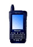


12 Panasonic Toughbook 07 Hammerhead TDS Ranger Panasonic Toughbook 01 Compaq ipaq TDS Recon Allegro
13 ADVANTAGES OF NEW GENERATION DATA COLLECTORS Easy to use - most of the users are already familiar with the Palm, Pocket PC operating systems, and Windows O/S. Can be used with or without GPS Can be used for other applications Long battery life Light Weight Color Display Voice Recording systems Pen-based USB Port Memory cards
14 FIELD DATA COLLECTION SOFTWARE
15 TRADITIONAL FIELD DATA COLLECTON SOFTWARE Difficult to learn Vendor specific to their GPS engines Expensive Operate only on Windows platform
16 NEW SOFTWARE FIELDWORKER SOLO ARCPAD SITE MATE PATCHWORKS COMPOSER LANDMARK OTHERS
17 ADVANTAGES OF NEW SOFTWARE Economical - $500 - $1,000 Have capability to add background maps or digital ortho photos Will run with MR. SID Not vendor specific to GPS engine Recreational to survey grade Easy to use Can edit data dictionary in the field Most of them have a similar version running on the PC, so learning and training is easier. Accept two serial inputs simultaneously Digital camera input
18 ADVANTAGES OF NEW SOFTWARE RHINO SOFTWARE ALLOWS Post Processing of Garmin GPS receiver data Collect feature and attribute data
19 EXAMPLE SCREENS

20 RASTER IMAGES

21 IMAGE

22 LOGGING DATA

23 OFFSETS

24 EXPORTING

25 STYLUS USES
26 APPLICATIONS

27 INFRASTRUCTURE

28 GEOLOGY
29 APPLICATION Collect Point, Line and Polygon data For Line and Polygon data, collect GPS reading at user selectable distance or time interval automatically and pause and collect point features on the way.
30 DATA DICTIONARY Crossings Type many picklist Cable line Electrical Line Gas Line Liquid Petroleum Line Overhead Crossing (Other) Overhead pipeline crossing Sewer Line Telephone Cable Water Line
31 DATA DICTIONARY CON T City alpha Company alpha Contact Tel. numberonly Depth cover numberonly Marked? checkbox Vert Sep ft. numberonly Date Visit date mandatory Time Visit time mandatory
32 DATA DICTIONARY CON T Boundariesmany Type picklist City Limits Fence Lines Property Line City alpha Owner alpha Depth Cover numberonly Date Visit date Time Visit time
33 DATA DICTIONARY CON T Roads many Type picklist Railroad Road Centerline Road Edge Subdivision Line Road Name alpha Road Type picklist City County State Highway Federal Highway Interstate Frontage road
34 DATA DICTIONARY CON T Name alpha Mile # Numberonly Equipment picklist Pump Unit Motor Unit Control Valve Control Building Tark Edge Rack Edge Manifold Meters Strainers
35 DATA DICTIONARY CON T Condition picklist Good Fair Needs Repair Needs Replacement Date Installed date Date Visit Date Time Visit Time
36 DATA DICTIONARY CON T Pipe many Type picklist CPL Route Survey Abondoned-in-place pipe Point of intersection Exposure Suspended Pipe Depth cover Date Abondoned date Depth cover numberonly Date Visit date Time Visit time
37 DATA DICTIONARY CON T Check Valve mixed Name alpha ANSI ratingpicklist Date Visit date Time Visit time CV150 CV300 CV600 CV900 CV150
38 DATA DICTIONARY CON T Block Valve mixed Name alpha ANSI ratingpicklist BV150 BV300 BV600 BV900 BV1500
39 DATA DICTIONARY CON T Type picklist ball slab gate slabgt wedge gate wedgeg plug dbl blk/bleed dlbblk
40 DATA DICTIONARY CON T Instrument many Instrument picklist Temperature probe Pressure Probe Test Head Date Installed date Serial No Numberonly Date Visit date Time Visit time
41 DATA DICTIONARY CON T Cathodic Type Name Date Visit Time Visit many picklist Close Interval Survey Interference Bond Ground Bed Rectifier Test Lead alpha date time
42 DATA DICTIONARY CON T Anomalys & Defects Type Name many picklist Anomaly Dent External Corossion Internal Corossion Gouge Lamination alpha
43 DATA DICTIONARY CON T Cathodic Type Name Date Visit Time Visit many picklist Close Interval Survey Interference Bond Ground Bed Rectifier Test Lead alpha date time
44 DATA DICTIONARY CON T Type picklist dent Andent gouge Angoug Lamination Anlamn Internal Corossion AnIntl External Corossion AnExtl O'clock numberonly Postn Dwnst numberonly max depth numberonly max length numberonly max width numberonly
45 DATA DICTIONARY CON T Ext Corr Type localized general Int Corr Tpe localized general Date Visit date Time Visit time picklist ExtLoc ExtGen picklist end
46 DATA DICTIONARY CON T Exposed Pipe Evaluation Check list Waterway Crossing Evaluation Checklist ROW Evaluation Checklist Closed Interval Survey
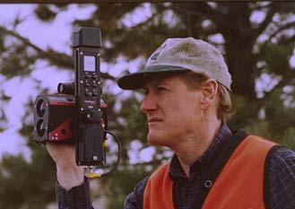
47 LASER RANGE FINDERS
48 Data acquisition challenge #1 You can t get there from here Terrain separates you from the feature you want to map.
49 Data collection challenge #2 You can get there... but don t want to Also known among field mapping technicians and postal delivery personnel as the Doberman factor.
50 Data collection challenge #3 You can get there... but the satellite can t
51 Data collection challenge # 4 You can get there, and there, and there...


52 To address these challenges, consider using laser mapping systems
53 The key to laser mapping is... You don t have to get there from here! Instead, just shoot it with the laser.
54 What makes a laser mapping system work? Eye-safe diode pulse laser measures distance without reflectors. Digital flux-gate compass or angle encoder (not affected by magnetic fields) Electronic tilt sensor determines vertical angle.
55 General range finding specifications Multiple pulse averaging gives better accuracy. Mapping grade lasers vary in accuracy from about 5 cm. up to 1.5 meters. Maximum range varies from 1000 ft... up to 2500 ft.
56

57


58

59
60 Direct GPS Integration GPS Data logging device CRITERION Laser gun
61 Indirect laser / GPS integration Features Laser GPS
62 Independent laser mapping Laser with data collection hardware and software. Base map coordinates or survey markers provide reference points. Features are accurate to base map and to each other. Can be geo-referenced again when more accurate base maps become available. Requires origin coordinates.
63 DIGITAL CAMERA AND GIS
64 MediaMapper A desktop mapping software that links pictures and other files to GIS map layers. Creates media maps that can be used in Arcview GIS, MapInfo Professional, or on the web. The mapping solution for GIS users wanting a fast, easy way to link photographs or other multimedia files to map locations.

65 How MediaMapper Works With Digital Still Pictures Take digital pictures while recording GPS data. Media Mapper downloads the pictures and the GPS data file. Click the map to view the pictures of location.


66 Get the Picture Make the Map Take Pictures and Collect GPS data Pictures Link to Map Via GPS Metadata Download to MediaMapper Customize the Map

67 Environmental Application Pollution Monitoring Environmental Assessment Programs Hazardous Spills Public Education and Outreach Mandatory Reporting Waste Contamination Points Cleanup Areas Environmental Data Collection Water Management Wetlands
68 Benefits Works with Off-the-Shelf Components Small, Lightweight for Individual Users No Need for Expensive Outside Programs Simple to Operate Fast Turnaround from the Field to the Internet Quick Association of Images with Maps Creates.shp,.tab, or html maps
69 Questions?
GPS: What do I need to collect Application Appropriate location data?
 GPS: What do I need to collect Application Appropriate location data? Bob Goodwin, GISP GIS/Remote Sensing Analyst Remote Sensing & GIS Research and Outreach Services, MSU http://www.rsgis.msu.edu 2005
36. Global Positioning System
 36. Introduction to the Global Positioning System (GPS) Why do we need GPS? Position: a basic need safe sea travel, crowed skies, resource management, legal questions Positioning: a challenging job local
NR402 GIS Applications in Natural Resources
 NR402 GIS Applications in Natural Resources Lesson 5 GPS/GIS integration Global Positioning System (GPS)..a global navigation system that everyone can use What is GPS? How does it work? How accurate is
GPS for GIS Data Collection - 101
 GPS for GIS Data Collection - 101 Speaker: Eric Gakstatter, Editor of GPS World s Survey Scene Newsletter & Geospatial Solutions Guest Commentator: Craig Greenwald, Technical Director, GeoMobile Innovations,
The Global Positioning System
 The Global Positioning System 5-1 US GPS Facts of Note DoD navigation system First launch on 22 Feb 1978, fully operational in 1994 ~$15 billion (?) invested to date 24 (+/-) Earth-orbiting satellites
Line and polygon features can be created via on-screen digitizing.
 This module explains how GPS works, sources of error, and error correction using real time or post processing differential correction. Cost and accuracy of different grades of GPS units are also part of
GPS Milestones, cont. GPS Milestones. The Global Positioning Sytem, Part 1 10/10/2017. M. Helper, GEO 327G/386G, UT Austin 1. US GPS Facts of Note
 The Global Positioning System US GPS Facts of Note DoD navigation system First launch on 22 Feb 1978, fully operational in 1994 ~$15 billion (?) invested to date 24 (+/-) Earth-orbiting satellites (SVs)
GEO 428: DEMs from GPS, Imagery, & Lidar Tuesday, September 11
 GEO 428: DEMs from GPS, Imagery, & Lidar Tuesday, September 11 Global Positioning Systems GPS is a technology that provides Location coordinates Elevation For any location with a decent view of the sky
The Global Positioning System II Field Experiments. 10/10/2013 GEO327G/386G, UT Austin 5-1
 The Global Positioning System II Field Experiments 10/10/2013 GEO327G/386G, UT Austin 5-1 Mexico DGPS Field Campaign Cenotes in Tamaulipas, MX, near Aldama 10/10/2013 GEO327G/386G, UT Austin 5-2 Are Cenote
NJDEP GPS Data Collection Standards for GIS Data Development
 NJDEP GPS Data Collection Standards for GIS Data Development Bureau of Geographic Information Systems Office of Information Resource Management April 24 th, 2017 Table of Contents 1.0 Introduction... 3
GEOGRAPHIC INFORMATION SYSTEMS Lecture 22: Field Mapping with GPS
 GEOGRAPHIC INFORMATION SYSTEMS Lecture 22: Field Mapping with GPS GPS Receivers - there are many GPS receivers on the market today - some receivers are relatively inexpensive (recreational grade receivers)
UNITED NATIONS UNIVERSITY Institute for Environment & Human Security (UNU-EHS) Bonn, Germany
 Bonn, Germany") UNITED NATIONS UNIVERSITY Institute for Environment & Human Security (UNU-EHS) Bonn, Germany Introduction to GPS technology Prof. Dr. Jörg Szarzynski Education Programme Director Head of Section EduSphere
UNITED NATIONS UNIVERSITY Institute for Environment & Human Security (UNU-EHS) Bonn, Germany Introduction to GPS technology Prof. Dr. Jörg Szarzynski Education Programme Director Head of Section EduSphere
GPS Performance in Southern Hardwood Forests
 GPS Performance in Southern Hardwood Forests Pete Bettinger Warnell School of Forestry and Natural Resources University of Georgia In forests, vegetation plays a significant role in obstructing signals
What is it? History. Other systems. How does it work? Trilateration GEOG 201 4/28/2010. Instructor: Pesses 1. {06} The Global Positioning System
 What is it? {06} The Global Positioning System G.P.S. = Global Positioning System Different from G.I.S. (Geographic Information Systems) Map Interpretation & GPS Spring 2010 M. Pesses History Conceived
Introduction to Total Station and GPS
 Introduction to Total Station and GPS Dr. P. NANJUNDASWAMY Professor of Civil Engineering J S S Science and Technology University S J College of Engineering Mysuru 570 006 Introduction History GPS Overview
What is Precision Technology?
 Using Precision Technology for Application of Fertilizer and Herbicides Dana Ritenour Chemical Containers Inc. What is Precision Technology? * Ability to apply different amounts of inputs to specific points
How is GPS Used in Farming? Equipment Guidance Systems
 GPS Applications in Crop Production John Nowatzki, Extension Geospatial Specialist, Vern Hofman, Extension Ag Engineer Lowell Disrud, Assistant Professor, Kraig Nelson, Graduate Student Introduction The
GPS Performance in Southern Hardwood Forests Pete Bettinger Warnell School of Forestry and Natural Resources University of Georgia
 GPS Performance in Southern Hardwood Forests Pete Bettinger Warnell School of Forestry and Natural Resources University of Georgia Introduction In forests, vegetation plays a significant role in obstructing
Surface Potential Surveys Training Manual DA Meter Version
 Surface Potential Surveys Training Manual DA Meter Version M. C. Miller Co., Inc. 11640 U.S. Highway 1, Sebastian, FL 32958 U.S.A. Telephone: 772 794 9448; Website: www.mcmiller.com CONTENTS Page Introduction..
3M Dynatel Locating and Marking Products
 3M Dynatel Locating and Marking Products 1420 Series ID Markers EMS 1420 Marker Locator 2200M Series Locators 2200M-iD Series Locators Dynatel Strengths 30+ years experience in locating Inventors of passive
GPS Errors. Figure 1. Four satellites are required to determine a GPS position.
 Expl ai ni nggps:thegl obalposi t i oni ngsyst em since a minimum of four satellites is required to calculate a position (Fig 1). However, many newer GPS receivers are equipped to receive up to 12 satellite
GIS Mapping with SiReNT Real-time Differential GPS
 GIS Mapping with SiReNT Real-time Differential GPS Victor KHOO Hock Soon ABSTRACT Singapore Land Authority No.8, Shenton Way #26-01 Singapore 068811 Email: Victor_khoo@sla.gov.sg Accurate and up-to-date
pipeline integrity PCM + Pipeline Current Mapper
 pipeline integrity PCM + Pipeline Current Mapper Fast locate and effective measurement of pipeline coating defects. The location and measurement of pipeline corrosion using electromagnetic detection devices
FieldGenius Technical Notes GPS Differential Corrections
 FieldGenius Technical tes GPS Differential Corrections Introduction The accuracy requirement of survey grade or mapping grade GPS applications for real time positioning requires the use of differential
REMOTE MONITORING AND CONTROL SYSTEM
 REMOTE MONITORING AND CONTROL SYSTEM The COMMANCHE RMCS automatically monitors and controls digital/analog functions and processes associated with the oil and gas industries, which include but are not
ACCURACIES OF VARIOUS GPS ANTENNAS UNDER FORESTED CONDITIONS
 ACCURACIES OF VARIOUS GPS ANTENNAS UNDER FORESTED CONDITIONS Brian H. Holley and Michael D. Yawn LandMark Systems, 122 Byrd Way Warner Robins, GA 31088 ABSTRACT GPS accuracy is much more variable in forested
Height Limited Switch
 Height Limited Switch Manual version: 1.0 Content Introduction...3 How it works...3 Key features...3 Hardware...4 Motor cut-off settings...4 Specification...4 Using the RC HLS #1 module...5 Powering the
Addressing Issues with GPS Data Accuracy and Position Update Rate for Field Traffic Studies
 Addressing Issues with GPS Data Accuracy and Position Update Rate for Field Traffic Studies THIS FEATURE VALIDATES INTRODUCTION Global positioning system (GPS) technologies have provided promising tools
GPS Pathfinder ProXH and ProXT Customer FAQs
 7 December 2009 GPS Pathfinder ProXH and ProXT Customer FAQs What is the GPS Pathfinder ProXH receiver? The GPS Pathfinder ProXH receiver is a fully integrated receiver, antenna and battery unit with Trimble
GBAS FOR ATCO. June 2017
 GBAS FOR ATCO June 2017 Disclaimer This presentation is for information purposes only. It should not be relied on as the sole source of information, and should always be used in the context of other authoritative
A Turnkey Weld Inspection Solution Combining PAUT & TOFD
 A Turnkey Weld Inspection Solution Combining PAUT & TOFD INTRODUCTION With the recent evolutions of the codes & standards, the replacement of conventional film radiography with advanced ultrasonic testing
The GPS Classroom. Jared Covili
 The GPS Classroom Jared Covili 1/17/06 2 The GPS Classroom Jared Covili jcovili@media.utah.edu (801) 585-5667 The GPS Classroom is a 2-day course that provides participants with the basic knowledge of
Pipeline Current Mapper
 Pipeline Current Mapper Locate Accurately find buried pipes, establish centerline depth, then troubleshoot coating defects Record Stores up to 1000 measured PCM and location data in memory within the receiver
MSB Imagery Program FAQ v1
 MSB Imagery Program FAQ v1 (F)requently (A)sked (Q)uestions 9/22/2016 This document is intended to answer commonly asked questions related to the MSB Recurring Aerial Imagery Program. Table of Contents
al T TD ) ime D Faamily Products The RTD Family of products offers a full suite of highprecision GPS sensor positioning and navigation solutions for:
 ime D Faamily Products The RTD Family of products offers a full suite of highprecision GPS sensor positioning and navigation solutions for:") Reeal ynnamics al T amics (R TD ) ime D RTD) Time Dy Faamily mily ooff P roducts Products The RTD Family of products offers a full suite of highprecision GPS sensor positioning and navigation solutions
Reeal ynnamics al T amics (R TD ) ime D RTD) Time Dy Faamily mily ooff P roducts Products The RTD Family of products offers a full suite of highprecision GPS sensor positioning and navigation solutions
GPS: The Basics. Darrell R. Dean, Jr. Civil and Environmental Engineering West Virginia University. Expected Learning Outcomes for GPS
 GPS: The Basics Darrell R. Dean, Jr. Civil and Environmental Engineering West Virginia University Expected Learning Outcomes for GPS Explain the acronym GPS Name 3 important tdt dates in history of GPS
Cockpit GPS Quick Start Guide
 Cockpit GPS Quick Start Guide Introduction My online book, Cockpit GPS, has grown to over 250 pages. I have that much information because at one time or another I thought that each piece would be useful
Suveying Lectures for CE 498
 Suveying Lectures for CE 498 SURVEYING CLASSIFICATIONS Surveying work can be classified as follows: 1- Preliminary Surveying In this surveying the detailed data are collected by determining its locations
GNSS & Coordinate Systems
 GNSS & Coordinate Systems Matthew McAdam, Marcelo Santos University of New Brunswick, Department of Geodesy and Geomatics Engineering, Fredericton, NB May 29, 2012 Santos, 2004 msantos@unb.ca 1 GNSS GNSS
Opera Duo. Opera Duo. GeoRadar Division. a first class underground survey
 a first class underground survey Opera Duo Competitive advantages Designed around you A large, comfortable handle to make pushing an pulling easier, large wheels for better control and a balanced weight
GPS 101. An Introduction to Using a GPS Receiver
 GPS 101 An Introduction to Using a GPS Receiver The goal of this presentation if to provide a basic understanding of what is GPS, how it works, provide some basic terminology and to provide ideas on how
(IDC) INTEGRATED DATA COLLECTION TECHNOLOGY. Presented by: Kevin Pastotnik
 INTEGRATED DATA COLLECTION TECHNOLOGY. Presented by: Kevin Pastotnik") (IDC) INTEGRATED DATA COLLECTION TECHNOLOGY Presented by: Kevin Pastotnik Definition and Brief History to the Need INTEGRATED DATA COLLECTION TECHNOLOGY What is IDC? IDC is an external assessment tool
(IDC) INTEGRATED DATA COLLECTION TECHNOLOGY Presented by: Kevin Pastotnik Definition and Brief History to the Need INTEGRATED DATA COLLECTION TECHNOLOGY What is IDC? IDC is an external assessment tool
ArcGIS Apps and GPS GNSS Connections. By: Colin Lawrence and Kiersten Hudson
 ArcGIS Apps and GPS GNSS Connections By: Colin Lawrence and Kiersten Hudson Agenda ArcGIS Apps and high accuracy data The importance of high accuracy data Making connections to external receivers Bringing
Products. Locating DAMAGE PREVENTION
 Products Locating DAMAGE PREVENTION UT 9000 The new standard for damage prevention and pipe location easy always efficient A new dimension in pipe location When it comes to locating underground pipes and
STARTRAK PIGGING TECHNOLOGIES, INC. PIPELINE PIG MONITORING
 STARTRAK PIGGING TECHNOLOGIES, INC. Pathfinder magnetic pigs can now be monitored for all types of operations, world wide. Station Magnetometers - Statics for land service operations. Buoy systems - Offshore
The survey-grade mapping drone
 The survey-grade mapping drone 3 reasons to choose the ebee RTK 01. Survey-grade accuracy Absolute orthomosaic / Digital Elevation Model accuracy of down to 3 cm (1.2 in) without the need for GCPs meaning
Validation of the QuestUAV PPK System
 Validation of the QuestUAV PPK System 3cm in xy, 400ft, no GCPs, 100Ha, 25 flights Nigel King 1, Kerstin Traut 2, Cameron Weeks 3 & Ruairi Hardman 4 1 Director QuestUAV, 2 Data Analyst QuestUAV, 3 Production
Indian Institute of Technology Kanpur Department of Civil Engineering
 Indian Institute of Technology Kanpur Department of Civil Engineering Inquiry No- CE/JNM/2013-14/R-10 30 December, 2013 Subject: Quotation for supply of Integrated System/Smart System Reflectorless Robotic
Basic Functions. The program is able to remotely: - manage all the system parameters of the PPM box. - execute the sensor tuning process
 PPM Utility Program Our PPM system has originally been designed with a basic human-interface made of an integrated LCD and keypad but it can now be remotely controlled from a Windows-based PC through any
AGENDA. NEI Overview. Mobile platforms with the new R1 / R2 GNSS receiver. High Accuracy Cloud Based Data Collection. Geo 7X Higher Accuracy Option
 AGENDA NEI Overview Mobile platforms with the new R1 / R2 GNSS receiver High Accuracy Cloud Based Data Collection Geo 7X Higher Accuracy Option Selecting - the Right Tool for the Right Job Field to Finish.
Collecting Multiple Indirect Inspection Results with One Pass
 Collecting Multiple Indirect Inspection Results with One Pass Gord Parker, Spectrum External Line Inspection Technologies SIEO Winter 2008 Sun Valley PHMSA R&D Forum (Feb.06) Data Mining/Threat Assessment
Exit point. Can you do it?
 Can you do it? Don t just guess, Be precise! Horizontal directional drilling is a specialized profession nowadays. The days when directional drilling was ruled by assumptions, are far behind us. Clients
PIPELINE DEFECT MAPPER
 PIPELINE DEFECT MAPPER Receiver Colour Display C.A.T. Survey Graph ACVG Survey Graph GIS View General: The Pipeline Defect Mapper Kit designed and developed in such a way; to precisely locate and assist
StarTrak Pigging Technologies
 StarTrak Pigging Technologies 27235 West Highway Blvd. Katy, Texas, 77494 281-599-7557 Introduction Pipeline Pigs are dispatched through pipelines to perform various functions: 1: To clean the inner wall
GPS Position Sensor PS-2175
 In s tr u c ti o n M a n u a l 012-09919A GPS Position Sensor PS-2175! Table of Contents Contents Introduction........................................................... 3 Theory of Operation....................................................
LAB 1 METHODS FOR LOCATING YOUR FIELD DATA IN GEOGRAPHIC SPACE. Geog 315 / ENSP 428
 LAB 1 METHODS FOR LOCATING YOUR FIELD DATA IN GEOGRAPHIC SPACE Geog 315 / ENSP 428 Lab 1 Schedule Introduction to bio-physical field data collection (8:00-8:20am) Locating your data on the earth: NAVSTAR
Hinkle (K5PA), Using GPS to Set Computer Time April 7, 2016
, Using GPS to Set Computer Time April 7, 2016") Using GPS Receivers to Set Computer Time for Fielded Digital Modes and Logging From the Field Keeping Time Using GPS Satellites at Remote Locations -- Great for Field Day & DXpeditions Introduction to
Using GPS Receivers to Set Computer Time for Fielded Digital Modes and Logging From the Field Keeping Time Using GPS Satellites at Remote Locations -- Great for Field Day & DXpeditions Introduction to
APPENDIX C VISUAL AND NAVIGATIONAL AIDS
 VISUAL AND NAVIGATIONAL AIDS APPENDIX C VISUAL AND NAVIGATIONAL AIDS An integral part of the airport system is the visual and navigational aids provided to assist pilots in navigating both on the airfield
Metrolog HL7000 TM. Acoustic Leak Logging System. Simple Reliable Efficient. Reduce Water Leaks Faster...
 Metrolog HL7000 TM Acoustic Leak Logging System Simple Reliable Efficient Reduce Water Leaks Faster... Monitors Pipe Networks Efficiently and Economically... Read and Program noise loggers through Laptop
Nebraska 4-H Robotics and GPS/GIS and SPIRIT Robotics Projects
 Name: Club or School: Robots Knowledge Survey (Pre) Multiple Choice: For each of the following questions, circle the letter of the answer that best answers the question. 1. A robot must be in order to
Shared Use of DGPS for DP and Survey Operations
 Gabriel Delgado-Saldivar The Use of DP-Assisted FPSOs for Offshore Well Testing Services DYNAMIC POSITIONING CONFERENCE October 17-18, 2006 Sensors Shared Use of DGPS for Dr. David Russell Subsea 7, Scotland
Helicopter Aerial Laser Ranging
 Helicopter Aerial Laser Ranging Håkan Sterner TopEye AB P.O.Box 1017, SE-551 11 Jönköping, Sweden 1 Introduction Measuring distances with light has been used for terrestrial surveys since the fifties.
An Introduction to Airline Communication Types
 AN INTEL COMPANY An Introduction to Airline Communication Types By Chip Downing, Senior Director, Aerospace & Defense WHEN IT MATTERS, IT RUNS ON WIND RIVER EXECUTIVE SUMMARY Today s global airliners use
Chapter 2 Definitions and Acronyms
 Advanced Materials and Technology Manual TABLE OF CONTENTS.0 Introduction... 1.1 Definitions... FIGURE.1 Schematic of Gridded All Passes Data and Gridded Final Coverage Data.... 4 FIGURE. Schematic of
Introduction to Geographic Information Science. Last Lecture. Today s Outline. Geography 4103 / GNSS/GPS Technology
 Geography 4103 / 5103 Introduction to Geographic Information Science GNSS/GPS Technology Last Lecture Geoids Ellipsoid Datum Projection Basics Today s Outline GNSS technology How satellite based navigation
DGT Smart Board manual English
 manual English MA_ENG_Smart Board_Manual_Rev 1804 Copyright 2018 Digital Game Technology BV DGT Hengelosestraat 66 7514 AJ Enschede The Netherlands digitalgametechnology.com 1 1. Introduction Congratulations
MAP MAKING. Procedure. Required. Do-it-yourself maps
 MAP MAKING The first maps used in Kiwi Orienteering are simple maps, hand drawn by the children themselves. See Understanding maps on page 8 and Mini Maps on page 12. After that a school grounds map is
Metrolog HL7000TM. Acoustic Leak Logging System. Simple Reliable. Reduce Water Leaks Faster...
 Metrolog HL7000TM Acoustic Leak Logging System Simple Reliable Efficient Reduce Water Leaks Faster... Monitors Pipe Networks 2 Read and Program noise loggers through Laptop or Commander via Bidirectional
GPS-G5 User s Manual
 GPS-G5 User s Manual Contents Using the GPS... 1 Description...1 Electrical Connections...2 Mounting...3 GPS Configuration...3 GPS Operation...3 Logging Device Configuration...4 Data Analysis...5 Specifications...
IG-2500 OPERATIONS GROUND CONTROL Updated Wednesday, October 02, 2002
 IG-2500 OPERATIONS GROUND CONTROL Updated Wednesday, October 02, 2002 CONVENTIONS USED IN THIS GUIDE These safety alert symbols are used to alert about hazards or hazardous situations that can result in
DGT USB e-board manual English
 DGT USB e-board manual English MA_ENG_USB e-board_manual_rev 1805 Copyright 2019 Digital Game Technology BV DGT Hengelosestraat 66 7514 AJ Enschede The Netherlands digitalgametechnology.com 1 1. Introduction
Global Positioning System (GPS)
") Global Positioning System (GPS) GPS enables users to easily record the location of natural and man-made features on the land. It allows users to identify where a photo or video is taken, revisit previously
Global Positioning System (GPS) GPS enables users to easily record the location of natural and man-made features on the land. It allows users to identify where a photo or video is taken, revisit previously
Agenda Motivation Systems and Sensors Algorithms Implementation Conclusion & Outlook
 Overview of Current Indoor Navigation Techniques and Implementation Studies FIG ww 2011 - Marrakech and Christian Lukianto HafenCity University Hamburg 21 May 2011 1 Agenda Motivation Systems and Sensors
HDD Wire Guided Waterway Crossing ATON Plan. Youghiogheny River (S122)
") HDD Wire Guided Waterway Crossing ATON Plan Youghiogheny River (S122) Mariner East Phase 2 Pipeline Project Prepared for: Sunoco Pipeline, L.P. 535 Friztown Road Sinking Springs, PA 19608 Prepared by:
HDD Wire Guided Waterway Crossing ATON Plan Youghiogheny River (S122) Mariner East Phase 2 Pipeline Project Prepared for: Sunoco Pipeline, L.P. 535 Friztown Road Sinking Springs, PA 19608 Prepared by:
AccuSolar SOLAR POWERED SYSTEM
 AccuSolar SOLAR POWERED SYSTEM FLO-CORP s AccuSolar Solar Powered Level Monitoring System monitors process conditions through wireless WiFi that communicate up to 1,500 feet to a base station PC. The Solar
RC Altimeter #2 BASIC Altitude data recording and monitoring system 3/8/2009 Page 2 of 11
 Introduction... 3 How it works... 3 Key features... 3 System requirements... 3 Hardware... 4 Specifications... 4 Using the RC Altimeter #2 BASIC module... 5 Powering the module... 5 Mounting the module...
U-Pilot can fly the aircraft using waypoint navigation, even when the GPS signal has been lost by using dead-reckoning navigation. Can also orbit arou
 We offer a complete solution for a user that need to put a payload in a advanced position at low cost completely designed by the Spanish company Airelectronics. Using a standard computer, the user can
MFAM: Miniature Fabricated Atomic Magnetometer for Autonomous Magnetic Surveys
 MFAM: Miniature Fabricated Atomic Magnetometer for Autonomous Magnetic Surveys Bart Hoekstra Rahul Mhaskar Drones Applied to Geophysical Mapping Workshop Unmanned Vehicles The Future of Geophysics REMUS
Chanalyzer 4. Chanalyzer 4 by MetaGeek USER GUIDE page 1
 Chanalyzer 4 Chanalyzer 4 by MetaGeek USER GUIDE page 1 Chanalyzer 4 spectrum analysis software Table of Contents Introduction What is a Wi-Spy? What is Chanalyzer? Installation Choose a Wireless Network
The Global Positioning Sytem II 10/19/2017
 The Global Positioning System II Field Experiments 10/19/2017 5-1 Mexico DGPS Field Campaign Cenotes in Tamaulipas, MX, near Aldama 10/19/2017 5-2 Are Cenote Water Levels Related? 10/19/2017 5-3 M. Helper,
Nigerian Communications Satellite Ltd. (NIGCOMSAT)
") OVERVIEW OF NIGERIAN SATELLITE AUGMENTATION SYSTEM COMMENCING WITH PILOT DEMONSTRATION TO VALIDATE NATIONAL WORK PLAN presented by Dr. Lawal Lasisi Salami, NIGERIAN COMMUNICATIONS SATELLITE LTD UNDER FEDERAL
OVERVIEW OF NIGERIAN SATELLITE AUGMENTATION SYSTEM COMMENCING WITH PILOT DEMONSTRATION TO VALIDATE NATIONAL WORK PLAN presented by Dr. Lawal Lasisi Salami, NIGERIAN COMMUNICATIONS SATELLITE LTD UNDER FEDERAL
Nikon D90 Camera Kit -Checklist and Operations Manual-
 Airborne Digital Reconnaissance System (ADRS) Nikon D90 Camera Kit -Checklist and Operations Manual- V2.2 April 26, 2012 National Headquarters, Civil Air Patrol Advanced Technology Group 2 1.0 Equipment
Navigation Sensor Technology Aids Marine Seismic Survey
 Page 1 of 5 Navigation Sensor Technology Aids Marine Seismic Survey Al Hise, NCS SubSea; John Thorson, Sparton Navigation and Exploration; Craig Lippus, Geometrics April 1, 2012 A new digital compass provides
SOLMETA GEOTAGGER N2. Test review about this new model of gps for DSLR cameras. Description, features and accuity
 SOLMETA GEOTAGGER N2 Test review about this new model of gps for DSLR cameras Description, features and accuity Realized and written by par Pol F. Gillard 07 march 2009 1 Table of Contents 1. General presentation
Receiver Technology CRESCENT OEM WHITE PAPER AMY DEWIS JENNIFER COLPITTS
 CRESCENT OEM WHITE PAPER AMY DEWIS JENNIFER COLPITTS With offices in Kansas City, Hiawatha, Calgary and Scottsdale, Hemisphere GPS is a global leader in designing and manufacturing innovative, costeffective,
Detection of Pipelines using Sub-Audio Magnetics (SAM)
") Gap Geophysics Australia Pty Ltd. Detection of Pipelines using Sub-Audio Magnetics is a patented technique developed by Gap Geophysics. The technique uses a fast sampling magnetometer to monitor magnetic
Gap Geophysics Australia Pty Ltd. Detection of Pipelines using Sub-Audio Magnetics is a patented technique developed by Gap Geophysics. The technique uses a fast sampling magnetometer to monitor magnetic
POSITIONING AN AUTONOMOUS OFF-ROAD VEHICLE BY USING FUSED DGPS AND INERTIAL NAVIGATION. T. Schönberg, M. Ojala, J. Suomela, A. Torpo, A.
 POSITIONING AN AUTONOMOUS OFF-ROAD VEHICLE BY USING FUSED DGPS AND INERTIAL NAVIGATION T. Schönberg, M. Ojala, J. Suomela, A. Torpo, A. Halme Helsinki University of Technology, Automation Technology Laboratory
Managing Metallic Pipe
 Managing Metallic Pipe Metallic Pipe Overview Buried infrastructure is the backbone of our modern society. It connects communities, empowers our economy and enables everyday life. While there are many
Sense. 3D Scanner. User Guide. See inside for use and safety information.
 Sense 3D Scanner User Guide See inside for use and safety information. 1 CONTENTS INTRODUCTION.... 3 IMPORTANT SAFETY INFORMATION... 4 Safety Guidelines....4 SENSE 3D SCANNER FEATURES AND PROPERTIES....
D-RTK. User Manual V
 D-RTK User Manual V1.0 2017.10 Searching for Keywords Search for keywords such as battery and install to find a topic. If you are using Adobe Acrobat Reader to read this document, press Ctrl+F on Windows
Leica Digisystem i-series Safe and fast location of underground utilities
 Leica Digisystem i-series Safe and fast location of underground utilities Leica Digisystem i-series Making cable avoidance easier and safer Every year site workers are injured due to inadvertently striking
670 10/26/17 SSD: 07/14/16, 09/16/17 Page 1 of 6
 SSD: 07/14/16, 09/16/17 Page 1 of 6 S P E C I A L P R O V I S I O N Section MISCELLANEOUS INCIDENTALS Item.822 - GNSS Construction Inspection Equipment Description SAMPLE PROJECT 12345 10/30/17 1.1 Work
QLD/NT NSW WA
 vlocpro2 vlocpro2 features enhance productive location Rugged ABS & carbon fiber construction IP54 rating for all weather use Color display High speed dual core processor Multiple location modes with compass
User Manual. This User Manual will guide you through the steps to set up your Spike and take measurements.
 User Manual (of Spike ios version 1.14.6 and Android version 1.7.2) This User Manual will guide you through the steps to set up your Spike and take measurements. 1 Mounting Your Spike 5 2 Installing the
Global Positioning Systems (GPS) Trails: the achilles heel of mapping from the air / satellites
 Trails: the achilles heel of mapping from the air / satellites") Global Positioning Systems (GPS) Trails: the achilles heel of mapping from the air / satellites Google maps updated regularly by local users using GPS Also: http://openstreetmaps.org GPS applications
Global Positioning Systems (GPS) Trails: the achilles heel of mapping from the air / satellites Google maps updated regularly by local users using GPS Also: http://openstreetmaps.org GPS applications
Raveon M7 GX Frequently Asked Questions
 Technical Brief AN134Rev A3 Raveon M7 GX Frequently Asked Questions By John Sonnenberg Raveon Technologies Corp How far will a 5-watt UHF radio communicate? An excellent question, but very difficult to
Our Company. We are major supplier to:
 VACUUM METROLOGY Our Company Hositrad Holland and Hositrad Deutschland combine more than 50 years of experience in vacuum and cryogenic technology. Customers profit from a broad range of capabilities,
The Alaska Air Carriers Association. Supports and Advocates for the Commercial Aviation Community
 The Alaska Air Carriers Association Supports and Advocates for the Commercial Aviation Community The Alaska Air Carriers Association membership includes Part 121, 135, 125 and commercial Part 91 air operators.
DCVG Training Manual DA Meter Version
 DC-Voltage Gradient (DCVG) Surveys Using MCM s Integrated Pipeline Survey Test Equipment and Database Management Package DCVG Training Manual DA Meter Version M. C. Miller Co., Inc. 11640 US Hwy 1, Sebastian,
Swath Guidance Technology. Ron C. Johnson
 Swath Guidance Technology by Ron C. Johnson Widespread acceptance of new information technologies in agriculture may still be a long way off. But some producers and custom applicators are beginning to