LAB 1 METHODS FOR LOCATING YOUR FIELD DATA IN GEOGRAPHIC SPACE. Geog 315 / ENSP 428
|
|
|
- Helen Leonard
- 6 years ago
- Views:
Transcription
1 LAB 1 METHODS FOR LOCATING YOUR FIELD DATA IN GEOGRAPHIC SPACE Geog 315 / ENSP 428
2 Lab 1 Schedule Introduction to bio-physical field data collection (8:00-8:20am) Locating your data on the earth: NAVSTAR Global Positioning System (8:20-9:20am) min Break -- Quiz (9:35-10:00am) Measuring distance and azimuth (10:00-10:30am) --15-min Break Planning the field campaign (10:45am-11:10am) Introduction to Trimble Juno GPS units and Impulse laser rangefinder (11:10am-11:40pm)
3 Lab Objectives Understand the spatial dimension of field data, and the costs and benefits of collecting it Understand how the Global Positions System (GPS) works, its advantages, and its limitations Understand how distance between points can be surveyed with laser rangefinders, and know when this technology is appropriate to use Learn how to effectively plan for a field campaign to increase sampling efficiency and spatial and attribute data accuracy Exposure to GPS units and laser rangefinders used in Lab 2
4 Collecting bio-physical field data
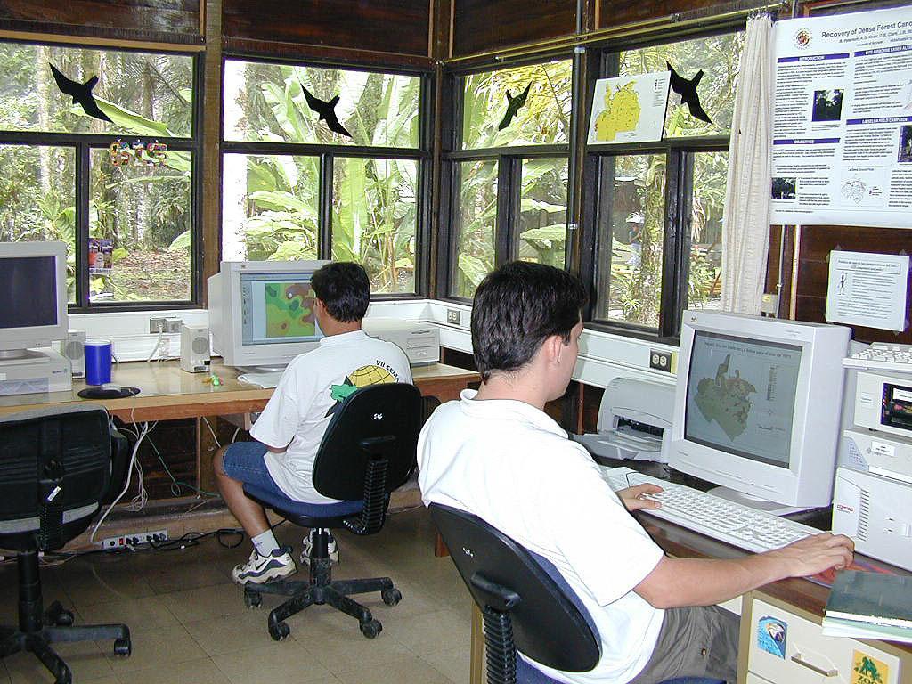
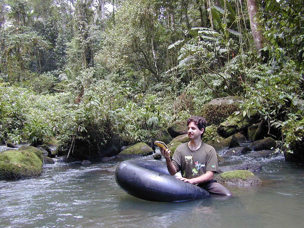
5

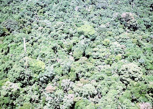
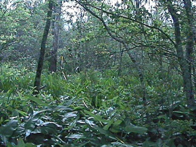
6 La Selva Biological Field Station


7 Dipteryx panamensis # Species present / Presencia del especies Soils / Suelos Old alluvium / Aluvion viejo Recent alluvium / Aluvion reciente Residual Stream-associated / Suelo de quebradas Swamp / Pantano # ## # # ## # # ## # ## ## ## # # ## ## # ## ## ## # ## ## ## # ## # # ## ## ## # # # # # ## # # ## # ## ## ## ## # # ## # ## # # ## # ## # # # # # # ## # # # # ## # # ## # ## ## # ## ## # ## ## ## # ## # # # # ## ## # ## ## ## # # # # ## # # ## ## # ## ## ## # # # # # ## ## ## # # # # # ## # # # # # # # ## # # ## # # # # # # # ## # # # # # ## ## # ## # N Meters

8 Elephant herd home range
9 Spatial information Most spatial information of interest is geographic can be placed on the earth Spatial information links a place with a property of that place The temperature is 40 C at Latitude: 38 N, Longitude: 122 W Could also be at a specific time The temperature is 40 C at Latitude: 38 N, Longitude: 122 W at 02/13/2009, 8 am Properties are variables that we measure sensed with our body or instruments Can be quantitative or qualitative The potential number of geographic places and their properties is vast
10 Some bio-physical variables of interest Biological plants, animals, fungi, etc. Composition presence/absence, abundance of species or groups, communities Vegetation structure biomass, height, diameter, percent cover, leaf area index Physical environment variables Moisture, temperature, light Geological composition Chemistry of soil, water or air (e.g., nutrients, pollution) Geomorphology shape of the land, including slope, aspect, elevation Disturbance and threats Natural: fire, wind-throw, pest attack, species invasion Anthropogenic: deforestation, poaching, grazing
11 Sampling geographic information Type Single points Transects along a line Plots Rapid assessment visit Scale Space boundary area; geographic area or length of samples; distribution of samples Time -- return interval. Once every year? Need to come back to location? Need to leave a monument? Considerations Preliminary assessment or long-term monitoring Time Money Access
12 Locating your data on the earth Global Navigation Satellite Systems (GNSS)
 It uses range measurements based on radio signals from satellites Systems developed by USA, Russia, European community and")
13 Global Navigation Satellite Systems (GNSS) Most common approach to surveying locations is using Global Navigation Satellite Systems (GNSS) It uses range measurements based on radio signals from satellites Systems developed by USA, Russia, European community and China
14 NAVSTAR Global Positioning System ( GPS ) Developed, owned and maintained by the U.S. Department of Defense (US$400 million per year to maintain) Accurately determines horizontal location, elevation and speed Almost anywhere on earth day or night any weather Free for public use!
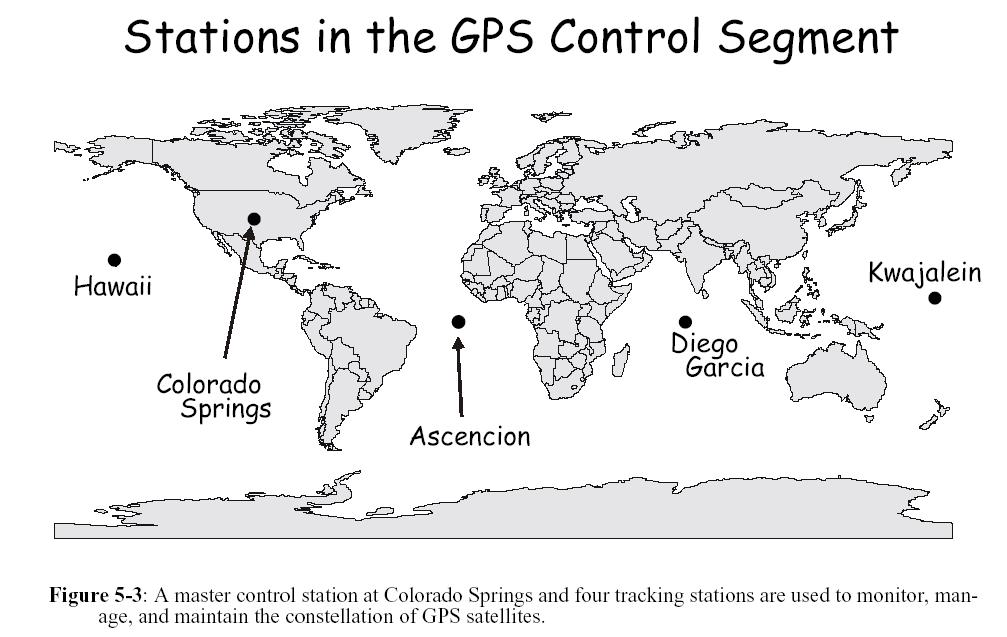
15 GPS segments

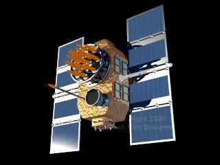
16 GPS satellite segment 32
17


18 GPS user segment
19 GPS General Information GPS satellites broadcast three different types of data using radio waves 1. Almanac data - system health and rough orbits of all GPS satellites; tells receiver which satellites to listen for 2. Ephemeris data for the broadcasting satellite; - allows a GPS receiver to accurately calculate the position of the broadcasting satellite - satellite health, clock corrections, etc. 3. Coded signals - Coarse Acquisition code, or C/A, and the Precise code, or P- code (C/A code used mainly in civilian applications)
20 A single satellite range measurement t 0 t 1 Range = speed of light x travel time Range = c(t 1 t 0 ) (c =299,792,458 meters per second)
21 GPS code receiver Assume that satellite and receiver are generating the same pseudo-random code at exactly the same time
22 Measurements to multiple satellites determines position
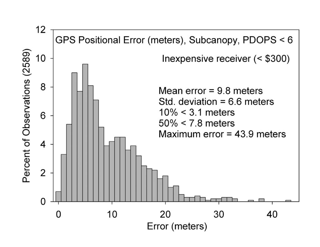
23 Positional uncertainty (1) Sources of Error Several factors can result in erroneous location determination with GNSS (or GPS) Source Range Error (m) Satellite clock error 1 Satellite position error 1 Atmospheric & Ionospheric effects 4 Receiver error 1.5 Total ~7.5
24 Positional uncertainty (2) Leads to positional uncertainty


25 Ionosphere Electrified region within the upper atmosphere Can reflect, deflect and scatter radio waves increase range

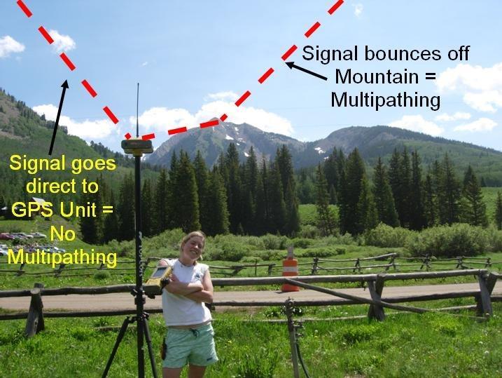
26 Multipath signal error Source:
27
28 Positional Dilution of Precision (PDOP)


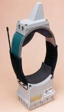
29 Obstructions to satellite signals Telescoping pole
30 Adjusting PDOP thresholds Typically want PDOP < 6
31 Types of receivers (1) Many types of receivers on the market vary in price, features and performance Most now are multi-channel (12) can track up to 12 satellites Ability to average points Ability to change projection and datum Display screen for features and maps Memory to hold features and properties (attributes) Ability to download data Battery life Differential corrections (more on this coming) Antennas that reduce error
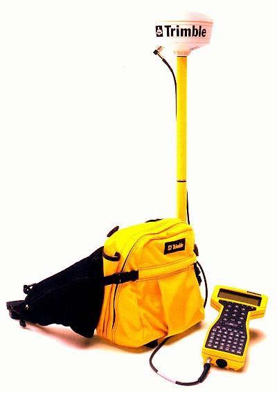
32 Types of receivers (2) Recreational receivers - $200 to $1000 Mapping grade - $ $10,000 Set PDOP, satellite elevation and signal-to-noise filters Target satellites Point averaging Differential corrections Data dictionary and data download High-end survey grade Better antennas Can achieve centimeter accuracy
33
34
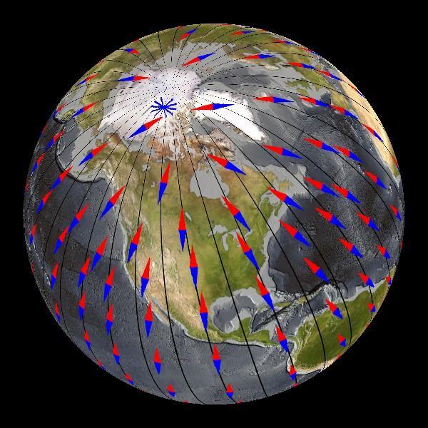
35 Differential correction
36 Differential correction For each satellite, the roving (receiver) range is corrected by the observed range error at base station
37 Two common types of differential GPS Best performance if base station within 180 miles, 300 km
38 CORS - Continuously Operating Reference Stations National Geodetic Survey (NGS), an office of NOAA's National Ocean Service, coordinates a network of Continuously Operating Reference Stations (CORS) base stations Each CORS site provides carrier phase and code range measurements for differential correction GNSS - GPS and GLONASS supported CORS data are available at their original sampling rate for 30 days, after that at reduced sampling rate


39 CORS CORS/GoogleMap/
40 Measuring distance and azimuth angles
41 Distance and azimuth measurements Offset points: We can locate a fixed point with a GPS (GNSS) receiver and then calculate the horizontal position of other points relative to the GPS point with distance and azimuth (bearing) angle measurements The GPS point in this context is called a control point Azimuth: the clockwise angle from north, e.g. 45 o (northeast), 180 o (south) i.e., bearing The accuracy of this technique depends on accuracy of instruments used to measure Geographic position (e.g., GPS) Angle (e.g., analog or digital compass) Distance (e.g., tape measure, laser rangefinder)


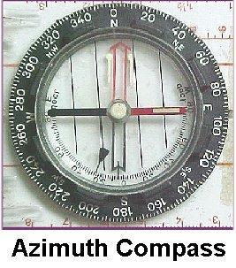
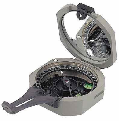
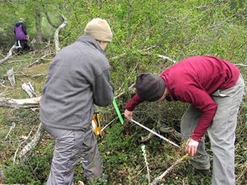
42 Compass Measures azimuth angles 0º to 360º
43 Magnetic declination Earth has a geographic north and south pole axis upon which the planet spins Earth is like a big magnet; liquid iron-nickel core creates magnetic field Compass needles point in the direction of the magnetic field lines North on a compass, or 0º is magnetic north, not geographic north Magnetic declination - angle between the compass pointing direction and geographic north, or true north
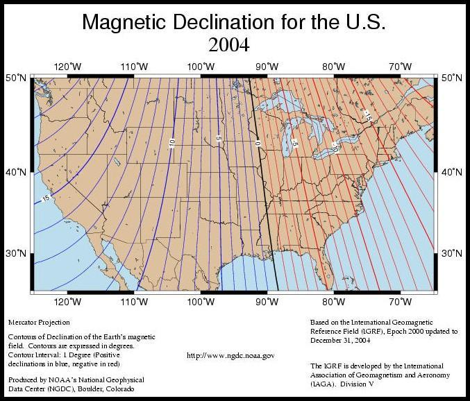
44

45 /geomagmodels/struts/calc Declination

46 Distance Tape measures


47 Laser rangefinder Maximum Range Accuracy Inclinometer Range Inclinometer Accuracy 575 m 3-5 cm typical ± 90 degrees ± 0.1 deg. typical
 = hd/sd (adjacent/ hypotenuse)")

48 Horizontal distance Want horizontal distance, or planimetric distance -- may need to slope correct Cos (θ) = hd/sd (adjacent/ hypotenuse) hd = sd * Cos (θ) B Θ can be measured with a inclinometer A Θ = inclination angle hd = horizontal distance or laser rangefinder inclinometer
49 Vertical height Some applications require measurement of height Same concepts apply B Tan(θ) = vh/hd (opposite/adjacent) vh 1 = hd * Tan(θ 1 ) vh total = vh 1 + vh 2 vh 1 = vertical height A θ 1 hd = horizontal distance θ 2 vh 2 = vertical height C


50 Measuring tree height, La Selva, Costa Rica


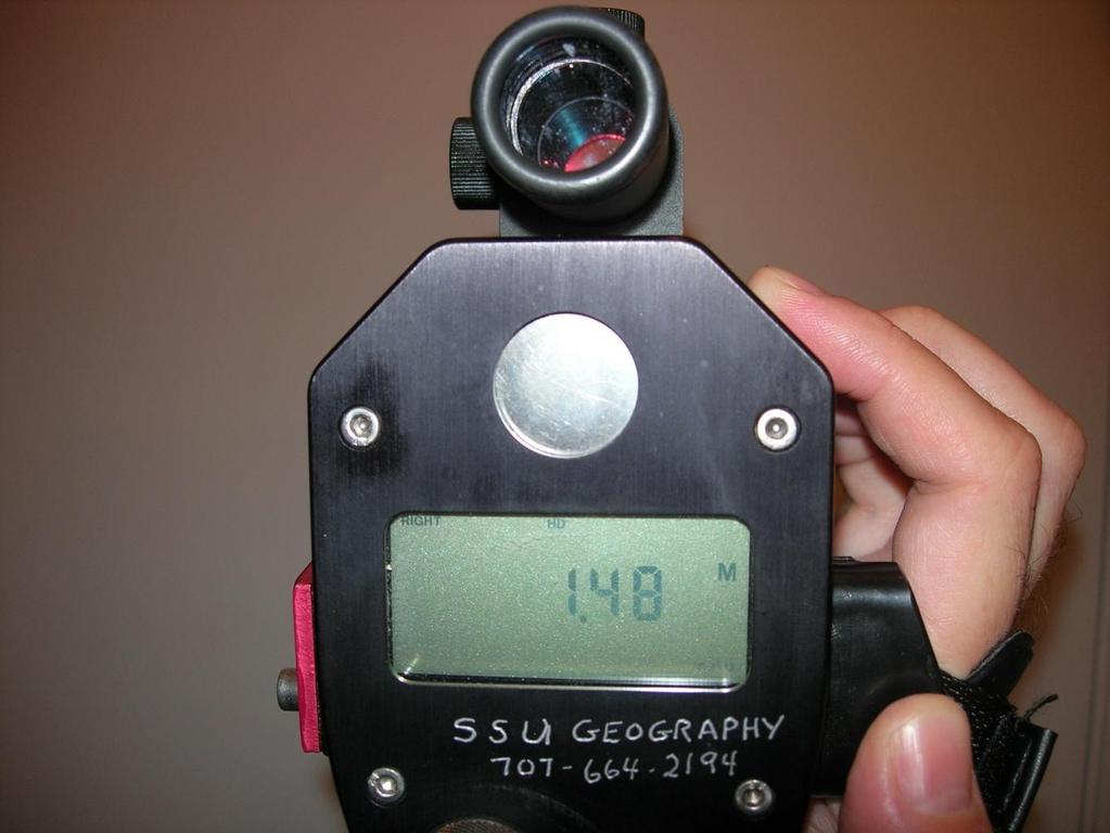
51 Using the Laser Tech Impulse
 y= Cos (θ) * hd Trunk x = GPS x + x Trunk y = GPS y + y 0 N y θ x GPS control point & laser")
52 Mapping a point Sin (θ) = x/hd (opposite/ hypotenuse) x = Sin (θ) * hd Forest Cos (θ) = y/hd (adjacent/ hypotenuse) y= Cos (θ) * hd Trunk x = GPS x + x Trunk y = GPS y + y 0 N y θ x GPS control point & laser rangefinder
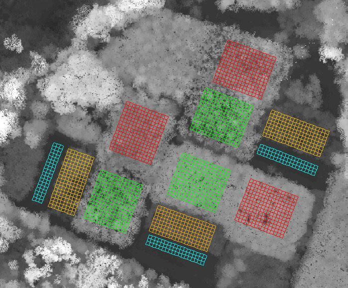
53 Mapping a polygon (1) Collecting corner x,y positions with a GPS receiver GPS positional error Field Plot
54 Mapping a polygon (2) Collecting corner x,y positions with a GPS receiver and differential corrections (DGPS) DGPS positional error Field Plot
55 Mapping a polygon (3) Collecting corner x,y positions with DGPS and laser rangefinder Control point DGPS positional error Laser rangefinder positional error Closure? Field Plot
56 Planning the field campaign
57 Project fundamentals Define research question and goals Consider a spatial perspective in questions Ask how spatial data and sampling scheme help answer this Familiarize yourself with study area Logistics of getting there What type of obstacles canopy cover, mountains Permissions for access, other cultural issues
58 Project fundamentals (cont) Resolution and accuracy needs Spatial and temporal scale Type of equipment: recreational or mapping-grade GPS? Tape measure or laser rangefinder? Data collection methodology Points, lines or areas Coordinate system and projection How data collected? Who? How data stored data dictionary, on a paper form

59 Long-term field plots
60 Field data form
61 Data dictionary A data dictionary is a "shopping list" of the features and their attributes that you want to map in the field You create the data dictionary with the GPS vendor s software (e.g., Pathfinder Office) prior to going into the field You then upload the data dictionary to your GPS receiver Once in the field, the data dictionary prompts you for information for each spatial feature (e.g., point, polygon) measured Provides a standard format for data entry Saves time! Helps prevent input errors!

62 Mission planning software GPS (GNSS) vendors generally provide mission planning software with receiver Free software is from Trimble Almanac information on satellites is available from Trimble, /gpsdataresources.shtml
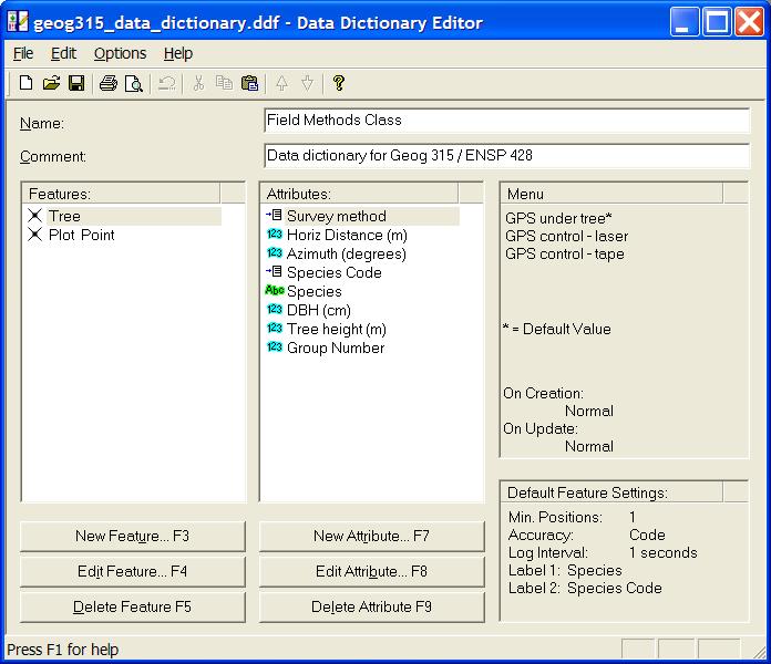
63 Data dictionary
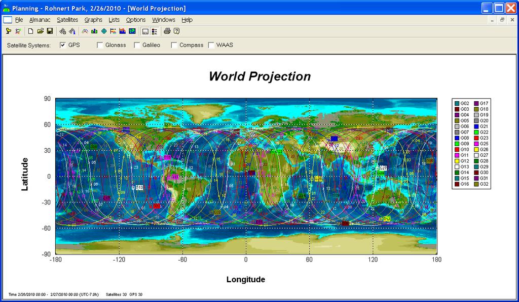
64 GPS satellites - 02/26/2010

65 Sky plot Rohnert Park, CA 02/26/2010

66 Number of satellites Santa Rosa, CA Rohnert Park, CA 02/26/2010

67 PDOP Santa Rosa, CA Rohnert Park, CA 02/26/2010

68 Sonoma State Campus June 2007
GPS: The Basics. Darrell R. Dean, Jr. Civil and Environmental Engineering West Virginia University. Expected Learning Outcomes for GPS
 GPS: The Basics Darrell R. Dean, Jr. Civil and Environmental Engineering West Virginia University Expected Learning Outcomes for GPS Explain the acronym GPS Name 3 important tdt dates in history of GPS
Introduction to Geographic Information Science. Last Lecture. Today s Outline. Geography 4103 / GNSS/GPS Technology
 Geography 4103 / 5103 Introduction to Geographic Information Science GNSS/GPS Technology Last Lecture Geoids Ellipsoid Datum Projection Basics Today s Outline GNSS technology How satellite based navigation
What is a GPS How does GPS work? GPS Segments GPS P osition Position Position Accuracy Accuracy Accuracy GPS A pplications Applications Applications
 What is GPS? What is a GPS How does GPS work? GPS Segments GPS Position Accuracy GPS Applications What is GPS? The Global Positioning System (GPS) is a precise worldwide radio-navigation system, and consists
NR402 GIS Applications in Natural Resources
 NR402 GIS Applications in Natural Resources Lesson 5 GPS/GIS integration Global Positioning System (GPS)..a global navigation system that everyone can use What is GPS? How does it work? How accurate is
Global Positioning Systems (GPS) Trails: the achilles heel of mapping from the air / satellites
 Trails: the achilles heel of mapping from the air / satellites") Global Positioning Systems (GPS) Trails: the achilles heel of mapping from the air / satellites Google maps updated regularly by local users using GPS Also: http://openstreetmaps.org GPS applications
Global Positioning Systems (GPS) Trails: the achilles heel of mapping from the air / satellites Google maps updated regularly by local users using GPS Also: http://openstreetmaps.org GPS applications
PRINCIPLES AND FUNCTIONING OF GPS/ DGPS /ETS ER A. K. ATABUDHI, ORSAC
 PRINCIPLES AND FUNCTIONING OF GPS/ DGPS /ETS ER A. K. ATABUDHI, ORSAC GPS GPS, which stands for Global Positioning System, is the only system today able to show you your exact position on the Earth anytime,
GLOBAL POSITIONING SYSTEMS
 GLOBAL POSITIONING SYSTEMS GPS & GIS Fall 2017 Global Positioning Systems GPS is a general term for the navigation system consisting of 24-32 satellites orbiting the Earth, broadcasting data that allows
Resection. We can measure direction in the real world! Lecture 10: Position Determination. Resection Example: Isola, Slovenia. Professor Keith Clarke
 Geography 12: Maps and Spatial Reasoning Lecture 10: Position Determination We can measure direction in the real world! Professor Keith Clarke Resection Resection Example: Isola, Slovenia Back azimuth
Appendix D Brief GPS Overview
 Appendix D Brief GPS Overview Global Positioning System (GPS) Theory What is GPS? The Global Positioning System (GPS) is a satellite-based navigation system, providing position information, accurate to
Line and polygon features can be created via on-screen digitizing.
 This module explains how GPS works, sources of error, and error correction using real time or post processing differential correction. Cost and accuracy of different grades of GPS units are also part of
Differential Global Positioning ~ System Techniques For Surveying/ Mapping within Forested Wetlands
 WRP Technical Note WG-SW-2.2 ~- Differential Global Positioning ~ System Techniques For Surveying/ Mapping within Forested Wetlands PURPOSE: This technical note describes the use of Differential Global
FieldGenius Technical Notes GPS Terminology
 FieldGenius Technical Notes GPS Terminology Almanac A set of Keplerian orbital parameters which allow the satellite positions to be predicted into the future. Ambiguity An integer value of the number of
GNSS 101 Bringing It Down To Earth
 GNSS 101 Bringing It Down To Earth Steve Richter Frontier Precision, Inc. UTM County Coordinates NGVD 29 State Plane Datums Scale Factors Projections Session Agenda GNSS History & Basic Theory Coordinate
GPS and Recent Alternatives for Localisation. Dr. Thierry Peynot Australian Centre for Field Robotics The University of Sydney
 GPS and Recent Alternatives for Localisation Dr. Thierry Peynot Australian Centre for Field Robotics The University of Sydney Global Positioning System (GPS) All-weather and continuous signal system designed
GLOBAL POSITIONING SYSTEMS. Knowing where and when
 GLOBAL POSITIONING SYSTEMS Knowing where and when Overview Continuous position fixes Worldwide coverage Latitude/Longitude/Height Centimeter accuracy Accurate time Feasibility studies begun in 1960 s.
What is GPS? GPS Position Accuracy. GPS Applications. What is a GPS. How does GPS work? GPS Segments
 What is GPS? What is a GPS How does GPS work? GPS Segments GPS Position Accuracy GPS Applications 1 What is GPS? The Global Positioning System (GPS) is a precise worldwide radio-navigation system, and
The Global Positioning System
 The Global Positioning System 5-1 US GPS Facts of Note DoD navigation system First launch on 22 Feb 1978, fully operational in 1994 ~$15 billion (?) invested to date 24 (+/-) Earth-orbiting satellites
Sources of Geographic Information
 Sources of Geographic Information Data properties: Spatial data, i.e. data that are associated with geographic locations Data format: digital (analog data for traditional paper maps) Data Inputs: sampled
Lecture 8: GIS Data Error & GPS Technology
 Lecture 8: GIS Data Error & GPS Technology A. Introduction We have spent the beginning of this class discussing some basic information regarding GIS technology. Now that you have a grasp of the basic terminology
The Global Positioning System II Field Experiments
 The Global Positioning System II Field Experiments 5-1 Mexico DGPS Field Campaign Cenotes in Tamaulipas, MX, near Aldama 5-2 Are Cenote Water Levels Related? 5-3 DGPS Static Survey of Cenote Water Levels
GPS Milestones, cont. GPS Milestones. The Global Positioning Sytem, Part 1 10/10/2017. M. Helper, GEO 327G/386G, UT Austin 1. US GPS Facts of Note
 The Global Positioning System US GPS Facts of Note DoD navigation system First launch on 22 Feb 1978, fully operational in 1994 ~$15 billion (?) invested to date 24 (+/-) Earth-orbiting satellites (SVs)
GEOGRAPHIC INFORMATION SYSTEMS Lecture 22: Field Mapping with GPS
 GEOGRAPHIC INFORMATION SYSTEMS Lecture 22: Field Mapping with GPS GPS Receivers - there are many GPS receivers on the market today - some receivers are relatively inexpensive (recreational grade receivers)
GNSS & Coordinate Systems
 GNSS & Coordinate Systems Matthew McAdam, Marcelo Santos University of New Brunswick, Department of Geodesy and Geomatics Engineering, Fredericton, NB May 29, 2012 Santos, 2004 msantos@unb.ca 1 GNSS GNSS
t =1 Transmitter #2 Figure 1-1 One Way Ranging Schematic
 1.0 Introduction OpenSource GPS is open source software that runs a GPS receiver based on the Zarlink GP2015 / GP2021 front end and digital processing chipset. It is a fully functional GPS receiver which
NJDEP GPS Data Collection Standards for GIS Data Development
 NJDEP GPS Data Collection Standards for GIS Data Development Bureau of Geographic Information Systems Office of Information Resource Management April 24 th, 2017 Table of Contents 1.0 Introduction... 3
The Global Positioning Sytem II 10/19/2017
 The Global Positioning System II Field Experiments 10/19/2017 5-1 Mexico DGPS Field Campaign Cenotes in Tamaulipas, MX, near Aldama 10/19/2017 5-2 Are Cenote Water Levels Related? 10/19/2017 5-3 M. Helper,
GPS for. Land Surveyors. Jan Van Sickle. Fourth Edition. CRC Press. Taylor & Francis Group. Taylor & Francis Croup, an Informa business
 GPS for Land Surveyors Fourth Edition Jan Van Sickle CRC Press Taylor & Francis Group Boca Raton London New York CRC Press is an imprint of the Taylor & Francis Croup, an Informa business Contents Preface
Principal Investigator Co-Principal Investigator Co-Principal Investigator Prof. Talat Ahmad Vice-Chancellor Jamia Millia Islamia Delhi
 Subject Paper No and Title Module No and Title Module Tag Geology Remote Sensing and GIS Concepts of Global Navigation Satellite RS & GIS XXXIII Principal Investigator Co-Principal Investigator Co-Principal
What is it? History. Other systems. How does it work? Trilateration GEOG 201 4/28/2010. Instructor: Pesses 1. {06} The Global Positioning System
 What is it? {06} The Global Positioning System G.P.S. = Global Positioning System Different from G.I.S. (Geographic Information Systems) Map Interpretation & GPS Spring 2010 M. Pesses History Conceived
Department of Civil and Environmental Engineering
 Department of Civil and Environmental Engineering CEE213L Surveying & Introduction to GIS Lab SURVEYING LABORATORY NORTH SOUTH UNIVERSITY Center of Excellence in Higher Education The First Private University
Introduction to Total Station and GPS
 Introduction to Total Station and GPS Dr. P. NANJUNDASWAMY Professor of Civil Engineering J S S Science and Technology University S J College of Engineering Mysuru 570 006 Introduction History GPS Overview
GPS STATIC-PPP POSITIONING ACCURACY VARIATION WITH OBSERVATION RECORDING INTERVAL FOR HYDROGRAPHIC APPLICATIONS (ASWAN, EGYPT)
") GPS STATIC-PPP POSITIONING ACCURACY VARIATION WITH OBSERVATION RECORDING INTERVAL FOR HYDROGRAPHIC APPLICATIONS (ASWAN, EGYPT) Ashraf Farah Associate Professor,College of Engineering, Aswan University,
GPS STATIC-PPP POSITIONING ACCURACY VARIATION WITH OBSERVATION RECORDING INTERVAL FOR HYDROGRAPHIC APPLICATIONS (ASWAN, EGYPT) Ashraf Farah Associate Professor,College of Engineering, Aswan University,
Testing RTK GPS Horizontal Positioning Accuracy within an Urban Area
 Testing RTK GPS Horizontal Positioning Accuracy within an Urban Area Ismat M Elhassan* Civil Engineering Department, King Saud University, Surveying Engineering Program, Kingdom of Saudi Arabia Research
Primer on GPS Operations
 MP Rugged Wireless Modem Primer on GPS Operations 2130313 Rev 1.0 Cover illustration by Emma Jantz-Lee (age 11). An Introduction to GPS This primer is intended to provide the foundation for understanding
Introduction to the Global Positioning System
 GPS for Fire Management - 2004 Introduction to the Global Positioning System Pre-Work Pre-Work Objectives Describe at least three sources of GPS signal error, and identify ways to mitigate or reduce those
GPS: What do I need to collect Application Appropriate location data?
 GPS: What do I need to collect Application Appropriate location data? Bob Goodwin, GISP GIS/Remote Sensing Analyst Remote Sensing & GIS Research and Outreach Services, MSU http://www.rsgis.msu.edu 2005
The Global Positioning System II Field Experiments. 10/10/2013 GEO327G/386G, UT Austin 5-1
 The Global Positioning System II Field Experiments 10/10/2013 GEO327G/386G, UT Austin 5-1 Mexico DGPS Field Campaign Cenotes in Tamaulipas, MX, near Aldama 10/10/2013 GEO327G/386G, UT Austin 5-2 Are Cenote
UNITED NATIONS UNIVERSITY Institute for Environment & Human Security (UNU-EHS) Bonn, Germany
 Bonn, Germany") UNITED NATIONS UNIVERSITY Institute for Environment & Human Security (UNU-EHS) Bonn, Germany Introduction to GPS technology Prof. Dr. Jörg Szarzynski Education Programme Director Head of Section EduSphere
UNITED NATIONS UNIVERSITY Institute for Environment & Human Security (UNU-EHS) Bonn, Germany Introduction to GPS technology Prof. Dr. Jörg Szarzynski Education Programme Director Head of Section EduSphere
2 INTRODUCTION TO GNSS REFLECTOMERY
 2 INTRODUCTION TO GNSS REFLECTOMERY 2.1 Introduction The use of Global Navigation Satellite Systems (GNSS) signals reflected by the sea surface for altimetry applications was first suggested by Martín-Neira
Introduction to GNSS Base-Station
 Introduction to GNSS Base-Station Dinesh Manandhar Center for Spatial Information Science The University of Tokyo Contact Information: dinesh@iis.u-tokyo.ac.jp Slide : 1 Introduction GPS or GNSS observation
DYNAMIC RT TECHNOLOGY
 DYNAMIC RT TECHNOLOGY GLOBAL NAVIGATION SATELLITE SYSTEMS (GNSS) POTENTIAL FUTURE DEVELOPMENTS(2005 2017?) GPS MODERNIZATION BLOCK IIF & III GLONASS ENHANCEMENTS (K & M) EUROPEAN UNION - GALILEO CHINA
Introduction to NAVSTAR GPS
 Introduction to NAVSTAR GPS Charlie Leonard, 1999 (revised 2001, 2002) The History of GPS Feasibility studies begun in 1960 s. Pentagon appropriates funding in 1973. First satellite launched in 1978. System
36. Global Positioning System
 36. Introduction to the Global Positioning System (GPS) Why do we need GPS? Position: a basic need safe sea travel, crowed skies, resource management, legal questions Positioning: a challenging job local
Utilizing A GNSS Network Solution for Utility Applications
 Utilizing A GNSS Network Solution for Utility Applications David Newcomer, PE, PLS GPServ, Inc. newcomer@ (407) 601-5816 AGENDA Types and accuracies of data collection o Autonomous o Meter + o Sub-meter
VARIATION OF STATIC-PPP POSITIONING ACCURACY USING GPS-SINGLE FREQUENCY OBSERVATIONS (ASWAN, EGYPT)
") ARTIFICIAL SATELLITES, Vol. 52, No. 2 2017 DOI: 10.1515/arsa-2017-0003 VARIATION OF STATIC-PPP POSITIONING ACCURACY USING GPS-SINGLE FREQUENCY OBSERVATIONS (ASWAN, EGYPT) Ashraf Farah Associate professor,
ARTIFICIAL SATELLITES, Vol. 52, No. 2 2017 DOI: 10.1515/arsa-2017-0003 VARIATION OF STATIC-PPP POSITIONING ACCURACY USING GPS-SINGLE FREQUENCY OBSERVATIONS (ASWAN, EGYPT) Ashraf Farah Associate professor,
Global Positioning System: what it is and how we use it for measuring the earth s movement. May 5, 2009
 Global Positioning System: what it is and how we use it for measuring the earth s movement. May 5, 2009 References Lectures from K. Larson s Introduction to GNSS http://www.colorado.edu/engineering/asen/
Precise Point Positioning (PPP) using
 using") Precise Point Positioning (PPP) using Product Technical Notes // May 2009 OnPOZ is a product line of Effigis. EZSurv is a registered trademark of Effigis. All other trademarks are registered or recognized
Precise Point Positioning (PPP) using Product Technical Notes // May 2009 OnPOZ is a product line of Effigis. EZSurv is a registered trademark of Effigis. All other trademarks are registered or recognized
Fundamentals of GPS Navigation
 Fundamentals of GPS Navigation Kiril Alexiev 1 /76 2 /76 At the traditional January media briefing in Paris (January 18, 2017), European Space Agency (ESA) General Director Jan Woerner explained the knowns
TEST YOUR SATELLITE NAVIGATION PERFORMANCE ON YOUR ANDROID DEVICE GLOSSARY
 TEST YOUR SATELLITE NAVIGATION PERFORMANCE ON YOUR ANDROID DEVICE GLOSSARY THE GLOSSARY This glossary aims to clarify and explain the acronyms used in GNSS and satellite navigation performance testing
GLOBAL NAVIGATION SATELLITE SYSTEMS (GNSS) ECE 2526E Tuesday, 24 April 2018
 ECE 2526E Tuesday, 24 April 2018") GLOBAL NAVIGATION SATELLITE SYSTEMS (GNSS) ECE 2526E Tuesday, 24 April 2018 MAJOR GLOBAL NAVIGATION SATELLITE SYSTEMS (GNSS) Global Navigation Satellite System (GNSS) includes: 1. Global Position System
GLOBAL NAVIGATION SATELLITE SYSTEMS (GNSS) ECE 2526E Tuesday, 24 April 2018 MAJOR GLOBAL NAVIGATION SATELLITE SYSTEMS (GNSS) Global Navigation Satellite System (GNSS) includes: 1. Global Position System
Global Positioning Systems -GPS
 Global Positioning Systems -GPS GPS Why? What is it? How does it work? Differential GPS How can it help me? GPS Why?? Where am I? How do I get there? Where are you, and how do I get to You? WHO CARES???
Asian Journal of Science and Technology Vol. 08, Issue, 11, pp , November, 2017 RESEARCH ARTICLE
 Available Online at http://www.journalajst.com ASIAN JOURNAL OF SCIENCE AND TECHNOLOGY ISSN: 0976-3376 Asian Journal of Science and Technology Vol. 08, Issue, 11, pp.6697-6703, November, 2017 ARTICLE INFO
GPS for GIS Data Collection - 101
 GPS for GIS Data Collection - 101 Speaker: Eric Gakstatter, Editor of GPS World s Survey Scene Newsletter & Geospatial Solutions Guest Commentator: Craig Greenwald, Technical Director, GeoMobile Innovations,
2.017 DESIGN OF ELECTROMECHANICAL ROBOTIC SYSTEMS Fall 2009 Lab 3: GPS and Data Logging. September 28, 2009 Dr. Harrison H. Chin
 2.017 DESIGN OF ELECTROMECHANICAL ROBOTIC SYSTEMS Fall 2009 Lab 3: GPS and Data Logging September 28, 2009 Dr. Harrison H. Chin Formal Labs 1. Microcontrollers Introduction to microcontrollers Arduino
Introduction. Global Positioning System. GPS - Intro. Space Segment. GPS - Intro. Space Segment - Contd..
 Introduction Global Positioning System Prof. D. Nagesh Kumar Dept. of Civil Engg., IISc, Bangalore 560 012, India URL: http://www.civil.iisc.ernet.in/~nagesh GPS is funded and controlled by U. S. Department
Introduction to the Global Positioning System
 GPS for ICS - 2003 Introduction to the Global Positioning System Pre-Work Pre-Work Objectives Describe at least three sources of GPS signal error, and ways to mitigate or reduce those errors. Identify
ENGI 3703 Surveying and Geomatics
 Satellite Geometry: Satellites well spread out in the sky have a much stronger solution to the resection type problem (aka trilateration) then satellite that are grouped together. Since the position of
High Precision GNSS for Mapping & GIS Professionals
 High Precision GNSS for Mapping & GIS Professionals Agenda Address your needs for GNSS knowledge. GNSS Basics Satellite Ranging Fundamentals (Code $ Carrier) Differential Corrections (Post Processed $
GEO 428: DEMs from GPS, Imagery, & Lidar Tuesday, September 11
 GEO 428: DEMs from GPS, Imagery, & Lidar Tuesday, September 11 Global Positioning Systems GPS is a technology that provides Location coordinates Elevation For any location with a decent view of the sky
Suveying Lectures for CE 498
 Suveying Lectures for CE 498 SURVEYING CLASSIFICATIONS Surveying work can be classified as follows: 1- Preliminary Surveying In this surveying the detailed data are collected by determining its locations
ENGRG Introduction to GIS
 ENGRG 59910 Introduction to GIS Michael Piasecki December 01, 2017 Lecture 12: GPS Systems Lecture 7: Introduction To GPS November 27, 2017 ENGRG 59910 Intro to GIS 2 November 27, 2017 ENGRG 59910 Intro
Global Positioning Systems - GPS
 Global Positioning Systems - GPS GPS Why? What is it? How does it work? Differential GPS How can it help me? GPS Why?? Where am I? How do I get there? Where are you, and how do I get to You? WHO CARES???
Introduction to Datums James R. Clynch February 2006
 Introduction to Datums James R. Clynch February 2006 I. What Are Datums in Geodesy and Mapping? A datum is the traditional answer to the practical problem of making an accurate map. If you do not have
CARRIER PHASE VS. CODE PHASE
 DIFFERENTIAL CORRECTION Code phase processing- GPS measurements based on the pseudo random code (C/A or P) as opposed to the carrier of that code. (1-5 meter accuracy) Carrier phase processing- GPS measurements
Monitoring the Earth Surface from space
 Monitoring the Earth Surface from space Picture of the surface from optical Imagery, i.e. obtained by telescopes or cameras operating in visual bandwith. Shape of the surface from radar imagery Surface
Assessing the Accuracy of GPS Control Point, Using Post-Processed and Absolute Positioning Data
 American Journal of Environmental Engineering and Science 2017; 4(5): 42-47 http://www.aascit.org/journal/ajees ISSN: 2381-1153 (Print); ISSN: 2381-1161 (Online) Assessing the Accuracy of GPS Control Point,
High Precision Positioning Unit 1: Accuracy, Precision, and Error Student Exercise
 High Precision Positioning Unit 1: Accuracy, Precision, and Error Student Exercise Ian Lauer and Ben Crosby (Idaho State University) This assignment follows the Unit 1 introductory presentation and lecture.
Lecture-1 CHAPTER 2 INTRODUCTION TO GPS
 Lecture-1 CHAPTER 2 INTRODUCTION TO GPS 2.1 History of GPS GPS is a global navigation satellite system (GNSS). It is the commonly used acronym of NAVSTAR (NAVigation System with Time And Ranging) GPS (Global
Mapping The Study Area
 While on the beach you will need to take some measurements to show where the study area is relative to the rest of the world and to show what is inside the study area. Once the measurements have been taken,
Best field practices for GIS Data collection: Presented by, Jacob Wittenberg Frontier Precision, Inc.
 Best field practices for GIS Data collection: Presented by, Jacob Wittenberg Frontier Precision, Inc. Agenda What is GNSS Code and Carrier Data H-Star Processing Best Practices Code and Carrier Solutions
What makes the positioning infrastructure work. Simon Kwok Chairman, Land Surveying Division Hong Kong Institute of Surveyors
 What makes the positioning infrastructure work The experience of the Hong Kong Satellite Positioning Reference Station Network Simon Kwok Chairman, Land Surveying Division Hong Kong Institute of Surveyors
GPS Global Positioning System
 GPS Global Positioning System 10.04.2012 1 Agenda What is GPS? Basic consept History GPS receivers How they work Comunication Message format Satellite frequencies Sources of GPS signal errors 10.04.2012
Proceedings of Al-Azhar Engineering 7 th International Conference Cairo, April 7-10, 2003.
 Proceedings of Al-Azhar Engineering 7 th International Conference Cairo, April 7-10, 2003. MODERNIZATION PLAN OF GPS IN 21 st CENTURY AND ITS IMPACTS ON SURVEYING APPLICATIONS G. M. Dawod Survey Research
1
 1 2 3 4 City of Golden 5 TerraSync ideally suited for new asset data collection, bullet proof because it pretty basic ArcPad Best for GIS professionals to take their GIS out to the field for decision making,
METIS Second Master Training & Seminar. Augmentation Systems Available in Egypt
 METIS Second Master Training & Seminar Augmentation Systems Available in Egypt By Eng. Ramadan Salem M. Sc. Surveying and Geodesy Email: ramadan_salem@link.net Page 1 Augmentation Systems Available in
The last 25 years - GPS to multi-gnss: from a military tool to the most widely used civilian positioning solution
 1 The last 25 years - GPS to multi-gnss: from a military tool to the most widely used civilian positioning solution B. Hofmann-Wellenhof Institute of Geodesy / Navigation, Graz University of Technology
GPS Errors. Figure 1. Four satellites are required to determine a GPS position.
 Expl ai ni nggps:thegl obalposi t i oni ngsyst em since a minimum of four satellites is required to calculate a position (Fig 1). However, many newer GPS receivers are equipped to receive up to 12 satellite
The Role of F.I.G. in Leading the Development of International Real-Time Positioning Guidelines
 The Role of F.I.G. in Leading the Development of International Real-Time Positioning Guidelines, USA Key Words: RTN, real-time, GNSS, Guidelines SUMMARY The rapid growth of real-time reference station
Space Weather and the Ionosphere
 Dynamic Positioning Conference October 17-18, 2000 Sensors Space Weather and the Ionosphere Grant Marshall Trimble Navigation, Inc. Note: Use the Page Down key to view this presentation correctly Space
DYNAMIC POSITIONING CONFERENCE October 7-8, Sensors II. Redundancy in Dynamic Positioning Systems Based on Satellite Navigation
 Return to Session Directory DYNAMIC POSITIONING CONFERENCE October 7-8, 2008 Sensors II Redundancy in Dynamic Positioning Systems Based on Satellite Navigation Ole Ørpen, Tor Egil Melgård, Arne Norum Fugro
TDS Survey Pro CE Version Setup RTK Base on known NAD83/WGS84 Point: Mapping Plane Geoid99 Modeling.
 TDS Survey Pro CE Version 2.1.8 Setup RTK Base on known NAD83/WGS84 Point: Mapping Plane Geoid99 Modeling. Pre-load known NAD83 State Plane Coordinates and appropriate NGS Geoid 99/96 data files into the
Phase Center Calibration and Multipath Test Results of a Digital Beam-Steered Antenna Array
 Phase Center Calibration and Multipath Test Results of a Digital Beam-Steered Antenna Array Kees Stolk and Alison Brown, NAVSYS Corporation BIOGRAPHY Kees Stolk is an engineer at NAVSYS Corporation working
ACCURACIES OF VARIOUS GPS ANTENNAS UNDER FORESTED CONDITIONS
 ACCURACIES OF VARIOUS GPS ANTENNAS UNDER FORESTED CONDITIONS Brian H. Holley and Michael D. Yawn LandMark Systems, 122 Byrd Way Warner Robins, GA 31088 ABSTRACT GPS accuracy is much more variable in forested
ANALYSIS OF THE INFLUENCE OF SATELLITES CONSTELLATION IN GNSS POSITIONING ACCURACY 1. University of Novi Sad, Faculty of Technical Sciences,
 ANNALS of Faculty Engineering Hunedoara International Journal of Engineering Tome XV [201] Fascicule 2 [May] ISSN: 154-25 [print; online] ISSN: 154-23 [CD-Rom; online] a free-access multidisciplinary publication
GPS Performance in Southern Hardwood Forests
 GPS Performance in Southern Hardwood Forests Pete Bettinger Warnell School of Forestry and Natural Resources University of Georgia In forests, vegetation plays a significant role in obstructing signals
Applications, Products and Services of GPS Technology
 Applications, Products and Services of GPS Technology Enrico C. Paringit. Dr. Eng. University of the Philippines Training Center for Applied Geodesy and Photogrammetry 1 Outline of this Presentation GPS
GROUND CONTROL SURVEY REPORT
 GROUND CONTROL SURVEY REPORT Services provided by: 3001, INC. a Northrop Grumman company 10300 Eaton Place Suite 340 Fairfax, VA 22030 Ground Control Survey in Support of Topographic LIDAR, RGB Imagery
GPS Accuracy Comparison. Tom Biernacki Florida Department of Environmental Protection
 GPS Accuracy Comparison Tom Biernacki Florida Department of Environmental Protection What Effects the accuracy of GPS? Atmospheric delay Multipath bounce Weak receiver algorithms Atmospheric Delay Signal
GPS Performance in Southern Hardwood Forests Pete Bettinger Warnell School of Forestry and Natural Resources University of Georgia
 GPS Performance in Southern Hardwood Forests Pete Bettinger Warnell School of Forestry and Natural Resources University of Georgia Introduction In forests, vegetation plays a significant role in obstructing
Field DGPS Report AT
 Field DGPS Report AT-329 2005 Ellen M. Sundlisæter Lene Kristensen Sigrid K. Dahl Ulli Neumann 1 Table of contents Table of contents...2 Introduction...2 Methods...3 Equipment...3 Availability...3 Setup...3
Trimble Business Center:
 Trimble Business Center: Modernized Approaches for GNSS Baseline Processing Trimble s industry-leading software includes a new dedicated processor for static baselines. The software features dynamic selection
Effect of Quasi Zenith Satellite (QZS) on GPS Positioning
 on GPS Positioning") Effect of Quasi Zenith Satellite (QZS) on GPS ing Tomoji Takasu 1, Takuji Ebinuma 2, and Akio Yasuda 3 Laboratory of Satellite Navigation, Tokyo University of Marine Science and Technology 1 (Tel: +81-5245-7365,
Effect of Quasi Zenith Satellite (QZS) on GPS ing Tomoji Takasu 1, Takuji Ebinuma 2, and Akio Yasuda 3 Laboratory of Satellite Navigation, Tokyo University of Marine Science and Technology 1 (Tel: +81-5245-7365,
King AbdulAziz University. Faculty of Environmental Design. Geomatics Department. Mobile GIS GEOM 427. Lecture 3
 King AbdulAziz University Faculty of Environmental Design Geomatics Department Mobile GIS GEOM 427 Lecture 3 Ahmed Baik, Ph.D. Email: abaik@kau.edu.sa Eng. Fisal Basheeh Email: fbasaheeh@kau.edu.sa GNSS
Application of GPS and Remote Sensing Image Technology in Construction Monitoring of Road and Bridge
 2017 3rd International Conference on Social Science, Management and Economics (SSME 2017) ISBN: 978-1-60595-462-2 Application of GPS and Remote Sensing Image Technology in Construction Monitoring of Road
GPS Glossary Written by Carl Carter SiRF Technology 2005
 GPS Glossary Written by Carl Carter SiRF Technology 2005 This glossary provides supplementary information for students of GPS Fundamentals. While many of the terms can have other definitions from those
International Journal of Scientific & Engineering Research, Volume 6, Issue 8, August ISSN
 International Journal of Scientific & Engineering Research, Volume 6, Issue 8, August-2015 683 Assessment Accuracy of Static Relative Positioning Using Single Frequency GPS Receivers Mahmoud I. El-Mewafi
9/26/2016. Accuracy with GNSS What are you getting? Presented By Tom Bryant PLS Kelly Harris PLS Seiler Instrument
 Accuracy with GNSS What are you getting? Presented By Tom Bryant PLS Kelly Harris PLS Seiler Instrument 1 What We Will Talk About Today What coordinate system should I use in my data collector Site Calibrations-what
Where in the world are my field plots? Using GPS effectively in environmental field studies
 REVIEWS REVIEWS REVIEWS Where in the world are my field plots? Using GPS effectively in environmental field studies 475 Chris E Johnson 1 and Christopher C Barton 2 Global positioning system (GPS) technology
Visualizing a Pixel. Simulate a Sensor s View from Space. In this activity, you will:
 Simulate a Sensor s View from Space In this activity, you will: Measure and mark pixel boundaries Learn about spatial resolution, pixels, and satellite imagery Classify land cover types Gain exposure to
Biological Inventories
 Field Lab 1 Urban Ecology Center Biological Inventories Introduction In order to begin work on our semester research project, this week we will be conducting biological inventories at a moderately disturbed