RV SIKULIAQ ALIGNMENT AND ORTHOGONAL COORDINATE SURVEY FINAL REPORT. March 5, 2016 Revision 2. Prepared By:
|
|
|
- Preston Heath
- 5 years ago
- Views:
Transcription

1 RV SIKULIAQ ALIGNMENT AND ORTHOGONAL COORDINATE SURVEY FINAL REPORT March 5, 2016 Revision 2 Prepared By: The IMTEC Group, Ltd E Ringo Circle Independence, MO USA Phone Facsimile AOL.com On the Web at www ImtecGroup.com On the Web at www Accuracy-Control.com Industrial Measurement Technology Engineering Consultants
2 CONTENTS Page Description 1 PROJECT OVERVIEW Purpose General Comments-Tasks Performed 3-D Coordinate Measurement Equipment 2 Reference Coordinate System Measurement Procedure 3-D X,Y,Z Coordinates, Post Processing Data Files Measurement Uncertainty 4 PROJECT DATA 4 Table 1 Benchmarks with respect to granite block, Meters 5 Table 2 Features with respect to Granite Block, Meters Table 3 Centerboard features with respect to Granite Block measured at hull, Meters 6 Table 4, Antenna Location with respect to Granite Block, Meters 7 Table 5, Transducer Pitch, Roll, Azimuth Figure 1- Granite Block 8 Figure 2- X & S Band Radar Elevation Figure 3 Kongsberg MRU Elevation 9 Figure 4 A-Frame Center Sheave Reverence Figure 5 LHS Crane Sheave Reference 10 Figure 6 - Sample Instrument Calibration Certificate 11 Figure 7 Instrument Calibration Certificate Revision 1. 2/9/2014- Added Kongsberg MRU to Table 5, Revised Kongsberg MRU elevation Table 2 and Figure 3, Added Elevation of 20FT Draft mark to page 5. Revision 2. 3/5/2016 Resurveyed 9.1, 9.2 GPS and 10.3 GCGPS after relocation.
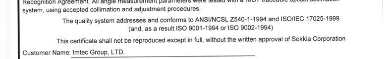
3 PROJECT OVERVIEW Purpose The purpose of this commentary is to summarize the procedures and analytical methods employed to perform the 3-D coordinate total station inspection that produced the data in this report for those unfamiliar with the equipment and process. Dimensional data resulting from the inspection is included with the report. General Comments- Tasks performed This report summarizes data taken, analyzed and recorded by IMTEC Group, Ltd. from October 2011 through June, The survey data included characterizing the vessel, locating and determining 3-D coordinates of benchmarks and features as outlined in Section 725 of ARRV Contract Specifications dated 18 March, D Coordinate Measurement Equipment A Sokkia NET 1200 enhanced electronic total station operated through a notebook computer running New River Kinematics Spatial Analyzer measurement and analysis software was utilized. This system measures 3-D spherical coordinates by recording an azimuth and zenith angle simultaneously with the near infrared distance coaxial with the telescope line of sight for each observation. Spatial Analyzer measurement and analysis software converts the spherical coordinate data to a Cartesian coordinate system that can be defined by the user. Measurements are made to either adhesive or kinematic targets that have a retro-reflective target face. Where practical, certain features were measured with the instrument in the Reflectorless targeting mode. Temporary "benchmarks" or reference points were placed throughout the vessel as required to allow for re-locating the instrument to a new position or "Station" and tie all of the data to the common coordinate system for comparison. The measuring system used for this final inspection report is one of several owned by The IMTEC Group, Ltd. The NET 1200 total stations, S/N and S/N were calibrated, traceable to N.I.S.T. and in accordance with A.N.S.I. Z-540-1, at the Sokkia USA Factory Service Center. A Wyler CLINO 2000, Electronic Clinometer S/N M4474 was used the set the Pitch and Roll axis of the Granite Block. Certificates of calibration for all instruments are kept on file in the IMTEC offices. Each test instrument had a current calibration sticker affixed to it at the time it was utilized for this project. 1
4 Reference Coordinate System The following parameters were used to define the reference coordinate system for reporting the survey data: The origin for the vessel coordinate system (0, 0, 0) is the center of the granite block. The X (+X) axis is positive forward, the Y (+Y) axis is positive starboard and the Z (+Z) axis is positive down towards the keel. Measurement Procedure Adhesive targets with retro reflective target face were used throughout the survey as temporary benchmarks for relocating the instrument to new stations. Kinematic (a target with a known offset) retro reflective targets such as the RT-50M swivel targets used to measure some of the features defining the specified elements to be reported. The RT-50M was also frequently used as a temporary benchmark. Where possible, a retro reflective surface target was used to eliminate any offsets. 3-D X, Y, Z coordinates, Post Processing In some cases, the features or targets defining the elements required by the survey were made to a kinematic target with a known offset orthogonal to the vessel s final reference coordinate system. After the each survey was complete, these offsets were applied to report the final X, Y, Z value of the element. The pitch and roll values were processed mathematically in the Spatial Analyzer software. Backup data is provided with this report. Data files One measurement file was used to perform the survey. All measurement files were backed up at the completion of a set of observations from a particular station and on a daily basis. This vessel coordinate system was created from the initial characterization file. Measurement Precision and Uncertainty Region to Region, i.e., Origin to main mast features; BM, DGPS, etc. X 5 mm Y 5 mm Z 5 mm 2
5 Locally, i.e. EM302 TX to ADCP s and Topas PS 18 X 2 mm Y 2 mm Z 2 mm Antenna Survey- X 30 mm Y 30 mm Z 30 mm Angular precision is based on analysis of features measured and calculation of the mathematical relationship of these features. The angular measurement precision of the NET1200 is < 1 arc second in azimuth and zenith. There can be some error introduced by targeting. Random and systematic errors can be introduced by the working environment. The expected angular precision is analyzed to be: Azimuth: Pitch: Roll:
6 PROJECT DATA TABLE 1 BENCHMARKS WITH RESPECT TO GRANITE BLOCK, METERS ITEM LOCATION X Y Z ORIGIN GRANITE BLOCK BM1 ON CENTER MAIN MAST, AFT 1.4 M ABOVE 04 LEVEL BM2 01 LEVEL ON DECK STBD BASE OF AFT AFRAME BM3 01 LEVEL AFT DECK STBD BM4 01 LEVEL AFT DECK PORT BM5 ON CENTER FWD MAST, AFT 5.7 M ABOVE 01 LEVEL BM6 05 LEVEL STBD NEAR BASE OF ANTENNA BM7 05 LEVEL PORT NEAR BASE OF ANTENNA BM8 02 LEVEL, STBD MARKS AFT OF CENTEBOARD BM9 02 LEVEL, STBD MARKS FWD OF CENTEBOARD BM10 02 LEVEL, PORT MARKS FWD OF CENTEBOARD BM11 02 LEVEL, PORT MARKS AFT OF CENTEBOARD BM12 ON CENTER,0.25 M ABOVE 04 LEVEL DECK BM13 03 LEVEL TOP OF SCIENTIFIC CONTROL ROOM OUTBOARD BM14 03 LEVEL TOP OF SCIENTIFIC CONTROL ROOM INBOARD BM15 ON CENTER TOP CB TRUNK ON WALL 0.75M ABOVE 04 LEVEL BM16 FWD TRANSDUCER ROOM FWD BH 0.7M ABOVE TANK TOP BM17 FWD TRANSDUCER ROOM AFT BH 0.7M ABOVE TANK TOP BM18 AFT TRANSDUCER ROOM, PORT BM19 AFT TRANSDUCER ROOM, STBD BM20 UPPER LABORATORY ON AFT BH BM21 NO INSTALLATION BM22 ELECTRONICS/COMPUTER LAB BM23 ELECTRONICS/COMPUTER LAB BM24 SCIENCE HOLD, PORT,.9 M ABOVE 1ST PLATFORM BM25 ON CENTER, SCIENCE HOLD, 1.7 M ABOVE 1ST PLATFORM BM26 SCIENCE HOLD,STBD,.9 M ABOVE 1ST PLATFORM
7 TABLE 2 FEATURES WITH RESPECT TO GRANITE BLOCK, METERS FEATURE X Y Z 12Khz AIRMAR Khz ADCP " SPARE CENTER " SPARE PORT " SPARE STBD KhZ ADCP Khz ADCP LSE Khz AFT 19" SPARE TRANSDUCER AFT 24" SPARE TRANSDUCER AFT SEA CHEST HULL AFT HULL FWD FWD SEACHEST LSE KhZ EM 302 TX EM 302 RX STBD ANEMOMETER PORT ANEMOMETER MAGCOMPASS CL TOPAS PS EM 710 RX EM 710TX Rapp MRU, Top Dead Center Kongsberg MRU (Note 4) (Rev 1) MT MRU, Top Dead Center Gyrocompass No. 1, Top Dead Ctr Gyrocompass No. 2, Top Dead Ctr A Frame Center Sheave (Note 5) LHS Crane Sheave (Note 6) Note 4 See Figure 3 Note 5 See Figure 4 Note 6 See Figure 5 (Rev 1) Elevation of 20 Ft Draftmark, STBD side = 0.324M TABLE 3 CENTERBOARD FEATURES WITH RESPECT TO GRANITE BLOCK MEASURED AT HULL, METERS FEATURE X Y Z EK " NPS 150# FLANGE EK EK EK EK
8 TABLE 4 ANTENNA LOCATION WITH RESPECT TO GRANITE BLOCK METERS (1) Number System/Function X Y Z 1.1 HF# HF# HF# HF# DGPS# DGPS# GCGPS (3) AIS GPS INMARSAT C IRIDIUM TV, AM/FM VHF VHF# VHF# VHF# VHF# VHF# VHF# AIS VHF UHF AIRCRAFT WX FAX NAVTEX HIGHSEAS NET FLEET BROADBAND RADIO DIRECION FINDER GPS (3) GPS (3) CLS ANTENNA S BAND RADAR (2) X BAND RADAR (2) (1) Coordinates reported at center of antenna at base unless otherwise noted (2) See Figure 2 for Location of elevation (Z) coordinate (3) Antennas resurveyed after relocation 6


 1.16847 STBD 0.72870 BOW UP 0.15098 STBD UP CENTERBOARD (3) 0.14671 STBD 0.")
 0.84780 BOW DN 0.24212 STBD UP EK60 38 (3) 0.17435 BOW DN 0.")
9 TABLE 5 TRANSDUCER PITCH, ROLL, AZIMUTH Feature Azimuth Rotation Pitch Rotation Roll Rotation GRANITE BLOCK STBD EM 302 TX STBD BOW DN STBD UP EM302 RX PORT BOW DN Stbd Dn TOPAS PS STBD BOW UP STBD UP EM 710 TX STBD BOW UP STBD DN EM 710 RX PORT BOW UP STBD UP 75 Khz ADCP STBD BOW UP STBD UP 150 Khz ADCP STBD BOW DN STBD DN LSE Khz BOW UP STBD UP LSE Khz BOW UP STBD DN 12 Khz AIRMAR BOW DN STBD UP Kongsberg MRU (Rev 1) STBD BOW UP STBD UP CENTERBOARD (3) STBD BOW UP STBD DN EK60 70 (3) BOW DN STBD UP EK60 18 (3) BOW DN STBD UP EK (3) BOW DN STBD UP EK (3) BOW DN STBD UP EK60 38 (3) BOW DN STBD UP (3) Centerboard and Transducers, measured with centerboard flush with hull 7
 of MRU at Adapter interface FIGURE 3 KONGSBERG MRU")
10 FIGURE 1- GRANITE BLOCK Elevation (Z) in Table 4 Given here FIGURE 2- X & S BAND RADAR ELEVATION Kongsberg MRU Elev given at center (Rev 1) of MRU at Adapter interface FIGURE 3 KONGSBERG MRU ELEVATION 8
11 Sheave was not in-place at time of survey, Reference position given at center of cross beam and center of center sheave support block FIGURE 4 A-FRAME CENTER SHEAVE LHS Crane Arm was retracted, at time of survey, Reference point given at center of sheave FIGURE 5- LHS CRANE SHEAVE 9


12 FIGURE 6- SAMPLE INSTRUMENT CALIBRATION CERTIFICATE 10
13 FIGURE 7- INSTRUMENT CALIBRATION CERTIFICATE
NMEA Training Overview
 NMEA Training Overview NMEA offers 4 classroom installer training courses Basic Marine Electronics Installer (MEI) Basic NMEA 2000 Network Installer Basic Marine Electronics Installer (MEI) Advanced NMEA
Sonars TECHNOLOGY FOR SUSTAINABLE FISHERIES
 Sonars TECHNOLOGY FOR SUSTAINABLE FISHERIES SIMRAD SU90 SONAR The SU90 Sonar is made with no compromises. The number of channels has been increased by 50% compared to the SX90 Sonar giving the sonar an
DP MAINTENANCE INTRODUC INTR TION T TION O SENS T OR O SENS S OR
 DP MAINTENANCE INTRODUCTION TO SENSORS Sensors Wind Sensors PMEs Workstations Gyrocompasses Network Switchbox Network Switchbox Controller Cabinets Dual Ethernet Motion Sensors (VRU) Field Stations Thrusters
Dimensional Survey Company
 Dimensional Survey Company Services Anko Bluepix was founded in 2016 by experienced engineers, each a specialist within different segments of the survey business. Even though Anko Bluepix is a young company
IS Shore Based Maintenance. Definition and Pricing
 IS Shore Based Maintenance Definition and Pricing Content 1 IS SBM Basic - Mandatory Annual Tests... 3 2 IS SBM Basic Com - Mandatory Annual Tests plus Communication Equipment... 4 3 IS SBM Nav - Mandatory
Lars Thrane A/S. September 19, LT-1000 NRU & LT-500 AHRS Installation on Grand Banks 64 Aleutian
 Lars Thrane A/S September 19, 2016 LT-1000 NRU & LT-500 AHRS Installation on Grand Banks 64 Aleutian LT-1000 NRU Key Features Navigation Reference Unit with 12 precision sensors True heading, magnetic
Jam Lab Capabilities. Charles Dionne. Matthew Pilat. Jam Lab Manager
 Jam Lab Capabilities Charles Dionne Jam Lab Manager charles.e.dionne@baesystems.com Matthew Pilat Senior Systems Engineer matthew.pilat@baesystems.com 1 Infrared Countermeasure (IRCM) Jam Lab Capabilities
Introduction to: Radio Navigational Aids
 Introduction to: Radio Navigational Aids 1 Lecture Topics Basic Principles Radio Directional Finding (RDF) Radio Beacons Distance Measuring Equipment (DME) Instrument Landing System (ILS) Microwave Landing
VESSEL IDENTIFICATION. Ready to work:
 The Nautical Geo is a research vessel available for worldwide operations. Fitted with cutting-edge survey equipment, she can undertake complex survey operations as well as light construction support, ensuring
OUTDOOR SOUND MODULE/TRANSMITTER MODEL: THE BANDIT
 Page 1 of 16 FCC PART 15, SUBPART B and C TEST REPORT for OUTDOOR SOUND MODULE/TRANSMITTER MODEL: THE BANDIT Prepared for MINASKA OUTDOORS 6517 PLATTE AVENUE LINCOLN, NEBRASKA 68507 Prepared by: KYLE FUJIMOTO
Side-Scan Sonar Presentation STS
 Training Module Side-Scan Sonar Presentation STS SIDE-SCAN SONAR SAFETY Training Module Content: This module includes information on: Types of Side-Scan Benefits and Disadvantages System Configuration
10-35V (10 mt. cable)
") UX0GPGxx 10-35V (10 mt. cable) Issue A220302 1. INTRODUCTION This GPS receiver module is based on a ultimate 12 channel GPS engine. The GPS engine, interface electronics, and a passive GPS antenna are
UX0GPGxx 10-35V (10 mt. cable) Issue A220302 1. INTRODUCTION This GPS receiver module is based on a ultimate 12 channel GPS engine. The GPS engine, interface electronics, and a passive GPS antenna are
BENETTI CLASSIC SUPREME 132, 2014, ITALY
 BENETTI CLASSIC SUPREME 132, 2014, ITALY price In Europe: 17 200 000 RUR 16 500 000 EUR (VAT not paid, Flag - Estonia) Technical Characteristics Length overall: 40.24 m Hull length: 40.20 m Beam overall:
DYNAMIC POSITIONING CONFERENCE October 7-8, Sensors I. Field Applications and Environmental Challenges in the Use of Radascan
 Return to Session Directory DYNAMIC POSITIONING CONFERENCE October 7-8, 28 Sensors I Field Applications and Environmental Challenges in the Use of Radascan Dr. Dominic Pearce Guidance Navigation Ltd. (Leicester,
L-742 Ultra-Precision Roll Alignment System for Printing Presses/Paper Machines
 ujijijijijijijijijijijijijijijijijijijijijijijijijijijijijijijijijijijijijijijijijijijijijijijijijijijijijijijijijijijijiji Application Notes Roll Alignment System Recommendations Printing Presses/Paper
ROV/IMR - OFFSHORE SUPPORT VESSEL
 ROV/IMR - OFFSHORE SUPPORT VESSEL FUJIAN MAWEI DESIGN, 86.0M X 20.0M, 100T AHC CRANE, MOONPOOL, ABS +A1 (E), SPS, DPS 2, FIFI 1, ENVIRO, OIL REC Manager NORTRANS OFFSHORE II PTE LTD Class/Notation ABS
Motion Reference Units
 Motion Reference Units MRU Datasheet Rev. 1.3 IP-67 sealed 5% / 5 cm Heave accuracy 0.03 m/sec Velocity accuracy 0.05 deg Pitch and Roll accuracy 0.005 m/sec2 Acceleration accuracy 0.0002 deg/sec Angular
Antenna Measurement Software Features and Specifications
 Antenna Measurement Software Antenna emission measurement and characterization http://www.diamondeng.net 484 Main Street, Suite 16 Diamond Springs, CA 95619 (530) 626-3857 Software Features Test Equipment
CORE B265LH (Low & High-Frequency)
") CHIRP Upgrade Your Sounder to a Serious Fishfinding Machine! Only possible with the use of an AIRMAR broadband transducer. CHIRP TECHNOLOGY 5 to 10 times greater detail and resolution 10 to 1,000 times
CHIRP Upgrade Your Sounder to a Serious Fishfinding Machine! Only possible with the use of an AIRMAR broadband transducer. CHIRP TECHNOLOGY 5 to 10 times greater detail and resolution 10 to 1,000 times
User Configurable POSITION 303 DATA OUTPUT 450 HEADING 910
 WinFrog Device Group: Device Name/Model: Device Manufacturer: Device Data String(s) Output to WinFrog: WinFrog Data String(s) Output to Device: WinFrog Data Item(s) and their RAW record: GPS TRACS TDMA
HPC Compass NMEA Version. Installation and Operation Manual
 HPC Compass NMEA Version Installation and Operation Manual NMEA HPC COMPASS 13-1 NMEA HPC COMPASS This manual is written for the NMEA HPC Compass transducer 1.1 Edition: 1.4 May 2010 13-2 NMEA HPC COMPASS
Fiducialization of Superconducting Radio Frequency Cryomodules at Jefferson Lab
 Fiducialization of Superconducting Radio Frequency Cryomodules at Jefferson Lab C. J. Curtis, J. Dahlberg, W. Oren, J. Preble, K. Tremblay. Thomas Jefferson National Accelerator Facility, Virginia, U.S.A.
CHAPTER 7 Total Station Surveying. CE 316 March 2012
 CHAPTER 7 Total Station Surveying CE 316 March 2012 249 7.1 Introduction Total station surveying - defined as the use of electronic survey equipment used to perform horizontal and vertical measurements
PROFESSIONAL RADIOFREQUENCY TECHNOLOGY SOLUTIONS
 PROFESSIONAL RADIOFREQUENCY TECHNOLOGY SOLUTIONS AIR TRAFFIC CONTROL BROADCASTING DEFENCE SCIENTIFIC INSTALLATIONS S RYMSA has been leading the market thanks to its RF technology products for more than
Matric Limited Hill City Road R.R. #1 Box 421A Seneca, PA 16346
 FCC CERTIFICATION TEST REPORT for Hill City Road R.R. #1 Box 421A Seneca, PA 16346 FCC ID: K5B-TP105 May 14, 2001 Revised: June 18, 2001 WLL PROJECT #: 6182X This report may not be reproduced, except in
New Antenna Designs for DTV Implementation
 New Antenna Designs for DTV Implementation JOHN L. SCHADLER and KERRY COZAD Dielectric Communications Raymond, Maine ABSTRACT WIDE BAND CAVITY ANTENNA (TFU-WB) Over the past few years the implementation
Kongsberg Seatex AS Pirsenteret N-7462 Trondheim Norway POSITION 303 VELOCITY 900 HEADING 910 ATTITUDE 413 HEAVE 888
 WinFrog Device Group: Device Name/Model: Device Manufacturer: Device Data String(s) Output to WinFrog: WinFrog Data String(s) Output to Device: WinFrog Data Item(s) and their RAW record: GPS SEAPATH Kongsberg
RESEARCH SHIP AFRICANA
 RESEARCH SHIP AFRICANA BACKGROUND: Africana, was built and commissioned in 1982 for the then Sea Fisheries Research Institute. She has achieved close to 40 000 scientific stations. The Africana is based
Paradigm. Connect100 Installation Guide
 Paradigm GX Connect100 Installation Guide Paradigm GX Safe Use WARNING Radiation Hazard. Transmitter power levels are sufficient to cause blindness or other serious injury to body tissue. Do not power
Applications of Gaussian Optics. Gaussian Optics Capability
 Millitech is a leading supplier of millimeterwave antennas and associated products for frequencies ranging from 18 to above 600 GHz. The range of products offered cover virtually every application and
Dimensional Survey Company
 Dimensional Survey Company AnkoBluepix was founded in 2016 by experienced engineers, each a specialist within different segments of the survey business. Even though AnkoBluepix is a young company Our Mother
Generic Bathymetry Data - Interface Control Document
 Generic Bathymetry Data - Interface Control Document For WASSP Prepared by: Keith Fletcher Electronic Navigation Ltd October 15, 2013 Version 2.2 2013 by WASSP Ltd No part of this document should be reproduced
RVIB Nathaniel B. Palmer EM122 Multibeam Echosounder Sea Acceptance Trial for TX/RX Arrays NBP1505 June 10-15, 2015
 RVIB Nathaniel B. Palmer EM122 Multibeam Echosounder Sea Acceptance Trial for TX/RX Arrays NBP1505 June 10-15, 2015 Report prepared by: Paul Johnson and Kevin Jerram University of New Hampshire Center
75-TA-4. Elevator Skins
 75-TA-4 This manual has been prepared for assembly of the. This photo assembly manual is intended as a supplement to the drawings. If there is any discrepancy between this manual and the drawings, the
The Application of TOFD Technique on the Large Pressure Vessel
 17th World Conference on Nondestructive Testing, 25-28 Oct 2008, Shanghai, China The Application of TOFD Technique on the Large Pressure Vessel Yubao Guangdong Special Equipment Inspection Institute Floor
4G system for internet access in coastal areas
 4G system for internet access in coastal areas System Presentation The purpose of NeptuLink by MVG is to satisfy the broadband IP communication needs of users on board ships and various vessels in coastal
Robust Wideband Waveforms for Synthetic Aperture Radar (SAR) and Ground Moving Target Indication (GMTI) Applications
 and Ground Moving Target Indication (GMTI) Applications") Robust Wideband Waveforms for Synthetic Aperture Radar (SAR) and Ground Moving Target Indication (GMTI) Applications DARPA SBIR Topic: SB82-2, Phase II Army Contract W31P4Q-11-C-43 Program Summary September
Robust Wideband Waveforms for Synthetic Aperture Radar (SAR) and Ground Moving Target Indication (GMTI) Applications DARPA SBIR Topic: SB82-2, Phase II Army Contract W31P4Q-11-C-43 Program Summary September
REPORT ITU-R BT Radiation pattern characteristics of UHF * television receiving antennas
 Rep. ITU-R BT.2138 1 REPORT ITU-R BT.2138 Radiation pattern characteristics of UHF * television receiving antennas (2008) 1 Introduction This Report describes measurements of the radiation pattern characteristics
Acoustic ranging. Greg Hassell. Technical Manager, Acoustics TECS. A presentation to the NPL Conference. 23 May
 Acoustic ranging Greg Hassell Technical Manager, Acoustics TECS A presentation to the NPL Conference 23 May 2007 Acoustic ranging 01 The reasons / requirements for ranging 02 The UK acoustic ranging capability
A CYLINDRICAL NEAR-FIELD VS. SPHERICAL NEAR-FIELD ANTENNA TEST COMPARISON
 A CYLINDRICAL NEAR-FIELD VS. SPHERICAL NEAR-FIELD ANTENNA TEST COMPARISON Jeffrey Fordham VP, Sales and Marketing MI Technologies, 4500 River Green Parkway, Suite 200 Duluth, GA 30096 jfordham@mi-technologies.com
Gyrocompass and motion sensor. octans. navigation and positioning
 Gyrocompass and motion sensor octans navigation and positioning the best in fog technology The technological heart of is the Fibre-Optic Gyroscope (FOG), the only truly-solid-state answer to rotation sensing.
On the Plane Wave Assumption in Indoor Channel Modelling
 On the Plane Wave Assumption in Indoor Channel Modelling Markus Landmann 1 Jun-ichi Takada 1 Ilmenau University of Technology www-emt.tu-ilmenau.de Germany Tokyo Institute of Technology Takada Laboratory
Accredited calibration of field strength meters
 Accredited calibration of field strength meters Calibration laboratory accredited in accordance with DIN EN ISO/IEC 17025:2005 by the Deutsche Akkreditierungsstelle (DAkkS) Application oriented calibration
Experiences in. Flight Inspecting GBAS
 Experiences in Flight Inspecting GBAS Thorsten Heinke Aerodata AG 1 Flight Inspection of GBAS Overview Basics Requirements Equipment Flight Inspection 2 Ground Based Augmentation System VDB Tx-Frequency
Field Service Procedure PCU Kit, XX97, XX97A & XX00
 1. Brief Summary: Troubleshooting document for diagnosing a fault with and replacing the PCU assembly on the XX97, XX97A and XX00 series antennas. 2. Checklist: Verify Initialization N0 Parameter Pedestal
Handling Interferometric Data: Streamlining the Processing Flow
 Handling Interferometric Data: Streamlining the Processing Flow Paper 5 at Hydro8, 4 th November 2008 Tom Hiller, Advanced Products Manager, GeoAcoustics Ltd. WORLD CLASS through people, technology and
Procedure, Field Replacement, PCU Kit, 6003A/6004, 2406 & 4003A
 1. Brief Summary: Troubleshooting document for diagnosing a fault with and replacing the PCU assembly on the 6003A/6004, 2406 & 4003A series antennas. 2. Checklist: Verify Initialization N0 Parameter Pedestal
DHS/U.S. Customs and Border Protection -
 DHS/U.S. Customs and Border Protection - Technology Solutions Program Office (TSPO) DHS/ Unmanned Aircraft System (UAS) October 31, 2006 1 Purpose Provide overall UAS program overview Program Description
GLOBAL POSITIONING SYSTEM SHIPBORNE REFERENCE SYSTEM
 GLOBAL POSITIONING SYSTEM SHIPBORNE REFERENCE SYSTEM James R. Clynch Department of Oceanography Naval Postgraduate School Monterey, CA 93943 phone: (408) 656-3268, voice-mail: (408) 656-2712, e-mail: clynch@nps.navy.mil
THE NASA/JPL AIRBORNE SYNTHETIC APERTURE RADAR SYSTEM. Yunling Lou, Yunjin Kim, and Jakob van Zyl
 THE NASA/JPL AIRBORNE SYNTHETIC APERTURE RADAR SYSTEM Yunling Lou, Yunjin Kim, and Jakob van Zyl Jet Propulsion Laboratory California Institute of Technology 4800 Oak Grove Drive, MS 300-243 Pasadena,
COMMUNICATIONS FOR MARITIME SAFETY AND EFFICIENCY. Francis Zachariae, Secretary-General, IALA
 COMMUNICATIONS FOR MARITIME SAFETY AND EFFICIENCY Francis Zachariae, Secretary-General, IALA IALA and its Purpose Non profit, international technical association established in 1957 Two Goals aimed at
Product description. High Precision Acoustic Positioning system
 Product description HiPAP 350 system High Precision Acoustic Positioning system Product description 855-164557 /AA000/N/A HiPAP 350 system High Precision Acoustic Positioning system This document describes
P. 1 of 18 REPORT 1.1. TV ANTENNA RECONSTITUTION P. 1 of 18. Commercial in Confidence SAMPLE SITE (TV). 3 MARCH 2017.
. 3 MARCH 2017.") P. 1 of 18 Commercial in Confidence REPORT 1.1 TV ANTENNA RECONSTITUTION P. 1 of 18 SAMPLE SITE (TV). 3 MARCH 2017. 1/ EXECUTIVE SUMMARY Sixarms has been commissioned by the Client to verify the performance
P. 1 of 18 Commercial in Confidence REPORT 1.1 TV ANTENNA RECONSTITUTION P. 1 of 18 SAMPLE SITE (TV). 3 MARCH 2017. 1/ EXECUTIVE SUMMARY Sixarms has been commissioned by the Client to verify the performance
Robust Wideband Waveforms for Synthetic Aperture Radar (SAR) and Ground Moving Target Indication (GMTI) Applications
 and Ground Moving Target Indication (GMTI) Applications") Robust Wideband Waveforms for Synthetic Aperture Radar (SAR) and Ground Moving Target Indication (GMTI) Applications DARPA SBIR Topic: SB82-2, Phase II Army Contract W31P4Q-11-C-43 Program Summary September
Robust Wideband Waveforms for Synthetic Aperture Radar (SAR) and Ground Moving Target Indication (GMTI) Applications DARPA SBIR Topic: SB82-2, Phase II Army Contract W31P4Q-11-C-43 Program Summary September
Bill Kneller 20 January 2008 Rev. 12 Dec 2012 TackTick T111 Dual Digital Display (Mast Bracket)
") Autohelm ST1000 Connector (Engine Control Panel) TackTick T120 Wireless Wind Xmttr (Mast Head) TackTick T111 Dual Digital Display (Port Cabin) TackTick T112 Analog Display (Stbd Cabin) TackTick T070 Racemaster
Autohelm ST1000 Connector (Engine Control Panel) TackTick T120 Wireless Wind Xmttr (Mast Head) TackTick T111 Dual Digital Display (Port Cabin) TackTick T112 Analog Display (Stbd Cabin) TackTick T070 Racemaster
A DUAL-PORTED PROBE FOR PLANAR NEAR-FIELD MEASUREMENTS
 A DUAL-PORTED PROBE FOR PLANAR NEAR-FIELD MEASUREMENTS W. Keith Dishman, Doren W. Hess, and A. Renee Koster ABSTRACT A dual-linearly polarized probe developed for use in planar near-field antenna measurements
Assembly Manual. Mobile Communications ANTENNA SYSTEMS LBI ERICSSONZM ERICSSONZM
 ERICSSONZM LBI-38983 Mobile Communications ANTENNA SYSTEMS ERICSSONZM Ericsson GE Mobile Communications Inc. Mountain View Road Lynchburg Virginia 24502 Printed in U.S.A. Assembly Manual LBI-38983 TABLE
HYDROGRAPHIC SURVEY STANDARDS AND DELIVERABLES
 TABLE OF CONTENTS 1. HYDROGRAPHIC SURVEY METHODOLOGY... 3 2. HYDROGRAPHIC SURVEY REFERENCE STANDARDS... 3 3. HYDROGRAPHIC SURVEY CRITERIA... 3 3.1 HYDROGRAPHIC SURVEYS OVER NON GAZETTED NAVIGABLE WATERS*:...
Verification of Conformity On Behalf of
 Verification of Conformity On Behalf of EVERPRO TECHNOLOGIES COMPANY LTD. HDMI Active optical Cable Model No.: HDMI OPTICAL FIBER CABLE 330FT, 300FT, 250FT, 200FT, 150FT, 100FT, 50FT Prepared for : EVERPRO
High Performance Advanced MEMS Industrial & Tactical Grade Inertial Measurement Units
 High Performance Advanced MEMS Industrial & Tactical Grade Inertial Measurement Units ITAR-free Small size, low weight, low cost 1 deg/hr Gyro Bias in-run stability Datasheet Rev.2.0 5 μg Accelerometers
The World s First Triple Nested HF Radar Test Bed for Current Mapping and Ship Detection
 The World s First Triple Nested HF Radar Test Bed for Current Mapping and Ship Detection Hugh Roarty Scott Glenn Josh Kohut Rutgers University Don Barrick Pam Kung CODAR Ocean Sensors FUTURE WORK (ROW4)
AN AIDED NAVIGATION POST PROCESSING FILTER FOR DETAILED SEABED MAPPING UUVS
 MODELING, IDENTIFICATION AND CONTROL, 1999, VOL. 20, NO. 3, 165-175 doi: 10.4173/mic.1999.3.2 AN AIDED NAVIGATION POST PROCESSING FILTER FOR DETAILED SEABED MAPPING UUVS Kenneth Gade and Bjørn Jalving
Specification. Patent Pending. Description : AccuraUWB Flex Series 3~10GHz Ultra-Wide Band (UWB) Flex Antenna with 100mm 1.
 Flex Antenna with 100mm 1.") Specification Patent Pending Part No. : FXUWB10.07.0100C Description : AccuraUWB Flex Series 3~10GHz Ultra-Wide Band (UWB) Flex Antenna with 100mm 1.37mm IPEX MHFHT Features : Flexible UWB Antenna Mounting
Specification Patent Pending Part No. : FXUWB10.07.0100C Description : AccuraUWB Flex Series 3~10GHz Ultra-Wide Band (UWB) Flex Antenna with 100mm 1.37mm IPEX MHFHT Features : Flexible UWB Antenna Mounting
C I R R U S LEVELING DESCRIPTION
 LEVELING 1. DESCRIPTION This chapter provides information necessary to properly level the airplane for any of the various maintenance, overhaul, or major repairs which might become necessary. For general
Thuraya Orion IP Satellite Terminal. Maritime Installation Guide
 Thuraya Orion IP Satellite Terminal Maritime Installation Guide 3500867-0001 Revision 2 November 27, 2013 Copyright 2013 Hughes Network Systems, LLC All rights reserved. This publication and its contents
Range Sensing strategies
 Range Sensing strategies Active range sensors Ultrasound Laser range sensor Slides adopted from Siegwart and Nourbakhsh 4.1.6 Range Sensors (time of flight) (1) Large range distance measurement -> called
SeaKeeping (SK) Validation Studies
 Validation Studies") SeaKeeping () Validation Studies Contents: Page D Hydrodynamic Coefficients for Simple Shapes... Box Section... Triangle Section... Cylindrical Section... 7 D Forces and Phase Angles at Multiple Headings
SeaKeeping () Validation Studies Contents: Page D Hydrodynamic Coefficients for Simple Shapes... Box Section... Triangle Section... Cylindrical Section... 7 D Forces and Phase Angles at Multiple Headings
User & Installation Manual
 User & Installation Manual LT-1000 NRU Document Number: 95-100178 REV 1.01 Release date: December 20, 2016 Copyright Lars Thrane A/S Denmark ALL RIGHTS RESERVED This Document is of copyright to Lars Thrane
TRANSMITTER MODEL: KAS-2030M
 Page 1 of 16 FCC PART 15, SUBPART B and C TEST REPORT for TRANSMITTER MODEL: KAS-2030M Prepared for WILDLIFE TECHNOLOGIES 115 WOLCOTT STREET MANCHESTER, NEW HAMPSHIRE 03103 Prepared by: KYLE FUJIMOTO Approved
1 Introduction integrated 3D sonar system for underwater inspection applications
 1 Introduction The Underwater Inspection System (UIS TM ) is an integrated 3D sonar system for underwater inspection applications, specifically port and harbor construction, maintenance, port expansion,
BROADBAND GAIN STANDARDS FOR WIRELESS MEASUREMENTS
 BROADBAND GAIN STANDARDS FOR WIRELESS MEASUREMENTS James D. Huff Carl W. Sirles The Howland Company, Inc. 4540 Atwater Court, Suite 107 Buford, Georgia 30518 USA Abstract Total Radiated Power (TRP) and
REVISION DESCRIPTION:
 REVISION DESCRIPTION: Page: 09-10 REV 1: Delete Step 1. 14401 Keil Road NE, Aurora, Oregon, USA 97002 PHONE 503-678-6545 FAX 503-678-6560 www.vansaircraft.com info@vansaircraft.com Service Letters and
Nebraska 4-H Robotics and GPS/GIS and SPIRIT Robotics Projects
 Name: Club or School: Robots Knowledge Survey (Pre) Multiple Choice: For each of the following questions, circle the letter of the answer that best answers the question. 1. A robot must be in order to
Implementing Automated Oscilloscope Calibration Systems
 This paper was first presented at the National Conference of Standards Laboratories '97, Atlanta, Georgia, USA, on July 28, 1997. Implementing Automated Oscilloscope Calibration Systems Presenter: Richard
FCC 47 CFR PART 15 SUBPART C INDUSTRY CANADA RSS-210 ISSUE 8 BLUETOOTH LOW ENERGY CERTIFICATION TEST REPORT FOR. 2.4GHz LE MODULE MODEL NUMBER: RN4020
 FCC 47 CFR PART 15 SUBPART C INDUSTRY CANADA RSS-210 ISSUE 8 BLUETOOTH LOW ENERGY CERTIFICATION TEST REPORT FOR 2.4GHz LE MODULE MODEL NUMBER: RN4020 REPORT NUMBER: 14U17191-1 ISSUE DATE: MARCH 21, 2014
integrated Cathodic Protection (icp) Surveying with an Autonomous Underwater Vehicle
 Surveying with an Autonomous Underwater Vehicle") Cathodic Protection Survey integrated Cathodic Protection (icp) Surveying with an Autonomous Underwater Vehicle Brian Claus, Ph.D., Matthew Kowalczyk, Eng. OFG Craig Donald BSc. Dip Eng. ISES Technical
Cathodic Protection Survey integrated Cathodic Protection (icp) Surveying with an Autonomous Underwater Vehicle Brian Claus, Ph.D., Matthew Kowalczyk, Eng. OFG Craig Donald BSc. Dip Eng. ISES Technical
STC GROUP LLC 480 RUDDIMAN DRIVE MUSKEGON, MICHIGAN REPORT NO: G REV E TRIO AUTO PILOT INSTALLATION INSTRUCTIONS
 STC GROUP LLC 480 RUDDIMAN DRIVE MUSKEGON, MICHIGAN 49445 REPORT NO: G-1006-51 REV E TRIO AUTO PILOT INSTALLATION INSTRUCTIONS CESSNA MODEL 182 WITH PREVIOUS CESSNA EQUIPPED AUTO PILOT DATE: Original Issue
L.S. Compliance, Inc. W66 N220 Commerce Court Cedarburg, WI
 L.S. Compliance, Inc. W66 N220 Commerce Court Cedarburg, WI 53012 262-375-4400 COMPLIANCE TESTING OF: Quartex Synchronization Transmitter Model FM-72 PREPARED FOR: Quartex, Division of Primex, Inc. 965
FOR SALE m (172'10"ft) Golden Yachts O'Neiro
 Golden Yachts O'Neiro") O'Neiro 52.70m (172'10"ft) Golden Yachts 2008 O'Neiro Motor yacht O Neiro, meaning Dream in her native Greece has been designed to offer her guests just that kind of experience during a Mediterranean yacht
O'Neiro 52.70m (172'10"ft) Golden Yachts 2008 O'Neiro Motor yacht O Neiro, meaning Dream in her native Greece has been designed to offer her guests just that kind of experience during a Mediterranean yacht
Environmental Data Collection Using Autonomous Wave Gliders
 CRUSER Monthly meeting presentation 06Oct2014 Environmental Data Collection Using Autonomous Wave Gliders LCDR Kate Hermsdorfer Qing Wang, Dick Lind, Ryan Yamaguchi Meteorology Department, NPS John Kalogiros
Rotating Coil Measurement Errors*
 Rotating Coil Measurement Errors* Animesh Jain Superconducting Magnet Division Brookhaven National Laboratory, Upton, NY 11973, USA 2 nd Workshop on Beam Dynamics Meets Magnets (BeMa2014) December 1-4,
Corresponding author: Rebecca Woodgate,
 Correction of Teledyne Acoustic Doppler Current Profiler (ADCP) Bottom-Track Range Measurements for Instrument Pitch and Roll Rebecca A. Woodgate 1 and Alexander E. Holroyd 1 Applied Physics Laboratory,
MELTEK INFOSYSTEMS PVT. LTD. VERTEX MAKE 9MTR ANTENNA I&C FOR DEAL DEHRADUN (BEL PROJECT)
") MELTEK INFOSYSTEMS PVT. LTD. VERTEX MAKE 9MTR ANTENNA I&C FOR DEAL DEHRADUN (BEL PROJECT) Scope of Work 1. Vertex makes 9mtr Antenna Erection, Installation & commissioning and NOCC at DEAL Dehradun. 2.
MELTEK INFOSYSTEMS PVT. LTD. VERTEX MAKE 9MTR ANTENNA I&C FOR DEAL DEHRADUN (BEL PROJECT) Scope of Work 1. Vertex makes 9mtr Antenna Erection, Installation & commissioning and NOCC at DEAL Dehradun. 2.
SONARMITE v4.0 MTX sweep version - PORTABLE BLUETOOTH ECHO SOUNDER
 SONARMITE v4.0 MTX sweep version - PORTABLE BLUETOOTH ECHO SOUNDER Introduction The SonarMite Echo Sounder was the result of nearly two years research and development to further extend the boundaries of
OPTOFORM 40 ENGINEERING SPECIFICATIONS
 OPTOFORM 40 The world s most competitively priced Ultra Precision Lathe specifically designed for manufacturing both INTRA-OCULAR LENSES and CONTACT LENSES. ENGINEERING SPECIFICATIONS Description Through
LTE. Tester of laser range finders. Integrator Target slider. Transmitter channel. Receiver channel. Target slider Attenuator 2
 a) b) External Attenuators Transmitter LRF Receiver Transmitter channel Receiver channel Integrator Target slider Target slider Attenuator 2 Attenuator 1 Detector Light source Pulse gene rator Fiber attenuator
Gain And Arbitrary Beamwidth Measurement For Identical Test Antennas
 Simple Antenna Measurements Using DAMs5.0 Advanced Software DESKTOP ANTENNA TEST SYSTEM Gain And Arbitrary Beamwidth Measurement For Identical Test Antennas This note demonstrates the measurement proceeder
Preamplifiers for Callisto Solar Radio Spectrometer
 Preamplifiers for Callisto Solar Radio Spectrometer Whitham Reeve and Christian Monstein 1. Introduction We investigated the performance of three amplifiers (figure 1) for Callisto applications by measuring
Test results of Array Type HF Radar in the eastern coast of Korea
 Test results of Array Type HF Radar in the eastern coast of Korea Seung Bea Choi 1, Hyeon Seong Kim 1, Jong Yoon Moon 1, Kang Ho Lee 1, Isamu Ogasawara 2 and Matthias Kniephoff 3 1 Marine Information Technology,
M A N U A L CA,CE,CP,CR44/54 Installation manual English
 M A N U A L CA,CE,CP,CR44/54 Installation manual 183-3400-102 English 03101.10 Installation and service Table of contents Installation and service for the following units: CA44/54, CE44/54, CP44/54 and
X/Y Antenna Ground Terminals: A Small Sat Cost Effective Approach
 X/Y Antenna Ground Terminals: A Small Sat Cost Effective Approach March 21, 2014 Introduction With the insurgence of the small satellite market the demand for cost effective ground terminals has never
Radiation characteristics of a dipole antenna in free space
 Department of Electrical and Electronic Engineering (EEE), Bangladesh University of Engineering and Technology (BUET). EEE 434: Microwave Engineering Laboratory Experiment No.: A1 Radiation characteristics
global acoustic positioning system GAPS usbl acoustic with integrated INS positioning system Ixsea Oceano GAPS page 1
 global acoustic positioning system usbl acoustic positioning system with integrated INS positioning system page 1 THE MERGER OF INERTIAL AND UNDERWATER ACOUSTIC TECHNOLOGIES is a unique Global Acoustic
Appendix B. Argonaut-SL Principles of Operation
 Appendix B. Argonaut-SL Principles of Operation SonTek/YSI, Inc. This Argonaut-SL System Manual appendix provides an introduction to the operating principles of the SonTek/YSI Argonaut Side-Looking (SL)
Double-Ridged Waveguide Horn
 Features: Maintains Single Lobe Radiation Pattern Over Frequency Ultra Broadband: 1 GHz - 18 GHz 300 W Power Input Capacity Optimized High Frequency Gain Low VSWR ETS-Lindgren s PATENT PENDING The Waveguide
R/V PROFESSOR VODYANITSKIY
 R/V PROFESSOR VODYANITSKIY R/V PROFESSOR VODYANITSKIY, namesake of Institute of Biology of the Southern Seas founder Vladimir Alexeevich Vodyanitskiy, is a 68.86 meters Oceanographic research vessel that
Including GNSS Based Heading in Inertial Aided GNSS DP Reference System
 Author s Name Name of the Paper Session DYNAMIC POSITIONING CONFERENCE October 9-10, 2012 Sensors II SESSION Including GNSS Based Heading in Inertial Aided GNSS DP Reference System By Arne Rinnan, Nina
Unguided Media and Matched Filter After this lecture, you will be able to Example?
 Unguided Media and Matched Filter After this lecture, you will be able to describe the physical and transmission characteristics of various unguided media Example? B.1 Unguided media Guided to unguided
COURSE SYLLABUS. Course Title: Introduction to Quality and Continuous Improvement
 COURSE SYLLABUS Course Number: TBD Course Title: Introduction to Quality and Continuous Improvement Course Pre-requisites: None Course Credit Hours: 3 credit hours Structure of Course: 45/0/0/0 Textbook:
Dynamic Global Navigation Satellite System antenna position verification using raw pseudorange information
 Scientific Journals of the Maritime University of Szczecin Zeszyty Naukowe Akademii Morskiej w Szczecinie 016, 46 (118), 76 81 ISSN 1733-8670 (Printed) Received: 31.08.015 ISSN 39-0378 (Online) Accepted:.03.016