Data Preparation. Warren Vick Europa Technologies Ltd.
|
|
|
- Ashley Harrison
- 5 years ago
- Views:
Transcription

1 Data Preparation Warren Vick Europa Technologies Ltd.
2 What s your poison? We use a variety of methods and technologies Straw poll Hand drawn Non-GIS software (whole process) Esri PB / MapInfo Open source Other Your choice?

3 Ken Field, 2017


4 What is the best GIS for cartography? There is no single product or platform Where possible, use the right tool(s) for the job


5 Data Preparation Crossing the data chasm Not a task to be underestimated! Plan Document (especially if a repeated process) Source data Effort Results Disproportionate effort Data ready & ideal for use
6 What might need to be changed? Data Format Data Type (raster / vector) Data Projection Inherent styling Geometry joins / splits (Good example in my final presentation) Topology


7 Formats There are many formats for geospatial data: Based on published standards De facto vendor standards Data suppliers support limited number of formats Choose the best format for your software Some may be better than others: Active vs. transfer formats Know the limitations of your chosen format 2Gb file size limits are common
8 Projection Choosing the right projection for a map is very important Nearly all GIS software can reproject on the fly but this is a computational burden If you have a known destination projection, it is best to process to it Not all reprojection algorithms are the same which can lead to misalignment

9
10 Spatial ETL Extract / Transform / Load Promoting greater interoperability Building a bridge over our data chasm Common tasks: Reprojection Transformations Restyling Other tasks: Geocoding Merging / conflict management Publishing / dissemination
11 Developing a workflow Programming/scripting vs. Visual workflows Programming/scripting is difficult but becoming more accessible. e.g. Python Visual programming is being made available on many technology platforms Building blocks (readers, transformers & writers) with an intuitive drag-and-drop user interface Examples
 Alistair Aitchison")
12 FME, Safe Software ( Alistair Aitchison
 Just like programmers")

13 Geoprocessing in ArcGIS, Esri ( Just like programmers creating code, add comments to workflows so that they may be better understood by others.
14 Spatial Model Builder, ERDAS Imagine, Hexagon (

15 Graphical Modeller QGIS (
16 Introducing GDAL & OGR Open source software ( GDAL for raster processing OGR for vector data processing Multiple pronunciations Gee-Dhal vs. Goo-Dull, even Gee-Dull! Included with QGIS package ( Command line tools OSGeo4W Shell
 GDAL for raster processing OGR for vector data processing")

17 Introducing GDAL & OGR Open source software ( GDAL for raster processing OGR for vector data processing Multiple pronunciations Gee-Dhal vs. Goo-Dull, even Gee-Dull! Included with QGIS package ( Command line tools OSGeo4W Shell


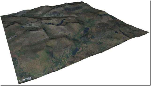
18 Hillshade Slope Base colour OS Terrain 50 Using gdaldem command


19 Using gdaldem command LIDAR Digital Surface Model (DSM)
20 GDAL/OGR Cheat Sheet GDAL Get vector information Print vector extent List vector drivers Convert between vector formats Print count of features with attributes matching a given pattern Read from a zip file Clip vectors by bounding box Clip one vector by another Reproject vector Add an index to a shapefile Add a spatial index Merge features in a vector file by attribute ("dissolve") Merge features ("dissolve") using a buffer to avoid slivers Merge vector files Get the difference between two vector files OGR Get raster information List raster drivers Force creation of world file Convert between raster formats Reproject raster Clip raster by bounding box Crop raster dimensions to vector bounding box Merge rasters Stack grayscale bands into a georeferenced RGB Export a raster for Google Earth Raster calculation (map algebra) Create a hillshade from a DEM Apply color ramp to a DEM Derek Watkins (
21 Thank you Warren Vick
Using the ADMS Mapper
 Using the ADMS Mapper Mark Attree, CERC ADMS-Urban and ADMS-Roads User Group Meeting 14 th November 2013 Newcastle Contents Introduction Key applications Using the ADMS Mapper Viewing model input Checking
Analysis & Geoprocessing: Case Studies Problem Solving
 Analysis & Geoprocessing: Case Studies Problem Solving Shawn Marie Simpson Federal User Conference 2008 3 Overview Analysis & Geoprocessing Review What is it? How can I use it to answer questions? Case
Vacation Itinerary Generation
 Vacation Itinerary Generation Sudesh Agrawal Melissa Lee Paul Ruess ORI 397 Computational Optimization November 22, 2016 Introduction For any US city, how can I maximize returns on my limited stay? Why
UNIGIS University of Salzburg. Module: ArcGIS for Server Lesson: Online Spatial analysis UNIGIS
 1 Upon the completion of this presentation you should be able to: Describe the geoprocessing service capabilities Define supported data types input and output of geoprocessing service Configure a geoprocessing
THE LIST USABILITY PUG 2007
 THE LIST USABILITY PUG 2007 Layer/Map Management Working with many layers, maps and data sets Direction that ESRI is taking with the Geodatabase Information Model Direction that ESRI is taking with GIS
Spatial Analysis with ArcGIS Pro. Krithica Kantharaj, Esri
 Spatial Analysis with ArcGIS Pro Krithica Kantharaj, Esri What is analysis? Analysis transforms raw data into information or knowledge Spatial analysis does this for geographic or spatial data Who? What?
Using the ModelBuilder of ArcGIS 9 for Landscape Modeling
 Using the ModelBuilder of ArcGIS 9 for Landscape Modeling Jochen MANEGOLD, ESRI-Germany Geoprocessing in GIS A geographic information system (GIS) provides a framework to support planning tasks and decisions,
ArcGIS Runtime: Analysis. Lucas Danzinger Mark Baird Mike Branscomb
 ArcGIS Runtime: Analysis Lucas Danzinger Mark Baird Mike Branscomb ArcGIS Runtime session tracks at DevSummit 2018 ArcGIS Runtime SDKs share a common core, architecture and design Functional sessions promote
Working with Elevation Services. Cody Benkelman
 Working with Elevation Services Cody Benkelman Outline ArcGIS Online World Elevation & 3D Elevation Cache for Pro What is included? - Data and Tools How can I use it? - Modes of use - Client Applications
QGIS document from the previous exercise: worldmap.qgs
 MAP PROJECTION 1. Introduction: All data in a GIS view must be in the same projection in order to correctly align with other datasets. In QGIS this is often done in the background. QGIS will use the projection
An Introduction to Geoprocessing
 An Introduction to Geoprocessing 1 Geoprocessing What is Geoprocessing What are Geoprocessing Models 2 What is Geoprocessing? Geoprocessing is the processing of geographic information, one of the basic
Analysis and Geoprocessing Sessions and Demo Theater Presentations
 Esri User Conference 2018 Analysis and Geoprocessing Sessions and Demo Theater Presentations TUESDAY 7/10 -------------------------------------------------------------------------------------------------------------------------------------------
ORFEO program : Methodological part Report
 ORFEO program : Methodological part Report - 2010 Introduction CNES Paris December 2010 2 Goals of the methodological part Goal: make the development of new algorithms and their validation easier Respond
Fundamentals of ModelBuilder
 Fundamentals of ModelBuilder Agenda An Overview of Geoprocessing Framework Introduction to ModelBuilder Basics of ArcToolbox Using ModelBuilder Documenting Models Sharing Models with Others Q & A Geoprocessing
Assessment of Spatiotemporal Changes in Vegetation Cover using NDVI in The Dangs District, Gujarat
 Assessment of Spatiotemporal Changes in Vegetation Cover using NDVI in The Dangs District, Gujarat Using SAGA GIS and Quantum GIS Tutorial ID: IGET_CT_003 This tutorial has been developed by BVIEER as
Session 3: Python Geoprocessing
 Session 3: Python Geoprocessing In this session we use ArcGIS geoprocessing tools in the Python window. Typically you first set your environment and extensions. For example, copy (Ctrl-C) following from
ArcGIS Pro: What s New in Analysis
 Federal GIS Conference February 9 10, 2015 Washington, DC ArcGIS Pro: What s New in Analysis James Sullivan What is analysis? Analysis transforms raw data into information or knowledge. Spatial analysis
Implementing Analysis in ArcGIS Runtime
 Esri Developer Summit March 8 11, 2016 Palm Springs, CA Implementing Analysis in ArcGIS Runtime Mike Branscomb Eric Bader David Lednik Analysis Understand Places Determine relationships Find locations
Geocoding DoubleCheck: A Unique Location Accuracy Assessment Tool for Parcel-level Geocoding
 Measuring, Modelling and Mapping our Dynamic Home Planet Geocoding DoubleCheck: A Unique Location Accuracy Assessment Tool for Parcel-level Geocoding Page 1 Geocoding is a process of converting an address
GIS Programming Practicuum
 New Course for Fall 2009 GIS Programming Practicuum Geo 599 2 credits, Monday 4:00-5:20 CRN: 18970 Using Python scripting with ArcGIS Python scripting is a powerful tool for automating many geoprocessing
ARCGIS DESKTOP DEMO (GEOCODING, SERVICE AREAS, TABULAR & SPATIAL JOINS)
") ARCGIS DESKTOP DEMO (GEOCODING, SERVICE AREAS, TABULAR & SPATIAL JOINS) Indiana State GIS Day Conference: September 22, 2015 ASHLEY SUITER GIS Data Analyst Epidemiology Resource Center Indiana State Department
ARCGIS DESKTOP DEMO (GEOCODING, SERVICE AREAS, TABULAR & SPATIAL JOINS) Indiana State GIS Day Conference: September 22, 2015 ASHLEY SUITER GIS Data Analyst Epidemiology Resource Center Indiana State Department
Between a Rock and a Hard Place
 Between a Rock and a Hard Place Will Cadell & Chris Hermansen Timberline Natural Resource Group Pt 2 1 Challenges: Proprietary Integration Open Source Integration Open Source Application To continue on
Extending GDAL/OGR and UMN MapServer
 Extending GDAL/OGR and UMN MapServer Maarten Plieger Nils de Reus Providing the building blocks for a geospatial infrastructure http://adaguc.knmi.nl/ This project is sponsored by Space for Geo-Information
Building Java Apps with ArcGIS Runtime SDK
 Building Java Apps with ArcGIS Runtime SDK Vijay Gandhi, Elise Acheson, Eric Bader Demo Source code: https://github.com/esri/arcgis-runtime-samples-java/tree/master/devsummit-2014 Video Recording: http://video.esri.com
ArcGIS Runtime SDK for Java: Building Applications. Eric
 ArcGIS Runtime SDK for Java: Building Applications Eric Bader @ECBader Agenda ArcGIS Runtime and the SDK for Java How to build / Functionality - Maps, Layers and Visualization - Geometry Engine - Routing
ArcGIS Pro: What s New in Analysis. Rob Elkins
 ArcGIS Pro: What s New in Analysis Rob Elkins ArcGIS Pro Welcome ArcGIS Pro: Analysis Rob Elkins ArcGIS Pro 1.0 Now Available = + Includes the complete ArcGIS Platform Application fusion Single, always
Network Analyst: Automating Workflows with Geoprocessing
 Esri International User Conference San Diego, California Technical Workshops July 25, 2012 Network Analyst: Automating Workflows with Geoprocessing Deelesh Mandloi Patrick Stevens Introductions Who are
Preview Guide. Contents. AUTOCAD Raster Design 2008
 AUTOCAD Raster Design 2008 Preview Guide AutoCAD Raster Design 2008 software is the leading raster application for design professionals in any industry who need to use or reuse scanned paper drawings or
AGENDA. Effective Geodatabase Management. Presentation Title. Using Automation. Mohsen Kamal. Name of Speaker Company Name
 AGENDA Effective Geodatabase Management Presentation Title Using Automation Mohsen Kamal Name of Speaker Company Name Agenda Introducing the geodatabase What is a Schema? Schema Creation Options Geoprocessing
Managing Imagery and Raster Data. Peter Becker
 Managing Imagery and Raster Data Peter Becker ArcGIS is a Comprehensive Imagery Platform Empowering you to make informed decisions System of Engagement System of Insight Extract Information from Imagery
Geocoding An Introduction
 2013 Esri International User Conference July 8 12, 2013 San Diego, California Technical Workshop Geocoding An Introduction Miriam Schmidts Agatha Wong Esri UC2013. Technical Workshop. Agenda What is geocoding?
Managing and serving large collections of imagery
 IOP Conference Series: Earth and Environmental Science OPEN ACCESS Managing and serving large collections of imagery To cite this article: V Viswambharan 2014 IOP Conf. Ser.: Earth Environ. Sci. 18 012062
RADAR ANALYST WORKSTATION MODERN, USER-FRIENDLY RADAR TECHNOLOGY IN ERDAS IMAGINE
 RADAR ANALYST WORKSTATION MODERN, USER-FRIENDLY RADAR TECHNOLOGY IN ERDAS IMAGINE White Paper December 17, 2014 Contents Introduction... 3 IMAGINE Radar Mapping Suite... 3 The Radar Analyst Workstation...
Military Tools for ArcGIS: An Introduction. Derek Foll Lyle Wright
 Military Tools for ArcGIS: An Introduction Derek Foll Lyle Wright Defense Solutions Current Capabilities Whole Organization Intelligence Analysis Civil-Military Operations Military Tools for ArcGIS Coordinate
Landslide susceptibility mapping: A remote sensing based approach using QGIS 2.2 (Valmiera)
") Record 2014/56 GeoCat 82438 Landslide susceptibility mapping: A remote sensing based approach using QGIS 2.2 (Valmiera) Technical manual Metz, L. and Bear-Crozier, A.N. APPLYING GEOSCIENCE TO AUSTRALIA
Record 2014/56 GeoCat 82438 Landslide susceptibility mapping: A remote sensing based approach using QGIS 2.2 (Valmiera) Technical manual Metz, L. and Bear-Crozier, A.N. APPLYING GEOSCIENCE TO AUSTRALIA
Features and Benefits
 AutoCAD Raster Design 2010 Features and Benefits Make the most of rasterized scanned drawings, maps, aerial photos, satellite imagery, and digital elevation models. Get more out of your raster data and
Semi-Automatic Classification Plugin Documentation
 Semi-Automatic Classification Plugin Documentation Release 5.3.2.1 Luca Congedo February 05, 2017 Contents I Introduction 1 II Plugin Installation 5 1 Installation in Windows 32 bit 9 1.1 QGIS download
A Web Application That Can Save You Money
 Esri Southwest Conference December 2-4, 2014 Santa Fe, NM A Web Application That Can Save You Money Colleen Swain, Swain GIS Services, LLC Brian Zheng, East Bay Municipal Utility District Problem Background
Downloading Imagery & LIDAR
 Downloading Imagery & LIDAR 333 Earth Explorer The USGS is a great source for downloading many different GIS data products for the entire US and Canada and much of the world. Below are instructions for
Watershed Sciences 4930 & 6920 GEOGRAPHIC INFORMATION SYSTEMS
 Slides by Wheaton et al. (2009-2014) are licensed under a Creative Commons Attribution-NonCommercial-ShareAlike 3.0 Unported License Watershed Sciences 4930 & 6920 GEOGRAPHIC INFORMATION SYSTEMS INTRODUCTION
Qt Developing ArcGIS Runtime Applications. Eric
 Qt Developing ArcGIS Runtime Applications Eric Bader @ECBader Agenda Getting Started Creating the Map Geocoding and Routing Geoprocessing Message Processing Working Offline The Next Release What s Coming
Creating Geoprocessing Services
 Esri International User Conference San Diego, California Technical Workshops July 25, 2012 Creating Geoprocessing Services Kevin Hibma, Scott Murray Analysis and Geoprocessing Resource Center Quick Links:
Generic Tools Description and User Manual
 This project has received funding from the European Union s Horizon 2020 research and innovation programme under grant agreement No 687289 Coastal Waters Research Synergy Framework Tools Document Code:
Provides the data analysis, management and
 Leveraging g the Geoprocessing Framework in ArcGIS Engine in.net (Best Practices) Jason Pardy Corey Tucker UC 2006 Tech Session 1 Workshop Outline What is Geoprocessing Accessing and Running Geoprocessing
Top 10 Things at Esri UC 2015 & ArcGIS Pro
 Top 10 Things at Esri UC 2015 & ArcGIS Pro Jim Tochterman, VP - Research & Development Who is BCS? Formed in 1998 in Aiken, SC Privately held and woman-owned Primary focus is GIS for Public Safety Esri
Spatial Analyst is an extension in ArcGIS specially designed for working with raster data.
 Spatial Analyst is an extension in ArcGIS specially designed for working with raster data. 1 Do you remember the difference between vector and raster data in GIS? 2 In Lesson 2 you learned about the difference
Public Safety Geocoding Using ArcGIS Online and HERE Data
 Public Safety Geocoding Using ArcGIS Online and HERE Data I. Knowledge, Skills, and Abilities (KSAs) Supported This training module aids in the development of several KSAs that are fundamental to using
HARRIS GEOSPATIAL MARKETPLACE. HarrisGeospatial.com
 HARRIS GEOSPATIAL MARKETPLACE HarrisGeospatial.com Satellite image of Washington, D.C. Image courtesy of DigitalGlobe GET IT ALL IN ONE PLACE Data for Any Project Map Products Vis/Sim Products Geospatial
Integration of GIS with Coastal Simulations for. Real-world Applications
 Integration of GIS with Coastal Simulations for Real-world Applications Master of Science, Systems Science Project Report submitted to Department of Computer Science, Louisiana State University Rakesh
Integrating 3D Optical Imagery with Thermal Remote Sensing for Evaluating Bridge Deck Conditions
 Integrating 3D Optical Imagery with Thermal Remote Sensing for Evaluating Bridge Deck Conditions Richard Dobson www.mtri.org Project History 3D Optical Bridge-evaluation System (3DOBS) Proof-of-Concept
Michigan Technological University. Characterization of Unpaved Road Condition Through the Use of Remote Sensing
 Michigan Technological University Characterization of Unpaved Road Condition Through the Use of Remote Sensing Deliverable 6-A: A Demonstration Mission Planning System for use in Remote Sensing the Phenomena
bhuvan Gateway to Indian Earth Observation Data Products & Services ISRO s Geoportal
 bhuvan ISRO s Geoportal Gateway to Indian Earth Observation Data Products & Services One-stop versatile Web based Earth Observation Data Products & Services Interactive 3D Environment Societal Applications
Campus GIS (Tsukuba University Campus Geospatial Information)
") Campus GIS (Tsukuba University Campus Geospatial Information) User Manual Draft version 3.0 20130402 Department Homepage http://giswin.geo.tsukuba.ac.jp/sis/jp/ 1 Contents 1. Graphical User Interface 2.
Campus GIS (Tsukuba University Campus Geospatial Information) User Manual Draft version 3.0 20130402 Department Homepage http://giswin.geo.tsukuba.ac.jp/sis/jp/ 1 Contents 1. Graphical User Interface 2.
Lab#2: Five Dimensions of GIS Data
 NRM338 Fall 2018 Lab#1 Page#1 of 13 Lab#2: Five Dimensions of GIS Data In this lab, we will explore five basic dimensions of GIS data Location or position Length and Area Measures (M-dimension) Elevation
Using Imagery for Intelligence Analysis. Jim Michel Renee Bernstein
 Using Imagery for Intelligence Analysis Jim Michel Renee Bernstein Deriving Value from GIS and Imagery Capabilities Evolved Along Separate but Parallel Paths GIS Imagery brings value Imagery Contextual
GEO/EVS 425/525 Unit 9 Aerial Photograph and Satellite Image Rectification
 GEO/EVS 425/525 Unit 9 Aerial Photograph and Satellite Image Rectification You have seen satellite imagery earlier in this course, and you have been looking at aerial photography for several years. You
Development of Mosaic Datasets and Image Services for Bathymetric Data
 Development of Mosaic Datasets and Image Services for Bathymetric Data Jesse Varner Cooperative Institute for Research in Environmental Sciences (CIRES), University of Colorado John Cartwright NOAA National
Packaging Projects, Maps and Layers. Shilpi Jain Melanie Summers
 Packaging Projects, Maps and Layers Shilpi Jain Melanie Summers What can be packaged Layer Map Project Layer package (.lypkx) Tile package (.tpk) Scene layer package (.slpk) Map package (.mpkx) Mobile
SECTION GEOGRAPHIC INFORMATION SYSTEM (GIS)
") PART 1 - GENERAL 1.1 DESCRIPTION SECTION 11 83 01 A. Provide all labor, materials, manpower, tools and equipment required to furnish, install, activate and test a new Geographic Information System (GIS).
PART 1 - GENERAL 1.1 DESCRIPTION SECTION 11 83 01 A. Provide all labor, materials, manpower, tools and equipment required to furnish, install, activate and test a new Geographic Information System (GIS).
RADARSAT-2/RCM Synthetic Aperture Radar data exploitation for military geomatics via ArcGIS
 RADARSAT-2/RCM Synthetic Aperture Radar data exploitation for military geomatics via ArcGIS Presented by: Greg Barrie, Defence Scientist, DRDC Ottawa October 17, 2018 Defence R&D Canada (DRDC) What we
GIS and Remote Sensing BIO8014. Data acquisition
 GIS and Remote Sensing BIO8014 Data acquisition Introduction Data can be manually created Data can be obtained from a wide range of providers both free and at cost Acquisition is key and must be accounted
MSB 2011 LiDAR & Imagery Project - File Management Schema
 MSB 2011 LiDAR & Imagery Project - File Management Schema The Matanuska-Susitna Borough 2011 LiDAR & Imagery project produced a large number of datasets that are typically made available via portable hard
Sharing Oblique and Oriented Imagery. Cody Benkelman Cristelle D Souza UC2018
 Sharing Oblique and Oriented Imagery Cody Benkelman Cristelle D Souza UC2018 Image Orientation Image Orientation Mosaic Dataset Image Orientation Oriented Imagery Oblique Imagery Oblique imagery modes
Laboratory Exercise 1
 Page 1 Laboratory Exercise 1 GEOG*2420 The Earth From Space University of Guelph, Department of Geography Prof. John Lindsay Fall 2013 Total of 32 marks Learning objectives The intention of this lab exercise
EDUCATION GIS CONFERENCE Geoprocessing with ArcGIS Pro. Rudy Prosser GISP CTT+ Instructor, Esri
 EDUCATION GIS CONFERENCE Geoprocessing with ArcGIS Pro Rudy Prosser GISP CTT+ Instructor, Esri Maintenance What is geoprocessing? Geoprocessing is - a framework and set of tools for processing geographic
LizardTech. GeoExpress 9.5. User Manual
 LizardTech GeoExpress 9.5 User Manual Copyright 2009 2016 Celartem, Inc. d.b.a. LizardTech. All rights reserved. Information in this document is subject to change without notice. The software described
Semi-Automatic Classification Plugin Documentation
 Semi-Automatic Classification Plugin Documentation Release 6.1.0.1 Luca Congedo Jun 13, 2018 Contents 1 Introduction 1 2 Plugin Installation 3 2.1 Installation in Windows 32 bit....................................
Esri UC 2014 Technical Workshop
 Introduction to Parcel Fabric Amir Plans Parcels Control 1 Points 1-1 Line Points - Lines Editing and Maintaining Parcels using Deed Drafter and ArcGIS Desktop What is a parcel fabric? Dataset of related
GIS-Based Plan and Profile Mapping
 GIS-Based Plan and Profile Mapping ESRI International User Conference 2010 July 12-16, 2010 Maik Flanagin U.S. Army Corps of Engineers, MVN New Orleans, Louisiana maik.c.flanagin@usace.army.mil Sam Falchook
Realigning Historical Census Tract and County Boundaries
 Realigning Historical Census Tract and County Boundaries David Van Riper Research Fellow Minnesota Population Center University of Minnesota Twin Cities dvanriper@gmail.com Stanley Dallal ESEA dallal@esea.com
The NAGI Fusion Method: A New Technique to Integrate Color and Grayscale Raster Layers
 Mountain and Glacier Mapping The NAGI Fusion Method: A New Technique to Integrate Color and Grayscale Raster Layers Rajinder S. Nagi and Aileen R. Buckley Esri, Redlands, CA, USA rnagi@esri.com, abuckley@esri.com
Chapter 10. What is geocoding?
 Chapter 10 Geocoding 10-1 Copyright McGraw-Hill Education. Permission required for reproduction or display. What is geocoding? The process of assigning a location, usually in the form of coordinate values
Using Soil Productivity to Assess Agricultural Land Values in North Dakota
 Using Soil Productivity to Assess Agricultural Land Values in North Dakota STUDENT HANDOUT Overview Why is assigning a true and full value to agricultural land parcels important? Agricultural production
ERDAS IMAGINE Suite Comparison
 ERDAS Suite Comparison A brief comparison of Essentials, Advantage and Professional age 1 of 7 Overview This document provides a brief comparison of the main features and capabilities found within the
Rapid Airfield Construction Decision Support Toolset
 Rapid Airfield Construction Decision Support Toolset Scott Bourne ERDC Scott.Bourne@erdc.usace.army.mil 601-634-3980 Introduction One of the greatest challenges to the U.S. Army s Rapid Deployment concept
ANNEX IV ERDAS IMAGINE OPERATION MANUAL
 ANNEX IV ERDAS IMAGINE OPERATION MANUAL Table of Contents 1. TOPIC 1 DATA IMPORT...1 1.1. Importing SPOT DATA directly from CDROM... 1 1.2. Importing SPOT (Panchromatic) using GENERIC BINARY... 7 1.3.
Autodesk Raster Design for Mapping and Land Development Professionals
 11/28/2005-8:00 am - 9:30 am Room:Pelican 2 (Swan) Walt Disney World Swan and Dolphin Resort Orlando, Florida Autodesk Raster Design for Mapping and Land Development Professionals David Zavislan - Nolte
Landscape Lighting Techniques for Cartography Using ArcGIS. Jeffery S. Nighbert Bureau of Land Management Portland, Oregon
 Landscape Lighting Techniques for Cartography Using ArcGIS Jeffery S. Nighbert Bureau of Land Management Portland, Oregon Context: Cartographic Realism Movement Greater understanding in the mind of the
How to Avoid Landmines: Managing your Motion Graphics Projects
 How to Avoid Landmines: Managing your Motion Graphics Projects -Richard Harrington, PMP www.rhedpixel.com 703.560.0220 Import Tips Double-Click in Project Window Shift-Click Multiple Items Organize in
Geospatial Keynote Nordic Civil konference I Vejle Bentley Systems, Incorporated 2016 Bentley Systems, Incorporated
 Geospatial Keynote Nordic Civil konference 07.11.2016 I Vejle 1 WWW.BENTLEY.COM 2016 Bentley Systems, Incorporated 2016 Bentley Systems, Incorporated Introduction Johannes Klick Senior Support Manager
Wetlands Investigation Utilizing GIS and Remote Sensing Technology for Lucas County, Ohio: a hybrid analysis.
 Wetlands Investigation Utilizing GIS and Remote Sensing Technology for Lucas County, Ohio: a hybrid analysis. Update on current wetlands research in GISAG Nathan Torbick Spring 2003 Component One Remote
Copyright The McGraw-Hill Companies, Inc. Permission required for reproduction or display.
 Chapter 16. GEOCODING AND DYNAMIC SEGMENTATION 16.1 Geocoding 16.1.1 Geocoding Reference Database 16.1.2 The Address Matching Process 16.1.3 Address Matching Options Box 16.1 Scoring System for Geocoding
Semi-Automatic Classification Plugin Documentation
 Semi-Automatic Classification Plugin Documentation Release 5.3.6.1 Luca Congedo Apr 13, 2018 Contents 1 Introduction 1 2 Plugin Installation 3 2.1 Installation in Windows 32 bit....................................
The Benefits and Appropriate Use of Base Flood Approximate Shapefiles to Calculate Zone A Base Flood Elevations. Jeremy Kirkendall, CFM June 12, 2013
 The Benefits and Appropriate Use of Base Flood Approximate Shapefiles to Calculate Zone A Base Flood Elevations Jeremy Kirkendall, CFM June 12, 2013 Federal Emergency Management Agency (FEMA) Flood Insurance
The power of virtual globes for valorising cultural heritage and enabling sustainable tourism: NASA World Wind applications
 The power of virtual globes for valorising cultural heritage and enabling sustainable tourism: NASA World Wind applications Maria Antonia Brovelli*, Patrick Hogan**, Marco Minghini*, Giorgio Zamboni* *
GEOGRAPHIC MODELLING AND ANALYSIS
 GEOGRAPHIC MODELLING AND ANALYSIS I. INTRODUCTION A. Background Geographic Information System is organized within a GIS so as to optimize the convenience and efficiency with they can be used. To distinguish
HMA Architecture WG Meeting,
 www.dlr.de Chart 1 DLR Online Data Access Status D-SDA Geoservice Team, S. Kiemle 2012-02-15 DLR EO Online Data Access Status HMA Architecture WG Meeting, 2012-02-15 www.dlr.de Chart 2 DLR Online Data
Geomatica I Course Guide Version 10.1
 Geomatica I Course Guide Version 10.1 Geomatica Version 10.1 2007 PCI Geomatics Enterprises Inc.. All rights reserved. COPYRIGHT NOTICE Software copyrighted by PCI Geomatics, 50 West Wilmot St., Suite
GEO/EVS 425/525 Unit 2 Composing a Map in Final Form
 GEO/EVS 425/525 Unit 2 Composing a Map in Final Form The Map Composer is the main mechanism by which the final drafts of images are sent to the printer. Its use requires that images be readable within
LAND SURFACE TEMPERATURE MONITORING THROUGH GIS TECHNOLOGY USING SATELLITE LANDSAT IMAGES
 Abstract LAND SURFACE TEMPERATURE MONITORING THROUGH GIS TECHNOLOGY USING SATELLITE LANDSAT IMAGES Aurelian Stelian HILA, Zoltán FERENCZ, Sorin Mihai CIMPEANU University of Agronomic Sciences and Veterinary
Applying Colour & Style. Christopher Wesson London Borough of Redbridge
 Applying Colour & Style Christopher Wesson London Borough of Redbridge The components of colour Generally, the colours on our maps are made up of combinations of Red Green Blue from light sources such
Module 3: Introduction to QGIS and Land Cover Classification
 Module 3: Introduction to QGIS and Land Cover Classification The main goals of this Module are to become familiar with QGIS, an open source GIS software; construct a single-date land cover map by classification
Street Canyon Tool. User Guide CERC
 Street Canyon Tool User Guide CERC ADMS Street Canyon Tool Version 2.0 User Guide August 2018 Cambridge Environmental Research Consultants Ltd. 3, King s Parade Cambridge CB2 1SJ UK Telephone: +44 (0)1223
ArcGIS 9 Using ArcGIS StreetMap
 ArcGIS 9 Using ArcGIS StreetMap Copyright 2001 2004 ESRI All Rights Reserved. Printed in the United States of America. The information contained in this document is the exclusive property of ESRI. This
How to put the Image Services in the Living Atlas to Work in Your GIS. Charlie Frye, Chief Cartographer Esri, Redlands
 How to put the Image Services in the Living Atlas to Work in Your GIS Charlie Frye, Chief Cartographer Esri, Redlands Image Services in the Living Atlas of the World Let s have a look: https://livingatlas.arcgis.com
INTRODUCTION TO SNAP TOOLBOX
 INTRODUCTION TO SNAP TOOLBOX EXERCISE 1 (Exploring S2 data) Data: Sentinel-2A Level 1C: S2A_MSIL1C_20180303T170201_N0206_R069_T14QNG_20180303T221319.SAFE 1. Open file 1.1. File / Open Product 1.2. Browse
Ge111A Remote Sensing and GIS Lecture
 Ge111A Remote Sensing and GIS Lecture Remote Sensing - many different geophysical data sets. We concentrate on : Imagery (optical, infrared and radar) Topography Geographical Information Systems (GIS)
Railway Training Simulators run on ESRI ArcGIS generated Track Splines
 Railway Training Simulators run on ESRI ArcGIS generated Track Splines Amita Narote 1, Technical Specialist, Pierre James 2, GIS Engineer Knorr-Bremse Technology Center India Pvt. Ltd. Survey No. 276,
An ESRI White Paper May 2009 ArcGIS 9.3 Geocoding Technology
 An ESRI White Paper May 2009 ArcGIS 9.3 Geocoding Technology ESRI 380 New York St., Redlands, CA 92373-8100 USA TEL 909-793-2853 FAX 909-793-5953 E-MAIL info@esri.com WEB www.esri.com Copyright 2009 ESRI
Grant Boxer Consultant Geologist March 10th 2014 (Updated Nov 2014)
") Grant Boxer Consultant Geologist March 10th 2014 (Updated Nov 2014) Work flow for Landsat 8 Landgate Data Selecting and processing basic data Importing into MapInfo Applications SLIP Portal WMS access
Grant Boxer Consultant Geologist March 10th 2014 (Updated Nov 2014) Work flow for Landsat 8 Landgate Data Selecting and processing basic data Importing into MapInfo Applications SLIP Portal WMS access