New Jersey Regional Sediment Management
|
|
|
- Julianna Ryan
- 5 years ago
- Views:
Transcription


1 New Jersey Regional Sediment Management
2 RSM Demo: Cape May Inlet / Wildwood Sand Bypassing Project Ocean County N Atlantic Ocean Atlantic County Delaware Bay Cape May County Miles Regional Sediment Management Analysis Segments Island Beach Long Beach Island Brigantine Island Absecon Island Ocean City Ludlam Island Seven Mile Island The Wildwoods Cape May

3 Cape May Wildwoods Historical Shorelines

4 Cape May Meadows Shoreline Change

5 Cape May Inlet Historical Shorelines

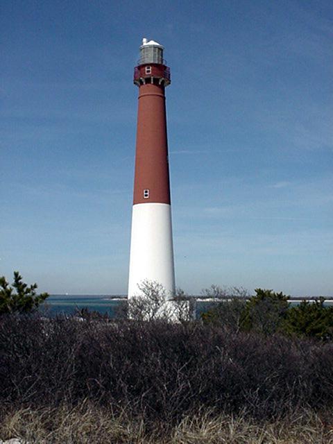
6 Cape May Inlet - Looking West

7 Cape May Inlet Looking Northeast Wildwood

8 Cape May Inlet and Vicinity Stone Harbor Beachfill 2.2 MCY FY03 S.H. Pt. Eco System Restoration Hereford Inlet Seawall FY04 Pond Creek Ecorestoration
9 RSM Demo Cape May Inlet Sand Bypassing BENEFITS Cost Effective Nourishment for Cape May City/Coast Guard Identify Alternative Borrow Source to Offshore Extends usage of finite offshore resources Minimizes Environmental Impacts to offshore sites Reduce Excess Sediment at Wildwood (Clogged Outfalls, Safety, Ponding) Reduce Potential Shortfall of Present Borrow Site Obtains multiple uses of sediment already in littoral system Develops inter-community and inter-agency working group for sediment management issues
10 RSM Demo Cape May Inlet Sand Bypassing Benefits cont. Provide model for other communities for developing sediment management plans Provide sample procedures for other communities for equipment needs and methods of purchase Provide framework for inter-community loan of sediment moving equipment AUTHORITIES Existing Authorized Beach Erosion Control Project/Projects NJDEP and Municipalities Interested New Initiatives/ Partnerships

11 Proposed RSM Alternative Cape May Inlet Sand Bypassing
12 Cape May Inlet Sand Bypassing Potential Options 1. Fixed or Semi-Fixed sand bypassing Plant on CG property NE. of Inlet. More-or-less continuous (low) level of sand bypassing across Cape May Inlet 2. Mechanical removal of sand, presumably by mobile pan scrapers, along the beaches of Wildwood and Wildwood Crest, stockpiling of sand at the east Cape May Inlet jetty. #1 to move sand across Cape May Inlet
13 Cape May Inlet Sand Bypassing Potential Options 3. Permanent installation of infrastructure necessary for hydraulic transport of sediment from the updrift beaches to the vicinity of the east jetty at Cape May Inlet Buried Pipes 4. Periodic (i.e., once per year, or less frequently) dredging from the east jetty fillet by means of a conventional floating hydraulic pipeline dredge.
14 Proposed RSM Alternative Cape May Inlet Sand Bypassing

15 Bypass Plant Bypass Eductor & Crane at work

16 Wildwood, NJ. October 2001


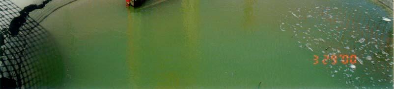

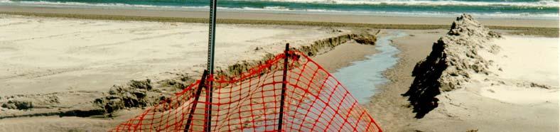
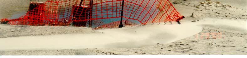
17 Clogged Outfalls Wildwood, NJ


18 Approx. MHW Wildwood, NJ April ft Pier ~1/4 mile Outfalls Boardwalk
19 RSM Demo Project Direct Borrow from Wildwood Beaches for Cape May Project BENEFITS Provide High Quality Beach Sand as Alternative to Depleted Offshore Borrow Areas Ample Quantity (Enough for 10+ Nourishment Cycles) Reduce Problems of Excess Sand at Wildwood AUTHORITIES Existing Authorized Beach Erosion Control Project (Cape May) NJDEP and Municipalities Interested IMPACT Management of Sand Resources on a Regional Scale would Benefit both Cape May and Wildwood Communities Requires Non-Standard Dredging Operation to Mine Sand from the Beach
20 RSM Demo Project Cape May Region Future Plans Continue Environmental and Resource Agency Coordination Coordinate with Dredging Companies to Develop improved Methods of Dredging from Beaches Determine Optimal Borrow Configuration based on Coastal Processes Coordinate Proposed Borrow Configuration with State and Local Municipalities Plan for Implementation in an upcoming Cape May Nourishment Cycle and or future Hereford to Cape May Project.
Philadelphia District: Cape May County, New Jersey
 ERDC/RSM-DB6, June 2003 Regional Sediment Management (RSM) Demonstration Program Project Brief Philadelphia District: Cape May County, New Jersey ISSUE The Atlantic coast of New Jersey extends from Sandy
2012 STATUS REPORT NJ BEACHES AND INLETS PHILADELPHIA DISTRICT, USACE
 2012 STATUS REPORT NJ BEACHES AND INLETS PHILADELPHIA DISTRICT, USACE Jeff Gebert, Coastal Planning, USACE Philadelphia Philadelphia District Established 1866 Delaware River Basin Parts of 5 states 9 million
Dredging, Beach Nourishment and. Bird Conservation Workshop Atlantic Coast Region
 Dredging, Beach Nourishment and US Army Corps Bird Conservation Workshop Atlantic Coast Region Beach Nourishment and Bird Habitat Restoration in Southern New Jersey Shore Protection and Ecosystem Restoration
TABLE OF CONTENTS. Executive Summary 1 Acknowledgements 3 Introduction 3 Storm Recovery and Beach Project Effectiveness 3
 TABLE OF CONTENTS Executive Summary 1 Acknowledgements 3 Introduction 3 Storm Recovery and Beach Project Effectiveness 3 Monmouth County 4 Figures 1a-1d. Monmouth County Station Locations 5 Site Descriptions
State of New Jersey Chris Christie, Governor. Dept. of Environmental Protection Bob Martin, Commissioner
 Cape May Beach 2016/2017 Renourishment Cape May Inlet to Lower Township & Lower Cape May Meadows Cape May Point Cape May County, New Jersey New Jersey Department of Environmental Protection Engineering
New Jersey Dept. of Environmental Protection Shore Protection Program
 New Jersey Dept. of Environmental Protection Benjamin Keiser, Manager 1510 Hooper Avenue, Suite 140 Toms River, New Jersey 08753 1-732-255-0767 New Jersey s State of New Jersey Chris Christie, Governor
New Jersey Dept. of Environmental Protection Shore Protection Program
 New Jersey Dept. of Environmental Protection William Dixon, Acting Manager 1510 Hooper Avenue, Suite 140 Toms River, New Jersey 08753 1-732-255-0767 New Jersey s State of New Jersey Chris Christie, Governor
Corps Dredge Plan 2016 Emily Hughes Env Resources, USACE BUILDING STRONG
 Corps Dredge Plan 2016 Emily Hughes Env Resources, USACE Goodbye Jeff Richter!! Navigation/Operations USACE Goal/Mission: To maintain safe Navigation in Federal Channels using methods that are most (1)
Sector Delaware Bay/District 5NR - Coast Guard Auxiliary Patrol Areas. Eastern Area
 Enclosure (2) to SECDELBAYINST 16790.1F Sector Delaware Bay/District 5NR - Coast Guard Auxiliary Patrol Areas STA Manasquan Inlet: (Div 16) Eastern Area Station (Small) Shark River: AREA 1 Shark River
Endangered Species Monitoring - Northern Coastline of New Jersey
 Endangered Species Monitoring - Northern Coastline of New Jersey By: Mark H. Burlas, Sr. Wildlife Biologist U.S. Army Corps of Engineers New York District Planning Division Presentation Format Project
Cat Island Chain Restoration Project Brown County Port & Resource Recovery Department
 Cat Island Chain Restoration Project Brown County Port & Resource Recovery Department February 2, 2015 Fox River and Lower Green Bay Cat Island Chain - 1938 Cat Island Brown County Aerial Photography,
Update on American Oystercatcher Reseach and Conservation in New Jersey
 Update on American Oystercatcher Reseach and Conservation in New Jersey - 2007 Todd Pover, New Jersey Division of Fish and Wildlife - Endangered and Nongame Species Program Tom Virzi, PhD Candidate Department
Beach Nourishment in Galveston, Texas A Long Term Plan For Success
 Beach Nourishment in Galveston, Texas A Long Term Plan For Success Reuben Trevino, Director of Operations Galveston Island Park Board of Trustees Parks & Natural Areas (PNA) Sub-Committee Natural Resources
Palm Beach County. Estuarine Habitat Mapping
 Palm Beach County Estuarine Habitat Mapping Coastal Habitat Integrated Mapping and Monitoring Program (CHIMMP) April 29, 2014 Eric Anderson, Environmental Analyst Palm Beach County Department of Environmental
Beach Management Funding Assistance Program
 DEPARTMENT OF ENVIRONMENTAL PROTECTION Division of Water Resource Management January 23, 2014 Fixed Capital Outlay Local Government Funding Requests For FY 2014/2015 TABLE OF CONTENTS Introduction... 4
Piping Plover Nesting Results in New Jersey: 2017
 Piping Plover Nesting Results in New Jersey: 2017 Prepared by Emily Heiser, Wildlife Biologist Conserve Wildlife Foundation of New Jersey and Christina Davis, Environmental Specialist II New Jersey Division
City of Cape May Master Plan Reexamination. Open House - April 16, 2018
 City of Cape May Master Plan Reexamination Open House - April 16, 2018 2 What is a Master Plan Vision for the municipality Provides direction and guidance for the growth, resource preservation, and land
1. Qualitative Assessment... II-101
 Table of Contents I. Introduction... I-1 A. Session Law 2009-479 / House Bill 709... I-2 B. Public Consultation... I-3 C. Selection of Study Sites... I-5 D. Limitations of Study... I-8 II. Physical Assessment...
Southeast O ahu (SEO) Regional Sediment Management (RSM) Workshop #2 June 1, 2005 Ko olau Golf Course
 Regional Sediment Management (RSM) Workshop #2 June 1, 2005 Ko olau Golf Course") Southeast O ahu (SEO) Regional Sediment Management (RSM) Workshop #2 June 1, 2005 Ko olau Golf Course 1 June 2005 Southeast O ahu RSM Workshop #2 1 Agenda Welcome and Introductions Mr. Sam Lemmo Summary
Southeast O ahu (SEO) Regional Sediment Management (RSM) Workshop #2 June 1, 2005 Ko olau Golf Course 1 June 2005 Southeast O ahu RSM Workshop #2 1 Agenda Welcome and Introductions Mr. Sam Lemmo Summary
Economic Values Generated by the New Jersey Shore for Climate Change and Coastal Hazards Conference
 Economic Values Generated by the New Jersey Shore for Climate Change and Coastal Hazards Conference Professor Joseph J. Seneca Bloustein School of Planning and Public Policy, Rutgers University 25 May
Taking RSM to the Next Level
 Taking RSM to the Next Level Q AVG Jackie Keiser Chief, Coastal and Navigation USACE Jacksonville District Q AVG RSM & EWN In-Progress Review 21 July 2014 US Army Corps of Engineers BUILDING STRONG RSM:
Ensuring habitat considerations in beach and shoreline management along Delaware Bay a bay wide perspective.
 Ensuring habitat considerations in beach and shoreline management along Delaware Bay a bay wide perspective. Kimberly B. Cole, David B. Carter, Tricia K. Arndt Delaware Coastal Programs Delaware Bay Coastal
Application of an Artificial Neural Network to Predict Tidal Currents in an Inlet
 Application of an Artificial Neural Network to Predict Tidal Currents in an Inlet by Wenrui Huang and Catherine Murray PURPOSE: The Coastal and Hydraulics Engineering Technical Note (CHETN) herein describes
ATLANTIC COUNTY MUNICIPAL JOINT INSURANCE FUND 2018 RISK MANAGEMENT CONSULTANTS
 Absecon City Michael F Thomas Acct Mgr: Brian Kenny Glenn Insurance, Inc 500 East Absecon Blvd. mthomas@glenninsurance.com Avalon Borough Michael McLaughlin Brigantine City J Eugene Siracusa Siracusa Kaufmann
Instruction with Hands-on Practice: Creating a Bathymetric Database & Datum Conversion
 Instruction with Hands-on Practice: Creating a Bathymetric Database & Datum Conversion Tanya Beck Coastal and Hydraulics Laboratory Engineer Research and Development Center May 17, 2010 US Army Corps of
New Jersey PRESERVING OUR WATERFOWLING TRADITION THROUGH HABITAT CONSERVATION!
 New Jersey PRESERVING OUR WATERFOWLING TRADITION THROUGH HABITAT CONSERVATION! he Delaware Bay and the New York Bight watersheds provide a multitude of critical wetland and upland habitats for fish and
LAKE HOPATCONG. Lake Hopatcong, New Jersey
 LAKE HOPATCONG Lake Hopatcong, New Jersey Presentation to NEIWPCC May 20, 2008 by Ken Klipstein, Director NJWSA Watershed Protection Unit and Pat Rector, NJDEP Div. Watershed Management LAKE HOPATCONG
Appendix B. Historical Aerial Photograph Review
 . Historical Aerial Photograph Review A historical aerial photo review was conducted to document changes in site use and layout at T-108 over time. Photos from 1936 (King County 2008), 1946 (Aerial Photo
Management Unit 2: East Beach to West Beach, Selsey
 Management Unit 2: East Beach to West Beach, Selsey Unit limits 4400m from 487200E, 094300N to 484450E, 093100N This Unit also forms Unit 1 of the South Downs SMP. Coastal processes The Selsey peninsula,
Ray Allen Executive Director (361)
") Ray Allen Executive Director (361)885-6204 rallen@cbbep.org www.cbbep.org CBBEP History 1987 U.S. Congress established the National Estuary Program (NEP) to promote longterm planning and management of
Ray Allen Executive Director (361)885-6204 rallen@cbbep.org www.cbbep.org CBBEP History 1987 U.S. Congress established the National Estuary Program (NEP) to promote longterm planning and management of
Wetland Restoration at Blackwater NWR. Dixie Birch November 2, 2006
 Wetland Restoration at Blackwater NWR Dixie Birch November 2, 2006 Goal: Restore 20,000 acres In Dorchester County including 11,000 at Blackwater Strategic Partnerships Remaining marsh shown in red Blackwater
COOK INLET NAVIGATION CHANNEL
 COOK INLET NAVIGATION CHANNEL 1-5 COOK INLET NAVIGATION CHANNEL, ALASKA (CWIS NO. 10324, 10534) Condition of Improvement 30 September 2011 AUTHORIZATION: (1) Water Resources Development Act of 1996 (Public
LONG ISLAND TIDAL WETLANDS TRENDS ANALYSIS PROJECT
 LONG ISLAND TIDAL WETLANDS TRENDS ANALYSIS PROJECT a presentation to The LIS Tidal Wetlands Loss Workshop October 22, 2014 prepared by Cameron Engineering & Associates, LLP In association with Land Use
THE SPATIAL AND TEMPORAL DISTRIBUTION OF PIPING PLOVERS IN NEW JERSEY: CHRISTINA LIN KISIEL. A Thesis submitted to the
 THE SPATIAL AND TEMPORAL DISTRIBUTION OF PIPING PLOVERS IN NEW JERSEY: 1987-2007 by CHRISTINA LIN KISIEL A Thesis submitted to the Graduate School-New Brunswick Rutgers, The State University of New Jersey
National Park Service Beach Access Report for July 31, 2008
 National Park Service U.S. Department of the Interior Outer Banks Group: Cape Hatteras National Seashore Fort Raleigh National Historic Site Wright Brothers National Memorial 1401 National Park Road Manteo,
Information for File # RMM
 Information for File # 3-4-RMM Applicant:, L.P. Corps Contact: Ryan Malterud Address: 8 Fifth Street East, St. Paul, Minnesota 56 E-Mail: Ryan.M.Malterud@usace.army.mil Phone: (65) 9-586 Primary County:
Piping Plovers - An Endangered Beach Nesting Bird, and The Threat of Habitat Loss With. Predicted Sea Level Rise in Cape May County.
 Piping Plovers - An Endangered Beach Nesting Bird, and The Threat of Habitat Loss With Thomas Thorsen May 5 th, 2009 Predicted Sea Level Rise in Cape May County. Introduction and Background Piping Plovers
Goal: Effective Decision Making
 Goal: Effective Decision Making Objective 1. Enhance inter-agency coordination Focus on aspects of governmental decision-making (NEPA and other existing siting/regulatory programs) related to marine energy
Distribution of Piping Plover and Coastal Birds in Relation to Federal Activities on the Southern Coast of Long Island
 U.S. U.S. Fish Fish & Wildlife & Wildlife Service Service Distribution of Piping Plover and Coastal Birds in Relation to Federal Activities on the Southern Coast of Long Island Implications for Project
Lower Cape May Meadows Ecological Restoration: Analysis of Economic and Social Benefits
 Lower Cape May Meadows Ecological Restoration: Analysis of Economic and Social Benefits Elizabeth Schuster, Environmental Economist The Nature Conservancy June 2014 Contact Elizabeth Schuster at eschuster@tnc.org
Oil Spill Funds and the Opportunities they Present for Galveston Bay
 Oil Spill Funds and the Opportunities they Present for Galveston Bay A presentation to Texas Environmental Grantmakers Group By Bob Stokes, President, Galveston Bay Foundation Friday, October 31, 2014
Richard A. Fischer, Ph.D. U.S. Army Engineer Research and Development Center Environmental Laboratory
 Regional Sediment Management - Beneficial Uses of Dredged Material Along Lake Erie and Tributaries Section 204 of the 1992 Water Resources Development Act Richard A. Fischer, Ph.D. U.S. Army Engineer Research
A B C D E F G H SEE NOTE 1 EL (MIN.) 2 NEW UNCOMPACTED EL. VARIES EARTH EMBANKMENT 3 (MIN.) TYPICAL SECTION EMBANKMENT AND BORROW 6 (MIN.
 2 NEW UNCOMPACTED EL. VARIES EARTH EMBANKMENT 3 (MIN.) TYPICAL SECTION EMBANKMENT AND BORROW 6 (MIN.") BORROW AS NECESSARY TO CONSTRUCT RIVERWARD SEE NOTE EL.. (MIN.) (MIN.) NEW UNCOMPACTED EL. EARTH C L C C C TYPICAL SECTION AND BORROW NO SCALE. CDF FLAT POOL EL.. JULJRP/REH AS CONSTRUCTED Approved Description
BORROW AS NECESSARY TO CONSTRUCT RIVERWARD SEE NOTE EL.. (MIN.) (MIN.) NEW UNCOMPACTED EL. EARTH C L C C C TYPICAL SECTION AND BORROW NO SCALE. CDF FLAT POOL EL.. JULJRP/REH AS CONSTRUCTED Approved Description
Meeting Report. PORT ORFORD MARINE ECONOMIC DEVELOPMENT PROJECT TEAM Monday, May 12, 2008 American Legion Hall
 Meeting Report PORT ORFORD MARINE ECONOMIC DEVELOPMENT PROJECT TEAM Monday, May 12, 2008 American Legion Hall Mayor Jim Auborn called the meeting to order at 1 PM. He welcomed everyone and then asked each
U.S. Army Corps of Engineers Regulatory Program
 U.S. Army Corps of Engineers Regulatory Program Hull Offshore Wind Workshop Hull, Massachusetts 12 May 2011 Presented by: James W. Haggerty Regulatory Program Manager North Atlantic Division US Army Corps
PRESENTATION TITLE. Regional Sediment Management. Common goals for uncommon results. AAPA Facilities Engineering Seminar October 22, 2015
 Regional Sediment Management PRESENTATION TITLE Common goals for uncommon results AAPA Facilities Engineering Seminar October 22, 2015 Presented by: Milan A. Mora, PE Project Manager Water Resources Branch
NORTH CAROLINA STATEWIDE PROGRAMMATIC BIOLOGICAL OPINION BEACH SAND PLACEMENT EXECUTIVE SUMMARY August 28, 2017
 INTRODUCTION NORTH CAROLINA STATEWIDE PROGRAMMATIC BIOLOGICAL OPINION BEACH SAND PLACEMENT EXECUTIVE SUMMARY August 28, 2017 A biological opinion (BO) is the document that states the opinion of the U.S.
FOR SALE. Wyatt Ranch Ranch, County Road 59, Chapman Ranch, TX
 Wyatt Ranch Ranch, County Road 59, Chapman Ranch, TX Size: Approximately 237.69 acres Price: $2,330,000 (Price/acre: $9,800) Legal Description: LAURELS FARM TRACTS Comments: This site was originally part
APPENDIX M BIRD NESTING DATA ( )
") APPENDIX M BIRD NESTING DATA (1984-2011) Final Environmental Impact Statement Village of Bald Head Island Shoreline Protection Project Brunswick County, North Carolina Date Species Number of Birds Number
APPENDIX M BIRD NESTING DATA (1984-2011) Final Environmental Impact Statement Village of Bald Head Island Shoreline Protection Project Brunswick County, North Carolina Date Species Number of Birds Number
2003 New Jersey Endangered Beach Nesting Bird (Piping Plover, Least Tern and Black Skimmer) Site Management Report
 Site Management Report") 2003 New Jersey Endangered Beach Nesting Bird (Piping Plover, Least Tern and Black Skimmer) Site Report Prepared By C. David Jenkins, Principal Zoologist Todd Pover, Biological Assistant New Jersey Department
2003 New Jersey Endangered Beach Nesting Bird (Piping Plover, Least Tern and Black Skimmer) Site Report Prepared By C. David Jenkins, Principal Zoologist Todd Pover, Biological Assistant New Jersey Department
ODU CEEVC and SAME Fall 2009 Seminar
 NASA/Goddard Space s Wallops Flight Facility ODU CEEVC and SAME Fall 2009 Seminar Paul Bull, P.E. Senior Project Manager 1 Location, Location, Location NASA/ Goddard D.C. Area Pentagon DARPA Missile Defense
Maryland Coastal Bays Colonial Waterbird and Islands Report 2018
 Maryland Coastal s Colonial Waterbird and Islands Report 2018 THE REPORT This report provides an assessment of the current state of colonial waterbird breeding in the Coastal s of Maryland behind Ocean
OCEAN ECONOMY: SA - Norway PRESENTATION
 OCEAN ECONOMY: SA - Norway PRESENTATION PRESENTATION OUTLINE 1) Introduction: Ocean Economy 2) Introduction: Ocean Economy Focus Areas 3) Ocean Economy recommendations 4) Ocean Economy Focus Area Progress
PNWA 2013 SUMMER CONFERENCE: USACE PORTLAND DISTRICT UPDATE
 PNWA 2013 SUMMER CONFERENCE: USACE PORTLAND DISTRICT UPDATE Michael E. Ott, P.E., PMP, USACE Portland District June 24-26, 2013 La Conner, WA US Army Corps of Engineers Agenda Inland Navigation System
Testimony by. Before the. Boston, Mass. July 24, 2002
 360networks inc. Alcatel Submarine Networks AT&T Corp. Gemini Submarine Cable System, Inc. Global Crossing Ltd. Global Marine Systems Limited Global Photon Systems, Inc. GlobeNet Communications Group Ltd.
ATTACHMENT H TACOMA HYDROELECTRIC PROJECT DESCRIPTION OF PROJECT FEATURES
 ATTACHMENT H TACOMA HYDROELECTRIC PROJECT DESCRIPTION OF PROJECT FEATURES The Tacoma Hydroelectric Project is located about 20 miles north of Durango, Colorado, on a high intermountain plateau west of
United States Department of the Interior
 United States Department of the Interior Mickey T. Sugg Wilmington Regulatory Field Office U. S. Army Corps of Engineers 69 Darlington Ave. Wilmington, North Carolina 28403 FISH AND WILDLIFE SERVICE Raleigh
Carl Alderson, NOAA Restoration Center
 `` U.S. Department of Commerce National Oceanic and Atmospheric Administration National Marine Fisheries Office of Habitat Conservation Restoration Center Analysis and Assessment of Thirty Years of Wetland
Expansion Work Has Begun The perimeter dike for Cell 7 is now visible
 Summer/Fall 2017 In This Issue Poplar Island Expansion Wetland Cell 5AB Development Wildlife Update Birding tours on Poplar Island Expansion Work Has Begun The perimeter dike for Cell 7 is now visible
Coastal and Hydraulics Laboratory
 ERDC/CHL TR-08-6 Coastal Inlets Research Program Morphologic Examination of the Stability of Pass Cavallo, Texas Nicholas C. Kraus and Brian K. Batten May 2008 Coastal and Hydraulics Laboratory Pass Cavallo,
Eastern Lake Ontario Dunes D-3 Assessment SLELO-PRISM Buckthorn and Swallow-wort Surveillance/Dune Willow Monitoring
 St. Lawrence Eastern Lake Ontario Partnership for Regional Invasive Species Management Eastern Lake Ontario Dunes D-3 Assessment Buckthorn and Swallow-wort Surveillance/Dune Willow Monitoring July 13 &
Plan Preparation Checklist
 Appendix D Plan Preparation Checklist It is the responsibility of the Designer to complete and submit this checklist along with all required drawings for OUC (EFP) Review. All drawings submitted for OUC
Northeast Florida Coastal Wetland Restoration Program A Partnership Based Regional Approach for Estuary Habitat Restoration
 Northeast Florida Coastal Wetland Restoration Program A Partnership Based Regional Approach for Estuary Habitat Restoration Paul Haydt Restore America s Estuaries November 15, 2010 St Johns River Water
COASTAL MANAGEMENT ELEMENT
 COASTAL MANAGEMENT ELEMENT of the PINELLAS COUNTY COMPREHENSIVE PLAN Prepared By: The Pinellas County Planning Department as staff to the LOCAL PLANNING AGENCY for THE BOARD OF COUNTY COMMISSIONERS OF
UPPER MISSISSIPPI RIVER RESTORATION LAKE ODESSA HABITAT REHABILITATION AND ENHANCEMENT PROJECT OPERATION AND MAINTENANCE MANUAL APPENDIX F
 UPPER MISSISSIPPI RIVER RESTORATION LAKE ODESSA HABITAT REHABILITATION AND ENHANCEMENT PROJECT OPERATION AND MAINTENANCE MANUAL APPENDIX F PROJECT PHOTOGRAPHS Table of Photographs Photograph 1: Lake Odessa
Sightings. Steve Kerr, Photo Editor. Cassinia 89. Black-bellied Whistling-Ducks South Cape May Meadows Cape May, NJ August 23, 2010 Karl Lukens
 Steve Kerr, Photo Editor Black-bellied Whistling-Ducks South Cape May Meadows August 23, 2010 Karl Lukens Trumpeter Swan Forsythe NWR, NJ December 10, 2011 Marvin Hyett Barnacle Goose Green Lane Reservoir
TYPICAL SECTIONS TYPICAL NO. 1 (MAINLINE) STA TO STA STA TO STA ROUNDING DETAIL TYPICAL NO.
 STA TO STA STA TO STA ROUNDING DETAIL TYPICAL NO.") FILL SECTION TYPICAL NO. 1 (MAINLINE) STA. 2434. TO STA. 244035.16 STA. 244396.83 TO STA. 2449. CUT SECTION ROUNDING DETAIL FILL SECTION TYPICAL NO. 3 (DETOUR) CUT SECTION STA. 242849.86 TO STA. 2453.88
FILL SECTION TYPICAL NO. 1 (MAINLINE) STA. 2434. TO STA. 244035.16 STA. 244396.83 TO STA. 2449. CUT SECTION ROUNDING DETAIL FILL SECTION TYPICAL NO. 3 (DETOUR) CUT SECTION STA. 242849.86 TO STA. 2453.88
VICINITY MAP LOCATION MAP GRAPHIC SCALES
 VICINITY MAP LOCATION MAP GI-01 LEGEND TABLE OF CONTENTS CONSTRUCTION SEQUENCE NOTES GENERAL NOTES SEDIMENTATION & EROSION CONTROL ABBREVIATIONS GI-02 M P P P P M EXISTING HYDRAULIC PROFILE AND DEMOLITION
Species Conclusions Table
 Project Manager: Melissa Nash Project Name: Sandbridge Road/Nimmo VII-A Project Description:City of Virginia Beach safety improvements to Sandbridge Rd from McClanan s Curve to one mile east of intersection
APPENDIX A. SECTION 404(b)(1) EVALUATION
(1) EVALUATION") Draft Appendix A Section 404(b)(1) APPENDIX A SECTION 404(b)(1) EVALUATION TYBEE ISLAND, GEORGIA SHORELINE PROTECTION PROJECT 2019 HURRICAN HARVEY, IRMA, MARIA EMERGENCY SUPPLEMENTAL RENOURISHMENT U.S.
Draft Appendix A Section 404(b)(1) APPENDIX A SECTION 404(b)(1) EVALUATION TYBEE ISLAND, GEORGIA SHORELINE PROTECTION PROJECT 2019 HURRICAN HARVEY, IRMA, MARIA EMERGENCY SUPPLEMENTAL RENOURISHMENT U.S.
NJ Wildlife Action Plan: 01/23/08
 2. Atlantic City Area a. Habitats b. Wildlife of Greatest Conservation Need c. Threats to Wildlife and Habitats d. Conservation Goals e. Conservation Actions f. Potential Partnerships to Deliver Conservation
Charette Vision #1 for 2050
 Charette Vision #1 for 2050 Bird use? mercury? Charette Vision #2 for 2050 Important Uncertainties Mercury Sediment Dynamics/Mudflats Bird Use of Different Habitats, esp. tidal marsh ponds/pannes Non-avian
AGENCY: National Marine Fisheries Service (NMFS), National Oceanic and Atmospheric
, National Oceanic and Atmospheric") This document is scheduled to be published in the Federal Register on 12/30/2014 and available online at http://federalregister.gov/a/2014-30398, and on FDsys.gov Billing Code: 3510-22-P DEPARTMENT OF
This document is scheduled to be published in the Federal Register on 12/30/2014 and available online at http://federalregister.gov/a/2014-30398, and on FDsys.gov Billing Code: 3510-22-P DEPARTMENT OF
RESEARCH VILLAGE at WHITNEY LABORATORY for MARINE BIOSCIENCE For your consideration
 RESEARCH VILLAGE at WHITNEY LABORATORY for MARINE BIOSCIENCE For your consideration MISSION MISSION The mission of Whitney Laboratory for Marine Bioscience at the University of Florida is to use marine
Rookery Island Clean Ups Remove 8,000 Pounds of Trash and Debris by Kathryn Tunnell
 Stay connected with The Edge: News and Updates from the Coastal Bend Bays & Estuaries Program News and Updates from the Coastal Bend Bays & Estuaries Program Visit Our Website Rookery Island Clean Ups
King And Queen County, VA P.O. Box 177 King and Queen Courthouse, VA (804) (804) (fax)
 (804) (fax)") King And Queen County, VA P.O. Box 177 King and Queen Courthouse, VA 23085 (804) 785-5975 (804) 785-5999 (fax) Shoreline Erosion Project Water Quality Impact Assessment (WQIA) & Wetland Board Permit Submittal
King And Queen County, VA P.O. Box 177 King and Queen Courthouse, VA 23085 (804) 785-5975 (804) 785-5999 (fax) Shoreline Erosion Project Water Quality Impact Assessment (WQIA) & Wetland Board Permit Submittal
Lake Worth Lagoon Initiative Habitat Working Group
 Lake Worth Lagoon Initiative Habitat Working Group April 5, 2018 10:00am 12:00pm AGENDA I. Introductions II. Business A. LWL Benthic Analysis at Fixed Transect Locations Cheryl Miller, Coastal Eco-Group
Shigeki Hosoda (JAMSTEC)
") Shigeki Hosoda (JAMSTEC) Motivation: After achievement of 3000 floats in the global ocean, Japan Argo community was delay to show any next plan. Also, decreasing the fund of Japan Argo (especially in JAMSTEC)
Shigeki Hosoda (JAMSTEC) Motivation: After achievement of 3000 floats in the global ocean, Japan Argo community was delay to show any next plan. Also, decreasing the fund of Japan Argo (especially in JAMSTEC)
DREDGED MATERIAL SETTLEMENT FROM MARSH CREATION PROJECTS CONDUCTED IN COASTAL LOUISIANA
 DREDGED MATERIAL SETTLEMENT FROM MARSH CREATION PROJECTS CONDUCTED IN COASTAL LOUISIANA Thomas McGinnis CPRA Operations Division Lafayette Regional Office National Conference on Ecosystem Restoration August
BookletChart. Chesapeake Bay Pocomoke and Tangier Sounds NOAA Chart A reduced-scale NOAA nautical chart for small boaters
 BookletChart Chesapeake Bay Pocomoke and Tangier Sounds NOAA Chart 12228 A reduced-scale NOAA nautical chart for small boaters When possible, use the full-size NOAA chart for navigation. Published by the
1. Working with Bathymetry
 1. Working with Bathymetry The CMS setup for Shark River Inlet provides a succinct example for illustrating a number of methods and SMS tools that can be applied to most engineering projects. The area
BIOLOGICAL OPINION. Town of Holden Beach. Holden Beach East End Shore Protection Project
 BIOLOGICAL OPINION Town of Holden Beach Holden Beach East End Shore Protection Project July 21, 2016 Corps Action ID No. SAW-2011-01914 USFWS Log No. 04EN2000-2016-F-0283 Table of Contents Acronyms...5
Atlantic Coast of NY, East Rockaway Inlet to Rockaway Inlet and Jamaica Bay APPENDIX J ENDANGERED SPECIES ACT COMPLIANCE
 Atlantic Coast of NY, East Rockaway Inlet to Rockaway Inlet and Jamaica Bay APPENDIX J ENDANGERED SPECIES ACT COMPLIANCE Draft Hurricane Sandy General Reevaluation Report August 2016 BIOLOGICAL ASSESSMENT
BookletChart. Sacramento River Andrus Island to Sacramento NOAA Chart A reduced-scale NOAA nautical chart for small boaters
 BookletChart Sacramento River Andrus Island to Sacramento NOAA Chart 18662 A reduced-scale NOAA nautical chart for small boaters When possible, use the full-size NOAA chart for navigation. Included Area
Black-crowned Night-heron Minnesota Conservation Summary
 Credit Deborah Reynolds Black-crowned Night-heron Minnesota Conservation Summary Audubon Minnesota Spring 2014 The Blueprint for Minnesota Bird Conservation is a project of Audubon Minnesota written by
Inland Waterways Users Board #60. Inland Navigation R&D
 Inland Waterways Users Board #60 Inland Navigation R&D 19 February 2009 Vicksburg, MS Agenda 0845-0900 Welcome Dr. Jeff Holland 0900 0920 Agenda & Navigation R&D Overview Mr. Jeff Lillycrop 0920-0940 Mississippi
Alternative Technologies in Beach Preservation
 Alternative Technologies in Beach Preservation Proceedings of the 7th National Conference on Beach Preservation Technology Hyatt Regency Hotel Tampa, Florida February 9-11,1994 Conference Organizers: Florida
Collaboration and Planning to Implement the South San Diego Bay Restoration and Enhancement Project
 Collaboration and Planning to Implement the South San Diego Bay Restoration and Enhancement Project Carolyn Lieberman Coastal Program Coordinator for Southern California U.S. Fish and Wildlife Service
REVISED DRAFT Integrated Hurricane Sandy General Reevaluation Report and Environmental Impact Statement. Atlantic Coast of New York
 REVISED DRAFT Integrated Hurricane Sandy General Reevaluation Report and Environmental Impact Statement Atlantic Coast of New York East Rockaway Inlet to Rockaway Inlet and Jamaica Bay Appendix D Environmental
LESSONS FROM HURRICANE FLORENCE: TOOLS TO PROTECT BIRDS AND PEOPLE October 14, 2018
 LESSONS FROM HURRICANE FLORENCE: TOOLS TO PROTECT BIRDS AND PEOPLE October 14, 2018 One month ago, the Coastal Carolinas experienced firsthand the widespread impacts of Hurricane Florence. For birds and
the SLA and AIM Inc.
 Schroon Lake Invasive Species Reconnaissance 2015 Robert Bombard & Nicholas Rowell 31 B Depalo Lane Queensbury, NY 12804 (518)926-8376 or (518)321-5024 The 2015 Eurasian Watermilfoil (EWM) survey of Schroon
Cape Romain National Wildlife Refuge Climate Change Impacts
 Climate Change Impacts How will the Refuge be Affected by Climate Change? Salt marsh fragmentation by rapidly eroding tidal creeks Salt marsh submergence during high tide events leading to habitat conversion
Site Description: Gull Rock is located approximately 0.4 miles offshore and about six miles north of Yaquina Head in Lincoln County, Oregon.
 Devil s Punchbowl intertidal area Gull Rock (offshore) 12. Gull Rock Site Description: Gull Rock is located approximately 0.4 miles offshore and about six miles north of Yaquina Head in Lincoln County,
Comments of Deepwater Wind, LLC May 18, 2018
 STATE OF NEW JERSEY BOARD OF PUBLIC UTILITIES Docket No. QX18040466 In the Matter of Offshore Wind Renewable Energy Certificate (OREC) Funding Mechanism Comments of Deepwater Wind, LLC May 18, 2018 Deepwater
Commercial Fishing and Offshore Wind in Maine For more information: Josh Plourde (207) March 16, 2018
 March 16, 2018") Commercial Fishing and Offshore Wind in Maine For more information: Josh Plourde (207) 907-0069 jp@maine.edu March 16, 2018 Future Offshore Wind Development in Maine The University of Maine will not license
Commercial Fishing and Offshore Wind in Maine For more information: Josh Plourde (207) 907-0069 jp@maine.edu March 16, 2018 Future Offshore Wind Development in Maine The University of Maine will not license
APPENDIX E: CIP Maps
 APPENDIX E: CIP Maps 175 ALT 19 PARK ST 49TH ST N. EAST LAKE RD BEGINNING YEAR OF CONSTRUCTION: ALT 19 TARPON AVE KEYSTONE RD FY 2010 FY 2011 FY 2012 FY 2013 FY 2014 FY 2015 FY 2016 FY 2017 KLOSTERMAN
DetailedShoreChange at Chesapeake BayDune Systems. C.S.Hardaway,Jr. D.A.Milligan K.Farnsworth S. Dewing
 DetailedShoreChange at Chesapeake BayDune Systems C.S.Hardaway,Jr. D.A.Milligan K.Farnsworth S. Dewing November 2001 Detailed Shore Change at Chesapeake Bay Dune Systems by C. S. Hardaway, Jr. D. A. Milligan
News Release Cape May County, New Jersey ersey cape.c om
 News Release Cape May County, New Jersey www.thej ersey cape.c om Contact: Diane Wieland, Director, (609) 463-6415 dwieland@co.cape-may.nj.us Cape May County AN ESCAPE TO THE JERSEY CAPE: TOWN BY TOWN
15 November 1969: Prior to Baptiste Collette channel construction
 DREDGED MATERIAL DISPOSAL HISTORY Baptiste Collette Bayou existed as a small canal in 1868 that extended between the Mississippi River and what was then known as the Bird Island Sound. In 1874, a crevasse
Geographic Response Plan Map: SC-56. Map Continued on SC-50 XXX. Fripps Inlet. Raptor Nesting Area. Recreational Fishing. Sea Turtles.
 32 22'30"N Map Continued on SC-55 80 30'0"W X ull et SC56-01 Story/Harbor River Junction Story River!h!S(!d Old House Creek 1050 [ 400 1000 SC56-03 Old House Creek «Geographic Response Plan Map: SC-56