Wetland Restoration at Blackwater NWR. Dixie Birch November 2, 2006
|
|
|
- Juniper Shaw
- 5 years ago
- Views:
Transcription
1 Wetland Restoration at Blackwater NWR Dixie Birch November 2, 2006


2 Goal: Restore 20,000 acres In Dorchester County including 11,000 at Blackwater


3 Strategic Partnerships

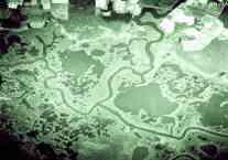
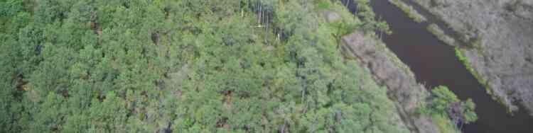
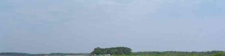
4 Remaining marsh shown in red Blackwater


5 Roughly 60 miles from the Bay Bridge by land Blackwater is 31 miles from Poplar Island and 5 Miles from James Island by water
6 Blackwater National Wildlife Refuge Established ,000 acre complex 1/3 marsh, 1/3 forest, 1/3 water


7 Blackwater NWR is part of the Chesapeake Marshlands National Wildlife Refuge Complex: Blackwater NWR Eastern Neck NWR Martin NWR Susquehanna NWR Watts Island Bishops Head Point Spring Island Barren Island


8 Significance of Blackwater Wetlands Wetlands of International Importance (RAMSAR site) 1 of 6 priority wetland areas by North American Waterfowl Management Plan The Nature Conservancy: one of the LAST GREAT PLACES
9 Blackwater Watershed The Everglades of the North Exceptional Recreational and Ecological System Waters (ERES) Over 1/3 of all tidal wetlands in MD Northernmost 3-square 3 bulrush marshes in the U.S.


10 Internationally Important Bird Area: American Bird Conservancy 85 nesting songbird species 34 waterfowl species 52 shorebird species 30 marsh and wading birds 24 raptor species Over 350 bird species annually Prothonotary Warbler Barred Owl


11 Biodiversity Endangered Delmarva Fox Squirrel
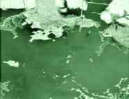

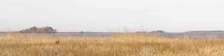
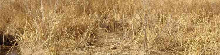
12 The Disappearing Marsh

13 Marsh Loss 8,000 acres or 12 sq. miles have been lost acres lost/year

14 Curt Larsen (USGS) Model of Sea Level Rise over next 50 years Slaughter Creek Little Blackwater River Blackwater River Honga River Blackwater National Wildlife Refuge LIDAR 0.0ft

15 1900 Model Red is NAVD to 0.0meters Shorter s Wharf Road MHHW 1900

16 1960 Red 0.12 to 0.0 meters MHHW 1960
17 1980 Red 0.06 to 0.0 meters MHHW 1980

18 2000 Blue 0.0 meters MHHW 2000 NAVD88

19 2020 MHHW +20 years Blue is 0.06 meters
20 2030 Shorter swharf Road MHHW + 30 years Blue is 0.09 meters

21 2050 Wolf Pit McGraws Island Hart s Ridge Fishing Bay WMA MHHW + 50 years Blue is 0.15 meters


22 Causes of Marsh Loss Sea level rise Subsidence Erosion Salt water intrusion Invasive species - herbivory

23 Little Choptank River Stewart s Canal: saltwater Intrusion

24 Stewart s Canal


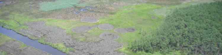
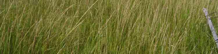
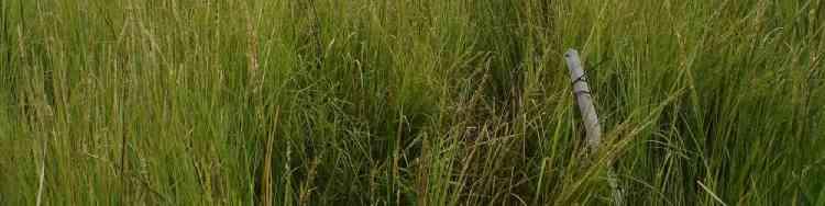
25 Subsidence Shifting of Geologic Plates Groundwater Withdrawal- Canneries


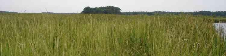
26 Excessive Herbivory Resident Canada Geese Nutria
27 MARSH LOSS AT BLACKWATER Altered Hydrology and Salinity Stressed Marsh Wildlife Damage Nutria Resident Geese IncreasedWave Energy MARSH EROSION Breaching of Peat Layer Increased Open Water Wave Action Sediment Loss Destruction of Natural Levees Steve Kopecky US ACE


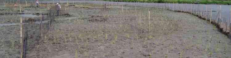
28 Efforts to Restore Blackwater Wetlands Reduce salt water intrusion Extirpate nutria Reduce resident Canada geese 1980s Wetland Restoration of 12 acres 2003 Wetland Restoration of 15 acres
29 Weir Installation at Stewart s Canal: June 2006

30 Weir: Stewart s Canal

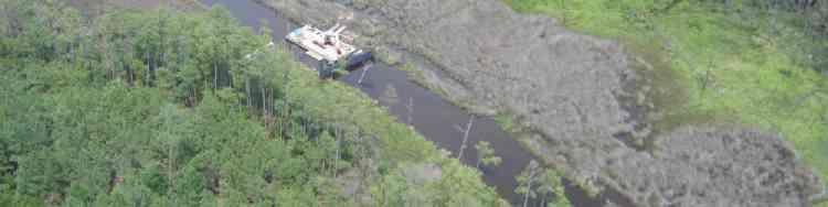
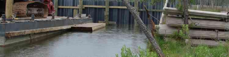
31 Nutria Extirpated from Blackwater Watershed By 2006, over 9,500 nutria removed Monitoring continues to eliminate new nutria Marsh Areas Recovering Trapping efforts expanded to State and Private Lands


32 1980s Wetland Restoration Three-square transplanted in 1982 restoration project


33 1982 Restoration Site in 2005
34 1983 Restoration Site in 2005
35 2003 Wetland Restoration Partners National Aquarium Army Corps of Engineers Friends of Blackwater Salisbury Zoo U.S. Fish and Wildlife Service


36 3 sites Wildlife Drive Observation site Shorters Wharf
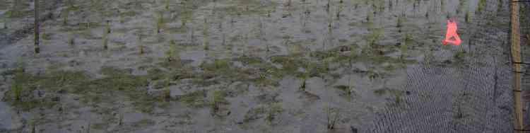
37 Methods Restore 15 acres of tidal wetlands at 3 sites Plant 70,000 marsh grass units Monitor plant success Sediment containability

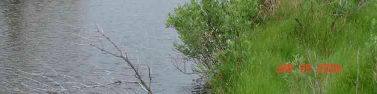
38 Initial Containment Installation of Straw Bales and Wooden Stakes

39 Water Depths were often too deep for thin layering and required 1 to 1.5 feet of fill Floating Excavator moved pipeline
40 Dredge Wildlife Drive Wildlife Drive Cells

41 Shorters Wharf Shorter s Wharf Road

42 Dredge slurry: 10% sediment and 90% water Overall sediment containment was successful

43 Hydro-seeding and Hand-planting were used; no fertilization necessary
, salt marsh bulrush (Schoenoplectus robustus), and smooth cordgrass (Spartina")
44 May 2003 Volunteers planted 70,000 units combined of Olney s 3-square (Schoenoplectus americanus), salt marsh bulrush (Schoenoplectus robustus), and smooth cordgrass (Spartina alterniflora)


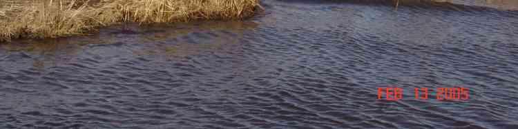
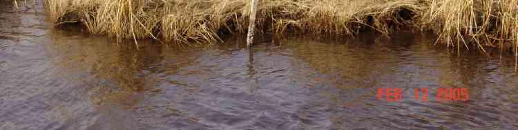
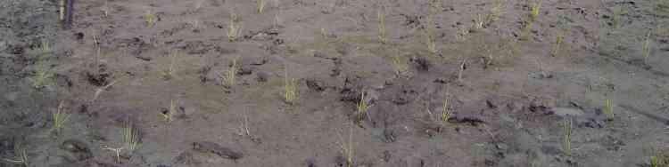
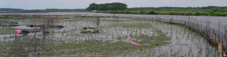
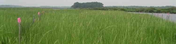
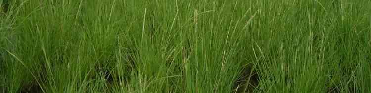
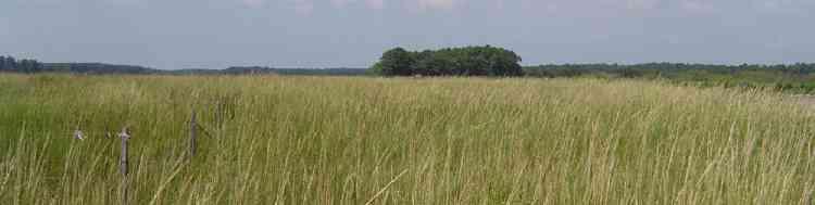
45 Photo Station Documentation June 2003 August 2003 Compare permanent photo stations over time to assess sediment and vegetation sustainability
46 May 2003

47 June 2003

48 August 2003

49 August 2004

50 August 2005

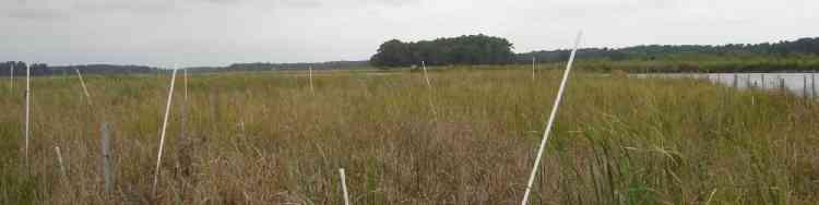
51 September 2006

52 What s Next? Recreate the Lost Marsh
53 Blackwater s Comprehensive Conservation Plan (CCP) calls for restoring wetlands to 1933 conditions Additional restoration is needed to meet this management goal -Dennis King & Liz Price, CBL -Uni. of MD Geography Dept., Coastal Marsh Project
54 Dredge Material Placement Total dredging needs for approach channels in MD portion of Chesapeake Bay is about 3 to 4 million cubic yards annually Dr. Dennis King and Liz Price Chesapeake Biological Lab

55 Tiered Environmental Impact Statement 3 Options: 1.Expansion of Poplar Island 2.Mid-Bay Islands 3.Blackwater/Dorchester County
56 Use clean Dredged Material to Restore the Marsh Restoring 8,000 acres (12 miles 2 ) at: 1 foot requires 12,907,000 cubic yards 2 feet requires 25,813,000 cubic yards 3 feet requires 38,720,000 cubic yards 5 feet requires 64,533,000 cubic yards Dennis King, Liz Price, CBL


57 Total Restoration in Dorchester County: 20,000 acres Tudor Farms Fishing Bay -Dennis King & Liz Price, CBL -Uni. of MD Geography Dept., Coastal Marsh Project
58 Use clean Dredged Material to Restore the Marsh Restoring 20,000 acres at: 1 foot requires 32,267,500 cubic yards 2 feet requires 64,532,500 cubic yards 3 feet requires 96,800,000 cubic yards 5 feet requires 1,613,325,000 cubic yards Dennis King, Liz Price, CBL


59 Dorchester Restoration provides placement opportunities for dredged material for 25 to 100 years and would restore the watershed


60 Bucket and barge to move clean dredged material James Island could be used as a re-handling station James Island

61 Future Wetland Restoration Benefits 1. Ecosystem and Environmental Restoration 2. Placement of Substantial amounts of Dredged Material 3. Easy Public Access, Community Involvement, Public Support 4. Prevent additional wetland loss
62 5. Watershed restoration benefits finfish, shellfishfisheries, wildlife, and the overall health of the Chesapeake Bay Ecosystem


63 Blackwater Restoration can only be achieved through the use of clean dredged material. Currently, we do not know of any other options to restore these valuable wetlands

64 Congress appropriated $247,000 Future Directions to Army Corps in FY 2006 Spatially explicit (GIS) vegetation analyses Correlation of NOAA Tidal Datums, Site Elevation, Purpose: Plant Performance Develop and Project Restoration Management Success Plan Generation of design guidance for future sites 1.Create Sub-groups technical expertise 2.Determine Biological/Technical Data gaps 3.Engineering and Economics 4.Estimate Costs for Full Implementation

65 International Tidal Wetland Conference May 31 June 2, 2006
66 Citizen s Advisory Group and Technical Working Group. If you would like to serve on a group, Please contact Dixie Birch: dixie_birch@fws.gov Phone: , ext. 118 Pilot study using 2-10 acres of material
Chesapeake Bay adaptation Designing marshes for David Curson, National Audubon Society Erik Meyers, The Conservation Fund
 Chesapeake Bay adaptation Designing marshes for 2100 David Curson, National Audubon Society Erik Meyers, The Conservation Fund Blackwater National Wildlife Refuge Maryland s Everglades Biological Resources:
Designing Salt Marshes for 2100: Climate Adaptation in the Chesapeake Bay
 THE CONSERVATION FUND Designing Salt Marshes for 2100: Climate Adaptation in the Chesapeake Bay Who We Are Results and Recognition Our Partners Areas of Expertise www.conservationfund.org THE CONSERVATION
Cat Island Chain Restoration Project Brown County Port & Resource Recovery Department
 Cat Island Chain Restoration Project Brown County Port & Resource Recovery Department February 2, 2015 Fox River and Lower Green Bay Cat Island Chain - 1938 Cat Island Brown County Aerial Photography,
Collaboration and Planning to Implement the South San Diego Bay Restoration and Enhancement Project
 Collaboration and Planning to Implement the South San Diego Bay Restoration and Enhancement Project Carolyn Lieberman Coastal Program Coordinator for Southern California U.S. Fish and Wildlife Service
Expansion Work Has Begun The perimeter dike for Cell 7 is now visible
 Summer/Fall 2017 In This Issue Poplar Island Expansion Wetland Cell 5AB Development Wildlife Update Birding tours on Poplar Island Expansion Work Has Begun The perimeter dike for Cell 7 is now visible
A Rising Tide: Conserving Shorebirds and Shorebird Habitat within the Columbia River Estuary
 A Rising Tide: Conserving Shorebirds and Shorebird Habitat within the Columbia River Estuary By Vanessa Loverti USFWS Migratory Birds and Habitat Programs, Portland, Oregon May 28, 2014 Outline of Talk
Dredging, Beach Nourishment and. Bird Conservation Workshop Atlantic Coast Region
 Dredging, Beach Nourishment and US Army Corps Bird Conservation Workshop Atlantic Coast Region Beach Nourishment and Bird Habitat Restoration in Southern New Jersey Shore Protection and Ecosystem Restoration
Oil Spill Funds and the Opportunities they Present for Galveston Bay
 Oil Spill Funds and the Opportunities they Present for Galveston Bay A presentation to Texas Environmental Grantmakers Group By Bob Stokes, President, Galveston Bay Foundation Friday, October 31, 2014
RESTORE Act Bucket 2 Planning Public Meeting
 RESTORE Act Bucket 2 Planning Public Meeting James C. Gibeaut, Ph.D. Coastal and Marine Geospatial Sciences Harte Research Institute for Gulf of Mexico Studies Texas A&M University Corpus Christi Public
LOUISIANA NAWCA PROJECTS
 LOUISIANA NAWCA PROJECTS $47,109,174 $123,650,071 64 1,174,349 NAWCA GRANT AMOUNT TOTAL PARTNER CONTRIBUTION NUMBER OF PROJECTS TOTAL ACRES Louisiana currently has 64 NAWCA projects either completed or
Special Habitats In Greene County
 Special Habitats In Greene County What does Greene County have in common with these animals.. That need special grassland habitat to survive? Or these That need special wetland habitat to survive? We have
NAPA MARSHES RESTORATION Coastal Ecosystem Restoration Through Collaborative Partnerships
 NAPA MARSHES RESTORATION Coastal Ecosystem Restoration Through Collaborative Partnerships National Conference on Ecosystem Restoration July 29-August 2, 2013 Jeff McCreary Director of Conservation Programs
Cape Romain National Wildlife Refuge Climate Change Impacts
 Climate Change Impacts How will the Refuge be Affected by Climate Change? Salt marsh fragmentation by rapidly eroding tidal creeks Salt marsh submergence during high tide events leading to habitat conversion
Charette Vision #1 for 2050
 Charette Vision #1 for 2050 Bird use? mercury? Charette Vision #2 for 2050 Important Uncertainties Mercury Sediment Dynamics/Mudflats Bird Use of Different Habitats, esp. tidal marsh ponds/pannes Non-avian
New Jersey PRESERVING OUR WATERFOWLING TRADITION THROUGH HABITAT CONSERVATION!
 New Jersey PRESERVING OUR WATERFOWLING TRADITION THROUGH HABITAT CONSERVATION! he Delaware Bay and the New York Bight watersheds provide a multitude of critical wetland and upland habitats for fish and
Species Response to Habitat Restoration and Management in San Francisco Bay
 Species Response to Habitat Restoration and Management in San Francisco Bay Joy Albertson, U.S. Fish and Wildlife Service October 11, 2017 2017 State of the San Francisco Estuary Conference Past (~1850)
Ray Allen Executive Director (361)
") Ray Allen Executive Director (361)885-6204 rallen@cbbep.org www.cbbep.org CBBEP History 1987 U.S. Congress established the National Estuary Program (NEP) to promote longterm planning and management of
Ray Allen Executive Director (361)885-6204 rallen@cbbep.org www.cbbep.org CBBEP History 1987 U.S. Congress established the National Estuary Program (NEP) to promote longterm planning and management of
Richard A. Fischer, Ph.D. U.S. Army Engineer Research and Development Center Environmental Laboratory
 Regional Sediment Management - Beneficial Uses of Dredged Material Along Lake Erie and Tributaries Section 204 of the 1992 Water Resources Development Act Richard A. Fischer, Ph.D. U.S. Army Engineer Research
Analysis of Reference Tidal Channel Plan Form For the Montezuma Wetlands Restoration Project
 Analysis of Reference Tidal Channel Plan Form For the Montezuma Wetlands Restoration Project Sarah Pearce, Geomorphologist Joshua N. Collins, Project Manager Contribution No. 80 May, 2004 ACKNOWLEDGEMENTS
Sauvie Island Wildlife Area BCS number: 47-28
 Sauvie Island Wildlife Area BCS number: 47-28 Site description author(s) Mark Nebeker, Oregon Department of Fish and Wildlife, Sauvie Island Wildlife Area Manager Primary contact for this site Mark Nebeker,
TEXAS NAWCA PROJECTS
 TEXAS NAWCA S $41,369,025 $88,508,308 84 580,494 NAWCA GRANT AMOUNT TOTAL PARTNER CONTRIBUTION NUMBER OF S TOTAL ACRES Texas currently has 84 NAWCA projects either completed or underway. These projects
Kaskaskia River Watershed
 Kaskaskia River Watershed Kaskaskia River Basin Initiative Through Locally Led Efforts Ed Weilbacher, Coordinator, USDA-NRCS Providing technical assistance to the Southwestern Illinois RC&D, Inc. FACTS
Black Duck Outcome Management Strategy , v.2
 Management Strategy 2015 2025, v.2 (Photo by Will Parson/Chesapeake Bay Program) I. Introduction The American black duck has been called the gold standard of eastern waterfowl. Historically, the black
Course 1- Salt Marsh Exploration
 The following courses are offered as part of the Waterfront Stewardship Program. For further information about these courses please contact Christopher Girgenti, Natural Areas Manager, at 212-860-1899
Tiered Species Habitats (Terrestrial and Aquatic)
") Tiered Species Habitats (Terrestrial and Aquatic) Dataset Description Free-Bridge Area Map The Department of Game and Inland Fisheries (DGIF s) Tiered Species Habitat data shows the number of Tier 1, 2
Tiered Species Habitats (Terrestrial and Aquatic) Dataset Description Free-Bridge Area Map The Department of Game and Inland Fisheries (DGIF s) Tiered Species Habitat data shows the number of Tier 1, 2
WISCONSIN NAWCA PROJECTS
 NAWCA S $33,459,570 $105,130,448 92 160,109 NAWCA GRANT AMOUNT TOTAL PARTNER CONTRIBUTION NUMBER OF S TOTAL ACRES Wisconsin currently has 92 NAWCA projects either completed or underway. These projects
UPPER MISSISSIPPI RIVER RESTORATION LAKE ODESSA HABITAT REHABILITATION AND ENHANCEMENT PROJECT OPERATION AND MAINTENANCE MANUAL APPENDIX F
 UPPER MISSISSIPPI RIVER RESTORATION LAKE ODESSA HABITAT REHABILITATION AND ENHANCEMENT PROJECT OPERATION AND MAINTENANCE MANUAL APPENDIX F PROJECT PHOTOGRAPHS Table of Photographs Photograph 1: Lake Odessa
Project Summary. Predicting waterbird nest distributions on the Yukon-Kuskokwim Delta of Alaska
 Project Summary 1. PROJECT INFORMATION Title Project ID Predicting waterbird nest distributions on the Yukon-Kuskokwim Delta of Alaska WA2012_22 Project Period July 1, 2012 to June 30, 2014 Report submission
Ensuring habitat considerations in beach and shoreline management along Delaware Bay a bay wide perspective.
 Ensuring habitat considerations in beach and shoreline management along Delaware Bay a bay wide perspective. Kimberly B. Cole, David B. Carter, Tricia K. Arndt Delaware Coastal Programs Delaware Bay Coastal
Northeast Florida Coastal Wetland Restoration Program A Partnership Based Regional Approach for Estuary Habitat Restoration
 Northeast Florida Coastal Wetland Restoration Program A Partnership Based Regional Approach for Estuary Habitat Restoration Paul Haydt Restore America s Estuaries November 15, 2010 St Johns River Water
Phragmites australis invasion into disturbances in Chesapeake Bay tidal wetlands: Dispersal, colonization, fitness, and restoration
 Phragmites australis invasion into disturbances in Chesapeake Bay tidal wetlands: Dispersal, colonization, fitness, and restoration Karin Kettenring 1,4, Eric Hazelton 1,4, Sally Gallagher 2,4, Heather
Geographic Response Plan Map: GA-2. Raptor Nesting Area. Recreational Fishing. Sea Turtles. Shorebird Nesting Area. Wading birds Nesting Area
 81 7'30"W Geographic Response Plan Map: GA-2 81 0'0"W 32 15'0"N 32 15'0"N Union Creek «46 Jasper Beaufort «170 Sector Charleston Sava n nah «170 and 2 AH NATIONAL FE REFUGE Middle River GA1-07 Steam Boat
The North American Wetlands Conservation Act: Working for Maine
 The North American Wetlands Conservation Act: Working for Maine The North American Wetlands Conservation Act (NAWCA) is an incentive-based, landowner-friendly program that fosters the development of public-private
Habitat Use by Wildlife in Agricultural and Ranching Areas in the Pantanal and Everglades. Dr. Júlio Cesar de Souza and Dr. Elise V.
 Habitat Use by Wildlife in Agricultural and Ranching Areas in the Pantanal and Everglades Dr. Júlio Cesar de Souza and Dr. Elise V. Pearlstine Pantanal 140,000 km 2 of wetlands with a monomodal flood pulse
MINNESOTA NAWCA PROJECTS
 NAWCA S $40,343,809 $152,258,606 125 270,804 NAWCA GRANT AMOUNT TOTAL PARTNER CONTRIBUTION NUMBER OF S TOTAL ACRES Minnesota currently has 125 NAWCA projects either completed or underway. These projects
Avian Project Guidance
 SPECIES MANAGEMENT Avian Project Guidance Stakeholder Informed Introduction Avian species, commonly known as birds, are found on every continent and play important roles in the world s ecosystems and cultures.
State of New Jersey Chris Christie, Governor. Dept. of Environmental Protection Bob Martin, Commissioner
 Cape May Beach 2016/2017 Renourishment Cape May Inlet to Lower Township & Lower Cape May Meadows Cape May Point Cape May County, New Jersey New Jersey Department of Environmental Protection Engineering
RELATING TO THE MANAGEMENT OF CONSERVATION LANDS LOCATED ON THE SOUTHERN TIP OF THE EASTERN SHORE IN NORTHAMPTON COUNTY, VIRGINIA
 MEMORANDUM OF UNDERSTANDING Between THE U.S. FISH AND WILDLIFE SERVICE, DEPARTMENT OF THE INTERIOR and THE DEPARTMENT OF CONSERVATION AND RECREATION, COMMONWEALTH OF VIRGINIA and THE DEPARTMENT OF GAME
NPS Inventory and Monitoring Program
 NPS Inventory and Monitoring Program Metrics and Protocols Monitoring Tidal Marsh Condition Tidal Marsh Resiliency Coordination Workshop U.S. Fish & Wildlife Service, Hadley, MA Dec 8-9, 2014 Northeast
THE GULF COAST VULNERABILITY ASSESSMENT:
 THE GULF COAST VULNERABILITY ASSESSMENT: Amanda Watson GCVA Coordinator Mississippi State University Gulf Coast Prairie LCC June 3, 2015 Webinar Why? Changing Conditions Conservation is increasingly challenging
Economic Values Generated by the New Jersey Shore for Climate Change and Coastal Hazards Conference
 Economic Values Generated by the New Jersey Shore for Climate Change and Coastal Hazards Conference Professor Joseph J. Seneca Bloustein School of Planning and Public Policy, Rutgers University 25 May
Baskett Slough National Wildlife Refuge BCS number: 47-4
 Baskett Slough National Wildlife Refuge BCS number: 47-4 Site description author(s) Daphne E. Swope, Research and Monitoring Team, Klamath Bird Observatory Primary contact for this site N/A Location (UTM)
North American Wetlands Conservation Act
 North American Wetlands Conservation Act WISCONSIN Wisconsin currently has 85 NAWCA projects either completed or underway. These projects have conserved a total of 151,974 acres of wildlife habitat. NAWCA
North American Wetlands Conservation Act
 North American Wetlands Conservation Act CALIFORNIA California currently has 151 NAWCA projects either completed or underway. These projects have conserved a total of 869,189 acres of wildlife habitat.
Piping Plovers - An Endangered Beach Nesting Bird, and The Threat of Habitat Loss With. Predicted Sea Level Rise in Cape May County.
 Piping Plovers - An Endangered Beach Nesting Bird, and The Threat of Habitat Loss With Thomas Thorsen May 5 th, 2009 Predicted Sea Level Rise in Cape May County. Introduction and Background Piping Plovers
2011 Wood River Wetland Yellow Rail (Coturnicops neveboracensis noveboracensis) Survey Report
 Survey Report") 2011 Wood River Wetland Yellow Rail (Coturnicops neveboracensis noveboracensis) Survey Report Project Description The Bureau of Land Management s Wood River Wetland is located in T34S-R 7 1/2E; the wetland
2011 Wood River Wetland Yellow Rail (Coturnicops neveboracensis noveboracensis) Survey Report Project Description The Bureau of Land Management s Wood River Wetland is located in T34S-R 7 1/2E; the wetland
Coastal wetland at risk
 South West NRM Case Study: A Peel-Harvey Catchment Council Project Coastal wetland at risk Project Title A Component of the Peel-Harvey Catchment Council s Ramsar Initiative CC082614: Implementing the
Assessing the Importance of Wetlands on DoD Installations for the Persistence of Wetland-Dependent Birds in North America (Legacy )
") Assessing the Importance of Wetlands on DoD Installations for the Persistence of Wetland-Dependent Birds in North America (Legacy 12-610) Abstract Wetlands are among the most imperiled ecosystems in the
Assessing the Importance of Wetlands on DoD Installations for the Persistence of Wetland-Dependent Birds in North America (Legacy 12-610) Abstract Wetlands are among the most imperiled ecosystems in the
McKay Creek National Wildlife Refuge BCS number: 48-19
 Oregon Coordinated Aquatic Bird Monitoring: Description of Important Aquatic Bird Site McKay Creek National Wildlife Refuge BCS number: 48-19 Site description author(s) Howard Browers, Supervisory Wildlife
SURVEY OF SEAGRASS BEDS AT PLACEMENT AREA 62, WEST BAY CONTRACT FOR GIWW, TEXAS CAUSEWAY U. S. ARMY CORPS OF ENGINEERS CONTRACT NO.
 SURVEY OF SEAGRASS BEDS AT PLACEMENT AREA 62, WEST BAY CONTRACT FOR GIWW, TEXAS CAUSEWAY U. S. ARMY CORPS OF ENGINEERS CONTRACT NO. W912HY-10-C-0036 Prepared for: RLB CONTRACTING, INC. P.O. Box 1739 Port
Grey County Natural Heritage System Study
 Grey County Natural Heritage System Study Green in Grey Technical Advisory Committee Meeting #1 February 25, 2015 225 Labrador Drive, Unit 1, Waterloo, Ontario, N2K 4M8 Tel: (519) 725-2227 Web: www.nrsi.on.ca
Making Informed Decisions
 Making Informed Decisions Scientific research is an essential first step to solve environmental problems. However, many other factors must also be considered. How will the proposed solution affect people
Rhode Island Wildlife Action Plan. Appendix 5
 Rhode Island Wildlife Action Plan Appendix 5 APPENDI 5: COMPILATION OF EISTING MONITORING PLANS Appendix 5. Compilation of Existing Monitoring Plans This appendix lists the key, relevant monitoring plans
North American Wetlands Conservation Act
 North American Wetlands Conservation Act MAINE Maine currently has 90 NAWCA projects either completed or underway. These projects have conserved a total of 1,031,300 acres of wildlife habitat. NAWCA funding
Backcountry Management. Anne Morkill Wildlife Refuge Manager U.S. Fish & Wildlife Service
 Backcountry Management Anne Morkill Wildlife Refuge Manager U.S. Fish & Wildlife Service Florida Keys National Marine Sanctuary Advisory Council Duck Key, FL February 21, 2012 Overview of National Wildlife
Waterbird Nesting Ecology and Management in San Francisco Bay
 Waterbird Nesting Ecology and Management in San Francisco Bay Josh Ackerman, Alex Hartman, Mark Herzog, and Sarah Peterson U.S. Geological Survey (October 11, 2017) Outline Wetland Management for Nesting
Corps Dredge Plan 2016 Emily Hughes Env Resources, USACE BUILDING STRONG
 Corps Dredge Plan 2016 Emily Hughes Env Resources, USACE Goodbye Jeff Richter!! Navigation/Operations USACE Goal/Mission: To maintain safe Navigation in Federal Channels using methods that are most (1)
C onserving A g r i c u lt u r a l R esources and the E nvironment
 C onserving A g r i c u lt u r a l R esources and the E nvironment DUCKS UNLIMITED IN TEXAS OUR MISSION Did You Know? Ducks Unlimited and partners have conserved more than 180,000 acres of various wetland
Wetlands in the Spotlight 10 Easy Steps! Wisconsin s Wetland Gems
 As printed in Wetland News, August 2010, Association of State Wetland Managers, Inc. Wetlands in the Spotlight 10 Easy Steps! Wisconsin s Wetland Gems By Leah Stetson, ASWM The nonprofit Wisconsin Wetlands
Squam Contaminants Meeting PSU
 Squam Contaminants Meeting 11/1/2017 @ PSU Welcome to PSU Reason for meeting o Discuss LPC reports and historical data, o Gather other information and provide some context of results, o Answer your questions
B. Project Summary: Audubon Arkansas will work on assessment and restoration of aquatic habitats in urban environments in Central Arkansas.
 A. Title of Project: Assessment and Restoration of Aquatic Habitats in Central Arkansas B. Project Summary: Audubon Arkansas will work on assessment and restoration of aquatic habitats in urban environments
Lisa B. Beever Greater Everglades Ecosystem Restoration Conference July 15, 2010
 Lisa B. Beever Greater Everglades Ecosystem Restoration Conference July 15, 2010 Climate Ready Estuaries Partnership with 15 NEPs and EPA Barnegat Bay NEP www.epa.gov/cre Comprehensive Conservation and
Wilderness Lost. Cape Romain National Wildlife Refuge. South Carolina Lowcountry Refuge Complex
 Wilderness Lost Cape Romain National Wildlife Refuge South Carolina Lowcountry Refuge Complex Waccamaw NWR 22,859 Acres Santee NWR 12,483 Acres Cape Romain NWR 66,287 Acres Ernest F. Hollings ACE Basin
Klamath Marsh National Wildlife Refuge BCS number: 48-16
 Oregon Coordinated Aquatic Bird Monitoring: Description of Important Aquatic Bird Site Klamath Marsh National Wildlife Refuge BCS number: 48-16 Site description author(s) Carol Damberg, Klamath Marsh NWR
Wulfert Bayous Land Acquisition Campaign. Preserve. Protect. Inspire. Ding Darling Wildlife Society
 Wulfert Bayous Land Acquisition Campaign Preserve. Protect. Inspire. Ding Darling Wildlife Society Project Overview Wulfert Bayous is the largest unprotected property on Sanibel Island, and is adjacent
Santa Clara Valley Habitat Plan
 Santa Clara Valley Habitat Plan Joint Governing & Implementation Board Meeting Burrowing Owl Survey Summary and Fee Map January 15, 2015 29 1 Agenda Brief Overview of the Key Aspects of the Burrowing Owl
Red-breasted Merganser Minnesota Conservation Summary
 Credit Jim Williams Red-breasted Merganser Minnesota Conservation Summary Audubon Minnesota Spring 2014 The Blueprint for Minnesota Bird Conservation is a project of Audubon Minnesota written by Lee A.
Malheur National Wildlife Refuge BCS number: 48-18
 Oregon Coordinated Aquatic Bird Monitoring: Description of Important Aquatic Bird Site Malheur National Wildlife Refuge BCS number: 48-18 Site description author(s) Sally Hall, Volunteer, Malheur NWR Roger
Salt Marsh Integrity Assessment Program in USFWS Region 5
 Salt Marsh Integrity Assessment Program in USFWS Region 5 SusanC. Adamowicz; Neckles, Hilary; Guntenspergen, Glenn; Shriver, Greg; Taylor, Jan Jim Lyons USFWS Division of Migratory Bird Management Nicholas
Monitoring Bird, Fish, and Vegetation Communities at Prime Hook NWR Before, During, and After Tidal Marsh Restoration
 Monitoring Bird, Fish, and Vegetation Communities at Prime Hook NWR Before, During, and After Tidal Marsh Restoration Susan Guiteras Supervisory Wildlife Biologist USFWS Coastal Delaware National Wildlife
Smith River Mouth BCS number: 86-6
 Smith River Mouth BCS number: 86-6 ***NOTE: We were unable to determine all necessary information for this site description. If you would like to contribute the needed information to this description,
CALIFORNIA NAWCA PROJECTS
 CALIFORNIA NAWCA S $100,277,613 $394,228,870 159 887,770 NAWCA GRANT AMOUNT TOTAL PARTNER CONTRIBUTION NUMBER OF S TOTAL ACRES California currently has 159 NAWCA projects either completed or underway.
Maryland Coastal Bays Colonial Waterbird and Islands Report 2018
 Maryland Coastal s Colonial Waterbird and Islands Report 2018 THE REPORT This report provides an assessment of the current state of colonial waterbird breeding in the Coastal s of Maryland behind Ocean
Dr. Wiley Kitchens. University of Florida USGS Florida Cooperative Fish and Wildlife Research Unit
 Tidal Wetland Studies Part I: Tide Gate Era Dr. Wiley Kitchens University of Florida USGS Florida Cooperative Fish and Wildlife Research Unit PRE TIDE GATE ERA MARSH AREAS SAVANNAH NWR GEORGIA/ TOTAL S.
What is an Environmental Assessment?
 What is an Environmental Assessment? Environmental Assessment Environmental Assessment is a process that is mandated by both Canadian and Manitoban law and is required before construction of large projects.
Lakewide Action and Management Plans - LAMPs Beth Hinchey Malloy & Liz LaPlante, US EPA GLNPO
 Lakewide Action and Management Plans - LAMPs Beth Hinchey Malloy & Liz LaPlante, US EPA GLNPO An Overview Prepared for GL ANS Panel Meeting Nov 7, 2018 Great Lakes Water Quality Purpose is to restore and
Oak Hammock Marsh Interpretive Centre
 AB SK MB ON Edmonton Saskatoon Calgary Regina Winnipeg Oak Hammock Marsh Interpretive Centre $800,000 in 1972-73 Pacific Flyway Central Flyway Mississippi Flyway Atlantic Flyway Oak Hammock Marsh North
Nevada Sagebrush Ecosystem Conservation Program
 Nevada Sagebrush Ecosystem Conservation Program Managing approximately 1.8 million acres for multiple uses, including mineral exploration and mining, rangeland livestock production, and ecosystem restoration.
1/18/2008. Wetlands Reservoirs of Biodiversity Billy McCord, SCDNR. Estuaries. Freshwater Riverine. Tidal Riverine Fresh & Brackish
 Wetlands Reservoirs of Biodiversity Billy McCord, SCDNR Estuaries Freshwater Riverine Tidal Riverine Fresh & Brackish 1 Freshwater Riverine, Oxbows & Swamp Forest Cypress Tupelo Swamp Forest Bottomland
Advanced Scavenger Hunt
 2012 Start inside the Galleria! The Bay 1. Find a shark that hunts at night. 2. Find the large, bright orange fish (the state marine fish of California.) Write its name here: 3. How long can a spiny lobster
Introduction of The Iraqi Marshlands
 Introduction of The Iraqi Marshlands Urgent needs for the long-term sustainable management Dr Ali Al-Lami Advisor to the Minister Ministry of Environment, Republic of Iraq 1 CBD COP10 side event for Long-term
2012 STATUS REPORT NJ BEACHES AND INLETS PHILADELPHIA DISTRICT, USACE
 2012 STATUS REPORT NJ BEACHES AND INLETS PHILADELPHIA DISTRICT, USACE Jeff Gebert, Coastal Planning, USACE Philadelphia Philadelphia District Established 1866 Delaware River Basin Parts of 5 states 9 million
Oregon Dunes National Recreation Area BCS Number: 47-5
 Oregon Dunes National Recreation Area BCS Number: 47-5 ***NOTE: We were unable to determine all necessary information for this site description. If you would like to contribute the needed information to
Jackson Bottom Wetlands Preserve BCS Number: 47-14
 Jackson Bottom Wetlands Preserve BCS Number: 47-14 Site description author(s) Greg Gillson, Jackson Bottom Wetlands Preserve Primary contact for this site Ed Becker, Natural Resources Manager, Jackson
SENATE CONCURRENT RESOLUTION No. 158 STATE OF NEW JERSEY. 217th LEGISLATURE INTRODUCED JUNE 26, 2017
 SENATE CONCURRENT RESOLUTION No. STATE OF NEW JERSEY th LEGISLATURE INTRODUCED JUNE, 0 Sponsored by: Senator JEFF VAN DREW District (Atlantic, Cape May and Cumberland) Senator ROBERT M. GORDON District
2017 Monarch Butterfly Conservation Fund Grant Slate
 2017 Monarch Butterfly Conservation Fund Grant Slate NFWF CONTACT Todd Hogrefe Director, Central Regional Office todd.hogrefe@nfwf.org 612-564-7286 PARTNERS Monarch butterflies ABOUT NFWF The National
BIRD READING ASSIGNMENT
 Ocean Connectors BIRD READING ASSIGNMENT To do before the field trip, in class or at home 1. Students will read Wetland Neighbors. The reading is available on the next page and online at http://oceanconnectors.org/resources.
Blackwater National Wildlife Refuge
 Blackwater National Wildlife Refuge 2145 Key Wallace Drive Cambridge, MD 21613 410/228 2677 e-mail: fw5rw_bwnwr@fws.gov http://www.fws.gov/blackwater/ Federal Relay Service for the deaf and hard-of-hearing
Title Marsh Bird Habitat Restoration and Management on Private and Public land in Arkansas Mississippi Alluvial Valley
 Title Marsh Bird Habitat Restoration and Management on Private and Public land in Arkansas Mississippi Alluvial Valley Project Summary: Changes in habitat and hydrology have caused serious declines in
Ms. Robyn Thorson Director, Region 1 U.S. Fish and Wildlife Service 911 NE 11 th Avenue Portland, Oregon November Dear Ms.
 Ms. Robyn Thorson Director, Region 1 U.S. Fish and Wildlife Service 911 NE 11 th Avenue Portland, Oregon 97232 16 November 2009 Dear Ms. Thorson, For the last decade, U.S. Shorebird Conservation Plan partners
DALE D. HUMBURG Chief Biologist
 TESTIMONY OF DALE D. HUMBURG Chief Biologist Ducks Unlimited One Waterfowl Way Memphis, TN 38120 901-758-3874 Before the U.S. HOUSE OF REPRESENTATIVES COMMITTEE ON NATURAL RESOURCES SUBCOMMITTEE ON FISHERIES,
Saugus. Produced in This report and associated map provide information about important sites for biodiversity conservation in your area.
 CONSERVING THE BIODIVERSITY OF MASSACHUSETTS IN A CHANGING WORLD Saugus Produced in 2012 This report and associated map provide information about important sites for biodiversity conservation in your area.
Performance Monitoring
 Performance Monitoring Rock Island District Kara N. Mitvalsky, P.E. CEMVR-EC-DN Traditional Reports Analysis of existing data Comparison of data points to objectives identified in the feasibility reports
Soft Engineering Case Study: Wallasea Island
 Soft Engineering Case Study: Wallasea Island Situation By the British Geographer Wallasea Island is on the south side of the Crouch Estuary in Essex and also linked to the Roach Estuary. These estuaries
Building Community Awareness and Support for Wetlands through Recognition: Wetland Gems and Ramsar. Katie Beilfuss Wisconsin Wetlands Association
 Building Community Awareness and Support for Wetlands through Recognition: Wetland Gems and Ramsar Katie Beilfuss Wisconsin Wetlands Association Painting by Judi Ekholm A statewide, non-profit organization
Coos Bay BCS number: 47-8
 Coos Bay BCS number: 47-8 ***NOTE: The completion of this site description is still in progress by our Primary Contact (listed below). However, if you would like to contribute additional information to
DREDGED MATERIAL SETTLEMENT FROM MARSH CREATION PROJECTS CONDUCTED IN COASTAL LOUISIANA
 DREDGED MATERIAL SETTLEMENT FROM MARSH CREATION PROJECTS CONDUCTED IN COASTAL LOUISIANA Thomas McGinnis CPRA Operations Division Lafayette Regional Office National Conference on Ecosystem Restoration August
A View from the Gulf Coast: How Does All This Stuff Add Up?
 A View from the Gulf Coast: How Does All This Stuff Add Up? John Tirpak, PhD Science Coordinator, USFWS Gulf Restoration Program Lafayette, LA January 21, 2016 Mississippi River Basin/Gulf Hypoxia Initiative
Geographic [x Response Plan Map: GA-12 [r. Map Continued on GA-8 XXX. GA12-01 Green Island Sound. OSSABAW ISLAND WMA Raccoon Key XXX
 Charles Ogeechee River tal Waterway 31 52'30"N Little Ogeechee River Harveys Island 81 7'30"W Charles Rush Charles 950 Ogeechee River Geographic Response Plan Map: GA-12 Map Continued on GA-8 Green Island
Nelson's Sparrow. Appendix A: Birds. Ammodramus nelsoni. New Hampshire Wildlife Action Plan Appendix A Birds-20
 Nelson's Sparrow Ammodramus nelsoni Federal Listing State Listing Global Rank State Rank Regional Status N/A SC G5 S3 Photo by Scott Young Justification (Reason for Concern in NH) Birds that breed in salt