Corps Dredge Plan 2016 Emily Hughes Env Resources, USACE BUILDING STRONG
|
|
|
- Antony Damian Mills
- 5 years ago
- Views:
Transcription


1 Corps Dredge Plan 2016 Emily Hughes Env Resources, USACE

2 Goodbye Jeff Richter!!
3 Navigation/Operations
4 USACE Goal/Mission: To maintain safe Navigation in Federal Channels using methods that are most (1) economically feasible (2) engineeringly sound and (3) environmentally responsible. (It comes last but at least it s mentioned, right??)


5 Morehead City Harbor, NC Navigation Projects Virginia North Carolina Manteo Oregon Inlet Washington Fayetteville NC State Port Wilmington, NC Lock and Dam 3 Lock and Dam 2 Lock and Dam 1 Lockwoods Folly Inlet Wilmington Morehead City Wilmington Harbor Bogue Inlet New River Inlet New Topsail Inlet Carolina Beach Inlet Morehead City Harbor

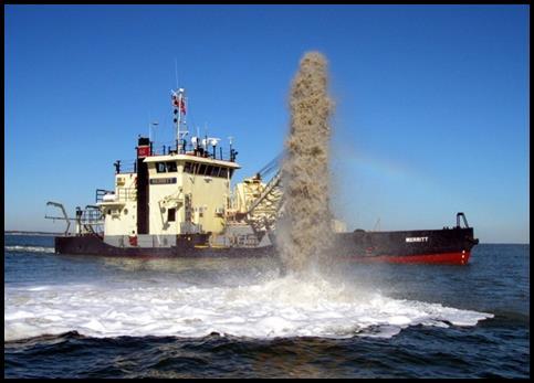
6 Over 1500 miles of Navigable Channels 2 Deep Draft Ports Wilmington Harbor Morehead City Harbor 300 miles Atlantic Intracoastal Waterway 7 Shallow Draft inlets Oregon Inlet Bogue Inlet New River Inlet New Topsail Inlet Masonboro Inlet Carolina Beach Inlet Lockwoods Folly Inlet Customers & Partners Public US Coast Guard US Marine Corps US Army NOAA State, County & Local Municipalities
7 Contracts Currently Out for Bid: 1. Wilmington Harbor Bald Head Shoal Reach 3; Disposal in ODMDS 2. Morehead City Harbor Ranges A & B; Disposal in ODMDS (If hopper dredges awarded, work to be completed by May 1!)
 Eagle Island Mid River (Every 2 yrs) Bird Islands/ODMDS Inner Ocean Bar (Every 2")
8 Wilmington Harbor Reaches Anchorage Basin (~1.2 mil cys annually) Eagle Island Mid River (Every 2 yrs) Bird Islands/ODMDS Inner Ocean Bar (Every 2 years) Oak Island/ Bald Head Is. Outer Ocean Bar (Annually) ODMDS

9 WH Dredged Material Management Plan (DMMP)

10 Morehead City Harbor State Ports Area Brandt Island / Radio Island Range A ODMDS Cutoff Nearby Beaches / Nearshore Disposal Area Range B Beaches / Nearshore / ODMDS Range C Brandt/ Radio Island

11 Nearshore Disposal Area ODMDS

12 MHC DMMP (green = proposed /under review)
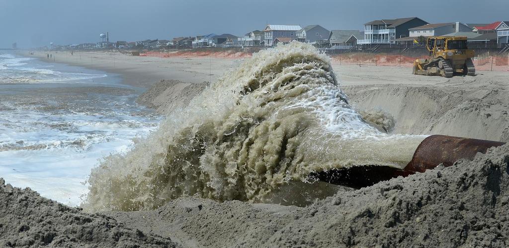
13 Coastal Storm Damage Reduction Project 1. Carolina Beach Borrow Source: CB Inlet Placement Method/Area: Pipeline Dredge; 770,000 cyds To Be Complete: By April 30, 2016
14 Coastal Storm Damage 2. Kure Beach Reduction Project Borrow Source: Offshore Borrow Area Placement Method/Area: Pipeline Dredge; 592,000 cyds (2 sections) To Be Complete: By April 30, 2016 (hopefully!)

15 BUILDING STRONG

16 Eagle Island Raising dikes to 42 EA study to raise dikes to 50 with toe berm 20-year DMMP to construct Cells 4 & 5??
17 FY 16 Dredge Projects to be awarded by the 4 th Quarter: Morehead City Harbor Inner Harbor Contract Wilmington Harbor Anchorage Basin Contract Wilmington Harbor Mid-River Contract AIWW High Use Maintenance Dredging
18 Environmental Windows Windows for bird nesting locations: a) Oceanfront beach placement: November 16 March 31 If disposal is expected to extend past March 31 on certain beaches, coordination by about March 15 with Environmental Resources Section is necessary. Decision may be that work can continue past March 31 if survey reveals that no nesting birds will be disturbed along pipeline alignment. Following completion, if survey reveals nesting birds along pipeline alignment, pipe or other equipment may have to stay in place until nesting is completed.
19 Environmental Windows Windows for bird nesting locations: b) Diked upland disposal islands: September 1 March 31 Although not a formally required window, disposal areas need to be checked for bird nesting. If a nest is found, we will coordinate with appropriate resource agencies. We may allow Contractor to continue work while avoiding the nest. If bird nesting is not an issue, there is no window.
20 Environmental Windows Windows for bird nesting locations: c) Control-of-Effluent Islands: September 1 March 31 Parnell and Wells (Old House and Rollinson Channels dredging project), Pelican and South Ferry Slip (Wilmington Harbor/CFR dredging project), Wainwright Island (Wainwright Slough dredging project), Islands D, G, F, et al, (Manteo Shallowbag Bay dredging project), Big Foot Slough Island (Big Foot Slough/Silver Lake Harbor dredging project).
21 Environmental Windows Windows for bird nesting locations: d) Maintenance of Upland Disposal Areas: September 1 March 31 If work begins prior to March 31, Contractor may continue into April provided no nesting birds are present. Presence of nesting birds stops project until all necessary coordination with resource agencies has been completed.

22 Coordination: Coordinate with NCWRC/USFWS to determine best pipeline route Attempt to coordinate scheduling of pipeline inspection Schedule an end-of project inspection after pipe has been demobilized.

23 Beneficial Use of Dredge Material

24 Bird Islands on the Cape Fear River
25 Assumptions: Horseshoe Shoal and Snows Marsh channels will be dredged every even year (2016, 2018, 2020, etc.) Quantity = about 135,000 cubic yards per cycle Bird islands will require replenishment in 2016, 2020, 2024 and again All material from Horseshoe Shoal and Snows Marsh channels will be of suitable quality for beach renourishment at Kure Beach and on Bird Islands.

26 Working with NOAA to start Thin Layer Disposal Program Method of restoring coastal marsh along Federal channels Camp LeJeune pilot project Combat erosion and sea level rise New concept to this District EA/Resource Agencies feedback Research/design Use of Govt Dredge, Snell
27 Navigation is Seeking Opportunities! Provide navigation solutions within the coastal region of NC: USMC Camp LeJeune, MOTSU USCG Stations Local Governments Along the NC coast, as needed Assist with planning, designing, and permitting docks, piers, breakwaters, etc. as needed: NPS (National Seashores) USFWS (Wildlife Refuges NCDPR (State Parks) NCWRC (Wildlife Boat ramps)

28 QUESTIONS??
29 Contact Info: Emily Hughes Environmental Resource Specialist USACE Wilmington District (910)
State of New Jersey Chris Christie, Governor. Dept. of Environmental Protection Bob Martin, Commissioner
 Cape May Beach 2016/2017 Renourishment Cape May Inlet to Lower Township & Lower Cape May Meadows Cape May Point Cape May County, New Jersey New Jersey Department of Environmental Protection Engineering
Philadelphia District: Cape May County, New Jersey
 ERDC/RSM-DB6, June 2003 Regional Sediment Management (RSM) Demonstration Program Project Brief Philadelphia District: Cape May County, New Jersey ISSUE The Atlantic coast of New Jersey extends from Sandy
New Jersey Dept. of Environmental Protection Shore Protection Program
 New Jersey Dept. of Environmental Protection Benjamin Keiser, Manager 1510 Hooper Avenue, Suite 140 Toms River, New Jersey 08753 1-732-255-0767 New Jersey s State of New Jersey Chris Christie, Governor
1. Qualitative Assessment... II-101
 Table of Contents I. Introduction... I-1 A. Session Law 2009-479 / House Bill 709... I-2 B. Public Consultation... I-3 C. Selection of Study Sites... I-5 D. Limitations of Study... I-8 II. Physical Assessment...
APPENDIX K US FISH AND WILDLIFE SERVICE FINAL COORDINATION ACT REPORT
 FINAL INTEGRATED FEASIBILITY REPORT AND ENVIRONMENTAL IMPACT STATEMENT COASTAL STORM DAMAGE REDUCTION BOGUE BANKS, CARTERET COUNTY NORTH CAROLINA APPENDIX K US FISH AND WILDLIFE SERVICE FINAL COORDINATION
Cat Island Chain Restoration Project Brown County Port & Resource Recovery Department
 Cat Island Chain Restoration Project Brown County Port & Resource Recovery Department February 2, 2015 Fox River and Lower Green Bay Cat Island Chain - 1938 Cat Island Brown County Aerial Photography,
PRESENTATION TITLE. Regional Sediment Management. Common goals for uncommon results. AAPA Facilities Engineering Seminar October 22, 2015
 Regional Sediment Management PRESENTATION TITLE Common goals for uncommon results AAPA Facilities Engineering Seminar October 22, 2015 Presented by: Milan A. Mora, PE Project Manager Water Resources Branch
Ensuring habitat considerations in beach and shoreline management along Delaware Bay a bay wide perspective.
 Ensuring habitat considerations in beach and shoreline management along Delaware Bay a bay wide perspective. Kimberly B. Cole, David B. Carter, Tricia K. Arndt Delaware Coastal Programs Delaware Bay Coastal
2012 STATUS REPORT NJ BEACHES AND INLETS PHILADELPHIA DISTRICT, USACE
 2012 STATUS REPORT NJ BEACHES AND INLETS PHILADELPHIA DISTRICT, USACE Jeff Gebert, Coastal Planning, USACE Philadelphia Philadelphia District Established 1866 Delaware River Basin Parts of 5 states 9 million
Northeast Florida Coastal Wetland Restoration Program A Partnership Based Regional Approach for Estuary Habitat Restoration
 Northeast Florida Coastal Wetland Restoration Program A Partnership Based Regional Approach for Estuary Habitat Restoration Paul Haydt Restore America s Estuaries November 15, 2010 St Johns River Water
Endangered Species Monitoring - Northern Coastline of New Jersey
 Endangered Species Monitoring - Northern Coastline of New Jersey By: Mark H. Burlas, Sr. Wildlife Biologist U.S. Army Corps of Engineers New York District Planning Division Presentation Format Project
United States Department of the Interior
 United States Department of the Interior Mickey T. Sugg Wilmington Regulatory Field Office U. S. Army Corps of Engineers 69 Darlington Ave. Wilmington, North Carolina 28403 FISH AND WILDLIFE SERVICE Raleigh
Dredging, Beach Nourishment and. Bird Conservation Workshop Atlantic Coast Region
 Dredging, Beach Nourishment and US Army Corps Bird Conservation Workshop Atlantic Coast Region Beach Nourishment and Bird Habitat Restoration in Southern New Jersey Shore Protection and Ecosystem Restoration
New Jersey Regional Sediment Management
 New Jersey Regional Sediment Management RSM Demo: Cape May Inlet / Wildwood Sand Bypassing Project Ocean County N Atlantic Ocean Atlantic County Delaware Bay Cape May County 8 0 8 16 Miles Regional Sediment
REVIEW PLAN. Wilmington Harbor Draft Integrated Dredged Material Management Plan and EA. Wilmington District
 REVIEW PLAN Wilmington Harbor Draft Integrated Dredged Material Management Plan and EA Wilmington District MSC Approval Date: 5 March 2014 Last Revision Date: N/A REVIEW PLAN Wilmington Harbor, Wilmington,
Old House Channel Bathymetric and Side Scan Survey
 FIELD RESEARCH FACILITY DUCK, NC Old House Channel Bathymetric and Side Scan Survey COASTAL AND HYDRAULICS LABORATORY FIELD DATA COLLECTION AND ANALYSIS BRANCH Michael Forte December 2009 View looking
Lakes and Rivers Division, David Dale
 Locks and Dams 2, 3, and 4 Monongahela River, PA (Lower Mon Project) Inland Waterways Users Board Lakes and Rivers Division, David Dale November 2014 David Dale, PE, PMP Braddock Dam US Army Corps of Engineers
Collaboration and Planning to Implement the South San Diego Bay Restoration and Enhancement Project
 Collaboration and Planning to Implement the South San Diego Bay Restoration and Enhancement Project Carolyn Lieberman Coastal Program Coordinator for Southern California U.S. Fish and Wildlife Service
COOK INLET NAVIGATION CHANNEL
 COOK INLET NAVIGATION CHANNEL 1-5 COOK INLET NAVIGATION CHANNEL, ALASKA (CWIS NO. 10324, 10534) Condition of Improvement 30 September 2011 AUTHORIZATION: (1) Water Resources Development Act of 1996 (Public
NAVIGATION RD&T UPDATE
 1 NAVIGATION RD&T UPDATE W. Jeff Lillycrop Technical Director Navigation RD&T Needs & Priorities Dredging Optimization Quantifying Ship Movement Dredged Material Placement Data Access and Applications
New Jersey Dept. of Environmental Protection Shore Protection Program
 New Jersey Dept. of Environmental Protection William Dixon, Acting Manager 1510 Hooper Avenue, Suite 140 Toms River, New Jersey 08753 1-732-255-0767 New Jersey s State of New Jersey Chris Christie, Governor
APPENDIX M BIRD NESTING DATA ( )
") APPENDIX M BIRD NESTING DATA (1984-2011) Final Environmental Impact Statement Village of Bald Head Island Shoreline Protection Project Brunswick County, North Carolina Date Species Number of Birds Number
APPENDIX M BIRD NESTING DATA (1984-2011) Final Environmental Impact Statement Village of Bald Head Island Shoreline Protection Project Brunswick County, North Carolina Date Species Number of Birds Number
TABLE OF CONTENTS. Executive Summary 1 Acknowledgements 3 Introduction 3 Storm Recovery and Beach Project Effectiveness 3
 TABLE OF CONTENTS Executive Summary 1 Acknowledgements 3 Introduction 3 Storm Recovery and Beach Project Effectiveness 3 Monmouth County 4 Figures 1a-1d. Monmouth County Station Locations 5 Site Descriptions
Maryland Coastal Bays Colonial Waterbird and Islands Report 2018
 Maryland Coastal s Colonial Waterbird and Islands Report 2018 THE REPORT This report provides an assessment of the current state of colonial waterbird breeding in the Coastal s of Maryland behind Ocean
BookletChart. Sacramento River Andrus Island to Sacramento NOAA Chart A reduced-scale NOAA nautical chart for small boaters
 BookletChart Sacramento River Andrus Island to Sacramento NOAA Chart 18662 A reduced-scale NOAA nautical chart for small boaters When possible, use the full-size NOAA chart for navigation. Included Area
Richard A. Fischer, Ph.D. U.S. Army Engineer Research and Development Center Environmental Laboratory
 Regional Sediment Management - Beneficial Uses of Dredged Material Along Lake Erie and Tributaries Section 204 of the 1992 Water Resources Development Act Richard A. Fischer, Ph.D. U.S. Army Engineer Research
BookletChart. Chesapeake Bay Pocomoke and Tangier Sounds NOAA Chart A reduced-scale NOAA nautical chart for small boaters
 BookletChart Chesapeake Bay Pocomoke and Tangier Sounds NOAA Chart 12228 A reduced-scale NOAA nautical chart for small boaters When possible, use the full-size NOAA chart for navigation. Published by the
Inland Waterways Users Board #60. Inland Navigation R&D
 Inland Waterways Users Board #60 Inland Navigation R&D 19 February 2009 Vicksburg, MS Agenda 0845-0900 Welcome Dr. Jeff Holland 0900 0920 Agenda & Navigation R&D Overview Mr. Jeff Lillycrop 0920-0940 Mississippi
Distribution of Piping Plover and Coastal Birds in Relation to Federal Activities on the Southern Coast of Long Island
 U.S. U.S. Fish Fish & Wildlife & Wildlife Service Service Distribution of Piping Plover and Coastal Birds in Relation to Federal Activities on the Southern Coast of Long Island Implications for Project
Taking RSM to the Next Level
 Taking RSM to the Next Level Q AVG Jackie Keiser Chief, Coastal and Navigation USACE Jacksonville District Q AVG RSM & EWN In-Progress Review 21 July 2014 US Army Corps of Engineers BUILDING STRONG RSM:
Expansion Work Has Begun The perimeter dike for Cell 7 is now visible
 Summer/Fall 2017 In This Issue Poplar Island Expansion Wetland Cell 5AB Development Wildlife Update Birding tours on Poplar Island Expansion Work Has Begun The perimeter dike for Cell 7 is now visible
Central California. 600,000 breeding seabirds + 8 million people (SF Bay Area) Potential for disturbance is high!
 Potential for disturbance is high!") Central California 600,000 breeding seabirds + 8 million people (SF Bay Area) -------------------------- Potential for disturbance is high! Overview Seabird Protection Network 2010 Accomplishments Expanding
Central California 600,000 breeding seabirds + 8 million people (SF Bay Area) -------------------------- Potential for disturbance is high! Overview Seabird Protection Network 2010 Accomplishments Expanding
DREDGED MATERIAL SETTLEMENT FROM MARSH CREATION PROJECTS CONDUCTED IN COASTAL LOUISIANA
 DREDGED MATERIAL SETTLEMENT FROM MARSH CREATION PROJECTS CONDUCTED IN COASTAL LOUISIANA Thomas McGinnis CPRA Operations Division Lafayette Regional Office National Conference on Ecosystem Restoration August
Appendix B. Responses to Comments. on the Draft Environmental Assessment. for Rehabilitation of. Dredged Material Containment Area 1N (Onslow Island)
") Appendix B Responses to Comments on the Draft Environmental Assessment for Rehabilitation of Dredged Material Containment Area 1N (Onslow Island) Savannah Harbor Navigation Project Chatham County, Georgia
Appendix B Responses to Comments on the Draft Environmental Assessment for Rehabilitation of Dredged Material Containment Area 1N (Onslow Island) Savannah Harbor Navigation Project Chatham County, Georgia
Matagorda Island Marsh Restoration An Adaptive Management Approach by Coastal Bend Bays & Estuaries Program
 Matagorda Island Marsh Restoration An Adaptive Management Approach by Coastal Bend Bays & Estuaries Program 1957: After Levees 1930: Before Levees Matagorda Island: Site Location Texas Coastal Bend Calhoun
A Rising Tide: Conserving Shorebirds and Shorebird Habitat within the Columbia River Estuary
 A Rising Tide: Conserving Shorebirds and Shorebird Habitat within the Columbia River Estuary By Vanessa Loverti USFWS Migratory Birds and Habitat Programs, Portland, Oregon May 28, 2014 Outline of Talk
Proposed Anchorage Grounds, Hudson River; Yonkers, NY to Kingston, NY Docket Number USCG
 August 8, 2016 U.S. Coast Guard First District C/O Mr. Craig Lapiejko Waterways Management Branch Submitted Via Federal erulemaking Portal Subject: Proposed Anchorage Grounds, Hudson River; Yonkers, NY
Site Description: Gull Rock is located approximately 0.4 miles offshore and about six miles north of Yaquina Head in Lincoln County, Oregon.
 Devil s Punchbowl intertidal area Gull Rock (offshore) 12. Gull Rock Site Description: Gull Rock is located approximately 0.4 miles offshore and about six miles north of Yaquina Head in Lincoln County,
Lakes and Rivers Division, Mr. David Dale
 Locks and Dams 2, 3, and 4 Monongahela River, PA (Lower Mon Project) Inland Waterways Users Board Lakes and Rivers Division, Mr. David Dale 25 February 2015 Braddock Dam US Army Corps of Engineers Charleroi
BookletChart. Intracoastal Waterway Grassy Key to Bahia Honda Key NOAA Chart A reduced-scale NOAA nautical chart for small boaters
 BookletChart Intracoastal Waterway Grassy Key to Bahia Honda Key NOAA Chart 11453 A reduced-scale NOAA nautical chart for small boaters When possible, use the full-size NOAA chart for navigation. Published
Marine Corps Support Facility-Blount Island: Integrated Natural Resources Program Successes. E2S2 Conference May 12, 2011
 Marine Corps Support Facility-Blount Island: Integrated Natural Resources Program Successes E2S2 Conference May 12, 2011 Shari Kennedy, MCSF-BI Robert Price, CH2M HILL Location Mission The mission of Marine
SECTION III NM 15/12 MARINE INFORMATION
 SECTION III NM 15/12 MARINE INFORMATION CHANGES TO BROADCAST OF WEATHER FORECASTS FOR THE OFFSHORE SOUTHWEST NORTH ATLANTIC, CARIBBEAN, AND GULF OF MEXICO Effective Tuesday April 03, 2012 at 2:00 pm Eastern
Virginia s Efforts to Reduce Marine Debris. Katie Register, Executive Director Clean Virginia Waterways of Longwood University
 Virginia s Efforts to Reduce Marine Debris Katie Register, Executive Director Clean Virginia Waterways of Longwood University Coastal Zone Management funded clam ne;ng program ShoreKeeper Ghost Pot Busters
UPPER MISSISSIPPI RIVER RESTORATION LAKE ODESSA HABITAT REHABILITATION AND ENHANCEMENT PROJECT OPERATION AND MAINTENANCE MANUAL APPENDIX F
 UPPER MISSISSIPPI RIVER RESTORATION LAKE ODESSA HABITAT REHABILITATION AND ENHANCEMENT PROJECT OPERATION AND MAINTENANCE MANUAL APPENDIX F PROJECT PHOTOGRAPHS Table of Photographs Photograph 1: Lake Odessa
Palm Beach County. Estuarine Habitat Mapping
 Palm Beach County Estuarine Habitat Mapping Coastal Habitat Integrated Mapping and Monitoring Program (CHIMMP) April 29, 2014 Eric Anderson, Environmental Analyst Palm Beach County Department of Environmental
Pioneer Array Micro-siting Meeting
 Ocean Observatories Initiative Pioneer Array Micro-siting Meeting June 7, 2011 Coastal Institute University of Rhode Island June 7, 2011 PIONEER ARRAY MICRO-SITING MEETING AGENDA Welcome, Introduction
NOAA s National Ocean Service / Office of Coast Survey
 Coast Survey OCS 1807 2007 Maintains over 1000 nautical charts & 9 Coast Pilots Surveys over 3.4M SNM of oceans and lakes Conducts research and development in hydrography Thomas Jefferson Founder of The
Geographic Response Plan Map: SFL-31. Bradley. Map continued Key on: SFL-34. Key. Murray Key XXX SFL Clive Key XXX. SFL31-06 Clive Key
 ! 1550 1450 81 0'0"W # [\ m [] Geographic Response Plan Map: SFL-31 Bradley Map continued on: SFL-34 Jow Kemp Florida Bay 80 52'30"W 25 7'30"N 1550 1350 SFL31-01 Conchie Channel SFL31-02 Oyster Oyster
Geographic Response Plan Map: SC-56. Map Continued on SC-50 XXX. Fripps Inlet. Raptor Nesting Area. Recreational Fishing. Sea Turtles.
 32 22'30"N Map Continued on SC-55 80 30'0"W X ull et SC56-01 Story/Harbor River Junction Story River!h!S(!d Old House Creek 1050 [ 400 1000 SC56-03 Old House Creek «Geographic Response Plan Map: SC-56
Drawbridge Operation Regulation; Oakland Inner Harbor, ACTION: Notice of deviation from drawbridge regulation.
 This document is scheduled to be published in the Federal Register on 03/06/2015 and available online at http://federalregister.gov/a/2015-05231, and on FDsys.gov 9110-04-P DEPARTMENT OF HOMELAND SECURITY
Navigation RD&T Highlights
 Navigation RD&T Highlights W. Jeff Lillycrop Technical Director, Navigation Engineering Research and Development Center U.S. Army Corps of Engineers 22 July 2014 Vicksburg, MS US Army Corps of Engineers
Upper Klamath National Wildlife Refuge Complex Upper Klamath Unit and Hank s Marsh Unit BCS Number: 48-29
 Oregon Coordinated Aquatic Bird Monitoring: Description of Important Aquatic Bird Site Upper Klamath National Wildlife Refuge Complex Upper Klamath Unit and Hank s Marsh Unit BCS Number: 48-29 Site description
Prepared by Battelle Memorial Institute
 Final Independent External Peer Review Report Houston Ship Channel Expansion Channel Improvement Project, Harris, Chambers, and Galveston Counties, Texas, Draft Integrated Feasibility Report and Environmental
Sauvie Island Wildlife Area BCS number: 47-28
 Sauvie Island Wildlife Area BCS number: 47-28 Site description author(s) Mark Nebeker, Oregon Department of Fish and Wildlife, Sauvie Island Wildlife Area Manager Primary contact for this site Mark Nebeker,
National Park Service Beach Access Report for July 31, 2008
 National Park Service U.S. Department of the Interior Outer Banks Group: Cape Hatteras National Seashore Fort Raleigh National Historic Site Wright Brothers National Memorial 1401 National Park Road Manteo,
Report on Wintering Western Snowy Plovers at Coos Bay North Spit and Impacts to Plovers from The North Jetty Repair Project, Winter 2009
 Report on Wintering Western Snowy Plovers at Coos Bay North Spit and Impacts to Plovers from The North Jetty Repair Project, Winter 2009 David J. Lauten, Kathleen A. Castelein, and Eleanor P. Gaines The
Wetland Restoration at Blackwater NWR. Dixie Birch November 2, 2006
 Wetland Restoration at Blackwater NWR Dixie Birch November 2, 2006 Goal: Restore 20,000 acres In Dorchester County including 11,000 at Blackwater Strategic Partnerships Remaining marsh shown in red Blackwater
15 November 1969: Prior to Baptiste Collette channel construction
 DREDGED MATERIAL DISPOSAL HISTORY Baptiste Collette Bayou existed as a small canal in 1868 that extended between the Mississippi River and what was then known as the Bird Island Sound. In 1874, a crevasse
A COMPARISON OF PLAN-i SUCCESSION AND EHRD UTItlZATlON ON DlKED AND - UNDIKED DREDGED MATERIAL MAN-W IN NORTH CAROLINA: ESTUARIES.
 TECI-INICAL REPORT D-78-9 A COMPARISON OF PLAN-i SUCCESSION AND EHRD UTItlZATlON ON DlKED AND - UNDIKED DREDGED MATERIAL MAN-W IN NORTH CAROLINA: ESTUARIES.- James F. Pamell, David M. DuMond, Robert N.
Wood Stork Nesting Population Survey Results 2016 and Radio-tracking Dice
 Wood Stork Nesting Population Survey Results 2016 and Radio-tracking Dice Sara H. Schweitzer Wildlife Diversity Program North Carolina Wildlife Resources Commission Annika Anderson and Edye Kornegay (NCWRC)
Siletz Bay BCS number: 47-29
 Siletz Bay BCS number: 47-29 ***NOTE: We were unable to determine all necessary information for this site description. If you would like to contribute the needed information to this description, please
Designing Salt Marshes for 2100: Climate Adaptation in the Chesapeake Bay
 THE CONSERVATION FUND Designing Salt Marshes for 2100: Climate Adaptation in the Chesapeake Bay Who We Are Results and Recognition Our Partners Areas of Expertise www.conservationfund.org THE CONSERVATION
National Fish and Wildlife Foundation Executive Summary for the American Oystercatcher Business Plan
 National Fish and Wildlife Foundation Executive Summary for the American Oystercatcher Business Plan October 26, 2008 AMOY Exec Sum Plan.indd 1 8/11/09 5:24:00 PM Colorado Native Fishes Upper Green River
National Audubon Society. Coastal Bird Conservation Program
 National Audubon Society Coastal Bird Conservation Program Coastal Bird Conservation Program This presentation contains original photos and data. For any use of this information, data, maps, or photographs
Rocky Reach Wildlife Forum 2017 Wildlife Monitoring Proposal FINAL
 Rocky Reach Wildlife Forum 2017 Wildlife Monitoring Proposal FINAL Background January 13, 2017 During the Rocky Reach Hydroelectric Project (Project 2145) relicensing process, the Public Utility District
Feasibility Study To Define Costs & General Conditions For Construction of Improved Entrance Structure
 Feasibility Study To Define Costs & General Conditions For Construction of Improved Entrance Structure From Lake Michigan Into Mona Lake Muskegon County, Michigan Muskegon Chronicle, August 2007 Prepared
BookletChart. St. Joseph and Benton Harbor NOAA Chart A reduced-scale NOAA nautical chart for small boaters
 BookletChart St. Joseph and Benton Harbor NOAA Chart 14930 A reduced-scale NOAA nautical chart for small boaters When possible, use the full-size NOAA chart for navigation. Included Area Published by the
MLG to MLLW Vertical Datum Conversion. Mississippi River Venice, Louisiana to the Gulf of Mexico (Vicinity of Southwest Pass) Louisiana
 Louisiana") Engineering Documentation Report EDR-OD-01 MLG to MLLW Vertical Datum Conversion Mississippi River Venice, Louisiana to the Gulf of Mexico (Vicinity of Southwest Pass) Louisiana Prepared by: US Army Corps
Engineering Documentation Report EDR-OD-01 MLG to MLLW Vertical Datum Conversion Mississippi River Venice, Louisiana to the Gulf of Mexico (Vicinity of Southwest Pass) Louisiana Prepared by: US Army Corps
Species Conclusions Table
 Project Manager: Melissa Nash Project Name: Sandbridge Road/Nimmo VII-A Project Description:City of Virginia Beach safety improvements to Sandbridge Rd from McClanan s Curve to one mile east of intersection
Coos Bay BCS number: 47-8
 Coos Bay BCS number: 47-8 ***NOTE: The completion of this site description is still in progress by our Primary Contact (listed below). However, if you would like to contribute additional information to
SECTION III NM 17/15 MARINE INFORMATION
 SECTION III NM 17/15 MARINE INFORMATION NOAA CHART NEW EDITIONS AND THEIR AVAILABILITY NOAA produces nautical chart products to support Federal chart carriage requirements. These nautical charts are available
Geographic Response Plan Map: SC-42
 w Bowles SC41-07 New Chehaw 750! 80 30'0"W BASIN NERR 32 37'30"N Map Contined on SC-41 32 30'0"N Beafort Conty Coosaw R Ashepoo 80 30'0"W iver Legend Beet Coosaw [!d Crooked SC42-03 ICWW - Coosaw 650 Rock
A B C D E F G H SEE NOTE 1 EL (MIN.) 2 NEW UNCOMPACTED EL. VARIES EARTH EMBANKMENT 3 (MIN.) TYPICAL SECTION EMBANKMENT AND BORROW 6 (MIN.
 2 NEW UNCOMPACTED EL. VARIES EARTH EMBANKMENT 3 (MIN.) TYPICAL SECTION EMBANKMENT AND BORROW 6 (MIN.") BORROW AS NECESSARY TO CONSTRUCT RIVERWARD SEE NOTE EL.. (MIN.) (MIN.) NEW UNCOMPACTED EL. EARTH C L C C C TYPICAL SECTION AND BORROW NO SCALE. CDF FLAT POOL EL.. JULJRP/REH AS CONSTRUCTED Approved Description
BORROW AS NECESSARY TO CONSTRUCT RIVERWARD SEE NOTE EL.. (MIN.) (MIN.) NEW UNCOMPACTED EL. EARTH C L C C C TYPICAL SECTION AND BORROW NO SCALE. CDF FLAT POOL EL.. JULJRP/REH AS CONSTRUCTED Approved Description
INGESTION OF JALBTCX ALB DATASET INTO NOAA'S CHART PRODUCTION
 INGESTION OF JALBTCX ALB DATASET INTO NOAA'S CHART PRODUCTION Shachak Pe eri (JHC/CCOM) and Gretchen Imahori (NOAA) OCS/MCD (NOAA): John Barber, Anthony Klemm, Julia Powell, Mike Brown and John Nyberg
Beach Nourishment in Galveston, Texas A Long Term Plan For Success
 Beach Nourishment in Galveston, Texas A Long Term Plan For Success Reuben Trevino, Director of Operations Galveston Island Park Board of Trustees Parks & Natural Areas (PNA) Sub-Committee Natural Resources
Hartwell Lake Application for Dry Dredging
 Hartwell Lake Application for Dry Dredging Applicant: Mailing Address: E-Mail Address: Day Time Phone Number/s: Dredging Site Address: Subdivision: Lot #: Shoreline Use Permit #: Next Upstream Permit #,
Stay Out Zones and Boom Priorities for Shorebirds in Franklin County
 Stay Out Zones and Boom Priorities for Shorebirds in Franklin County C All the Coastal Beaches that are Publically Owned (State and Federal) have use by nesting birds. These areas are posted. BMPs for
Siuslaw River Estuary BCS number 47-32
 Siuslaw River Estuary BCS number 47-32 Site description author(s) Daphne E. Swope, Research and Monitoring Team, Klamath Bird Observatory Primary contact for this site Liz Vollmer, Siuslaw Watershed Council
BookletChart. Sacramento River Sacramento to Fourmile Bend NOAA Chart A reduced-scale NOAA nautical chart for small boaters
 BookletChart Sacramento River Sacramento to Fourmile Bend NOAA Chart 18664 A reduced-scale NOAA nautical chart for small boaters When possible, use the full-size NOAA chart for navigation. Included Area
Board Meeting. Stewardship Departmental Update. Authorization for Biological Services Contracts. February 6, 2018
 Board Meeting February 6, 2018 Authorization for Biological Services Contracts Stewardship Departmental Update Matt Graul, Chief of Stewardship EBRPD Board Meeting February 6, 2018 OVERVIEW Scope of Proposed
Soft Engineering Case Study: Wallasea Island
 Soft Engineering Case Study: Wallasea Island Situation By the British Geographer Wallasea Island is on the south side of the Crouch Estuary in Essex and also linked to the Roach Estuary. These estuaries
NORTH CAROLINA STATEWIDE PROGRAMMATIC BIOLOGICAL OPINION BEACH SAND PLACEMENT EXECUTIVE SUMMARY August 28, 2017
 INTRODUCTION NORTH CAROLINA STATEWIDE PROGRAMMATIC BIOLOGICAL OPINION BEACH SAND PLACEMENT EXECUTIVE SUMMARY August 28, 2017 A biological opinion (BO) is the document that states the opinion of the U.S.
Geographic Response Plan Map: GA-2. Raptor Nesting Area. Recreational Fishing. Sea Turtles. Shorebird Nesting Area. Wading birds Nesting Area
 81 7'30"W Geographic Response Plan Map: GA-2 81 0'0"W 32 15'0"N 32 15'0"N Union Creek «46 Jasper Beaufort «170 Sector Charleston Sava n nah «170 and 2 AH NATIONAL FE REFUGE Middle River GA1-07 Steam Boat
LESSONS FROM HURRICANE FLORENCE: TOOLS TO PROTECT BIRDS AND PEOPLE October 14, 2018
 LESSONS FROM HURRICANE FLORENCE: TOOLS TO PROTECT BIRDS AND PEOPLE October 14, 2018 One month ago, the Coastal Carolinas experienced firsthand the widespread impacts of Hurricane Florence. For birds and
PNWA 2013 SUMMER CONFERENCE: USACE PORTLAND DISTRICT UPDATE
 PNWA 2013 SUMMER CONFERENCE: USACE PORTLAND DISTRICT UPDATE Michael E. Ott, P.E., PMP, USACE Portland District June 24-26, 2013 La Conner, WA US Army Corps of Engineers Agenda Inland Navigation System
REVISED DRAFT - 8/21/00 BIOLOGICAL OPINION ON THE OPERATION OF THE MISSOURI RIVER MAIN STEM RESERVOIR SYSTEM,
 REVISED DRAFT - 8/21/00 BIOLOGICAL OPINION ON THE OPERATION OF THE MISSOURI RIVER MAIN STEM RESERVOIR SYSTEM, OPERATION AND MAINTENANCE OF THE MISSOURI RIVER BANK STABILIZATION AND NAVIGATION PROJECT,
December 2002 Meeting
 Summary of Corps Of Engineers Survey and Monitoring Efforts for ILT Richard A. Fischer, Ph.D. U.S. Army Engineer R&D Center December 2002 Meeting Representatives from 3 Corps Divisions, ( Northwestern,
Environmental Protection
 Myakka Wild and Scenic River Program 2017 Annual Report 1 A. Permitting & Regulatory issues 1. Construction continues at the bridge replacement at C.R. 780. MRP030314 was issued to Sarasota County on March
Klamath Marsh National Wildlife Refuge BCS number: 48-16
 Oregon Coordinated Aquatic Bird Monitoring: Description of Important Aquatic Bird Site Klamath Marsh National Wildlife Refuge BCS number: 48-16 Site description author(s) Carol Damberg, Klamath Marsh NWR
The Marine Managed Areas Inventory of the United States
 The Marine Managed Areas Inventory of the United States The National Marine Protected Areas Center Dan Farrow, MMA Inventory Coordinator Wednesday, June 25, 2003 Overview MMA Inventory Basics Status of
Smith and Bybee Wetlands Natural Area BCS number 47-33
 Smith and Bybee Wetlands Natural Area BCS number 47-33 Site description author(s) Elaine Stewart, Smith and Bybee Lakes Wildlife Area Manager Danielle Morris, Research and Monitoring Team, Klamath Bird
Sector Delaware Bay/District 5NR - Coast Guard Auxiliary Patrol Areas. Eastern Area
 Enclosure (2) to SECDELBAYINST 16790.1F Sector Delaware Bay/District 5NR - Coast Guard Auxiliary Patrol Areas STA Manasquan Inlet: (Div 16) Eastern Area Station (Small) Shark River: AREA 1 Shark River
McKay Creek National Wildlife Refuge BCS number: 48-19
 Oregon Coordinated Aquatic Bird Monitoring: Description of Important Aquatic Bird Site McKay Creek National Wildlife Refuge BCS number: 48-19 Site description author(s) Howard Browers, Supervisory Wildlife
Recent Developments in NOAA s Real- Time Coastal Observing Systems for Safe and Efficient Maritime Transportation
 Recent Developments in NOAA s Real- Time Coastal Observing Systems for Safe and Efficient Maritime Transportation Rich Edwing, Director NOAA Center for Operational Oceanographic Products and Services CMTS
Historic Structure Report: Bodie Island Life-Saving Station & Boat House: Cape Hatteras National Seashore By Joseph K. Oppermann
 Historic Structure Report: Bodie Island Life-Saving Station & Boat House: Cape Hatteras National Seashore By Joseph K. Oppermann If you are looking for a book by Joseph K. Oppermann Historic Structure
Tahkenitch Creek Estuary BCS number: 47-35
 Tahkenitch Creek Estuary BCS number: 47-35 ***NOTE: We were unable to determine all necessary information for this site description. If you would like to contribute the needed information to this description,
MPA Baseline Program. Annual Progress Report. Use of Estuarine, Intertidal, and Subtidal Habitats by Seabirds Within the MLPA South Coast Study Region
 MPA Baseline Program Annual Progress Report Principal Investigators - please use this form to submit your MPA Baseline Program project annual report, including an update on activities completed over the
RESTORE Act Bucket 2 Planning Public Meeting
 RESTORE Act Bucket 2 Planning Public Meeting James C. Gibeaut, Ph.D. Coastal and Marine Geospatial Sciences Harte Research Institute for Gulf of Mexico Studies Texas A&M University Corpus Christi Public
~~MICROCOPY RESOLUTION TEST CHART. A l l N NATIONAJ I PJ1 ~ S i, *-" . o IIIo. . o, r
 AO-A152 IEuIIIIIIIIII 171 EXPLORATORY REMOTE-SENSING SURVEY OF THE 1/1 FOLLY-RIVER-STONO INLET SOUTH CA.. (U) GULF SOUTH RESEARCH INST BATON ROUGE LA A R SALTUS APR 78 UNCLASSIFIED 0ACM54-7?-C-4139 F/G
Jackson Bottom Wetlands Preserve BCS Number: 47-14
 Jackson Bottom Wetlands Preserve BCS Number: 47-14 Site description author(s) Greg Gillson, Jackson Bottom Wetlands Preserve Primary contact for this site Ed Becker, Natural Resources Manager, Jackson