Modernization of the National Spatial Reference System Keeping Pace with Changes in Positioning Technology and User Expectations in a Dynamic World
|
|
|
- Pierce Shepherd
- 6 years ago
- Views:
Transcription
1 Modernization of the National Spatial Reference System Keeping Pace with Changes in Positioning Technology and User Expectations in a Dynamic World Wisconsin Society of Land Surveyors Institute Wisconsin Dells January 24, 2018 Dave Doyle NGS, Chief Geodetic Surveyor (Retired) base9geodesy@gmail.com
2 Can You Answer These Questions? 1) What, if any, are the most significant problems with both NAD 83 and NAVD 88? 2) What is the approximate positional difference between NAD 83 and the ITRF? 3) What organization is responsible for this standard? 4) What 4 geodetic measurement techniques are used to define the standard? 5) What is the biggest problem that keeps leveled height differences from being the same as those derived strictly by gravity observations? 6) Why do surveyors need to understand the epoch of coordinates and heights? 7) How fast and in what direction is Milwaukee moving as part of the North American tectonic plate per year? 8) What is the most current iteration of the World Geodetic System of 1984 (WGS 84) called? 9) How does IGS08 relate to ITRF08?

3 The National Geodetic Survey 10 year plan Mission, Vision and Strategy Official NGS policy as of Jan 31, 2013 Updates 2008 plan Modernized and Improve NSRS Attention to accuracy Attention to time-changes Improved products and services Fully vetted by NSPS/AAGS 2022 Targets: Replace NAD 83 and NAVD 88 Cm-accuracy access to all coordinates
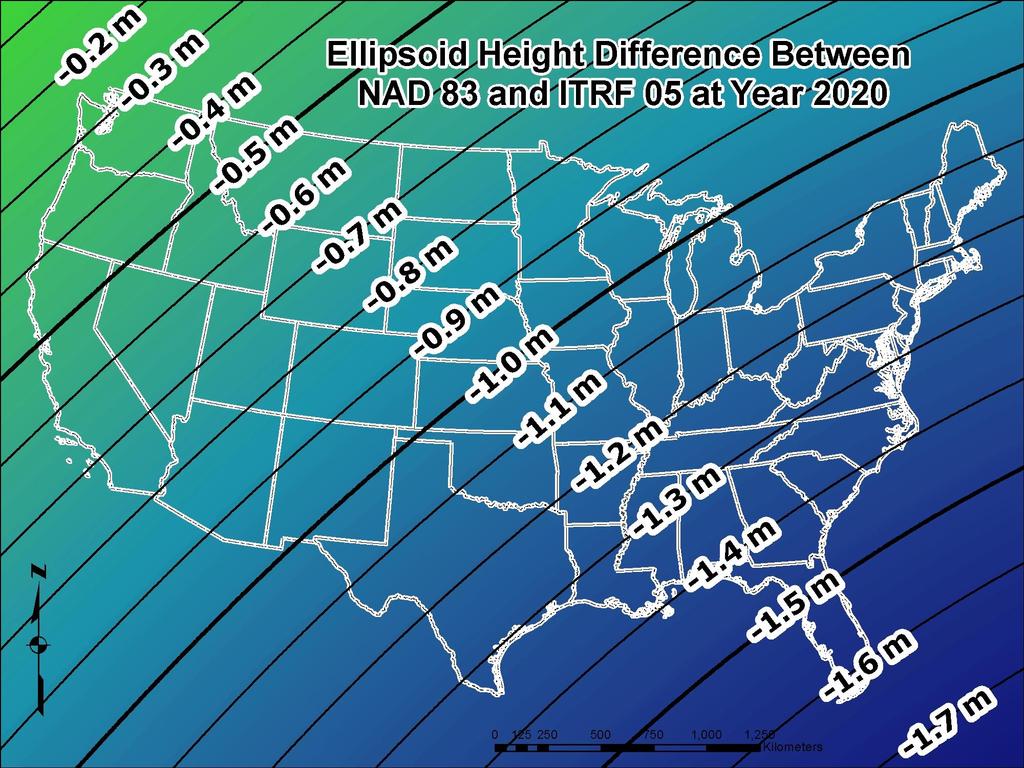
4 Problems with NAD 83 and NAVD 88 NAD 83 is not as geocentric as it could be (approx. 1.5 m for CONUS). Surveyors don t see this Yet NAD 83 is not well defined with positional velocities NAVD 88 is realized by passive control (bench marks) most of which have not been releveled in years NAVD 88 does not easily account for local vertical velocities (subsidence/uplift) Post glacial isostatic readjustment (Forebulge collapse) Subsurface fluid/hydrocarbon extraction Sediment loading - Compaction Sea level rise
5 New Reference Frame Names NAD 83 becomes: North American Terrestrial Reference Frame (NATR2022) Caribbean Terrestrial Reference Frame (CTRF2022) Mariana Terrestrial Reference Frame (MTRF2022) Pacific Terrestrial Reference Frame (PTRF2022) NAVD 88 becomes: North American-Pacific Geopotential Datum of 2022 (NAPGD2022) Realized by GEOID2022

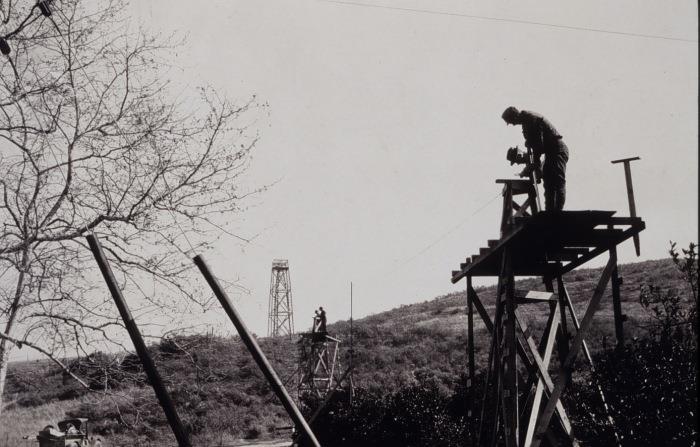
6 Cutting Edge Surveying Technology circa 1890

7 Salina, KS Baseline Measurement km/4.1 mi required about 5 weeks Precision ~ 8 mm/0.03 ft (1:721,600)

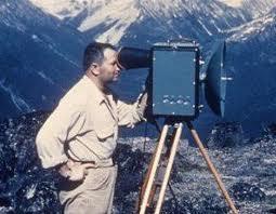
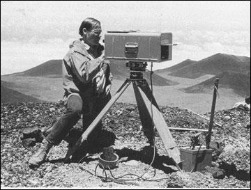
8 Advances in distance measurement technology Early 1900s
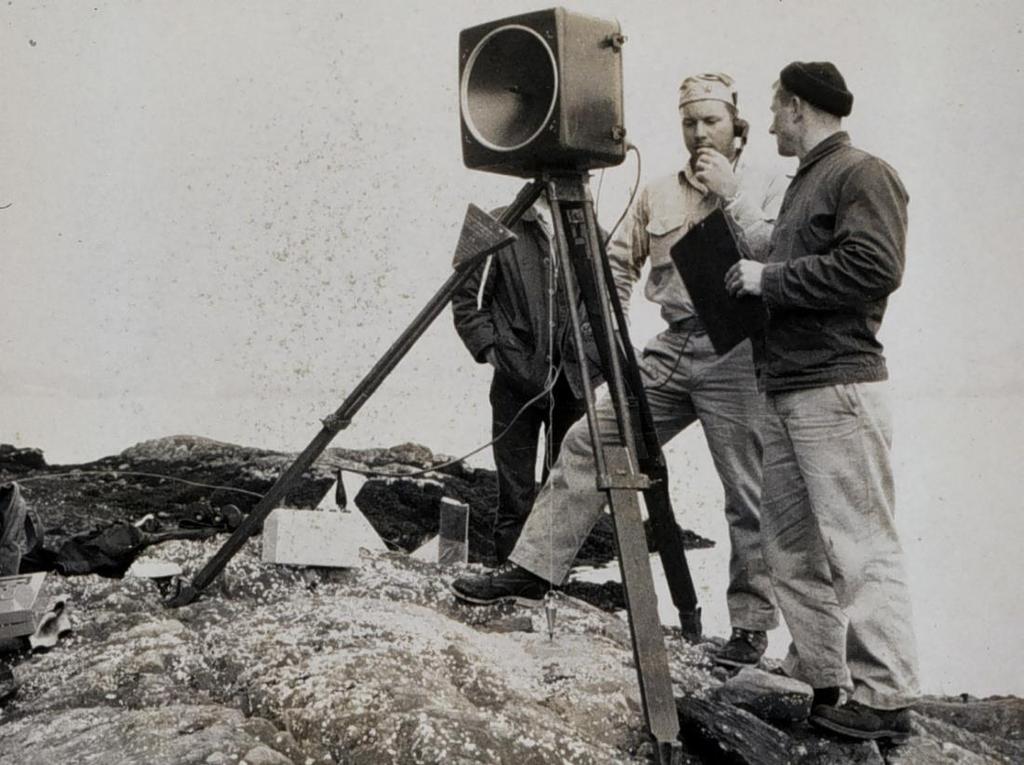
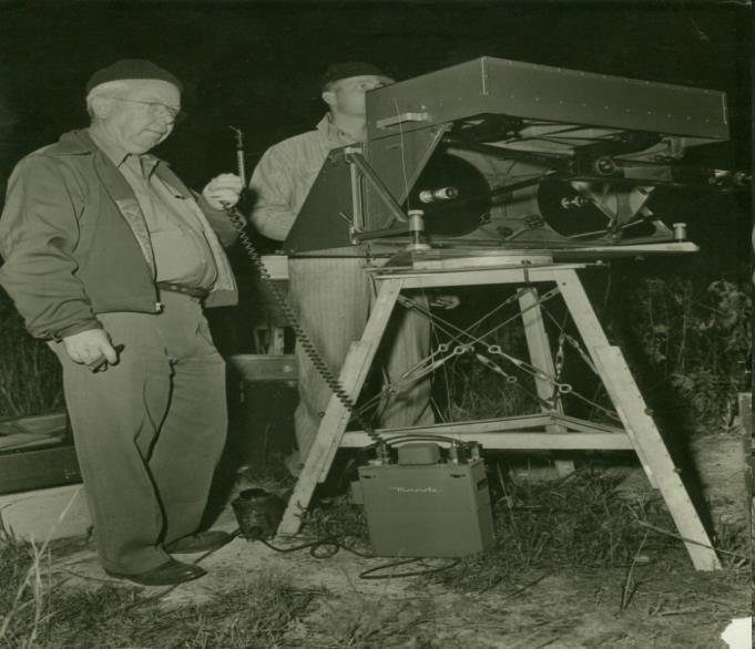
9 Electronic technology 1950s

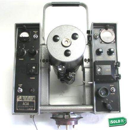
10 A Game Changer
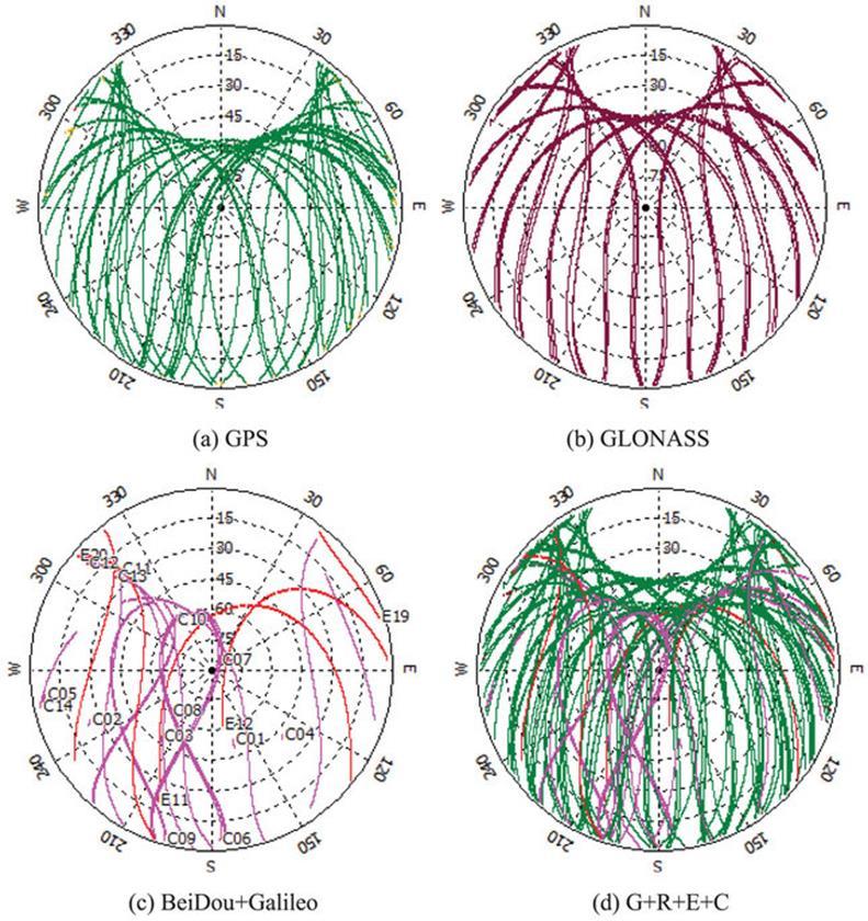
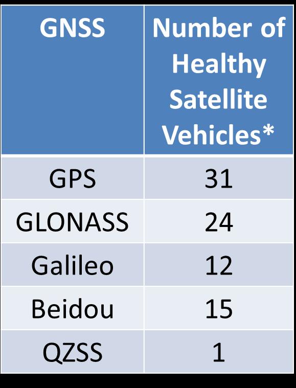
11 Global Navigation Satellite Systems US - GPS Russia - GLONASS EU - Galileo China BeiDou Four positioning and navigation systems NAVSTAR/GPS US (Currently 31) GLONASS Russia (Currently 24) Galileo EU (Currently 22, 4 planned for 2018) BeiDou3 China (Currently 2, 30 by 2020?)
12 Global Navigation Satellite Systems US - GPS Russia - GLONASS EU - Galileo China BeiDou 22

13 International Gold Standard International Earth Rotation and Reference System Service (IERS) Established 1987 Office in Paris, France Produces the International Terrestrial Reference System And International Terrestrial Reference Frame First ITRF 1988 Current ITRF 2014


14 IERS Four Geodetic Services International GNSS Service International DORIS Service International Laser Ranging Service International VLBI Service

15 Tectonic Plate Velocities

16 Tectonic Plate Velocities Horizontal Vertical IGS08 Velocities Mequon WIM5 N = m/yr E = m/yr U = m/yr
17 IGS08 is the GNSS component of the ITRF08 They can be considered to be equivalent MEQUON 5 (WIM5), WISCONSIN Antenna Reference Point(ARP): MEQUON 5 CORS ARP PID = DI2110 IGS08 POSITION (EPOCH ) Computed in Aug 2011 using data through gpswk X = m latitude = N Y = m longitude = W Z = m ellipsoid height = m IGS08 VELOCITY Computed in Aug 2011 using data through gpswk VX = m/yr northward = m/yr VY = m/yr eastward = m/yr VZ = m/yr upward = m/yr DEHt NAD_83 (2011) POSITION (EPOCH ) Transformed from IGS08 (epoch ) position in Aug X = m latitude = N Y = m longitude = W Z = m ellipsoid height = m NAD_83 (2011) VELOCITY Transformed from IGS08 velocity in Aug VX = m/yr northward = m/yr VY = m/yr eastward = m/yr VZ = m/yr upward = m/yr IGS08 NAD 83(2011) DHoriz = 1.095m/3.59ft = 1.042m/3.42ft
18 Simplified Concept of NAD 83 vs. ITRF/IGS h NAD83 h ITRF/IGS Earth s Surface ~ 1.5 m +/- 0.2 m CONUS ~ 1.4 m +/- 0.1 m AK ~ 1.9 m PR & VI ~ 2.5 m HI ~ 3.1 m AS ~ 2.3 m +/- 0.1 m GU & NM Mequon WIM5 dx = m dy = m dz = m 3D = m ITRF/IGS Origin NAD 83 Origin Identically shaped ellipsoids (GRS-80) a = 6,378, meters (semi-major axis) 1/f = (flattening)

19
20

21 Why isn t NAVD 88 good enough anymore? Approximate level of global geoid mismatch known to exist in the NAVD 88 zero surface:


22 Passive Vertical Control Mark Problems -- Are rarely re-leveled for movement -- Disappear by the hundreds every year -- Are not funded for replacement -- Are not often readily located for GPS observations -- Don t exist in most of Alaska -- Determined by leveling from a single point allowing cross-country error build up.
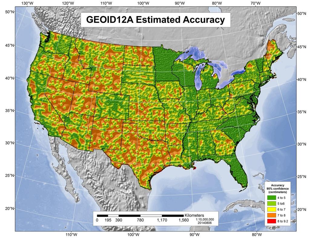
23 GEOID 12A/B ACCURACY


24 GEOID 12A/B Accuracy in Wisconsin

25 Post GEOID12B GPS on BM data in Wisconsin
26 NGS Plan for GEOID 19? Early January Produce a beta model with new data select Web Map End of February 2018 Engage surveyors to fill in GPS on BM gaps w/opus Share Solutions and/or OPUS Projects (Work w/regional Advisor John Ellingson) End of August 2018 Cut off acceptance of new GPS on BM data December 2018 Release BETA model Early 2019 Collect user feedback and resolve problems April 2019 Release final geoid model
27 NGS CORS Networked Data Some, but not all, CORS currently collect GLONASS data Can be provided to user by request NGS processing software PAGES/OPUS uses only GPS data NGS is currently reprocessing all CORS project REPRO new NAD 83 (2011) and IGS14 coordinates and updated velocities excepted soon (Spring 18?) NGS not likely to adjust existing passive GPS stations with respect to any CORS changes from REPRO New all viable GNSS processing software to replace PAGES being developed target 2022?


28 OPUS DB Simple Shared Data NGS Archived Update scaled NAD 83 positions for most NAVD 88 BMs Position NAVD 88 BMs for inclusion in next geoid model Helps improve accuracy of future vertical datum transformation tool Validate position/height of stations published in NSRS Position your new marks Position marks of other agencies not already in NSRS: USGS USACE BOR GLO/BLM State DoT
29 What can you do to improve the next NGS geoid model? / 2022 vertical transformation tool? OPUS DB Shared Solutions

30 Transition to the Future GRAV-D Gravity for the Redefinition of the American Vertical Datum Official NGS policy as of Nov 14, 2007 $38.5M over 10 years Airborne Gravity Snapshot Absolute Gravity Tracking Re-define the Vertical Datum of the USA by 2022 Approximately 64% Complete
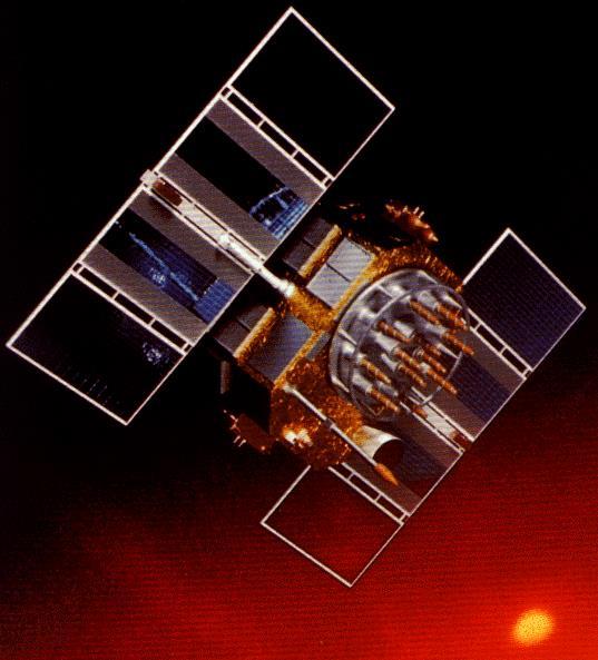
 137 mi apart/310 miles high Launched March")
 Launched March 2009 Re-entry")
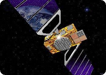
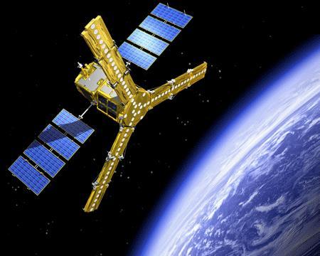
31 Space-Base Gravity Observations Gravity Recovery And Climate Experiment (GRACE) 137 mi apart/310 miles high Launched March 2002 Mission End October 2017 Gravity field and steady state Ocean Circulation Explorer (GOCE) Launched March 2009 Re-entry November 2013

")


32 Building a Gravity Field Long Wavelengths ( 250 km) GRACE/GOCE/Satellite Altimetry + Intermediate Wavelengths (500 km to 20 km) Airborne Measurement Surface Measurement and Predicted Gravity from Topography + Short Wavelengths (< 100 km)

33 GRAV-D STATUS : ~ 64% 33

34 SURVEY AND BLOCK PLANS Layout rectangular survey 400 x 500 km Extends beyond the shelf break Block size will reflect the endurance of the aircraft 34

35 SURVEY AND BLOCK PLANS Data lines spaced 10 km apart Cross lines spaced km apart Flight altitude 20,000 ft Nominal speed kts 35


36 GRAV-D AIRCRAFT DOI Bureau of Land Management Pilatus PC-12 Fugro King Air E-90A Cessna Conquest Naval Research Lab King Air RC-12 NOAA Gulfstream Jet Prop NOAA P-3 Hurricane Hunter Pilatus PC-12 King Air RC-12 King Air E-90A 36

37 GRAV-D Reconnaissance Survey GPS Base Stations Parking Space Gravity Tie 37


38 Gravity and GPS Base Stations Parking spot ID Micro-G A10 Absolute Gravity measurement GPS Base Stations Vertical gravity gradient 38


39 GRAV-D Aircraft Instrumentation Micro-g LaCoste TAGS Gravimeter NovAtel SPAN-SE w/ Honeywell µirs IMU Both instruments include GNSS receivers SPAN system allows for tightly coupled GPS/IMU solutions 39


40 INSTRUMENT INSTALLATION Instrument suite installed Lever arm survey required Test flight performed 40
41 BETA GEOID MODEL COMPUTATION The gravity data from satellites, airborne, corrected surface data, and terrain predictions will be blended into a gravity field As regions are completed, beta preliminary geoid models will be created and released to the public for local testing Create a gravimetric geoid model that will be the basis of the new vertical datum 41
42 Why GRAV-D? A relatively small workforce can update the geoid as compared to the large workforce needed to re-level bench marks As the H=0 surface (W 0 ), the geoid will be tracked over time to keep the datum up to date. Also known as the equipotential surface W 0 = 62,636,856.0 m 2 /s 2 A 2 cm target accuracy anywhere that GNSS receivers can be used, kept up to date through monitoring CORS and the geoid, is better than the accuracy and accessibility of NAVD 88 today It is far cheaper than leveling The geoid can t be bulldozed out of usefulness The effect of subsidence/uplift upon the realization will be known (and accounted for) by monitoring CORS and monitoring the geoid
43 What is GRAV-D? GRAV-D will mean: As the H=0 surface, the geoid will be tracked over time to keep the datum up to date The reliance on passive marks will dwindle to: Secondary access to the datum Minimal NGS involvement Maintenance/checking in the hands of users Use at your own risk
44 How will I access the new vertical datum? Primary access (NGS mission) Users with geodetic quality GNSS receivers will continue to use OPUS suite of tools and other standard processing methods (e.g. RTNs, RTK, Static ) Ellipsoid heights computed, and then a gravimetric geoid applied to provide orthometric heights in the new datum No passive marks needed But, could be used to position a passive mark
45 How will I access the new vertical datum? Secondary access (Use at your own risk) Passive marks that have been tied to the new vertical datum NGS will provide a data sharing service (e.g. OPUS Shared Solutions) for these points, but their accuracy (due to either the quality of the survey or the age of the data) will not be a responsibility of NGS
46 How will I access the new vertical datum? NAVD 88 conversion to new datum A conversion will be provided between NAVD 88 and the new datum Only where recent GNSS ellipsoid heights exist to provide modern heights in the new reference system

47 Geopotential Datum Changes USGG2012
48 BETA Geoid Model Computation The gravity data from satellites, airborne, corrected surface data, and terrain predictions will be blended into a gravity field As regions are completed, beta preliminary geoid models will be created and released to the public for local testing Create a gravimetric geoid model that will be the basis of the new vertical datum 48
49 xgeoid17 Experimental Model First experimental geoid published in June 2014 Includes all GRAV-D processed by the end of the previous year xgeoid17a Covers entire U.S. but does not include any GRAV-D data xgeoid17b Covers those areas of U.S. that include processed GRAV-D data (CONUS, ALASKA, PR & VI)
50 Predicted Position & Height Changes in 2022 WISCONSIN Near Milwaukee Computed for MILWAUKEE B (AA8062) HORIZONTAL = 1.27 m (4.2 ft) ELLIPSOID HEIGHT = m (- 3.5 ft) ORTHOMETRIC HEIGHT = m (- 2.2 ft) Computed with xgeoid17b Eau Claire Computed for CEC 5 (DJ4662) HORIZONTAL = 1.32 m (4.3 ft) ELLIPSOID HEIGHT = m (- 3.1 ft) ORTHOMETRIC HEIGHT = m (- 2.5 ft) Computed with xgeoid17b
51 Predicted Position & Height Changes in 2022 WISCONSIN Near Green Bay Computed for H (AH5305) HORIZONTAL = 1.30 m (4.3 ft) ELLIPSOID HEIGHT = m (- 3.3 ft) ORTHOMETRIC HEIGHT = m (- 2.2 ft) Computed with xgeoid17b Eagle River Computed for EAGLE RIVER GPS (QM0771) HORIZONTAL = 1.32 m (4.3 ft) ELLIPSOID HEIGHT = m (- 3.1 ft) ORTHOMETRIC HEIGHT = m (- 2.3 ft) Computed with xgeoid17b
52 Predicted Position & Height Changes in 2022 WISCONSIN Near Superior Computed for 315 RESET (RN1693) HORIZONTAL = 1.35 m (4.4 ft) ELLIPSOID HEIGHT = m (- 2.9 ft) ORTHOMETRIC HEIGHT = m (- 2.5 ft) Computed with xgeoid17b Stevens Point Computed for 5U04 (DJ4385) HORIZONTAL = 1.31 m (4.3 ft) ELLIPSOID HEIGHT = m (- 3.3 ft) ORTHOMETRIC HEIGHT = m (- 2.4 ft) Computed with xgeoid17b

53 Predicted 2022 Orthometric Heights From OPUS Make geoid-based orthometric heights available via OPUS - Done, in extended output
54 Metadata Coordinates and heights without appropriate metadata have the same value as a boundary line in Google Earth Just A Wild A** Guess
55 METADATA DATA ABOUT DATA Datums and Realizations NAD 27, NAD 83(1986), NAD83 (199X), NAD 83 (2007), NAD 83 (2011), Epoch xxxx.xx NGVD29, NAVD88 Units of Measure Meters, U.S. Survey Feet, International Feet Accuracy Horizontal & Vertical 0.03 m, 0.1 ft, 1 st -, 2 nd -, 3 rd - Order etc. How accurate are values really?


56 Examples of Bad Metadata LE0000 STATION RECOVERY (2013) LE0000 LE0000'RECOVERY NOTE BY INDIVIDUAL CONTRIBUTORS 2013 LE0000'RECOVERED BY XXXX ENGINEERING COMPANY LE0000'RECOVERED WITH THE FOLLOWING READINGS LE0000'LAT N03x 50' LE0000'LONG W09x 20' LE0000'ELEV LE0000' LE0000'NAD83 IOWA STATE PLANES, SOUTH ZONE, US FOOT LE0000'NORTHING x ' LE0000'EASTING xx '
57 What can you do to get ready for 2022?? Understand the impact of changing positions and heights for your community, company or agency Watch for upcoming NGS status reports/webinars Consider legislative changes to Wisconsin Statutes, Chapter 236, Subchapter NGS plans to publish State Plane Coordinates using the same geometric parameters as NAD 83 NGS SPC contact Michael Dennis Communicate your issues directly to NGS John Ellingson Great Lakes Regional Advisor Dru.Smith NSRS Modernization Manager
58 GOOD COORDINATION BEGINS WITH GOOD COORDINATES GEOGRAPHY WITHOUT GEODESY IS A FELONY
NSRS Modernization Update
 geodesy.noaa.gov NSRS Modernization Update Scott Lokken National Geodetic Survey, NOAA Mid Atlantic Regional Geodetic Advisor Oct 05, 2017 Maryland Society of Surveyors Fall Conference NGS Regional Geodetic
Overview of New Datums NOAA s National Geodetic Survey
 Overview of New Datums NOAA s National Geodetic Survey February 3, 2015 1 NGS s Mission and Role NGS Mission: To define, maintain, and provide access to the National Spatial Reference System to meet our
Overview of New Datums
 Overview of New Datums Scott Lokken NC Advisor NOAA s National Geodetic Survey 9/4/2015 1 New Datums are Coming in 2022! Both a new geometric and a new geopotential (vertical) datum will be released in
Datums and Tools to Connect Geospatial Data Accurately
 Datums and Tools to Connect Geospatial Data Accurately Pamela Fromhertz Colorado State Geodetic Advisor National Geodetic Survey National Oceanic and Atmospheric Administration GIS-T April 18, 2012 Loveland,
Determining Accurate Elevations: Datums & Tools, Today & Tomorrow
 Determining Accurate Elevations: Datums & Tools, Today & Tomorrow Association of State Floodplain Managers Annual Meeting Grand Rapids, MI Christine Gallagher June 21, 2016 Overview NGS Mission Important
An NGS Illustrated Guide to Geodesy for GIS Professionals
 An NGS Illustrated Guide to Geodesy for GIS Professionals Michael Dennis, RLS, PE michael.dennis@noaa.gov Esri User Conference San Diego Convention Center July 14-18, 2014 San Diego, CA Why should we care
ELEMENTS OF THE NATIONAL SPATIAL REFERENCE SYSTEM
 Dave Doyle NGS Chief Geodetic Surveyor dave.doyle@noaa.gov 301-713-3178 ELEMENTS OF THE NATIONAL SPATIAL REFERENCE SYSTEM ESRI SURVEY SUMMIT San Diego, CA June 17, 2007 ftp://ftp.ngs.noaa.gov/dist/daved/esri
Datums for a Dynamic Earth
 Datums for a Dynamic Earth Based on a paper given at the American Society of Agricultural and Biological Engineers (ASABE) Conference in Reno, Nevada June 2009 Rollin StrohmanPh.D. Tom Mastin L.S Background
Determining Accurate Elevations: Datums & Tools, Today & Tomorrow
 Determining Accurate Elevations: Datums & Tools, Today & Tomorrow Maryland Association Floodplain and Stormwater Managers Linthicum Heights, MD Christine Gallagher Oct. 20, 2016 Overview NGS Mission Important
Utilizing A GNSS Network Solution for Utility Applications
 Utilizing A GNSS Network Solution for Utility Applications David Newcomer, PE, PLS GPServ, Inc. newcomer@ (407) 601-5816 AGENDA Types and accuracies of data collection o Autonomous o Meter + o Sub-meter
High Precision GNSS for Mapping & GIS Professionals
 High Precision GNSS for Mapping & GIS Professionals Agenda Address your needs for GNSS knowledge. GNSS Basics Satellite Ranging Fundamentals (Code $ Carrier) Differential Corrections (Post Processed $
BILL HENNING, Prof LS. ACRONYMS
 BILL HENNING, Prof LS. ACRONYMS US 1 WIKIPEDIA: Also known as geodetics, geodetic engineering or geodetics engineering a branch of applied mathematics [2] and earth sciences, is the scientific discipline
Introduction to Datums James R. Clynch February 2006
 Introduction to Datums James R. Clynch February 2006 I. What Are Datums in Geodesy and Mapping? A datum is the traditional answer to the practical problem of making an accurate map. If you do not have
BILL HENNING, Prof LS.
 BILL HENNING, Prof LS. DEFINITIONS: GEODESY, DATUMS, NSRS ACCESSING THE DATUM REALIZATION: PASSIVE MARKS, ACTIVE STATIONS WORLD SCIENTIFIC DATUMS HORIZONTAL, GEOMETRIC, VERTICAL, GRAVIMETRIC DATUMS IN
GNSS 101 Bringing It Down To Earth
 GNSS 101 Bringing It Down To Earth Steve Richter Frontier Precision, Inc. UTM County Coordinates NGVD 29 State Plane Datums Scale Factors Projections Session Agenda GNSS History & Basic Theory Coordinate
Geodesy, Geographic Datums & Coordinate Systems
 Geodesy, Geographic Datums & Coordinate Systems What is the shape of the earth? Why is it relevant for GIS? 1/23/2018 2-1 From Conceptual to Pragmatic Dividing a sphere into a stack of pancakes (latitude)
Datum Transformations: Nightmare on GIS Street. Agenda
 Datum Transformations: Nightmare on GIS Street Speaker: Eric Gakstatter Contributing Editor GPS World Editor - Geospatial Solutions Presented at: Minnesota Society of Professional Surveyors Bloomington,
Lecture 14 NAD 83(NSRS), NAD 83(CORS 96), WGS84 and ITRF
, NAD 83(CORS 96), WGS84 and ITRF") Lecture 14 NAD 83(NSRS), NAD 83(CORS 96), WGS84 and ITRF Monday, March 1, 2010 2 March 2010 GISC3325 NAD 27 and NAD 83 NAD 27 and NAD 83 Versions of NAD 83 First implementation labeled NAD 83 (1986). Deficiencies
Lecture 14 NAD 83(NSRS), NAD 83(CORS 96), WGS84 and ITRF Monday, March 1, 2010 2 March 2010 GISC3325 NAD 27 and NAD 83 NAD 27 and NAD 83 Versions of NAD 83 First implementation labeled NAD 83 (1986). Deficiencies
FieldGenius Technical Notes GPS Terminology
 FieldGenius Technical Notes GPS Terminology Almanac A set of Keplerian orbital parameters which allow the satellite positions to be predicted into the future. Ambiguity An integer value of the number of
GPS Geodetic Reference System WGS 84
 GPS Geodetic Reference System WGS 84 International Committee on GNSS Working Group D Saint Petersburg, Russia 16 September 2009 Barbara Wiley National Geospatial-Intelligence Agency United States of America
Lecture # 7 Coordinate systems and georeferencing
 Lecture # 7 Coordinate systems and georeferencing Coordinate Systems Coordinate reference on a plane Coordinate reference on a sphere Coordinate reference on a plane Coordinates are a convenient way of
Benefits and Impacts to Nautical Charting by Adopting a New Reference Frame. Dr. Neil Weston Office of Coast Survey, NOAA
 Benefits and Impacts to Nautical Charting by Adopting a New Reference Frame Dr. Neil Weston Office of Coast Survey, NOAA Motivation for this study NOAA s National Geodetic Survey New geometric reference
Standard for New Zealand Vertical Datum 2016 LINZS25009
 Standard for New Zealand Vertical Datum 2016 LINZS25009 Effective Date: 27 June 2016 Table of Contents TERMS ND DEFINITIONS... 3 FOREWORD... 5 INTRODUCTION... 5 PURPOSE OF STNDRD... 5 BRIEF HISTORY OF
What makes the positioning infrastructure work. Simon Kwok Chairman, Land Surveying Division Hong Kong Institute of Surveyors
 What makes the positioning infrastructure work The experience of the Hong Kong Satellite Positioning Reference Station Network Simon Kwok Chairman, Land Surveying Division Hong Kong Institute of Surveyors
Appendix A Lower Columbia River Chart Datum Modeling
 Appendix A Lower Columbia River Chart Datum Modeling David Evans and Associates, Inc. David Evans and Associates, Inc. 2801 SE Columbia Way, Ste. 130 Vancouver, WA 98661 (360) 314-3200 1.0 Vertical Datum
Development of Geoid Based Vertical Datums, A New Zealand Perspective
 Technical Seminar Reference Frame in Practice, Development of Geoid Based Vertical Datums, A New Zealand Perspective Matt Amos Manager Positioning and Innovation Land Information New Zealand Sponsors:
Application of GPS/GNSS in Cybermapping. Cybermapping Lab University of Texas at Dallas 2009
 Application of GPS/GNSS in Cybermapping Cybermapping Lab University of Texas at Dallas 2009 GNSS Global Navigation Satellite System (GNSS) is the standard generic term for satellite navigation systems
Basic Geodetics. Bobby Saleh Guidon Energy April 13, 2017
 Experts in Geomatics, Surveying, Positioning, Geospatial Data, and Mapping Sciences Basic Geodetics Bobby Saleh Guidon Energy b.saleh@guidonenergy.com April 13, 2017 The Earth is NOT flat Q: So what does
Definition and use of the New Zealand Vertical Datum Matt Amos Senior Advisor Geodesy
 Definition and use of the New Zealand Vertical Datum 2009 Matt Amos Senior Advisor Geodesy NZIS Continuing Professional Development Programme, November 2009 Overview Height Theory Heights in New Zealand
AUSPOS GPS Processing Report
 AUSPOS GPS Processing Report February 13, 2012 This document is a report of the GPS data processing undertaken by the AUSPOS Online GPS Processing Service (version: AUSPOS 2.02). The AUSPOS Online GPS
GNSS & Coordinate Systems
 GNSS & Coordinate Systems Matthew McAdam, Marcelo Santos University of New Brunswick, Department of Geodesy and Geomatics Engineering, Fredericton, NB May 29, 2012 Santos, 2004 msantos@unb.ca 1 GNSS GNSS
DYNAMIC RT TECHNOLOGY
 DYNAMIC RT TECHNOLOGY GLOBAL NAVIGATION SATELLITE SYSTEMS (GNSS) POTENTIAL FUTURE DEVELOPMENTS(2005 2017?) GPS MODERNIZATION BLOCK IIF & III GLONASS ENHANCEMENTS (K & M) EUROPEAN UNION - GALILEO CHINA
The Global Positioning System II Field Experiments
 The Global Positioning System II Field Experiments 5-1 Mexico DGPS Field Campaign Cenotes in Tamaulipas, MX, near Aldama 5-2 Are Cenote Water Levels Related? 5-3 DGPS Static Survey of Cenote Water Levels
Coordinates, Datums, and Map Projection
 Coordinates, Datums, and Map Projection Two views on the World Intersect at 90 o angles Latitude/ Longitude is a Spherical System Acceptable latitudes/longitudes i) W125 o 27 33 ii) N92 o 45 12 iii)
Understanding the Evolution of WGS 84 and NAD 83
 Summary Both WGS 84, the datum used by GPS,, commonly used in North America, have been redefined several times since their beginning. Parallel to this, there have also been several realizations of the
Beginners Guide to GPS Elevation Plus an Update on GPS Technology
 Beginners Guide to GPS Elevation Plus an Update on GPS Technology A TMS Presentation By: Jon Aschenbach Summerlake Enterprises 919 36 th Place Forest Grove, OR 97116 503-707-6236 Coeur d Alene, ID April,
The Global Positioning Sytem II 10/19/2017
 The Global Positioning System II Field Experiments 10/19/2017 5-1 Mexico DGPS Field Campaign Cenotes in Tamaulipas, MX, near Aldama 10/19/2017 5-2 Are Cenote Water Levels Related? 10/19/2017 5-3 M. Helper,
Standard for the Australian Survey Control Network
 Standard for the Australian Survey Control Network Special Publication 1 Intergovernmental Committee on Survey and Mapping (ICSM) Geodesy Technical Sub-Committee (GTSC) 30 March 2012 Table of contents
9/26/2016. Accuracy with GNSS What are you getting? Presented By Tom Bryant PLS Kelly Harris PLS Seiler Instrument
 Accuracy with GNSS What are you getting? Presented By Tom Bryant PLS Kelly Harris PLS Seiler Instrument 1 What We Will Talk About Today What coordinate system should I use in my data collector Site Calibrations-what
WISCONSIN COORDINATE SYSTEMS
 Pdf versions of the Handout and Powerpoint slides are on jerrymahun.com. Follow the USPLSS Forum link and use the password: WildT2 WISCONSIN COORDINATE SYSTEMS CONCEPTS & IMPLEMENTATION Jerry Mahun, PLS,
CHAPTER 5 Vertical Control. CE 316 January 2012
 CHAPTER 5 Vertical Control CE 316 January 01 137 5.1 Introduction Vertical Datums Leveling Techniques and Corrections Bench Mark Design and Construction Bench Mark Data Trigonometric Barometric Leveling
Geodetic policy for Ireland and Northern Ireland
 Geodetic policy for Ireland and Northern Ireland Background Ordnance Survey Ireland (OSi) is the National Mapping Agency (NMA) of the Republic of Ireland. The Ordnance Survey of Northern Ireland (OSNI)
Lecture 16 NAD 83 (1986), NAD 83(1993) and NAD 83 (NSRS 2007) 10 March 2009 GISC3325
, NAD 83(1993) and NAD 83 (NSRS 2007) 10 March 2009 GISC3325") Lecture 16 NAD 83 (1986), NAD 83(1993) and NAD 83 (NSRS 2007) 10 March 2009 GISC3325 Significant dates 16-20 March 2009 is Spring Break 12 March 2009 is Exam Two Emphasis on chapter 5, 6 and 8 of text
Lecture 16 NAD 83 (1986), NAD 83(1993) and NAD 83 (NSRS 2007) 10 March 2009 GISC3325 Significant dates 16-20 March 2009 is Spring Break 12 March 2009 is Exam Two Emphasis on chapter 5, 6 and 8 of text
GROUND CONTROL SURVEY REPORT
 GROUND CONTROL SURVEY REPORT Services provided by: 3001, INC. a Northrop Grumman company 10300 Eaton Place Suite 340 Fairfax, VA 22030 Ground Control Survey in Support of Topographic LIDAR, RGB Imagery
GPS for. Land Surveyors. Jan Van Sickle. Fourth Edition. CRC Press. Taylor & Francis Group. Taylor & Francis Croup, an Informa business
 GPS for Land Surveyors Fourth Edition Jan Van Sickle CRC Press Taylor & Francis Group Boca Raton London New York CRC Press is an imprint of the Taylor & Francis Croup, an Informa business Contents Preface
A NEW GEOCENTRIC DATUM FOR NEW ZEALAND
 A NEW GEOCENTRIC DATUM FOR NEW ZEALAND Don Grant Graeme Blick Office of Surveyor-General Land Information New Zealand PO Box 5501 Wellington New Zealand Phone 04 4600100 Fax 04 4722244 dgrant@linz.govt.nz
Chapter 6 GPS Relative Positioning Determination Concepts
 Chapter 6 GPS Relative Positioning Determination Concepts 6-1. General Absolute positioning, as discussed earlier, will not provide the accuracies needed for most USACE control projects due to existing
GLOBAL POSITIONING SYSTEMS
 GLOBAL POSITIONING SYSTEMS GPS & GIS Fall 2017 Global Positioning Systems GPS is a general term for the navigation system consisting of 24-32 satellites orbiting the Earth, broadcasting data that allows
CHAPTER 2 GEODESY AND DATUMS IN NAVIGATION
 CHAPTER 2 GEODESY AND DATUMS IN NAVIGATION GEODESY, THE BASIS OF CARTOGRAPHY 200. Definition Geodesy is the application of mathematics to model the size and shape of the physical earth, enabling us to
GNSS Technology Update
 GNSS Technology Update Speaker: Eric Gakstatter Contributing Editor GPS World Editor - Geospatial Solutions Presented at: Association of Petroleum Surveying & Geomatics Houston, TX April 7, 2015 Agenda
IAG School on Reference Systems June 7 June 12, 2010 Aegean University, Department of Geography Mytilene, Lesvos Island, Greece SCHOOL PROGRAM
 IAG School on Reference Systems June 7 June 12, 2010 Aegean University, Department of Geography Mytilene, Lesvos Island, Greece SCHOOL PROGRAM Monday June 7 8:00-9:00 Registration 9:00-10:00 Opening Session
Geodetic Positioning Refresher
 Geodetic Positioning Refresher by Joan Yau PhD ABCLS AGM 2016, Kimberley BC Contents Horizontal / Vertical Datums and Epochs used in BC and Canada How do we reference our project coordinates to BC datums
Using RTK GNSS Wisely
 Using RTK GNSS Wisely February 017 Autonomous Positioning Differential Positioning Concept: Detect and cancel identical errors with simultaneous observation. F + E = G + E 1 Static & RTK Computations Static
Who s heard of the GDA2020?
 Implications of a next generation datum in Australia on mining operations: A discussion. School of Civil & Environmental Engineering Craig Roberts Senior lecturer Surveying and Geospatial Engineering group
MONITORING SEA LEVEL USING GPS
 38 MONITORING SEA LEVEL USING GPS Hasanuddin Z. Abidin* Abstract GPS (Global Positioning System) is a passive, all-weather satellite-based navigation and positioning system, which is designed to provide
Choosing the best path:
 GEODESY Choosing the best path: Global to national coordinate transformations The paper demonstrates that differences of up to a few centimetres in each coordinate component can occur depending on the
Geodetic Reference Frame Theory
 Technical Seminar Reference Frame in Practice, Geodetic Reference Frame Theory and the practical benefits of data sharing Geoffrey Blewitt University of Nevada, Reno, USA http://geodesy.unr.edu Sponsors:
New Zealand Reference Frame Case Study
 New Zealand Reference Frame Case Study Graeme Blick Chief Geodesist Land Information New Zealand 1 Fundamental role of the reference frame Requirements of a National Reference System A coordinate framework
NATIONAL VDATUM -- THE IMPLEMENTATION OF A NATIONAL VERTICAL DATUM TRANSFORMATION DATABASE
 NATIONAL VDATUM -- THE IMPLEMENTATION OF A NATIONAL VERTICAL DATUM TRANSFORMATION DATABASE Bruce Parker, Dennis Milbert, Kurt Hess, and Stephen Gill National Ocean Service, NOAA The National Ocean Service
Satellite Laser Retroreflectors for GNSS Satellites: ILRS Standard
 Satellite Laser Retroreflectors for GNSS Satellites: ILRS Standard Michael Pearlman Director Central Bureau International Laser Ranging Service Harvard-Smithsonian Center for Astrophysics Cambridge MA
Global Positioning Systems - GPS
 Global Positioning Systems - GPS GPS Why? What is it? How does it work? Differential GPS How can it help me? GPS Why?? Where am I? How do I get there? Where are you, and how do I get to You? WHO CARES???
Applications, Products and Services of GPS Technology
 Applications, Products and Services of GPS Technology Enrico C. Paringit. Dr. Eng. University of the Philippines Training Center for Applied Geodesy and Photogrammetry 1 Outline of this Presentation GPS
Update on the International Terrestrial Reference Frame (ITRF)
") Update on the International Terrestrial Reference Frame (ITRF) Zuheir Altamimi Head of the IERS ITRF Product Center Institut National de l Information Géographique et Forestière IGN, France E-mail: zuheir.altamimi@ign.fr
Update on the International Terrestrial Reference Frame (ITRF) Zuheir Altamimi Head of the IERS ITRF Product Center Institut National de l Information Géographique et Forestière IGN, France E-mail: zuheir.altamimi@ign.fr
Global Positioning Systems -GPS
 Global Positioning Systems -GPS GPS Why? What is it? How does it work? Differential GPS How can it help me? GPS Why?? Where am I? How do I get there? Where are you, and how do I get to You? WHO CARES???
Overview of Tides and Water Levels
 Overview of Tides and Water Levels www.tidesandcurrents.noaa.gov New Orleans, Baton Rouge, Lafayette, LA March 2009 Gerald Hovis, NOAA - National Ocean Service William Sweet, NOAA - National Ocean Service
Geoscience & Positioning, Navigation and Timing Services for Canadians
 Geoscience & Positioning, Navigation and Timing Services for Canadians Calvin Klatt, Ph.D. Director and Chief Geodesist Natural Resources Canada / Directeur et géodésien principal Ressources naturelles
LSD PQSL Series Geodetic Survey. Prepared by Mr KWOK King-hung 22 May 2015
 LSD PQSL Series 2015 Geodetic Survey Prepared by Mr KWOK King-hung 22 May 2015 1 Geodesy Source from Wiki May 2015 also known as geodetics or geodetics engineering a branch of applied mathematics and earth
U.S. Army Corps of Engineers: Review of Progress Toward Consistent Vertical Datums. by Jim Garster and Mark Huber
 U.S. Army Corps of Engineers: Review of Progress Toward Consistent Vertical Datums by Jim Garster and Mark Huber i ii Abstract A vertical datum is the most important part of any geospatial data, no matter
OLC Turnbull. wsidata.com
 OLC Turnbull wsidata.com August 26, 2013 Base station set up over control TURN_03 Data collected for: Department of Geology and Mineral Industries 800 NE Oregon Street Suite 965 Portland, OR 97232 Prepared
GPS Technical Aspects
 GPS Technical Aspects Charles Ghilani (cghilani@psu.edu) Turn off all cell phones Or set them to vibrate Class Etiquette Ask questions at any point during the class. Simply speak up so that all can hear
PHOTOGRAMMETRIC RESECTION DIFFERENCES BASED ON LABORATORY vs. OPERATIONAL CALIBRATIONS
 PHOTOGRAMMETRIC RESECTION DIFFERENCES BASED ON LABORATORY vs. OPERATIONAL CALIBRATIONS Dean C. MERCHANT Topo Photo Inc. Columbus, Ohio USA merchant.2@osu.edu KEY WORDS: Photogrammetry, Calibration, GPS,
LAB PROCEDURES: TOPCON TOOLS FAMILIARIZATION
 LAB PROCEDURES: TOPCON TOOLS FAMILIARIZATION This lab will cover the basic setup and processing options of Topcon Tools (TT). We will learn how to start a project, upload data and control files, set up
Using GPS to Establish the NAVD88 Elevation on Reilly The A-order HARN Station at NMSU
 Using GPS to Establish the NAVD88 Elevation on Reilly The A-order HARN Station at NMSU Earl F. Burkholder, PS, PE New Mexico State University Las Cruces, NM 88003 July 005 Introduction GPS has become an
The Geodetic Reference Antenna in Space (GRASP): A Mission to Enhance the Terrestrial Reference Frame
: A Mission to Enhance the Terrestrial Reference Frame") The Geodetic Reference Antenna in Space (GRASP): A Mission to Enhance the Terrestrial Reference Frame Yoaz Bar-Sever, R. Steven Nerem, and the GRASP Team The Most Complete Geodesy Mission Collocate all
The Geodetic Reference Antenna in Space (GRASP): A Mission to Enhance the Terrestrial Reference Frame Yoaz Bar-Sever, R. Steven Nerem, and the GRASP Team The Most Complete Geodesy Mission Collocate all
The Global Positioning System II Field Experiments. 10/10/2013 GEO327G/386G, UT Austin 5-1
 The Global Positioning System II Field Experiments 10/10/2013 GEO327G/386G, UT Austin 5-1 Mexico DGPS Field Campaign Cenotes in Tamaulipas, MX, near Aldama 10/10/2013 GEO327G/386G, UT Austin 5-2 Are Cenote
National Height Modernization: Cost comparison of conducting a vertical survey by leveling versus by GPS in western North Carolina
 Introduction: National Height Modernization: Cost comparison of conducting a vertical survey by leveling versus by GPS in western North Carolina The North Carolina Geodetic Survey (NCGS) conducted a National
CGG. Office of the Surveyor General of the Federation Federal Capital Territory, Abuja, Nigeria 2
 Prof. P. C. Nwilo 1, * Dr. J. D. Dodo 2, U. R. Edozie 1, and A. Adebomehin 1. 1 Office of the Surveyor General of the Federation Federal Capital Territory, Abuja, Nigeria 2 Centre for Geodesy and Geodynamics,
Connecting a Cadastral Survey to PNG94 using GNSS
 43rd Association of Surveyors PNG Congress, Lae, 12th-15th August 2009 Connecting a Cadastral Survey to PNG94 using GNSS Richard Stanaway QUICKCLOSE Workshop overview Legal requirements to connect surveys
Overview of Recent Tidal Projects in the United States
 1 st Tides and Water Levels Working Group Meeting Overview of Recent Tidal Projects in the United States Stephen Gill National Oceanic and Atmospheric Administration, National Ocean Service Center for
GNSS CORS in the Pacific
 GNSS CORS in the Pacific FIG References Frame in Practice Seminar Operational Aspects of GNSS CORS Technical Workshop Holiday Inn, Suva - Fiji PGSC Partnership Desk, GEM Division, Pacific Community (SPC)
GPS for crustal deformation studies. May 7, 2009
 GPS for crustal deformation studies May 7, 2009 High precision GPS for Geodesy Use precise orbit products (e.g., IGS or JPL) Use specialized modeling software GAMIT/GLOBK GIPSY OASIS BERNESE These software
Active microwave systems (1) Satellite Altimetry
 Satellite Altimetry") Remote Sensing: John Wilkin Active microwave systems (1) Satellite Altimetry jwilkin@rutgers.edu IMCS Building Room 214C 732-932-6555 ext 251 Active microwave instruments Scatterometer (scattering from
Remote Sensing: John Wilkin Active microwave systems (1) Satellite Altimetry jwilkin@rutgers.edu IMCS Building Room 214C 732-932-6555 ext 251 Active microwave instruments Scatterometer (scattering from
INTEGRATING BATHYMETRY, TOPOGRAPHY, AND SHORELINE, AND THE IMPORTANCE OF VERTICAL DATUMS
 INTEGRATING BATHYMETRY, TOPOGRAPHY, AND SHORELINE, AND THE IMPORTANCE OF VERTICAL DATUMS Bruce Parker, Dennis Milbert, Kurt Hess, and Stephen Gill National Ocean Service, NOAA 1315 East-West Highway Silver
Connecting a Survey to PNG94 and MSL using GNSS
 45th Association of Surveyors PNG Congress, Madang, 19-22 July 2011 Connecting a Survey to PNG94 and MSL using GNSS Richard Stanaway QUICKCLOSE Workshop overview Legal requirements to connect surveys to
GPS and GNSS from the International Geosciences Perspective
 GPS and GNSS from the International Geosciences Perspective G. Beutler Astronomical Institute, University of Bern Member of IAG Executive Committee and of IGS Governing Board National Space-Based Positioning,
MAINTENANCE DREDGING, PORT OF ALASKA HYDROGRAPHIC SURVEY PRE_ _POA ANCHORAGE, ALASKA V-101 SHEET IDENTIFICATION.
 _FINAL.DWG /7/08 0:07 AM " = 00' 0-8 W9KB8C000 ANCEXP 7 May 08 /07/8 CONTRACT NO. W9KB-8-C-000 Engineers V-0 _FINAL.DWG /7/08 0:07 AM " = 00' 0-8 W9KB8C000 ANCEXP 7 May 08 /07/8 CONTRACT NO. W9KB-8-C-000
PREFACE. National Geographic Department would like to express our sincere thanks for your comments.
 PREFACE According to the role of National Geographic Department on Prim Minister s Decree No 255 PM, dated August 16, 2005 regarding to Surveying, Aerial Photography and mapping activities in the territory
The realization of a 3D Reference System
 The realization of a 3D Reference System Standard techniques: topographic surveying and GNSS Observe angles and distances either between points on the Earth surface or to satellites and stars. Do not observe
Philippine Geodetic Infrastructure Status, Challenges and Future Direction
 Philippine Geodetic Infrastructure Status, Challenges and Future Direction Engr. Charisma Victoria D. Cayapan National Mapping and Resource Information Authority PHILIPPINES Outline Evolution of Geodetic
TECHNICAL REPORT NO. 45 TECHNICAL REVIEW AND REEVALUATION OF THE REGIONAL CONTROL SURVEY PROGRAM IN SOUTHEASTERN WISCONSIN
 TECHNICAL REPORT NO. 45 TECHNICAL REVIEW AND REEVALUATION OF THE REGIONAL CONTROL SURVEY PROGRAM IN SOUTHEASTERN WISCONSIN SOUTHEASTERN WISCONSIN REGIONAL PLANNING COMMISSION SOUTHEASTERN WISCONSIN REGIONAL
TDS Survey Pro CE Version Setup RTK Base on known NAD83/WGS84 Point: Mapping Plane Geoid99 Modeling.
 TDS Survey Pro CE Version 2.1.8 Setup RTK Base on known NAD83/WGS84 Point: Mapping Plane Geoid99 Modeling. Pre-load known NAD83 State Plane Coordinates and appropriate NGS Geoid 99/96 data files into the
The Promise and Challenges of Accurate Low Latency GNSS for Environmental Monitoring and Response
 Technical Seminar Reference Frame in Practice, The Promise and Challenges of Accurate Low Latency GNSS for Environmental Monitoring and Response John LaBrecque Geohazards Focus Area Global Geodetic Observing
Other Space Geodetic Techniques. E. Calais Purdue University - EAS Department Civil 3273
 Other Space Geodetic Techniques E. Calais Purdue University - EAS Department Civil 3273 ecalais@purdue.edu Satellite Laser Ranging = SLR Measurement of distance (=range) between a ground station and a
LiDAR Remote Sensing Data Collection Department of Geology and Mineral Industries Mt. Shasta Study Area February 2, 2011
 LLiiD DA AR RR Reem moottee SSeennssiinngg D Daattaa C Coolllleeccttiioonn D Deeppaarrttm meenntt ooff G Geeoollooggyy aanndd M Miinneerraall IInndduussttrriieess M Mtt.. SShhaassttaa SSttuuddyy A Arreeaa
National Reference Systems of the RUSSIAN FEDERATION, used in GLONASS. including the user and fundamental segments
 National Reference Systems of the RUSSIAN FEDERATION, used in GLONASS. including the user and fundamental segments 8-th Meeting of the International Committee on Global Navigation Satellite Systems Dubai,
Baldwin and Mobile Counties, AL Orthoimagery Project Report. Submitted: March 23, 2016
 2015 Orthoimagery Project Report Submitted: Prepared by: Quantum Spatial, Inc 523 Wellington Way, Suite 375 Lexington, KY 40503 859-277-8700 Page i of iii Contents Project Report 1. Summary / Scope...
Other Space Geodetic Techniques. E. Calais Purdue University - EAS Department Civil 3273
 Other Space Geodetic Techniques E. Calais Purdue University - EAS Department Civil 3273 ecalais@purdue.edu Satellite Laser Ranging Measurement of distance (=range) between a ground station and a satellite
GEODESY LESSON PLAN Meet Geodesy
 Meet Lesson Plan GEODESY LESSON PLAN Meet Focus Introduction to geodesy Grade Level 9-12 Focus Question What is geodesy, and why is it important? Learning Objectives Students will be able to define geodesy.
Progress Towards the Seamless Combination of Bathymetric and Topographic Data in New Zealand
 Progress Towards the Seamless Combination of Bathymetric and Topographic Data in New Zealand Matt Amos Senior Technical Advisor National Geodetic Office Introduction Datasets usually defined in terms of
HEIGHTING WITH GPS: POSSIBILITIES AND LIMITATIONS
 HEIGHTING WITH GPS: POSSIBILITIES AND LIMITATIONS Matthew B. Higgins ABSTRACT Global Positioning System (GPS) surveying is now seen as a true three dimensional tool and GPS heighting can be a viable alternative