GNSS CORS in the Pacific
|
|
|
- Grant Paul
- 5 years ago
- Views:
Transcription
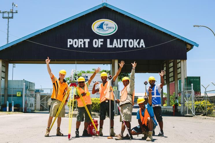
1 GNSS CORS in the Pacific FIG References Frame in Practice Seminar Operational Aspects of GNSS CORS Technical Workshop Holiday Inn, Suva - Fiji PGSC Partnership Desk, GEM Division, Pacific Community (SPC) National Geodesy & GNSS Networks Team, Geoscience Australia 18 September 2018

2 REGIONAL NETWORKS SPRGN South Pacific Regional GNSS Network 14 GNSS COR Stations 13 Pacific Island Countries Managed by GA, with the assistance of local government Lands & Survey or Weather offices.


3 REGIONAL NETWORKS SPRGN South Pacific Regional GNSS Network


4 REGIONAL NETWORKS SPRGN South Pacific Regional GNSS Network
 provides 1 Hz data streaming")


5 REAL TIME GNSS NETWORK AUSCORS NTRIP Broadcaster Geoscience Australia (GA) provides 1 Hz data streaming from our Global Navigation Satellite System (GNSS) stations throughout Australia, Antarctica and the Pacific, with a mean latency of below 2 seconds. The SPRGN GNSS CORS network was established primarily for scientific research, in particular the monitoring of crustal deformation and tectonic motion. Real-time data is an additional benefit of these networks


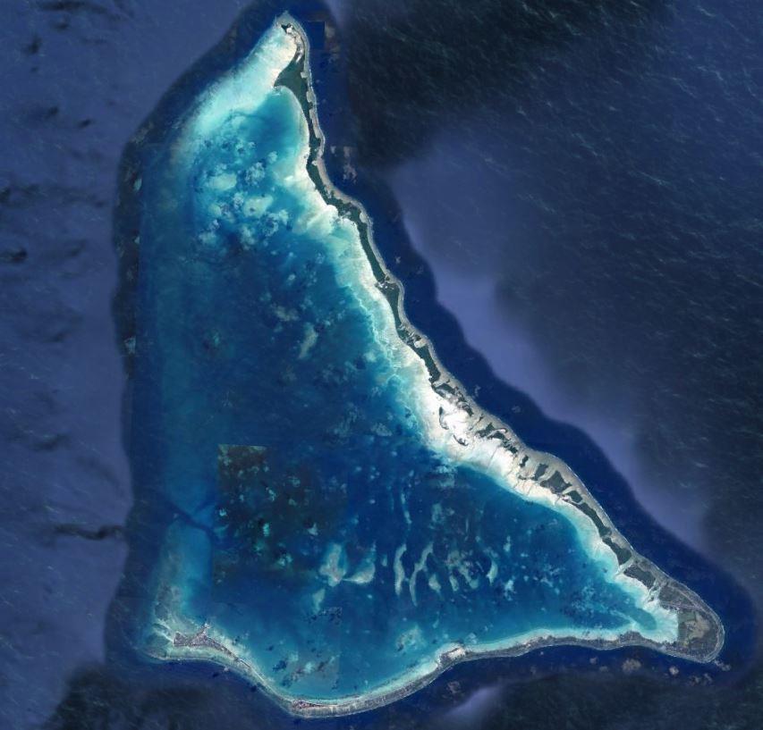
6 GNSS STATION (CORS) LAUTOKA, FIJI. IGS Network
 since 1991 Comprises of a tide gauge network component, and geodetic monitoring component (GNSS")
7 COSPPac The Pacific Sea Level & Geodetic Monitoring Project (PSLGMP), operates under the Climate and Oceans Support Program in the Pacific (COSPPac). It is a continuation of the 20-year South Pacific Sea Level and Climate Monitoring Project (SPSLCMP) since 1991 Comprises of a tide gauge network component, and geodetic monitoring component (GNSS CORS) To monitor sea level over a long time period, vertical crustal movement of the earth needs to be accounted for, to provide an absolute reading from the tide gauge Geodetic monitoring component is maintained by Geoscience Australia Providing a Long term height time series of data Providing a Long term GNSS CORS data In a consistent, accurate, global geocentric terrestrial reference frame ITRF2008 Meeting accuracy requirements to match the expected sea level rise determined from over a century previous global tide gauge measurements of 1mm/annum

8 PACIFIC SEA LEVEL & GEODETIC MONITORING PROJECT Earth Monitoring: Permanent GNSS CORS Sea Level Monitoring: Permanent SEAFRAME station with continuous monitoring of instantaneous sea level Co-Location of this equipment at 13 sites in the region:

9 PACIFIC SEA LEVEL & GEODETIC MONITORING PROJECT
10 PACIFIC SEA LEVEL & GEODETIC MONITORING PROJECT GNSS CORS Data Access
11 ftp://ftp.ga.gov.au/geodesyoutgoing/gnss/data/highrate/2018/ PACIFIC SEA LEVEL & GEODETIC MONITORING PROJECT GNSS CORS Data Access ftp://ftp.ga.gov.au/geodesy-outgoing/gnss/data ftp://ftp.ga.gov.au/geodesy-outgoing/gnss/data/sprgn/2018


12 PACIFIC SEA LEVEL & GEODETIC MONITORING PROJECT Weekly SINEX Files Weekly station performance Weekly station coordinates


13 PACIFIC SEA LEVEL & GEODETIC MONITORING PROJECT


14 PACIFIC SEA LEVEL & GEODETIC MONITORING PROJECT Increasing the confidence of measurements: Local deformation of equipment
15 PACIFIC SEA LEVEL & GEODETIC MONITORING PROJECT Increasing the confidence of measurements: Validation of tide gauge readings MSL We can measure the movement of the land using GNSS CORS
16 BENEFITS OF GNSS CORS TO LOCAL SURVEYING A local GNSS CORS site can provide the opportunity to preform accurate baseline measurements when the user only has 1 geodetic quality GNSS receiver available. Having observations from a permanent reference station available will allow local Lands & Survey departments to update their current network of survey control from a Local coordinate system onto the International Terrestrial Reference Frame [currently ITRF2008].


17 BENEFITS OF A GNSS CORS TO LOCAL SURVEYING The distance & azimuth between parts of the country that may once have been known to only a low accuracy, can now be measured to the mm
18


19 BENEFITS OF A GNSS CORS TO LOCAL SURVEYING Local & Regional Benefits: Strong local coordinated network is necessary for infrastructure and asset management. Provide a common reference between local data sets (sea floor mapping, land surveys, aerial photography) & allowing various GIS applications Integration of data sets across the region (fisheries, maritime boundaries, large scale environmental monitoring, disaster management)
20 CHALLENGES OF GNSS CORS Power Supply Data Storage (Local Server -> Cloud) Communications (internet) Good Coordination with Local Contact Infrastructure and asset management.

21 Questions? Vinaka
PageNET: In Support of the Surveying Community
 Philippine Active Geodetic Network : In Support of the Surveying Community ICG Experts Meeting: Global Navigation Satellite Systems Services Vienna International Center, Vienna, Austria December 14-18,
Session 1.2 Regional and National Reference Systems. Asia Pacific. Dr John Dawson Leader - National Geodesy Program Geoscience Australia
 Session 1.2 Regional and National Reference Systems Asia Pacific Dr John Dawson Leader - National Geodesy Program Geoscience Australia Presentation Overview Part 1 Australia s contributions to the ITRF
Standard for the Australian Survey Control Network
 Standard for the Australian Survey Control Network Special Publication 1 Intergovernmental Committee on Survey and Mapping (ICSM) Geodesy Technical Sub-Committee (GTSC) 30 March 2012 Table of contents
The International Scene: How Precise Positioning Will Underpin Critical GNSS Applications
 The International Scene: How Precise Positioning Will Underpin Critical GNSS Applications School of Civil & Environmental Engineering, UNSW, Sydney, Australia Chris Rizos Member of the IGS Governing Board
New Zealand Reference Frame Case Study
 New Zealand Reference Frame Case Study Graeme Blick Chief Geodesist Land Information New Zealand 1 Fundamental role of the reference frame Requirements of a National Reference System A coordinate framework
What makes the positioning infrastructure work. Simon Kwok Chairman, Land Surveying Division Hong Kong Institute of Surveyors
 What makes the positioning infrastructure work The experience of the Hong Kong Satellite Positioning Reference Station Network Simon Kwok Chairman, Land Surveying Division Hong Kong Institute of Surveyors
SIRGAS: BASIS FOR GEOSCIENCES, GEODATA, AND NAVIGATION IN LATIN AMERICA
 SIRGAS: BASIS FOR GEOSCIENCES, GEODATA, AND NAVIGATION IN LATIN AMERICA Laura Sánchez SIRGAS Vice-president Deutsches Geodätisches Forschungsintitut Munich, Germany Claudio Brunini SIRGAS President Universidad
Precise Positioning GNSS Applications
 Precise Point Positioning: Is the Era of Differential GNSS Positioning Drawing to an End? School of Surveying & Spatial Information Systems, UNSW, Sydney, Australia Chris Rizos 1, Volker Janssen 2, Craig
Kobe, Japan July 2017 BULA WELCOME. Page 1
 BULA WELCOME Page 1 Technical Seminar Reference Frame in Practice, FIG/IAG/UN-GGIM-AP/ICG/GSI/JFS FIJI GEODETIC NETWORK Asakaia Tabuabisataki Principal Surveyor Ministry of Lands and Mineral Resources
A NEW GEOCENTRIC DATUM FOR NEW ZEALAND
 A NEW GEOCENTRIC DATUM FOR NEW ZEALAND Don Grant Graeme Blick Office of Surveyor-General Land Information New Zealand PO Box 5501 Wellington New Zealand Phone 04 4600100 Fax 04 4722244 dgrant@linz.govt.nz
Applications, Products and Services of GPS Technology
 Applications, Products and Services of GPS Technology Enrico C. Paringit. Dr. Eng. University of the Philippines Training Center for Applied Geodesy and Photogrammetry 1 Outline of this Presentation GPS
Utilizing A GNSS Network Solution for Utility Applications
 Utilizing A GNSS Network Solution for Utility Applications David Newcomer, PE, PLS GPServ, Inc. newcomer@ (407) 601-5816 AGENDA Types and accuracies of data collection o Autonomous o Meter + o Sub-meter
Geodetic Reference Frame Theory
 Technical Seminar Reference Frame in Practice, Geodetic Reference Frame Theory and the practical benefits of data sharing Geoffrey Blewitt University of Nevada, Reno, USA http://geodesy.unr.edu Sponsors:
Establishment of Karadeniz Technical University Permanent GNSS Station As Reactivated of TRAB IGS Station
 Establishment of Karadeniz Technical University Permanent GNSS Station As Reactivated of TRAB IGS Station Selma Zengin Kazancı, Emine Tanır Kayıkçı Karadeniz Technical University, Department of Geomatics
CO-LOCATION: GUIDING PRINCIPLE OF THE DORIS DEPLOYMENT
 CO-LOCATION: GUIDING PRINCIPLE OF THE DORIS DEPLOYMENT IDS WORKSHOP 2016 Jérôme Saunier 1, Zuheir Altamimi 1, Xavier Collilieux 1, Bruno Garayt 1, Médéric Gravelle 2, Jean-Claude Poyard 1 1 IGN France
GNSS (GPS) buoy array in the Pacific for natural disaster mitigation. Teruyuki KATO Earthquake Research Institute the University of Tokyo, Japan
 buoy array in the Pacific for natural disaster mitigation. Teruyuki KATO Earthquake Research Institute the University of Tokyo, Japan") GNSS (GPS) buoy array in the Pacific for natural disaster mitigation Teruyuki KATO Earthquake Research Institute the University of Tokyo, Japan 1 (Modified from Oki & Koketsu, 2011) Historical megaquakes
GNSS (GPS) buoy array in the Pacific for natural disaster mitigation Teruyuki KATO Earthquake Research Institute the University of Tokyo, Japan 1 (Modified from Oki & Koketsu, 2011) Historical megaquakes
Geoscience & Positioning, Navigation and Timing Services for Canadians
 Geoscience & Positioning, Navigation and Timing Services for Canadians Calvin Klatt, Ph.D. Director and Chief Geodesist Natural Resources Canada / Directeur et géodésien principal Ressources naturelles
IAG School on Reference Systems June 7 June 12, 2010 Aegean University, Department of Geography Mytilene, Lesvos Island, Greece SCHOOL PROGRAM
 IAG School on Reference Systems June 7 June 12, 2010 Aegean University, Department of Geography Mytilene, Lesvos Island, Greece SCHOOL PROGRAM Monday June 7 8:00-9:00 Registration 9:00-10:00 Opening Session
An inventory of collocated and nearly-collocated CGPS stations and tide gauges
 1 sur 6 An inventory of collocated and nearly-collocated CGPS stations and tide gauges Progress report on the survey - (July 25, 2007) - by Guy Wöppelmann, Thorkild Aarup, and Tilo Schoene Note : The dynamic
MONITORING SEA LEVEL USING GPS
 38 MONITORING SEA LEVEL USING GPS Hasanuddin Z. Abidin* Abstract GPS (Global Positioning System) is a passive, all-weather satellite-based navigation and positioning system, which is designed to provide
Determination of GDA94 coordinates for station PDM1 at BMA s Peak Downs Mine in central Queensland using the June 2013 GPS data set
 Record 2013/42 GeoCat 76764 Determination of GDA94 coordinates for station PDM1 at BMA s Peak Downs Mine in central Queensland using the G. Hu, J. Dawson APPLYING GEOSCIENCE TO AUSTRALIA S MOST IMPORTANT
Datum Transformations: Nightmare on GIS Street. Agenda
 Datum Transformations: Nightmare on GIS Street Speaker: Eric Gakstatter Contributing Editor GPS World Editor - Geospatial Solutions Presented at: Minnesota Society of Professional Surveyors Bloomington,
The Promise and Challenges of Accurate Low Latency GNSS for Environmental Monitoring and Response
 Technical Seminar Reference Frame in Practice, The Promise and Challenges of Accurate Low Latency GNSS for Environmental Monitoring and Response John LaBrecque Geohazards Focus Area Global Geodetic Observing
The realization of a 3D Reference System
 The realization of a 3D Reference System Standard techniques: topographic surveying and GNSS Observe angles and distances either between points on the Earth surface or to satellites and stars. Do not observe
Determination of GDA94 coordinates for eight stations of Ultimate Positioning Group Pty Ltd using the May 2013 GPS data set
 Record 2013/47 GeoCat 78541 Determination of GDA94 coordinates for eight stations of Ultimate Positioning Group Pty Ltd using the May 2013 GPS G. Hu, J. Dawson APPLYING GEOSCIENCE TO AUSTRALIA S MOST IMPORTANT
CGG. Office of the Surveyor General of the Federation Federal Capital Territory, Abuja, Nigeria 2
 Prof. P. C. Nwilo 1, * Dr. J. D. Dodo 2, U. R. Edozie 1, and A. Adebomehin 1. 1 Office of the Surveyor General of the Federation Federal Capital Territory, Abuja, Nigeria 2 Centre for Geodesy and Geodynamics,
GNSS & Coordinate Systems
 GNSS & Coordinate Systems Matthew McAdam, Marcelo Santos University of New Brunswick, Department of Geodesy and Geomatics Engineering, Fredericton, NB May 29, 2012 Santos, 2004 msantos@unb.ca 1 GNSS GNSS
Philippine Geodetic Infrastructure Status, Challenges and Future Direction
 Philippine Geodetic Infrastructure Status, Challenges and Future Direction Engr. Charisma Victoria D. Cayapan National Mapping and Resource Information Authority PHILIPPINES Outline Evolution of Geodetic
Comparative analysis of GNSS Real Time Kinematic methods for navigation
 IAV Hassan II Comparative analysis of GNSS Real Time Kinematic methods for navigation Mourad BOUZIANI School of Geomatic Sciences, IAV Hassan II, Rabat, Morocco. Coordinator of the Master - GNSS, IAV&
Geodetic policy for Ireland and Northern Ireland
 Geodetic policy for Ireland and Northern Ireland Background Ordnance Survey Ireland (OSi) is the National Mapping Agency (NMA) of the Republic of Ireland. The Ordnance Survey of Northern Ireland (OSNI)
An introduction to RTKLIB open source GNSS processing software. Ryan Ruddick and Suelynn Choy
 An introduction to RTKLIB open source GNSS processing software Ryan Ruddick and Suelynn Choy 1 Resources RTKLIB homepage http://www.rtklib.com GIT repository https://github.com/tomojitakasu/rtklib/ Windows
GNSS buoy array in the ocean for natural hazard mitigation. Teruyuki KATO Earthquake Research Institute the University of Tokyo, Japan
 GNSS buoy array in the ocean for natural hazard mitigation Teruyuki KATO Earthquake Research Institute the University of Tokyo, Japan 1 GNSS applications in Earth science From static to high-rate observations
The 3 rd generation SWEPOS TM network - towards a modern GNSS reference station infrastructure
 The 3 rd generation SWEPOS TM network - towards a modern GNSS reference station infrastructure Lars Jämtnäs, Johan Sunna and Bo Jonsson Johan Sunna, 2010-09-28, Sundvolden hotel Table of contents Introduction
TrigNet, South Africa s GNSS base station network: past, present and future
 TrigNet, South Africa s GNSS base station network: past, present and future Patrick Vorster 1, Stephan Koch 2 Chief Directorate: National Geospatial Information. Department of Rural Development and Land
Record 2013/01 GeoCat 75057
 Record 2013/01 GeoCat 75057 Determination of GDA94 coordinates for station CCMB at the Clermont Coal Mine of Rio Tinto Coal Australia (RTCA) in central Queensland using the October and November 2012 GPS
Trimble GNSS Infrastructure
 Trimble GNSS Infrastructure A History of Innovation Trimble, the first company to offer commercial GPS products company to integrate GPS with communications technology RTK system in the market in 1994
Introduction to Datums James R. Clynch February 2006
 Introduction to Datums James R. Clynch February 2006 I. What Are Datums in Geodesy and Mapping? A datum is the traditional answer to the practical problem of making an accurate map. If you do not have
Remote sensing radio applications/ systems for environmental monitoring
 Remote sensing radio applications/ systems for environmental monitoring Alexandre VASSILIEV ITU Radiocommunication Bureau phone: +41 22 7305924 e-mail: alexandre.vassiliev@itu.int 1 Source: European Space
Record 2013/06 GeoCat 75084
 Record 2013/06 GeoCat 75084 Determination of GDA94 coordinates for station CAVL at the Caval Ridge Mine of RPS Australia East Pty Ltd in Queensland using the November 2012 GPS data set G. Hu, J. Dawson
Record 2012/76 GeoCat 74975
 Record 2012/76 GeoCat 74975 Determination of GDA94 coordinates for station GRBA at the Goonyella Riverside Mine of the BHP Billiton Mitsubishi Alliance (BMA) in central Queensland using the September and
TrigNet: The South African Network of Continuously Operating GNSS Base Stations
 TrigNet: The South African Network of Continuously Operating GNSS Base Stations R Wonnacott ESESA User Need Workshop Thread 2: Status of Current GNSS Applications in South Africa Somerset West 2 March
Optimizing GNSS CORS networks at remote locations
 Optimizing GNSS CORS networks at remote locations Rui M. S. FERNANDES; João APOLINÁRIO; H. VALENTIM; P. VENÂNCIO, N. GONÇALVES, Portugal Key words: GNSS SUMMARY The installation and maintenance of GNSS
Real-Time and Multi-GNSS Key Projects of the International GNSS Service
 Real-Time and Multi-GNSS Key Projects of the International GNSS Service Urs Hugentobler, Chris Rizos, Mark Caissy, Georg Weber, Oliver Montenbruck, Ruth Neilan EUREF 2013 Symposium Budapest, Hungary, May
ELEMENTS OF THE NATIONAL SPATIAL REFERENCE SYSTEM
 Dave Doyle NGS Chief Geodetic Surveyor dave.doyle@noaa.gov 301-713-3178 ELEMENTS OF THE NATIONAL SPATIAL REFERENCE SYSTEM ESRI SURVEY SUMMIT San Diego, CA June 17, 2007 ftp://ftp.ngs.noaa.gov/dist/daved/esri
Standard for New Zealand Vertical Datum 2016 LINZS25009
 Standard for New Zealand Vertical Datum 2016 LINZS25009 Effective Date: 27 June 2016 Table of Contents TERMS ND DEFINITIONS... 3 FOREWORD... 5 INTRODUCTION... 5 PURPOSE OF STNDRD... 5 BRIEF HISTORY OF
SIRGAS: the geodetic reference frame for Latin America and the Caribbean
 SIRGAS: the geodetic reference frame for Latin America and the Caribbean C. Brunini UNLP, Argentina L. Sánchez DGFI, Germany V. Mackern UNCuyo, UJAM, Argentina W. Martínez IGAC, Colombia R. Luz IBGE, Brazil
Update on the International Terrestrial Reference Frame (ITRF)
") Update on the International Terrestrial Reference Frame (ITRF) Zuheir Altamimi Head of the IERS ITRF Product Center Institut National de l Information Géographique et Forestière IGN, France E-mail: zuheir.altamimi@ign.fr
Update on the International Terrestrial Reference Frame (ITRF) Zuheir Altamimi Head of the IERS ITRF Product Center Institut National de l Information Géographique et Forestière IGN, France E-mail: zuheir.altamimi@ign.fr
G. Luton 1, G. Hu 1. GEOSCIENCE AUSTRALIA RECORD 2008/04
 Data Analysis for Determination of International Terrestrial Reference Frame (ITRF) Coordinates for the August 2007 Southern Fiji Islands GPS Survey Campaign Network GEOSCIENCE AUSTRALIA RECORD 2008/04
NTRIP Background History, Development & BKG. Networked Transport of RTCM via Internet Protocol
 Networked Transport of RTCM via Internet Protocol Networked Transport of RTCM via Internet Protocol Bundesamt für Kartographie und Geodäsie Motivation: Use Internet to transport GNSS corrections Communication
Determination of GDA94 coordinates for fifteen CORSnet-NSW stations using the October 2012 GPS data sets
 Record 2013/10 GeoCat 75460 Determination of GDA94 coordinates for fifteen CORSnet-NSW stations using the October 2012 GPS data sets G. Hu, J. Dawson APPLYING GEOSCIENCE TO AUSTRALIA S MOST IMPORTANT CHALLENGES
Connecting a Cadastral Survey to PNG94 using GNSS
 43rd Association of Surveyors PNG Congress, Lae, 12th-15th August 2009 Connecting a Cadastral Survey to PNG94 using GNSS Richard Stanaway QUICKCLOSE Workshop overview Legal requirements to connect surveys
Datums and Tools to Connect Geospatial Data Accurately
 Datums and Tools to Connect Geospatial Data Accurately Pamela Fromhertz Colorado State Geodetic Advisor National Geodetic Survey National Oceanic and Atmospheric Administration GIS-T April 18, 2012 Loveland,
National Reference Systems of the RUSSIAN FEDERATION, used in GLONASS. including the user and fundamental segments
 National Reference Systems of the RUSSIAN FEDERATION, used in GLONASS. including the user and fundamental segments 8-th Meeting of the International Committee on Global Navigation Satellite Systems Dubai,
Absolute Sea Level Rise Estimation at Alexandria Using Tide Records and GPS Observations
 Absolute Sea Level Rise Estimation at Alexandria Using Tide Records and GPS Observations Prof. A. A. SHAKER, Prof. D. ALNAGGAR, Prof. A. A. SAAD, Dr. H. Faisal, Egypt Key words Sea level Rise, Tide Gauge,
EUREF Permanent GNSS Network Carine Royal Observatory of Belgium
 ENEON first workshop Observing Europe: Networking the Earth Observation Networks in Europe EUREF Permanent GNSS Network Carine Bruyninx/C.Bruyninx@oma.be Royal Observatory of Belgium 1. About your network
Record 2011/02. GeoCat # M. Jia, J. Dawson APPLYING GEOSCIENCE TO AUSTR ALIA S MOST IMPORTANT CHALLENGES
 G E O S C I E N C E A U S T R A L I A Correction to Determination of GDA94 coordinates for eleven Queensland Department of Environment and Resource Management CORS stations using the August 2010 GPS data
GEONET -CORS Network of japan-
 GEONET -CORS Network of japan- Basara Miyahara Geospatial Information Authority of Japan Geospatial and GNSS CORS Infrastructure Forum Kuala Lumpur - Malaysia Geospatial Information Authority of Japan
Reference Frame in Practice Workshop 2A
 Reference Frame in Practice Workshop 2A A template for the development of a modernised geodetic infrastructure in Pacific Island states Richard Stanaway School of Civil and Environmental Engineering, University
Precise Positioning... what does it mean? Precise GNSS Positioning Not just a niche technology. Chris Rizos 15/12/15
 Precise GNSS Positioning Not just a niche technology Chris Rizos Precise Positioning... what does it mean? 1 Precise Positioning... a spectrum of users... Few mm 1cm 2cm < dm 1dm sub-m Precision agriculture
Salient Feature of ITRF. Realization of Dubai Emirate Datum. Reference Frame 2000 (Ditr 2000)
") Salient Feature of ITRF on the Reference Frame 2000 (Ditr 2000) ITRF stands for International Terrestrial Reference Frame ITRF established by the International Earth Rotation Service (IERS), France. One
Salient Feature of ITRF on the Reference Frame 2000 (Ditr 2000) ITRF stands for International Terrestrial Reference Frame ITRF established by the International Earth Rotation Service (IERS), France. One
GPS STATIC-PPP POSITIONING ACCURACY VARIATION WITH OBSERVATION RECORDING INTERVAL FOR HYDROGRAPHIC APPLICATIONS (ASWAN, EGYPT)
") GPS STATIC-PPP POSITIONING ACCURACY VARIATION WITH OBSERVATION RECORDING INTERVAL FOR HYDROGRAPHIC APPLICATIONS (ASWAN, EGYPT) Ashraf Farah Associate Professor,College of Engineering, Aswan University,
GPS STATIC-PPP POSITIONING ACCURACY VARIATION WITH OBSERVATION RECORDING INTERVAL FOR HYDROGRAPHIC APPLICATIONS (ASWAN, EGYPT) Ashraf Farah Associate Professor,College of Engineering, Aswan University,
Developing a National Real-time CORS Network in New Zealand
 Dave COLLETT, New Zealand Key words: GNSS, Positioning, CORS, New Zealand, Infrastructure SUMMARY Land Information New Zealand administers PositioNZ - New Zealand's national CORS network. This network
MARINE SURVEY AND MAPPING ACTIVITIES, 2011 SPC-SOPAC Report to the South West Pacific Hydrographic Commission (SWPHC)
") MARINE SURVEY AND MAPPING ACTIVITIES, SPC-SOPAC Report to the South West Pacific Hydrographic Commission (SWPHC) 11 th IHO SWPHC Conference, Brisbane, Australia 15-16 February 2012 SPC SOPAC Division Published
MARINE SURVEY AND MAPPING ACTIVITIES, SPC-SOPAC Report to the South West Pacific Hydrographic Commission (SWPHC) 11 th IHO SWPHC Conference, Brisbane, Australia 15-16 February 2012 SPC SOPAC Division Published
Accuracy assessment of free web-based online GPS Processing services and relative GPS solution software
 82 Accuracy assessment of free web-based online GPS Processing services and relative GPS solution software Khaled Mahmoud Abdel Aziz Department of Surveying Engineering, Shoubra Faculty of Engineering,
UNAVCO's Community Planning for real-time GPS in Earthscope's Plate Boundary Observatory
 Click to edit Master slide title UNAVCO's Community Planning for real-time GPS in Earthscope's Plate Boundary Observatory Chuck Meertens (presenting Author) David Mencin William Hammond John Langbein Bob
Application of GNSS Methods for Monitoring Offshore Platform Deformation
 Application of GNSS Methods for Monitoring Offshore Platform Deformation Khin Cho Myint 1,*, Abd Nasir Matori 1, and Adel Gohari 1 1 Department of Civil and Environmental Engineering, Universiti Teknologi
AUSPOS GPS Processing Report
 AUSPOS GPS Processing Report February 13, 2012 This document is a report of the GPS data processing undertaken by the AUSPOS Online GPS Processing Service (version: AUSPOS 2.02). The AUSPOS Online GPS
Who s heard of the GDA2020?
 Implications of a next generation datum in Australia on mining operations: A discussion. School of Civil & Environmental Engineering Craig Roberts Senior lecturer Surveying and Geospatial Engineering group
Connecting a Survey to PNG94 and MSL using GNSS
 45th Association of Surveyors PNG Congress, Madang, 19-22 July 2011 Connecting a Survey to PNG94 and MSL using GNSS Richard Stanaway QUICKCLOSE Workshop overview Legal requirements to connect surveys to
FIJI S GEODETIC DATUM MODERNISATION PROGRAM AND CHALLENGES. By: Asakaia Tabua Ministry of Lands & Mineral Resources Fiji
 FIJI S GEODETIC DATUM MODERNISATION PROGRAM AND CHALLENGES By: Asakaia Tabua Ministry of Lands & Mineral Resources Fiji 18 September 2018 WHAT IS DATUM? Is a mathematical model that approximates the shape
Rapid static GNSS data processing using online services
 J. Geod. Sci. 2014; 4:123 129 Research Article Open Access M. Berber*, A. Ustun, and M. Yetkin Rapid static GNSS data processing using online services Abstract: Recently, many organizations have begun
Overview of New Datums NOAA s National Geodetic Survey
 Overview of New Datums NOAA s National Geodetic Survey February 3, 2015 1 NGS s Mission and Role NGS Mission: To define, maintain, and provide access to the National Spatial Reference System to meet our
GPS for. Land Surveyors. Jan Van Sickle. Fourth Edition. CRC Press. Taylor & Francis Group. Taylor & Francis Croup, an Informa business
 GPS for Land Surveyors Fourth Edition Jan Van Sickle CRC Press Taylor & Francis Group Boca Raton London New York CRC Press is an imprint of the Taylor & Francis Croup, an Informa business Contents Preface
Alternatives to Current GPS-RTK Services & Some Implications for CORS Infrastructure and Operations
 Alternatives to Current GPS-RTK Services & Some Implications for CORS Infrastructure and Operations Chris Rizos School of Surveying & Spatial Information Systems University of New South Wales, Sydney 2052,
Tamás Horváth. 06 June 2012
 Tamás Horváth Software solutions for GNSS infrastructure monitoring 06 June 2012 1/18 Software solutions for GNSS infrastructure monitoring Tamás Horváth Alberding GmbH 06 June 2012 Tamás Horváth Software
The International GNSS Service: In the Service of Geoscience and the Geospatial Industry
 International Global Navigation Satellite Systems Society IGNSS Symposium 2007 The University of New South Wales, Sydney, Australia 4 6 December, 2007 The International GNSS Service: In the Service of
Determination of GDA94 coordinates for eighteen C.R. Kennedy Survey Solutions stations using the July and August 2011 GPS data set
 G E O S C I E N C E A U S T R A L I A Determination of GDA94 coordinates for eighteen C.R. Kennedy Survey Solutions stations using the July and August 2011 GPS data set Jia, M. and Dawson, J. Record 2011/37
GNSS Application trends in Central Asia
 GNSS Application trends in Central Asia GIS Open 2014, April 15-17, 2014, Székesfehérvár, Hungary Akylbek Chymyrov PhD Candidate, Faculty of Geoinformatics University of West-Hungary Docent of the Geodesy
An NGS Illustrated Guide to Geodesy for GIS Professionals
 An NGS Illustrated Guide to Geodesy for GIS Professionals Michael Dennis, RLS, PE michael.dennis@noaa.gov Esri User Conference San Diego Convention Center July 14-18, 2014 San Diego, CA Why should we care
WHAT DOES FIG SURVEYORS EXPECT IN COLLABORATIVE PARTNERSHIP WITH IGS
 WHAT DOES FIG SURVEYORS EXPECT IN COLLABORATIVE PARTNERSHIP WITH IGS Larry D. Hothem, Past Chair, FIG Commission 5, Positioning and Measurement U.S. Geological Survey, Reston, Virginia, USA (Lhothem@usgs.gov)
USE OF EGNOS AND GALILEO FOR SCIENTIFIC APPLICATIONS & INNOVATIVE APPLICATIONS IN NEW DOMAINS
 USE OF EGNOS AND GALILEO FOR SCIENTIFIC APPLICATIONS & INNOVATIVE APPLICATIONS IN NEW DOMAINS Carmen Aguilera Market Development Project Officer European GNSS Supervisory Authority 1 1 GALILEO TECHNICAL
LSD PQSL Series Geodetic Survey. Prepared by Mr KWOK King-hung 22 May 2015
 LSD PQSL Series 2015 Geodetic Survey Prepared by Mr KWOK King-hung 22 May 2015 1 Geodesy Source from Wiki May 2015 also known as geodetics or geodetics engineering a branch of applied mathematics and earth
International Journal of Scientific & Engineering Research, Volume 6, Issue 8, August ISSN
 International Journal of Scientific & Engineering Research, Volume 6, Issue 8, August-2015 683 Assessment Accuracy of Static Relative Positioning Using Single Frequency GPS Receivers Mahmoud I. El-Mewafi
Korean Geodetic Datum 2002(KGD2002): Nationwide GPS Network Densification
: Nationwide GPS Network Densification") Korean Geodetic Datum 2002(KGD2002): Nationwide GPS Network Densification Young-Jin LEE, Hung-Kyu LEE, Kwang-Ho JEONG, and Sang-Hun CHA, Republic of Korea Key words: KGD2002, GPS, Network Densification,
Korean Geodetic Datum 2002(KGD2002): Nationwide GPS Network Densification Young-Jin LEE, Hung-Kyu LEE, Kwang-Ho JEONG, and Sang-Hun CHA, Republic of Korea Key words: KGD2002, GPS, Network Densification,
PREFACE. National Geographic Department would like to express our sincere thanks for your comments.
 PREFACE According to the role of National Geographic Department on Prim Minister s Decree No 255 PM, dated August 16, 2005 regarding to Surveying, Aerial Photography and mapping activities in the territory
The Fehmarnbelt Positioning System for a Mega Construction Site
 The Fehmarnbelt Positioning System for a Mega Construction Site Bastian Huck 1, Anna Jensen 2, Anders Almholt 3, Jürgen Rüffer 4 1 AXIO-NET GmbH, Hannover, Germany mail: bastian.huck@axio-net.eu 2 AJ Geomatics,
Exploring NZVD2016. NZ s National Vertical Datum. Rachelle Winefield. Senior Geodesist Location Information
 Exploring NZVD2016 NZ s National Vertical Datum Rachelle Winefield Senior Geodesist Location Information Email: rwinefield@linz.govt.nz www.linz.govt.nz Hawkes Bay S+SNZ Meeting 3 October 2018 Overview
The Reasons to Succeed or to Fail a GNSS Network RTK Project
 The Reasons to Succeed or to Fail a GNSS Network RTK Project Joël van Cranenbroeck, Managing Director CGEOS Creative Geosensing sprl-s, Belgium Andy Yin, International Sales Director ComNav Technology
GNSS Buoy Array in the Ocean for a Synthetic Geohazards Monitoring System
 GNSS Buoy Array in the Ocean for a Synthetic Geohazards Monitoring System Teruyuki Kato, Earthq. Res. Inst., Univ. Tokyo, Japan Yukihiro Terada, Nat. Inst. Tech., Kochi Col., Japan Keiichi Tadokoro, Grad.
High Precision GNSS for Mapping & GIS Professionals
 High Precision GNSS for Mapping & GIS Professionals Agenda Address your needs for GNSS knowledge. GNSS Basics Satellite Ranging Fundamentals (Code $ Carrier) Differential Corrections (Post Processed $
I N D O N E S I A N O C E A N P O L I C Y National Aspirations, Regional Contribution and Global Engagement
 I N D O N E S I A N O C E A N P O L I C Y 2 0 1 7 National Aspirations, Regional Contribution and Global Engagement Ambassador Arif Havas Oegroseno Deputy Coordinating Minister for Maritime Affairs Coordinating
Guorong Hu & Michael Moore Geodesy Section, Geoscience Australia
 Influence of using individual GPS receiver antenna calibrations on high precision geodetic positioning, case study: Northern Surat Basin Queensland 2015 GPS campaign Guorong Hu & Michael Moore Geodesy
The Future of GNSS RTK Services & Implications for CORS Infrastructure
 The Future of GNSS RTK Services & Implications for CORS Infrastructure Chris Rizos School of Surveying & Spatial information Systems University of New South Wales, Sydney 2052, Australia Abstract. A crucial
Making GNSS-RTK Services Pay
 Chris RIZOS, Australia and Joel van CRANENBROECK, Switzerland Keywords. GNSS, GPS, Network, RTK, CORS, client-server SUMMARY The authors are regularly fielding questions by (potential and current) GNSS
Presentation Plan. The Test of Processing Modules of Global Positioning System (GPS) Softwares by Using Products of International GPS Service (IGS)
 Softwares by Using Products of International GPS Service (IGS)") The Test of Processing Modules of Global Positioning System (GPS) Softwares by Using Products of International GPS Service (IGS) Presentation Plan 1. Introduction 2. Application 3. Conclusions Ismail SANLIOGLU,
The Test of Processing Modules of Global Positioning System (GPS) Softwares by Using Products of International GPS Service (IGS) Presentation Plan 1. Introduction 2. Application 3. Conclusions Ismail SANLIOGLU,
SERVIR: The Portuguese Army CORS Network for RTK
 SERVIR: The Portuguese Army CORS Network for RTK António Jaime Gago AFONSO, Rui Francisco da Silva TEODORO and Virgílio Brito MENDES, Portugal Key words: GNSS, RTK, VRS, Network ABSTRACT Traditionally
Chatham Island Local Tie Survey
 2016 - Chatham Island Local Tie Survey Complied by Land Information New Zealand Published: 23 September 2016 LINZ id A2407149 Contents Executive Summary... 4 Acknowledgements... 4 1. Introduction... 1
The geocentric reference system for the Americas
 The geocentric reference system for the Americas Claudio Brunini Sergio Cimbaro Virginia Mackern Laura Mateo William Martínez Laura Sánchez Hermann Drewes Víctor Cioce David Cisneros 8th FIG Regional Conference
Supporting GNSS applications in Latin America through the SIRGAS reference frame
 United Nations/Argentina Workshop on the Applications of Global Navigation Satellite Systems Supporting GNSS applications in Latin America through the SIRGAS reference frame 1 Víctor Cioce, 2 William Martínez,
GPS for crustal deformation studies. May 7, 2009
 GPS for crustal deformation studies May 7, 2009 High precision GPS for Geodesy Use precise orbit products (e.g., IGS or JPL) Use specialized modeling software GAMIT/GLOBK GIPSY OASIS BERNESE These software