GPS for crustal deformation studies. May 7, 2009
|
|
|
- Rolf Wood
- 6 years ago
- Views:
Transcription
1 GPS for crustal deformation studies May 7, 2009
2 High precision GPS for Geodesy Use precise orbit products (e.g., IGS or JPL) Use specialized modeling software GAMIT/GLOBK GIPSY OASIS BERNESE These software packages will Estimate integer ambiguities Reduces rms of East component significantly Model physical processes that effect precise positioning, such as those discussed so far plus Solid Earth Tides Polar Motion, Length of Day Ocean loading Relativistic effects Antenna phase center variations

3 High precision GPS for Geodesy Produce daily station positions with 2 3 mm horizontal repeatability, 10 mm vertical. Can improve these stats by removing common mode error.
4 Ambiguity Resolution: why
5 Ambiguity Resolution: why Average east repeatability bias free = 3.3 mm bias fixed = 2.7 mm 78 stations distributed around the globe
6 Ambiguity resolution Resolving integer ambiguity converts carrier phase biases into ultraprecise psuedorange L 1 = φ 1 λ 1 = R + c(δt u δt s ) + Z + I φ1 + M φ1 + B 1 + ε φ1 Blewitt, G., Carrier Phase Ambiguity Resolution for the Global Positioning System Applied to Geodetic Baselines up to 2000 km, J. Geophysical Research, 1989
7 Double Differencing j ΔL AB j = Δρ AB j + cδτ AB + ΔZ AB j ΔI AB j + ΔB AB k ΔL AB k = Δρ AB k + cδτ AB + ΔZ AB k ΔI AB k + ΔB AB jk ΔL AB = Δρ jk AB + ΔZ jk AB ΔI jk jk AB + ΔB AB Satellite and clock errors are gone Random errors are increased (e.g., multipath, measurement noise) Double difference phase ambiguity is a true integer: removes uncalibrated components of phase delay for receiver and satellite
8 Ambiguity Resolution jk ΔL AB = Δρ jk AB + ΔZ jk AB ΔI jk jk AB + λ ΔN AB How do we go about solving for N? What we end up doing is solving for widelane and narrowlane biases. First, form widelane linear combination of phase observables: L δ k i L δ k i i = c(φ 1k φ i 2k ) /( f 1 f 2 ) i = ρ k + I i k f 1 f 2 ( f 2 1 f 2 i 2 ) + λ δ B δ k + Δρ k i f 2 ( f 1 2 f 2 2 ) λ δ = c /( f 1 f 2 ) 86.2 cm
9 Ambiguity resolution Use pseudorange to calibrate widelane, solve for b B δ k i = 1 i i L δ λ k P δ k 2Δρ i k f 1 f 2 /( f 2 1 f 2 2 ) δ [ ] Computed at each data point, time averaged real value is taken Form double differenced widelane ij N δ kl = B δ k i B δ l i B δ k j + B δ l j Independent of knowledge of orbits, station locations Dependent on common visibility of satellites.
10 Ambiguity resolution Then solve for narrowlane ambiguities Narrowlane is ionospheric free combination: L c k i = ( f 1 2 L 1k i f 2 2 L 2k i ) /( f 1 2 f 2 2 ) i B c k = ( f 2 i 1 λ 1 B 1 k f 2 2 λ 2 B i 2 k) /( f 2 1 f 2 2 ) λ c 10.7 cm
11 Analysis Software What are some differences between GIPSY and GAMIT? GIPSY JPL Need a license Single difference Tightly constrains satellite parameters Data weighting independent of elevation angle More flexible: e.g., can be used for low earth orbiters GAMIT MIT Open source Double difference Loosely constraints satellite parameters Elevation angle dependent data weighting More focused on tools for solid earth science applications
12 How to get started? Don t need to process data yourself? Auto gipsy: PBO Analysis centers Acquire software GIPSY: oasis.jpl.nasa.gov/ GAMIT: gpsg.mit.edu/~simon/gtgk/ Learn software basics: UNAVCO short course on GAMIT : No regular courses offered on GIPSY currently read documentation & work with JPL ers
13 Processing Overview 1. Get Daily dual frequency GPS observations from a network of stations (could be 1 station) RINEX files 1. Edit the data for outliers, losses of lock by the receiver (cycle slips) 2. Model the observations Fixing orbits and clocks of the satellites, polar motions, etc. Modeling tidal effects, propagation delays, etc. 3. Estimate station coordinates and other station parameters 4. Solutions Station coordinates and covariances Tropospheres as a functions of time Phase biases as functions of satellite station pairs and time Station Clocks 5. Repeat for next day of data
14 Processing Steps Collect Data (campaign or continuous) Raw data is converted from binary to RINEX format Keep track of metadata Equipment used Antenna heights Get any additional data and metadata from archive ftp and web services Get precise orbits, clocks, and EOP from an archive/provider E.g, ftp://sideshow.jpl.nasa.gov/pub/gipsy/products Decide on Solution rate Data rates are usually 30 sec Solution rates are usually daily Network vs. Point Positioning More CPU, memory Faster, independent Do I need those biases fixed? How big is the signal? What is the solution rate? How long is the time series?
15 Processing Steps Process GPS observables Fixed orbits and clocks? Estimating Station positions Nuisance parameters (i. e. clocks, trops, etc.) Assess quality of estimates Are the formal errors reasonable? Are the values of the parameters reasonable? Are the residuals nominal? Were there a lot of data outliers and/or phase breaks? Post Process Time series of station positions for Scientific signals Geodetic studies
16 GIPSY OASIS: How it works
17 GIPSY: How its used /goa/bin/gd2p.pl -i chwk o -w_elmin 15 -d \ -n chwk -stop_before wash \ -tdp_in /sggs0/tdpfilein2 \ -orb_clk "flinn /tmp/orbits/ \ -add_ocnld -no_del_shad


18 Analysis of Very Large GPS Data Sets Challenge to analyze the large amount of data efficiently: - 10 years of data from station network. - Almost 2 years to process data set using single CPU. Solved problem by developing Network Processor: - Produces bias-fixed solutions using GIPSY on cluster computers. - Using 250 dual processor nodes, can re-analyze entire GEONET data set in under 2 days. May 7, 2009
19 Reference Frame The Terrestrial RF provides the stable coordinate system that allows us to link measurements over space and time. Cartesian Coordinate System Earth Centered Earth Fixed Defined by station coordinates and station velocities Velocities usually linear with time Not really true for any point on the Earth Some examples: International Terrestrial Reference Frame (ITRF) Stable North American Reference Frame (SNARF) workinggroups_projects/snarf/snarf.html
20 ITRF International Terrestrial Reference Frame Space geodesy based Satellite Laser Ranging for geocenter Very Long Baseline Interferometery (VLBI) for scale VLBI for celestial orientation GPS and DORIS (and VLBI and SLR) for coordinate positions and velocities DORIS is a French system for positioning of TOPEX/Poseidon & Jason satellites Identical to WGS84 at the meter level
21 Why does ITRF use multiple techniques? High precision geodesy is very challenging Accuracy of 1 part per billion Fundamentally different observations with unique capabilities Together provide cross validation and increased accuracy Technique Signal Source Obs. Type Celestial Frame UT1 VLBI Microwave Quasars Time difference SLR Optical Satellite Two-way range Yes No No Scale Yes Yes Yes Geocenter No Yes Yes Geographic Density GPS Microwave Satellites Range change No No Yes Real-time Yes No Yes Decadal Stability Yes Yes Yes

22 Reference Frame: ITRF05 Defined by station coordinates and velocities Coordinates at reference epoch: Jan 1, 2005.

23 Reference Frame: ITRF05 Defined by station coordinates and velocities Coordinates at reference epoch: Jan 1, 2005.
24 Reference Frame: SNARF Example of local reference frame definition Plate boundary velocities in ITRF05 aren t as easy to interpret:
25 Reference Frame: SNARF Need sites on stable NA. Some challenges: Glacial Isostatic Adjustment is significant signal in stable interior Historically, not as many sites in stable regions Shorter time series for defining velocities Sites are installed for navigation/surveying instead of tectonic purposes Similar to ITRF, combine time series from different analysis centers Different from ITRF, only uses GPS time series

26 SNARF and GIA Dominant vertical signal Need to model in order to determine translation between SNARF and ITRF


27 SNARF: Accounting for GIA Horizontal effects not very well constrained M. Tamisea

28 Plate Boundary Observatory Velocities From GPS Explorer website:
29 Combining different GPS velocities Velocity fields are in different realizations of frame Need to make sure solutions are loosely constrained Difficult to account for from different analysis software Need to put all solutions into a common reference frame Helmert s Transformation 7 Parameters Scale Translation Rotations
30 Evaluating GPS time series
31 If you see a signal in a GPS time series, what should you ask? Were precise techniques applied? Is the equipment and software recognized for high precision work? Were the orbits high precision orbits? Is the reference frame a high precision frame? Are there unmodeled and systematic errors? Are there correlations between the height and vertical estimates? Are the residuals, chi square, and other metrics of fit reasonable? Could this be some non tectonic phenomena? A strange tropospheric effect? A vertical and/or horizontal signal? Changes at the GPS site Is the signal regional or only seen on one station?
32 Other things to care about Was a quality source of orbits and clocks used? Was a fancy estimation strategy used? Was the solution regionally filtered? Are there regionally correlated signals? Tectonic source? Orbit error? Are the results consistent with expectations from best practices? Positions 3, 5, 6 mm (Bias free) 1, 1, 4 mm (Bias fixed) Velocities mm/yr over several years
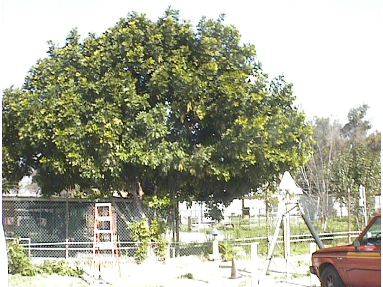
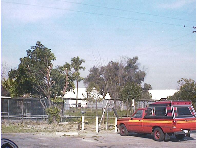
33 Tree Growth/Trimming
Global Positioning System: what it is and how we use it for measuring the earth s movement. May 5, 2009
 Global Positioning System: what it is and how we use it for measuring the earth s movement. May 5, 2009 References Lectures from K. Larson s Introduction to GNSS http://www.colorado.edu/engineering/asen/
Geodetic Reference Frame Theory
 Technical Seminar Reference Frame in Practice, Geodetic Reference Frame Theory and the practical benefits of data sharing Geoffrey Blewitt University of Nevada, Reno, USA http://geodesy.unr.edu Sponsors:
Bernese GPS Software 4.2
 Bernese GPS Software 4.2 Introduction Signal Processing Geodetic Use Details of modules Bernese GPS Software 4.2 Highest Accuracy GPS Surveys Research and Education Big Permanent GPS arrays Commercial
Principles of the Global Positioning System Lecture 20" Processing Software" Primary research programs"
 12.540 Principles of the Global Positioning System Lecture 20" Prof. Thomas Herring" Room 54-820A; 253-5941" tah@mit.edu" http://geoweb.mit.edu/~tah/12.540 " Processing Software" Examine basic features
IAG School on Reference Systems June 7 June 12, 2010 Aegean University, Department of Geography Mytilene, Lesvos Island, Greece SCHOOL PROGRAM
 IAG School on Reference Systems June 7 June 12, 2010 Aegean University, Department of Geography Mytilene, Lesvos Island, Greece SCHOOL PROGRAM Monday June 7 8:00-9:00 Registration 9:00-10:00 Opening Session
An Introduction to GPS
 An Introduction to GPS You are here The GPS system: what is GPS Principles of GPS: how does it work Processing of GPS: getting precise results Yellowstone deformation: an example What is GPS? System to
Principles of the Global Positioning System Lecture 19
 12.540 Principles of the Global Positioning System Lecture 19 Prof. Thomas Herring http://geoweb.mit.edu/~tah/12.540 GPS Models and processing Summary: Finish up modeling aspects Rank deficiencies Processing
Trimble Business Center:
 Trimble Business Center: Modernized Approaches for GNSS Baseline Processing Trimble s industry-leading software includes a new dedicated processor for static baselines. The software features dynamic selection
The realization of a 3D Reference System
 The realization of a 3D Reference System Standard techniques: topographic surveying and GNSS Observe angles and distances either between points on the Earth surface or to satellites and stars. Do not observe
GNSS Technologies. PPP and RTK
 PPP and RTK 29.02.2016 Content Carrier phase based positioning PPP RTK VRS Slides based on: GNSS Applications and Methods, by S. Gleason and D. Gebre-Egziabher (Eds.), Artech House Inc., 2009 http://www.gnssapplications.org/
GPS the Interdisciplinary Chameleon: How Does it do That?
 GPS the Interdisciplinary Chameleon: How Does it do That? Geoff Blewitt Nevada Bureau of Mines and Geology & Seismological Laboratory University of Nevada, Reno, USA Cool Science using GPS Application
Update on the International Terrestrial Reference Frame (ITRF)
") Update on the International Terrestrial Reference Frame (ITRF) Zuheir Altamimi Head of the IERS ITRF Product Center Institut National de l Information Géographique et Forestière IGN, France E-mail: zuheir.altamimi@ign.fr
Update on the International Terrestrial Reference Frame (ITRF) Zuheir Altamimi Head of the IERS ITRF Product Center Institut National de l Information Géographique et Forestière IGN, France E-mail: zuheir.altamimi@ign.fr
Precision N N. wrms. and σ i. y i
 Precision Time series = successive estimates of site position + formal errors First order analysis: Fit a straight line using a least square adjustment and compute a standard deviation Slope Associated
AUSPOS GPS Processing Report
 AUSPOS GPS Processing Report February 13, 2012 This document is a report of the GPS data processing undertaken by the AUSPOS Online GPS Processing Service (version: AUSPOS 2.02). The AUSPOS Online GPS
Modelling GPS Observables for Time Transfer
 Modelling GPS Observables for Time Transfer Marek Ziebart Department of Geomatic Engineering University College London Presentation structure Overview of GPS Time frames in GPS Introduction to GPS observables
Multi-technique combination at observation level with NAPEOS
 Multi-technique combination at observation level with NAPEOS Michiel Otten, Claudia Flohrer, Tim Springer, Werner Enderle EGU General Assembly 2012 Vienna Austria 27/04/2012 Introduction Combination of
Global IGS/GPS Contribution to ITRF
 Global IGS/GPS Contribution to ITRF R. Ferland Natural ResourcesCanada, Geodetic Survey Divin 46-61 Booth Street, Ottawa, Ontario, Canada. Tel: 1-613-99-42; Fax: 1-613-99-321. e-mail: ferland@geod.nrcan.gc.ca;
Study and analysis of Differential GNSS and Precise Point Positioning
 IOSR Journal of Electrical and Electronics Engineering (IOSR-JEEE) e-issn: 2278-1676,p-ISSN: 2320-3331, Volume 9, Issue 2 Ver. I (Mar Apr. 2014), PP 53-59 Study and analysis of Differential GNSS and Precise
IGS Reference Frames: Status & Future Improvements
 IGS 2004 Workshop, 01 March 2004, Berne, Switzerland IGS Reference Frames: Status & Future Improvements Jim Ray, Bureau International des Poids et Mesures & National Geodetic Survey Danan Dong, Jet Propulsion
Presented at the FIG Congress 2018, May 6-11, 2018 in Istanbul, Turkey
 Presented at the FIG Congress 2018, May 6-11, 2018 in Istanbul, Turkey 2 Improving Hydrographic PPP by Height Constraining Ashraf Abdallah (Egypt) Volker Schwieger, (Germany) ashraf.abdallah@aswu.edu.eg
DGFI reference frame solution as contribution to ITRF2008
 COST Action: ES0701, Vienna, Austria, November 16-17, 2010 WG2: Velocity determination / reference frame realization DGFI reference frame solution as contribution to ITRF2008 D. Angermann, M. Seitz, H.
Introduction to GAMIT/GLOBK Structure of GAMIT/GLOBK. Lecture 1. Overview of course of structure
 Introduction to GAMIT/GLOBK Structure of GAMIT/GLOBK Lecture 1 1 Overview of course of structure o Three lecture periods per day with one afternoon tutorial session o Night-time runs to generate processed
FieldGenius Technical Notes GPS Terminology
 FieldGenius Technical Notes GPS Terminology Almanac A set of Keplerian orbital parameters which allow the satellite positions to be predicted into the future. Ambiguity An integer value of the number of
Multipath and Atmospheric Propagation Errors in Offshore Aviation DGPS Positioning
 Multipath and Atmospheric Propagation Errors in Offshore Aviation DGPS Positioning J. Paul Collins, Peter J. Stewart and Richard B. Langley 2nd Workshop on Offshore Aviation Research Centre for Cold Ocean
GPS STATIC-PPP POSITIONING ACCURACY VARIATION WITH OBSERVATION RECORDING INTERVAL FOR HYDROGRAPHIC APPLICATIONS (ASWAN, EGYPT)
") GPS STATIC-PPP POSITIONING ACCURACY VARIATION WITH OBSERVATION RECORDING INTERVAL FOR HYDROGRAPHIC APPLICATIONS (ASWAN, EGYPT) Ashraf Farah Associate Professor,College of Engineering, Aswan University,
GPS STATIC-PPP POSITIONING ACCURACY VARIATION WITH OBSERVATION RECORDING INTERVAL FOR HYDROGRAPHIC APPLICATIONS (ASWAN, EGYPT) Ashraf Farah Associate Professor,College of Engineering, Aswan University,
The Global Positioning System
 The Global Positioning System Principles of GPS positioning GPS signal and observables Errors and corrections Processing GPS data GPS measurement strategies Precision and accuracy E. Calais Purdue University
Fundamentals of GPS for high-precision geodesy
 Fundamentals of GPS for high-precision geodesy T. A. Herring M. A. Floyd R. W. King Massachusetts Institute of Technology, Cambridge, MA, USA UNAVCO Headquarters, Boulder, Colorado, USA 19 23 June 2017
TREATMENT OF DIFFRACTION EFFECTS CAUSED BY MOUNTAIN RIDGES
 TREATMENT OF DIFFRACTION EFFECTS CAUSED BY MOUNTAIN RIDGES Rainer Klostius, Andreas Wieser, Fritz K. Brunner Institute of Engineering Geodesy and Measurement Systems, Graz University of Technology, Steyrergasse
Other Space Geodetic Techniques. E. Calais Purdue University - EAS Department Civil 3273
 Other Space Geodetic Techniques E. Calais Purdue University - EAS Department Civil 3273 ecalais@purdue.edu Satellite Laser Ranging = SLR Measurement of distance (=range) between a ground station and a
Precise Positioning with NovAtel CORRECT Including Performance Analysis
 Precise Positioning with NovAtel CORRECT Including Performance Analysis NovAtel White Paper April 2015 Overview This article provides an overview of the challenges and techniques of precise GNSS positioning.
Other Space Geodetic Techniques. E. Calais Purdue University - EAS Department Civil 3273
 Other Space Geodetic Techniques E. Calais Purdue University - EAS Department Civil 3273 ecalais@purdue.edu Satellite Laser Ranging Measurement of distance (=range) between a ground station and a satellite
Multisystem Real Time Precise-Point-Positioning, today with GPS+GLONASS in the near future also with QZSS, Galileo, Compass, IRNSS
 2 International Symposium on /GNSS October 26-28, 2. Multisystem Real Time Precise-Point-Positioning, today with +GLONASS in the near future also with QZSS, Galileo, Compass, IRNSS Álvaro Mozo García,
To Estimate The Regional Ionospheric TEC From GEONET Observation
 To Estimate The Regional Ionospheric TEC From GEONET Observation Jinsong Ping(Email: jsping@miz.nao.ac.jp) 1,2, Nobuyuki Kawano 2,3, Mamoru Sekido 4 1. Dept. Astronomy, Beijing Normal University, Haidian,
COMPARISON OF GPS COMMERCIAL SOFTWARE PACKAGES TO PROCESSING STATIC BASELINES UP TO 30 KM
 COMPARISON OF GPS COMMERCIAL SOFTWARE PACKAGES TO PROCESSING STATIC BASELINES UP TO 30 KM Khaled Mohamed Abdel Mageed Civil Engineering, Cairo, Egypt E-Mail: khaled_mgd@yahoo.com ABSTRACT The objective
STABILITY OF GLOBAL GEODETIC RESULTS
 STABILITY OF GLOBAL GEODETIC RESULTS Prof. Thomas Herring Room 54-611; 253-5941 tah@mit.edu http://bowie.mit.edu/~tah 04/22/02 EGS G6 2002 1 Overview Motivation for talk: Anomalies in apparent positions
Guochang Xu GPS. Theory, Algorithms and Applications. Second Edition. With 59 Figures. Sprin ger
 Guochang Xu GPS Theory, Algorithms and Applications Second Edition With 59 Figures Sprin ger Contents 1 Introduction 1 1.1 AKeyNoteofGPS 2 1.2 A Brief Message About GLONASS 3 1.3 Basic Information of Galileo
Sub-daily signals in GPS. at semi-annual and annual periods
 Sub-daily signals in GPS observations and their effect at semi-annual and annual periods Matt King1 Chris Watson2, Nigel Penna1 Newcastle University, UK 2 University of Tasmania, Australia 1 Propagation
Wednesday AM: (Doug) 2. PS and Long Period Signals
 2. PS and Long Period Signals") Wednesday AM: (Doug) 2 PS and Long Period Signals What is Colorado famous for? 32 satellites 12 Early on in the world of science synchronization of clocks was found to be important. consider Paris: puffs
Wednesday AM: (Doug) 2 PS and Long Period Signals What is Colorado famous for? 32 satellites 12 Early on in the world of science synchronization of clocks was found to be important. consider Paris: puffs
Processing of the NKG 2003 GPS Campaign. Need for a common coordinate set on 1 cm-level in the Nordic Area GPS-campaign GPS week 1238 (October 2003)
") Processing of the NKG 2003 GPS Campaign Need for a common coordinate set on 1 cm-level in the Nordic Area GPS-campaign GPS week 1238 (October 2003) Time frame Guidelines Data validation Preliminary processing
Processing of the NKG 2003 GPS Campaign Need for a common coordinate set on 1 cm-level in the Nordic Area GPS-campaign GPS week 1238 (October 2003) Time frame Guidelines Data validation Preliminary processing
Applications, Products and Services of GPS Technology
 Applications, Products and Services of GPS Technology Enrico C. Paringit. Dr. Eng. University of the Philippines Training Center for Applied Geodesy and Photogrammetry 1 Outline of this Presentation GPS
UNIT 1 - introduction to GPS
 UNIT 1 - introduction to GPS 1. GPS SIGNAL Each GPS satellite transmit two signal for positioning purposes: L1 signal (carrier frequency of 1,575.42 MHz). Modulated onto the L1 carrier are two pseudorandom
CGG. Office of the Surveyor General of the Federation Federal Capital Territory, Abuja, Nigeria 2
 Prof. P. C. Nwilo 1, * Dr. J. D. Dodo 2, U. R. Edozie 1, and A. Adebomehin 1. 1 Office of the Surveyor General of the Federation Federal Capital Territory, Abuja, Nigeria 2 Centre for Geodesy and Geodynamics,
GPS Geodetic Reference System WGS 84
 GPS Geodetic Reference System WGS 84 International Committee on GNSS Working Group D Saint Petersburg, Russia 16 September 2009 Barbara Wiley National Geospatial-Intelligence Agency United States of America
Global GPS-VLBI Hybrid Observation. Younghee Kwak
 Global GPS-VLBI Hybrid Observation Younghee Kwak Classical VLBI vs. Space Craft Tracking plane wave front stable sources curved wave front fast moving sources Plank(2013) 2/20 Space craft tracking by VieVS2tie
Reference Systems: Definition and Realization Associated IAG Services IAG Reference Frame Sub-commission for Europe (EUREF)
") Reference Systems: Definition and Realization Associated IAG Services IAG Reference Frame Sub-commission for Europe (EUREF) Zuheir ALTAMIMI Laboratoire de Recherche en Géodésie Institut Géographique National
Reference Systems: Definition and Realization Associated IAG Services IAG Reference Frame Sub-commission for Europe (EUREF) Zuheir ALTAMIMI Laboratoire de Recherche en Géodésie Institut Géographique National
Table of Contents. Frequently Used Abbreviation... xvii
 GPS Satellite Surveying, 2 nd Edition Alfred Leick Department of Surveying Engineering, University of Maine John Wiley & Sons, Inc. 1995 (Navtech order #1028) Table of Contents Preface... xiii Frequently
Terrestrial Reference Frame Realization from Combined GPS/LEO Orbit Determination
 Terrestrial Reference Frame Realization from Combined GPS/LEO Orbit Determination Jan P. Weiss, Willy Bertiger, Shailen D. Desai Bruce J. Haines, Nate Harvey Jet Propulsion Laboratory California Institute
Low-cost densification of permanent GPS networks for natural hazard mitigation: First tests on GSI s GEONET network
 LETTER Earth Planets Space, 52, 867 871, 2000 Low-cost densification of permanent GPS networks for natural hazard mitigation: First tests on GSI s GEONET network Chris Rizos 1, Shaowei Han 1, Linlin Ge
Satellite Laser Retroreflectors for GNSS Satellites: ILRS Standard
 Satellite Laser Retroreflectors for GNSS Satellites: ILRS Standard Michael Pearlman Director Central Bureau International Laser Ranging Service Harvard-Smithsonian Center for Astrophysics Cambridge MA
Integer Ambiguity Resolution for Precise Point Positioning Patrick Henkel
 Integer Ambiguity Resolution for Precise Point Positioning Patrick Henkel Overview Introduction Sequential Best-Integer Equivariant Estimation Multi-frequency code carrier linear combinations Galileo:
CHAPTER 2 GPS GEODESY. Estelar. The science of geodesy is concerned with the earth by quantitatively
 CHAPTER 2 GPS GEODESY 2.1. INTRODUCTION The science of geodesy is concerned with the earth by quantitatively describing the coordinates of each point on the surface in a global or local coordinate system.
MINOS Timing and GPS Precise Point Positioning
 MINOS Timing and GPS Precise Point Positioning Stephen Mitchell US Naval Observatory stephen.mitchell@usno.navy.mil for the International Workshop on Accelerator Alignment 2012 in Batavia, IL A Joint
The impact of tropospheric mapping functions based on numerical weather models on the determination of geodetic parameters
 The impact of tropospheric mapping functions based on numerical weather models on the determination of geodetic parameters J. Boehm, P.J. Mendes Cerveira, H. Schuh Institute of Geodesy and Geophysics,
Campaign GPS Data Processing for Integrated SCEC Community Geodetic Model
 Topic 1: Campaign GPS solutions Campaign GPS Data Processing for Integrated SCEC Community Geodetic Model Zheng-Kang Shen UCLA SCEC CGM Workshop January 28-29, 2016 Campaign GPS Data Compilation and Inspection:
THE INFLUENCE OF ZENITH TROPOSPHERIC DELAY ON PPP-RTK. S. Nistor a, *, A.S. Buda a,
 THE INFLUENCE OF ZENITH TROPOSPHERIC DELAY ON PPP-RTK S. Nistor a, *, A.S. Buda a, a University of Oradea, Faculty of Civil Engineering, Cadastre and Architecture, Department Cadastre-Architecture, Romania,
Latest PPP Efforts at UNB ( )
") Latest PPP Efforts at UNB (2007-2008) Simon Banville Rodrigo F. Leandro Hyunho Rho Richard B. Langley Marcelo C. Santos May 27 2008 GEOIDE Annual Conference Niagara Falls, ON, Canada Outline Impact of
Latest PPP Efforts at UNB (2007-2008) Simon Banville Rodrigo F. Leandro Hyunho Rho Richard B. Langley Marcelo C. Santos May 27 2008 GEOIDE Annual Conference Niagara Falls, ON, Canada Outline Impact of
Determination of GDA94 coordinates for station PDM1 at BMA s Peak Downs Mine in central Queensland using the June 2013 GPS data set
 Record 2013/42 GeoCat 76764 Determination of GDA94 coordinates for station PDM1 at BMA s Peak Downs Mine in central Queensland using the G. Hu, J. Dawson APPLYING GEOSCIENCE TO AUSTRALIA S MOST IMPORTANT
GNSS Technologies. PPP and RTK
 PPP and RTK 22.03.2017 Content Carrier phase based positioning PPP RTK VRS Slides based on: GNSS Applications and Methods, by S. Gleason and D. Gebre-Egziabher (Eds.), Artech House Inc., 2009 http://www.gnssapplications.org/
WHU s developments for the MGEX precise products and the GNSS ultra-rapid products
 IGS Workshop 2016 WHU s developments for the MGEX precise products and the GNSS ultra-rapid products Chuang Shi; Qile Zhao; Min Li; Jing Guo; Jingnan Liu Presented by Jianghui Geng GNSS Research Center,
Connecting a Survey to PNG94 and MSL using GNSS
 45th Association of Surveyors PNG Congress, Madang, 19-22 July 2011 Connecting a Survey to PNG94 and MSL using GNSS Richard Stanaway QUICKCLOSE Workshop overview Legal requirements to connect surveys to
(The basics of) VLBI Basics. Pedro Elosegui MIT Haystack Observatory. With big thanks to many of you, here and out there
 VLBI Basics. Pedro Elosegui MIT Haystack Observatory. With big thanks to many of you, here and out there") (The basics of) VLBI Basics Pedro Elosegui MIT Haystack Observatory With big thanks to many of you, here and out there Some of the Points Will Cover Today Geodetic radio telescopes VLBI vs GPS concept
(The basics of) VLBI Basics Pedro Elosegui MIT Haystack Observatory With big thanks to many of you, here and out there Some of the Points Will Cover Today Geodetic radio telescopes VLBI vs GPS concept
Accuracy assessment of free web-based online GPS Processing services and relative GPS solution software
 82 Accuracy assessment of free web-based online GPS Processing services and relative GPS solution software Khaled Mahmoud Abdel Aziz Department of Surveying Engineering, Shoubra Faculty of Engineering,
MONITORING SEA LEVEL USING GPS
 38 MONITORING SEA LEVEL USING GPS Hasanuddin Z. Abidin* Abstract GPS (Global Positioning System) is a passive, all-weather satellite-based navigation and positioning system, which is designed to provide
Record 2013/01 GeoCat 75057
 Record 2013/01 GeoCat 75057 Determination of GDA94 coordinates for station CCMB at the Clermont Coal Mine of Rio Tinto Coal Australia (RTCA) in central Queensland using the October and November 2012 GPS
Determination of GDA94 coordinates for eight stations of Ultimate Positioning Group Pty Ltd using the May 2013 GPS data set
 Record 2013/47 GeoCat 78541 Determination of GDA94 coordinates for eight stations of Ultimate Positioning Group Pty Ltd using the May 2013 GPS G. Hu, J. Dawson APPLYING GEOSCIENCE TO AUSTRALIA S MOST IMPORTANT
Connecting a Cadastral Survey to PNG94 using GNSS
 43rd Association of Surveyors PNG Congress, Lae, 12th-15th August 2009 Connecting a Cadastral Survey to PNG94 using GNSS Richard Stanaway QUICKCLOSE Workshop overview Legal requirements to connect surveys
Johannes Böhm, Paulo Jorge Mendes Cerveira, Harald Schuh, and Paul Tregoning
 Johannes Böhm, Paulo Jorge Mendes Cerveira, Harald Schuh, and Paul Tregoning The impact of mapping functions for the neutral atmosphere based on numerical weather models in GPS data analysis IAG Symposium
IGS Activities for Improving its Contribution to ITRF
 IGS Activities for Improving its Contribution to ITRF G. P. R. J. I. P. Gendt Fang Ferland Ray Romero Steigenberger (GeoForschungsZentrum, Potsdam, Germany) (San Diego, USA ) (Natural Resources, Canada
Guidelines for EUREF Densifications
 Guidelines for EUREF Densifications Carine Bruyninx, ROB EUREF Tutorial May 24, 2016 San Sebastian, Spain EPN CB: www.epncb.oma.be ftp://epncb.oma.be/pub/general/guidelines_ for_euref_densifications.pdf
Assessment of the Accuracy of Processing GPS Static Baselines Up To 40 Km Using Single and Dual Frequency GPS Receivers.
 International OPEN ACCESS Journal Of Modern Engineering Research (IJMER) Assessment of the Accuracy of Processing GPS Static Baselines Up To 40 Km Using Single and Dual Frequency GPS Receivers. Khaled
Strengths and weaknesses of the IGS contribution to the ITRF. Zuheir Altamimi, Xavier Collilieux, Laurent Metivier, Paul Rebischung IGN, France
 Strengths and weaknesses of the IGS contribution to the ITRF Zuheir Altamimi, Xavier Collilieux, Laurent Metivier, Paul Rebischung IGN, France 1 Outline Summary of GNSS strengths & weaknesses Extended
International Journal of Scientific & Engineering Research, Volume 6, Issue 8, August ISSN
 International Journal of Scientific & Engineering Research, Volume 6, Issue 8, August-2015 683 Assessment Accuracy of Static Relative Positioning Using Single Frequency GPS Receivers Mahmoud I. El-Mewafi
GRGS Combinations Earth Orientation Parameters Strategy Analyses Performed at GRGS
 GRGS Combinations Earth Orientation Parameters Strategy Analyses Performed at GRGS ccitej-y. Richard (), D. Gambis (), C. Bizouard (),,, G. Bourda (2), F. Deleflie (3), S. Loyer (4), L. Soudarin (4) -
NASDA S PRECISE ORBIT DETERMINATION SYSTEM
 NASDA S PRECISE ORBIT DETERMINATION SYSTEM Maki Maeda Takashi Uchimura, Akinobu Suzuki, Mikio Sawabe National Space Development Agency of Japan (NASDA) Sengen 2-1-1, Tsukuba, Ibaraki, 305-8505, JAPAN E-mail:
GNSS OBSERVABLES. João F. Galera Monico - UNESP Tuesday 12 Sep
 GNSS OBSERVABLES João F. Galera Monico - UNESP Tuesday Sep Basic references Basic GNSS Observation Equations Pseudorange Carrier Phase Doppler SNR Signal to Noise Ratio Pseudorange Observation Equation
GPS for. Land Surveyors. Jan Van Sickle. Fourth Edition. CRC Press. Taylor & Francis Group. Taylor & Francis Croup, an Informa business
 GPS for Land Surveyors Fourth Edition Jan Van Sickle CRC Press Taylor & Francis Group Boca Raton London New York CRC Press is an imprint of the Taylor & Francis Croup, an Informa business Contents Preface
Record 2013/06 GeoCat 75084
 Record 2013/06 GeoCat 75084 Determination of GDA94 coordinates for station CAVL at the Caval Ridge Mine of RPS Australia East Pty Ltd in Queensland using the November 2012 GPS data set G. Hu, J. Dawson
Salient Feature of ITRF. Realization of Dubai Emirate Datum. Reference Frame 2000 (Ditr 2000)
") Salient Feature of ITRF on the Reference Frame 2000 (Ditr 2000) ITRF stands for International Terrestrial Reference Frame ITRF established by the International Earth Rotation Service (IERS), France. One
Salient Feature of ITRF on the Reference Frame 2000 (Ditr 2000) ITRF stands for International Terrestrial Reference Frame ITRF established by the International Earth Rotation Service (IERS), France. One
GNSS & Coordinate Systems
 GNSS & Coordinate Systems Matthew McAdam, Marcelo Santos University of New Brunswick, Department of Geodesy and Geomatics Engineering, Fredericton, NB May 29, 2012 Santos, 2004 msantos@unb.ca 1 GNSS GNSS
Record 2012/76 GeoCat 74975
 Record 2012/76 GeoCat 74975 Determination of GDA94 coordinates for station GRBA at the Goonyella Riverside Mine of the BHP Billiton Mitsubishi Alliance (BMA) in central Queensland using the September and
Presentation Plan. The Test of Processing Modules of Global Positioning System (GPS) Softwares by Using Products of International GPS Service (IGS)
 Softwares by Using Products of International GPS Service (IGS)") The Test of Processing Modules of Global Positioning System (GPS) Softwares by Using Products of International GPS Service (IGS) Presentation Plan 1. Introduction 2. Application 3. Conclusions Ismail SANLIOGLU,
The Test of Processing Modules of Global Positioning System (GPS) Softwares by Using Products of International GPS Service (IGS) Presentation Plan 1. Introduction 2. Application 3. Conclusions Ismail SANLIOGLU,
Results from the Reprocessing of the BEK subnetwork
 Results from the Reprocessing of the BEK subnetwork Christof Völksen Commission for International Geodesy (BEK) Bayerische Kommission für die Internationale Erdmessung EUREF Symposium London 2007 Background
Current State and Future Developments of the IVS and Geodetic VLBI. H. Schuh, D. Behrend, A. Niell, B. Petrachenko, and R.
 Current State and Future Developments of the IVS and Geodetic VLBI H. Schuh, D. Behrend, A. Niell, B. Petrachenko, and R. Heinkelmann Bologna, 26-Sept-2008 Geodetic VLBI Unique technique for CRF Precession/Nutation
Precise Positioning GNSS Applications
 Precise Point Positioning: Is the Era of Differential GNSS Positioning Drawing to an End? School of Surveying & Spatial Information Systems, UNSW, Sydney, Australia Chris Rizos 1, Volker Janssen 2, Craig
Zero difference GPS ambiguity resolution at CNES-CLS IGS Analysis Center
 Zero difference GPS ambiguity resolution at CNES-CLS IGS Analysis Center S. Loyer, F. Perosanz, F. Mercier, H. Capdeville, J.C. Marty, F. Fund, P. Gegout 3, R. Biancale 08// G 0 ENSG, Marne-la-Vallée November
Advances in GNSS Technology and it s Application to Tidal Derivation
 Advances in GNSS Technology and it s Application to Tidal Derivation Tim Painter Chief Surveyor Fugro Survey Africa Pty Ltd John Vint Survey and Starfix Product Manager Fugro Survey AS, Norway Scope of
VLBI and DDOR activities at ESOC
 VLBI and DDOR activities at ESOC Claudia Flohrer 1, Mattia Mercolino 2, Erik Schönemann 1, Tim Springer 1, Joachim Feltens 1, René Zandbergen 1, Werner Enderle 1, Trevor Morley 3 1) Navigation Support
COMPARISON BETWEEN BROADCAST AND PRECISE ORBITS: GPS GLONASS GALILEO AND BEIDOU. A. Caporali and L. Nicolini University of Padova, Italy
 COMPARISON BETWEEN BROADCAST AND PRECISE ORBITS: GPS GLONASS GALILEO AND BEIDOU A. Caporali and L. Nicolini University of Padova, Italy Summary Previous works Input data and method used Comparison between
ITRF2014: Etat d'avancement et résultats préliminaires Zuheir Altamimi, Paul Rebischung, Xavier Collilieux, Laurent Métivier
 ITRF2014: Etat d'avancement et résultats préliminaires Zuheir Altamimi, Paul Rebischung, Xavier Collilieux, Laurent Métivier E-mail: zuheir.altamimi@ign.fr Key Points of ITRF2014 The Network: DORIS, GNSS,
GPS and GNSS from the International Geosciences Perspective
 GPS and GNSS from the International Geosciences Perspective G. Beutler Astronomical Institute, University of Bern Member of IAG Executive Committee and of IGS Governing Board National Space-Based Positioning,
Broadcast Ionospheric Model Accuracy and the Effect of Neglecting Ionospheric Effects on C/A Code Measurements on a 500 km Baseline
 Broadcast Ionospheric Model Accuracy and the Effect of Neglecting Ionospheric Effects on C/A Code Measurements on a 500 km Baseline Intro By David MacDonald Waypoint Consulting May 2002 The ionosphere
DECIMETER LEVEL MAPPING USING DIFFERENTIAL PHASE MEASUREMENTS OF GPS HANDHELD RECEIVERS
 DECIMETER LEVEL MAPPING USING DIFFERENTIAL PHASE MEASUREMENTS OF GPS HANDHELD RECEIVERS Dr. Ahmed El-Mowafy Civil and Environmental Engineering Department College of Engineering The United Arab Emirates
Integer Ambiguity Resolution in Precise Point Positioning: Method Comparison and Real-Time Application
 Integer Ambiguity Resolution in Precise Point Positioning: Method Comparison and Real-Time Application Jianghui Geng 1,2, Norman Teferle 3, Denis Laurichesse 4, Furqan Ahmed 3, Xiaolin Meng 1, Alan Dodson
APPLICATION OF FULL ROVING GPS OBSERVATION STRATEGY FOR MONITORING LOCAL MOVEMENTS
 APPLICATION OF FULL ROVING GPS OBSERVATION STRATEGY FOR MONITORING LOCAL MOVEMENTS Laszlo Banyai Geodetic and Geophysical Research Institute Hungarian Academy of Sciences Email: banyai@ggki.hu Abstract:
GPS: History, Operation, Processing
 GPS: History, Operation, Processing Impor tant Dates 1970 s: conceived as radionavigation system for the US military: realtime locations with few-meter accuracy. 1978: first satellite launched 1983: Declared
Space geodetic techniques for remote sensing the ionosphere
 Space geodetic techniques for remote sensing the ionosphere Harald Schuh 1,2, Mahdi Alizadeh 1, Jens Wickert 2, Christina Arras 2 1. Institute of Geodesy and Geoinformation Science, Technische Universität
Current Earth Orientation Parameters and Global combinations
 Current Earth Orientation Parameters and Global combinations D. Gambis C. Bizouard O. Becker, J.Y. Richard, T. Carlucci Earth Orientation Center of the IERS Observatoire de Paris +Colleagues of GRGS Main
Combined global models of the ionosphere
 Combined global models of the ionosphere S. Todorova (1), T. Hobiger (2), H. Schuh (1) (1) Institute of Geodesy and Geophysics (IGG), Vienna University of Technology (2) Space-Time Standards Group, Kashima
Coordinate time series comparison. Application to ITRF2005 height residuals time series. X. Collilieux, Zuheir Altamimi, David Coulot,
 Coordinate time series comparison. Application to ITRF2005 height residuals time series X. Collilieux, Zuheir Altamimi, David Coulot, Acknowledgement : J. Ray,T. Van Dam, P. Sillard, I. Panet 1 Outline:
Influence of network geometry on densification on the Faroe Islands 2011
 Influence of network geometry on densification on the Faroe Islands 2011 Shfaqat Abbas Khan 1, Mette Weber 2, Karsten Enggaard Engsager 1,2, and Per Knudsen 1 1 Department of Geodesy, National Space Institute