Overview. A Mission TO VALIDATE AND VERIFY DATA OF RADIO COMMUNICATION INFRA (RCI)
|
|
|
- Joanna Edwards
- 5 years ago
- Views:
Transcription


1


2
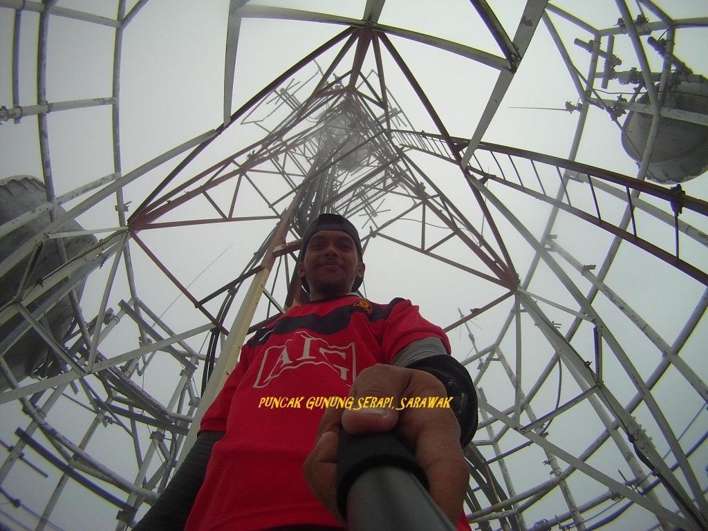
3 Overview A Mission TO VALIDATE AND VERIFY DATA OF RADIO COMMUNICATION INFRA (RCI) Divided into 5 phases : Phase 1 - WP Kuala Lumpur, WP Putrajaya and Perak Phase 2 - Perlis, Kedah, Kelantan, Terengganu and Pahang Phase 3 - Pulau Pinang, Melaka, Johor and Negeri Sembilan Phase 4 - Sarawak Phase 5 - Sabah Completed within 5 month (Average) time frame every phase
4 Project Area of Interest (Phase 2 and Phase 4) Radio Communication Infra (RCI) in the state of Perlis, Kedah, Kelantan, Terengganu, Pahang and Sarawak Total Towers Sarawak : 1156 Peninsular Malaysia : 3257 Project Time Frame : Phase 2 (Within 5 months, Year 2014) and Phase 4 ( Within 5 months, Year 2016)
5 Objectives To validate and verify RCI data submitted by Telco s. To verify accuracy of RCI data within CIMS. To update the observation data into CIMS. * CIMS - Communication Infrastructure Information System


6


7 PROJECT WORKFLOWs THE TEAM s ASSET TAGGING QUALITY CONTROL FIELD SURVEY MAPPING DELIVERABLE


8 Basic Standard Procedures Logistic / Accommodation / Personnel Contact Person / Phones / Vehicle / Working Permit / Schedule Hardware Check list Battery Life / External Disk / Disk Space / GPS / Vehicle / Whether forecast Site Preparation Check list Job Tracking / TOR/ Daily Target / Photos Instrument Calibration GPS related parts Planning Route Site Layout / Time Restriction / Mapping Style / Naming Convention Dataset / Daily Backup / Cross Check Daily Work / Next Day Planning
9 Methodology GPS RTK Technology (Single Base Correction) Pekeliling KPUP Bil. 9/2005 Garis Panduan Mengenai Penggunaan Perkhidmatan Malaysia RTK GPS network (MyRTKnet) Pekeliling KPUP Bil. 1/2008 Garis Panduan Mengenai Ujian Alat Sistem Penentududukan Sejagat (GNSS) Yang Menggunakan Malaysia RTK GNSS Network (MyRTKnet) Pekeliling KPUP Bil 3/2016 Perkhidmatan MyRTKnet di bawah platform Spidernet 50 GNSS reference stations are located in Peninsular Malaysia whilst 28 stations in Sabah and Sarawak, spacing between 30km to 120km


10 RTK BASE STATION Method & Equipment


11 RCI sites (CIMS database categories) Tower Rooftop Dual-Function In-Building Temporary BTS.


12 RCI Structure Type Monopole 4 Legged 3 Legged Guyed Mast


13 RCI Structure Type Mini Structure Ramo Rapole Water tank Monopole Tree Minaret
14 Data Dictionary Attributes Structure Information Data Type TOWER_ID T AUDIT_REFID LITSB-T STRUCTURE_OWNER_AUD MAXIS Maxis/ Sacofa / Celcom / Edotco / DiGi STRUCTURE_CATEGORY_AUD TOWER Tower / Roof top / Temporary BTS / Dual Function/ In Building STRUCTURE_TYPE_AUD 3LEGGED Monopole / 4 Legged / 3 Legged / Guyed / Mini Structure / Ramo / Rapole / Watertank / Monopole Tree / Minimast STRUCTURE_HEIGHT_M_AUD DISTANCE_TO_NEAREST_BLDG_M 0 TYPE_OF_NEAREST_BLDG NONE Commercial / Industrial / None SUB_TYPE_OF_NEAREST_BLDG 0 AVIATION_LIGHT YES Yes / No GROUND_STATUS EXIST Exist / None SITE_CONDITION WELL_MAINTAIN Well Maintain / Average / Poor FENCING AVERAGE Well Maintain / Average / Poor BLDG_HEIGHT_M_AUD 0 X Y
15 Infographic : Statistics Peninsular Malaysia 2014 : Surveyed Date State Start Date End Date Perlis 1/7/2014 8/7/2014 Kedah 9/7/ /8/2014 Kelantan 17/9/2014 1/10/2014 Terengganu 29/10/2014 9/11/2014 Pahang 10/11/ /11/2014
16 Infographic : Statistics Peninsular Malaysia 2014 : Structure Type State 3Legged 4Legged Monopole Monopole Tree Guyed Mast Water Tank Other (Minimast, Rooftop) Kedah Perlis Kelantan Terengganu Pahang Total

17 Infographic : Statistics Peninsular Malaysia 2014 : Structure Type Series1 Series2 Series3 Series4 Series5 Series6 Series7

18 Infographic : Statistics Peninsular Malaysia 2014 : Existing vs. Auditing State Provided by SKMM Total Tower Data Exist Data Not Exist New Data Found Total Data Audited DIFFERENT Perlis Original data from SKMM Kedah Original data from SKMM Kelantan Original data from SKMM Terengganu Original data from SKMM Pahang Original data from SKMM
19 Infographic : Statistics Peninsular Malaysia 2014 : Existing vs. Auditing Series1 Series2 Series3
20 Infographic Statistics Sarawak 2016 : Surveyed Date BAHAGIAN START DATE END DATE Kuching 12/11/ /11/2015 Samarahan 17/11/ /11/2015 Asajaya 18/11/ /11/2015 Lundu/Bau 19/11/ /11/2015 Sri Aman 30/11/2015 2/12/2015 Betong 3/12/2015 3/12/2015 Sarikei 4/12/2015 4/12/2015 Sibu 7/12/2015 9/12/2015 Bintulu 10/12/ /12/2015 Miri 15/12/ /12/2015 Limbang 05/01/ /01/2016 Mukah 12/01/ /01/2016 Kapit 18/01/ /01/2016 Newsite (Lundu, Sibu, Saratok) 24/03/ /03/2016
21 Infographic : Statistic Sarawak 2016 : Structure Type Bahagian Monopole 4legged 3legged Guyed Mast Mini Structure Ramo Rapole Kuching Samarahan Betong Bintulu Kapit Limbang Miri Mukah Sarikei Sibu Sri Aman Total
22 120 Infographic Statistic Sarawak 2016 : Structure Type Series1 Series2 Series3 Series4 Series5 Series6 Series7

23 Infographic : Statistics Sarawak 2016 : Existing vs. Auditing State Provided by SKMM Total Tower Data Exist Data Not Exist New Data Found Total Data Audited Different Area Batch 1 Original data from SKMM Area Batch 2 Original data from SKMM Area Batch 1 : Kuching, Samarahan Area Batch 2 : Betung, Bintulu, Kapit, Limbang, Miri, Mukah, Sarekei, Sibu, Sri Aman
24 Infographic : Statistics Sarawak 2016 : Existing vs. Auditing Series1 Series2 Series3 Area Batch 1 : Kuching, Samarahan Area Batch 2 : Betung, Bintulu, Kapit, Limbang, Miri, Mukah, Sarekei, Sibu, Sri Aman


25

26 Surrounding Kangar Town 3 Legged 4 Legged Monopole Guyed Mast Temp BTS

27 Surrounding Alor Setar Town 3 Legged 4 Legged Monopole Guyed Mast Temp BTS

28 Surrounding Kota Bharu Town 3 Legged 4 Legged Monopole Guyed Mast Temp BTS

29 Surrounding K. Terengganu Town 3 Legged 4 Legged Monopole Guyed Mast Temp BTS

30 Surrounding Town Kuantan 3 Legged 4 Legged Monopole Guyed Mast Temp BTS


31 Surrounding Town Kuching 3 Legged 4 Legged Monopole Guyed Mast Temp BTS


32 Overview all RCI towers

33 Report Deliverable

34 Report Deliverable


35 Site Condition : Visual Inspection Google StreetView 2014 Site Condition : Well Maintain 16 th August 2017 Site Condition : Poor


36 The challenge adventures GPS Signal Satellite Visibility No land access (road) Additional new tower Weather Poor Accessibility Deficient (metadata) at site


37 Final Acceptance Test / Verification
38 THE NEXT BIG THING FUTURE AUDITING 2.0


39 FUTURE AUDITING


 CAD 3D Model -")
40 FUTURE AUDITING 2.0 Hashtag Ideas Ranking - Rate (Risk) Tower Elements Shelter Elements Surrounding Site Green Environment / Habitat Respond to Emergency / Safety Infrastructure Life Cycle ( House keeping ) CAD 3D Model - BIM More Data Spatial layers 2D 3D Digital

41 FUTURE AUDITING Simulated Data

42 FUTURE AUDITING Simulated Data


43 FUTURE AUDITING


44 FUTURE AUDITING


45 Ha! I see my tower
RETURN OF AVERAGE NETT CIRCULATION OF NEWSPAPERS FOR THE PERIOD OF TO AUDIT BUREAU OF CIRCULATIONS
 RETURN OF AVERAGE NETT CIRCULATION OF NEWSPAPERS FOR THE PERIOD OF 01-07-2006 TO 30-06-2007 Newspapers - Peninsular Malaysia Period Average net sales Average net sales Cover No. of Summary 01.07.01 01.07.02
PRESENTATION OUTLINE
 FIG WORKING WEEK Marrakech WW2011 GNSS HEIGHTING AND ITS POTENTIAL USE IN MALAYSIA Hasan Jamil DEPARTMENT OF SURVEY AND MAPPING MALAYSIA PRESENTATION OUTLINE Introduction Vertical datum and Levelling Background
National Robotics Competition 2007
 Organisers MOSTI Official Battery VISION To provide a powerful learning platform to enable students to cope with skills that are essential for success in the 21st century. MISSION To develop and strengthen
GNSS Heighting and Its Potential Use in Malaysia
 GNSS Heighting and Its Potential Use in Malaysia Hasan JAMIL, Malaysia Keywords: GNSS heighting, levelling, geoid SUMMARY A system of vertical control is realised with the establishment of a levelling
CLICK HERE TO KNOW MORE
 CLICK HERE TO KNOW MORE Should GNSS Become a National Critical Infrastructure? Ooi Wei Han, Noordin Ahmad, Shahrizal IM National Space Agency (ANGKASA) Ministry of Science, Technology and Innovation (MOSTI)
THE UNIFIED LEVELLING NETWORK OF SARAWAK AND ITS ADJUSTMENT
 THE UNIFIED LEVELLING NETWORK OF SARAWAK AND ITS ADJUSTMENT Z A M Som a, A M Yazid a, T K Ming b, N M Yazid a * a GNSS & Geodynamic Research Group, Universiti Teknologi Malaysia, Johor Bahru, Malaysia
Introduction. FIG Congress 2010 Facing the Challenges Building the Capacity Sydney, Australia, April
 Introduction MRT48 and BT68 were the geodetic infrastructures used for geodetic, mapping and cadastral survey for Peninsular Malaysia and East Malaysia respectively The introduction of GPS at JUPEM in
CORNERS BEAD 10 3,000MM
 CORNERS BEAD 10 FEET @ 3,000MM EUROPE BOARD BRAND (MAL) EUROPE PLASTERBOARD BRAND (SIN) PUBLISHED FROM: 1 JULY 2013 Printed and Cataloged By: EUROPE BOARD TRADING SDN BHD (324540-X) LOT 56, SECTION 92,
Preliminary Study on the Current Situation of Building Information Modeling Adoption in the Interior Design Industry
 International Academic Research Journal of Business and Technology 2 (2) 2016 Page 1-6 Preliminary Study on the Current Situation of Building Information Modeling Adoption in the Interior Design Industry
PERFORMANCE ANALYSIS OF SISPELSAT MSK-DGNSS RADIO SIGNAL IN PENINSULAR MALAYSIA
 PERFORMANCE ANALYSIS OF MSK-DGNSS RADIO SIGNAL IN PENINSULAR MALAYSIA M. S. A. Razak 1, T. A., Musa 1, R. Othman 1, M. F. Yazair 1, A.Z. Sha ameri 2, A. Amirudin 3, R. M. Yusof 3 1 Geomatic Innovation
Strategic City Wide Mapping of Underground Assets using Ground Penetrating Radar. Mark Bell
 Strategic City Wide Mapping of Underground Assets using Ground Penetrating Radar Mark Bell XXV International Federation of Surveyors Congress, Kuala Lumpur, Malaysia, 16 21 June 2014 TOPICS GPR background
KELANTAN KELANTAN PDF KELANTAN - WIKIPEDIA KELANTAN FA THE USE OF KELANTAN DIALECT IN CYBERSPACE - HRMARS.COM
 PDF PDF - WIKIPEDIA FA THE USE OF DIALECT IN CYBERSPACE - HRMARS.COM 1 / 5 2 / 5 3 / 5 kelantan pdf.. kelantan pdf. There are a number of suggestions for the origin of the name Kelantan. One theory proposes
INVESTMENT OPPORTUNITIES IN MALAYSIA. GMRT, March, Frankfurt 2018
 INVESTMENT OPPORTUNITIES IN MALAYSIA GMRT, March, Frankfurt 2018 Who Are We? 1st point of contact Foreign Direct Investment Domestic Investment Manufacturing & Selected Services Assist companies in the
Research Article Solar Energy Prediction for Malaysia Using Artificial Neural Networks
 Hindawi Publishing Corporation International Journal of Photoenergy Volume, Article ID 95, pages doi:.55//95 Research Article Solar Energy Prediction for Malaysia Using Artificial Neural Networks Tamer
Augmented Reality in Transportation Construction
 September 2018 Augmented Reality in Transportation Construction FHWA Contract DTFH6117C00027: LEVERAGING AUGMENTED REALITY FOR HIGHWAY CONSTRUCTION Hoda Azari, Nondestructive Evaluation Research Program
Joint Industry Programme on E&P Sound and Marine Life - Phase III
 Joint Industry Programme on E&P Sound and Marine Life - Phase III Request for Proposals Number: JIP III-15-03 Long Term Fixed Acoustic Monitoring of Marine Mammals throughout the Life Cycle of an Offshore
ArcGIS Apps and GPS GNSS Connections. By: Colin Lawrence and Kiersten Hudson
 ArcGIS Apps and GPS GNSS Connections By: Colin Lawrence and Kiersten Hudson Agenda ArcGIS Apps and high accuracy data The importance of high accuracy data Making connections to external receivers Bringing
Afghanistan EIRP Emergency Irrigation Rehabilitation Project Islamic Republic of Afghanistan Ministry of Energy & Water
 Public Disclosure Authorized Public Disclosure Authorized Public Disclosure Authorized Public Disclosure Authorized World Bank/ IDA Afghanistan EIRP Emergency Irrigation Rehabilitation Project Islamic
INSTRUCTION: This section consists of TWO (2) structured question. Answer ALL questions.
 structured question. Answer ALL questions.") SECTION A : 50 MARKS BAHAGIAN A: 50 MARKAH INSTRUCTION: This section consists of TWO (2) structured question. Answer ALL questions. ARAHAN : Bahagian ini mengandungi DUA (2) soalan berstruktur. Jawab SEMUA
SECTION A : 50 MARKS BAHAGIAN A: 50 MARKAH INSTRUCTION: This section consists of TWO (2) structured question. Answer ALL questions. ARAHAN : Bahagian ini mengandungi DUA (2) soalan berstruktur. Jawab SEMUA
ROLES AND RESPONSIBILITIES OF PERHILITAN IN WILDLIFE CONSERVATION
 ROLES AND RESPONSIBILITIES OF PERHILITAN IN WILDLIFE CONSERVATION JABATAN PERLINDUNGAN HIDUPAN LIAR DAN TAMAN NEGARA (PERHILITAN) ABDUL KADIR BIN ABU HASHIM 28 th JULY 2015 1.0 HISTORY 2.0 BACKGROUND 1932
Relevance of Reference Frame to the Region and Industry - Malaysian Experience
 Relevance of Reference Frame to the Region and Industry - Malaysian Experience David Chang Leng Hua Geodesy Section Mapping Division, Department of Survey and Mapping Malaysia 7 th Regional Conference
Transforming Kerteh Port into a Petrochemical Hub Port: An Evaluation of the Prospect
 Transforming Kerteh Port into a Petrochemical Hub Port: An Evaluation of the Prospect Jagan Jeevan Universiti Malaysia Terengganu (UMT) A.H Saharuddin Universiti Malaysia Terengganu (UMT) Malaysia is one
Introduction to GNSS Base-Station
 Introduction to GNSS Base-Station Dinesh Manandhar Center for Spatial Information Science The University of Tokyo Contact Information: dinesh@iis.u-tokyo.ac.jp Slide : 1 Introduction GPS or GNSS observation
Introduction to SBES. January UNCLASSIFIED 2016 General Dynamics. All rights reserved. 1
 Introduction to SBES January 2016 1 Snapshot of Current Equipment and Operations at Electronic Proving Ground (EPG), Ft. Huachuca Emitter equipment contained in camping shelters and cargo vans Each system
Sec Radio, television, satellite dish and communications antennas and towers.
 Se 2106. - Radio, television, satellite dish and communications antennas and towers. (a) (b) (c) (d) No guy wires or other accessories associated with any antenna or tower shall cross, encroach, or otherwise
Ionospheric regional forecasting using statistical method for GPS application
 1 2016 the 4 th AOSWA Workshop, Asia Oceania Space Weather Alliance, 24-27 October 2016, Jeju, Korea Ionospheric regional forecasting using statistical method for GPS application M. Abdullah 1,2, N.A.
What makes the positioning infrastructure work. Simon Kwok Chairman, Land Surveying Division Hong Kong Institute of Surveyors
 What makes the positioning infrastructure work The experience of the Hong Kong Satellite Positioning Reference Station Network Simon Kwok Chairman, Land Surveying Division Hong Kong Institute of Surveyors
PROJECT REFERENCES: CHHG TRANSFORMER. Last updated: 17-Apr-18
 PROJECT REFERENCES: CHHG TRANSFORMER Last updated: 17-Apr-18 CERTIFICATIONS & APPROVALS KEMA Type Test comply to IEC60076 - Made in CHINA. - Manufacturer Oil Immersed & Cast Transformer. 2 CONDOMINIUMS
Validation of the QuestUAV PPK System
 Validation of the QuestUAV PPK System 3cm in xy, 400ft, no GCPs, 100Ha, 25 flights Nigel King 1, Kerstin Traut 2, Cameron Weeks 3 & Ruairi Hardman 4 1 Director QuestUAV, 2 Data Analyst QuestUAV, 3 Production
Guide to GNSS Base stations
 Guide to GNSS Base stations Outline Introduction Example of a base station (TUMSAT) Preparation for setting up a base station Procedure for setting up a base station Examples at two other universities
WHERE ARE Y OU, SUN BEAR?
 MALAYSIA Global Kids Malaysia In Malaysia there is a dense forest called Asia s Amazon. The vegetation in this forest provides the world with oxygen. This story concerns Rajana, a girl of the Iban tribe
Methods for Mapping Stormwater Infrastructure
 Methods for Mapping Stormwater Infrastructure GIS Day 2018 Rebecca Talamini Applied Geographics Project Manager Rebecca Talamini Project Manager - AppGeo rtalamini@appgeo.com 860-339-4255 Who is? Boston
Modernised GNSS Receiver and Design Methodology
 Modernised GNSS Receiver and Design Methodology March 12, 2007 Overview Motivation Design targets HW architecture Receiver ASIC Design methodology Design and simulation Real Time Emulation Software module
O T & E for ESM Systems and the use of simulation for system performance clarification
 O T & E for ESM Systems and the use of simulation for system performance clarification Dr. Sue Robertson EW Defence Limited United Kingdom e-mail: sue@ewdefence.co.uk Tuesday 11 March 2014 EW Defence Limited
GEONET -CORS Network of japan-
 GEONET -CORS Network of japan- Basara Miyahara Geospatial Information Authority of Japan Geospatial and GNSS CORS Infrastructure Forum Kuala Lumpur - Malaysia Geospatial Information Authority of Japan
Site-specific Multipath Characteristic of GPS ISKANDAR Network
 Site-specific Multipath Characteristic of GPS ISKANDAR Network NOOR SURYATI M. S. & MUSA, T. A. UTM-GNSS & Geodynamics Research Group, Faculty of Geoinformation Science & Engineering, Universiti Teknologi
PROJECT REFERENCES: SANIL TRANSFORMER. Last updated: 17-Apr-18
 PROJECT REFERENCES: SANIL TRANSFORMER Last updated: 17-Apr-18 CERTIFICATIONS & APPROVALS APPROVED by JKR CESI, UL, TUV, BSI Type Test comply to IEC60076 - Made in KOREA. - Specialist in Low Losses Transformer.
CG605: UTILITY MAPPING
 SECTION A: 50 MARKS BAHAGIAN A: 50 MARKAH INSTRUCTION: This section consists of TWO (2) structured questions. Answer ALL questions. ARAHAN: Bahagian ini mengandungi DUA (2) soalan struktur. Jawab SEMUA
GPS Accuracy in Urban Environments Using Post-Processed CORS Data
 GPS Accuracy in Urban Environments Using Post-Processed CORS Data Knute A. Berstis, Gerald L. Mader NOAA, NOS, National Geodetic Survey Silver Spring, MD Aaron Jensen US Census Bureau Washington, DC Presentation
NOW and NEXT BIM THE CONSTRUCTION PUZZLE- HOW TO MAKE EVERYONE WORK COLLABORATIVELY?
 BIM An advanced tool to reduce costs and support environmental design in the UK NOW and NEXT THE CONSTRUCTION PUZZLE- HOW TO MAKE EVERYONE WORK COLLABORATIVELY? Building information Modelling Is an industry
APPENDIX H PRICE WORKSHEETS, REVISED 12/26/15 1. BATTERIES, MODULAR FLOODED LEAD-ACID 2. BATTERIES, MODULAR VALVE REGULATED LEAD ACID
 APPENDIX H PRICE WORKSHEETS, REVISED 12/26/15 BIDDER INSTRUCTIONS: All Bidder pricing must be based on the Sample Product provided in Appendix H Mandatory Requirements. Any category in Appendix H that
Performance of Research-Based N-RTK Positioning System in ISKANDAR Malaysia
 1 International Symposium on GPS/GNSS October -8, 1. Performance of Research-Based N-RTK Positioning System in ISKANDAR Malaysia Shariff, N. S. M., Musa, T. A., Omar, K., Ses, S. and Abdullah, K. A. UTM-GNSS
1940 Malayan Nature Society was established, its first publication, The Malayan Nature Journal is published.
 1940 Malayan Nature Society was established, its first publication, The Malayan Nature Journal is published. 1963 Conservation of the Giant Leathery turtles in Terengganu 1960s I 960s Save Batu Caves Campaign
Representing human movement and behaviour in virtual environment using gaming software
 Loughborough University Institutional Repository Representing human movement and behaviour in virtual environment using gaming software This item was submitted to Loughborough University's Institutional
CURRENT STATUS OF THE GEOCENTRIC DATUM OF MALAYSIA 2000 (GDM2000)
") CURRENT STATUS OF THE GEOCENTRIC DATUM OF MALAYSIA 2000 (GDM2000) Sr Sohaime bin Rasidi, Director of Geodetic Survey Division, Department of Survey and Mapping, Malaysia (JUPEM) OUTLINE 1. INTRODUCTION
CURRENT STATUS OF THE GEOCENTRIC DATUM OF MALAYSIA 2000 (GDM2000) Sr Sohaime bin Rasidi, Director of Geodetic Survey Division, Department of Survey and Mapping, Malaysia (JUPEM) OUTLINE 1. INTRODUCTION
Fugro Marinestar Improvements
 Fugro Marinestar Improvements Hans Visser Fugro Intersite B.V. Improvements in Marinestar Positioning Hydro 2016 Warnemünde, 10 November 2016 Overview of presentation The Marinestar GNSS Networks The supplied
INTRODUCTION TO ENGINEERING SURVEYING (CE 1305)
") INTRODUCTION TO ENGINEERING SURVEYING (CE 1305) Coordinate Systems Sr Dr. Tan Liat Choon Email: tanliatchoon@gmail.com Mobile: 016-4975551 1 NATIONAL COORDINATE REFERENCE SYSTEM There are 2 types of coordinate
INTRODUCTION TO ENGINEERING SURVEYING (CE 1305) Coordinate Systems Sr Dr. Tan Liat Choon Email: tanliatchoon@gmail.com Mobile: 016-4975551 1 NATIONAL COORDINATE REFERENCE SYSTEM There are 2 types of coordinate
Bandit Detection using Color Detection Method
 Available online at www.sciencedirect.com Procedia Engineering 29 (2012) 1259 1263 2012 International Workshop on Information and Electronic Engineering Bandit Detection using Color Detection Method Junoh,
Using Location-Based Services to Improve Census and Demographic Statistical Data. Deirdre Dalpiaz Bishop May 17, 2012
 Using Location-Based Services to Improve Census and Demographic Statistical Data Deirdre Dalpiaz Bishop May 17, 2012 U.S. Census Bureau Mission To serve as the leading source of quality data about the
Technology Accreditation Canada (TAC) SURVEY/GEOMATICS TECHNOLOGY TECHNOLOGIST Canadian Technology Accreditation Criteria (CTAC)
 SURVEY/GEOMATICS TECHNOLOGY TECHNOLOGIST Canadian Technology Accreditation Criteria (CTAC)") Technology Accreditation Canada (TAC) SURVEY/GEOMATICS TECHNOLOGY TECHNOLOGIST Canadian Technology Accreditation Criteria (CTAC) Preamble These CTAC are applicable to programs having titles involving Survey/Geomatics
Technology Accreditation Canada (TAC) SURVEY/GEOMATICS TECHNOLOGY TECHNOLOGIST Canadian Technology Accreditation Criteria (CTAC) Preamble These CTAC are applicable to programs having titles involving Survey/Geomatics
1. INTRODUCTION. Proceedings of the. Available online at Keywords: Cloud computing, TOE framework, DOI theory, SMEs.
 Proceedings of the Available online at www.icoec.my Modelling the Drivers of Cloud Computing Use for SME Businesses Haslinda Hassan*, Norhaiza Khairudin, Mohd Herry Mohd Nasir, Iskandar Adon, Noor Azizi
Planning Commission meeting
 city of peachtree city March 8, 2010 Planning Commission meeting Public Hearings: NONE Workshop Items: Discuss potential modifications to the Telecommunication Towers and Antennas Ordinance and general
SPE A Systematic Approach to Well Integrity Management Alex Annandale, Marathon Oil UK; Simon Copping, Expro
 SPE 123201 A Systematic Approach to Well Integrity Management Alex Annandale, Marathon Oil UK; Simon Copping, Expro Copyright 2009, Society of Petroleum Engineers This paper was prepared for presentation
MOBILE COMPUTING 1/29/18. Cellular Positioning: Cell ID. Cellular Positioning - Cell ID with TA. CSE 40814/60814 Spring 2018
 MOBILE COMPUTING CSE 40814/60814 Spring 2018 Cellular Positioning: Cell ID Open-source database of cell IDs: opencellid.org Cellular Positioning - Cell ID with TA TA: Timing Advance (time a signal takes
The coordinate system and vertical datum shall be noted in the drawing in the metadata.
 Purpose This document is provided for informational purposes and to assure data compatibility and compliance for as-built drawings or vector data formats specifically for the 354th Civil Engineer Squadron
UAV PHOTOGRAMMETRY COMPARED TO TRADITIONAL RTK GPS SURVEYING
 UAV PHOTOGRAMMETRY COMPARED TO TRADITIONAL RTK GPS SURVEYING Brad C. Mathison and Amber Warlick March 20, 2016 Fearless Eye Inc. Kansas City, Missouri www.fearlesseye.com KEY WORDS: UAV, UAS, Accuracy
Maxis Project GABS SITE SURVEY REPORT
 Date: 17012013 Rev. B Maxis Project GABS SITE SURVEY REPORT SITE LRD : IMSIM1 SUB REGION : SARAWAK Site Owner: Site Address: SACOFA Pujut, 98000 Miri, Sarawak Lat (N-WGS 84-Decimal): 4.430350 Long (E-WGS
CITY AND COUNTY OF DENVER POLICY DENVER FIRE DEPARTMENT. Emergency Responder Radio Enhancement Coverage System (RES)
") Reference: Denver Fire Code Sections 510 Approved: Manuel Almagure Division Chief, Fire Prevention Division Number: 510-1 Effective Date: February 1, 2018 Page 1 of 8 This Policy 510-1 provides additional
Reference: Denver Fire Code Sections 510 Approved: Manuel Almagure Division Chief, Fire Prevention Division Number: 510-1 Effective Date: February 1, 2018 Page 1 of 8 This Policy 510-1 provides additional
2020 Population and Housing Census Planning Perspective and challenges for data collection
 2020 Population and Housing Census Planning Perspective and challenges for data collection Mexico Contents Background of Censuses in Mexico Planning the 2020 Census Georeferencing Statistical Information
THE ASIAN WATERBIRD CENSUS 2003 COUNTRY REPORT (MALAYSIA)
") THE ASIAN WATERBIRD CENSUS 2003 COUNTRY REPORT (MALAYSIA) Compiled by: Yeap Chin Aik, Anthony Sebastian & Siti Hawa Yatim Suggested Citation: Yeap, C.A., Sebastian, A. and Siti Hawa Yatim. (compilers)
THE ASIAN WATERBIRD CENSUS 2003 COUNTRY REPORT (MALAYSIA) Compiled by: Yeap Chin Aik, Anthony Sebastian & Siti Hawa Yatim Suggested Citation: Yeap, C.A., Sebastian, A. and Siti Hawa Yatim. (compilers)
Independent Communications Authority of South Africa Pinmill Farm, 164 Katherine Street, Sandton Private Bag X10002, Sandton, 2146
 Independent Communications Authority of South Africa Pinmill Farm, 164 Katherine Street, Sandton Private Bag X10002, Sandton, 2146 ANNEXURE A TECHNICAL SPECIFICATIONS ICASA 09/2018 1. Purpose of the Request
Peter Caplehorn Deputy Chief Executive and Policy Director Construction Products Association
 ASFP AGM 2015 Guest Presentation Peter Caplehorn Deputy Chief Executive and Policy Director Construction Products Association Pioneering fire protection through innovation and professionalism BIM NOW and
ARTES Competitiveness & Growth Full Proposal. Requirements for the Content of the Technical Proposal
 ARTES Competitiveness & Growth Full Proposal Requirements for the Content of the Technical Proposal Part 3C (DDVP) Statement of Applicability and Proposal Submission Requirements Applicable Domain(s) Space
On Location at Stanford University
 Thank you for inviting me to Calgary On Location at Stanford University by Per Enge (with the help of many) May 29, 2009 With Gratitude to the Federal Aviation Administration from Misra and Enge, 2006
Geoscience & Positioning, Navigation and Timing Services for Canadians
 Geoscience & Positioning, Navigation and Timing Services for Canadians Calvin Klatt, Ph.D. Director and Chief Geodesist Natural Resources Canada / Directeur et géodésien principal Ressources naturelles
JAMBOREE ON THE AIR (JOTA) 2005
 2005") PERSEKUTUAN PENGAKAP MALAYSIA AN INTRODUCTION TO THE 48TH JAMBOREE ON THE AIR (JOTA) 2005 PASUKAN KELANA KOMUNIKASI IBUPEJABAT What is JOTA? When Scouts want to meet young people from another country,
PERSEKUTUAN PENGAKAP MALAYSIA AN INTRODUCTION TO THE 48TH JAMBOREE ON THE AIR (JOTA) 2005 PASUKAN KELANA KOMUNIKASI IBUPEJABAT What is JOTA? When Scouts want to meet young people from another country,
The Promise and Realities of Additive Manufacturing (3D Printing) in Space Betsy Cantwell, PhD
 in Space Betsy Cantwell, PhD") The Promise and Realities of Additive Manufacturing (3D Printing) in Space Betsy Cantwell, PhD October 15, 2014 ASEB Meeting, Irvine, CA 1 Overview Background of the study Background on additive manufacturing
The Promise and Realities of Additive Manufacturing (3D Printing) in Space Betsy Cantwell, PhD October 15, 2014 ASEB Meeting, Irvine, CA 1 Overview Background of the study Background on additive manufacturing
A QUALITY ASSURANCE STRATEGY IN MALAYSIA 2020 POPULATION AND HOUSING CENSUS
 United Nations Regional Workshop on The 2020 World Programme on Population and Housing Censuses: International Standards and Contemporary Technologies SESSION 6: A QUALITY ASSURANCE IN POPULATION AND HOUSING
NetApp Sizing Guidelines for MEDITECH Environments
 Technical Report NetApp Sizing Guidelines for MEDITECH Environments Brahmanna Chowdary Kodavali, NetApp March 2016 TR-4190 TABLE OF CONTENTS 1 Introduction... 4 1.1 Scope...4 1.2 Audience...5 2 MEDITECH
IDK Communications ( IDK ) has been tasked with the following scope pertaining to the above referenced subject.
 has been tasked with the following scope pertaining to the above referenced subject.") IDK Communications April 27, 2017 Mr. Ethan J. Croce Senior Planner Town of Falmouth 271 Falmouth Road Falmouth, ME 04105 RE: Verizon Application 175 Falmouth Road Dear Mr. Croce, IDK Communications (
IDK Communications April 27, 2017 Mr. Ethan J. Croce Senior Planner Town of Falmouth 271 Falmouth Road Falmouth, ME 04105 RE: Verizon Application 175 Falmouth Road Dear Mr. Croce, IDK Communications (
SUNGAI MUDA: NO BASIS FOR KEDAH TO CLAIM RAW WATER CHARGES FROM PENANG.
 12 th August 2017 PRESS STATEMENT by Dato Ir. Jaseni Maidinsa, Chief Executive Officer, PBA Holdings Bhd (PBAHB) and Perbadanan Bekalan Air Pulau Pinang Sdn Bhd (PBAPP) SUNGAI MUDA: NO BASIS FOR KEDAH
PMLU PINTAR VOICES ISSUE 1/2016. featured stories. Connect with us. A quarterly publication. Produced & published by.
 KDN: PP 18323/11/2013(033700) A Malaysian CSR in Education Resource PINTAR A Malaysian CSR in Education Resource PINTAR VOICES ISSUE 1/2016 ISSUE 1/2016 A quarterly publication Produced & published by
Biology Research Projects
 Biology Research Projects Project Summary Location: Danum Valley, Sabah, Borneo, Malaysia. Duration: 5 days, 4 nights About the Programme A programme for young scientists set against the backdrop of the
NovAtel s. Performance Analysis October Abstract. SPAN on OEM6. SPAN on OEM6. Enhancements
 NovAtel s SPAN on OEM6 Performance Analysis October 2012 Abstract SPAN, NovAtel s GNSS/INS solution, is now available on the OEM6 receiver platform. In addition to rapid GNSS signal reacquisition performance,
Affordable Differential GPS. Ben Nizette and Andrew Tridgell Australian National University CanberraUAV
 Affordable Differential GPS Ben Nizette and Andrew Tridgell Australian National University CanberraUAV Better positioning cheaply! Very accurate GPS systems are possible, but expensive Can we build one
13 th June 2018 CEOE, Madrid INVESTMENT OPPORTUNITIES IN MALAYSIA
 13 th June 2018 CEOE, Madrid INVESTMENT OPPORTUNITIES IN MALAYSIA 1 The principal Malaysian Government agency responsible for the promotion of investments and coordination of industrial development and
NJDEP GPS Data Collection Standards for GIS Data Development
 NJDEP GPS Data Collection Standards for GIS Data Development Bureau of Geographic Information Systems Office of Information Resource Management April 24 th, 2017 Table of Contents 1.0 Introduction... 3
Radiocommunication Facility Review Protocol
 Radiocommunication Facility Review Protocol 1.0 PURPOSE 1.1 The purpose of this protocol is to outline the guidelines and review process through which Radiocommunication Facilities are evaluated within
Dependability of GNSS on the UK Railways
 Dependability of GNSS on the UK Railways M. Thomas 1, D. Lowe 2, M. Dumville 2, W. Roberts 2, P. Cross 3, G. Roberts 4, T. Nunn 5 1 Rail Safety and Standards Board, London, UK, 2 Nottingham Scientific
THE IMPACT OF TROPOSPHERIC DELAY TOWARDS THE ACCURACY OF GPS HEIGHT DETERMINATION
 THE IMPACT OF TROPOSPHERIC DELAY TOWARDS THE ACCURACY OF GPS HEIGHT DETERMINATION Mohd Hafiz Yahya and Md. Nor Kamarudin Department of Geomatics Engineering Faculty of Geoinformation Science and Engineering
MARITIME BOUNDARY GEO-FENCING WITH ENHANCED ACCURACY. A.M.I. Mihirani, A.W.C.K. Atugoda and D.N. Balasuriya 1
 MARITIME BOUNDARY GEO-FENCING WITH ENHANCED ACCURACY A.M.I. Mihirani, A.W.C.K. Atugoda and D.N. Balasuriya 1 1 Department of Electrical & Computer Engineering, The Open University of Sri Lanka INTRODUCTION
MODERN LOCALIZATION APPARATUS IN METALLURGICAL ENTERPRISE
 March 25 th 2015 MODERN LOCALIZATION APPARATUS IN METALLURGICAL ENTERPRISE POLLAK Milos 1, TUHY Tomas 1, PRAZAKOVA Veronika 1, FRISCHER Robert 1 1 VSB - Technical University of Ostrava, Ostrava, Czech
Tersus RTK Competitive Analysis
 Test Report Jun 2018 Tersus RTK Competitive Analysis 2018 Tersus GNSS Inc. All rights reserved. Sales & Technical Support: sales@tersus-gnss.com & support@tersus-gnss.com More details, please visit www.tersus-gnss.com
TOWARD AN INTEGRATED NATIONAL SURFACE OBSERVING NETWORK MALAYSIAN METEOROLOGICAL DEPARTMENT. Nik Mohd Riduan Nik Osman
 TOWARD AN INTEGRATED NATIONAL SURFACE OBSERVING NETWORK MALAYSIAN METEOROLOGICAL DEPARTMENT By Nik Mohd Riduan Nik Osman Malaysian Meteorological Department, Jalan Sultan, 46667 Petaling Jaya, Selangor,
al T TD ) ime D Faamily Products The RTD Family of products offers a full suite of highprecision GPS sensor positioning and navigation solutions for:
 ime D Faamily Products The RTD Family of products offers a full suite of highprecision GPS sensor positioning and navigation solutions for:") Reeal ynnamics al T amics (R TD ) ime D RTD) Time Dy Faamily mily ooff P roducts Products The RTD Family of products offers a full suite of highprecision GPS sensor positioning and navigation solutions
Reeal ynnamics al T amics (R TD ) ime D RTD) Time Dy Faamily mily ooff P roducts Products The RTD Family of products offers a full suite of highprecision GPS sensor positioning and navigation solutions
IBM SPSS Neural Networks
 IBM Software IBM SPSS Neural Networks 20 IBM SPSS Neural Networks New tools for building predictive models Highlights Explore subtle or hidden patterns in your data. Build better-performing models No programming
CHINA MOBILE GAME MARKET REPORT 2013
 CHINA MOBILE GAME MARKET REPORT 2013 August 2013 4th Report in Niko s 2013 Market Research Subscription on China s Games Industry ABOUT NIKO PARTNERS Our Focus Niko Partners specializes in market research
Application of Satellite Imagery for Rerouting Electric Power Transmission Lines
 Application of Satellite Imagery for Rerouting Electric Power Transmission Lines T. LUEMONGKOL 1, A. WANNAKOMOL 2 & T. KULWORAWANICHPONG 1 1 Power System Research Unit, School of Electrical Engineering
Drones for Telecommunications
 April 6, 2017 Drones for Telecommunications How AT&T uses drones to support and enhance its network Art Pregler AT&T UAS Program Director 2017 AT&T Intellectual Property. All rights reserved. AT&T, Globe
MALAYSIA BUILDING SOCIETY BERHAD (9417-K)
") (9417-K) Annual Report 2016 Solidifying the Future MBSB has played a prominent role in the nation s financial services industry and served as a catalyst for the nation s economic development for more than
(9417-K) Annual Report 2016 Solidifying the Future MBSB has played a prominent role in the nation s financial services industry and served as a catalyst for the nation s economic development for more than
When do you expect Athena to be available for VS330? This is currently being beta-tested and will be released in the very near future.
 Why Athena? Athena GNSS Engine What improvements does Athena offer over the RTK firmware I m running now? Compared to the Hemisphere firmware most users are currently using (Qf4), there are significant
GARIS PANDUAN MENGENAI SISTEM RUJUKAN KOORDINAT DI DALAM PENGGUNAAN GLOBAL NAVIGATION SATELLITE SYSTEM (GNSS) BAGI TUJUAN UKUR DAN PEMETAAN
 BAGI TUJUAN UKUR DAN PEMETAAN") Rujukan Kami: JUPEM 18/7/2.148 Jld. 3 ( 17 ) Tarikh: 25 Mei 2009 Semua Pengarah Ukur dan Pemetaan Negeri PEKELILING KETUA PENGARAH UKUR DAN PEMETAAN BILANGAN 1 TAHUN 2009 GARIS PANDUAN MENGENAI SISTEM
Rujukan Kami: JUPEM 18/7/2.148 Jld. 3 ( 17 ) Tarikh: 25 Mei 2009 Semua Pengarah Ukur dan Pemetaan Negeri PEKELILING KETUA PENGARAH UKUR DAN PEMETAAN BILANGAN 1 TAHUN 2009 GARIS PANDUAN MENGENAI SISTEM
SEA GRASS MAPPING FROM SATELLITE DATA
 JSPS National Coordinators Meeting, Coastal Marine Science 19 20 May 2008 Melaka SEA GRASS MAPPING FROM SATELLITE DATA Mohd Ibrahim Seeni Mohd, Nurul Hazrina Idris, Samsudin Ahmad 1. Introduction PRESENTATION
Overview of Need and Current Status of LPS for Emergency Response
 Precision Indoor Personnel Location and Tracking for Emergency Responders Workshop Overview of Need and Current Status of LPS for Emergency Response Krzysztof Kolodziej Author & Consultant IndoorLBS.com
Maximo Oil and Gas Maximo HSE Manager Application Overview Standard Actions Standard Action Groups
 Maximo Oil and Gas 7.6.1 Maximo HSE Manager 7.6.1 Application Overview Standard Actions Standard Action Groups Standard Actions 1.There are two types of Standard Action 1.Basic Standard Actions used for
Mounting and Alignment Overview
 CHAPTER 3 This chapter provides an overview of bridge mounting and antenna alignment. The following sections are included in this chapter: Mounting the Bridge, page 3-2 Mounting Hardware, page 3-2 Bridge
Electronics Putting Internet into Things. JP Morgan. 1 April 2015 Sam Weiss Chairman
 Electronics Putting Internet into Things JP Morgan 1 April 2015 Sam Weiss Chairman Introduction Disclaimer This presentation has been prepared by Altium Limited (ACN 009 568 772) and is for information
The species of white-nest swiftlets (Apodidae, Collocaliini) of Malaysia and the origins of house-farm birds: morphometric and genetic evidence
 of Malaysia and the origins of house-farm birds: morphometric and genetic evidence") FORKTAIL 29 (2013): 107 119 The species of white-nest swiftlets (Apodidae, Collocaliini) of Malaysia and the origins of house-farm birds: morphometric and genetic evidence EARL OF CRANBROOK, GOH WEI LIM,
FORKTAIL 29 (2013): 107 119 The species of white-nest swiftlets (Apodidae, Collocaliini) of Malaysia and the origins of house-farm birds: morphometric and genetic evidence EARL OF CRANBROOK, GOH WEI LIM,
Developments in BIM Infrastructure Design. Barry Blake 3 rd June 2014
 Developments in BIM Infrastructure Design Barry Blake 3 rd June 2014 BIM Infrastructure Design BIM Collaboration / Sharing / Design validation / Integrating various elements of design What are we delivering
Yamamoto, Yuta, Jeong, Jong-Hyeok Author(s) aka.
 aka.") Kochi University of Technology Aca Establishing Spatial Database for Title with GPS Digital Camera Yamamoto, Yuta, Jeong, Jong-Hyeok Author(s) aka Society for Social Management Sys Citation ournal, 3(1)
Kochi University of Technology Aca Establishing Spatial Database for Title with GPS Digital Camera Yamamoto, Yuta, Jeong, Jong-Hyeok Author(s) aka Society for Social Management Sys Citation ournal, 3(1)