NGA s Support for Positioning and Navigation
|
|
|
- Kathryn West
- 5 years ago
- Views:
Transcription


1 NGA s Support for Positioning and Navigation PNT Symposium 6 November 2007 Barbara Wiley NATIONAL GEOSPATIAL-INTELLIGENCE AGENCY
 is a National Intelligence and Combat Support Agency Mission: GEOINT Provide Timely, Relevant, and Accurate GEOINT in support")

2 What is NGA and What Do We Do? National Geospatial-Intelligence Agency (NGA) is a National Intelligence and Combat Support Agency Mission: GEOINT Provide Timely, Relevant, and Accurate GEOINT in support of National Security Definition: The exploitation and analysis of imagery and geospatial information to describe, assess, and visually depict physical features and geographically referenced activities on the Earth. GEOINT consists of imagery, imagery intelligence, and geospatial information. Imagery Production Building Administration Building Production Facility in Country X Main Vehicle Production Post-Flood July 200x Storage Buildings Imagery Intelligence Geospatial Information 2
 Precise Positioning Safety of Navigation Digital Terrain Elevation Data Digital Point Positioning")
3 Know the Earth, Show the Way Layers in the National System of Geospatial- Intelligence (NSG) define Positioning and Navigation Maps Charts Reference Frame (WGS 84) Precise Positioning Safety of Navigation Digital Terrain Elevation Data Digital Point Positioning Database 3


4 World Geodetic System 1984 Ensure Scientific Integrity Ensure Interoperability with other global systems Prime Meridian Z 0,0,0 Reference Frame Datum Transformations Earth Gravity Models Global Vertical Datum World Magnetic Model Elevations Map/Charts X EQUATOR Y 4
5 NGA s GPS Mission 30+ years of satellite tracking Precise orbits needed to produce precise positions From the Master Positioning, Navigation and Timing Plan: NGA is responsible for: Services to support DoD navigation systems Maintenance of GPS fixed site operations Generation and distribution of GPS precise ephemerides Approved for Public Release NGA Case #
 Geodetic tie for GPS Earth-fixed to Inertial Frame Approved for Public Release NGA Case #")
6 GPS Operations and NGA NGA GPS observations Directly improve GPS Broadcast Accuracy Directly improve GPS Integrity Monitoring NGA GPS Precise Ephemeris DoD Standard Quality control for GPS operations Earth Orientation (from USNO) Geodetic tie for GPS Earth-fixed to Inertial Frame Approved for Public Release NGA Case #

7 GPS Monitor Station Network GPS Wing designs and acquires the GPS space systems USAF operates and maintains the GPS constellation NGA provides trusted data and analysis to USAF on GPS satellites referenced to WGS 84 Approved for Public Release NGA Case #

8 NGA Precise Ephemeris for GPS is DoD Truth - Precise determination of where the satellites were - Precise GPS clock solutions - Used for precise positioning and system analysis NGA is the authoritative source for precise GPS ephemeris Approved for Public Release NGA Case #

9 Future GPS Products Estimation and Prediction of Orbits and Clocks to High Accuracy (EPOCHA) Near Real-Time, automated network distribution of orbital states to multiple customers Initially every 15 minutes Goal is every 30 seconds IOC is Summer 2009 Approved for Public Release NGA Case #


10 Inertial Navigation Systems GPS + INS + gravity = A more robust system GPS INS Gravity Data External to Weapon System 2 Navigation Solution Internal to Weapon System 1 Internal to Weapon System

11 Inertial Navigation Systems GPS + INS + gravity = A more robust system 11


12 Safety of Navigation 12
13 NATIONAL GEOSPATIAL-INTELLIGENCE AGENCY 13
GPS Geodetic Reference System WGS 84
 GPS Geodetic Reference System WGS 84 International Committee on GNSS Working Group D Saint Petersburg, Russia 16 September 2009 Barbara Wiley National Geospatial-Intelligence Agency United States of America
FieldGenius Technical Notes GPS Terminology
 FieldGenius Technical Notes GPS Terminology Almanac A set of Keplerian orbital parameters which allow the satellite positions to be predicted into the future. Ambiguity An integer value of the number of
GNSS & Coordinate Systems
 GNSS & Coordinate Systems Matthew McAdam, Marcelo Santos University of New Brunswick, Department of Geodesy and Geomatics Engineering, Fredericton, NB May 29, 2012 Santos, 2004 msantos@unb.ca 1 GNSS GNSS
Errors in GPS. Errors in GPS. Geodetic Co-ordinate system. R. Khosla Fall Semester
 Errors in GPS Errors in GPS GPS is currently the most accurate positioning system available globally. Although we are talking about extreme precision and measuring distances by speed of light, yet there
Lecture # 7 Coordinate systems and georeferencing
 Lecture # 7 Coordinate systems and georeferencing Coordinate Systems Coordinate reference on a plane Coordinate reference on a sphere Coordinate reference on a plane Coordinates are a convenient way of
Project Overview Mapping Technology Assessment for Connected Vehicle Highway Network Applications
 Project Overview Mapping Technology Assessment for Connected Vehicle Highway Network Applications AASHTO GIS-T Symposium April 2012 Table Of Contents Connected Vehicle Program Goals Mapping Technology
Proceedings of Al-Azhar Engineering 7 th International Conference Cairo, April 7-10, 2003.
 Proceedings of Al-Azhar Engineering 7 th International Conference Cairo, April 7-10, 2003. MODERNIZATION PLAN OF GPS IN 21 st CENTURY AND ITS IMPACTS ON SURVEYING APPLICATIONS G. M. Dawod Survey Research
GPS and Recent Alternatives for Localisation. Dr. Thierry Peynot Australian Centre for Field Robotics The University of Sydney
 GPS and Recent Alternatives for Localisation Dr. Thierry Peynot Australian Centre for Field Robotics The University of Sydney Global Positioning System (GPS) All-weather and continuous signal system designed
Methodology and Case Studies of Signal-in-Space Error Calculation
 Methodology and Case Studies of Signal-in-Space Error Calculation Top-down Meets Bottom-up Grace Xingxin Gao *, Haochen Tang *, Juan Blanch *, Jiyun Lee +, Todd Walter * and Per Enge * * Stanford University,
Introduction. Global Positioning System. GPS - Intro. Space Segment. GPS - Intro. Space Segment - Contd..
 Introduction Global Positioning System Prof. D. Nagesh Kumar Dept. of Civil Engg., IISc, Bangalore 560 012, India URL: http://www.civil.iisc.ernet.in/~nagesh GPS is funded and controlled by U. S. Department
ELEMENTS OF THE NATIONAL SPATIAL REFERENCE SYSTEM
 Dave Doyle NGS Chief Geodetic Surveyor dave.doyle@noaa.gov 301-713-3178 ELEMENTS OF THE NATIONAL SPATIAL REFERENCE SYSTEM ESRI SURVEY SUMMIT San Diego, CA June 17, 2007 ftp://ftp.ngs.noaa.gov/dist/daved/esri
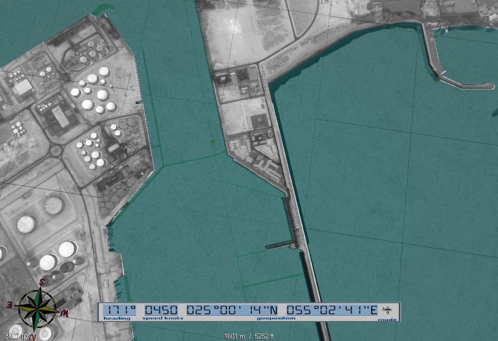
CHAPTER 2 GEODESY AND DATUMS IN NAVIGATION
 CHAPTER 2 GEODESY AND DATUMS IN NAVIGATION GEODESY, THE BASIS OF CARTOGRAPHY 200. Definition Geodesy is the application of mathematics to model the size and shape of the physical earth, enabling us to
RESOLUTION MSC.112(73) (adopted on 1 December 2000) ADOPTION OF THE REVISED PERFORMANCE STANDARDS FOR SHIPBORNE GLOBAL POSITIONING SYSTEM (GPS)
 (adopted on 1 December 2000) ADOPTION OF THE REVISED PERFORMANCE STANDARDS FOR SHIPBORNE GLOBAL POSITIONING SYSTEM (GPS)") MSC 73/21/Add.3 RESOLUTION MSC.112(73) FOR SHIPBORNE GLOBAL POSITIONING SYSTEM THE MARITIME SAFETY COMMITTEE, RECALLING Article (28(b) of the Convention on the International Maritime Organization concerning
MSC 73/21/Add.3 RESOLUTION MSC.112(73) FOR SHIPBORNE GLOBAL POSITIONING SYSTEM THE MARITIME SAFETY COMMITTEE, RECALLING Article (28(b) of the Convention on the International Maritime Organization concerning
GNSS: orbits, signals, and methods
 Part I GNSS: orbits, signals, and methods 1 GNSS ground and space segments Global Navigation Satellite Systems (GNSS) at the time of writing comprise four systems, two of which are fully operational and
High Precision Navigation Capabilities(L1-SAIF) and Applications Using Japanese Quasi-Zenith Satellite System (QZSS)
 and Applications Using Japanese Quasi-Zenith Satellite System (QZSS)") High Precision Navigation Capabilities(L1-SAIF) and Applications Using Japanese Quasi-Zenith Satellite System (QZSS) ICG WG-B Application SG Meeting Munich, Germany March 12, 2012 Satellite Positioning
High Precision Navigation Capabilities(L1-SAIF) and Applications Using Japanese Quasi-Zenith Satellite System (QZSS) ICG WG-B Application SG Meeting Munich, Germany March 12, 2012 Satellite Positioning
GPS Modernization and Program Update
 GPS Modernization and Program Update GPS Update to ION Southern California Chapter 22 Feb 2011 Colonel Bernie Gruber Director Global Positioning Systems Directorate Contents Current Constellation Modernization
Space Situational Awareness 2015: GPS Applications in Space
 Space Situational Awareness 2015: GPS Applications in Space James J. Miller, Deputy Director Policy & Strategic Communications Division May 13, 2015 GPS Extends the Reach of NASA Networks to Enable New
Dave Podlesney Program Director Lockheed Martin Space Systems Company
 GPS III Space Segment Dave Podlesney Program Director Lockheed Martin Space Systems Company Why GPS III? Deliver critical new high-value GPS space capabilities Improved PNT accuracy and power for both
Effect of Quasi Zenith Satellite (QZS) on GPS Positioning
 on GPS Positioning") Effect of Quasi Zenith Satellite (QZS) on GPS ing Tomoji Takasu 1, Takuji Ebinuma 2, and Akio Yasuda 3 Laboratory of Satellite Navigation, Tokyo University of Marine Science and Technology 1 (Tel: +81-5245-7365,
Effect of Quasi Zenith Satellite (QZS) on GPS ing Tomoji Takasu 1, Takuji Ebinuma 2, and Akio Yasuda 3 Laboratory of Satellite Navigation, Tokyo University of Marine Science and Technology 1 (Tel: +81-5245-7365,
EUROPEAN GNSS (GALILEO) INITIAL SERVICES NAVIGATION SOLUTIONS POWERED BY E U R O P E OPEN SERVICE QUARTERLY PERFORMANCE REPORT
 INITIAL SERVICES NAVIGATION SOLUTIONS POWERED BY E U R O P E OPEN SERVICE QUARTERLY PERFORMANCE REPORT") NAVIGATION SOLUTIONS POWERED BY E U R O P E EUROPEAN GNSS (GALILEO) INITIAL SERVICES OPEN SERVICE QUARTERLY PERFORMANCE REPORT JANUARY - MARCH 2018 TABLE OF CONTENTS 1 INTRODUCTION... 1 2 EXECUTIVE SUMMARY...
NAVIGATION SOLUTIONS POWERED BY E U R O P E EUROPEAN GNSS (GALILEO) INITIAL SERVICES OPEN SERVICE QUARTERLY PERFORMANCE REPORT JANUARY - MARCH 2018 TABLE OF CONTENTS 1 INTRODUCTION... 1 2 EXECUTIVE SUMMARY...
ANALYSIS OF GPS SATELLITE OBSERVABILITY OVER THE INDIAN SOUTHERN REGION
 TJPRC: International Journal of Signal Processing Systems (TJPRC: IJSPS) Vol. 1, Issue 2, Dec 2017, 1-14 TJPRC Pvt. Ltd. ANALYSIS OF GPS SATELLITE OBSERVABILITY OVER THE INDIAN SOUTHERN REGION ANU SREE
WE SPECIALIZE IN MILITARY PNT Research Education Engineering
 Defense-Focused Autonomy & Navigation Anywhere, Anytime, Using Anything WE SPECIALIZE IN MILITARY PNT Research Education Engineering RESEARCH THRUST 1 RESEARCH THRUST 2 RESEARCH THRUST 3 Autonomous & Cooperative
Assessing the Accuracy of GPS Control Point, Using Post-Processed and Absolute Positioning Data
 American Journal of Environmental Engineering and Science 2017; 4(5): 42-47 http://www.aascit.org/journal/ajees ISSN: 2381-1153 (Print); ISSN: 2381-1161 (Online) Assessing the Accuracy of GPS Control Point,
Understanding GPS: Principles and Applications Second Edition
 Understanding GPS: Principles and Applications Second Edition Elliott Kaplan and Christopher Hegarty ISBN 1-58053-894-0 Approx. 680 pages Navtech Part #1024 This thoroughly updated second edition of an
Datums for a Dynamic Earth
 Datums for a Dynamic Earth Based on a paper given at the American Society of Agricultural and Biological Engineers (ASABE) Conference in Reno, Nevada June 2009 Rollin StrohmanPh.D. Tom Mastin L.S Background
Basics of Satellite Navigation an Elementary Introduction Prof. Dr. Bernhard Hofmann-Wellenhof Graz, University of Technology, Austria
 Basics of Satellite Navigation an Elementary Introduction Prof. Dr. Bernhard Hofmann-Wellenhof Graz, University of Technology, Austria CONCEPT OF GPS Prof. Dr. Bernhard Hofmann-Wellenhof Graz, University
Customer Showcase > Defense and Intelligence
 Customer Showcase Skyline TerraExplorer is a critical visualization technology broadly deployed in defense and intelligence, public safety and security, 3D geoportals, and urban planning markets. It fuses
PRINCIPLES AND FUNCTIONING OF GPS/ DGPS /ETS ER A. K. ATABUDHI, ORSAC
 PRINCIPLES AND FUNCTIONING OF GPS/ DGPS /ETS ER A. K. ATABUDHI, ORSAC GPS GPS, which stands for Global Positioning System, is the only system today able to show you your exact position on the Earth anytime,
UNCLASSIFIED. InnoVision Overview. Theron Anders 16 April 2008 Precision Strike Annual Programs Review UNCLASSIFIED
 InnoVision Overview Theron Anders 16 April 2008 Precision Strike Annual Programs Review 1 Functional Manager for NSG RDT&E InnoVision is the Functional Manager for the National System for Geospatial Intelligence
GNSS 101 Bringing It Down To Earth
 GNSS 101 Bringing It Down To Earth Steve Richter Frontier Precision, Inc. UTM County Coordinates NGVD 29 State Plane Datums Scale Factors Projections Session Agenda GNSS History & Basic Theory Coordinate
IMAGINE StereoSAR DEM TM
 IMAGINE StereoSAR DEM TM Accuracy Evaluation age 1 of 12 IMAGINE StereoSAR DEM Product Description StereoSAR DEM is part of the IMAGINE Radar Mapping Suite and is designed to auto-correlate stereo pairs
An Empirical Solar Radiation Pressure Model for Autonomous GNSS Orbit Prediction
 Myrtle Beach, South Carolina 24-26.4.2012 An Empirical Solar Radiation Pressure Model for Autonomous GNSS Orbit Prediction Juha Ala-Luhtala, Mari Seppänen & Robert Piché Tampere University of Technology
(Presented by Jeppesen) Summary
 Summary") International Civil Aviation Organization SAM/IG/6-IP/06 South American Regional Office 24/09/10 Sixth Workshop/Meeting of the SAM Implementation Group (SAM/IG/6) - Regional Project RLA/06/901 Lima, Peru,
International Civil Aviation Organization SAM/IG/6-IP/06 South American Regional Office 24/09/10 Sixth Workshop/Meeting of the SAM Implementation Group (SAM/IG/6) - Regional Project RLA/06/901 Lima, Peru,
Real-Time and Multi-GNSS Key Projects of the International GNSS Service
 Real-Time and Multi-GNSS Key Projects of the International GNSS Service Urs Hugentobler, Chris Rizos, Mark Caissy, Georg Weber, Oliver Montenbruck, Ruth Neilan EUREF 2013 Symposium Budapest, Hungary, May
GPS Status and Modernization
 GPS Status and Modernization Nov 2011 Colonel Harold Martin PNT Command Lead AFSPC A3P "This briefing is for information only. No US Government commitment to sell, loan, lease, co-develop or co-produce
Defeating Magnetic Interference on the Battlefield
 Defeating Magnetic Interference on the Battlefield How multiple sensory inputs are enabling lightweight robust weapon pointing for mortar fire control systems Presented by Michael Wright & Ralph Tillinghast
t =1 Transmitter #2 Figure 1-1 One Way Ranging Schematic
 1.0 Introduction OpenSource GPS is open source software that runs a GPS receiver based on the Zarlink GP2015 / GP2021 front end and digital processing chipset. It is a fully functional GPS receiver which
RESOLUTION MSC.401(95) (Adopted on 8 June 2015) PERFORMANCE STANDARDS FOR MULTI-SYSTEM SHIPBORNE RADIONAVIGATION RECEIVERS
 (Adopted on 8 June 2015) PERFORMANCE STANDARDS FOR MULTI-SYSTEM SHIPBORNE RADIONAVIGATION RECEIVERS") ANNEX 17 MSC 95/22/Add.2 Annex 17, page 1 THE MARITIME SAFETY COMMITTEE, RECALLING Article 28(b) of the Convention on the International Maritime Organization concerning the functions of the Committee,
ANNEX 17 MSC 95/22/Add.2 Annex 17, page 1 THE MARITIME SAFETY COMMITTEE, RECALLING Article 28(b) of the Convention on the International Maritime Organization concerning the functions of the Committee,
Positioning, location data and GNSS as solution for Autonomous driving
 Positioning, location data and GNSS as solution for Autonomous driving Jarkko Koskinen, Heidi Kuusniemi, Juha Hyyppä, Sarang Thombre and Martti Kirkko-Jaakkola FGI, NLS Definition of the Arctic 66 34 N
GPS Glossary Written by Carl Carter SiRF Technology 2005
 GPS Glossary Written by Carl Carter SiRF Technology 2005 This glossary provides supplementary information for students of GPS Fundamentals. While many of the terms can have other definitions from those
The International Scene: How Precise Positioning Will Underpin Critical GNSS Applications
 The International Scene: How Precise Positioning Will Underpin Critical GNSS Applications School of Civil & Environmental Engineering, UNSW, Sydney, Australia Chris Rizos Member of the IGS Governing Board
MODULE 7 LECTURE NOTES 3 SHUTTLE RADAR TOPOGRAPHIC MISSION DATA
 MODULE 7 LECTURE NOTES 3 SHUTTLE RADAR TOPOGRAPHIC MISSION DATA 1. Introduction Availability of a reasonably accurate elevation information for many parts of the world was once very much limited. Dense
Challenges and Solutions for GPS Receiver Test
 Challenges and Solutions for GPS Receiver Test Presenter: Mirin Lew January 28, 2010 Agenda GPS technology concepts GPS and GNSS overview Assisted GPS (A-GPS) Basic tests required for GPS receiver verification
Resilient and Accurate Autonomous Vehicle Navigation via Signals of Opportunity
 Resilient and Accurate Autonomous Vehicle Navigation via Signals of Opportunity Zak M. Kassas Autonomous Systems Perception, Intelligence, and Navigation (ASPIN) Laboratory University of California, Riverside
GPS Technical Overview N5TWP NOV08. How Can GPS Mislead
 GPS Technical Overview How Can GPS Mislead 1 Objectives Components of GPS Satellite Acquisition Process Position Determination How can GPS Mislead 2 Components of GPS Control Segment Series of monitoring
Application of GPS and Remote Sensing Image Technology in Construction Monitoring of Road and Bridge
 2017 3rd International Conference on Social Science, Management and Economics (SSME 2017) ISBN: 978-1-60595-462-2 Application of GPS and Remote Sensing Image Technology in Construction Monitoring of Road
EXPERIMENTAL RESULTS OF LEX CORRECTIONS USING FARMING MACHINE
 Sixth Meeting of the International Committee on Global Navigation Satellite Systems (ICG) EXPERIMENTAL RESULTS OF LEX CORRECTIONS USING FARMING MACHINE Masayuki Kanzaki Hitachi Zosen Corporation Prof.
Understanding GPS/GNSS
 Understanding GPS/GNSS Principles and Applications Third Edition Contents Preface to the Third Edition Third Edition Acknowledgments xix xxi CHAPTER 1 Introduction 1 1.1 Introduction 1 1.2 GNSS Overview
Global Positioning Systems Directorate
 Space and Missile Systems Center Global Positioning Systems Directorate GPS Program Update to 8 th Stanford PNT Symposium 30 Oct 2014 Col Matt Smitham Deputy Director, GPS Directorate Global Positioning
SECTION III NM 40/17 MARINE INFORMATION
 SECTION III NM 40/17 MARINE INFORMATION NEW EDITION OF COAST PILOT U.S. Coast Pilot 4, Atlantic Coast: Cape Henry, VA to Key West, FL, forty-ninth edition, 2017, has been issued and is ready for free download
GLOBAL POSITIONING SYSTEMS
 GLOBAL POSITIONING SYSTEMS GPS & GIS Fall 2017 Global Positioning Systems GPS is a general term for the navigation system consisting of 24-32 satellites orbiting the Earth, broadcasting data that allows
GLOBAL POSITIONING SYSTEMS. Knowing where and when
 GLOBAL POSITIONING SYSTEMS Knowing where and when Overview Continuous position fixes Worldwide coverage Latitude/Longitude/Height Centimeter accuracy Accurate time Feasibility studies begun in 1960 s.
MAPPING, CHARTING AND GEODETIC NEEDS FOR REMOTE SENSING DATA
 MAPPING, CHARTING AND GEODETIC NEEDS FOR REMOTE SENSING DATA William L. Stein Technical Advisor for Advanced Sensors Defense Mapping Agency 8613 Lee Highway Fairfax, Virginia 22031-2137 Abstract The Defense
NGA GPS Monitor Station High-Performance Cesium Frequency Standard Stability: From NGA Kalman Filter Clock Estimates
 NGA GPS Monitor Station High-Performance Cesium Frequency Standard Stability: From NGA Kalman Filter Clock Estimates Dennis M. Manning National Geospatial-Intelligence Agency GPS Branch/L-22, 3838 Vogel
Modern Navigation. Thomas Herring
 12.215 Modern Navigation Thomas Herring Summary of Last class Satellite Orbits Treat the basic description and dynamics of satellite orbits Major perturbations on GPS satellite orbits Sources of orbit
Global Navigation Satellite Systems II
 Global Navigation Satellite Systems II AERO4701 Space Engineering 3 Week 4 Last Week Examined the problem of satellite coverage and constellation design Looked at the GPS satellite constellation Overview
The GLOBAL POSITIONING SYSTEM James R. Clynch February 2006
 The GLOBAL POSITIONING SYSTEM James R. Clynch February 2006 I. Introduction What is GPS The Global Positioning System, or GPS, is a satellite based navigation system developed by the United States Defense
GNSS Integrity Monitoring
 www.dlr.de Chart 1 GNSS Integrity Monitoring Martini - Rome, 22 June 2017 GNSS Integrity Monitoring Dr. Ilaria Martini Institute of Communications and Navigation German Aerospace Center Rome, 22.06.2017
Procedures for Quality Control of GNSS Surveying Results Based on Network RTK Corrections.
 Procedures for Quality Control of GNSS Surveying Results Based on Network RTK Corrections. Limin WU, China Feng xia LI, China Joël VAN CRANENBROECK, Switzerland Key words : GNSS Rover RTK operations, GNSS
Global Positioning System Policy and Program Update
 Global Positioning System Policy and Program Update Inaugural Forum Satellite Positioning Research and Application Center Tokyo, Japan 23 April 2007 James J. Miller, Senior GPS Technologist Space Communications
Een GPS naderingshulpmiddel voor de kleine luchtvaart
 Technische ontwikkelingen: Een GPS naderingshulpmiddel voor de kleine luchtvaart Christian Tiberius Faculteit Luchtvaart- en Ruimtevaarttechniek TU Delft WORKSHOP Is er nog Lucht(ruim) voor de Kleine Luchtvaart
Ubiquitous Positioning: A Pipe Dream or Reality?
 Ubiquitous Positioning: A Pipe Dream or Reality? Professor Terry Moore The University of What is Ubiquitous Positioning? Multi-, low-cost and robust positioning Based on single or multiple users Different
BUILDING A SINGLE VERSION OF TRUTH
 BUILDING A SINGLE VERSION OF TRUTH Versioning in PPDM Tarun Chandrasekhar Director, Data Management Products Neuralog AGENDA Introductions Importance of Source Need for multiple sources Source Prioritization
Geodesy, Geographic Datums & Coordinate Systems
 Geodesy, Geographic Datums & Coordinate Systems What is the shape of the earth? Why is it relevant for GIS? 1/23/2018 2-1 From Conceptual to Pragmatic Dividing a sphere into a stack of pancakes (latitude)
GPS BLOCK IIF ATOMIC FREQUENCY STANDARD ANALYSIS
 GPS BLOCK IIF ATOMIC FREQUENCY STANDARD ANALYSIS Francine Vannicola, Ronald Beard, Joseph White, Kenneth Senior U.S. Naval Research Laboratory 4555 Overlook Avenue, SW, Washington, DC 20375, USA francine.vannicola@nrl.navy.mil
Keeping the universe connected. NASA Update: GNSS Space Service Volume Providers Forum
 Keeping the universe connected. NASA Update: GNSS Space Service Volume Providers Forum Frank H. Bauer, FBauer Aerospace Consulting Services (FB-ACS) for NASA SCaN Program Human Exploration and Operations
Precise Point Positioning (PPP) using
 using") Precise Point Positioning (PPP) using Product Technical Notes // May 2009 OnPOZ is a product line of Effigis. EZSurv is a registered trademark of Effigis. All other trademarks are registered or recognized
Precise Point Positioning (PPP) using Product Technical Notes // May 2009 OnPOZ is a product line of Effigis. EZSurv is a registered trademark of Effigis. All other trademarks are registered or recognized
GEO 428: DEMs from GPS, Imagery, & Lidar Tuesday, September 11
 GEO 428: DEMs from GPS, Imagery, & Lidar Tuesday, September 11 Global Positioning Systems GPS is a technology that provides Location coordinates Elevation For any location with a decent view of the sky
Measurement Level Integration of Multiple Low-Cost GPS Receivers for UAVs
 Measurement Level Integration of Multiple Low-Cost GPS Receivers for UAVs Akshay Shetty and Grace Xingxin Gao University of Illinois at Urbana-Champaign BIOGRAPHY Akshay Shetty is a graduate student in
Introduction to Datums James R. Clynch February 2006
 Introduction to Datums James R. Clynch February 2006 I. What Are Datums in Geodesy and Mapping? A datum is the traditional answer to the practical problem of making an accurate map. If you do not have
Computer Technology and National
 Computer Technology and National Security Advantages will go to states that have a strong commercial technology sector and develop effective ways to link these capabilities to their national defense industrial
CHAPTER 2 GEODESY AND DATUMS IN NAVIGATION
 CHAPTER 2 GEODESY AND DATUMS IN NAVIGATION GEODESY, THE BASIS OF CARTOGRAPHY 200. Definition Geodesy is the science concerned with the exact positioning of points on the surface of the earth. It also involves
Introduction to Geographic Information Science. Last Lecture. Today s Outline. Geography 4103 / GNSS/GPS Technology
 Geography 4103 / 5103 Introduction to Geographic Information Science GNSS/GPS Technology Last Lecture Geoids Ellipsoid Datum Projection Basics Today s Outline GNSS technology How satellite based navigation
GPS for Snowmobilers. By Wayne Fischer. November 14, 2006
 GPS for Snowmobilers By Wayne Fischer November 14, 2006 Wayne@TahoeSnowmobiling.org Copy of White Paper & Presentation Both this presentation and the white paper are available on the www.tahoesnowmobiling.org
Carrier Phase GPS Augmentation Using Laser Scanners and Using Low Earth Orbiting Satellites
 Carrier Phase GPS Augmentation Using Laser Scanners and Using Low Earth Orbiting Satellites Colloquium on Satellite Navigation at TU München Mathieu Joerger December 15 th 2009 1 Navigation using Carrier
AUSPOS GPS Processing Report
 AUSPOS GPS Processing Report February 13, 2012 This document is a report of the GPS data processing undertaken by the AUSPOS Online GPS Processing Service (version: AUSPOS 2.02). The AUSPOS Online GPS
Global Positioning Systems (GPS) Trails: the achilles heel of mapping from the air / satellites
 Trails: the achilles heel of mapping from the air / satellites") Global Positioning Systems (GPS) Trails: the achilles heel of mapping from the air / satellites Google maps updated regularly by local users using GPS Also: http://openstreetmaps.org GPS applications
Global Positioning Systems (GPS) Trails: the achilles heel of mapping from the air / satellites Google maps updated regularly by local users using GPS Also: http://openstreetmaps.org GPS applications
Guochang Xu GPS. Theory, Algorithms and Applications. Second Edition. With 59 Figures. Sprin ger
 Guochang Xu GPS Theory, Algorithms and Applications Second Edition With 59 Figures Sprin ger Contents 1 Introduction 1 1.1 AKeyNoteofGPS 2 1.2 A Brief Message About GLONASS 3 1.3 Basic Information of Galileo
Suveying Lectures for CE 498
 Suveying Lectures for CE 498 SURVEYING CLASSIFICATIONS Surveying work can be classified as follows: 1- Preliminary Surveying In this surveying the detailed data are collected by determining its locations
The EU Satellite Navigation programmes status Applications for the CAP
 The EU Satellite Navigation programmes status Applications for the CAP Michaël MASTIER European Commission DG ENTR GP3 GNSS Applications, Security and International aspects GPS Workshop 2010 Montpellier
GLObal Navigation Satellite System (GLONASS)
") FEDERAL SPACE AGENCY GLObal Navigation Satellite System (GLONASS) Sergey Revnivykh Deputy Director General Central Research Institute of Machine Building Head of PNT Center 4-th meeting of International
FEDERAL SPACE AGENCY GLObal Navigation Satellite System (GLONASS) Sergey Revnivykh Deputy Director General Central Research Institute of Machine Building Head of PNT Center 4-th meeting of International
Overview of New Datums NOAA s National Geodetic Survey
 Overview of New Datums NOAA s National Geodetic Survey February 3, 2015 1 NGS s Mission and Role NGS Mission: To define, maintain, and provide access to the National Spatial Reference System to meet our
Applying Multisensor Information Fusion Technology to Develop an UAV Aircraft with Collision Avoidance Model
 Applying Multisensor Information Fusion Technology to Develop an UAV Aircraft with Collision Avoidance Model by Dr. Buddy H Jeun and John Younker Sensor Fusion Technology, LLC 4522 Village Springs Run
NR402 GIS Applications in Natural Resources
 NR402 GIS Applications in Natural Resources Lesson 5 GPS/GIS integration Global Positioning System (GPS)..a global navigation system that everyone can use What is GPS? How does it work? How accurate is
Mobile Positioning in Wireless Mobile Networks
 Mobile Positioning in Wireless Mobile Networks Peter Brída Department of Telecommunications and Multimedia Faculty of Electrical Engineering University of Žilina SLOVAKIA Outline Why Mobile Positioning?
Outlier-Robust Estimation of GPS Satellite Clock Offsets
 Outlier-Robust Estimation of GPS Satellite Clock Offsets Simo Martikainen, Robert Piche and Simo Ali-Löytty Tampere University of Technology. Tampere, Finland Email: simo.martikainen@tut.fi Abstract A
LONG STRIP MODELLING FOR CARTOSAT-1 WITH MINIMUM CONTROL
 LONG STRIP MODELLING FOR CARTOSAT-1 WITH MINIMUM CONTROL Amit Gupta a, *, Jagjeet Singh Nain a, Sanjay K Singh a, T P Srinivasan a, B Gopala Krishna a, P K Srivastava a a Space Applications Centre, Indian
NAVSTAR Global Positioning System Surveying
 1 August 1996 US Army Corps of Engineers ENGINEERING AND DESIGN NAVSTAR Global Positioning System Surveying ENGINEER MANUAL 1 DEPARTMENT OF THE ARMY EM 1110-1-1003 U.S. Army Corps of Engineers CECW-EP
Lecture 8: GIS Data Error & GPS Technology
 Lecture 8: GIS Data Error & GPS Technology A. Introduction We have spent the beginning of this class discussing some basic information regarding GIS technology. Now that you have a grasp of the basic terminology
Satellite Navigation (and positioning)
") Satellite Navigation (and positioning) Picture: ESA AE4E08 Instructors: Sandra Verhagen, Hans van der Marel, Christian Tiberius Course 2010 2011, lecture 1 Today s topics Course organisation Course contents
Satellite Navigation (and positioning) Picture: ESA AE4E08 Instructors: Sandra Verhagen, Hans van der Marel, Christian Tiberius Course 2010 2011, lecture 1 Today s topics Course organisation Course contents
MEOSAR & GPS ICG WG-B Vienna Austria, June 2016
 MEOSAR & GPS ICG WG-B Vienna Austria, June 2016 Dr. Lisa Mazzuca, Mission Manager NASA Search and Rescue Office Goddard Space Flight Center 1 Overview Cospas-Sarsat System GNSS-enabled Medium Earth Orbit
Multi-sensor Navigation Systems: Concepts, Evolution, Trends and Applications
 Multi-sensor Navigation Systems: Concepts, Evolution, Trends and Applications Dorota A. Grejner-Brzezinska Lowber B. Strange Endowed Professor and Chair Department of Civil, Environmental and Geodetic
RESOLUTION MSC.233(82) (adopted on 5 December 2006) ADOPTION OF THE PERFORMANCE STANDARDS FOR SHIPBORNE GALILEO RECEIVER EQUIPMENT
 (adopted on 5 December 2006) ADOPTION OF THE PERFORMANCE STANDARDS FOR SHIPBORNE GALILEO RECEIVER EQUIPMENT") MSC 82/24/Add.2 RESOLUTION MSC.233(82) THE MARITIME SAFETY COMMITTEE, RECALLING Article 28(b) of the Convention on the International Maritime Organization concerning the functions of the Committee, RECALLING
MSC 82/24/Add.2 RESOLUTION MSC.233(82) THE MARITIME SAFETY COMMITTEE, RECALLING Article 28(b) of the Convention on the International Maritime Organization concerning the functions of the Committee, RECALLING
Applying Multisensor Information Fusion Technology to Develop an UAV Aircraft with Collision Avoidance Model
 1 Applying Multisensor Information Fusion Technology to Develop an UAV Aircraft with Collision Avoidance Model {Final Version with
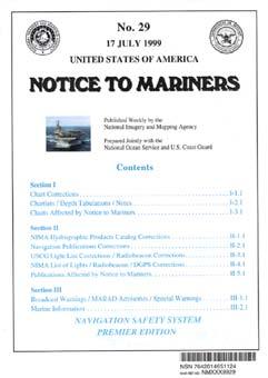
SECTION III NM 39/13 MARINE INFORMATION NGA CHART NEW EDITIONS AND THEIR AVAILABILITY
 SECTION III NM 39/13 MARINE INFORMATION NGA CHART NEW EDITIONS AND THEIR AVAILABILITY NGA standard nautical hardcopy chart products are made available and distributed by three different authorized methods:
Recommendation ITU-R M (09/2015)
") Recommendation ITU-R M.1906-1 (09/2015) Characteristics and protection criteria of receiving space stations and characteristics of transmitting earth stations in the radionavigation-satellite service (Earth-to-space)
Recommendation ITU-R M.1906-1 (09/2015) Characteristics and protection criteria of receiving space stations and characteristics of transmitting earth stations in the radionavigation-satellite service (Earth-to-space)
Modelling GPS Observables for Time Transfer
 Modelling GPS Observables for Time Transfer Marek Ziebart Department of Geomatic Engineering University College London Presentation structure Overview of GPS Time frames in GPS Introduction to GPS observables
The Role of F.I.G. in Leading the Development of International Real-Time Positioning Guidelines
 The Role of F.I.G. in Leading the Development of International Real-Time Positioning Guidelines, USA Key Words: RTN, real-time, GNSS, Guidelines SUMMARY The rapid growth of real-time reference station
Keywords: GPS/GLONASS, Precise Point Positioning, Kinematic, Hydrography
 GPS/GLONASS COMBINED PRECISE POINT POSITIOINING FOR HYDROGRAPHY CASE STUDY (ASWAN, EGYPT) Ashraf Farah Associate Professor,College of Engineering, Aswan University, Egypt, ashraf_farah@aswu.edu.eg ABSTRACT
ICG WG-B Achievements on Interoperable GNSS Space Service Volume (SSV) November, 2016 Sochi, Russian Federation
 November, 2016 Sochi, Russian Federation") ICG WG-B Achievements on Interoperable GNSS Space Service Volume (SSV) November, 2016 Sochi, Russian Federation ICG WG-B Action Group on SSV Action group on SSV was formed within WG-B in order to Establish
ICG WG-B Achievements on Interoperable GNSS Space Service Volume (SSV) November, 2016 Sochi, Russian Federation ICG WG-B Action Group on SSV Action group on SSV was formed within WG-B in order to Establish