No MAY 2010 UNITED STATES OF AMERICA. Contents
|
|
|
- Lewis Dorsey
- 5 years ago
- Views:
Transcription


1 18 1 MAY 2010 UNITED STATES OF AMERICA Published Weekly by the National Geospatial-Intelligence Agency Prepared Jointly with the National Ocean Service and U.S. Coast Guard Contents Section I Corrections I-1.1 lets / Depth Tabulations / Notes I-2.1 s Affected by Mariners I-3.1 Section II NGA / DLIS Catalog Corrections II-1.1 Navigation Publications Corrections II-2.1 USCG Light List Corrections / Radiobeacon Corrections II-3.1 NGA List of Lights / Radiobeacon / DGPS Corrections II-4.1 Publications Affected by Mariners II-5.1 Section III Broadcast Warnings / MARAD Advisories / Special Warnings III-1.1 Marine Information III-2.1 Visit the Maritime Safety Web site at
2 IMPORTANT INFORMATION The Mariners is published by the National Geospatial-Intelligence Agency (NGA), under the authority of Department of Defense Directive , to advise mariners of important matters affecting navigational safety, including new hydrographic discoveries, changes in channels and navigational aids, etc. (U.S. Code Title 10, Sec. 442 and Title 44, Sec refer). Nothing in the arrangement of information implies endorsement or acceptance by NGA in matters affecting the status and boundaries of States and territories. The Mariners presents corrective information affecting charts, NGA/DLIS Catalog of Maps s and Related Products, Coast Pilots, Sailing Directions, Fleet Guides, USCG Light Lists, NGA List of Lights, Radio Navigational Aids and other products produced by the National Geospatial-Intelligence Agency, National Ocean Service and U.S. Coast Guard. Information for the Mariners is contributed by the following Agencies: National Geospatial-Intelligence Agency (NGA) (Department of Defense) for waters outside the territorial limits of the United States; National Ocean Service (NOS) (Department of Commerce), which is charged with the surveys and charting of the coasts and harbors of the United States and its territories; the U.S. Coast Guard (USCG) (Department of Homeland Security), which is responsible for the safety of life at sea and the establishment and operation of aids to navigation; and the U.S. Army Corps of Engineers (Department of Defense), which is charged with the improvement of rivers and harbors of the United States. In addition, important contributions are made by foreign hydrographic offices and cooperating observers of all nationalities. For further information concerning NGA hydrographic products and services, including the Maritime Safety Web site, users may contact: Name Telephone DSN FAX Maritime Domain World Wide Navigational Warning Service Maritime Safety Web site Mariners: Regions 1 and Mariners: Regions 3 thru Sailing Directions, Fleet Guides Navigation Publications DLA Catalog of Maps s and Related Products The Maritime Safety Web site can be accessed directly at For your convenience NGA provides four addresses. For information affecting Mariners use NavNotices@nga.mil, for information affecting Sailing Directions and all other navigational publications use MCDPubs@nga.mil, for information concerning the Maritime Safety Web site, use webmaster_nss@nga.mil and for information concerning the World Wide Navigational Warning Service, use NavSafety@nga mil. Mariners are requested to notify NGA of discrepancies in charts and publications, using the Marine Information Report and Suggestion Sheet at the back of this Mariners. This form should also be used to report permanent changes, additions, or deletions from charted or published information. Reports which constitute an immediate hazard to navigation should be sent to the nearest NAVAREA Coordinator via coast radio stations. All reports are greatly appreciated. Cover Photo: F/V CORNELIA MARIE is a U.S. registered fishing vessel originally built in Bayou La Batre, Alabama in 1989, with an extension of 21 feet added to the hull in The vessel is now 128 feet in length, has a beam of 28 feet, draft of 11.7 feet and displaces 298 gross tons. Powered by twin 630 horsepower diesel engines, CORNELIA MARIE carries 25, 800 gallons of fuel and has 7,500 gallons of fresh catch storage space available. With a crew of six, she is routinely engaged in the Alaskan King Crab and Opilio Crab fisheries in the Bering Sea. She is named after Cornelia Marie Devlin, an owner of the vessel, and is homeported in Kodiak, Alaska. ii
3 INFORMATION OF SPECIAL INTEREST OR IMPORTANCE TO MARINERS NM National Geospatial-Intelligence Agency Bethesda, MD SPECIAL ANNOUNCEMENTS NEW PRODUCTS OR SERVICES IMPORTANT CHANGES 1 May 2010 NGA CHART NEW EDITIONS AND THEIR AVAILABILITY NGA RECOGNIZES TWO PAPER NAUTICAL CHART PRODUCTS: ENTERPRISE PRODUCT ON DEMAND-MARITIME (EPOD-M) CHARTS AND TRADITIONAL NGA PAPER CHARTS. FOR ADDITIONAL INFORMATION, SEE SECTIONS II AND III. NOAA CHART NEW EDITIONS AND THEIR AVAILABILITY NOAA RECOGNIZES TWO PAPER NAUTICAL CHART PRODUCTS: CHARTS-ON-DEMAND AND TRADITIONAL NOAA/NOS PAPER CHARTS. FOR ADDITIONAL INFORMATION, SEE SECTIONS II AND III. NATIONAL GEOSPATIAL-INTELLIGENCE AGENCY S IMPLEMENTATION OF A HARDCOPY TO DIGITAL TRANSITION STRATEGY THIS NOTICE IS A REMINDER OF THE NATIONAL GEOSPATIAL-INTELLIGENCE AGENCY (NGA) HARDCOPY TO DIGITAL TRANSITION PROGRAM. SEE SECTION III FOR DETAILS. iii
4 EXPLANATION OF CONTENTS The Mariners contains corrective information affecting nautical charts, the NGA/DLIS Catalog of Maps s and Related Products, Coast Pilots, Sailing Directions, Fleet Guides, USCG Light Lists, NGA List of Lights, Radio Navigational Aids and other related nautical publications. The information contained in these corrections is important to safe navigation. It is the user s responsibility to decide which of their charts and publications require correction. Consult the U.S. Coast Guard Local Mariners for information pertaining to waterways within the United States that are not normally used by oceangoing vessels. Because of the sometimes transitory nature of aids to navigation, depths and port information, local area sources should be consulted whenever possible. This publication is not required to be maintained intact. Portions may be separated for correction or attachment to an affected product. The Mariners is divided into the following sections: Section I-1 contains corrections to nautical charts listed in numeric order by chart number. Each chart correction listed applies only to that particular chart. Related charts, if any, will have their own specific correction listed separately. Users should also refer to U.S. 1 Nautical Symbols, Abbreviations and Terms for additional information pertaining to the correcting of charts. The illustration below describes the elements that comprise a typical chart correction: International Series chart number U.S. number Edition number Edition date Last Mariners that affected chart Current Notice to Mariners TP (INT 1234) 1 1/23/98 LAST NM 12/00 27/00 Add Depth 12 meters Obstn [K41] N E (12(345)00 Taunton) Corrective action Source of information Object of correction 1 reference Position A chart correction preceded by: indicates that it is based upon original U.S. source information. T indicates that it is temporary in nature. P indicates that it is preliminary, and that permanent corrective action will appear in a future Mariners. The letter M immediately following the chart number indicates that the correction should be applied to the metric side of the chart only. The letter M is not a part of the chart number. The letter N preceding the current Mariners number indicates that the affected chart is on Limited Distribution and is normally only for use by U.S. Navy, government-owned or -chartered vessels. Courses and bearings are given in degrees true. Light sectors are expressed in degrees true from the vessel TOWARD the light. The visible range(s) listed for lights is normally the nominal range (the distance at which it can be seen in clear weather), expressed in nautical miles, except in the Great Lakes where it is expressed in statute miles. The colors of structures and lights of navigational aids are abbreviated in accordance with 1. Section I-2* contains all chartlets, depth tabulations and notes associated with the chart corrections in Section I-1. lets and depth tabulations supersede all previous information portrayed. Section I-3 lists all NGA and NOS charts which have been affected by Mariners and the notice numbers which have affected them since the date of the oldest Summary of Corrections or the chart s announcement, whichever is later. Section II-1 is a weekly listing of corrections to the NGA/DLIS Catalog of Maps s and Related Products, including new charts and publications. It also contains the latest price category information. Section II-2* contains corrections to navigation publications, including Sailing Directions, Coast Pilots, Fleet Guides, Radio Navigational Aids (Pub. 117), The American Practical Navigator and other related nautical publications. Section II-3* lists weekly updates to the USCG Light Lists. Section II-4* lists weekly updates to the NGA List of Lights. Section II-5 lists all NGA, NOS and USCG navigation publications which have been affected by Mariners and the notice numbers which have affected them since the date of the publication s announcement. Section III-1 lists the message number of all in-force Navigational Warnings, and the text of those warnings promulgated during the previous week. Mariners Nos. 13, 26 and 39 list a summary of all in-force Navigational Warnings for the preceding quarter. Mariners 52 lists a complete summary of all in-force Navigational Warnings. Section III-2 contains miscellaneous information of particular interest to the maritime community. *The left-hand pages of these sections are intentionally blank. iv
5 SECTION I NM CHART CORRECTIONS 52 (INT 52) 1 4/5/86 LAST NM 7/10 Delete R Bn at light N E R Bn at light N E Add Depth 1312 meters enclosed by depth contour (2000-meter) centered N E (NTM0001/2010; ROK CH 165, 326) 53 (INT 53) 2 8/6/94 LAST NM 7/10 Delete R Bn at light N E R Bn at light N E (ROK CH 165, 326) 506 (INT 506) 2 2/3/96 LAST NM 47/09 Add Depth 1312 meters enclosed by depth contour (2000-meter) centered N E (NTM0001/2010) 507 (INT 507) 2 9/14/96 LAST NM 7/10 Add Depth 1312 meters enclosed by depth contour (2000-meter) centered N E (NTM0001/2010) 509 (INT 509) 4 7/2/94 LAST NM 38/09 Delete R Bn at light N E R Bn at light N E (ROK CH 165, 326) 511 (INT 511) 4 2/10/96 LAST NM 24/09 Delete R Bn at light N E (ROK CH 165) /13/96 LAST NM 47/09 Delete R Bn N E R Bn N E Add Depth 717 fathoms enclosed by depth contour (1000-fathom) centered N E (NTM0001/2010; ROK CH 165, 326) /6/96 LAST NM 7/10 Delete R Bn N E (ROK CH 326) /27/96 LAST NM 7/10 Add Depth 717 fathoms enclosed by depth contour (1000-fathom) centered N E (NTM0001/2010) /5/83 LAST NM 47/09 Add Depth 717 fathoms enclosed by depth contour (1000-fathom) centered N E (NTM0001/2010) /23/96 LAST NM 7/10 Add Depth 717 fathoms N E (NTM0001/2010) /18/76 LAST NM 45/09 Add Depth 38 fathoms Rep (2010) N W (NTM0011/2010) /10 NEW EDITION Add Dashed-line circle Discol. water [Ke] (PA) N W (Previously published 16/10) (NOS) /10 NEW EDITION (NOS) /06 LAST NM 12/10 Delete Danger circle Obstn PA (rep 1976) N W Substitute Depth 10 feet Rk [K14.2] for 14 feet Rk N W (See 22/ ) Add Depth 22 feet Rk [K14.1] N W Depth 10 feet Rk [K14.2] N W Depth 11 feet Rk [K14.2] N W Depth 12 feet Rk [K14.2] N W Depth 26 feet Rk [K14.2] N W Depth 41 feet Wk [K26] N W (NOS) /08 LAST NM 10/10 Delete Danger circle Obstn PA (rep 1976) N W Depth 14 feet Rk N W Depth 13 feet Rk N W (See 22/ ) Substitute Depth 5 feet for 15 feet N W Depth 12 feet Rk [K14.2] for 17 feet N W Depth 6 feet for 20 feet N W Depth 15 feet Rk [K14.1] for 27 feet N W Add Depth 15 feet Rk [K14.1] N W Depth 22 feet Rk [K14.1] N W Depth 10 feet Rk [K14.2] N W Depth 10 feet Rk [K14.2] N W Depth 11 feet Rk [K14.2] N W Depth 26 feet Rk [K14.2] N W Depth 41 feet Wk [K26] N W (NOS) /07 LAST NM 12/10 Delete Danger circle Obstn PA (rep 1976) N W Add Depth 41 feet Wk [K26] N W (NOS) /07 LAST NM 12/10 Delete Danger circle Obstn PA (rep 1976) N W Depth 13 feet Rk (reported) Depth 14 feet Rk Depth 15 feet Depth 17 feet Depth 20 feet (See 22/ ) N W N W N W N W N W Substitute Depth 15 feet Rk [K14.1] for 27 feet N W Add Depth 10 feet Rk [K14.2] N W Depth 10 feet Rk [K14.2] N W Depth 12 feet Rk [K14.2] N W Depth 5 feet N W Depth 6 feet N W Depth 41 feet Wk [K26] N W (NOS) /08 LAST NM 2/10 Change Legend to 14 1 / 2 FT FOR WIDTH OF FT JAN N W Add Legend 12 1 / 2 FT N W (NOS) /04 LAST NM 52/09 Add Purple dashed line (no-discharge zone limit) [N1.2] between N W N W Legend NO-DISCHARGE ZONE (see note Z) N W Depth 13 feet Rk (rep) N W (continued on next page) I-1.1
6 NM SECTION I (Continued) (Inset Wells Harbor) Add Purple dashed line (no-discharge zone limit) [N1.2] between N W N W Legend NO-DISCHARGE ZONE (see note Z) N W /09 LAST NM 16/10 Delete GONG from buoy N W (14/10 CG13) /29/06 LAST NM N15/10 N Add Depth 69 meters Rep (2010) N W (NTM0011/2010) Add (NOS) (Inset Kennebunk River) Legend NO-DISCHARGE ZONE (see note Z) N W /06 LAST NM 15/10 Add Depth 38 fathoms Rep (2010) N W (NTM0011/2010) /15/01 LAST NM 17/10 Add Depth 1 fathom N W Depth 1 fathom N W (NOS) /12/02 LAST NM 17/10 Delete Depth 1 fathom 5 feet N W Substitute Depth 2 fathoms 2 feet for 3 fathoms 4 feet N W Depth 1 fathom for 21 fathoms N W Add Depth 1 fathom 3 feet N W Depth 1 fathom 5 feet N W Depth 2 fathoms 2 feet N W Depth 2 fathoms 3 feet N W Depth 1 fathom N W Depth 1 fathom N W (NOS) /12/01 LAST NM 17/10 Substitute Depth 2 fathoms 3 feet for 4 fathoms 5 feet N W Add Depth 1 fathom 3 feet N W Depth 1 fathom 5 feet N W Depth 2 fathoms 2 feet N W Depth 1 fathom N W (NOS) /09 LAST NM 15/10 (Page A) Add SAFETY AND SECURITY ZONE (see note A) [N1.2] bound by shore and purple dashed line joining N W N W N W N W (NOS) /19/08 LAST NM 16/10 Add Depth 69 meters Rep (2010) N W (NTM0011/2010) /06 LAST NM 15/10 Add Depth 38 fathoms Rep (2010) N W (NTM0011/2010) /06 LAST NM 12/10 Add Depth 38 fathoms Rep (2010) N W (NTM0011/2010) /08 LAST NM 15/10 Add Depth 38 fathoms Rep (2010) N W (NTM0011/2010) /6/06 LAST NM N16/10 N Add Depth 69 meters Rep (2010) N W (NTM0011/2010) /08 LAST NM 16/10 Add Depth 38 fathoms Rep (2010) N W (NTM0011/2010) /05 LAST NM 16/10 Add Depth 38 fathoms Rep (2010) (PA) enclosed by depth contour (50-fathom) N W (NTM0011/2010) /10 NEW EDITION (NOS) /10 NEW EDITION (NOS) /03 LAST NM 51/09 Add SAFETY AND SECURITY ZONE (see note A) [N1.2] bound by shore and purple dashed line joining N W N W N W N W (NOS) /04 LAST NM 33/09 Add SAFETY AND SECURITY ZONE (see note A) [N1.2] bound by shore and purple dashed line joining N W N W N W N W (NOS) /03 LAST NM 15/10 Add SAFETY AND SECURITY ZONE (see note A) [N1.2] bound by shore and purple dashed line joining N W N W N W N W (NOS) I /10 NEW EDITION (NOS) /20/07 LAST NM 11/08 Delete Range beacon, range line and legend Bn between S W S W Range beacon, range line and legend Bn between S W S W Light (Fl 5s 9m 2M) and sector limits S W Note: Existing light (Fl 3s) and sector remains Add Double solid line with land tint (pier) [F14] between S W S W (11(104)09, 2(14)10 Valparaiso; Chile LL) /11/06 LAST NM 48/09 Delete Beacon S W Beacon S W Depth 22 meters S W Add Depth 112 meters S W Depth 108 meters S W Depth 105 meters S W (11(104)09, 2(14)10 Valparaiso)
7 SECTION I NM /9/96 LAST NM 15/10 Delete Depth 22 meters S W (2(14)10 Valparaiso) /18/98 LAST NM 30/08 Delete Horn from light N E (Fr LL) /3/96 LAST NM 45/09 Delete Depth 6.8 meters and enclosing depth contour in vicinity S W Relocate Buoy from S W to S W Substitute Depth 7.3 meters for 11.1 meters S W /12/08 LAST NM N38/08 N Delete Horn from light N E (Fr LL) /23/99 LAST NM 30/08 Delete Horn from light N E (Fr LL) Add Depth 1.8 meters for 4.7 meters S W Depth 5.3 meters Wk [K22], axis, 170 yards long by 60 yards wide, centered S W Depth 9.9 meters enclosed by depth contour (10-meter) S W /24/99 LAST NM 2/09 Delete Horn from light N W Horn from light N E Horn from light N E Substitute Buoy LHA RW, pillar, ball topmark, Mo(A) 12s Racon AIS for superbuoy LANBY LHA N W (See 40/ ) (2(7)10 Rio de Janeiro) (INT 1070) 2 2/24/96 LAST NM 17/10 Delete Horn from light N E Horn from light N E Horn from light N E Whis from buoy Bassurelle N E Substitute Buoy LHA RW, pillar, ball topmark, Mo(A) 12s Racon AIS for superbuoy LANBY LHA N W Change Light to Les Triagoz Fl(2) WR 6s 14/11M N W Period of light Les Sept Iles to 20s N W (32(25), 36(10), 38(4)09 Brest; Fr LL) Change Height of range light, front to 113m N E Height of range light, rear to 135m N E (38(4)09 Brest; Fr LL) /3/90 LAST NM 5/08 Delete Position circle HORN N E (Fr LL) /10/97 LAST NM 2/09 Delete HORN from light N E HORN from light N E (Fr LL) /3/07 LAST NM 14/10 Delete Horn from light N E (Fr LL) /29/96 LAST NM 52/08 Delete Whis from buoy N W Change Characteristic of light to Oc(3) G 12s N W (Fr LL) /28/96 LAST NM 17/10 Change Characteristic of beacon tower to Q WRG N W Characteristic of light to Dir Oc(3) WRG 12s N W (Fr LL) /8/97 LAST NM 17/10 Delete SIREN and R Bn from light N W HORN from light N W Change Characteristic of beacon to Q WRG N W /1/97 LAST NM 2/09 Delete Horn from light N E (Fr LL) /6/97 LAST NM 15/07 (Panel A) Delete Range lights (2), range line and legend Lights in line between N E N W (43(30)09 Brest) /21/97 LAST NM 5/08 Delete Range lights (2), range line and legend Lts in line between N E N W Substitute Buoy LHA RW, pillar, ball topmark, Mo(A) 12s Racon AIS for superbuoy LANBY LHA N W (Fr LL) Characteristic of light to Dir Oc(3) WRG 12s N W Change Visibility (range) of beacon to 5M N E Height of range light, front to 113m N E Height of range light, rear to 135m N E (38(4), 43(30)09 Brest; Fr LL) /26/96 LAST NM 32/08 Delete R Bn at light N W HORN from light N W HORN from light N E Substitute Buoy LHA RW, pillar, ball topmark, Mo(A) 12s Racon AIS for superbuoy LANBY LHA N W Change Light to QR 7m 5M N W Light to Fl(2) G 6s 11m 3M N W and delete NAUTO Height of range light, front to 113m N E Height of range light, rear to 135m N E (38(4)09 Brest; Fr LL) /13/97 LAST NM 15/07 Delete Range lights (2), range line and legend between N E N W Change Legend to N E Legend to N E Legend to N E Legend to N E (43(30)09 Brest; Fr CH 6683; Fr LL) /13/97 LAST NM 28/06 Change Visibility (range) of light (Dir Iso G) to 10M N W (continued on next page) I-1.3
8 NM SECTION I (Continued) Visibility (range) of range light, front to 10M N W Visibility (range) of range light, rear to 12M N W Characteristic of light to QR N W Characteristic of light to QG N W Visibility (range) of light (Q) to 11M N W (Fr LL) /22/97 LAST NM 13/05 Delete Siren from light N W RC at light N W Horn from light N W Substitute Buoy LHA RW, pillar, ball topmark, Mo(A) 12s Racon AIS for superbuoy LANBY LHA N W Change Light to QR 7m 5M N W Light to QG 7m 5M N W Characteristic of light to Fl R 4s N W Characteristic of light to Fl G 4s N W Characteristic of light to Fl(2) G 6s N W and delete Horn Characteristic of light to Fl(2) R 6s N W (38(4)09 Brest; Fr LL) /5/97 LAST NM 11/05 (Plan A) Change Light to Saint Medard QR 7m 5M N W Light to Barnabe QG 7m 5M N W Characteristic of light Quilbe to Fl R 4s N W Characteristic of light Riva to Fl G 4s N W Light to Fl(2) G 6s 11m 3M N W and delete fog signal Characteristic of light to Fl(2) R 6s N W Characteristic of light to Dir Oc(3+1) R 12s N W (Fr LL) /25/97 LAST NM 23/06 Change Visibility (range) of light (Dir Iso G) to 10M N W Visibility (range) of range light, front to 10M N W Visibility (range) of range light, rear to 12M N W Characteristic of light to QR N W Characteristic of light to QG N W Visibility (range) of light to 11M N W (Fr LL) /12/97 LAST NM 9/10 Change Characteristic of light Roscoff to Oc(3) G 12s N W Characteristic of light to QR N W Characteristic of light Locquemeau to QR N W Add Height 15m to light N W Light QR 35m 7M, QR 56m 7M N W Range line extending in 332 direction from above light solid for 3.5 miles Legend Lights in line 152 along above range line N W (41(44)08, 32(25), 36(10), 39(6)09 Brest; Fr CH 7095; Fr LL) /20/10 NEW CHART N (NGA) /19/96 LAST NM 15/10 Add Depth 33 meters Wk [K26] N E Light Fl(2) 7s 7M N E (11(109)08, 10(138)09 Tallinn) /3/09 LAST NM 17/10 Add Depth 33 meters Wk [K26] N E (10(138)09 Tallinn) /15/97 LAST NM 17/10 Substitute Depth 16.8 meters for 18.8 meters N E Depth 10.9 meters for 12.4 meters N E Add Depth 9.7 meters N E Light Fl(2) 7s 7M N E Depth 12.5 meters N E Depth 33 meters Wk [K26] N E (28(576)05, 32(560)08 Helsinki; 11(109)08, 10(132, 134, 138)09 Tallinn) /21/96 LAST NM 16/10 Add Depth 5.8 meters Rk [K14.1] N E Depth 9.8 meters Wk [K26] N E (10(143, 145)09 Tallinn) /2/08 LAST NM 17/10 Substitute Depth 10.9 meters for 12.4 meters N E Add Depth 9.7 meters N E Depth 12.5 meters N E Depth 43 meters Wk [K26] N E Depth 33 meters Wk [K26] N E (28(576)05, 32(560)08 Helsinki; 10(134, 138)09 Tallinn) /17/98 LAST NM 11/10 Add Depth 12.5 meters N E (32(560)08 Helsinki) /10/07 LAST NM N17/10 N Delete Danger circle Sunken Mine N E Change Characteristic of range light, front to Fl(2) G 3s N E Characteristic of range light, rear to Oc G 5s N E Add Depth 42.5 meters Wk [K26] N E Depth 33.5 meters Wk [K26] N E Under Construction area [N1.1] bound by shore, existing pier and dashed line joining N E N E N E (10(137, 138)09, 1(4)10 Tallinn; Est LL; BA LL) /2/08 LAST NM 17/10 Delete Buoy N E Light to Les Triagoz Fl(2) WR 6s 31m 14/11M N W Relocate Buoy 1 from N E to N E Period of light to 20s N W Add Depth 9.7 meters N E Depth 7 meters N E Light to Le Colombier Dir Q 28m 14M N W Visibility (range) of light Kerjean to 15-12M N W I-1.4 Buoy 2 RW, pillar, ball topmark, LFl 6s N E (28(576)05; 32(568)08 Helsinki; 43(5739)09 St. Petersburg)
9 SECTION I NM /5/94 LAST NM 17/10 Add Depth 7 meters N E (32(568)08 Helsinki) /7/96 LAST NM 16/10 Add Depth 5.8 meters Rk [K14.1] N E Depth 9.8 meters Wk [K26] N E (10(143, 145)09 Tallinn) /6/10 NEW EDITION N (NGA) /5/94 LAST NM 7/10 Add Marine farm area bound by dashed line joining N E N E N E N E Buoy Y, can, X topmark, Fl Y 3s [Q130.6] N E Buoy Y, can, X topmark, Fl Y 4s [Q130.6] N E Buoy Y, can, X topmark [Q130.6] N E Buoy Y, can, X topmark [Q130.6] N E /18/96 LAST NM 15/10 (Plan) Delete Light N W (See 30/ ) Add Land tint to area bound by shore, existing breakwater and solid line joining N W N W N W N W N W Light Q(6) + L Fl 15s 11m 5M N W (Spn CH 6120) /30/05 LAST NM 44/09 Delete Submarine pipeline between N W N W Buoy N W (Spn CH 4551) /13/05 LAST NM 13/10 Change Color of buoy to Y N E and delete legend Wave meter (2(7)10 Genova; UKHO ARCS 1941) /31/02 LAST NM 8/10 Delete PROHIB AREA and buoy in vicinity N E Anchorage area in vicinity N E Add Purple composite line between N E N E (3(15)10 Genova; Ital CH 36) (2(10)10 Genova) /3/95 LAST NM 47/09 Change Characteristic of light to Fl G N E (1(1)10 Split) /27/91 LAST NM 50/09 Add Wreck [K29] N E Wreck [K29] N E Wreck [K29] N E Wreck [K29] N E (3(74)10 Athens) /26/94 LAST NM 44/09 Add Wreck [K29] N E (3(74)10 Athens) /9/95 LAST NM 50/09 Add Wreck [K29] N E Wreck [K29] N E Wreck [K29] N E Wreck [K29] N E (3(74)10 Athens) /23/96 LAST NM 50/09 Add Wreck [K29] N E Wreck [K29] N E Wreck [K29] N E Wreck [K29] N E (3(74)10 Athens) /3/04 LAST NM 4/10 Add Dangerous wreck [K28] N E (3(73)10 Athens) /19/92 LAST NM 8/10 Delete PROHIB AREA and buoy in vicinity N E ANCH AREA in vicinity N E Add Purple composite line between N E N E (3(15)10 Genova; Ital CH 36) /18/95 LAST NM 37/09 Add Light Fl R 3s 6m 3M N E (3(76)10 Athens) /26/94 LAST NM 50/09 Add Light Fl R 3s 6m 3M N E Light Fl R 3s 7m 3M N E (3(76, 77)10 Athens) /3/05 LAST NM 7/10 Add Marine farm area bound by dashed line joining N E N E N E N E (2(10)10 Genova) /22/06 LAST NM 8/10 Delete PROHIBITED AREA and buoy in vicinity N E ANCHORAGE AREA in vicinity N E Add Purple composite line between N E N E (3(15)10 Genova; Ital CH 36) /22/90 LAST NM 2/10 Add Light Fl G 3s 6m 3M N E (3(75)10 Athens) /22/77 LAST NM 2/09 Add Stranded wreck [K24] N E (3(79)10 Athens) /27/96 LAST NM 12/10 Add Submarine cable (power) [L31.1] between N E N E Submarine cable (power) [L31.1] joining N E N E N E (3(78)10 Athens; UKHO ARCS 1055) I-1.5
10 NM SECTION I /20/98 LAST NM 8/10 Add Submarine cable (power) [L31.1] between N E N E Submarine cable (power) [L31.1] joining N E N E N E (3(78)10 Athens; UKHO ARCS 1055) /25/08 LAST NM N47/09 N Add Buoy (mooring) N E (5(487)10 St. Petersburg) /27/10 NEW EDITION N (NGA) /12/96 LAST NM 7/10 Delete Purple outline of chart N E Add Purple outline of chart joining N E N E N E N E (NGA) Dashed line and legend between N E N E Relocate Buoy No 1 from N E to N E Buoy Sitrah from N E to N E Change Period of buoy No 5 to 5s N E Designation of buoy to No N E Designation of buoy to No N E Buoy to No 25 G, conical, VQ G N E Add Land tint to area bound by shore and solid line [F13] joining N E N E N E N E N E N E N E N E Buoy No 2 R, can, QR N E Buoy No 3 G, conical, Fl G 3s N E Buoy No 4 R, can, Fl R 3s N E Buoy No 6 R, can, Fl R 5s N E Buoy No 7 G, conical, Fl(3) G 10s N E /5/96 LAST NM 10/10 Add Dangerous wreck [K28] N E (3(227)10 St. Petersburg) Buoy No 8 R, can, Fl(3) R 10s Buoy No 9 G, conical, Fl G 3s Buoy No 10 R, can, Fl R 3s Buoy No 12 R, can, Fl R 5s N E N E N E N E Buoy No 13 G, conical, Fl(3) G 10s N E /22/06 LAST NM 7/10 Delete Buoy No N E Buoy No N E Buoy No N E Buoy No N E Buoy No N E Buoy No N E Buoy No N E Buoy No N E Buoy No N E Buoy No N E Buoy No N E Buoy No N E Buoy No N E Buoy No N E Buoy No N E Buoy No N E Buoy No N E Dashed line between N E N E Dashed line and legend between N E N E Dashed line and legend between N E N E Dashed line and legend between N E N E Dashed line and legend between N E N E Dashed line and legend between N E N E Dashed line and legend joining N E N E N E Dashed line and legend between N E N E Dashed line and legend between N E N E Buoy No 14 R, can, Fl(3) R 10s N E Buoy No 16 R, can, QR N E Buoy No 17 G, conical, Fl G 3s N E Buoy No 18 R, can, Fl R 3s N E Buoy No 19 G, conical, Fl G 5s N E Buoy No 20 R, can, QR N E Buoy No 21 G, conical, Fl(3) G 10s N E Buoy No 22 Y, can, VQ Y N E Buoy No 23 G, conical, QG N E Buoy No 24 Y, can, Fl Y 3s N E Buoy No 26 R, can, Fl R 5s N E Buoy No 27 G, conical, Fl G 3s N E Buoy No 28 Y, can, Fl Y 10s N E Buoy No 29 G, conical, Fl G 5s N E Buoy No 30 Y, can, Fl Y 3s N E Buoy No 31 BYB, pillar, double cone topmark bases together, VQ(3) 5s N E Buoy No 32 R, can, QR N E Buoy No 33 G, conical, QG N E Buoy No 34 R, can, QR N E Buoy No 35 G, conical, Fl G 3s N E Buoy No 37 YB, pillar, double cone topmark points downward, Q(6) + L Fl 10s N E (NTM0010/2010; 2/10 MENAS; 35(4547)09 Taunton) /22/06 LAST NM 5/10 Delete Buoy No N E Buoy No N E Buoy No N E Buoy No N E Buoy No N E Buoy No N E Buoy No N E Buoy No N E Buoy No N E Buoy No N E Buoy No N E Buoy No N E Buoy No N E Dashed line and legend joining N E N E N E Dashed line and legend between N E N E (continued on next page) I-1.6
11 SECTION I NM (Continued) Dashed line and legend between N E N E Dashed line and legend between N E N E Dashed line and legend joining N E N E N E Dashed line and legend between N E N E Dashed line and legend joining N E N E N E Dashed line and legend between N E N E Dashed line and legend between N E N E Dashed line and legend between N E N E Relocate Buoy Sitrah from N E to N E Change Buoy to No 25 G, conical, VQ G N E Add Land tint to area bound by shore and solid line [F13] joining N E N E N E N E N E N E N E N E Buoy No 17 G, conical, Fl G 3s N E Buoy No 18 R, can, Fl R 3s N E Buoy No 19 G, conical, Fl G 5s N E Buoy No 20 R, can, QR N E Buoy No 21 G, conical, Fl(3) G 10s N E Buoy No 22 Y, can, VQ Y N E Buoy No 23 G, conical, QG N E Buoy No 24 Y, can, Fl Y 3s N E Buoy No 26 R, can, Fl R 5s N E Buoy No 27 G, conical, Fl G 3s N E Buoy No 28 Y, can, Fl Y 10s N E Buoy No 29 G, conical, Fl G 5s N E Buoy No 30 Y, can, Fl Y 3s N E Buoy No 31 BYB, pillar, double cone topmark bases together, VQ(3) 5s N E Buoy No 32 R, can, QR N E Buoy No 33 G, conical, QG N E Buoy No 34 R, can, QR N E Buoy No 35 G, conical, Fl G 3s N E Buoy No 37 YB, pillar, double cone topmark points downward, Q(6) + L Fl 10s N E (NTM0010/2010; 2/10 MENAS; 35(4547)09 Taunton) /28/09 LAST NM N18/09 N Delete Buoy No N E Dashed line and legend between N E N E Dashed line and legend between N E N E Dashed line and legend between N E N E Relocate Add Buoy Sitrah Light Buoy from N E to N E Land tint to area bound by shore and solid line [F13] joining N E N E N E N E N E N E N E N E and delete legend Works in progress (2009) in vicinity Buoy No 34 R, can, QR N E (NTM0010/2010; 2/10 MENAS; 35(4547)09 Taunton) /13/08 LAST NM 15/10 Add Note from Subsection I N E Platform SUN HOEC with light flare symbol [L2] N E Submarine pipeline [L40.1] with legend Gas (SEE NOTE) joining N E N E N E N E N E N E N E PY-1 Gas and Oil Field Development Area SEE NOTE bound by purple dashed line joining N E N E N E N E (NGA; 18(312)09 Dehra Dun) /08 LAST NM 47/09 Add Depth 717 fathoms N E (NTM0001/2010) /5/04 LAST NM N10/10 N Substitute Depth 1312 meters for 1358 meters N E (NTM0001/2010) /12/05 LAST NM N47/09 N Add Depth 1312 meters N E (NTM0001/2010) /8/93 LAST NM 47/09 Add Depth 1312 meters enclosed by depth contour (2000-meter) centered N E (NTM0001/2010) /16/95 LAST NM 15/10 Delete R Bn at light N E (ROK CH 165) /22/07 LAST NM 12/10 Change Height of light to 61m N E and delete RC Height of light to 29m N E (ROK CH 326) /20/07 LAST NM 12/10 Change Light to Fl(2) R 6s 13m 6M, Fl G 4s 17m 5M N E (ROK CH 252) /18/96 LAST NM 17/10 Change Light to Fl(2) R 6s 13m 6M, Fl G 4s 17m 5M N E Add Light Fl(2) R 6s 13m 5M N E (ROK CH 252) I-1.7
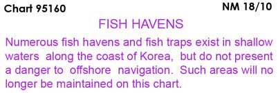
12 NM SECTION I /2/08 LAST NM 17/10 Add Light Fl(2) R 6s 13m 6M, Fl G 4s 17m 5M N E Light Fl(2) R 6s 13m 5M N E (ROK CH 252) /7/95 LAST NM 17/10 Change Light to Fl(3) 7s 54m 8M N E (ROK CH 201B) /19/97 LAST NM 34/09 Add Depth 460 meters N E (NTM0001/2010) /15/90 LAST NM N15/10 N Add Depth 69 meters Rep (2010) (PA) enclosed by depth contour (100-meter) N W (NTM0011/2010) /29/06 LAST NM 17/10 Add Legend CONTINUED ON N E (NGA) /29/06 LAST NM 17/10 Delete Buoy N E (See 13/ ) Change Visibility (range) of light to 12M N E Add Legend CONTINUED ON N E (NGA; ROK CH 142, 201B) /26/05 LAST NM 40/09 Change Visibility (range) of light to 12M N E Light to Fl(3) 7s 54m 8M N E Note: Obscured sector unchanged (ROK CH 201B) /5/09 LAST NM 17/10 Add Purple outline of chart joining N E N E N E N E Legend Numerous fish havens (see Note) N E (NGA) Note in center right margin of chart from Subsection I /27/93 LAST NM 5/10 Change Light to Fl 15s 40m 20M SIREN N E and delete R Bn Note: Obscured sector unchanged (ROK CH 165) /7/93 LAST NM 50/09 Delete R Bn N E Change Period of light to 15s N E (ROK CH 165) /24/01 LAST NM 11/10 Delete Light N E Add Double solid line with land tint (breakwater extension) between N E N E Light Fl R 4s 16m 8M (ROK CH 148) N E /15/96 LAST NM 15/10 Change Light to Fl 15s 40m 20M SIREN N E and delete R Bn (ROK CH 165) /28/96 LAST NM 37/09 Substitute Depth 1290 meters for 1510 meters N E Add Depth 460 meters N E (NTM0001/2010) I-1.8

13 SECTION I NM I-2.1
14 SECTION I NM CHARTS AFFECTED BY NOTICE TO MARINERS NM 50/08 THROUGH NM Note: N indicates Not For Sale; P indicates Preliminary; T indicates Temporary; * indicates New Edition/New ; ** indicates Canceled Mariners ,23,33,47/ ,29,33,34,45,47/ ,29,33,34,45,47/ /09;7/ ,46,48/09;7,16/ ,46,48/09;7,16/ ,22,23,26,28,29,34,35, 36,37,39,40,41/09;4,5,7, 11,12/ ,13,22,28,34,35,39,40, 41/ /08;37,38,47/09;7, ,22,32,34,35,38,39,40, 41,47,50/09;7, / /08;18/09;4,7/ ,46/ ,24/09;7/ /08;18,24,46/09;4,7/ / ,49/ ,23,24,26,30,33,34,38, 46,47/09;3/ ,30/ / ,23,29,33,34,45,46,47, 49/09;3/ ,29,33,34,45,46,47, 49/09;3/ ,23,29,34,41,45,46, 49/09;3,4,5,7,12,13/ ,48/09;7/ / / / ,46,48/09;7/ ,16,37,39/ ,4,30,39/ ,37,39/ ,4,23,24,26,28,29,33,34, 45,46,47,49,51/09;3,6/ ,16,24,28,33,34,47/09; 6/ ,16,23,29,47,49,51/09; 3/ ,3,4,5,8,10,14,16,24,25, 28,32,33,34,41,45,52/09; 6,11/ ,32,36,37/09;3/ *,36,47/09;5,10,11,12, 14/ /08;13,26,27,43/09;4, 10/ ,41,43/09;10,13/ ,16,22,27,28,29,34,35, 38,39,40/ ,21/ /08;37,47/09; /08;37,47/09;7, /09;7/ ,29,38/09; ,29,37,38,47/ ,24/09; ,41,50/09;7/ ,13,22,23,26,27,28,32, 34,35,36,37,39,40/09;3,4, 5,11,12/ /08;4,22,27,34,35,38, 39,40,41,50/09;7/ /08;24,29,37,38,47/09; ,6,22,24,27,28,29,32,34, 35,37,38,39,40,41,47, 50/09;7, /08;29,37,38,47/09;7, /08;37,38,47/09; /08;6,20,22,28,29,33, 34,35,37,38,39,40,47/09; 7, /08;4,6,11,21,22,23,26, 27,28,29,30,32,34,35,36, 37,38,39,40,41,42,46, 50/09;1,3,5,7,9,10,11, 12/10 Mariners ,5,8,23,24,26,32,36,37, 43,47/09;2,3,5,6,9,15/ ,41,50/09;7/ ,16,22,27,28,29,30,34, 35,39,40,41,42,45,46, 52/09;1,6,12/ ,20,28,29,35,45/09; / /09;7/ /09;4,7/ ,18,28,29,33/09;7/ / /08;8/09;7/ ,15,20,35/09;7/ ,35,48/09;7/ ,48/09;7/ ,10,15,48/09;6/ ,48/ /08;8,13,17,20,28,29, 33,35/09;7/ /08;29,33/09;7/ / / / /09;7/ /09;4,7/ / / ,38,47/09;1/ ,46/09;1/ ,46/09;4,7/ /09;7/ ,31,41/ ,26,31,32,36,37,41, 45/09;7/ N17/ A 10*,13,14/ A 51/08;7,8,22,24,30,41, 45/09;8,10,11/ A 3*,4,5,10,12,13,15,16,25, 31,32,33,34,35,38,40,41, 42,43,45,49,50/09;2,5,7, 9,11,14,16/ A 40*,41,42,43,45,48,49, 50,51/09;1,2,4,6,9,11,14, 16,17/ A 2,4,5,6,8,14,15,16,23,25, 32,38,41,43/09;4,6,9,14, 16/ ,51/08;4,8,9,10,15,16, 17,22,23,24,25,27,28,29, 30,31,32,33,34,35,36,41, 42,43,51/09;1,4,6,9,11, 14,16/ *,24,25,26,28,31,32, 34,35,38,40,41,43,45,49, 52/09;7,9,16/ /08;3,10,22,24,26,33, 38,45,46,47,52/09;14/ ,16,22,24,27,28,31,32, 40,45,51,52/09;14/ N23,N38,N45/09;N15, N16/ ,4,5,6,8,14,15,16,23,25, 32,38,41,43/09;4,6,9,14, 16/ ,15,17,22,23,35,38/09;9, 15,16/ ,22,23,35,38/09;9,15, 16/ N4,N23,N32,N38,N42, N45/09;N1,N2,N15/ *,9/ ,32,42,43/09;1,2/ ,23,32,38,42,43,45/09;1, 2,15,16/ N23,N38,N45/09;N11, N15,N16/ ,38,45/09;15/ *,38,42,45/09;1,2,15, 16/ ,52/08;8,10,38,41,42, 43/09;2,12/ /09* ,23,38,42,45/09;9,11,14, 15,16/10 I-3.1 Mariners *,38,45/09;14,15, 16/ N4,N23,N32,N38,N42, N43,N45/09;N1,N2, N15/ /09;14/ N38/ /08;16,27/09;9/ *,6,23,25,38/09;15, 17/ *,6,12,14,15/ *,23,24,25,27,29,34, 38,41,45,49/09;2,14,15, 16/ ,23,25,38,45/09;6,15, 16/ ,4,5,6,9,10,11,23,24,25, 27,29,34,38,41,45,49/09; 2,14,16/ *,23,38,45/09;15, 16/ ,38,45/09;15,16/ ,23,38,45/09;15,16/ *,6,9,11,14,16,17/ *,22,27,30,41,49/09;6, 14/ ,51,52/08;2,11,15,23, 27,35,38,42,49,50/09;11, 12,14,15/ N38/ /10* *,41,42,43,45,48,49, 50,51/09;1,2,4,6,9,11,14, 16,17/ /08;2,5,11,15,23,27,33, 35,38,42,49,50/09;11,14, 15/ ,52/08;4,6,11,14,22,23, 25,27,30,38,41,45,49/09; 5,6,11,14,15,16/ ,52/08;8,22,23,25,27, 30,38,41,45,49/09;14,15, 16/ ,7,22,31,33,34,35,41,49, 50/09;2,9,17/ ,35,50/ *,40,41,43,48,49/09;2, 4,11,12/ ,22,31,33,36,38,43,50, 51/09;2,9/ ,51/09;9/ /08;9,24,31,35,42,45, 50/09;14,16/ ,45/ /10* *,11/ /08;3,9,13,14,15,16,22, 24,28,31,32,33,35,49/09; 1,3,4,6,7,11,14,16/ ,7,8,10,15,25,42,49/09; 9,11,17/ *,35,36,41,43,48, 49/09;3,4,11,12/ *,41,42,45,49/09;2,3,4, 11,14,16/ /10* *,4,5,10,12,13,15,16,25, 31,32,33,34,35,38,40,41, 42,43,45,49,50/09;2,5,7, 9,11,14,16/ *,41,50/09;2,14,16/ N51/08;N4,N5,N10,N12, N13,N15,N16,N25,N31, N32,N33,N34,N35,N38, N40,N41,N42,N43,N45, N49,N50/09;N2,N5,N7, N9,N11,N14,N16/ /09*;1,2,3,4,6,11,14, 16/ *,50/09;3,17/ *,11/ * ,13,30,31,32/09;3/ ,13,30,31,43/09;3/ /09*;3/ *,4,8,14,21,34,41,45,48, 49/09;5,9,12,14,16,17/10 Mariners /08;33/09;9,16/ *,16,17/ *,6,9,15,16,17/ *,48,50/09;2,6,9,15, 16/ /08;5,11,14,15,22,28, 34,35,38,40,41,48,50/09; 2,6,9,15,16/ *,5,9,11,13,14,17/ *,25,28,29,32,34,35, 38,41,42,43,45,48,49, 51/09;2,3,9,11,13,17/ *,40,41,42,43,45, 48/09;2,3,9,11,12,13,16, 17/ ,11,12,25,34,38,41,43, 48,51/09;2,5,6,13,17/ ,23,38,40,43,48/09;2, 13/ /08;8,22,23,25,30,38, 40,43,45,48/09;2,12,13, 16,17/ /08;23,38,40,43,45, 48/09;2,12,13,16/ /08;10,31/ /08;9,21,25,28,38,42, 43,45/09;2,13/ ,21,28,30,35,45,50/09; 2/ ,21,28,30,35,43,45, 50/09;2/ ,45,50/ /08;45/09;13/ /08;7,8,22,24,30,41, 45/09;8,10,11/ ,45,48/ / ,43,48/ /08;10/ ,8,10/ ,14,16,30,39,41/09;5,6, 8,10/ ,24,30,41/09;5,6/ *,3,8,14,16,34,39,41, 46/09;3,6,13/ *,13,14/ N7,N16,N24,N29,N31, N33,N40,N46,N51, N52/09;N2,N5,N13, N14/ ,16,25,26,29,33,36, 46/ ,29,33/09;5/ /09*;2,5,13,14/ ,41/09;5/ / *,30/ ,40,52/ N31,N40,N52/ ,45,52/ ,40/09;8/ / / /09*;8/ / /09*;13,14/ /09*;2,14/ ,37,40,51/ * / ,15,27,30,32,39/09; 13/ ,11,27,30,31,32,34,39, 40,49/09;2,5,13/ ,15,27,30,31,32,39, 40/09;2,3,4,6,11/ /10* ,27,30,31,39/ ,32/09;2,3,4,6,11/ N27/ *,41,46,49/09;5,7,8/ N27,N30,N31/ ,29/09;7,14/ *,46,49/09;7,8/ /10*
15 NM SECTION I CHARTS AFFECTED BY NOTICE TO MARINERS NM 50/08 THROUGH NM Note: N indicates Not For Sale; P indicates Preliminary; T indicates Temporary; * indicates New Edition/New ; ** indicates Canceled Mariners N1,N18,N25,N27,N28, N32,N45,N48/09;N6, N7/ /08;1,15,18,20,26,27, 28,32,48/09;6,7,13/ N8,N18,N22,N24,N25, N27,N28,N30,N31, N45/09;N2,N14/ ,24,25,30,32,34,45/09; 5,7/ *,48/09;6,7/ N27/09;N3,N4,N6, N11/ ,25,27,28,32/09;6/ / / /08;34/09;5/ *,16,23,35,48/09;7,13, 14/ /08;23,34,46/09;16/ /08;9,23,30,46/09;2, 11,16/ N48/09*;N8,N16/ N5*,N7,N16/ N3,N15,N24,N25,N30, N33,N34,N45/09;N5,N7, N16/ ,16,30/09;5,14/ ,11,15,16,48/09;7,16/ /09;14/ ,18,30,41,43,46/09;1,7, 8,13/ *,39,46/09;1,13,14, 16/ ,37/ *,5,16,35,37/ / ,35,37/ /10* /09;7/ *,3,9,18,30,41,43,46/09; 1,8,13/ / / /10* ,21,24,25,42/09;16/ ,23,28,41,43/09;5, 14/ / ,23,39,41,43/09;5, 14/ *,14,16/ N52/08;N3,N5,N10,N21, N24,N25,N33,N42, N46/09;N16/ /09;7/ / ,15,18,36/09;7,8,14,16, 17/ *,47/09;7,8,14/ /09;16/ ,9,40,47,51/09;7/ *,17,20,21,26,27,39,40, 47/09;7,14/ ,12/ *,10,12,14,26,36,43/09; 7,14/ ,21/ ,21,25/ /08;3,8,10,11,14,25,26, 30,36,43/09;7,14/ /08;3,8,10,14,25,26,36, 43/09;7,14/ ,24,47/ ,24/ ,6/ / ,25,42/ ,52/08;5,6,7,8,18,31, 37,42,48,49/09;1,2/ N50,N52/08;N5,N6,N7, N8,N9,N10,N13,N18, N31,N36,N37,N42,N48, N49/09;N1,N2/ ,9,31/ *,12/ ,31,42/09 Mariners /10* *,49,51/09;12/ ,21,26,37,39,42,48/09; 2/ /08;5,7,8,9,10,13,15, 17,21,26,27,36,39,42, 48/09;2/ ,52/08;17,37,39,48, 49/09;15/ ,39/09;15/ *,22,24,29,32,36,37,38, 39,49,51/09;12/ *,51/09;12/ ,8,22,24,37,40/ *,11/ *,42,50/09;7,11/ ,27,40,42,44,50,52/09;2, 4,7,11,14/ *,27,41,44,49,50, 52/09;2,11/ /09* ,8,11,18,41,50/09;2, 11/ /08;5,9,20,25,36,37,38, 42,44,49,50/09;2,4,7, 14/ /08;2,5,47/ *,37/09;12/ ,38/ /10* ,43/ ,12,24,25,32,39/ /08;6,7,9,47/09;14, 17/ ,18,32,47/09;10,14/ ,14,35,52/ ,8,9,11,12,13,24,26,31, 42/ *,29,32/ / *,29,32/ / ,4,7,8,12,32/09;1,4,6, 14/ ,15,20/09;4/ /10* ,4,7,12,13,25/09;1, 14/ ,51/ ,18,26,35,41,51/09; 15/ ,26,41/ ,29,36/ ,9,18,26,35,51/09;15/ *,32,36,37,39,41,42, 44,49,50,51,52/09;1,2,4, 6,7,11,12,14/ /08;3,9,26,35,38, 51/09;3,4/ /08;2,7,12,13,18,25,35, 51/09;1/ ,7,12,13,25/09;1/ /09* ,11,18,22,24,25,41,44, 49,50/09;1,2,4,11,14, 15/ ,24/ /09* ,15,41/09;2,15/ ,25/09;1,2,15/ /08;5,6,8,11,13,14,19, 21,24,25,26,29,30,35,37, 39,45,47/09;1,4/ N50/08;N5,N6,N8,N11, N13,N14,N18,N19,N21, N24,N25,N26,N29,N30, N32,N37,N39,N45/09; N1,N4/ / *,9,15,18,29,32,36, 47/09;3,11,14/ *,48,51/09;1,11/ *,14,24,35,48,51/ /08;8,35,37/09;7,10, 11/ ,25/ /09 I-3.2 Mariners ,37/ *,8,25,37,48/ /09*;3,4,5/ *,45/ *,12,13/ /10* /08;10,19,20/09;5, 11/ /10* *,39,44,52/09;5,12, 13/ *,38/09;13/ ,30,38,43,44/09;11, 12/ /09;5/ /09* / ,22,31/09;6/ / / ,45/ ,31/ ,41/ /08;9,10,11,14,18,21, 22,38,44/09;5,10,12, ,10,18,21,22/09;10, /10* /08;14,15,29,36,49/09; 5/ / /08;29/ ,14,15,49/ ,36/ / ,13/09;5/ /08;2,9,11,14,15,19,21, 38,44/09;5,10/ *,3,4,5/ *,49/ N6,N8,NP15,N23,N26, N27,N32,N33/ ,51/08;5,6,8,9,11,P15, 17,18,19,21,23,26,27,29, 30,33,36,37,38,48/09;1, 13/ *,27,29,30,33,39,40, 45/09;1,4,13/ *,27,29,33,40,41/09;4, 13/ *,29,33,40/09;13/ N51/08;N1,N2,N5,N6, N9,N12,NP15,N19,N23, N26,N29,N32,N33, N40/09;N10,N13/ /09* / ,10,14,21,30,38,39,42, 44,46/09;4,6,10,12, ,10,14,21,22/09;10,12, *,2,9,21,38,44/09;10/ ,9,15,19,38,44/09;10/ /10* ,46,47/ /09*;1,4,6/ / ,30,31,43/ *,43/ /09*;7/ /10* ,30/09;5/ / /10* /08;3,6,8,11,13,20,22, 41,46,50/09;3,12,13/ /08;3,8,13,16,22,41, 46/09;3/ /10* /08*;13,14,20,50/09; 3/ ,50/09;3,12,13/ ,41,46/ ,14,15,19,20/09;5/ ,20/ /09 Mariners ,26,29,30,33,41,46/09;2, 12/ ,41/09;12/ ,41/ / / /08;1,8,9,12,26,27,30, 32,33,40,41/09;13/ N51/08;N1,N8,N9,N12, N26,N27,N30,N32,N33, N40,N41/09;N13/ /08;1,9,12,19,33,35,40, 41/09;2,12,13/ /09;2/ ,23,30,35,43/09;2, ,6,8,23,30,33,35,37, 38/09;5/ /08;9,19,25,30,33,35, 47/09;2,11/ /08;9,20,33,35/09;2, 11/ /08;20/ *,52/ /09* /09* ,33,47,52/ ,47/ ,41,47,52/09; / ,25,36,41,42,52/ /10* /10* ,30,36,42/ ,36/ ,36,42/ / ,41,45/ / / / /08;5,45/ / / ,45/ / / / /08;1/ /08;1/ ,43/ N20/ N2,N8,N18,N20/ /08;5,6,7,8,P15,23,26, 27,29,33/ N18,N20,N22/ N12/10** N11,N18,N20/ N22/ N18,N20/ N2/ N8,N18/ N2,N8,N18,N20/ N8/ ,19/ N4,N8,N20/ N8,N20/ N20/ N27/09** N27/09** N13/09* N27/09** N27/09** N27/09** N2/ ,11/ N27/09** N27/09** N27/09** N27/09** /09** N27/09** N27/09** N27/09** N27/09** N6/09* /09** /09**
16 SECTION I NM CHARTS AFFECTED BY NOTICE TO MARINERS NM 50/08 THROUGH NM Note: N indicates Not For Sale; P indicates Preliminary; T indicates Temporary; * indicates New Edition/New ; ** indicates Canceled Mariners N28/09** N20/ N23/09* /09** N2,N11,N18,N19/ N28/09** N28/09** N28/09** N28/09** N11,N19/ /09** N28/09** N30/09* N30/ N28/09** N28/09** N28/09** N28/09** N18/ N28/09** N28/09** N6,N22/ N29/09** /09** /09** N29/09** N11/10* /09** /09** /09** /09** N9*,N22/ N11/10* N29/09** N10/09* /09** /09** /10** N12/10* /09** /09** N12/10* /09** /10** /10** /09** /09** /09** N29/09** N29/09** N25/09* /10** N12/10* /09** /09** N29/09** /09** /10** N12/10* / /09** /09** /09** /09** /09** /09** /09** /10** N10/09** N30/ N30/ N14/09* N6/09* *,30/ / / / N6/09* /09** / ,16,22/09;3,10/ / ,22/ ,8,22,24/09;3,8,10/ / ,16,22,24/09;3,10/10 Mariners ,16,24,26,40/09;8,10, 11/ ,42,48/ ,42,48/ / /09;15/ / *,8,10/ /09;8/ ,24,34,49/09;10/ / ,24,34,36/ ,36,49/ ,11,16,24,26,31,40/09; 10,11/ ,31/09;10/ ,11,25,29,32/09;10/ ,8,14,16,17,29,32,36/09; 12/ ,14,16,17,29,36,37/09;5, 12/ ,8,9,11,12,16,17,24,25, 29,32,36,37/09;5,10, 12/ ,11,32/ ,40/09;8/ ,49/ /09;8/ / ,29,37,49/ ,52/08;11,24,29,30, 41/09;10/ N10/09* N30/09* /09** /09** /09** /09** N30/09** N8/09* N35/09* ,30,40/09;8/ *,30,40/09;8/ ,40,43/ /09;10/ / /08;4,6,12,13,14,16,17, 24,25,27,30,32,36/09; 14/ /08;4,6,14,24,25,30,32, 36/ / ,6,12,16,32/09;10,16/ ,6,13,17,22,24,27,31, 32/09;14/ ,16,32/09;3/ /09* ,25/ ,32,36,44/ / /08;14,24/ / / / / /09;12/ /09;14/ *,8,16/09;17/ ,52/08;16,24,48/ ,13,17,24,27,32/ ,13,17,24,27/09;10/ ,24,27/ ,17,27/ ,35/09;14/ ,10,29,42/09;3/ ,24,32,44/ ,27,34,49/ / /08;16,37/ ,7,13,36/ / ,9,29,31,32,36,40,42, 43/09;10/ ,10,29/09;10/ ,40,43/ ,40,42,43/ ,12,13,31,35/09 I-3.3 Mariners ,29,31,36/ ,13/ ,40/ ,29/ ,43/09;17/ ,15,31,36/09;1/ ,29/09;1/ ,51/08;9,10,25/ / N23/09* N12/10* N12/10* N12/10* N19/ /10** N31/09** N31/09** /10** N31/09** /10** N31/09** N31/09** N6/09* N31/09** N12/10* N31/09** N6*,N32/ N31/09** N31/09** /09** /09** /09** /09** /09** /09** /09** /09** /09** /09** /10** N48/09* /09** N32/09** N32/09** N32/09** N32/09** N32/09** N44/09* N32/09** N44/09* N39/ N35/09* N45/ N46/09* N23/09* N46/09* N32/09** N32/09** N11/10** N44/09* N27/09* N25/09* N25/09* N44/09* N7/09* N44/09* N3/ N25/ N32/09** N32/09** N32/09** N24/09* N32/09** N50/08;N35,N38/ N32/09** N32/09** N38/ N35,N38/ N44/09* N46/ N7/09* /08;27,28,31,41/ / /08;27,28,31,41/ ,41,52/09;7/ /08;34,41,43,52/09;3, 7/10 Mariners ,41/09;1,3/ ,4,27,36,37,41/09;3/ ,27,36,42/09;4/ / / / / / / / / / / *,5/ / / /09;7/ ,34,35,39,52/ / ,52/ ,26,38/ ,26,38/ ,52/ /08;12,21/09;3/ ,7,9,11,18,34,35,41,43, 44,52/09;4,12,14/ ,43/ /08;7,8,9,11,12,23, 43/09;4,12,14/ ,12,14/ ,18,44/ / / /09;3/ / ,41/09;17, /08;27,41/09;13,16,17, /09;13,16/ /08;27,41/09;13,16,17, ,12,30,51,52/09;1,2/ ,30,51,52/ ,12,30,51,52/09;1,2/ ,30,52/09;1,2/ / / / *,23,52/09;3/ ,21/ /09* / ,34,50/ /09* *,4,11/ /09;3/ / / ,26,47/09;2,4,5,6/ ,25,31,35,40,43,44, 46/09;4,5,6,7,16/ N27,N43,N47/09;N7, N15,N16/ ,34,35,42/09;7,13,15, 17/ ,21/09;7,15/ / / /09;17/ /09* / ,11,20,27,35,42/09; 13/ ,20,21,27,34,35,42/ /09;7,14/ /09*;7/ /08;8,18,20,28,37,42, 52/09;14/ / ,42/09;14/ / /08;1,8,18,20,21,22, 28/ /08;8,11,21,22/ ,8/ / ,25,42/09;17/10
17 NM SECTION I CHARTS AFFECTED BY NOTICE TO MARINERS NM 50/08 THROUGH NM Note: N indicates Not For Sale; P indicates Preliminary; T indicates Temporary; * indicates New Edition/New ; ** indicates Canceled Mariners /08;20,37/09;1,5/ ,3/ /10* / / ,52/09;4/ / / /10* / /08;5,7,8,9,18,20,21, 22,26,29,30,37,42/09;1,2, 4,5,7,12,13/ /08;37/09;5/ / /08*;5,9,18,29,30/09; 2/ *,52/08;5,8,9,18,21,29, 46/09;1,2,3,5,7/ /08;1,5,7,8,9,18,21,22, 46/09;4,12/ ,8,9,18,20/ N25,N43/ ,42/09;5,13,16/ / / / /10* / / ,22,43/ N43/ ,22,32,43/ / / / /10** N12/10* N12/10* N27,N29/09;N13/ /09;5,16/ /10** N10/ N10/ N12/10* N34/09** N12*,N16/ N44/09* N13/09* N24,N27,N43,N44,N47, N51/09;N7/ /10** /09** N2,N16/ N2/ N7/ /09** /10** N7/09*;N15/ N5,N9/09;N15/ /09** /09** /09** /09** N12/10* /10** /09** N27/09;N4/ N34/09** N6/09*;N5/ N44/09* N48,N51/ N2,N11/ N31/ N34/09** N51/ N24,N34/09;N1/ N25,N26,N37/09;N12/ /09** /09** N5/09;N4/ N31/ N44/ N27,N34,N35,N40/09; N5,N17/ N35/09;N4,N17/ N27/09 Mariners /09** /09** /09** ,42,44/ /09** /08;13,26,27/09;4,7, 10,11,12/ N50,N52/08;N13,N26, N27,N30,N34,N37,N41, N46/09;N4,N7,N10,N11, N12/ ,8,21,22,25,30,39,44,46, 47,48/09;3,12,17/ N50,N52/08;N6,N11, N22,N25,N28,N41, N42/09;N7,N8,N9,N10, N11/ N52/08;N25,N41/09;N7, N10/ *,16,21,23,25,34,42, 44,47,49/09;1,3,5,10,12, 17/ N5,N11,N16,N21,N23, N25,N33,N42,N44,N47, N49/09;N5,N6,N10,N12, N17/ N51/08;N6,N11,N22, N28,N42/09;N8,N11, N12/ /08;6,9,11,16,22,28,34, 42,48,51/09;8,10,11, 12/ ,52/08;6,11,26,27,28, 34,37,42,46/09;7,9,10,11, 12/ ,52/08;6,9,10,11,16,24, 25,26,28,30,34,37,42, 46/09;4,7,8,9,11,12/ *,14,15,19,20,22,23,25, 27,29,34,36,37,40,42,43, 47,48,49/09;7,12,15/ N35/09** /09;3/ /08;15,22,29,33,36,39, 43,47,49,51/09;2,7/ N35/09** *,47,48/09;1,2,5,7,14, 15/ ,36,51/ N35/09** N5,N17/ /09;5/ ,39,42,46/09;14/ ,39/ /08;47,48/ ,33/ /09;2/ ,42,47/09;14,15/ N11/ N33/09;N5,N17/ N33/ N35/09** N35/09** ,9,11,12,14,15,16,19,20, 22,24,26,28,33,40,41,42, 43,47,48/09;5,7,13,14, 15/ ,11,14,15,16,18,20,22, 26,33,34,41,42,43,47,48, 52/09;5,13,15/ N48/09;N2/ /10* *,5/ *,30,33,40,41,42,47, 49,50,51/09;5,13,14,15, ,24,29,34,42/09;5/ ,24,25,29,36,40/09; 5/ ,11,21,24,26,28,40,42, 47/09;13,14/ ,16,20,21,27,33,47,50, 51/09; ,27,33/09; N19/ ,47/09 I-3.4 Mariners ,10,11,12,17,24,25,28, 40/ N26,N42/09;N13,N14/ N11/ ,21/ ,11,12/ N9,N11/ /08;4,25,26,27,37, 46/09;12/ N19/09;N2/ N46/09;N3,N7/ ,26,34,41/ ,19,20,39,42,43,46/09; 7,14,15/ N16/ N5,N10/ ,15/ ,19,20,26,34,41,42, 48/ ,22,24,34,41,42,48/09; 5,13,15/ ,11,12,14,16,20,24,27, 28,33,40,47,50,51/09;15, ,11/09;13/ ,48/09;13/ /08;4,25,26,27,37,42, 46/09;12/ / /08;25,39/09;12/ ,22,26,39/09;3/ ,22,23,28,32,47/09;3/ ,40/ *,30,47,48,49,50/09; 12,17/ *,42,48,49,51,52/09; 16, ,16,18,22,27,28,36,41, 42,49,52/09;12,13,15, 16/ ,13,17,22,27,34,40,50, 52/09;15,16/ *,27,33,40,48,52/09; 13,16/ *,40,48,52/09;7,13, 16/ ,11,24,30,48/09;13/ /09;7,15/ /08;3,27,37,40,52/09; 13,16/ ,28,36/09;13/ ,50/ ,47,50/09;7,12,13/ ,30/09;7/ ,26,30,43,47/09;7/ /08*;16,21,22,23, 30/09;3,7/ ,43,47/ ,22,43/09;2/ ,15,20,22,26,30,33/09;7, 12,13/ ,26/09;2,15/ ,13/ ,19,48,51/09;10/ /09;13/ ,19,48,51/09;15/ ,36,41,47/09;10/ / ,8,16/09;7,11,12/ ,22,45/09;7/ / / / ,11,22,23,26,42/ /10* /08;9,11,23,26,42/ /09* *,8,11/ *,47,50,51/09;1,7,8/ ,33/09;7/ *,47,48,50,51/09;1,7,8, 10,11,13/ /10* ,24,27/09;1/ ,27/09;1/ ,12,21,24,27/09;7,10, 13/10 Mariners ,24/09;7,13/ ,24/09;13/ ,12,21/09;13/ /08;12/09;10/ /09*;7,10/ /09*;7/ ,24/09;13/ /08;5,9,11,14,22,23,26, 28,42/09;8,11/ ,9,14,22,24,31/09;8/ /08;5,10,25,41,44/09; 10,12/ ,7,10,44/09;12/ ,21,25,30,44,49/09;4,10, 11,12,16/ *,12/ ,44/ *,21,50/ ,21/09;8,11/ ,15,16,17,21,24,30,34, 37,46,47/09;4,7,8,10,11, 12,16/ N50/08;N24,N26,N30, N34,N46/09;N4,N7,N8, N10,N12/ ,15,16,20/09;10/ *,7/ ,13,16/09;10/ ,8,14,18,20,21,36,37,41, 47/09;4/ /09*;11/ /08;8/ / N50/08;N5,N24,N25, N26,N34,N37,N41, N46/09;N4,N7,N10, N12/ N17,N24,N34/09;N7, N12/ *,12/ ,24,34,46/09;7,12/ / ,24,30/09;7,10/ /08;1,24,30/09;4,7, 10/ N50/08;N1,N24,N30/09; N4,N7,N10/ N17,N24,N34,N46/09; N7,N12/ / ,23,39/09;1,4,7,8,12, 16/ ,46/09;8/ N17,N24,N34,N46/09; N7,N12/ N6,N16,N24,N28,N29, N32,N41,N42,N46/09; N1,N6,N12,N15,N /08;6,13,14,16,24,28, 32,41,42,46/09;1,6,12,15, ,16,22,27,28,30,34,35, 39,40,42,46,52/09;1,6/ ,16,22,27,28,29,34,35, 39,40,42,46,52/09;1,6,16, /08;6,13,14,16,24,28, 41,42,46/09;1,12,15, ,14,22,24,27,30,32,34, 35,39,40,41,42,46,52/09; 6,12, ,22,27,30,34,35,40/09; 16/ / / /08;16,24,25,41,42/09; 1,12,15, /08;18,25,36,42/09; 1/ ,36/ / N51/08;N3,N13,N14, N24,N32,N41,N42,N43, N46,N48,N49/09;N6, N11,N12,N15,N16, N
18 SECTION I NM CHARTS AFFECTED BY NOTICE TO MARINERS NM 50/08 THROUGH NM Note: N indicates Not For Sale; P indicates Preliminary; T indicates Temporary; * indicates New Edition/New ; ** indicates Canceled Mariners /08;3,13,14,24,32,41, 42,43,46,48,49/09;6,11, 12,15,16, /10* ,24,41/09;16, /09;16/ / ,24,41/ * /08;3,32,41,43,46,48, 49/09;3,6,11/ / /08;46/09;3/ N48/09;N6/ * *,43,48/09;6,11/ ,18,48/09;11/ ,28,33/ /08;3,4,26,28,33,48/ N32,N41,N48/09;N6/ ,41,48/09;6/ *,23,25,36/09;2/ * / N27,N35,N39,N40/ / / / / / / / / / / / ,42/ /09;6/ ,4,8,11,13,14/09;5,6/ ,5,8,13,14,46/09;5/ ,3,46/ ,4,6/ ,5,12/ / ,7,24,41,43/09;2,10,13, 16/ ,5,41/09;2,10,13/ /09;6/ ,11,14/09;5,6/ ,14/09;6/ / / /08;1,3,24,26/09;4, 7/ / / ,4/ / ,14/ ,8/ / ,5/ / ,12/ / / ,41/ / ,30/ ,30/09;16/ / /09;16/ ,30/ ,41/ ,30/ / / / *,51/ /09* /09*;8/ ,13/ ,6,10,18/09;4/ /08;8,10,14/09;15, 16/ /08;8,14,15,16,30, 35/09;6/10 Mariners ,9,10,14,25/ /09;5/ / /08;19,43/09;2,10/ ,7,24,28,42/09;2,5,15, 16/ /09;10/ ,23/09;10/ / /09;10/ /09;8,15,16/ /09;5/ ,16/ ,17,49/09;15,16/ ,14,35,44/ / / ,27,46/ ,46/ ,28,46/09;8/ ,28,40,41,44,52/ ,9,18,29,40,41/09;8, 14/ / / /08;8,10,14/ / /08;10,14,24,35/09; 5/ ,14,26/ / ,16,26/09;6/ ,16,35/09;6/ /08;14,26,35/ /08;8,10,14,35,42/09; 5/ /08;14,15/ /08;15,26,30,35/09; 6/ /08;10,14,15,16,26,30, 35/09;6,7,8/ /08;30,35/09;6/ ,26,30,35,42/09;6/ / ,10,14,42/09;5/ ,10,14,31/09;7/ /08;10/ ,14/ /09;8/ ,52/09;8/ ,21/ / / ,12,22/ ,12,22,48/09; /09;15/ ,21/ ,21/ ,9,48/09;8/ ,12,48/09;15, / ,21/ / ,13/ ,13/09;6/ ,13/09;6/ N22/ / /09;6/ /09;6/ N21/ N52/09;N6/ N21/ / /09;15/ N48/09;N15/ / / N17/10* N8/10* N12/ / ,10,11/ N12/ N12/ ,22/09;5,7,8/10 I-3.5 Mariners N20/ ,7/ N6,N7/ / N21,N22/09;N6,N7/ N11/ /09;7/ N21,N22/09;N5/ N6/ / / /09;5/ ,8,11/ ,21/09;5,8/ / ,6/09;4/ / / ,10/ / / / ,18/ ,10/ / / / ,8/ N39/09* / / / / ,8/ / ,33,39/09;11/ / / ,43/ / ,48,49/ / / / / / ,47/ / N6*,N14/ N6*,N14/ / ,43/ / /09;11/ ,43/ ,37,39/ / ,39/ /09;14/ / ,37/ / / ,37/09;4,14/ ,39,45/09;4/ ,39,45/09; / ,33/ /09;4,15/ /09;15/ / / ,37,41/ / ,37,41/ / / / /09;17/ / / / / / / / /09 Mariners / / / ,31,52/ / ,31,52/ ,49/ ,41,42/09;17/ N7*,N9,N42/ N9/ / / / ,21,27,40,41,42,46/09; 16/ ,27,40/ ,41/09;16/ / / ,52/ ,41,43/ / /09;16/ / ,43/ ,43/ ,34,43/ ,34/ /08;2,7,37/ / ,43/ / /08;2,4,43/09;16/ /08;2,4,7,43,49/09; 16/ N4,N43/ /08;2,4,5,7,16,20,23, 25,31,49/09;16/ ,7/ /08;4,5,7,16,20,23,25, 31,44,49/ /08;2,37/09;4/ /08;2,37/09;4/ /09;2,4,10/ ,37,44/09;2/ /08;37/09;2,4/ / / / / ,29,31,42,47,51,52/09;3, 16/ N29/09;N12,N17/ ,12,17/ / / ,48/ ,48/ / / / /09;1/ / ,31,52/09;17/ / / / ,31/ / ,52/09;6,12,17/ /09;6,17/ / ,46,49,52/09;6,12, 16/ /09*;3,17/ / / N8/ / / /09* ,20,30/09;13,16/ /09;3/ / *,5/09;17/ /09* /09
19 NM SECTION I CHARTS AFFECTED BY NOTICE TO MARINERS NM 50/08 THROUGH NM Note: N indicates Not For Sale; P indicates Preliminary; T indicates Temporary; * indicates New Edition/New ; ** indicates Canceled Mariners /09;7/ /10* / /10* ,10/ ,47/09;1/ / /10* / / / ,29/ ,42/ /08;32/09;5,10/ ,11/ /10* / /10* /10* ,10/ / / /10* /09;5/ ,6/ /09;2,5/ N8/10* / / / N34,N45/ ,45/ / / N24/ N24/ ,22,24,27,30,31,40, 49/09;5/ ,31,34,45,49/09;1,3/ / / ,37/ / ,31,40,51,52/ /08;50/ / ,6/ / / /09;14/ /09;14/ ,34,45/09;1,6/ / ,41/ / / ,52/ / / / / / ,40,51/ / ,48/ / /09* N30/09* / ,31/ / ,6/ /09;1/ / / ,4,6,8,14,22/ ,6,8,14,42/ ,6,42/ N25/09* ,4,5/ ,4,5/ ,4,8,14/ ,4,6,11,12,44,48,52/ N48/09* ,4,8,11,44/ /08;3,4,6,14,42/ /08;3,4,6,21,42/09 Mariners /08;6,42/ ,8,42/ / / / /08;15/ N33/09* N32/ ,15,21/ N33/09* N8,N10/ N50/08;N7/ N39/09** N39/09** N39/09** N39/09** N52/08*;N6/ N52/08*;N6/ N39/09** N39/09** N1,N10/ N39/09** N4/09* N39/09** N50/ N39/09** N4/ N39/09** N39/09** N10/ N51/08;N10/ N51/ N51/ N33/09* N39/09** N4/ N4/ N39/09** N1,N10/ N7/10* N12/10* N13/10* N13/10* N1,N4/ N1/ N39/09** N40/09** N40/09** N33/09* N40/09** N40/09** N8/ N40/09** N40/09** N8/ N33/09* N50/08;N8/ N8,N29/ N40/09** N1/ N40/09** N40/09** N1/ N1/ N1/ N40/09** N40/09** N40/09** N40/09** N40/09** N40/09** N40/09** N50/08;N3,N7,N27/ N33/09* / /09** N50/08;N4,N7,N9/ N52/ N50/08;N3,N27/ N41/09** N41/09** /08;5,7,9,17, N7,N10/ N8/ N41/09** N50/08;N1/ N50/08 I-3.6 Mariners N50/08;N3/ N1,N3/ N3/ N4,N9/ N41/09** N41/09** N41/09** N41/09** N1,N3/ N41/09** N3/ N33/09* N33/09* N41/09** N41/09** N8/ N41/09** N1/ N41/09** N41/09** N41/09** N33/09* N41/09** N41/09** / N42/09** N42/09** N1/ ,21,29/09;1,11/ N1/ N42/09** ,4,9,21/09;1,11/ N42/09** N42/09** N42/09** N42/09** N42/09** N42/09** N42/09** /08;41,49/ N42/09** N6/ N6/10* N42/09** N43/09** N43/09** N43/09** N43/09** N43/09** N43/09** N43/09** N22/09* /08; N52/08*;N2/ N50/08;N9/ N43/09** N43/09** N4/09;N5,N10,N14/ N43/09** N50/ N33/09* N22/09* N43/09** /09;5,7,8,9,12,17, /09** ,17, N43/09** N /09; /09; ,2,23,30,31,33,43,45/09; 13,14, /09; / ,23,27,28,31,32,33,34, 37,39,43/09;10,13/ ,2,4,9,33/ ,40,41,45,47/09;5,10, 11,14/ N39,N41,N49/09;N3/ N25*,N38,N41,N45/09; N10,N14/10 Mariners ,5,6,9,11,14,15,19,21, 22,26,30,31,32,33,37,40, 41,43,44,47,48,49,52/09; 1,3,5,7,10,11,15/ /08;9,40,41,48/09;1,5, 10,11,14/ *,29,44/ *,33,44,49,52/ ,5,9,11,18,20,21,23,31, 32,37,39,47,52/09;1,7, 11/ ,5,14,15,21,23,26,39,49, 51/09;1,3/ ,32,39,40,41/09;1,5,10, 11/ ,5,14,15,21,26,51/09; 3/ N4,N5,N11,N13,N23, N30,N31,N34,N39,N41, N43/09;N4,N11,N15/ ,14,31,41,43,52/09; 13/ ,34,52/09;7/ ,19,30/ ,5,6,11,13,14,15,19,21, 26,28,31,39,43,49,52/09; 13,15/ N4,N5,N9,N18,N41/ ,9,15,18,19,23,43/ ,15,18/ / ,41,45,49,51/09;4,10, 11/ N20*,N38,N39,N41, N44,N49/09;N1,N4,N5, N10,N14/ ,45,48,49/09;1,4,11, 14/ /09;1,11/ ,30,31,32,33,34,41,43, 44,45/09;1,2,10,11,14/ ,27,31,32,33,38,39,41, 44,45,48,49/09;5,10,11, 14/ ,22,23,27,28,29,30,32, 33,34,37,39,45,49,51/09; 10,13,14/ / N10,N12,N14/ ,12/ ,14/ /08;5,7,8,9, ,4,12/ /09;10/ ,12,36/ ,48/09;11/ / / /08;26/ /08;33,44,45,46,49,51, 52/ ,45,47,49,51,52/ ,52/ ,51,52/ /09;17/ / / / / / / /08;27,43/ /08;14/09;8/ / ,52/08;31,43/ /08;1,7,31,43/ N12/10* N* / /09
20 SECTION I NM CHARTS AFFECTED BY NOTICE TO MARINERS NM 50/08 THROUGH NM Note: N indicates Not For Sale; P indicates Preliminary; T indicates Temporary; * indicates New Edition/New ; ** indicates Canceled Mariners ,52/08;14/ / / ,49/09;1,2/ N49/ /09;15/ / / / / / / / ,25/ / / / N24/ / / / / / / / / / / / / / / / ,11,17,25,31/ ,17,25,30/ ,25,31/ ,17,25/ / ,29,31/ / / ,15,31/ / / /08;30/ / ,31/ / ,27,30/ ,26,27/ ,26/ / /09;2,15/ / N52/08;N12/ / ,17/ / ,19,24,27,29,30/ / ,32/09;17/ ,24,27,29,30/ ,17/ / / / / ,P48/09;1,5,11,12, 14/ ,26,29,32,P48/09;1,4, 5,8,12,13,14,15, *,51/09;1,4,5,8,12,14, 17, *,43,P48/09;1,10,11, 14,17/ ,49/ ,49/ /10* / / / N5/09* N29/ N26/09* ,19,20/09;2,4/ N5/10* /09*;2/10 Mariners / / ,42,49/ ,6,13,29,31/09;7/ ,29,30,43/ *,52/09;2,7/ ,13,14,19,20,30,42/ ,6,11,13,14,20,26,29,30, 37,39,52/ ,15,19/09;11/ / ,19,44/ ,18/ ,52/09;15/ ,9,19,31,34,41,49/09; 15/ ,4,6/ ,15,48/ ,52/08;1,2,9,18,20, 31/09;7,8/ ,2,7,15/09;4,7/ ,11,30,37,48/09;3/ /10* ,15,28,48/09;8,15/ /08;2,13,18,20,26,35, 40,41,45,48/09;8/ / / P48/09;1,7/ N26/09* N42/09*;N12/ ,12/ / N42/09*;N11/ / / / /09;15/ P48/09;1/ P48/09;1/ / /09;11/ /09;6/ /09;11,15/ /09;10,15/ /09;10/ ,8/ ,10,17/ ,10/ ,11,12,17,23,26,27,37, 41,43/09;5,6,7,12,14,16, 17, ,13,17,20,26,27,32/09;5, 8,12,16, ,13/ ,10,12,20,26,30,36,37, 41,43/09;5,6,14,16,17, /09;6,7,8,11, / N9,N13,N15,N19,N20, N26,N32,N34,N36, N41/09;N16,N17,N ,13,23,25,31,37,41,48, 52/09;5,6,14,17, ,25,31,32,46,48,49/09; 10/ / ,14,17, ,9,11,12,13,23,25,26,27, 29,32,33,34,37,39,41, 43/09;16, N* ,11,23,32,39,43/09;12, 15/ ,19,23,32,48,51,52/09; 12/ /08;1,8,11,18,19,31,32, 33,35,39,40,45,48,51/ N39*,N51/ N39/09* N44/09* N26*,N31/ N35/09* /08;1,2,13,17,18,20,32, 35,39,40,45/ /08;1,2,6,20/09;7/10 I-3.7 Mariners ,17,18,35,40/09;4,8/ /08;1,2,6,13,17,18,20, 31,32,35,40,45/09;4/ ,18,26,35/09;8/ ,46/ /08;15,23,27,41,46/ ,32/ / / /09;7/ /09;14/ ,21,48/ ,19,27,41/ ,19,37,41/ ,37/ ,21,34,46/ ,37,48/ /08;13,15,16,20,22,23, 38/09;3,6/ / /08;13,16,20,22,23/09; 3,6,17/ /08;16,18,23,27,37,41, 46/09;3,6/ N31/09*;N3/ ,18,20,41,48/09;14/ ,41/ /09;14/ ,41/ /08;18,41,45/ ,18,21,23,41,48/09; 17/ N48/09* /08;20/ /08;20,21/09;6/ /08;21,23/09;6,17/ / N1*,N52/ N1*,N52/ N1*,N52/ /09;4/ ,20/ /09;15, / / / / / / / *,45/ /09;7/ ,41,44/09;7/ /09* / N1/09* N16/10* N10/10* N10/10* N48/09* N19/09* /09* / / /09; ,39,44/ / N7/09* / / / ,5/ / N11/09*;N3,N4,N5/ N11/09*;N3,N4,N5/ /08;3,4,6,17,27,33/09; 10/ ,6,33/09;10/ ,17/ /08;3,6,9,17,20,27,33, 35,36/09;10/ ,36/ /08;3,4,6,16,18,25,29, 32,36,40,46/09;1,8,15/ ,46/ ,32,46,47/09;1/ /09;10/10 Mariners /09;11/ / / ,4,12,13,16,17,39,41/ ,47,49/09;8,15/ ,50/09;4,8,15/ ,15/ ,15/ / / /09;1/ ,14,50/09;1/ / ,26,51/09;1/ ,35,48,51/09;6,16/ N10/10* N50/09*;N1,N15/ N8/ ,37,51/09;16/ N33/ ,32/ / ,12,33,40,41,47,49/09; 2,3/ / / / / ,33,47/09;2/ ,41,47/ ,15,35/09;8/ N10*,N40/ ,12,14,16,41,47,49/09; 2/ ,5,12,13,16,22,28,38,42, 47,48,49/09;2,6/ ,16,22,42/ ,42/ N6/09* ,22,28,29,38,42,47, 48/ N39/09* /08;5,16,17,23,35,38, 49/09;2,8,13,15/ ,38,43,49/ /08;14,22/09;8,13/ ,23,26/09;8/ N17/10* /08;12,25,39,46/09;6, 13, ,37,40/ /09;6/ /09;6/ / N23,N45/09;N6/ N6/ ,46/ ,12,25,35,39,46/09;6, 10/ ,25,27,35/ ,15/ ,37/ / / ,37/09;10,15/ ,17,37/ /08;3,42/09;3,6/ ,16/ ,47/09;14/ /09;6/ / /08;3,42/09;3,6/ /08;3,42/09;3,6/ /09;14,15/ /09;15/ ,26,38,40,43/ ,28,33,38,41,43/ /08;3,5,15,25,26,27,28, 32,37,41,49/09;16/ N52/08;N23,N27/ / ,49/ N10/10* N27/ /08;3,5,20,25,39,40, 47/09
21 NM SECTION I CHARTS AFFECTED BY NOTICE TO MARINERS NM 50/08 THROUGH NM Note: N indicates Not For Sale; P indicates Preliminary; T indicates Temporary; * indicates New Edition/New ; ** indicates Canceled Mariners ,52/08;3,5,9,15,20,25, 26,28,41,42,49/09;11/ /09* ,5,8,20,25,27,29,34,40, 47/ /08;8,21,27,28,29,34, 40,41,47/09;2/ ,18,21,25,28,29,33,34, 37,41/09;2,5,8, /08;5,8,21,28,33,37,38, 41/09;2,8, /08;3,5,14,15,23,24,25, 26,28,31,34,35,40,41,43, 47/09;2,5,6,7, ,52/08;3,12,15,20,25, 28,37,39,40,41,49/09;2, 16/ ,14,18,24,28,33,35,40, 41,47/09;2,8, /08;1,8,14,30/ /08;15,26,35,43/09;6, 7, / / ,33,35,38/ ,23,24,29,33,35,47/09; 7/ ,24,25,29,33,34,47, 51/09;5,8/ / ,33,51/ ,25,29,31,34,47,51/09; 5,8/ ,31,34,47/09; ,29,30,34,41,44,47/09; 8/ / ,31,34/ ,31,33,47/ ,34,41/ /09;5,8/ N6/09*;N5,N8/ /09* /10* /09;11/ /08;5,9,10,12,17,18, 30/09;11/ ,51/08;2,10,11,12,17, 20,29,30,32,36,50/09;6, 11/ /08;12,18,29,47/ ,14,22/ ,52/08;4,14,18,24, 30/ ,36/ /09;12/ ,52/08;12,13,17,23,26, 29,32,36,48/09;11/ ,51/08;10,11,24,26/ ,52/08;1,10,17,23,24, 26,35,36,50/ ,25,33,44,46/09;6/ ,31/ ,33,44/09;6/ / ,13,17/09;11/ ,36,44/09;6/ /08;8,11,13,14,17,20, 24,25,26,36,44/09;6/ N16*,N24,N36/ /08;4,11,13,17,44/09; 6/ ,14/ ,14,20,33/ /08;11,17,25,44/ / ,22,26,27/ / /08;1,4/ /08;12,44,50/ N19*,N47/ / N18*,N47,N50/ ,52/08;4,9,14,22,24,26, 27,37,41,44,50/09; ,8,22,26,44/09; Mariners /08;14,16,19,41,47, 50/09; /08;12,14,41,44,47, 50/09; ,5,16,19,47,50/09;4, / /08;3,9,22,24,37/09; /08;1,9,11,27,30/ ,50/09; /08;9,48/09;11/ /08;2,33,36/ /08;1,9,11,13,24,30,33, 36,48/09;1,2, /08;2,24,33,36/ /08;8,9,17/09;1,2/ /08;8,17,50/ / ,9,11,48/09;1,2,13/ /08;1,9,20,35,48/09;1, 2,6,11,14/ ,41,47/09;1,6/ ,30,35,50/09;4,11/ /09;1,13/ /08;50/09;8,14/ ,51/08;11,13,14,18,24, 25,31,36,48/09;4,12/ /08;18/ ,8,15/ ,20,25/ /09; /08;4,24,25,31/09;4,6, 8,11,12, ,9/09;8, /09;10/ /09* /08;9,31/09;4,6,11/ /08;13,18,27/ /08;4,24,25/09;4,6, 8/ / /09;13/ ,33/ / ,15/ / / / / / ,12,13,14/ ,12,13/ ,34,37,38,39,40,42, 49/09;1/ ,34,35/09;13/ ,39,42/09;5,12,13/ ,43/09;5,15,16/ ,37,38/09;13/ ,38,42/09;5,12/ ,40,42,43,48,49/09;1,5, 6,11,12,13,14,16/ ,42,43/09;5,7,8,9,10, 12,13/ /09;5,7,8,9,10,16/ ,49,52/09;1,5,11,12,13, 16/ N30/09* ,9,10,12/ ,17,23,37/09;6/ ,37,43/09;6/ ,48,49/09;8,13/ ,48,49,52/09;2,14/ ,51/ N51/08*;N47/09;N / ,46,47,48/09;12/ ,13/ ,49/09;10,14/ N43/09;N6,N7/ /09;6,7/ ,23,25,43,46,48,49/09; 5,6,10/ ,25,49/09;16/ N* /09* ,36,46,47/09;10/10 I-3.8 Mariners / ,12,13/ / ,37,48/09;6/ /08;43,45,47/09;7, /09;10, ,43,45/ ,32,37,43,44,47/09;1,5, 7,10,14/ /08;4,12,22,46/ ,14/ / / /09;7/ /09;4/ /09;7/ ,5/ / / / / / / / / / ,26/ /09;16/ N5/10* / ,38/ / / / N10/10* / /10* / N12/09* /09* /09* / N16/10* / / / / ,34/ / N5/10* N5*,N13/ N16/10* N10/10* ,10,23,26/ ,23,31/ / / ,23,34/ / / / N34/ ,31/ / ,48/ N7/ / N8/09* / / / / / / / / ,24,38/ / ,22,31,38/ ,22,25,36,51/ N7,N22,N25,N36, N51/ / / / /09 Mariners / / / N16/09* / / /09;5/ / / / / N38/09* ,38/ / /09;5/ / / / ,49/ / ,51/ / / / / / ,22,51/ N21,N22,N51/ / ,22,51/ / / N23/09* N14/09* N8/ / ,25/09;5/ ,36,51/09;5/ ,36/09;5/ / /09;11/ ,16/ / / / / ,15,48/ ,11/09;5,7, ,11/09;5, / N48/09* /09;5/ / ,5/ / / /09;10,11,16/ / N10/ / N18/09*;N ,16/ ,21,25/09;5,11/ ,32/ / N10/10* ,21,22,25,36,51/09; 11/ /09;11/ N10/10* ,21,25,36/09;5,11/ N7,N21,N25,N36/09;N5, N11/ / ,10,51/09;5,10,11,16/ N7,N10,N51/09;N5,N10, N11,N16/ ,9,51/09;5,7,10,11/ N7,N9,N51/09;N5,N7, N10,N11/ ,24,40/09;2,5,11/ N7,N24,N40/09;N2,N5, N11/ ,9,51/09;5,7,10/ ,11/ /09;2,5/ /10
22 SECTION I NM CHARTS AFFECTED BY NOTICE TO MARINERS NM 50/08 THROUGH NM Note: N indicates Not For Sale; P indicates Preliminary; T indicates Temporary; * indicates New Edition/New ; ** indicates Canceled Mariners / / N24/ ,19,21,31,35,48/09;2,8, 11/ ,19,35,48,49/09;1/ ,24/09;3/ ,11,48/09;5/ ,20,21,31/09;2/ / ,31/ ,9,21,35/09;2/ ,7,8,11,18,21,35,47,49, 52/09;3,7,15/ ,35,49,52/09;7,14/ ,8,11,17,18,19,35,49/09; 7/ ,35,48/09;3,5,14/ *,30,52/09;11/ ,7,35,48/09;3,4,5,8/ ,8/ ,35/09;11/ N14*,N48,N52/09;N11, N15/ N14*,N35,N52/09;N1, N11,N15/ N7*,N11,N35/09;N1, N8/ ,19,35,49,50/09;1,11, 13/ ,15,50/09;13/ N15/ /08;19,35,48/09;1, 11/ /08;35,48/09;1,3,11/ ,24,50/ N4/ /09;3,8/ N41*,N52/09;N3,N8/ /09;3,8/ /09;14/ / / N47/ ,48/09;14/ N48/ ,35/09;14,15, / ,48,52/09;5/ N48,N51/09;N3/ ,11/09;5/ ,7,11,52/ /09;3,12/ / /09;4,13/ / /09;1,4/ / / ,11,16/ / ,46/09;11/ / ,24,48/09;11/ ,18,30,43/09;3,14/ / ,7,37/ / ,26,30,38/09;11/ N13/ /09;13/ ,25/ ,48/ N7,N12/ N7,N12/ N7,N12/ ,22,45/ / / / N23,N32/ N8*,N11,N13,N22, N32/09;N3/ ,32/ ,23,32/ ,43,44/09;12/ N18/09;N12/10 Mariners N36,N43,N44/ N36,N43,N44/ N52/08;N2,N11,N13, N14,N16,N22,N23,N32, N36,N43/09;N3,N7, N12/ ,14,18,36,43/09;3,12/ N52/08;N14,N36/ N41*,N44/09;N12/ N6,N11,N14,N18,N23, N32,N35/ ,22,40/ ,16,32/ /08;2,11,14,16,18,23, 32,36,43/09;3,7/ ,32,40/09;4,14/ ,36,40/ ,32,36,40/ /08;7,14,16,18,22,36, 43/09;3,4,7,12,14/ ,18,32/09;4,12,14/ /10* ,30,32,45/09;11/ ,24,30,45/09;11/ / / /09;6/ / / ,18,36,43/ / / /09;4/ / / / / / / / / / / / / /09* / / N10/09** N10/09** N43/09* / / N10/09** /08;29,33/ / / N10/09** N10/09** /09** N10/09** / ,50/ N50/ N10/09** N48/ N48/ N48/ / / /09** N43/ N43/ N11/09** N11/09** N11/09** N11/09** N11/09** N22/09* / N11/09** N11/09** N11/09** /09** /09* / N12/09 I-3.9 Mariners N12/09** N12/09** N41/09;N12/ N12/09** N12/09** N12/09** N42,N43,N46,N50, N51/09;N12/ N12/ N12/09** ,43/ / / / /09** ,12/ N12/09** / / N44/ N12/09** ,45/ N45/ / / / N13/09** /08;45/ /08;13,45/ N13/09** N39,N45/ /09** / N13/09** N13/09** / N13/09** N13/09** N52/ N14/09** /10** / N49/ N14/09** / N14/09** /09** /09** N14/09** /09** /09** / /09** N14/09** N52/ N14/09** N14/09** N14/09** N14/09** N14/09** ,14,22,23,25,32,48/09; 4/ /09;4/ ,48/09;4,7/ ,16/ ,15,16,19,31/ ,20,21,22,23,25,32, 48/09;14/ ,14,15,20,21,22,23,25, 30,32,48/ ,21/ ,22,25,48/09;5/ ,22,23/ ,16,19,22,23/ / ,22/ ,21/ ,21,22,42/ ,21/ ,49/ / ,19,31/ ,34/ / / / /09 Mariners ,16,18,49/ / / ,19/ / / /08;47/ ,38,47/09; / N52/08;N37,N38, N47/09;N10,N ,36,52/ / N52/08;N47/09;N /08;47/09; /09* /09* /08* / ,41,43,49/ / / / /09;4,7/ / / / / /09;7/ / / ,35/ ,7/ /09;4,7/ ,12,15,35/09;4,7/ /09* / / / / / ,25/ / / ,19,22/09;4,7/ ,22/09;4/ / /09;7/ / /09;4/ / ,29/ ,29/ /09;13/ /08;2,6,8,15,23,27,28, 33,48/ /08;2,6,8,15,23,27,28, 33,48/ ,47,51/ / / ,33/09;10/ / / *,23,33/ N14/09* / / / ,47/ ,47,51/ / / / / / ,13/ / / ,47/ / / / / / ,52/08;4,6,11,28,49/09
23 NM SECTION I CHARTS AFFECTED BY NOTICE TO MARINERS NM 50/08 THROUGH NM Note: N indicates Not For Sale; P indicates Preliminary; T indicates Temporary; * indicates New Edition/New ; ** indicates Canceled Mariners ,7,24,26,27,30,35,37/09; 13/ ,7,24,26,30,35,37/09; 13/ /08;6,11,28/ / / N37/ ,11/ N7,N22/ N30/09* ,11/ ,12,24,30/ N24,N30,N35,N37/ ,30,35,37/09;11/ ,26,27,35,37/ ,26,27,28,35,37/09; 12/ ,26,28,51,52/ / ,37/ ,30,35,51/09;11,12/ / ,35/09;11/ ,37/ ,26,28,35/09;12/ ,35/ ,12,14/ ,9/09;12/ / N8,N12/ / /09;14/ /08;6,13,25,49/ N51/08;N6,N8,N13,N22, N25,N36,N49/09;N4, N7/ ,21/ /09;5/ /08;4,6,8,11,13,25, 49/09;4/ N51/08;N4,N6,N13,N40, N49/09;N4,N13/ N51/08;N6,N13/09;N4, N9/ N51/08;N6,N31,N40, N49/09;N9,N13,N15/ /09;8/ /08;2,6,15,34,48/ /10* /09*;5/ ,8,9,15,23,38/09;8/ /08;6,15/09;8/ ,7,9/ ,15,48/09;6,13/ ,13/ /09;6,10/ /08;6,15,27,28/ /10* ,28/ / / ,8,15,28,34/ N39/09* ,15,28,34/09;16/ N6,N15/ / /09;13/ /08;9/ /08;8,9/09;14/ /08;9,16/ N16/ / /08;6,10/09;5/ ,8,9,10/ N6/ N12/ ,8,10/09;12/ ,10/ ,23/09;12/ N7/ / N18/ / ,6/09;14/ / ,6,8,11,15,18,23/09 Mariners ,13,15,18/ N6/09;N5/ / /08;6,9,15,23/ ,15/ ,15/ N51/ ,38/ ,23,29/09;7,15, / ,28,42/09;6,8,9,10/ /09;5/ ,32,41/09;5,6,8,10,13, 14/ N44/09*;N10/ N44/ ,9,11,13,18,22,28,31,32, 34,39,40,42/09;6,12, N1*,N8,N31,N32,N34, N39,N41/ ,22,27,43,50/09;5,11/ ,43,48/09;8/ ,52/08;8,11/ ,52/08;4,8,11/ /08;9,11,14,26,28,31, 32/09;8,12, ,18,22,26,28,30,48/09;7, 9,16/ ,11,22,30/09;4,6,7,8,10, 12,13/ ,52/08;9,14,23,27,30, 32,42,49/09;3,5,6,7,9,10, 11,12,13,17, /08;49/09;3,7,17, N14/ ,24,25,37/09;1,12,14, 16,17, ,9,11,14,27,47,50/09;6, 11,12,14/ ,43/09;1,3,6/ N6,N8,N13,N14,N22/09; N1,N7/ ,18,31,32,37/09;1,5,6,7, 16,17/ ,31,48/09;6,7,16,17, /09;12,16/ ,22,27,30,32,40,51/09;5, 16,17, ,22,32,40,51/09;5,12/ ,40/09; /09*;11,14,16,17, ,11,13,21,28,40,41,42, 43,49,50/09;8,11,12,13, 17/ /08;4,9/09;5,7/ ,44/09;7,16/ ,22,43/09;7,16/ N35/09* ,9,41,42/09;4,15/ ,13,23/09;5,8,10,16/ ,16/ ,50/09;3,5, /09; ,11, N43/09* ,11,13,23,41,44,49/09;3, 4,5,6,7,8,15, ,11/ ,49/09;5,9/ ,23,36,41,47/09;2,11, 15/ ,25/ ,40/ ,25,26,38/ N39/ / / / N50/09* ,25,43/ ,25,26,38/ / ,26/09;17/ /09 I-3.10 Mariners N10/10* ,48/ ,37/09;17/ ,45/09;11/ N8*,N34,N35,N41,N42, N46,N47/09;N11/ / ,21,24,29/09;7/ / ,14/ / / ,47/09;4,5,7/ ,47/09;4,7/ ,39,47/09;10,12/ /09;5,7,14/ ,51/09;14/ / / ,24,44,45,48/09;7/ / / / / ,38,44/ ,38,48/ ,38,45/ ,44,48/ ,14/ ,36,44,45,47/ ,36,44,45,47/ / / ,14/ ,52/ ,44,45/ ,36/09;8/ N24/09;N5/ ,23,24,32,38/09;5/ N5*,N23/09;N5/ ,23,29,36,38,41/09;2, 11,15/ ,42,47/ ,23,24,29,38,41/09;11, 15/ ,36/ /09;13/ ,23,24,32,36,45/09;5, 8/ ,36/09;11/ ,22,23,25,29,36/09; 11/ ,25,35,37,47/09;3/ ,25,26,31,37/09;3,5, 17/ ,26,29,38,45,46/ ,25,32,35,37/ ,30/09;1,17/ ,13/ ,30/09;17/ ,49/ ,27,30/09;17/ / *,22,39/ /09;7/ ,30/ / ,26/09;1,13/ N39/ ,26,47/09;1,12,13/ ,47/09;12/ / / ,47/09;12/ /08;4,6,15,16,30,37, 47/09;3/ /08;6,15,16,25,30,32, 34,35,36,37/09;3,13,15, 17/ ,6,15,47/ /08;1,4,6,15,30,44, 50/09;3/ /08;1,4,6,15,16,30,44, 50/ ,37,50/09;3/ /08;3,30,50,51/09; 15/10 Mariners /08;1,4,15,38,50/ N24*,N30/ / ,4,15,30/ / / /09;7/ ,34,37/09;13,15/ / /09;13/ / N5*,N15/ ,30,32,36,37,46,48, 50/09;2,5,12/ N33*,N48/09;N5/ ,36/ N35/09* / / ,52/09;5/ / ,31,32,36,37,45,50/09; 8,16/ ,47,48,52/09;8,16/ ,45/09;8/ N47/ ,38,52/09;10/ /09;12/ ,52/09;12,17/ / N18*,N31,N35,N41, N47,N48,N50,N52/09; N1,N10,N12,N17/ ,41,48,52/09;1/ ,41,50,52/09;1,10/ N34/09* / /09;12/ / ,39,43,50/09;11,12, 13/ ,49/09;13/ ,11/ ,43,49/ / ,37,43/ ,36/ N31,N34,N37,N39,N43, N50/09;N12,N16/ /09;7/ / ,52/ ,35,36,38,50/09;1/ N43/09;N1/ ,35/ N5*,N12/ ,39,44,47,50/ N39/09* N38,N47/ ,41/09;5/ ,35,41,43,52/09;7/ ,31,41,52/09;5,7/ ,40,48,52/09;2,7,11, 16/ / ,31,35,39,41,43/09;5,7, 13/ ,38,43,46/09;5,13/ N14/09*;N5/ N31/ ,52/09;11/ ,41,47,52/09;2/ ,44,47/09;11/ ,36,38,46/ ,43,46/ ,34/ / / ,24,37,46,52/09;7, 14/ ,9,10,14,16,17,24,25,46, 47/09;2,4,5,7,14/ ,46,52/09;7,14/ ,25,37,44,46/09;1,2,7, 11,15/ ,46/09;15/ ,44/09;1,7,11/10
24 SECTION I NM CHARTS AFFECTED BY NOTICE TO MARINERS NM 50/08 THROUGH NM Note: N indicates Not For Sale; P indicates Preliminary; T indicates Temporary; * indicates New Edition/New ; ** indicates Canceled Mariners / ,44/09;1,7/ / N13*,N14,N25,N34, N44,N47/09;N2/ / ,25,34/09;4/ ,9,10,14,17,25,47/09;2, 4,14/ N9*,N10,N14,N17/09; N4/ ,10/09;4/ ,10,37,39/09;4/ / ,36/09;4/ / ,25,36,41,46,47/09;4,7, 11,14/ /09;7/ N25,N47/ N5*,N25,N36/ ,37,43,46/09;10,16/ ,43,46/09;16/ ,43,46/09;16/ ,12,16,19,37,43,46/09; 10,16/ ,12,14,16,19,37/09; ,12,14,23,34/ N48/09* ,34/09; N25/09* ,12/ / / ,8,15/09;16/ / ,38/09;16/ / / N26*,N46/ N26*,N34,N46/09;N7, N12/ N51/08;N3,N26,N41, N46/ N6,N12,N16/ N21/ N52/ N26*,N34/09;N7,N12/ N31/09* N46/09* N47/09* N46/09* N47/09* N47/09* N10/10* N47/09* N46/09* N46/09* N46/09* N47/09* N47/09* N10/10* N46/09* N31/09* N31/09* N40/09;N2,N5/ N6/10* N31/09* N32,N43,N48/09;N6/ N24,N41/09;N15,N N31/09* N31/09* N31/09* N47/09* N46/09* N47/09* N47/09* N24,N41/09;N15/ N41/ N49/ N6/09* N8/ N47/09* N31/09* N30/ N13,N37/09 I-3.11
25 SECTION II NM NGA/DLIS CATALOG CORRECTIONS Note: Underlining indicates that column in which a correction has been made or new information added. Edition NGA Ref. (National Stk. ) Title Scale = 1: Date Price Category NTM REGION 1 11ACO11366 ( ) 11ACO11462 ( ) 19XHA19353 ( ) 19XHA19361 ( ) 19BHA19382 ( ) Approaches to Mississippi River 250, /10 NOS Fowey Rocks to Alligator Reef 80, /10 NOS Harbors of Molokai 13 3/10 NOS Insets: Kaunakakai Harbor 5,000 Pukoo Harbor 5,000 Kamalo Harbor 5,000 Kolo Harbor 5,000 Lono Harbor 5,000 Port Wai'anae 10, /10 NOS Port Allen 5, /10 NOS REGION 3 38BHA38642 ( ) Nordfjordur, Eskifjordur and Reydarfjordur 1 3/10 DS A: Nordfjordur N W N W B: Eskifjordur N W N W C: Reydarfjordur N W N W 10,000 10,000 10,000 REGION 4 44BHA44401 ( ) Riga N E N E 19, /10 DS 55XHA55133 ( ) Tuapse and Approaches N E N E Plan: Tuapse N E N E REGION 5 50, /10 DS 10,000 MISCELLANEOUS CHARTS AND PUBLICATIONS DNCDX004 ( ) Western Australia 16 1/10 DS Price Categories effective 1 October 2009 A E G 6.25 D F H II-1.1
26 NM SECTION II NGA/DLIS CATALOG CORRECTIONS CHS Canadian Hydrographic Service DS Distribution Limited GPO Government Printing Office NOS National Ocean Service UKHO United Kingdom Hydrographic Office DHO Danish Hydrographic Office AHS Australian Hydrographic Service * Not for sale or reproduction outside U.S.A. To locate the nearest FAA Sales Agents in your area, go to: Note: New editions cancel former editions. They include corrections published in the Mariners prior to the effective date of the new editions and/or important corrections from other sources. Mariners are warned against the use of obsolete charts and publications as new editions contain information essential to safe navigation; however, such new editions are not valid until their availability is announced in the weekly Mariners. For questions concerning the availability and distribution of announced hardcopy charts, users should contact the Defense Logistics Agency (DLA) at or ; DSN ; Fax II-1.2
27 SECTION II NM NAVIGATION PUBLICATIONS COAST PILOT CORRECTIONS COAST PILOT 2 39 Ed 2010 Change 10 LAST NM 16/10 Page 371 Paragraph 151, lines 3 to 4; read: electricity, gasoline, water, ice, marine supplies, a pump-out station, lifts to 25-tons, storage, and full repairs are available. An approach depth of 6 feet was available in February 2010 with 6 feet alongside. (DB small) Page 395 Paragraph 291, lines 7 to 15; read: westerly side of the harbor to the head. In June-July 2009, the controlling depths were 6 feet to a point abeam the southern tip of Crookes Point. Greater depths are available outside the channel beyond this point to the mouth of the harbor; the chart is the best guide. The controlling depth is 10 feet at midchannel from the mouth of the harbor to the head of the project. The channel is marked by buoys and a (CL 1253/09; BPs ) Page 395 Paragraph 292, lines 2 to 3; read: and (d)(3), chapter 2, for limits and regulations.) (33 CFR ) COAST PILOT 3 43 Ed 2010 Change 4 LAST NM 14/10 Page 66 Paragraph 645; read: Chester River. The draw of the S213 Bridge, mile 26.8, at Chestertown, shall open on signal if at least six hours notice is given. (FR 3/5/10) COAST PILOT 9 27 Ed 2009 Change 5 LAST NM 15/10 Page 357 Paragraph 230, line 10; read: winds, the force of the sea does not seem to reach. In severe weather, anchorage in Iliuliuk Bay is subject to restrictions. Vessel operators are encouraged to contact the Port of Dutch Harbor at and consult the United States Coast Guard Severe Weather Guidelines at mil/anchorage. (CL 1796/09) Page 358 Paragraph 237, line 10; read: mooring lines during the severe gales. Vessel operators are encouraged to contact the Port of Dutch Harbor at and consult the United States Coast Guard Severe Weather Guidelines at (CL 1796/09) II-2.1
28 SECTION II CORRECTIONS TO C. G. LIGHT LIST, VOLUME I ATLANTIC COAST, 2010 (1) (2) Name and Location (3) Position (4) Characteristic (5) Height (6) Range (7) Structure (8) Remarks *589.5 WHOI Temporary UOP Wave Research Lighted Buoy N W Fl Y 4s Private aid BATH IRON WORKS PIER LIGHT Remove from list. * 8415 Kittery Bridge Bypass Buoy N W Red nun. Maintained from Apr. 1 to Nov. 1. Private aid. * Entrance Lighted Bell Buoy N Q G 3 Green W * CORRECTIONS TO C. G. LIGHT LIST, VOLUME II ATLANTIC COAST, 2010 (1) (2) Name and Location (3) Position (4) Characteristic (5) Height (6) Range (7) Structure (8) Remarks 4867 Isle of Wight Bay Buoy 12A N W Red nun. * Buoy N W Green can. * Daybeacon N W SG on pile. * CHANNEL LIGHT N W Fl G 4s 16 4 SG on pile. * Channel Daybeacon N W SG on pile. * Channel Daybeacon N W SG on pile. * Channel Daybeacon N W TR on pile. * Channel Daybeacon N W SG on pile. * Note: Asterisks (*) indicate that column(s) in which a correction has been made or new information added. Denotes a new entry when preceding the station number. II-3.1
29 SECTION II CORRECTIONS TO C. G. LIGHT LIST, VOLUME II ATLANTIC COAST, 2010 (1) (2) Name and Location (3) Position (4) Characteristic (5) Height (6) Range (7) Structure (8) Remarks Daybeacon N W TR on pile. * CORRECTIONS TO C. G. LIGHT LIST, VOLUME III ATLANTIC AND GULF COASTS, 2010 (1) (2) Name and Location (3) Position (4) Characteristic (5) Height (6) Range (7) Structure (8) Remarks Southwest Channel Entrance Lighted Bell Buoy N W Fl G 2.5s 4 Green. * Entrance Lighted Bell Buoy N W Fl G 2.5s 4 Green. * Daybeacon N W TR-TY on pile. * Buoy 6B N W Red nun. * St Lucie River Lighted Buoy N W Fl R 4s 3 Red nun with yellow triangle. * * * CORRECTIONS TO C. G. LIGHT LIST, VOLUME IV GULF OF MEXICO - ECONFINA RIVER, FLORIDA TO THE RIO GRANDE, TEXAS, 2009 (1) (2) Name and Location (3) Position (4) Characteristic (5) Height (6) Range (7) Structure (8) Remarks 293 NOAA Lighted Buoy (ODAS) N W Fl (4) Y 20s Yellow disc buoy with mast. Maintained by National Oceanic and Atmospheric Adminstration. * 345 NOAA Environmental Experimental Lighted Buoy (ODAS) Remove from list. * 3020 St Joseph Bay Entrance Lighted Buoy 12 Q R 3 Red. * Lighted Buoy 22 Q R 4 Red. * LIGHT 22 Fl R 4s 17 3 TR on dolphin. Ra ref. * Note: Asterisks (*) indicate that column(s) in which a correction has been made or new information added. Denotes a new entry when preceding the station number. II-3.2
30 SECTION II CORRECTIONS TO C. G. LIGHT LIST, VOLUME IV GULF OF MEXICO - ECONFINA RIVER, FLORIDA TO THE RIO GRANDE, TEXAS, 2009 (1) (2) Name and Location (3) Position (4) Characteristic (5) Height (6) Range (7) Structure (8) Remarks Clear Creek Channel Buoy 11A N W Green can. * * LIGHT N W Fl G 4s 17 4 SG-SY on pile. Ra ref. * CORRECTIONS TO C. G. LIGHT LIST, VOLUME VI PACIFIC COAST AND PACIFIC ISLANDS, 2010 (1) (2) Name and Location (3) Position (4) Characteristic (5) Height (6) Range (7) Structure (8) Remarks DIKE LIGHT N W * RANGE FRONT LIGHT N W Q W 17 KRB on pile structure. Visible all around; higher intensity on rangeline. * RANGE REAR LIGHT 500 yards, from front light. Iso W 6s 58 KRB on skeleton tower. Visible 14 each side of rangeline. * HANUS REEF LIGHT N W Fl W 2.5s 25 6 NR on skeleton tower on concrete pier. * POINT WORONZOF RANGE FRONT LIGHT N W Oc G 4s KRW on single pile. Visible 4 each side of rangeline. * CORRECTIONS TO C. G. LIGHT LIST, VOLUME VII GREAT LAKES AND THE ST.LAWRENCE RIVER ABOVE THE ST. REGIS RIVER, 2009 (1) (2) Name and Location (3) Position (4) Characteristic (5) Height (6) Range (7) Structure (8) Remarks NOAA Lighted Weather Buoy N W Fl (4) Y 20s Yellow, disc-shaped hull. Maintained from May 14 to Nov. 14. Aid maintained by NOAA. * Pomeroy Reef Lighted Gong Buoy 2PR Marks west side of Pomeroy Reef N W Fl R 4s 4 Red. Maintained from May 1 to Nov. 14. * Lighted Buoy N W Fl G 4s 5 Green. Maintained from Apr 21 to Nov 14. * Note: Asterisks (*) indicate that column(s) in which a correction has been made or new information added. Denotes a new entry when preceding the station number. II-3.3
31 SECTION II CORRECTIONS TO C. G. LIGHT LIST, VOLUME VII GREAT LAKES AND THE ST.LAWRENCE RIVER ABOVE THE ST. REGIS RIVER, 2009 (1) (2) Name and Location (3) Position (4) Characteristic (5) Height (6) Range (7) Structure (8) Remarks Lighted Bell Buoy N W Fl R 4s 4 Red. Maintained from Apr 21 to Nov 14. * Lighted Buoy N W Fl G 4s 5 Green. Replaced by can from Dec. 14 to Apr. 21. * St. Martin Island Shoals Lighted Buoy 2 Marks south side of shoal N W Fl R 2.5s 4 Red. Maintained from Apr 21 to Nov 14 * St. Martin Shoal Buoy 4 Marks southwest side of shoal N W Red nun. Maintained from Apr. 21 to Nov. 01. * Little Gull Island Lighted Bell Buoy N W Fl R 4s 4 Red. Maintained from Apr. 21 to Oct. 14. * Note: Asterisks (*) indicate that column(s) in which a correction has been made or new information added. Denotes a new entry when preceding the station number. II-3.4
32 SECTION II CORRECTIONS TO PUB 111, LIST OF LIGHTS, 2009 EDITION (1) (2) Name and Location (3) Position (4) Characteristic (5) Height (6) Range (7) Structure (8) Remarks Breakwater. G S Fl.W W period 3s fl. 0.4s, ec. 2.6s White skeleton iron tower, red band; 23. Visible * * * * CORRECTIONS TO PUB 112, LIST OF LIGHTS, 2009 EDITION (1) (2) Name and Location (3) Position (4) Characteristic (5) Height (6) Range (7) Structure (8) Remarks Chumunjin Dan. M N E Fl.W. period 15s White round brick tower; 33. Visible Siren: 1 bl. ev. 60s. (bl. 5s, si. 55s). DGPS Station. * * N. breakwater, head. M N E Fl.R. period 4s Red round concrete tower; 33. * * * Kamch on Hang, E. M breakwater N E Fl.(2)R. period 6s Red round concrete tower; 99. * * W. breakwater. M N E Fl.(2)G. period 6s White round concrete tower; 99. -RACON Y( ) 10 * * * * Entrance Range, front. M N E F.G Red and white square steel tower; 128. * * Rear, 500 meters M from front N E F.G Red and white round concrete tower; 23. * * Tudo. M N E Fl.(3)W. period 7s White round concrete tower; 26. Visible * * * W. breakwater. M N E Fl.R. period 5s Red round steel tower; 26. * * * Dongbok Hang, breakwater. M N E Fl.(2)R. period 6s Red round metal tower; 30. * Sehwa Hang. M N E Fl.(2)R. period 6s Red round metal tower; 30. Note: Asterisks (*) indicate that column(s) in which a correction has been made or new information added. Denotes a new entry when preceding the station number. II-4.1
33 SECTION II CORRECTIONS TO PUB 112, LIST OF LIGHTS, 2009 EDITION (1) (2) Name and Location (3) Position (4) Characteristic (5) Height (6) Range (7) Structure (8) Remarks E. breakwater, head. M N E Fl.G. period 4s White round concrete tower; 39. * * * * Och'ong Do. M N E Fl.W. period 12s White round concrete tower; 39. Visible Storm signals. Siren: 1 bl. ev. 45s (bl. 5s, si. 40s). * * * * * W. breakwater. M N E Fl.G. period 5s White round concrete tower; 33. * * E. breakwater. M N E Fl.R. period 4s Red round concrete tower; 69. * * * * Kajin So. M N E Fl.W. period 4s White round concrete tower; 20. -RACON T( ) 10 * * CORRECTIONS TO PUB 112, RADIOBEACONS, 2009 EDITION (1) (2) Name (3) Position (4) Characteristic (5) Range (6) Sequence (7) Frequency (8) Remarks 1320 Och'ong Do Light Station Remove from list. * 1390 Chumunijin Don Light Station Remove from list. * CORRECTIONS TO PUB 113, LIST OF LIGHTS, 2009 EDITION (1) (2) Name and Location (3) Position (4) Characteristic (5) Height (6) Range (7) Structure (8) Remarks Uvala Stobrec, Strozanac. E N E Fl.G. period 3s fl. 0.5s, ec. 2.5s Green tower; 13. Obscured * * * About 366 meters S. of E extremity of Rt Sveti Roko N E Fl.(2)W. period 10s fl. 0.5s, ec. 2s fl. 0.5s, ec. 7s ISOLATED DANGER BRB, tower, topmark; 20. * * * * Pegadi, mole, head N E Fl.R. period 3s fl. 0.3s, ec. 2.7s Metal framework with gallery, metal column and red band. Note: Asterisks (*) indicate that column(s) in which a correction has been made or new information added. Denotes a new entry when preceding the station number. II-4.2
34 SECTION II CORRECTIONS TO PUB 113, LIST OF LIGHTS, 2009 EDITION (1) (2) Name and Location (3) Position (4) Characteristic (5) Height (6) Range (7) Structure (8) Remarks * Kato Gatzea, pier, head N E Fl.R. period 3s fl. 0.3s, ec. 2.7s Metal framework with gallery, metal column and red band. * Panagia, mole, head N E Fl.G. period 3s fl. 0.3s, ec. 2.7s Metal framework with gallery, metal column and green band First elbow N Q.(6)+L.Fl.W. D W period 15s S. CARDINAL YB, post, topmark; 10. * CORRECTIONS TO PUB 114, LIST OF LIGHTS, 2009 EDITION (1) (2) Name and Location (3) Position (4) Characteristic (5) Height (6) Range (7) Structure (8) Remarks 7696 Grande Basse de Portsall Buoy. A 1837 Remove from list Banc Astan, Buoy. Remove from list. * * Roscoff, Range, front. A N Oc.(3)G W period 12s lt. 1.5s, ec. 1.5s lt. 1.5s, ec. 1.5s lt. 4.5s, ec. 1.5s White column, green top; 23. Visible Synchronized with rear. * * * Le Menk. A N Q.(9)W.R W period 15s 20 6 W. 6 R. 4 W. CARDINAL YBY, tower, topmark; 36. W , R * * * * Anse de Primel Range, front. A N Q.R W 35 7 White pylon, white square daymark, red stripe; 23. Visible * * Rear, 202 meters 152 from A front N Q.R W 56 7 Wall, white square daymark, red stripe; 13. * * * Locquemeau Range, front. A N Q.R W 21 7 White pylon, red top; 62. Visible * * Rear, 484 meters 121 from A front N Q.R W 39 7 White gabled building, red lantern; 20. Visible Synchronized with front. * * * Note: Asterisks (*) indicate that column(s) in which a correction has been made or new information added. Denotes a new entry when preceding the station number. II-4.3
35 SECTION II CORRECTIONS TO PUB 114, LIST OF LIGHTS, 2009 EDITION (1) (2) Name and Location (3) Position (4) Characteristic (5) Height (6) Range (7) Structure (8) Remarks 7790 Pointe de Lan Kerellec. A N Iso.W.R.G W period 4s W. 8 R. 5 G. 5 Gray tower; 13. G , W.-069, R * * * 7792 Les Triagoz. A N Fl.(2)W.R W period 6s fl. 1s, ec. 1s fl. 1s, ec. 3s W. 14 R. 11 Gray square granite tower on W , R concrete base, red lantern; 98. Reserve light range 10/7M. * * * * * 7796 Les Sept Iles. A N Fl.(3)W W period 20s fl. 0.2s, ec. 4s fl. 0.2s, ec. 4s fl. 0.2s, ec. 11.4s Gray tower and dwelling; 65. Obscured * * * Passe de l'est Range, front. A N Dir.Q.W W White house; 23. Intensified * * * * Passe del'ouest Kerjean. A N Dir.Oc.(2+1)W.R.G W period 12s lt. 4s, ec. 1s lt. 4s, ec. 1s lt. 1s, ec. 1s W. 15 R. 12 G. 12 White tower with black top; 52. G , W , R * * La Jument Buoy. Remove from list. * Jetee de Kernoa Range, front. A N Q.R W 5 7 White hut, red top; 13. Visible on range line only. * Rear, 360 meters A from front N Dir.Q.R W White pylon, red top; 39. Intensified * * * * * Le Legue Approach Buoy. Remove from list. * Atterage Saint Malo Approach Buoy. Remove from list. * La Plate. A N Q.W.R.G W 11 W. 10 R. 7 G. 7 N. CARDINAL BY, tower, topmark; 72. W , R.-210, W.- 225, G * Note: Asterisks (*) indicate that column(s) in which a correction has been made or new information added. Denotes a new entry when preceding the station number. II-4.4
36 SECTION II CORRECTIONS TO PUB 114, LIST OF LIGHTS, 2009 EDITION (1) (2) Name and Location (3) Position (4) Characteristic (5) Height (6) Range (7) Structure (8) Remarks La Crabiere E., A N Dir.Oc.(3).W.R.G W period 12s lt. 4.5s, ec. 1.5s lt. 1.5s, ec. 1.5s lt. 1.5s, ec. 1.5s 16 5 W. 9 R. 6 G. 6 S. CARDINAL YB, beacon, topmark; 36. W , G.-329, W.- 335, R * * * * Le Videcoq Whistle Buoy. Remove from list. * Herel marina, jetty, head. A N Fl.(2)R W period 6s fl. 0.5s, ec. 1.5s fl. 0.5s, ec. 3.5s White metal post, red top; 29. Fl.(2)G. 6s shown on inner jetty. Horn: 2 bl. ev. 40s. * * * * Fort Du Homet Range, front, A 1484 SW. limit, N Dir.Q.W W 5 17 White triangular daymark on lantern; 13. Intensified Synchronized with common rear. * * * * * * Fort Du Homet Range, front, A NE. limit, N Dir.Q.W W 5 17 White triangular daymark on lantern; 13. Intensified Synchronized with common rear Gare Maritime, common A rear N Dir.Q.W W Gray tower, white triangular daymark; Directional light Same structure. Intensified * * * * * Common rear, Terre-plein du A Mielles N Dir.Iso.G W period 4s White column, black bands, white top; 49. Intensified Emergency light. Q.W Same structure. * * * * Anchorage Range, front. A N Dir.Q.G W White pylon. Intensified * * Rear, 652 meters 192 from A front N Dir.Q.G W Green support; 56. Intensified * * * Avant Port, S. side of entrance. A N Q.R W 11 6 White pylon, red top; 26. * * * Common rear, Bassin A 1492 Napoleon N Q.W W Gray pylon, white top; 46. Visible In line with N. and with S. sides of entrance for swinging in Petite Rade. * * * * Note: Asterisks (*) indicate that column(s) in which a correction has been made or new information added. Denotes a new entry when preceding the station number. II-4.5
37 SECTION II CORRECTIONS TO PUB 114, LIST OF LIGHTS, 2009 EDITION (1) (2) Name and Location (3) Position (4) Characteristic (5) Height (6) Range (7) Structure (8) Remarks N. side of entrance N Q.G. 36 A W 11 6 White pylon, green top; 26. * * * 8516 Port en Bessin Range, front. A N Oc.(3)W W period 12s lt. 1.5s, ec. 1.5s lt. 1.5s, ec. 1.5s lt. 4.5s, ec. 1.5s White pylon, green top; 26. Visible * * Rear, 93 meters 204 from A front N Oc.(3)W W period 12s lt. 1.5s, ec. 1.5s lt. 1.5s, ec. 1.5s lt. 4.5s, ec. 1.5s Gray and white house; 39. Visible Synchronized with front. * * Jetee Ouest, submerged. A N Iso.W.G W period 4s 23 7 W. 9 G. 6 Brown pylon on dolphin, green top; 46. W , G Saint Medard. A N Q.R W 7 * * 5 White pylon, red top; 56. Q.R. shown 175 meters W. Fl.R. 4s 9m 3M and Fl.G. 4s 9m 3M mark channel 550 meters S. * * * * * * Jetee Ouest, head. A N Fl.(2)G W period 6s fl. 1s, ec. 1s fl. 1s, ec. 3s Platform on white pylon, green top; 52. Radar reflector. * * * * * LHA N Mo.(A)W W period 12s SAFE WATER RW, superbuoy; 23. AIS (MMSI No ). -RACON ( ) 8 * * * * * * * Digue de Ratier. A N E V.Q.(9)W. period 10s W. CARDINAL YBY, pylon, topmark. * * Old Pass Range, front. A 1261 Remove from list. * Rear, 620 meters 090 from A front. Remove from list. * Oil Basin "1" Range, A 1276 front N E F.G. Visible * * * Note: Asterisks (*) indicate that column(s) in which a correction has been made or new information added. Denotes a new entry when preceding the station number. II-4.6
38 SECTION II CORRECTIONS TO PUB 114, LIST OF LIGHTS, 2009 EDITION (1) (2) Name and Location (3) Position (4) Characteristic (5) Height (6) Range (7) Structure (8) Remarks Rear, 140 meters ' A from front N E F.G. Visible * * * Oil Basin "2" Range, A 1277 front N E F.G. Visible * * * Rear, 140 meters ' A from front N E F.G. Visible * * * S. side of basin, Range, front N A E F.R Visible * * Rear, about 60 meters A from front N E F.R Visible * * * Oil Basin "3" Range, A 1279 front N E F.G Structure; 23. Visible * * * Rear, 46 meters ' A from front N E F.G Structure; 29. Visible * * * Approach Buoy ''A5''. Remove from list. * 8727 Antifer approach range, front. A N E Dir.Oc.W. period 4s lt. 3s, ec. 1s White pylon, green top; 23. Visible Dir.F.W. (occas.) 33M, visible by day. * Rear, 430 meters A from front N E Dir.Oc.W. period 4s White pylon, green top; 43. Visible Dir.F.W. (occas.) 33M, visible by day * * 8752 Fecamp. A N E Fl.(2)W. period 10s fl. 0.3s, ec. 2.2s fl. 0.3s, ec. 7.2s Gray tower, red top; 46. * * 8768 Pointe d'ailly. A N E Fl.(3)W. period 20s fl. 0.1s, ec. 3.9s fl. 0.1s, ec. 3.9s fl. 0.1s, ec. 11.9s White square tower, green top; 79. * * Note: Asterisks (*) indicate that column(s) in which a correction has been made or new information added. Denotes a new entry when preceding the station number. II-4.7
39 SECTION II CORRECTIONS TO PUB 114, LIST OF LIGHTS, 2009 EDITION (1) (2) Name and Location (3) Position (4) Characteristic (5) Height (6) Range (7) Structure (8) Remarks Entrance Bell Buoy ''D1''. Remove from list. * St. Valery sur Somme, A 1215 extremity of seawall N E Fl.G. period 2.5s Green pylon, green triangular daymark; 20. Radar reflector. * * * 8841 Bassurelle Buoy. Remove from list N. Vergoyer Buoy. Remove from list. * * Dique Sud Carnot. A N E Fl.(2+1)W. period 15s fl. 0.1s, ec. 2.5s fl. 0.1s, ec. 6.1s fl. 0.1s, ec. 6.1s White tower, green top; 72. Reserve light Fl.(2+1)W. 15s. * * CORRECTIONS TO PUB 114, RADIOBEACONS, 2009 EDITION (1) (2) Name (3) Position (4) Characteristic (5) Range (6) Sequence (7) Frequency (8) Remarks 650 Port-en-Bessin Rear Light Remove from list. * 720 Roscoff, Bloscon Jettty Light Remove from list. * CORRECTIONS TO PUB 116, LIST OF LIGHTS, 2009 EDITION (1) (2) Name and Location (3) Position (4) Characteristic (5) Height (6) Range (7) Structure (8) Remarks Miiduranna Harbor, Entrance C Range, front N E Fl.(2)G. period 3s fl. 0.5s, ec. 0.5s fl. 0.5s, ec. 1.5s Building, white rectangular daymark, black stripe; 36. Visible * Rear, 110 meters C from front N E Oc.G. period 5s lt. 3s, ec. 2s Building, white rectangular daymark, black stripe; 39. Visible * * * * Note: Asterisks (*) indicate that column(s) in which a correction has been made or new information added. Denotes a new entry when preceding the station number. II-4.8
40 NGA Reference SECTION II NM PUBLICATIONS AFFECTED BY NOTICE TO MARINERS THROUGH NM Note: * indicates New Edition/New Publication; ** indicates Publication Canceled; N indicates Not For Sale Mariners NGA Reference Mariners NGA Reference Mariners NGA/DLIS CATALOGS CATCDLIMDIS Region *,12,13,14,15,16, 18,21,22,23,24,25, 26,27,28,29,31,32, 33,34,35,36,38,39, 40,41,42,43,45,46, 47,48,49,50,51, 53/05;2,3,4,5,6,8,9, 10,11,12,14,15,16, 17,19,20,21,25,26, 27,28,29,30,31,32, 33,34,35,36,37,38, 39,40,41,42,45,46, 48,49,50,51,52/06;1, 3,4,6,7,8,10,11,12, 13,14,17,19,20,22, 23,24,25,26,30,31, 32,33,34,36,37,38, 40,41,43,44,45,46, 47,49,50,51,52/07;1, 5,6,7,8,11,12,13,15, 16,17,18,19,20,21, 22,23,24,25,27,28, 30,31,32,33,34,36, 38,39,40,41,42,43, 44,46,47,48,50, 51/08;1,3,6,7,8,9,10, 11,13,14,15,17,19, 22,23,24,25,26,27, 28,29,30,31,32,34, 35,37,39,40,41,42, 44,46,47,48,52/09;1, 3,4,5,9,10,11,12,15, 17, Region *,25,41/05;8,12, 13,14,20,23,25,26, 27,29,31,37,39, 42/06;3,10,12,13,21, 24,32,34,51/07;21, 31,34,45,48,49/08;1, 3,7,23,25,30,31,39, 41,48,50/09;6,8,10, 11,16,17/10 Region *,12,13,14,16,17, 19,23,24,25,27,31, 32,34,35,37,40,45, 46,47,51/05;4,5,8, 12,15,17,18,20,21, 22,23,25,26,27,29, 30,32,40,42,43,47, 52/06;2,3,4,5,6,7,9, 11,12,13,14,20,21, 24,27,28,29,30,37, 38,42,44/07;6,7,8, 10,16,21,25,26,27, 31,32,33,36,37,38, 46,49,52/08;4,5,16, 20,22,25,33,34,39, 40,41,42,43/09;6,7, 12,13, Region /05*;20,43/07;17, 20,25,43,45/08;5,26, 29,35,39,42,43,44, 45,49/09;5,11,12, Region *,14,18,20,22,23, 28,36,41,43,45, 49/05;4,5,7,9,10,12, 14,27,32,45/06;3,20, 23,25,28,30,31, 41/07;8,13,17,20,22, 25,29,31,33,36,38, 40,51/08;1,5,6,7,8,9, 10,11,12,16,18,19, 24,25,30,31,38,39, 41,44,48,50/09;5,10, 11,16,17, Region *,18,23,28,43,46, 52/05;5,7,10,12,14, 16,25,30,35,36,40, 41,42,43,45,50/06;3, 6,7,10,12,20,28,30, 35,39,41,42,50/07;3, 7,8,11,13,15,20,22, 32,34,37,43,45, 46/08;7,8,14,16,18, 23,38,41,48/09; 10/10 Region *,14,43,47,52/05; 12,14,15,17,18,19, 20,21,25,27,35,42, 45,46,47,48,49, 52/06;3,4,8,9,10,11, 12,13,14,15,16,17, 18,19,20,23,30,34, 35,36,39,42,50/07;1, 7,10,16,17,20,22,25, 26,37,42,43,48/08;1, 8,10,11,12,13,14,20, 22,41,43/09;17/10 Region *,23,53/05;15,16, 25,32,35,39,52/06; 10,20,23,39,40, 41/07;8,21,36,39,49, 51/08;5,7,14/09 Region *,43,47,52/05;2,4, 5,8,21,22,25,27,29, 32,39,40,42,45/06;3, 4,7,10,13,21,22,28, 29,34,38,40,41, 50/07;3,7,8,10,17, 19,20,24,25,32,33, 34,36,38,43,45,48, 49/08;1,5,8,9,10,13, 14,18,24,25,30,33, 34,35,39,43,44,48, 50/09;5,10,12/10 Miscellaneous s and Publications *,12,13,14,15,16, 18,19,20,21,22,24, 25,27,28,29,31,32, 33,35,36,37,38,39, 41,42,43,44,46,47, 48,50,52,53/05;1,3, 4,5,6,7,9,10,11,13, 14,15,16,17,18,19, 20,22,23,24,25,26, 27,28,29,30,31,32, 35,36,39,40,41,42, 44,45,46,49,50,51, 52/06;1,3,4,6,7,10, 13,17,18,19,21,22, 24,26,27,29,30,31, 32,33,34,35,36,37, 38,39,40,43,44,45, 46,47,48,49,50,51, 52/07;1,2,3,4,6,7,8, 9,10,11,12,13,14,16, 17,18,19,21,22,23, 24,25,26,27,28,29, 30,31,32,33,34,35, 36,37,38,39,40,41, 44,45,46,47,48, 52/08;1,2,3,4,6,7,8, 9,10,11,12,13,17,18, 19,20,22,24,25,26, 27,28,29,30,31,32, 34,35,36,37,38,39, 40,41,42,43,45,46, 47,48,49,50,51, 52/09;2,3,4,5,6,7,8, 9,10,11,12,13,14,15, 17, NGA LIST OF LIGHTS LLPUB *,31,32,33,34,35, 37,40,42,43,44,45, 47,48,49,51,52/09;5, 6,7,14,16,17/10 LLPUB *,46,47,48,49, 52/09;2,4,5,6,8,10, 11,12,14,15,16,17, LLPUB *,49,50,51,52/09; 1,2,3,4,5,6,7,8,9,10, 11,12,13,14,15,16, 17, LLPUB *,46,47,48,49,50, 51,52/09;1,3,4,5,6,7, 8,9,10,11,12,13,14, 15,16,17, LLPUB *,42,43,44,48, 51/09;4,5,7,8,9,10, 11,13,17, LLPUB *,49/09;16/10 LLPUB *,43,44,48,49,51, 52/09;3,4,7,10,15, 16,17, SAILING DIRECTIONS PUB /10* PUB /09* PUB /07* PUB /08* PUB /08* PUB /10* PUB /10* PUB /08* PUB /10* PUB /09* PUB /09* PUB /08* PUB /10* PUB /09* PUB /10* PUB /09* PUB /09* PUB /07* PUB /09* PUB /09* PUB /10* PUB /09* PUB /10* PUB /10* PUB /10* PUB /09* PUB /09* PUB /10* PUB /09* PUB /07* PUB /08* PUB /08* PUB /10* PUB /08* PUB /09* PUB /09* PUB /09* PUB /09* PUB /09* PUB /09* PUB /08* PUB /09* USCG LIGHT LIST VOLUMES I - VII COMDTM *,13,14,15,16,17, COMDTM *,13,14,15,16,17, COMDTM *,13,14,15,16,17, COMDTM *,13,14,15,16,17, 18,19,20,21,22,23, 24,25,26,27,28,29, 30,31,32,33,34,35, 36,37,38,39,40,41, 42,43,44,45,46,47, 48,49,50,51,52/09;1, 2,3,4,5,6,7,9,10,11, 12,13,14,16,17, COMDTM /10* COMDTM *,13,14,15,16,17, COMDTM *,14,15,16,17,18, 19,20,21,22,23,24, 26,27,28,29,30,31, 32,33,34,35,36,37, 38,41,42,43,45,47, 48,52/09;1,7,9,10, 12,13,14, DIGITAL PUBS - QUARTERLY CDPUBQTLY 2009 N8/10* FLEET GUIDES CDPUBFGATL 2005 N28/05* CDPUBFGPAC 2004 N17/04* NOS MISCELLANEOUS PUBLICATIONS NOSPBCATALOGA /09* NOSPBCATALOGG /09* II-5.1
41 NM NGA Reference SECTION II PUBLICATIONS AFFECTED BY NOTICE TO MARINERS THROUGH NM Note: * indicates New Edition/New Publication; ** indicates Publication Canceled; N indicates Not For Sale Mariners NGA Reference Mariners NOSPBCATALOGK /09* NOSPBCATALOGL /09* NOSPBCATALOGP /09* ALMANACS AIRALMANAC /09* NAUTALMANAC /09* NOSPBTTWCSTNSA N51/09* TIDAL CURRENT TABLES NOSPBTCTATCSTN N51/09* NOSPBTCTPACAS N51/09* COAST PILOT NOSPBCP *,19,24,26,28,29, 32,43,46,48,51/09;5, 7,9,12/10 NOSPBCP *,49/09;1,5,7,10, 12,16, NOSPBCP3 43 8*,9,12,14, NOSPBCP *,44,46,50/09;5,9, 12,14,15/10 NOSPBCP *,26,27,28,29,31, 32,33,34,35,37,42, 43,46,49/09;5,10,12, 14,16/10 NOSPBCP *,17/10 NOSPBCP7 42 3*,5,9,13,15,16, 17/10 NOSPBCP *,32,37,48/09;9, 13/10 NOSPBCP *,43/09;7,13,15, RADIO NAVIGATIONAL AIDS PUB /05* AMERICAN PRACTICAL NAVIGATOR NVPUB /02*;14,38/03; 40/05 INTERNATIONAL CODE OF SIGNALS PUB /03* WORLD PORT INDEX PUB /09* DISTANCES BETWEEN PORTS NVPUB /02* RADAR NAVIGATION AND MANEUVERING BOARD MANUAL CDPUBNV /01* SIGHT REDUCTION TABLES (MARINE) SRPUB229V /71* SRPUB229V /71* SRPUB229V /71* SRPUB229V /71* SRPUB229V /71* SRPUB229V /70* SIGHT REDUCTION TABLES (AIR) SRPUB249V /07* SRPUB249V /52* SRPUB249V /52* CHART NO. 1 WOBZC /98* CHART NO. 4 WOBZC N23/91* ATLAS OF PILOT CHARTS NVPUB /03* NVPUB /99* NVPUB /02* USCG NAVIGATION RULES COMDTM166722D /99*;52/00;16/04 NOS TIDE TABLES NOSPBTTCWPACIN N51/09* NOSPBTTECSTNSA N51/09* NOSPBTTEURAFR N51/09* II-5.2
42 SECTION III NM BROADCAST WARNINGS Details concerning the particulars of the broadcasting of radio navigational warnings may be found in Radio Navigational Aids, Pub NAVAREA IV Messages in force Z April 2010: 2009 series 496(28) 68(11) 142(11) 148(GEN) 152(11,25,26) 70(24) 2010 series 102(11,27) 144(11) 150(GEN) 468(11) 24(26) 103(25,26) 146(11) 151(24) The summary of all NAVAREA IV messages in force as of 17 December 2009 is given in Section III of NM 52/09. Warnings issued during the subsequent quarter are issued in NM 13/10. NAVAREA IV WARNINGS issued from Z to Z April /10(11). GULF OF MEXICO. 1. SEISMIC SURVEY IN PROGRESS UNTIL 22 MAY BY M/V VIKING VISION TOWING TEN 8100 METER LONG CABLES IN AREA BOUND BY N W, N W, N W, N W. SEVEN MILE BERTH REQUESTED. 2. CANCEL NAVAREA IV 109/ CANCEL THIS MSG 23 MAY. (152204Z APR 2010) 145/10. CANCELED. 146/10(11). GULF OF MEXICO. LOUISIANA. TEXAS. 1. HYDROGRAPHIC SURVEY IN PROGRESS UNTIL 01 JUL BY M/V THOMAS JEFFERSON TOWING 200 METER LONG CABLE IN AREA BOUND BY N W, N W, N W, N W. ONE MILE BERTH REQUESTED. 2. CANCEL THIS MSG 02 JUL. (161449Z APR 2010) 147/10. CANCELED. 148/10(GEN). 1. NAVAREA IV MESSAGES IN FORCE Z APR ONLY THOSE MESSAGES ISSUED DURING THE LAST SIX WEEKS ARE LISTED HEREIN SERIES: 102(11,27), 103(25,26), 111(24), 142(11), 144(11), 145(11,25,26), 146(11), 147(GEN). 2. THE SUMMARY OF ALL NAVAREA IV MESSAGES IN FORCE AS OF 17 DEC 09 IS GIVEN IN SEC III OF NM 52/09. WARNINGS ISSUED DURING THE SUBSEQUENT QUARTERS ARE SUMMARIZED IN NM 13/ CANCEL NAVAREA IV 138/10. (170908Z APR 2010) 149/10. CANCELED. 150/10(GEN). GPS SATELLITE SYSTEM. 1. PRN 23 UNUSABLE Z TO Z APR. 2. CANCEL THIS MSG Z APR. (180008Z APR 2010) III-1.1
43 NM SECTION III 151/10(24). NORTH ATLANTIC. ROCKETS. 1. HAZARDOUS OPERATIONS 2000Z TO 0046Z COMMENCING DAILY 25 APR THRU 25 MAY IN AREAS: A. WITHIN 12 MILES OF TRACKLINE BETWEEN 05-19N W AND 05-04N W. B. BOUND BY 05-11N W, 04-40N W, 04-44N W, 05-14N W. C. BOUND BY 04-56N W, 04-39N W, 04-47N W, 05-03N W. 2. CANCEL NAVAREA IV 111/ CANCEL THIS MSG Z MAY. 152/10(11,25,26). NORTH ATLANTIC. ROCKETS. 1. HAZARDOUS OPERATIONS Z TO Z APR, ALTERNATE Z TO Z APR IN AREAS BOUND BY: A N W, 28-32N W, 28-23N W, 28-24N W, 28-35N W, 28-38N W. B N W, 24-48N W, 25-33N W, 26-16N W. C N W, 17-34N W, 18-45N W, 21-09N W. 2. CANCEL NAVAREA IV 145/ CANCEL THIS MSG Z APR. (191243Z APR 2010) (191602Z APR 2010) III-1.2
44 SECTION III NM HYDROLANTS The summary of all HYDROLANTS in force as of 17 December 2009 is given in Section III of NM 52/09. Warnings issued during the subsequent quarter are issued in NM 13/ /10. CANCELED. Messages in force Z April 2010: 2008 series 2026(24) 183(57) 519(23,24) 631(57) 680(51,52) 889(35) 2119(57) 197(36) 539(53) 636(24) 681(37) 1354(24) 2139(24) 208(52) 566(24) 642(35) 683(24) 1463(24) 2187(36) 251(36) 568(24) 643(55) 684(24) 1746(36) 2274(24) 271(37) 576(26) 651(36,37) 685(24) 1852(37) 2339(24) 364(57,61) 582(56) 652(36) 686(24) 1917(24) 2523(24) 378(57) 590(37) 653(44) 687(51) 2009 series 2529(52) 392(37) 593(11) 654(44) 689(35) 413(24) 2530(54) 395(52) 601(51) 658(52) 692(22,23) 498(37) 2531(54) 396(52) 610(56) 661(57) 693(22,23) 743(37) 2532(54) 424(25,26) 615(25) 666(24) 695(25) 1194(24) 2010 series 426(37) 618(37) 669(GEN) 697(37) 1278(57) 6(57) 452(37) 620(24) 672(57) 698(55) 1321(51) 58(56) 455(37) 622(24) 673(GEN) 699(24) 1481(37) 103(24) 471(35) 625(37,43,44) 674(25,51) 700(24) 1664(36) 154(24) 495(55) 626(24) 677(24) 2002(35) 173(37) 499(52) 627(GEN) 678(57) 2024(36) 180(52) 500(52) 628(57) 679(37) HYDROLANT WARNINGS issued from Z to Z April /10(36,37). CELTIC SEA. HAZARDOUS OPERATIONS. 1. HAZARDOUS OPERATIONS 0600Z TO 1200Z DAILY 20 THRU 22 APR, ALTERNATE 0600Z TO 1200Z DAILY 27 THRU 29 APR AND Z TO Z MAY IN AREA BETWEEN 46-00N 47-30N AND W W. 2. CANCEL THIS MSG Z MAY. 652/10(36). IRISH SEA. NGA CHART (1ST ED). EAST AND WEST CARDINAL BUOYS 53-55N W DISCONTINUED. 653/10(44). EASTERN BALTIC SEA. LITHUANIA. HAZARDOUS OPERATIONS. 1. HAZARDOUS OPERATIONS 0600Z TO 1400Z DAILY 20 THRU 22 APR IN AREA BOUND BY 55-37N E, 55-34N E, 55-25N E, 55-22N E, 55-25N E, 55-34N E. 2. CANCEL THIS MSG Z APR. 654/10(44). EASTERN BALTIC SEA. LITHUANIA. 1. SURVEY OPERATIONS 12 AND 13 APR BY M/V KURSIS, 21 AND 22 BY M/V SUDUVIS IN AREA BETWEEN 55-56N 55-54N AND E E. WIDE BERTH REQUESTED. 2. CANCEL THIS MSG 23 APR. (151315Z APR 2010) (151351Z APR 2010) (151407Z APR 2010) (151414Z APR 2010) 655/10 thru 657/10. CANCELED. III-1.3
45 NM SECTION III 658/10(52). TUNISIA-EAST COAST. HAZARDOUS OPERATIONS. 1. HAZARDOUS OPERATIONS 0700Z TO 1500Z DAILY 20 THRU 30 APR IN AREA BETWEEN 35-30N 35-45N AND E E. 2. CANCEL HYDROLANT 629/10(24). 3. CANCEL THIS MSG Z APR. (161245Z APR 2010) 659/10 and 660/10. CANCELED. 661/10(57). SOUTH ATLANTIC. DISTRESS SIGNAL RECEIVED VICINITY S W. VESSELS IN VICINITY REQUESTED TO KEEP A SHARP LOOKOUT, ASSIST IF POSSIBLE. REPORTS TO PHONE: OR , FAX: (162307Z APR 2010) 662/10 thru 665/10. CANCELED. 666/10(24). BRAZIL-SOUTHEAST COAST. HAZARDOUS OPERATIONS. 1. HAZARDOUS OPERATIONS 0900Z TO 2130Z DAILY 22 THRU 24 APR IN AREA BOUND BY S W, S W, S W, S W, S W. 2. CANCEL THIS MSG Z APR. (170141Z APR 2010) 667/10 and 668/10. CANCELED. 669/10(GEN). 1. HYDROLANT MESSAGES IN FORCE Z APR ONLY THOSE MESSAGES ISSUED DURING THE LAST SIX WEEKS ARE LISTED HEREIN SERIES: 424(25,26), 426(37), 452(37), 455(37), 471(35), 478(24), 479(57), 495(55), 499(52), 500(52), 519(23,24), 539(53), 566(24), 568(24), 576(26), 580(37), 582(56), 590(37), 593(11), 601(51), 610(56), 615(25), 618(37), 620(24), 622(24), 625(37,43,44), 626(24), 627(GEN), 628(57), 631(57), 635(57), 636(24), 642(35), 643(55), 650(GEN), 651(36,37), 652(36), 653(44), 654(44), 656(36,37), 658(52), 659(36), 660(GEN), 661(57), 663(24), 664(24), 665(24), 666(24), 667(24), 668(24). 2. THE SUMMARY OF ALL HYDROLANT MESSAGES IN FORCE AS OF 17 DEC 09 IS GIVEN IN SEC III OF NM 52/09. WARNINGS ISSUED DURING THE SUBSEQUENT QUARTERS ARE SUMMARIZED IN NM 13/ CANCEL HYDROLANT 415/10, 445/10, 623/10. (170911Z APR 2010) 670/10 and 671/10. CANCELED. 672/10(57). GULF OF GUINEA. 1. SEISMIC SURVEY IN PROGRESS UNTIL 20 MAY BY M/V GEO CARIBBEAN TOWING FOUR MILE LONG CABLES IN AREA BETWEEN N N AND W W. WIDE BERTH REQUESTED. 2. CANCEL HYDROLANT 635/ CANCEL THIS MSG 21 MAY. 673/10(GEN). GPS SATELLITE SYSTEM. 1. PRN 23 UNUSABLE Z TO Z APR. 2. CANCEL THIS MSG Z APR. 674/10(25,51). NORTH ATLANTIC. M/V COLUMBA REPORTS CREWMAN WITH APPENDICITIS IN 26-39N W AT Z APR. VESSELS IN VICINITY ABLE TO PROVIDE MEDICAL ASSISTANCE REQUESTED TO ASSIST IF POSSIBLE. REPORTS TO RCC NORFOLK, TELEX: , INMARSAT-C: , PHONE: , FAX: , D05-SMB-D5CC@USCG.MIL. III-1.4 (172221Z APR 2010) (180005Z APR 2010) (181527Z APR 2010)
46 SECTION III NM 675/10 and 676/10. CANCELED. 677/10(24). NORTH ATLANTIC. ROCKETS. 1. HAZARDOUS OPERATIONS 2000Z TO 0046Z COMMENCING DAILY 25 APR THRU 25 MAY IN AREAS: A. WITHIN 12 MILES OF TRACKLINE BETWEEN 05-19N W AND 05-04N W. B. BOUND BY 05-11N W, 04-40N W, 04-44N W, 05-14N W. C. BOUND BY 04-56N W, 04-39N W, 04-47N W, 05-03N W. 2. CANCEL HYDROLANT 478/ CANCEL THIS MSG Z MAY. 678/10(57). GULF OF GUINEA. ROCKETS. 1. HAZARDOUS OPERATIONS 2000Z TO 0046Z COMMENCING DAILY 25 APR THRU 25 MAY IN AREA BOUND BY 00-31N E, 01-17S E, 00-34N W, 02-22N W. 2. CANCEL HYDROLANT 479/ CANCEL THIS MSG Z MAY. 679/10(37). SOUTHERN NORTH SEA. NGA CHART (3RD ED). PLATFORM ESTABLISHED IN N E. 680/10(51,52). EASTERN NORTH ATLANTIC. WESTERN MEDITERRANEAN SEA. 1. CABLE LAYING OPERATIONS 20 APR THRU 07 MAY BY CABLESHIP ILE DE BREHAT ALONG TRACKLINE JOINING N W, N W, N W, N W, N W, N W, N W, N W, N W, N W, N W, N W, N W, N W, N W, N W, N W, N W. ONE MILE BERTH REQUESTED. 2. CANCEL THIS MSG 08 MAY. 681/10(37). SOUTHERN NORTH SEA. NGA CHART (2ND ED). FOG SIGNAL AT PLATFORM 49/17-DD N E INOPERATIVE. (191244Z APR 2010) (191246Z APR 2010) (191618Z APR 2010) (191708Z APR 2010) (192147Z APR 2010) 682/10. CANCELED. 683/10(24). BRAZIL-SOUTHEAST COAST. 1. SEISMIC SURVEY IN PROGRESS UNTIL Z APR BY M/V WESTERN NEPTUNE TOWING MILE LONG CABLES AND M/V GECO DIAMOND TOWING 250 METER LONG CABLE IN AREA BOUND BY S W, S W, S W, S W. SIX MILE BERTH REQUESTED. 2. CANCEL THIS MSG Z APR. (200132Z APR 2010) III-1.5
47 NM SECTION III 684/10(24). BRAZIL-SOUTH COAST. 1. SEISMIC SURVEY IN PROGRESS UNTIL Z APR BY M/V VERITAS VANTAGE TOWING EIGHT 7000 METER LONG CABLES IN AREA BETWEEN 25-32S 26-10S AND W W. SIX MILE BERTH REQUESTED. 2. CANCEL HYDROLANT 667/ CANCEL THIS MSG Z APR. 685/10(24). BRAZIL-SOUTHEAST COAST. 1. SEISMIC SURVEY IN PROGRESS UNTIL Z APR BY M/V WG AMUNDSEN TOWING EIGHT 3.5 MILE LONG CABLES IN AREA BOUND BY S W, S W, S W, S W, S W, S W. SIX MILE BERTH REQUESTED. 2. CANCEL THIS MSG Z APR. 686/10(24). BRAZIL-SOUTHEAST COAST. 1. SEISMIC SURVEY IN PROGRESS UNTIL Z APR BY M/V OCEAN EUROPE AND M/V SANCO STAR IN AREA BOUND BY S W, S W, S W, S W, S W, S W. SIX MILE BERTH REQUESTED. 2. CANCEL THIS MSG Z APR. 687/10(51). NORTH ATLANTIC. AZORES. CABLE REPAIR OPERATIONS IN PROGRESS UNTIL FURTHER NOTICE BY CABLESHIP LEON THEVENIN ALONG TRACKLINE BETWEEN N W AND N W. WIDE BERTH REQUESTED. (200138Z APR 2010) (200145Z APR 2010) (200153Z APR 2010) (200450Z APR 2010) 688/10. CANCELED. 689/10(35). SCOTLAND-WEST COAST. RADIO SERVICES. MRCC CLYDE 56-30N W MF DSC UNRELIABLE. (200643Z APR 2010) 690/10 and 691/10. CANCELED. 692/10(22,23). CHILE-SOUTHEAST COAST. NGA CHART (5TH ED). RACON AT CABO ESPIRITU SANTO LIGHT S W INOPERATIVE. 693/10(22,23). CHILE-SOUTHEAST COAST. NGA CHART (5TH ED). RACON AT PUNTA DUNGENESS LIGHT S W INOPERATIVE. (201125Z APR 2010) (201126Z APR 2010) 694/10. CANCELED. 695/10(25). EASTERN CARIBBEAN SEA. LESSER ANTILLES. TWO MEN OVERBOARD VICINITY N W. VESSELS IN VICINITY REQUESTED TO KEEP A SHARP LOOKOUT, ASSIST IF POSSIBLE. REPORTS TO MRCC FORT DE FRANCE, TELEX: , PHONE: , FAX: III-1.6 (201820Z APR 2010)
48 SECTION III NM 696/10. CANCELED. 697/10(37). SOUTHERN NORTH SEA. UNDERWATER OPERATIONS IN PROGRESS UNTIL FURTHER NOTICE BY CABLESHIP PETER FABER IN N E. WIDE BERTH REQUESTED. 698/10(55). TURKEY. DARDANELLES. 1. DARDANELLES CLOSED TO VESSEL TRAFFIC 0130Z TO 0900Z DAILY 22 THRU 24 APR. 2. CANCEL THIS MSG Z APR. 699/10(24). BRAZIL-NORTH COAST. 1. SEISMIC SURVEY IN PROGRESS UNTIL 27 APR BY M/V SEA SURVEYOR TOWING METER LONG CABLES IN AREA BETWEEN 02-20N 01-20S AND W W. TEN MILE BERTH REQUESTED. 2. CANCEL HYDROLANT 696/ CANCEL THIS MSG 28 APR. 700/10(24). BRAZIL-SOUTH COAST. NGA CHART (5TH ED). WEST MOLE LIGHT S W UNLIT. (210747Z APR 2010) (211320Z APR 2010) (212317Z APR 2010) (212334Z APR 2010) III-1.7
49 SECTION III NM NAVAREA XII The summary of all NAVAREA XII messages in force as of 17 December 2009 is given in Section III of NM 52/09. Warnings issued during the subsequent quarter are issued in NM 13/ /10 thru 177/10. CANCELED. Messages in force Z April 2010: 2010 series 133(19) 178(GEN) 183(18) 189(21) 14(17) 147(GEN) 181(GEN) 188(18,19) NAVAREA XII WARNINGS issued from Z to Z April /10(GEN). 1. NAVAREA XII MESSAGES IN FORCE Z APR ONLY THOSE MESSAGES ISSUED DURING THE LAST SIX WEEKS ARE LISTED HEREIN SERIES: 115(21), 133(19), 147(GEN), 149(21), 150(21), 151(21), 162(18), 176(18,19), 177(GEN). 2. THE SUMMARY OF ALL NAVAREA XII MESSAGES IN FORCE AS OF 17 DEC 09 IS GIVEN IN SEC III OF NM 52/09. WARNINGS ISSUED DURING THE SUBSEQUENT QUARTERS ARE SUMMARIZED IN NM 13/ CANCEL NAVAREA XII 157/10. (170913Z APR 2010) 179/10 and 180/10. CANCELED. 181/10(GEN). GPS SATELLITE SYSTEM. 1. PRN 23 UNUSABLE Z TO Z APR. 2. CANCEL THIS MSG Z APR. (180010Z APR 2010) 182/10. CANCELED. 183/10(18). EASTERN NORTH PACIFIC. CALIFORNIA. MISSILES. 1. INTERMITTENT MISSILE FIRING OPERATIONS 0001Z TO 2359Z DAILY MONDAY THRU SUNDAY IN THE NAVAL AIR WARFARE CENTER SEA RANGE. THE MAJORITY OF MISSILE FIRINGS TAKE PLACE 1400Z TO 2359Z AND 0001Z TO 0200Z DAILY MONDAY THRU FRIDAY IN AREA BOUND BY 34-02N W, 33-52N W, 33-29N W, 33-20N W, 32-11N W, 31-54N W, 35-09N W, 35-29N W, 35-57N W, 34-04N W. 2. VESSELS MAY BE REQUESTED TO ALTER COURSE WITHIN THE ABOVE AREA DUE TO FIRING OPERATIONS AND ARE REQUESTED TO CONTACT PLEAD CONTROL ON KHZ (5080 KHZ) OR KHZ (3237 KHZ) SECONDARY OR MHZ (CH 16) OR MHZ BEFORE ENTERING THE ABOVE BOUNDARIES AND MAINTAIN CONTINUOUS GUARD WHILE WITHIN THE RANGE. 3. VESSELS INBOUND AND OUTBOUND FOR SOUTHERN CALIFORNIA PORTS WILL CREATE THE LEAST INTERFERENCE TO FIRING OPERATIONS DURING THE SPECIFIC PERIODS, AS WELL AS ENHANCE THE VESSEL'S SAFETY WHEN PASSING THE THROUGH THE VICINITY OF THE SEA RANGE. IF THEY WILL TRANSIT VIA THE SANTA BARBARA CHANNEL AND WITHIN NINE MILES OFFSHORE VICINITY OF POINT MUGU OR CROSS THE AREA SOUTHWEST OF SAN NICOLAS ISLAND BETWEEN SUNSET AND SUNRISE. 4. CANCEL NAVAREA XII 162/10. (180923Z APR 2010) 184/10 thru 187/10. CANCELED. III-1.9
50 NM SECTION III 188/10(18,19). EASTERN NORTH PACIFIC. HAZARDOUS OPERATIONS. 1. HAZARDOUS OPERATIONS 1830Z TO 0200Z COMMENCING DAILY 22 THRU 27 APR IN AREAS BOUND BY: A N W, 34-39N W, 34-35N W, 34-34N W. B N W, 34-50N W, 34-36N W, 35-00N W. C N W, 35-45N W, 35-38N W, 35-59N W. D N W, 28-46N W, 32-33N W, 31-12N W, 30-55N W. 2. CANCEL NAVAREA XII 184/ CANCEL THIS MSG Z APR. 189/10(21). EASTERN NORTH PACIFIC. MEXICO. 1. UNDERWATER OPERATIONS 25 APR THRU 03 JUN BY M/V L'ATALANTE WITH SUBMERSIBLE ALONG TRACKLINES BETWEEN: A N W AND 12-48N W. B N W AND 11-20N W. C N W AND 09-49N W. WIDE BERTH REQUESTED. 2. CANCEL THIS MSG 04 JUN. (211449Z APR 2010) (211715Z APR 2010) 190/10. CANCELED. III-1.10
51 SECTION III NM HYDROPACS The summary of all HYDROPACS in force as of 17 December 2009 is given in Section III of NM 52/09. Warnings issued during the subsequent quarter are issued in NM 13/ /10 and 776/10. CANCELED. Messages in force Z April 2010: 2007 series 31(22) 578(71) 715(63) 773(GEN) 815(63) 1284(71) 75(22) 584(19) 719(63) 777(63) 816(61) 2008 series 86(76) 593(71) 725(61) 779(19) 817(22) 44(GEN) 230(92,93) 614(97) 726(62) 781(21) 819(71,93) 427(74) 306(22) 615(94) 732(63) 785(61) 820(62) 1345(92) 375(97) 616(94) 737(71) 789(GEN) 821(21) 1497(71) 379(57,61) 623(62) 741(22) 790(74) 822(61) 2286(74) 397(76) 626(71,93) 743(61) 791(91,94) 823(61,63) 2009 series 402(74) 636(GEN) 748(63) 792(95,96) 824(81) 12(62) 407(76) 637(GEN) 752(83) 795(74) 825(81) 424(74) 457(81) 640(62) 753(81) 796(GEN) 826(95) 554(62) 459(62) 641(62,63) 754(81) 797(95) 827(95) 561(73,74) 461(92,93) 645(19) 756(91,94) 798(63) 828(95) 1128(22) 491(74) 655(63) 757(63) 799(63) 829(95) 2194(76) 503(76) 668(94) 763(21,22) 803(71) 830(71) 2266(73) 513(22) 677(62) 764(95) 805(63) 831(61) 2323(75) 514(22) 684(63) 765(95) 806(63) 832(63) 2364(63) 531(74) 688(71,93) 767(95) 808(81,97) 833(63) 2366(63) 536(76) 692(GEN) 768(95) 810(63) 834(93) 2010 series 554(22) 698(83) 770(63) 811(63) 835(61) 19(76) 560(63) 699(94) 771(62) 813(61) 30(71) 567(19) 705(61) 772(76) 814(61,63) HYDROPAC WARNINGS issued from Z to Z April /10(63). INDIA-SOUTHWEST COAST. HAZARDOUS OPERATIONS. 1. HAZARDOUS OPERATIONS Z TO Z, Z TO Z AND Z TO Z APR IN AREA BOUND BY N E, N E, N E, N E. 2. CANCEL THIS MSG Z APR. (151220Z APR 2010) 778/10. CANCELED. 779/10(19). NORTH PACIFIC. DISTRESS SIGNAL RECEIVED ON 406 MHZ IN N W AT Z APR. VESSELS IN VICINITY REQUESTED TO KEEP A SHARP LOOKOUT, ASSIST IF POSSIBLE. REPORTS TO JRCC HONOLULU, TELEX: , PHONE: , FAX: , JRCCHONOLULU@USCG.MIL. (152226Z APR 2010) 780/10. CANCELED. 781/10(21). EASTERN NORTH PACIFIC. DISTRESS SIGNAL RECEIVED ON 406 MHZ IN N W. VESSELS IN VICINITY REQUESTED TO KEEP A SHARP LOOKOUT, ASSIST IF POSSIBLE. REPORTS TO U.S.COAST GUARD ALAMEDA, TELEX: , PHONE: , RCCALAMEDA@USCG.MIL. (160131Z APR 2010) 782/10 thru 784/10. CANCELED. III-1.11
52 NM SECTION III 785/10(61). WESTERN INDIAN OCEAN. PIRACY. MOTHERSHIP REPORTED IN 01-40S E AT Z APR. CAUTION ADVISED. REPORTS TO UKMTO DUBAI, PHONE: , (161131Z APR 2010) 786/10 thru 788/10. CANCELED. 789/10(GEN). 1. HYDROPAC MESSAGES IN FORCE Z APR ONLY THOSE MESSAGES ISSUED DURING THE LAST SIX WEEKS ARE LISTED HEREIN SERIES: 457(81), 459(62), 461(92,93), 491(74), 503(76), 513(22), 514(22), 531(74), 536(76), 554(22), 560(63), 561(63), 567(19), 578(71), 584(19), 593(71), 614(97), 615(94), 616(94), 623(62), 626(71,93), 636(GEN), 637(GEN), 640(62), 641(62,63), 645(19), 655(63), 668(94), 677(62), 684(63), 688(71,93), 692(GEN), 695(72,92), 698(83), 699(94), 705(61), 713(63), 714(63), 715(63), 716(63), 719(63), 720(71,93), 725(61), 726(62), 729(63), 732(63), 733(71,93), 737(71), 741(22), 743(61), 748(63), 752(83), 753(81), 754(81), 756(91,94), 757(63), 763(21,22), 764(95), 765(95), 767(95), 768(95), 770(63), 771(62), 772(76), 773(GEN), 775(97), 776(63), 777(63), 778(63), 779(19), 781(21), 783(76), 784(81), 785(61), 786(81), 787(81), 788(GEN). 2. THE SUMMARY OF ALL HYDROPAC MESSAGES IN FORCE AS OF 17 DEC 09 IS GIVEN IN SEC III OF NM 52/09. WARNINGS ISSUED DURING THE SUBSEQUENT QUARTERS ARE SUMMARIZED IN NM 13/ CANCEL HYDROPAC 1239/09, 406/10, 642/10, 648/10, 670/10, 671/10, 672/10, 675/10, 678/10, 681/10, 682/10, 685/10, 687/10, 689/10, 690/10, 694/10, 710/10, 7, 724/10, 735/10, 749/10, 750/ /10(74). AUSTRALIA-NORTHWEST COAST. SEISMIC SURVEY IN PROGRESS UNTIL FURTHER NOTICE BY M/V GEO ATLANTIC IN AREA BETWEEN 16-00S 20-00S AND E E. SIX MILE BERTH REQUESTED. 791/10(91,94). TAIWAN-SOUTHEAST COAST. GUNNERY. 1. GUNNERY EXERCISES 0630Z TO 0800Z DAILY 20 THRU 23 APR WITHIN 52 MILES OF N E. 2. CANCEL THIS MSG Z APR. 792/10(95,96). SEA OF JAPAN. MISSILES. 1. HAZARDOUS OPERATIONS 2300Z TO 0200Z COMMENCING DAILY 20 THRU 22 APR AND 0400Z TO 0700Z DAILY 21 THRU 23 APR IN AREA BOUND BY N E, N E, N E, N E, N E, N E, N E. 2. CANCEL THIS MSG Z APR. (170916Z APR 2010) (170921Z APR 2010) (170931Z APR 2010) (170943Z APR 2010) 793/10 and 794/10. CANCELED. 795/10(74). AUSTRALIA-SOUTHEAST COAST. SEISMIC SURVEY IN PROGRESS UNTIL FURTHER NOTICE BY M/V LIMITLESS ALONG TRACKLINE BETWEEN S E AND S E. TWO MILE BERTH REQUESTED. 796/10(GEN). GPS SATELLITE SYSTEM. 1. PRN 23 UNUSABLE Z TO Z APR. 2. CANCEL THIS MSG Z APR. (172300Z APR 2010) (180007Z APR 2010) III-1.12
53 797/10(95). SEA OF JAPAN. GUNNERY. 1. GUNNERY EXERCISES Z TO Z APR IN AREA BOUND BY 38-25N E, 38-25N E, 38-10N E, 38-10N E, 38-17N E, 38-17N E. 2. CANCEL THIS MSG Z APR. SECTION III NM (180810Z APR 2010) 798/10(63). SOUTHERN ARABIAN SEA. PIRACY. M/V ATTACKED IN 09-29N E AT Z APR. VESSELS PASSING WITHIN 100 MILES ARE ADVISED TO EXERCISE EXTREME CAUTION. REPORTS TO UKMTO DUBAI, PHONE: , UKMTO@EIM.AE. 799/10(63). INDIA-WEST COAST. HAZARDOUS OPERATIONS. 1. HAZARDOUS OPERATIONS Z TO Z APR IN AREAS BOUND BY: A N E, 17-44N E, 16-29N E, 16-29N E. B N E, 19-23N E, 20-05N E, 20-55N E. 2. CANCEL THIS MSG Z APR. (180900Z APR 2010) (180914Z APR 2010) 800/10 thru 802/10. CANCELED. 803/10(71). STRAIT OF MALACCA. PIRACY. 1. POSSIBLE ATTEMPTED PIRACY ATTACK REPORTED IN N E AT Z APR. CAUTION ADVISED. 2. CANCEL THIS MSG 03 MAY. (190522Z APR 2010) 804/10. CANCELED. 805/10(63). ARABIAN SEA. INDIA-WEST COAST. 1. SEISMIC SURVEY BY M/V WESTERN PRIDE TOWING EIGHT METER LONG CABLES: A. 17 THRU 20 APR IN AREA BOUND BY 20-38N E, 20-48N E, 21-25N E, 21-14N E. B. 21 APR THRU 20 MAY IN AREA BOUND BY 20-46N E, 20-48N E, 22-06N E, 22-03N E. EIGHT MILE BERTH REQUESTED. 2. CANCEL HYDROPAC 716/ CANCEL THIS MSG 21 MAY. 806/10(63). BAY OF BENGAL. INDIA-EAST COAST. 1. SEISMIC SURVEY BY M/V PACIFIC SWORD TOWING TWO 5100 METER LONG CABLES: A. IN PROGRESS UNTIL 26 APR IN AREA BOUND BY N E, N E, N E, N E, N E. B. 27 APR THRU 07 MAY IN AREA BOUND BY N E, N E, N E, N E, N E, N E. C. 08 AND 09 MAY IN AREA BOUND BY N E, N E, N E, N E. D. 10 THRU 16 MAY IN AREA BOUND BY N E, N E, N E, N E. FOUR MILE BERTH REQUESTED. 2. CANCEL THIS MSG 17 MAY. III-1.13 (190843Z APR 2010) (191153Z APR 2010)
54 NM SECTION III 807/10. CANCELED. 808/10(81,97). WESTERN NORTH PACIFIC. ROCKETS. 1. HAZARDOUS OPERATIONS 1100Z TO 1230Z DAILY 24 THUR 27 APR WITHIN 216 MILES OF 24-23N E. 2. CANCEL THIS MSG Z APR. (200052Z APR 2010) 809/10. CANCELED. 810/10(63). ANDAMAN SEA. ANDAMAN ISLANDS. 1. HYDROGRAPHIC SURVEY: A. 21 THRU 29 APR IN AREA BETWEEN N N AND E E. B. 01 THRU 09 MAY IN AREA BETWEEN N N AND E E. TWO MILE BERTH REQUESTED. 2. CANCEL THIS MSG 10 MAY. 811/10(63). INDIA-EAST COAST. 1. SEISMIC SURVEY IN PROGRESS UNTIL 30 APR BY M/V AKADEMIK FERSMAN TOWING 4500 METER LONG CABLE IN AREA BOUND BY N E, N E, N E, N E. FOUR MILE BERTH REQUESTED. 2. CANCEL THIS MSG 01 MAY. (200812Z APR 2010) (200827Z APR 2010) 812/10. CANCELED. 813/10(61). WESTERN INDIAN OCEAN. PIRACY. M/V ATTACKED IN 00-50S E AT Z APR (APPROXIMATELY 350 MILES NORTHWEST OF PORT VICTORIA, SEYCHELLES). MARINERS ARE ADVISED TO STAY CLEAR OF THIS HIGH RISK AREA FOR THE NEXT HOURS. CAUTION ADVISED. 814/10(61,63). WESTERN INDIAN OCEAN. PIRACY. CANCEL HYDROPAC 812/10, 785/10 REFERS. 815/10(63). SOUTHERN ARABIAN SEA. PIRACY. THREE F/V'S HIJACKED IN 09-29N E AT Z APR. VESSELS PASSING WITHIN 100 MILES ARE ADVISED TO EXERCISE EXTREME CAUTION. REPORTS TO UKMTO DUBAI, PHONE: , UKMTO@EIM.AE. 816/10(61). MOZAMBIQUE. MOZAMBIQUE CHANNEL. NGA CHART (4TH ED). PONTA MATIRRE LIGHT S E UNLIT. 817/10(22). CHILE. HAZARDOUS OPERATIONS. 1. HAZARDOUS OPERATIONS Z TO Z APR IN AREA BETWEEN 22-10S 23-30S AND W W. 2. CANCEL THIS MSG Z APR. (200853Z APR 2010) (200854Z APR 2010) (201144Z APR 2010) (201227Z APR 2010) (201528Z APR 2010) III-1.14
55 SECTION III NM 8. CANCELED. 819/10(71,93). SOUTH CHINA SEA. ANAMBAS ISLANDS. PIRACY. 1. M/V HIJACKED IN 03-00N E AT Z APR. CAUTION ADVISED. 2. CANCEL THIS MSG 05 MAY. 820/10(62). ARABIAN SEA. GULF OF ADEN. PIRACY. M/V HIJACKED IN 16-25N E AT Z APR. VESSELS ARE ADVISED TO KEEP 100 MILES CLEAR OF THIS POSITION AND TO EXERCISE EXTREME CAUTION. REPORTS TO UKMTO DUBAI, PHONE: , 821/10(21). EASTERN NORTH PACIFIC. DISTRESS SIGNAL RECEIVED IN 13-30N W. VESSELS IN VICINITY REQUESTED TO KEEP A SHARP LOOKOUT, ASSIST IF POSSIBLE. REPORTS TO U.S. COAST GUARD ALAMEDA, TELEX: , PHONE: , RCCALAMEDA@USCG.MIL. 822/10(61). WESTERN INDIAN OCEAN. PIRACY. MOTHERSHIP REPORTED IN 00-30S E AT Z APR. VESSELS PASSING WITHIN 100 MILES ARE ADVISED TO EXERCISE EXTREME CAUTION. REPORTS TO UKMTO DUBAI, PHONE: , UKMTO@EIM.AE. 823/10(61,63). WESTERN INDIAN OCEAN PIRACY. M/V ATTACKED IN 01-10N E AT Z APR. VESSELS PASSING WITHIN 100 MILES ARE ADVISED TO EXERCISE EXTREME CAUTION. REPORTS TO UKMTO DUBAI, PHONE: , UKMTO@EIM.AE. 824/10(81). NORTH PACIFIC. MARSHALL ISLANDS. MISSILES. 1. HAZARDOUS OPERATIONS 1201Z TO 0745Z COMMENCING DAILY 22 THRU 27 APR IN AREA BOUND BY 08-51N E, 08-43N E, 07-51N E. 2. CANCEL HYDROPAC 801/ CANCEL THIS MSG Z APR. 825/10(81). NORTH PACIFIC. MARSHALL ISLANDS. MISSILES. 1. HAZARDOUS OPERATIONS 1800Z TO 0147Z COMMENCING DAILY 22 THRU 27 APR IN AREA BOUND BY 11-31N E, 11-49N E, 10-13N E, 09-58N E. 2. CANCEL HYDROPAC 802/ CANCEL THIS MSG Z APR. (210615Z APR 2010) (210648Z APR 2010) (210733Z APR 2010) (211033Z APR 2010) (211317Z APR 2010) (211531Z APR 2010) (211532Z APR 2010) III-1.15
56 NM SECTION III 826/10(95). SEA OF JAPAN. GUNNERY. 1. GUNNERY EXERCISES 0001Z TO 0800Z DAILY 26 THRU 30 APR IN AREA BOUND BY 38-08N E, 38-08N E, 37-39N E, 37-42N E. 2. CANCEL THIS MSG Z APR. 827/10(95). YELLOW SEA. GUNNERY. 1. GUNNERY EXERCISES 0001Z TO 0800Z DAILY 26 THRU 30 APR IN AREA BETWEEN 34-50N 35-15N AND E E. 2. CANCEL THIS MSG Z APR. 828/10(95). YELLOW SEA. GUNNERY. 1. GUNNERY EXERCISES 0001Z TO 0800Z DAILY 26 THRU 30 APR IN AREA BETWEEN 36-05N 36-35N AND E E. 2. CANCEL THIS MSG Z APR. 829/10(95). YELLOW SEA. GUNNERY. 1. GUNNERY EXERCISES 0001Z TO 0800Z DAILY 26 THRU 30 APR IN AREA BOUND BY N E, N E, N E, N E. 2. CANCEL THIS MSG Z APR. 830/10(71). INDONESIA. JAVA-NORTH COAST. PIRACY. 1. FOUR PIRATES ARMED WITH KNIVES BOARDED VESSEL ANCHORED IN S E AT Z APR. CAUTION ADVISED. 2. CANCEL THIS MSG 05 MAY. 831/10(61). MOZAMBIQUE CHANNEL. SURVEY OPERATIONS IN PROGRESS UNTIL FURTHER NOTICE BY M/V GEOWAVE VOYAGER AND M/V SANCO CHASER TOWING METER LONG CABLE IN AREA BOUND BY S E, S E, S E, S E. WIDE BERTH REQUESTED. 832/10(63). INDIA-SOUTH COAST. 1. SURVEY OPERATIONS IN PROGRESS UNTIL 05 MAY BY M/V OHM LEADER TOWING 2000 METER LONG CABLE IN AREA BOUND BY 07-10N E, 07-45N E, 06-00N E, 05-25N E. TWO MILE BERTH REQUESTED. 2. CANCEL THIS MSG 06 MAY. 833/10(63). WESTERN INDIAN OCEAN. PIRACY. 1. VESSELS ATTACKED VICINITY: A N E. B N E. VESSELS PASSING WITHIN 100 MILES ARE ADVISED TO EXERCISE EXTREME CAUTION. REPORTS TO UKMTO DUBAI, PHONE: , UKMTO@EIM.AE. 2. CANCEL THIS MSG 06 MAY. III-1.16 (211640Z APR 2010) (211644Z APR 2010) (211653Z APR 2010) (211656Z APR 2010) (211748Z APR 2010) (211957Z APR 2010) (220044Z APR 2010) (220057Z APR 2010)
57 SECTION III NM 834/10(93). SOUTH CHINA SEA. PIRACY. 1. M/V TOWING BARGE HIJACKED IN 04-32N E AT Z APR. M/V ESCAPED AND BARGE WAS RELEASED. CAUTION ADVISED. 2. CANCEL THIS MSG 06 MAY. 835/10(61). MOZAMBIQUE CHANNEL. CABLE LAYING OPERATIONS IN PROGRESS UNTIL FURTHER NOTICE BY CABLESHIP ILE DE BATZ IN AREA BOUND BY S E, S E, S E, S E. TWO MILE BERTH REQUESTED. (220914Z APR 2010) (221241Z APR 2010) MARAD ADVISORIES MARAD ADVISORIES rapidly disseminate information on government policy, danger and safety issues pertaining to vessel operations and other timely maritime matters. They are periodically issued by the U.S. Maritime Administration (MARAD) to vessel masters, operators, and other U.S. maritime interests. The text of all in-force MARAD ADVISORIES may be obtained by accessing the NGA Maritime Safety Web site ( by referring to Section I (paragraph 50) of US Mariners 1/10 for those in-force as of 2 January 2010, or by contacting the Maritime Administration, Office of Security, Code MAR-420, Room W23-312, 1200 New Jersey Avenue S.E., Washington DC 20590, Telephone (202) , FAX (202) , Cell (202) MARAD ADVISORIES in force 22 April 2010: 00-7, 05-1, 06-1, 07-1, 08-1, 10-3, 10-4, 10-5 and SPECIAL WARNINGS SPECIAL WARNINGS, primarily intended to announce official government proclamations affecting shipping, are broadcast as needed. They are numbered consecutively and further promulgated in the Mariners. The text of all in-force SPECIAL WARNINGS may be obtained by accessing the NGA Maritime Safety Web site ( or by referring to Section I (paragraph 5) of US Mariners 1/10 for those in-force as of 2 January 2010 and in Mariners 13/10. SPECIAL WARNINGS in force 22 April 2010: 1, 29, 77, 81, 82, 89, 92, 107, 108, 114, 115, 116, 117, 118, 119, 120, 121, 122, 123, 124 and 125. III-1.17
58 SECTION III NM MARINE INFORMATION NGA CHART NEW EDITIONS AND THEIR AVAILABILITY NGA recognizes two paper nautical chart products: - the Enterprise Product on Demand-Maritime (epod-m) chart, and - the traditional NGA paper chart distributed by the Defense Logistics Agency and the Federal Aviation Administration. The Enterprise Product on Demand-Maritime (epod-m) chart is available the day after NGA clears a New Edition for release and is available to Department of Defense (DoD) customers and other authorized U.S. Government users. The traditional paper chart is available six to eight weeks later. Each is official, should be put into service immediately, and meets Federal chart carriage requirements immediately upon its release. Each should be updated from the dates shown in the lower left corner of the chart. For questions, contact NGA at mcdepod@nga.mil. This week s new editions released by NGA are listed below. These NGA charts are now available for download in the epod-m format (large PDF print file) at the following websites: - NIPRNet: - SIPRNet: rd Apr. 3, 2010 NEW EDITION WGS-84 (NGA Bethesda, MD) APPROACHES TO LUDERITZ 1:30,000 (Correct through NM 14/10). Limited Distribution rd Apr. 24, 2010 NEW EDITION WGS-84 (NGA Bethesda, MD) TARAWA ATOLL 1:30,000 (Correct through NM 17/10). NOAA CHART NEW EDITIONS AND THEIR AVAILABILITY NOAA recognizes two paper nautical chart products: - the Print-on-Demand (POD) chart distributed by OceanGrafix ( and - the traditional NOAA/NOS paper chart distributed by the Federal Aviation Administration and the National Geospatial-Intelligence Agency (NGA). The Print-on-Demand chart is available the day after NOAA clears a New Edition for release. The traditional chart is available two to eight weeks later. Each is official, should be put into service immediately, and meets Federal chart carriage requirements immediately upon its release. Each should be updated from the dates shown in the lower left corner of the chart. For questions, contact NOAA at help@nauticalcharts.gov or call x105. Dates of Latest Edition for both charts are listed at This week s new editions released by NOAA are listed below (These NOAA charts are now available in both the Print-on Demand and digital raster formats. See for details.): th Apr 2010 NEW EDITION NAD 83 (NOS Silver Spring, MD) MISSISSIPPI - LOUISIANA - INTRACOASTAL WATERWAY - WAVELAND TO CATAHOULA BAY 1:40,000 (New edition due to numerous Mariner and hydrographic changes.) nd Apr 2010 NEW EDITION NAD 83 (NOS Silver Spring, MD) GULF COAST - ALABAMA - MOBILE BAY - EAST FOWL RIVER TO DEER RIVER 1:20,000 (New edition due to numerous Mariner and hydrographic changes.) III-2.1
59 NM SECTION III th Apr 2010 NEW EDITION NAD 83 (NOS Silver Spring, MD) EAST COAST - NEW JERSEY - LITTLE EGG INLET TO HEREFORD INLET 1:80,000 (New edition due to numerous Mariner changes.) rd Apr 2010 NEW EDITION NAD 83 (NOS Silver Spring, MD) WEST COAST - CALIFORNIA - SAN PEDRO BAY 1:20,000 (New edition due to numerous Mariner changes.) NATIONAL GEOSPATIAL-INTELLIGENCE AGENCY S IMPLEMENTATION OF A HARDCOPY TO DIGITAL TRANSITION STRATEGY Since the mid-1990 s, the National Geospatial-Intelligence Agency (NGA) has been working to improve digital navigation product support for the US Navy and other US Government users. The US Navy is transitioning to digital navigation, thus reducing the need for NGA to continue production of hardcopy charts. Therefore, NGA has begun a gradual transition from hardcopy chart production to a digital data maintenance environment. This notice is to advise mariners, chart agents, and other users of this strategy. During the gradual transition from hardcopy charts to digital charts, NGA will continue to make certain hardcopy charts available only to US Government-approved entities, in accordance with US law or international agreement. These particular charts will be identified as bilateral charts, since they are the product of international bilateral agreements and are duplicates of foreign copyright charts. Each bilateral chart will carry an NGA chart number, a National Stock Number (NSN), a bar code, and will show the number of any existing NGA chart that it replaces only when the chart is a one-for-one replacement. For those charts that are not a one-for-one replacement, no canceled chart number will appear. In the case where more than one new chart is being introduced to replace a single NGA chart, the existing chart will not be canceled until all new replacement charts have been announced in the Mariners. Bilateral charts are the result of NGA international agreements and are duplicates of foreign copyrighted charts. The charts are printed in English, use metric units, refer to WGS-84 datum and are marked as Distribution Limited. However, certain bilateral charts have not yet been converted to WGS-84 datum, and are of sufficiently large scale (generally larger than 1:50, 000) where the difference from WGS-84 datum is noticeable. These exception charts are printed with datum shift values, which must be applied in order to plot GPS-derived positions correctly. The exception charts are scheduled for eventual conversion to WGS-84 datum; until this occurs, their chart numbers will appear bold-faced in the announcement list below. Bilateral charts will contain references to host nation charts and publications, and may use symbology not yet found in US 1. In most cases, NGA will not attempt to change these references to the equivalent US charts, publications or symbology. However, it should be noted that relevant maritime information referenced in a foreign publication can also usually be found within Sailing Directions, Mariners 1 (Special Paragraphs), List of Lights, Radio Navigational Aids, or 1. Updates to Sailing Directions and other electronic publications can be made through the application of digital patch files (PDU files), available for download from the NGA Maritime Safety Web site. As the US Navy completes its transition to digital navigation, the use of bilateral charts will be gradually phased out. Until then, Section II of the Mariners, NGA/DLIS Catalog Corrections, will contain information about specific bilateral charts being announced as well as cancellation of any existing charts that they replace. Update information for bilateral charts will appear in Section I of the Mariners, Corrections. Standard chart policy remains intact, in that NGA charts are not to be placed in service until their announcement appears in the US Mariners. NGA has begun adopting bilateral charts in waters of Australia, Canada, and the UK, with additional countries to follow. What this further means is that NGA no longer provides certain hardcopy charts (i.e., those replaced by bilateral charts) for public sale. To obtain these hardcopy charts, civilian users will be required to purchase bilateral chart equivalents from their producer nations and their agents. Contact information for purchasing Australian, Canadian, and UK charts is listed below: Australian Hydrographic Service Web site: Australian Distribution Network: Canadian Hydrographic Service Web site: Canadian Sales Agents: UK Hydrographic Office Web site: III-2.2
60 UK Sales Agents: SECTION III NM NGA standard (non-bilateral) charts and NOS charts can still be purchased from the FAA, National Aeronautical ing Office. The following Web site can be used to search for FAA sales agents by geographic region: United States NOAA/FAA Sales Agents: NGA issues this notice weekly. It will also appear in the See What s New section of the Maritime Safety Web site ( however, the following list of announced bilateral charts will only appear in the Mariners. NGA bilateral Australian, Canadian, and UK charts announced to date: Former US Current US Foreign Originally Announced in NTM Later Edition ACO14000 Can / ACO14001 Can / ACO14334 Can / ACO14004 Can / ACO14011 Can / ACO14012 Can / ACO14013 Can / ACO14015 Can / ACO14013 Can / ACO14016 Can / XHA14019 Can / XHA14020 Can / AHA14021 Can /05 42/ AHA14022 Can / BHA14023 Can / XCO14025 Can / XCO14026 Can / BHA14027 Can / XCO14026 Can / XHA14028 Can / XHA14029 Can / XHA14030 Can / XHA14031 Can / XHA14029 Can / XHA14032 Can / XHA14032 Can / AHA14036 Can /05 34/ AHA14037 Can / AHA14039 Can / AHA14047 Can / AHA14048 Can / AHA14049 Can / AHA14050 Can / AHA14051 Can / XHA14052 Can / XHA14053 Can / AHA14054 Can / XCO14058 Can / XHA14059 Can / XHA14060 Can / AHA14064 Can /07 III-2.3
61 NM SECTION III XHA14072 Can / XHA14073 Can / AHA14075 Can / AHA14076 Can / XHA14143 Can /03 11/ AHA14077 Can / XHA14078 Can / XHA14079 Can / BHA14080 Can / ACO14096 Can / XHA14195 Can /03 11/ XHA14211 Can /03 5/ ACO14004 Can / ACO14334 Can / BCO14336 Can / AHA14339 Can / AHA14334 Can / AHA14334 Can / ACO14348 Can / AHA14359 Can / AHA14359 Can / BHA14362 Can / ACO14377 Can / XHA14809 Can / ACO15001 Can / ACO15002 Can / ACO15003 Can / ACO15004 Can / ACO15005 Can / ACO15007 Can / ACO15014 Can / BHA15024 Can / BHA15027 Can / ACO15030 Can / ACO15031 Can / ACO15032 Can / ACO15035 Can / XCO15672 Can / ACO17007 Can / XHA17410 Can / ACO17411 Can / BCO17415 Can / BCO17417 Can / BHA17418 Can / BHA17419 Can / BHA17440 Can / BHA17442 Can / BHA17447 Can / XHA17448 Can / BHA17439 Can / XHA17450 Can / XHA17451 Can / ACO17454 Can / XHA17456 Can / XCO17458 Can / XHA17488 Can / ACO17493 Can /07 III-2.4
62 SECTION III NM XHA17497 Can /05 1/ XHA17496 Can / XHA17498 Can / BHA17499 Can / BHA17500 Can / ACO17501 Can / BCO17511 Can / ACO17514 Can / BHA18404 Can / BHA18426 Can / BHA18435 Can / BHA18436 Can / BHA18437 Can / BHA18442 Can / XHA18451 Can / BHA18461 Can / AHA18462 Can / AHA18466 Can / BHA18467 Can /07 16/ XHA18472 Can / ACO35002 UK /04 3/ ACO35003 UK /04 3/ ACO35004 UK /04 4/ ACO35005 UK /04 4/ ACO35006 UK /04 8/ ACO35010 UK /04 12/ ACO35013 UK /04 49/ ACO35014 UK /04 33/ ACO35015 UK /06 10/ ACO35017 UK /08 32/ ACO35018 UK / ACO35019 UK /06 6/ ACO35020 UK / ACO35024 UK1123 3/07 20/ ACO35006 UK /04 8/ ACO35010 UK / ACO35014 UK /04 33/ BHA35035 UK /04 52/ BHA35037 UK /04 52/ BHA35045 UK /04 12/ BHA35048 UK /04 4/ BHA35050 UK /04 12/ ACO35013 UK /04 49/ BHA35052 UK / ACO35055 UK /04 10/ ACO35056 UK / ACO35057 UK / ACO35058 UK / ACO35059 UK /07 33/ XCO35062 UK /07 49/ ACO35063 UK / ACO35064 UK / ACO35065 UK / ACO35066 UK / ACO35067 UK / ACO35068 UK / ACO35071 UK /07 III-2.5
63 NM SECTION III ACO35072 UK / ACO35001 UK /04 33/ ACO35073 UK /07 6/ ACO35074 UK /07 6/ ACO35075 UK /07 6/ ACO35078 UK /07 10/ AHA35079 UK /07 7/ AHA35089 UK /07 12/ AHA35090 UK / BHA35091 UK /07 6/ ACO35092 UK /07 13/ AHA35093 UK /07 13/ BHA35094 UK / BHA35095 UK /07 7/ AHA35096 UK / AHA35097 UK / ACO35104 UK /07 7/ ACO35106 UK /07 33/ AHA35109 UK / ACO35110 UK / BHA35113 UK /06 7/ BHA35114 UK / BHA35115 UK / BHA35116 UK / BHA35117 UK / BHA35118 UK /07 33/ ACO35119 UK /06 5/ ACO35121 UK / ACO35123 UK / ACO35126 UK / ACO35127 UK / ACO35128 UK / ACO35131 UK / ACO35138 UK / ACO35139 UK / ACO35140 UK / ACO35147 UK / AHA35148 UK / AHA35149 UK / AHA35151 UK / XCO35172 UK 219 8/08 33/ ACO36000 UK / ACO36001 UK / ACO36002 UK / ACO36006 UK / BHA36007 UK / BHA36008 UK / BHA36009 UK / BHA36011 UK / AHA36012 UK / BHA36014 UK / BHA36016 UK / BHA36017 UK / BHA36018 UK / BHA36019 UK / BHA36020 UK / AHA36021 UK /05 III-2.6
64 SECTION III NM BHA36022 UK / BHA36023 UK / BHA36024 UK / ACO36025 UK / BHA36030 UK / BHA36030 UK / AHA36032 UK / AHA36033 UK /04 9/ BHA36034 UK /04 33/ ACO36035 UK /04 33/ BHA36036 UK /04 9/ BHA36039 UK / BHA36041 UK / BHA36042 UK / BHA36044 UK /05 52/ ACO36049 UK /05 33/ AHA37003 UK / AHA37004 UK 30 25/05 10/ AHA37006 UK /05 20/ AHA37007 UK /05 18/ XHA37008 UK /05 27/ ACO36050 UK / ACO37015 UK / AHA37016 UK /05 4/ AHA37017 UK /05 4/ AHA37019 UK /05 38/ AHA37020 UK /06 38/ AHA37021 UK /05 16/ AHA37027 UK / AHA37028 UK /05 6/ AHA37040 UK /05 22/ AHA37051 UK /04 52/ BHA37052 UK /04 7/ ACO37055 UK /04 17/ ACO37057 UK /04 8/ ACO37058 UK /04 8/ ACO37059 UK /04 10/ AHA37062 UK /04 33/ BHA37066 UK /05 22/ BHA74072 Aus / BHA74073 Aus / BHA74074 Aus / XHA74142 Aus / XHA74143 Aus / AHA74154 Aus / BHA74150 Aus / BHA74155 Aus / BCO74163 Aus / BCO74164 Aus / AHA74180 Aus / AHA74189 Aus / BHA74213 Aus / BHA74199 Aus / BHA74208 Aus / BHA74209 Aus / AHA74212 Aus / BCO74245 Aus /07 III-2.7
65 NM SECTION III BCO74227 Aus / BHA74226 Aus / BCO74246 Aus / BCO74247 Aus / BHA74226 Aus / BHA74216 Aus / BHA74237 Aus /07 22/ BCO74262 Aus / BCO74275 Aus / BCO74277 Aus / BHA74267 Aus / BHA74279 Aus / ACO74311 Aus / BCO74300 Aus / ACO74311 Aus / BCO74395 Aus / BCO74313 Aus / BCO74387 Aus / BCO74384 Aus / BCO74383 Aus /07 43/ BHA74390 Aus / BHA74396 Aus / BHA74397 Aus / BHA74397 Aus / ACO74416 Aus / ACO74431 Aus /08 48/ ACO74451 Aus /07 48/ AHA75147 Aus / ACO74593 Aus / AHA74585 Aus / ACO75111 Aus / ACO75114 Aus / ACO75111 Aus / ACO75114 Aus / BHA75137 Aus /06 42/ BHA75146 Aus / ACO75166 Aus / ACO75167 Aus / ACO75168 Aus / AHA75165 Aus /06 20/ AHA75174 Aus / AHA75174 Aus / AHA75178 Aus /06 25/ AHA75274 Aus / AHA75269 Aus / AHA75267 Aus / AHA75266 Aus /07 III-2.8
66 MARINE INFORMATION REPORT AND SUGGESTION SHEET INSTRUCTIONS We value your suggestions to improve our products. The Marine Information Report and Suggestion Sheet is provided for users to submit corrective information. Please be complete and accurate in your description/suggestion and include the information as detailed below: Observer: name(s) of person(s) making observation and rank, rate or title. Ship/Organization: name of vessel or organization. Address: complete mailing address. Also include telephone number, fax, and/or address, if available, in case clarification is required. Date of Observation: day, month and year at which the observation was made. Time of Observation: local time at which the observation was made. Latitude/Longitude: exact position of the observation expressed as accurately as possible. Datum: horizontal datum to which the observed position is referred (e.g. WGS, NAD83, local foreign datum, etc.). Navigation System: method used to determine the position of the observation (e.g. radar, GPS, Loran, etc.). Include details about the equipment used, if deemed pertinent. Verified by Navigator: indicate whether observation was verified by navigator. Product(s) Affected: product number(s) and/or name(s) to which the observation applies (e.g , Sailing Directions Pub. 127, etc.). Edition: edition number and/or year of affected product. Latest correction applied: the latest Mariners to which your copy of affected product has been corrected. Sounding sensor or method used: equipment or method used to collect soundings. When reporting soundings, please provide an annotated echogram, if available, for verification. Soundings corrected for draft: indicate whether soundings have been corrected for vessel s draft. If not, please include observed draft along with the details of information reported. Details of Information Reported: use this space to provide details of the observation/suggestion. When referring to a charted feature, please describe it exactly as it appears on the chart. When referring to a publication, please indicate page number(s) and line number(s) or station number(s) as applicable. Use additional sheets as necessary and include diagrams, photocopies of the product(s) involved and/or photographs to describe observations in greater detail. If possible, include the designation, point of contact, telephone number, fax number and/or address of the local port authority to enable NGA to update our records and obtain additional or later information. User Feedback: use this space to provide feedback and suggestions for improving NGA products and services. Please detach, fold and mail the pre-addressed form and include any other relevant material or supporting information. Reports which present an immediate hazard to navigation should be sent to the nearest NAVAREA Coordinator via coast radio stations. In general, these hazards would include major aids to navigation anomalies, discovery of obstructions or shoals with depths of less than 30 meters, floating dangers to shipping, and any situation deemed critical to safety of life at sea. For further information consult Mariners 1, paragraph 44 (Worldwide Navigational Warnings Service). Due to the large volume of information received, NGA cannot acknowledge receipt of every report. Some reports containing useful data are filed for use in the compilation of the next edition of the affected product. Others confirm or clarify previously reported information. Echogram traces are digitized and become part of out Bathymetric Database. Acknowledgment is made by inclusion in the Observer s List of the Mariners (page ii), or in some cases by letter from the Agency involved. For additional information about various Hydrographic Reports, consult The American Practical Navigator (Chapter 30).
67 MARINE INFORMATION REPORT AND SUGGESTION SHEET Observer Ship/Organization Address address Date of Observation Time of Observation (Local) Latitude Longitude Datum Navigation System Verified by Navigator: Yes No Product(s) Affected Editionn Latest correction applied: N.M. Sounding sensor or method used Sounding(s) corrected for draft: Yes Noc Details of Information Reported (continue on additional sheets as necessary) User Feedback (continue on additional sheets as necessary)
68 FIRST-CLASS MAIL POSTAGE & FEES PAID NGA PERMIT NO. G-2 MARITIME DOMAIN ST D44 NATIONAL GEOSPATIAL-INTELLIGENCE AGENCY 4600 SANGAMORE ROAD BETHESDA MD
69 ARCTIC MARITIME SAFETY INFORMATION REPORT SHEET Observer Ship/Organization Phone Address Describe Hazard (e.g. dredge, buoy, current meter, operations): Is hazard remotely monitored? Yes No If yes, list Internet URL where most recent position will be posted (if any): Depth water column is occupied (e.g. bottom to surface, surface to 500m ): Date of Insertion Latitude Longitude Date of Expected Removal Most Recent Observation: Date Time (Local) Latitude Longitude Datum Navigation System Verified by Navigator: Yes No Sounding sensor or method used Sounding(s) corrected for draft: Yes Noc Details of Information Reported (continue on additional sheets as necessary):
70 FIRST-CLASS MAIL POSTAGE & FEES PAID NGA PERMIT NO. G-2 MARITIME DOMAIN ST D44 NATIONAL GEOSPATIAL-INTELLIGENCE AGENCY 4600 SANGAMORE ROAD BETHESDA MD

71 For chart numbering purposes, the world is divided into nine regions, each corresponding to the geographic limits of one of the nine regions in the NGA/DLIS Catalog of Maps s and Related Products. Each Region is further subdivided into the numbered Subregions in the above graphic. The first two digits of all five-digit chart numbers indicate the geographic subregion to which the chart pertains. Users can locate corrections in this Notice for charts of their immediate interest by determining the two-digit Subregion number of the pertinent geographic area, and then turning to the page or pages that list the chart numbers beginning with those two digits.

72 IMPORTANT NAVIGATIONAL INFORMATION TIME DATED NOTICE TO MARINERS PLEASE EXPEDITE DELIVERY
No MAY 2010 UNITED STATES OF AMERICA. Contents
 19 8 MAY 2010 UNITED STATES OF AMERICA Published Weekly by the National Geospatial-Intelligence Agency Prepared Jointly with the National Ocean Service and U.S. Coast Guard Contents Section I Corrections............................................
No OCTOBER 2016 UNITED STATES OF AMERICA. Contents
 42 15 OCTOBER 2016 UNITED STATES OF AMERICA Published Weekly by the National Geospatial-Intelligence Agency Prepared Jointly with the National Ocean Service and U.S. Coast Guard Contents Section I Chart
No MARCH 2014 UNITED STATES OF AMERICA. Contents
 10 8 MARCH 2014 UNITED STATES OF AMERICA Published Weekly by the National Geospatial-Intelligence Agency Prepared Jointly with the National Ocean Service and U.S. Coast Guard Contents Section I Chart Corrections............................................
No JANUARY 2011 UNITED STATES OF AMERICA. Contents
 3 15 JANUARY 2011 UNITED STATES OF AMERICA Published Weekly by the National Geospatial-Intelligence Agency Prepared Jointly with the National Ocean Service and U.S. Coast Guard Contents Section I Corrections............................................
No FEBRUARY 2017 UNITED STATES OF AMERICA. Contents
 6 11 FEBRUARY 2017 UNITED STATES OF AMERICA Published Weekly by the National Geospatial-Intelligence Agency Prepared Jointly with the National Ocean Service and U.S. Coast Guard Contents Section I Chart
No DECEMBER 2008 UNITED STATES OF AMERICA. Contents
 52 27 DECEMBER 2008 UNITED STATES OF AMERICA Published Weekly by the National Geospatial-Intelligence Agency Prepared Jointly with the National Ocean Service and U.S. Coast Guard Contents Section I Chart
No OCTOBER 2012 UNITED STATES OF AMERICA. Contents
 41 13 OCTOBER 2012 UNITED STATES OF AMERICA Published Weekly by the National Geospatial-Intelligence Agency Prepared Jointly with the National Ocean Service and U.S. Coast Guard Contents Section I Chart
No DECEMBER 2012 UNITED STATES OF AMERICA. Contents
 49 8 DECEMBER 2012 UNITED STATES OF AMERICA Published Weekly by the National Geospatial-Intelligence Agency Prepared Jointly with the National Ocean Service and U.S. Coast Guard Contents Section I Chart
No NOVEMBER 2011 UNITED STATES OF AMERICA. Contents
 46 12 NOVEMBER 2011 UNITED STATES OF AMERICA Published Weekly by the National Geospatial-Intelligence Agency Prepared Jointly with the National Ocean Service and U.S. Coast Guard Contents Section I Corrections............................................
No AUGUST 2013 UNITED STATES OF AMERICA. Contents
 35 31 AUGUST 2013 UNITED STATES OF AMERICA Published Weekly by the National Geospatial-Intelligence Agency Prepared Jointly with the National Ocean Service and U.S. Coast Guard Contents Section I Chart
No APRIL 2012 UNITED STATES OF AMERICA. Contents
 15 14 APRIL 2012 UNITED STATES OF AMERICA Published Weekly by the National Geospatial-Intelligence Agency Prepared Jointly with the National Ocean Service and U.S. Coast Guard Contents Section I Chart
No APRIL 2012 UNITED STATES OF AMERICA. Contents
 14 7 APRIL 2012 UNITED STATES OF AMERICA Published Weekly by the National Geospatial-Intelligence Agency Prepared Jointly with the National Ocean Service and U.S. Coast Guard Contents Section I Chart Corrections............................................
No JULY 2013 UNITED STATES OF AMERICA. Contents
 27 6 JULY 2013 UNITED STATES OF AMERICA Published Weekly by the National Geospatial-Intelligence Agency Prepared Jointly with the National Ocean Service and U.S. Coast Guard Contents Section I Chart Corrections............................................
No JULY 2018 UNITED STATES OF AMERICA. Contents
 28 14 JULY 2018 UNITED STATES OF AMERICA Published Weekly by the National Geospatial-Intelligence Agency Prepared Jointly with the National Ocean Service and U.S. Coast Guard Contents Section I Chart Corrections............................................
BookletChart. Approaches to Cap-Haitien and Bahia de Monti Cristi NGA Chart A reduced-scale NGA nautical chart for small boaters
 BookletChart Approaches to Cap-Haitien and Bahia de Monti Cristi NGA Chart 26142 A reduced-scale NGA nautical chart for small boaters When possible, use the full-size NGA chart or Electronic Nautical Chart
Passages Between Acklins Island, Haiti and Caicos Islands NGA Chart A reduced-scale NGA nautical chart for small boaters
 BookletChart Passages Between Acklins Island, Haiti and Caicos Islands NGA Chart 26260 A reduced-scale NGA nautical chart for small boaters When possible, use the full-size NGA chart or Electronic Nautical
BookletChart. Cap-Haitien NGA Chart A reduced-scale NGA nautical chart for small boaters
 BookletChart Cap-Haitien NGA Chart 26146 A reduced-scale NGA nautical chart for small boaters When possible, use the full-size NGA chart or Electronic Nautical Chart (ENC) for navigation. VHF Marine Radio
SECTION III NM 34/14 MARINE INFORMATION
 MARINE INFORMATION AREAS TO BE AVOIDED (OCEANOGRAPHIC MOORINGS) IN THE EQUATORIAL PACIFIC OCEAN The National Oceanic and Atmospheric Administration (NOAA) maintains various buoys in the Equatorial Pacific
Baie de L Acul and Approaches (Haiti) NGA Chart A reduced-scale NGA nautical chart for small boaters
 NGA Chart A reduced-scale NGA nautical chart for small boaters") BookletChart Baie de L Acul and Approaches (Haiti) NGA Chart 26148 A reduced-scale NGA nautical chart for small boaters When possible, use the full-size NGA chart or Electronic Nautical Chart (ENC) for
BookletChart Baie de L Acul and Approaches (Haiti) NGA Chart 26148 A reduced-scale NGA nautical chart for small boaters When possible, use the full-size NGA chart or Electronic Nautical Chart (ENC) for
PROVIDING KNOWLEDGE AND KNOWHOW... ANYTIME, ANYWHERE LIGHT LIST. Reference Materials. Digital Edition. Captain Robert L. Figular
 PROVIDING KNOWLEDGE AND KNOWHOW... ANYTIME, ANYWHERE LIGHT LIST Reference Materials Digital Edition Captain Robert L. Figular Page intentionally left blank LIGHT LIST Atlantic Coast of North America MLS
SECTION III NM 35/10 MARINE INFORMATION NOAA CHART NEW EDITIONS AND THEIR AVAILABILITY
 SECTION III NM 35/10 MARINE INFORMATION NOAA CHART NEW EDITIONS AND THEIR AVAILABILITY NOAA recognizes two paper nautical chart products: - the Print-on-Demand (POD) chart distributed by OceanGrafix (www.oceangrafix.com),
SECTION III NM 40/17 MARINE INFORMATION
 SECTION III NM 40/17 MARINE INFORMATION NEW EDITION OF COAST PILOT U.S. Coast Pilot 4, Atlantic Coast: Cape Henry, VA to Key West, FL, forty-ninth edition, 2017, has been issued and is ready for free download
BookletChart. Port-au-Prince (Haiti) NGA Chart A reduced-scale NGA nautical chart for small boaters
 NGA Chart A reduced-scale NGA nautical chart for small boaters") BookletChart Port-au-Prince (Haiti) NGA Chart 26186 A reduced-scale NGA nautical chart for small boaters When possible, use the full-size NGA chart or Electronic Nautical Chart (ENC) for navigation. VHF
BookletChart Port-au-Prince (Haiti) NGA Chart 26186 A reduced-scale NGA nautical chart for small boaters When possible, use the full-size NGA chart or Electronic Nautical Chart (ENC) for navigation. VHF
SECTION III NM 32/13 MARINE INFORMATION NOAA CHART NEW EDITIONS AND THEIR AVAILABILITY
 MARINE INFORMATION NOAA CHART NEW EDITIONS AND THEIR AVAILABILITY NOAA recognizes two paper nautical chart products: Print-on-Demand (POD) and traditional paper charts. - Print-on-Demand (POD) charts are
SECTION III NM 15/12 MARINE INFORMATION
 SECTION III NM 15/12 MARINE INFORMATION CHANGES TO BROADCAST OF WEATHER FORECASTS FOR THE OFFSHORE SOUTHWEST NORTH ATLANTIC, CARIBBEAN, AND GULF OF MEXICO Effective Tuesday April 03, 2012 at 2:00 pm Eastern
SECTION III NM 39/13 MARINE INFORMATION NGA CHART NEW EDITIONS AND THEIR AVAILABILITY
 SECTION III NM 39/13 MARINE INFORMATION NGA CHART NEW EDITIONS AND THEIR AVAILABILITY NGA standard nautical hardcopy chart products are made available and distributed by three different authorized methods:
BookletChart. Sacramento River Sacramento to Fourmile Bend NOAA Chart A reduced-scale NOAA nautical chart for small boaters
 BookletChart Sacramento River Sacramento to Fourmile Bend NOAA Chart 18664 A reduced-scale NOAA nautical chart for small boaters When possible, use the full-size NOAA chart for navigation. Included Area
SECTION III NM 24/15 MARINE INFORMATION
 SECTION III NM 24/15 MARINE INFORMATION NATIONAL GEOSPATIAL-INTELLIGENCE AGENCY'S (NGA) GUIDANCE ON THE PROPER DISPLAY SCALE OF DIGITAL NAUTICAL CHART (DNC) DATA The DNC portfolio was originally created
SECTION III NM 4/16 MARINE INFORMATION
 MARINE INFORMATION NOAA CHART NEW EDITIONS AND THEIR AVAILABILITY NOAA produces nautical chart products to support Federal chart carriage requirements. These nautical charts are available as Print on Demand
SECTION III NM 17/15 MARINE INFORMATION
 SECTION III NM 17/15 MARINE INFORMATION NOAA CHART NEW EDITIONS AND THEIR AVAILABILITY NOAA produces nautical chart products to support Federal chart carriage requirements. These nautical charts are available
SECTION III NM 41/14 MARINE INFORMATION
 MARINE INFORMATION NOAA CHART NEW EDITIONS AND THEIR AVAILABILITY NOAA recognizes two paper nautical chart products: Print-on-Demand (POD) and traditional paper charts. - Print-on-Demand (POD) charts are
16 Chart 1 - Symbols, Abbreviations, and Terms. Nautical Charts. John C. Kelly, 2003
 16 Chart 1 - Symbols, Abbreviations, and Terms GENERAL A. Chart Number, Title, Marginal Notes B. Positions, Distances, Directions, Compass TOPOGRAPHY C. Natural Features D. Cultural Features E. Landmarks
BookletChart. St. Joseph and Benton Harbor NOAA Chart A reduced-scale NOAA nautical chart for small boaters
 BookletChart St. Joseph and Benton Harbor NOAA Chart 14930 A reduced-scale NOAA nautical chart for small boaters When possible, use the full-size NOAA chart for navigation. Included Area Published by the
BookletChart. Sacramento River Andrus Island to Sacramento NOAA Chart A reduced-scale NOAA nautical chart for small boaters
 BookletChart Sacramento River Andrus Island to Sacramento NOAA Chart 18662 A reduced-scale NOAA nautical chart for small boaters When possible, use the full-size NOAA chart for navigation. Included Area
BookletChart. Intracoastal Waterway Grassy Key to Bahia Honda Key NOAA Chart A reduced-scale NOAA nautical chart for small boaters
 BookletChart Intracoastal Waterway Grassy Key to Bahia Honda Key NOAA Chart 11453 A reduced-scale NOAA nautical chart for small boaters When possible, use the full-size NOAA chart for navigation. Published
MARITIME SAFETY INFORMATION
 Introduction 1. Maritime Safety Information (MSI) is defined as navigational and meteorological warnings, meteorological forecasts, and other urgent safety-related messages. This information is of vital
BookletChart. Chesapeake Bay Pocomoke and Tangier Sounds NOAA Chart A reduced-scale NOAA nautical chart for small boaters
 BookletChart Chesapeake Bay Pocomoke and Tangier Sounds NOAA Chart 12228 A reduced-scale NOAA nautical chart for small boaters When possible, use the full-size NOAA chart for navigation. Published by the
SECTION III NM 50/12 MARINE INFORMATION NOAA CHART NEW EDITIONS AND THEIR AVAILABILITY
 SECTION III NM 50/12 MARINE INFORMATION NOAA CHART NEW EDITIONS AND THEIR AVAILABILITY NOAA recognizes two paper nautical chart products: - the Print-on-Demand (POD) chart distributed by OceanGrafix (www.oceangrafix.com),
BookletChart. Island of O ahu NOAA Chart A reduced-scale NOAA nautical chart for small boaters
 BookletChart Island of O ahu NOAA Chart 19357 A reduced-scale NOAA nautical chart for small boaters When possible, use the full-size NOAA chart for navigation. Included Area Published by the National Oceanic
BRIEF - NAVAREA IX INTROCUCTION/BACK GROUND
 BRIEF - NAVAREA IX INTROCUCTION/BACK GROUND 1. NAVAREA IX is one of the 16 areas established through the Worldwide Navigational Warning Service (WWNWS). It consists of Northwest Arabian Sea, the Gulfand
PRODUCTS AND SERVICES FOR THE MARITIME COMMUNITY. Ed Martin, Chief Customer Affairs Branch Navigation Services Division Monday, 27 October, 2008
 PRODUCTS AND SERVICES FOR THE MARITIME COMMUNITY Ed Martin, Chief Customer Affairs Branch Navigation Services Division Monday, 27 October, 2008 Coral Reef Conservation International Collaboration Marine
LT Matthew Forney, NOAA Navigation Manager Alaska Region Bering Strait MaritimeSymposium. Office of Coast Survey
 NOAA LT Matthew Forney, NOAA Navigation Manager Alaska Region Bering Strait MaritimeSymposium Who is Coast Survey? First science agency of the U.S. Formed in 1807 Responsible for surveying 3.4 million
Notice to Mariner No. 213
 To : Attn: From: All Agents, Bunkering Companies, Coast Guard, National Transport Authority, Hydrographic Office Operations Manager Capt. Tamer Masoud Harbour Master Facsimile No.: City: Fujairah Country:
The Notices to Mariners (NMs) listed below apply to the latest edition of SC5612 (3rd Edition) published on 28 th July 2016.
 listed below apply to the latest edition of SC5612 (3rd Edition) published on 28 th July 2016.") Admiralty Leisure Folio SC5612 Northern Ireland The Notices to Mariners (NMs) listed below apply to the latest edition of SC5612 (3rd Edition) published on 28 th July 2016. L2080(P)/14 IRISH SEA England
Admiralty Leisure Folio SC5612 Northern Ireland The Notices to Mariners (NMs) listed below apply to the latest edition of SC5612 (3rd Edition) published on 28 th July 2016. L2080(P)/14 IRISH SEA England
The Notices to Mariners (NMs) listed below apply to the latest edition of SC5622 (3 rd Edition) published on 4 th January 2018.
 listed below apply to the latest edition of SC5622 (3 rd Edition) published on 4 th January 2018.") SC5622 Ireland South Coast The Notices to Mariners (NMs) listed below apply to the latest edition of SC5622 (3 rd Edition) published on 4 th January 2018. Temporary/Preliminary NMs L3652(P)/17 IRELAND
SC5622 Ireland South Coast The Notices to Mariners (NMs) listed below apply to the latest edition of SC5622 (3 rd Edition) published on 4 th January 2018. Temporary/Preliminary NMs L3652(P)/17 IRELAND
(P.27)
") (P.27) 27 7 210 120 8 * Navigation and Anchoring Prohibited Area has been changed since June, 2017. 9 Port of Osaka The Guidelines of Measures for preventing Typhoon Disaster ( Objective )
(P.27) 27 7 210 120 8 * Navigation and Anchoring Prohibited Area has been changed since June, 2017. 9 Port of Osaka The Guidelines of Measures for preventing Typhoon Disaster ( Objective )
THIS CIRCULAR LETTER REQUIRES YOU TO VOTE. IHB File No. S3/8151/CHRIS CIRCULAR LETTER 93/ November 2008
 THIS CIRCULAR LETTER REQUIRES YOU TO VOTE IHB File No. S3/8151/CHRIS CIRCULAR LETTER 93/2008 17 November 2008 REVIEW OF IHO TECHNICAL RESOLUTIONS BY THE COMMITTEE ON HYDROGRAPHIC REQUIREMENTS FOR INFORMATION
M5/M24 NAVIGATION EXERCISES AUS 252 NAME:
 M5/M24 NAVIGATION EXERCISES AUS 252 NAME: Use chart Aus 252 extract. Use the deviation card at end of this paper. EXERCISE NO. 1 CHART INFORMATION Select Chart Aus252 and answer the following. 1 Find the
NOAA s National Ocean Service / Office of Coast Survey
 Coast Survey OCS 1807 2007 Maintains over 1000 nautical charts & 9 Coast Pilots Surveys over 3.4M SNM of oceans and lakes Conducts research and development in hydrography Thomas Jefferson Founder of The
RADIO AIDS TO MARINE NAVIGATION (Pacific and Western Arctic) CANADIAN COAST GUARD. Marine Communications and Traffic Services. Annual Edition 2007
 CANADIAN COAST GUARD. Marine Communications and Traffic Services. Annual Edition 2007") RADIO AIDS TO MARINE NAVIGATION (Pacific and Western Arctic) CANADIAN COAST GUARD Marine Communications and Traffic Services Annual Edition 2007 IMPORTANT This publication is revised on a monthly basis
RADIO AIDS TO MARINE NAVIGATION (Pacific and Western Arctic) CANADIAN COAST GUARD Marine Communications and Traffic Services Annual Edition 2007 IMPORTANT This publication is revised on a monthly basis
IHO Colours & Symbols Maintenance Working Group (C&SMWG) 15th Meeting, BSH, Rostock, Germany, 2-4 May 2005
 15th Meeting, BSH, Rostock, Germany, 2-4 May 2005") CSMWG15-INF2 IHO Colours & Symbols Maintenance Working Group (C&SMWG) 15th Meeting, BSH, Rostock, Germany, 2-4 May 2005 Ref: HA405/004/033-01 NOTE: this is an internal document of the UKHO and is supplied
CSMWG15-INF2 IHO Colours & Symbols Maintenance Working Group (C&SMWG) 15th Meeting, BSH, Rostock, Germany, 2-4 May 2005 Ref: HA405/004/033-01 NOTE: this is an internal document of the UKHO and is supplied
IMPORTANT THIS PUBLICATION SHOULD BE CORRECTED EACH WEEK FROM THE NOTICE TO MARINERS
 PUB. 111 LIST OF LIGHTS RADIO AIDS AND FOG SIGNALS 0 THE WEST COASTS OF NORTH AND SOUTH AMERICA (EXCLUDING CONTINENTAL U.S.A. AND HAWAII), AUSTRALIA, TASMANIA, NEW ZEALAND, AND THE ISLANDS OF THE NORTH
NEW ZEALAND NOTICES TO MARINERS
 NEW ZEALAND NOTICES TO MARINERS Notices NZ 147-148 Published fortnightly by the New Zealand Hydrographic Authority Crown Copyright 2018. All rights reserved. Permission is not required to make analogue
ECDIS ENC Accuracy. Contents. Introduction LOSS PREVENTION BRIEFING FOR NORTH MEMBER SHIPS / MAY Introduction... 1
 LOSS PREVENTION BRIEFING FOR NORTH MEMBER SHIPS / MAY 2017 ECDIS ENC Accuracy Contents Introduction... 1 ECDIS Specific Familiarisation... 2 IHO S-57... 2 ENC Data Source... 2 CATZOC and M_QUAL... 2 CATZOC
INTRODUCTION. Mariners and other users are requested to forward new or corrective information useful in the correction of this publication to:
 INTRODUCTION The National Geospatial-Intelligence Agency publishes a List of Lights, Radio Aids and Fog Signals in seven volumes divided geographically as shown on the index chartlet on the inside front
The Automatic Identification System operating jointly with radar as the aid to navigation
 Scientific Journals Maritime University of Szczecin Zeszyty Naukowe Akademia Morska w Szczecinie 2013, 36(108) z. 1 pp. 156 161 2013, 36(108) z. 1 s. 156 161 ISSN 1733-8670 The Automatic Identification
RESOLUTION MSC.278(85) (adopted on 1 December 2008) ADOPTION OF THE NEW MANDATORY SHIP REPORTING SYSTEM "OFF THE COAST OF PORTUGAL - COPREP"
 (adopted on 1 December 2008) ADOPTION OF THE NEW MANDATORY SHIP REPORTING SYSTEM OFF THE COAST OF PORTUGAL - COPREP") MSC 85/26/Add.1 RESOLUTION MSC.278(85) SYSTEM OFF THE COAST OF PORTUGAL COPREP THE MARITIME SAFETY COMMITTEE, RECALLING Article 28 of the Convention on the International Maritime Organization concerning
MSC 85/26/Add.1 RESOLUTION MSC.278(85) SYSTEM OFF THE COAST OF PORTUGAL COPREP THE MARITIME SAFETY COMMITTEE, RECALLING Article 28 of the Convention on the International Maritime Organization concerning
NVIC Apr NAVIGATION AND VESSEL INSPECTION CIRCULAR NO Electronic Version for distribution via the World Wide Web
 Washington, D.C. 20593 (202) 426-4958 NVIC 7 86 30 Apr 1986 NAVIGATION AND VESSEL INSPECTION CIRCULAR NO. 7-86 Electronic Version for distribution via the World Wide Web Subj: Ref: Information on the Adequacy
PFA Update 22 June 2018
 PFA COM MEETING FRIDAY 22 JUNE The PFA COM met today at the Newcastle Commercial Fishermen s Cooperative. Discussions surrounding recent issues and activities such as recent Financial Health Checks, promotional
RADIO NAVIGATIONAL AIDS CORRECTIONS
 RADIO NAVIGATIONAL AIDS CORRECTIONS PUB 117 Ed 2001 LAST NM 13/01 (1) Hours of Transmission System PERU 2460 Callao (OBC3). 2-5540 *2462 Radio Victoria. 0300, 1300, 1700, 2300. U.S. 780 khz, J3E. 2-5550
RADIO AIDS TO MARINE NAVIGATION (Atlantic, St. Lawrence, Great Lakes, Lake Winnipeg and Eastern Arctic) CANADIAN COAST GUARD
 CANADIAN COAST GUARD") RADIO AIDS TO MARINE NAVIGATION (Atlantic, St Lawrence, Great Lakes, Lake Winnipeg and Eastern Arctic) CANADIAN COAST GUARD Marine Communications and Traffic Services Annual Edition 2006 IMPORTANT This
RADIO AIDS TO MARINE NAVIGATION (Atlantic, St Lawrence, Great Lakes, Lake Winnipeg and Eastern Arctic) CANADIAN COAST GUARD Marine Communications and Traffic Services Annual Edition 2006 IMPORTANT This
Ufs. No Notices to Mariners, SWEDEN Swedish Maritime Administration.
 Ufs No 727 2018-11-01 Notices to Mariners, SWEDEN Swedish Maritime Administration Editorial office Swedish Maritime Administration Ufs 601 78 NORRKÖPING Sweden tel: 0771 630 605 e-mail: ufs@sjofartsverket.se
THE ELECTRONIC CHART DISPLAY AND INFORMATION SYSTEM (ECDIS) IN CHINA
 IN CHINA") International Hydrographic 'Review, Monaco, LXIX(2), September 1992 THE ELECTRONIC CHART DISPLAY AND INFORMATION SYSTEM (ECDIS) IN CHINA by The Research Group on ECDIS 1 Abstract This paper presents a
International Hydrographic 'Review, Monaco, LXIX(2), September 1992 THE ELECTRONIC CHART DISPLAY AND INFORMATION SYSTEM (ECDIS) IN CHINA by The Research Group on ECDIS 1 Abstract This paper presents a
2. CHARTS. 2.1 Chart projections Mercator projections. Maps which are used for marine or aeronautical navigation are called charts.
 Maps which are used for marine or aeronautical navigation are called charts. In Canadian waters, mariners are required to carry the latest editions of the paper charts, at the largest scale available (see
Proposed Anchorage Grounds, Hudson River; Yonkers, NY to Kingston, NY Docket Number USCG
 August 8, 2016 U.S. Coast Guard First District C/O Mr. Craig Lapiejko Waterways Management Branch Submitted Via Federal erulemaking Portal Subject: Proposed Anchorage Grounds, Hudson River; Yonkers, NY
The Notices to Mariners (NMs) listed below apply to the latest edition of SC5600 (17 th Edition) published on 20th July 2017.
 listed below apply to the latest edition of SC5600 (17 th Edition) published on 20th July 2017.") SC5600 The Solent and Approaches The Notices to Mariners (NMs) listed below apply to the latest edition of SC5600 (17 th Edition) published on 20th July 2017. Temporary/Preliminary NMs L2131(T)/16 ENGLAND
SC5600 The Solent and Approaches The Notices to Mariners (NMs) listed below apply to the latest edition of SC5600 (17 th Edition) published on 20th July 2017. Temporary/Preliminary NMs L2131(T)/16 ENGLAND
The Notices to Mariners (NMs) listed below apply to the latest edition of SC5621 (3rd Edition) published on 16 th July 2015.
 listed below apply to the latest edition of SC5621 (3rd Edition) published on 16 th July 2015.") Admiralty Leisure Folio SC5621 Carlingford Lough to Waterford The Notices to Mariners (NMs) listed below apply to the latest edition of SC5621 (3rd Edition) published on 16 th July 2015. Temporary/Preliminary
Admiralty Leisure Folio SC5621 Carlingford Lough to Waterford The Notices to Mariners (NMs) listed below apply to the latest edition of SC5621 (3rd Edition) published on 16 th July 2015. Temporary/Preliminary
National Maritime Center
 National Maritime Center Providing Credentials to Mariners (Sample Examination) Page 1 of 5 Choose the best answer to the following Multiple Choice Questions. 1. The following questions should be answered
NAVIGA TIONAL VIGA WARNINGS/MSI/GMDSS N NAV NA AREA III VIII
 NAVIGATIONAL WARNINGS/MSI/GMDSS IN NAVAREA VIII 5/16/2008 1 SCOPE OF PRESENTATION 1. Introduction 2. Navarea VIII Radio Warnings 3. Indian Notices to Mariners 4. Implementation of GMDSS 5. Marine Safety
Western Region enavigation Sub- Committee Report
 Western Region enavigation Sub- Committee Report Western Region enavigation meeting - Jan 12 18 BC Ferries BC Coast Pilots BCIT Marine Campus Canadian Coast Guard Canadian Hydrographic Services Canadian
GsXQ(9)15s 54 06' 23N., 3 39' 73W. GmUVQ 54 04' 92N., 3 32' 15W. GsXVQ(9)10s 54 03' 68N., 3 39' 68W.
15s 54 06' 23N., 3 39' 73W. GmUVQ 54 04' 92N., 3 32' 15W. GsXVQ(9)10s 54 03' 68N., 3 39' 68W.") Admiralty Leisure Folio SC5613 Irish Sea - Eastern Part The Notices to Mariners (NMs) listed below apply to the latest edition of SC5613 (3rd Edition) published on 21st May 2015. L3797/15 WALES West Coast
Admiralty Leisure Folio SC5613 Irish Sea - Eastern Part The Notices to Mariners (NMs) listed below apply to the latest edition of SC5613 (3rd Edition) published on 21st May 2015. L3797/15 WALES West Coast
DSC WATCH - Coast stations participating in MF, HF and VHF watch-keeping using digital selective calling techniques
 GRC - Greece NOTES DSC WATCH - Coast stations participating in MF, HF and VHF watch-keeping using digital selective calling techniques DC1 Also keeps permanent watch for distress and safety traffic, by
NEW ZEALAND NOTICES TO MARINERS
 NEW ZEALAND NOTICES TO MARINERS Notice NZ 133 133 Published fortnightly by the New Zealand Hydrographic Authority Crown Copyright 2018. All rights reserved. Permission is not required to make analogue
IMO/IHO World-wide Navigational Warning Service (WWNWS)
") IMO/IHO World-wide Navigational Warning Service (WWNWS) 1 WWNWS 1972 PROPOSAL TO SET UP AN Ad Hoc IHO/IMO COMMITTEE TO DEVELOP AN INTER- NATIONALLY CO-ORDINATED SYSTEM FOR PROMULGATING LONG RANGE NAVIGATIONAL
IMO/IHO World-wide Navigational Warning Service (WWNWS) 1 WWNWS 1972 PROPOSAL TO SET UP AN Ad Hoc IHO/IMO COMMITTEE TO DEVELOP AN INTER- NATIONALLY CO-ORDINATED SYSTEM FOR PROMULGATING LONG RANGE NAVIGATIONAL
Radio Log Book. for Canadian Flag Vessels. 1 Master s Signature. Transports Canada. Transport Canada TP 13926E MARINE SAFETY
 Transport Canada MARINE SAFETY Transports Canada TP 13926E Radio Log Book for Canadian Flag Vessels Also for use on GMDSS exempted vessels Date Commenced Date Completed 1 Instructional Guide for Keeping
NEW ZEALAND CHARTING AND NOTICES TO MARINERS
 General Information 1. In accordance with agreements between New Zealand, Australia (AUS) and the British Admiralty (BA) for reducing duplication in charting activities, New Zealand has a defined Charting
INTRODUCTION. Mariners and other users are requested to forward new or corrective information useful in the correction of this publication to:
 INTRODUCTION The National Geospatial-Intelligence Agency publishes a List of Lights, Radio Aids and Fog Signals in seven volumes divided geographically as shown on the index chartlet on the inside front
LIST OF CORRECTIONS. 107 Chart. Belgische Kust Edition February / December Updated up to and including NMs
 LIST OF CORRECTIONS 107 Chart Belgische Kust Edition February 2018 Updated up to and including NMs 25 / 2018 6 December 2018 The last version of these corrections are available on www.vlaamsehydrografie.be
STANDING NOTICE TO MARINERS
 ASSOCIATED BRITISH PORTS P O BOX 1, PORT HOUSE, NORTHERN GATEWAY, HULL HU9 5PQ STANDING NOTICE TO MARINERS (No. S.H. 2) ASSOCIATED BRITISH PORTS VESSEL TRAFFIC SERVICES HUMBER HARBOUR AREA Associated British
COOK INLET NAVIGATION CHANNEL
 COOK INLET NAVIGATION CHANNEL 1-5 COOK INLET NAVIGATION CHANNEL, ALASKA (CWIS NO. 10324, 10534) Condition of Improvement 30 September 2011 AUTHORIZATION: (1) Water Resources Development Act of 1996 (Public
AAPSilver System Performance Validation
 Report No. CG-D-04-13 AAPSilver System Performance Validation Distribution Statement A: Approved for public release; distribution is unlimited. 1 N O T I C E This document is disseminated under the sponsorship
Questionnaire about the Depiction of the Quality of the Data in Nautical Charts
 Questionnaire about the Depiction of the Quality of the Data in Nautical Charts Your answers to this questionnaire, to be returned to the UKHO (see details on last page), will remain anonymous unless you
How to Conduct a Bridge to Bridge Inspection
 How to Conduct a Bridge to Bridge Inspection 80.1001 Applicability. The Bridge-to-Bridge Act and the regulations of this part apply to the following vessels in the navigable waters of the United States:
EGYPTIAN HYDROGRAPHIC DEPARTMENT THE EGYPTIAN HYDROGRAPHIC FRAMEWORK
 gvt THE EGYPTIAN HYDROGRAPHIC FRAMEWORK The roles of a national Hydrographic Service can be summarized in collecting georeferenced data through systematic surveys at sea and along the coast related to:
RESOLUTION MSC.229(82) (adopted on 5 December 2006) ADOPTION OF A NEW MANDATORY SHIP REPORTING SYSTEM "IN THE GALAPAGOS PARTICULARLY SENSITIVE SEA
 (adopted on 5 December 2006) ADOPTION OF A NEW MANDATORY SHIP REPORTING SYSTEM IN THE GALAPAGOS PARTICULARLY SENSITIVE SEA") MSC 82/24/Add.2 RESOLUTION MSC.229(82) IN THE GALAPAGOS PARTICULARLY SENSITIVE SEA AREA (PSSA) (GALREP) THE MARITIME SAFETY COMMITTEE, RECALLING Article 28(b) of the Convention on the International Maritime
MSC 82/24/Add.2 RESOLUTION MSC.229(82) IN THE GALAPAGOS PARTICULARLY SENSITIVE SEA AREA (PSSA) (GALREP) THE MARITIME SAFETY COMMITTEE, RECALLING Article 28(b) of the Convention on the International Maritime
NEW AND AMENDED TRAFFIC SEPARATION SCHEMES
 E 4 ALBERT EMBANKMENT LONDON SE1 7SR Telephone: +44 (0)20 7735 7611 Fax: +44 (0)20 7587 3210 NEW AND AMENDED TRAFFIC SEPARATION SCHEMES COLREG.2/Circ.67 20 May 2016 1 The Maritime Safety Committee, at
How Automatic Identification System (AIS) Is Being Used to Improve Navigation Safety Lock Operations Management Application Michael Winkler
 Is Being Used to Improve Navigation Safety Lock Operations Management Application Michael Winkler") How Automatic Identification System (AIS) Is Being Used to Improve Navigation Safety Lock Operations Management Application Michael Winkler June 2016 LOMA system overview USCG AIS data capabilities: AIS
How Automatic Identification System (AIS) Is Being Used to Improve Navigation Safety Lock Operations Management Application Michael Winkler June 2016 LOMA system overview USCG AIS data capabilities: AIS
This document contained the major International agreements, plus United States radio laws and regulations, current at the time of publication.
 Do You Know? On June 27, 1914 the Department of Commerce published a new document called Regulations Governing Radio Operators And The Use Of Radio Apparatus On Ships And On Land. (http://earlyradiohistory.us/1914reg.htm#ra4-15)
WWNWS9/3/2/XVII_XVIII Meeting 9 21 July 2017 Agenda Item 3.2. MSI Self Assessment NAVAREA XVII_XVIII. Submitted by Canada (Canadian Coast Guard)
") WWNWS WWNWS9/3/2/XVII_XVIII Meeting 9 21 July 2017 Agenda Item 3.2 MSI Self Assessment NAVAREA XVII_XVIII Submitted by Canada (Canadian Coast Guard) SUMMARY Executive Summary: Summary of activities within
WWNWS WWNWS9/3/2/XVII_XVIII Meeting 9 21 July 2017 Agenda Item 3.2 MSI Self Assessment NAVAREA XVII_XVIII Submitted by Canada (Canadian Coast Guard) SUMMARY Executive Summary: Summary of activities within
ROUTEING OF SHIPS, SHIP REPORTING AND RELATED MATTERS. Establishment of a Mandatory Ship Reporting System in the
 INTERNATIONAL MARITIME ORGANIZATION E SUB-COMMITTEE ON SAFETY OF NAVIGATION 48th session Agenda item 3 IMO NAV 48/3/2 11 April 2002 Original: ENGLISH ROUTEING OF SHIPS, SHIP REPORTING AND RELATED MATTERS
If you are searching for the ebook by Atmospheric Administration, Mapping Agency, National Oceanic, National Imagery U.S. Chart No.
 U.S. Chart No. 1: Symbols, Abbreviations And Terms Used On Paper And Electronic Navigational Charts, 12th Edition By Atmospheric Administration, Mapping Agency, National Oceanic, National Imagery READ
NEW ZEALAND NOTICES TO MARINERS
 NEW ZEALAND NOTICES TO MARINERS Notices NZ 20-23 Published fortnightly by the New Zealand Hydrographic Authority Crown Copyright 2019. All rights reserved. Permission is not required to make analogue copies
CHAPTER 3 MARGINAL INFORMATION AND SYMBOLS
 CHAPTER 3 MARGINAL INFORMATION AND SYMBOLS A map could be compared to any piece of equipment, in that before it is placed into operation the user must read the instructions. It is important that you, as
Myanmar Naval Hydrographic Centre. National Report for 13 th North Indian Ocean Hydrographic Commission Meeting
 Myanmar Naval Hydrographic Centre National Report for 13 th North Indian Ocean Hydrographic Commission Meeting Yangon, Myanmar 19 th 22 nd February 2013 CONTENT 1. Myanmar Naval Hydrographic Centre 2.
e-navigation Progress and trends: the IHO perspective
 International Hydrographic Organization e-navigation Progress and trends: the IHO perspective Gilles Bessero Director, IHO International Hydrographic Organization Intergovernmental consultative and technical
LIGHT LIST. Volume VI PACIFIC COAST AND PACIFIC ISLANDS. Pacific Coast and outlying Pacific Islands
 U.S. Department of Homeland Security United States Coast Guard LIST Volume VI PACIFIC COAST AND PACIFIC ISLANDS Pacific Coast and outlying Pacific Islands This contains a list of lights, sound signals,
DSC WATCH - Coast stations participating in MF, HF and VHF watch-keeping using digital selective calling techniques
 CAN - Canada NOTES DSC WATCH - Coast stations participating in MF, HF and VHF watch-keeping using digital selective calling techniques DC1 Open only during the season of navigation, as advertised in the
Emergency Marine Communications
 Emergency Marine Communications Presented by: Steve Chamberlin Content:Chuck Hawley Safety at Sea Seminar US Sailing Goals of Emergency Communications To alert rescue services to your situation To get
United States - Canada Hydrographic Commission Halifax, Canada May 16, 2016
 United States - Canada Hydrographic Commission Halifax, Canada May 16, 2016 USCHC39 INF-E NOAA Pilot Study Applying Satellite-Derived Bathymetry to Longboat Pass, Florida Submitted by: The United States
NEW ZEALAND NOTICES TO MARINERS
 NEW ZEALAND NOTICES TO MAINES Notices NZ 113 116 Published fortnightly by the New Zealand Hydrographic Authority Crown Copyright 2018. All rights reserved. Permission is not required to make analogue copies