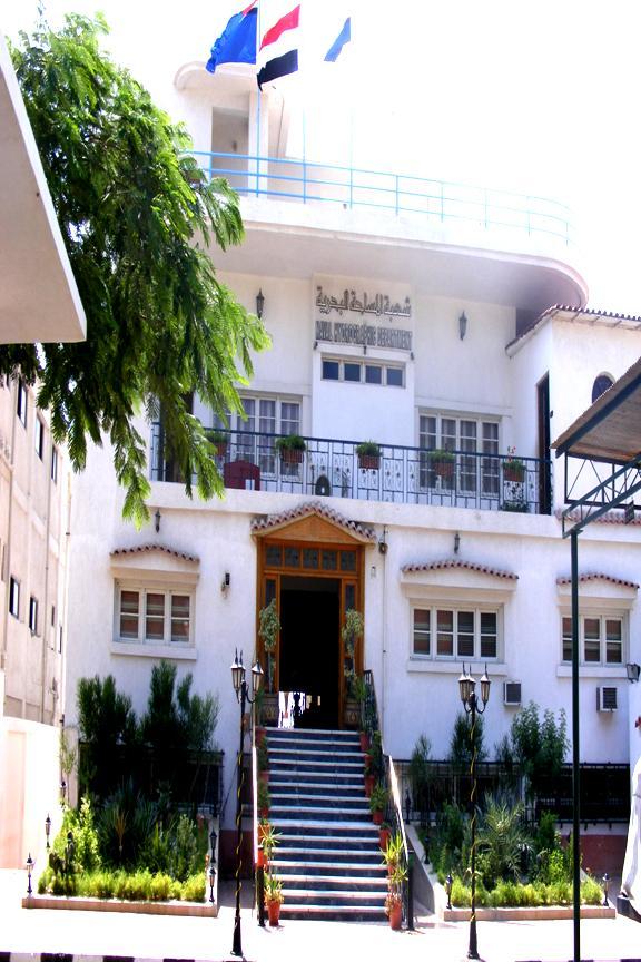
EGYPTIAN HYDROGRAPHIC DEPARTMENT THE EGYPTIAN HYDROGRAPHIC FRAMEWORK
|
|
|
- Asher Jackson
- 6 years ago
- Views:
Transcription

1 gvt
2 THE EGYPTIAN HYDROGRAPHIC FRAMEWORK The roles of a national Hydrographic Service can be summarized in collecting georeferenced data through systematic surveys at sea and along the coast related to: Depths of the seas in the area of national interest (including all potential hazards to navigation - considering present and future ships' drafts - and other marine activities) Coastal features, including man-made infrastructures for maritime navigation, aids to navigation and port configuration Nature of the sea floor Tides & currents Physical properties of the water column 2

3 THE EGYPTIAN HYDROGRAPHIC FRAMEWORK In order to process the information collected in order to create organized databases capable of supporting the production of nautical charts, thematic maps and other types of documentation for the following most common uses : Maritime navigation (and traffic control) 3
 Definition of maritime boundaries (Law of the Sea")
4 THE EGYPTIAN HYDROGRAPHIC FRAMEWORK In order to process the information collected in order to create organized databases capable of supporting the production of nautical charts, thematic maps and other types of documentation for the following most common uses : Maritime navigation (and traffic control) Definition of maritime boundaries (Law of the Sea implementation) 4

 Exploitation of marine resources and laying of submarine")
5 THE EGYPTIAN HYDROGRAPHIC FRAMEWORK In order to process the information collected in order to create organized databases capable of supporting the production of nautical charts, thematic maps and other types of documentation for the following most common uses : Maritime navigation (and traffic control) Definition of maritime boundaries (Law of the Sea implementation) Exploitation of marine resources and laying of submarine cables/pipelines 5
6 THE EGYPTIAN HYDROGRAPHIC FRAMEWORK In order to process the information collected in order to create organized databases capable of supporting the production of nautical charts, thematic maps and other types of documentation for the following most common uses : Maritime navigation (and traffic control) Definition of maritime boundaries (Law of the Sea implementation) Exploitation of marine resources and laying of submarine cables/pipelines Naval operations Coastal management Civil defense Marine environment preservation Scientific studies related to the sea and near-shore zone 6
7 ENHD The ENHD following by the chain of command the Egyptian Naval HQ. Considered the oldest and the most experienced hydrographic office in the region (since 1920). ENHD is the official representative for EGYPT to the IHO (international Hydrographic Organization). Member in the Mediterranean and Black sea hydrographic committee & NIOHC. Permanent member in international Hydrographic and scientific conferences and workshops. 7

8 Navy Egyptian HQ. Egyptian Navy Hydrographic Dep. Hydrographic Division Meteorology and Oceanography Division Navigation Branch Maintenance & Repair Division Logistic Division 8


9 CHAIN OF COMMAND Hydrographic Branch Field Work Division Processing Division Hydrographic Database Cartography Division Nautical Charts production Digital Cartography ENC production Geospatial information Nav aids Database 9
10 Responsibilities Provide Hydrographic security for the Egyptian fleet. Achieve efficient and safe Maritime Transport. Coastal zone management. Exploration and Exploitation for marine recourses. Marine science. Maritime Boundary Delimitation. Nautical and Electronic charts production for the Egyptian Territorial waters. Technical approval and supervision for the International Surveying companies working in the Egyptian waters. 10
11 Capabilities to achieve responsibilities Highly qualified personnel. Hardware Software for the purpose of: Hydrographic Surveying. Nautical Chart production. ENC production. Provide Marine Safety Information and Aids to Navigation. Provide scientific information for economic commercial purposes. 11

12 Survey Team and their qualifications A group of the most professional hydrographic surveyors who had deep and great experience in this field will run and control both field and office works their qualification are as following: Bachelor degree in marine science and technology. All local basic and advanced courses in navigation science. Basic and advanced (Cat A, Cat B) Hydrographic survey courses in the United State of America. Basic and advanced (Cat A, Cat B) Hydrographic survey courses in the United Kingdom (HMS). Basic Hydrographic survey courses in Italy (IMA). Hydrographic Data Management courses in Italy (IMA). Advanced Cartography Course in Italy (IMA). Arial Photogrametry and remote sensing courses in (NASA) United State of America. Master Degree in Hydrographic survey and Chart Production. Advanced courses in (ENC) Electronic Navigation Chart production. 12


13 Egyptian Navy Survey squadron Two Route Survey Vessels. Two survey Motor Boats. Three Zodiacs. Oceanographic ship (contracting). 13
.")


14 Sounding EGYPTIAN HYDROGRAPHIC DEPARTMENT Single beam Echosounder (single frequency). Single beam Dual frequency Echosounder. High Frequency MultiBeam Echosounder (Reson m shallow water). Low Frequency MultiBeam Echosounder (Reson m deep water). MHRS Motion sensor. Equipment onboard 14


.")
15 Equipment onboard Bottom Depiction (Bottom obstacles detection and definition) Digital Side Scan Sonar (KLEIN 3000). ROV (Sea Rover). Sub bottom profiler (SES 2000). 15


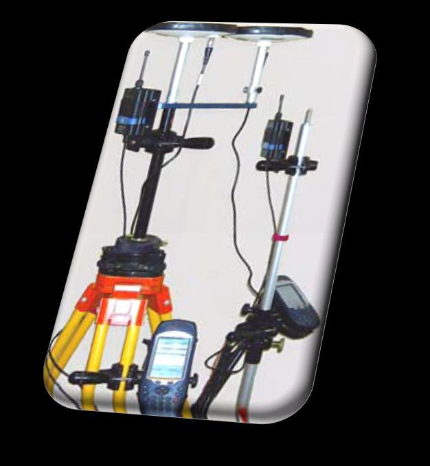

16 Equipment onboard Positioning DGPS (Beacon correction-egnos corrections). HP (OMNISTAR correction). RTK. High Precession. Microfix. 16


17 SOFTWARE Hypack Max. Pds2000 Pangea Caris GIS Caris HOM SES 1.7 CAD Packages 17

18 SOFTWARE TRITON imaging Target pro ISIS sonar. Sonar pro THALES Navigation GNSS Solution. Fast Survey. 18

19 The Egyptian Northern Coastline 19

20 100 % coverage 20

21 ABU-QUIR BAY PAPER CHART 21

22 ABU-QUIR BAY ENC 22

23 M12 The Egyptian Northern APPROACHES TO Coastline IDKU LNG PORT Published at Alexandria Egypt 16 April

24 IDKU PORT PAPER CHART 24

25 M13 IDKU LNG PORT Published at Alexandria, Egypt 15 June
26 ABU QUIR PORT PAPER CHART 26

27 M14 APPRACHES TO ABU QUIR PORT Published at Alexandria, Egypt 25 Nov

28 PORT OF ELMAADYIA PAPER CHART 28


29 M15 MINA ELMAADDIYA PORT OF ELMAADYIA Published at Alexandria, Egypt 13 Auguest

30 RASHID TO ELALAMIN PAPER CHART 30
Myanmar Naval Hydrographic Centre. National Report for 13 th North Indian Ocean Hydrographic Commission Meeting
 Myanmar Naval Hydrographic Centre National Report for 13 th North Indian Ocean Hydrographic Commission Meeting Yangon, Myanmar 19 th 22 nd February 2013 CONTENT 1. Myanmar Naval Hydrographic Centre 2.
Maritime Administration of Latvia Hydrographic Service National Report to Baltic Sea Hydrographic Commission
 Maritime Administration of Latvia Hydrographic Service National Report to Baltic Sea Hydrographic Commission Executive summary 2017 The Report gives an overview of the main activities of Hydrographic Service
FOREWORD. IHO S-100 Working Group
 IHO International Hydrographic Organization KHOA Korea Hydrographic and Oceanographic Agency MUCH MORE THAN JUST NAUTICAL CHARTS IHO UNIVERSAL HYDROGRAPHIC data MODEL This document was produced with the
A guideline for establishing feature and symbol standard management system for national HOs
 A guideline for establishing feature and symbol standard management system for national HOs Joint 26th TSMAD and 5th DIPWG Meeting Silver Spring, Maryland, USA(10-14 June 2013) Republic of Korea (ROK)
The ship RV Timba repairs are now almost complete and it is expected that come September 2014 the ship will be fully operational.
 Malawi National Report 2014 1 Malawi Hydrographic Office The assembly of the 70 ton ship RV Timba with the assistance of the French government in 1989 ushered in the commencement of modern hydrographic
REGIONAL HYDROGRAPHIC COMMISSIONS CAPACITY BUILDING NSHC NHC BSHC USCHC USCHC EAtHC MBSHC RSAHC EAHC MACHC NIOHC SWPHC SEPHC (SWAtHC) SAIHC SWPHC HCA
 SAIHC SWPHC HCA") CONTENT THE VALUE of HYDROGRAPHIC INFORMATION and its INFLUENCE By THE INTERNATIONAL HYDROGRAPHIC ORGANIZATION I.II.III.IV.V.- INTRODUCTION HYDROGRAPHIC INFORMATION OF MAIN VALUE ACTIVITIES THAT BENEFIT
CONTENT THE VALUE of HYDROGRAPHIC INFORMATION and its INFLUENCE By THE INTERNATIONAL HYDROGRAPHIC ORGANIZATION I.II.III.IV.V.- INTRODUCTION HYDROGRAPHIC INFORMATION OF MAIN VALUE ACTIVITIES THAT BENEFIT
Production of Electronic Chart using updated survey data for EL-Arish harbor
 ARAB ACADEMY FOR SCIENCE AND TECHNOLOGY AND MARITIME TRANSPORT Alexandria, Egypt Production of Electronic Chart using updated survey data for EL-Arish harbor Submitted By ASHRAF NABIL HASSAN EL-ASSAL B.SC.
LT Matthew Forney, NOAA Navigation Manager Alaska Region Bering Strait MaritimeSymposium. Office of Coast Survey
 NOAA LT Matthew Forney, NOAA Navigation Manager Alaska Region Bering Strait MaritimeSymposium Who is Coast Survey? First science agency of the U.S. Formed in 1807 Responsible for surveying 3.4 million
MESOAMERICAN AND CARIBBEAN HYDROGRAPHIC COMMISSION 11 th Meeting, Paramaribo, Suriname, Novembro NATIONAL REPORT BRAZIL
 Page 1 of 5 MESOAMERICAN AND CARIBBEAN HYDROGRAPHIC COMMISSION 11 th Meeting, Paramaribo, Suriname, Novembro 8-12 2010 NATIONAL REPORT BRAZIL 1. Hydrographic Office / Service: Directorate of Hydrography
Maritime Administration of Latvia (MAL) Hydrographic Service National Report to Baltic Sea Hydrographic Commission
 Hydrographic Service National Report to Baltic Sea Hydrographic Commission") Maritime Administration of Latvia (MAL) Hydrographic Service National Report to Baltic Sea Hydrographic Commission Executive summary 2016 The Report gives an overview of the main activities of Hydrographic
Maritime Administration of Latvia (MAL) Hydrographic Service National Report to Baltic Sea Hydrographic Commission Executive summary 2016 The Report gives an overview of the main activities of Hydrographic
National Report of Finland
 National Report of Finland 1. Finnish Hydrographic Office The Finnish Hydrographic Office is organized under The Finnish Transport Agency. The Finnish Transport Agency is responsible for the Finnish roads,
Department of Marine Science The University of Southern Mississippi and
 Continuing Development of the FIG/ Approved Category A Master of Science Degree in Hydrographic Science Program at The University of Southern Mississippi David Dodd 1, Ken Barbor 2, Stephan Howden 1, Charles
PAPUA NEW GUINEA HYDROGRAPHIC SERVICE
 PAPUA NEW GUINEA HYDROGRAPHIC SERVICE IHO SOUTH WEST PACIFIC HYDROGRAPHIC COMMISSION (SWPHC) 9 th Meeting Port Moresby, Papua New Guinea, 10-11 March 2007 SWPHC9-01PNG 1. INTRODUCTION 9 th SOUTH WEST PACIFIC
OFFSHORE ANALYSIS & RESEARCH SOLUTIONS HOUSTON PETROLEUM SURVEYORS GROUP PERSONNEL DATA PROCESSING PARTNERSHIPS
 OFFSHORE ANALYSIS & RESEARCH SOLUTIONS HOUSTON PETROLEUM SURVEYORS GROUP KEEPING YOUR PROJECTS IN MOTION OARS-HPSG combines the experience of two highly complementary organizations providing expanded capabilities,
Kordil Surveying & Engineering Services
 Kordil Surveying & Engineering Services About Kordil Kordil Surveying & Engineering Ltd. Co. in short Kordil is an all in one surveying company providing service from Turkey. Hydrography, Oceanography
NAUTICAL CHARTING IN SMALLER COUNTRIES WITH SHORT COASTLINE - TROUBLES AND ADVANTAGES
 NAUTICAL CHARTING IN SMALLER COUNTRIES WITH SHORT COASTLINE - TROUBLES AND ADVANTAGES Igor KARNICNIK, M.Sc. Dalibor RADOVAN (Geodetic Institute of Slovenia, Jamova 2, Ljubljana, Slovenia; igor.karnicnik@geod-is.si)
MEDITERRANEAN AND BLACK SEAS HYDROGRAPHIC COMMISSION
 MEDITERRANEAN AND BLACK SEAS HYDROGRAPHIC COMMISSION XVIII CONFERENCE CONTRIBITION BY MALTA Istanbul, Turkey 25-27 September 2013 1 Item 1 Hydrographic Office Transport Malta is responsible for all transport
Helping Build Your Capacity in Nautical Charting & Hydrography
 Helping Build Your Capacity in Nautical Charting & Hydrography Helping Chart your World Rajesh Alla Riyadh, Kingdom of Saudi Arabia 04-06 March 2013 Company Background Marine Services Capacity Building
PRODUCTS AND SERVICES FOR THE MARITIME COMMUNITY. Ed Martin, Chief Customer Affairs Branch Navigation Services Division Monday, 27 October, 2008
 PRODUCTS AND SERVICES FOR THE MARITIME COMMUNITY Ed Martin, Chief Customer Affairs Branch Navigation Services Division Monday, 27 October, 2008 Coral Reef Conservation International Collaboration Marine
Emerging Subsea Networks
 FIBRE-TO-PLATFORM CONNECTIVITY, WORKING IN THE 500m ZONE Andrew Lloyd (Global Marine Systems Limited) Email: andrew.lloyd@globalmarinesystems.com Global Marine Systems Ltd, New Saxon House, 1 Winsford
PROGRESS UPDATE AND FUTURE DIRECTIONS OF THE MARINE ELECTRONIC HIGHWAY (MEH)
") PROGRESS UPDATE AND FUTURE DIRECTIONS OF THE MARINE ELECTRONIC HIGHWAY (MEH) BACKGROUND 1. The Marine Electronic Highway Demonstration Project (MEH DP) was a 4- year regional project in the Straits of
PROGRESS UPDATE AND FUTURE DIRECTIONS OF THE MARINE ELECTRONIC HIGHWAY (MEH) BACKGROUND 1. The Marine Electronic Highway Demonstration Project (MEH DP) was a 4- year regional project in the Straits of
e-navigation Progress and trends: the IHO perspective
 International Hydrographic Organization e-navigation Progress and trends: the IHO perspective Gilles Bessero Director, IHO International Hydrographic Organization Intergovernmental consultative and technical
Applanix Products and Solutions for Hydrographic Survey & Marine Applications Maximize Your Productivity!
 Applanix Products and Solutions for Hydrographic Survey & Marine Applications Maximize Your Productivity! Applanix technology and support gives you the advantage: lower costs of deployment, faster times
There is also need to acquire equipment such as GPS, Echo-Sounder and update data acquisition and processing software among other requirements.
 Malawi National Report 2016 1 Malawi Hydrographic Office The mandate of the Hydrographic office is to carry out surveys of Lake Malawi including the lesser lakes of Malombe, Chilwa and Chiuta as well as
GEO-MARINE TECHNOLOGY, INC. A Geological, Geophysical, and Hydrographic Survey Consultancy
 COMPANY PROFILE OUR MISSION AND TRADE OUR MISSION: OUR TRADE: We few, professional scientists strive to support the objectives of our marine energy and telecommunications clients with cooperation, innovation
National Report of Finland
 National Report of Finland [31 August 2010] Executive Summary This Report gives an overview of the main activities of the Finnish Hydrographic Office (FHO) since the previous BSHC 14 th Conference. The
dkart Navigator 9010
 dkart Navigator 9010 dkart Navigator - purpose dkart Navigator is an electronic navigation chart system specially designed to facilitate all the navigational tasks of mariner's day-to-day practice. Along
ROUTEING OF SHIPS, SHIP REPORTING AND RELATED MATTERS. New traffic separation schemes and two-way routes in Norra Kvarken
 E SUB-COMMITTEE ON SAFETY OF NAVIGATION 57th session Agenda item 3 NAV 57/3/7 11 March 2011 Original: ENGLISH ROUTEING OF SHIPS, SHIP REPORTING AND RELATED MATTERS New traffic separation schemes and two-way
MBSHC (Mediterranean and Black Seas Hydrographic Commission) XVII. conference, Greece Jun. 2011
 XVII. conference, Greece Jun. 2011") MBSHC (Mediterranean and Black Seas Hydrographic Commission) XVII. conference, Greece 01. 03. Jun. 2011 National report of SLOVENIA 01. May 2011 MBSHC report - SLOVENIA 1 0 Index 0 Index... 2 1 Hydrographic
MBSHC (Mediterranean and Black Seas Hydrographic Commission) XVII. conference, Greece 01. 03. Jun. 2011 National report of SLOVENIA 01. May 2011 MBSHC report - SLOVENIA 1 0 Index 0 Index... 2 1 Hydrographic
Building A New National Hydrographic Service: The Italian-Lebanese Collaboration
 Building A New National Hydrographic Service: The Italian-Lebanese Collaboration Lamberto Orlando LAMBERTI and Nicola Marco PIZZEGHELLO (Italy), Afif GHAITH, Elie el JBEILY and Christian FAHED (Lebanon)
POSITION & ORIENTATION SYSTEMS FOR MARINE VESSELS
 POSITION & ORIENTATION SYSTEMS FOR MARINE VESSELS Applanix POS MV is the marine-survey industry s most accurate, robust, and reliable position and orientation solution available today. Representing the
Marine Institute Job Description
 Marine Institute Job Description Position Contract Service Group Location Temporary Scientific & Technical Officer (STO), Hydrographic Data Processor (INFOMAR) Temporary specified purpose contract for
GNSS in Maritime and Education in Egypt
 GNSS in Maritime and Education in Egypt GNSS IN MARITIME PORTS SHIPS PORTS WATERWAYS GNSS maritime applications will help to improve: navigation. Ship operations. Traffic management. Seaport operations.
Services Overview. Northeast Blueprint
 Services Overview 2D CAD Conversions Paper to CAD 2D CAD Conversions Construction Engineering / CAD Services Construction Markups Consultant Drawings Coordinated Drawings As -Builts Steel Structural Detailing
NOAA s National Ocean Service / Office of Coast Survey
 Coast Survey OCS 1807 2007 Maintains over 1000 nautical charts & 9 Coast Pilots Surveys over 3.4M SNM of oceans and lakes Conducts research and development in hydrography Thomas Jefferson Founder of The
Recent Developments in NOAA s Real- Time Coastal Observing Systems for Safe and Efficient Maritime Transportation
 Recent Developments in NOAA s Real- Time Coastal Observing Systems for Safe and Efficient Maritime Transportation Rich Edwing, Director NOAA Center for Operational Oceanographic Products and Services CMTS
Handling Interferometric Data: Streamlining the Processing Flow
 Handling Interferometric Data: Streamlining the Processing Flow Paper 5 at Hydro8, 4 th November 2008 Tom Hiller, Advanced Products Manager, GeoAcoustics Ltd. WORLD CLASS through people, technology and
Nordic Hydrographic Commission 60th Conference - Stavanger - Norway April New national ENC service for leisure craft users
 Nordic Hydrographic Commission 60th Conference - Stavanger - Norway 11-13 April 2016 New national ENC service for leisure craft users New national ENC service for leisure craft users The aim of the new
World-Wide Navigational Warning Service Sub-Committee WWNWS-5 Monaco, 1-4 October S-100 Basics Background Brief
 International Hydrographic Organization World-Wide Navigational Warning Service Sub-Committee WWNWS-5 Monaco, 1-4 October 2013 S-100 Basics Background Brief Gilles Bessero 15:29 1 S-100 Basics S-100 -
Use of laser bathymetry at the German Baltic Sea coast. 9 November, 2016
 Use of laser bathymetry at the German Baltic Sea coast 9 November, 2016 Content Initial situation and aim of the project Organization and implementation Conclusions and next steps 16.02.2017 Ellmer: Laserbathymetry
ECDIS ENC Accuracy. Contents. Introduction LOSS PREVENTION BRIEFING FOR NORTH MEMBER SHIPS / MAY Introduction... 1
 LOSS PREVENTION BRIEFING FOR NORTH MEMBER SHIPS / MAY 2017 ECDIS ENC Accuracy Contents Introduction... 1 ECDIS Specific Familiarisation... 2 IHO S-57... 2 ENC Data Source... 2 CATZOC and M_QUAL... 2 CATZOC
Modernisation of the Hydrographic Service of Uruguay
 Note Modernisation of the Hydrographic Service of Uruguay By Capt. Hugo Roldos de la Sovera, Capt. Orestes Pereyra, Lt. Alvaro Sanchez and Lt Jose Dominguez, Servicio de Oceanografîa, Hidrografîa y Meteorologfa
... Salient Ocean Issues that have arisen during 2002
 ... As reported in paragraph 62 of the resolution Oceans and the law of the seas, we are especially pleased with the focus for this meeting, given that protecting vulnerable marine ecosystems and safety
Survey Sensors. 18/04/2018 Danny Wake Group Surveyor i-tech Services
 Survey Sensors 18/04/2018 Danny Wake Group Surveyor i-tech Services What do we need sensors for? For pure hydrographic surveying: Depth measurements Hazard identification Seabed composition Tides & currents
Malawi National Report Malawi Hydrographic Office
 Malawi National Report 2013 1 Malawi Hydrographic Office The Malawi Hydrographic Office was started 30 years after the federal government hydrographic surveys. In the year 1989 the 70-ton ship RV Timba
METIS Second Master Training & Seminar. Augmentation Systems Available in Egypt
 METIS Second Master Training & Seminar Augmentation Systems Available in Egypt By Eng. Ramadan Salem M. Sc. Surveying and Geodesy Email: ramadan_salem@link.net Page 1 Augmentation Systems Available in
Route Planning & Cable Route Surveys
 Route Planning & Cable Route Surveys Graham Evans Director EGS Survey Group www.egssurvey.com Concept to Reality Key Phases Development of Business Model Definition of Key Project Milestones Project Concept
GLMTF November 18, 2014 Presentation
 GLMTF November 18, 2014 Presentation Michigan Security Network Founded by major corporations, industry leaders and leading universities in 2008 as a non-profit organization (501c6). MiSN mission is to
CAPACITY BUILDING PLAN Programme document for the period
 INTERNATIONAL HYDROGRAPHIC ORGANIZATION MESO AMERICAN & CARIBBEAN SEA HYDROGRAPHIC COMMISSION 1. INTRODUCTION CAPACITY BUILDING PLAN Programme document for the period 2013-2017 1.1. Rationale It is estimated
global acoustic positioning system GAPS usbl acoustic with integrated INS positioning system Ixsea Oceano GAPS page 1
 global acoustic positioning system usbl acoustic positioning system with integrated INS positioning system page 1 THE MERGER OF INERTIAL AND UNDERWATER ACOUSTIC TECHNOLOGIES is a unique Global Acoustic
A new Modular and Open Concept for the Maritime Integrated PNT System
 A new Modular and Open Concept for the Maritime Integrated PNT System T. Noack German Aerospace Center Institute of Communications and Navigation www.dlr.de Chart 2 MTS-2012 Maritime Integrated PNT Unit
Marine Institute Job Description
 Marine Institute Job Description 02-02-2015 Position Contract Service Group Location Scientific & Technical Officer, Hydrographic Data Processor (INFOMAR) Temporary Specified Purpose, up to end 2018 (INFOMAR
Notice to Mariner No. 213
 To : Attn: From: All Agents, Bunkering Companies, Coast Guard, National Transport Authority, Hydrographic Office Operations Manager Capt. Tamer Masoud Harbour Master Facsimile No.: City: Fujairah Country:
THE IHO, ELECTRONIC CHARTING AND THE CHANGING RELATIONSHIP TO PORTS
 International Hydrographic Review, Monaco, LXXI(2), September 1994 THE IHO, ELECTRONIC CHARTING AND THE CHANGING RELATIONSHIP TO PORTS by Rear Admiral Christian ANDREASEN1 (Presented at European Harbour
DEVELOPMENT OF A DEFINITION FOR MSPS AND CONSIDERATION FOR THE HARMONIZATION OF THE FORMAT AND STRUCTURE OF MSPS
 INTERNATIONAL HYDROGRAPHIC ORGANIZATION E IMO/IHO HARMONIZATION GROUP ON DATA MODELLING Agenda item 5 15 September 2017 ENGLISH ONLY DEVELOPMENT OF A DEFINITION FOR MSPS AND CONSIDERATION FOR THE HARMONIZATION
KONGSBERG seafloor-mapping echosounders
 KONGSBERG seafloor-mapping echosounders Berit Horvei WORLD CLASS through people, technology and dedication AGENDA Historical overview EM series Multibeam echosounder and Subbottom profiler Topside software.
The Nordic Institute of Navigation (NNF)
") The Nordic Institute of Navigation (NNF) www.nornav.org non-profit, independent and a non-political organization for professionals working within the field of navigation. The focus of NNF is on all aspects
The Nordic Institute of Navigation (NNF) www.nornav.org non-profit, independent and a non-political organization for professionals working within the field of navigation. The focus of NNF is on all aspects
Research Vessel Technical Enhancement Committee (RVTEC) November 2009 Meeting ISS - Integrated Survey Systems
 November 2009 Meeting ISS - Integrated Survey Systems") Research Vessel Technical Enhancement Committee (RVTEC) November 2009 Meeting ISS - Integrated Survey Systems John Kiernan, P.E. SAIC - Marine Science and Technology Division ISS-2000 Integrated Survey
Research Vessel Technical Enhancement Committee (RVTEC) November 2009 Meeting ISS - Integrated Survey Systems John Kiernan, P.E. SAIC - Marine Science and Technology Division ISS-2000 Integrated Survey
REPORT. Technical Visit THE ISLAMIC REPUBLIC OF IRAN February 2007
 REPORT Technical Visit to THE ISLAMIC REPUBLIC OF IRAN 20-22 February 2007 2 Technical Visit to the Islamic Republic of Iran (IHO Work Program 2007, Tasks 2.1.7 and 2.1.10) 20-22 February 2007 I.- General
Paper for a communication at the U.S. Hydro 2003
 Paper for a communication at the U.S. Hydro 2003 A Student Initiated Hydrographic Survey in a Riverine Environment, The Pearl River 2002 Field Project Experience David Dodd, Stephan Howden, David Wells,
RESOLUTION MSC.278(85) (adopted on 1 December 2008) ADOPTION OF THE NEW MANDATORY SHIP REPORTING SYSTEM "OFF THE COAST OF PORTUGAL - COPREP"
 (adopted on 1 December 2008) ADOPTION OF THE NEW MANDATORY SHIP REPORTING SYSTEM OFF THE COAST OF PORTUGAL - COPREP") MSC 85/26/Add.1 RESOLUTION MSC.278(85) SYSTEM OFF THE COAST OF PORTUGAL COPREP THE MARITIME SAFETY COMMITTEE, RECALLING Article 28 of the Convention on the International Maritime Organization concerning
MSC 85/26/Add.1 RESOLUTION MSC.278(85) SYSTEM OFF THE COAST OF PORTUGAL COPREP THE MARITIME SAFETY COMMITTEE, RECALLING Article 28 of the Convention on the International Maritime Organization concerning
MARITIME SAFETY INFORMATION
 Introduction 1. Maritime Safety Information (MSI) is defined as navigational and meteorological warnings, meteorological forecasts, and other urgent safety-related messages. This information is of vital
The Normal Baseline. Dick Gent Law of the Sea Division UK Hydrographic Office
 The Normal Baseline Dick Gent Law of the Sea Division UK Hydrographic Office 2 The normal baseline for measuring the breadth of the territorial sea is the low water line along the coast as marked on large
Acoustical images of the Gulf of Gdansk
 PROCEEDINGS of the 22 nd International Congress on Acoustics Underwater Acoustics: Paper ICA2016-427 Acoustical images of the Gulf of Gdansk Eugeniusz Kozaczka (a), Grazyna Grelowska (b) (a) Gdansk University
Hydrographic processing considerations in the Big Data age: An overview of technology trends in ocean and coastal surveys
 IOP Conference Series: Earth and Environmental Science PAPER OPEN ACCESS Hydrographic processing considerations in the Big Data age: An overview of technology trends in ocean and coastal surveys To cite
Inertial Navigation System
 Apogee Series ULTIMATE ACCURACY MEMS Inertial Navigation System INS MRU AHRS ITAR Free 0.005 RMS Motion Sensing & Georeferencing APOGEE SERIES makes high accuracy affordable for all surveying companies.
SAFE TO SEA (S2S) FOR THE SAFETY OF NAVIGTION.
 FOR THE SAFETY OF NAVIGTION.") SAFE TO SEA (S2S) FOR THE SAFETY OF NAVIGTION. GRAFINTA.S.A. Company founded in 1964 and located in Madrid. With 11 people on our payroll from which 8 are engineers specialized in new technologies and
SAFE TO SEA (S2S) FOR THE SAFETY OF NAVIGTION. GRAFINTA.S.A. Company founded in 1964 and located in Madrid. With 11 people on our payroll from which 8 are engineers specialized in new technologies and
SONOBOT AUTONOMOUS HYDROGRAPHIC SURVEY VEHICLE PRODUCT INFORMATION GUIDE
 SONOBOT AUTONOMOUS HYDROGRAPHIC SURVEY VEHICLE PRODUCT INFORMATION GUIDE EvoLogics SONOBOT: Autonomous Surface Vehicle for Hydrographic Surveys High Precision Differential GPS for high-accuracy cartography
COOK INLET NAVIGATION CHANNEL
 COOK INLET NAVIGATION CHANNEL 1-5 COOK INLET NAVIGATION CHANNEL, ALASKA (CWIS NO. 10324, 10534) Condition of Improvement 30 September 2011 AUTHORIZATION: (1) Water Resources Development Act of 1996 (Public
PROCESSING RECORD SCRIPPS INSTITUTION OF OCEANOGRAPHY ARCHIVES. University of California Division of War Research Reports,
 Accession No.: 86-47 PROCESSING RECORD SCRIPPS INSTITUTION OF OCEANOGRAPHY ARCHIVES University of California Division of War Research University of California Division of War Research Reports, 1942-1946
VDatum and SBET to Improve Accuracy of NOAA s High-Resolution Bathymetry
 VDatum and SBET to Improve Accuracy of NOAA s High-Resolution Bathymetry US HYDRO 2007 Extended Abstract Author: Crescent H. Moegling CoAuthor: Steve Brodet Moegling HYDRO 2007 1 Introduction NOAA s Hydrographic
GUIDANCE FOR THE PRESENTATION AND DISPLAY OF AIS APPLICATION-SPECIFIC MESSAGES INFORMATION
 E 4 ALBERT EMBANKMENT LONDON SE1 7SR Telephone: +44 (0)20 7735 7611 Fax: +44 (0)20 7587 3210 Ref. T2-OSS/2.7.1 SN.1/Circ.290 2 June 2010 GUIDANCE FOR THE PRESENTATION AND DISPLAY OF AIS APPLICATION-SPECIFIC
HYDROGRAPHIC SURVEY STANDARDS AND DELIVERABLES
 TABLE OF CONTENTS 1. HYDROGRAPHIC SURVEY METHODOLOGY... 3 2. HYDROGRAPHIC SURVEY REFERENCE STANDARDS... 3 3. HYDROGRAPHIC SURVEY CRITERIA... 3 3.1 HYDROGRAPHIC SURVEYS OVER NON GAZETTED NAVIGABLE WATERS*:...
SPAIN NATIONAL REPORT/ ეროვნული ანგარიში.
 SPAIN NATIONAL REPORT/ ეროვნული ანგარიში http://www.armada.mde.es/ihm. 2 Index 1. Hydrographic Offices 2. Surveys 3. Charts and updates 4. Publications and updates 5. MSI 6. C-55 7. Capacity Building 8.
ROV TRAINING & SUBSEA SOLUTIONS.
 ROV TRAINING & SUBSEA SOLUTIONS www.qstar.es www.rovs.eu The Company The company THE COMPANY Founded in 2007, QSTAR - ROV TRAINING & SUBSEA SOLUTIONS, located in the Canary Islands & Barcelona (Spain)
17 th CHRIS Meeting Rostock, Germany, 5-9 September Report of IHO-IEC Harmonization Group on Marine Information Objects (HGMIO
 17 th CHRIS Meeting Rostock, Germany, 5-9 September 2004 CHRIS17-7A rev.1 Report of IHO-IEC Harmonization Group on Marine Information Objects (HGMIO Lee Alexander, University of New Hampshire (Chair, HGMIO)
Object Detection for Underwater Port Security
 Object Detection for Underwater Port Security Dr. Lloyd Huff LCHUFF CONSULTANCY,LLC Mr. John Thomas TRITON IMAGING,INC Shallow Survey 2012 February 22, 2012 INTRODUCTION I am glad to be here today to make
Rutter High Resolution Radar Solutions
 Rutter High Resolution Radar Solutions High Resolution Imagery, Target Detection, and Tracking At the core of our enhanced radar capabilities are proprietary radar processing and imaging technologies.
Seafloor Mapping Using Interferometric Sonars: Advances in Technology and Techniques
 Seafloor Mapping Using Interferometric Sonars: Advances in Technology and Techniques Tom Hiller, Advanced Products Manager, GeoAcoustics Ltd. WORLD CLASS through people, technology and dedication Brest,
1 st MEETING OF THE IHO COUNCIL
 C1-3.1 1 st MEETING OF THE IHO COUNCIL Monaco, 17-19 October 2017 REPORT OF THE IHO HYDROGRAPHIC SERVICES AND STANDARDS COMMITTEE C1-3.1 - P a g e 3 REPORT OF THE HYDROGRAPHIC STANDARDS AND SERVICES COMMITTEE
NEW AND AMENDED TRAFFIC SEPARATION SCHEMES
 E 4 ALBERT EMBANKMENT LONDON SE1 7SR Telephone: +44 (0)20 7735 7611 Fax: +44 (0)20 7587 3210 NEW AND AMENDED TRAFFIC SEPARATION SCHEMES COLREG.2/Circ.67 20 May 2016 1 The Maritime Safety Committee, at
THE DEVELOPMENT OF CHINESE CHART IN THE 20TH CENTURY AND THE PROSPECTS FOR THE 21ST CENTURY
 THE DEVELOPMENT OF CHINESE CHART IN THE 20TH CENTURY AND THE PROSPECTS FOR THE 21ST CENTURY Li Shujun Hydrography and Mapping Department, Dalian Naval Academy, Dalian, CHINA,116018 E-mail : gh78088@online.
MARINE ELECTRONIC HIGHWAY IN STRAITS OF MALACCA AND SINGAPORE. Development of Supporting Element for Future & Sustainable Operation
 COOPERATION FORUM UNDER THE COOPERATIVE MECHANISM ON SAFETY OF NAVIGATION AND ENVIRONMENTAL PROTECTION IN THE STRAITS OF MALACCA AND SINGAPORE 7th SESSION Agenda Item... CF 7/... 22-23 September 2014 Original.
SONOBOT AUTONOMOUS HYDROGRAPHIC SURVEY VEHICLE PRODUCT INFORMATION GUIDE
 SONOBOT AUTONOMOUS HYDROGRAPHIC SURVEY VEHICLE PRODUCT INFORMATION GUIDE EvoLogics Sonobot an autonomous unmanned surface vehicle for hydrographic surveys High Precision Differential GPS for high-accuracy
VESSEL IDENTIFICATION. Ready to work:
 The Nautical Geo is a research vessel available for worldwide operations. Fitted with cutting-edge survey equipment, she can undertake complex survey operations as well as light construction support, ensuring
This circular summarizes the various important aspects of the LRIT system with a view to enabling companies to ensure compliance in a timely manner.
 Luxembourg, 29/10/2008 CIRCULAR CAM 02/2008 N/Réf. : AH/63353 Subject : Long-Range Identification and Tracking of Ships (LRIT) To : All ship owners, ship operators and designated persons of Luxembourg
RESOLUTION MSC.229(82) (adopted on 5 December 2006) ADOPTION OF A NEW MANDATORY SHIP REPORTING SYSTEM "IN THE GALAPAGOS PARTICULARLY SENSITIVE SEA
 (adopted on 5 December 2006) ADOPTION OF A NEW MANDATORY SHIP REPORTING SYSTEM IN THE GALAPAGOS PARTICULARLY SENSITIVE SEA") MSC 82/24/Add.2 RESOLUTION MSC.229(82) IN THE GALAPAGOS PARTICULARLY SENSITIVE SEA AREA (PSSA) (GALREP) THE MARITIME SAFETY COMMITTEE, RECALLING Article 28(b) of the Convention on the International Maritime
MSC 82/24/Add.2 RESOLUTION MSC.229(82) IN THE GALAPAGOS PARTICULARLY SENSITIVE SEA AREA (PSSA) (GALREP) THE MARITIME SAFETY COMMITTEE, RECALLING Article 28(b) of the Convention on the International Maritime
Western Region enavigation Sub- Committee Report
 Western Region enavigation Sub- Committee Report Western Region enavigation meeting - Jan 12 18 BC Ferries BC Coast Pilots BCIT Marine Campus Canadian Coast Guard Canadian Hydrographic Services Canadian
THE ELECTRONIC CHART DISPLAY AND INFORMATION SYSTEM (ECDIS) IN CHINA
 IN CHINA") International Hydrographic 'Review, Monaco, LXIX(2), September 1992 THE ELECTRONIC CHART DISPLAY AND INFORMATION SYSTEM (ECDIS) IN CHINA by The Research Group on ECDIS 1 Abstract This paper presents a
International Hydrographic 'Review, Monaco, LXIX(2), September 1992 THE ELECTRONIC CHART DISPLAY AND INFORMATION SYSTEM (ECDIS) IN CHINA by The Research Group on ECDIS 1 Abstract This paper presents a
Questionnaire about the Depiction of the Quality of the Data in Nautical Charts
 Questionnaire about the Depiction of the Quality of the Data in Nautical Charts Your answers to this questionnaire, to be returned to the UKHO (see details on last page), will remain anonymous unless you
SUBMARINE CABLES, RESOURCE USE, AND ENVIRONMENTAL PROTECTION. Ambassador Satya Nandan
 SUBMARINE CABLES, RESOURCE USE, AND ENVIRONMENTAL PROTECTION Ambassador Satya Nandan CIL Workshop on Submarine Cables and Law of the Sea Singapore 14-15 December 2009 www.telegeography.com LOSC Framework
Ocean Observations Erik Buch EuroGOOS chair
 EB1 EB2 Ocean Observations Erik Buch EuroGOOS chair 15-07-2015 EuroGOOS AISBL eurogoos@eurogoos.eu - http://www.eurogoos.eu 1 Slide 1 EB1 Erik Buch, 2/26/2014 EB2 Erik Buch, 2/26/2014 Maritime activities
DGPS AND EGNOS SYSTEMS IN HYDROGRAPHIC SURVEY ACCURACY ANALYSES AT THE POLISH SEA AREA CEZARY SPECHT
 DGPS AND EGNOS SYSTEMS IN HYDROGRAPHIC SURVEY ACCURACY ANALYSES AT THE POLISH SEA AREA CEZARY SPECHT Polish Naval Academy, 8-3 Gdynia 3, Smidowicza 69 str., Poland C.Specht@amw.gdynia.pl Problem of positioning
Marine Construction Support & Dimensional Control
 Page 1 of 5 Marine Construction Support & Dimensional Control Key Specifications Surface and Subsurface Positioning IRM Support Lay Support Trench Suport Installation Support Metrology As-Built Heavy Lift
Lake Borgne, Louisiana Debris Mapping
 Lake Borgne, Louisiana Debris Mapping Abstract Gary R. Davis, Paul L. Donaldson, Walter Simmons, Rebecca Quintal Science Applications International Corporation 221 Third Street Newport, RI 02840 USA Under
South Coast Marine Cluster. World Leading Innovation-led Marine & Maritime Cluster
 South Coast Marine Cluster World Leading Innovation-led Marine & Maritime Cluster The South Coast Marine Cluster Concept Began as a cross- local authority and LEP partnership initiative through the GREAT
NAUTICAL CHARTS OF THE BRAZILIAN COAST FOR SMALL CRAFT
 International Hydrographic Review, Monaco, LXIX(2), September 1992 NAUTICAL CHARTS OF THE BRAZILIAN COAST FOR SMALL CRAFT by Eliana Fernandez LIRA 1and Fernando AMADEO 2 Abstract Brazil, a country of continental
UNITED KINGDOM NATIONAL REPORT
 SAIHC12-5.3K UNITED KINGDOM NATIONAL REPORT 12 TH SOUTHERN AFRICA AND ISLANDS HYDROGRAPHIC COMMISSION (SAIHC) MEETING Dar es Salaam, Tanzania 22 nd 23 rd September 2015 This report supplements the UK Generic
Now add true dual channel side scan and Sub Bottom profile to your hydrographic surveys.
 New ROSS 4900 Series Side Scan Sonar and Sub Bottom profiler. Now add true dual channel side scan and Sub Bottom profile to your hydrographic surveys. Laboratories, well known for its line of multi channel
ROUTEING OF SHIPS, SHIP REPORTING AND RELATED MATTERS. Establishment of a Mandatory Ship Reporting System in the
 INTERNATIONAL MARITIME ORGANIZATION E SUB-COMMITTEE ON SAFETY OF NAVIGATION 48th session Agenda item 3 IMO NAV 48/3/2 11 April 2002 Original: ENGLISH ROUTEING OF SHIPS, SHIP REPORTING AND RELATED MATTERS