Research on GNSS Interoperable Parameters
|
|
|
- Anne Shields
- 5 years ago
- Views:
Transcription


1 The 7 th Meeting of International Committee on GNSS Research on GNSS Interoperable Parameters --Working Group A LU Xiaochun National Time Service Center Chinese Academy of Science Beijing, China, Nov. 7, 2012
2 Background Interoperability refers to the ability of global and regional navigation satellite systems and augmentations and the services to be used together to provide better capabilities at the user level than would be achieved by relying solely on the open signals of one system. Multi-GNSS is able to achieve interoperability. BUT, existence of differences among GNSSs cause inconvenience to users. 2
3 Background Thus, we need: Define the differences among GNSSs Study the parameters to represent these differences Process and transmit the parameters to users Make sure the users can depend on the parameters to improve services 3
4 Differences among GNSSs Differences among GNSSs: Constellation: Satellite number, Types of satellite orbit, ect. Signal: Modulation, Center frequency, Received power, ect. Message: Massage structure, Data content, Data format, etc. System time reference System coordinate reference These differences effect users on: Position,Navigation and Timing 4
5 Differences among GNSSs Positioning equation: ( x x i) + ( y y i) + ( z z i) c v T = ρ ( ) ( ) c v a b i + δρi ion + δρi trop t the elements : can be obtained from signals or messages of different system; have different format and precision. % i Elements From Signal Differences From Message Format Precision Parameter From Signal Differences From Message Format Precision ( x, y, z ) i i i ( δρ ) i ion ρ% v i a t i 5


6 Differences Signal Ephemeris Onboard Clock Propagation Items User-Received Signal Level, Modulation Error, Correlation Characteristics, Phase Coherence, TGD Orbit offset, GNSS reference bias Clock offset, GNSS Time Bias Ionosphere GNSS interoperable parameters 6


7 GNSS Interoperability In order to provide better service for users: utilize specific method to monitor interoperable parameters; calculate parameters in a common time reference and coordinate reference frame; broadcast parameters to users; take parameters to eliminate adverse effect of the GNSS differences. 7


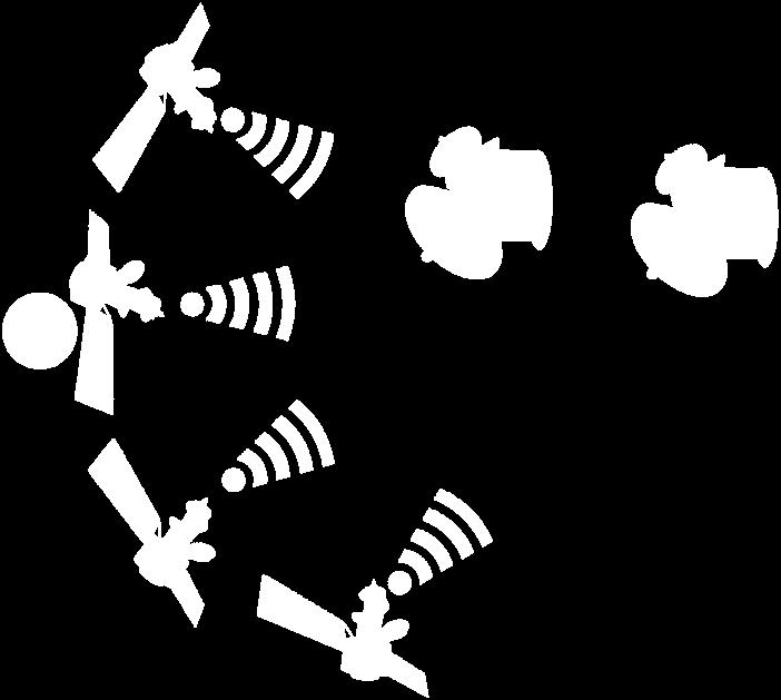
8 GNSS Interoperability Without interoperable parameters Wi Too many dates! Limited accuracy! 8


9 Divide these interoperable parameters into two sub-sets: Signal Parameters GNSS time bias GNSS coordina te bias User Received Signal Level TGD Modulat ion Ionos phere Correlati on Charact eristics interoperable parameter Set Clock offset Phase Coherence Orbit Message Parameters 9


10 Signal Parameters Provide users interoperable parameters in signal level: ability to chose a high quality signal in receiving process reduce the first positioning duration and decrease the complexity of receiver Too many signals! Receiver 10
11 User Received Signal Level Definition: The signal power when it arrives at the ground station. Detection: Use ground monitoring receiver to monitor the signal power and its variation range. Modulat ion Definition: The error which was produced in the modulation and transmission, including: phase modulation error and amplitude modulation error. Phase modulation error: Amplitude modulation error: The differences between the real phase in each channel and the ideal phase of the signal. The differences between the real amplitude in each branch and the ideal amplitude of the signal Detection : Compare the received signal to designed signal. 11
12 Correlati on Charact eristics Definition: Outputs of correlation peak amplitude and correlation curve characteristics after the operation of signal correlation. Correlation loss: Power difference between the actually received signal and the ideal signal in the designed bandwidth of the signal. Correlation curve: The curve obtained through correlation calculation between recovered ranging code and the ideal ranging code of all signals. Detection : The monitoring receiver acquire navigation signal, and then evaluate amplitude attenuation and curve distortion which is caused by wave distortion. 12
13 Correlati on Charact eristics (Continued) Calculation method: Correlation function: CCF( ε ) = T p T p 0 S () t S ( t ε ) dt BB PreProc Re f BB PreProc Re f 0 0 S BB-PrePeoc is the base-band signal been pretreated (down conversion, Doppler removal); reference signal S Ref is ideal base-band signal generated by local receiver; integral time T p is the main code period of reference signal. Relative loss: Power loss of available signal to all received signals : 2 ( S ( t) dt) ( S ( t) dt) P [ db] = max (20 log ( CCF( ε ))) CCF over allε 10 * T p 2 13
14 Phase Coherence Definition: The relative change of signal elements in the timeline. Code and carrier Coherence : Relative jitter value between ranging code and carrier wave in the same signal branch. Codes Coherence: Relative jitter value of time delay between ranging code and carrier wave; relative jitter value of ranging codes in different signal branch. Detection : Monitor the navigation signal. Calculation: Coherence between code and carrier & Coherence in ranging codes 14
15 Phase Coherence (Continued) Calculate method: Code and carrier Coherence: In interval of [t,t+t], use carrier wave limited in L j and L k as radiation of code carrier wave in L i frequency: CCD ( t, t + T) = PR ( t + T) PR ( t) [ CR ( t + T) CR ( t)] Li Lj, Lk Li Li Li Li 2 f L1 2 ILj, Lk( t, t T) fli Δ + I Lj,Lk (t,t+t) denotes the ionospheric delay differences in L 1 frequency on interval [t,t+t], these differences calculated from D-value of L j and L k frequency amplitude. If CCD Li Lj,Lk(t,t+T) neets: 100 T 7200, t 1 t t 2 -T, CCD Li Lj,Lk(t,t+T)>6.1 m Thus, code and carrier wave are consistence at t+t. 15

16 Phase Coherence Calculate method: Coherence in ranging codes: (Continued) Φ Φ Φ Φ ρ ρ λ ρ ρ λ ρ ρ ρ ρ, 2 j i, 2 i j i = i + i, = +, Δ = Δ 2 2 j j j 2 2 i j i, j λj λi λi λj ρ i, ρ j, ρ i, ρ j represent pseudo-range when exist ionospheric error and no ionospheric error respectively, j represent frequency which is different from i. Ф i and Ф j are observation value of carrier phase( the unit is distance), wavelength are λ i and λ j respectively; λ 2 i(ф j - Ф i )/(λ 2 j- λ 2 i) is amended value of dual-frequency ionosphere; ρ represent time delay between receiver channels. 16
17 Orbit Definition: GNSS precise orbit calculated based on same monitor station, same orbit determination algorithm, same space-time reference. Detection : Utilize observation value of multi-mode receiver and precise orbit algorithm to calculate GNSS precise orbit. Calculation: a) Detect the coarse error of observation value and cycle slip; b) Using the processed data to the precision of satellite orbit, station location and ERP parameter estimation; c) Obtained by compare to the correction information of broadcast ephemeris orbit. 17
18 Clock offset Definition: Calculate GNSS precise clock error based on same monitor station, same orbit determination algorithm, same space-time reference. Detection : Utilize Observation data of Laser, radio, dualfrequency carrier wave and precise clock error algorithm to get precise clock error of GNSS. 18
 Use preprocessed real-time observation data by means of Square Root Filter to evaluate clock error; d) Compare")
19 Clock offset (Continued) Calculation: a) Detect the coarse difference and cycle slip of the observation data; b) Take real-time precise satellite orbit, the position of observation station, and EPR parameters as known parameters to real-time precise satellite clock error processor; c) Use preprocessed real-time observation data by means of Square Root Filter to evaluate clock error; d) Compare the evaluated clock error with the broadcasted clock error, and then get amended clock error information. 19
 nd max n % TEC( φ, λ) = P% (sin ϕ) A cos( mλ) + B% sin( mλ) n= 0 m= 0 Total electron content (TEC) in the path from monitoring station to satellite: 40.")
20 Ionos phere Definition: Total electron content of global ionospheric grid based on the calculation of dual-frequency observations. Detection : By monitoring of ionospheric grid model. Calculation: a) nd max n % TEC( φ, λ) = P% (sin ϕ) A cos( mλ) + B% sin( mλ) n= 0 m= 0 Total electron content (TEC) in the path from monitoring station to satellite: TEC P% P% = (1 ξ ) +Δ b +Δb k k k 1, i 2, i 2 i f1 b) Work out total electron content of global ionospheric grid by geomagnetic model: ( ) nm nm nm 20
21 GNSS time bias Definition: The time differences between each satellite navigation system and UTC. Detection : Monitor each system time and compare with UTC. Calculation: 1)Calculate the differences sys between each system time and UTC(K), sys =T sys -UTC(K); 2)Worked out the difference k between UTC(K) and UTC, k=utc(k)-utc; 3)Normalized each system time to UTC, = sys + k. 21
22 GNSS coordina te bias Definition : Differences between coordinate reference frame and ITRF. Detection : Measure the coordinate of given points in different coordinate reference frame, then calculate their difference Calculation : (X n, Y n, Z n ) T i: the coordinate of P n in frame i, (X n, Y n, Z n ) T ITRF: the coordinate of P n in ITRF; then (using Bursa model): 22
23 TGD Definition: GNSS signal group time delay Detection : Monitor and compare the signal time delay Calculation: TGD( f, f ) i j = PR( f) PRf ( ) i 1 ( f f ) i j 2 j Where, f i and f j are carrier wave frequency of two GNSS signals, PR(f i ) and PR(f j ) are the corresponded signal group time delay. 23


24 GNSS Interoperability Two forms can represent the parameters: The precision data point the assessment result. The tolerance data point the difference between the monitoring result and the assessment result. 24
25 Form of interoperable parameters Comparison of the two forms: Precision data Tolerance data Advantages Less computational complexity of user receiver Less computational complexity of the third monitoring station Low requirements of data rate Receive complete information in short time Can still use original GNSS to realize PVT when the parameters of the third party are unavailable Disadvantages Need high data rate Increased the time of receiving complete information The system will be useless when the parameters of the third party is unavailable Additional process at user receiver Increased the amount of computation in the third monitoring station 25


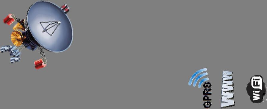


26 Broadcasting interoperable parameters Except the providers own links, interoperable parameters can be broadcasted to users in different ways. internet/mobile communication/commercial satellite User 26
27 Conclusion Other issues about GNSS interoperability: DOP amelioration of multi-gnss DOP saturation value Utilize existing or planned spare capacity in civil/open service navigation messages to increase multi-gnss interoperability Utilize existing or planned spare capacity SBAS navigation messages in order to increase multi-gnss interoperability Patent of MBOC signal Receive multi-system observation data Technology on receiving interoperable signal and receiver interoperable parameter model and algorithm taken by users Data type consistency and transferability The third frequency for interoperability Frequency diversity Definition, model and calculation of interoperable parameters Monitoring method in interoperable parameters (include system time difference monitoring) System time difference monitoring interoperable parameters broadcasting Correction model of ionosphere and atmospheric delay in multi-gnss Correction model of solar radiation pressure in multi-gnss Other methods to enhance interoperability 27
28 Conclusion WG-B and WG-D have paying more attention to overlaps between their work and in-depth interoperability research. A platform is required to attracts more academic, experts and industry specialists to research on interoperability and to provide better services for users. Overlaps between Interoperability & WG-B WG-B Interoperability WG-D Overlaps between Interoperability & WG-D 28


29 Conclusion Under this platform, we can discuss the following topics : Interoperable signal interoperable parameter Interoperability in user level Methods to enhance interoperability Interoperable algorithm 29


30 Prof. LU Xiaochun 30
UNIT 1 - introduction to GPS
 UNIT 1 - introduction to GPS 1. GPS SIGNAL Each GPS satellite transmit two signal for positioning purposes: L1 signal (carrier frequency of 1,575.42 MHz). Modulated onto the L1 carrier are two pseudorandom
ESTIMATION OF IONOSPHERIC DELAY FOR SINGLE AND DUAL FREQUENCY GPS RECEIVERS: A COMPARISON
 ESTMATON OF ONOSPHERC DELAY FOR SNGLE AND DUAL FREQUENCY GPS RECEVERS: A COMPARSON K. Durga Rao, Dr. V B S Srilatha ndira Dutt Dept. of ECE, GTAM UNVERSTY Abstract: Global Positioning System is the emerging
t =1 Transmitter #2 Figure 1-1 One Way Ranging Schematic
 1.0 Introduction OpenSource GPS is open source software that runs a GPS receiver based on the Zarlink GP2015 / GP2021 front end and digital processing chipset. It is a fully functional GPS receiver which
Global Positioning System: what it is and how we use it for measuring the earth s movement. May 5, 2009
 Global Positioning System: what it is and how we use it for measuring the earth s movement. May 5, 2009 References Lectures from K. Larson s Introduction to GNSS http://www.colorado.edu/engineering/asen/
Initial Assessment of BDS Zone Correction
 Initial Assessment of BDS Zone Correction Yize Zhang, Junping Chen, Sainan Yang and Qian Chen Abstract Zone correction is a new type of differential corrections for BeiDou wide area augmentation system.
SSR Technology for Scalable Real-Time GNSS Applications
 SSR Technology for Scalable Real-Time GNSS Applications Gerhard Wübbena, Jannes Wübbena, Temmo Wübbena, Martin Schmitz Geo++ GmbH 30827 Garbsen, Germany www.geopp.de Abstract SSR Technology for scalable
Challenges and Solutions for GPS Receiver Test
 Challenges and Solutions for GPS Receiver Test Presenter: Mirin Lew January 28, 2010 Agenda GPS technology concepts GPS and GNSS overview Assisted GPS (A-GPS) Basic tests required for GPS receiver verification
The Global Positioning System
 The Global Positioning System Principles of GPS positioning GPS signal and observables Errors and corrections Processing GPS data GPS measurement strategies Precision and accuracy E. Calais Purdue University
Broadcasting System Time Scales Offsets in Navigation Messages. Assessment of Feasibility
 Broadcasting System Time Scales Offsets in Navigation Messages. Assessment of Feasibility A. Druzhin, A. Tyulyakov. A. Pokhaznikov Working Group A ICG-8, Dubai, United Arab Emirates 2 Rastrelli Square,
Galileo: The Added Value for Integrity in Harsh Environments
 sensors Article Galileo: The Added Value for Integrity in Harsh Environments Daniele Borio, and Ciro Gioia 2, Received: 8 November 25; Accepted: 3 January 26; Published: 6 January 26 Academic Editor: Ha
Global Navigation Satellite Systems II
 Global Navigation Satellite Systems II AERO4701 Space Engineering 3 Week 4 Last Week Examined the problem of satellite coverage and constellation design Looked at the GPS satellite constellation Overview
Global Navigation Satellite Systems (GNSS)Part I EE 570: Location and Navigation
Part I EE 570: Location and Navigation") Lecture Global Navigation Satellite Systems (GNSS)Part I EE 570: Location and Navigation Lecture Notes Update on April 25, 2016 Aly El-Osery and Kevin Wedeward, Electrical Engineering Dept., New Mexico
Lecture Global Navigation Satellite Systems (GNSS)Part I EE 570: Location and Navigation Lecture Notes Update on April 25, 2016 Aly El-Osery and Kevin Wedeward, Electrical Engineering Dept., New Mexico
Ionospheric Corrections for GNSS
 Ionospheric Corrections for GNSS The Atmosphere and its Effect on GNSS Systems 14 to 16 April 2008 Santiago, Chile Ing. Roland Lejeune Overview Ionospheric delay corrections Core constellations GPS GALILEO
Assessing & Mitigation of risks on railways operational scenarios
 R H I N O S Railway High Integrity Navigation Overlay System Assessing & Mitigation of risks on railways operational scenarios Rome, June 22 nd 2017 Anja Grosch, Ilaria Martini, Omar Garcia Crespillo (DLR)
ANALYSIS OF GPS SATELLITE OBSERVABILITY OVER THE INDIAN SOUTHERN REGION
 TJPRC: International Journal of Signal Processing Systems (TJPRC: IJSPS) Vol. 1, Issue 2, Dec 2017, 1-14 TJPRC Pvt. Ltd. ANALYSIS OF GPS SATELLITE OBSERVABILITY OVER THE INDIAN SOUTHERN REGION ANU SREE
An Introduction to GPS
 An Introduction to GPS You are here The GPS system: what is GPS Principles of GPS: how does it work Processing of GPS: getting precise results Yellowstone deformation: an example What is GPS? System to
Modelling GPS Observables for Time Transfer
 Modelling GPS Observables for Time Transfer Marek Ziebart Department of Geomatic Engineering University College London Presentation structure Overview of GPS Time frames in GPS Introduction to GPS observables
Enhancing space situational awareness using passive radar from space based emitters of opportunity
 Tracking Space Debris Craig Benson School of Engineering and IT Enhancing space situational awareness using passive radar from space based emitters of opportunity Space Debris as a Problem Debris is fast
The Indian Regional Navigation. First Position Fix with IRNSS. Successful Proof-of-Concept Demonstration
 Successful Proof-of-Concept Demonstration First Position Fix with IRNSS A. S. GANESHAN, S. C. RATNAKARA, NIRMALA SRINIVASAN, BABU RAJARAM, NEETHA TIRMAL, KARTIK ANBALAGAN INDIAN SPACE RESEARCH ORGANISATION
The Benefit of Triple Frequency on Cycle Slip Detection
 Presented at the FIG Congress 2018, The Benefit of Triple Frequency on Cycle Slip Detection May 6-11, 2018 in Istanbul, Turkey Dong Sheng Zhao 1, Craig Hancock 1, Gethin Roberts 2, Lawrence Lau 1 1 The
GNSS OBSERVABLES. João F. Galera Monico - UNESP Tuesday 12 Sep
 GNSS OBSERVABLES João F. Galera Monico - UNESP Tuesday Sep Basic references Basic GNSS Observation Equations Pseudorange Carrier Phase Doppler SNR Signal to Noise Ratio Pseudorange Observation Equation
EE 570: Location and Navigation
 EE 570: Location and Navigation Global Navigation Satellite Systems (GNSS) Part I Aly El-Osery Kevin Wedeward Electrical Engineering Department, New Mexico Tech Socorro, New Mexico, USA In Collaboration
GPS (Introduction) References. Terms
 References. Terms") GPS (Introduction) WCOM2, GPS, 1 Terms NAVSTAR GPS ( Navigational Satellite Timing and Ranging - Global Positioning System) is a GNSS (Global Navigation Satellite System), developed by the US-DoD in 197x
GPS (Introduction) WCOM2, GPS, 1 Terms NAVSTAR GPS ( Navigational Satellite Timing and Ranging - Global Positioning System) is a GNSS (Global Navigation Satellite System), developed by the US-DoD in 197x
FieldGenius Technical Notes GPS Terminology
 FieldGenius Technical Notes GPS Terminology Almanac A set of Keplerian orbital parameters which allow the satellite positions to be predicted into the future. Ambiguity An integer value of the number of
GNSS Technologies. GNSS Acquisition Dr. Zahidul Bhuiyan Finnish Geospatial Research Institute, National Land Survey
 GNSS Acquisition 25.1.2016 Dr. Zahidul Bhuiyan Finnish Geospatial Research Institute, National Land Survey Content GNSS signal background Binary phase shift keying (BPSK) modulation Binary offset carrier
International GNSS Monitoring & Assessment Service for OS (igmas) ICG September 2011, Tokyo, Japan
 ICG September 2011, Tokyo, Japan") Presentation on igmas FOR WORKING GROUP A International GNSS Monitoring & Assessment Service for OS (igmas) by Xurong Dong International Cooperation Research Centre, CSNO ICG 6 5 9 September 2011, Tokyo,
Presentation on igmas FOR WORKING GROUP A International GNSS Monitoring & Assessment Service for OS (igmas) by Xurong Dong International Cooperation Research Centre, CSNO ICG 6 5 9 September 2011, Tokyo,
Satellite Navigation Integrity and integer ambiguity resolution
 Satellite Navigation Integrity and integer ambiguity resolution Picture: ESA AE4E08 Sandra Verhagen Course 2010 2011, lecture 12 1 Today s topics Integrity and RAIM Integer Ambiguity Resolution Study Section
Real-time RTK messages for permanent reference station applications standardized by RTCM. Dr.-Ing. Hans-Juergen Euler Leica Research Fellow
 Real-time RTK messages for permanent reference station applications standardized by RTCM Dr.-Ing. Hans-Juergen Euler Leica Research Fellow Permanent Station Arrays Arrays with Permanent Stations are established
Guochang Xu GPS. Theory, Algorithms and Applications. Second Edition. With 59 Figures. Sprin ger
 Guochang Xu GPS Theory, Algorithms and Applications Second Edition With 59 Figures Sprin ger Contents 1 Introduction 1 1.1 AKeyNoteofGPS 2 1.2 A Brief Message About GLONASS 3 1.3 Basic Information of Galileo
Status of COMPASS/BeiDou Development
 Status of COMPASS/BeiDou Development Stanford s 2009 PNT Challenges and Opportunities Symposium October 21-22,2009 Cao Chong China Technical Application Association for GPS Contents 1. Basic Principles
Study and analysis of Differential GNSS and Precise Point Positioning
 IOSR Journal of Electrical and Electronics Engineering (IOSR-JEEE) e-issn: 2278-1676,p-ISSN: 2320-3331, Volume 9, Issue 2 Ver. I (Mar Apr. 2014), PP 53-59 Study and analysis of Differential GNSS and Precise
Posicionamento por ponto com. Posicionamento por satélite UNESP PP 2017 Prof. Galera
 Posicionamento por ponto com multiconstelação GNSS Posicionamento por satélite UNESP PP 2017 Prof. Galera Single-GNSS Observation Equations Considering j = 1; : : : ; f S the frequencies of a certain GNSS
Introduction to Global Navigation Satellite System (GNSS) Signal Structure
 Signal Structure") Introduction to Global Navigation Satellite System (GNSS) Signal Structure Dinesh Manandhar Center for Spatial Information Science The University of Tokyo Contact Information: dinesh@iis.u-tokyo.ac.jp
Introduction to Global Navigation Satellite System (GNSS) Signal Structure Dinesh Manandhar Center for Spatial Information Science The University of Tokyo Contact Information: dinesh@iis.u-tokyo.ac.jp
Time and frequency transfer methods based on GNSS. LIANG Kun, National Institute of Metrology(NIM), China
, China") Time and frequency transfer methods based on GNSS LIANG Kun, National Institute of Metrology(NIM), China Outline Remote time and frequency transfer GNSS time and frequency transfer methods Data and results
Time and frequency transfer methods based on GNSS LIANG Kun, National Institute of Metrology(NIM), China Outline Remote time and frequency transfer GNSS time and frequency transfer methods Data and results
Integrity of Satellite Navigation in the Arctic
 Integrity of Satellite Navigation in the Arctic TODD WALTER & TYLER REID STANFORD UNIVERSITY APRIL 2018 Satellite Based Augmentation Systems (SBAS) in 2018 2 SBAS Networks in 2021? 3 What is Meant by Integrity?
Fundamentals of GPS Navigation
 Fundamentals of GPS Navigation Kiril Alexiev 1 /76 2 /76 At the traditional January media briefing in Paris (January 18, 2017), European Space Agency (ESA) General Director Jan Woerner explained the knowns
Sources of Error in Satellite Navigation Positioning
 http://www.transnav.eu the International Journal on Marine Navigation and Safety of Sea Transportation Volume 11 Number 3 September 2017 DOI: 10.12716/1001.11.03.04 Sources of Error in Satellite Navigation
Monitoring the Ionosphere and Neutral Atmosphere with GPS
 Monitoring the Ionosphere and Neutral Atmosphere with GPS Richard B. Langley Geodetic Research Laboratory Department of Geodesy and Geomatics Engineering University of New Brunswick Fredericton, N.B. Division
ABSOLUTE CALIBRATION OF TIME RECEIVERS WITH DLR'S GPS/GALILEO HW SIMULATOR
 ABSOLUTE CALIBRATION OF TIME RECEIVERS WITH DLR'S GPS/GALILEO HW SIMULATOR S. Thölert, U. Grunert, H. Denks, and J. Furthner German Aerospace Centre (DLR), Institute of Communications and Navigation, Oberpfaffenhofen,
Clock Synchronization of Pseudolite Using Time Transfer Technique Based on GPS Code Measurement
 , pp.35-40 http://dx.doi.org/10.14257/ijseia.2014.8.4.04 Clock Synchronization of Pseudolite Using Time Transfer Technique Based on GPS Code Measurement Soyoung Hwang and Donghui Yu* Department of Multimedia
PRECISE RECEIVER CLOCK OFFSET ESTIMATIONS ACCORDING TO EACH GLOBAL NAVIGATION SATELLITE SYSTEMS (GNSS) TIMESCALES
 TIMESCALES") ARTIFICIAL SATELLITES, Vol. 52, No. 4 DOI: 10.1515/arsa-2017-0009 PRECISE RECEIVER CLOCK OFFSET ESTIMATIONS ACCORDING TO EACH GLOBAL NAVIGATION SATELLITE SYSTEMS (GNSS) TIMESCALES Thayathip Thongtan National
ARTIFICIAL SATELLITES, Vol. 52, No. 4 DOI: 10.1515/arsa-2017-0009 PRECISE RECEIVER CLOCK OFFSET ESTIMATIONS ACCORDING TO EACH GLOBAL NAVIGATION SATELLITE SYSTEMS (GNSS) TIMESCALES Thayathip Thongtan National
Methodology and Case Studies of Signal-in-Space Error Calculation
 Methodology and Case Studies of Signal-in-Space Error Calculation Top-down Meets Bottom-up Grace Xingxin Gao *, Haochen Tang *, Juan Blanch *, Jiyun Lee +, Todd Walter * and Per Enge * * Stanford University,
Rec. ITU-R P RECOMMENDATION ITU-R P *
 Rec. ITU-R P.682-1 1 RECOMMENDATION ITU-R P.682-1 * PROPAGATION DATA REQUIRED FOR THE DESIGN OF EARTH-SPACE AERONAUTICAL MOBILE TELECOMMUNICATION SYSTEMS (Question ITU-R 207/3) Rec. 682-1 (1990-1992) The
The Global Positioning System
 The Global Positioning System 5-1 US GPS Facts of Note DoD navigation system First launch on 22 Feb 1978, fully operational in 1994 ~$15 billion (?) invested to date 24 (+/-) Earth-orbiting satellites
GNSS: orbits, signals, and methods
 Part I GNSS: orbits, signals, and methods 1 GNSS ground and space segments Global Navigation Satellite Systems (GNSS) at the time of writing comprise four systems, two of which are fully operational and
3D-Map Aided Multipath Mitigation for Urban GNSS Positioning
 Summer School on GNSS 2014 Student Scholarship Award Workshop August 2, 2014 3D-Map Aided Multipath Mitigation for Urban GNSS Positioning I-Wen Chu National Cheng Kung University, Taiwan. Page 1 Outline
Asia Oceania Regional Workshop on GNSS Precise Point Positioning Experiment by using QZSS LEX
 Asia Oceania Regional Workshop on GNSS 2010 Precise Point Positioning Experiment by using QZSS LEX Tomoji TAKASU Tokyo University of Marine Science and Technology Contents Introduction of QZSS LEX Evaluation
Ionospheric Monitoring in China. Zhen Weimin, Ou Ming
 ICG-5 WG-B, Turino Ionospheric Monitoring in China Zhen Weimin, Ou Ming October 20 th, 2010, Turino, Italy Outline 1.Introduction 2.Ionosphere monitoring in China 3.Summary 1. Introduction GNSS performance
GPS (Introduction) References. Terms
 References. Terms") GPS (Introduction) MSE, Rumc, GPS, 1 Terms NAVSTAR GPS ( Navigational Satellite Timing and Ranging - Global Positioning System) is a GNSS (Global Navigation Satellite System), developed by the US-DoD in
GPS (Introduction) MSE, Rumc, GPS, 1 Terms NAVSTAR GPS ( Navigational Satellite Timing and Ranging - Global Positioning System) is a GNSS (Global Navigation Satellite System), developed by the US-DoD in
RTCM-SSR Strategy of Bias Treatment
 RTCM-SSR Strategy of Bias Treatment Gerhard Wübbena Geo++ GmbH 30827 Garbsen Germany www.geopp.de Chair of RTCM-SSR WG www.rtcm.org RTCM-SC104 SSR Development working group established in 2007 3 message
Satellite Navigation Principle and performance of GPS receivers
 Satellite Navigation Principle and performance of GPS receivers AE4E08 GPS Block IIF satellite Boeing North America Christian Tiberius Course 2010 2011, lecture 3 Today s topics Introduction basic idea
GPS Milestones, cont. GPS Milestones. The Global Positioning Sytem, Part 1 10/10/2017. M. Helper, GEO 327G/386G, UT Austin 1. US GPS Facts of Note
 The Global Positioning System US GPS Facts of Note DoD navigation system First launch on 22 Feb 1978, fully operational in 1994 ~$15 billion (?) invested to date 24 (+/-) Earth-orbiting satellites (SVs)
Procedures for Quality Control of GNSS Surveying Results Based on Network RTK Corrections.
 Procedures for Quality Control of GNSS Surveying Results Based on Network RTK Corrections. Limin WU, China Feng xia LI, China Joël VAN CRANENBROECK, Switzerland Key words : GNSS Rover RTK operations, GNSS
SC - Single carrier systems One carrier carries data stream
 Digital modulation SC - Single carrier systems One carrier carries data stream MC - Multi-carrier systems Many carriers are used for data transmission. Data stream is divided into sub-streams and each
PPP with Ambiguity Resolution (AR) using RTCM-SSR
 using RTCM-SSR") PPP with Ambiguity Resolution (AR) using RTCM-SSR Gerhard Wübbena, Martin Schmitz, Andreas Bagge Geo++ GmbH 30827 Garbsen Germany www.geopp.de PPP with Ambiguity Resolution (AR) using RTCM-SSR Abstract
PPP with Ambiguity Resolution (AR) using RTCM-SSR Gerhard Wübbena, Martin Schmitz, Andreas Bagge Geo++ GmbH 30827 Garbsen Germany www.geopp.de PPP with Ambiguity Resolution (AR) using RTCM-SSR Abstract
Enhancing global PPP with Local Ionospheric Corrections
 Enhancing global PPP with Local Ionospheric Corrections Suelynn Choy 1, Ken Harima 1, Satoshi Kogure 2 1 School of Mathematical and Geospatial Sciences, RMIT University, Australia 2 Satellite Navigation
Foreword by Glen Gibbons About this book Acknowledgments List of abbreviations and acronyms List of definitions
 Table of Foreword by Glen Gibbons About this book Acknowledgments List of abbreviations and acronyms List of definitions page xiii xix xx xxi xxv Part I GNSS: orbits, signals, and methods 1 GNSS ground
A Distribution Method of High Precise Differential Corrections for a Network Beidou/RTK System Based on Vehicular Networks
 BULGARIAN ACADEMY OF SCIENCES CYBERNETICS AND INFORMATION TECHNOLOGIES Volume 15, No 5 Special Issue on Control in Transportation Systems Sofia 215 Print ISSN: 1311-972; Online ISSN: 1314-481 DOI: 1.1515/cait-215-24
GPS and Recent Alternatives for Localisation. Dr. Thierry Peynot Australian Centre for Field Robotics The University of Sydney
 GPS and Recent Alternatives for Localisation Dr. Thierry Peynot Australian Centre for Field Robotics The University of Sydney Global Positioning System (GPS) All-weather and continuous signal system designed
Phase Center Calibration and Multipath Test Results of a Digital Beam-Steered Antenna Array
 Phase Center Calibration and Multipath Test Results of a Digital Beam-Steered Antenna Array Kees Stolk and Alison Brown, NAVSYS Corporation BIOGRAPHY Kees Stolk is an engineer at NAVSYS Corporation working
Global positioning system (GPS) - Part I -
 - Part I -") Global positioning system (GPS) - Part I - Thomas Hobiger Space-Time Standards Group National Institute of Information and Communications Technology (NICT), Japan Content GPS overview GPS Signal and Receiver
Global positioning system (GPS) - Part I - Thomas Hobiger Space-Time Standards Group National Institute of Information and Communications Technology (NICT), Japan Content GPS overview GPS Signal and Receiver
Resection. We can measure direction in the real world! Lecture 10: Position Determination. Resection Example: Isola, Slovenia. Professor Keith Clarke
 Geography 12: Maps and Spatial Reasoning Lecture 10: Position Determination We can measure direction in the real world! Professor Keith Clarke Resection Resection Example: Isola, Slovenia Back azimuth
GPS for. Land Surveyors. Jan Van Sickle. Fourth Edition. CRC Press. Taylor & Francis Group. Taylor & Francis Croup, an Informa business
 GPS for Land Surveyors Fourth Edition Jan Van Sickle CRC Press Taylor & Francis Group Boca Raton London New York CRC Press is an imprint of the Taylor & Francis Croup, an Informa business Contents Preface
Chapter-15. Communication systems -1 mark Questions
 Chapter-15 Communication systems -1 mark Questions 1) What are the three main units of a Communication System? 2) What is meant by Bandwidth of transmission? 3) What is a transducer? Give an example. 4)
GPS for crustal deformation studies. May 7, 2009
 GPS for crustal deformation studies May 7, 2009 High precision GPS for Geodesy Use precise orbit products (e.g., IGS or JPL) Use specialized modeling software GAMIT/GLOBK GIPSY OASIS BERNESE These software
Methodology and Case Studies of Signal-in-Space Error Calculation Top-down Meets Bottom-up
 Methodology and Case Studies of Signal-in-Space Error Calculation Top-down Meets Bottom-up Grace Xingxin Gao*, Haochen Tang*, Juan Blanch*, Jiyun Lee+, Todd Walter* and Per Enge* * Stanford University,
Mobile Positioning in Wireless Mobile Networks
 Mobile Positioning in Wireless Mobile Networks Peter Brída Department of Telecommunications and Multimedia Faculty of Electrical Engineering University of Žilina SLOVAKIA Outline Why Mobile Positioning?
3GPP TS V ( )
") TS 25.172 V10.2.0 (2011- Technical Specification 3rd Generation Partnership Project; Technical Specification Group Radio Access Network; Requirements for support of Assisted Galileo and Additional Navigation
TS 25.172 V10.2.0 (2011- Technical Specification 3rd Generation Partnership Project; Technical Specification Group Radio Access Network; Requirements for support of Assisted Galileo and Additional Navigation
COMMUNICATION SYSTEMS NCERT
 Exemplar Problems Physics Chapter Fifteen COMMUNCATON SYSTEMS MCQ 151 Three waves A, B and C of frequencies 1600 khz, 5 MHz and 60 MHz, respectively are to be transmitted from one place to another Which
Recommendation 16-A for Committee Decision
 Recommendation 16-A for Committee Decision Information on the works related to the proposed redefinition of UTC (revision of Recommendation 16 (2012) Considering that: the navigation systems have unique
EUROPEAN GNSS (GALILEO) INITIAL SERVICES NAVIGATION SOLUTIONS POWERED BY E U R O P E OPEN SERVICE QUARTERLY PERFORMANCE REPORT
 INITIAL SERVICES NAVIGATION SOLUTIONS POWERED BY E U R O P E OPEN SERVICE QUARTERLY PERFORMANCE REPORT") NAVIGATION SOLUTIONS POWERED BY E U R O P E EUROPEAN GNSS (GALILEO) INITIAL SERVICES OPEN SERVICE QUARTERLY PERFORMANCE REPORT JANUARY - MARCH 2018 TABLE OF CONTENTS 1 INTRODUCTION... 1 2 EXECUTIVE SUMMARY...
NAVIGATION SOLUTIONS POWERED BY E U R O P E EUROPEAN GNSS (GALILEO) INITIAL SERVICES OPEN SERVICE QUARTERLY PERFORMANCE REPORT JANUARY - MARCH 2018 TABLE OF CONTENTS 1 INTRODUCTION... 1 2 EXECUTIVE SUMMARY...
TEST YOUR SATELLITE NAVIGATION PERFORMANCE ON YOUR ANDROID DEVICE GLOSSARY
 TEST YOUR SATELLITE NAVIGATION PERFORMANCE ON YOUR ANDROID DEVICE GLOSSARY THE GLOSSARY This glossary aims to clarify and explain the acronyms used in GNSS and satellite navigation performance testing
Effects of magnetic storms on GPS signals
 Effects of magnetic storms on GPS signals Andreja Sušnik Supervisor: doc.dr. Biagio Forte Outline 1. Background - GPS system - Ionosphere 2. Ionospheric Scintillations 3. Experimental data 4. Conclusions
Tajul Ariffin Musa. Tajul A. Musa. Dept. of Geomatics Eng, FKSG, Universiti Teknologi Malaysia, Skudai, Johor, MALAYSIA.
 Tajul Ariffin Musa Dept. of Geomatics Eng, FKSG, Universiti Teknologi Malaysia, 81310 Skudai, Johor, MALAYSIA. Phone : +6075530830;+6075530883; Mobile : +60177294601 Fax : +6075566163 E-mail : tajul@fksg.utm.my
Global Positioning System (GPS) Positioning Errors During Ionospheric Scintillation Event. Keywords: GPS; scintillation; positioning error
 Positioning Errors During Ionospheric Scintillation Event. Keywords: GPS; scintillation; positioning error") Jurnal Teknologi Full paper Global Positioning System (GPS) Positioning Errors During Ionospheric Scintillation Event Y. H. Ho a*, S. Abdullah b, M. H. Mokhtar b a Faculty of Electronic and Computer Engineering,
Jurnal Teknologi Full paper Global Positioning System (GPS) Positioning Errors During Ionospheric Scintillation Event Y. H. Ho a*, S. Abdullah b, M. H. Mokhtar b a Faculty of Electronic and Computer Engineering,
RESOLUTION MSC.233(82) (adopted on 5 December 2006) ADOPTION OF THE PERFORMANCE STANDARDS FOR SHIPBORNE GALILEO RECEIVER EQUIPMENT
 (adopted on 5 December 2006) ADOPTION OF THE PERFORMANCE STANDARDS FOR SHIPBORNE GALILEO RECEIVER EQUIPMENT") MSC 82/24/Add.2 RESOLUTION MSC.233(82) THE MARITIME SAFETY COMMITTEE, RECALLING Article 28(b) of the Convention on the International Maritime Organization concerning the functions of the Committee, RECALLING
MSC 82/24/Add.2 RESOLUTION MSC.233(82) THE MARITIME SAFETY COMMITTEE, RECALLING Article 28(b) of the Convention on the International Maritime Organization concerning the functions of the Committee, RECALLING
Introduction to GNSS
 Introduction to GNSS Dimitrios Bolkas, Ph.D. Department of Surveying Engineering, Pennsylvania State University, Wilkes Barre Campus PSLS Surveyor s Conference Hershey, PA Global Navigation Satellite System
Real-Time and Multi-GNSS Key Projects of the International GNSS Service
 Real-Time and Multi-GNSS Key Projects of the International GNSS Service Urs Hugentobler, Chris Rizos, Mark Caissy, Georg Weber, Oliver Montenbruck, Ruth Neilan EUREF 2013 Symposium Budapest, Hungary, May
BeiDou Next Generation Signal Design and Expected Performance
 International Technical Symposium on Navigation and Timing ENAC, 17 Nov 2015 BeiDou Next Generation Signal Design and Expected Performance Challenges and Proposed Solutions Zheng Yao Tsinghua University
GPS: The Basics. Darrell R. Dean, Jr. Civil and Environmental Engineering West Virginia University. Expected Learning Outcomes for GPS
 GPS: The Basics Darrell R. Dean, Jr. Civil and Environmental Engineering West Virginia University Expected Learning Outcomes for GPS Explain the acronym GPS Name 3 important tdt dates in history of GPS
COMMUNICATION SYSTEMS-II (In continuation with Part-I)
") MODULATING A SIGNAL COMMUNICATION SYSTEMS-II (In continuation with Part-I) TRANSMITTING SIGNALS : In order to transmit the original low frequency baseband message efficiently over long distances, the signal
MODULATING A SIGNAL COMMUNICATION SYSTEMS-II (In continuation with Part-I) TRANSMITTING SIGNALS : In order to transmit the original low frequency baseband message efficiently over long distances, the signal
CHAPTER 2 GPS GEODESY. Estelar. The science of geodesy is concerned with the earth by quantitatively
 CHAPTER 2 GPS GEODESY 2.1. INTRODUCTION The science of geodesy is concerned with the earth by quantitatively describing the coordinates of each point on the surface in a global or local coordinate system.
Understanding GPS: Principles and Applications Second Edition
 Understanding GPS: Principles and Applications Second Edition Elliott Kaplan and Christopher Hegarty ISBN 1-58053-894-0 Approx. 680 pages Navtech Part #1024 This thoroughly updated second edition of an
Muhammad Ali Jinnah University, Islamabad Campus, Pakistan. Fading Channel. Base Station
 Fading Lecturer: Assoc. Prof. Dr. Noor M Khan Department of Electronic Engineering, Muhammad Ali Jinnah University, Islamabad Campus, Islamabad, PAKISTAN Ph: +9 (51) 111-878787, Ext. 19 (Office), 186 (ARWiC
COMBINED PERFORMANCES FOR OPEN GPS/GALILEO RECEIVERS
 EU-US Cooperation on Satellite Navigation Working Group C COMBINED PERFORMANCES FOR OPEN /GAIEO RECEIVERS Final version July 9, The technical information contained in this note does not represent any official
Intersatellites Channel Emulator
 Intersatellites Channel Emulator Technical Specifications The Intersatellites Channel Emulator is a very accurate Channel Emulator with RF (or low IF) input and RF (or low IF) output with an excess Bandwidth
Where Next for GNSS?
 Where Next for GNSS? Professor Terry Moore Professor of Satellite Navigation Nottingham The University of Nottingham Where Next for GNSS Back to the Future? Professor Terry Moore Professor of Satellite
magicgnss: QUALITY DATA, ALGORITHMS AND PRODUCTS FOR THE GNSS USER COMMUNITY
 SEMANA GEOMATICA 2009 magicgnss: QUALITY DATA, ALGORITHMS AND PRODUCTS FOR THE GNSS USER COMMUNITY MARCH 3, 2009 BARCELONA, SPAIN SESSION: GNSS PRODUCTS A. Mozo P. Navarro R. Píriz D. Rodríguez March 3,
Introduction to GNSS
 Introduction to GNSS Dimitrios Bolkas, Ph.D. Department of Surveying Engineering, Pennsylvania State University, Wilkes Barre Campus PSLS Surveyor s Conference January 21-24, 2018 Hershey, PA Global Navigation
DYNAMIC POSITIONING CONFERENCE October 7-8, Sensors II. Redundancy in Dynamic Positioning Systems Based on Satellite Navigation
 Return to Session Directory DYNAMIC POSITIONING CONFERENCE October 7-8, 2008 Sensors II Redundancy in Dynamic Positioning Systems Based on Satellite Navigation Ole Ørpen, Tor Egil Melgård, Arne Norum Fugro
Antennas and Propagation. Chapter 5
 Antennas and Propagation Chapter 5 Introduction An antenna is an electrical conductor or system of conductors Transmission - radiates electromagnetic energy into space Reception - collects electromagnetic
Combined global models of the ionosphere
 Combined global models of the ionosphere S. Todorova (1), T. Hobiger (2), H. Schuh (1) (1) Institute of Geodesy and Geophysics (IGG), Vienna University of Technology (2) Space-Time Standards Group, Kashima
CH GPS/GLONASS/GALILEO/SBAS Signal Simulator. General specification Version 0.2 Eng. Preliminary
 CH-380 GPS/GLONASS/GALILEO/SBAS Signal Simulator General specification Version 0.2 Eng Preliminary Phone: +7 495 665 648 Fax: +7 495 665 649 navis@navis.ru NAVIS-UKRAINE Mazura str. 4 Smela, Cherkassy
Mitigate Effects of Multipath Interference at GPS Using Separate Antennas
 Mitigate Effects of Multipath Interference at GPS Using Separate Antennas Younis H. Karim AlJewari #1, R. Badlishah Ahmed *2, Ali Amer Ahmed #3 # School of Computer and Communication Engineering, Universiti
RECOMMENDATION ITU-R M *
 Rec. ITU-R M.823-3 1 RECOMMENDATION ITU-R M.823-3 * Technical characteristics of differential transmissions for global navigation satellite systems from maritime radio beacons in the frequency band 283.5-315
Channel. Muhammad Ali Jinnah University, Islamabad Campus, Pakistan. Multi-Path Fading. Dr. Noor M Khan EE, MAJU
 Instructor: Prof. Dr. Noor M. Khan Department of Electronic Engineering, Muhammad Ali Jinnah University, Islamabad Campus, Islamabad, PAKISTAN Ph: +9 (51) 111-878787, Ext. 19 (Office), 186 (Lab) Fax: +9
Clock Steering Using Frequency Estimates from Stand-alone GPS Receiver Carrier Phase Observations
 Clock Steering Using Frequency Estimates from Stand-alone GPS Receiver Carrier Phase Observations Edward Byrne 1, Thao Q. Nguyen 2, Lars Boehnke 1, Frank van Graas 3, and Samuel Stein 1 1 Symmetricom Corporation,
Using GPS Receivers to Study the Upper Atmosphere
 Using GPS Receivers to Study the Upper Atmosphere Jonathan J. Makela University of Illinois at Urbana-Champaign jmakela@illinois.edu With a big THANKS to Anthea Coster for providing some very useful slides!
Global Correction Services for GNSS
 Global Correction Services for GNSS Hemisphere GNSS Whitepaper September 5, 2015 Overview Since the early days of GPS, new industries emerged while existing industries evolved to use position data in real-time.
Integration of GPS with a Rubidium Clock and a Barometer for Land Vehicle Navigation
 Integration of GPS with a Rubidium Clock and a Barometer for Land Vehicle Navigation Zhaonian Zhang, Department of Geomatics Engineering, The University of Calgary BIOGRAPHY Zhaonian Zhang is a MSc student