Ionospheric Monitoring in China. Zhen Weimin, Ou Ming
|
|
|
- Wilfrid Barrett
- 5 years ago
- Views:
Transcription

1 ICG-5 WG-B, Turino Ionospheric Monitoring in China Zhen Weimin, Ou Ming October 20 th, 2010, Turino, Italy
2 Outline 1.Introduction 2.Ionosphere monitoring in China 3.Summary
3 1. Introduction GNSS performance is influenced by the ionosphere, its monitoring is quite important for the system performance. There exist many ionospheric monitoring network in some countries, like USA, Russian, Japan and European area. The Ionospheric monitoring network could be used for many different applications.

4 Chinese Ionosphere Monitoring Network Global Ionospheric Modeling Regional Ionospheric Modeling 2. Ionosphere Monitoring in China Ionospheric Physics Regional precise ionospheric correction models New technologies application in ionosphere detection Ionospheric threat models for SBAS Ionospheric Disturbance Effects on GNSS


5 2.1 Chinese Ionosphere Monitoring network Ionospheric monitoring network Cover most of the subcontinent. Real time monitoring. Monitoring methods: GPS- for TEC and Scintillation. Tri-band satellite beacons Ionosondes Oblique sounders VLF device Radar.. Ionosphere monitoring network in China Earthquakes monitoring network in China GNSS-based ionospheric Scintillation monitoring network in China

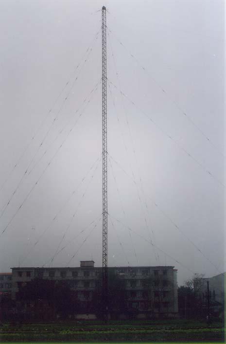
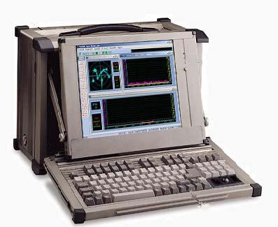
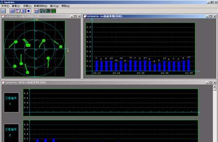
6 Ionosonde Antenna of Ionosonde Ionospheric scintillation monitor with GPS


7 2.2 Global Ionospheric Modeling A correction model Chinese Reference Ionosphere (CRI) is developed; Middle and low latitude theoretical Ionospheric model-theoretical Ionospheric Model of the Earth in Institute of Geology and Geophysics, Chinese Academy of Sciences (TIME-IGGCAS); Ionospheric TEC comparison between CRI,IRI and observations Ionospheric Electron Density by TIME-IGGCAS
 Performance comparison between the original model and the modified model")
8 Ionospheric Modeling for GNSS Based on CRI and NeQuick model, a modified model is under development to satisfying GNSS use Ionospheric Eclipse Factor Method for Single-frequency GNSS User Modified Klobuchar Model for China Regional GNSS Error distribution of the original model Error distribution of modified model (IRI) Performance comparison between the original model and the modified model for GNSS

![Ray Tracing through the ionosphere 600 12 500 10 400 8 Height[km] 300 6 200 4 100 2 Ionospheric long-term forecasting(fof2)](/docs-images/85/92554759/images/9-1.jpg "0-2000 -1500-1000 -500 0 500 1000 1500 Ground Distance [km] Ray tracing for ionospheric disturbances detection 0 Ionospheric")
9 2.3 Regional Ionospheric Model a) Ionospheric Physics Long-term trends of the ionosphere variations; Ionospheric disturbances studies; Characters of ionospheric scintillations in low-latitude area of China; Character of ionosphere in polar region. Ray Tracing through the ionosphere Height[km] Ionospheric long-term forecasting(fof2) Ground Distance [km] Ray tracing for ionospheric disturbances detection 0 Ionospheric scintillations

10 b) Regional precise Ionospheric correction models Spatial and temporal correlation studies conducted to look for a better way for ionospheric TEC map reconstruction and prediction. The presented TEC mapping system has been used for estimate the ionospheric TEC over China. Realization of a suitable regional ionospheric model for augmentation system. Ionospheric TEC mapping with Kriging technique Ionospheric TEC forecasting with autocorrelation method (Black: measured TEC; Red: Forecasted TEC; Blue: Error of forecasted TEC )

11 c) New technologies in the ionosphere detection CIT, Computerized Ionospheric Tomography, used for fine Ionospheric parameters reconstruction. GNSS occultation for global Ionospheric weather research. CIT for GNSS Augmentation application. Ground based ionospheric tomography GNSS occultation in the global ionospheric NmF2 detection CIT for geomagnetic storm imaging
12 2.4 Ionospheric threat models for SBAS A Ionospheric threat model has been developed to overbound the ionospheric delay errors. Thus the performance of ionosphere related integrity is improved. 12 Vertical Ionosphere Decorrelation (China 17th Mar.09) x Residual Ionosphere Difference Probability (China, 17th Mar. 09) Residual Ionospehre Containment σ (China 17th Mar. 2009) Δ I (m) dist(km) probality of exceeding dion delta iono. delay between IPPs σ bound(m) % 95% 99% 99.9% distance between IPPs Research of Regional Ionospheric Characters in China


13 2.5 Ionospheric Disturbance Effects on GNSS Ionospheric scintillation monitoring and forecasting in low-latitude areas in China. Impacts analysis of ionospheric scintillation on the GNSS. Signal fading L1 C/No (db) L2 C/No (db) C/N0 fluctuating 75 m50 m25 m Ionosphere scintillation distribution over China. (made by CRIRP) Positioning error Tracking error S 4 Ionosphere scintillation impacts on GPS positioning
14 2.6 Improvements for GNSS in China Ionospheric scintillation model Studies are carried out on ionospheric scintillation model which could be used to current and shortterm forecasting in China sub-continent. Ionospheric models for GNSS Regional Augmentation system New single frequency correction algorithms Ionospheric threat models Detecting methods for ionospheric irregularity


15 2.7 Further Works Global Ionospheric Modernization Models optimization for GNSS Improvement of Ionospheric threat models for SBAS New technologies application in the SBAS Ionospheric correction modeling, for example, the Computerize Ionospheric Tomography, GNSS occultation, etc. Satellit e vox el Receiv er Multi-layer Ionospher e The Earth Computerize Ionospheric Tomography GNSS occultation
16 3. Summary Ionospheric is quite important for GNSS applications China has established an Ionosphere monitoring network and provide data for GNSS service The current monitoring network could be updated and expanded on demand China is open for the international cooperation in this area.
17 Thanks for your attention!
GPS TEC Measurements Utilized for Monitoring Recent Space Weather Events and Effects in Europe
 GPS TEC Measurements Utilized for Monitoring Recent Space Weather Events and Effects in Europe S. M. Stankov (1), N. Jakowski (2), B. Huck (3) (1) German Aerospace Center (DLR) Institute of Communications
Ionospheric Corrections for GNSS
 Ionospheric Corrections for GNSS The Atmosphere and its Effect on GNSS Systems 14 to 16 April 2008 Santiago, Chile Ing. Roland Lejeune Overview Ionospheric delay corrections Core constellations GPS GALILEO
Satellite Navigation Science and Technology for Africa. 23 March - 9 April, The African Ionosphere
 2025-28 Satellite Navigation Science and Technology for Africa 23 March - 9 April, 2009 The African Ionosphere Radicella Sandro Maria Abdus Salam Intern. Centre For Theoretical Physics Aeronomy and Radiopropagation
Introduction to International Space Weather Initiative (ISWI) and China's Participation (Meridian Project)
 and China's Participation (Meridian Project)") Introduction to International Space Weather Initiative (ISWI) and China's Participation (Meridian Project) Chi Wang National Space Science Center, CAS Nov. 7, 2012 Outline What is Space Weather? International
Introduction to International Space Weather Initiative (ISWI) and China's Participation (Meridian Project) Chi Wang National Space Science Center, CAS Nov. 7, 2012 Outline What is Space Weather? International
On the Importance of Radio Occultation data for Ionosphere Modeling
 On the Importance of Radio Occultation data for Ionosphere Modeling IROWG Workshop, Estes Park, March 30, 2012 ABSTRACT The availability of unprecedented amounts of Global Navigation Satellite Systems
Real-time ionosphere monitoring by three-dimensional tomography over Japan
 Real-time ionosphere monitoring by three-dimensional tomography over Japan 1* Susumu Saito, 2, Shota Suzuki, 2 Mamoru Yamamoto, 3 Chia-Hun Chen, and 4 Akinori Saito 1 Electronic Navigation Research Institute,
EFFECTS OF SCINTILLATIONS IN GNSS OPERATION
 - - EFFECTS OF SCINTILLATIONS IN GNSS OPERATION Y. Béniguel, J-P Adam IEEA, Courbevoie, France - 2 -. Introduction At altitudes above about 8 km, molecular and atomic constituents of the Earth s atmosphere
(CSES) Introduction for China Seismo- Electromagnetic Satellite
 Introduction for China Seismo- Electromagnetic Satellite") Introduction for China Seismo- Electromagnetic Satellite (CSES) Wang Lanwei Working Group of China Earthquake-related related Satellites Mission China Earthquake Administration Outline Project Objectives
Introduction for China Seismo- Electromagnetic Satellite (CSES) Wang Lanwei Working Group of China Earthquake-related related Satellites Mission China Earthquake Administration Outline Project Objectives
NAVIGATION SYSTEMS PANEL (NSP) NSP Working Group meetings. Impact of ionospheric effects on SBAS L1 operations. Montreal, Canada, October, 2006
 NSP Working Group meetings. Impact of ionospheric effects on SBAS L1 operations. Montreal, Canada, October, 2006") NAVIGATION SYSTEMS PANEL (NSP) NSP Working Group meetings Agenda Item 2b: Impact of ionospheric effects on SBAS L1 operations Montreal, Canada, October, 26 WORKING PAPER CHARACTERISATION OF IONOSPHERE
NAVIGATION SYSTEMS PANEL (NSP) NSP Working Group meetings Agenda Item 2b: Impact of ionospheric effects on SBAS L1 operations Montreal, Canada, October, 26 WORKING PAPER CHARACTERISATION OF IONOSPHERE
Preliminary results of ionosphere measurement from GNOS on China FY-3C satellite
 Preliminary results of ionosphere measurement from GNOS on China FY-3C satellite Guanglin Yang 1, Tian Mao 1, Lingfeng Sun 2, Xinan Yue 3, Weihua Bai 4 and Yueqiang Sun 4 1 National Satellite Meteorological
Activities of the JPL Ionosphere Group
 Activities of the JPL Ionosphere Group On-going GIM wor Submit rapid and final GIM TEC maps for IGS combined ionosphere products FAA WAAS & SBAS analysis Error bounds for Brazilian sector, increasing availability
Ionospheric Estimation using Extended Kriging for a low latitude SBAS
 Ionospheric Estimation using Extended Kriging for a low latitude SBAS Juan Blanch, odd Walter, Per Enge, Stanford University ABSRAC he ionosphere causes the most difficult error to mitigate in Satellite
Using GNSS Tracking Networks to Map Global Ionospheric Irregularities and Scintillation
 Using GNSS Tracking Networks to Map Global Ionospheric Irregularities and Scintillation Xiaoqing Pi Anthony J. Mannucci Larry Romans Yaoz Bar-Sever Jet Propulsion Laboratory, California Institute of Technology
Ionospheric Imprint to LOFAR
 Ionospheric Imprint to LOFAR Norbert Jakowski Institute of Communications und Navigation German Aerospace Center Kalkhorstweg 53, D-17235 Neustrelitz, Germany LOFAR Workshop, 8/9 November 2010, Potsdam,
Study of Ionospheric Perturbations during Strong Seismic Activity by Correlation Technique using NmF2 Data
 Research Journal of Recent Sciences Res.J.Recent Sci. Study of Ionospheric Perturbations during Strong Seismic Activity by Correlation Technique using NmF2 Data Abstract Gwal A.K., Jain Santosh, Panda
Operational Products of the Space Weather Application Center Ionosphere (SWACI) and capabilities of their use
 and capabilities of their use") Operational Products of the Space Weather Application Center Ionosphere (SWACI) and capabilities of their use N. Jakowski, C. Borries, V. Wilken, K.D. Missling, H. Barkmann, M. M. Hoque, M. Tegler, C.
Operational Products of the Space Weather Application Center Ionosphere (SWACI) and capabilities of their use N. Jakowski, C. Borries, V. Wilken, K.D. Missling, H. Barkmann, M. M. Hoque, M. Tegler, C.
Monitoring the polar cap/ auroral ionosphere: Industrial applications. P. T. Jayachandran Physics Department University of New Brunswick Fredericton
 Monitoring the polar cap/ auroral ionosphere: Industrial applications P. T. Jayachandran Physics Department University of New Brunswick Fredericton Outline Ionosphere and its effects on modern and old
Present and future IGS Ionospheric products
 Present and future IGS Ionospheric products Andrzej Krankowski, Manuel Hernández-Pajares, Joachim Feltens, Attila Komjathy, Stefan Schaer, Alberto García-Rigo, Pawel Wielgosz Outline Introduction IGS IONO
Study of small scale plasma irregularities. Đorđe Stevanović
 Study of small scale plasma irregularities in the ionosphere Đorđe Stevanović Overview 1. Global Navigation Satellite Systems 2. Space weather 3. Ionosphere and its effects 4. Case study a. Instruments
Outline. GPS RO Overview. COSMIC Overview. COSMIC-2 Overview. Summary 9/29/16
 Bill Schreiner and UCAR/COSMIC Team UCAR COSMIC Program Observation and Analysis Opportunities Collaborating with the ICON and GOLD Missions Sept 27, 216 GPS RO Overview Outline COSMIC Overview COSMIC-2
Weathering the Storm GNSS and the Solar Maximum Next Generation GNSS Ionospheric Scintillation and TEC Monitoring
 Weathering the Storm GNSS and the Solar Maximum Next Generation GNSS Ionospheric Scintillation and TEC Monitoring NovAtel White Paper March 2012 Overview This paper addresses the concerns caused by the
Fast convergence of Trimble CenterPoint RTX by regional augmentation
 Fast convergence of Trimble CenterPoint RTX by regional augmentation Dr. Ralf Drescher Trimble Terrasat GmbH, Munich EGU General Assembly 2015, Vienna Thursday, 16 April 2015 Outline Introduction CenterPoint
Ionospheric Range Error Correction Models
 www.dlr.de Folie 1 >Ionospheric Range Error Correction Models> N. Jakowski and M.M. Hoque 27/06/2012 Ionospheric Range Error Correction Models N. Jakowski and M.M. Hoque Institute of Communications and
Polar Ionospheric Imaging at Storm Time
 Ms Ping Yin and Dr Cathryn Mitchell Department of Electronic and Electrical Engineering University of Bath BA2 7AY UNITED KINGDOM p.yin@bath.ac.uk / eescnm@bath.ac.uk Dr Gary Bust ARL University of Texas
Ionospheric Effects on Aviation
 Ionospheric Effects on Aviation Recent experience in the observation and research of ionospheric irregularities, gradient anomalies, depletion walls, etc. in USA and Europe Stan Stankov, René Warnant,
4 Space plasma effects on Earth-space and satellite-to-satellite communications: Working Group 4 overview
 ANNALS OF GEOPHYSICS, SUPPLEMENT TO VOL. 47, N. 2/3, 2004 4 Space plasma effects on Earth-space and satellite-to-satellite communications: Working Group 4 overview SANDRO M. RADICELLA ( 1 ) and ERSIN TULUNAY
KSWC Action for Observation and Research of Ionosphere
 KSWC Action for Observation and Research of Ionosphere Contents 1. KSWC Overview 2. Operating System for Ionosphere Observation 3. Tailored Model 4. Future Plan KSWC Overview RRA started to observe ionosphere
Space weather Application Center Ionosphere A Near-Real-Time Service Based on NTRIP Technology
 Space weather Application Center Ionosphere A Near-Real-Time Service Based on NTRIP Technology N. Jakowski, S. M. Stankov, D. Klaehn, C. Becker German Aerospace Center (DLR), Institute of Communications
Space Weather influence on satellite based navigation and precise positioning
 Space Weather influence on satellite based navigation and precise positioning R. Warnant, S. Lejeune, M. Bavier Royal Observatory of Belgium Avenue Circulaire, 3 B-1180 Brussels (Belgium) What this talk
Local ionospheric activity - nowcast and forecast services
 Solar Terrestrial Centre of Excellence Ionospheric research and development activities at the Royal of Belgium Local ionospheric activity - nowcast and forecast services S. Stankov, R. Warnant, K. Stegen,
Ionosphere Observability Using GNSS and LEO Platforms. Brian Breitsch Advisor: Dr. Jade Morton
 Ionosphere Observability Using GNSS and LEO Platforms Brian Breitsch Advisor: Dr. Jade Morton 1 Motivate ionosphere TEC observations Past work in ionosphere observability Observation volume Ground receivers
imaging of the ionosphere and its applications to radio propagation Fundamentals of tomographic Ionospheric Tomography I: Ionospheric Tomography I:
 Ionospheric Tomography I: Ionospheric Tomography I: Fundamentals of tomographic imaging of the ionosphere and its applications to radio propagation Summary Introduction to tomography Introduction to tomography
International GNSS Service Workshop 2017
 International GNSS Service Workshop 2017 The Recent Activities of CAS Ionosphere Analysis Center on GNSS Ionospheric Modeling within IGS CAS: Chinese Academy of Sciences Yunbin Yuan*, Zishen Li, Ningbo
Ionospheric Modeling for WADGPS at Northern Latitudes
 Ionospheric Modeling for WADGPS at Northern Latitudes Peter J. Stewart and Richard B. Langley Geodetic Research Laboratory, Department of Geodesy and Geomatics Engineering, University of New Brunswick,
Assessment of WAAS Correction Data in Eastern Canada
 Abstract Assessment of WAAS Correction Data in Eastern Canada Hyunho Rho and Richard B. Langley Geodetic Research Laboratory University of New Brunswick P.O. Box Fredericton, NB Canada, E3B 5A3 As part
EFFECTS OF IONOSPHERIC SMALL-SCALE STRUCTURES ON GNSS
 EFFECTS OF IONOSPHERIC SMALL-SCALE STRUCTURES ON GNSS G. Wautelet, S. Lejeune, R. Warnant Royal Meteorological Institute of Belgium, Avenue Circulaire 3 B-8 Brussels (Belgium) e-mail: gilles.wautelet@oma.be
Plasma effects on transionospheric propagation of radio waves II
 Plasma effects on transionospheric propagation of radio waves II R. Leitinger General remarks Reminder on (transionospheric) wave propagation Reminder of propagation effects GPS as a data source Some electron
The Significance of GNSS for Radio Science
 Space Weather Effects on the Wide Area Augmentation System (WAAS) The Significance of GNSS for Radio Science Patricia H. Doherty Vice Chair, Commission G International Union of Radio Science www.ursi.org
On improving the topside ionospheric modelling by selecting an optimal electron density profiler
 On improving the topside ionospheric modelling by selecting an optimal electron density profiler Tobias Verhulst Stan Stankov Solar-Terrestrial Centre of Excellence Royal Meteorological Institute of Belgium
Assessment of GNSS Ionospheric Scintillation and TEC Monitoring Using the Multi-constellation GPStation-6 Receiver
 Assessment of GNSS Ionospheric Scintillation and TEC Monitoring Using the Multi-constellation GPStation-6 Receiver Rod MacLeod Regional Manager Asia/Pacific NovAtel Australia Pty Ltd Outline Ionospheric
CDAAC Ionospheric Products
 CDAAC Ionospheric Products Stig Syndergaard COSMIC Project Office COSMIC retreat, Oct 13 14, 5 COSMIC Ionospheric Measurements GPS receiver: { Total Electron Content (TEC) to all GPS satellites in view
Monitoring the 3 Dimensional Ionospheric Electron Distribution based on GPS Measurements
 Monitoring the 3 Dimensional Ionospheric Electron Distribution based on GPS Measurements Stefan Schlüter 1, Claudia Stolle 2, Norbert Jakowski 1, and Christoph Jacobi 2 1 DLR Institute of Communications
THE USE OF GPS/MET DATA FOR IONOSPHERIC STUDIES
 THE USE OF GPS/MET DATA FOR IONOSPHERIC STUDIES Christian Rocken GPS/MET Program Office University Corporation for Atmospheric Research Boulder, CO 80301 phone: (303) 497 8012, fax: (303) 449 7857, e-mail:
Ionogram inversion F1-layer treatment effect in raytracing
 ANNALS OF GEOPHYSICS, VOL. 48, N. 3, June 2005 Ionogram inversion F1-layer treatment effect in raytracing Gloria Miró Amarante ( 1 ), Man-Lian Zhang ( 2 ) and Sandro M. Radicella ( 1 ) ( 1 ) The Abdus
Sub-Mesoscale Imaging of the Ionosphere with SMAP
 Sub-Mesoscale Imaging of the Ionosphere with SMAP Tony Freeman Xiaoqing Pi Xiaoyan Zhou CEOS Workshop, ASF, Fairbanks, Alaska, December 2009 1 Soil Moisture Active-Passive (SMAP) Overview Baseline Mission
Assessment of Nominal Ionosphere Spatial Decorrelation for LAAS
 Assessment of Nominal Ionosphere Spatial Decorrelation for LAAS Jiyun Lee, Sam Pullen, Seebany Datta-Barua, and Per Enge Stanford University, Stanford, California 9-8 Abstract The Local Area Augmentation
APPLICATION OF SMALL SATELLITES FOR HIGH PRECISION MEASURING EFFECTS OF RADIO WAVE PROPAGATION
 APPLICATION OF SMALL SATELLITES FOR HIGH PRECISION MEASURING EFFECTS OF RADIO WAVE PROPAGATION K. Igarashi 1, N.A. Armand 2, A.G. Pavelyev 2, Ch. Reigber 3, J. Wickert 3, K. Hocke 1, G. Beyerle 3, S.S.
Recent progress of NICT ionospheric observations in Japan
 Recent progress of NICT ionospheric observations in Japan T. Tsugawa, M. Nishioka, H. Kato, H. Jin, and M. Ishii National Institute of Information and Communications Technology (NICT), Japan NICT ionospheric
SWIPPA Products COMMENTS
 PRODUCT SWIPPA-DLR-CNF-PRO-DAT-TEC SWIPPA-DLR-RST-PRO-MAP-TEC COMMENTS TEC : Total Electron Content Vertical Source: GNSS measurements; SWIPPA-DLR-CNF-PRO-DAT-TMP SWIPPA-DLR-RST-PRO-MAP-TMP TEC-TMP : Total
2 nd ICAO/UNOOSA Symposium, March 2016, Abu Dhabi, UAE. Space Weather. Sharafat Gadimova Office for Outer Space Affairs
 2 nd ICAO/UNOOSA Symposium, 15 17 March 2016, Abu Dhabi, UAE Space Weather Sharafat Gadimova Office for Outer Space Affairs Science, Capacity Building and Outreach 2004: Session of the Committee on the
Space Weather as a Global Challenge
 Space Weather as a Global Challenge IMPC DLR Neustrelitz and Expert Service Centre Ionospheric Weather (I-ESC) Dr. Juergen Drescher DLR Washington Office German Aerospace Center jd@dlr.org German Aerospace
Storms in Earth s ionosphere
 Storms in Earth s ionosphere Archana Bhattacharyya Indian Institute of Geomagnetism IISF 2017, WSE Conclave; Anna University, Chennai Earth s Ionosphere Ionosphere is the region of the atmosphere in which
Imaging of the equatorial ionosphere
 ANNALS OF GEOPHYSICS, VOL. 48, N. 3, June 2005 Imaging of the equatorial ionosphere Massimo Materassi ( 1 ) and Cathryn N. Mitchell ( 2 ) ( 1 ) Istituto dei Sistemi Complessi, CNR, Sesto Fiorentino (FI),
Topside Ionospheric Model Based On the Electron Density Profile Data of Cosmic Mission
 Topside Ionospheric Model Based On the Electron Density Profile Data of Cosmic Mission PING Jingsong, SHI Xian, GUO Peng, YAN Haojian Shanghai Astronomical Observatory, Chinese Academy of Sciences, Nandan
MEETING OF THE METEOROLOGY PANEL (METP) METEOROLOGICAL INFORMATION AND SERVICE DEVELOPMENT WORKING GROUP (WG-MISD)
 METEOROLOGICAL INFORMATION AND SERVICE DEVELOPMENT WORKING GROUP (WG-MISD)") METP-WG/MISD/1-IP/09 12/11/15 MEETING OF THE METEOROLOGY PANEL (METP) METEOROLOGICAL INFORMATION AND SERVICE DEVELOPMENT WORKING GROUP (WG-MISD) FIRST MEETING Washington DC, United States, 16 to 19 November
METP-WG/MISD/1-IP/09 12/11/15 MEETING OF THE METEOROLOGY PANEL (METP) METEOROLOGICAL INFORMATION AND SERVICE DEVELOPMENT WORKING GROUP (WG-MISD) FIRST MEETING Washington DC, United States, 16 to 19 November
Satellite Navigation Science and Technology for Africa. 23 March - 9 April, Air Navigation Applications (SBAS, GBAS, RAIM)
") 2025-25 Satellite Navigation Science and Technology for Africa 23 March - 9 April, 2009 Air Navigation Applications (SBAS, GBAS, RAIM) Walter Todd Stanford University Department of Applied Physics CA 94305-4090
2025-25 Satellite Navigation Science and Technology for Africa 23 March - 9 April, 2009 Air Navigation Applications (SBAS, GBAS, RAIM) Walter Todd Stanford University Department of Applied Physics CA 94305-4090
IDA3D: An Ionospheric Data Assimilative Three Dimensional Tomography Processor
 IDA3D: An Ionospheric Data Assimilative Three Dimensional Tomography Processor Dr. Gary S. Bust Applied Research Laboratories, The University of Texas at Austin 10000 Burnet Austin Texas 78758 phone: 512-835-3623
Study of the Ionosphere Irregularities Caused by Space Weather Activity on the Base of GNSS Measurements
 Study of the Ionosphere Irregularities Caused by Space Weather Activity on the Base of GNSS Measurements Iu. Cherniak 1, I. Zakharenkova 1,2, A. Krankowski 1 1 Space Radio Research Center,, University
An Investigation of Local-Scale Spatial Gradient of Ionospheric Delay Using the Nation-Wide GPS Network Data in Japan
 An Investigation of Local-Scale Spatial Gradient of Ionospheric Delay Using the Nation-Wide GPS Network Data in Japan Takayuki Yoshihara, Takeyasu Sakai and Naoki Fujii, Electronic Navigation Research
Effects of magnetic storms on GPS signals
 Effects of magnetic storms on GPS signals Andreja Sušnik Supervisor: doc.dr. Biagio Forte Outline 1. Background - GPS system - Ionosphere 2. Ionospheric Scintillations 3. Experimental data 4. Conclusions
CONVERGENCE TIME IMPROVEMENT OF PRECISE POINT POSITIONING
 CONVERGENCE TIME IMPROVEMENT OF PRECISE POINT POSITIONING Mohamed Elsobeiey and Ahmed El-Rabbany Department of Civil Engineering (Geomatics Option) Ryerson University, CANADA Outline Introduction Impact
Ionospheric sounding at the RMI Geophysical Centre in Dourbes: digital ionosonde performance and ionospheric monitoring service applications
 Solar Terrestrial Centre of Excellence Ionospheric sounding at the RMI Geophysical Centre in Dourbes: digital ionosonde performance and ionospheric monitoring service applications S. Stankov, T. Verhulst,
3D electron density estimation in the ionosphere by using IRI-Plas model and GPS-TEC measurements
 3D electron density estimation in the ionosphere by using IRI-Plas model and GPS-TEC measurements HAKAN TUNA, ORHAN ARIKAN, FEZA ARIKAN Bilkent University, Ankara, Turkey htuna@bilkent.edu.tr, oarikan@ee.bilkent.edu.tr
Propagation for Space Applications
 Propagation for Space Applications by Bertram Arbesser-Rastburg Chairman ITU-R SG3 Invited talk at LAPC 2014, Loughborough, UK bertram@arbesser.org Abstract:The presentation covers the key propagation
Influence of Major Geomagnetic Storms Occurred in the Year 2011 On TEC Over Bangalore Station In India
 International Journal of Electronics and Communication Engineering. ISSN 0974-2166 Volume 6, Number 1 (2013), pp. 105-110 International Research Publication House http://www.irphouse.com Influence of Major
Determination of the correlation distance for spaced antennas on multipath HF links and implications for design of SIMO and MIMO systems.
 Determination of the correlation distance for spaced antennas on multipath HF links and implications for design of SIMO and MIMO systems. Hal J. Strangeways, School of Electronic and Electrical Engineering,
The Role of Ground-Based Observations in M-I I Coupling Research. John Foster MIT Haystack Observatory
 The Role of Ground-Based Observations in M-I I Coupling Research John Foster MIT Haystack Observatory CEDAR/GEM Student Workshop Outline Some Definitions: Magnetosphere, etc. Space Weather Ionospheric
A study of the ionospheric effect on GBAS (Ground-Based Augmentation System) using the nation-wide GPS network data in Japan
 using the nation-wide GPS network data in Japan") A study of the ionospheric effect on GBAS (Ground-Based Augmentation System) using the nation-wide GPS network data in Japan Takayuki Yoshihara, Electronic Navigation Research Institute (ENRI) Naoki Fujii,
A study of the ionospheric effect on GBAS (Ground-Based Augmentation System) using the nation-wide GPS network data in Japan Takayuki Yoshihara, Electronic Navigation Research Institute (ENRI) Naoki Fujii,
The Wide Area Augmentation System
 The Wide Area Augmentation System Stanford University http://waas.stanford.edu What is Augmentation? 2 Add to GNSS to Enhance Service Improve integrity via real time monitoring Improve availability and
An Investigation into the Relationship between Ionospheric Scintillation and Loss of Lock in GNSS Receivers
 Ionospheric Scintillation and Loss of Lock in GNSS Receivers Robert W. Meggs, Cathryn N. Mitchell and Andrew M. Smith Department of Electronic and Electrical Engineering University of Bath Claverton Down
Developing systems for ionospheric data assimilation
 Developing systems for ionospheric data assimilation Making a quantitative comparison between observations and models A.C. Bushell, 5 th European Space Weather Week, Brussels, 20 th November 2008 Collaborators
The GPS measured SITEC caused by the very intense solar flare on July 14, 2000
 Advances in Space Research 36 (2005) 2465 2469 www.elsevier.com/locate/asr The GPS measured SITEC caused by the very intense solar flare on July 14, 2000 Weixing Wan a, *, Libo Liu a, Hong Yuan b, Baiqi
[EN-107] Impact of the low latitude ionosphere disturbances on GNSS studied with a three-dimensional ionosphere model
![[EN-107] Impact of the low latitude ionosphere disturbances on GNSS studied with a three-dimensional ionosphere model](/thumbs/86/93972301.jpg "[EN-107] Impact of the low latitude ionosphere disturbances on GNSS studied with a three-dimensional ionosphere model") ENRI Int. Workshop on ATM/CNS. Tokyo, Japan (EIWAC21) [EN-17] Impact of the low latitude ionosphere disturbances on GNSS studied with a three-dimensional ionosphere model + S. Saito N. FUjii Communication
ENRI Int. Workshop on ATM/CNS. Tokyo, Japan (EIWAC21) [EN-17] Impact of the low latitude ionosphere disturbances on GNSS studied with a three-dimensional ionosphere model + S. Saito N. FUjii Communication
Integrity of Satellite Navigation in the Arctic
 Integrity of Satellite Navigation in the Arctic TODD WALTER & TYLER REID STANFORD UNIVERSITY APRIL 2018 Satellite Based Augmentation Systems (SBAS) in 2018 2 SBAS Networks in 2021? 3 What is Meant by Integrity?
GINESTRA MIMOSA - MEDSTEC COMPETENCE SURVEYS WITHIN THE ESA ALCANTARA INITIATIVES
 GINESTRA MIMOSA - MEDSTEC COMPETENCE SURVEYS WITHIN THE ESA ALCANTARA INITIATIVES Lucilla Alfonsi, Gabriella Povero, Julian Rose TENTH EUROPEAN SPACE WEATHER WEEK. Antwerp, 19 th November 2013 WHAT? MImOSA
How GNSS and Beacon receivers can be used to monitor auroral ionosphere and space weather?
 How GNSS and Beacon receivers can be used to monitor auroral ionosphere and space weather? Kirsti Kauristie, Finnish Meteorological Institute Special Thanks: J. Norberg (FMI), A. Aikio and T. Nygren (University
Development of a GAST-D ground subsystem prototype and its performance evaluation with a long term-data set
 Development of a GAST-D ground subsystem prototype and its performance evaluation with a long term-data set T. Yoshihara, S. Saito, A. Kezuka, K. Hoshinoo, S. Fukushima, and S. Saitoh Electronic Navigation
Broadcast Ionospheric Model Accuracy and the Effect of Neglecting Ionospheric Effects on C/A Code Measurements on a 500 km Baseline
 Broadcast Ionospheric Model Accuracy and the Effect of Neglecting Ionospheric Effects on C/A Code Measurements on a 500 km Baseline Intro By David MacDonald Waypoint Consulting May 2002 The ionosphere
Natural Disaster Prediction NADIP 2005
 1 Natural Disaster Prediction NADIP 2005 Earthquake Early Warning System Principle Summary Tel Aviv: 19 June, 2006 2 Content Introduction Earthquake Hazards The Infra-Sonic Phenomena in Earthquakes Infrasonic
Report of the Working Group B: Enhancement of Global Navigation Satellite Systems (GNSS) Services Performance
 Services Performance") Report of the Working Group B: Enhancement of Global Navigation Satellite Systems (GNSS) Services Performance 1. The Working Group on Enhancement of Global Navigation Satellite Systems (GNSS) Service Performance
Report of the Working Group B: Enhancement of Global Navigation Satellite Systems (GNSS) Services Performance 1. The Working Group on Enhancement of Global Navigation Satellite Systems (GNSS) Service Performance
Detecting Ionospheric TEC Perturbations Generated by Natural Hazards Using a Real-Time Network of GPS Receivers
 Detecting Ionospheric TEC Perturbations Generated by Natural Hazards Using a Real-Time Network of GPS Receivers Attila Komjathy, Yu-Ming Yang, and Anthony J. Mannucci Jet Propulsion Laboratory California
Estimation Method of Ionospheric TEC Distribution using Single Frequency Measurements of GPS Signals
 Estimation Method of Ionospheric TEC Distribution using Single Frequency Measurements of GPS Signals Win Zaw Hein #, Yoshitaka Goto #, Yoshiya Kasahara # # Division of Electrical Engineering and Computer
April - 1 May, GNSS Derived TEC Data Calibration
 2333-44 Workshop on Science Applications of GNSS in Developing Countries (11-27 April), followed by the: Seminar on Development and Use of the Ionospheric NeQuick Model (30 April-1 May) 11 April - 1 May,
What is Space Weather? THE ACTIVE SUN
 Aardvark Roost AOC Space Weather in Southern Africa Hannes Coetzee 1 What is Space Weather? THE ACTIVE SUN 2 The Violant Sun 3 What is Space Weather? Solar eruptive events (solar flares, coronal Mass Space
Computerized ionospheric tomography analysis of the Combined Ionospheric Campaign
 Radio Science, Volume 36, Number 6, Pages 1599-1605, November-December 2001 Computerized ionospheric tomography analysis of the Combined Ionospheric Campaign G S Bust, D S Coco, and T L Gaussiran II Center
Present Status and Future Plan of Ionospheric Observation and Research in LAPAN
 Present Status and Future Plan of Ionospheric Observation and Research in LAPAN Buldan Muslim 1), Jiyo 1), Asnawi 1) and Dyah R.M. 1) 1) Space Science Center National Institute of Aeronautics and Space
Total Electron Content (TEC) and Model Validation at an Equatorial Region
 and Model Validation at an Equatorial Region") Total Electron Content (TEC) and Model Validation at an Equatorial Region NORSUZILA YA ACOB 1, MARDINA ABDULLAH 2,* MAHAMOD ISMAIL 2,* AND AZAMI ZAHARIM 3,** 1 Faculty of Electrical Engineering, Universiti
Total Electron Content (TEC) and Model Validation at an Equatorial Region NORSUZILA YA ACOB 1, MARDINA ABDULLAH 2,* MAHAMOD ISMAIL 2,* AND AZAMI ZAHARIM 3,** 1 Faculty of Electrical Engineering, Universiti
SSR Technology for Scalable Real-Time GNSS Applications
 SSR Technology for Scalable Real-Time GNSS Applications Gerhard Wübbena, Jannes Wübbena, Temmo Wübbena, Martin Schmitz Geo++ GmbH 30827 Garbsen, Germany www.geopp.de Abstract SSR Technology for scalable
Polar Ionospheric Imaging at Storm Time
 UNCLASSIFIED/UNLIMITED Polar Ionospheric Imaging at Storm Time Ms Ping Yin and Dr Cathryn Mitchell Department of Electronic and Electrical Engineering University of Bath BA2 7AY UNITED KINGDOM p.yin@bath.ac.uk
Satellite Navigation Science and Technology for Africa. 23 March - 9 April, Scintillation Impacts on GPS
 2025-29 Satellite Navigation Science and Technology for Africa 23 March - 9 April, 2009 Scintillation Impacts on GPS Groves Keith Air Force Research Lab. Hanscom MA 01731 U.S.A. Scintillation Impacts on
Space weather: A research grand challenge. Professor Jøran Moen (GCI-Cusp project scientist)
") Space weather: A research grand challenge Professor Jøran Moen (GCI-Cusp project scientist) Birkeland Space Weather Symposium 15 JUNE 2017 Outline: Space weather phenomena in cusp Research Grand Challenges
Space weather: A research grand challenge Professor Jøran Moen (GCI-Cusp project scientist) Birkeland Space Weather Symposium 15 JUNE 2017 Outline: Space weather phenomena in cusp Research Grand Challenges
The ionosphere weather service SWACI and its capability for estimating propagation effects of transionospheric radio signals
 The ionosphere weather service SWACI and its capability or estimating propagation eects o transionospheric radio signals Norbert Jakowski Institute o Communications und Navigation German Aerospace Center
Microsatellite Ionospheric Network in Orbit
 Changing the economics of space Microsatellite Ionospheric Network in Orbit Dr Stuart Eves Lead Mission Concepts Engineer SSTL s.eves@sstl.co.uk In tribute to Mino Freund 1962-2012 Introduction Objective
analysis of GPS total electron content Empirical orthogonal function (EOF) storm response 2016 NEROC Symposium M. Ruohoniemi (3)
 storm response 2016 NEROC Symposium M. Ruohoniemi (3)") Empirical orthogonal function (EOF) analysis of GPS total electron content storm response E. G. Thomas (1), A. J. Coster (2), S.-R. Zhang (2), R. M. McGranaghan (1), S. G. Shepherd (1), J. B. H. Baker
Empirical orthogonal function (EOF) analysis of GPS total electron content storm response E. G. Thomas (1), A. J. Coster (2), S.-R. Zhang (2), R. M. McGranaghan (1), S. G. Shepherd (1), J. B. H. Baker
Modeling of Ionospheric Refraction of UHF Radar Signals at High Latitudes
 Modeling of Ionospheric Refraction of UHF Radar Signals at High Latitudes Brenton Watkins Geophysical Institute University of Alaska Fairbanks USA watkins@gi.alaska.edu Sergei Maurits and Anton Kulchitsky
Radio tomography based on satellite beacon experiment and FORMOSAT- 3/COSMIC radio occultation
 Radio tomography based on satellite beacon experiment and FORMOSAT- 3/COSMIC radio occultation Mamoru Yamamoto (1), Smitha V. Thampi (2), Charles Lin (3) (1) RISH, Kyoto University, Japan (2) Space Physics
Spatial and Temporal Variations of GPS-Derived TEC over Malaysia from 2003 to 2009
 Spatial and Temporal Variations of GPS-Derived TEC over Malaysia from 2003 to 2009 Leong, S. K., Musa, T. A. & Abdullah, K. A. UTM-GNSS & Geodynamics Research Group, Infocomm Research Alliance, Faculty
Real-time Water Vapor and TEC calculation using existing GNSS reference station infrastructure. Rana Charara Trimble Infrastructure
 Real-time Water Vapor and TEC calculation using existing GNSS reference station infrastructure Rana Charara Trimble Infrastructure GNSS Netwoks International GNSS Network and Meteorological Products IGS
Study of GPS Scintillation during Solar Maximum at Malaysia
 1 st International Conference of Recent Trends in Information and Communication Technologies Study of GPS Scintillation during Solar Maximum at Malaysia Emad Fathi Aon 1,2*, Redhwan Qasem Shaddad 3,4,Abdul
Space Weather and the Ionosphere
 Dynamic Positioning Conference October 17-18, 2000 Sensors Space Weather and the Ionosphere Grant Marshall Trimble Navigation, Inc. Note: Use the Page Down key to view this presentation correctly Space