CHILEAN SEA LEVEL NETWORK
|
|
|
- Ashlyn Norman
- 5 years ago
- Views:
Transcription

1 5 th IHO TIDAL AND WATER LEVEL WORKING GROUP MEETING MAY 2013, HELSINKI, FINLAND CHILEAN SEA LEVEL NETWORK Juan Fierro C.
2 Lecture Overview Tsunami, Offshore Maule, Chile Current State and ongoing upgrade Sea level station components Data transmission improvements Conclusions
3 Tsunami, Offshore Maule, Chile
4 Introduction At 3:34 local time, February 27 th, a devastating earthquake M 8.8 struck Chile The earthquake also triggered a tsunami which crossed into the Pacific Ocean Historic world earthquake after 1900 listed by magnitude Valdivia, Chile M Prince William Sound, Alaska M Sumatra Andaman Island M Kamchatka M Honshu, Japan M Offshore Maule, Chile M 8.8 Sea level stations contribute strongly as tsunami detection systems with potential warning time from minutes to hours, depending on proximity of source location


5


6 Chilean Sea Level Network Some damage I. DE PASCUA I. SAN FELIX ARICA IQUIQUE ANTOFAGASTA CALDERA COQUIMBO VALPARAISO I. JUAN FERNANDEZ SAN ANTONIO TALCAHUANO CORRAL PTO. MONTT ANCUD 20º 30º 40º PTO. CHACABUCO SAN PEDRO 50º PTA. ARENAS PTO. WILLIAMS 60ºS SELF CONTAINED PLATFORM SATELITE DIGITAL PLATFORM PTO. SOBERANÍA RADA COVADONGA Territorio ChilenoAntártico 105ºW 95º 85º 75º 65º 55º
7 Current State and Ongoing Upgrade


8 Chilean Sea Level Network Hardware Upgrade process Feb 27th 2010 Near Real Time Real Time A reinforced upgrade -Improving telemetry dry purged recording tide gauge Data collecting platforms -New platforms and sensors Mechanical devices Digital equipments


9 Chilean Sea Level Network Hardware Upgrade process March 2010 May 2013 Date 27th 2010 Dec 2010 Dec 2011 Dec 2012 May 2013 Satellite digital platform Autoself contained platform Total of Stations


10 Chilean Sea Level Stations Network Before 27 Feb 2010 Updated to May 2013 THANKS


11 Chilean Sea Level Stations Network 2 nd MEETING OF THE IHO TIDAL AND WATER LEVEL GROUP 38 Stations with real time transmission: APRIL 2010, STAVANGER, NORWAY Sampling interval: 1 minute Tx transmission: 1, 5, 10, 15, 60 min Sensor Standard configuration Sea Level Water Temperature Combined Air Temp and humidity Atmospheric pressure Current State at May 2013 THANKS 2 Self contained platforms: San Pedro Rada Covadonga
12 Sea Level Station Components

13 Tide Station for Tsunami Monitoring heavy-duty mast with extension arm QHR102 sea-level radar Two Configurations of Installation 2 SOLAR50 solar panel MAWS110 Automatic Weather Station with PMT16A barometer mast QMH102 combined temp.- humidity sensor UHFantenna GOES antenna BGAN antenna QMH102 combined temp.- humidity sensor MAWS110 Automatic Weather Station with GPRS 2 SOLAR50 solar panel QHR102 sea-level radar Tide staff (scale) Bench marks (option: pillar for GPS antenna) PR-36XW/H differential pressure sensor Sea Water Temperature Sea Water Temperature PR-36XW/H differential pressure sensor


14 Radar Water Level Sensor QHR104


15 Sea Level Station Components Mounting Configuration GOES/Internet Transmission SOLAR 50 panel Air Temp. and relative humidity Sensor DCP external enclosure UHF Antenna GOES Anntena DCP external enclosure QHR102 sea-level radar Submerged sensors cables Submerged sensors cables Pyramid of aluminum Masts of steel


16 Sea Level Station Components BGAN/GPRS Transmission Air Temp. and relative humidity Sensor Solar 50 Panel BGAN Antenna QHR102 sea-level radar DCP external enclosure Submerged sensors cables BGAN Antenna Thrane&Thrane 300 GPRS Modem Centurion 300


17 Satellite Systems: BGAN Terminal Thrane & Thrane Explorer 300 Hughes 9502 Power Consumption Transmit Mode 14 W Less than 20 W Weight 1.4 Kg 1.5 Kg Outdoor Enabled No Yes (antena) Minimum CDR 10 Kb 1 Kb Cost per conexion 100 Kb None Watchdog reset No Yes Yearly Transmission Cost per station 873 USD 2,185 USD


18 Gauge Contact Point (CP) The CP is a type of Benchmark, which must be connected to the TGBM. Is a vertical reference mark, associated with the gauge itself. Radar gauges Pressure gauges Contact Point
19 Experiences from Chile Telemetry systems
20 Primary Transmission Telemetry Satellites Systems

21 GOES BGAN SHOA DRGS Server 2 Main Server Server 3
22 GOES E Satellite GOES Satellite Telemetry DRGS SHOA DRGS Server 2 Server 3 Formatting Script ADC0D G43+0NN217EXE Main Server (S:ARI_GOES;D:180512;T:180751;WL-K:2101;WL-V:4019;TA:21.2;RH:068;TW:17.9;BP:1012.8;BAT:14.3;ROC_K:128;ROC_V:130) (S:ARI_GOES;D:180512;T:180651;WL-K:2339;WL-V:4229;TA:21.2;RH:068;TW:17.9;BP:1012.8;BAT:14.3; ROC_K:019;ROC_V:018) (S:ARI_GOES;D:180512;T:180551;WL-K:2143;WL-V:4024;TA:21.2;RH:068;TW:17.9;BP:1012.8;BAT:14.3; ROC_K:005;ROC_V:002) (S:ARI_GOES;D:180512;T:180451;WL-K:2251;WL-V:4183;TA:21.2;RH:068;TW:17.9;BP:1012.8;BAT:14.3; ROC_K:054;ROC_V:073) (S:ARI_GOES;D:180512;T:180351;WL-K:2263;WL-V:4100;TA:21.2;RH:068;TW:17.9;BP:1012.8;BAT:14.3; ROC_K:092;ROC_V:105)


23 Alternatives Paths: GOES Data Reception GOES E Satellite DRGS NOAA GTS GOES Satellite Tide Tools IOC Website
24 GOES BGAN SHOA DRGS Formatting Script SHOA Server 2 Main Server Server 3 ORACLE Server METMAN System
")
25 BGAN Satellite Telemetry GOES Satellite Main Server ORACLE Server SHOA (S:TAL_BGAN;D:180511;T:171520;WL-K:2101;WL-V:4010;ROC_K:021;ROC_V:068) (S:TAL_BGAN;D:180512;T:171620;WL-K:2156;WL-V:4173;ROC_K:045;ROC_V:050)
26 Secondary Transmission Telemetry Land Based Systems
27 GOES GPRS BGAN SHOA DRGS SHOA Server 2 Main Server Server 3
 (S:TAL_GPRS;D:180512;T:120451;WL-K:2339;WL-V:4229;TA:21.2;RH:068;TW:17.9;BP:1012.8;BAT:14.3; ROC_K:056;ROC_V:064) (S:TAL_GPRS;D:180512;T:120551;WL-K:2143;WL-V:4024;TA:21.")
28 Telemetría GPRS Main Server GOES Satellite (S:TAL_GPRS;D:180512;T:120351;WL-K:2101;WL-V:4019;TA:21.2;RH:068;TW:17.9;BP:1012.8;BAT:14.3; ROC_K:128;ROC_V:130) (S:TAL_GPRS;D:180512;T:120451;WL-K:2339;WL-V:4229;TA:21.2;RH:068;TW:17.9;BP:1012.8;BAT:14.3; ROC_K:056;ROC_V:064) (S:TAL_GPRS;D:180512;T:120551;WL-K:2143;WL-V:4024;TA:21.2;RH:068;TW:17.9;BP:1012.8;BAT:14.3; ROC_K:126;ROC_V:135) (S:TAL_GPRS;D:180512;T:120651;WL-K:2251;WL-V:4183;TA:21.2;RH:068;TW:17.9;BP:1012.8;BAT:14.3; ROC_K:143;ROC_V:139) (S:TAL_GPRS;D:180512;T:120751;WL-K:2263;WL-V:4100;TA:21.2;RH:068;TW:17.9;BP:1012.8;BAT:14.3; ROC_K:112;ROC_V:132)
29 GPRS GOES BGAN SHOA DRGS SHOA Server 2 Main Server Server 3


30 RADIO LINK GOES WAN Naval WAN Telemetry GPRS BGAN DTMR Server SHOA DRGS SHOA Server 2 Main Server Server 3 (S:TAL_WAN;D:180512;T:180651;WL-K:2101;WL-V:4019;TA:21.2;RH:068;TW:17.9;BP:1012.8;BAT:14.3;ROC_K:028;ROC_V:010) (S:TAL_WAN;D:180512;T:180751;WL-K:2339;WL-V:4229;TA:21.2;RH:068;TW:17.9;BP:1012.8;BAT:14.3;ROC_K:-122;ROC_V:120)

")
31 Naval WAN Telemetry WAN METMAN SERVER A GOES Satellite (S:TAL_GPRS;D:180512;T:180751;WL-K:2101;WL-V:4019;TA:21.2;RH:068;TW:17.9;BP:1012.8;BAT:14.3;ROC_K:028;ROC_V:010) (S:TAL_GPRS;D:180512;T:180651;WL-K:2339;WL-V:4229;TA:21.2;RH:068;TW:17.9;BP:1012.8;BAT:14.3;ROC_K:-122;ROC_V:120)


32 INMARSAT-BGAN SHOA Operational Data Collection BGAN Service Provider GOES BGAN Terminal Stations in new Places or upgraded Stations Installed before Feb 27th 2010 GOES Ground Station Secure Communication Using Secure navy VPN (backup) SHOA GPRS (backup)

33 Sea Level Register March 2011 Arica ARICA IQUIQUE 20º ANTOFAGASTA I. DE PASCUA I. SAN FELIX CALDERA COQUIMBO VALPARAISO I. JUAN FERNANDEZ SAN ANTONIO TALCAHUANO 30º San Felix CORRAL PTO. MONTT ANCUD PTO. CHACABUCO 40º SAN PEDRO 50º PTA. ARENAS PTO. WILLIAMS Coquimbo SELF CONTAINED PLATFORM SATELITE DIGITAL PLATFORM PTO. SOBERANÍA RADA COVADONGA Territorio ChilenoAntártico 60ºS Ancud 105ºW 95º 85º 75º 65º 55º

34
 GPRS data availability Average 100 % GOES data availability Average 98")
35 Blackout in Chile: Sept 24th :30 to 21:45 local time (23:30 to 00:45 UTC) GPRS data availability Average 100 % GOES data availability Average 98 %


36 Current GOES and Internet VPN Status


37 BGAN with DXE-421 and current GPRS Status


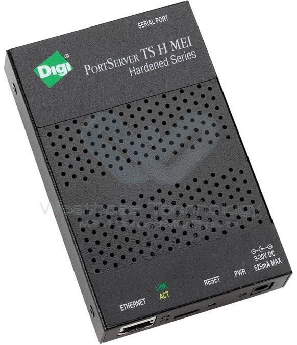

38 Current BGAN performance with Digi
 Radar")
39 Sea Level data (collected through BGAN) Radar Pressure
40 Conclusions Alternative systems for real time data transmission using several telemetry options (GOES, BGAN, GPRS and a Wide Area Network) has given powerful support to the National Tsunami Alarm System operation. Higher frecuency GOES transmision slots strengthens the capacity to monitor tsunamis in real time. VEGA radar sensor has demostrate high reliability in several sea conditions as a redundant sea level sensor (potencially primary sensor). Densification has improved the sea level data collecting network for operational and scientific purposes.
41 THANKS
Report to the Ninth Session of the IOC Group of Experts On the Global Sea Level Observing System (GLOSS) Chilean Sea Level Network: Current State
 Chilean Sea Level Network: Current State") Report to the Ninth Session of the IOC Group of Experts On the Global Sea Level Observing System (GLOSS) Chilean Sea Level Network: Current State Juan J. Fierro Servicio Hidrográfico y Oceanográfico de
Report to the Ninth Session of the IOC Group of Experts On the Global Sea Level Observing System (GLOSS) Chilean Sea Level Network: Current State Juan J. Fierro Servicio Hidrográfico y Oceanográfico de
INTRODUCTION. Personnel FUNDING. Personnel. Time Line. Budget. Tidal Stations and Bench Marks: Tools for spatial information managements
 Tidal Stations and Bench Marks: Tools for spatial information managements Linda L. VÉLEZV LEZ-RODRÍGUEZ, MS, PE, PLS Professor Civil Engineering and Land Surveying Department Univ. of Puerto Rico-Mayag
System development and performance of the Deep-ocean Assessment and Reporting of Tsunamis (DART) system from
 system from") ITS 2001 Proceedings, NHTMP Review Session, Paper R-24 317 System development and performance of the Deep-ocean Assessment and Reporting of Tsunamis (DART) system from 1997 2001 Christian Meinig, Marie
ITS 2001 Proceedings, NHTMP Review Session, Paper R-24 317 System development and performance of the Deep-ocean Assessment and Reporting of Tsunamis (DART) system from 1997 2001 Christian Meinig, Marie
Meeting 7 18 August 2015 Agenda Item 3.2.XV. MSI Self Assessment NAVAREA XV - Chile. Submitted by Chile SUMMARY
 WWNWS WWNWS7/3/2/XV Meeting 7 18 August 2015 Agenda Item 3.2.XV MSI Self Assessment NAVAREA XV - Chile Submitted by Chile SUMMARY Executive Summary: Overview of activities undertaken within NAVAREA XV
DATAMAR 2000 MICROWAVE (26 GHz) RADAR TIDE GAUGE
 RADAR TIDE GAUGE") DATAMAR 2000 MICROWAVE (26 GHz) RADAR TIDE GAUGE BATTERY POWERED COMPACT AND STAND ALONE TIDE GAUGE WITH MICROWAVE RADAR SENSOR (26 GHz) PROVIDING EXTREMELY HIGH PRECISION AND STABILITY Level measurements
DATAMAR 2000 MICROWAVE (26 GHz) RADAR TIDE GAUGE BATTERY POWERED COMPACT AND STAND ALONE TIDE GAUGE WITH MICROWAVE RADAR SENSOR (26 GHz) PROVIDING EXTREMELY HIGH PRECISION AND STABILITY Level measurements
2. Measurement Range / Further specifications of the LOG_aLevel system
 1. Introduction General Acoustics, e.k., founded in 1996, with its origins as an acoustics and sensors research and services partnership, is now a high-end technology producer of sophisticated water level
SOUTH AFRICAN NAVY HYDROGRAPHIC OFFICE
 SOUTH AFRICAN NAVY HYDROGRAPHIC OFFICE GLOSS National Report for South Africa 2009 Compiled by Ms Ruth Farre Superintendent Tidal Information 1. Introduction The South African coastline is approximately
GNSS (GPS) buoy array in the Pacific for natural disaster mitigation. Teruyuki KATO Earthquake Research Institute the University of Tokyo, Japan
 buoy array in the Pacific for natural disaster mitigation. Teruyuki KATO Earthquake Research Institute the University of Tokyo, Japan") GNSS (GPS) buoy array in the Pacific for natural disaster mitigation Teruyuki KATO Earthquake Research Institute the University of Tokyo, Japan 1 (Modified from Oki & Koketsu, 2011) Historical megaquakes
GNSS (GPS) buoy array in the Pacific for natural disaster mitigation Teruyuki KATO Earthquake Research Institute the University of Tokyo, Japan 1 (Modified from Oki & Koketsu, 2011) Historical megaquakes
WWNWS10/2/1-XV Meeting July 2018 Agenda Item 2.1. MSI Self Assessment NAVAREA XV - Chile. Submitted by Chile
 WWNWS WWNWS10/2/1-XV Meeting 10 27 July 2018 Agenda Item 2.1 MSI Self Assessment NAVAREA XV - Chile Submitted by Chile Executive Summary: Overview of activities undertaken within NAVAREA XV since WWNWS-9
Recent Developments in NOAA s Real- Time Coastal Observing Systems for Safe and Efficient Maritime Transportation
 Recent Developments in NOAA s Real- Time Coastal Observing Systems for Safe and Efficient Maritime Transportation Rich Edwing, Director NOAA Center for Operational Oceanographic Products and Services CMTS
Tsunami Detection System Nick Street, Project Engineer David Mould, Presenter.
 Tsunami Detection System Nick Street, Project Engineer David Mould, Presenter Agenda 1. Need for Tsunami Detection System 2. System Overview 3. Tsunami Detection System requirements 4. Seabed Unit - Tsunameter
Computers Watching Tsunamis DEEP- O C E A N A S S E S S M E N T A N D R E P O R T I N G ( D A R T I I )
") Computers Watching Tsunamis DEEP- O C E A N A S S E S S M E N T A N D R E P O R T I N G ( D A R T I I ) Origins of Tsunamis 1 Origins of Tsunamis 1 Energy density I(r) in terms of energy, E, and distance,
Computers Watching Tsunamis DEEP- O C E A N A S S E S S M E N T A N D R E P O R T I N G ( D A R T I I ) Origins of Tsunamis 1 Origins of Tsunamis 1 Energy density I(r) in terms of energy, E, and distance,
The U.S. West Coast and Alaska Tsunami Warning Center
 ITS 2001 Proceedings, NTHMP Review Session, Paper R-23 229 The U.S. West Coast and Alaska Tsunami Warning Center Thomas J. Sokolowski West Coast and Alaska Tsunami Warning Center, Palmer, Alaska, U.S.A.
ANNEX 7. Is it operational now? Yes X No
 ANNE 7 518 khz NAVTE service 1. Does your Administration operate NAVTE service on 518 khz? Yes No Is it operational now? Yes No 2. Indicate details of NAVTE stations.* NAV/MET Area Country NAVTE Coast
WWNWS6/3/2/XVI Meeting 6 30 July 2014 Agenda Item 3.2.XVI. MSI Self Assessment NAVAREA XVI. Submitted by
 WWNWS WWNWS6/3/2/XVI Meeting 6 30 July 2014 Agenda Item 3.2.XVI MSI Self Assessment NAVAREA XVI Submitted by PERÚ - DIRECTORATE OF HYDROGRAPHY AND NAVIGATION SUMMARY Executive Summary: THIS DOCUMENT REPORTS
This presentation uses concepts addressed by Stevens lectures, by SE books
 ARCHITECTURES Tsunami Warning System Manolo Omiciuolo Space System Engineer RUAG Space AG This presentation covers a personal elaboration of topics addressed during a post-grad certificate in Space System
WWNWS9/3/2/XVI/Rev.1 Meeting 9 22 August 2017 Agenda Item 3.2. MSI Self Assessment NAVAREA XVI. Submitted by
 WWNWS9 WWNWS9/3/2/XVI/Rev.1 Meeting 9 22 August 2017 Agenda Item 3.2 MSI Self Assessment NAVAREA XVI Submitted by PERÚ - DIRECTORATE OF HYDROGRAPHY AND NAVIGATION SUMMARY Executive Summary: Report of activities
HF RADAR DETECTS AN APPROACHING TSUNAMI WAVE ALREADY IN DEEP WATERS
 HF RADAR HF RADAR DETECTS AN APPROACHING TSUNAMI WAVE ALREADY IN DEEP WATERS Long-Lih Huang 1, Anna Dzvonkovskaya 2, Mal Heron 3 1 All-Star-Technology Co., Taipei, Taiwan 2 Helzel Messtechnik GmbH, Kaltenkirchen,
Riza Muhida. Presented at he 22nd Session of the Asia Pacific Regional Space Agency Forum (APRSAF 22), Bali, Indonesia, December 1 4, 2015
, Bali, Indonesia, December 1 4, 2015") Riza Muhida Presented at he 22nd Session of the Asia Pacific Regional Space Agency Forum (APRSAF 22), Bali, Indonesia, December 1 4, 2015 1 Presentation Outline Abstract Background Objective Project Scope
Riza Muhida Presented at he 22nd Session of the Asia Pacific Regional Space Agency Forum (APRSAF 22), Bali, Indonesia, December 1 4, 2015 1 Presentation Outline Abstract Background Objective Project Scope
Specifications for: OSOP Sixaola4-V4
 Specifications for: OSOP Sixaola4-V4 (Soon to be rebranded as the "Raspberry Shake Pro") - Seismograph, Accelerograph, Infrasound - Born on: 2012 (first versions in
AUTOMATIC WEATHER STATIONS FOR HYDRO-METEOROLOGY
 AUTOMATIC WEATHER STATIONS FOR HYDRO-METEOROLOGY METEODATA / HYDRODATA - 3000C SERIES 1/6 GENERAL DESCRIPTION METEODATA / HYDRODATA-3000C Automatic Meteorological and Hydrological Stations are measurement,
Experiences with Fugro's Real Time GPS/GLONASS Orbit/Clock Decimeter Level Precise Positioning System
 Return to Session Directory DYNAMIC POSITIONING CONFERENCE October 13-14, 2009 Sensors Experiences with Fugro's Real Time GPS/GLONASS Orbit/Clock Decimeter Level Precise Positioning System Ole Ørpen and
IPSTAR Disaster Recovery and Emergency Communications
 IPSTAR Disaster Recovery and Emergency Communications March 2009 COPYRIGHT THAICOM PLC 2009 PROPRIETARY Content Introduction 3 Advantages 4 Applications 5 Equipment 6-7 IPSTAR Enterprise Series IPSTAR
A Report On Tide Gauges In Singapore. 1 The Republic of Singapore is an island city-state situated at the southern tip of
 A Report On Tide Gauges In Singapore Introduction 1 The Republic of Singapore is an island city-state situated at the southern tip of Peninsula Malaysia, approximately 1 north of the equator. It consists
GNSS Reflectometry and Passive Radar at DLR
 ACES and FUTURE GNSS-Based EARTH OBSERVATION and NAVIGATION 26./27. May 2008, TU München Dr. Thomas Börner, Microwaves and Radar Institute, DLR Overview GNSS Reflectometry a joined proposal of DLR and
Meeting 10 8 August 2018 Agenda Item 2.1. MSI Self Assessment NAVAREA XVI. Submitted by PERÚ - DIRECTORATE OF HYDROGRAPHY AND NAVIGATION SUMMARY
 WWNWS10 WWNWS10/2/1-XVI Meeting 10 8 August 2018 Agenda Item 2.1 MSI Self Assessment NAVAREA XVI Submitted by PERÚ - DIRECTORATE OF HYDROGRAPHY AND NAVIGATION SUMMARY Executive Summary: Report of activities
Flow Monitoring Product Guide
 Monitoring Product Guide 2100 Series Modules Velocity Profiling 4200 Series 3010 Transmitter 4501 Pump Station Monitor Advanced Products From Teledyne Isco Offering a wide range of flow instruments and
Marine Monitor (M ) A Low Cost Radar Solution for Monitoring Nearshore Marine Protected Areas
 A Low Cost Radar Solution for Monitoring Nearshore Marine Protected Areas") 2 Marine Monitor (M ) A Low Cost Radar Solution for Monitoring Nearshore Marine Protected Areas 1 Problem The number of Marine Protected Areas (MPAs) are increasing globally making it challenging to effectively
2 Marine Monitor (M ) A Low Cost Radar Solution for Monitoring Nearshore Marine Protected Areas 1 Problem The number of Marine Protected Areas (MPAs) are increasing globally making it challenging to effectively
AIS Training. AIS Technology in Digital Yacht Products Explained. Digital Yacht Ltd TEL
 AIS Training AIS Technology in Digital Yacht Products Explained Digital Yacht Ltd www.digitalyacht.co.uk TEL + 44 1179 554474 What is AIS? The Automatic Identification System (AIS) is the biggest advance
GMI 10. quick start manual
 GMI 10 quick start manual Introduction The GMI 10 allows you to quickly view important information about your boat provided by connected sensors. Connected sensors transmit data to the GMI 10 using NMEA
ULM-0.8/2.5 Ultrasonic Fuel Level Meter
 ULM-0.8/2.5 Ultrasonic Fuel Level Meter 1.Introduction 2.Application 3.Technical Characteristics 4.Installation diagram 5.. Connection to GPS 6. Notices 1. Introduction Ultrasonic liquid level gauge/meter
AUTOMATIC WEATHER AND HYDROLOGICAL STATIONS
 AUTOMATIC WEATHER AND HYDROLOGICAL STATIONS METEODATA/HYDRODATA-3000C SERIES Brochure nº 9722.0044 GEONICA, S.A. - Alejandro Rodríguez, nº 22-28039 Madrid - Spain Tel. +34 91 450 51 18 Fax +34 91 459 46
Ka by C-COM Satellite Systems Inc.
 Ka-66 The inetvu Ka-66 Drive-Away Antenna is a 66 cm auto-acquire satellite antenna system which can be mounted on the roof of a vehicle for direct broadband access over any configured satellite. The system
CHC MINING DEFORMATION MONITORING SOLUTION
 CHC MINING DEFORMATION MONITORING SOLUTION Safety is first in mining. CHC offers solutions designed to improve safety for personnel on the ground and in the cab with 24/7 precision positioning for automatic
ENAiKOON inmarsat-600
 -600 Inmarsat modem for worldwide satellite communication -600 enables communication between trackables and the back-end system through satellite communication. -600 was designed specifically for fleet
The Norwegian Tide Gauge Network : National report of Norway
 The Norwegian Tide Gauge Network : National report of Norway June 2017 Oda Roaldsdotter Ravndal 1 and Trine Abrahamsen 2 oda.roaldsdotter.ravndal@kartverket.no, trine.abrahamsen@kartverket.no Introduction
A Permanent GPS Array in Crete & the Cal/Val facility for satellite radar altimeters in Gavdos
 A Permanent GPS Array in Crete & the Cal/Val facility for satellite radar altimeters in Gavdos S. P. Mertikas Technical University f Crete EUREF 2007 Symposium, 6-96 9 June 2007, London, England Laboratory
3-DEMON MONITORING PLATFORM: EXAMPLES OF APPLICATIONS IN STRUCTURAL AND GEOTECHNICAL MONITORING PROJECTS
 3-DEMON MONITORING PLATFORM: EXAMPLES OF APPLICATIONS IN STRUCTURAL AND GEOTECHNICAL MONITORING PROJECTS Luca MANETTI, Daniele INAUDI and Branko GLISIC Smartec SA, Switzerland Abstract: The 3DeMoN (3-Dimentional
R40 Mk III AIS Base Station
 R40 Mk III AIS Base Station The new R40 Mk III AIS Base Station from Saab TransponderTech is a result of our on-going efforts to enhance all our products. The R40 Mk III is equipped with a new Base Station
The Earthscope Plate Boundary Observatory Logistics, Construction and Maintenance Challenges in Alaska. Max Enders Field Engineer
 The Earthscope Plate Boundary Observatory Logistics, Construction and Maintenance Challenges in Alaska Max Enders Field Engineer Mar 25 2010 Earthscope Plate Boundary Observatory Network - Alaska In the
Product Certificate Gealog Automatic Weather Station. Gealog Automatic Weather Station. Pic. 1: Applications of Gealog Automatic Weather Stations
 Pic. 1: Applications of s Page 1 of 17 General The monitoring of the earth s athmosphere is one of the most important tasks, especially at present, where the climate change causes worldwide problems by
DATACAR ADVANCED MULTILANE TRAFFIC MONITORING SYSTEM
 DATACAR Doc 9723 0030 ADVANCED MULTILANE TRAFFIC MONITORING SYSTEM Suitable both for permanent and temporary installations Non-Intrusive System Accurate detection, speed, counting and classifying traffic
Tide & Meteorological Data over AIS
 Tide & Meteorological Data over AIS E.F.Read (Ohmex Ltd) & W.S.Heaps (ABP Ltd) THSUK Hydro8 1 Background to AIS Most significant development since RADAR Positions and Timing from GPS network 12.5 Watt
National report of Finland
 National report of Finland Matti Ollikainen, Jorma Jokela, Markku Poutanen, Ruizhi Chen and Jaakko Mäkinen, Finnish Geodetic Institute, P.O.Box 15, 02431 Masala, Finland EUREF Symposium 2006, June 14-17,
De-recruitments In 2012
 VOS / p. 1 VOS Report for 2012 (Canada) a. Programme description: Category No. of ships at 31 Dec 2012 Recruitments in 2012 De-recruitments In 2012 Comments Selected Selected AWS VOSClim VOSClim AWS 51
AERINOS Profisens - Wireless IoT Platform
 Introduction AERINOS ProfiSens is a local area wireless IOT platform. It comprises wireless sensor nodes and a 3G Data Gateway. Using ProfiSens, you can deploy anywhere your private IOT network. The battery
Above All. The most sophisticated unit for tracking containers in real time for security and management.
 * The most sophisticated unit for tracking containers in real time for security and management. The French comedian Pierre Dac once said, To see into the distance, you simply need to get closer. That applies
Abstract. 1. Introduction
 IBP1572_09 REMOTE EROSION AND CORROSION MONITORING OF SUBSEA PIPELINES USING ACOUSTIC TELEMETRY AND WET-MATE CONNECTOR TECHNOLOGY Howard Painter 1, Stewart Barlow 2, Daniel Clarke 3, Dale Green 4 Copyright
Remote Monitoring of Environmental Sites using Solar Powered Wi-Fi Enabled Systems
 Remote Monitoring of Environmental Sites using Solar Powered Wi-Fi Enabled Systems Mark Landress, P.G. Project Navigator, Ltd 10497 Town & Country Way Suite 830 Houston, TX 77024 www.projectnavigator.com
Atomic Forecast Station with Moon Phase
 Atomic Forecast Station with Moon Phase For online video support: http://bit.ly/laxtechtalk Model: S84107 Instruction Manual DC: 080817 Welcome to the La Crosse Technology family! We hope you enjoy your
Installation Manual. Repeater QC0149. Version: Jan17 1.0
 Installation Manual Repeater QC0149 Manual Ref: QC0149 Version: Jan17 1.0 System Concept RF Transmitters connect to sensors or meters and send data to the infrastructure internet connected Gateway on site
Meeting 3 10 August 2011 Agenda Item 3.2. MSI Self Assessment NAVAREA X. Submitted by Australia SUMMARY
 WWNWS WWNWS3/3/2-X Meeting 3 10 August 2011 Agenda Item 3.2 MSI Self Assessment NAVAREA X Submitted by Australia SUMMARY Executive Summary: Annual report of NAVAREA X MSI activities for the period July
Use of Satellite Remote Sensing in Tsunami Damage Assessment
 Japan-Peru Workshop on Earthquake Disaster Mitigation, Lima 2005 Use of Satellite Remote Sensing in Tsunami Damage Assessment August 10, 2005 Fumio Yamazaki Chiba University, Chiba, Japan 1 World Tsunami
The IEODO THEFIRSTRESULTS OFANALYSINGGPS OBSERVATIONS AT IEODO OCEAN RESEARCH STATION IN KOREA
 THEFIRSTRESULTS OFANALYSINGGPS OBSERVATIONS AT IEODO OCEAN RESEARCH BYUNGMOON PARK STATION IN KOREA DEPARTMENT OF GEOINFORMATICS, UNIVERSITY OF SEOUL, KOREA DR. TAJUL ARIFFIN MUSA GNSS & GEODYNAMICS RESEARCH
Monitoring Lecture ETH Zürich, Michael Rutschmann
 Monitoring Lecture 5.11.2008 ETH Zürich, Michael Rutschmann Monitoring lecture Contents 1. Monitoring System Intro 2. Different Setup of Monitoring Systems 3. GeoMoS (Monitor and Analyzer) 4. Setup of
Drive-by DTM. and Navigation at our university in cooperation
 Drive-by DTM GPS and GSM/GPRS Power Cost-Effective Terrain Modeling A data teletransmission system for quick and efficient creation of digital terrain models (DTMs) forms the backbone of experimental work
Vaisala DigiCORA Sounding System
 Vaisala DigiCORA Sounding System Leading the world in BUFR messaging All you need to measure the upper air atmospheric profile The Vaisala DigiCORA Sounding System simplifies your daily synoptic observations
WaterLOG Product Guide
 WaterLOG Product Guide HYDROLOGICAL AND METEOROLOGICAL MEASUREMENTS D23-01 High Quality. High Accuracy. Long Lasting Products. We are a world leader in water measurement, providing equipment capable of
Accutech GP10. Wireless gauge pressure field unit
 Accutech GP10 Wireless gauge pressure field unit 1 The Accutech GP10 wireless gauge pressure field unit provides pressure data in a variety of ranges from 250 to 10000 PSIG. With its integrated and highly
Development of Tsunami early warning embedded system with GSM alert
 2 nd International Conference on Current Research Trends in Engineering and Technology 2018 IJSRSET Volume 4 Issue 5 Print ISSN: 2395-1990 Online ISSN : 2394-4099 Themed Section: Engineering and Technology
Myanmar Naval Hydrographic Centre. National Report for 13 th North Indian Ocean Hydrographic Commission Meeting
 Myanmar Naval Hydrographic Centre National Report for 13 th North Indian Ocean Hydrographic Commission Meeting Yangon, Myanmar 19 th 22 nd February 2013 CONTENT 1. Myanmar Naval Hydrographic Centre 2.
APPLICATIONS OF KINEMATIC GPS AT SHOM
 International Hydrographic Review, Monaco, LXXVI(1), March 1999 APPLICATIONS OF KINEMATIC GPS AT SHOM by Michel EVEN 1 Abstract The GPS in kinematic mode has now been in use at SHOM for several years in
DeltaV SIS Logic Solver
 DeltaV SIS Process Safety System Product Data Sheet September 2017 DeltaV SIS Logic Solver World s first smart SIS Logic Solver Integrated, yet separate from the control system Easy compliance with IEC
radar target generator RTG
 radar target generator RTG Rf target injection for primary radar The RTG (Radar Target Generator) is part of the RASS-S test equipment suite and is designed to generate primary radar returns. It can be
MP Series Radar Transmitter Installation & Operation Manual
 IOM MP Series Radar Transmitter Installation & Operation Manual MP Series Radar Transmitter Installation & Operation Manual CONTENTS I. HANDLING AND STORAGE... 1 Inspection and Handling Disposal and Recycling
Cobham SATCOM Marine. Chris Insall Manager, Commercial Programmes. Hamburg, 28 th Feb Digital Ship Hamburg - 28 February 2013
 Digital Ship Hamburg - 28 February 2013 The most important thing we build is trust AEROSPACE AND SECURITY DIVISION Aerospace Communications Antenna Systems Commercial Systems SATCOM Tactical Communications
New Approach for Tsunami Detection Based on RTK-GNSS Using Network of Ships
 New Approach for Tsunami Detection Based on RTK-GNSS Using Network of Ships Tokyo University of Marine Science and Technology Ryuta Nakaosone Nobuaki Kubo Background After the Indian Ocean Tsunami on 2004,
FleetBroadband JUE-251. since the second generation JRC FB250 brings a whole new level of communication to the bridge
 JUE-251 FleetBroadband the second generation JRC FB250 brings a whole new level of communication to the bridge All-new antenna design Ready for all Inmarsat FB services Advanced integrated web interface
IG-2500 OPERATIONS GROUND CONTROL Updated Wednesday, October 02, 2002
 IG-2500 OPERATIONS GROUND CONTROL Updated Wednesday, October 02, 2002 CONVENTIONS USED IN THIS GUIDE These safety alert symbols are used to alert about hazards or hazardous situations that can result in
SLX-1 Multi-Application GNSS Receiver
 SLX-1 Multi-Application GNSS Receiver w w w.sa tla b g p s. c o m SLX-1 Multi-Application GNSS Receiver Designed for CORS Ready for Anything European Standards GPS GLONASS BEIDOU GALILEO SBAS QZSS Long
Maritime Satellite Communication Terminal. Inmarsat Certification No. 66JR01
 Maritime Satellite Communication Terminal Inmarsat Certification No. 66JR01 The Quality Leader in Maritime Communication High Performance and Quality With more than 25 years experience in developing Inmarsat
Wide Area Time distribution Via eloran. NASPI WG Meeting
 Wide Area Time distribution Via eloran NASPI WG Meeting March 22 2017 This work is supported through a Cooperative Research and Development Agreement (CRADA) with the Department of Homeland Security (DHS)
Brochure nº
 A U T O M A T I C W E A T H E R A N D H Y D R O L O G I C A L S T A T I O N S M E T E O D ATA / H Y D R O D ATA-3 0 0 0 C S E R I E S GEONICA, S.A. - Alejandro Rodríguez, nº 22-28039 Madrid - Spain Tel.
User Configurable POSITION 303 DATA OUTPUT 450 HEADING 910
 WinFrog Device Group: Device Name/Model: Device Manufacturer: Device Data String(s) Output to WinFrog: WinFrog Data String(s) Output to Device: WinFrog Data Item(s) and their RAW record: GPS TRACS TDMA
FLOWIZ ( M L ) Warranty conditions are available on this website: only in English version
 Warranty conditions are available on this website: only in English version") THE MOST ACCURATE BATTERY POWERED SYSTEM FLOWIZ ( M L 2 5 5 ) E l e c t r o m a g n e t i c c o n v e r t e r p o w e r e d b y b a t t e r i e s a n d u n i v e r s a l p o w e r s u p p l y. O p t i
THE MOST ACCURATE BATTERY POWERED SYSTEM FLOWIZ ( M L 2 5 5 ) E l e c t r o m a g n e t i c c o n v e r t e r p o w e r e d b y b a t t e r i e s a n d u n i v e r s a l p o w e r s u p p l y. O p t i
NanoTimeLapse 2015 Series
 NanoTimeLapse 2015 Series 18MP Time Lapse and Construction Photography Photograph your project with the stunning clarity of a Canon EOS Digital SLR camera Mobile Broadband equipped and ready to capture,
Marine Weather Program
 Marine Weather Program Shipping Federation of Canada Marine Workshop 2018 Montreal daniel.huang@canada.ca Meteorological Service of Canada Jan 31, 2018 ECCC is actively adapting its marine weather observing
STARTRAK PIGGING TECHNOLOGIES, INC. PIPELINE PIG MONITORING
 STARTRAK PIGGING TECHNOLOGIES, INC. Pathfinder magnetic pigs can now be monitored for all types of operations, world wide. Station Magnetometers - Statics for land service operations. Buoy systems - Offshore
WIRELESS INSULATOR POLLUTION MONITORING SYSTEM
 SYSTEM OVERVIEW Pollution monitoring of high voltage insulators in electrical power transmission and distribution systems, switchyards and substations is essential in order to minimise the risk of power
Using GSM/GPRS Technology For Generation Of Precise Digital Terrain Model (DTM)
") Using GSM/GPRS Technology For Generation Of Precise Digital Terrain Model (DTM) Adam Ciećko, Bartłomiej Oszczak, Stanisław Oszczak www.kgsin.pl Chair of Satellite Geodesy and Navigation, University of
Using GSM/GPRS Technology For Generation Of Precise Digital Terrain Model (DTM) Adam Ciećko, Bartłomiej Oszczak, Stanisław Oszczak www.kgsin.pl Chair of Satellite Geodesy and Navigation, University of
JOINT STOCK COMPANY. MULTICHANNEL RECEIVER RI-4010M (version RM ) User guide
 User guide") JOINT STOCK COMPANY MULTICHANNEL RECEIVER RI-4010M (version RM1-60619) User guide Safety requirements Before using the multichannel receiver RI-4010M read this user guide and follows safety requirements!
JOINT STOCK COMPANY MULTICHANNEL RECEIVER RI-4010M (version RM1-60619) User guide Safety requirements Before using the multichannel receiver RI-4010M read this user guide and follows safety requirements!
Installation Manual Multi Input Temperature Logger QC0163. Manual Ref: QC0163. Version: FEB17 1.0
 Installation Manual 3999-913-2252 Multi Input Temperature Logger QC0163 Manual Ref: QC0163 Version: FEB17 1.0 System Concept RF Transmitters connect to sensors or meters and send data to the infrastructure
SUN-T EcoSensor Wireless light & temperature sensor EcoSensor Low cost & small package New Product
 Wireless light & temperature New Product Temperature & Light Sensors powered by Beanair Low cost & small package Ultra-low Consumption No need of calibration IEEE 802.15.4 Wireless Stack Very easy to install
Development of Microsatellite to Detect Illegal Fishing MS-SAT
 Development of Microsatellite to Detect Illegal Fishing MS-SAT Ernest S. C. P. Bintang A.S.W.A.M. Department of Aerospace Engineering Faculty of Mechanical and Aerospace Engineering Institut Teknologi
Wireless Activity Sensors
 The Leader in Low-Cost, Remote Monitoring Solutions Wireless Activity Sensors General Description Monnit wireless activity sensors can be used in a host of applications where detecting vibration (sudden
3. GENERAL TIDAL DATUM COMPUTATION PROCEDURES
 3. GENERAL TIDAL DATUM COMPUTATION PROCEDURES 3.1 Datum Computation Procedures Overview A vertical datum is termed a tidal datum when it is defined by a certain phase of the tide. Tidal datums are local
MINIMUS MINIMUS+ SMART SEISMIC DIGITISER WITH ADVANCED DATA-PROCESSING CAPABILITY AND SOFTWARE COMMUNICATIONS
 MINIMUS MINIMUS+ SMART SEISMIC DIGITISER WITH ADVANCED DATA-PROCESSING CAPABILITY AND SOFTWARE COMMUNICATIONS KEY FEATURES > > Advanced software communications for quick and easy instrument and data management
GNSS buoy array in the ocean for natural hazard mitigation. Teruyuki KATO Earthquake Research Institute the University of Tokyo, Japan
 GNSS buoy array in the ocean for natural hazard mitigation Teruyuki KATO Earthquake Research Institute the University of Tokyo, Japan 1 GNSS applications in Earth science From static to high-rate observations
----STAR S86 GPS Receiver. User Guide. SOUTH CO., Ltd.
 ----STAR S86 GPS Receiver User Guide SOUTH CO., Ltd. www.southsurveying.com Sales@SOUTHsurveying.com 2 CONTENTS Chapter 1 Introduction... 1 STAR S86 GPS - System Summary... 1 Technical Specification...
EMWIN OVERVIEW. Outline
 EMWIN OVERVIEW Thursday, July 10, 2008 Santos Rodriguez NWS EMWIN 1 Outline EMWIN System Description Users of EMWIN EMWIN and the GOES-N Satellite Generation EMWIN and the GOES-R Satellite Generation Project
An automatic weather station (AWS) is defined as a meteorological station at which observations are made and transmitted automatically (WMO, 1992).
 is defined as a meteorological station at which observations are made and transmitted automatically (WMO, 1992).") CHAPTER 1. MEASUREMENTS AT AUTOMATIC WEATHER STATIONS 1 SECTION: Table_of_Contents_Chapter Chapter title in running head: CHAPTER 1. MEASUREMENTS AT AUTOMATIC WE Chapter_ID: 8_II_1_en Part title in running
CHAPTER 1. MEASUREMENTS AT AUTOMATIC WEATHER STATIONS 1 SECTION: Table_of_Contents_Chapter Chapter title in running head: CHAPTER 1. MEASUREMENTS AT AUTOMATIC WE Chapter_ID: 8_II_1_en Part title in running
GEONET -CORS Network of japan-
 GEONET -CORS Network of japan- Basara Miyahara Geospatial Information Authority of Japan Geospatial and GNSS CORS Infrastructure Forum Kuala Lumpur - Malaysia Geospatial Information Authority of Japan
GEONICA, S.A. - Alejandro Rodríguez, nº Madrid - Spain Tel Fax
 A U T O M A T I C W E A T H E R A N D H Y D R O L O G I C A L S T A T I O N S M E T E O D A T A / H Y D R O D A T A - 2 0 0 0 C S E R I E S The type Automatic Meteorological and Hydrological Stations are
MAJORSINE Power Inverter
 MAJORSINE Power Inverter Product Features: 24, 48, 130 V 1 KVA/800 Watts Output 2 KVA/1600 Watts Output 100-120 VAC Range 208-240 VAC Range Standard 19 /23, Pure Sine Wave Output High Low EMI/RFI Emissions
[TDSS -2015] JRC Ispra 2-3 July 2015
![[TDSS -2015] JRC Ispra 2-3 July 2015](/thumbs/88/116068155.jpg "[TDSS -2015] JRC Ispra 2-3 July 2015") [TDSS -2015] JRC Ispra 2-3 July 2015 [TDSS-2015] Tsunami Decision Support Systems Workshop JRC Tools European Crisis Management Laboratory 2-3 July 2015 Alessandro Annunziato European Commission - JRC
[TDSS -2015] JRC Ispra 2-3 July 2015 [TDSS-2015] Tsunami Decision Support Systems Workshop JRC Tools European Crisis Management Laboratory 2-3 July 2015 Alessandro Annunziato European Commission - JRC
Frequently Asked Questions
 Frequently Asked Questions This document provides a non-exhaustive collection of some of the questions frequently asked by our customers. What is your system s wireless range? 1 What are the risks of interference
Project METEOR Instrumentation Platform P08101
 Project METEOR 07-08 Instrumentation Platform P08101 Team Members (from left to right): Christopher J. Fisher (Project Manager), David J. Semione, Gabriela Eneriz Pereira Nunes, Brian A. Hanna, Sergey
Setting up i80 CHC receiver in RTK mode using TcpGPS
 Sumatra, 9 E-29190 Málaga (Spain) www.aplitop.com Phone: +34 952439771 Fax: +34 952431371 Technical Note (tcpgps_en_v41_002_setting_up_chc_i80_in_rtk_mode) Setting up i80 CHC receiver in RTK mode using
Technical manual GS 4x.00 knx application description air quality sensor
 Technical manual GS 4x.00 knx application description air quality sensor General Information The device fits for the particular use of the following tasks: monitoring of the air quality in building systems
Small Satellites: The Execution and Launch of a GPS Radio Occultation Instrument in a 6U Nanosatellite
 Small Satellites: The Execution and Launch of a GPS Radio Occultation Instrument in a 6U Nanosatellite Dave Williamson Director, Strategic Programs Tyvak Tyvak: Satellite Solutions for Multiple Organizations