EMWIN OVERVIEW. Outline
|
|
|
- Buddy Lamb
- 5 years ago
- Views:
Transcription
1 EMWIN OVERVIEW Thursday, July 10, 2008 Santos Rodriguez NWS EMWIN 1 Outline EMWIN System Description Users of EMWIN EMWIN and the GOES-N Satellite Generation EMWIN and the GOES-R Satellite Generation Project Accomplishments In Conclusion 2 1
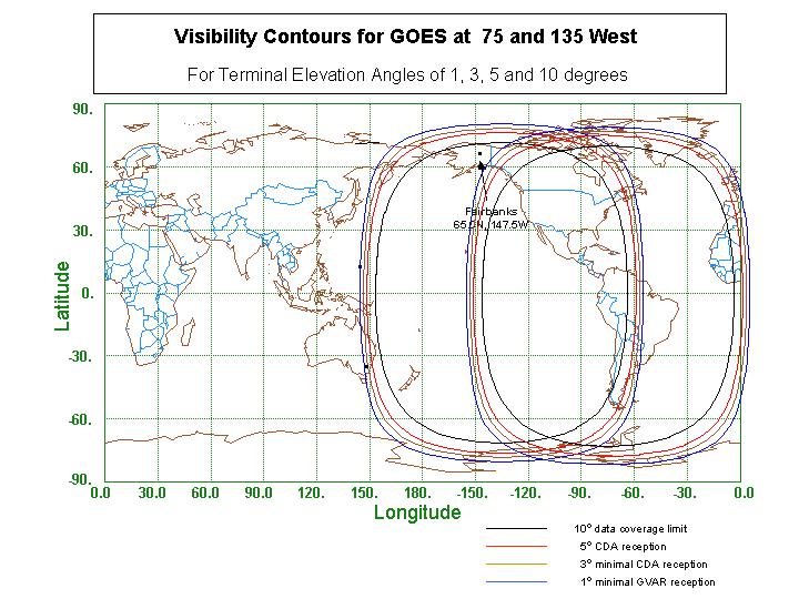
2 What is EMWIN? The Emergency Managers Weather Information Network is a priority-driven computer weather data broadcast system that takes advantage of minimal bandwidth. EMWIN provides rapid Satellite, VHF Radio, and Internet dissemination of: Alerts/Watches/Warnings < 1 minute Forecasts Graphics, Imagery Hurricane tracking and tropical storm data 3 4 2

3 5 6 3
4 How it works Data is collected from the Gateway, Weather Wire and the Internet Assembled and prioritized Sent to NESDIS, (Wallops CDA) where it is up-linked to GOES 11 and GOES 12 Sent further west via Peace Sat (NOAA donated GOES-7) in a cooperative effort between NWS Pacific Region and the Univ. of Hawaii Transmitted via VHF radio (local re-broadcast) in some areas Sent on the Internet via IP unicast 7 EMWIN Dataflow GOES SPACE CRAFT NOAANET NOAANET NWS GATEWAY SYSTEM Secondary circuit NOAANET Circuit Primary EMWIN Servers WALLOPS CDA Silver Spring WWIRE System Wallops Tertiary WWIRE System INTERNET INTERNET CLOUD CLOUD Internet Push EMWIN satellite User 8 4
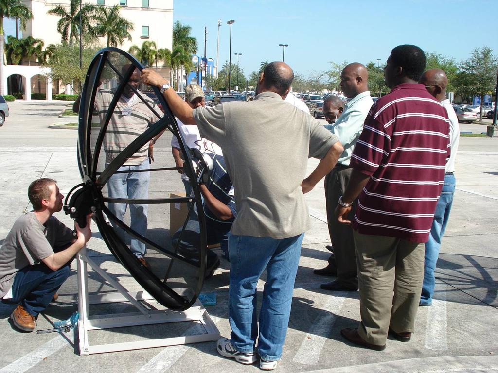
5 Typical VHF Re-transmission System MHz MHz GOES WEST dish Internet Internetor or Intranet Intranet cloud cloud GOES EAST dish Receiver Custom local EMWIN Data stream To Paging Network VHF Transmitter EMWIN SERVER


6 EMWIN User Receive System Screen Shots 11 EMWIN Domestic Users Local and National Emergency managers Storm Spotters Schools TV Stations Emergency Responders Re-broadcasters using VHF Paging networks Weather Channel 12 6
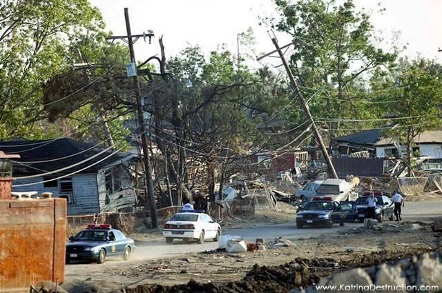
7 EMWIN International Users Pacific Rim Nations Peace Sat relays the EMWIN data stream from Univ. of Hawaii Provides advance warnings eg. Tsunamis and Typhoons Testimonials show that after a severe event the only weather system still functioning was EMWIN AsiaStar now broadcasts portions of EMWIN data Canada Canadian Meteorological Service uses for warnings Caribbean, Central & South American Nations As of 2007 many Caribbean island nations implemented EMWIN systems for Emergency Management In Latin America used for hurricane preparedness and flooding, volcanic ash etc
8
9 EMWIN GOES-N Satellite GOES N thru P constellation changes Power reduced Frequency changes Modulation scheme changes Latest generation receivers are transition ready Improved transmit technologies Speed doubles Forward error correction Allows enhancement of the data stream Coding gains used to retain current user dish size Dedicated transponder 17 EMWIN GOES-R Satellite GOES R constellation Combined EMWIN/LRIT transponder Greater user/vendor base Additional cooperation between NESDIS and NWS Frequency, modulation, and power change Combined speed increases to 400+ KBPS Forward error correction User satellite dish remains the same size Backwards compatible software defined receiver prototype Software defined receiver will be open source Prototype demo to be held in Greenbelt, Md. summer 2008 GOES-R Program to give prototype receiver to NWS in Summer
10 EMWIN Satellite Transitions 19 EMWIN Accomplishments EMWIN-I (9.6 kbs legacy L-band and internet bit stream) NWS IA sponsored White House Third Border Initiative Two Caribbean EMWIN-I training courses given in 2007 Systems donated to attending nations, with ongoing support Invited to U.N. SPIDER conference in Barbados EMWIN-N (19.2 kbs L-band and internet bit stream) User/vendor conference held to gather inputs for transition to EMWIN-N Receiver is backwards compatible with EMWIN-I GOES-10 dedicated as test platform for developers 1 COTS user receive system developed using software receiver EMWIN-R (128 kbs or higher L-band and internet bit stream) Initial prototype demo in March 2008 at Aerospace Corporation Ground and space interface documents being formalized 20 10
11 In Conclusion EMWIN is a low cost emergency management tool available now to all of the Caribbean area. Questions? 21 11
PUBLIC ALERT: Delivers Emergency All-Hazard Warnings, Everywhere, All the Time
 PUBLIC ALERT: Delivers Emergency All-Hazard Warnings, Everywhere, All the Time DELIVERS EMERGENCY ALL-HAZARD WARNINGS In November 2002, the National Oceanic and Atmospheric Administration (NOAA) and National
RECOMMENDATIONS SEEKING AFFORDABLE FUTURE RECEIVING STATIONS OR ALTERNATIVES TO DIRECT READ-OUT SOLUTIONS
 Prepared by NOAA Agenda Item: I.3 Discussed in WGI RECOMMENDATIONS SEEKING AFFORDABLE FUTURE RECEIVING STATIONS OR ALTERNATIVES TO DIRECT READ-OUT SOLUTIONS In response to CGMS WGI IS-1 NOAA-WP-09 provided
Kidder, Jones, Purdom, and Greenwald BACIMO 98 First Local Area Products from the NOAA-15 Advanced Microwave Sounding Unit (AMSU) page 1 of 5
 page 1 of 5") First Local Area Products from the NOAA-15 Advanced Microwave Sounding Unit (AMSU) Stanley Q. Kidder, Andrew S. Jones*, James F. W. Purdom, and Thomas J. Greenwald Cooperative Institute for Research in
First Local Area Products from the NOAA-15 Advanced Microwave Sounding Unit (AMSU) Stanley Q. Kidder, Andrew S. Jones*, James F. W. Purdom, and Thomas J. Greenwald Cooperative Institute for Research in
Presentation Outline
 Presentation Outline Who and what is RANET? What does RANET do? Core RANET principles and philosophies. Overview of Technologies Satellite Community FM Where does RANET work? Who are we? Just tell me where
HF Weather Broadcasting. How much longer will it last? Russell Levin, US Coast Guard
 US Coast Guard HF Weather Broadcasting How much longer will it last? Russell Levin, US Coast Guard What we ll cover History: Why we do it What we are doing now The problem The business case Where we go
NOAA Satellite Observing System Architecture (NSOSA) Study Update
 Study Update") NOAA Satellite Observing System Architecture (NSOSA) Study Update Dr. Karen St. Germain Director NOAA/NESDIS Office of System Architecture and Advanced Planning (OSAAP) Spring 2017 Meeting of the Committee
NOAA Satellite Observing System Architecture (NSOSA) Study Update Dr. Karen St. Germain Director NOAA/NESDIS Office of System Architecture and Advanced Planning (OSAAP) Spring 2017 Meeting of the Committee
Short and Long Term Partnering Strategies for Improving Communications/Disseminatio ns for Pacific Island NMHSs
 Short and Long Term Partnering Strategies for Improving Communications/Disseminatio ns for Pacific Island NMHSs Edward H. Young, Jr. NOAA National Weather Service Pacific Region RANET Pacific Steering
DELIVERING THE INDUSTRY S FIRST DISASTER AND SAFETY AUTOMATIONS
 DELIVERING THE INDUSTRY S FIRST DISASTER AND SAFETY AUTOMATIONS About Us - Only Disaster Automations company in existence with our extensive partnerships and capabilities - Covering 98% of the US population
Concept of Operations. Emergency Support Function (ESF) # 2 Communications
 # 2 Communications") Concept of Operations Lead Agency Support Agencies Emergency Support Function (ESF) # 2 Communications Franklin County Sheriff s Office (FCSO) Amateur Radio Emergency Services (ARES) Apalachicola Police
Concept of Operations Lead Agency Support Agencies Emergency Support Function (ESF) # 2 Communications Franklin County Sheriff s Office (FCSO) Amateur Radio Emergency Services (ARES) Apalachicola Police
CGMS-37, NOAA-WP-33 Prepared by NOAA Agenda Item: IV/1 Discussed in WG IV
 Prepared by NOAA Agenda Item: IV/1 Discussed in WG IV NOAA-WP-33 provides a status of its Geostationary Operational Environmental Satellite Series R (GOES-R). and polar-orbiting satellite constellations.
Onboard Communications. WxLive! Session 1
 Onboard Communications WxLive! Session 1 Expectations Broad Overview of Comm Equipment Compare and Contrast Them Links and Resources Question Management Objectives For the Series How do we get weather
JPSS and GOES-R Direct Broadcast Capabilities
 JPSS and GOES-R Direct Broadcast Capabilities NESDIS Data Distribution and Access Panel Session, NOAA Satellite Conference 7/20/2017 Greg Mandt, Director, Joint Polar Satellite System (JPSS) Direct Broadcast
ITU Radiocommunication Sector (ITU-R) and Climate Change. Alexandre VASSILIEV ITU Radiocommunication Bureau
 and Climate Change. Alexandre VASSILIEV ITU Radiocommunication Bureau") ITU Radiocommunication Sector (ITU-R) and Climate Change Alexandre VASSILIEV ITU Radiocommunication Bureau WSIS FORUM 2009, Geneva, 18-22 May 2009 Radio and Information Society Today radio technologies
ITU Radiocommunication Sector (ITU-R) and Climate Change Alexandre VASSILIEV ITU Radiocommunication Bureau WSIS FORUM 2009, Geneva, 18-22 May 2009 Radio and Information Society Today radio technologies
Himawari-8 and AOMSUC-6. Toshihiko HASHIDA Japan Meteorological Agency (JMA)
") Himawari-8 and AOMSUC-6 Toshihiko HASHIDA Japan Meteorological Agency (JMA) Side Event on Communication to Members of RA II and RA V on the outcomes and future plans of AOMSUCs, 3 June 2015 Dawn of a New
Himawari-8 and AOMSUC-6 Toshihiko HASHIDA Japan Meteorological Agency (JMA) Side Event on Communication to Members of RA II and RA V on the outcomes and future plans of AOMSUCs, 3 June 2015 Dawn of a New
Satellite services and products for Automatic Weather Stations. Sophie Baudel
 Satellite services and products for Automatic Weather Stations Sophie Baudel sbaudel@cls.fr Share basic knowledge on telemetry services used by meteorologists and oceanographers for autonomous platforms
ITU/WMO Seminar Use of Radio Spectrum for Meteorology: Weather, Water and Climate Monitoring and Prediction
 ITU/WMO Seminar Use of Radio Spectrum for Meteorology: Weather, Water and Climate Monitoring and Prediction Session 5: Meteorological Aids Service (Radiosondes( Radiosondes) ) and Other Systems 5.1.1 MetAids)
EMWIN User Training. For Colorado Front Range. September, 2007
 EMWIN User Training For Colorado Front Range September, 2007 Agenda 1 p.m. Getting Started SOME ASSEMBLY REQUIRED Antenna Radio equipment RealEMWIN Software installation 2:30 p.m. Basic features of RealEMWIN
AccuWeather.com Premium v3.0. User Manual
 AccuWeather.com Premium v3.0 User Manual Contents About AccuWeather, Inc....3 Overview of AccuWeather.com Premium v3.0...3 Initial Download and Installation...4 Using and Navigating the Application...5
ITWG WORKING GROUP ON INTERNATIONAL ISSUES AND FUTURE SYSTEMS AND RFI AND FREQUENCY MANAGEMENT
 ITWG WORKING GROUP ON INTERNATIONAL ISSUES AND FUTURE SYSTEMS AND RFI AND FREQUENCY MANAGEMENT ITSC-19, Jeju, 26 March 1 April 2014 Jérôme Lafeuille, Steve English WMO / OBS / Space Programme www.wmo.int/sat
Distribution of data from meteorological satellites (MetSat)
") World Meteorological Organization Working together in weather, climate and water Distribution of data from meteorological satellites (MetSat) Jose Arimatea de Sousa Brito Chair - WMO Steering Group on
World Meteorological Organization Working together in weather, climate and water Distribution of data from meteorological satellites (MetSat) Jose Arimatea de Sousa Brito Chair - WMO Steering Group on
MEO Satellite Applications to Support Mobility
 MEO Satellite Applications to Support Mobility Colloquium on Satellite Services for Global Mobility 14 October, 2013 David Burr, Director, Product Development O3b A revolutionary solution O3b Networks
第 XVII 部 災害時における情報通信基盤の開発
 XVII W I D E P R O J E C T 17 1 LifeLine Station (LLS) WG LifeLine Station (LLS) WG was launched in 2008 aiming for designing and developing an architecture of an information package for post-disaster
Consultation Paper on Using a Portion of the Band GHz for Tactical Common Data Link (TCDL) Systems
 Systems") December 2008 Spectrum Management and Telecommunications Consultation Paper on Using a Portion of the Band 14.5-15.35 GHz for Tactical Common Data Link (TCDL) Systems Aussi disponible en français Department
December 2008 Spectrum Management and Telecommunications Consultation Paper on Using a Portion of the Band 14.5-15.35 GHz for Tactical Common Data Link (TCDL) Systems Aussi disponible en français Department
The Future in Marine Radio Communication GMDSS. Department of Transportation United States Coast Guard
 The Future in Marine Radio Communication GMDSS Department of Transportation United States Coast Guard Do you use a Maritime Radio System? If so, the new Global Maritime Distress and Safety System (GMDSS)
COMMENTS OF TELESAT CANADA
 COMMENTS OF TELESAT CANADA In response to: Canada Gazette, Part I, October 21, 2017, Consultation on the Spectrum Outlook 2018 to 2022, SLPB-006-17 and Canada Gazette, Part I, December 30, 2017, Extension
THE BEST FIT DIGITAL TELEVISION STANDARD FOR THE PHILIPPINES
 ISDB T (Integrated Services Digital Broadcast Terrestrial) THE BEST FIT DIGITAL TELEVISION STANDARD FOR THE PHILIPPINES October 10, 2008 James Rodney P. Santiago Consultant ARIB/Digital Broadcast Experts
Standard Operating Procedures Miami-Dade County Emergency Nets
 Standard Operating Procedures Miami-Dade County Emergency Nets Standard Information For Countywide Emergency/Event Nets Zone (Citywide) Emergency/Event Nets ARES Emergency Information For Miami-Dade County
Virginia s IFLOWS System and Future Approaches to Dam Safety
 Virginia s IFLOWS System and Future Approaches to Dam Safety Sam Utley Division Manager, Environmental Monitoring Services 3154 State Street, Blacksburg, VA 24060 PH: 540-961-7894 x427 March 10, 2008 MapTech
Long Term Evolution (LTE) Next-Generation Public Safety Communications. Fred Scalera
 Next-Generation Public Safety Communications. Fred Scalera") Long Term Evolution (LTE) Next-Generation Public Safety Communications Fred Scalera August 3, 2011 INTEROPERABILITY IS MORE THAN: NEW THREATS, NEW CHALLENGES NEEDS NEW APPROACHES The need to effectively
Long Term Evolution (LTE) Next-Generation Public Safety Communications Fred Scalera August 3, 2011 INTEROPERABILITY IS MORE THAN: NEW THREATS, NEW CHALLENGES NEEDS NEW APPROACHES The need to effectively
Consultation on the Use of the Band GHz
 May 2010 Spectrum Management and Telecommunications Consultation on the Use of the Band 25.25-28.35 GHz Aussi disponible en français Contents 1. Intent...1 2. Background...1 3. Policy...2 4. First-Come,
SECC Plan Draft New Mexico Version Revision 1.4 September 5, 2012 Mike Langner
 SECC Plan Draft New Mexico Version Revision 1.4 September 5, 2012 Mike Langner Sections 1 Purpose and scope of this plan 2 Changes to the EAS system with the advent of CAP 3 Types of warnings the EAS system
GOES-R: Significance of Spatial Resolution in Satellite Imagery
 GOES-R: Significance of Spatial Resolution in Satellite Imagery Source/Authors: Peter Dorofy, John Moore, The Institute for Earth Observations at Palmyra Cove Nature Park, Palmyra, NJ (www.palmyracove.org).
EMWIN User Training. For Colorado Front Range. October, 2006
 EMWIN User Training For Colorado Front Range October, 2006 Agenda 08:30 Getting Started SOME ASSEMBLY REQUIRED Antenna Radio equipment RealEMWIN Software installation 10:00 BREAK 10:30 Basic features of
XV. MITRE Corporation
 XV. MITRE Corporation A. General Information The MITRE Corporation, established in 1958, is a not-for-profit organization which conducts work in systems engineering, information technology, operational
The Los Alamos Dual Band Lightning Array: A new tool for mapping VLF and VHF lightning in the Gulf of Mexico
 The Los Alamos Dual Band Lightning Array: A new tool for mapping VLF and VHF lightning in the Gulf of Mexico Can we probe D-region disturbances using lightning? Christopher A. Jeffery (cjeffery@lanl.gov)
BookletChart. Sacramento River Sacramento to Fourmile Bend NOAA Chart A reduced-scale NOAA nautical chart for small boaters
 BookletChart Sacramento River Sacramento to Fourmile Bend NOAA Chart 18664 A reduced-scale NOAA nautical chart for small boaters When possible, use the full-size NOAA chart for navigation. Included Area
An Introduction to Airline Communication Types
 AN INTEL COMPANY An Introduction to Airline Communication Types By Chip Downing, Senior Director, Aerospace & Defense WHEN IT MATTERS, IT RUNS ON WIND RIVER EXECUTIVE SUMMARY Today s global airliners use
Galileo signal reflections used for monitoring waves and weather at sea
 Press Release Monday 26 th November 2007 Galileo signal reflections used for monitoring waves and weather at sea Surrey Satellite Technology Ltd (SSTL) and the University of Surrey have succeeded for the
Overview on Data Collection systems: case of low orbiting satellites
 ITU Seminar for Americas Region Overview on Data Collection systems: case of low orbiting satellites Jean PLA, Frequency Management CNES, Toulouse, FRANCE jean.pla@cnes.fr Michel SARTHOU, ARGOS project
CIWS Data Distribution Service
 CIWS Data Distribution Service Carol Kelly 11 December Distribution Statement A. Approved for public release; distribution is unlimited. This work is sponsored by the Federal Aviation Administration under
Sensor Technologies and Sensor Materials for Small Satellite Missions related to Disaster Management CANEUS Indo-US Cooperation
 Sensor Technologies and Sensor Materials for Small Satellite Missions related to Disaster Management CANEUS Indo-US Cooperation Suraj Rawal, Lockheed Martin Space Systems Co., USA G. Mohan Rao, Indian
IPReady. EAS CAP doesn t get any easier. Ka You
 IPReady. EAS CAP doesn t get any easier. Who is Communications? Leading provider of broadcast satellite solutions Serving radio and TV broadcasters nationwide Customer base Group-owned and operated networks
Addressable Radios for Emergency Alert (AREA): WorldSpace Satellite Radio
: WorldSpace Satellite Radio") Addressable Radios for Emergency Alert (AREA): A WorldSpace solution for effective delivery of alerts S.Rangarajan, Jerome Soumagne and Jean-Luc Vignaud WorldSpace Satellite Radio srangarajan@worldspace.com,
Addressable Radios for Emergency Alert (AREA): A WorldSpace solution for effective delivery of alerts S.Rangarajan, Jerome Soumagne and Jean-Luc Vignaud WorldSpace Satellite Radio srangarajan@worldspace.com,
GEONETCAST AMERICAS AN OPERATIONAL SERVICE DELIVERING ENVIRONMENTAL INFORMATION USING COMMUNICATION SATELLITES INTRODUCTION
 GEONETCAST AMERICAS AN OPERATIONAL SERVICE DELIVERING ENVIRONMENTAL INFORMATION USING COMMUNICATION SATELLITES Richard A. Fulton, Linda V. Moodie, and Paul Seymour National Oceanic and Atmospheric Administration
NOAA Satellite and Information Service National Environmental Satellite, Data, and Information Service (NESDIS)
") NOAA Satellite and Information Service National Environmental Satellite, Data, and Information Service (NESDIS) Status of Current and Future Systems (NOAA-WP-33) Presentation to CGMS-40 November 2012;
NOAA Satellite and Information Service National Environmental Satellite, Data, and Information Service (NESDIS) Status of Current and Future Systems (NOAA-WP-33) Presentation to CGMS-40 November 2012;
Public Workshop on Optimising the Use of the Radio Spectrum by the Public Sector in the EU. Applications and Technologies
 Public Workshop on Optimising the Use of the Radio Spectrum by the Public Sector in the EU Applications and Technologies John Burns, Aegis Systems Ltd 1st April 2008 0 Scope of Presentation Overview of
Leica Spider Infrastructure HW Solutions Introducing: Leica GR30 & GR50
 Leica Spider Infrastructure HW Solutions Introducing: Leica GR30 & GR50 Reliable solutions for today and tomorrow Leica Spider Integrated Solutions Introducing: Leica GR30 & GR50 Outline Introducing Leica
Datacasting Minnesota Public Safety Communications Conference
 Datacasting Minnesota Public Safety Communications Conference John M. Contestabile, Program Manager April 23, 2018 Background Datacasting leverages available capacity in a broadcast signal to provide a
Overview: Radio Frequency Spectrum
 Overview: Radio Frequency Spectrum Krystal Wilson, Secure World Foundation Working Group on Spectrum and Operational Challenges with the Emergence of Small Satellites 15 th Space Generation Congress Guadalajara,
Data Dissemination and Broadcasting Systems Lesson 09 Digital Audio Broadcasting
 Data Dissemination and Broadcasting Systems Lesson 09 Digital Audio Broadcasting Oxford University Press 2007. All rights reserved. 1 Digital Audio Broadcast System (DAB) OFDM carrier FHSS based technique
Meeting 10 8 August 2018 Agenda Item 2.1. MSI Self Assessment NAVAREA XVI. Submitted by PERÚ - DIRECTORATE OF HYDROGRAPHY AND NAVIGATION SUMMARY
 WWNWS10 WWNWS10/2/1-XVI Meeting 10 8 August 2018 Agenda Item 2.1 MSI Self Assessment NAVAREA XVI Submitted by PERÚ - DIRECTORATE OF HYDROGRAPHY AND NAVIGATION SUMMARY Executive Summary: Report of activities
Recent Developments in NOAA s Real- Time Coastal Observing Systems for Safe and Efficient Maritime Transportation
 Recent Developments in NOAA s Real- Time Coastal Observing Systems for Safe and Efficient Maritime Transportation Rich Edwing, Director NOAA Center for Operational Oceanographic Products and Services CMTS
Technical Requirements for Land Mobile and Fixed Radio Services Operating in the Bands MHz and MHz
 Provisional - Issue 1 March 2004 Spectrum Management and Telecommunications Policy Standard Radio System Plans Technical Requirements for Land Mobile and Fixed Radio Services Operating in the Bands 138-144
Proposal. ITU/PITA RRS-16 for Asia & Pacific Emergency Communications: The Role of Satellites
 ITU/PITA RRS-16 for Asia & Pacific Emergency Communications: Proposal The Role of Satellites Raquib Masashi PRAMANIK SKY Perfect JSAT Corporation JAPAN 21 September 2016 JSAT Background Largest Satellite
AIREON SPACE-BASED ADS-B
 AIREON SPACE-BASED ADS-B 2018 Transport Canada Delegates Conference Steve Bellingham Manager, Navigation Systems Engineering Steve.Bellingham@navcanada.ca CNS/ATM Systems Communication Navigation Surveillance
OPERATIONAL RESULTS USING LOW POWER GOES TRANSMITTERS IN MOORED BUOY APPLICATIONS 300 BAUD UPDATE
 OPERATIONAL RESULTS USING LOW POWER GOES TRANSMITTERS IN MOORED BUOY APPLICATIONS 300 BAUD UPDATE (Originally presented at the DBCP18 Technical Workshop and updated for the DBCP19 Technical Workshop, Angra
Turks and Caicos Islands Table of Frequency Allocations 88 MHz to 59 GHz
 Turks and Caicos Islands Table of Frequency Allocations 88 MHz to 59 GHz Published March 21, 2011 (Incorporating the Decisions of the 2007 World Radiocommunication Conference) 1 The Turks and Caicos Islands
Role of the amateur and amateur-satellite services in support of disaster mitigation and relief
 Report ITU-R M.2085-1 (11/2011) Role of the amateur and amateur-satellite services in support of disaster mitigation and relief M Series Mobile, radiodetermination, amateur and related satellite services
The Alert4All Project Cristina Párraga Niebla(DLR)
") The Alert4All Project Cristina Párraga Niebla(DLR) IRT Colloquium HbbTV: Ein Werkzeug zur Alarmierung der Bevölkerung während einer Krise Munich, 20/01/2014 Alerting the Population: an Easy Principle.
The Alert4All Project Cristina Párraga Niebla(DLR) IRT Colloquium HbbTV: Ein Werkzeug zur Alarmierung der Bevölkerung während einer Krise Munich, 20/01/2014 Alerting the Population: an Easy Principle.
Data Dissemination and Broadcasting Systems Lesson 10 Digital video Broadcasting and Mobile TV
 Data Dissemination and Broadcasting Systems Lesson 10 Digital video Broadcasting and Mobile TV Oxford University Press 2007. All rights reserved. 1 Digital video Broadcasting (DVB) Analog TV AM transmission
Automated Damage Analysis from Overhead Imagery
 Automated Damage Analysis from Overhead Imagery EVAN JONES ANDRE COLEMAN SHARI MATZNER Pacific Northwest National Laboratory 1 PNNL FY2015 at a Glance $955 million in R&D expenditures 4,400 scientists,
Extension of Wideband HF Capabilities
 Extension of Wideband HF Capabilities Randy Nelson, Mark Jorgenson, Robert W. Johnson February 13, 2014 Overview of Extended Wideband HF Capabilities Motivation of extending HF bandwidths: viable mitigation
Victoria to Maui International Yacht Race
 Bulletin 5 COMMUNICATIONS INFORMATION Victoria to Maui International Yacht Race www.vicmaui.org Vic Maui 2014 Bulletin 5 Communications Information June 13, 2014 Page 1 of 8 Vic-Maui Acknowledges the Support
Future IMT Bands: WRC-15 & C-band Satellite Solutions for the Caribbean. David Hartshorn Secretary General GVF
 Future IMT Bands: WRC-15 & C-band Satellite Solutions for the Caribbean David Hartshorn Secretary General GVF C-Band Satellites in Service Global Distribution of 36 MHz Transponder-Equivalents (TPE) per
Integration and Test of the Microwave Radiometer Technology Acceleration (MiRaTA) CubeSat
 CubeSat") Integration and Test of the Microwave Radiometer Technology Acceleration (MiRaTA) CubeSat Kerri Cahoy, Gregory Allan, Ayesha Hein, Andrew Kennedy, Zachary Lee, Erin Main, Weston Marlow, Thomas Murphy MIT
Integration and Test of the Microwave Radiometer Technology Acceleration (MiRaTA) CubeSat Kerri Cahoy, Gregory Allan, Ayesha Hein, Andrew Kennedy, Zachary Lee, Erin Main, Weston Marlow, Thomas Murphy MIT
Data and Computer Communications. Tenth Edition by William Stallings
 Data and Computer Communications Tenth Edition by William Stallings Data and Computer Communications, Tenth Edition by William Stallings, (c) Pearson Education - Prentice Hall, 2013 Wireless Transmission
Using Variable Coding and Modulation to Increase Remote Sensing Downlink Capacity
 Using Variable Coding and Modulation to Increase Remote Sensing Downlink Capacity Item Type text; Proceedings Authors Sinyard, David Publisher International Foundation for Telemetering Journal International
This is by far the most ideal method, but poses some logistical problems:
 NXU to Help Migrate to New Radio System Purpose This Application Note will describe a method at which NXU Network extension Units can aid in the migration from a legacy radio system to a new, or different
IPSTAR Disaster Recovery and Emergency Communications
 IPSTAR Disaster Recovery and Emergency Communications March 2009 COPYRIGHT THAICOM PLC 2009 PROPRIETARY Content Introduction 3 Advantages 4 Applications 5 Equipment 6-7 IPSTAR Enterprise Series IPSTAR
BookletChart. Sacramento River Andrus Island to Sacramento NOAA Chart A reduced-scale NOAA nautical chart for small boaters
 BookletChart Sacramento River Andrus Island to Sacramento NOAA Chart 18662 A reduced-scale NOAA nautical chart for small boaters When possible, use the full-size NOAA chart for navigation. Included Area
GMDSS for Recreational Boaters
 GMDSS for Recreational Boaters OVERVIEW The Global Maritime Distress and Safety System (GMDSS) is an international system using advanced communications technology. Development of GMDSS was initiated by
Hosted Payload Lessons
 Hosted Payload Lessons Carl Schueler Orbital Sciences Corporation Schueler.carl@orbital.com 805-895-8425 Poster 277a AMS 8 th Symposium on Space Weather Abstract Commercial satellites can host remote sensing
NUREG 0654, Federal Emergency Management Agency, establishes emergency notification requirements for Nuclear Power Plants.
 I. Introduction When the Emergency Broadcast System (EBS) was first introduced in the 1960s its scope was limited: warn the population of the threat of nuclear attack. Through the years, the EBS became
Emergency Telecommunications initiatives for Disaster Management in Maldives
 Emergency Telecommunications initiatives for Disaster Management in Maldives ITU/ESCAP Disaster Communications Workshop, 12 15 December 2006, Bangkok, Thailand Abdullah Shiham Adam E-mail:- shiham@tam.gov.mv
Deriving meteorological observations from intercepted Mode-S EHS messages.
 Deriving meteorological observations from intercepted Mode-S EHS messages. Edmund Keith Stone and Malcolm Kitchen July 28, 2016 Abstract The Met Office has deployed a network of five receivers in the UK
DVB-RCS for emergency services Taiwan Case
 DVB-RCS for emergency services Taiwan Case 1st Satlabs DVB-RCS Symposium 8th - 9th September 2005 ESA/ESTEC - Noordwijk Netherlands July 2005 Taiwan NFA program Page 2 Taiwan National Fire Agency (NFA)
Solar Radar Experiments
 Solar Radar Experiments Paul Rodriguez Plasma Physics Division Naval Research Laboratory Washington, DC 20375 phone: (202) 767-3329 fax: (202) 767-3553 e-mail: paul.rodriguez@nrl.navy.mil Award # N0001498WX30228
DAB EWF Emergency Warning & Alert Functionality
 DAB EWF Emergency Warning & Alert Functionality DAB Tools, Features and Considerations 2014-06-14 DAB Workshop @ itvf, Istanbul Dipl.-Ing. Bernd Linz Fraunhofer IIS Broadcast Applications bernd.linz@iis.fraunhofer.de
The Meteorological Service of Canada (MSC) of Environment Canada commends Industry Canada for this very important public consultation.
 of Environment Canada commends Industry Canada for this very important public consultation.") Meteorological Service of Canada Service météorologique du Canada 4905 rue Dufferin Street Downsview, Ontario M3H 5T4 31 May 2004 Director of Spectrum and Radio Services Industry Canada Room 1611A, 300
Meteorological Service of Canada Service météorologique du Canada 4905 rue Dufferin Street Downsview, Ontario M3H 5T4 31 May 2004 Director of Spectrum and Radio Services Industry Canada Room 1611A, 300
THE EVOLUTION AND DEVELOPMENT OF THE UNITED STATES NATIONAL WEATHER SERVICE UNIVERSAL RADIOSONDE REPLACEMENT SYSTEM. Carl A. Bower, Jr.
 THE EVOLUTION AND DEVELOPMENT OF THE UNITED STATES NATIONAL WEATHER SERVICE UNIVERSAL RADIOSONDE REPLACEMENT SYSTEM Carl A. Bower, Jr. National Weather Service, 1325 East-West Highway #4312, Silver Spring,
Air Traffic Controllers use StarCaster ATIS software to create, update and verify the contents of ATIS messages
 ACASTER A a clear voice for for aviation aviation ATIS Datasheet Email: info@speechtech.com Tel: +1.250.477.0544 (GMT-8) ATIS (Automatic Terminal Information Service) is a comprehensive solution for the
Satellite Imagery and Remote Sensing. DeeDee Whitaker SW Guilford High EES & Chemistry
 Satellite Imagery and Remote Sensing DeeDee Whitaker SW Guilford High EES & Chemistry whitakd@gcsnc.com Outline What is remote sensing? How does remote sensing work? What role does the electromagnetic
R3I Overview Regional Risk Reduction Initiative
 Technical Cooperation workshop for Development of the Caribbean regional Cooperation Programme in Multi-Hazard Early Warning System Barbados 2-5 November 2010 R3I Overview Regional Risk Reduction Initiative
REMOTE SITE MONITORING
 Codan Radio Communications now offers Remote Site Monitoring options that provide live site information, giving you the power to respond intelligently to communications failures that affect your system
Debris Detection: Background, Efforts, & Lessons Learned. Peter Murphy Alaska Coordinator / Detection Lead NOAA Marine Debris Program
 Debris Detection: Background, Efforts, & Lessons Learned Peter Murphy Alaska Coordinator / Detection Lead NOAA Marine Debris Program Outline Marine Debris Issue Types Distribution Impacts NOAA Marine Debris
Tour the World with World Wind By Rob Rice
 Tour the World with World Wind By Rob Rice Lots of folks are familiar with Google Earth the free downloadable virtual globe program. Yet, I am finding that many have never heard of NASA S World Wind. World
Emergency Response/Recovery Plan
 Emergency Response/Recovery Plan Revised June 2010 Introduction This document outlines the WGCU Public Media personnel and procedures plan in response to a hurricane or other declared natural disaster.
RF Performance Predictions for Real Time Shipboard Applications
 DISTRIBUTION STATEMENT A. Approved for public release; distribution is unlimited. RF Performance Predictions for Real Time Shipboard Applications Dr. Richard Sprague SPAWARSYSCEN PACIFIC 5548 Atmospheric
Selecting the Optimal 700MHz LTE Antenna for Public Safety Communications. By Jerry Posluszny, Director of Engineering, Mobile Mark
 Selecting the Optimal 700MHz LTE Antenna for Public Safety Communications By Jerry Posluszny, Director of Engineering, Mobile Mark Public safety industry communications methods are rapidly evolving as
Free space loss: transmitting antenna: signal power P snd receiving antenna: signal power P rcv distance: d frequency: f.
 Signal Propagation and Power Free space loss: transmitting antenna: signal power P snd receiving antenna: signal power P rcv distance: d frequency: f P rcv P snd 1 d 2 f 2 quadratic decrease in distance
Consultation Paper on Public Safety Radio Interoperability Guidelines
 June 2006 Spectrum Management and Telecommunications Consultation Paper on Public Safety Radio Interoperability Guidelines Aussi disponible en français Department of Industry Radiocommunication Act Notice
Microwave Radiometers for Small Satellites
 Microwave Radiometers for Small Satellites Gregory Allan, Ayesha Hein, Zachary Lee, Weston Marlow, Kerri Cahoy MIT STAR Laboratory Daniel Cousins, William J. Blackwell MIT Lincoln Laboratory This work
Radiocommunications and climate changes
 Radiocommunications and climate changes Durban, South Africa 1 December 2011 COP-17 Vadim Nozdrin, Counselor, ITU-R Study Group 7 Study Group Department Radiocommunication Bureau
There are not any on site emergency medical facilities in Holberg.
 12.2 HOLBERG Holberg is located on Holberg Inlet which has access to the Pacific Ocean on the west coast of Vancouver Island. Population is approximately 70 persons with the village located mainly at the
Technical and Regulatory Studies on HAPS
 Technical and Regulatory Studies on HAPS 04 December 2008 Jong Min Park Contents 1. Overview of HAPS 2. Frequency identifications for HAPS 3. Technical and regulatory conditions for HAPS 4. Conclusions
Greg Mandt. AMS 90 th Annual Meeting 6th Annual Symposium on Future National Operational Environmental Satellite Systems NPOESS and GOES R
 An Overview of the GOES R Program Greg Mandt System Program Director AMS 90 th Annual Meeting 6th Annual Symposium on Future National Operational Environmental Satellite Systems NPOESS and GOES R January19
CAP Implementation in México
 CAP Implementation in México Mtro. Mario Álvaro Ruiz Velázquez Asesor del Centro de Instrumentación y Registro Sísmico A. C. CIRES September 2015 Since 1991 is working Monitoring and Warning System to
Royal Canadian Mounted Police Port Hardy Detachment There are no on-site emergency medical facilities in Holberg.
 PART 4.3 HOLBERG 4.3.1 Overview Holberg is located on Holberg Inlet which has access to the Pacific Ocean on the west coast of Vancouver Island. Population is approximately 100 persons, with the village
Spectrum Utilization Policy Decisions for the Band MHz
 December 2012 Spectrum Management and Telecommunications Spectrum Utilization Policy Decisions for the Band 1435-1525 MHz Aussi disponible en français PS 1435 MHz Contents 1. Intent... 1 2. Background...
Iridium NEXT SensorPODs: Global Access For Your Scientific Payloads
 Iridium NEXT SensorPODs: Global Access For Your Scientific Payloads 25 th Annual AIAA/USU Conference on Small Satellites August 9th 2011 Dr. Om P. Gupta Iridium Satellite LLC, McLean, VA, USA Iridium 1750