A New Geodetic Network Design for Hydro Power Plants
|
|
|
- Magdalene Montgomery
- 5 years ago
- Views:
Transcription


1 Kaniv HPP Dniprodzerzhynsk HPP Dnipro HPP Dnister HPP A New Geodetic Network Design for Hydro Power Plants Joël van Cranenbroeck International Projects & Business Technology Manager Leica Geosystems AG New Business Division CH-9435 Heerbrugg Switzerland Andrey Balan Managing Director Leica Geosystems Ltd Kiev Ukraine FIG WORKING WEEK - ROME, ITALY MAY 2012 Joël van Cranenbroeck / Selected and Placed (design) Every instrument on a project should be selected and placed to assist with answering a specific question : if there is no question, there should be no instrumentation. John Dunnicliff Geotechnical Instrumentation for Monitoring Field Performance ( ISBN WILEY-INTERSCIENCE ) FIG Working Week Rome, ITALY MAY 2012 Slide n 2 1
 and/or raise the height with an impact of the")


2 Reasons to setup Geodetic Monitoring Hydro PP is a huge investment and must be maintained over years to fit with the ROI planning. There is a large trend to increase the power capacity (renewing the turbines is 15% power increasing ) and/or raise the height with an impact of the structure ( vibrations ) Seismicity is a reality ( IRAN, CHINA, INDIA, but also in UKRAINE ) New Hydro PP infrastructure must be monitored not only during the filling of the reservoir but after Monitoring must be 24/7 and automatic Geodetic monitoring can reduce significantly the number of Geotechnical sensors Geodetic monitoring instrumentation can be offset by Geotechnical sensors FIG Working Week Rome, ITALY MAY 2012 Slide n 3 Kruonio HAE Dam Water Variations on Upper Reservoir Geodetic Monitoring must be 24/7 or the investment will be lost having no results! FIG Working Week Rome, ITALY MAY 2012 Slide n 4 2


3 Wall Deflection vs Water Level on the upper reservoir GMX2 0.0 mm GMX3 0.0 mm GMX mm FIG Working Week Rome, ITALY MAY 2012 Slide n 5 Wall Deflection vs Water Level on the upper reservoir GMX mm GMX mm GMX1 0.0 mm FIG Working Week Rome, ITALY MAY 2012 Slide n 6 3

4 NIVEL210 Long Term Monitoring Fluctuation on the Dam s wall Δ MIN = 0.0 mm Δ MAX = mm FIG Working Week Rome, ITALY MAY 2012 Slide n 7 Methodology The 7 seven steps approach 1. Site visit and meeting with the Director of the HPP, engineers and surveyors 2. Site inspection and final Design 1. HPP infrastructure, surrounding environment 2. Selection of GNSS Reference Station location 3. Selection of TPS location 4. Location of the GNSS Monitoring stations with 360 reflector 5. Location of passive control points (360 reflector) 6. Visit to the control centre, processing facility 7. Report to partners on communication and accessories 3. Simulation on the final design proposal (Least Squares Adjustment) 4. Report delivered to the authority for approval 5. Planning on instruments and accessories delivering 6. Installation and initialisation (network processing) 7. Fine tuning and acceptance, contractual maintenance and support. FIG Working Week Rome, ITALY MAY 2012 Slide n 8 4


5 Site Visit and Meeting with HPP authority Understanding the site and infrastructure Existing Geodetic Assets Environment and location for GNSS Reference & TPS Understanding the structure FIG Working Week Rome, ITALY MAY 2012 Slide n 9 Site Visit and Meeting with HPP authority Understanding the past Geodetic history (X,Y) Previous Geodetic Monitoring Campaign executed by University, Geodesy Department using GPS on pillars. Control points and monitoring points on steel pillars anchored on massive concrete foundations. FIG Working Week Rome, ITALY MAY 2012 Slide n 10 5
 history Previous Levelling Monitoring Campaign")


6 Site Visit and Meeting with HPP authority Understanding the past Levelling (H) history Previous Levelling Monitoring Campaign executed by the surveyors of the HPP on a yearly basis. Levelling benchmark anchored on stable foundation. Levelling operations will continue using Digital Levelling instrument and Invar bars with software. FIG Working Week Rome, ITALY MAY 2012 Slide n 11 Site Visit and Meeting with HPP authority Understanding the infrastructure The original design of the structure and the construction are important elements to understand the HPP structure and how it is supposed to behave under water load. The turbines and electromechanical parts management for electricity production planning are influencing the way the structure will react as well. FIG Working Week Rome, ITALY MAY 2012 Slide n 12 6


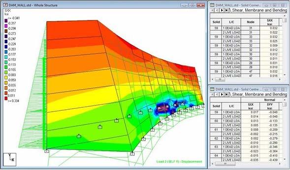
7 Site Visit and Meeting with HPP authority Understanding the HPP Structural Behaviour FIG Working Week Rome, ITALY MAY 2012 Slide n 13 Site Visit and Meeting with HPP authority Understanding the HPP Structural Behaviour FIG Working Week Rome, ITALY MAY 2012 Slide n 14 7

8 Site Visit and Meeting with HPP authority Understanding the HPP Structural Behaviour FIG Working Week Rome, ITALY MAY 2012 Slide n 15 INNOVATIVE PROPOSAL GNSS and TPS mixed Network Automatic Total Station TM Reflector Circular Reflector GNSS Control Point GNSS Reference Station FIG Working Week Rome, ITALY MAY 2012 Slide n 16 8
. Leica GNSS AR10 Antenna (24 cm x 14 cm) GRZ121 360 Reflector PRO.")


9 Active GNSS Control Points Concept For each GNSS stations (control points and reference ) a 360 reflector will be collocated with the antenna in order to be measured by the Total Stations ( Active Control Points ). Leica GNSS AR10 Antenna (24 cm x 14 cm) GRZ Reflector PRO. Reflector with 5/8 thread adapter for mounting of GNSS antenna Antenna cable will be protected by a resistant coating against vandalism. Stub to screw 5/8 adaptor or stub support from the mast top. FIG Working Week Rome, ITALY MAY 2012 Slide n 17 WORKFLOW Post-Processing TPS GNSS Base GNSS Control Hz, Vz, Ds Data Reduction T, ppm ΔX, ΔY, ΔZ Reporting, Archiving Least Squares Adjust. Minimum Constraints Visualisation Quality Analysis Data Snooping, Filtering Deformation Analysis Epoch of Reference? Yes Store Epoch of Reference No Statistical Analysis S-Transformation FIG Working Week Rome, ITALY MAY 2012 Slide n 18 9

10 Site Inspection and Final Design The design must fit with structural analysis FIG Working Week Rome, ITALY MAY 2012 Slide n 19 Site Inspection and Final Design The design must fit with structural analysis FIG Working Week Rome, ITALY MAY 2012 Slide n 20 10


11 Site Inspection and Final Design GNSS and TPS location to insure accuracy GNSS 2 and TPS 2 NIVEL PASSIVE CONTROL POINTS FIG Working Week Rome, ITALY MAY 2012 Slide n 21 Site Inspection and Final Design GNSS and TPS location to insure accuracy GNSS 1 and TPS 1 NIVEL PASSIVE CONTROL POINTS FIG Working Week Rome, ITALY MAY 2012 Slide n 22 11

, the designed")


12 Site Inspection and Final Design Site survey using GNSS RTK The site survey is an important operation consisting of validating the existing geodesy (coordinate system), the designed location of instrumentation (GNSS and TPS) and to obtain information for the final design validation using Least Squares Simulation processing. FIG Working Week Rome, ITALY MAY 2012 Slide n 23 Site Inspection and Final Design Comparison and Datum Transformation FIG Working Week Rome, ITALY MAY 2012 Slide n 24 12


13 Site Inspection and Final Design Site survey using TPS The site survey with TPS is an important operation consisting of validating the designed location of instrumentation (TPS and Reflectors), the performances on site and to obtain information for the final design validation using Least Squares Simulation processing. FIG Working Week Rome, ITALY MAY 2012 Slide n 25 Site Inspection and Final Design Site survey using TPS FIG Working Week Rome, ITALY MAY 2012 Slide n 26 13


14 Site Inspection and Final Design Validation of EDM performances over water FIG Working Week Rome, ITALY MAY 2012 Slide n 27 Simulation of Final Design Proposal Least Squares Adjustment Simulation FIG Working Week Rome, ITALY MAY 2012 Slide n 28 14
15 Simulation of Final Design Proposal Least Squares Adjustment Simulation FIG Working Week Rome, ITALY MAY 2012 Slide n 29 Simulation of Final Design Proposal Least Squares Adjustment GNSS Simulation FIG Working Week Rome, ITALY MAY 2012 Slide n 30 15

16 Simulation of Final Design Proposal Least Squares Adjustment TPS Simulation FIG Working Week Rome, ITALY MAY 2012 Slide n 31 Simulation of Final Design Proposal Least Squares Adjustment Mixed Simulation FIG Working Week Rome, ITALY MAY 2012 Slide n 32 16
17 Simulation of Final Design Proposal Relative Error Ellipse ~ 1mm FIG Working Week Rome, ITALY MAY 2012 Slide n 33 Simulation of Final Design Proposal Reliability (marginal detectable error) ~ 1mm FIG Working Week Rome, ITALY MAY 2012 Slide n 34 17


18 Sensors and Data Fusion Rigorous Least-Squares Adjustment Analysis Sensor Management Data Logger Adjustment SQL DB s Results per epoch Web distributor SQL DB Final Report FIG Working Week Rome, ITALY MAY 2012 Slide n 35 Least Squares Adjustment Work Flow GNSS + TPS Best Linear Unbiased Estimates Free Network Adj. Weighted Constraint Fully Constraint Data Snooping Blunder Detection Identify Fixed Control Points NO FIXED POINTS! MINIMUM FIXED POINTS! FIG Working Week Rome, ITALY MAY 2012 Slide n 36 18
 Q, x xx reference")


19 Least Squares Adjustment Work Flow Automatic Deformation Analysis Epoch Reference ( any ) Q, x xx reference S-Transformation Δx,Δy,Δz,r x,r y,r z Q xx, x i Residuals Analysis Deformation Reference points? Deformation on Object points? Epoch i FIG Working Week Rome, ITALY MAY 2012 Slide n 37 The Mock-up proof of concept FIG Working Week Rome, ITALY MAY 2012 Slide n 38 19

20 Design of GNSS Reference Station and TPS Station monumentation GNSS ANTENNA REFLECTOR STEEL MAST Automatic Leica TM30 CABINET INSIDE CONCRETE FIG Working Week Rome, ITALY MAY 2012 Slide n 39 Conclusion Every instrument should be selected to answer a specific question! Site reconnaissance and understanding of the structure is fundamental background to design a geodetic monitoring network Site qualification and pre-survey are mandatory Least Squares Simulation allows the project engineer to check and improve the design to match the accuracy requirements Geodetic Monitoring is the σ = 1 mm ( 95% ) market segment Eine Messung is Keine Messung ( Karl Friedrich GAUSS ) The Marginal Detectable Error is one of the main criterion Precision without Reliability is zero quality Geodetic Monitoring is just more than surveying! FIG Working Week Rome, ITALY MAY 2012 Slide n 40 20

21 Большое спасибо за внимание FIG Working Week Rome, ITALY MAY 2012 Slide n 41 Many thanks for your consideration Joel van Cranenbroeck, Business Technology Manager New Business Division Leica Geosystems AG CH-9435 Heerbrugg, Switzerland Joel.vancranenbroeck@leica-geosystems.com Mobile : FIG WORKING WEEK - ROME, ITALY MAY 2012 Joël van Cranenbroeck /
A New Geodetic Network Design for Hydro Power Plant
 A New Geodetic Network Design for Hydro Power Plant Joël VAN CRANENBROECK, Belgium Andrey BALAN, Ukraine Marco DI MAURO, Italy Key words: Structural Health Analysis, GLONASS, GPS, Centralized Processing,
The GNSS Active Control Point Concept Get the {dynamic} Reference Points when You Need
 The GNSS Active Control Point Concept Get the {dynamic} Reference Points when You Need Joel van Cranenbroeck Chair of Commission 6 WG 6.2 International Federation of Surveyors (FIG) Belgium, Europa 2 3
STRUCTURAL BRIDGE HEALTH MONITORING WITH GLONASS AND GPS THE YEONG-JONG BRIDGE IN SOUTH KOREA
 Joël VAN CRANENBROECK Leica Geosystems AG, Switzerland, joel.vancranenbroeck@leica-geosystems.com STRUCTURAL BRIDGE HEALTH MONITORING WITH GLONASS AND GPS THE YEONG-JONG BRIDGE IN SOUTH KOREA Key words:
Monitoring Lecture ETH Zürich, Michael Rutschmann
 Monitoring Lecture 5.11.2008 ETH Zürich, Michael Rutschmann Monitoring lecture Contents 1. Monitoring System Intro 2. Different Setup of Monitoring Systems 3. GeoMoS (Monitor and Analyzer) 4. Setup of
Establishing a Geodetic Monitoring System for Gotvand Dam
 1 Establishing a Geodetic Monitoring System for Gotvand Dam Reza Esmaeili, Iran Joel Vancranenbroeck, Belgium Key words: geodetic monitoring system, dam monitoring SUMMARY Geodetic monitoring is one of
The Reasons to Succeed or to Fail a GNSS Network RTK Project
 The Reasons to Succeed or to Fail a GNSS Network RTK Project Joël van Cranenbroeck, Managing Director CGEOS Creative Geosensing sprl-s, Belgium Andy Yin, International Sales Director ComNav Technology
Innovation and Experience in GNSS Bridge Real Time 3D- Monitoring System
 Innovation and Experience in GNSS Bridge Real Time 3D- Monitoring System Joël van Cranenbroeck, Managing Director CGEOS Creative GeoSensing sprl-s Rue du Tienne de Mont, 11 5530 MONT, Belgium Transportation
Procedures for Quality Control of GNSS Surveying Results Based on Network RTK Corrections.
 Procedures for Quality Control of GNSS Surveying Results Based on Network RTK Corrections. Limin WU, China Feng xia LI, China Joël VAN CRANENBROECK, Switzerland Key words : GNSS Rover RTK operations, GNSS
Combining Terrestrial and GNSS Technolgies for Geodetic Monitoring. Neil ASHCROFT Leica Geosystems Engineering Segment Manager
 Combining Terrestrial and GNSS Technolgies for Geodetic Monitoring Neil ASHCROFT Leica Geosystems Engineering Segment Manager Structural Monitoring Technolgies Introduction Monitoring Instrumentation Reflectors,
Next Generation Positioning Infrastructure
 Next Generation Positioning Infrastructure The GNSS Network in the 21 st Century Joel VAN CRANENBROECK & Partners Beyond East & West GeoSensing Community 1 INFRASTRUCTURE "The installations that form the
Guide to GNSS Base stations
 Guide to GNSS Base stations Outline Introduction Example of a base station (TUMSAT) Preparation for setting up a base station Procedure for setting up a base station Examples at two other universities
Advances in GNSS-RTK for Structural Deformation Monitoring in Regions of High Ionospheric Activity
 Advances in GNSS-RTK for Structural Deformation Monitoring in Regions of High Ionospheric Activity Chris RIZOS, Australia, Joël van CRANENBROECK, Belgium, Vincent LUI, Hong Kong, PR China Key words: GNSS,
Zenith Line Unconventional Use of an Automatic Total Station
 Zenith Line Unconventional Use of an Automatic Total Station Joel van Cranenbroeck, Director of Technology New Business Division, Leica Geosystems AG, Switzerland Soang Hun OH, Competence Manager Extreme
Micrometre-level Deformation Monitoring of a Concrete Dam
 ARTICLE ACCURATE AND FREQUENT DEFORMATION MONITORING USING FIBRE-OPTIC CABLES Micrometre-level Deformation Monitoring of a Concrete Dam Highly accurate measurements with a high temporal resolution have
Leica GRX1200+ Series High Performance GNSS Reference Receivers
 Leica GRX1200+ Series High Performance GNSS Reference Receivers Leica GRX1200+ Series For permanent reference stations The Leica GRX1200+ Series, part of Leica's future proof System 1200, is designed specifically
What makes the positioning infrastructure work. Simon Kwok Chairman, Land Surveying Division Hong Kong Institute of Surveyors
 What makes the positioning infrastructure work The experience of the Hong Kong Satellite Positioning Reference Station Network Simon Kwok Chairman, Land Surveying Division Hong Kong Institute of Surveyors
Experience of Using Total Station and GNSS Technologies for Tall Building Construction Monitoring
 Experience of Using Total Station and GNSS Technologies for Tall Building Construction Monitoring Irineu da Silva 1(&), Wernher Ibañez 2, and Guilherme Poleszuk 1 1 Department of Transportation Engineering,
Leica GPS900 Equipment List
 Leica GPS900 Equipment List 2 GPS900 Package 1. GPS900 RTK Rover 1.1 GPS900 Controller The controller can be connected to the ATX900 with a Bluetooth connection or can be connected using a cable. 1.1.1
Surveying in the Year 2020
 Surveying in the Year 2020 Johannes Schwarz Leica Geosystems My first toys 2 1 3 Questions Why is a company like Leica Geosystems constantly developing new surveying products and instruments? What surveying
Structural Health Monitoring of bridges using accelerometers a case study at Apollo Bridge in Bratislava
 UDC: 531.768 539.38 543.382.42 DOI: 10.14438/gn.2015.03 Typology: 1.01 Original Scientific Article Article info: Received 2015-03-08, Accepted 2015-03-19, Published 2015-04-10 Structural Health Monitoring
Guide to GNSS Base stations
 Guide to GNSS Base stations Outline Introduction Example of Base Station (TUMSAT) Preparation for setting up a base station Procedure for setting up a base station Example of each Univ. Based on documents
Equipment List For GNSS Networks and Reference Stations
 Equipment List For GNSS Networks and Reference Stations GNSS Reference Station with GPS Spider Software Essential Items: For Data logging only: For transmitting RTK/DGPS data: a - Power supply l - Cable
New Guide to GNSS Base stations
 New Guide to GNSS Base stations Asian Base Stations Project Updated on December 2017 Outline 1 st Chapter (page3 page25) -Setting of The Base Station- Introduction Example of base Station (TUMSAT) Preparation
icon gps 80 Hint Sheet
 icon gps 80 Hint Sheet Date 17 th March 2014 From Lennon Bedford, Product Specialist GNSS Sensors, Leica Machine Control Valentin Fuchs, Program Manager, Leica Machine Control Upgrading existing Redline
Philippine Geodetic Infrastructure Status, Challenges and Future Direction
 Philippine Geodetic Infrastructure Status, Challenges and Future Direction Engr. Charisma Victoria D. Cayapan National Mapping and Resource Information Authority PHILIPPINES Outline Evolution of Geodetic
Leica GRX1200 Series High Performance GNSS Reference Receivers
 Leica GRX1200 Series High Performance GNSS Reference Receivers Leica GRX1200 Series For permanent reference stations The Leica GRX1200 Series, part of Leica s new System 1200, is designed specifically
MEASURING THE DYNAMIC DEFORMATION OF BRIDGES USING A TOTAL STATION
 Proceedings, 11 th FIG Symposium on Deformation Measurements, Santorini, Greece, 23. MEASURING THE DYNAMIC DEFORMATION OF BRIDGES USING A TOTAL STATION Emily Cosser, Gethin W Roberts, Xiaolin Meng, Alan
Leica icon gps 80 Equipment List
 Leica icon gps 80 Equipment List Table of Contents icon gps 80 Machine Control GNSS receiver 3 1 icon gps 80 Machine Control GNSS receiver 3 2 Additional icon gps 80 Receiver Options 4 3 Slot in Radios
Commission 6 Engineering Surveys. Work Plan
 Appendix to item 17.6 Commission 6 Engineering Surveys Work Plan 2011-2014 1. Title Engineering Surveys. 2. Terms of Reference Acquisition, processing and management of topometric data and all related
Use of ground based radar to monitor the effect of increased axle loading on rail bridges. Evgeny Shilov. IDS GeoRadar
 Use of ground based radar to monitor the effect of increased axle loading on rail bridges aa Evgeny Shilov IDS GeoRadar Background of Techniques All rights reserved to IDS GeoRadar 2 Radar technology Radar
Role of Manufacturers to support Geodetic Infrastructure
 FIG / UN-GGIM-AP / JUPEM Geospatial and GNSS CORS Infrastructure Forum Kuala Lumpur, Malaysia 16-17 Oct 2016 Role of Manufacturers to support Geodetic Infrastructure Neil Ashcroft Leica Geosystems Information
PROCEDURE FOR GNSS EQUIPMENT VERIFICATION IN STATIC POSITIONING
 M. Tsakiri, V. Pagounis, V. Zacharis Procedure for GNSS equipment verification in static positioning PROCEDURE FOR GNSS EQUIPMENT VERIFICATION IN STATIC POSITIONING Maria TSAKIRI, School of Rural and Surveying
LEICA TC2003/TCA2003. High-performance total station for precision surveying to millimetre accuracies with quality certificate
 LEICA TC2003/TCA2003 High-performance total station for precision surveying to millimetre accuracies with quality certificate LEICA TC2003/TCA2003 high-performance total stations The TC2003/TCA2003 high-performance
Version 1.0 English. Leica GS09 Quick Guide
 Version 1.0 English Leica GS09 Quick Guide To use the product in a permitted manner, please refer to the detailed safety instructions in the User Manual. Hardware Real-time reference setup a b c d e f
Long Term Performance Analysis of a New Ground-transceiver Positioning Network (LocataNet) for Structural Deformation Monitoring Applications
 for Structural Deformation Monitoring Applications") Long Term Performance Analysis of a New Ground-transceiver Positioning Network (LocataNet) for Structural Deformation Monitoring Applications Dr. Joel BARNES, Australia, Mr. Joel VAN CRANENBROECK, Belgium,
Long Term Performance Analysis of a New Ground-transceiver Positioning Network (LocataNet) for Structural Deformation Monitoring Applications Dr. Joel BARNES, Australia, Mr. Joel VAN CRANENBROECK, Belgium,
Geoscience & Positioning, Navigation and Timing Services for Canadians
 Geoscience & Positioning, Navigation and Timing Services for Canadians Calvin Klatt, Ph.D. Director and Chief Geodesist Natural Resources Canada / Directeur et géodésien principal Ressources naturelles
Precise Positioning GNSS Applications
 Precise Point Positioning: Is the Era of Differential GNSS Positioning Drawing to an End? School of Surveying & Spatial Information Systems, UNSW, Sydney, Australia Chris Rizos 1, Volker Janssen 2, Craig
Real-Time Processing Strategeis - System 500
 30 40 0 Real-Time rocessing Strategeis - System 00 New Ambiguity Resolution Strategies Improved Reliability in Difficult Environments Shortened Ambiguity Resolution Times Low Latency Results Christian
The Design and Philosophy of the Tunneling Survey for the Klang Valley Underground Mass Rapid Transit Project
 The Design and Philosophy of the Tunneling Survey for the Klang Valley Underground Mass Rapid Transit, Malaysia Keywords: Underground tunnelling survey, surface network, underground network, control traverse.
Who s heard of the GDA2020?
 Implications of a next generation datum in Australia on mining operations: A discussion. School of Civil & Environmental Engineering Craig Roberts Senior lecturer Surveying and Geospatial Engineering group
EPOCH-BY-EPOCH POSITIONING APPLIED TO DAM DEFORMATION MONITORING AT DIAMOND VALLEY LAKE, SOUTHERN CALIFORNIA
 EPOCH-BY-EPOCH POSITIONING APPLIED TO DAM DEFORMATION MONITORING AT DIAMOND VALLEY LAKE, SOUTHERN CALIFORNIA Yehuda Bock, Paul J. de Jonge, David Honcik, Michael Bevis, Lydia Bock 1 Steve Wilson 2 1 Geodetics,
Utilizing A GNSS Network Solution for Utility Applications
 Utilizing A GNSS Network Solution for Utility Applications David Newcomer, PE, PLS GPServ, Inc. newcomer@ (407) 601-5816 AGENDA Types and accuracies of data collection o Autonomous o Meter + o Sub-meter
CONCEPT OF INTEGRATED CONTROL SYSTEM FOR MONITORING GEOMETRIC CHANGES OF THE TEMPORARY BRIDGE CROSSINGS
 CONCEPT OF INTEGRATED CONTROL SYSTEM FOR MONITORING GEOMETRIC CHANGES OF THE TEMPORARY BRIDGE CROSSINGS A. Bartnicki 1), J. Bogusz 2), G. Nykiel 2), M. Szołucha 2), M. Wrona 2) 1) Faculty of Mechanical
Assessing Tidal Energy Resource
 Assessing Tidal Energy Resource Frank Biskup, Bilbao Marine Energy Week, Bilbao 1 Tidal Farm 2 Tidal Site ADCP with 10 min average 3 Tidal Site ADCP with high resolution of 2 Hz 4 Tidal Site ADCP Measurement
Spectral Analysis Techniques in Deformation Analysis Studies
 Stella PYTHAROULI, Villy KONTOGIANNI, Panos PSIMOULIS and Stathis STIROS, Greece Key words: time series, periodicity, spectral analysis, dam deformation, unevenly spaced data, signal SUMMARY Analysis of
9/26/2016. Accuracy with GNSS What are you getting? Presented By Tom Bryant PLS Kelly Harris PLS Seiler Instrument
 Accuracy with GNSS What are you getting? Presented By Tom Bryant PLS Kelly Harris PLS Seiler Instrument 1 What We Will Talk About Today What coordinate system should I use in my data collector Site Calibrations-what
This firmware is protected and can only be loaded onto instruments with valid firmware (software) Maintenance date.
 Maintenance date.") Products: TS30, TM30, TPS1200, GPS1200, RX1250 From: System 1200 Product Management Date: January 2011 DVD ROM: Leica SmartWorx DVD (Art. No. 755806) Version: SmartWorx v8.10 Download: These Release Notes
Products: TS30, TM30, TPS1200, GPS1200, RX1250 From: System 1200 Product Management Date: January 2011 DVD ROM: Leica SmartWorx DVD (Art. No. 755806) Version: SmartWorx v8.10 Download: These Release Notes
REAL TIME BRIDGE DECK GUIDANCE USING GNSS SYSTEMS
 REAL TIME BRIDGE DECK GUIDANCE USING GNSS SYSTEMS Antonio LÓPEZ MOLINA, Spain and Joël VAN CRANENBROECK, Belgium Key words: RTK Positioning, GNSS Systems, guidance, bridge deck, incremental launching,
Version 1.0 English. Leica GPS900 QuickGuide
 Version 1.0 English Leica GPS900 QuickGuide To use the product in a permitted manner, please refer to the detailed safety instructions in the User Manual. Hardware Real-time reference setup a b c d e f
PERSPECTIVES OF FREE GNSS POST-PROCESSING SOFTWARE USING
 XIII International forum «INTEREXPO GEO-Siberia 2017» PERSPECTIVES OF FREE GNSS POST-PROCESSING SOFTWARE USING S. Shevchuk, L. Lipatnikov, K. Malyutina (Siberian State University of Geosystems and Technologies)
Shared Use of DGPS for DP and Survey Operations
 Gabriel Delgado-Saldivar The Use of DP-Assisted FPSOs for Offshore Well Testing Services DYNAMIC POSITIONING CONFERENCE October 17-18, 2006 Sensors Shared Use of DGPS for Dr. David Russell Subsea 7, Scotland
Improving the Resilience to Interference of a GNSS Reference Station
 Improving the Resilience to Interference of a GNSS Reference Station Dr. Youssef Tawk Product Application Specialist Leica Geosystems Outline What is Interference for GNSS Reference Station? Interference
Chatham Island Local Tie Survey
 2016 - Chatham Island Local Tie Survey Complied by Land Information New Zealand Published: 23 September 2016 LINZ id A2407149 Contents Executive Summary... 4 Acknowledgements... 4 1. Introduction... 1
Locata: A New Constellation for High Accuracy Outdoor & Indoor Positioning
 Locata: A New Constellation for High Accuracy Outdoor & Indoor Positioning Chris Rizos, Yong Li, Nonie Politi School of Surveying & Spatial Information Systems University of New South Wales, Sydney, Australia
3-DEMON MONITORING PLATFORM: EXAMPLES OF APPLICATIONS IN STRUCTURAL AND GEOTECHNICAL MONITORING PROJECTS
 3-DEMON MONITORING PLATFORM: EXAMPLES OF APPLICATIONS IN STRUCTURAL AND GEOTECHNICAL MONITORING PROJECTS Luca MANETTI, Daniele INAUDI and Branko GLISIC Smartec SA, Switzerland Abstract: The 3DeMoN (3-Dimentional
SURVEYORS BOARD OF QUEENSLAND. RTK GNSS for Cadastral Surveys. Guideline
 SURVEYORS BOARD OF QUEENSLAND RTK GNSS for Cadastral Surveys Guideline 30 November 2012 RTK GNSS for Cadastral Surveys General The Surveyors Board of Queensland has recently become aware of some issues
Specifications for Post-Earthquake Precise Levelling and GNSS Survey. Version 1.0 National Geodetic Office
 Specifications for Post-Earthquake Precise Levelling and GNSS Survey Version 1.0 National Geodetic Office 24 November 2010 Specification for Post-Earthquake Precise Levelling and GNSS Survey Page 1 of
Proposed standard for permanent GNSS reference stations in the Nordic countries
 Version 0.6 2003-05-15 Proposed standard for permanent GNSS reference stations in the Nordic countries Introduction Subproject A0 of the project Nordic Real-time Positioning Service Gunnar Hedling, Finn
NRTK services in Ireland - an Evaluation
 NRTK services in Ireland - an Evaluation Dr. Audrey Martin & Dr. Eugene McGovern, Dublin Institute of Technology, Ireland. FIG Working Week, May 12 Ireland s Survey Infrastructure 1995 IRENET ING 185 Ground
CHC MINING DEFORMATION MONITORING SOLUTION
 CHC MINING DEFORMATION MONITORING SOLUTION Safety is first in mining. CHC offers solutions designed to improve safety for personnel on the ground and in the cab with 24/7 precision positioning for automatic
leica-geosystems.com Leica DD SMART utility locator solution Work safer, work smarter, work simpler
 leica-geosystems.com Leica DD SMART utility locator solution Work safer, work smarter, work simpler Leica DD SMART utility locator solution The Leica DD SMART utility locators and DX Shield software open
The Future of GNSS RTK Services & Implications for CORS Infrastructure
 The Future of GNSS RTK Services & Implications for CORS Infrastructure Chris Rizos School of Surveying & Spatial information Systems University of New South Wales, Sydney 2052, Australia Abstract. A crucial
Geodetic network design and strategies followed for drilling a 25 km tunnel in a high speed railway in Spain
 Geodetic network design and strategies followed for drilling a 25 km tunnel in a high speed railway in Spain Jesus VELASCO, Juan PRIETO, Tomas HERRERO and Jose FABREGA Technical University of Madrid, Spain
Geodetic monitoring experiment by low-cost GNSS receivers and gogps positioning engine
 Geodetic monitoring experiment by low-cost GNSS receivers and gogps positioning engine Stefano Caldera1, Eugenio Realini1, Daisuke Yoshida2 1 2 Geomatics Research & Development (GReD) srl, c/o ComoNExT,
EPOCH-BY-EPOCH POSITIONING APPLIED TO DAM DEFORMATION MONITORING AT DIAMOND VALLEY LAKE, SOUTHERN CALIFORNIA
 SESSION III: SOFTWARE FOR DEFORMATION DATA COLLECTION, PROCESSING, AND ANALYSIS EPOCH-BY-EPOCH POSITIONING APPLIED TO DAM DEFORMATION MONITORING AT DIAMOND VALLEY LAKE, SOUTHERN CALIFORNIA Yehuda Bock,
Vertical Component Quality Comparison of GPS RTK Method in Combination with Laser System vs. Conventional Methods for Height Determination
 59 Vertical Component Quality Comparison of GPS RTK Method in Combination with Laser System vs. Conventional Methods for Height Determination Paar, R., Novakovi, G. and Kolovrat, D. University of Zagreb,
APPLICATION OF FULL ROVING GPS OBSERVATION STRATEGY FOR MONITORING LOCAL MOVEMENTS
 APPLICATION OF FULL ROVING GPS OBSERVATION STRATEGY FOR MONITORING LOCAL MOVEMENTS Laszlo Banyai Geodetic and Geophysical Research Institute Hungarian Academy of Sciences Email: banyai@ggki.hu Abstract:
Turning the wheels of your success
 INDUSTRIAL SERVICES Turning the wheels of your success A comprehensive package of integrated services combining traditional certification and inspection with innovative business solutions based on the
Sidereal Filtering Based on GPS Single Differences for Mitigating Multipath Effects
 International Global Navigation Satellite Systems Society IGNSS Symposium 2007 The University of New South Wales, Sydney, ustralia 4 6 December, 2007 Sidereal Filtering Based on GPS Single Differences
1995 UNAVCO ANTENNA HEIGHT TESTS - PART I
 1995 UNAVCO ANTENNA HEIGHT TESTS - PART I Experiment Purpose/Introduction At the 1995 UNAVCO Users Meeting (May 2 and 3), Working Group 3 (WG3) asked the facility to conduct tests to determine the effect
EVALUATION OF INTEGRITY OF AGED PENSTOCK SUPPORTING STRUCTURE IN HYDROELECTRIC GENERATING STATIONS
 EVALUATION OF INTEGRITY OF AGED PENSTOCK SUPPORTING STRUCTURE IN HYDROELECTRIC GENERATING STATIONS More info about this article: http://www.ndt.net/?id=22314 Abstract Janardhana.M*, Kishore kumar. G* and
Photosynthetically Active Radiation (PAR) Smart Sensor (Part # S-LIA-M003)
 Smart Sensor (Part # S-LIA-M003)") Photosynthetically Active Radiation (PAR) Smart Sensor (Part # S-LIA-M003) The Photosynthetically Active Radiation (PAR) smart sensor is designed to work with the HOBO Weather Station logger. The smart
Photosynthetically Active Radiation (PAR) Smart Sensor (Part # S-LIA-M003) The Photosynthetically Active Radiation (PAR) smart sensor is designed to work with the HOBO Weather Station logger. The smart
Installation Guide. Gemini Navsoft Technologies Inc. Fredericton, NB, Canada Version navsoft.com
 GPS Stationti Installation Guide 2011 Version 1.0 Gemini Navsoft Technologies Inc. Fredericton, NB, Canada 2011 Gemini Navsoft Technologies Inc. - All rights reserved. http://www.gemini navsoft.com Notes
Mass Structure Deformation Monitoring using Low Cost Differential Global Positioning System Device
 American Journal of Applied Sciences 6 (1): 152-156, 2009 ISSN 1546-9239 2009 Science Publications Mass Structure Deformation Monitoring using Low Cost Differential Global Positioning System Device Ramin
Accurate High-Sensitivity GPS for Short Baselines
 Tutorial 3: Positioning and map matching - Part 3: Positioning by multi sensor systems 1 for Short Baselines FIG Working Week TS 6C GPS for Engineering Volker Schwieger University Stuttgart Germany Eilat,
What to Expect with the Current Constellation
 FIGURE 1 Galileo constellation and occupation status of orbital slots (RAAN: right ascension of the ascending node, May 9, 2017). Source: ESA HOW GALILEO BENEFITS HIGH-PRECISION RTK What to Expect with
Structural Monitoring Equipment List
 Structural Monitoring Equipment List Table of Contents Overview 5 1 Monitoring Systems 5 1.1 Main Components 5 1.2 Setups 5 1.3 Stable Reference Points 6 Software 7 2 GeoMoS 7 2.1 GeoMoS Modules 7 2.2
MODIFIED GPS-OTF ALGORITHMS FOR BRIDGE MONITORING: APPLICATION TO THE PIERRE-LAPORTE SUSPENSION BRIDGE IN QUEBEC CITY
 MODIFIED GPS-OTF ALGORITHMS FOR BRIDGE MOITORIG: APPLICATIO TO THE PIERRE-LAPORTE SUSPESIO BRIDGE I QUEBEC CIT Rock Santerre and Luc Lamoureux Centre de Recherche en Géomatique Université Laval Québec,
Webinar. 9 things you should know about centimeter-level GNSS accuracy
 Webinar 9 things you should know about centimeter-level GNSS accuracy Webinar agenda 9 things you should know about centimeter-level GNSS accuracy 1. High precision GNSS challenges 2. u-blox F9 technology
Indian Institute of Technology Kanpur Department of Civil Engineering
 Indian Institute of Technology Kanpur Department of Civil Engineering Inquiry No- CE/JNM/2013-14/R-10 30 December, 2013 Subject: Quotation for supply of Integrated System/Smart System Reflectorless Robotic
COMPARISON OF GPS COMMERCIAL SOFTWARE PACKAGES TO PROCESSING STATIC BASELINES UP TO 30 KM
 COMPARISON OF GPS COMMERCIAL SOFTWARE PACKAGES TO PROCESSING STATIC BASELINES UP TO 30 KM Khaled Mohamed Abdel Mageed Civil Engineering, Cairo, Egypt E-Mail: khaled_mgd@yahoo.com ABSTRACT The objective
The realization of a 3D Reference System
 The realization of a 3D Reference System Standard techniques: topographic surveying and GNSS Observe angles and distances either between points on the Earth surface or to satellites and stars. Do not observe
SPECIFICATION. Product Name : MA130 GPS/GLONASS/GALILEO and ISM Band 868MHz 2 in 1 Combination Hercules Screw Mount (Permanent Thread Mount)
") SPECIFICATION Part No. : MA130.A.LP.002 Product Name : MA130 GPS/GLONASS/GALILEO and ISM Band 868MHz 2 in 1 Combination Hercules Screw Mount (Permanent Thread Mount) Features : Stable and High efficiency
SPECIFICATION Part No. : MA130.A.LP.002 Product Name : MA130 GPS/GLONASS/GALILEO and ISM Band 868MHz 2 in 1 Combination Hercules Screw Mount (Permanent Thread Mount) Features : Stable and High efficiency
A Solution for Every Application. Trimble GNSS Geodetic Antennas TRANSFORMING THE WAY THE WORLD WORKS
 A Solution for Every Application Trimble GNSS Geodetic Antennas TRANSFORMING THE WAY THE WORLD WORKS Trimble GNSS Geodetic Antennas Trimble geodetic antennas mitigate multipath in different ways. Each
Geodetic policy for Ireland and Northern Ireland
 Geodetic policy for Ireland and Northern Ireland Background Ordnance Survey Ireland (OSi) is the National Mapping Agency (NMA) of the Republic of Ireland. The Ordnance Survey of Northern Ireland (OSNI)
Optimizing wind farms
 Optimizing wind farms We are Uniper We are a leading international energy company with operations in more than 40 countries and around 13,000 employees. We combine a balanced portfolio of modern assets
New GeoMax Zenith35 GNSS receiver
 No 22/205 GeoMax November 25th, 205 Product Announcement New GeoMax Zenith35 GNSS receiver We are pleased to inform you about the release of the GeoMax Zenith35 the new GNSS receiver. The compact and fully
Cost-effective precise positioning for geospatial applications
 Cost-effective precise positioning for geospatial applications Octavian Andrei Department of Survey Engineering, Chulalongkorn University, Thailand IPNTJ Summaer School 2014 Jul 28 Aug 02, Total Value
Datums and Tools to Connect Geospatial Data Accurately
 Datums and Tools to Connect Geospatial Data Accurately Pamela Fromhertz Colorado State Geodetic Advisor National Geodetic Survey National Oceanic and Atmospheric Administration GIS-T April 18, 2012 Loveland,
Antenna Selection for Bridge Deformation Monitoring Comparison of Multipath Mitigation Characteristics for Three Types of Antennas
 Antenna Selection for Bridge Deformation Monitoring Comparison of Multipath Mitigation Characteristics for Three Types of Antennas Oluropo OGUNDIPE, United Kingdom and Gethin Roberts, China, PR Key words:
LOCAL DEFORMATION MONITORING USING REAL-TIME GPS KINEMATIC TECHNOLOGY: INITIAL STUDY
 LOCAL DEFORMATION MONITORING USING REAL-TIME GPS KINEMATIC TECHNOLOGY: INITIAL STUDY Donghyun (Don) Kim, Richard B. Langley, Jason Bond, and Adam Chrzanowski Department of Geodesy and Geomatics Engineering
Design of control network and survey for CSNS. Accelerator center of IHEP Wang tong, Li bo
 Design of control network and survey for CSNS Accelerator center of IHEP Wang tong, Li bo 2012.09.11 Contents 1 Project Overview 2 Design of the Primary Control Network 3 Survey Scheme for the Surface
Applications, Products and Services of GPS Technology
 Applications, Products and Services of GPS Technology Enrico C. Paringit. Dr. Eng. University of the Philippines Training Center for Applied Geodesy and Photogrammetry 1 Outline of this Presentation GPS
SOFTWARE DEVELOPMENT FOR GEODETIC TOTAL STATIONS IN MATLAB
 SOFTWARE DEVELOPMENT FOR GEODETIC TOTAL STATIONS IN MATLAB Imrich Lipták Slovak University of Technology in Bratislava, Faculty of Civil Engineering, Department of Surveying Radlinského 11, 813 68 Bratislava
Leica MNS1200 GNSS Series Toughest GNSS solution for toughest sites
 Leica MNS1200 GNSS Series Toughest GNSS solution for toughest sites >Fast >Smart >Integrated Leica MNS1200 GNSS Series Robust GNSS machine navigation solution The Leica MNS1200 GNSS (Global Navigation
Phase One ixu-rs1000 Accuracy Assessment Report Yu. Raizman, PhaseOne.Industrial, Israel
 17 th International Scientific and Technical Conference FROM IMAGERY TO DIGITAL REALITY: ERS & Photogrammetry Phase One ixu-rs1000 Accuracy Assessment Report Yu. Raizman, PhaseOne.Industrial, Israel 1.
Keysight M9485A PXIe Multiport Vector Network Analyzer
 Keysight M9485A PXIe Multiport Vector Network Analyzer 02 Keysight M9485A PXIe Multiport Vector Network Analyzer - Brochure High-Performance PXI Multiport Vector Network Analyzer (VNA) Innovative solution
Monitoring of large Bridges. Geodetic Metrology and Engineering Geodesy - Prof. Dr. H. Ingensand
 Monitoring of large Bridges Beispiele: Grosser Belt und Oeresund Millau Bridge (France) Tejo Brücke Shanghai Monitoring of the Fatih Sultan Mehmet Bridge 1984-1988 Concepts Group of Geodetic Metrology
Assessment of high-rate GPS using a single-axis shake table
 Assessment of high-rate GPS using a single-axis shake table S. Häberling, M. Rothacher, A. Geiger Institute of Geodesy and Photogrammetry, ETH Zurich Introduction Project: Study the applicability of high-rate
NEXT-GENERATION ACOUSTIC WIND PROFILERS
 15 Height=80 m, N=835, Average 600 s Slope =1.008+/- 0.0007, R 2 =0.998+/-0.0001 σ V / V 0.03 0.025 SODAR wind speed m/s 10 NEXT-GENERATION ACOUSTIC WIND PROFILERS 5 Stuart Bradley 1,2 Sabine Von Hünerbein