9/26/2016. Accuracy with GNSS What are you getting? Presented By Tom Bryant PLS Kelly Harris PLS Seiler Instrument
|
|
|
- Margaret Hall
- 6 years ago
- Views:
Transcription


1 Accuracy with GNSS What are you getting? Presented By Tom Bryant PLS Kelly Harris PLS Seiler Instrument 1
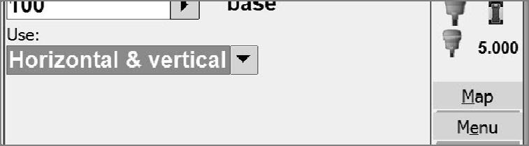
2 What We Will Talk About Today What coordinate system should I use in my data collector Site Calibrations-what s up with that? Tool of the Devil or a Useful Tool? Best Practices for Real Time observations How to improve confidence in a Real Time observation Seiler Instrument 3 Coordinate Systems Does it matter which one you choose? Nothing matters until it does! Everything is significant, but nothing matters or is it the other way around? That nothing is significant but everything matters? No Projection/No Datum NAD83 UTM Scale Factor 1 2


3 3


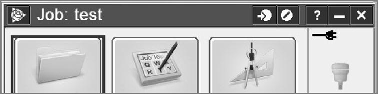
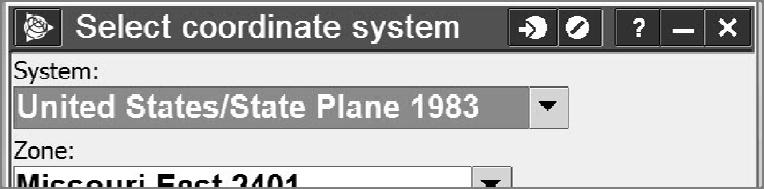
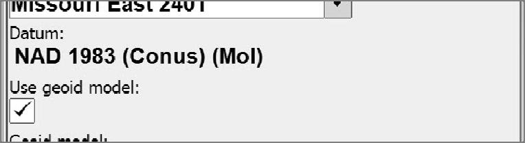
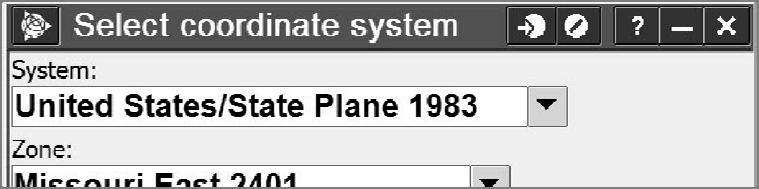
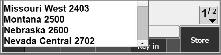
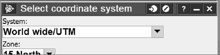
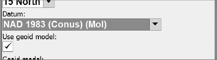
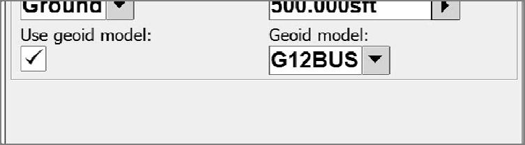
4 Series of slides showing Screen shots from collector of different coordinate system choices Discuss each one 4

5 5
6 6
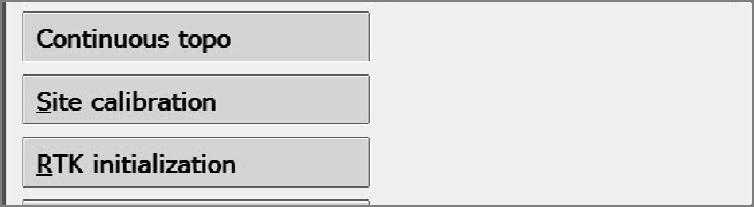
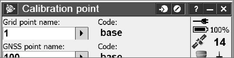
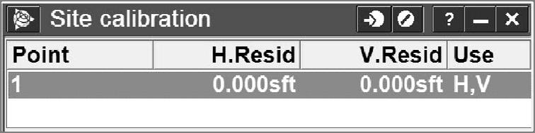
7 Site Calibrations Purpose of a site calibration LLe to NEE Transformation Rotation Scale Best fit Set Scale Factor to 1? Site Calibrations What coordinate system to start in What difference it makes No Projection/No Datum NAD83 UTM Scale Factor 1 7
8 Constraining to Passive Monuments Calibrations Localizations Seiler Instrument 15 Orthometric elevations (heights) Use four Benchmarks surrounding site PLUS the geoid model Use one Benchmark, use geoid model, check to another Benchmark Just use what comes out of the RTN Why are my elevations off by 100 feet? Probably should check at least one Benchmark if possible Seiler Instrument 16 8
9 9

10 10

11 11

12 12
13 13
14 14
15 15
 Limitations of Classical RTK Survey Limited range from single reference station Potential ti gross")
16 Datum Used by MoDOT RTN NAD Old datum NAD83 CORS96 ended 15 October 2015 Network broadcasts Latitude, Longitude and Ellipsoid heights You choose your coordinate system in your data collector Site Calibration NOT tied to any vertical control (Checks very well with high quality Benchmarks) Limitations of Classical RTK Survey Limited range from single reference station Potential ti gross error in establishing reference station ti Dependency on single reference station No integrity monitoring Productivity loss Security Communications Power supply Seiler Instrument 32 16
17 Benefits of a Reference Station Network Eliminate the need for local base stations Only GPS rover receivers are needed Less initial GPS expense because it doubles the number of GPS systems you have now No surveyor required to watch the base station Consistent known datum and coordinate system Seiler Instrument 33 Correction Streams (Mount Points) RTCM VRS_RTCM21 VRS_RTCM23RTCM23 VRS_RTCM31 VRS_CMRplus RTCM3Net_autocell VRS VRS_CMRplus VRS_CMRX BOOTHEEL_CMRplus BOOTHEEL_CMRx 17
18 What do you see in your data when you choose VRS_CMR? VRS_RTCM? Any advantage to one or the other? Reference Station Network (RTN) Accuracy, Reliability, Availability Good Bad Seiler Instrument 36 18
19 RTN Equipment Needed Dual frequency GNSS rover receiver Data collector Communications device to access the internet Appropriate accessories Seiler Instrument 37 Communication is the Key Cell phone. Bluetooth or old school cable Internal modem in receiver Internal modem in data collector Seiler Instrument 38 19
20 Communication is the Key (2) Intuicom RTK Bridge WiFi Hotspots MiFi devices Phones Other WiFi s Without the communication link VRS is not possible Seiler Instrument 39 Choose Your Wireless Provider Pick whoever has the best coverage in your area Maps are VERY generalized Only way to really know which carrier has best coverage is to test it yourself Seiler Instrument 40 20
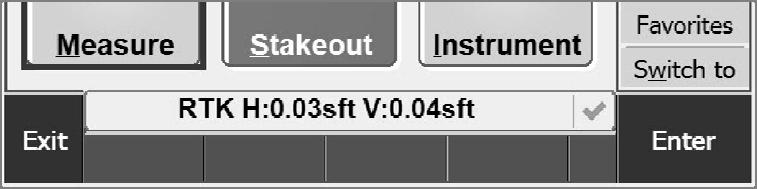
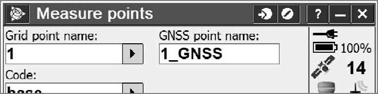
21 How Much Data Does a VRS Connection Use? Here is approximately what you could expect using CMR+ with 14 SVs for 8hrs straight: 1 sec: 310bytes 1 min: (310bytes x 60) = 18.6KB 1 hour: (18.6KB x 60) = 1.11MB 8 hrs: (1.11MB 11MB x 8) = 8.93MB 5GB (typical plan amount): 24/7 for 30 days Seiler Instrument 41 Best Methods for RTN Users Check Equipment, Data Collector Parameters & Site information Conditions Coordinates Communication Constraining to passive monuments (a.k.a. Calibrations or Localizations) Collection Confidence Seiler Instrument 42 21
22 Check Equipment and Parameters Measure the actual height of the antenna reference point (ARP) on the rover pole Ensure that all necessary and correct projection parameters are in the data collector Ensure that all project data are in the data collector Adjust the rover pole bubble before every campaign Seiler Instrument 43 Check Equipment (cont) Test wireless data communications (cell/cdma/sim card/etc.) for Internet connectivity at the project site. Make sure the GNSS unit and the communication device batteries are fully charged and that there are backups. For orthometric t heights, ht be sure to preload the current geoid model supplied by the NGS Seiler Instrument 44 22

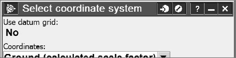
23 Coordinates Know what datum, adjustment and epoch is needed d for the coordinate data produced Know what datum, adjustment and epoch coordinates are supplied by the RTN Grid or Ground? Seiler Instrument 45 23


24 24
25 25


26 Communication Robust communication is the key to an effective RTN Wireless internet from a variety of sources lets you roam anywhere within an RTN Many options The GNSS solution at a point of interest should become fixed in a normal amount of time and should remain fixed for the duration of the actual data collection Seiler Instrument 52 26
27 Communication Robust communication is the key to an effective RTN Wireless internet from a variety of sources lets you roam anywhere within an RTN Many options The GNSS solution at a point of interest should become fixed in a normal amount of time and should remain fixed for the duration of the actual data collection Seiler Instrument 53 Confidence Redundancy is the king of RT GNSS positioning Redundancy gives confidence and refines the precision of the data Robust wireless Internet connectivity Coordinate accuracy will suffer if Latencies rise above 2 seconds Communication is intermittent during data capture Checks on known points Before, During, After Obvious Multipath avoid it Seiler Instrument 54 27
28 Best Methods for RTN Users - Summary Four basic elements to achieve reliability Communication Checks Redundancy Multipath Good GNSS gear, good field conditions and good field procedures will yield good Real Time positions Seiler Instrument 55 How to Ensure Accuracy in Real Time Solutions What is a real time (RTN) shot? How can you add redundancy to your work? Seiler Instrument 56 28
29 An RTK Shot is a Radial Sideshot Need to measure it more than once to know for sure that titi is right How do we achieve redundancy using RTK? Measure it more than once Measurements separated by time Change in the satellite constellation Seiler Instrument 57 Redundancy Store raw data at selected locations Submit to OPUS If setting two points for control Measuring between them with a total station (or tape) is an excellent check You can store more than one observation, and post process and adjust in office software. Seiler Instrument 58 29
30 How Much Time Between Observations? Ideally four hours How big is your budget on the job? Studies have shown For precise work where the height component is important, observe for three minutes and then another three minutes A separation of 20 minutes gives a 10-20% improvement in coordinate accuracy 45 minute separation gives a 15-30% improvement over a single epoch solution Seiler Instrument 59 If You Do Not Have Time Measure your point Dump the antenna Let it reinitialize Measure again Store as same number and look at differences Store as a different number and inverse More of a warm and fuzzy check than anything Seiler Instrument 60 30
31 Or For practical reasons, most users cannot wait four hours between RTN observations due to cost and logistics. Record your first point measurement Force receiver to lose initialization Raise elevation mask to 90 degrees Change antenna height by 0.3 meters (0.98 feet - Longer than one wavelength of the GPS signal) Seiler Instrument 61 Or Change antenna mask back to 10 degrees Do a Known Point initialization on the point you stored If it does not succeed, the first shot probably wasn t any good Then measure again after 20 minutes to allow change in constellation Seiler Instrument 62 31
32 RTN Initialization For example, on newer Trimble GNSS receivers Built in routine for RTN Initialization Resets Satellite Tracking Closes elevation mask to 90 Lose all SVs Reset mask to 10 Regain SVs Regain initializationiti Can be added to a hot key Can be done manually on any receiver Seiler Instrument 63 A Best Practice Two observed control measurements for ALL SURVEY POINTS 1 st observation 60 seconds Re-initialize 10 m from last initialization Change antenna height by 0.30 m 2 nd observation 30 seconds If H & V deltas within & (m), store as check Time between observations is recommended but not mandatory Seiler Instrument 64 32


33 In Summary Takes longer to get to most points than it does to shoot them Longer observation is better Redundancy is better than longer observation I would rather see two 60 second shots than one 180 second shot NO single shots on important points Just too many variables Seiler Instrument 65 33
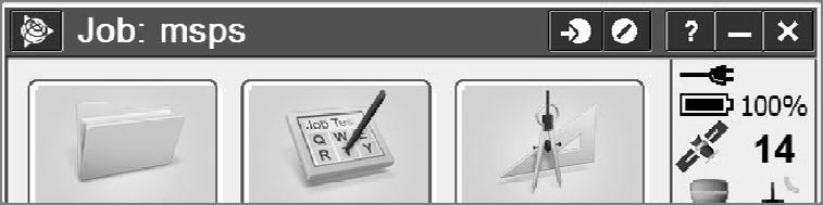
MSPS 54 th Annual Meeting October 15, 2011 Tom Bryant, PLS
 MSPS 54 th Annual Meeting October 15, 2011 Tom Bryant, PLS Tom Bryant PLS Seiler Instrument Company St. Louis MO Technical Support and Training Manager Tom Seiler Seiler Instrument Company Vice President
Utilizing A GNSS Network Solution for Utility Applications
 Utilizing A GNSS Network Solution for Utility Applications David Newcomer, PE, PLS GPServ, Inc. newcomer@ (407) 601-5816 AGENDA Types and accuracies of data collection o Autonomous o Meter + o Sub-meter
TDS Ranger Survey Pro CE Version RTK Base on known Control Point. RTK Rover - Localization with Control Points.
 TDS Ranger Survey Pro CE Version 2.1.8 RTK Base on known Control Point. RTK Rover - Localization with Control Points. Pre-load control Coordinates and appropriate NGS Geoid 99/96 data files into the Ranger
TDS Survey Pro CE Version Setup RTK Base on known NAD83/WGS84 Point: Mapping Plane Geoid99 Modeling.
 TDS Survey Pro CE Version 2.1.8 Setup RTK Base on known NAD83/WGS84 Point: Mapping Plane Geoid99 Modeling. Pre-load known NAD83 State Plane Coordinates and appropriate NGS Geoid 99/96 data files into the
DYNAMIC RT TECHNOLOGY
 DYNAMIC RT TECHNOLOGY GLOBAL NAVIGATION SATELLITE SYSTEMS (GNSS) POTENTIAL FUTURE DEVELOPMENTS(2005 2017?) GPS MODERNIZATION BLOCK IIF & III GLONASS ENHANCEMENTS (K & M) EUROPEAN UNION - GALILEO CHINA
GNSS 101 Bringing It Down To Earth
 GNSS 101 Bringing It Down To Earth Steve Richter Frontier Precision, Inc. UTM County Coordinates NGVD 29 State Plane Datums Scale Factors Projections Session Agenda GNSS History & Basic Theory Coordinate
The Global Positioning System II Field Experiments
 The Global Positioning System II Field Experiments 5-1 Mexico DGPS Field Campaign Cenotes in Tamaulipas, MX, near Aldama 5-2 Are Cenote Water Levels Related? 5-3 DGPS Static Survey of Cenote Water Levels
High Precision GNSS for Mapping & GIS Professionals
 High Precision GNSS for Mapping & GIS Professionals Agenda Address your needs for GNSS knowledge. GNSS Basics Satellite Ranging Fundamentals (Code $ Carrier) Differential Corrections (Post Processed $
The Global Positioning Sytem II 10/19/2017
 The Global Positioning System II Field Experiments 10/19/2017 5-1 Mexico DGPS Field Campaign Cenotes in Tamaulipas, MX, near Aldama 10/19/2017 5-2 Are Cenote Water Levels Related? 10/19/2017 5-3 M. Helper,
SurvCE: configuration of S9III/S8 for a UHF radio connection
 SurvCE: configuration of S9III/S8 for a UHF radio connection This tutorial will show the basic settings of a S9III/S8 as a base, transmitting with its internal radio or with a generic external radio, and
The Reasons to Succeed or to Fail a GNSS Network RTK Project
 The Reasons to Succeed or to Fail a GNSS Network RTK Project Joël van Cranenbroeck, Managing Director CGEOS Creative Geosensing sprl-s, Belgium Andy Yin, International Sales Director ComNav Technology
Using RTK GNSS Wisely
 Using RTK GNSS Wisely February 017 Autonomous Positioning Differential Positioning Concept: Detect and cancel identical errors with simultaneous observation. F + E = G + E 1 Static & RTK Computations Static
The Role of F.I.G. in Leading the Development of International Real-Time Positioning Guidelines
 The Role of F.I.G. in Leading the Development of International Real-Time Positioning Guidelines, USA Key Words: RTN, real-time, GNSS, Guidelines SUMMARY The rapid growth of real-time reference station
Datums and Tools to Connect Geospatial Data Accurately
 Datums and Tools to Connect Geospatial Data Accurately Pamela Fromhertz Colorado State Geodetic Advisor National Geodetic Survey National Oceanic and Atmospheric Administration GIS-T April 18, 2012 Loveland,
GPS for. Land Surveyors. Jan Van Sickle. Fourth Edition. CRC Press. Taylor & Francis Group. Taylor & Francis Croup, an Informa business
 GPS for Land Surveyors Fourth Edition Jan Van Sickle CRC Press Taylor & Francis Group Boca Raton London New York CRC Press is an imprint of the Taylor & Francis Croup, an Informa business Contents Preface
Mark s MobileMapper 120, ProMark 120, ProMark 220 Notes
 1 Mark s MobileMapper 120, ProMark 120, ProMark 220 Notes By: Mark Silver, ms@igage.com, +1 801-412-0011 Updated: 19 November 2012 All of the MobileMapper and ProMark products, software and accessories
FieldGenius Technical Notes GPS Terminology
 FieldGenius Technical Notes GPS Terminology Almanac A set of Keplerian orbital parameters which allow the satellite positions to be predicted into the future. Ambiguity An integer value of the number of
Chapter 6 GPS Relative Positioning Determination Concepts
 Chapter 6 GPS Relative Positioning Determination Concepts 6-1. General Absolute positioning, as discussed earlier, will not provide the accuracies needed for most USACE control projects due to existing
Connecting a Cadastral Survey to PNG94 using GNSS
 43rd Association of Surveyors PNG Congress, Lae, 12th-15th August 2009 Connecting a Cadastral Survey to PNG94 using GNSS Richard Stanaway QUICKCLOSE Workshop overview Legal requirements to connect surveys
S320 and SurvCE RTK Base Unknown Location
 S320 and SurvCE RTK Base Unknown Location Part Number 874-0303-000 Released April 17, 2012 Overview This document describes how to configure the S320 RTK base using SurvCE at an unknown location, perform
Determining Accurate Elevations: Datums & Tools, Today & Tomorrow
 Determining Accurate Elevations: Datums & Tools, Today & Tomorrow Association of State Floodplain Managers Annual Meeting Grand Rapids, MI Christine Gallagher June 21, 2016 Overview NGS Mission Important
FieldGenius Technical Notes GPS Differential Corrections
 FieldGenius Technical tes GPS Differential Corrections Introduction The accuracy requirement of survey grade or mapping grade GPS applications for real time positioning requires the use of differential
GNSS & Coordinate Systems
 GNSS & Coordinate Systems Matthew McAdam, Marcelo Santos University of New Brunswick, Department of Geodesy and Geomatics Engineering, Fredericton, NB May 29, 2012 Santos, 2004 msantos@unb.ca 1 GNSS GNSS
Connecting a Survey to PNG94 and MSL using GNSS
 45th Association of Surveyors PNG Congress, Madang, 19-22 July 2011 Connecting a Survey to PNG94 and MSL using GNSS Richard Stanaway QUICKCLOSE Workshop overview Legal requirements to connect surveys to
Indian Institute of Technology Kanpur Department of Civil Engineering
 Indian Institute of Technology Kanpur Department of Civil Engineering Inquiry No- CE/JNM/2013-14/R-10 30 December, 2013 Subject: Quotation for supply of Integrated System/Smart System Reflectorless Robotic
ELEMENTS OF THE NATIONAL SPATIAL REFERENCE SYSTEM
 Dave Doyle NGS Chief Geodetic Surveyor dave.doyle@noaa.gov 301-713-3178 ELEMENTS OF THE NATIONAL SPATIAL REFERENCE SYSTEM ESRI SURVEY SUMMIT San Diego, CA June 17, 2007 ftp://ftp.ngs.noaa.gov/dist/daved/esri
The Global Positioning System II Field Experiments. 10/10/2013 GEO327G/386G, UT Austin 5-1
 The Global Positioning System II Field Experiments 10/10/2013 GEO327G/386G, UT Austin 5-1 Mexico DGPS Field Campaign Cenotes in Tamaulipas, MX, near Aldama 10/10/2013 GEO327G/386G, UT Austin 5-2 Are Cenote
GPS Accuracy Comparison. Tom Biernacki Florida Department of Environmental Protection
 GPS Accuracy Comparison Tom Biernacki Florida Department of Environmental Protection What Effects the accuracy of GPS? Atmospheric delay Multipath bounce Weak receiver algorithms Atmospheric Delay Signal
Guidelines for RTK/RTN GNSS Surveying in Canada
 Guidelines for RTK/RTN GNSS Surveying in Canada July 2015 Version 1.2 Ministry of Transportation Ministère des Transports EARTH SCIENCES SECTOR GENERAL INFORMATION PRODUCT 100-E Main Authors: Brian Donahue,
Determining Accurate Elevations: Datums & Tools, Today & Tomorrow
 Determining Accurate Elevations: Datums & Tools, Today & Tomorrow Maryland Association Floodplain and Stormwater Managers Linthicum Heights, MD Christine Gallagher Oct. 20, 2016 Overview NGS Mission Important
NYSNET 11/28/2014 GPS/GLONASS (GG) January 2015 NYSAPLS Conference
 January 2015 NYSAPLS Conference") GPS/GLONASS (GG) January 2015 NYSAPLS Conference 2015 1 NYSNet 2015 GLONASS Upgrades Antenna Types Single Base/Network RTK GPS/GLONASS (GG) Single Base GPS/GLONASS (GG) Network RTK RT Products (NTRIP Mount
GPS/GLONASS (GG) January 2015 NYSAPLS Conference 2015 1 NYSNet 2015 GLONASS Upgrades Antenna Types Single Base/Network RTK GPS/GLONASS (GG) Single Base GPS/GLONASS (GG) Network RTK RT Products (NTRIP Mount
Geodesy, Geographic Datums & Coordinate Systems
 Geodesy, Geographic Datums & Coordinate Systems What is the shape of the earth? Why is it relevant for GIS? 1/23/2018 2-1 From Conceptual to Pragmatic Dividing a sphere into a stack of pancakes (latitude)
670 10/26/17 SSD: 07/14/16, 09/16/17 Page 1 of 6
 SSD: 07/14/16, 09/16/17 Page 1 of 6 S P E C I A L P R O V I S I O N Section MISCELLANEOUS INCIDENTALS Item.822 - GNSS Construction Inspection Equipment Description SAMPLE PROJECT 12345 10/30/17 1.1 Work
Using GPS to Establish the NAVD88 Elevation on Reilly The A-order HARN Station at NMSU
 Using GPS to Establish the NAVD88 Elevation on Reilly The A-order HARN Station at NMSU Earl F. Burkholder, PS, PE New Mexico State University Las Cruces, NM 88003 July 005 Introduction GPS has become an
GNSS Receivers, Sensors, Desktop Solutions
 GNSS Receivers, Sensors, Desktop Solutions keep it simple high performance: the best GNSS tracking in field ready, reliable packages coupled with the best field and desktop software tools support and service
Best field practices for GIS Data collection: Presented by, Jacob Wittenberg Frontier Precision, Inc.
 Best field practices for GIS Data collection: Presented by, Jacob Wittenberg Frontier Precision, Inc. Agenda What is GNSS Code and Carrier Data H-Star Processing Best Practices Code and Carrier Solutions
Guide to GNSS Base stations
 Guide to GNSS Base stations Outline Introduction Example of a base station (TUMSAT) Preparation for setting up a base station Procedure for setting up a base station Examples at two other universities
Bulletin. Loss Control. Land Surveyors. Towards Achieving Measurement Redundancy* Professional Liability Insurance. Background
 Bulletin No. 13 February 2008 Revised November 2014 ENCON Group Inc. Telephone 613-786-2000 Facsimile 613-786-2001 Toll Free 800-267-6684 www.encon.ca Loss Control Bulletin Land Surveyors Professional
CHAPTER THREE DATA SETUP
 CHAPTER THREE DATA SETUP 3 DATA SETUP 3 OVERVIEW NOTE: Refer to Conventions Used in this Manual, in Chapter 1, for terminology used in this chapter and/or the order of precedence of contract documentation.
Geodetic Positioning Refresher
 Geodetic Positioning Refresher by Joan Yau PhD ABCLS AGM 2016, Kimberley BC Contents Horizontal / Vertical Datums and Epochs used in BC and Canada How do we reference our project coordinates to BC datums
G10 G10 G10 LAND SURVEYING RTK GNSS SYSTEM RTK GNSS SYSTEM RTK GNSS SYSTEM. GENEQ inc. GNSS RTK measurement technology revolution
 GENEQ inc. S C I E N T I F I C I N S T R U M E N T S LAND SURVEYING RTK GNSS SYSTEM RTK GNSS SYSTEM RTK GNSS SYSTEM G10 G10 G10 The new generation full function GNSS Receiver GNSS RTK measurement technology
Guidelines for RTK/RTN GNSS Surveying in Canada
 Guidelines for RTK/RTN GNSS Surveying in Canada Brian Donahue GSD/NRCan Jan Wentzel SGB/NRCan Ron Berg MTO December 2012 Version 1.0.7 Ministry of Transportation Table of Contents Table of Acronyms...
GROUND CONTROL SURVEY REPORT
 GROUND CONTROL SURVEY REPORT Services provided by: 3001, INC. a Northrop Grumman company 10300 Eaton Place Suite 340 Fairfax, VA 22030 Ground Control Survey in Support of Topographic LIDAR, RGB Imagery
Next Generation Positioning Infrastructure
 Next Generation Positioning Infrastructure The GNSS Network in the 21 st Century Joel VAN CRANENBROECK & Partners Beyond East & West GeoSensing Community 1 INFRASTRUCTURE "The installations that form the
Asian Journal of Science and Technology Vol. 08, Issue, 11, pp , November, 2017 RESEARCH ARTICLE
 Available Online at http://www.journalajst.com ASIAN JOURNAL OF SCIENCE AND TECHNOLOGY ISSN: 0976-3376 Asian Journal of Science and Technology Vol. 08, Issue, 11, pp.6697-6703, November, 2017 ARTICLE INFO
CHC i80 GNSS Receiver QuickTour with LandStar7. (PDA Network Mode)
") CHC i80 GNSS Receiver QuickTour with LandStar7 (PDA Network Mode) 1.Prerequisites Hardware: CHC i80 rover, Controller Kit, SIM card,lithium Battery, pole Software: LandStar7 2.Steps to set i80 working
CHC i80 GNSS Receiver QuickTour with LandStar7 (PDA Network Mode) 1.Prerequisites Hardware: CHC i80 rover, Controller Kit, SIM card,lithium Battery, pole Software: LandStar7 2.Steps to set i80 working
Overview of New Datums NOAA s National Geodetic Survey
 Overview of New Datums NOAA s National Geodetic Survey February 3, 2015 1 NGS s Mission and Role NGS Mission: To define, maintain, and provide access to the National Spatial Reference System to meet our
ENGI 3703 Surveying and Geomatics
 Satellite Geometry: Satellites well spread out in the sky have a much stronger solution to the resection type problem (aka trilateration) then satellite that are grouped together. Since the position of
SURVEYORS BOARD OF QUEENSLAND. RTK GNSS for Cadastral Surveys. Guideline
 SURVEYORS BOARD OF QUEENSLAND RTK GNSS for Cadastral Surveys Guideline 30 November 2012 RTK GNSS for Cadastral Surveys General The Surveyors Board of Queensland has recently become aware of some issues
Trimble GNSS Infrastructure
 Trimble GNSS Infrastructure A History of Innovation Trimble, the first company to offer commercial GPS products company to integrate GPS with communications technology RTK system in the market in 1994
GeoMax GNSS Zenith10 & Zenith20 Series
 GeoMax GNSS Zenith10 & Zenith20 Series GeoMax About Us At GeoMax we provide a com- group with strong market At GeoMax, we concentrate on prehensive portfolio of inte- positions within measurement providing
RTN 101: RTN101. >> By Gavin Schrock, LS. Technological Approaches to Network-based Corrections (Part 7)
") RTN101 Approaches, Implementations, Brands & Choices Network corrected real-time is a technological approach to high precision GPS/ GNSS positioning that has been theorized about, studied, experimented
RTN101 Approaches, Implementations, Brands & Choices Network corrected real-time is a technological approach to high precision GPS/ GNSS positioning that has been theorized about, studied, experimented
National Report of Greece to EUREF 2009
 National Report of Greece to EUREF 2009 M. Gianniou KTIMATOLOGIO S.A. (Hellenic Cadastre) 1 Introduction In 2007, KTIMATOLOGIO S.A (Hellenic Cadastre) established HEPOS, the HEllenic POsitioning System,
GNSS CONSTRUCTION INSPECTION EQUIPMENT
 Project: Jamaica-Winhall STP 2904(1) Advertised Date: 5/30/2018 GNSS CONSTRUCTION INSPECTION EQUIPMENT DESCRIPTION. This work shall consist of furnishing, configuring, installing, maintaining, and removing
NJDEP GPS Data Collection Standards for GIS Data Development
 NJDEP GPS Data Collection Standards for GIS Data Development Bureau of Geographic Information Systems Office of Information Resource Management April 24 th, 2017 Table of Contents 1.0 Introduction... 3
Setting up i80 CHC receiver in RTK mode using TcpGPS
 Sumatra, 9 E-29190 Málaga (Spain) www.aplitop.com Phone: +34 952439771 Fax: +34 952431371 Technical Note (tcpgps_en_v41_002_setting_up_chc_i80_in_rtk_mode) Setting up i80 CHC receiver in RTK mode using
FREQUENTLY ASKED QUESTIONS (FAQ)
") FREQUENTLY ASKED QUESTIONS (FAQ) GSR2600 FAQs The following sections provide answers to some of the frequently asked questions about the GSR2600 system. GSR2600 Receiver GSR2600 Compatibility SDR Level
FREQUENTLY ASKED QUESTIONS (FAQ) GSR2600 FAQs The following sections provide answers to some of the frequently asked questions about the GSR2600 system. GSR2600 Receiver GSR2600 Compatibility SDR Level
Trimble NetR9 Reference Receiver Series: Frequently Asked Questions
 July 2010 Trimble NetR9 Reference Receiver Series: Frequently Asked Questions What is the Trimble NetR9 GNSS reference receiver? The Trimble NetR9 GNSS (Global Navigation Satellite System) reference receiver
LAB PROCEDURES: TOPCON TOOLS FAMILIARIZATION
 LAB PROCEDURES: TOPCON TOOLS FAMILIARIZATION This lab will cover the basic setup and processing options of Topcon Tools (TT). We will learn how to start a project, upload data and control files, set up
Datums for a Dynamic Earth
 Datums for a Dynamic Earth Based on a paper given at the American Society of Agricultural and Biological Engineers (ASABE) Conference in Reno, Nevada June 2009 Rollin StrohmanPh.D. Tom Mastin L.S Background
Guidelines for Laying Targets for Ground Control Points
 Guidelines for Laying Targets for Ground Control Points Overview of target requirements: Three to four unambiguous ground survey targets, recognizable in the satellite photo, are requested. The survey
COMPARISON OF RELATIVE AND ABSOLUTE PRECISION OF OHIO S WIDE AREA GPS NETWORK INCLUDING THE COMPARISON WITH ALTERNATIVE METHODS.
 COMPARISON OF RELATIVE AND ABSOLUTE PRECISION OF OHIO S WIDE AREA GPS NETWORK INCLUDING THE COMPARISON WITH ALTERNATIVE METHODS A Thesis Presented in Partial Fulfillment of the Requirements for the Degree
Global Positioning Systems -GPS
 Global Positioning Systems -GPS GPS Why? What is it? How does it work? Differential GPS How can it help me? GPS Why?? Where am I? How do I get there? Where are you, and how do I get to You? WHO CARES???
Global Positioning Systems - GPS
 Global Positioning Systems - GPS GPS Why? What is it? How does it work? Differential GPS How can it help me? GPS Why?? Where am I? How do I get there? Where are you, and how do I get to You? WHO CARES???
GPS STATIC-PPP POSITIONING ACCURACY VARIATION WITH OBSERVATION RECORDING INTERVAL FOR HYDROGRAPHIC APPLICATIONS (ASWAN, EGYPT)
") GPS STATIC-PPP POSITIONING ACCURACY VARIATION WITH OBSERVATION RECORDING INTERVAL FOR HYDROGRAPHIC APPLICATIONS (ASWAN, EGYPT) Ashraf Farah Associate Professor,College of Engineering, Aswan University,
GPS STATIC-PPP POSITIONING ACCURACY VARIATION WITH OBSERVATION RECORDING INTERVAL FOR HYDROGRAPHIC APPLICATIONS (ASWAN, EGYPT) Ashraf Farah Associate Professor,College of Engineering, Aswan University,
Lecture 16 NAD 83 (1986), NAD 83(1993) and NAD 83 (NSRS 2007) 10 March 2009 GISC3325
, NAD 83(1993) and NAD 83 (NSRS 2007) 10 March 2009 GISC3325") Lecture 16 NAD 83 (1986), NAD 83(1993) and NAD 83 (NSRS 2007) 10 March 2009 GISC3325 Significant dates 16-20 March 2009 is Spring Break 12 March 2009 is Exam Two Emphasis on chapter 5, 6 and 8 of text
Lecture 16 NAD 83 (1986), NAD 83(1993) and NAD 83 (NSRS 2007) 10 March 2009 GISC3325 Significant dates 16-20 March 2009 is Spring Break 12 March 2009 is Exam Two Emphasis on chapter 5, 6 and 8 of text
Alberding solutions for GNSS infrastructure operators
 Tamás Horváth Alberding solutions for GNSS infrastructure operators 21.11.2017 1/35 Alberding solutions for GNSS infrastructure operators Tamás Horváth Alberding GmbH 4 th EUPOS Technical Meeting 21-22
A GLONASS Observation Message Compatible With The Compact Measurement Record Format
 A GLONASS Observation Message Compatible With The Compact Measurement Record Format Leica Geosystems AG 1 Introduction Real-time kinematic (RTK) Global Navigation Satellite System (GNSS) positioning has
Accuracy Evaluation Internet-Based GNSS for Kinematic Surveying the Case Study in Thailand
 Accuracy Evaluation Internet-Based GNSS for Kinematic Surveying the Case Study in Thailand Kritsada Anantakarn 1 1 Faculty of Engineering and Architectural : Uthenthawai campus. Rajamongala University
ProMark 3 RTK. White Paper
 ProMark 3 RTK White Paper Table of Contents 1. Introduction... 1 2. ProMark3 RTK Operational Environment... 2 3. BLADE TM : A Unique Magellan Technology for Quicker Convergence... 3 4. ProMark3 RTK Fixed
Specifications. Trimble BX982 Modular GNSS Heading Receiver
 Name Configuration Option Base and Rover interchangeability Rover position update rate Rover maximum range from base radio Rover operation within a VRS network Heading and Moving Base operation Factory
GNSS Accuracy Improvements through Multipath Mitigation with New Signals and services
 GNSS Accuracy Improvements through Multipath Mitigation with New Signals and services Andrey Veytsel, Ph.D Moscow Technical University 10 Meeting of the International Committee on Global Navigation Satellite
NRTK services in Ireland - an Evaluation
 NRTK services in Ireland - an Evaluation Dr. Audrey Martin & Dr. Eugene McGovern, Dublin Institute of Technology, Ireland. FIG Working Week, May 12 Ireland s Survey Infrastructure 1995 IRENET ING 185 Ground
ION ITM Tokyo University of Marine Science and Technology H. Sridhara, N. Kubo, R.Kikuchi
 Single-Frequency Multi-GNSS RTK Positioning for Moving Platform ION ITM 215 215.1.27-29 Tokyo University of Marine Science and Technology H. Sridhara, N. Kubo, R.Kikuchi 1 Agenda Motivation and Background
LAB 1 METHODS FOR LOCATING YOUR FIELD DATA IN GEOGRAPHIC SPACE. Geog 315 / ENSP 428
 LAB 1 METHODS FOR LOCATING YOUR FIELD DATA IN GEOGRAPHIC SPACE Geog 315 / ENSP 428 Lab 1 Schedule Introduction to bio-physical field data collection (8:00-8:20am) Locating your data on the earth: NAVSTAR
Is neo-cadastral surveying on your smartphone feasible?
 Is neo-cadastral surveying on your smartphone feasible? School of Civil & Environmental Engineering Craig Roberts UNSW Paul Davis-Raiss, David Lofberg, Greg Goodman LandTeam Van der Vlugt, 2012 1 Cadastral
2/15/2018. Survey grade GPS. (or enough information to be very dangerous) Raymond Hintz University of Maine
 Raymond Hintz University of Maine") Survey grade GPS (or enough information to be very dangerous) Raymond Hintz University of Maine Ray.hintz@maine.edu GPS is old school The correct term is now GNSS (Global Navigation Satellite System) which
Survey grade GPS (or enough information to be very dangerous) Raymond Hintz University of Maine Ray.hintz@maine.edu GPS is old school The correct term is now GNSS (Global Navigation Satellite System) which
Technology Talk Bulletin
 Technology Talk Bulletin This Technology Talk Bulletin compares John Deere dealer s current Real Time Kinematic (RTK) base station approach to the different RTK technologies available. What is RTK? RTK
PROCEDURE FOR GNSS EQUIPMENT VERIFICATION IN STATIC POSITIONING
 M. Tsakiri, V. Pagounis, V. Zacharis Procedure for GNSS equipment verification in static positioning PROCEDURE FOR GNSS EQUIPMENT VERIFICATION IN STATIC POSITIONING Maria TSAKIRI, School of Rural and Surveying
Monitoring with low-cost GNSS receivers
 Monitoring with low-cost GNSS receivers GNSS monitoring with low-cost receivers 1 Why GNSS? Your advantages! free of charge and available worldwide No line of sight connection is necessary to the measuring
All you wanted to know about High Accuracy Data Collection Eric Muncy Precision Products Mapping-GIS Division
 All you wanted to know about High Accuracy Data Collection Eric Muncy Precision Products Mapping-GIS Division Tell me your name What School / Organization Any experience with GPS equipment What would you
GPS NAVSTAR PR (XR5PR) N/A
 N/A") WinFrog Device Group: GPS Device Name/Model: Device Manufacturer: Device Data String(s) Output to WinFrog: WinFrog Data String(s) Output to Device: NAVSTAR PR (XR5PR) Symmetricom Navstar Systems Ltd. Mansard
WinFrog Device Group: GPS Device Name/Model: Device Manufacturer: Device Data String(s) Output to WinFrog: WinFrog Data String(s) Output to Device: NAVSTAR PR (XR5PR) Symmetricom Navstar Systems Ltd. Mansard
Leica Spider Infrastructure HW Solutions Introducing: Leica GR30 & GR50
 Leica Spider Infrastructure HW Solutions Introducing: Leica GR30 & GR50 Reliable solutions for today and tomorrow Leica Spider Integrated Solutions Introducing: Leica GR30 & GR50 Outline Introducing Leica
Using Dual Frequency GPS Under Tree Canopy
 Using Dual Frequency GPS Under Tree Canopy Presented by: Jon Aschenbach Resource Supply, LLC PO Box 663 West Linn, OR 97068 503-521-0888 Field Technology Conference 11-2015 Four Scenarios Will Be Reviewed
CHAPTER 7 Total Station Surveying. CE 316 March 2012
 CHAPTER 7 Total Station Surveying CE 316 March 2012 249 7.1 Introduction Total station surveying - defined as the use of electronic survey equipment used to perform horizontal and vertical measurements
Contents. Chapter 1 Brief Introduction of K9 series Chapter 2 K9 series mainframe The appearance of mainframe Interface...
 Contents Chapter 1 Brief Introduction of K9 series... 1 Chapter 2 K9 series mainframe... 2 2.1 The appearance of mainframe... 2 2.2 Interface... 2 2.3 The installation of battery... 3 2.4 Guiding light
Beginners Guide to GPS Elevation Plus an Update on GPS Technology
 Beginners Guide to GPS Elevation Plus an Update on GPS Technology A TMS Presentation By: Jon Aschenbach Summerlake Enterprises 919 36 th Place Forest Grove, OR 97116 503-707-6236 Coeur d Alene, ID April,
Performance Evaluation Of Real Time Precise Point Positioning (RT-PPP) In Static & Kinematic Modes In Egypt
 In Static & Kinematic Modes In Egypt") Performance Evaluation Of Real Time Precise Point Positioning (RT-PPP) In Static & Kinematic Modes In Egypt Eng. Ahmed Mansour Abdallah Dr. Mahmoud Abd Rabbou Prof. Adel El.shazly Geomatic Branch, Civil
Performance Evaluation Of Real Time Precise Point Positioning (RT-PPP) In Static & Kinematic Modes In Egypt Eng. Ahmed Mansour Abdallah Dr. Mahmoud Abd Rabbou Prof. Adel El.shazly Geomatic Branch, Civil
al T TD ) ime D Faamily Products The RTD Family of products offers a full suite of highprecision GPS sensor positioning and navigation solutions for:
 ime D Faamily Products The RTD Family of products offers a full suite of highprecision GPS sensor positioning and navigation solutions for:") Reeal ynnamics al T amics (R TD ) ime D RTD) Time Dy Faamily mily ooff P roducts Products The RTD Family of products offers a full suite of highprecision GPS sensor positioning and navigation solutions
Reeal ynnamics al T amics (R TD ) ime D RTD) Time Dy Faamily mily ooff P roducts Products The RTD Family of products offers a full suite of highprecision GPS sensor positioning and navigation solutions
Lecture # 7 Coordinate systems and georeferencing
 Lecture # 7 Coordinate systems and georeferencing Coordinate Systems Coordinate reference on a plane Coordinate reference on a sphere Coordinate reference on a plane Coordinates are a convenient way of
Specifications. Trimble SPS985L GNSS Smart Antenna
 Receiver Name Configuration Option Base and Rover interchangeability Rover position update rate Rover maximum range from base radio Rover operation within a VRS network Heading and Moving Base operation
The Global Positioning System
 The Global Positioning System 5-1 US GPS Facts of Note DoD navigation system First launch on 22 Feb 1978, fully operational in 1994 ~$15 billion (?) invested to date 24 (+/-) Earth-orbiting satellites
GeoExplorer 6000 series: Customer FAQs
 16 July 2012 GeoExplorer 6000 series: Customer FAQs This document includes information about the Trimble GeoExplorer 6000 series GeoXH and GeoXT handhelds. For information about the Trimble GeoXR Network
An NGS Illustrated Guide to Geodesy for GIS Professionals
 An NGS Illustrated Guide to Geodesy for GIS Professionals Michael Dennis, RLS, PE michael.dennis@noaa.gov Esri User Conference San Diego Convention Center July 14-18, 2014 San Diego, CA Why should we care
GNSS Low-Cost High-Accuracy Receiver (L-CHAR)
") GNSS Low-Cost High-Accuracy Receiver (L-CHAR) Dinesh Manandhar Center for Spatial Information Science The University of Tokyo Contact Information: dinesh@iis.u-tokyo.ac.jp Slide : 1 High Accuracy Receivers
GNSS Low-Cost High-Accuracy Receiver (L-CHAR) Dinesh Manandhar Center for Spatial Information Science The University of Tokyo Contact Information: dinesh@iis.u-tokyo.ac.jp Slide : 1 High Accuracy Receivers
Introduction to GNSS Base-Station
 Introduction to GNSS Base-Station Dinesh Manandhar Center for Spatial Information Science The University of Tokyo Contact Information: dinesh@iis.u-tokyo.ac.jp Slide : 1 Introduction GPS or GNSS observation
Lecture 14 NAD 83(NSRS), NAD 83(CORS 96), WGS84 and ITRF
, NAD 83(CORS 96), WGS84 and ITRF") Lecture 14 NAD 83(NSRS), NAD 83(CORS 96), WGS84 and ITRF Monday, March 1, 2010 2 March 2010 GISC3325 NAD 27 and NAD 83 NAD 27 and NAD 83 Versions of NAD 83 First implementation labeled NAD 83 (1986). Deficiencies
Lecture 14 NAD 83(NSRS), NAD 83(CORS 96), WGS84 and ITRF Monday, March 1, 2010 2 March 2010 GISC3325 NAD 27 and NAD 83 NAD 27 and NAD 83 Versions of NAD 83 First implementation labeled NAD 83 (1986). Deficiencies
SUPPORT OF NETWORK FORMATS BY TRIMBLE GPSNET NETWORK RTK SOLUTION
 SUPPORT OF NETWORK FORMATS BY TRIMBLE GPSNET NETWORK RTK SOLUTION TRIMBLE TERRASAT GMBH, HARINGSTRASSE 19, 85635 HOEHENKIRCHEN, GERMANY STATUS The Trimble GPSNet network RTK solution was first introduced
Overview of New Datums
 Overview of New Datums Scott Lokken NC Advisor NOAA s National Geodetic Survey 9/4/2015 1 New Datums are Coming in 2022! Both a new geometric and a new geopotential (vertical) datum will be released in