Next Generation Positioning Infrastructure
|
|
|
- Samson Holt
- 6 years ago
- Views:
Transcription

1 Next Generation Positioning Infrastructure The GNSS Network in the 21 st Century Joel VAN CRANENBROECK & Partners Beyond East & West GeoSensing Community 1


2 INFRASTRUCTURE "The installations that form the basis for any operation or system". GNSS RTK is High Precision Survey 2
3 GNSS SINGLE RTK Accuracy, Reliability, Availability Good Bad Range Error ε Distance Dependency transmitted corrections ε R δ M ε M ε R Quality Degradation with Distance true corrections Reference Practical Limit of RTK Rover Distance 3
 R k = R δ r Residuals are used to derive an interpolation model Typically ~ 80 km Network Corrections transmitted corrections Range Error ε R δ M Quality Degradation from Interpolation")
4 Derived Observation Corrections Phase and Code Corrections δ δ ( N ( ϕ ϕ ) + E ( λ λ ) cos( ϕ )) r0 = α 0 R 0 ( N ( ϕ ϕ ) + E ( λ λ ) cos( ϕ )) r1 = β H 1 R 1 R R R R Longitude and Latitude of the Mobile ( x,y ) R k = R δ r Residuals are used to derive an interpolation model Typically ~ 80 km Network Corrections transmitted corrections Range Error ε R δ M Quality Degradation from Interpolation true corrections ε R Reference Rover Reference Distance With a GNSS Network RTK (interpolation & extrapolation) no more distance dependency. The choice of the CREATIVE Master Station GEOSENSING can be any SPRL-S Reference Engineering station selected Geodesy within the Consultancy cell. 4


5 GNSS Network RTK Accuracy, Reliability, Availability Good Bad GNSS NETWORK BENEFITS Single RTK NETWORK RTK 5

6 PASSIVE GEODETIC ACTIVE GEODETIC NETWORK NETWORK GNSS NETWORK RTK 6
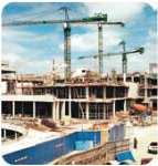
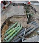


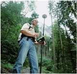

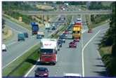
7 COMMUNITY Positioning Infrastructure Building Construction Utilities Sector GPS Monitoring Precise Vehicle Tracking Emergency Services Port Operations Land Surveying Machine Control Agriculture 7
8 From 2001 GNSS Network RTK developed for supporting High Accuracy Surveying GNSS RTK Only one GNSS Rover RTK needed! Good Communication ( GSM, GPRS, 4G, ) is mandatory! ( Network & Rover ) Manufacturers are competing with models VRS, PRS, imax, MAC, FKP, Same corrections different results! Homogenous precision? Today Multi-constellations, Multiple frequencies GPS, GLONASS, BDS nothing from GALILEO! Manufacturers compete on channel s number XXXXXXXX processes GPS (including L2C and l5), GLONASS and Galileo (including AltBOC) data in the standard RINEX format that is supported by all leading reference station software. "With the addition of Galileo and BeiDou MEO support, we offer researchers, scientists and academics the opportunity to evaluate and experiment with results from these evolving satellite constellations," XXXXXXXX provides simultaneous high-quality GPS, GLONASS and Galileo tracking together with a digital UHF radio and GSM/GPRS or CDMA modem for robust RTK upon demand. 8


9 GPS + GLONASS + COMPASS/BEIDOU First Trial in Belgium 05 June,


10 First trial in Belgium 05 June, June,

11 Today Manufacturers and Academics are promoting PPP ( Precise Point Positioning ) but SLOW on initialisation PPP + RTK is the best combination, FAST but similar to GNSS Network Still need a GNSS NETWORK. Manufacturers provide RTK solutions with different performances and results. Firmware upgrade produces other results 11
12 CLOUD RTK Coordinates as a Service Send OBSERVATIONS (RTCM) Cloud Computing Easting, Northing, Height (NMEA) Select best corrections approach (SINGLE, NETWORK, PPP, PPP+RTK) Processing POSITION QUALITY CONTROL Transformation local datum Applied GEOID VRS MAC PPP SOCIAL RTK Share positions, pictures, messages, info Social Networking Access to the community SOCIAL RTK Collaborative Survey Field to Office Office to Field Becoming Friends Like your Position FaceBook LinkedIn GIS Smart Cities 12

13 GNSS the Truth! GPS, GLONASS, BDS are positioning tools for DEFENSE APPLICATIONS never designed for Surveyors! In the cities (urban canyons), under ground, indoor GNSS is not working! The GNSS signals can be easily jammed! GNSS is vulnerable! In the US the company Light Square setup communication network along the highway on the same frequency than GPS! With the idea to track everything (cars, trucks, people, ) now people are considering GPS Jammer to get their privacy. Jamming GNSS signals is EASY and UNDETECTABLE 05 June,


14 GPS JAMMERS 05 June, 2014 GPS Jammers and Battlefield 05 June,
 are using GPS TIME Lot of automation systems are fully based on GPS and never")
15 05 June, 2014 What would be the world without GNSS? Positions will be wrong or impossible to obtain Financial transactions (ATM) are using GPS TIME Lot of automation systems are fully based on GPS and never imagine GPS signals can be jammed (UAV, Mapping, Surveying, ) Are we prepare for that situation? 05 June,

16 05 June,


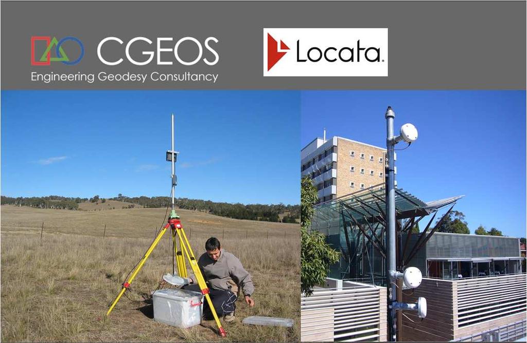
17 LocataLite Network. Time-synchronized transceivers. XYZ XYZ XYZ LOCATA Positioning 17

 to validate if Compact Active Transponders can be a")
18 SAR INTERFEROMETRY Persistent Scattered SAR Interferometry present a geodetic network of opportunity but the points are not marked. Outside urbanised area s PS is not possible without Corner Reflector. Researches are conducted (DELFT) to validate if Compact Active Transponders can be a valuable alternative to Passive Corner Reflectors. CATS AND CR EXTRACT 18
19 GNSS NETWORK RTK METEO sensors New GNSS ANTENNA COMMUNICATION New GNSS RECEIVER PILLAR, CABINET, POWER LOCATA LEVELLING CATS ( InSAR Active CC ) COMMUNITY CLOUD RTK GPS + GLONASS + BDS GNSS + LOCATA SOCIAL NETWORK 19
?")
20 Positioning Infrastructure New Generation GNSS Network RTK has proven to be effective to support GNSS RTK surveying (no need local base station) and GNSS monitoring operations. Can a GNSS Network locates a jamming source? Can disable a GNSS constellation that is failing ( 2 nd of April 2014 )? Must move from corrections as service to coordinates as service ( Cloud computing RTK ). Today GNSS receivers are not tuned to provide highest grade of measurements ( ME same than others ). Next Generation is coming New GNSS Antenna (VRAY) to counter jamming. Compact active transponders (CATs) for SAR Interferometry will benefit greatly of being host. LOCATA ground to ground location systems proves they will join Is there any other sensors to be considered as part of such positioning infrastructure? Not only for Surveyors new users! 20


21 Digital & Smart Cities Digital & Smart Cities HOW TO INTERACT WITH A DIGITAL MODEL EVEN A SMART ONE? 21

22 22


23 To hyperlink the geo-spatial object Indentify the object Survey ( x, y, z ) Associate INFO Processing Upload TAG SURVEY TAG 23


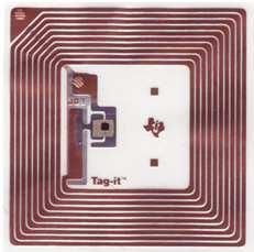

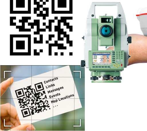
24 It s all about Geo-tags! QUICK CODE RFID 24
 which detects/reads the RFID")

25 The idea consists in using RFID (Radio Frequency Identification) passive transponders (i.e. microchips) to create a path guiding a visually impaired person through a location. The walking stick has an embedded antenna (with a bluetooth transmitter) which detects/reads the RFID transponders. Each transponder sends a signal via the antenna to a Smart Phone equipped with a database with information on the location. 25

26 Passive transponders buried in the pavement and a dedicated electronic walking cane help to guide visually impaired people by acoustic signals inside an airport terminal. AUGMENTED GEOSENSING 26


27 Most of the GNSS Network RTK projects have been developed by the economical justification that an active geodetic network would reduce the cost of maintaining a traditional geodetic network where the maintenance of the benchmarks and the control survey were a significant part of the owner s budget. Conclusion Next Generation Positioning Infrastructure will rock with millions of active geodetic marks and new signals, new receivers GPS, GLONASS, BDS and LOCATA is the 4 th constellation! GNSS receivers & Antenna must be re-engineered totally! Positioning Infrastructure as a Service ( Cloud RTK ) GNSS is vulnerable and we have to address that! What we do need is PI 2.0! 27


28 Thank you so much! Creativity and passion will refresh Engineering Geodesy and Surveying in the 21 st Century by GEOSENSING the World Beyond East & West GeoSensing Community JOEL VAN CRANENBROECK 28
The Reasons to Succeed or to Fail a GNSS Network RTK Project
 The Reasons to Succeed or to Fail a GNSS Network RTK Project Joël van Cranenbroeck, Managing Director CGEOS Creative Geosensing sprl-s, Belgium Andy Yin, International Sales Director ComNav Technology
The GNSS Active Control Point Concept Get the {dynamic} Reference Points when You Need
 The GNSS Active Control Point Concept Get the {dynamic} Reference Points when You Need Joel van Cranenbroeck Chair of Commission 6 WG 6.2 International Federation of Surveyors (FIG) Belgium, Europa 2 3
Innovation and Experience in GNSS Bridge Real Time 3D- Monitoring System
 Innovation and Experience in GNSS Bridge Real Time 3D- Monitoring System Joël van Cranenbroeck, Managing Director CGEOS Creative GeoSensing sprl-s Rue du Tienne de Mont, 11 5530 MONT, Belgium Transportation
Professional GNSS solutions in challenging environments
 Professional GNSS solutions in challenging environments Company history 2000 Septentrio is founded as a spin-off from IMEC, world s premier semiconductor research center and still a strong partner & shareholder.
Case sharing of the use of RF Localization Techniques. Dr. Frank Tong LSCM R&D Centre LSCM Summit 2015
 Case sharing of the use of RF Localization Techniques Dr. Frank Tong LSCM R&D Centre LSCM Summit 2015 Outline A. LBS tracking and monitoring 1) Case of anti-wandering-off tracking vest system in elderly
NYSNET 11/28/2014 GPS/GLONASS (GG) January 2015 NYSAPLS Conference
 January 2015 NYSAPLS Conference") GPS/GLONASS (GG) January 2015 NYSAPLS Conference 2015 1 NYSNet 2015 GLONASS Upgrades Antenna Types Single Base/Network RTK GPS/GLONASS (GG) Single Base GPS/GLONASS (GG) Network RTK RT Products (NTRIP Mount
GPS/GLONASS (GG) January 2015 NYSAPLS Conference 2015 1 NYSNet 2015 GLONASS Upgrades Antenna Types Single Base/Network RTK GPS/GLONASS (GG) Single Base GPS/GLONASS (GG) Network RTK RT Products (NTRIP Mount
FieldGenius Technical Notes GPS Terminology
 FieldGenius Technical Notes GPS Terminology Almanac A set of Keplerian orbital parameters which allow the satellite positions to be predicted into the future. Ambiguity An integer value of the number of
Leica GRX1200+ Series High Performance GNSS Reference Receivers
 Leica GRX1200+ Series High Performance GNSS Reference Receivers Leica GRX1200+ Series For permanent reference stations The Leica GRX1200+ Series, part of Leica's future proof System 1200, is designed specifically
A New Geodetic Network Design for Hydro Power Plants
 Kaniv HPP Dniprodzerzhynsk HPP Dnipro HPP Dnister HPP A New Geodetic Network Design for Hydro Power Plants Joël van Cranenbroeck International Projects & Business Technology Manager Leica Geosystems AG
Motion & Navigation Solution
 Navsight Land & Air Solution Motion & Navigation Solution FOR SURVEYING APPLICATIONS Motion, Navigation, and Geo-referencing NAVSIGHT LAND/AIR SOLUTION is a full high performance inertial navigation solution
Leica GRX1200 Series High Performance GNSS Reference Receivers
 Leica GRX1200 Series High Performance GNSS Reference Receivers Leica GRX1200 Series For permanent reference stations The Leica GRX1200 Series, part of Leica s new System 1200, is designed specifically
Leica Spider Infrastructure HW Solutions Introducing: Leica GR30 & GR50
 Leica Spider Infrastructure HW Solutions Introducing: Leica GR30 & GR50 Reliable solutions for today and tomorrow Leica Spider Integrated Solutions Introducing: Leica GR30 & GR50 Outline Introducing Leica
AgGPS RTK 450 MHz Mobile Base Station and Rover Unit: Setting Up
 6 August 2007 AgGPS RTK 450 MHz Mobile Base Station and Rover Unit: Setting Up This Support Note describes how to set up a Trimble AgGPS RTK 450 mobile base station and rover radio. Instructions apply
Combining Terrestrial and GNSS Technolgies for Geodetic Monitoring. Neil ASHCROFT Leica Geosystems Engineering Segment Manager
 Combining Terrestrial and GNSS Technolgies for Geodetic Monitoring Neil ASHCROFT Leica Geosystems Engineering Segment Manager Structural Monitoring Technolgies Introduction Monitoring Instrumentation Reflectors,
9/26/2016. Accuracy with GNSS What are you getting? Presented By Tom Bryant PLS Kelly Harris PLS Seiler Instrument
 Accuracy with GNSS What are you getting? Presented By Tom Bryant PLS Kelly Harris PLS Seiler Instrument 1 What We Will Talk About Today What coordinate system should I use in my data collector Site Calibrations-what
Sokkia GNSS Receiver. Product Portfolio. Price GRX2 GCX2. GHX2 MESA Field Tablet SA300 S-10. Features
 Only from Sokkia GNSS Receiver Price Product Portfolio GRX2 GCX2 S-10 GHX2 MESA Field Tablet SA300 Features Product Overview Smallest and lightest GNSS integrated receiver Innovative and ergonomic shape
MGA Webinar Series : 1 Very Cheap RTK Receivers: Changing the Landscape of Positioning Services
 MGA Webinar Series : 1 Very Cheap RTK Receivers: Changing the Landscape of Positioning Services Dinesh Manandhar Center for Spatial Information Science The University of Tokyo Contact Information: dinesh@iis.u-tokyo.ac.jp
GPS Application. Global Positioning System. We provide GPS module ODM / OEM service, any GPS receiver you want, we can provide customized services.
 GPS Application Global Positioning System We provide GPS module ODM / OEM service, any GPS receiver you want, we can provide customized services. www.win-tec.com.tw sales@win-tec.com.tw GNSS Receiver WGM-303
Current status of Quasi-Zenith Satellite System. Japan Aerospace Exploration Agency QZSS Project Team
 Current status of Quasi-Zenith Satellite System Japan Aerospace Exploration Agency QZSS Project Team 1 Quasi-Zenith Satellite System The QZSS is a regional space-based PNT (Positioning, Navigation and
Mobile Security Fall 2015
 Mobile Security Fall 2015 Patrick Tague #8: Location Services 1 Class #8 Location services for mobile phones Cellular localization WiFi localization GPS / GNSS 2 Mobile Location Mobile location has become
SSR & RTCM Current Status
 SSR & RTCM Current Status Gerhard Wübbena, Martin Schmitz, Jannes Wübbena Geo++ GmbH 30827 Garbsen, Germany www.geopp.de Outline RTCM SC104 WG s SSR Today SSR Formats SC104 RTCM-SSR Geo++ RTCM 4090 SSR
Where Next for GNSS?
 Where Next for GNSS? Professor Terry Moore Professor of Satellite Navigation Nottingham The University of Nottingham Where Next for GNSS Back to the Future? Professor Terry Moore Professor of Satellite
Lecture-1 CHAPTER 2 INTRODUCTION TO GPS
 Lecture-1 CHAPTER 2 INTRODUCTION TO GPS 2.1 History of GPS GPS is a global navigation satellite system (GNSS). It is the commonly used acronym of NAVSTAR (NAVigation System with Time And Ranging) GPS (Global
Understanding GPS/GNSS
 Understanding GPS/GNSS Principles and Applications Third Edition Contents Preface to the Third Edition Third Edition Acknowledgments xix xxi CHAPTER 1 Introduction 1 1.1 Introduction 1 1.2 GNSS Overview
Locata: A New Constellation for High Accuracy Outdoor & Indoor Positioning
 Locata: A New Constellation for High Accuracy Outdoor & Indoor Positioning Chris Rizos, Yong Li, Nonie Politi School of Surveying & Spatial Information Systems University of New South Wales, Sydney, Australia
Webinar. 9 things you should know about centimeter-level GNSS accuracy
 Webinar 9 things you should know about centimeter-level GNSS accuracy Webinar agenda 9 things you should know about centimeter-level GNSS accuracy 1. High precision GNSS challenges 2. u-blox F9 technology
EXPERIMENTAL RESULTS OF LEX CORRECTIONS USING FARMING MACHINE
 Sixth Meeting of the International Committee on Global Navigation Satellite Systems (ICG) EXPERIMENTAL RESULTS OF LEX CORRECTIONS USING FARMING MACHINE Masayuki Kanzaki Hitachi Zosen Corporation Prof.
The Role of F.I.G. in Leading the Development of International Real-Time Positioning Guidelines
 The Role of F.I.G. in Leading the Development of International Real-Time Positioning Guidelines, USA Key Words: RTN, real-time, GNSS, Guidelines SUMMARY The rapid growth of real-time reference station
Specifications. Trimble BX982 Modular GNSS Heading Receiver
 Name Configuration Option Base and Rover interchangeability Rover position update rate Rover maximum range from base radio Rover operation within a VRS network Heading and Moving Base operation Factory
Location, Location, Location
 Location, Location, Location Larry Rudolph 1 Outline Positioning Technology GPS and others Location Specifiers Privacy Issues Universal Location On earth, we need three piece of information: latitude,
Surveying in the Year 2020
 Surveying in the Year 2020 Johannes Schwarz Leica Geosystems My first toys 2 1 3 Questions Why is a company like Leica Geosystems constantly developing new surveying products and instruments? What surveying
Principal Investigator Co-Principal Investigator Co-Principal Investigator Prof. Talat Ahmad Vice-Chancellor Jamia Millia Islamia Delhi
 Subject Paper No and Title Module No and Title Module Tag Geology Remote Sensing and GIS Concepts of Global Navigation Satellite RS & GIS XXXIII Principal Investigator Co-Principal Investigator Co-Principal
GE 113 REMOTE SENSING
 GE 113 REMOTE SENSING Topic 9. Introduction to Global Positioning Systems (GPS) and Other GNSS Technologies Lecturer: Engr. Jojene R. Santillan jrsantillan@carsu.edu.ph Division of Geodetic Engineering
GeoMax GNSS. Zenith35 Pro Series. Product Presentation V 3.0
 GeoMax GNSS Zenith35 Pro Series Product Presentation V 3.0 GeoMax Zenith35 Pro Series Table of Contents Receiver Overview Specs Options GeoMax Geo Office Datalogger Field Software Packages Promotion Material
King AbdulAziz University. Faculty of Environmental Design. Geomatics Department. Mobile GIS GEOM 427. Lecture 3
 King AbdulAziz University Faculty of Environmental Design Geomatics Department Mobile GIS GEOM 427 Lecture 3 Ahmed Baik, Ph.D. Email: abaik@kau.edu.sa Eng. Fisal Basheeh Email: fbasaheeh@kau.edu.sa GNSS
NRTK services in Ireland - an Evaluation
 NRTK services in Ireland - an Evaluation Dr. Audrey Martin & Dr. Eugene McGovern, Dublin Institute of Technology, Ireland. FIG Working Week, May 12 Ireland s Survey Infrastructure 1995 IRENET ING 185 Ground
Technical Notes LAND MAPPING APPLICATIONS. Leading the way with increased reliability.
 LAND MAPPING APPLICATIONS Technical Notes Leading the way with increased reliability. Industry-leading post-processing software designed to maximize the accuracy potential of your POS LV (Position and
What to Expect with the Current Constellation
 FIGURE 1 Galileo constellation and occupation status of orbital slots (RAAN: right ascension of the ascending node, May 9, 2017). Source: ESA HOW GALILEO BENEFITS HIGH-PRECISION RTK What to Expect with
Protection Augmentation Toughness and Alternatives of GNSS. Melaha 2016 Concord Al-Salam Hotel Cairo, April 25,2016 Refaat Rashad
 Protection Augmentation Toughness and Alternatives of GNSS Melaha 2016 Concord Al-Salam Hotel Cairo, April 25,2016 Refaat Rashad Road Map of the Presentation 1- How Good are GNSS 2- How Vulnerable are
Role of Manufacturers to support Geodetic Infrastructure
 FIG / UN-GGIM-AP / JUPEM Geospatial and GNSS CORS Infrastructure Forum Kuala Lumpur, Malaysia 16-17 Oct 2016 Role of Manufacturers to support Geodetic Infrastructure Neil Ashcroft Leica Geosystems Information
Drive-by DTM. and Navigation at our university in cooperation
 Drive-by DTM GPS and GSM/GPRS Power Cost-Effective Terrain Modeling A data teletransmission system for quick and efficient creation of digital terrain models (DTMs) forms the backbone of experimental work
Article Number: 457 Rating: Unrated Last Updated: Wed, Sep 2, 2009 at 3:46 PM
 T opcon GB-1000 - Receiver Board Firmware Version 3.4 Article Number: 457 Rating: Unrated Last Updated: Wed, Sep 2, 2009 at 3:46 PM Topcon has recently released GNSS receiver board firmware version 3.4
Comparative analysis of GNSS Real Time Kinematic methods for navigation
 IAV Hassan II Comparative analysis of GNSS Real Time Kinematic methods for navigation Mourad BOUZIANI School of Geomatic Sciences, IAV Hassan II, Rabat, Morocco. Coordinator of the Master - GNSS, IAV&
Geoscience & Positioning, Navigation and Timing Services for Canadians
 Geoscience & Positioning, Navigation and Timing Services for Canadians Calvin Klatt, Ph.D. Director and Chief Geodesist Natural Resources Canada / Directeur et géodésien principal Ressources naturelles
High Precision GNSS for Mapping & GIS Professionals
 High Precision GNSS for Mapping & GIS Professionals Agenda Address your needs for GNSS knowledge. GNSS Basics Satellite Ranging Fundamentals (Code $ Carrier) Differential Corrections (Post Processed $
SL 300 GNSS Receiver. w w w. s a t l a b g p s. c o m
 SL 300 GNSS Receiver w w w. s a t l a b g p s. c o m SL 300 6G GNSS Receiver The Ultimate Expandable Handheld Smart GNSS Sensor with 6G Tracking European Standards Lightweight Bluetooth GPS GLONASS BEIDOU
Development of Hong Kong GNSS infrastructure
 Development of Hong Kong GNSS infrastructure Wu Chen Department of Land Surveying and Geoinformatics (LSGI) Hong Kong Polytechnic University Hong Kong 1 Research Areas Research Areas GNSS Positioning and
Trimble GPSNet 2.5 Software for GNSS Infrastructure: New Features. Martin Janousek - Trimble Technical Support - Infrastructure
 Trimble GPSNet 2.5 Software for GNSS Infrastructure: New Features Martin Janousek - Trimble Technical Support - Infrastructure GPSNet Users Seminar Munich, March 30 th /31 th 2006 Overview Support for
SERVIR: The Portuguese Army CORS Network for RTK
 SERVIR: The Portuguese Army CORS Network for RTK António Jaime Gago AFONSO, Rui Francisco da Silva TEODORO and Virgílio Brito MENDES, Portugal Key words: GNSS, RTK, VRS, Network ABSTRACT Traditionally
Positioning, location data and GNSS as solution for Autonomous driving
 Positioning, location data and GNSS as solution for Autonomous driving Jarkko Koskinen, Heidi Kuusniemi, Juha Hyyppä, Sarang Thombre and Martti Kirkko-Jaakkola FGI, NLS Definition of the Arctic 66 34 N
Precise Positioning GNSS Applications
 Precise Point Positioning: Is the Era of Differential GNSS Positioning Drawing to an End? School of Surveying & Spatial Information Systems, UNSW, Sydney, Australia Chris Rizos 1, Volker Janssen 2, Craig
Location, Location, Location Lecture 8 (catch-up from lecture 7) Larry Rudolph. Problem Set 3
 Larry Rudolph. Problem Set 3") Location, Location, Location Lecture 8 (catch-up from lecture 7) Larry Rudolph 1 Problem Set 3 Suggest ways to use phones and handhelds Useful for (university-level) education social networking Assume
Location, Location, Location Lecture 8 (catch-up from lecture 7) Larry Rudolph 1 Problem Set 3 Suggest ways to use phones and handhelds Useful for (university-level) education social networking Assume
Long Term Performance Analysis of a New Ground-transceiver Positioning Network (LocataNet) for Structural Deformation Monitoring Applications
 for Structural Deformation Monitoring Applications") Long Term Performance Analysis of a New Ground-transceiver Positioning Network (LocataNet) for Structural Deformation Monitoring Applications Dr. Joel BARNES, Australia, Mr. Joel VAN CRANENBROECK, Belgium,
Long Term Performance Analysis of a New Ground-transceiver Positioning Network (LocataNet) for Structural Deformation Monitoring Applications Dr. Joel BARNES, Australia, Mr. Joel VAN CRANENBROECK, Belgium,
Technical Specifications Document. for. Satellite-Based Augmentation System (SBAS) Testbed
 Testbed") Technical Specifications Document for Satellite-Based Augmentation System (SBAS) Testbed Revision 3 13 June 2017 Table of Contents Acronym Definitions... 3 1. Introduction... 4 2. SBAS Testbed Realisation...
Technical Specifications Document for Satellite-Based Augmentation System (SBAS) Testbed Revision 3 13 June 2017 Table of Contents Acronym Definitions... 3 1. Introduction... 4 2. SBAS Testbed Realisation...
Is neo-cadastral surveying on your smartphone feasible?
 Is neo-cadastral surveying on your smartphone feasible? School of Civil & Environmental Engineering Craig Roberts UNSW Paul Davis-Raiss, David Lofberg, Greg Goodman LandTeam Van der Vlugt, 2012 1 Cadastral
Performance Evaluation of Differential Global Navigation Satellite System with RTK Corrections
 IOSR Journal of Electronics and Communication Engineering (IOSR-JECE) e-issn: 2278-2834,p- ISSN: 2278-8735.Volume 9, Issue 2, Ver. VI (Mar - Apr. 2014), PP 43-47 Performance Evaluation of Differential
National Report of Greece to EUREF 2009
 National Report of Greece to EUREF 2009 M. Gianniou KTIMATOLOGIO S.A. (Hellenic Cadastre) 1 Introduction In 2007, KTIMATOLOGIO S.A (Hellenic Cadastre) established HEPOS, the HEllenic POsitioning System,
GLOBAL POSITIONING SYSTEMS
 GLOBAL POSITIONING SYSTEMS GPS & GIS Fall 2017 Global Positioning Systems GPS is a general term for the navigation system consisting of 24-32 satellites orbiting the Earth, broadcasting data that allows
GNSS Receivers, Sensors, Desktop Solutions
 GNSS Receivers, Sensors, Desktop Solutions keep it simple high performance: the best GNSS tracking in field ready, reliable packages coupled with the best field and desktop software tools support and service
European Position Determination System. Technical Standards
 European Position Determination System Technical Standards Revised 2 nd Edition 24 April 2008 Resolution of the International EUPOS Steering Committee 13 th Conference, Bucharest, Romania, 23 24 April
ATLANS-C. mobile mapping position and orientation solution
 mobile mapping position and orientation solution mobile mapping position and orientation solution THE SMALLEST ATLANS-C is a high performance all-in-one position and orientation solution for both land
Future GNSS Precision Applications. Stuart Riley
 Future GNSS Precision Applications Stuart Riley Major Trimble Precision Markets Survey Mostly person portable equipment Construction Machine control and person carried equipment Includes Marine applications
New GeoMax Zenith35 GNSS receiver
 No 22/205 GeoMax November 25th, 205 Product Announcement New GeoMax Zenith35 GNSS receiver We are pleased to inform you about the release of the GeoMax Zenith35 the new GNSS receiver. The compact and fully
When do you expect Athena to be available for VS330? This is currently being beta-tested and will be released in the very near future.
 Why Athena? Athena GNSS Engine What improvements does Athena offer over the RTK firmware I m running now? Compared to the Hemisphere firmware most users are currently using (Qf4), there are significant
Leica SmartStation Total Station with integrated GPS
 Leica SmartStation Total Station with integrated GPS Leica SmartStation Total station with integrated GPS New revolutionary surveying system. World s first, TPS and GPS perfectly combined. High performance
SL 300 GNSS Receiver. w w w.sa tla b g p s. c o m
 SL 300 GNSS Receiver w w w.sa tla b g p s. c o m SL 300 GNSS Receiver The Ultimate Expandable Handheld Smart GNSS Sensor with Multi Constellation Tracking European Standards Lightweight Bluetooth Multi
Extreme space weather: Geomagnetic storms, GNSS disruptions and the impact on vital functions in society
 Extreme space weather: Geomagnetic storms, GNSS disruptions and the impact on vital functions in society Fredrik Marsten Eklöf FOI, Informationssystem fredrik.eklof@foi.se, 0709-277426 Global Navigation
A Distribution Method of High Precise Differential Corrections for a Network Beidou/RTK System Based on Vehicular Networks
 BULGARIAN ACADEMY OF SCIENCES CYBERNETICS AND INFORMATION TECHNOLOGIES Volume 15, No 5 Special Issue on Control in Transportation Systems Sofia 215 Print ISSN: 1311-972; Online ISSN: 1314-481 DOI: 1.1515/cait-215-24
Agenda Motivation Systems and Sensors Algorithms Implementation Conclusion & Outlook
 Overview of Current Indoor Navigation Techniques and Implementation Studies FIG ww 2011 - Marrakech and Christian Lukianto HafenCity University Hamburg 21 May 2011 1 Agenda Motivation Systems and Sensors
GeoMax GNSS Zenith10 & Zenith20 Series
 GeoMax GNSS Zenith10 & Zenith20 Series GeoMax About Us At GeoMax we provide a com- group with strong market At GeoMax, we concentrate on prehensive portfolio of inte- positions within measurement providing
AN AUSTRALIAN PILOT PROJECT FOR A REAL TIME KINEMATIC GPS NETWORK USING THE VIRTUAL REFERENCE STATION CONCEPT
 AN AUSTRALIAN PILOT PROJECT FOR A REAL TIME KINEMATIC GPS NETWORK USING THE VIRTUAL REFERENCE STATION CONCEPT Matthew B HIGGINS, Australia Key words: GPS, Surveying, Real Time Kinematic, Virtual Reference
Alberding solutions for GNSS infrastructure operators
 Tamás Horváth Alberding solutions for GNSS infrastructure operators 21.11.2017 1/35 Alberding solutions for GNSS infrastructure operators Tamás Horváth Alberding GmbH 4 th EUPOS Technical Meeting 21-22
The Global Positioning Sytem II 10/19/2017
 The Global Positioning System II Field Experiments 10/19/2017 5-1 Mexico DGPS Field Campaign Cenotes in Tamaulipas, MX, near Aldama 10/19/2017 5-2 Are Cenote Water Levels Related? 10/19/2017 5-3 M. Helper,
GNSS Modernisation and Its Effect on Surveying
 Lawrence LAU and Gethin ROBERTS, China/UK Key words: GNSS Modernisation, Multipath Effect SUMMARY GPS and GLONASS modernisation is being undertaken. The current GPS modernisation plan is expected to be
PosKEN Related Activities in the Czech Republic
 Research Institute of Geodesy, Topography, and Cartography Geodetic Observatory Pecny Land Survey Office, Prague PosKEN Related Activities in the Czech Republic 2014-2015 National Report J. Šimek 1 and
GSA GNSS Technology Report Main highlights IPIN 2018
 GSA GNSS Technology Report Main highlights IPIN 2018 Justyna Redelkiewicz, European GNSS Agency 25 September 2018, Nantes The European GNSS Agency (GSA) is responsible for market development and operations
Geodetic policy for Ireland and Northern Ireland
 Geodetic policy for Ireland and Northern Ireland Background Ordnance Survey Ireland (OSi) is the National Mapping Agency (NMA) of the Republic of Ireland. The Ordnance Survey of Northern Ireland (OSNI)
Macao Geodetic Infrastructure: Permanent GPS Reference Stations
 Ka Man IU, Macao SAR, China Key words: GPS Reference Station, Geodetic Infrastructure, Macao DSCC, RTK. SUMMARY The first Macao GPS control network was surveyed in 1991 that consists of six Doppler stations.
The International Scene: How Precise Positioning Will Underpin Critical GNSS Applications
 The International Scene: How Precise Positioning Will Underpin Critical GNSS Applications School of Civil & Environmental Engineering, UNSW, Sydney, Australia Chris Rizos Member of the IGS Governing Board
GNSS Accuracy Improvements through Multipath Mitigation with New Signals and services
 GNSS Accuracy Improvements through Multipath Mitigation with New Signals and services Andrey Veytsel, Ph.D Moscow Technical University 10 Meeting of the International Committee on Global Navigation Satellite
GAVIN DOCHERTY & CRAIG ROBERTS School of Surveying & Spatial Information Systems. University of NSW
 FIG2010, Sydney, Australia 15 April 2010 The impact of Solar Cycle 24 on Network RTK in Australia GAVIN DOCHERTY & CRAIG ROBERTS School of Surveying & Spatial Information Systems University of NSW School
SL800 GNSS RTK System User Manual
 SL800 GNSS RTK System User Manual User Manual Revision SatLab SL800 GNSS Receiver Revision Date Revision Number Description 1 st Nov 2017 1 SL800 User Manual (Release V1.0) 1 Table of Contents Introduction...
GNSS Positioning STATUS AND FEATURES
 STATUS AND FEATURES GNSS Positioning Nowadays, GNSS receivers have scores and often more than one hundred of channels, enabling them to track GPS, Glonass, Galileo and Compass signals simultaneously. The
HEAD OFFICE OF GEODESY AND CARTOGRAPHY. Wspolna 2 Str., Warsaw, Poland ASG-EUPOS THE POLISH CONTRIBUTION TO THE EUPOS PROJECT
 HEAD OFFICE OF GEODESY AND CARTOGRAPHY Wspolna 2 Str., 00-926 Warsaw, Poland ASG-EUPOS THE POLISH CONTRIBUTION TO THE EUPOS PROJECT Project Part-Financed by European Union European Regional Development
TRIUMPH-LS. The Ultimate RTK Land Survey Machine
 The Ultimate RTK Land Survey Machine Introducing GUIDE data collection in the. Visual Stake-out, navigation, six parallel RTK engines, over 3,000 coordinate conversions, advanced CoGo features, rich attribute
Trimble NetR9 Reference Receiver Series: Frequently Asked Questions
 July 2010 Trimble NetR9 Reference Receiver Series: Frequently Asked Questions What is the Trimble NetR9 GNSS reference receiver? The Trimble NetR9 GNSS (Global Navigation Satellite System) reference receiver
Indian Institute of Technology Kanpur Department of Civil Engineering
 Indian Institute of Technology Kanpur Department of Civil Engineering Inquiry No- CE/JNM/2013-14/R-10 30 December, 2013 Subject: Quotation for supply of Integrated System/Smart System Reflectorless Robotic
MHz. Figure 1: spectrum plot of the L1 band without interference with the GPS L1C/A central frequency indicated
 White paper Internet or Positioning? Abstract Centimetre-level RTK or PPP positioning requires high quality GNSS measurements. By virtue of their low power however, GNSS signals are prone to interference
Understanding GPS: Principles and Applications Second Edition
 Understanding GPS: Principles and Applications Second Edition Elliott Kaplan and Christopher Hegarty ISBN 1-58053-894-0 Approx. 680 pages Navtech Part #1024 This thoroughly updated second edition of an
TACOT Project. Trusted multi Application receiver for Trucks. Bordeaux, 4 June 2014
 TACOT Project Trusted multi Application receiver for Trucks Bordeaux, 4 June 2014 Agenda TACOT Context & Solution Technical developments Test & Validation results Conclusions GNSS ease our lives GNSS is
Datums and Tools to Connect Geospatial Data Accurately
 Datums and Tools to Connect Geospatial Data Accurately Pamela Fromhertz Colorado State Geodetic Advisor National Geodetic Survey National Oceanic and Atmospheric Administration GIS-T April 18, 2012 Loveland,
Leica SmartStation Total Station with integrated GNSS
 Leica SmartStation Total Station with integrated GNSS Leica SmartStation Total station with integrated GNSS New revolutionary surveying system. World s first, TPS and GNSS perfectly combined. High performance
SSR Technology for Scalable Real-Time GNSS Applications
 SSR Technology for Scalable Real-Time GNSS Applications Gerhard Wübbena, Jannes Wübbena, Temmo Wübbena, Martin Schmitz Geo++ GmbH 30827 Garbsen, Germany www.geopp.de Abstract SSR Technology for scalable
Exploiting the high precision capabilities of the Hellenic Positioning System - HEPOS
 Exploiting the high precision capabilities of the Hellenic Positioning System - HEPOS M. Gianniou, D. Mastoris, I. Stavropoulou Geodetic Department KTIMATOLOGIO S.A. 339 Mesogion Ave., 15562 Holargos Greece
Location, Location, Location
 Location, Location, Location Larry Rudolph 1 Outline Administrative remarks and requests Positioning Technology GPS and others Location Specifiers Privacy Issues Asking for help For 3rd edition phones,
DEFINING THE FUTURE OF SATELLITE SURVEYING WITH TRIMBLE R-TRACK TECHNOLOGY
 DEFINING THE FUTURE OF SATELLITE SURVEYING WITH TRIMBLE R-TRACK TECHNOLOGY EDMOND NORSE, GNSS PORTFOLIO MANAGER, TRIMBLE SURVEY DIVISION WESTMINSTER, CO USA ABSTRACT In September 2003 Trimble introduced
DATE: 17/08/2006 Issue No 2 e-plate Operation Overview
 Page 1 of 7 Fundamentals Introduction e-pate technology is the next generation of long range RFID (Radio Frequency IDentification). The objective is wireless and automated data collection of vehicles and
Future of GNSS Receivers. Éamonn Glennon
 Future of GNSS Receivers Éamonn Glennon Future of GNSS Receivers? What have we got now? What do customers want? What does government want? What are the problems with current receivers? What type of receivers?
The Global Positioning System II Field Experiments
 The Global Positioning System II Field Experiments 5-1 Mexico DGPS Field Campaign Cenotes in Tamaulipas, MX, near Aldama 5-2 Are Cenote Water Levels Related? 5-3 DGPS Static Survey of Cenote Water Levels
IMO WORLDWIDE RADIONAVIGATION SYSTEM (WWRNS) Study on Communication Techniques for High Accuracy DGPS in the Republic of Korea
 Study on Communication Techniques for High Accuracy DGPS in the Republic of Korea") INTERNATIONAL MARITIME ORGANIZATION E IMO SUB-COMMITTEE ON SAFETY OF NAVIGATION 52nd session Agenda item 12 NAV 52/INF.8 12 May 2006 ENGLISH ONLY WORLDWIDE RADIONAVIGATION SYSTEM (WWRNS) Study on Communication
INTERNATIONAL MARITIME ORGANIZATION E IMO SUB-COMMITTEE ON SAFETY OF NAVIGATION 52nd session Agenda item 12 NAV 52/INF.8 12 May 2006 ENGLISH ONLY WORLDWIDE RADIONAVIGATION SYSTEM (WWRNS) Study on Communication