in the economy United Nations Eleventh Meeting of the International Committee on Global Navigation Satellite Systems (ICG-11) and the 17th Meeting of
|
|
|
- Berniece Barrett
- 6 years ago
- Views:
Transcription
 and")

1 Applications of highprecision GNSS solutions in the economy United Nations Eleventh Meeting of the International Committee on Global Navigation Satellite Systems (ICG-11) and the 17th Meeting of the Providers' Forum, 6 11 November 2016, Sochi, Russian Federation Experts Seminar on Applications, 07 November Andrey Kupriyanov GLONASS/GNSS Forum Association
2 GLOBAL NAVIGATION SATELLITE SYSTEMS GLONASS GPS BEIDOU GALILEO REGIONAL NAVIGATION SATELLITE SYSTEMS QZSS IRNSS


3 SBAS (Satellite Based Augmentation System) EGNOS WAAS SDKM GAGAN MSAS


4 GLOBAL DIFFERENTIAL CORRECTION SYSTEMS


")


5 Synergy of performance and requirements Extended PNT Architecture of Russia Precise Ephemeris and Clock System GLONASS Space Complex Satellite Based Augmentation Systems Regional Augments Earth Attitude and Rotation System Time Reference System UTC (SU) Certification Standardization Geodesy Reference and Maps Inertial navigation Special User Equipment 5 Civil Users Equipment
6 GNSS Application Sphere Transport Geodesy, cartography, cadastre Construction Mining Agriculture Inventory, management of territories Monitoring of natural and technogenic processes Space researches Science Communication Trade Power industries Forestry, hunting Fishery Sports, tourism Public health Insurance Policing Emergency response Social services


7 GNSS Application Sphere The next level of mass service precision positioning The development of ground infrastructure of high-precision navigation system GALILEO GLONASS GPS Beidow Regional differential station Centre differential correction and monitoring Regional differential station Local differential station Local differential station Mobile local differential station Maritime local differential station USER


8 GNSS Application Sphere GNSS TECHNOLOGIES ON TRANSPORT )))))))))))) )))))))))))) monitoring system Including : Monitoring municipal, special transports Traffic Monitoring, overcharge Control of modes of working and rest of drivers transportation of passengers transportation of dangerous goods heavy lift system of toll roads tachographs with GNSS technologies


9 GNSS Application Sphere Intelligent Transport Systems System of identifying and collecting payments loop method Determination of location image recognition Ultrasound determination ACS of the transport systems of the RF Sea ports Intermodal transport Airports Iron road System management traffic signals Control system of movement of transport vehicles Information system on vehicles Traffic control center Telematic devices and systems System of data processing of incidents Information systems provide road users System of receiving and processing information Visual data Internet Information about vehicles Automatic Funds telephone communication Car navigation Management of Traffic lights Information on bus stops Forced control vehicles Data processing about collisions Traffic control of vehicles


10 Increasing Informational content coordinate and time providing rolling stock Ассоциация «ГЛОНАСС/ГНСС-Форум» High-precision monitoring of objects of transport infrastructure, keeping and creating united digital cartographical basis


11 GNSS Application Sphere Synchronization of communications networks


12 GNSS Application Sphere Precision agriculture. Mining. RTK is the main open cut mining GNSS technology -Precision agriculture develops intensively in private sector using local differential networks, precision steering systems can now run on commercial market.


13 GNSS Application Sphere GNSS monitoring systems of buildings, bridges, dams - Precision control system using local reference systems, data transmission systems, software analysis for decision making


14 Unnoticed in time deformation of the construction may result into cracks and its subsequent collapse 3


15 GNSS Application Sphere Direction of commercial high-precision applications of GNSS technology and equipment : -monitoring of ground infrastructures, oil and gas pipelines, geophysical survey and other work on the continental shelf - -machine control - road construction with centimeter accuracy, using technology and real-time reference stations, digital maps


16 Since the late 80s commercial satellite equipment and technology for maritime and ground navigation, survey. Maritime and aviation application were under IMO and ICAO requirements and regulations. Commercial application of precision technology and equipment were first of all in survey, cadastre, land and ground infrastructure inventory. The major sector of application were oil&gas, survey and mining. The methods of field applications were static, pseudo kinematic.


17
18 Almanac from 9/15/ Healthy GPS Sats, 40 Healthy GPS+GLONASS Sats 8 Day simulation, 10 degree mask angle. % Availability 100 Latitude How to use this plot: Example: 9 satellites. 9 or more sats in view 97% of the day, with GPS+GLONASS 9 or more sats in view 5% GG of the day, with GPS-only GPS # Satellites


 reference networks for various applications")
19 The next step was Development, improvement of technology equipment for commercial application - RTK-kinematics in real time, kinematics with moving base base stations, transmission of differential corrections Development of commercial (regional, local) reference networks for various applications based on GLONASS and GPS signals.
20 GNSS Equipment Ergonomics Evolution Ashtech Z-12 GPS Receiver NovAtel PwrPak7 4.0 kg 8/1 0.5 kg 21.6 х 20.3 х 9.9 cm power consumption 21W 4/1 12/ х 14.5 х 5.3 cm power consumption 1.8W
21 GNSS Equipment Ergonomics Evolution Ashtech Z-12 GPS Receiver NovAtel PwrPak7 GPS L1,L2 12 Channel Real-Time Differential Position < 1 m GPS L1, L2, L5; GLONASS L1, L2, L3, L5; BeiDou B1, B2, B3; Galileo E1, E5 AltBOC,E5a, E5b, E6; IRNSS L5; SBAS L1, L5; QZSS L1, L2, L5, L6 555 Channel SBAS (60 cm); DGPS (40 cm); PPP TerraStar- L (40 cm); PPP TerraStar-C (4 cm); RTK (1 cm + 1 ppm)


22 Survey GNSS Equipment Evolution Ashtech Z-12 GPS Receiver NovAtel PwrPak Static, Pseudo-Kinematic Survey Accuracy: 5 mm + 1 ppm 3 mm ppm

23
24 Multi GNSS More Satellites Improved PPP convergence More pierce points for atmospheric sounding Decorrelation of height, clock, troposphere Improved Signals Less multipath Increased robustness (scintillation, weak signals) Stable clocks Improved Real-time PPP Orbit improvement / prediction Diversity Different orbital periods and commensurabilities Decorrelation of estimated parameters (orbits, Earth rotation) G. Beutler Astronomical Institute, University of Bern ICG 10
25 IGS-RTS spurring innovation... Geohazard... seismic displacements, tsunami prediction (Near-)real-time comparison of UTC(k) s... time transfer IGMA parameter estimation... orbits, clocks, etc Atmospheric remote sensing, meteorology Precise orbit determination Geodesy, datum studies/monitoring, kinematic positioning Buoys, wave height measuring, hydrography Surveying, mapping, UAV platforms, agriculture, etc Performance statistics... intercomparisons, RTK v PPP v SBAS Testing, demonstrations, investigations... manufacturers, academic Low-cost GNSS receiver studies Intelligent Transport System Outdoor robotics, wearables, IoT Education (Chris Rizos, Steve Fisher, Ruth Neilan IGS W-S Sydney) 19 I

26 Positioning Technology: Real-Time Kinematics

27 Positioning Technology: Real Time PPP


28 High-Precision GNSS Equipment - Mass Product


29 High-Precision Solutions as Part of Complex Systems

30 Integration of High-Precision Solutions into Mobile Devices


31 Integration of High-Precision Solutions into Mobile Devices

32 Integration of High-Precision Solutions into Mobile Devices
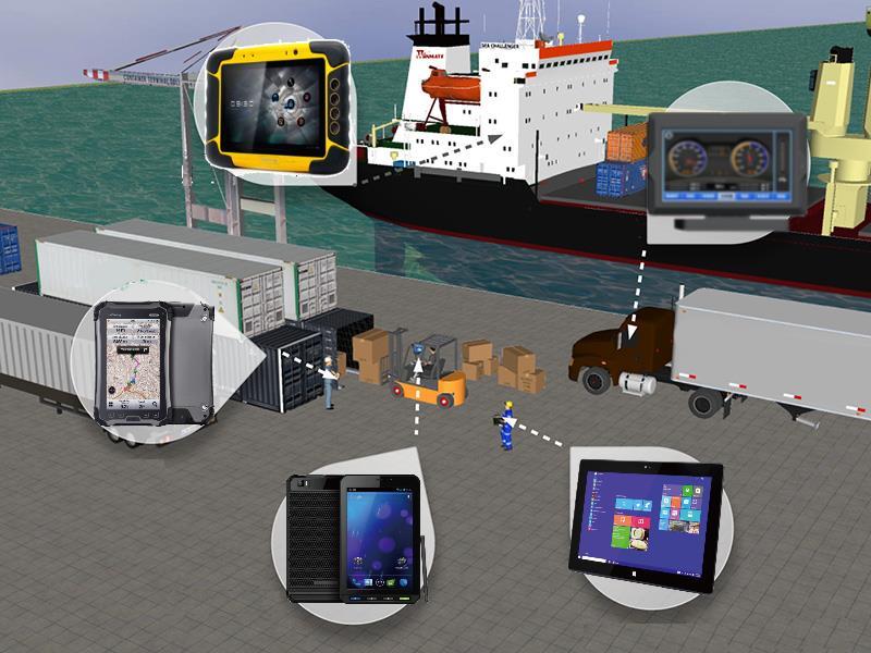


33 Sphere of Implementation of High-Precision Solutions into Mobile Devices

34 Atmosphere Anomalies Detection


35 Atmosphere Anomalies Detection Задержка, м G10 G20 G16 G30 Номер спутника Иозмеренные задержки Межканальная задержка Сумарная задержка G05 G23 G09 G07
36 Jamming Denial of service attack Military jammers Friendly jamming Disabling of civilian GNSS while keeping military services intact Personal or Privacy Protection Devices (PPD)s Sold over the internet starting at 30 Usage is illegal in almost every country Motivation: Turning off car anti-theft-systems Bypassing pay-as-you-drive insurance Withdrawing Fleet Management System Protecting the privacy of parcel delivery agents from their employers Alexander Rügamer Fraunhofer IIS Dirk Kowalewski NavXperience GmbH FIG Working Week, Bulgaria

37 Spoofing Spoofing: transmission of fake GNSS signals with the intention of fooling a GNSS receiver into providing false Position, Velocity and Time (PVT) Different types of attacks Meaconing: rebroadcasting a received signal Simplistic attack Intermediate attack Sophisticated attack Spoofers exist: SimSAFE from Spirent with GSS8000: >200k Proof-of-concept demonstrators


38 GNSS Spoofing Interference attacks Incidents Spoofing attacks Successful demonstration of spoofing attack on drone on Yacht on time of power grid
39 GNSS Conclusion Interference GNSS technology market grows rapidly, infiltrating new and expanding old spheres of application; With the latest improvements of global differential correction services and PPP technology we now witness the global shifting of GNSS developments focus to wide variety of services and mobility; With the GNSS solutions integrating deeply to our everyday life, new threats emerging and become more dangerous: GNSS service is often taken for granted No real awareness of how fragile it is, despite many incidents Most professional receivers do not detect jamming or spoofing events Even though commercial jammers and spoofers are emerging Despite of existing models of ionosphere, high level of solar activities still result in TEC anomalies and scintillation effects.
40 Thank you! Andrey Kupriyanov
«Current state and prospects of development of commercial application GLONASS/GNSS in the Russian Federation»
 «Current state and prospects of development of commercial application GLONASS/GNSS in the Russian Federation» United Nations SYMPOSIUM TO STRENGTHEN THE PARTNERSHIP WITH INDUSTRY COMMERCIAL APPLICATIONS
Jamming and Spoofing of GNSS Signals An Underestimated Risk?!
 Jamming and Spoofing of GNSS Signals An Underestimated Risk?! Alexander Rügamer Dirk Kowalewski Fraunhofer IIS NavXperience GmbH Fraunhofer IIS 1 Source: http://securityaffairs.co/wordpress/wpcontent/uploads/2012/02/spoofing.jpg
Precise Positioning... what does it mean? Precise GNSS Positioning Not just a niche technology. Chris Rizos 15/12/15
 Precise GNSS Positioning Not just a niche technology Chris Rizos Precise Positioning... what does it mean? 1 Precise Positioning... a spectrum of users... Few mm 1cm 2cm < dm 1dm sub-m Precision agriculture
The International Scene: How Precise Positioning Will Underpin Critical GNSS Applications
 The International Scene: How Precise Positioning Will Underpin Critical GNSS Applications School of Civil & Environmental Engineering, UNSW, Sydney, Australia Chris Rizos Member of the IGS Governing Board
Protection Augmentation Toughness and Alternatives of GNSS. Melaha 2016 Concord Al-Salam Hotel Cairo, April 25,2016 Refaat Rashad
 Protection Augmentation Toughness and Alternatives of GNSS Melaha 2016 Concord Al-Salam Hotel Cairo, April 25,2016 Refaat Rashad Road Map of the Presentation 1- How Good are GNSS 2- How Vulnerable are
Experience with Radio Navigation Satellite Service (RNSS)
") Experience with Radio Navigation Satellite Service (RNSS) International Satellite Communication Symposium International Telecommunication Union (ITU) Geneva, 13-14 June 2016 MITOME, Takahiro Co-Chair of
Experience with Radio Navigation Satellite Service (RNSS) International Satellite Communication Symposium International Telecommunication Union (ITU) Geneva, 13-14 June 2016 MITOME, Takahiro Co-Chair of
Status of the European EGNOS and Galileo Programmes. Frank Udnaes Galileo policy and Infrastructure group EC DG-TREN. June 2008
 Status of the European EGNOS and Galileo Programmes Frank Udnaes Galileo policy and Infrastructure group EC DG-TREN EUROPEAN COMMISSION z June 2008 Galileo An infrastructure 30 satellite Constellation
Understanding GPS: Principles and Applications Second Edition
 Understanding GPS: Principles and Applications Second Edition Elliott Kaplan and Christopher Hegarty ISBN 1-58053-894-0 Approx. 680 pages Navtech Part #1024 This thoroughly updated second edition of an
One Source for Positioning Success
 novatel.com One Source for Positioning Success RTK, PPP, SBAS OR DGNSS. NOVATEL CORRECT OPTIMIZES ALL CORRECTION SOURCES, PUTTING MORE POWER, FLEXIBILITY AND CONTROL IN YOUR HANDS. NovAtel CORRECT is the
Geoscience & Positioning, Navigation and Timing Services for Canadians
 Geoscience & Positioning, Navigation and Timing Services for Canadians Calvin Klatt, Ph.D. Director and Chief Geodesist Natural Resources Canada / Directeur et géodésien principal Ressources naturelles
CLICK HERE TO KNOW MORE
 CLICK HERE TO KNOW MORE Should GNSS Become a National Critical Infrastructure? Ooi Wei Han, Noordin Ahmad, Shahrizal IM National Space Agency (ANGKASA) Ministry of Science, Technology and Innovation (MOSTI)
School of Civil & Environmental Engineering, UNSW, Sydney, Australia. Chris Rizos. President Australian Institute of Navigation
 The Threat to Space Based Service (for PNT applications) School of Civil & Environmental Engineering, UNSW, Sydney, Australia Chris Rizos President Australian Institute of Navigation Outline GNSS... a
FieldGenius Technical Notes GPS Terminology
 FieldGenius Technical Notes GPS Terminology Almanac A set of Keplerian orbital parameters which allow the satellite positions to be predicted into the future. Ambiguity An integer value of the number of
PRELIMINARY PROGRAMME
 ICG EXPERTS MEETING: GLOBAL NAVIGATION SATELLITE SYSTEMS SERVICES 14-18 December 2015 Vienna International Centre, Vienna, Austria Organized by International Committee on Global Navigation Satellite Systems
The last 25 years - GPS to multi-gnss: from a military tool to the most widely used civilian positioning solution
 1 The last 25 years - GPS to multi-gnss: from a military tool to the most widely used civilian positioning solution B. Hofmann-Wellenhof Institute of Geodesy / Navigation, Graz University of Technology
Development of Hong Kong GNSS infrastructure
 Development of Hong Kong GNSS infrastructure Wu Chen Department of Land Surveying and Geoinformatics (LSGI) Hong Kong Polytechnic University Hong Kong 1 Research Areas Research Areas GNSS Positioning and
GNSS Accuracy Improvements through Multipath Mitigation with New Signals and services
 GNSS Accuracy Improvements through Multipath Mitigation with New Signals and services Andrey Veytsel, Ph.D Moscow Technical University 10 Meeting of the International Committee on Global Navigation Satellite
Introduction to GNSS Base-Station
 Introduction to GNSS Base-Station Dinesh Manandhar Center for Spatial Information Science The University of Tokyo Contact Information: dinesh@iis.u-tokyo.ac.jp Slide : 1 Introduction GPS or GNSS observation
Nigerian Communications Satellite Ltd. (NIGCOMSAT)
") OVERVIEW OF NIGERIAN SATELLITE AUGMENTATION SYSTEM COMMENCING WITH PILOT DEMONSTRATION TO VALIDATE NATIONAL WORK PLAN presented by Dr. Lawal Lasisi Salami, NIGERIAN COMMUNICATIONS SATELLITE LTD UNDER FEDERAL
OVERVIEW OF NIGERIAN SATELLITE AUGMENTATION SYSTEM COMMENCING WITH PILOT DEMONSTRATION TO VALIDATE NATIONAL WORK PLAN presented by Dr. Lawal Lasisi Salami, NIGERIAN COMMUNICATIONS SATELLITE LTD UNDER FEDERAL
GLObal Navigation Satellite System (GLONASS)
") FEDERAL SPACE AGENCY GLObal Navigation Satellite System (GLONASS) Sergey Revnivykh Deputy Director General Central Research Institute of Machine Building Head of PNT Center 4-th meeting of International
FEDERAL SPACE AGENCY GLObal Navigation Satellite System (GLONASS) Sergey Revnivykh Deputy Director General Central Research Institute of Machine Building Head of PNT Center 4-th meeting of International
The Global Positioning Sytem II 10/19/2017
 The Global Positioning System II Field Experiments 10/19/2017 5-1 Mexico DGPS Field Campaign Cenotes in Tamaulipas, MX, near Aldama 10/19/2017 5-2 Are Cenote Water Levels Related? 10/19/2017 5-3 M. Helper,
Webinar. 9 things you should know about centimeter-level GNSS accuracy
 Webinar 9 things you should know about centimeter-level GNSS accuracy Webinar agenda 9 things you should know about centimeter-level GNSS accuracy 1. High precision GNSS challenges 2. u-blox F9 technology
The Global Positioning System II Field Experiments
 The Global Positioning System II Field Experiments 5-1 Mexico DGPS Field Campaign Cenotes in Tamaulipas, MX, near Aldama 5-2 Are Cenote Water Levels Related? 5-3 DGPS Static Survey of Cenote Water Levels
MGA Webinar Series : 1 Very Cheap RTK Receivers: Changing the Landscape of Positioning Services
 MGA Webinar Series : 1 Very Cheap RTK Receivers: Changing the Landscape of Positioning Services Dinesh Manandhar Center for Spatial Information Science The University of Tokyo Contact Information: dinesh@iis.u-tokyo.ac.jp
Extreme space weather: Geomagnetic storms, GNSS disruptions and the impact on vital functions in society
 Extreme space weather: Geomagnetic storms, GNSS disruptions and the impact on vital functions in society Fredrik Marsten Eklöf FOI, Informationssystem fredrik.eklof@foi.se, 0709-277426 Global Navigation
Indian GNSS Industry Overview Challenges and future prospects
 Indian GNSS Industry Overview Challenges and future prospects Expert Presentation By Dr. S.V. Kibe Consultant, SATCOM & GNSS, Bangalore, India (Former Programme Director, SATNAV,ISRO HQ) On February 20,2013
Report of the Working Group B: Enhancement of Global Navigation Satellite Systems (GNSS) Services Performance
 Services Performance") Report of the Working Group B: Enhancement of Global Navigation Satellite Systems (GNSS) Services Performance 1. The Working Group on Enhancement of Global Navigation Satellite Systems (GNSS) Service Performance
Report of the Working Group B: Enhancement of Global Navigation Satellite Systems (GNSS) Services Performance 1. The Working Group on Enhancement of Global Navigation Satellite Systems (GNSS) Service Performance
System Status and Performance Improvement Prospects
 Communication Геодезия Navigation GLOBAL NAVIGATION SATELLITE SYSTEM (GLONASS): System Status and Performance Improvement Prospects Viktor KOSENKO, First Deputy General Designer First Deputy General Director
GLOBAL POSITIONING SYSTEMS. Knowing where and when
 GLOBAL POSITIONING SYSTEMS Knowing where and when Overview Continuous position fixes Worldwide coverage Latitude/Longitude/Height Centimeter accuracy Accurate time Feasibility studies begun in 1960 s.
Assessment of GNSS Ionospheric Scintillation and TEC Monitoring Using the Multi-constellation GPStation-6 Receiver
 Assessment of GNSS Ionospheric Scintillation and TEC Monitoring Using the Multi-constellation GPStation-6 Receiver Rod MacLeod Regional Manager Asia/Pacific NovAtel Australia Pty Ltd Outline Ionospheric
HOW TO RECEIVE UTC AND HOW TO PROVE ACCURACY
 HOW TO RECEIVE UTC AND HOW TO PROVE ACCURACY Marc Weiss, Ph.D. Independent Consultant to Booz Allen Hamilton Weiss_Marc@ne.bah.com Innovation center, Washington, D.C. JANUARY 23, 2018 HOW DO YOU GET UTC
GNSS Technology Update
 GNSS Technology Update Speaker: Eric Gakstatter Contributing Editor GPS World Editor - Geospatial Solutions Presented at: Association of Petroleum Surveying & Geomatics Houston, TX April 7, 2015 Agenda
Foreword by Glen Gibbons About this book Acknowledgments List of abbreviations and acronyms List of definitions
 Table of Foreword by Glen Gibbons About this book Acknowledgments List of abbreviations and acronyms List of definitions page xiii xix xx xxi xxv Part I GNSS: orbits, signals, and methods 1 GNSS ground
Comparative analysis of GNSS Real Time Kinematic methods for navigation
 IAV Hassan II Comparative analysis of GNSS Real Time Kinematic methods for navigation Mourad BOUZIANI School of Geomatic Sciences, IAV Hassan II, Rabat, Morocco. Coordinator of the Master - GNSS, IAV&
High Precision GNSS in Automotive
 High Precision GNSS in Automotive Jonathan Auld, VP Engineering and Safety 6, March, 2018 2 Global OEM Positioning Solutions and Services for Land, Sea, and Air. GNSS in Automotive Today Today the primary
Positioning, location data and GNSS as solution for Autonomous driving
 Positioning, location data and GNSS as solution for Autonomous driving Jarkko Koskinen, Heidi Kuusniemi, Juha Hyyppä, Sarang Thombre and Martti Kirkko-Jaakkola FGI, NLS Definition of the Arctic 66 34 N
Global Navigation Satellite System (GNSS) GPS Serves Over 400 Million Users Today. GPS is used throughout our society
 GPS Serves Over 400 Million Users Today. GPS is used throughout our society") Global avigation Satellite System (GSS) For freshmen at CKU AA December 10th, 2009 by Shau-Shiun Jan ICA & IAA, CKU Global avigation Satellite System (GSS) GSS (Global Positioning System, GPS) Basics Today
Global avigation Satellite System (GSS) For freshmen at CKU AA December 10th, 2009 by Shau-Shiun Jan ICA & IAA, CKU Global avigation Satellite System (GSS) GSS (Global Positioning System, GPS) Basics Today
Challenges and Solutions for GPS Receiver Test
 Challenges and Solutions for GPS Receiver Test Presenter: Mirin Lew January 28, 2010 Agenda GPS technology concepts GPS and GNSS overview Assisted GPS (A-GPS) Basic tests required for GPS receiver verification
DYNAMIC POSITIONING CONFERENCE October 7-8, Sensors II. Redundancy in Dynamic Positioning Systems Based on Satellite Navigation
 Return to Session Directory DYNAMIC POSITIONING CONFERENCE October 7-8, 2008 Sensors II Redundancy in Dynamic Positioning Systems Based on Satellite Navigation Ole Ørpen, Tor Egil Melgård, Arne Norum Fugro
Future GNSS Precision Applications. Stuart Riley
 Future GNSS Precision Applications Stuart Riley Major Trimble Precision Markets Survey Mostly person portable equipment Construction Machine control and person carried equipment Includes Marine applications
GE 113 REMOTE SENSING
 GE 113 REMOTE SENSING Topic 9. Introduction to Global Positioning Systems (GPS) and Other GNSS Technologies Lecturer: Engr. Jojene R. Santillan jrsantillan@carsu.edu.ph Division of Geodetic Engineering
GPS STATIC-PPP POSITIONING ACCURACY VARIATION WITH OBSERVATION RECORDING INTERVAL FOR HYDROGRAPHIC APPLICATIONS (ASWAN, EGYPT)
") GPS STATIC-PPP POSITIONING ACCURACY VARIATION WITH OBSERVATION RECORDING INTERVAL FOR HYDROGRAPHIC APPLICATIONS (ASWAN, EGYPT) Ashraf Farah Associate Professor,College of Engineering, Aswan University,
GPS STATIC-PPP POSITIONING ACCURACY VARIATION WITH OBSERVATION RECORDING INTERVAL FOR HYDROGRAPHIC APPLICATIONS (ASWAN, EGYPT) Ashraf Farah Associate Professor,College of Engineering, Aswan University,
TACOT Project. Trusted multi Application receiver for Trucks. Bordeaux, 4 June 2014
 TACOT Project Trusted multi Application receiver for Trucks Bordeaux, 4 June 2014 Agenda TACOT Context & Solution Technical developments Test & Validation results Conclusions GNSS ease our lives GNSS is
GPS and Recent Alternatives for Localisation. Dr. Thierry Peynot Australian Centre for Field Robotics The University of Sydney
 GPS and Recent Alternatives for Localisation Dr. Thierry Peynot Australian Centre for Field Robotics The University of Sydney Global Positioning System (GPS) All-weather and continuous signal system designed
GNSS Training for ITS Developers. 1 - GNSS Principles
 GNSS Training for ITS Developers 1 - GNSS Principles Table of Content Introduction to Satellite Navigation Systems Basics on GNSS Receivers Galileo, the European GNSS EGNOS, the European Augmentation System
European GNSS: Galileo and EGNOS for next generation Road Charging
 European GNSS: Galileo and EGNOS for next generation Road Charging 20 th October 2014 Gian Gherardo Calini European GNSS Agency (GSA) GNSS have made a huge impact in our society it is key in Road transportation
GSA GNSS Technology Report Main highlights IPIN 2018
 GSA GNSS Technology Report Main highlights IPIN 2018 Justyna Redelkiewicz, European GNSS Agency 25 September 2018, Nantes The European GNSS Agency (GSA) is responsible for market development and operations
NCS TITAN. The most powerful GNSS Simulator available. NCS TITAN Datasheet. Scalability. Extendability. In co-operation with
 NCS TITAN The most powerful GNSS Simulator available Scalability Fidelity Reliability Usability Extendability Flexibility Upgradability Features Signal Capabilities Support of all global (GNSS) and regional
Galileo Aktueller Stand der Entwicklung
 Galileo Aktueller Stand der Entwicklung Is there a positive perspective for Galileo? Dr. Philipp Berglez TeleConsult Austria GmbH GSV-Forum Galileo das europäische Satellitennavigationssystem eine neue
What is a GPS How does GPS work? GPS Segments GPS P osition Position Position Accuracy Accuracy Accuracy GPS A pplications Applications Applications
 What is GPS? What is a GPS How does GPS work? GPS Segments GPS Position Accuracy GPS Applications What is GPS? The Global Positioning System (GPS) is a precise worldwide radio-navigation system, and consists
GNSS Training for ITS Developers. Characterisation of EGNSS performances in relationship with the application requirements
 GNSS Training for ITS Developers Characterisation of EGNSS performances in relationship with the application requirements Table of Content egnss for Application: Main Challenges EGNOS and GALILEO Performances
GNSS Low-Cost High-Accuracy Receiver (L-CHAR)
") GNSS Low-Cost High-Accuracy Receiver (L-CHAR) Dinesh Manandhar Center for Spatial Information Science The University of Tokyo Contact Information: dinesh@iis.u-tokyo.ac.jp Slide : 1 High Accuracy Receivers
GNSS Low-Cost High-Accuracy Receiver (L-CHAR) Dinesh Manandhar Center for Spatial Information Science The University of Tokyo Contact Information: dinesh@iis.u-tokyo.ac.jp Slide : 1 High Accuracy Receivers
The Future of Global Navigation Satellite Systems
 The Future of Global Navigation Satellite Systems Chris RIZOS School of Surveying & Spatial Information Systems University of New South Wales Sydney, NSW 2052, AUSTRALIA E-mail: c.rizos@unsw.edu.au Abstract
Precise Positioning with NovAtel CORRECT Including Performance Analysis
 Precise Positioning with NovAtel CORRECT Including Performance Analysis NovAtel White Paper April 2015 Overview This article provides an overview of the challenges and techniques of precise GNSS positioning.
Hydrofest The Hydrographic Society in Scotland
 Hydrofest 2017 The Hydrographic Society in Scotland POSITIONING SYSTEMS Eddie Milne 1. GNSS Positioning 2. Additional Sensors 3. Alternative Positioning 4. Bringing it altogether GNSS = GPS + Glonass +
Preparing for the Future The IGS in a Multi-GNSS World
 Preparing for the Future The IGS in a Multi-GNSS World O. Montenbruck DLR/GSOC 1 The International GNSS Service is a federation of more than 200 institutions and organizations worldwide a Service of the
Compact multi-gnss PPP corrections messages for transmission through a 250 bps channel
 Compact multi-gnss PPP corrections messages for transmission through a 250 bps channel Ken Harima, School of Science, RMIT University Suelynn Choy, School of Science, RMIT University Chris Rizos, School
SSR Technology for Scalable Real-Time GNSS Applications
 SSR Technology for Scalable Real-Time GNSS Applications Gerhard Wübbena, Jannes Wübbena, Temmo Wübbena, Martin Schmitz Geo++ GmbH 30827 Garbsen, Germany www.geopp.de Abstract SSR Technology for scalable
السلطة البحرية االردنية Jordan Maritime Authority
 السلطة البحرية االردنية السلطة البحرية االردنية Humans have always been interested in where things are السلطة البحرية االردنية One of the basic questions have always been where I am? which leads to where
VARIATION OF STATIC-PPP POSITIONING ACCURACY USING GPS-SINGLE FREQUENCY OBSERVATIONS (ASWAN, EGYPT)
") ARTIFICIAL SATELLITES, Vol. 52, No. 2 2017 DOI: 10.1515/arsa-2017-0003 VARIATION OF STATIC-PPP POSITIONING ACCURACY USING GPS-SINGLE FREQUENCY OBSERVATIONS (ASWAN, EGYPT) Ashraf Farah Associate professor,
ARTIFICIAL SATELLITES, Vol. 52, No. 2 2017 DOI: 10.1515/arsa-2017-0003 VARIATION OF STATIC-PPP POSITIONING ACCURACY USING GPS-SINGLE FREQUENCY OBSERVATIONS (ASWAN, EGYPT) Ashraf Farah Associate professor,
Bring satellites into your lab
 Bring satellites into your lab GNSS simulators from the T&M expert 5215.5042.32 02.01 PDP 1 en www.rohde-schwarz.com/gnss-solutions GNSS-Simulators--------Bring-satellites_fly_5215-5042-32_v0201.indd 7
Precise Positioning GNSS Applications
 Precise Point Positioning: Is the Era of Differential GNSS Positioning Drawing to an End? School of Surveying & Spatial Information Systems, UNSW, Sydney, Australia Chris Rizos 1, Volker Janssen 2, Craig
Trimble GNSS Infrastructure
 Trimble GNSS Infrastructure A History of Innovation Trimble, the first company to offer commercial GPS products company to integrate GPS with communications technology RTK system in the market in 1994
ORBITAL NAVIGATION SYSTEMS PRESENT AND FUTURE TENDS
 ORBITAL NAVIGATION SYSTEMS PRESENT AND FUTURE TENDS CONTENT WHAT IS COVERED A BRIEF HISTORY OF SYSTEMS PRESENT SYSTEMS IN USE PROBLEMS WITH SATELLITE SYSTEMS PLANNED IMPROVEMENTS CONCLUSION CONTENT WHAT
Fast convergence of Trimble CenterPoint RTX by regional augmentation
 Fast convergence of Trimble CenterPoint RTX by regional augmentation Dr. Ralf Drescher Trimble Terrasat GmbH, Munich EGU General Assembly 2015, Vienna Thursday, 16 April 2015 Outline Introduction CenterPoint
Understanding GPS/GNSS
 Understanding GPS/GNSS Principles and Applications Third Edition Contents Preface to the Third Edition Third Edition Acknowledgments xix xxi CHAPTER 1 Introduction 1 1.1 Introduction 1 1.2 GNSS Overview
The topic we are going to see in this unit, the global positioning system, is not directly related with the computer networks we use everyday, but it
 The topic we are going to see in this unit, the global positioning system, is not directly related with the computer networks we use everyday, but it is indeed a kind of computer network, as the specialised
Bring satellites into your lab: GNSS simulators from the T&M expert.
 Bring satellites into your lab: GNSS simulators from the T&M expert. www.rohde-schwarz.com/gnss-solutions Your challenge GNSS receiver tests can only be conclusive when they are performed under realistic
GPS/QZSS Signal Authentication Concept
 GPS/QZSS Signal Authentication Concept Dinesh Manandhar, Koichi Chino, Ryosuke Shibasaki The University of Tokyo Satoshi Kogure, Jiro Yamashita, Hiroaki Tateshita Japan Aerospace Exploration Agency (JAXA)
Real-Time and Multi-GNSS Key Projects of the International GNSS Service
 Real-Time and Multi-GNSS Key Projects of the International GNSS Service Urs Hugentobler, Chris Rizos, Mark Caissy, Georg Weber, Oliver Montenbruck, Ruth Neilan EUREF 2013 Symposium Budapest, Hungary, May
GPS for. Land Surveyors. Jan Van Sickle. Fourth Edition. CRC Press. Taylor & Francis Group. Taylor & Francis Croup, an Informa business
 GPS for Land Surveyors Fourth Edition Jan Van Sickle CRC Press Taylor & Francis Group Boca Raton London New York CRC Press is an imprint of the Taylor & Francis Croup, an Informa business Contents Preface
Time Firewall: Securing the GNSS receivers against Spoofing/Jamming. Shemi Prazot AccuBeat
 Time Firewall: Securing the GNSS receivers against Spoofing/Jamming Shemi Prazot AccuBeat 1 The need The GNSS systems are widely used for both navigation and timing in civilian infrastructures and military
Developing a GNSS resiliency framework for timing receivers. By Guy Buesnel and Adam Price Spirent Communications, October 2017
 Developing a GNSS resiliency framework for timing receivers By Guy Buesnel and Adam Price, October 2017 Overview of Spirent Positioning and Timing Mobile Devices Military Applications Commercial Air Travel
Future of GNSS Receivers. Éamonn Glennon
 Future of GNSS Receivers Éamonn Glennon Future of GNSS Receivers? What have we got now? What do customers want? What does government want? What are the problems with current receivers? What type of receivers?
GNSS VULNERABILITY AND CRITICAL INFRASTRUCTURE
 GNSS VULNERABILITY AND CRITICAL INFRASTRUCTURE NNF CONFERENCE 24 MAY 2012 Brynjar Hansen Senior adviser Norwegian Space Centre Lars Giske Senior adviser Norwegian Space Centre MULTI GNSS EXTERNAL COOPERATION
GPS Evidence - Where s It Taking Us?
 GPS Evidence - Where s It Taking Us? Professor David Last International Communications Data & Digital Forensics Seminars 17-21 March 2014 Picture: earthobservatory.nasa. gov//ewsroom/bluemarble/ David
Civil Applications of Galileo. Brussels, June 12, 2006 Ir. Peter A. Grognard Founder and CEO, Septentrio nv
 Civil Applications of Galileo Brussels, June 12, 2006 Ir. Peter A. Grognard Founder and CEO, Septentrio nv Company overview Founded January 21, 2000 in Leuven, Belgium Spin-off of Interuniversity MicroElectronics
Lecture-1 CHAPTER 2 INTRODUCTION TO GPS
 Lecture-1 CHAPTER 2 INTRODUCTION TO GPS 2.1 History of GPS GPS is a global navigation satellite system (GNSS). It is the commonly used acronym of NAVSTAR (NAVigation System with Time And Ranging) GPS (Global
User Trajectory (Reference ) Vitual Measurement Synthesiser. Sig Gen Controller SW. Ethernet. Steering Commands. IO-Controller
 Vitual Measurement Synthesiser. Sig Gen Controller SW. Ethernet. Steering Commands. IO-Controller") Performance Evaluation of the Multi-Constellation and Multi-Frequency GNSS RF Navigation Constellation Simulator NavX -NCS Guenter Heinrichs, Markus Irsigler, and Robert Wolf, IFEN GmbH Guenther Prokoph,
Performance Evaluation of the Multi-Constellation and Multi-Frequency GNSS RF Navigation Constellation Simulator NavX -NCS Guenter Heinrichs, Markus Irsigler, and Robert Wolf, IFEN GmbH Guenther Prokoph,
Precise Positioning with Smartphones running Android 7 or later
 Precise Positioning with Smartphones running Android 7 or later * René Warnant, * Cécile Deprez, + Quentin Warnant * University of Liege Geodesy and GNSS + Augmenteo, Plaine Image, Lille (France) Belgian
GNSS 101 Bringing It Down To Earth
 GNSS 101 Bringing It Down To Earth Steve Richter Frontier Precision, Inc. UTM County Coordinates NGVD 29 State Plane Datums Scale Factors Projections Session Agenda GNSS History & Basic Theory Coordinate
High Precision Navigation Capabilities(L1-SAIF) and Applications Using Japanese Quasi-Zenith Satellite System (QZSS)
 and Applications Using Japanese Quasi-Zenith Satellite System (QZSS)") High Precision Navigation Capabilities(L1-SAIF) and Applications Using Japanese Quasi-Zenith Satellite System (QZSS) ICG WG-B Application SG Meeting Munich, Germany March 12, 2012 Satellite Positioning
High Precision Navigation Capabilities(L1-SAIF) and Applications Using Japanese Quasi-Zenith Satellite System (QZSS) ICG WG-B Application SG Meeting Munich, Germany March 12, 2012 Satellite Positioning
Precise Point Positioning (PPP) using
 using") Precise Point Positioning (PPP) using Product Technical Notes // May 2009 OnPOZ is a product line of Effigis. EZSurv is a registered trademark of Effigis. All other trademarks are registered or recognized
Precise Point Positioning (PPP) using Product Technical Notes // May 2009 OnPOZ is a product line of Effigis. EZSurv is a registered trademark of Effigis. All other trademarks are registered or recognized
The Global Positioning System II Field Experiments. 10/10/2013 GEO327G/386G, UT Austin 5-1
 The Global Positioning System II Field Experiments 10/10/2013 GEO327G/386G, UT Austin 5-1 Mexico DGPS Field Campaign Cenotes in Tamaulipas, MX, near Aldama 10/10/2013 GEO327G/386G, UT Austin 5-2 Are Cenote
Current Challenges (and Solutions) in Satellite Navigation. Omar García Crespillo Institute of Communication and Navigation
 in Satellite Navigation. Omar García Crespillo Institute of Communication and Navigation") Current Challenges (and Solutions) in Satellite Navigation Omar García Crespillo Institute of Communication and Navigation Satellite Navigation Application Fields Navigation: automotive, aircrafts, shipping,
Current Challenges (and Solutions) in Satellite Navigation Omar García Crespillo Institute of Communication and Navigation Satellite Navigation Application Fields Navigation: automotive, aircrafts, shipping,
NavX -NCS The first Galileo/GPS full RF Navigation Constellation Simulator
 NavX -NCS The first Galileo/GPS full RF Navigation Constellation Simulator Guenter Heinrichs, IFEN GmbH Markus Irsigler, IFEN GmbH Robert Wolf, IFEN GmbH Jón Winkel, IFEN GmbH Günther Prokoph, Work Microwave
Integrity of Satellite Navigation in the Arctic
 Integrity of Satellite Navigation in the Arctic TODD WALTER & TYLER REID STANFORD UNIVERSITY APRIL 2018 Satellite Based Augmentation Systems (SBAS) in 2018 2 SBAS Networks in 2021? 3 What is Meant by Integrity?
GNSS High Precision Systems for Cadastre: development, experiences and Galileo perspectives
 GNSS High Precision Systems for Cadastre: development, experiences and Galileo perspectives CLGE Plenary Workshop 29 September 2017 Roberto Capua, Flavio Ferrante DO-11-DO-03 1 Agenda GNSS High Precision
Jun Shen International Cooperation Center. China Satellite Navigation Office
 Jun Shen (shenjun@beidou.gov.cn) International Cooperation Center Tenth Meeting of the International Committee on Global Navigation Satellite Systems (ICG) November 1-6, 2015 1 Introduction and Background
GNSS Technologies. Introduction to GNSS technologies, Dr. Laura Ruotsalainen
 GNSS Technologies Introduction to GNSS technologies, 11.1.2016 Dr. Laura Ruotsalainen Finnish Geospatial Research Institute, National Land Survey / Aalto University, School of Engineering, Department of
EXPERIMENTAL STUDY OF REAL- TIME IONOSPHERE PARAMETERS USING THE SPECIAL MULTI- GNNS EQUIPMENT
 UNITED NATIONS/RUSSIAN FEDERATION WORKSHOP ON THE APPLICATION OF GLOBAL NAVIGATION SATELLITE SYSTEMS, 18-22 May, 2015, Krasnoyarsk, Russia MIIGAIK 1779-2013 EXPERIMENTAL STUDY OF REAL- TIME IONOSPHERE
Performance Evaluation of Differential Global Navigation Satellite System with RTK Corrections
 IOSR Journal of Electronics and Communication Engineering (IOSR-JECE) e-issn: 2278-2834,p- ISSN: 2278-8735.Volume 9, Issue 2, Ver. VI (Mar - Apr. 2014), PP 43-47 Performance Evaluation of Differential
SSR & RTCM Current Status
 SSR & RTCM Current Status Gerhard Wübbena, Martin Schmitz, Jannes Wübbena Geo++ GmbH 30827 Garbsen, Germany www.geopp.de Outline RTCM SC104 WG s SSR Today SSR Formats SC104 RTCM-SSR Geo++ RTCM 4090 SSR
BeiDou: Bring the World and China to Your Doorstep
 IGS Workshop 2012-ICG Working Group A BeiDou: Bring the World and China to Your Doorstep China Satellite Navigation Office 2012.7.25 Olsztyn, Poland 1 Contents I. Development Schemes II. Performance III.
Performance Evaluation Of Real Time Precise Point Positioning (RT-PPP) In Static & Kinematic Modes In Egypt
 In Static & Kinematic Modes In Egypt") Performance Evaluation Of Real Time Precise Point Positioning (RT-PPP) In Static & Kinematic Modes In Egypt Eng. Ahmed Mansour Abdallah Dr. Mahmoud Abd Rabbou Prof. Adel El.shazly Geomatic Branch, Civil
Performance Evaluation Of Real Time Precise Point Positioning (RT-PPP) In Static & Kinematic Modes In Egypt Eng. Ahmed Mansour Abdallah Dr. Mahmoud Abd Rabbou Prof. Adel El.shazly Geomatic Branch, Civil
Prospect for Global Positioning Augmentation Service by QZSS
 Prospect for Global Positioning Augmentation Service by QZSS Global Positioning Augmentation Service Corporation Director, Yoshikatsu Iotake Feb. 6, 2018 Copyright 2018 Global Positioning Augmentation
GNSS in Maritime and Education in Egypt
 GNSS in Maritime and Education in Egypt GNSS IN MARITIME PORTS SHIPS PORTS WATERWAYS GNSS maritime applications will help to improve: navigation. Ship operations. Traffic management. Seaport operations.
ESA/CNES/ARIANESPACE-Service Optique CSG, S. Martin ABUJA, OCTOBER 2018
 ESA/CNES/ARIANESPACE-Service Optique CSG, S. Martin ABUJA, OCTOBER 2018 GALILEO - SOME KEY FEATURES CIVIL Not managed by Defence DUAL FREQUENCY (L1/L5 ) Less impact from solar conditions/ionosphere DIGITAL
The Wide Area Augmentation System
 The Wide Area Augmentation System Stanford University http://waas.stanford.edu What is Augmentation? 2 Add to GNSS to Enhance Service Improve integrity via real time monitoring Improve availability and
Challenges and Methods for Integrity Assurance in Future GNSS
 Challenges and Methods for Integrity Assurance in Future GNSS Igor Mozharov Division Head, Information and Analytical Center for PNT, Central Research Institute for Machine Building, Roscosmos igor.mozharov@mcc.rsa.ru