Introduction to Chinese Meridian Project
|
|
|
- Ashley Haynes
- 6 years ago
- Views:
Transcription
1 Introduction to Chinese Meridian Project (Chinese Ground-based Space Weather Monitoring Project) Chi Wang National Space Science Center Chinese Academy of Sciences Sept. 28, 2018
2 Outline Milestone Framework Recent Activites International Collaboration

3 Milestone Meridian Project was officially approved by the China National Development and Reform Commission as a mega- scientific project The feasibility study of the Meridian Project was evaluated and approved. The total budget is about 24 million US$ Construction phase started Construction phase completed, official kick-off of operation

4 It is a Chinese multi-station chain along 120ºE to monitor space environment, starting from Mohe, the most northern station in China, through Beijing Wuhan Guangzhou and extended to Chinese Zhongshan station in the Antarctic.

5 Scientific Principles Many basic physical processes occur along the meridian circle. With the rotation of the Earth, we can make global measurements of the space environment.
6 Observatories 15 Stations : 120 E Meridian Chain (10 stations):mohe Manzhouli Changchun Beijing Xinxiang Hefei Wuhan Guanzhou Hainan Zhongshan; 30 N Chain (5 stations):shanghai (Hangzhou) Chongqing Chengdu Qujing Laasa Among them, Beijing Wuhan Hainan Zhongsan are multi-tasking stations.


7 漠河 满洲里 Station DIM OFM FGM SCM SED DEM 长春 Distribution ASAI FPI 北京 新乡 拉萨 成都重庆 合肥武汉 上海 LIDA AURO 曲靖 广州 海南 CRM TEL IPS DPS IONO DOPP TEC METR 南极中山 HFR MST VHF ISR SROC MROC
8 Station Lat. Lon. Instruments Mohe 53.5N 122.4E magnetometer, digisonde, TEC monitor/ionospheric scintillation monitor Manzhouli 49.6N 117.4E magnetometer, ionosonde Changchun 44.0N 125.2E magnetometer, ionosonde Beijing 40.3N 116.2E magnetometer, digisonde, lidar, all-sky imager, Fabry-Perot interferometer, mesosphere-stratosphere-thermosphere radar, interplanetary scintillation monitor, cosmic ray monitor, TEC monitor/ionospheric scintillation monitor, high frequency Doppler frequency shift Monitor Xinxiang 34.6N 113.6E magnetometer, ionosonde, TEC monitor/ionospheric scintillation monitor Wuhan 30.5N 114.6E magnetometer, digisonde, lidar, mesosphere-stratospherethermosphere radar, meteor radar, TEC monitor/ionospheric scintillation monitor, high frequency Doppler frequency shift monitor Hefei 33.4N 116.5E Lidar
9 Station Lat. Lon. Instruments Guangzhou 23.1N 113.3E magnetometer, digisonde, lidar, mesosphere-stratospherethermosphere radar, meteor radar, TEC monitor/ ionospheric scintillation monitor, high frequency Doppler frequency shift monitor Hainan 19.0N 109.8E magnetometer, digisonde, TEC monitor/ionospheric scintillation monitor, Lidar, all-sky imager, very high frequency radar, sounding rockets, meteor radar Zhongshan 69.4S 76.4E magnetometer, digisonde, high-frequency coherent scatter radar, aurora spectrometer Shanghai 31.1N 121.2E magnetometer, TEC monitor Chongqing 29.5N 106.5E magnetometer, ionosonde Qujing 25.6N 103.8E Incoherent Scattering Radar Chengdu 31.0N 103.7E magnetometer, ionosonde Lhasa 29.6N 91.0E magnetometer, ionosonde

10 Spatial Coverage By The Meridian Project
11 Parameters Observed Earth Surface:Geomagnetic field Geoelectronic field Cosmic Rays; Middle-Upper Atmosphere:density temperature composition electric current; Ionosphere:density of electron and proton, temperature, irregular structures, electric current Interplanetary Space:solar wind plasma speed
12 Geo- Magnetic Radio Optical atmospheric Sounding Rocket Space Environment Monitoring System Domestic Data Exchange Data and Communication System Research and Forecast System International Data Exchange FRAMEWORK Public User Professional User
")
 field to interplanetary")
13 I. Geomagnetic Monitoring Subsystem To measure the variation of the geomagnetic (geoelectric) field To study the response of the geomagnetic (geoelectric) field to interplanetary disturbances
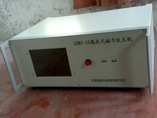
14 Geomagnetic Measurement Absolute Measurement Relative Measurement Proton Precession Magnetometer: F Overhauser magnetometer F DI-fluxgate magnetometer: D. I Fluxgate Magnetometer: H, D, Z Induction Magnetometer
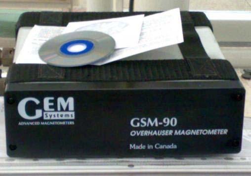
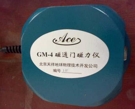
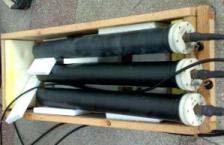

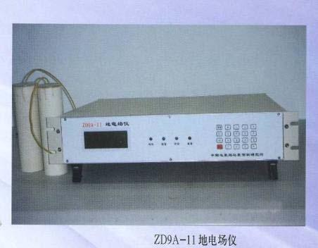
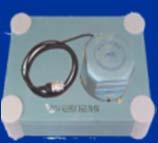
15 Geomagnetic Instrument Geo-electric Overhauser Fluxgate Sensor 探头 Atmospheric electric Induction DI-fluxgate
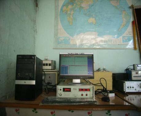
16 Geomagnetic Observatories


17 II. Radio Monitoring Subsystem To measure the physical parameters of the middle-upper atmosphere, ionosphere and the interplanetary space by use of remote sensing technique.
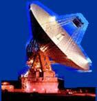
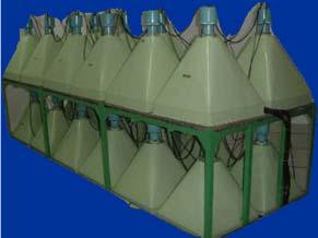
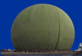
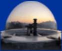
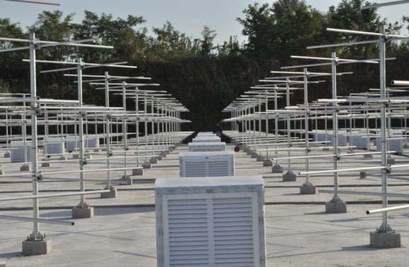
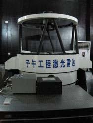
18 Four Parts 1. Incoherent Scattering Radar(ISR) ISR is located in Qujing, Yunnan Province (25.6 N, E) To measure physical parameters of the middle-upper atmosphere and ionosphere from 70 up to 1000 km. ISR has a peak transmission power of ~2MW.


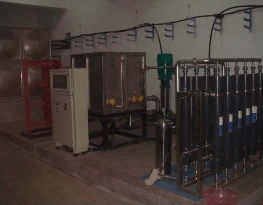
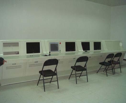
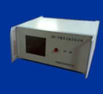
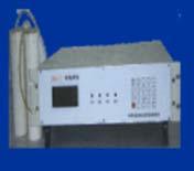
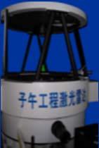
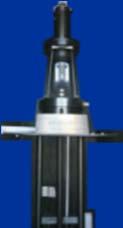
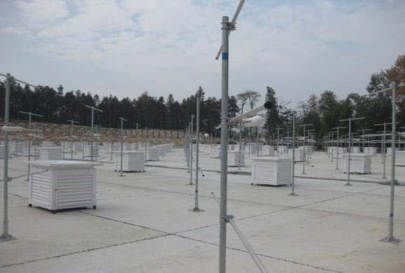
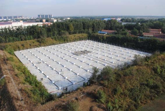
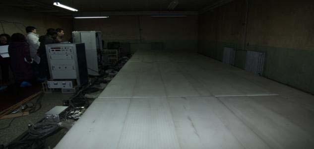
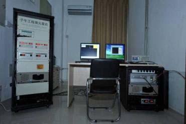
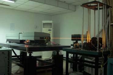
19 ISR Radar Aetna doom Control room transmitter Cooling system
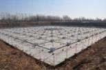
20 2. Radar Chain Instrument Detecting Content Sites MST Radar HF Coherent Scattering Radar (HF Radar) VHF Coherent Scatter Radar (VHF Radar) Meteor Radar Wind parameters of troposphere, stratosphere and mesosphere, ~50MHz To detect the motion of the ionospheric structure within a azimuth angle of 52º and 3000 km height by use of the scatter features of the ionospheric irregular structures To detect the irregular structure and drift (electrical field) in the ionospheric E lay, and to detect intensity and drift of the spread F, by measuring the intensity and Doppler Shift of the echo from the field aligned irregular bulk. To detect the wind field and diffusive coefficient of the atmosphere, the flux, position and velocity of the meteors between 70~110 km by tracing the meteors Beijing Wuhan Zhongshan Station at South Pole Hainan Wuhan

21 MST Radar Beijing Wuhan
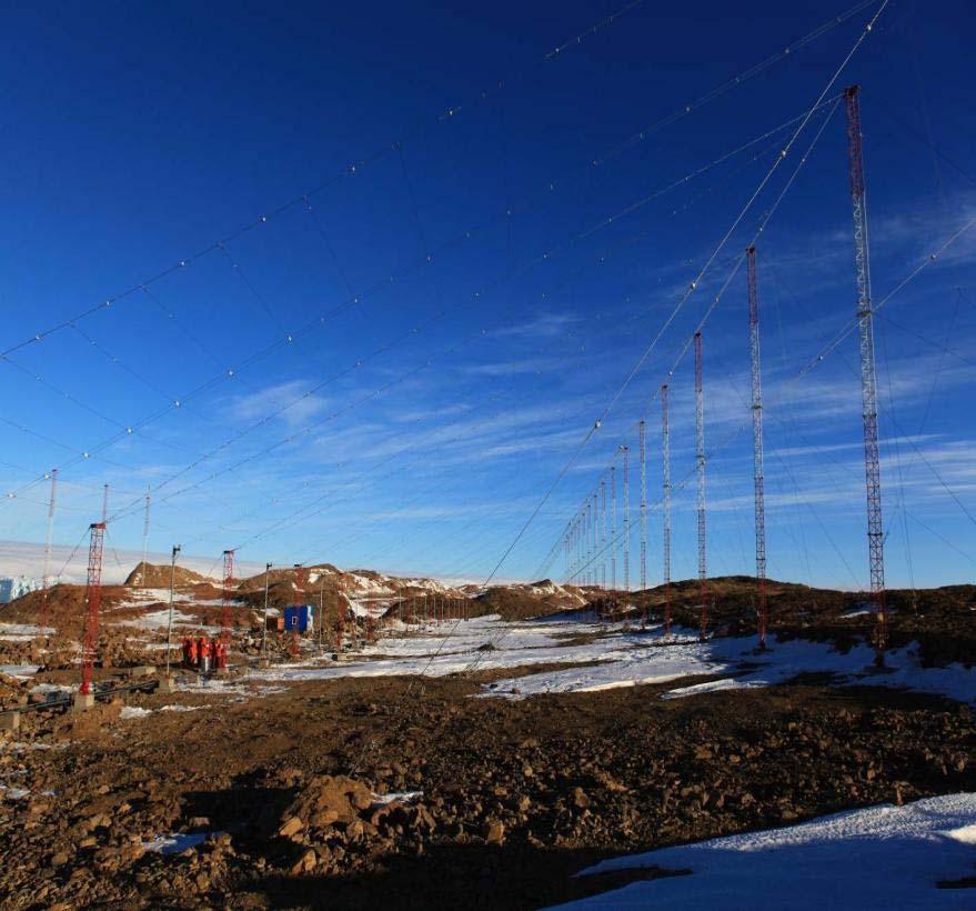
22 HF Radar


23 VHF Radar 前端数字单元实物 时钟同步设备 后端处理系统

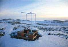
24 Meteor Radar


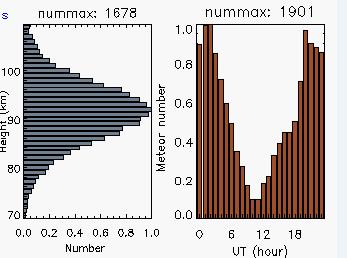
25 Meteor radar observation Observed meteors Observed wind
26 Meteor radar observation: tidal winds : Observation : GSWM02
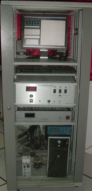
27 3. Ionosode Chain Digisonde Mohe (new) Beijing (new) Wuhan (upgrade)-hainan (upgrade) Zhongshan (upgrade) Traditional Ionosonde Manzhouli Changchun Ghuanzhou Chongqing - Lasha


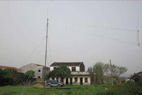
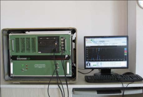
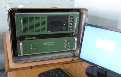
28 Digisonde Beijing Hainan Wuhan Mohee Zhongshan
29 4. Real time monitor chain of space environment Instrument Purpose Site Interplanetary Scintillation (IPS) Monitor Neutron Monitor Ionospheric TEC and Scintillation Monitors HF Doppler Drift Monitor To monitor the interplanetary disturbance and obtain information about the solar wind velocity and plasma irregular structures To detect the solar energetic particles and cosmic rays To monitor the ionospheric TEC and scintillation in real time To monitor multi-scale ionospheric disturbance propagation, by use of a long baseline system including a 3 HF Doppler antenna array in Beijing and a HF Doppler monitor in Wuhan Beijing Beijing, Guanzhou Mohe, Beijing, Xinxiang, Wuhan, Hainan, Shanghai(Hangzhou) Beijing, Wuhan


30 IPS 50-meter Atena Control room


31 Neutron Monitor Beijing Guangzhou


32 III. Optical-Atmospheric Monitoring Subsystem To measure the density, temperature, wind field, airglow and aurora spectrum by use of active and passive optical tools.
33 Station Distribution Lidar Chain: Beijing(new)-Wuhan(upgrade)-Hefei(new)-Hainan(new) Beijing: All-sky Airglow Imager, FP-interferometer (new) Hainan: All-sky Airglow Imager (new) Zhangshan: Aurora Spectrometer (new)
34 Instrument Content Sites Lidar Fabry-Perot Interferometer All-sky Airglow Imager Aurora Spectrometer Temperature and density profiles of the middle atmosphere Wind and temperature of atmosphere in the mesopause region and F2 layer The horizontal structure and transmitting feature of gravity waves in the mesopause region and the thermosphere Aurora spectrum, the atmospheric chemical species, the energetic spectrum of the energetic particles from the solar wind and the magnetosphere Beijing, Wuhan, Hefei, Hainan Beijing Beijing, Hainan Zhongshan Station in South Pole


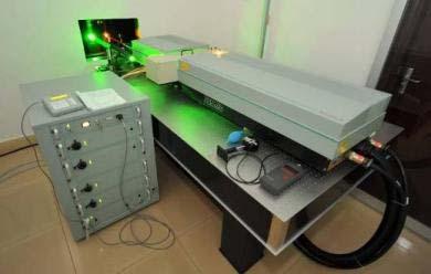
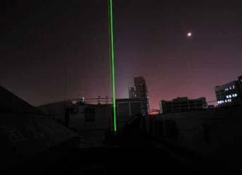
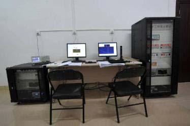
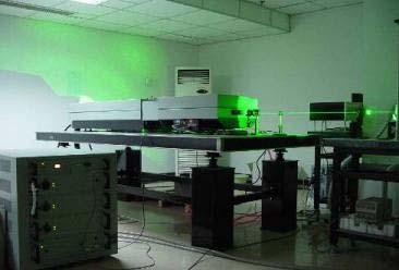
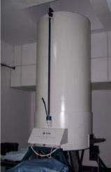
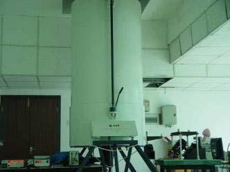
35 Lidar Beijing Hainan Hefei
36 Origin data Origin data Sodium density (double sodium layer) Rayleigh temperature


37 All-Sky Imager 全天空气辉成像仪 光学干涉仪


38 A difference image between consecutive raw images of OH airglow at 05:14 LT and 05:15LT on Dec. 26, This image shows some gravity waves.
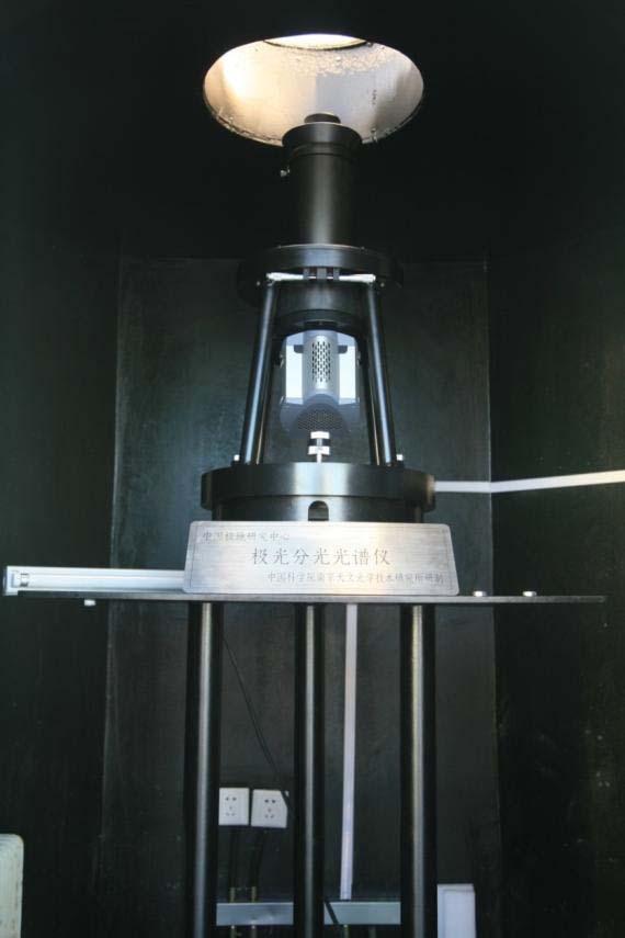
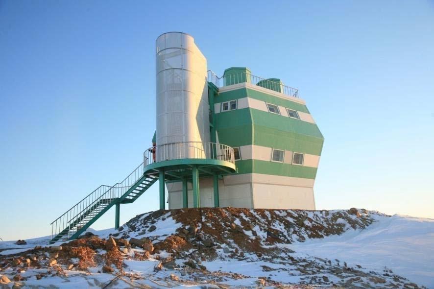
39 Aurora Spectrometer Zhongshan


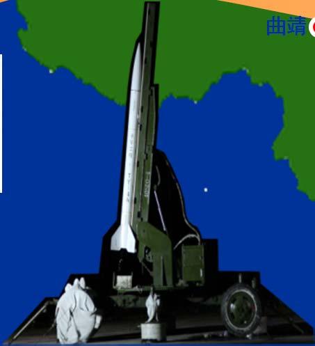
40 IV. Rocket Sounding Subsystem To make in-situ measurements of temperature, density, pressure, wind etc. in the height of 20~200 km.

")
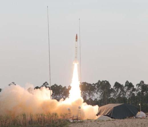
41 The sounding rocket (~200km) was successfully launched on May 7, 2011.
42 Data and Communication System Collect, transfer, process, store and distribute data International and domestic data exchange
43 Three-layer- Structure: Station-Node-Center

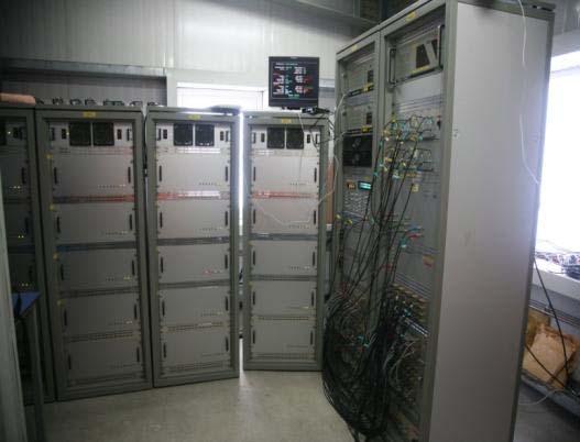
44 Data Center


45 Data Center Storage Equipment
46 Research and Forecast System Coordinate observations, research and management Carry out research and model Jointly make space weather forecast Promote international collaboration

47 Part of Data available in English:


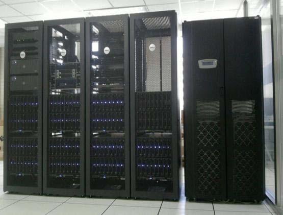
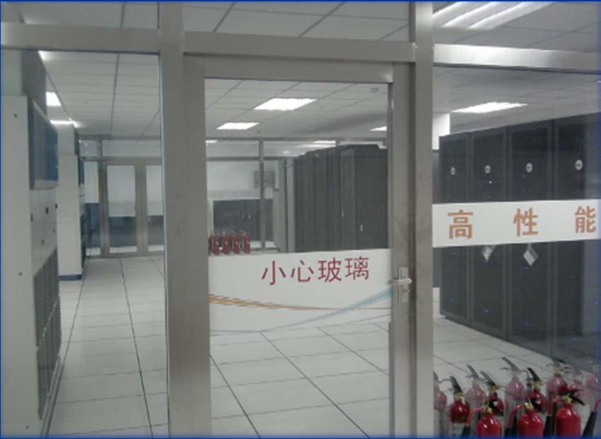
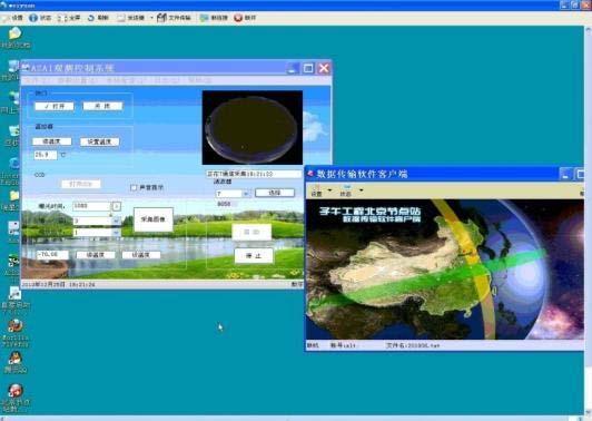
48 Science Operation Center 专用高性能计算平台 演示大厅


49 Space Weather Warning and Forecast Center
![First Observations of the geospace response of to the solar storm on Aug. 1 3, 2010 ManZhouLi ChangChun ChengDu Declination angle [min] 100 Lat=49.57 Lon=117.43 50 0-50 -100 150 Lat=44.08 Lon=124.](/docs-images/76/73068883/images/50-2.jpg "86 100 50 0 0 Lat=30.91 Lon=103.")
![73-50 -100 600 550 500 450 400 100 50 0-50 -100 0-50 -100-150 H component [nt] 100 80 60 40 80 60 40 20 280 260 240 Z component [nt] ionospheric WuHan Lhasa QuanZhou QiongZhong ChongMingSanLie -150](/docs-images/76/73068883/images/50-3.jpg "100 Lat=30.5 Lon=114.5 50 0-50 50 Lat=29 Lon=91 0-50 -100 Lat=25 Lon=118.5-150 -200-250 -100 Lat=19 Lon=109.8-150 -200 150 Lat=0 Lon=0 100 50 2010.8.3-5 -200-800 -850-900 -950-1000 -850-900 -950-1000 -1050 0-50 -100-150 -200 0-50 -100-150 -50-100 -150-200 -250 2010.")
50 First Observations of the geospace response of to the solar storm on Aug. 1 3, 2010 ManZhouLi ChangChun ChengDu Declination angle [min] 100 Lat=49.57 Lon= Lat=44.08 Lon= Lat=30.91 Lon= H component [nt] Z component [nt] ionospheric WuHan Lhasa QuanZhou QiongZhong ChongMingSanLie Lat=30.5 Lon= Lat=29 Lon= Lat=25 Lon= Lat=19 Lon= Lat=0 Lon= Geo Magnetic field Na layer


51 Observations of the geospace response of to the biggest solar storm since 2007 on Aug. 5 6, 2011 Geo Magnetic field HF radar

52 Simultaneous Observation of plasmaspheric and ionospheric variations during magnetic storms Dst (nt) Frequency (mhz) Density (amu/cm 3 ) NmF2 (10 12 el/cm 2 ) TEC (10 12 el/cm 2 ) /26 9/27 9/28 9/29 9/30 10/1 10/2 10/3 Days in 2011 (Wang et al. JGR, 2013) The plasmasphere dynamics seems to be controlled by the ionosphere during magnetic storms


53 Ionospheric disturbances caused by March 11,2011 Japan big earthquake Ionospheric Doppler-Shift Equipment (Xiao et al. JGR, 2012)


54 Chinese Meridian Project provided high time resolution and continuous space environment data and space weather service for Chinese Manned- Program

55 Space Weather Journal Cover Article (2010/08/19) Editor s Comments: What an ambitious, broad-reaching, and hard-hitting endeavor!
56 International Collaboration Considering the global nature of geospace processes and their coupling to the thermosphere and mesosphere, a new initiative, called the International Space Weather Meridian Circle Project (IMCP) is proposed to connect ground-based instruments and observatories deployed along the great meridian circle inscribed by the 120 E and 60 W meridian lines.
57 What will IMCP do? Data sharing and Exchange Coordinating observational campaigns; Encouraging collaboration on scientific research and observations; Promoting education and public outreach on space science and technology.


58 Joint Space Weather Lab IMCP Workshop Sanya, China, Feb 21-25, 2011 Hainan, China Santa Maria, Brazil

59
60 IMCP Session in ST13 Chi Wang: Overview about the Meridian Project Shunrong Zhang: Meridian Circle International Observations John Foster: Coupled Observations of Space weather Storms in the Geospace Hongqiao Hu: An overview on PRIC s UAP observation in the polar regions Anthony van Eyken: Space Weather: The current and future role of the Incoherent Scatter Radar network Qian Wu: Thermospheric wind observations and simulations
61 What Next? Scientific Committee for IMCP Executive Office for IMCP Next Workshop (2016) Space Weather Observation Campaigns Research Plan for Space Weather
62 Summary Meridian Project is a ground-based network program to monitor space environment, which consists of a chain of ground-based observatories with multiple instruments. The Meridian Project started collecting data from Oct. 2012, and will last at least 10 years. International collaborations will make it possible to constitute the first complete geospace space weather monitoring circle around the globe.

63 Thank 谢谢指正 You!!
New Chains of Space Weather Monitoring Stations in China
 SPACE WEATHER, VOL. 8, S08001, doi:10.1029/2010sw000603, 2010 New Chains of Space Weather Monitoring Stations in China Chi Wang Published 19 August 2010. Citation: Wang, C. (2010), New Chains of Space
Introduction to International Space Weather Initiative (ISWI) and China's Participation (Meridian Project)
 and China's Participation (Meridian Project)") Introduction to International Space Weather Initiative (ISWI) and China's Participation (Meridian Project) Chi Wang National Space Science Center, CAS Nov. 7, 2012 Outline What is Space Weather? International
Introduction to International Space Weather Initiative (ISWI) and China's Participation (Meridian Project) Chi Wang National Space Science Center, CAS Nov. 7, 2012 Outline What is Space Weather? International
Meridian Space Weather Monitoring Project (Meridian Project) and the International Collaboration
 and the International Collaboration") Meridian Space Weather Monitoring Project (Meridian Project) and the International Collaboration Guotao Yang National Space Science Center, China Jun. 25, 2012, Santa Fe Outline Overview of the Meridian
Meridian Space Weather Monitoring Project (Meridian Project) and the International Collaboration Guotao Yang National Space Science Center, China Jun. 25, 2012, Santa Fe Outline Overview of the Meridian
MWA Ionospheric Science Opportunities Space Weather Storms & Irregularities (location location location) John Foster MIT Haystack Observatory
 John Foster MIT Haystack Observatory") MWA Ionospheric Science Opportunities Space Weather Storms & Irregularities (location location location) John Foster MIT Haystack Observatory Storm Enhanced Density: Longitude-specific Ionospheric Redistribution
MWA Ionospheric Science Opportunities Space Weather Storms & Irregularities (location location location) John Foster MIT Haystack Observatory Storm Enhanced Density: Longitude-specific Ionospheric Redistribution
The Role of Ground-Based Observations in M-I I Coupling Research. John Foster MIT Haystack Observatory
 The Role of Ground-Based Observations in M-I I Coupling Research John Foster MIT Haystack Observatory CEDAR/GEM Student Workshop Outline Some Definitions: Magnetosphere, etc. Space Weather Ionospheric
Study of small scale plasma irregularities. Đorđe Stevanović
 Study of small scale plasma irregularities in the ionosphere Đorđe Stevanović Overview 1. Global Navigation Satellite Systems 2. Space weather 3. Ionosphere and its effects 4. Case study a. Instruments
The Ionosphere and Thermosphere: a Geospace Perspective
 The Ionosphere and Thermosphere: a Geospace Perspective John Foster, MIT Haystack Observatory CEDAR Student Workshop June 24, 2018 North America Introduction My Geospace Background (Who is the Lecturer?
Hermanus Magnetic Observatory (HMO)
") Hermanus Magnetic Observatory (HMO) As a Space Physics facility in Africa Presented by Danie Gouws & Elda Saunderson The HMO in a nutshell... The Hermanus Magnetic Observatory (HMO) is a national facility
Hermanus Magnetic Observatory (HMO) As a Space Physics facility in Africa Presented by Danie Gouws & Elda Saunderson The HMO in a nutshell... The Hermanus Magnetic Observatory (HMO) is a national facility
Jicamarca Radio Observatory: 50 years of scientific and engineering achievements
 Jicamarca Radio Observatory: 50 years of scientific and engineering achievements Jorge L. Chau, David L. Hysell and Marco A. Milla Radio Observatorio de Jicamarca, Instituto Geofísico del Perú, Lima Outline
Using the Radio Spectrum to Understand Space Weather
 Using the Radio Spectrum to Understand Space Weather Ray Greenwald Virginia Tech Topics to be Covered What is Space Weather? Origins and impacts Analogies with terrestrial weather Monitoring Space Weather
What is Space Weather? THE ACTIVE SUN
 Aardvark Roost AOC Space Weather in Southern Africa Hannes Coetzee 1 What is Space Weather? THE ACTIVE SUN 2 The Violant Sun 3 What is Space Weather? Solar eruptive events (solar flares, coronal Mass Space
(CSES) Introduction for China Seismo- Electromagnetic Satellite
 Introduction for China Seismo- Electromagnetic Satellite") Introduction for China Seismo- Electromagnetic Satellite (CSES) Wang Lanwei Working Group of China Earthquake-related related Satellites Mission China Earthquake Administration Outline Project Objectives
Introduction for China Seismo- Electromagnetic Satellite (CSES) Wang Lanwei Working Group of China Earthquake-related related Satellites Mission China Earthquake Administration Outline Project Objectives
FPI Instrumentation Control Software. National Center for Atmospheric Science at the High Altitude Observatory. Elizabeth Vickery. Mentor: Dr.
 FPI Instrumentation Control Software National Center for Atmospheric Science at the High Altitude Observatory Elizabeth Vickery Mentor: Dr. Qian Wu Programming Guide: Alice Lecinski Outline Abstract Background:
Monitoring the polar cap/ auroral ionosphere: Industrial applications. P. T. Jayachandran Physics Department University of New Brunswick Fredericton
 Monitoring the polar cap/ auroral ionosphere: Industrial applications P. T. Jayachandran Physics Department University of New Brunswick Fredericton Outline Ionosphere and its effects on modern and old
AGF-216. The Earth s Ionosphere & Radars on Svalbard
 AGF-216 The Earth s Ionosphere & Radars on Svalbard Katie Herlingshaw 07/02/2018 1 Overview Radar basics what, how, where, why? How do we use radars on Svalbard? What is EISCAT and what does it measure?
Ground-based network observations for investigation of the inner magnetosphere
 Ground-based network observations for investigation of the inner magnetosphere Shiokawa, K. 1, Y. Miyoshi 1, K. Keika 2, M. Connors 3, A. Kadokura 4, T. Nagatsuma 5, N. Nishitani 1, H. Ohya 6, F. Tsuchiya
The USU-GAIM Data Assimilation Models for Ionospheric Specifications and Forecasts
 The USU-GAIM Data Assimilation Models for Ionospheric Specifications and Forecasts L. Scherliess, R. W. Schunk, L. C. Gardner, L. Zhu, J.V. Eccles and J.J Sojka Center for Atmospheric and Space Sciences
Lecture 02. Introduction of Remote Sensing
 Lecture 02. Introduction of Remote Sensing Concept of Remote Sensing Picture of Remote Sensing Content of Remote Sensing Classification of Remote Sensing Passive Remote Sensing Active Remote Sensing Comparison
Activities of the JPL Ionosphere Group
 Activities of the JPL Ionosphere Group On-going GIM wor Submit rapid and final GIM TEC maps for IGS combined ionosphere products FAA WAAS & SBAS analysis Error bounds for Brazilian sector, increasing availability
Spatial and temporal extent of ionospheric anomalies during sudden stratospheric warmings in the daytime ionosphere
 Spatial and temporal extent of ionospheric anomalies during sudden stratospheric warmings in the daytime ionosphere Larisa Goncharenko, Shunrong Zhang, Anthea Coster, Leonid Benkevitch, Massachusetts Institute
Radar Reprinted from "Waves in Motion", McGourty and Rideout, RET 2005
 Radar Reprinted from "Waves in Motion", McGourty and Rideout, RET 2005 What is Radar? RADAR (Radio Detection And Ranging) is a way to detect and study far off targets by transmitting a radio pulse in the
Examination of Three Empirical Atmospheric Models
 Examination of Three Empirical Atmospheric Models A Presentation Given to The Department of Physics Utah State University In Partial Fulfillment of the Requirements for the Degree Doctor of Philosophy
Dartmouth College SuperDARN Radars
 Dartmouth College SuperDARN Radars Under the guidance of Thayer School professor Simon Shepherd, a pair of backscatter radars were constructed in the desert of central Oregon over the Summer and Fall of
The EISCAT Heating Facility
 The EISCAT Heating Facility Michael Rietveld EISCAT Tromsø, Norway EISCAT radar school, 30 Aug-4 Sept, 2010, Sodankylä 1 Outline Description of the hardware Antenna beams Practical details- power levels
Radio Observatorio de Jicamarca - Instituto Geofísico del Perú
 JRO Operations INCOHERENT ECHOES Experiments summary EXPERIME NTS MEASURED PARAMETERS RANGE (km) RESOLUTION (HEIGHT TIME) ANTENNA TRANSMITTER S (POWER) Duty Cycle (%) HYBRID2 (Long Pulse-LP and Double
On the Importance of Radio Occultation data for Ionosphere Modeling
 On the Importance of Radio Occultation data for Ionosphere Modeling IROWG Workshop, Estes Park, March 30, 2012 ABSTRACT The availability of unprecedented amounts of Global Navigation Satellite Systems
 Page 1 of 8 Search Contact NRL Personnel Locator Human Resources Public Affairs Office Visitor Info Planning a Visit Directions Maps Weather & Traffic Field Sites Stennis Monterey VXS-1 Chesapeake Bay
Outline. GPS RO Overview. COSMIC Overview. COSMIC-2 Overview. Summary 9/29/16
 Bill Schreiner and UCAR/COSMIC Team UCAR COSMIC Program Observation and Analysis Opportunities Collaborating with the ICON and GOLD Missions Sept 27, 216 GPS RO Overview Outline COSMIC Overview COSMIC-2
IONOSPHERE AND ATMOSPHERE RESEARCH WITH RADARS
 IONOSPHERE AND ATMOSPHERE RESEARCH WITH RADARS Jürgen Röttger, Max-Planck-Institut, Lindau, Germany published in UNESCO Encyclopedia of Life Support Systems (EOLSS), Geophysics and Geochemistry, 6.16.5.3,
ISR Coordinated Science at Equatorial Latitudes
 ISR Coordinated Science at Equatorial Latitudes J. L. Chau 1, D. L. Hysell 2, and E. Kudeki 3 1 Radio Observatorio de Jicamarca, Instituto Geofísico del Perú, Lima 2 Earth and Atmospheric Sciences, Cornell
First Results from the 2014 Coordinated Measurements Campaign with HAARP and CASSIOPE/ePOP
 First Results from the 2014 Coordinated Measurements Campaign with HAARP and CASSIOPE/ePOP Carl L. Siefring, Paul A. Bernhardt, Stanley J. Briczinski, and Michael McCarrick Naval Research Laboratory Matthew
Lecture 25. Wind Lidar (3) Direct Detection Doppler Lidar
 Direct Detection Doppler Lidar") Lecture 25. Wind Lidar (3) Direct Detection Doppler Lidar Overview of Direct Detection Doppler Lidar (DDL) Fringe imaging DDL Scanning FPI DDL FPI edge-filter DDL Iodine absorption-line edge-filter DDL
Lecture 25. Wind Lidar (3) Direct Detection Doppler Lidar Overview of Direct Detection Doppler Lidar (DDL) Fringe imaging DDL Scanning FPI DDL FPI edge-filter DDL Iodine absorption-line edge-filter DDL
ionospheric satellite cluster scientific premises and proposed configuration
 ionospheric satellite cluster scientific premises and proposed configuration O. Fedorov, Institute of Space Research, Kyiv, Ukraine V. Korepanov, Lviv Centre of Institute of Space Research, Lviv, Ukraine
The ALOMAR Andøya Space Center, how and why?
 Gats Inc. Sodium lidar Before NSF policy change The ALOMAR Observatory @ Andøya Space Center, how and why? Gats Inc. Sodium lidar Before NSF policy change Kolbjørn Blix Dir. of Space Systems dept. Kolbjørn
and Atmosphere Model:
 1st VarSITI General Symposium, Albena, Bulgaria, 2016 Canadian Ionosphere and Atmosphere Model: model status and applications Victor I. Fomichev 1, O. V. Martynenko 1, G. G. Shepherd 1, W. E. Ward 2, K.
Introduction To The Ionosphere
 Introduction To The Ionosphere John Bosco Habarulema Radar School 12 13 September 2015, SANSA, What is a radar? This being a radar school... RAdio Detection And Ranging To determine the range, R, R=Ct/2,
1. Terrestrial propagation
 Rec. ITU-R P.844-1 1 RECOMMENDATION ITU-R P.844-1 * IONOSPHERIC FACTORS AFFECTING FREQUENCY SHARING IN THE VHF AND UHF BANDS (30 MHz-3 GHz) (Question ITU-R 218/3) (1992-1994) Rec. ITU-R PI.844-1 The ITU
Impact of the low latitude ionosphere disturbances on GNSS studied with a three-dimensional ionosphere model
 Impact of the low latitude ionosphere disturbances on GNSS studied with a three-dimensional ionosphere model Susumu Saito and Naoki Fujii Communication, Navigation, and Surveillance Department, Electronic
CHAPTER 1 INTRODUCTION
 CHAPTER 1 INTRODUCTION The dependence of society to technology increased in recent years as the technology has enhanced. increased. Moreover, in addition to technology, the dependence of society to nature
Future of the HAARP Facility. Bob McCoy Director, Geophysical Institute University of Alaska Fairbanks
 Future of the HAARP Facility Bob McCoy Director, Geophysical Institute University of Alaska Fairbanks rpmccoy@alaska.edu 1 US Chairmanship 2015-2017 Future Space Research in Alaska: Integrated networks
Satellite Navigation Science and Technology for Africa. 23 March - 9 April, The African Ionosphere
 2025-28 Satellite Navigation Science and Technology for Africa 23 March - 9 April, 2009 The African Ionosphere Radicella Sandro Maria Abdus Salam Intern. Centre For Theoretical Physics Aeronomy and Radiopropagation
Scientific Studies of the High-Latitude Ionosphere with the Ionosphere Dynamics and ElectroDynamics - Data Assimilation (IDED-DA) Model
 Model") DISTRIBUTION STATEMENT A. Approved for public release; distribution is unlimited. Scientific Studies of the High-Latitude Ionosphere with the Ionosphere Dynamics and ElectroDynamics - Data Assimilation
DISTRIBUTION STATEMENT A. Approved for public release; distribution is unlimited. Scientific Studies of the High-Latitude Ionosphere with the Ionosphere Dynamics and ElectroDynamics - Data Assimilation
Ionospheric Propagation
 Ionospheric Nick Massey VA7NRM 1 Electromagnetic Spectrum Radio Waves are a form of Electromagnetic Radiation Visible Light is also a form of Electromagnetic Radiation Radio Waves behave a lot like light
Ionospheric Monitoring in China. Zhen Weimin, Ou Ming
 ICG-5 WG-B, Turino Ionospheric Monitoring in China Zhen Weimin, Ou Ming October 20 th, 2010, Turino, Italy Outline 1.Introduction 2.Ionosphere monitoring in China 3.Summary 1. Introduction GNSS performance
SuperDARN (Super Dual Auroral Radar Network)
") SuperDARN (Super Dual Auroral Radar Network) What is it? How does it work? Judy Stephenson Sanae HF radar data manager, UKZN Ionospheric radars Incoherent Scatter radars AMISR Arecibo Observatory Sondrestrom
SuperDARN (Super Dual Auroral Radar Network) What is it? How does it work? Judy Stephenson Sanae HF radar data manager, UKZN Ionospheric radars Incoherent Scatter radars AMISR Arecibo Observatory Sondrestrom
General Classs Chapter 7
 General Classs Chapter 7 Radio Wave Propagation Bob KA9BHD Eric K9VIC Learning Objectives Teach you enough to get all the propagation questions right during the VE Session Learn a few things from you about
4/29/2012. General Class Element 3 Course Presentation. Radio Wave Propagation. Radio Wave Propagation. Radio Wave Propagation.
 General Class Element 3 Course Presentation ti ELEMENT 3 SUB ELEMENTS General Licensing Class Subelement G3 3 Exam Questions, 3 Groups G1 Commission s Rules G2 Operating Procedures G3 G4 Amateur Radio
Special Thanks: M. Magoun, M. Moldwin, E. Zesta, C. Valladares, and AMBER, SCINDA, & C/NOFS teams
 Longitudinal Variability of Equatorial Electrodynamics E. Yizengaw 1, J. Retterer 1, B. Carter 1, K. Groves 1, and R. Caton 2 1 Institute for Scientific Research, Boston College 2 AFRL, Kirtland AFB, NM,
Space Weather and the Ionosphere
 Dynamic Positioning Conference October 17-18, 2000 Sensors Space Weather and the Ionosphere Grant Marshall Trimble Navigation, Inc. Note: Use the Page Down key to view this presentation correctly Space
The Significance of GNSS for Radio Science
 Space Weather Effects on the Wide Area Augmentation System (WAAS) The Significance of GNSS for Radio Science Patricia H. Doherty Vice Chair, Commission G International Union of Radio Science www.ursi.org
1 Introduction. 2 Scientific Objectives and Mission Contents. SHEN Xuhui
 0254-6124/2014/34(5)-558 05 Chin. J. Space Sci. Ξ ΛΠΠ Shen Xuhui. The experimental satellite on electromagnetism monitoring. Chin. J. Space Sci., 2014, 34(5): 558-562, doi:10.11728/ cjss2014.05.558 The
Brief introduction on Chinese ocean colour satellite missions
 卫星海洋环境动力学国家重点实验室 Brief introduction on Chinese ocean colour satellite missions Zhihua Mao, Delu Pan State Key Laboratory of Satellite Ocean Environment Dynamics, Second Institute of Oceanography, SOA 卫星海洋环境动力学国家重点实验室国家海洋局第二海洋研究所
Dynasonde measurements advance understanding of the thermosphereionosphere
 Dynasonde measurements advance understanding of the thermosphereionosphere dynamics Nikolay Zabotin 1 with contributions from Oleg Godin 2, Catalin Negrea 1,4, Terence Bullett 3,5, Liudmila Zabotina 1
Australian Wind Profiler Network and Data Use in both Operational and Research Environments
 Australian Wind Profiler Network and Data Use in both Operational and Research Environments Bronwyn Dolman 1,2 and Iain Reid 1,2 1 ATRAD Pty Ltd 20 Phillips St Thebarton South Australia www.atrad.com.au
ESS 7 Lectures 15 and 16 November 3 and 5, The Atmosphere and Ionosphere
 ESS 7 Lectures 15 and 16 November 3 and 5, 2008 The Atmosphere and Ionosphere The Earth s Atmosphere The Earth s upper atmosphere is important for groundbased and satellite radio communication and navigation.
A first study into the propagation of 5 MHz (60 m) signals using the South African ionosonde network
 signals using the South African ionosonde network") A first study into the propagation of 5 MHz (60 m) signals using the South African ionosonde network Hannes Coetzee, B. Eng. (Electronics), M. Sc. (Physics), ZS6BZP The SARL has purchased two 5 MHz test
A first study into the propagation of 5 MHz (60 m) signals using the South African ionosonde network Hannes Coetzee, B. Eng. (Electronics), M. Sc. (Physics), ZS6BZP The SARL has purchased two 5 MHz test
Community Perspective: GeoSpace Observations and Analysis
 Community Perspective: GeoSpace Observations and Analysis Prof. Jeff Thayer Aerospace Engineering Sciences Department OBSERVATION AND ANALYSIS OPPORTUNITIES COLLABORATING WITH THE ICON AND GOLD MISSIONS,
Equatorial MU Radar (EMU) under Study of Coupling Processes in the Solar- Terrestrial System + New beacon satellite project TBEx and COSMIC-2
 under Study of Coupling Processes in the Solar- Terrestrial System + New beacon satellite project TBEx and COSMIC-2") Quo Vadas WS 2016 Boulder, USA May 25-27, 2016 Equatorial MU Radar (EMU) under Study of Coupling Processes in the Solar- Terrestrial System + New beacon satellite project TBEx and COSMIC-2 Mamoru Yamamoto
Quo Vadas WS 2016 Boulder, USA May 25-27, 2016 Equatorial MU Radar (EMU) under Study of Coupling Processes in the Solar- Terrestrial System + New beacon satellite project TBEx and COSMIC-2 Mamoru Yamamoto
Vicki Hsu University of Colorado at Boulder MIT Haystack Observatory REU Program 2010 August 5, 2010
 Vicki Hsu University of Colorado at Boulder MIT Haystack Observatory REU Program 2010 August 5, 2010 Motivation Ionospheric variability affects a variety of communication and navigation systems The current
Solar Radar Experiments
 Solar Radar Experiments Paul Rodriguez Plasma Physics Division Naval Research Laboratory Washington, DC 20375 phone: (202) 767-3329 fax: (202) 767-3553 e-mail: paul.rodriguez@nrl.navy.mil Award # N0001498WX30228
Study of the Ionosphere Irregularities Caused by Space Weather Activity on the Base of GNSS Measurements
 Study of the Ionosphere Irregularities Caused by Space Weather Activity on the Base of GNSS Measurements Iu. Cherniak 1, I. Zakharenkova 1,2, A. Krankowski 1 1 Space Radio Research Center,, University
The Earth s Atmosphere
 ESS 7 Lectures 15 and 16 May 5 and 7, 2010 The Atmosphere and Ionosphere The Earth s Atmosphere The Earth s upper atmosphere is important for groundbased and satellite radio communication and navigation.
Chapter 6 Propagation
 Chapter 6 Propagation Al Penney VO1NO Objectives To become familiar with: Classification of waves wrt propagation; Factors that affect radio wave propagation; and Propagation characteristics of Amateur
Near Earth space monitoring with LOFAR PL610 station in Borówiec
 Near Earth space monitoring with LOFAR PL610 station in Borówiec Hanna Rothkaehl 1, Mariusz Pożoga 1, Marek Morawski 1, Barbara Matyjasiak 1, Dorota Przepiórka 1, Marcin Grzesiak 1 and Roman Wronowski
Space weather: A research grand challenge. Professor Jøran Moen (GCI-Cusp project scientist)
") Space weather: A research grand challenge Professor Jøran Moen (GCI-Cusp project scientist) Birkeland Space Weather Symposium 15 JUNE 2017 Outline: Space weather phenomena in cusp Research Grand Challenges
Space weather: A research grand challenge Professor Jøran Moen (GCI-Cusp project scientist) Birkeland Space Weather Symposium 15 JUNE 2017 Outline: Space weather phenomena in cusp Research Grand Challenges
Enhancing the societal value of Research Infrastructures Three Face to of Huairou National Science Center
 Enhancing the societal value of Research Infrastructures Three Face to of Huairou National Science Center JIANG Xiaoming Beijing Advanced Sciences and Innovation Center Chinese Academy of Sciences Contents
DYNAMIC IONOSPHERE CUBESAT EXPERIMENT
 Geoff Crowley, Charles Swenson, Chad Fish, Aroh Barjatya, Irfan Azeem, Gary Bust, Fabiano Rodrigues, Miguel Larsen, & USU Student Team DYNAMIC IONOSPHERE CUBESAT EXPERIMENT NSF-Funded Dual-satellite Space
THERMOSPHERE-IONOSPHERE-MESOSPHERE MODELING USING THE TIME-GCM
 THERMOSPHERE-IONOSPHERE-MESOSPHERE MODELING USING THE TIME-GCM Raymond G. Roble High Altitude Observatory National Center for Atmospheric Research Boulder, CO 80307 phone: (303) 497-1562, fax: (303) 497-1589,
Data assimilation of FORMOSAT-3/COSMIC using NCAR Thermosphere Ionosphere Electrodynamic General Circulation Model (TIE-GCM)
") Session 2B-03 5 th FORMOSAT-3 / COSMIC Data Users Workshop & ICGPSRO 2011 Data assimilation of FORMOSAT-3/COSMIC using NCAR Thermosphere Ionosphere Electrodynamic General Circulation Model (TIE-GCM) I
Session 2B-03 5 th FORMOSAT-3 / COSMIC Data Users Workshop & ICGPSRO 2011 Data assimilation of FORMOSAT-3/COSMIC using NCAR Thermosphere Ionosphere Electrodynamic General Circulation Model (TIE-GCM) I
Comparing the Low-- and Mid Latitude Ionosphere and Electrodynamics of TIE-GCM and the Coupled GIP TIE-GCM
 Comparing the Low-- and Mid Latitude Ionosphere and Electrodynamics of TIE-GCM and the Coupled GIP TIE-GCM Clarah Lelei Bryn Mawr College Mentors: Dr. Astrid Maute, Dr. Art Richmond and Dr. George Millward
Big Data and High Performance Computing
 Big Data and High Performance Computing Big data and high performance computing focus on academic research and technology development in areas of high performance computing platform architecture, parallel
Assimilation Ionosphere Model
 Assimilation Ionosphere Model Robert W. Schunk Space Environment Corporation 399 North Main, Suite 325 Logan, UT 84321 phone: (435) 752-6567 fax: (435) 752-6687 email: schunk@spacenv.com Award #: N00014-98-C-0085
Working with the new CEDAR Madrigal Archive Database
 Working with the new CEDAR Madrigal Archive Database Bill Rideout MIT Haystack Observatory brideout@haystack.mit.edu June 25, 2012 1 Key points of talk The new CEDAR archival database is a Madrigal node
Lecture 27. Wind Lidar (6) Edge Filter-Based Direct Detection Doppler Lidar
 Edge Filter-Based Direct Detection Doppler Lidar") Lecture 27. Wind Lidar (6) Edge Filter-Based Direct Detection Doppler Lidar q FPI and Fizeau edge-filter DDL q Iodine-absorption-line edge-filter DDL q Edge-filter lidar data retrieval and error analysis
Lecture 27. Wind Lidar (6) Edge Filter-Based Direct Detection Doppler Lidar q FPI and Fizeau edge-filter DDL q Iodine-absorption-line edge-filter DDL q Edge-filter lidar data retrieval and error analysis
Chapter 7 HF Propagation. Ionosphere Solar Effects Scatter and NVIS
 Chapter 7 HF Propagation Ionosphere Solar Effects Scatter and NVIS Ionosphere and Layers Radio Waves Bent by the Ionosphere Daily variation of Ionosphere Layers Ionospheric Reflection Conduction by electrons
KiChang Yoon, Sunhak Hong, Yongki Kwon, Gwan-sik Wi
 53th COPUOS Scientific and Technical Subcommittee Space Weather Expert Group 15-17 February 2016 KiChang Yoon, Sunhak Hong, Yongki Kwon, Gwan-sik Wi Contents 1. SWx Operations 2. Tailored Services 3. National
Ionospheric sounding at the RMI Geophysical Centre in Dourbes: digital ionosonde performance and ionospheric monitoring service applications
 Solar Terrestrial Centre of Excellence Ionospheric sounding at the RMI Geophysical Centre in Dourbes: digital ionosonde performance and ionospheric monitoring service applications S. Stankov, T. Verhulst,
Modeling of Ionospheric Refraction of UHF Radar Signals at High Latitudes
 Modeling of Ionospheric Refraction of UHF Radar Signals at High Latitudes Brenton Watkins Geophysical Institute University of Alaska Fairbanks USA watkins@gi.alaska.edu Sergei Maurits and Anton Kulchitsky
Storms in Earth s ionosphere
 Storms in Earth s ionosphere Archana Bhattacharyya Indian Institute of Geomagnetism IISF 2017, WSE Conclave; Anna University, Chennai Earth s Ionosphere Ionosphere is the region of the atmosphere in which
EISCAT_3D The next generation European Incoherent Scatter radar system Introduction and Brief Background
 EISCAT_3D The next generation European Incoherent Scatter radar system Introduction and Brief Background The high latitude environment is of increasing importance, not only for purely scientific studies,
Recent progress of NICT ionospheric observations in Japan
 Recent progress of NICT ionospheric observations in Japan T. Tsugawa, M. Nishioka, H. Kato, H. Jin, and M. Ishii National Institute of Information and Communications Technology (NICT), Japan NICT ionospheric
Analysis of Ionospheric Anomalies due to Space Weather Conditions by using GPS-TEC Variations
 Presented at the FIG Congress 2018, May 6-11, 2018 in Istanbul, Turkey Analysis of Ionospheric Anomalies due to Space Weather Conditions by using GPS-TEC Variations Asst. Prof. Dr. Mustafa ULUKAVAK 1,
EFFECTS OF SCINTILLATIONS IN GNSS OPERATION
 - - EFFECTS OF SCINTILLATIONS IN GNSS OPERATION Y. Béniguel, J-P Adam IEEA, Courbevoie, France - 2 -. Introduction At altitudes above about 8 km, molecular and atomic constituents of the Earth s atmosphere
EISCAT Experiments. Anders Tjulin EISCAT Scientific Association 2nd March 2017
 EISCAT Experiments Anders Tjulin EISCAT Scientific Association 2nd March 2017 Contents 1 Introduction 3 2 Overview 3 2.1 The radar systems.......................... 3 2.2 Antenna scan patterns........................
Ionospheric and cosmic ray monitoring: Recent developments at the RMI
 Solar Terrestrial Centre of Excellence Ionospheric and cosmic ray monitoring: Recent developments at the RMI Danislav Sapundjiev, Stan Stankov, Tobias Verhulst, Jean-Claude Jodogne Royal (RMI) Ringlaan
Assimilation Ionosphere Model
 Assimilation Ionosphere Model Robert W. Schunk Space Environment Corporation 221 North Spring Creek Parkway, Suite A Providence, UT 84332 phone: (435) 752-6567 fax: (435) 752-6687 email: schunk@spacenv.com
Operational Products of the Space Weather Application Center Ionosphere (SWACI) and capabilities of their use
 and capabilities of their use") Operational Products of the Space Weather Application Center Ionosphere (SWACI) and capabilities of their use N. Jakowski, C. Borries, V. Wilken, K.D. Missling, H. Barkmann, M. M. Hoque, M. Tegler, C.
Operational Products of the Space Weather Application Center Ionosphere (SWACI) and capabilities of their use N. Jakowski, C. Borries, V. Wilken, K.D. Missling, H. Barkmann, M. M. Hoque, M. Tegler, C.
Ionosphere and Radio Communication
 Ionosphere and Radio Communication Saradi Bora The Earth s ionosphere consists of plasma produced by the photoionization of thin upper atmospheric gases by UV rays and photons of short wavelength from
Radio-science experiments with the Enhanced Polar Outflow Probe satellite payload using its RRI, GAP and CERTO instruments
 Radio-science experiments with the Enhanced Polar Outflow Probe satellite payload using its RRI, GAP and CERTO instruments H.G. James, CRC, Ottawa, Canada P.A. Bernhardt, NRL, Washington, U.S.A. R.B. Langley,
RADAR DEVELOPMENT BASIC CONCEPT OF RADAR WAS DEMONSTRATED BY HEINRICH. HERTZ VERIFIED THE MAXWELL RADAR.
 1 RADAR WHAT IS RADAR? RADAR (RADIO DETECTION AND RANGING) IS A WAY TO DETECT AND STUDY FAR OFF TARGETS BY TRANSMITTING A RADIO PULSE IN THE DIRECTION OF THE TARGET AND OBSERVING THE REFLECTION OF THE
Measurements of doppler shifts during recent auroral backscatter events.
 Measurements of doppler shifts during recent auroral backscatter events. Graham Kimbell, G3TCT, 13 June 2003 Many amateurs have noticed that signals reflected from an aurora are doppler-shifted, and that
imaging of the ionosphere and its applications to radio propagation Fundamentals of tomographic Ionospheric Tomography I: Ionospheric Tomography I:
 Ionospheric Tomography I: Ionospheric Tomography I: Fundamentals of tomographic imaging of the ionosphere and its applications to radio propagation Summary Introduction to tomography Introduction to tomography
Introduction to ILWS. George Withbroe. Office of Space Science Sun Earth Connection Division NASA Headquarters
 Introduction to ILWS George Withbroe Office of Space Science Sun Earth Connection Division NASA Headquarters GOAL: Stimulate and strengthen research in solar-terrestrial physics to improve understanding
Ionosphere- Thermosphere
 Ionosphere- Thermosphere Jan J Sojka Center for Atmospheric and Space Sciences Utah State University, Logan, Utah 84322 PART I: Local I/T processes (relevance for Homework Assignments) PART II: Terrestrial
The ICG, Multifunction GNSS Signals and How To Protect Them. Space Weather Studies Using GNSS and Space Science Outreach activities at Sangli
 4 th EUROPEAN SPACE SOLUTIONS The ICG, Multifunction GNSS Signals and How To Protect Them Space Weather Studies Using GNSS and Space Science Outreach activities at Sangli D. J. SHETTI DEPARTMENT OF PHYSICS,
Developing systems for ionospheric data assimilation
 Developing systems for ionospheric data assimilation Making a quantitative comparison between observations and models A.C. Bushell, 5 th European Space Weather Week, Brussels, 20 th November 2008 Collaborators
Assessment of HF Radar for Significant Wave Height Determination. Desmond Power VP, Remote Sensing, C-CORE
 Assessment of HF Radar for Significant Wave Height Determination Desmond Power VP, Remote Sensing, C-CORE Study Rationale Agenda Technology Overview Technology Assessment for CNLOPB Proposed Go Forward
Report of Regional Warning Centre INDIA, Annual Report
 Report of Regional Warning Centre INDIA, 2013-2014 Annual Report A.K Upadhayaya Radio and Atmospheric Sciences Division, National Physical Laboratory, New Delhi-110012, India Email: upadhayayaak@nplindia.org
Terrestrial Ionospheres
 Terrestrial Ionospheres I" Stan Solomon" High Altitude Observatory National Center for Atmospheric Research Boulder, Colorado stans@ucar.edu Heliophysics Summer School National Center for Atmospheric Research
How GNSS and Beacon receivers can be used to monitor auroral ionosphere and space weather?
 How GNSS and Beacon receivers can be used to monitor auroral ionosphere and space weather? Kirsti Kauristie, Finnish Meteorological Institute Special Thanks: J. Norberg (FMI), A. Aikio and T. Nygren (University