Basics of GPS Jeff Freymueller UAF Geophysical Inst.
|
|
|
- Verity Reed
- 6 years ago
- Views:
Transcription


1 Basics of GPS Jeff Freymueller UAF Geophysical Inst.

2 GPS Design Timeline NAVSTAR = NAVigaDon System with Timing and Ranging Always on, instant global posidoning Development began in 1973 First satellites launched 1978 User equip tests : KLM 007 shot down by Soviet Union Reagan mandates future civilian use of GPS


3 GPS User Hardware Old!


4 GPS User Hardware Modern!
5 Different Modes of Use Naviga'on Instantaneous Single stadon Original intended use Accuracy Few meters Sub meter w/differendal correcdons Surveying Usually post process Usually muld stadon Science or survey Accuracy 1 2 cm at worst 1 2 mm at best Also seismology
6 Basic Principles: Surveying Requires data from n 4 satellites, m 2 receivers Requires condnuous tracking over Dme Post processed using data from all receivers Use pseudorange and carrier phase measurements from each satellite to receiver Orbits of satellites fixed or esdmated Clock error on satellites esdmated EsDmate receiver posidon (X,Y,Z) and clock error Model a wide variety of path delays and other effects
7 PosiDoning By Ranging 1
8 PosiDoning By Ranging 2
9 PosiDoning By Ranging 3
10 GPS PosiDoning Measure posidon by measuring ranges to satellites A few satellites can serve an unlimited number of users on the ground, anywhere in the world How do we know where satellites are? They broadcast their posidons (orbits) in a naviga&on message (or) someone gives us precise orbits back in the lab Measured ranges are called pseudoranges
11 Why call it a pseudorange? Range is the distance from satellite to receiver, plus path delays. Pseudorange is distance plus effects of clock errors Geometric range ρ is true distance. P = ρ + c*(clock errors) + c*(path delays)


12 Evolving Satellites

13 Satellite ConstellaDon
14 Satellite ConstellaDon Facts Nominally 4 satellites (SVs) in each of 6 equally spaced orbital planes (now 5 in each plane). Orbital planes inclined 55 from equator. Nearly circular orbits R = 26,600 km ~ 4R E Orbital period is 11h 58m, two orbits per sidereal day Sidereal day is length of day defined by when stars appear in same place in sky Differs from rotadonal day because of modon of earth around the sun.
 In pracdce, highly precise orbits are available from the IGS Ultra Rapid: includes predict ahead for real Dme use Rapid: Available next day Final:")
15 Orbits Can esdmate orbits or fix orbits to pre determined values RepresentaDon of orbit Broadcast: Keplerian elements Tabular file of XYZ satellite posidons Traectory: inidal condidons + integrate equadons of modon (needed to esdmate orbits) In pracdce, highly precise orbits are available from the IGS Ultra Rapid: includes predict ahead for real Dme use Rapid: Available next day Final: Available in <2 weeks

16 Satellite Ground Tracks

17 24 hours of GPS Data Southern California Fairbanks
18 GPS Signal Structure Two frequencies at L band, L1 and L2 L1 at 154*10.23 MHz (~19 cm) L2 at 120*10.23 MHz (~24 cm) Codes Modulated (phase moduladon) onto each carrier P code at MHz on L1 + L2 C/A (Coarse AcquisiDon) code at MHz on L1 + L2 (new L2C) NavigaDon message at 50 bits per second P and C/A codes are types of pseudo random noise (PRN) codes
 Frequency Modulation (FM) Phase Modulation")
19 Types of signal moduladon Amplitude Modulation (AM) Frequency Modulation (FM) Phase Modulation (PM)

20 Precision of ObservaDons chip length Code chip length is the distance associated with each bit of the code. C/A: 293 m Repeats every ~300 km P: 29.3 m Carrier wavelength is analogous to chip length == 2 3 orders of magnitude more precise
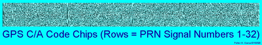
21 Pseudo Random Noise Computers cannot generate true random numbers, but can generate a sequence of numbers with random stadsdcal properdes. But the sequence can be repeated exactly Begin with some stardng value, then perform a series of operadons C/A code has 1023 bits, repeats 1000 Dmes per second P code has a lot of bits, repeats every days; each SV gets a 7 day piece of code


22 Code CorrelaDon for Ranging
23 Pseudorange ObservaDon Model The correladon procedure produces a Dme shiv, which is the fundamental pseudorange measurement. Travel Dme = (Dme of recepdon) (Dme of transmission) P S = (T T S )c T = receiver clock reading at recepdon T S = satellite clock reading at transmission c = speed of light = m/s
![ObservaDon Model with Clocks P S = (T T S )c T = t + τ T S = t S + τ S t, t S are true receive, transmit Dmes SubsDtuDng P S = [(t + τ) (t S + τ S )]c P S = (t t S )c + (τ τ S )c P S = ρ S (t,t S ) +](/docs-images/75/72258661/images/24-0.jpg "(τ τ S )c τ 1 millisecond τ S is small (Cesium or Rubidium clocks) ρ S (t,t S ) is range from receiver at receive Dme to satellite at transmit Dme: ρ S (t,t S ) = ( x S (t S ) x(t) ) 2 + ( y S (t S )")
24 ObservaDon Model with Clocks P S = (T T S )c T = t + τ T S = t S + τ S t, t S are true receive, transmit Dmes SubsDtuDng P S = [(t + τ) (t S + τ S )]c P S = (t t S )c + (τ τ S )c P S = ρ S (t,t S ) + (τ τ S )c τ 1 millisecond τ S is small (Cesium or Rubidium clocks) ρ S (t,t S ) is range from receiver at receive Dme to satellite at transmit Dme: ρ S (t,t S ) = ( x S (t S ) x(t) ) 2 + ( y S (t S ) y(t) ) 2 + ( z S (t S ) z(t) ) 2
25 Set of Simplified Observ. EquaDons Now, generalize to muldple satellites. We use a superscript to idendfy each satellite (don t confuse with an exponent). Later we will have to use a subscript to keep track of muldple receivers: P (1) = [ (x (1) x) 2 + (y (1) y) 2 + (z (1) z) 2 ] 1/2 + cτ cτ (1) P (2) = [ (x (2) x) 2 + (y (2) y) 2 + (z (2) z) 2 ] 1/2 + cτ cτ (2) P (3) = [ (x (3) x) 2 + (y (3) y) 2 + (z (3) z) 2 ] 1/2 + cτ cτ (3) P (4) = [ (x (4) x) 2 + (y (3) y) 2 + (z (3) z) 2 ] 1/2 + cτ cτ (4)


26 Linearizing Nonlinear EquaDons There are simple ways to solve systems of linear equadons, like matrix inversion or least squares. But we have a nonlinear problem. One approach is to linearize, or construct a linear approximadon to the non linear problem. We can do that with Taylor s theorem (Taylor Series) f(x) =

27 Linearizing Part 2 For problems with muldple variables, there is a simple extension of the Taylor Series. We linearize about approximate values (a,b) ParDal derivadves are computed at (a,b)
28 Linearizing Our EquaDons We linearize our equadons about approximate values (x 0, y 0, z 0, τ 0 ) P(x, y,z,τ) = P(x 0,y 0,z 0,τ 0 ) + P ( x x x 0) + P ( y y y 0) + P ( z z z 0) + P ( τ τ τ 0) P(x, y,z,τ) = P(x 0,y 0,z 0,τ 0 ) + P x P(x, y,z,τ) P(x 0,y 0,z 0,τ 0 ) = P x P observed P computed = P x Δx + P y Δx + P y Δx + P y Δy + P z Δy + P z Δy + P z Δz + P τ Δτ Δz + P τ Δτ Δz + P τ Δτ
29 Matrix EquaDon It is easier to deal with this equadon if we write it as a matrix equadon: ΔP (1) ΔP (2) ΔP (3) ΔP (4 ) = P (1) x P (2) x P (3) x P (4 ) x P (1) y P (2) y P (3) y P (4) y P (1) z P (2) z P (3) z P (4) z P (1) τ P (2) τ P (3) τ P (4 ) τ Δx Δy + Δz Δτ v (1) v (2) v (3) v (4 )
30 Evaluate the ParDal DerivaDves This is oven wri en in matrix form like b = Ax + v A is called the Design matrix If ρ (i) = [ (x 0 x (i) ) 2 + (y 0 y (i) ) 2 + (z 0 z (i) ) 2 ] 1/2 x 0 x (1) y 0 y (1) z 0 z (1) ρ (1) ρ (1) ρ (1) x 0 x (2) y 0 y (2) z 0 z (2) ρ A = (2) ρ (2) ρ (2) x 0 x (3) y 0 y (3) z 0 z (3) ρ (3) ρ (3) ρ (3) x 0 x (4 ) y 0 y (4 ) z 0 z (4 ) ρ (4) ρ (4 ) ρ (4) c c c c These have the form of trig functions, and can also be written in terms of the azimuth to the satellite and the inclination of the satellite above the horizon.
31 DOPs DiluDon of Precision Your handheld GPS probably reports a number called PDOP, which stands for PosiDon DiluDon of Precision. These are other DOPs as well, which all give measures of how the satellite geometry maps into posidon or Dme precision. VDOP = σ h HDOP = (σ e 2 + σ n2 ) 1/2 PDOP = (σ e 2 + σ n 2 + σ h2 ) 1/2 PDOP > 5 considered poor GDOP = (σ e 2 + σ n 2 + σ h 2 + c 2 σ τ2 ) 1/2 TDOP = σ τ MulDply PDOP by measurement precision to get uncertainty in 3D posidon.
32 Phase Tracking Receiver measures changes in phase of carrier signal over Dme First must remove codes to recover raw phase Then track condnuous phase, keeping record of the number of whole cycles Phase has an integer ambiguity (inidal value) Problems occur if receiver loses phase lock φ φ 0 1 cycle 2 cycles

33 Measurement Trick: Beat Phase Remove PRN code moduladon by muldplying signal by code removes phase shivs and recovers original carrier signal Mix received phase with reference phase signal Filter high frequency beats and measure phase of low frequency beat
34 Measuring Beat Phase Doppler Shiv shivs each SVs frequency slightly Receiver generates reference signal at nominal GPS frequency Beat phase and beat frequency are φ B (t) = φ R (t) φ G (t) f B = f R f G Beat frequency is much lower than nominal, easier to measure beat phase, but we can recover all variadons in phase of the transmi ed carrier signal from the beat phase
35 Phase Ambiguity One drawback of the beat phase is that we can add an arbitrary constant number of cycles to the transmi ed carrier signal, and we would get exactly the same beat phase: Φ + N = φ R φ G Actual recorded phase is Φ Also, we must track the phase condnuously. If we lose track of the phase over Dme, and start over, we get a different N. Losing track is called a cycle slip
36 Loss of Lock (Cycle Slips) If receiver loses phase lock, there will be a ump of an integer number of cycles in the phase data This must be detected and repaired by the analysis sovware Slightly different procedures are usually applied muldple Dmes to find all of the cycle slips Before After φ 2πn φ t t
37 ObservaDon EquaDons Compare the phase observadon model with the pseudorange model: L A (T A ) = c(t A T ) + B a P A (T A ) = c(t A T ) Exactly the same except for the phase bias! We need to add more terms to deal with the clock errors and with path delay terms L A (T A ) = ρ A (t A, t ) + cτ A cτ + Z a I A + B A P A (T A ) = ρ A (t A, t ) + cτ A cτ + Z a + I A Path delay terms are Z for the troposphere, and I for ionosphere. We ll come back to these later on.
38 Differencing Techniques Receiver and satellite clock biases can be removed by differencing data from mulitple satellites and/or receivers. Difference between receivers ( single difference ) removes satellite clock Difference between satellites ( single difference ) removes receiver clock Difference of differences ( double difference ) removes both clocks
39 Advantages/Disadvantages of Advantage Differencing Removes clock errors, which are a pain Makes for faster esdmadon (fewer parameters if you do not need to esdmate clock error at every observadon Dme) Phase bias parameters reduce to integer values Disadvantages Requires a method to select differences Requires addidonal bookkeeping NotaDon gets messy
40 Single Difference satellite ρ A receiver A records L A ρ B receiver B records L B Receivers A and B observe: L A = ρ A + cτ A cτ + B A L B = ρ B + cτ B cτ + B B Form a difference between receivers A and B ΔL AB = L A L B ΔL AB = (ρ A ρ B ) + (cτ A cτ B ) + (B A B B ) ΔL AB = Δρ AB + cδτ AB + ΔB AB We use Δ to indicate a difference between ground receivers.
41 Double Difference satellite ρ A ρ B receiver A records L A records L A k ρ A k satellite k ρ B k receiver B records L B records L B k Receivers A and B observe: L A = ρ A + cτ A cτ + B A L A k = ρ A k + cτ A cτ k + B A k L B = ρ B + cτ B cτ + B B L B k = ρ B k + cτ B cτ k + B B k Form the single difference between receivers A and B, and then difference between satellites and k: ΔΔL AB k = ΔL AB ΔL AB k ΔΔL AB k = (Δρ AB Δρ ABk ) + (ΔB AB ΔB ABk ) ΔΔL AB k = ΔΔρ AB k + ΔΔB AB k We use ΔΔ to indicate a double difference.
42 Double Differenced Ambiguity The double differenced phase ambiguides become exactly integers: ΔΔB AB k = ΔB AB ΔB AB k = λ 0 ΔN AB k Each B has three parts: B A = λ 0 (N A + φ 0A φ 0 ) The receiver bias φ 0A is common to all satellites, and differences out like the receiver clock. The satellite bias φ 0 is common to all receivers, and differences out like the satellite clock. There are some clever techniques to remove the phase ambiguity completely, if you can resolve it to the correct integer.
43 Triple Difference satellite ρ A ρ B receiver A records L A records L A k ρ A k satellite k ρ B k receiver B records L B records L B k The triple difference adds a difference in Dme. If you difference the double differenced observadons from one epoch in Dme to those of the previous epoch, you get a triple difference: ΔΔΔL AB k (i+i, i) = ΔΔΔρ AB k (i+i, i) We use ΔΔΔ to indicate a double difference. The triple difference also removes most of the geometric strength from GPS, so it produces only weakly determined posidons. But the triple difference could be applied to kinemadc problems.
44 Final Notes on Differencing When you difference between receivers, then in effect you are now esdmadng the baseline vector between the two receivers, rather than the two posidons. You have to take some care in choosing which differences to use Cannot use linearly dependent observadons Must be careful in choosing baselines to difference, satellites to difference between. Each sovware does it differently Some sovwares do not difference at all, but esdmate clock errors instead.
45 Ionospheric CalibraDon To a very good approximadon, the path delay due to ionospheric refracdon is propordonal to 1/f 2 The phase is advanced, while the pseudorange data are delayed InformaDon travels at group velocity Specifically, the path delay is (40.3/f 2 )TEC, where TEC is the total electron content. This path delay can be as large as meters. The delay term I a = 40.3TEC/f 2 ; f =f 1 for L1, f 2 for L2
46 Ionosphere free CombinaDon We can remove the effects of the ionosphere by forming a linear combinadon of the data at the two frequencies L C = f 12 /(f 2 2 f 12 )L 1 + f 22 /(f 2 2 f 12 )L 2 P C = f 12 /(f 2 2 f 12 )P 1 + f 22 /(f 2 2 f 12 )P 2 Try it: For L1 and L2, the biases are (40.3TEC/f 12, 40.3TEC/f 22 ) Note that the two coefficients sum to 1. They have values of approximately ( 1.54, 2.54) This removes all ionospheric effects except for a 1/f 4 dependence. There are now second order ionosphere models coming into use, which have an impact on posidons at the few mm level or less.
47 Some Other Important Models Tropospheric delay (esdmated) Hopfield, Saastamoinen, Lanyi, Niell Earth Ddes (well known) Up to ~70 cm amplitude Ocean Tidal Loading Response of solid earth to changing load of ocean Ddes Antenna Phase Center variadons with elevadon Phase center is the point on the antenna that we actually measure distances to It is an imaginary point in space, not a physical point
48 Troposphere Tropospheric path delay affects both frequencies idendcally. It has two components. Dry delay: due to air mass (~ propordonal to pressure) Wet delay: due to integrated water vapor along path Delay in both cases is largest at low elevadons above the horizon, because the path length through atmosphere is longer there. In pracdce, we esdmate a zenith delay, and use a mapping funcdon of elevadon angle to map this to lower elevadons Mapping funcdon is ~1/sin(i) To SV e
 Mapping funcdons vary with space and Dme based on distribudon of")
49 Wet Tropospheric Mapping FuncDon Detailed form of mapping funcdon is a condnued fracdon: Fortaleza, Brazil, 5 elevation Approx. for layered atmosphere Path delay at some elevadon angle e is ZTD*mf(e) Mapping funcdons vary with space and Dme based on distribudon of water vapor.
50 Ocean Tidal Loading Solid earth responds to changing load of ocean Ddes Displacements large near coast, where Ddal range is large Details depend on ocean Ddes, coastline Accurate removal depends on good Ddal models

51 Antenna Phase Center Models Ideally, phase center is a point in space. Different for every type of antenna In reality, the phase center depends on the azimuth and elevadon of incoming signal. Models assume azimuthal symmetry and fit elevadon dependence
52 Ambiguity ResoluDon Ambiguity resoludon is a trick that can dramadcally improve posidon quality for short surveys or kinemadc posidoning. If you know the ambiguity is an integer, and can determine which integer, then you can fix the ambiguity to that integer value. Removing the ambiguity parameter dramadcally improves the strength of the data to be used for determining the posidon We ll talk about this more in the kinemadc discussion
53 Product is DifferenDal PosiDon Or a set of relative positions (all sites in network relative to each other)
Global Positioning System: what it is and how we use it for measuring the earth s movement. May 5, 2009
 Global Positioning System: what it is and how we use it for measuring the earth s movement. May 5, 2009 References Lectures from K. Larson s Introduction to GNSS http://www.colorado.edu/engineering/asen/
Fundamentals of GPS for geodesy
 Fundamentals of GPS for geodesy T. A. Herring M. A. Floyd Massachuse(s Ins,tute of Technology GAMIT/GLOBK/TRACK Short Course for GPS Data Analysis Korea InsDtute of Geoscience and Mineral Resources (KIGAM)
Modelling GPS Observables for Time Transfer
 Modelling GPS Observables for Time Transfer Marek Ziebart Department of Geomatic Engineering University College London Presentation structure Overview of GPS Time frames in GPS Introduction to GPS observables
UNIT 1 - introduction to GPS
 UNIT 1 - introduction to GPS 1. GPS SIGNAL Each GPS satellite transmit two signal for positioning purposes: L1 signal (carrier frequency of 1,575.42 MHz). Modulated onto the L1 carrier are two pseudorandom
Fundamentals of GPS Navigation
 Fundamentals of GPS Navigation Kiril Alexiev 1 /76 2 /76 At the traditional January media briefing in Paris (January 18, 2017), European Space Agency (ESA) General Director Jan Woerner explained the knowns
An Introduction to GPS
 An Introduction to GPS You are here The GPS system: what is GPS Principles of GPS: how does it work Processing of GPS: getting precise results Yellowstone deformation: an example What is GPS? System to
Study and analysis of Differential GNSS and Precise Point Positioning
 IOSR Journal of Electrical and Electronics Engineering (IOSR-JEEE) e-issn: 2278-1676,p-ISSN: 2320-3331, Volume 9, Issue 2 Ver. I (Mar Apr. 2014), PP 53-59 Study and analysis of Differential GNSS and Precise
FieldGenius Technical Notes GPS Terminology
 FieldGenius Technical Notes GPS Terminology Almanac A set of Keplerian orbital parameters which allow the satellite positions to be predicted into the future. Ambiguity An integer value of the number of
GPS for crustal deformation studies. May 7, 2009
 GPS for crustal deformation studies May 7, 2009 High precision GPS for Geodesy Use precise orbit products (e.g., IGS or JPL) Use specialized modeling software GAMIT/GLOBK GIPSY OASIS BERNESE These software
Guochang Xu GPS. Theory, Algorithms and Applications. Second Edition. With 59 Figures. Sprin ger
 Guochang Xu GPS Theory, Algorithms and Applications Second Edition With 59 Figures Sprin ger Contents 1 Introduction 1 1.1 AKeyNoteofGPS 2 1.2 A Brief Message About GLONASS 3 1.3 Basic Information of Galileo
GPS: History, Operation, Processing
 GPS: History, Operation, Processing Impor tant Dates 1970 s: conceived as radionavigation system for the US military: realtime locations with few-meter accuracy. 1978: first satellite launched 1983: Declared
Bernese GPS Software 4.2
 Bernese GPS Software 4.2 Introduction Signal Processing Geodetic Use Details of modules Bernese GPS Software 4.2 Highest Accuracy GPS Surveys Research and Education Big Permanent GPS arrays Commercial
GPS: History, Operation, Processing
 GPS: History, Operation, Processing Impor tant Dates 1970 s: conceived as radionavigation system for the US military: realtime locations with few-meter accuracy. 1978: first satellite launched 1983: Declared
GPS Error and Biases
 Component-I(A) - Personal Details Role Name Affiliation Principal Investigator Prof.MasoodAhsanSiddiqui Department of Geography, JamiaMilliaIslamia, New Delhi Paper Coordinator, if any Dr. Mahaveer Punia
Chapter 6 GPS Relative Positioning Determination Concepts
 Chapter 6 GPS Relative Positioning Determination Concepts 6-1. General Absolute positioning, as discussed earlier, will not provide the accuracies needed for most USACE control projects due to existing
Wednesday AM: (Doug) 2. PS and Long Period Signals
 2. PS and Long Period Signals") Wednesday AM: (Doug) 2 PS and Long Period Signals What is Colorado famous for? 32 satellites 12 Early on in the world of science synchronization of clocks was found to be important. consider Paris: puffs
Wednesday AM: (Doug) 2 PS and Long Period Signals What is Colorado famous for? 32 satellites 12 Early on in the world of science synchronization of clocks was found to be important. consider Paris: puffs
GPS and Recent Alternatives for Localisation. Dr. Thierry Peynot Australian Centre for Field Robotics The University of Sydney
 GPS and Recent Alternatives for Localisation Dr. Thierry Peynot Australian Centre for Field Robotics The University of Sydney Global Positioning System (GPS) All-weather and continuous signal system designed
E. Calais Purdue University - EAS Department Civil 3273
 E. Calais Purdue University - EAS Department Civil 373 ecalais@purdue.edu GPS signal propagation GPS signal (= carrier phase modulated by satellite PRN code) sent by satellite. About 66 msec (0,000 km)
t =1 Transmitter #2 Figure 1-1 One Way Ranging Schematic
 1.0 Introduction OpenSource GPS is open source software that runs a GPS receiver based on the Zarlink GP2015 / GP2021 front end and digital processing chipset. It is a fully functional GPS receiver which
What is GPS? Whyuse GPS? It swhere the moneyis
 What is GPS? Global radionavigation system, to provide locations in real time to US militar y,with few-meter accuracy. Conceived in the 1970 s, first satellites launched 1978, became operational in1994.
Sidereal Filtering Based on GPS Single Differences for Mitigating Multipath Effects
 International Global Navigation Satellite Systems Society IGNSS Symposium 2007 The University of New South Wales, Sydney, ustralia 4 6 December, 2007 Sidereal Filtering Based on GPS Single Differences
Errors in GPS. Errors in GPS. Geodetic Co-ordinate system. R. Khosla Fall Semester
 Errors in GPS Errors in GPS GPS is currently the most accurate positioning system available globally. Although we are talking about extreme precision and measuring distances by speed of light, yet there
Resection. We can measure direction in the real world! Lecture 10: Position Determination. Resection Example: Isola, Slovenia. Professor Keith Clarke
 Geography 12: Maps and Spatial Reasoning Lecture 10: Position Determination We can measure direction in the real world! Professor Keith Clarke Resection Resection Example: Isola, Slovenia Back azimuth
Multipath and Atmospheric Propagation Errors in Offshore Aviation DGPS Positioning
 Multipath and Atmospheric Propagation Errors in Offshore Aviation DGPS Positioning J. Paul Collins, Peter J. Stewart and Richard B. Langley 2nd Workshop on Offshore Aviation Research Centre for Cold Ocean
Integer Ambiguity Resolution for Precise Point Positioning Patrick Henkel
 Integer Ambiguity Resolution for Precise Point Positioning Patrick Henkel Overview Introduction Sequential Best-Integer Equivariant Estimation Multi-frequency code carrier linear combinations Galileo:
CHAPTER 2 GPS GEODESY. Estelar. The science of geodesy is concerned with the earth by quantitatively
 CHAPTER 2 GPS GEODESY 2.1. INTRODUCTION The science of geodesy is concerned with the earth by quantitatively describing the coordinates of each point on the surface in a global or local coordinate system.
Precise Positioning with NovAtel CORRECT Including Performance Analysis
 Precise Positioning with NovAtel CORRECT Including Performance Analysis NovAtel White Paper April 2015 Overview This article provides an overview of the challenges and techniques of precise GNSS positioning.
Global Navigation Satellite Systems II
 Global Navigation Satellite Systems II AERO4701 Space Engineering 3 Week 4 Last Week Examined the problem of satellite coverage and constellation design Looked at the GPS satellite constellation Overview
PDHonline Course L105 (12 PDH) GPS Surveying. Instructor: Jan Van Sickle, P.L.S. PDH Online PDH Center
 GPS Surveying. Instructor: Jan Van Sickle, P.L.S. PDH Online PDH Center") PDHonline Course L105 (12 PDH) GPS Surveying Instructor: Jan Van Sickle, P.L.S. 2012 PDH Online PDH Center 5272 Meadow Estates Drive Fairfax, VA 22030-6658 Phone & Fax: 703-988-0088 www.pdhonline.org www.pdhcenter.com
PDHonline Course L105 (12 PDH) GPS Surveying Instructor: Jan Van Sickle, P.L.S. 2012 PDH Online PDH Center 5272 Meadow Estates Drive Fairfax, VA 22030-6658 Phone & Fax: 703-988-0088 www.pdhonline.org www.pdhcenter.com
EXPERIMENTAL ONE AXIS ATTITUDE DETERMINATION USING GPS CARRIER PHASE MEASUREMENTS
 EXPERIMENTAL ONE AXIS ATTITUDE DETERMINATION USING GPS CARRIER PHASE MEASUREMENTS Arcélio Costa Louro INPE - National Institute for Space Research E-mail: aclouro@dss.inpe.br Roberto Vieira da Fonseca
ENGI 3703 Surveying and Geomatics
 Satellite Geometry: Satellites well spread out in the sky have a much stronger solution to the resection type problem (aka trilateration) then satellite that are grouped together. Since the position of
AUSPOS GPS Processing Report
 AUSPOS GPS Processing Report February 13, 2012 This document is a report of the GPS data processing undertaken by the AUSPOS Online GPS Processing Service (version: AUSPOS 2.02). The AUSPOS Online GPS
The Global Positioning System
 The Global Positioning System 5-1 US GPS Facts of Note DoD navigation system First launch on 22 Feb 1978, fully operational in 1994 ~$15 billion (?) invested to date 24 (+/-) Earth-orbiting satellites
ANALYSIS OF GPS SATELLITE OBSERVABILITY OVER THE INDIAN SOUTHERN REGION
 TJPRC: International Journal of Signal Processing Systems (TJPRC: IJSPS) Vol. 1, Issue 2, Dec 2017, 1-14 TJPRC Pvt. Ltd. ANALYSIS OF GPS SATELLITE OBSERVABILITY OVER THE INDIAN SOUTHERN REGION ANU SREE
The Global Positioning System
 The Global Positioning System Principles of GPS positioning GPS signal and observables Errors and corrections Processing GPS data GPS measurement strategies Precision and accuracy E. Calais Purdue University
GPS Milestones, cont. GPS Milestones. The Global Positioning Sytem, Part 1 10/10/2017. M. Helper, GEO 327G/386G, UT Austin 1. US GPS Facts of Note
 The Global Positioning System US GPS Facts of Note DoD navigation system First launch on 22 Feb 1978, fully operational in 1994 ~$15 billion (?) invested to date 24 (+/-) Earth-orbiting satellites (SVs)
PDHonline Course L105 (12 PDH) GPS Surveying. Instructor: Jan Van Sickle, P.L.S. PDH Online PDH Center
 GPS Surveying. Instructor: Jan Van Sickle, P.L.S. PDH Online PDH Center") PDHonline Course L105 (12 PDH) GPS Surveying Instructor: Jan Van Sickle, P.L.S. 2012 PDH Online PDH Center 5272 Meadow Estates Drive Fairfax, VA 22030-6658 Phone & Fax: 703-988-0088 www.pdhonline.org www.pdhcenter.com
PDHonline Course L105 (12 PDH) GPS Surveying Instructor: Jan Van Sickle, P.L.S. 2012 PDH Online PDH Center 5272 Meadow Estates Drive Fairfax, VA 22030-6658 Phone & Fax: 703-988-0088 www.pdhonline.org www.pdhcenter.com
Broadcast Ionospheric Model Accuracy and the Effect of Neglecting Ionospheric Effects on C/A Code Measurements on a 500 km Baseline
 Broadcast Ionospheric Model Accuracy and the Effect of Neglecting Ionospheric Effects on C/A Code Measurements on a 500 km Baseline Intro By David MacDonald Waypoint Consulting May 2002 The ionosphere
The Benefit of Triple Frequency on Cycle Slip Detection
 Presented at the FIG Congress 2018, The Benefit of Triple Frequency on Cycle Slip Detection May 6-11, 2018 in Istanbul, Turkey Dong Sheng Zhao 1, Craig Hancock 1, Gethin Roberts 2, Lawrence Lau 1 1 The
ESTIMATION OF IONOSPHERIC DELAY FOR SINGLE AND DUAL FREQUENCY GPS RECEIVERS: A COMPARISON
 ESTMATON OF ONOSPHERC DELAY FOR SNGLE AND DUAL FREQUENCY GPS RECEVERS: A COMPARSON K. Durga Rao, Dr. V B S Srilatha ndira Dutt Dept. of ECE, GTAM UNVERSTY Abstract: Global Positioning System is the emerging
Global Positioning System (GPS) Positioning Errors During Ionospheric Scintillation Event. Keywords: GPS; scintillation; positioning error
 Positioning Errors During Ionospheric Scintillation Event. Keywords: GPS; scintillation; positioning error") Jurnal Teknologi Full paper Global Positioning System (GPS) Positioning Errors During Ionospheric Scintillation Event Y. H. Ho a*, S. Abdullah b, M. H. Mokhtar b a Faculty of Electronic and Computer Engineering,
Jurnal Teknologi Full paper Global Positioning System (GPS) Positioning Errors During Ionospheric Scintillation Event Y. H. Ho a*, S. Abdullah b, M. H. Mokhtar b a Faculty of Electronic and Computer Engineering,
Basics of Satellite Navigation an Elementary Introduction Prof. Dr. Bernhard Hofmann-Wellenhof Graz, University of Technology, Austria
 Basics of Satellite Navigation an Elementary Introduction Prof. Dr. Bernhard Hofmann-Wellenhof Graz, University of Technology, Austria CONCEPT OF GPS Prof. Dr. Bernhard Hofmann-Wellenhof Graz, University
2. GPS and GLONASS Basic Facts
 2. GPS and GLONASS Basic Facts In 1973 the U.S. Department of Defense decided to establish, develop, test, acquire, and deploy a spaceborne Global Positioning System (GPS). The result of this decision
GNSS Technologies. PPP and RTK
 PPP and RTK 29.02.2016 Content Carrier phase based positioning PPP RTK VRS Slides based on: GNSS Applications and Methods, by S. Gleason and D. Gebre-Egziabher (Eds.), Artech House Inc., 2009 http://www.gnssapplications.org/
Effect of Quasi Zenith Satellite (QZS) on GPS Positioning
 on GPS Positioning") Effect of Quasi Zenith Satellite (QZS) on GPS ing Tomoji Takasu 1, Takuji Ebinuma 2, and Akio Yasuda 3 Laboratory of Satellite Navigation, Tokyo University of Marine Science and Technology 1 (Tel: +81-5245-7365,
Effect of Quasi Zenith Satellite (QZS) on GPS ing Tomoji Takasu 1, Takuji Ebinuma 2, and Akio Yasuda 3 Laboratory of Satellite Navigation, Tokyo University of Marine Science and Technology 1 (Tel: +81-5245-7365,
Trimble Business Center:
 Trimble Business Center: Modernized Approaches for GNSS Baseline Processing Trimble s industry-leading software includes a new dedicated processor for static baselines. The software features dynamic selection
Monitoring the Ionosphere and Neutral Atmosphere with GPS
 Monitoring the Ionosphere and Neutral Atmosphere with GPS Richard B. Langley Geodetic Research Laboratory Department of Geodesy and Geomatics Engineering University of New Brunswick Fredericton, N.B. Division
Tajul Ariffin Musa. Tajul A. Musa. Dept. of Geomatics Eng, FKSG, Universiti Teknologi Malaysia, Skudai, Johor, MALAYSIA.
 Tajul Ariffin Musa Dept. of Geomatics Eng, FKSG, Universiti Teknologi Malaysia, 81310 Skudai, Johor, MALAYSIA. Phone : +6075530830;+6075530883; Mobile : +60177294601 Fax : +6075566163 E-mail : tajul@fksg.utm.my
Digital Land Surveying and Mapping (DLS and M) Dr. Jayanta Kumar Ghosh Department of Civil Engineering Indian Institute of Technology, Roorkee
 Dr. Jayanta Kumar Ghosh Department of Civil Engineering Indian Institute of Technology, Roorkee") Digital Land Surveying and Mapping (DLS and M) Dr. Jayanta Kumar Ghosh Department of Civil Engineering Indian Institute of Technology, Roorkee Lecture 11 Errors in GPS Observables Welcome students. Lesson
Digital Land Surveying and Mapping (DLS and M) Dr. Jayanta Kumar Ghosh Department of Civil Engineering Indian Institute of Technology, Roorkee Lecture 11 Errors in GPS Observables Welcome students. Lesson
PDHonline Course L105 (12 PDH) GPS Surveying. Instructor: Jan Van Sickle, P.L.S. PDH Online PDH Center
 GPS Surveying. Instructor: Jan Van Sickle, P.L.S. PDH Online PDH Center") PDHonline Course L105 (12 PDH) GPS Surveying Instructor: Jan Van Sickle, P.L.S. 2012 PDH Online PDH Center 5272 Meadow Estates Drive Fairfax, VA 22030-6658 Phone & Fax: 703-988-0088 www.pdhonline.org www.pdhcenter.com
PDHonline Course L105 (12 PDH) GPS Surveying Instructor: Jan Van Sickle, P.L.S. 2012 PDH Online PDH Center 5272 Meadow Estates Drive Fairfax, VA 22030-6658 Phone & Fax: 703-988-0088 www.pdhonline.org www.pdhcenter.com
Global Navigation Satellite Systems (GNSS)Part I EE 570: Location and Navigation
Part I EE 570: Location and Navigation") Lecture Global Navigation Satellite Systems (GNSS)Part I EE 570: Location and Navigation Lecture Notes Update on April 25, 2016 Aly El-Osery and Kevin Wedeward, Electrical Engineering Dept., New Mexico
Lecture Global Navigation Satellite Systems (GNSS)Part I EE 570: Location and Navigation Lecture Notes Update on April 25, 2016 Aly El-Osery and Kevin Wedeward, Electrical Engineering Dept., New Mexico
GPS the Interdisciplinary Chameleon: How Does it do That?
 GPS the Interdisciplinary Chameleon: How Does it do That? Geoff Blewitt Nevada Bureau of Mines and Geology & Seismological Laboratory University of Nevada, Reno, USA Cool Science using GPS Application
Fundamentals of GPS for high-precision geodesy
 Fundamentals of GPS for high-precision geodesy T. A. Herring M. A. Floyd R. W. King Massachusetts Institute of Technology, Cambridge, MA, USA UNAVCO Headquarters, Boulder, Colorado, USA 19 23 June 2017
PRINCIPLES AND FUNCTIONING OF GPS/ DGPS /ETS ER A. K. ATABUDHI, ORSAC
 PRINCIPLES AND FUNCTIONING OF GPS/ DGPS /ETS ER A. K. ATABUDHI, ORSAC GPS GPS, which stands for Global Positioning System, is the only system today able to show you your exact position on the Earth anytime,
Radar Probabilistic Data Association Filter with GPS Aiding for Target Selection and Relative Position Determination. Tyler P.
 Radar Probabilistic Data Association Filter with GPS Aiding for Target Selection and Relative Position Determination by Tyler P. Sherer A thesis submitted to the Graduate Faculty of Auburn University in
GPS Glossary Written by Carl Carter SiRF Technology 2005
 GPS Glossary Written by Carl Carter SiRF Technology 2005 This glossary provides supplementary information for students of GPS Fundamentals. While many of the terms can have other definitions from those
GPS: The Basics. Darrell R. Dean, Jr. Civil and Environmental Engineering West Virginia University. Expected Learning Outcomes for GPS
 GPS: The Basics Darrell R. Dean, Jr. Civil and Environmental Engineering West Virginia University Expected Learning Outcomes for GPS Explain the acronym GPS Name 3 important tdt dates in history of GPS
GPS POSITIONING GUIDE
 GPS POSITIONING GUIDE (July 1993) Third printing July 1995 This product is available from: Natural Resources Canada* Geomatics Canada Geodetic Survey Division Information Services 615 Booth Street Ottawa,
Introduction to GNSS
 Introduction to GNSS Dimitrios Bolkas, Ph.D. Department of Surveying Engineering, Pennsylvania State University, Wilkes Barre Campus PSLS Surveyor s Conference January 21-24, 2018 Hershey, PA Global Navigation
2 INTRODUCTION TO GNSS REFLECTOMERY
 2 INTRODUCTION TO GNSS REFLECTOMERY 2.1 Introduction The use of Global Navigation Satellite Systems (GNSS) signals reflected by the sea surface for altimetry applications was first suggested by Martín-Neira
CARRIER PHASE VS. CODE PHASE
 DIFFERENTIAL CORRECTION Code phase processing- GPS measurements based on the pseudo random code (C/A or P) as opposed to the carrier of that code. (1-5 meter accuracy) Carrier phase processing- GPS measurements
Introduction to GNSS
 Introduction to GNSS Dimitrios Bolkas, Ph.D. Department of Surveying Engineering, Pennsylvania State University, Wilkes Barre Campus PSLS Surveyor s Conference Hershey, PA Global Navigation Satellite System
Integration of GPS with a Rubidium Clock and a Barometer for Land Vehicle Navigation
 Integration of GPS with a Rubidium Clock and a Barometer for Land Vehicle Navigation Zhaonian Zhang, Department of Geomatics Engineering, The University of Calgary BIOGRAPHY Zhaonian Zhang is a MSc student
GLOBAL POSITIONING SYSTEMS. Knowing where and when
 GLOBAL POSITIONING SYSTEMS Knowing where and when Overview Continuous position fixes Worldwide coverage Latitude/Longitude/Height Centimeter accuracy Accurate time Feasibility studies begun in 1960 s.
Atmospheric propagation
 Atmospheric propagation Johannes Böhm EGU and IVS Training School on VLBI for Geodesy and Astrometry Aalto University, Finland March 2-5, 2013 Outline Part I. Ionospheric effects on microwave signals (1)
Principles of Global Positioning Systems Spring 2008
 MIT OpenCourseWare http://ocw.mit.edu 12.540 Principles of Global Positioning Systems Spring 2008 For information about citing these materials or our Terms of Use, visit: http://ocw.mit.edu/terms. 12.540
3. Radio Occultation Principles
 Page 1 of 6 [Up] [Previous] [Next] [Home] 3. Radio Occultation Principles The radio occultation technique was first developed at the Stanford University Center for Radar Astronomy (SUCRA) for studies of
APPENDIX GPS TERMINOLOGY
 APPENDIX GPS TERMINOLOGY Almanac Data transmitted by a GPS satellite which includes orbital information on all the satellites, clock correction, and atmospheric delay parameters. These data are used to
Chapter 5. Clock Offset Due to Antenna Rotation
 Chapter 5. Clock Offset Due to Antenna Rotation 5. Introduction The goal of this experiment is to determine how the receiver clock offset from GPS time is affected by a rotating antenna. Because the GPS
EE 570: Location and Navigation
 EE 570: Location and Navigation Global Navigation Satellite Systems (GNSS) Part I Aly El-Osery Kevin Wedeward Electrical Engineering Department, New Mexico Tech Socorro, New Mexico, USA In Collaboration
HIGH PRECISION TRACKING SYSTEM FOR VIRTUAL REALITY USING GPS
 HIGH PRECISION TRACKING SYSTEM FOR VIRTUAL REALITY USING GPS AALBORG UNIVERSITY INSTITUTE OF ELECTRONIC SYSTEMS GROUP 948 2002 AALBORG UNIVERSITY INSTITUTE OF ELECTRONIC SYSTEMS Fredrik Bajersvej 7 DK-9220
A Tropospheric Delay Model for the user of the Wide Area Augmentation System
 A Tropospheric Delay Model for the user of the Wide Area Augmentation System J. Paul Collins and Richard B. Langley 1st October 1996 +641&7%6+1 OBJECTIVES Develop and test a tropospheric propagation delay
The GLOBAL POSITIONING SYSTEM James R. Clynch February 2006
 The GLOBAL POSITIONING SYSTEM James R. Clynch February 2006 I. Introduction What is GPS The Global Positioning System, or GPS, is a satellite based navigation system developed by the United States Defense
What is a GPS How does GPS work? GPS Segments GPS P osition Position Position Accuracy Accuracy Accuracy GPS A pplications Applications Applications
 What is GPS? What is a GPS How does GPS work? GPS Segments GPS Position Accuracy GPS Applications What is GPS? The Global Positioning System (GPS) is a precise worldwide radio-navigation system, and consists
Table of Contents. Frequently Used Abbreviation... xvii
 GPS Satellite Surveying, 2 nd Edition Alfred Leick Department of Surveying Engineering, University of Maine John Wiley & Sons, Inc. 1995 (Navtech order #1028) Table of Contents Preface... xiii Frequently
Using GPS Receivers to Study the Upper Atmosphere
 Using GPS Receivers to Study the Upper Atmosphere Jonathan J. Makela University of Illinois at Urbana-Champaign jmakela@illinois.edu With a big THANKS to Anthea Coster for providing some very useful slides!
GPS Accuracies in the Field
 GPS Accuracies in the Field A short and informative talk by A. Richard Vannozzi, PLS Assistant Professor of Civil Technology/Surveying and Mapping Thompson School of Applied Science University of New Hampshire
Cycle Slip Detection in Single Frequency GPS Carrier Phase Observations Using Expected Doppler Shift
 Nordic Journal of Surveying and Real Estate Research Volume, Number, 4 Nordic Journal of Surveying and Real Estate Research : (4) 63 79 submitted on April, 3 revised on 4 September, 3 accepted on October,
Lab Assignment #3 ASE 272N/172G Satellite Navigation Prof. G. Lightsey Assigned: October 28, 2003 Due: November 11, 2003 in class
 The University of Texas at Austin Department of Aerospace Engineering and Engineering Mechanics Lab Assignment #3 ASE 272N/172G Satellite Navigation Prof. G. Lightsey Assigned: October 28, 2003 Due: November
Appendix D Brief GPS Overview
 Appendix D Brief GPS Overview Global Positioning System (GPS) Theory What is GPS? The Global Positioning System (GPS) is a satellite-based navigation system, providing position information, accurate to
GLOBAL POSITIONING SYSTEMS
 GLOBAL POSITIONING SYSTEMS GPS & GIS Fall 2017 Global Positioning Systems GPS is a general term for the navigation system consisting of 24-32 satellites orbiting the Earth, broadcasting data that allows
Orion-S GPS Receiver Software Validation
 Space Flight Technology, German Space Operations Center (GSOC) Deutsches Zentrum für Luft- und Raumfahrt (DLR) e.v. O. Montenbruck Doc. No. : GTN-TST-11 Version : 1.1 Date : July 9, 23 Document Title:
PRECISE POINT POSITIONING USING COMBDINE GPS/GLONASS MEASUREMENTS
 PRECISE POINT POSITIONING USING COMBDINE GPS/GLONASS MEASUREMENTS Mohamed AZAB, Ahmed EL-RABBANY Ryerson University, Canada M. Nabil SHOUKRY, Ramadan KHALIL Alexandria University, Egypt Outline Introduction.
Principles of the Global Positioning System Lecture 19
 12.540 Principles of the Global Positioning System Lecture 19 Prof. Thomas Herring http://geoweb.mit.edu/~tah/12.540 GPS Models and processing Summary: Finish up modeling aspects Rank deficiencies Processing
Ultra-wideband Radio Aided Carrier Phase Ambiguity Resolution in Real-Time Kinematic GPS Relative Positioning. Eric Broshears
 Ultra-wideband Radio Aided Carrier Phase Ambiguity Resolution in Real-Time Kinematic GPS Relative Positioning by Eric Broshears AthesissubmittedtotheGraduateFacultyof Auburn University in partial fulfillment
Multipath mitigation of carrier-phase GPS position estimates from the Helheim glacier: using new reduced sidereal filtering approach JOHAN NILSSON
 100 80 SDF RSDF ORG Along track position estimates [mm] 60 40 20 0 20 40 60 80 0 5 10 15 20 Time [hrs] Multipath mitigation of carrier-phase GPS position estimates from the Helheim glacier: using new reduced
Optimization of Cascade Integer Resolution with Three Civil GPS Frequencies
 Optimization of Cascade Integer Resolution with Three Civil GPS Frequencies Jaewoo Jung, Per Enge, Stanford University Boris Pervan, Illinois Institute of Technology BIOGRAPHY Dr. Jaewoo Jung received
Attitude Determination of Small Satellite: The GNSS Paradigm
 Attitude Determination of Small Satellite: The GNSS Paradigm Dr. Najam Abbas Naqvi Assistant Professor Department of Aeronautics and Astronautics Institute of Space Technology Islamabad, Pakistan Personal
Content. Chapter 6 PASSBAND DATA TRANSMISSION. Dr. Samir Alghadhban 11/22/13
 Chapter 6 PASSBAND DATA TRANSMISSION Dr. Samir Alghadhban 1 Content Different methods of digital modula3on, namely, phase- shi8 keying, quadrature- amplitude modula3on, and frequency- shi8 keying, and
RTCM State Space Representation (SSR) Overall Concepts Towards PPP-RTK
 Overall Concepts Towards PPP-RTK") RTCM State Space Representation (SSR) Overall Concepts Towards PPP-RTK Gerhard Wübbena Geo++ GmbH 30827 Garbsen Germany www.geopp.de Contents Terms and Abbreviations RTCM-SSR Working Group GNSS Error Sources
RTCM State Space Representation (SSR) Overall Concepts Towards PPP-RTK Gerhard Wübbena Geo++ GmbH 30827 Garbsen Germany www.geopp.de Contents Terms and Abbreviations RTCM-SSR Working Group GNSS Error Sources
GNSS Surveying & Processing (A Surveyors Peek Behind the Curtain) Presented by Jeff Clark, PLS
 Presented by Jeff Clark, PLS") GNSS Surveying & Processing (A Surveyors Peek Behind the Curtain) Presented by Jeff Clark, PLS Global Positioning System (GPS) (GNSS) GPS is considered a passive system Passive in the sense that only the
GNSS Surveying & Processing (A Surveyors Peek Behind the Curtain) Presented by Jeff Clark, PLS Global Positioning System (GPS) (GNSS) GPS is considered a passive system Passive in the sense that only the
Global Correction Services for GNSS
 Global Correction Services for GNSS Hemisphere GNSS Whitepaper September 5, 2015 Overview Since the early days of GPS, new industries emerged while existing industries evolved to use position data in real-time.
Geodetic Reference via Precise Point Positioning - RTK
 2012 Geo++ GmbH Geodetic Reference via Precise Point Positioning - RTK Gerhard Wübbena Geo++ GmbH 30827 Garbsen Germany www.geopp.de 2012 Geo++ GmbH Contents Terms and Abbreviations GNSS Principles GNSS
UCGE Reports Number 20180
 UCGE Reports Number 20180 Department of Geomatics Engineering Investigations into the Estimation of Tropospheric Delay and Wet Refractivity Using GPS Measurements (URL: http://www.geomatics.ucalgary.ca/links/gradtheses.html)
Research on GNSS Interoperable Parameters
 The 7 th Meeting of International Committee on GNSS Research on GNSS Interoperable Parameters --Working Group A LU Xiaochun National Time Service Center Chinese Academy of Science Beijing, China, Nov.
Introduction to the Global Positioning System
 GPS for Fire Management - 2004 Introduction to the Global Positioning System Pre-Work Pre-Work Objectives Describe at least three sources of GPS signal error, and identify ways to mitigate or reduce those
GNSS & Coordinate Systems
 GNSS & Coordinate Systems Matthew McAdam, Marcelo Santos University of New Brunswick, Department of Geodesy and Geomatics Engineering, Fredericton, NB May 29, 2012 Santos, 2004 msantos@unb.ca 1 GNSS GNSS
Assessment of the Accuracy of Processing GPS Static Baselines Up To 40 Km Using Single and Dual Frequency GPS Receivers.
 International OPEN ACCESS Journal Of Modern Engineering Research (IJMER) Assessment of the Accuracy of Processing GPS Static Baselines Up To 40 Km Using Single and Dual Frequency GPS Receivers. Khaled
Precision N N. wrms. and σ i. y i
 Precision Time series = successive estimates of site position + formal errors First order analysis: Fit a straight line using a least square adjustment and compute a standard deviation Slope Associated
LOCAL IONOSPHERIC MODELLING OF GPS CODE AND CARRIER PHASE OBSERVATIONS
 Survey Review, 40, 309 pp.71-84 (July 008) LOCAL IONOSPHERIC MODELLING OF GPS CODE AND CARRIER PHASE OBSERVATIONS H. Nahavandchi and A. Soltanpour Norwegian University of Science and Technology, Division