Statewide Orthoimagery 2010 Data Delivery (excerpts for imagery review)
|
|
|
- Abel Terry
- 5 years ago
- Views:
Transcription
1 Statewide Orthoimagery 2010 Data Delivery (excerpts for imagery review) Center for Geographic Information and Analysis Tim Johnson, Director March 2011
2 Project In Brief City of Durham PSAP Funded by NC 911 Board 100 counties Flights early 2010 Imagery to counties early ,000 tiles (5,000 by 5,000 feet) 6-inch ground resolution NC Statewide Orthoimagery
3 Four regions for image acquisition, processing and delivery. Contractors were Sanborn (Mts), Photo Science (W. Peid.), Surdex (E. Pied),and AeroMetric (coastal). 3

4 Blocks for Aerial Triangulation and Processing Contractors used large blocks for aerial triangulation and processing. Larger in the east where gentle slopes and long North-South flight lines. 4
5 Visual QC Third party quality control AECOM Selected tiles Attention to edges of regions (four processing contractors) Expectations
6 NC Specifications NC Technical Specifications for Digital Orthophoto Base Mapping from Land Records Management Program in the Secretary of State s Office (2009): Methods Formats Quality and accuracy Reports certified by surveyor licensed in NC 6


")
7 Visual Quality Control Areas of great importance Transportation Major bridges Urban areas No seam lines cutting buildings or large structures Areas of state importance Color and contrast well balanced at seam edges between contractors Areas of least importance Highly vegetated areas Water bodies (color and seam lines) Utility lines above the ground
8 Is the imagery flawless? High quality, but not perfect Contractors: 25 percent of tiles inspected CGIA: 5 percent of tiles inspected (focus on transportation and urban cores) percent not inspected unless a systematic problem in the sample Positional accuracy from sample points, not every location 8
9 What is a Flaw? What is a flaw that should be fixed? Project expectations What is the cost of misrepresentation of a feature? What is the effort to modify? State Specifications Contact CGIA 90-day period before final repairs 9

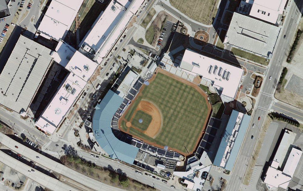
10 Visual Quality is High Cumberland County example

11 Bay River, Pamlico County example.

12 Stonewall in Pamlico County example
13
14 What you should not see Major bridge is distorted Transportation feature cut and offset by a seam line Tall building is cut by a seam line or is leaning extremely Areas of state importance distorted or obscured Color and contrast changes abruptly at seam edges between contractors Artifacts from a flaw in rectification Wash out from brightness or too dark to see features

15 Automated processing based on digital elevation model distorted the elevated highway in this example. Elevated features can be warped in processing, but can be fixed.

16 Same example after repair.

17 Combination of digital exposures into tiles requires subtle seams between exposures. This example has abrupt seam lines and displaced roadways. This can be fixed.

18 This example has abrupt seam lines and displaced features. This can be fixed.

19 This is an example of an anomaly from an automated process. Parts of the images were pulled toward an elevation point in the water. This can be fixed.

20 Same example after repair.
21 What is acceptable? Color balance between regions / contractors Some building lean (not nadir) Bright roof tops Power lines discontinuous Leaning trees Water as is No tiles in the sounds

22 Color balance varies from one region to the next. Color balancing relied on statistics from sample locations within a region. Contractors smoothed color balance in tiles at the edge of regions.

23 Some of the tallest buildings appear to lean over adjacent features. Some lean is acceptable and inevitable because the digital sensors are not directly above all tall buildings.

24 Some locations are bright where rooftops soils or concrete are very reflective. If feature outlines are not washed out, this is acceptable. Adjacent areas may get too dark if the tile were darkened.

25 Features high above the ground such as power lines in this example may appear distorted or displaced. Photos are rectified to the ground, not to elevated features. This is an example of acceptable visual quality.

26 Some locations have trees that partly obscure roads. Some of this is inevitable given camera angles and vegetation. The north and south portions of the road are visible and can be extrapolated for 911 and GIS purposes.

27 Water reflects differently from different flight lines and images. Contractors were not expected to color balance large water bodies like the one in this example.
.")
28 The project did not acquire images over the sounds. Recent imagery from NOAA is included in distribution (orange tiles). The large area of open water in the sounds will not have imagery tiles.

29 If you display multiple county mosaics, white space will appear in counties displayed under an adjacent county. The compression software creates a rectangle to include county tiles. Where boundaries are irregular, parts of the rectangle have no imagery from that county.
 as shown in this example. If zoomed in far enough to see the white pixels, change the display order of the county mosaics.")
30 A solution is to go to the layer properties for a mosaic, and display background value as This nearly eliminates the white pixels, but a few may remain (software bug) as shown in this example. If zoomed in far enough to see the white pixels, change the display order of the county mosaics. There is no current fix to this display problem. There is no missing data in any of the county mosaics.
31 What if you find a flaw? 90-day period for review Contact your county 911 or GIS coordinator and CGIA (Darrin Smith or Jeff Brown) with the issue Include the image name and a snapshot if practical Project team will review If deemed a flaw that can be fixed, replacement tiles will be generated after the 90-day period
32 Reminder: Share the Data Expected sharing: PSAPs within your county GIS operations in municipalities NC OneMap for online access ( Download Imagery services by end of May Requests for copies data are public records; distribute as you wish. 32

33 Project Information Online
34 911 Board Feedback The Board invites your feedback 4-Year Quarter State Plan Next Generation 911 Richard Taylor, Executive Director
35 Acknowledgements NC 911 Board City of Durham CGIA staff Geospatial and Technology Management Office NC Geodetic Survey Land Records Management, Secretary of State Private contractors USGS and NGA NC ITS: Enterprise Project Management Office; Hosting Services State Chief Information Officer GICC and Statewide Mapping Advisory Committee Working Group for Orthophotography Planning Local Government Committee
36 Contact
DRAPP Product QAQC Participating Partner Process Guidelines Steve Ashbee ASPRS Certified Photogrammetrist PMI Project Management Professional Sanborn
 DRAPP Product QAQC Participating Partner Process Guidelines Steve Ashbee ASPRS Certified Photogrammetrist PMI Project Management Professional Sanborn Program Manager Area naming and other general feedback
Baldwin and Mobile Counties, AL Orthoimagery Project Report. Submitted: March 23, 2016
 2015 Orthoimagery Project Report Submitted: Prepared by: Quantum Spatial, Inc 523 Wellington Way, Suite 375 Lexington, KY 40503 859-277-8700 Page i of iii Contents Project Report 1. Summary / Scope...
Metro Area Planning Agency. Request for Proposal Omaha-Lincoln Metro Area Imagery Project
 Metro Area Planning Agency Request for Proposal 2018 Omaha-Lincoln Metro Area Imagery Project 1. General Info 1.1. Objective The Metro Area Planning Agency ( MAPA ) in Omaha is soliciting proposals from
Orthoimagery Standards. Chatham County, Georgia. Jason Lee and Noel Perkins
 1 Orthoimagery Standards Chatham County, Georgia Jason Lee and Noel Perkins 2 Table of Contents Introduction... 1 Objective... 1.1 Data Description... 2 Spatial and Temporal Environments... 3 Spatial Extent
DRAPP 2014 DATA ACCEPTANCE TESTING (DAT) SCOPE OF WORK August 13, 2013
 SCOPE OF WORK August 13, 2013") DRAPP 2014 DATA ACCEPTANCE TESTING (DAT) SCOPE OF WORK August 13, 2013 Contents Background... 2 Summary... 2 Definitions... 2 Services to be Rendered... 3 Overview... 3 Geographic Extent... 3 Tasks and
DRAPP 2014 DATA ACCEPTANCE TESTING (DAT) SCOPE OF WORK August 13, 2013 Contents Background... 2 Summary... 2 Definitions... 2 Services to be Rendered... 3 Overview... 3 Geographic Extent... 3 Tasks and
Satellite Data Used in Land Development
 4.95 Satellite Data Used in Land Development There s been much speculation that satellite data will one day replace traditional aerial photography for photogrammetric applications. Yet even with the latest
GIS Data Sources. Thomas Talbot
 GIS Data Sources Thomas Talbot Chief, Environmental Health Surveillance Section Bureau of Environmental & Occupational Epidemiology New York State Department of Health Outline Sources of Data Census, health,
Preserving the Past: The Development of a Digital Historical Aerial Photography Archive
 DONALD E. LUMAN Preserving the Past: The Development of a Digital Historical Aerial Photography Archive The University of Illinois Map and Geography Library maintains a collection of approximately 60,000
Lesson 4: Photogrammetry
 This work by the National Information Security and Geospatial Technologies Consortium (NISGTC), and except where otherwise Development was funded by the Department of Labor (DOL) Trade Adjustment Assistance
Acquisition of Aerial Photographs and/or Satellite Imagery
 Acquisition of Aerial Photographs and/or Satellite Imagery Acquisition of Aerial Photographs and/or Imagery From time to time there is considerable interest in the purchase of special-purpose photography
Use of digital aerial camera images to detect damage to an expressway following an earthquake
 Use of digital aerial camera images to detect damage to an expressway following an earthquake Yoshihisa Maruyama & Fumio Yamazaki Department of Urban Environment Systems, Chiba University, Chiba, Japan.
REQUEST FOR PROPOSAL AERIAL PHOTOGRAPHY & DIGITAL MAPPING ROADS DEPARTMENT
 REQUEST FOR PROPOSAL AERIAL PHOTOGRAPHY & DIGITAL MAPPING ROADS DEPARTMENT The Cherokee Nation is requesting proposals from qualified professionals to provide aerial photography and digital mapping of
MSB Imagery Program FAQ v1
 MSB Imagery Program FAQ v1 (F)requently (A)sked (Q)uestions 9/22/2016 This document is intended to answer commonly asked questions related to the MSB Recurring Aerial Imagery Program. Table of Contents
Basics of Photogrammetry Note#6
 Basics of Photogrammetry Note#6 Photogrammetry Art and science of making accurate measurements by means of aerial photography Analog: visual and manual analysis of aerial photographs in hard-copy format
Recurring Aerial Imagery Acquisition Program
 Recurring Aerial Imagery Acquisition Program MSB Project No. 16-130 Report 4 of 5 Analysis of Aerial Imagery Acquisition Options Prepared By: Kinney Engineering, LLC 3909 Arctic Blvd, Ste 400 Anchorage,
Using High-Res. Orthoimagery for Environmental Change Detection & Analysis in Northern Alaska
 Using High-Res. Orthoimagery for Environmental Change Detection & Analysis in Northern Alaska William F. Manley Leanne R. Lestak INSTAAR, University of Colorado INSTAAR, University of Colorado 1 Talk Outline
GE 113 REMOTE SENSING
 GE 113 REMOTE SENSING Topic 5. Introduction to Digital Image Interpretation and Analysis Lecturer: Engr. Jojene R. Santillan jrsantillan@carsu.edu.ph Division of Geodetic Engineering College of Engineering
FOR 474: Forest Inventory. FOR 474: Forest Inventory. Why do we Care About Forest Sampling?
 FOR 474: Forest Inventory 1. Advanced Forest Inventory The Need for Forest Sampling Brief Intro to Remote Sensing and GIS Readings: FOR 474: Forest Inventory Related Courses! FOR 274: Forest Measurements
Acquisition of Aerial Photographs and/or Imagery
 Acquisition of Aerial Photographs and/or Imagery Acquisition of Aerial Photographs and/or Imagery From time to time there is considerable interest in the purchase of special-purpose photography contracted
MULTISPECTRAL AGRICULTURAL ASSESSMENT. Normalized Difference Vegetation Index. Federal Robotics INSPECTION & DOCUMENTATION
 MULTISPECTRAL AGRICULTURAL ASSESSMENT Normalized Difference Vegetation Index INSPECTION & DOCUMENTATION Federal Robotics Clearwater Dr. Amherst, New York 14228 716-221-4181 Sales@FedRobot.com www.fedrobot.com
TESTFIELD TRENTO: GEOMETRIC EVALUATION OF VERY HIGH RESOLUTION SATELLITE IMAGERY
 TESTFIELD TRENTO: GEOMETRIC EVALUATION OF VERY HIGH RESOLUTION SATELLITE IMAGERY G. AGUGIAROa, D. POLIb, F. REMONDINOa, 3DOM, 3D Optical Metrology Unit Bruno Kessler Foundation, Trento, Italy a b Vermessung
Please show the instructor your downloaded index files and orthoimages.
 Student Exercise 1: Sandia Forest Infestation Acquiring Orthophotos and Satellite Imagery Please show the instructor your downloaded index files and orthoimages. Objectives: Determine appropriate imagery
Processing of stereo scanner: from stereo plotter to pixel factory
 Photogrammetric Week '03 Dieter Fritsch (Ed.) Wichmann Verlag, Heidelberg, 2003 Bignone 141 Processing of stereo scanner: from stereo plotter to pixel factory FRANK BIGNONE, ISTAR, France ABSTRACT With
Project Planning and Cost Estimating
 CHAPTER 17 Project Planning and Cost Estimating 17.1 INTRODUCTION Previous chapters have outlined and detailed technical aspects of photogrammetry. The basic tasks and equipment required to create various
SECTION SITE SURVEYS
 SECTION 02 21 13 SITE SURVEYS SPEC WRITER NOTE: 1. Delete text between // // not applicable to project. Edit remaining text to suit project. 2. Use this section to specify survey required before design
Introduction to WG5 on CwRS imagery use and alternatives and QE5 on claimed rate inside the RP Peter Viskum Jørgensen, FERV and Birger Faurholt
 Introduction to WG5 on CwRS imagery use and alternatives and QE5 on claimed rate inside the RP Peter Viskum Jørgensen, FERV and Birger Faurholt Pedersen, University of Aarhus, DK CwRS Imagery use and alternatives
Request for Proposals: 2019 Flight for Ada and Canyon Counties, Idaho Flight for Ada and Canyon Counties, Idaho November 7, 2018 by 5 p.m.
 Request for Proposals: 2019 Flight for Ada and Canyon Counties, Idaho 1 RFP Summary RFP Number RFP 2019-13 RFP Title Deadline for Submittal Scope Send Submittals to Direct Inquires to COMPASS Project Manager
to Geospatial Technologies
 What s in a Pixel? A Primer for Remote Sensing What s in a Pixel Development UNH Cooperative Extension Geospatial Technologies Training Center Shane Bradt UConn Cooperative Extension Geospatial Technology
William B. Green, Danika Jensen, and Amy Culver California Institute of Technology Jet Propulsion Laboratory Pasadena, CA 91109
 DIGITAL PROCESSING OF REMOTELY SENSED IMAGERY William B. Green, Danika Jensen, and Amy Culver California Institute of Technology Jet Propulsion Laboratory Pasadena, CA 91109 INTRODUCTION AND BASIC DEFINITIONS
Peace Project Water Use Plan. Williston Air Photos and DEM. Reference: GMSWORKS #14. Williston Air Photos and DEM 2011
 Peace Project Water Use Plan Williston Air Photos and DEM Reference: GMSWORKS #14 Williston Air Photos and DEM 2011 Study Period: May 2011 to December 2011 Les Giles Transmission Engineering, Photogrammetry
A Short History of Using Cameras for Weld Monitoring
 A Short History of Using Cameras for Weld Monitoring 2 Background Ever since the development of automated welding, operators have needed to be able to monitor the process to ensure that all parameters
ENVI Orthorectification Module
 Visual Information Solutions ENVI Orthorectification Module Orthorectify Your Imagery Quickly and Easily. Rigorous Orthorectification. Simple Workflow. Trusted Method. The Need for Orthorectification Satellite
NORMALIZATION REPORT GAMMA RADIATION DETECTION SYSTEMS SANTA SUSANA FIELD LABORATORY AREA IV RADIOLOGICAL STUDY VENTURA COUNTY, CALIFORNIA
 NORMALIZATION REPORT GAMMA RADIATION DETECTION SYSTEMS SANTA SUSANA FIELD LABORATORY AREA IV RADIOLOGICAL STUDY VENTURA COUNTY, CALIFORNIA 1.0 INTRODUCTION Gamma detection systems scan the ground surface
Salt Lake County (Utah). Planning and Development Services Aerial Photographs, Series #PD-001
. Planning and Development Services Aerial Photographs, Series #PD-001") Salt Lake County (Utah). Planning and Development Services Aerial Photographs, 1946-1979 Series #PD-001 Processed by: Ronda Frazier Date Completed: December, 2008 Updated: October, 2015 Salt Lake County
Salt Lake County (Utah). Planning and Development Services Aerial Photographs, 1946-1979 Series #PD-001 Processed by: Ronda Frazier Date Completed: December, 2008 Updated: October, 2015 Salt Lake County
Photogrammetry. Lecture 4 September 7, 2005
 Photogrammetry Lecture 4 September 7, 2005 What is Photogrammetry Photogrammetry is the art and science of making accurate measurements by means of aerial photography: Analog photogrammetry (using films:
REQUEST FOR PROPOSAL For Color Orthogonal & Color Oblique Imagery
 REQUEST FOR PROPOSAL For Color Orthogonal & Color Oblique Imagery OVERVIEW Austin County Appraisal District is seeking services from a qualified and experienced vendor for the delivery of color Orthogonal
Remote Sensing for Rangeland Applications
 Remote Sensing for Rangeland Applications Jay Angerer Ecological Training June 16, 2012 Remote Sensing The term "remote sensing," first used in the United States in the 1950s by Ms. Evelyn Pruitt of the
Sample Copy. Not For Distribution.
 Photogrammetry, GIS & Remote Sensing Quick Reference Book i EDUCREATION PUBLISHING Shubham Vihar, Mangla, Bilaspur, Chhattisgarh - 495001 Website: www.educreation.in Copyright, 2017, S.S. Manugula, V.
THE NATIONAL AERIAL PHOTOGRAPHY PROGRAM: AN AERIAL SYSTEM IN SUPPORT OF THE UNITED STATES SPATIAL DATA INFRASTRUCTURE
 THE NATIONAL AERIAL PHOTOGRAPHY PROGRAM: AN AERIAL SYSTEM IN SUPPORT OF THE UNITED STATES SPATIAL DATA INFRASTRUCTURE Donald L. Light U.S. Geological Survey MS 511 National Center Reston, Virginia 22092
Aerial photography: Principles. Frame capture sensors: Analog film and digital cameras
 Aerial photography: Principles Frame capture sensors: Analog film and digital cameras Overview Introduction Frame vs scanning sensors Cameras (film and digital) Photogrammetry Orthophotos Air photos are
11/25/2009 CHAPTER THREE INTRODUCTION INTRODUCTION (CONT D) THE AERIAL CAMERA: LENS PHOTOGRAPHIC SENSORS
 THE AERIAL CAMERA: LENS PHOTOGRAPHIC SENSORS") INTRODUCTION CHAPTER THREE IC SENSORS Photography means to write with light Today s meaning is often expanded to include radiation just outside the visible spectrum, i. e. ultraviolet and near infrared
INTRODUCTION CHAPTER THREE IC SENSORS Photography means to write with light Today s meaning is often expanded to include radiation just outside the visible spectrum, i. e. ultraviolet and near infrared
MAPPING DAMAGES CAUSED BY THE OCTOBER 2003 WILDFIRES IN CALIFORNIA
 MAPPING DAMAGES CAUSED BY THE OCTOBER 2003 WILDFIRES IN CALIFORNIA Louis Demargne & Mitch Jordan EarthData International 7320 Executive Way, Frederick, MD 21702 ABSTRACT EarthData, in coordination with
Histogram Painting for Better Photomosaics
 Histogram Painting for Better Photomosaics Brandon Lloyd, Parris Egbert Computer Science Department Brigham Young University {blloyd egbert}@cs.byu.edu Abstract Histogram painting is a method for applying
BCC Displacement Map Filter
 BCC Displacement Map Filter The Displacement Map filter uses the luminance or color information from an alternate video or still image track (the Map Layer) to displace the pixels in the source image horizontally
Floodplain Modeling 101. Presentation Goals
 Floodplain Modeling 101 Presenter: Joseph L. Miller, P.E., CFM 2016 INAFSM Conference Presentation Goals Introduction to Indiana s and FEMA s floodplain modeling technical requirements for riverine modeling
Black Dot shows actual Point location
 207 Plate 1 Use of scanned archive aerial photographs, digital photogrammetry and GIS to plot river channel erosion along the Afon Trannon, Wales (part of the study by Mount et al 2000, 2003). Plate 2
CanImage. (Landsat 7 Orthoimages at the 1: Scale) Standards and Specifications Edition 1.0
 Standards and Specifications Edition 1.0") CanImage (Landsat 7 Orthoimages at the 1:50 000 Scale) Standards and Specifications Edition 1.0 Centre for Topographic Information Customer Support Group 2144 King Street West, Suite 010 Sherbrooke, QC
CanImage (Landsat 7 Orthoimages at the 1:50 000 Scale) Standards and Specifications Edition 1.0 Centre for Topographic Information Customer Support Group 2144 King Street West, Suite 010 Sherbrooke, QC
VisionMap A3 Edge A Single Camera for Multiple Solutions
 Photogrammetric Week '15 Dieter Fritsch (Ed.) Wichmann/VDE Verlag, Belin & Offenbach, 2015 Raizman, Gozes 57 VisionMap A3 Edge A Single Camera for Multiple Solutions Yuri Raizman, Adi Gozes, Tel-Aviv ABSTRACT
EarthData International
 (Part 2) EarthData International >> By Marc S. Cheves, LS In the Charter Issue we ran a story about Bryan Logan and EarthData International. In this issue we serve up another slice of the EarthData information:
Digital Photogrammetry. Presented by: Dr. Hamid Ebadi
 Digital Photogrammetry Presented by: Dr. Hamid Ebadi Background First Generation Analog Photogrammetry Analytical Photogrammetry Digital Photogrammetry Photogrammetric Generations 2000 digital photogrammetry
[GEOMETRIC CORRECTION, ORTHORECTIFICATION AND MOSAICKING]
![[GEOMETRIC CORRECTION, ORTHORECTIFICATION AND MOSAICKING]](/thumbs/78/78211997.jpg "[GEOMETRIC CORRECTION, ORTHORECTIFICATION AND MOSAICKING]") 2013 Ogis-geoInfo Inc. IBEABUCHI NKEMAKOLAM.J [GEOMETRIC CORRECTION, ORTHORECTIFICATION AND MOSAICKING] [Type the abstract of the document here. The abstract is typically a short summary of the contents
2013 Ogis-geoInfo Inc. IBEABUCHI NKEMAKOLAM.J [GEOMETRIC CORRECTION, ORTHORECTIFICATION AND MOSAICKING] [Type the abstract of the document here. The abstract is typically a short summary of the contents
Phase One ixu-rs1000 Accuracy Assessment Report Yu. Raizman, PhaseOne.Industrial, Israel
 17 th International Scientific and Technical Conference FROM IMAGERY TO DIGITAL REALITY: ERS & Photogrammetry Phase One ixu-rs1000 Accuracy Assessment Report Yu. Raizman, PhaseOne.Industrial, Israel 1.
36. Global Positioning System
 36. Introduction to the Global Positioning System (GPS) Why do we need GPS? Position: a basic need safe sea travel, crowed skies, resource management, legal questions Positioning: a challenging job local
Volume 1 - Module 6 Geometry of Aerial Photography. I. Classification of Photographs. Vertical
 RSCC Volume 1 Introduction to Photo Interpretation and Photogrammetry Table of Contents Module 1 Module 2 Module 3.1 Module 3.2 Module 4 Module 5 Module 6 Module 7 Module 8 Labs Volume 1 - Module 6 Geometry
Lidar stands for light detection and ranging. Lidar imagery is created with a laser beam composed of a very narrow light band.
 Lidar stands for light detection and ranging. Lidar imagery is created with a laser beam composed of a very narrow light band. This light can be transmitted over large distances. Normal light is composed
OUR INDUSTRIAL LEGACY WHAT ARE WE LEAVING OUR CHILDREN REAAA Roadshow Taupo, August 2016 Young presenter s competition
 OUR INDUSTRIAL LEGACY WHAT ARE WE LEAVING OUR CHILDREN Preserving the country s aerial photography archive for future generations Abstract For over eighty years, aerial photography has captured the changing
What is Photogrammetry
 Photogrammetry What is Photogrammetry Photogrammetry is the art and science of making accurate measurements by means of aerial photography: Analog photogrammetry (using films: hard-copy photos) Digital
LPIS Orthoimagery An assessment of the Bing imagery for LPIS purpose
 LPIS Orthoimagery An assessment of the Bing imagery for LPIS purpose Slavko Lemajić Wim Devos, Pavel Milenov GeoCAP Action - MARS Unit - JRC Ispra Tallinn, 24 th November 2011 Outline JRC`s Ortho specifications
APCAS/10/21 April 2010 ASIA AND PACIFIC COMMISSION ON AGRICULTURAL STATISTICS TWENTY-THIRD SESSION. Siem Reap, Cambodia, April 2010
 APCAS/10/21 April 2010 Agenda Item 8 ASIA AND PACIFIC COMMISSION ON AGRICULTURAL STATISTICS TWENTY-THIRD SESSION Siem Reap, Cambodia, 26-30 April 2010 The Use of Remote Sensing for Area Estimation by Robert
Chapter 3 Data Acquisition in an Urban Environment
 Chapter 3 Data Acquisition in an Urban Environment - One fundamental issue : cost of data 5-10 times of HW, SW, org ware, staff training, maintenance - Another issue : different kinds of data alphanumeric
UAV-based remote sensing of the slow-moving landslide Super-Sauze
 Universität Stuttgart UAV-based remote sensing of the slow-moving landslide Super-Sauze U. Niethammer, S. Rothmund, M. Joswig 06.02.2009 Motivation The four main objectives for our remote sensing campaign
T I P S F O R I M P R O V I N G I M A G E Q U A L I T Y O N O Z O F O O T A G E
 T I P S F O R I M P R O V I N G I M A G E Q U A L I T Y O N O Z O F O O T A G E Updated 20 th Jan. 2017 References Creator V1.4.0 2 Overview This document will concentrate on OZO Creator s Image Parameter
Image Fusion. Pan Sharpening. Pan Sharpening. Pan Sharpening: ENVI. Multi-spectral and PAN. Magsud Mehdiyev Geoinfomatics Center, AIT
 1 Image Fusion Sensor Merging Magsud Mehdiyev Geoinfomatics Center, AIT Image Fusion is a combination of two or more different images to form a new image by using certain algorithms. ( Pohl et al 1998)
Before you start, make sure that you have a properly calibrated system to obtain high-quality images.
 CONTENT Step 1: Optimizing your Workspace for Acquisition... 1 Step 2: Tracing the Region of Interest... 2 Step 3: Camera (& Multichannel) Settings... 3 Step 4: Acquiring a Background Image (Brightfield)...
SECTION GEOGRAPHIC INFORMATION SYSTEM (GIS)
") PART 1 - GENERAL 1.1 DESCRIPTION SECTION 11 83 01 A. Provide all labor, materials, manpower, tools and equipment required to furnish, install, activate and test a new Geographic Information System (GIS).
PART 1 - GENERAL 1.1 DESCRIPTION SECTION 11 83 01 A. Provide all labor, materials, manpower, tools and equipment required to furnish, install, activate and test a new Geographic Information System (GIS).
Traffic and Roadway Improvements - Rte 123 (Belmont Street) Brockton, MA Client: BETA Group, Inc.
 Brockton, MA Client: BETA Group, Inc.") HIGHWAY PROJECT EXPERIENCE Traffic and Roadway Improvements - Rte 123 (Belmont Street) Brockton, MA Client: BETA Group, Inc. Alpha provided survey services to prepare a base plan of an approximately 2900
HIGHWAY PROJECT EXPERIENCE Traffic and Roadway Improvements - Rte 123 (Belmont Street) Brockton, MA Client: BETA Group, Inc. Alpha provided survey services to prepare a base plan of an approximately 2900
SUMMIT COUNTY PLANNING AND ENGINEERING DEPARTMENT
 SUMMIT COUNTY PLANNING AND ENGINEERING DEPARTMENT SINGLE-FAMILY SITE PLAN INFORMATION PACKET GENERAL INFORMATION This information packet explains how your application for a single-family site plan will
PROCEEDINGS - AAG MIDDLE STATES DIVISION - VOL. 21, 1988
 PROCEEDINGS - AAG MIDDLE STATES DIVISION - VOL. 21, 1988 SPOTTING ONEONTA: A COMPARISON OF SPOT 1 AND landsat 1 IN DETECTING LAND COVER PATTERNS IN A SMALL URBAN AREA Paul R. Baumann Department of Geography
Integrating 3D Optical Imagery with Thermal Remote Sensing for Evaluating Bridge Deck Conditions
 Integrating 3D Optical Imagery with Thermal Remote Sensing for Evaluating Bridge Deck Conditions Richard Dobson www.mtri.org Project History 3D Optical Bridge-evaluation System (3DOBS) Proof-of-Concept
Development of Mosaic Datasets and Image Services for Bathymetric Data
 Development of Mosaic Datasets and Image Services for Bathymetric Data Jesse Varner Cooperative Institute for Research in Environmental Sciences (CIRES), University of Colorado John Cartwright NOAA National
Separation of crop and vegetation based on Digital Image Processing
 Separation of crop and vegetation based on Digital Image Processing Mayank Singh Sakla 1, Palak Jain 2 1 M.TECH GEOMATICS student, CEPT UNIVERSITY 2 M.TECH GEOMATICS student, CEPT UNIVERSITY Word Limit
Hello, welcome to the video lecture series on Digital Image Processing.
 Digital Image Processing. Professor P. K. Biswas. Department of Electronics and Electrical Communication Engineering. Indian Institute of Technology, Kharagpur. Lecture-33. Contrast Stretching Operation.
9 LAND SURVEYING. 9.1 General. 9.2 Administrative Requirements Standards Meetings Survey Data Provided to the Design-Builder
 9 LAND SURVEYING 9.1 General The Design-Builder shall conduct all Work necessary to meet the requirements associated with land surveying, including Project and supplemental horizontal and vertical control
EVALUATION OF PLEIADES-1A TRIPLET ON TRENTO TESTFIELD
 EVALUATION OF PLEIADES-1A TRIPLET ON TRENTO TESTFIELD D. Poli a, F. Remondino b, E. Angiuli c, G. Agugiaro b a Terra Messflug GmbH, Austria b 3D Optical Metrology Unit, Fondazione Bruno Kessler, Trento,
Satellite Imagery and Remote Sensing. DeeDee Whitaker SW Guilford High EES & Chemistry
 Satellite Imagery and Remote Sensing DeeDee Whitaker SW Guilford High EES & Chemistry whitakd@gcsnc.com Outline What is remote sensing? How does remote sensing work? What role does the electromagnetic
SPECIFICATION WORDING RECOMMENDATIONS
 SPECIFICATION WORDING RECOMMENDATIONS VOLUME 1; revision B PHOTO DOCUMENTATION OF SURFACE CONDITIONS FOR STREET AND PIPELINE PR0JECTS P-Tn RoutePHOTOS P-Tn RouteSCANS The following terms (as written) are
Land Records Management Division North Carolina Department of the Secretary of State. Spring 2007
 Technical Specifications for Base, Cadastral and Digital Mapping (Orthophotos) Land Records Management Division North Carolina Department of the Secretary of State Spring 2007 Page 1 of 84 PREFACE The
Old House Channel Bathymetric and Side Scan Survey
 FIELD RESEARCH FACILITY DUCK, NC Old House Channel Bathymetric and Side Scan Survey COASTAL AND HYDRAULICS LABORATORY FIELD DATA COLLECTION AND ANALYSIS BRANCH Michael Forte December 2009 View looking
High Fidelity 3D Reconstruction
 High Fidelity 3D Reconstruction Adnan Ansar, California Institute of Technology KISS Workshop: Gazing at the Solar System June 17, 2014 Copyright 2014 California Institute of Technology. U.S. Government
HARRIS GEOSPATIAL MARKETPLACE. HarrisGeospatial.com
 HARRIS GEOSPATIAL MARKETPLACE HarrisGeospatial.com Satellite image of Washington, D.C. Image courtesy of DigitalGlobe GET IT ALL IN ONE PLACE Data for Any Project Map Products Vis/Sim Products Geospatial
STATE UNIVERSITY CONSTRUCTION FUND
 DIRECTIVE 1C-12 Issue date: August 2012 1. General SURVEY, MAPPING AND UTILITY LOCATING This Directive has been developed as a general guide for the survey and mapping effort required for Fund projects.
Legal Description & Site Plan Requirements and Layouts
 Legal Description & Site Plan Requirements and Layouts Plot Plan * A plot plan shows the location of a house from an aerial view. * The site plan, also known as a plot or lot plan includes: 1. Site plan
ROAD TO THE BEST ALPR IMAGES
 ROAD TO THE BEST ALPR IMAGES INTRODUCTION Since automatic license plate recognition (ALPR) or automatic number plate recognition (ANPR) relies on optical character recognition (OCR) of images, it makes
Automated Machine Guidance
 Design Manual Chapter 5 - Roadway Design 5H - Automated Machine Guidance 5H-1 Automated Machine Guidance A. Concept Automated machine guidance (AMG) for grading is a process in which grading equipment,
CHECKLIST PRELIMINARY SUBDIVISION AND PRELIMINARY SITE PLAN
 N/A Waiver (1) Four (4) copies of application form. (2) Fifteen (15) copies of plan (3) Subdivision/site plan application fee & professional review escrow deposit (4) Variance application fee & professional
Image Generation for GIS:Experimental Mapping Principles and Techniques
 Association for Information Systems AIS Electronic Library (AISeL) AMCIS 1997 Proceedings Americas Conference on Information Systems (AMCIS) 8-15-1997 Image Generation for GIS:Experimental Mapping Principles
ASTER GDEM Readme File ASTER GDEM Version 1
 I. Introduction ASTER GDEM Readme File ASTER GDEM Version 1 The Advanced Spaceborne Thermal Emission and Reflection Radiometer (ASTER) Global Digital Elevation Model (GDEM) was developed jointly by the
Owner / Architect Certification of Complete Documentation for the Additions and Remodels Conditional Approval Review
 Step 1: Request for Conditional Approval, page 1 of 5 Owner / Architect Certification of Complete Documentation for the Additions and Remodels Conditional Approval Review I,, the Property Owner, or Owner
Enhancement of Multispectral Images and Vegetation Indices
 Enhancement of Multispectral Images and Vegetation Indices ERDAS Imagine 2016 Description: We will use ERDAS Imagine with multispectral images to learn how an image can be enhanced for better interpretation.
Aerial Image Acquisition and Processing Services. Ron Coutts, M.Sc., P.Eng. RemTech, October 15, 2014
 Aerial Image Acquisition and Processing Services Ron Coutts, M.Sc., P.Eng. RemTech, October 15, 2014 Outline Applications & Benefits Image Sources Aircraft Platforms Image Products Sample Images & Comparisons
Site Plan/Building Permit Review
 Part 6 Site Plan/Building Permit Review 1.6.01 When Site Plan Review Applies 1.6.02 Optional Pre- Application Site Plan/Building Permit Review (hereafter referred to as Site Plan Review) shall be required
Spectral Signatures. Vegetation. 40 Soil. Water WAVELENGTH (microns)
") Spectral Signatures % REFLECTANCE VISIBLE NEAR INFRARED Vegetation Soil Water.5. WAVELENGTH (microns). Spectral Reflectance of Urban Materials 5 Parking Lot 5 (5=5%) Reflectance 5 5 5 5 5 Wavelength (nm)
Spectral Signatures % REFLECTANCE VISIBLE NEAR INFRARED Vegetation Soil Water.5. WAVELENGTH (microns). Spectral Reflectance of Urban Materials 5 Parking Lot 5 (5=5%) Reflectance 5 5 5 5 5 Wavelength (nm)
Application of GIS to Fast Track Planning and Monitoring of Development Agenda
 Application of GIS to Fast Track Planning and Monitoring of Development Agenda Radiometric, Atmospheric & Geometric Preprocessing of Optical Remote Sensing 13 17 June 2018 Outline 1. Why pre-process remotely
DatuGram 2D. User Guide. Version 2.0 August Datumate Geomatics Expert Systems
 DatuGram 2D User Guide Version 2.0 August 2013 Datumate Geomatics Expert Systems Using DatuGram, land surveying is made easier, faster and with excellent geodetic accuracy. For more information please
Designing a Remote Sensing Project. Many factors to consider: here lumped into 12 sections hold on!! first some basic concepts
 Designing a Remote Sensing Project Many factors to consider: here lumped into 12 sections hold on!! first some basic concepts DVC Geography 160 Introduction to Remote Sensing J. Ellis DigitalGlobe (2006)
OAK RUN BUILDING PERMIT
 OAK RUN BUILDING PERMIT (DOCK APPLICATION) ALL PERMIT APPLICATIONS MUST BE SUBMITTED AT THE POA OFFICE A MINIMUM OF 48 HOURS BEFORE THE SCHEDULED MEETING. ALL INFORMATION MUST BE SUPPLIED AND HAVE PROPER
Some Enhancement in Processing Aerial Videography Data for 3D Corridor Mapping
 Some Enhancement in Processing Aerial Videography Data for 3D Corridor Mapping Catur Aries ROKHMANA, Indonesia Key words: 3D corridor mapping, aerial videography, point-matching, sub-pixel enhancement,
Aerial Triangulation Radiometry Essentials Dense Matching Ortho Generation
 Radiometry Aerial Triangulation Essentials Dense Matching Ortho Generation Highly advanced photogrammetric workflow system for UltraCam images. Microsoft UltraMap is a state-of-the-art, end-to-end, complete
Spatial Analyst is an extension in ArcGIS specially designed for working with raster data.
 Spatial Analyst is an extension in ArcGIS specially designed for working with raster data. 1 Do you remember the difference between vector and raster data in GIS? 2 In Lesson 2 you learned about the difference
NEXTMAP. P-Band. Airborne Radar Imaging Technology. Key Benefits & Features INTERMAP.COM. Answers Now
 INTERMAP.COM Answers Now NEXTMAP P-Band Airborne Radar Imaging Technology Intermap is proud to announce the latest advancement of their Synthetic Aperture Radar (SAR) imaging technology. Leveraging over