Sample Copy. Not For Distribution.
|
|
|
- Brittany Bradford
- 5 years ago
- Views:
Transcription
1
2 Photogrammetry, GIS & Remote Sensing Quick Reference Book i
3 EDUCREATION PUBLISHING Shubham Vihar, Mangla, Bilaspur, Chhattisgarh Website: Copyright, 2017, S.S. Manugula, V. Bommakanti All rights reserved. No part of this book may be reproduced, stored in a retrieval system, or transmitted, in any form by any means, electronic, mechanical, magnetic, optical, chemical, manual, photocopying, recording or otherwise, without the prior written consent of its writer. ISBN: Price: ` The opinions/ contents expressed in this book are solely of the authors and do not represent the opinions/ standings/ thoughts of Educreation or the Editors. The book is released by using the services of self-publishing house. Printed in India ii
 www.educreation.in iii")
4 Photogrammetry, GIS & Remote Sensing Quick Reference Book Dr. S.S. Manugula Dr. Veeranna Bommakanti EDUCREATION PUBLISHING (Since 2011) iii
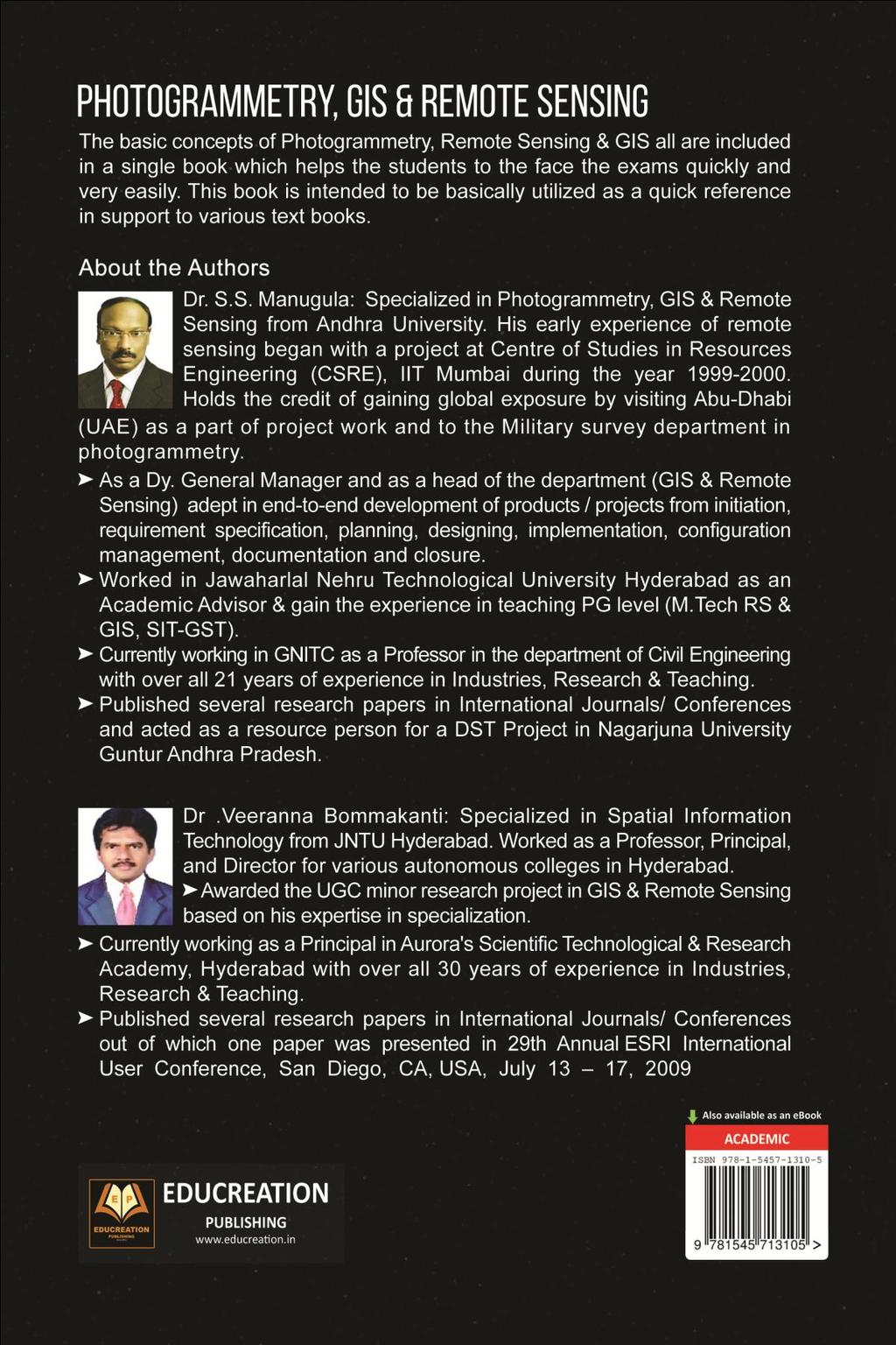
5 Preface This book has been written for use in classrooms by both the instructor and the students and also for independent study in the coming decades. The main intention for writing this book is to make the subject very easy at the same time to cover the syllabus for undergraduate students. The basic concepts of Photogrammetry, Remote Sensing & GIS all are included in a single book which helps the students to the face the exams easily and very quickly. This book is intended to be basically utilized as a quick reference in support to various text books. This book also covers few real images which I used in the industries during my visit to UAE (Dubai & Abu Dhabi) for set up a project for Military Survey Department. Dr. S.S. Manugula Dr. Veeranna Bommakanti iv
6 Content List Sr. Content Page 1. Introduction to Photogrammetry Types of Photogrammetry Principle and types of aerial photographs, Geometry of vertical aerial photograph, Scale and Height measurement on single vertical aerial photograph, Height measurement based on relief displacement, Fundamental of stereoscopy, fiducial points, parallax measurement using fiducial line. 2. Remote Sensing Basic concepts of Remote Sensing, Data and Information, Remote sensing data collection, Remote sensing advantages & Limitations, Remote sensing process. Electro-magnetic Spectrum, Energy interactions with atmosphere and earth surface features (soil, water, vegetation), Indian satellite and sensors Characteristics, Resolution, Map and Image and False color composite, introduction to digital data analysis. Elements of visual interpretation techniques. 3. Geographic Information System Introduction to GIS, Components of GIS, Geospatial Data- Spatial Data, and Attribute data-joining Spatial and Attribute data: GIS Operation: v
7 Spatial Data Input-Attribute data Management.-Data display- Data Exploration-Data Analysis. COORDINATE SYSTEMS: Geographic Coordinate System: Approximation of Earth, Datum; Map Projections: Types of Map Projection Map projection parameters-commonly used Map projections-projected coordinate System. 4. Vector Data Model Representation of simple features- Topology and its importance; coverage and its importance: coverage and its data structure, Shape file; Data models for composite features Object Based Vector Data Model; Classes and their Relationship; The geo database data model; Geometric representation of Spatial Features and data structure, Topology rules 5. Raster Data Model Elements of the Raster data model, Types of Raster Data, Raster Data Structure, Data Conversion, Integration of Raster and Vector Data. Data Input: Metadata, Conversion of Existing data, creating new data; Remote Sensing data, Field data, Text data, Digitizing, Scanning, on screen digitizing, importance of source map, Data Editing. 6. UNIVERSITY QUESTION BANK (UQB) vi
8 Photogrammetry, GIS & Remote Sensing Chapter 1 Introduction to Photogrammetry Introduction Photogrammetry is a Branch of Remote Sensing. Defined as the art, science, and technology of obtaining reliable information about physical objects and the environment. This is done through a process of recording, measuring, and interpreting aerial and terrestrial photographs. In a sense, the word photogrammetry may be analyzed in two parts: photo- meaning picture," and grammetry - meaning "measurement." Therefore; photo-measurement. Types of Photogrammetry Photogrammetry was invented in 1851 by laussedat, and has continued to develop over the last 140 years. Over time the development of photogrammetry has passed through the phases of 1. Plane table photogrammetry 2. Analog photogrammetry 3. Analytical photogrammetry 4. Digital photogrammetry (latest) 1
9 Dr. S.S. Manugula, Dr. Veeranna Bommakanti The traditional, and large, application of photogrammetry is to extract topographic information (e.g., topographic maps) from aerial images. However, photogrammetric techniques have also be applied to process satellite images and close range images in order to acquire topographic or non-topographic information of photographed objects. 1. Plane table photogrammetry: Prior to invention of airplane, photographs taken on the ground where used to extract the relationships between objects using geometric principles. This was during the phase of table photogrammetry 2. Analog photogrammetry: In analog photogrammetry, starting with stereo measurement in 1901, optical or mechanical instruments were used to reconstruct three-dimensional geometry from two overlapping photographs. The main product during this phase was topographic maps. 3. Analytical photogrammetry: In Analytical photogrammetry, the computer replaces some expensive optical & mechanical components. The resulting devices were analog/digital hybrids. Analytical aero triangulation, analytical plotters, orthophoto projectors were the main developments during this phase. Outputs of analytical photogrammetry can be topographic maps, but also can be digital products, such as digital maps and DEMs. 4. Digital photogrammetry (latest): Digital photogrammetry is photogrammetry as applied to digital images that are stored and processed by the computer. The images can be obtained by scanning the photographs or by directly from digital cameras. Many photogrammetry tasks can be highly automated in digital photogrammetry (e.g., automated DEM extraction and digital orthophoto generation). Digital photogrammetry can also be called softcopy photogrammetry. 2

10 Photogrammetry, GIS & Remote Sensing The output of the product is in the digital form, such as digital maps, DEMs, and digital Orthophotos saved on the computer media. With the development of digital photogrammetry the photogrammetric techniques are more closely integrated into Remote Sensing and GIS. Principle The principle involved in the aerial photography is The taking of photographs of a regular intervals from an aero plane/satellite along a define line at the certain height above the mean sea level at a specified speed of movement. Further Explanation: -- Photographs are taken from aero planes and satellites with metric and Non-metric cameras. These photographs are collected with forward overlap between each photograph as they are captured down a flight line. Mapping areas may require multiple flight lines in order to include all necessary mapping area within the imagery. In these cases, the imagery flight lines are flown so that they overlap (side lap). Near 3
11 Dr. S.S. Manugula, Dr. Veeranna Bommakanti vertical aerial photography is flown with a forward lap of 60 percent and side lap of 30 percent. Based on the various input parameters and after generating Aero Triangulation (AT) the compiler able to see stereo and map the required features. Planimetric and topographic features are collected from natural colour near vertical aerial photography. Planimetric and topographic mapping is generally the base mapping data set in a GIS or engineering data set. The accuracy of computations and queries made from these base mapping data sets is based on their thoroughness and accuracy. Colour aerial photography provides the clarity and spatial resolution required to achieve most large- and small-scale mapping accuracies. Types of Aerial Photographs The axis of camera may not be remaining exactly vertical. So the aerial photographs are classified into 4 major types. They are 1) Aerial/Vertical photographs 2) Near vertical photographs 3) Tilted photographs 4) Horizontal/terrestrial photographs 1) Vertical Photographs: The photographs taken from an aero plane with camera axis coincide with the direction of gravity are called Vertical Photographs. These photographs are commonly used for topographic mapping and planimetric mapping. 2) Near vertical photographs: The photographs taken from an aero plane with camera axis makes an angle between 1degree and 3 degree from the direction of gravity. For all practical purposes, 4
 Tilted / oblique photographs: oblique photographs and images are similar to aerial photographs and images, except the camera axis is intentionally inclined at an angle with the vertical.")
12 Photogrammetry, GIS & Remote Sensing these photographs are considered as vertical photographs. 3) Tilted / oblique photographs: oblique photographs and images are similar to aerial photographs and images, except the camera axis is intentionally inclined at an angle with the vertical. This can be further divided into Low oblique (camera 30º) and High oblique (camera 60º) from the vertical. These are commonly used for reconnaissance and corridor mapping applications. 4) Horizontal or Terrestrial photographs: Terrestrial or ground-based photographs and images are taken with the camera stationed on or closed to the Earth s surface. These are commonly used for applications involved with archeology, geomorphology, civil engineering, architecture, industry, etc. Geometry of Vertical Aerial Photograph Geometry of the single aerial photograph The geometry of a single vertical aerial photograph is illustrated in Figure 1. In a vertical aerial photograph the optical axis of the camera is vertical and the plane of the photograph (film) is horizontal. The point where the optical axis intersects the photograph is termed the centre point or principal point of the photograph. This can be located on an aerial photograph as the intersection of lines drawn between opposite fiducial marks in the margins of the print. In a perfectly vertical 5
13 Dr. S.S. Manugula, Dr. Veeranna Bommakanti aerial photograph the principal point also represents the plumb point or nadir point which is the photographic position representing the point on the earth's surface vertically beneath the camera lens at the time of exposure. In practice a vertical aerial photograph is rarely absolutely vertical and the nadir point and the centre point do not coincide exactly, the usually small difference being the result of tilt. The distance between the camera lens and the ground represents the flight height of the aircraft and the focal length is the distance between the camera lens and the film. The scale & Height measurement on a single vertical aerial photograph Scale: the ratio of the distance between two points on a photo to the actual distance between the same two points on the ground (i.e. 1 unit on the photo equals "x" units on the ground). If a 1 km stretch of highway covers 4 cm on an air photo, the scale is calculated as follows: Large Scale - Larger-scale photos (e.g. 1:25 000) cover small areas in greater detail. A large scale photo simply means that ground features are at a larger, more detailed size. The area of ground coverage that is seen on the photo is less than at smaller scales. Small Scale - Smaller-scale photos (e.g. 1:50 000) cover large areas in less detail. A small scale photo simply means that ground features are at a smaller, less detailed size. The area of ground 6
14 Photogrammetry, GIS & Remote Sensing coverage that is seen on the photo is greater than at larger scales. Another method used to determine the scale of a photo is to find the ratio between the camera's focal length and the plane's altitude above the ground being photographed f = focal length 6 or mm is common H = height of plane above ground h = height (elevation) of ground H = height of place above datum [altimeter reading (2% error)] One of the most significant geometric relationships is that the angles are subtended at a camera lense by an object and by its photographic image. In other words the triangles abc and cde are similar and it follows that the ratio of object size (O) to image size(i) is the same as the ratio of focal length (f) to flight height (H), or The ratio of image to object size is the general scale of the aerial photograph and it follows that the scale may be determined if the camera focal length and the flight height are known: It is also very important to remember that the flight height refers to a distance above the ground directly 7

15 Dr. S.S. Manugula, Dr. Veeranna Bommakanti below and not necessarily to the attitude (height above sea level or the base airport) of the aircraft. For this reason a more precise restatement of equation 2 should modify as Heights Measurement In a vertical aerial photograph the displacement of images is in a radial direction from the center point of the photograph. This displacement is termed the radial displacement due to relief and represents an error in map positioning For any one aerial photograph the amount of radial displacement, m of the top of an object from its base can be determined by the relation In which r= radial distance on the photograph from the center point to the top of the image displaced, h= height of the object displaced, and H = flight height. Rearranging the equation (4) yields a convenient expression for estimation the height of an object on a photograph by measuring its redial displacement. 8

 The stereoscopic methods present two different offset images separately to the left and right eye of the viewer.")
16 Photogrammetry, GIS & Remote Sensing Fundamental of stereoscopy What is a Stereoscopy? Stereoscopy is the science and art that deals with the use of binocular vision for the observation of overlapping photographs or other perspective views and the method by which such views are produced. - Essentially most of us with normal eyesight have stereoscopic vision (i.e. the ability to see and appreciate depth of field through the perception of parallax.) The stereoscopic methods present two different offset images separately to the left and right eye of the viewer. These two images when combined the brain have the capability to give the perception of 3D depth. Based on the stereo vision i.e. 3D perception one can get and extract more information from the stereo images. Proper Use of Stereoscopes The following are some guidelines that will help you use your stereoscopes properly. They are important and should be kept in mind when performing stereo based interpretations: 1. Be sure that the photos are properly aligned, preferably with the shadows toward the viewer. 9
17 Get Complete Book At Educreation Store
18
PHOTOGRAMMETRY STEREOSCOPY FLIGHT PLANNING PHOTOGRAMMETRIC DEFINITIONS GROUND CONTROL INTRODUCTION
 PHOTOGRAMMETRY STEREOSCOPY FLIGHT PLANNING PHOTOGRAMMETRIC DEFINITIONS GROUND CONTROL INTRODUCTION Before aerial photography and photogrammetry became a reliable mapping tool, planimetric and topographic
Aerial photography: Principles. Frame capture sensors: Analog film and digital cameras
 Aerial photography: Principles Frame capture sensors: Analog film and digital cameras Overview Introduction Frame vs scanning sensors Cameras (film and digital) Photogrammetry Orthophotos Air photos are
not to be republished NCERT Introduction To Aerial Photographs Chapter 6
 Chapter 6 Introduction To Aerial Photographs Figure 6.1 Terrestrial photograph of Mussorrie town of similar features, then we have to place ourselves somewhere in the air. When we do so and look down,
Basics of Photogrammetry Note#6
 Basics of Photogrammetry Note#6 Photogrammetry Art and science of making accurate measurements by means of aerial photography Analog: visual and manual analysis of aerial photographs in hard-copy format
Volume 1 - Module 6 Geometry of Aerial Photography. I. Classification of Photographs. Vertical
 RSCC Volume 1 Introduction to Photo Interpretation and Photogrammetry Table of Contents Module 1 Module 2 Module 3.1 Module 3.2 Module 4 Module 5 Module 6 Module 7 Module 8 Labs Volume 1 - Module 6 Geometry
Geometry of Aerial Photographs
 Geometry of Aerial Photographs Aerial Cameras Aerial cameras must be (details in lectures): Geometrically stable Have fast and efficient shutters Have high geometric and optical quality lenses They can
Following are the geometrical elements of the aerial photographs:
 Geometrical elements/characteristics of aerial photograph: An aerial photograph is a central or perspective projection, where the bundles of perspective rays meet at a point of origin called perspective
Photogrammetry. Lecture 4 September 7, 2005
 Photogrammetry Lecture 4 September 7, 2005 What is Photogrammetry Photogrammetry is the art and science of making accurate measurements by means of aerial photography: Analog photogrammetry (using films:
11/25/2009 CHAPTER THREE INTRODUCTION INTRODUCTION (CONT D) THE AERIAL CAMERA: LENS PHOTOGRAPHIC SENSORS
 THE AERIAL CAMERA: LENS PHOTOGRAPHIC SENSORS") INTRODUCTION CHAPTER THREE IC SENSORS Photography means to write with light Today s meaning is often expanded to include radiation just outside the visible spectrum, i. e. ultraviolet and near infrared
INTRODUCTION CHAPTER THREE IC SENSORS Photography means to write with light Today s meaning is often expanded to include radiation just outside the visible spectrum, i. e. ultraviolet and near infrared
2019 NYSAPLS Conf> Fundamentals of Photogrammetry for Land Surveyors
 2019 NYSAPLS Conf> Fundamentals of Photogrammetry for Land Surveyors George Southard GSKS Associates LLC Introduction George Southard: Master s Degree in Photogrammetry and Cartography 40 years working
Principles of Photogrammetry
 Winter 2014 1 Instructor: Contact Information. Office: Room # ENE 229C. Tel: (403) 220-7105. E-mail: ahabib@ucalgary.ca Lectures (SB 148): Monday, Wednesday& Friday (10:00 a.m. 10:50 a.m.). Office Hours:
Lesson 4: Photogrammetry
 This work by the National Information Security and Geospatial Technologies Consortium (NISGTC), and except where otherwise Development was funded by the Department of Labor (DOL) Trade Adjustment Assistance
NREM 345 Week 2, Material covered this week contributes to the accomplishment of the following course goal:
 NREM 345 Week 2, 2010 Reading assignment: Chapter. 4 and Sec. 5.1 to 5.2.4 Material covered this week contributes to the accomplishment of the following course goal: Goal 1: Develop the understanding and
Introduction to Photogeology
 Geological Mapping 1 Academic Year 2016/2017 Introduction to Photogeology Igor Vlahović igor.vlahovic@rgn.hr Today we will say a little about basic photogeological analysis of terrain: about aerial photographs,
Govt. Engineering College Jhalawar Model Question Paper Subject- Remote Sensing & GIS
 Govt. Engineering College Jhalawar Model Question Paper Subject- Remote Sensing & GIS Time: Max. Marks: Q1. What is remote Sensing? Explain the basic components of a Remote Sensing system. Q2. What is
MINNESOTA DEPARTMENT OF TRANSPORTATION OFFICE OF LAND MANAGEMENT SURVEYING AND MAPPING SECTION PHOTOGRAMMETRY UNIT
 SEP. 2011 MINNESOTA DEPARTMENT OF TRANSPORTATION OFFICE OF LAND MANAGEMENT SURVEYING AND MAPPING SECTION PHOTOGRAMMETRY UNIT SPECIAL PROVISIONS FOR: GROUP 1: AERIAL PHOTOGRAPHY/PHOTOGRAMMETRIC LAB SERVICES
Lesson 12. Stereoscopy and Photo Preparation. Steven J. Steinberg
 Lesson 12 Stereoscopy and Photo Preparation Steven J. Steinberg Description: The lessons in this section focus on stereoscopy and photo preparation. We begin with a discussion of the principles of stereoscopy.
High Resolution Sensor Test Comparison with SPOT, KFA1000, KVR1000, IRS-1C and DPA in Lower Saxony
 High Resolution Sensor Test Comparison with SPOT, KFA1000, KVR1000, IRS-1C and DPA in Lower Saxony K. Jacobsen, G. Konecny, H. Wegmann Abstract The Institute for Photogrammetry and Engineering Surveys
EXAMPLES OF TOPOGRAPHIC MAPS PRODUCED FROM SPACE AND ACHIEVED ACCURACY CARAVAN Workshop on Mapping from Space, Phnom Penh, June 2000
 EXAMPLES OF TOPOGRAPHIC MAPS PRODUCED FROM SPACE AND ACHIEVED ACCURACY CARAVAN Workshop on Mapping from Space, Phnom Penh, June 2000 Jacobsen, Karsten University of Hannover Email: karsten@ipi.uni-hannover.de
Relief Displacement of Vertical Features
 G 210 Lab. Relief Displacement of Vertical Features An increase in the elevation of a feature causes its position on the photograph to be displaced radially outward from the principle point. Hence, when
Acquisition of Aerial Photographs and/or Satellite Imagery
 Acquisition of Aerial Photographs and/or Satellite Imagery Acquisition of Aerial Photographs and/or Imagery From time to time there is considerable interest in the purchase of special-purpose photography
GEO 428: DEMs from GPS, Imagery, & Lidar Tuesday, September 11
 GEO 428: DEMs from GPS, Imagery, & Lidar Tuesday, September 11 Global Positioning Systems GPS is a technology that provides Location coordinates Elevation For any location with a decent view of the sky
CHAPTER 8 AERIAL PHOTOGRAPHS
 CHAPTER 8 AERIAL PHOTOGRAPHS An aerial photograph is any photograph taken from an airborne vehicle (aircraft, drones, balloons, satellites, and so forth). The aerial photograph has many uses in military
An Introduction to Geomatics. Prepared by: Dr. Maher A. El-Hallaq خاص بطلبة مساق مقدمة في علم. Associate Professor of Surveying IUG
 An Introduction to Geomatics خاص بطلبة مساق مقدمة في علم الجيوماتكس Prepared by: Dr. Maher A. El-Hallaq Associate Professor of Surveying IUG 1 Airborne Imagery Dr. Maher A. El-Hallaq Associate Professor
What is Photogrammetry
 Photogrammetry What is Photogrammetry Photogrammetry is the art and science of making accurate measurements by means of aerial photography: Analog photogrammetry (using films: hard-copy photos) Digital
Content Reviewer (CR) Swati Katiyar Senior Research Fellow, Birla Institute of Scientific Research, Jaipur Language Editor (LE)
 Swati Katiyar Senior Research Fellow, Birla Institute of Scientific Research, Jaipur Language Editor (LE)") Component-I(A) - Personal Details Role Name Affiliation Principal Investigator Prof.MasoodAhsanSiddiqui Department of Geography, JamiaMilliaIslamia, New Delhi Paper Coordinator, if any Dr. M P Punia Head,
Component-I(A) - Personal Details Role Name Affiliation Principal Investigator Prof.MasoodAhsanSiddiqui Department of Geography, JamiaMilliaIslamia, New Delhi Paper Coordinator, if any Dr. M P Punia Head,
Technical Evaluation of Khartoum State Mapping Project
 Technical Evaluation of Khartoum State Mapping Project Nagi Zomrawi 1 and Mohammed Fator 2 1 School of Surveying Engineering, Collage of Engineering, Sudan University of Science and Technology, Khartoum,
CEE 6100 / CSS 6600 Remote Sensing Fundamentals 1 Topic 4: Photogrammetry
 CEE 6100 / CSS 6600 Remote Sensing Fundamentals 1 PHOTOGRAMMETRY DEFINITION (adapted from Manual of Photographic Interpretation, 2 nd edition, Warren Philipson, 1997) Photogrammetry and Remote Sensing:
Photo Scale The photo scale and representative fraction may be calculated as follows: PS = f / H Variables: PS - Photo Scale, f - camera focal
 Scale Scale is the ratio of a distance on an aerial photograph to that same distance on the ground in the real world. It can be expressed in unit equivalents like 1 inch = 1,000 feet (or 12,000 inches)
Digital Photogrammetry. Presented by: Dr. Hamid Ebadi
 Digital Photogrammetry Presented by: Dr. Hamid Ebadi Background First Generation Analog Photogrammetry Analytical Photogrammetry Digital Photogrammetry Photogrammetric Generations 2000 digital photogrammetry
Acquisition of Aerial Photographs and/or Imagery
 Acquisition of Aerial Photographs and/or Imagery Acquisition of Aerial Photographs and/or Imagery From time to time there is considerable interest in the purchase of special-purpose photography contracted
746A27 Remote Sensing and GIS
 746A27 Remote Sensing and GIS Lecture 1 Concepts of remote sensing and Basic principle of Photogrammetry Chandan Roy Guest Lecturer Department of Computer and Information Science Linköping University What
AERIAL PHOTOGRAPHS CHAPTER 8
 CHAPTER 8 AERIAL PHOTOGRAPHS An aerial photograph is any photograph taken from an airborne vehicle (aircraft, drones, balloons) satellites, and so forth). The aerial photograph has many uses in military
CSI: Rombalds Moor Photogrammetry Photography
 Photogrammetry Photography Photogrammetry Training 26 th March 10:00 Welcome Presentation image capture Practice 12:30 13:15 Lunch More practice 16:00 (ish) Finish or earlier What is photogrammetry 'photo'
HIGH RESOLUTION COLOR IMAGERY FOR ORTHOMAPS AND REMOTE SENSING. Author: Peter Fricker Director Product Management Image Sensors
 HIGH RESOLUTION COLOR IMAGERY FOR ORTHOMAPS AND REMOTE SENSING Author: Peter Fricker Director Product Management Image Sensors Co-Author: Tauno Saks Product Manager Airborne Data Acquisition Leica Geosystems
Phase One 190MP Aerial System
 White Paper Phase One 190MP Aerial System Introduction Phase One Industrial s 100MP medium format aerial camera systems have earned a worldwide reputation for its high performance. They are commonly used
Chapters 1 & 2. Definitions and applications Conceptual basis of photogrammetric processing
 Chapters 1 & 2 Chapter 1: Photogrammetry Definitions and applications Conceptual basis of photogrammetric processing Transition from two-dimensional imagery to three-dimensional information Automation
THE NATIONAL AERIAL PHOTOGRAPHY PROGRAM: AN AERIAL SYSTEM IN SUPPORT OF THE UNITED STATES SPATIAL DATA INFRASTRUCTURE
 THE NATIONAL AERIAL PHOTOGRAPHY PROGRAM: AN AERIAL SYSTEM IN SUPPORT OF THE UNITED STATES SPATIAL DATA INFRASTRUCTURE Donald L. Light U.S. Geological Survey MS 511 National Center Reston, Virginia 22092
Phase One ixu-rs1000 Accuracy Assessment Report Yu. Raizman, PhaseOne.Industrial, Israel
 17 th International Scientific and Technical Conference FROM IMAGERY TO DIGITAL REALITY: ERS & Photogrammetry Phase One ixu-rs1000 Accuracy Assessment Report Yu. Raizman, PhaseOne.Industrial, Israel 1.
Unmanned Aerial Vehicle Data Acquisition for Damage Assessment in. Hurricane Events
 Unmanned Aerial Vehicle Data Acquisition for Damage Assessment in Hurricane Events Stuart M. Adams a Carol J. Friedland b and Marc L. Levitan c ABSTRACT This paper examines techniques for data collection
VERTICAL AERIAL PHOTOGRAPHY
 VERTICAL AERIAL PHOTOGRAPHY Mike Craig Cooperative Research Centre for Landscape Environments and Mineral Exploration, Geoscience Australia. PO Box 378, Canberra, ACT 2601. E-mail: mike.craig@ga.gov.au
MSB Imagery Program FAQ v1
 MSB Imagery Program FAQ v1 (F)requently (A)sked (Q)uestions 9/22/2016 This document is intended to answer commonly asked questions related to the MSB Recurring Aerial Imagery Program. Table of Contents
DIFFERENTIAL APPROACH FOR MAP REVISION FROM NEW MULTI-RESOLUTION SATELLITE IMAGERY AND EXISTING TOPOGRAPHIC DATA
 DIFFERENTIAL APPROACH FOR MAP REVISION FROM NEW MULTI-RESOLUTION SATELLITE IMAGERY AND EXISTING TOPOGRAPHIC DATA Costas ARMENAKIS Centre for Topographic Information - Geomatics Canada 615 Booth Str., Ottawa,
UltraCam and UltraMap Towards All in One Solution by Photogrammetry
 Photogrammetric Week '11 Dieter Fritsch (Ed.) Wichmann/VDE Verlag, Belin & Offenbach, 2011 Wiechert, Gruber 33 UltraCam and UltraMap Towards All in One Solution by Photogrammetry ALEXANDER WIECHERT, MICHAEL
MONITORING RUBBLE-MOUND COASTAL STRUCTURES WITH PHOTOGRAMMETRY
 ,. CETN-III-21 2/84 MONITORING RUBBLE-MOUND COASTAL STRUCTURES WITH PHOTOGRAMMETRY INTRODUCTION: Monitoring coastal projects usually involves repeated surveys of coastal structures and/or beach profiles.
Module 3 Introduction to GIS. Lecture 8 GIS data acquisition
 Module 3 Introduction to GIS Lecture 8 GIS data acquisition GIS workflow Data acquisition (geospatial data input) GPS Remote sensing (satellites, UAV s) LiDAR Digitized maps Attribute Data Management Data
Large Scale Photogrammetric Maps for Land Planning
 Large Scale Photogrammetric Maps for Land Planning A lva F. W arren Clyde E. Williams & Associates, Inc. South Bend, Indiana Introduction It is my purpose to give a brief explanation of the method of making
Suveying Lectures for CE 498
 Suveying Lectures for CE 498 SURVEYING CLASSIFICATIONS Surveying work can be classified as follows: 1- Preliminary Surveying In this surveying the detailed data are collected by determining its locations
FROM THE FIELD SHEET TO THE COMPLETE DIGITAL WORKFLOW
 FROM THE FIELD SHEET TO THE COMPLETE DIGITAL WORKFLOW Martin Gurtner Swisstopo, Federal Office of Topography, CH-3084 Wabern, Switzerland, martin.gurtner@swisstopo.ch Abstract The Swiss Federal Office
VERIFICATION OF POTENCY OF AERIAL DIGITAL OBLIQUE CAMERAS FOR AERIAL PHOTOGRAMMETRY IN JAPAN
 VERIFICATION OF POTENCY OF AERIAL DIGITAL OBLIQUE CAMERAS FOR AERIAL PHOTOGRAMMETRY IN JAPAN Ryuji. Nakada a, *, Masanori. Takigawa a, Tomowo. Ohga a, Noritsuna. Fujii a a Asia Air Survey Co. Ltd., Kawasaki
Outline Remote Sensing Defined Resolution Electromagnetic Energy (EMR) Types Interpretation Applications
 Types Interpretation Applications") Introduction to Remote Sensing Outline Remote Sensing Defined Resolution Electromagnetic Energy (EMR) Types Interpretation Applications Remote Sensing Defined Remote Sensing is: The art and science of
Introduction to Remote Sensing Outline Remote Sensing Defined Resolution Electromagnetic Energy (EMR) Types Interpretation Applications Remote Sensing Defined Remote Sensing is: The art and science of
Introduction to Remote Sensing
 Introduction to Remote Sensing Spatial, spectral, temporal resolutions Image display alternatives Vegetation Indices Image classifications Image change detections Accuracy assessment Satellites & Air-Photos
LAB 2: AERIAL PHOTOGRAPHY AND PHOTOGRAMMETRY PART 1: INTERPRETATION OF AERIAL PHOTOGRAPHY
 E&ES 328 Remote Sensing Laboratory LAB 2: AERIAL PHOTOGRAPHY AND PHOTOGRAMMETRY Due February 22, 2012 PART 1: INTERPRETATION OF AERIAL PHOTOGRAPHY Some of the first aerial photography, employed during
9/12/2011. Training Course Remote Sensing Basic Theory & Image Processing Methods September 2011
 Training Course Remote Sensing Basic Theory & Image Processing Methods 19 23 September 2011 Remote Sensing Platforms Michiel Damen (September 2011) damen@itc.nl 1 Overview Platforms & missions aerial surveys
VisionMap Sensors and Processing Roadmap
 Vilan, Gozes 51 VisionMap Sensors and Processing Roadmap YARON VILAN, ADI GOZES, Tel-Aviv ABSTRACT The A3 is a family of digital aerial mapping cameras and photogrammetric processing systems, which is
FOR 474: Forest Inventory. FOR 474: Forest Inventory. Why do we Care About Forest Sampling?
 FOR 474: Forest Inventory 1. Advanced Forest Inventory The Need for Forest Sampling Brief Intro to Remote Sensing and GIS Readings: FOR 474: Forest Inventory Related Courses! FOR 274: Forest Measurements
9/13/2011. Training Course Remote Sensing Basic Theory & Image Processing Methods September 2011
 Training Course Remote Sensing Basic Theory & Image Processing Methods 19 23 September 2011 DIGITAL TERRAIN MODELS Introduction Michiel Damen (April 2011) damen@itc.nl 1 Digital Elevation and Terrain Models
Lab #10 Digital Orthophoto Creation (Using Leica Photogrammetry Suite)
") Lab #10 Digital Orthophoto Creation (Using Leica Photogrammetry Suite) References: Leica Photogrammetry Suite Project Manager: Users Guide, Leica Geosystems LLC. Leica Photogrammetry Suite 9.2 Introduction:
Lab #10 Digital Orthophoto Creation (Using Leica Photogrammetry Suite) References: Leica Photogrammetry Suite Project Manager: Users Guide, Leica Geosystems LLC. Leica Photogrammetry Suite 9.2 Introduction:
Processing of stereo scanner: from stereo plotter to pixel factory
 Photogrammetric Week '03 Dieter Fritsch (Ed.) Wichmann Verlag, Heidelberg, 2003 Bignone 141 Processing of stereo scanner: from stereo plotter to pixel factory FRANK BIGNONE, ISTAR, France ABSTRACT With
Aerial photography and Remote Sensing. Bikini Atoll, 2013 (60 years after nuclear bomb testing)
") Aerial photography and Remote Sensing Bikini Atoll, 2013 (60 years after nuclear bomb testing) Computers have linked mapping techniques under the umbrella term : Geomatics includes all the following spatial
Aerial photography and Remote Sensing Bikini Atoll, 2013 (60 years after nuclear bomb testing) Computers have linked mapping techniques under the umbrella term : Geomatics includes all the following spatial
University of Kota Kota
 University of Kota Kota Diploma in Remote Sensing and GIS SYLLABUS 2017 1 Diploma in Remote Sensing And GIS (DRSGIS) Exam.-2016-17 Title of the Course: Diploma in Remote Sensing And GIS Duration of the
Chapter 1 Overview of imaging GIS
 Chapter 1 Overview of imaging GIS Imaging GIS, a term used in the medical imaging community (Wang 2012), is adopted here to describe a geographic information system (GIS) that displays, enhances, and facilitates
remote sensing? What are the remote sensing principles behind these Definition
 Introduction to remote sensing: Content (1/2) Definition: photogrammetry and remote sensing (PRS) Radiation sources: solar radiation (passive optical RS) earth emission (passive microwave or thermal infrared
Application of 3D Terrain Representation System for Highway Landscape Design
 Application of 3D Terrain Representation System for Highway Landscape Design Koji Makanae Miyagi University, Japan Nashwan Dawood Teesside University, UK Abstract In recent years, mixed or/and augmented
Leica ADS80 - Digital Airborne Imaging Solution NAIP, Salt Lake City 4 December 2008
 Luzern, Switzerland, acquired at 5 cm GSD, 2008. Leica ADS80 - Digital Airborne Imaging Solution NAIP, Salt Lake City 4 December 2008 Shawn Slade, Doug Flint and Ruedi Wagner Leica Geosystems AG, Airborne
Project Planning and Cost Estimating
 CHAPTER 17 Project Planning and Cost Estimating 17.1 INTRODUCTION Previous chapters have outlined and detailed technical aspects of photogrammetry. The basic tasks and equipment required to create various
Remote Sensing. Measuring an object from a distance. For GIS, that means using photographic or satellite images to gather spatial data
 Remote Sensing Measuring an object from a distance For GIS, that means using photographic or satellite images to gather spatial data Remote Sensing measures electromagnetic energy reflected or emitted
Photographic Interpretation Handbook, United States Forces: Section 09 Height and Depth Finding from Parallax
 University of Nebraska - Lincoln DigitalCommons@University of Nebraska - Lincoln DOD Military Intelligence U.S. Department of Defense 4-1944 Photographic Interpretation Handbook, United States Forces:
UAV PHOTOGRAMMETRY COMPARED TO TRADITIONAL RTK GPS SURVEYING
 UAV PHOTOGRAMMETRY COMPARED TO TRADITIONAL RTK GPS SURVEYING Brad C. Mathison and Amber Warlick March 20, 2016 Fearless Eye Inc. Kansas City, Missouri www.fearlesseye.com KEY WORDS: UAV, UAS, Accuracy
North Carolina Property Mappers Association
 North Carolina Property Mappers Association SECTION 1 AERIAL PHOTOGRAMMETRY 1.1 Introduction Photogrammetry is defined by the American Society of Photogrammetry as the art, science, and technology of obtaining
Mapping Cameras. Chapter Three Introduction
 Chapter Three Mapping Cameras 3.1. Introduction This chapter introduces sensors used for acquiring aerial photographs. Although cameras are the oldest form of remote sensing instrument, they have changed
VisionMap A3 Edge A Single Camera for Multiple Solutions
 Photogrammetric Week '15 Dieter Fritsch (Ed.) Wichmann/VDE Verlag, Belin & Offenbach, 2015 Raizman, Gozes 57 VisionMap A3 Edge A Single Camera for Multiple Solutions Yuri Raizman, Adi Gozes, Tel-Aviv ABSTRACT
Microwave Remote Sensing (1)
") Microwave Remote Sensing (1) Microwave sensing encompasses both active and passive forms of remote sensing. The microwave portion of the spectrum covers the range from approximately 1cm to 1m in wavelength.
Microwave Remote Sensing (1) Microwave sensing encompasses both active and passive forms of remote sensing. The microwave portion of the spectrum covers the range from approximately 1cm to 1m in wavelength.
CALIBRATING THE NEW ULTRACAM OSPREY OBLIQUE AERIAL SENSOR Michael Gruber, Wolfgang Walcher
 CALIBRATING THE NEW ULTRACAM OSPREY OBLIQUE AERIAL SENSOR Michael Gruber, Wolfgang Walcher Microsoft UltraCam Business Unit Anzengrubergasse 8/4, 8010 Graz / Austria {michgrub, wwalcher}@microsoft.com
CSC Stereography Course I. What is Stereoscopic Photography?... 3 A. Binocular Vision Depth perception due to stereopsis
 CSC Stereography Course 101... 3 I. What is Stereoscopic Photography?... 3 A. Binocular Vision... 3 1. Depth perception due to stereopsis... 3 2. Concept was understood hundreds of years ago... 3 3. Stereo
Application of GIS for earthquake hazard and risk assessment: Kathmandu, Nepal. Part 2: Data preparation GIS CASE STUDY
 GIS CASE STUDY Application of GIS for earthquake hazard and risk assessment: Kathmandu, Nepal Part 2: Data preparation Cees van Westen (E-mail : westen@itc.nl) Siefko Slob (E-mail: Slob@itc.nl) Lorena
PERSPECTIVE VIEWS AND PANORAMAS IN PRESENTATION OF RELIEF FORMS IN POLAND
 PERSPECTIVE VIEWS AND PANORAMAS IN PRESENTATION OF RELIEF FORMS IN POLAND Waldemar Rudnicki Institute of Geodesy and Cartography, ul. Modzelewskiego 27, 02 679 Warsaw, Poland Tel: +48 22 3291993, Fax:
COPYRIGHTED MATERIAL. Overview
 In normal experience, our eyes are constantly in motion, roving over and around objects and through ever-changing environments. Through this constant scanning, we build up experience data, which is manipulated
NRMT 2270, Photogrammetry/Remote Sensing. Lecture 4
 NRMT 2270, Photogrammetry/Remote Sensing Lecture 4 Cameras. Lenses. Photo Scale. Principles of Aerial Photography. Principle and Conjugate Principal Points. Vertical and Oblique Aerial photos. Stereo Viewing.
Remote Sensing. Ch. 3 Microwaves (Part 1 of 2)
") Remote Sensing Ch. 3 Microwaves (Part 1 of 2) 3.1 Introduction 3.2 Radar Basics 3.3 Viewing Geometry and Spatial Resolution 3.4 Radar Image Distortions 3.1 Introduction Microwave (1cm to 1m in wavelength)
Remote Sensing Ch. 3 Microwaves (Part 1 of 2) 3.1 Introduction 3.2 Radar Basics 3.3 Viewing Geometry and Spatial Resolution 3.4 Radar Image Distortions 3.1 Introduction Microwave (1cm to 1m in wavelength)
Image Fusion. Pan Sharpening. Pan Sharpening. Pan Sharpening: ENVI. Multi-spectral and PAN. Magsud Mehdiyev Geoinfomatics Center, AIT
 1 Image Fusion Sensor Merging Magsud Mehdiyev Geoinfomatics Center, AIT Image Fusion is a combination of two or more different images to form a new image by using certain algorithms. ( Pohl et al 1998)
Baldwin and Mobile Counties, AL Orthoimagery Project Report. Submitted: March 23, 2016
 2015 Orthoimagery Project Report Submitted: Prepared by: Quantum Spatial, Inc 523 Wellington Way, Suite 375 Lexington, KY 40503 859-277-8700 Page i of iii Contents Project Report 1. Summary / Scope...
Important Questions. Surveying Unit-II. Surveying & Leveling. Syllabus
 Surveying Unit-II Important Questions Define Surveying and Leveling Differentiate between Surveying and Leveling. Explain fundamental Principles of Surveying. Explain Plain and Diagonal Scale. What is
COPYRIGHTED MATERIAL OVERVIEW 1
 OVERVIEW 1 In normal experience, our eyes are constantly in motion, roving over and around objects and through ever-changing environments. Through this constant scanning, we build up experiential data,
RESEARCH ON LOW ALTITUDE IMAGE ACQUISITION SYSTEM
 RESEARCH ON LOW ALTITUDE IMAGE ACQUISITION SYSTEM 1, Hongxia Cui, Zongjian Lin, Jinsong Zhang 3,* 1 Department of Information Science and Engineering, University of Bohai, Jinzhou, Liaoning Province,11,
CALIBRATION OF IMAGING SATELLITE SENSORS
 CALIBRATION OF IMAGING SATELLITE SENSORS Jacobsen, K. Institute of Photogrammetry and GeoInformation, University of Hannover jacobsen@ipi.uni-hannover.de KEY WORDS: imaging satellites, geometry, calibration
Chapter 3 Data Acquisition in an Urban Environment
 Chapter 3 Data Acquisition in an Urban Environment - One fundamental issue : cost of data 5-10 times of HW, SW, org ware, staff training, maintenance - Another issue : different kinds of data alphanumeric
HD aerial video for coastal zone ecological mapping
 HD aerial video for coastal zone ecological mapping Albert K. Chong University of Otago, Dunedin, New Zealand Phone: +64 3 479-7587 Fax: +64 3 479-7586 Email: albert.chong@surveying.otago.ac.nz Presented
Using Low Cost DeskTop Publishing (DTP) Scanners for Aerial Photogrammetry
 Scanners for Aerial Photogrammetry") Journal of Geosciences and Geomatics, 21, Vol. 2, No., 17- Available online at http://pubs.sciepub.com/jgg/2//5 Science and Education Publishing DOI:1.12691/jgg-2--5 Using Low Cost DeskTop Publishing (DTP)
Journal of Geosciences and Geomatics, 21, Vol. 2, No., 17- Available online at http://pubs.sciepub.com/jgg/2//5 Science and Education Publishing DOI:1.12691/jgg-2--5 Using Low Cost DeskTop Publishing (DTP)
Overview. Objectives. The ultimate goal is to compare the performance that different equipment offers us in a photogrammetric flight.
 Overview At present, one of the most commonly used technique for topographic surveys is aerial photogrammetry. This technique uses aerial images to determine the geometric properties of objects and spatial
How to. Go Smoothly. Make Your Next Project. Oblique color aerial photograph from a fl yover of the Island of Mayaguana in the Bahamas
 Color infrared aerial photograph (1:12,000) of a Cape Cod estuary for the U.S. Fish & Wildlife for use in aquatic vegetation studies Oblique color aerial photograph from a fl yover of the Island of Mayaguana
Atmospheric interactions; Aerial Photography; Imaging systems; Intro to Spectroscopy Week #3: September 12, 2018
 GEOL 1460/2461 Ramsey Introduction/Advanced Remote Sensing Fall, 2018 Atmospheric interactions; Aerial Photography; Imaging systems; Intro to Spectroscopy Week #3: September 12, 2018 I. Quick Review from
Lab 4 - Photogrammetry
 Name: GSP 216: Introduction to Remote Sensing Introduction Lab 4 - Photogrammetry Photogrammetry is process of making measurements from photographs. In this lab we will become familiar with the basic photogrammic
HISTORY OF REMOTE SENSING
 HISTORY OF REMOTE SENSING IMPORTANT PERIODS The beginning: photography and flight (1858-1918) Rapid developments in photogrammetry (1918-1939) Military imperatives (1939-1945) Cold wars and environmental
Experimental aerial photogrammetry with professional non metric camera Canon EOS 5D
 Experimental aerial photogrammetry with professional non metric camera Canon EOS 5D Ante Sladojević, Goran Mrvoš Galileo Geo Sustavi, Croatia 1. Introduction With this project we wanted to test professional
CONTINUOUS STRIP AERIAL PHOTOGRAPHY
 CONTINUOUS STRIP AERIAL PHOTOGRAPHY Phillip S. Kistler, Chicago Aerial Survey CO. ONE of the most effective photographic developments of World War II was the Sonne stereoscopic strip camera. This unique
Topographic mapping from space K. Jacobsen*, G. Büyüksalih**
 Topographic mapping from space K. Jacobsen*, G. Büyüksalih** * Institute of Photogrammetry and Geoinformation, Leibniz University Hannover ** BIMTAS, Altunizade-Istanbul, Turkey KEYWORDS: WorldView-1,
AERIAL SURVEYS COMPANY PROFILE
 AERIAL SURVEYS COMPANY PROFILE Aerial Surveys, previously known as GeoSmart, is an innovative aerial photography and geospatial mapping service provider Our services enable customers to make better business
LECTURE NOTES 2016 CONTENTS. Sensors and Platforms for Acquisition of Aerial and Satellite Image Data
 LECTURE NOTES 2016 Prof. John TRINDER School of Civil and Environmental Engineering Telephone: (02) 9 385 5020 Fax: (02) 9 313 7493 j.trinder@unsw.edu.au CONTENTS Chapter 1 Chapter 2 Sensors and Platforms
ACTIVE SENSORS RADAR
 ACTIVE SENSORS RADAR RADAR LiDAR: Light Detection And Ranging RADAR: RAdio Detection And Ranging SONAR: SOund Navigation And Ranging Used to image the ocean floor (produce bathymetic maps) and detect objects