Changes in Kelp and Other Seaweeds Following Elwha Dam Removal
|
|
|
- Jennifer Johns
- 5 years ago
- Views:
Transcription
 May 1st, 3:30 PM - 5:00 PM Changes in Kelp and Other Seaweeds Following Elwha Dam Removal Stephen Rubin Geological Survey (U.S.), srubin@usgs.gov Helen Berry Washington (State).")


1 Western Washington University Western CEDAR Salish Sea Ecosystem Conference 2014 Salish Sea Ecosystem Conference (Seattle, Wash.) May 1st, 3:30 PM - 5:00 PM Changes in Kelp and Other Seaweeds Following Elwha Dam Removal Stephen Rubin Geological Survey (U.S.), srubin@usgs.gov Helen Berry Washington (State). Department of Natural Resources Nancy Elder Ian Miller Washington Sea Grant Program Jeff Duda See next page for additional authors Follow this and additional works at: Part of the Terrestrial and Aquatic Ecology Commons Rubin, Stephen; Berry, Helen; Elder, Nancy; Miller, Ian; Duda, Jeff; Foley, Melissa; Warrick, Jonathan; Beirne, Matt; McHenry, Mike; and Pedersen, Rob, "Changes in Kelp and Other Seaweeds Following Elwha Dam Removal" (2014). Salish Sea Ecosystem Conference This Event is brought to you for free and open access by the Conferences and Events at Western CEDAR. It has been accepted for inclusion in Salish Sea Ecosystem Conference by an authorized administrator of Western CEDAR. For more information, please contact westerncedar@wwu.edu.
2 Speaker Stephen Rubin, Helen Berry, Nancy Elder, Ian Miller, Jeff Duda, Melissa Foley, Jonathan Warrick, Matt Beirne, Mike McHenry, and Rob Pedersen This event is available at Western CEDAR:


3 Changes in Kelp and Other Seaweeds Following Elwha Dam Removal Steve Rubin 1, Helen Berry 2, Nancy Elder 3, Ian Miller 4, Jeff Duda 1, Melissa Foley 5, Jon Warrick 5, Matt Beirne 6, Mike McHenry 6, Rob Pedersen 7 1 USGS Western Fisheries Research Center 2 WA Department of Natural Resources 3 USGS WFRC Marrowstone Marine Station 4 WA Sea Grant, Port Angeles WA 5 USGS Pacific Coastal and Marine Science Center 6 Lower Elwha Klallam Tribe 7 USEPA Region 10 Environmental Cleanup Office
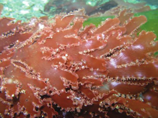
4 Nearshore Vegetation Diverse algae and seagrasses 3-D structure Important food source to local and distant ecosystems

5 Long-term Shift toward soft sediment species Short-term Turbidity Scour Burial Expected Changes


6 Floating Kelp Monitoring Methods (Since 1989) Near-vertical aerial photography collected from small plane during a late summer low tide (7500 MSL) with Nikon D200 digital 35mm DSLR camera. Hand delineated onto 1:12K basemaps
 70 60 50 40 30 20 10 0-54% -42% -74% -100% +14% -7% -42% 2011 2012")
7 Floating Kelp Canopy Area Changes Following Elwha Dam Removal -53% ( ) Crescent Bay -54% Tongue Pt Observatory Pt -42% Freshwater Bay -74% Angeles Point Elwha Bluffs -100% Ediz Hook +14% Dungeness Bluffs -7% Dungeness Spit -42% Canopy Area (ha) % -42% -74% -100% +14% -7% -42%
 and MRC (Jim Norris) for 2010 imagery.")
8 Underwater Transects Surveyed in 2010*, 2012 & 2013 from shallow to -15 m * Thanks to Clallam County (Cathy Lear) and MRC (Jim Norris) for 2010 imagery.


9 Underwater Video Classification Vegetation Types All macrovegetation All kelp Stipitate kelp Prostrate kelp Floating kelp Non-kelp red/brown algae Green algae Seagrass Cover classes Really Low <15% Low 15-33% Medium 33-66% High 66-85% Really High >85% Mapping Unit ~ 1 m 2


.")
10 Directly east of the Elwha River mouth, -8 m (MLLW).
11 Major Decrease in Area with Vegetation Present, % ** 1000 All Vegetation Red/brown (non-kelp) Kelp - all Kelp - prostrate Kelp - stipitate Seagrass Area (ha) % ** -73%** -54%* Weighted Linear regression * p < 0.2 ** p < 0.05

12 Strong Gradient

,")
13 Dive surveys Identify and count plants in 30 m x 1 m swaths Transect endpoint markers on seafloor: End pyramid Center post Two transects per site Seasonal window: Late July-early September Surveys conducted annually at 17 sites: 1 site: sites: sites: sites: 2009 (GPS only, no endpoint markers),

14 All kelp Density before dam removal


15 All kelp Percent change in density after dam removal Before Before-2012 Before-2013
 3.0 2.5 2.0 1.5 1.0 0.5 0.")
16 Kelp species Density before dam removal and in 2012 and 2013 Density (number per square meter) Before Species
 3.0 2.5 2.0 1.5 1.0 0.5 0.")
17 Kelp species Density before dam removal and in 2012 and 2013 Density (number per square meter) Before Nereocystis luetkeana (bull kelp) Species
 3.0 2.5 2.0 1.5 1.0 0.5 0.")
18 Kelp species Density before dam removal and in 2012 and 2013 Density (number per square meter) Before Cymathere triplicata Species
")

19 Kelp species Density before dam removal and in 2012 and 2013 Density (number per square meter) Before Agarum fimbriatum Pterygophora californica Species


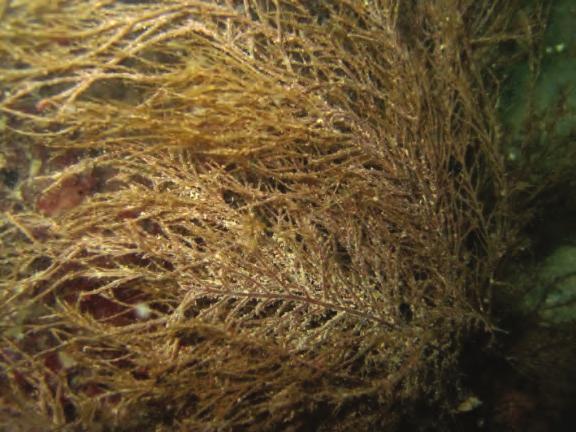


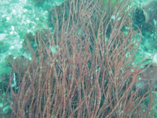

20 Other seaweeds Also decreased after dam removal Acid kelp (Desmarestia spp): Red algae (Rhodophyta): Kelp + acid kelp + red algae = total vegetation


21 Unseasonal recruitment Juveniles appeared in late August 2013 Not present August 16 Present August 30


22 Unseasonal recruitment Species that typically recruit in spring: Alariamarginata Cymathere triplicata Desmarestia bushy Desmarestia flat-bladded Laminaria ephemera Nereocystis luetkeana Present at three sites:


23 Not permanent burial Physical drivers Not buried Buried 2012: 15 sites 2013: 11 sites 2012: 0 sites 2013: 4 sites

24 Not permanent burial Physical drivers Aug 2011 to May 2012 May 2012 to Aug 2012 Aug 2012 to Mar 2013 Mar 201 to Sep 2013 Gelfenbaum et al. in prep.


25 Physical drivers Ephemeral deposition Scour ( sandblasting ) Light reduction Photos from Jonathon Warrick


26 Chance to learn How does sedimentation affect kelp and other seaweeds?
Clallam County Marine Resources Committee 2017 Annual Report. Prepared by Clallam County Marine Resources Committee
 Clallam County Marine Resources Committee 2017 Annual Report Prepared by Clallam County Marine Resources Committee About the Clallam MRC The Clallam County Marine Resources Committee (Clallam MRC) was
Oceanography of Cowichan Bay: A background view for early marine survival of Chinook and Coho salmon
 Western Washington University Western CEDAR Salish Sea Ecosystem Conference 2014 Salish Sea Ecosystem Conference (Seattle, Wash.) May 1st, 1:30 PM - 3:00 PM Oceanography of Cowichan Bay: A background view
Preliminary study of the seagrasses in Middle Tampa Bay between Apollo Beach and Simmons Park
 University of South Florida Scholar Commons Reports Tampa Bay Area Study Group Project 9-3-1986 Preliminary study of the seagrasses in Middle Tampa Bay between Apollo Beach and Simmons Park Mangrove Systems,
Roberts Bank Terminal 2 Project Field Studies Information Sheet
 July 2012 Port Metro Vancouver is continuing field studies in July as part of ongoing environmental and technical work for the proposed Roberts Bank Terminal 2 Project. Roberts Bank Terminal 2 Project
Mercury trends in cormorant and great blue heron eggs from Pacific Canada: a question of local and global sources
 Western Washington University Western CEDAR Salish Sea Ecosystem Conference 2018 Salish Sea Ecosystem Conference (Seattle, Wash.) Apr 5th, 2:00 PM - 2:15 PM Mercury trends in cormorant and great blue heron
Brominated Flame Retardants: Spatial and Temporal Patterns and Trends in Seabird eggs from the Nearshore Pacific Coast of Canada
 Western Washington University Western CEDAR Salish Sea Ecosystem Conference 214 Salish Sea Ecosystem Conference (Seattle, Wash.) Apr 3th, 1:3 PM - 3: PM Brominated Flame Retardants: Spatial and Temporal
Seasonal Impacts on the Breakage of Nereocystis luetkeana: A Break in Time. FHL 470: Research in Marine Biology Spring 2016
 Seasonal Impacts on the Breakage of Nereocystis luetkeana: A Break in Time Nadia Ahmed 1,2, Katie Dobkowski 1,2 FHL 470: Research in Marine Biology Spring 2016 1 Friday Harbor Laboratories, University
PISCO Swath Algae 2017
 PISCO Swath Algae 2017 Swath algae data sheet Count stipes >1 m Count stipes >30 cm Count if diameter/width meets criterion Macrocystis pyrifera Macrocystis pyrifera Count all giant kelp >1 m tall, else
Instruction with Hands-on Practice: Creating a Bathymetric Database & Datum Conversion
 Instruction with Hands-on Practice: Creating a Bathymetric Database & Datum Conversion Tanya Beck Coastal and Hydraulics Laboratory Engineer Research and Development Center May 17, 2010 US Army Corps of
Estimates of Feeder Bluff Recession Rates in the Dungeness Spit Drift Cell, Clallam County, Washington
 Estimates of Feeder Bluff Recession Rates in the Dungeness Spit Drift Cell, Clallam County, Washington Robert Knapp and Randy Johnson, Jamestown S Klallam Tribe, July 2016 Contents Introduction... 1 Shoreline
MPA Baseline Program. Annual Progress Report
 MPA Baseline Program Annual Progress Report Principal Investigators please use this form to submit your MPA Baseline Program project annual report, including an update on activities completed over the
MONITORING IN SHARK BAY MARINE PARK WESTERN AUSTRALIA
 MONITORING IN SHARK BAY MARINE PARK WESTERN AUSTRALIA Kevin P Bancro< 1, 2 Simone S Strydom 1, 3 George Shedrawi 1 Thomas Holmes 1 Kathy Murray 4 Bart Huntley 4 1 Marine Science Program, Department of
Cat Island Chain Restoration Project Brown County Port & Resource Recovery Department
 Cat Island Chain Restoration Project Brown County Port & Resource Recovery Department February 2, 2015 Fox River and Lower Green Bay Cat Island Chain - 1938 Cat Island Brown County Aerial Photography,
Detecting and Mapping Invasive Phragmites australis in the Coastal Great Lakes with ALOS PALSAR Imagery
 Detecting and Mapping Invasive Phragmites australis in the Coastal Great Lakes with ALOS PALSAR Imagery Brian Huberty U.S Fish & Wildlife Service Region 3 Ecological Services Laura L. Bourgeau-Chavez,
Waterbird monitoring and habitat association modeling to inform tidal marsh restoration in an urbanized estuary
 Western Washington University Western CEDAR Salish Sea Ecosystem Conference 2018 Salish Sea Ecosystem Conference (Seattle, Wash.) Apr 4th, 4:30 PM - 4:45 PM Waterbird monitoring and habitat association
USING UNMANNED AERIAL VEHICLES (UAV'S) TO MEASURE JELLYFISH AGGREGATIONS: AN INTER
 TO MEASURE JELLYFISH AGGREGATIONS: AN INTER") USING UNMANNED AERIAL VEHICLES (UAV'S) TO MEASURE JELLYFISH AGGREGATIONS: AN INTER COMPARISON WITH NET SAMPLING BRIAN P. V. HUNT University of British Columbia Institute for the Oceans and Fisheries Schaub,
USING UNMANNED AERIAL VEHICLES (UAV'S) TO MEASURE JELLYFISH AGGREGATIONS: AN INTER COMPARISON WITH NET SAMPLING BRIAN P. V. HUNT University of British Columbia Institute for the Oceans and Fisheries Schaub,
SURVEY OF SEAGRASS BEDS AT PLACEMENT AREA 62, WEST BAY CONTRACT FOR GIWW, TEXAS CAUSEWAY U. S. ARMY CORPS OF ENGINEERS CONTRACT NO.
 SURVEY OF SEAGRASS BEDS AT PLACEMENT AREA 62, WEST BAY CONTRACT FOR GIWW, TEXAS CAUSEWAY U. S. ARMY CORPS OF ENGINEERS CONTRACT NO. W912HY-10-C-0036 Prepared for: RLB CONTRACTING, INC. P.O. Box 1739 Port
NAPA MARSHES RESTORATION Coastal Ecosystem Restoration Through Collaborative Partnerships
 NAPA MARSHES RESTORATION Coastal Ecosystem Restoration Through Collaborative Partnerships National Conference on Ecosystem Restoration July 29-August 2, 2013 Jeff McCreary Director of Conservation Programs
Development of Mid-Frequency Multibeam Sonar for Fisheries Applications
 Development of Mid-Frequency Multibeam Sonar for Fisheries Applications John K. Horne University of Washington, School of Aquatic and Fishery Sciences Box 355020 Seattle, WA 98195 phone: (206) 221-6890
Page 1. Abstract: History
 GIS in the Virgin Islands National Park & the Coral Reef National Monument Christy Loomis Virgin Islands National Park ESRI Federal User Conference January 31- February 2, 2006 Abstract: The Virgin Islands
Introduction. Further Information
 2011 Data Report Introduction T he spring of 2011 was the fifth year Citizen Science trained high school students conducted habitat characterization and presence/ absence species surveys on seven Seattle-area
Roberts Bank Terminal 2 Project Field Studies Information Sheet
 January 2013 Port Metro Vancouver is continuing field studies in January as part of ongoing environmental and technical work for the proposed. The is a proposed new multi berth container terminal which
Flagler Park Living Shoreline Monitoring Vincent Encomio, Pam Hopkins, Katie Tiling, Josh Mills 9/23/2016
 FLORIDA OCEANOGRAPHIC SOCIETY Flagler Park Living Shoreline Monitoring 2015-2016 Vincent Encomio, Pam Hopkins, Katie Tiling, Josh Mills 9/23/2016 Flagler Living Shoreline Monitoring Summary Constructed
Coos Bay BCS number: 47-8
 Coos Bay BCS number: 47-8 ***NOTE: The completion of this site description is still in progress by our Primary Contact (listed below). However, if you would like to contribute additional information to
Mapping of Eelgrass and Other SAV Using Remote Sensing and GIS Chris Mueller NRS 509 November 30, 2004
 Mapping of Eelgrass and Other SAV Using Remote Sensing and GIS Chris Mueller NRS 509 November 30, 2004 Of the 58 species of seagrass that grow worldwide, Zostera marina, commonly called eelgrass, is by
Aythya nyroca Eastern Europe/E Mediterranean & Sahelian Africa
 Period 2008-2012 European Environment Agency European Topic Centre on Biological Diversity Aythya nyroca Eastern Europe/E Mediterranean & Sahelian Africa Annex I International action plan Yes SAP Ferruginous
Seagrass and Caulerpa Monitoring in Hillsborough Bay Fifteenth Annual Report
 University of South Florida Scholar Commons Reports Tampa Bay Area Study Group Project 5-1-24 Seagrass and Caulerpa Monitoring in Hillsborough Bay Fifteenth Annual Report City of Tampa Department of Sanitary
Unmanned Aerial Vehicles: A New Approach for Coastal Habitat Assessment
 Unmanned Aerial Vehicles: A New Approach for Coastal Habitat Assessment David Ryan Principal Marine Scientist WorleyParsons Western Operations 2 OUTLINE Importance of benthic habitat assessment. Common
MARINE BIRD SURVEYS AT BOGOSLOF ISLAND, ALASKA, IN 2005
 AMNWR 05/18 MARINE BIRD SURVEYS AT BOGOSLOF ISLAND, ALASKA, IN 2005 Photo: Paul Hillman Heather M. Renner and Jeffrey C. Williams Key Words: Aleutian Islands, black-legged kittiwake, Bogoslof Island, Fratercula
Trinity River Bird and Vegetation Monitoring: 2015 Report Card
 Trinity River Bird and Vegetation Monitoring: 2015 Report Card Ian Ausprey 2016 KBO 2016 Frank Lospalluto 2016 Frank Lospalluto 2016 Background The Trinity River Restoration Program (TRRP) was formed in
Map and Drawing Standards for the South Pacific Division Regulatory Program
 Map and Drawing Standards for the South Pacific Division Regulatory Program Hollis Jencks Project Manager, Nevada/Utah Section Sacramento District Regulatory Program Workshop 31 May 2018 US Army Corps
Prepared for: RLB CONTRACTING, INC. P.O. Box 1739 Port Lavaca, TX 77979
 FIRST DRAFT REPORT SURVEY OF SEAGRASS BEDS AT PLACEMENT AREAS 62 & 63, WEST BAY CONTRACT FOR GIWW, TEXAS CAUSEWAY U. S. ARMY CORPS OF ENGINEERS CONTRACT NO. W912HY-10-C-0036 Prepared for: RLB CONTRACTING,
September 25, 2014 YEAR TWO HABITAT COMPENSATION MONITORING
 September 25, 2014 YEAR TWO HABITAT COMPENSATION MONITORING Telus Duct Bank Relocation Project Submitted to: Dwayne Kalynchuk Director of Engineering and Public Works City of Victoria City Hall, 1 Centennial
Project Summary. Predicting waterbird nest distributions on the Yukon-Kuskokwim Delta of Alaska
 Project Summary 1. PROJECT INFORMATION Title Project ID Predicting waterbird nest distributions on the Yukon-Kuskokwim Delta of Alaska WA2012_22 Project Period July 1, 2012 to June 30, 2014 Report submission
Marbled Murrelet Effectiveness Monitoring, Northwest Forest Plan
 Marbled Murrelet Effectiveness Monitoring, Northwest Forest Plan 2017 Summary Report Northwest Forest Plan Interagency Regional Monitoring Program Photo credits: S.F. Pearson (top) May 2018 1 Marbled Murrelet
Engaging Citizen Scientists & Landowners Through Bioblitzes
 Engaging Citizen Scientists & Landowners Through Bioblitzes Karen Dvornich University of Washington Washington Cooperative Fish & Wildlife Research Unit College of the Environment School of Forestry NatureMapping
Eldrett Bird Conservation Area
 St. Lawrence Eastern Lake Ontario Partnership for Regional Invasive Species Management Eldrett Bird Conservation Area Early Detection Surveillance July 18-19, 2013 Figure 1: Panoramic view of Eldrett Bird
Fugro Worldwide Fugro Environmental
 1 2 Fugro Worldwide The Fugro group of companies is an international consulting company that provides measurements and interpretations of data related to the earth's surface and the soils and rocks beneath.
INTRACOASTAL WATERWAY DEEPENING BROWARD COUNTY, FLORIDA
 INTRACOASTAL WATERWAY DEEPENING BROWARD COUNTY, FLORIDA APPENDIX J Submerged Aquatic Resources Survey Seagrass Survey Temporary Coral Relocation INTRACOASTAL WATERWAY DEEPENING BROWARD COUNTY, FLORIDA
MPA Baseline Program. Annual Progress Report
 MPA Baseline Program Annual Progress Report Principal Investigators - please use this form to submit your MPA Baseline Program project annual report, including an update on activities completed over the
Freshwater Aquatic Ecosystem Fieldwork
 Year 11 Biology/Senior Science Freshwater Aquatic Ecosystem Fieldwork Outcomes: 1. Use scientific techniques to investigate how the distribution, diversity and numbers of plants and animals found in ecosystems
Summaries of Sub-regional Trends in Density Indices PROCEEDINGS 1
 Trends Observed for Selected Marine Bird Species during 1993- Winter Aerial Surveys, Conducted by the PSAMP Bird Component (WDFW) in the Inner Marine Waters of Washington State David R. Nysewander, Joseph
6/13/03 RKLD Aquatic Vegetation Survey USGS Gage msl Location: GPS Point 164, westernmost shoreline stake of Quadrant D, Carcajou Shallow
 6/13/03 RKLD Aquatic Vegetation Survey USGS Gage - 776.31 msl Location: GPS Point 164, westernmost shoreline stake of Quadrant D, Carcajou Shallow Marsh Lake Study plot. Elevation 776.14 msl. 6/13/03 RKLD
Acropora Species Status and Trends in Dry Tortugas National Park
 Acropora Species Status and Trends in Dry Tortugas National Park Douglas Morrison 1, Meredith Meyers 2, Jim Kidney 3, Dustin Johnson 3, Rob Ruzicka 3, Mike Colella 3, Michael Callahan 3, Vanessa Brinkhuis
First Exam: Thurs., Sept 28
 8 Geographers Tools: Gathering Information Prof. Anthony Grande Hunter College Geography Lecture design, content and presentation AFG 0917. Individual images and illustrations may be subject to prior copyright.
Commercial Fishing and Offshore Wind in Maine For more information: Josh Plourde (207) March 16, 2018
 March 16, 2018") Commercial Fishing and Offshore Wind in Maine For more information: Josh Plourde (207) 907-0069 jp@maine.edu March 16, 2018 Future Offshore Wind Development in Maine The University of Maine will not license
Commercial Fishing and Offshore Wind in Maine For more information: Josh Plourde (207) 907-0069 jp@maine.edu March 16, 2018 Future Offshore Wind Development in Maine The University of Maine will not license
First Exam. Geographers Tools: Gathering Information. Photographs and Imagery. SPIN 2 Image of Downtown Atlanta, GA 1995 REMOTE SENSING 9/19/2016
 First Exam Geographers Tools: Gathering Information Prof. Anthony Grande Hunter College Geography Lecture design, content and presentation AFG 0616. Individual images and illustrations may be subject to
Towards a Management Plan for a Tropical Reef-Lagoon System Using Airborne Multispectral Imaging and GIS
 Towards a Management Plan for a Tropical Reef-Lagoon System Using Airborne Multispectral Imaging and GIS This paper was presented at the Fourth International Conference on Remote Sensing for Marine and
NPS Inventory and Monitoring Program
 NPS Inventory and Monitoring Program Metrics and Protocols Monitoring Tidal Marsh Condition Tidal Marsh Resiliency Coordination Workshop U.S. Fish & Wildlife Service, Hadley, MA Dec 8-9, 2014 Northeast
Chapter 2 : Aerial Survey Methods
 Chapter 2 : Aerial Survey Methods Emily E. Connelly, Melissa Duron, Iain J. Stenhouse, Kathryn A. Williams Introduction High-definition video aerial surveys were conducted by (BRI) and HiDef Aerial Surveying,
Kelp Canopy Biomass, Landsat 5 TM. Santa Barbara Coastal LTER (2011, 2013)
") Kelp Canopy Biomass, Landsat 5 TM Santa Barbara Coastal LTER (2011, 2013) Overview: The Landsat 5 TM sensor has acquired 30 m spatial resolution multispectral imagery nearly continuously from 1984 to 2011
Kelp Canopy Biomass, Landsat 5 TM Santa Barbara Coastal LTER (2011, 2013) Overview: The Landsat 5 TM sensor has acquired 30 m spatial resolution multispectral imagery nearly continuously from 1984 to 2011
Marine Reserve Science and Monitoring Workshop Oregon Department of Fish and Wildlife, February 3, 2012
 Marine Reserve Science and Monitoring Workshop Oregon Department of Fish and Wildlife, February 3, 2012 Meeting Purpose The purpose of this meeting was to seek expert feedback on current and future ecological
Northwest Power & Conservation Council. Acknowledgments. Jessica Adkins, Pete Loschl, Dan Battaglia
 Avian Predation on Juvenile Salmonids in the Lower Columbia River Briefing for the Fish Committee Northwest Power & Conservation Council Oregon State University Real Time Research, Inc. USGS Oregon Cooperative
APCAS/10/21 April 2010 ASIA AND PACIFIC COMMISSION ON AGRICULTURAL STATISTICS TWENTY-THIRD SESSION. Siem Reap, Cambodia, April 2010
 APCAS/10/21 April 2010 Agenda Item 8 ASIA AND PACIFIC COMMISSION ON AGRICULTURAL STATISTICS TWENTY-THIRD SESSION Siem Reap, Cambodia, 26-30 April 2010 The Use of Remote Sensing for Area Estimation by Robert
VDatum and SBET to Improve Accuracy of NOAA s High-Resolution Bathymetry
 VDatum and SBET to Improve Accuracy of NOAA s High-Resolution Bathymetry US HYDRO 2007 Extended Abstract Author: Crescent H. Moegling CoAuthor: Steve Brodet Moegling HYDRO 2007 1 Introduction NOAA s Hydrographic
Dungeness River Comprehensive Flood Hazard Management Plan 2009 DUNGENESS WATERSHED RESTORATION PLANS AND ACTIVITIES ( ) 1
 1") Dungeness River Comprehensive Flood Hazard Management Plan 2009 APPENDIX A: DUNGENESS WATERSHED RESTORATION PLANS AND ACTIVITIES (1989 2006) 1 [Note: References cited in the 2009 Comprehensive Flood Management
Dungeness River Comprehensive Flood Hazard Management Plan 2009 APPENDIX A: DUNGENESS WATERSHED RESTORATION PLANS AND ACTIVITIES (1989 2006) 1 [Note: References cited in the 2009 Comprehensive Flood Management
Acquisition of Aerial Photographs and/or Imagery
 Acquisition of Aerial Photographs and/or Imagery Acquisition of Aerial Photographs and/or Imagery From time to time there is considerable interest in the purchase of special-purpose photography contracted
Overview of Tides and Water Levels
 Overview of Tides and Water Levels www.tidesandcurrents.noaa.gov New Orleans, Baton Rouge, Lafayette, LA March 2009 Gerald Hovis, NOAA - National Ocean Service William Sweet, NOAA - National Ocean Service
on Batillaria attramentaria, which is now so widely distributed in the Batillaria attramentaria, Ulva spp., NDVI, Yatsu Tidal Flat, Japan, Aerial
 Advances in Remote Sensing, 2018, 7, 15-24 http://www.scirp.org/journal/ars ISSN Online: 2169-2688 ISSN Print: 2169-267X A Method for Determining Batillaria attramentaria Distribution Using Aerial Balloon
MULTI-TEMPORAL SATELLITE IMAGES WITH BATHYMETRY CORRECTION FOR MAPPING AND ASSESSING SEAGRASS BED CHANGES IN DONGSHA ATOLL
 MULTI-TEMPORAL SATELLITE IMAGES WITH BATHYMETRY CORRECTION FOR MAPPING AND ASSESSING SEAGRASS BED CHANGES IN DONGSHA ATOLL Chih -Yuan Lin and Hsuan Ren Center for Space and Remote Sensing Research, National
Facts about the DuPont Nature Center at Mispillion Harbor Reserve
 Facts about the DuPont Nature Center at Mispillion Harbor Reserve The Center: The DuPont Nature Center at Mispillion Harbor Reserve is a $2.1 million natural history interpretive center and wildlife observatory.
Land Cover Type Changes Related to. Oil and Natural Gas Drill Sites in a. Selected Area of Williams County, ND
 Land Cover Type Changes Related to Oil and Natural Gas Drill Sites in a Selected Area of Williams County, ND FR 3262/5262 Lab Section 2 By: Andrew Kernan Tyler Kaebisch Introduction: In recent years, there
Enhanced coastal mapping using lidar waveform features
 University of New Hampshire University of New Hampshire Scholars' Repository Center for Coastal and Ocean Mapping Center for Coastal and Ocean Mapping 6-2014 Enhanced coastal mapping using lidar waveform
Lakewide Action and Management Plans - LAMPs Beth Hinchey Malloy & Liz LaPlante, US EPA GLNPO
 Lakewide Action and Management Plans - LAMPs Beth Hinchey Malloy & Liz LaPlante, US EPA GLNPO An Overview Prepared for GL ANS Panel Meeting Nov 7, 2018 Great Lakes Water Quality Purpose is to restore and
PNWA 2013 SUMMER CONFERENCE: USACE PORTLAND DISTRICT UPDATE
 PNWA 2013 SUMMER CONFERENCE: USACE PORTLAND DISTRICT UPDATE Michael E. Ott, P.E., PMP, USACE Portland District June 24-26, 2013 La Conner, WA US Army Corps of Engineers Agenda Inland Navigation System
Study of Chlorophyll-a Distribution of Microalgae at Tasik Aman and Tasik Harapan in Penang Island Malaysia using Landsat Image
 ISSN 2407-289 Study of Chlorophyll-a Distribution of Microalgae at Tasik Aman and Tasik Harapan in Penang Island Malaysia using Landsat Image a b c Fairooz Johan, Mohd Zubir Mat Jafri, Lim Hwee San,Wan
CalCOFI Marine Mammal Monitoring
 CalCOFI Marine Mammal Monitoring Greg Campbell 1, Lisa Munger 1, Karlina Merkens 1, Dominque Camacho 2, Andrea Havron 2 and John Hildebrand 1 1 Scripps Institution of Oceanography, La Jolla 2 Spatial Ecosystems,
Winter Marine Bird Surveys
 Winter Marine Bird Surveys February 16-March 6 2012 Prepared by Gregory Mills, National Oceanic and Atmospheric Administration (NOAA) On behalf of Oregon Wave Energy Trust March 2012 This work was funded
Sea and Shore CHAPTER 1
 CHAPTER 1 Sea and Shore It was 9:30 A.M. when Mr. MacMath and the class from Central School reached the seashore. There, they met a naturalist named Marnie. Helping people discover nature was her job.
DISTRIBUTION AND ABUNDANCE OF SEA DUCKS AND DIVING DUCKS ON LAKE ST. CLAIR AND W. LAKE ERIE
 DISTRIBUTION AND ABUNDANCE OF SEA DUCKS AND DIVING DUCKS ON LAKE ST. CLAIR AND W. LAKE ERIE Dave Luukkonen, Michigan DNR and Michigan State University Importance of Lake St. Clair and western Lake Erie
Fish-eating birds in Western Port: long-term trends. Peter Dann, Richard Loyn, Peter Menkhorst, Canran Liu, Birgita Hansen & Moragh Mackay
 Fish-eating birds in Western Port: long-term trends Peter Dann, Richard Loyn, Peter Menkhorst, Canran Liu, Birgita Hansen & Moragh Mackay The most important science gaps Number 12. Examine the trends in
Appendix B. Historical Aerial Photograph Review
 . Historical Aerial Photograph Review A historical aerial photo review was conducted to document changes in site use and layout at T-108 over time. Photos from 1936 (King County 2008), 1946 (Aerial Photo
Relicensing Study 3.5.1
 Relicensing Study 3.5.1 BASELINE INVENTORY OF WETLAND, RIPARIAN AND LITTORAL HABITAT IN THE TURNERS FALLS IMPOUNDMENT, AND ASSESSMENT OF OPERATIONAL IMPACTS ON SPECIAL-STATUS SPECIES Updated Study Report
Occurrence, Distribution, and Density of Protected Marine. Species in the Chesapeake Bay Near Naval Air Station Patuxent: 2016 Annual Progress Report
 Occurrence, Distribution, and Density of Protected Marine Submitted to: Naval Facilities Engineering Command Atlantic under Contract No. N62470-10-D-3011, Task Order 55, issued to HDR, Inc. Species in
Photo: Sarah McCord. Monitoring for Adaptive Management BLM s National Assessment, Inventory, and Monitoring Strategy
 Photo: Sarah McCord Monitoring for Adaptive Management BLM s National Assessment, Inventory, and Monitoring Strategy A Brief History of Rangeland Monitoring Sampson(1923) promoted the idea of a systemized
Habitat changes force waterfowl to flee the coast by large amount
 Habitat changes force waterfowl to flee the coast by large amount BY: SHANNON TOMPKINS HOUSTON CHRONICLE MARCH 2, 2016 Photo: Picasa While the Texas coast still winters the majority of the continent's
Using ArcMap to Extract Shorelines from Landsat TM & ETM+ Data. Richard C. Daniels, GISP
 Using ArcMap to Extract Shorelines from Landsat TM & ETM+ Data Thirty-second ESRI International Users Conference Proceedings, San Diego, CA Richard C. Daniels, GISP Abstract Many site and region specific
SPECIAL PUBLIC NOTICE
 SPECIAL PUBLIC NOTICE Draft Map and Drawing Standards for the South Pacific Division Regulatory Program August 6, 2012 Corps contacts: Sacramento District: Michael Finan (916) 557-5324 (Michael.C.Finan@usace.army.mil)
IDENTIFICATION AND MAPPING OF HAWAIIAN CORAL REEFS USING HYPERSPECTRAL REMOTE SENSING
 IDENTIFICATION AND MAPPING OF HAWAIIAN CORAL REEFS USING HYPERSPECTRAL REMOTE SENSING Jessica Frances N. Ayau College of Education University of Hawai i at Mānoa Honolulu, HI 96822 ABSTRACT Coral reefs
1. Qualitative Assessment... II-101
 Table of Contents I. Introduction... I-1 A. Session Law 2009-479 / House Bill 709... I-2 B. Public Consultation... I-3 C. Selection of Study Sites... I-5 D. Limitations of Study... I-8 II. Physical Assessment...
High Resolution Nearshore Substrate Mapping and Persistence Analysis with Multi-spectral Aerial Imagery.
 High Resolution Nearshore Substrate Mapping and Persistence Analysis with Multi-spectral Aerial Imagery. 1 st Project Year Annual Report Submitted to the California Sea Grant Program Grant no: MPA 09-015
Matagorda Bay Nature Park
 Matagorda Bay Nature Park N a t u r a l S c i e n c e E d u c a t i o n P r o g r a m s This is such a wonderful facility and the location lends itself to teaching about the coastal environment. This is
Object Detection for Underwater Port Security
 Object Detection for Underwater Port Security Dr. Lloyd Huff LCHUFF CONSULTANCY,LLC Mr. John Thomas TRITON IMAGING,INC Shallow Survey 2012 February 22, 2012 INTRODUCTION I am glad to be here today to make
Removed. Scientific Skills. Gel Chromatography Thin Layer Chromatography NMR Reading Spectrophotometer Reading Centrifuge Handling
 Removed date Removed EDUCATION BA Florida Gulf Coast University, Ft. Myers (anticipated graduation = 2010) Major = Biology; Minor = Chemistry; Philosophy; & Interdisciplinary Studies High School Cape Coral
Old House Channel Bathymetric and Side Scan Survey
 FIELD RESEARCH FACILITY DUCK, NC Old House Channel Bathymetric and Side Scan Survey COASTAL AND HYDRAULICS LABORATORY FIELD DATA COLLECTION AND ANALYSIS BRANCH Michael Forte December 2009 View looking
Quantifying Change in. Quality Effects on a. Wetland Extent & Wetland. Western and Clark s Grebe Breeding Population
 Quantifying Change in Wetland Extent & Wetland Quality Effects on a Western and Clark s Grebe Breeding Population Eagle Lake, CA: 1998-2010 Renée E. Robison 1, Daniel W. Anderson 2,3, and Kristofer M.
SPECIAL PUBLIC NOTICE
 SPECIAL PUBLIC NOTICE Draft Map and Drawing Standards for the South Pacific Division Regulatory Program March 5, 2012 Comment period: ends April 5, 2012 Corps contact: Thomas Cavanaugh (415) 503-6574 (Thomas.J.Cavanaugh@usace.army.mil)
Satellite Monitoring of a Large Tailings Storage Facility
 Satellite Monitoring of a Large Tailings Storage Facility Benjamin Schmidt and Matt Malgesini, Golder Associates Inc., USA Jim Turner, PhotoSat Ltd, Canada Jeff Reinson, Goldcorp Inc., Canada Presentation
Simon Says WHAT S INSIDE PROTECTED AREAS IN THE SANCTUARY HOW IS SIMON INVOLVED?
 Simon Says TRACKING THE HEALTH OF OUR SANCTUARY Monterey Bay National Marine Sanctuary INSIDE 1 Introduction 2 MPAs 3 Seasonal Upwelling 4 Habitat 5 biodiversity 6 Synopsis 8 SIMoN Web Site Welcome to
Collaboration and Planning to Implement the South San Diego Bay Restoration and Enhancement Project
 Collaboration and Planning to Implement the South San Diego Bay Restoration and Enhancement Project Carolyn Lieberman Coastal Program Coordinator for Southern California U.S. Fish and Wildlife Service
Real-Time Continuous Observations of Lake Erie Chemical, Biological, and Physical Parameters
 Real-Time Continuous Observations of Lake Erie Chemical, Biological, and Physical Parameters S. Ruberg 1, S. Brandt 1, S. Gordon 2, R. Muzzi 1 1. NOAA Great Lakes Environmental Research Lab (GLERL) 2.
Strategic planning for the Far Eastern Curlew
 Strategic planning for the Far Eastern Curlew Special report to Darwin Port on research training trip to Broome, Western Australia February-March 2018 Strategic planning for the Far Eastern Curlew Special
A Rising Tide: Conserving Shorebirds and Shorebird Habitat within the Columbia River Estuary
 A Rising Tide: Conserving Shorebirds and Shorebird Habitat within the Columbia River Estuary By Vanessa Loverti USFWS Migratory Birds and Habitat Programs, Portland, Oregon May 28, 2014 Outline of Talk
WILLIAM F. GREY, D.A.
 WILLIAM F. GREY, D.A. Areas of Specialization: Plant taxonomy, plant ecology, marine and estuarine ecology, Threatened or Endangered (T&E) species, nonvascular plants, tropical flora. Experience: Senior
CIMT June 5 & 6, 2006 Workshop Important Notes & Tasks
 CIMT June 5 & 6, 2006 Workshop Important Notes & Tasks June 5, 2006 La Feliz Room, Seymour Center at Long Marine Lab Center for Ocean Health Library at Long Marine Lab ATTENDEES: Raphe Kudela UCSC/CIMT
GNSS CORS in the Pacific
 GNSS CORS in the Pacific FIG References Frame in Practice Seminar Operational Aspects of GNSS CORS Technical Workshop Holiday Inn, Suva - Fiji PGSC Partnership Desk, GEM Division, Pacific Community (SPC)
44. MARINE WILDLIFE Introduction Results and Discussion. Marine Wildlife Cook Inlet
 44. MARINE WILDLIFE 44.1 Introduction This study examined the distribution and abundance of marine-oriented wildlife (birds and mammals) during surveys conducted by ABR, Inc. Environmental Research & Services.
ALASKA BELUGA WHALE COMMITTEE REPORT Distribution and Abundance of Beluga Whales in Bristol Bay, Alaska,
 ALASKA BELUGA WHALE COMMITTEE REPORT 95-1 Distribution and Abundance of Beluga Whales in Bristol Bay, Alaska, 1993-1994 Prepared by Kathryn J. Frost and Lloyd F. Lowry Alaska Department of Fish and Game
Revised Work Plan and Budget for Project:
 Revised Work Plan and Budget for Project: Nearshore Substrate Mapping and Change Analysis using Historical and Concurrent Multi-spectral Aerial Imagery. 8/17/2011 Project Leader and PI: Dr. Jan Svejkovsky
Photo Scale The photo scale and representative fraction may be calculated as follows: PS = f / H Variables: PS - Photo Scale, f - camera focal
 Scale Scale is the ratio of a distance on an aerial photograph to that same distance on the ground in the real world. It can be expressed in unit equivalents like 1 inch = 1,000 feet (or 12,000 inches)