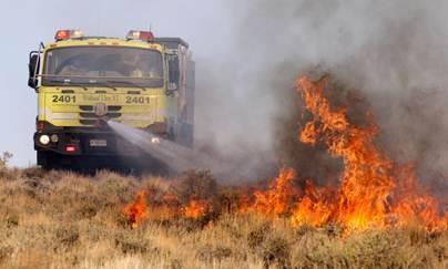
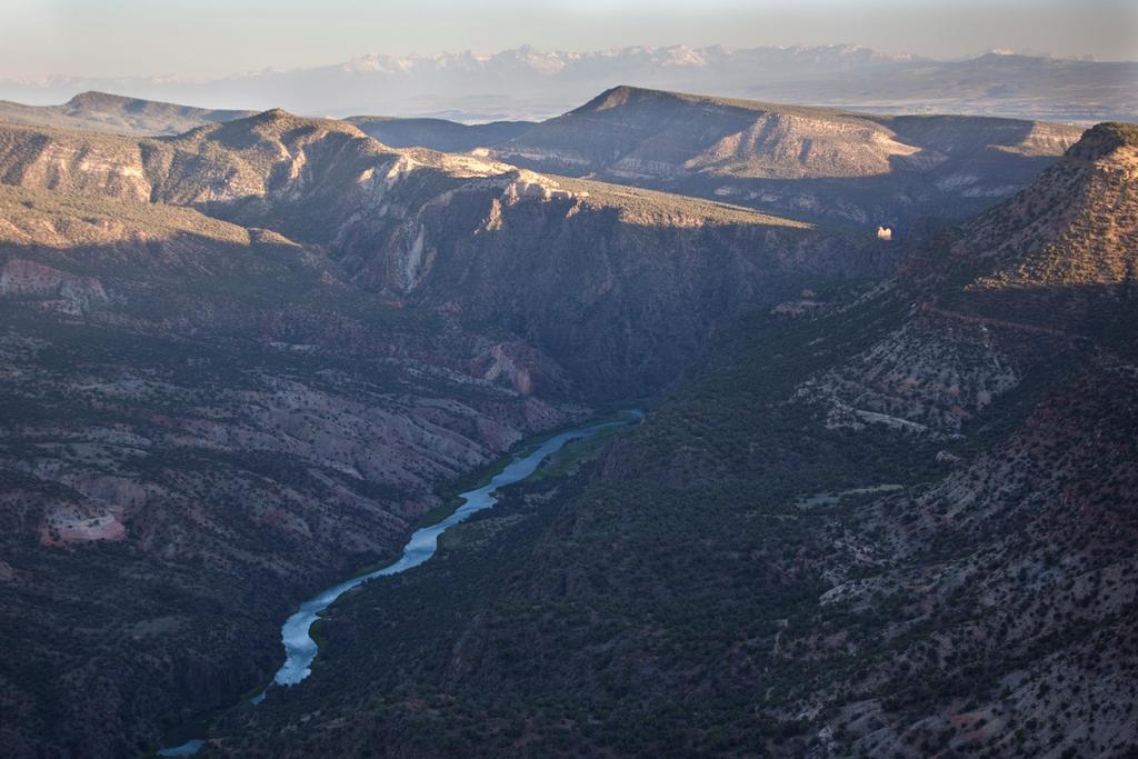
Photo: Sarah McCord. Monitoring for Adaptive Management BLM s National Assessment, Inventory, and Monitoring Strategy
|
|
|
- Randolph Cook
- 5 years ago
- Views:
Transcription


1 Photo: Sarah McCord Monitoring for Adaptive Management BLM s National Assessment, Inventory, and Monitoring Strategy


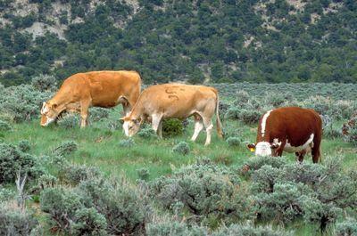
2 A Brief History of Rangeland Monitoring Sampson(1923) promoted the idea of a systemized study, designed to secure the data that will lead to permanent improvement in management and to increased profits from the lands. Historically, rangeland monitoring focused on determining impacts of and maximizing productivity related to land use typically grazing Monitoring designed around specific land uses or program objectives Jornada cattle 1932 Veg sampling on the Jornada 1928


3 Changing uses/values of rangelands Changing uses/values of rangelands

4 Rangelands in a Changing Climate Source: USDA SW Climate Hub

5 Resource Monitoring in the BLM: the AIM Origin Story 2004 OMB programmatic review of BLM s monitoring activities Found the BLM collects a large amount of information, yet has insufficient data to determine effectiveness of actions above the project level Directed the BLM to analyze Monitoring Activities and develop a cohesive monitoring strategy Wendy s ad from 1984
6 BLM Local Workgroup Summary None of these findings are particularly surprising as the BLM s data collection activities have evolved over time in response to changing user needs for specific resources, specific new program statutory and judicial mandates, and new scientific understandings. The BLM s data collection and analysis activities were not designed to answer many of the performance and landscape level questions currently being asked. Local Workgroup Report, 2007


7 The Assessment, Inventory, and Monitoring (AIM) Strategy The goal of the AIM Strategy is to report on the status and trends of public rangelands at multiple scales of inquiry, to report on the effectiveness of management actions, and to provide the information necessary to implement adaptive management.

8 The Five Principles of AIM Core indicators and methods Scalable (statistically valid) sample design Integration with remote imagery Electronic data capture and management Structured implementation adaptive management


9 Functional Indicators of Land Health Indicator - aspect of an ecosystem or process that can be observed or measured and provides useful information about the condition of the system being monitored Focus on indicators describing processes related to land health E.g., bare ground, canopy gaps, functional group diversity Conceptual models embody knowledge and can be useful for selecting indicators Bare Ground Flow Pattern

10 Core Indicators and Methods Lack of consistent and comparable monitoring procedures within and between the federal management, advisory, and regulatory agencies has made it impossible to conclude reliably what the overall condition and trends in conditions of our public rangelands are. West (2003) Core Indicators and Methods Measurable ecosystem components Applicable across many different ecosystems Informative to many different management objectives Minimal set that should be measured in all monitoring programs. Standardized methods Supplemented as necessary


11 AIM Core Terrestrial Indicators TERRESTRIAL Canopy Gaps Bare Ground Vegetation Composition Plants of Mgmt. Concern Nonnative Invasive Sp. Vegetation Height Soil aggregate stability


12 AIM is standard, quantitative indicators and measurements AQUATIC Acidity, Salinity and Temperature, Pool Dimensions, Stream Bed Substrate, Bank Stability, Floodplain Interaction, Macroinvertebrates, Riparian Vegetation, Canopy Cover

13 AIM Core Terrestrial Methods Plot characterization Line-point Intercept Vegetation Height Plot-level species inventory Canopy-gap Intercept Soil aggregate stability Rationale Quantitative Straightforward to teach and implement Allow observer calibration Consistently measure indicators across ecosystems Used by other national monitoring programs Supplement as needed

14 Supplemental Indicators/Methods Additional indicators to evaluate to meet a local or resource specific objective EXAMPLE: In reclamation monitoring, density of seeded species is an important indicator

15 AIM is managed data BLM National Operations Center
 approaches provide this foundation Can be defined according to objectives or generally Flexible and unbiased Can be combined and scaled up Quantifiable uncertainty")
16 Scalable Sampling Designs Sampling design includes where you are going to monitoring Diversity of land uses/impacts + budgetary restrictions are driving need for sampling designs that can Address multiple objectives Provide information at multiple scales Statistical (i.e., probability-based) approaches provide this foundation Can be defined according to objectives or generally Flexible and unbiased Can be combined and scaled up Quantifiable uncertainty


17 Scales of AIM Implementation National Landscape Monitoring Framework (LMF) Regional E.g., state assessments Local AIM projects with BLM offices

18 BLM Landscape Monitoring Framework Percent of BLM Rangelands with Canopy Gaps > 2m Extension of NRCS NRI onto BLM Lands Separate sample frame so data can be shared Started in 2011 ~5,000 sites visited so far Target sample of 10,000 sites Source: 2011 BLM Rangeland Resource Assessment (in press)

19 BLM Local Monitoring Projects Designed to support local management/ monitoring objectives Locally-staffed field crews Rotating panel designs annual sampling Core + supplemental methods Design/Analysis support


20 Select project area & reporting units Identify lands that can produce GRSG Habitat Define or map GRSG seasonal habitats Gather/evaluate sample data & point weights Determine Habitat Suitability Define habitat indicator objectives Calculate indicator values for sample locations Determine suitability for individual indicators Determine overall habitat suitability by sample location Summarize by reporting unit

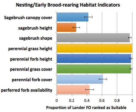
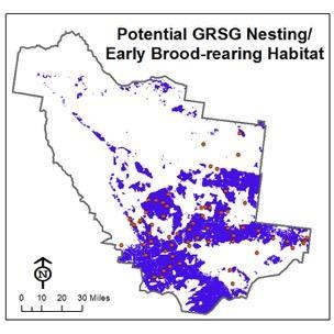
21 Sage Grouse Nesting/Early Broodrearing Habitat

22 LEARN Monitoring Objectives based on BLM Land Health Fundamentals Structured Implementation for Adaptive Management

23 Information for Informed Decisions For more info:
Riparian Conservation Project Monitoring and Avian Habitat in Colorado
 Riparian Conservation Project Monitoring and Avian Habitat in Colorado October 14, 2004 Colorado Riparian Association Alison Banks Cariveau Rocky Mountain Bird Observatory Conserving birds of the Rocky
Table of Contents. Chapter 1.0 Purpose and Need
 Table of Contents Chapter 1.0 Purpose and Need CHAPTER 1.0 PURPOSE AND NEED... 1 1.1 INTRODUCTION... 1 1.1.1 EA ORGANIZATION... 1 1.2 PROJECT AREA... 1 1.3 PROPOSED ACTION... 2 1.3.1 SCOPE OF THE PROPOSED
ARS-TBGPEA collabora1ve research update
 ARS-TBGPEA collabora1ve research update March 16, 2016 Long-range goals Find out how to best manage Thunder Basin for mul1ple objec1ves livestock produc1on, conserva1on of both short-grass and sagebrush
What is the Southeastern Oregon RMP?
 Resource Management Plans Alan Majchrowicz What is the Southeastern Oregon RMP? The Bureau of Land Management creates Resource Management Plans for planning areas to guide their decision-making about the
Nevada Sagebrush Ecosystem Conservation Program
 Nevada Sagebrush Ecosystem Conservation Program Managing approximately 1.8 million acres for multiple uses, including mineral exploration and mining, rangeland livestock production, and ecosystem restoration.
User Manual for Grass Snap (Android Version)
") User Manual for Grass Snap (Android Version) Grass Snap is a useful tool when monitoring your pastures and grasslands. Grass Snap will take you through the monitoring process step-by-step. Grass Snap meets
User Manual for Grass Snap (Android Version) Grass Snap is a useful tool when monitoring your pastures and grasslands. Grass Snap will take you through the monitoring process step-by-step. Grass Snap meets
Monitoring Avian Populations in Utah s Riparian Areas
 Monitoring Avian Populations in Utah s Riparian Areas Why monitor riparian birds? Look at results from 10 yrs of monitoring Population trends: linear & non-linear Compare techniques: relative abundance
Greater Sage-Grouse & BLM Guidance. For Colorado Oil & Gas Operators
 Greater Sage-Grouse & BLM Guidance For Colorado Oil & Gas Operators Background Greater Sage-Grouse managed as BLM Sensitive Species for years USFWS concluded in 2010 listing was warranted but precluded
Attachment C. Implementation Schedule for Technical Study Plans as of December 31, Aquatic Resources
 Attachment C. Implementation Schedule for s as December 31, 2008. Resources 2007 2008 2009 Jan Feb Mar Apr May Jun Jul Aug Sep Oct Nov Dec Jan Feb Mar Apr May Jun Jul Aug Sep Oct Nov Dec Jan Feb Mar Apr
(Docket ID: BLM ; LLW X.Ll PNOOOOJ
 DEPARTMENT OF THE INTERIOR Bureau of Land Management 43 CFR Part 1600 (Docket ID: BLM-2016-0002; LLW0210000.17X.Ll6100000.PNOOOOJ RIN: 1004-AE39 Resource Management Planning AGENCY: Bureau of Land Management,
Methods for characterization of freshwater turtle nesting beaches in an urban environment
 Methods for characterization of freshwater turtle nesting beaches in an urban environment Nicole Richards MES candidate, York University In Collaboration with the Toronto Zoo The Plight of Urban Turtles
LIMITED LICENSE TO MODIFY.
 Invasive Species LIMITED LICENSE TO MODIFY. These PowerPoint slides may be modified only by teachers currently teaching the Science and Global Issues SEPUP course to customize the unit to match their students
Sustainable Fishery Sustainable Habitat Managing Oysters in Delaware Bay. David Bushek, Kathy Alcox & Lisa Calvo
 Sustainable Fishery Sustainable Habitat Managing Oysters in Delaware Bay David Bushek, Kathy Alcox & Lisa Calvo Philadelphia Baltimore Wilmington HSRL Delaware Bay is (geographically) DC Delaware Bay superior
Ferruginous Hawk Buteo regalis
 Photo by Teri Slatauski Habitat Use Profile Habitats Used in Nevada Sagebrush Pinyon-Juniper (Salt Desert Scrub) Key Habitat Parameters Plant Composition Sagebrush spp., juniper spp., upland grasses and
Dirty REMOTE SENSING Lecture 3: First Steps in classifying Stuart Green Earthobservation.wordpress.com
 Dirty REMOTE SENSING Lecture 3: First Steps in classifying Stuart Green Earthobservation.wordpress.com Stuart.Green@Teagasc.ie You have your image, but is it any good? Is it full of cloud? Is it the right
ASSESSING HABITAT QUALITY FOR PRIORITY WILDLIFE SPECIES IN COLORADO WETLANDS
 C O L O R A D O P A R K S Dabbling Ducks & W I L D L I F E GADWALL TOM KOERNER, USFWS / AMERICAN WIGEON BILL GRACEY NORTHERN PINTAIL GEORGIA HART / MALLARD MICHAEL MENEFEE, CNHP / ALL TEAL PHOTOS TOM KOERNER,
Mesquite-Acacia. Conservation Profile 11,400 ha [28,200 acres] 0.04% of state. Key Bird-Habitat Attributes. Hab-10-1
![Mesquite-Acacia. Conservation Profile 11,400 ha [28,200 acres] 0.04% of state. Key Bird-Habitat Attributes. Hab-10-1](/thumbs/74/70299362.jpg "Mesquite-Acacia. Conservation Profile 11,400 ha [28,200 acres] 0.04% of state. Key Bird-Habitat Attributes. Hab-10-1") Mesquite bosque near Corn Creek, Clark County. Photo by Elisabeth Ammon. Key Bird-Habitat Attributes Stand Structure Ideal Scale for Conservation Action Plant Species Composition Plant Condition Distance
Mesquite bosque near Corn Creek, Clark County. Photo by Elisabeth Ammon. Key Bird-Habitat Attributes Stand Structure Ideal Scale for Conservation Action Plant Species Composition Plant Condition Distance
Biological Objectives for Bird Populations 1
 Biological Objectives for Bird Populations 1 Jonathan Bart, 2 Mark Koneff, 3 and Steve Wendt 4 Introduction This paper explores the development of populationbased objectives for birds. The concept of populationbased
Varying levels of bird activity within a forest understory dominated by the invasive glossy buckthorn (Rhamnus frangula)
") 1 Varying levels of bird activity within a forest understory dominated by the invasive glossy buckthorn (Rhamnus frangula) Tamara M. Baker Biology Department, College of Letters and Sciences, University
1 Varying levels of bird activity within a forest understory dominated by the invasive glossy buckthorn (Rhamnus frangula) Tamara M. Baker Biology Department, College of Letters and Sciences, University
Trinity River Bird and Vegetation Monitoring: 2015 Report Card
 Trinity River Bird and Vegetation Monitoring: 2015 Report Card Ian Ausprey 2016 KBO 2016 Frank Lospalluto 2016 Frank Lospalluto 2016 Background The Trinity River Restoration Program (TRRP) was formed in
Notice of Availability of the Record of Decision for the Grand Junction Field Office
 This document is scheduled to be published in the Federal Register on 08/24/2015 and available online at http://federalregister.gov/a/2015-20706, and on FDsys.gov 4130-JB DEPARTMENT OF THE INTERIOR Bureau
Use of Knowledge Modeling to Characterize the NOAA Observing System Architecture
 Use of Knowledge Modeling to Characterize the NOAA Observing System Architecture Presentation to The Open Group Architecture Practitioner s Conference 23 October 2003 James N Martin The Aerospace Corporation
Sage-grouse and Bats: Management through Conservation Planning. Jericho Whiting Gonzales-Stoller Surveillance, Idaho Falls
 Sage-grouse and Bats: Management through Conservation Planning Jericho Whiting Gonzales-Stoller Surveillance, Idaho Falls Outline Why are these species an issue? What can be done to minimize project impacts
Global Exploration Strategy. Jeff Volosin Strategy Development Lead NASA Exploration Systems Mission Directorate
 Global Exploration Strategy Jeff Volosin Strategy Development Lead NASA Exploration Systems Mission Directorate February 27, 2007 2 What Is a Global Exploration Strategy Used For? A high-level compelling
Earth Observations from Space U.S. Geological Survey
 Earth Observations from Space U.S. Geological Survey Geography Land Remote Sensing Program Dr. Bryant Cramer April 1, 2009 U.S. Department of the Interior U.S. Geological Survey USGS Landsat Historical
ESG challenges and opportunities in the mining sector. Dr. Elaine Dorward-King EVP, Sustainability & External Relations
 ESG challenges and opportunities in the mining sector Dr. Elaine Dorward-King EVP, Sustainability & External Relations Agenda Overview of ESG ESG stakeholder landscape The value of ESG Emerging trends
10/25/2010. Indicator Species
 Indicator Species INRMP Phase I Products Indicator Species Report - 2 nd of Four Phase I Products Indicator Species Relationship to Final INRMP Indicator Species A. Habitat Inventory B. Habitat Protection
Management of Toxic Materials in DoD: The Emerging Contaminants Program
 SERDP/ESTCP Workshop Carole.LeBlanc@osd.mil Surface Finishing and Repair Issues 703.604.1934 for Sustaining New Military Aircraft February 26-28, 2008, Tempe, Arizona Management of Toxic Materials in DoD:
Chief of Naval Operations, Energy & Environmental Readiness Division
 U.S. NAVY STRATEGIC PLANNING PROCESS FOR MARINE SPECIES MONITORING Chief of Naval Operations, Energy & Environmental Readiness Division EXECUTIVE SUMMARY The U.S. Navy has engaged in a strategic planning
Implementing Adaptive Management and Monitoring for Restoration of Invasive Phragmites Comprehensive Invasive Phragmites Management Planning: PI:
 Implementing Adaptive Management and Monitoring for Restoration of Invasive Phragmites - Funded by EPA Comprehensive Invasive Phragmites Management Planning: Funded by MISGP PI: Laura L. Bourgeau-Chavez,
Guide to Developing a Stream Photograph Documentation Program
 Guide to Developing a Stream Photograph Documentation Program William Robertson: MSUEWQ & BSWC Introduction Landscape photographs can offer a qualitative and, in some situations, quantitative evaluation
Daniel A. Bachen - Curriculum Vitae
 Daniel A. Bachen - Curriculum Vitae Montana Natural Program, 1515 East Sixth Avenue, Helena, Montana, 59620-1800 Work Phone: (406) 444-3586 Cell Phone: (406) 546-4302 dbachen@mt.gov Goal: To pursue a career
Energy Advisory Board Meeting Thursday, November 5, :00 pm
 Energy Advisory Board Meeting Thursday, November 5, 2015 6:00 pm Last Presented to EAB on 11/07/13 almost 2 years ago exactly since then much has occurred, but most notably: 1) The BLM signed the Record
Application Submittal Checklist for a BASIC USE PERMIT (BUP) Planning & Development Department Planning Division
 Planning & Development Department Planning Division") Application Submittal Checklist for a BASIC USE PERMIT (BUP) APPLICABILITY. This checklist should be used when submitting an application for a Basic Use Permit. When is a Basic Use Permit required? Section
Application Submittal Checklist for a BASIC USE PERMIT (BUP) APPLICABILITY. This checklist should be used when submitting an application for a Basic Use Permit. When is a Basic Use Permit required? Section
Safeguarding the Nation from the Impacts of Invasive Species We Can Do This. Jamie K. Reaser, PhD Executive Director
 Safeguarding the Nation from the Impacts of Invasive Species We Can Do This Jamie K. Reaser, PhD Executive Director Invasive Species: means, with regard to a particular ecosystem, a non-native organism
Where are the Birds? Urban Birds in a Heat Island
 Where are the Birds? Urban Birds in a Heat Island Objectives: Students will be able to: 1. propose a relationship for how urban heat island might affect birds. 2. test whether schoolyard microclimates
The BLM Scoping Process: Making the Process Work for You in National Monuments and National Conservation Areas
 Public Policy Department Bureau of Land Management Program With the Generous Support of the Wyss Foundation The BLM Scoping Process: Making the Process Work for You in National Monuments and National Conservation
RECENT CHANGES TO THE ILLINOIS SMCRA THREATENED AND ENDANGERED SPECIES (T&E) REQUIREMENTS
 REQUIREMENTS") RECENT CHANGES TO THE ILLINOIS SMCRA THREATENED AND ENDANGERED SPECIES (T&E) REQUIREMENTS William O Leary, M.S. and Amanda Pankau, M.S. HDR Engineering Murphysboro, IL ILLINOIS SMCRA T&E HISTORY 1983 2009
RECENT CHANGES TO THE ILLINOIS SMCRA THREATENED AND ENDANGERED SPECIES (T&E) REQUIREMENTS William O Leary, M.S. and Amanda Pankau, M.S. HDR Engineering Murphysboro, IL ILLINOIS SMCRA T&E HISTORY 1983 2009
MS.LS2.A: Interdependent Relationships in Ecosystems. MS.LS2.C: Ecosystem Dynamics, Functioning, and Resilience. MS.LS4.D: Biodiversity and Humans
 Disciplinary Core Idea MS.LS2.A: Interdependent Relationships in Ecosystems Similarly, predatory interactions may reduce the number of organisms or eliminate whole populations of organisms. Mutually beneficial
Species Response to Habitat Restoration and Management in San Francisco Bay
 Species Response to Habitat Restoration and Management in San Francisco Bay Joy Albertson, U.S. Fish and Wildlife Service October 11, 2017 2017 State of the San Francisco Estuary Conference Past (~1850)
B IRD CONSERVATION FOREST BIRD SURVEY ENTERS FINAL WINTER V OLUME 11, NUMBER 1 JANUARY Board of. Trustees. Forest bird survey 1
 B IRD CONSERVATION V OLUME 11, NUMBER 1 JANUARY 2009 INSIDE THIS ISSUE: Forest bird survey 1 Forest bird survey (continued) 2 FOREST BIRD SURVEY ENTERS FINAL WINTER Forest bird paper 3 Populations decrease
Table of Contents. Two Cultures of Ecology...0 RESPONSES TO THIS ARTICLE...3
 Table of Contents Two Cultures of Ecology...0 RESPONSES TO THIS ARTICLE...3 Two Cultures of Ecology C.S. (Buzz) Holling University of Florida This editorial was written two years ago and appeared on the
Climate and Space. Leina Hutchinson April 8, 2019
 Climate and Space Leina Hutchinson April 8, 2019 NASA Background Originally founded as NACA (National Advisory Committee for Aeronautics) in 1915 Became NASA (National Aeronautics and Space Administration)
* * * * * * * * * * * * * * * * For Judges Use Only
 Welcome to the Wildlife O-Rama! SENIOR KEY NAME: COUNTY: * * * * * * * * * * * * * * * * For Judges Use Only Score Wildlife ID (30 pts) Wildlife Foods (15 pts) Wildlife Concepts (15 pts) Total RANK: Wildlife
.As is true of all forms of rangeland
 USING REPEAT COLOR PHOTOGRAPHY AS A TOOL TO MONITOR RANGELANDS Larry D. Howery 1 and Peter Sundt 2 Boy, you should have seen this place 10 or 15 years ago. Things sure look better now! Cover has improved.
NE Oregon Wildlife Project Precious Lands. Managed by The Nez Perce Tribe Angela C. Sondenaa, Ph.D.
 NE Oregon Wildlife Project Precious Lands Managed by The Nez Perce Tribe Angela C. Sondenaa, Ph.D. 1. Project History 2. Project Goals 3. Limiting Factors 4. Project Accomplishments 5. Major Work Elements
What we can see from space; and how to link it to data and statistics
 What we can see from space; and how to link it to data and statistics Mohammed Said 1, Shem Kifugo 1, Madelene Ostwald 2, Gert Nyberg 3, and Lance Robinson 1 1 International Livestock Research Institute,
Data Archive, Retrieval, and Use: Building the Rainbow Bridge
 Data Archive, Retrieval, and Use: Building the Rainbow Bridge Jason E. Granberg Water Resources Management Specialist Wisconsin Department of Natural Resources (() phone: (608) 267-9868 (+) e-mail: Jason.Granberg@Wisconsin.gov
LATVIA NATIONAL REPORT FOR THE AQUATIC WARBLER MEMORANDUM OF UNDERSTANDING AND ACTION PLAN
 CMS/AW-1/Inf/3.3 LATVIA NATIONAL REPORT FOR THE AQUATIC WARBLER MEMORANDUM OF UNDERSTANDING AND ACTION PLAN This reporting format is designed to monitor the implementation of the Action Plan associated
Regional Monitoring of Restoration Outcomes on the Sacramento: the Central Valley Floodplain Forest Bird Survey Michelle Gilbert, Nat Seavy, Tom
 Regional Monitoring of Restoration Outcomes on the Sacramento: the Central Valley Floodplain Forest Bird Survey Michelle Gilbert, Nat Seavy, Tom Gardali, Catherine Hickey PRBO Conservation Science Middle
Costal region of northern Peru, the pacific equatorial dry forest there is recognised for its unique endemic biodiversity
 S.Baena@kew.org http://www.kew.org/gis/ Costal region of northern Peru, the pacific equatorial dry forest there is recognised for its unique endemic biodiversity Highly threatened ecosystem affected by
NPS Inventory and Monitoring Program
 NPS Inventory and Monitoring Program Metrics and Protocols Monitoring Tidal Marsh Condition Tidal Marsh Resiliency Coordination Workshop U.S. Fish & Wildlife Service, Hadley, MA Dec 8-9, 2014 Northeast
GreenSeeker Handheld Crop Sensor Features
 GreenSeeker Handheld Crop Sensor Features Active light source optical sensor Used to measure plant biomass/plant health Displays NDVI (Normalized Difference Vegetation Index) reading. Pull the trigger
Goal: Effective Decision Making
 Goal: Effective Decision Making Objective 1. Enhance inter-agency coordination Focus on aspects of governmental decision-making (NEPA and other existing siting/regulatory programs) related to marine energy
TEMPORAL VARIATION IN THE SELECTED HABITATS OF A GUILD OF GRASSLAND SPARROWS
 W&m Bull., 91(4), 1979, pp. 592-598 TEMPORAL VARIATION IN THE SELECTED HABITATS OF A GUILD OF GRASSLAND SPARROWS ROBERT C. WHITMORE The selected habitats of grassland birds have been the source of much
Improving the Quality Of Citizen Science Data. Carl Lagoze University of Michigan School of Information October 9, 2012 Microsoft escience Workshop
 Improving the Quality Of Citizen Science Data Carl Lagoze University of Michigan School of Information October 9, 2012 Microsoft escience Workshop Acknowledgments to: Steve Kelling (Cornell Lab of Ornithology)
Ecological Desired Conditions in Action
 Ecological Desired Conditions in Action A REVIEW OF FOREST PLAN TO DISTRICT PROJECT WORK Jason A. Rodrigue August 17 th, 2017, Forum Meeting Concept Review 1) Need/Interest 2) Desired Conditions 3) Current
Make Your Own Monitoring Equipment
 Make Your Own Monitoring Equipment Stadia Rod A stadia rod is used to take depth measurements in a stream channel. With this rod you can measure in both metric and English systems. You can also take length
Digitization of Trail Network Using Remotely-Sensed Data in the CFB Suffield National Wildlife Area
 Digitization of Trail Network Using Remotely-Sensed Data in the CFB Suffield National Wildlife Area Brent Smith DLE 5-5 and Mike Tulis G3 GIS Technician Department of National Defence 27 March 2007 Introduction
State-and-transitions models (STMs) are becoming
 are becoming") Home on a Transitioning Range: A Ranch Simulation Game Demonstrating STMs By James Pritchett, Emily Kachergis, Jay Parsons, Maria Fernandez-Gimenez, and John Ritten State-and-transitions models (STMs)
Home on a Transitioning Range: A Ranch Simulation Game Demonstrating STMs By James Pritchett, Emily Kachergis, Jay Parsons, Maria Fernandez-Gimenez, and John Ritten State-and-transitions models (STMs)
BLM S LAND USE PLANNING PROCESS AND PUBLIC INVOLVEMENT OPPORTUNITIES STEP-BY-STEP
 BLM ACTION CENTER www.blmactioncenter.org BLM S LAND USE PLANNING PROCESS AND PUBLIC INVOLVEMENT OPPORTUNITIES STEP-BY-STEP Planning What you, the public, can do the Public to Submit Pre-Planning During
NRS 415 Remote Sensing of Environment
 NRS 415 Remote Sensing of Environment 1 High Oblique Perspective (Side) Low Oblique Perspective (Relief) 2 Aerial Perspective (See What s Hidden) An example of high spatial resolution true color remote
QUANTITATIVE GLOBAL MAPPING OF TERRESTRIAL VEGETATION PHOTOSYNTHESIS: THE FLUORESCENCE EXPLORER (FLEX) MISSION
 MISSION") 2017 IEEE International Geoscience and Remote Sensing Symposium July 23 28, 2017 Fort Worth, Texas, USA Session MO3.L12 - International Spaceborne Imaging Spectroscopy Missions: Updates and News I QUANTITATIVE
2017 IEEE International Geoscience and Remote Sensing Symposium July 23 28, 2017 Fort Worth, Texas, USA Session MO3.L12 - International Spaceborne Imaging Spectroscopy Missions: Updates and News I QUANTITATIVE
Integrated Environmental Management in the Colorado River Basin A Dream, or Moving to Reality?
 Integrated Environmental Management in the Colorado River Basin A Dream, or Moving to Reality? Chris Harris Deputy Director Colorado River Board of California 1922 Compact 1928 BCPA 1944 Treaty w/mexico
Coastal Wildlife Conservation Initiative
 Coastal Wildlife Conservation Initiative What is the Coastal Wildlife Conservation Initiative? A partnership strategy to address coastal issues that impact wildlife and their habitats USFWS CWCI Vision
Vegetation Phenology. Quantifying climate impacts on ecosystems: Field and Satellite Assessments
 Vegetation Phenology Quantifying climate impacts on ecosystems: Field and Satellite Assessments Plants can tell us a story about climate. Timing of sugar maple leaf drop (Ollinger, S.V. Potential effects
Tiered Species Habitats (Terrestrial and Aquatic)
") Tiered Species Habitats (Terrestrial and Aquatic) Dataset Description Free-Bridge Area Map The Department of Game and Inland Fisheries (DGIF s) Tiered Species Habitat data shows the number of Tier 1, 2
Tiered Species Habitats (Terrestrial and Aquatic) Dataset Description Free-Bridge Area Map The Department of Game and Inland Fisheries (DGIF s) Tiered Species Habitat data shows the number of Tier 1, 2
Sixth Grade Science. Students will understand that science and technology affect the Earth's systems and provide solutions to human problems.
 Description Textbooks/Resources Required Assessments Board Approved Sixth grade science focuses on investigations involving life, earth, and physical science as well as scientific reasoning and technology.
Hardrock Project GRT Terrestrial Working Group Environmental Baseline
 Hardrock Project GRT Terrestrial Working Group Environmental Baseline February 24, 2015 : Presentation Overview Introductions Project Overview Terrestrial Objectives / methods Results / key takeaways Discussion
A stronger system to protect the health and safety of Canadians. Exploring the Future of the Food Regulatory Framework Under the Food and Drugs Act
 A stronger system to protect the health and safety of Canadians Exploring the Future of the Food Regulatory Framework Under the Food and Drugs Act Purpose and Scope To stimulate a discussion about how
Introduction to Microwave Remote Sensing
 Introduction to Microwave Remote Sensing lain H. Woodhouse The University of Edinburgh Scotland Taylor & Francis Taylor & Francis Group Boca Raton London New York A CRC title, part of the Taylor & Francis
DISTRIBUTION AND ABUNDANCE OF SEA DUCKS AND DIVING DUCKS ON LAKE ST. CLAIR AND W. LAKE ERIE
 DISTRIBUTION AND ABUNDANCE OF SEA DUCKS AND DIVING DUCKS ON LAKE ST. CLAIR AND W. LAKE ERIE Dave Luukkonen, Michigan DNR and Michigan State University Importance of Lake St. Clair and western Lake Erie
John Forren U.S. EPA (3EA30) 1650 Arch Street Philadelphia, PA January 5, 2004
 1650 Arch Street Philadelphia, PA January 5, 2004") John Forren U.S. EPA (3EA30) 1650 Arch Street Philadelphia, PA 19103 January 5, 2004 mountaintop.r3@epa.gov Subject: Draft Programmatic Environmental Impact Statement on Mountain Top Mining/Valley Fill
John Forren U.S. EPA (3EA30) 1650 Arch Street Philadelphia, PA 19103 January 5, 2004 mountaintop.r3@epa.gov Subject: Draft Programmatic Environmental Impact Statement on Mountain Top Mining/Valley Fill
Lakewide Action and Management Plans - LAMPs Beth Hinchey Malloy & Liz LaPlante, US EPA GLNPO
 Lakewide Action and Management Plans - LAMPs Beth Hinchey Malloy & Liz LaPlante, US EPA GLNPO An Overview Prepared for GL ANS Panel Meeting Nov 7, 2018 Great Lakes Water Quality Purpose is to restore and
[LLNVB01000.L EX0000.LVTFF15F6810 MO# ] Notice of Intent to Prepare an Environmental Impact Statement for the Proposed
![[LLNVB01000.L EX0000.LVTFF15F6810 MO# ] Notice of Intent to Prepare an Environmental Impact Statement for the Proposed](/thumbs/87/96336676.jpg "[LLNVB01000.L EX0000.LVTFF15F6810 MO# ] Notice of Intent to Prepare an Environmental Impact Statement for the Proposed") This document is scheduled to be published in the Federal Register on 09/29/2015 and available online at http://federalregister.gov/a/2015-24432, and on FDsys.gov 4310-HC DEPARTMENT OF THE INTERIOR Bureau
This document is scheduled to be published in the Federal Register on 09/29/2015 and available online at http://federalregister.gov/a/2015-24432, and on FDsys.gov 4310-HC DEPARTMENT OF THE INTERIOR Bureau
LOON FLOATING NEST PLATFORMS 2014 ANNUAL REPORT
 SETTLEMENT AGREEMENT ARTICLE 507 LOON FLOATING NEST PLATFORMS 2014 ANNUAL REPORT REPORTING PERIOD JANUARY 1 DECEMBER 31, 2014 BAKER RIVER HYDROELECTRIC PROJECT FERC No. 2150 September 2015 PUGET SOUND
Detecting and Mapping Invasive Phragmites australis in the Coastal Great Lakes with ALOS PALSAR Imagery
 Detecting and Mapping Invasive Phragmites australis in the Coastal Great Lakes with ALOS PALSAR Imagery Brian Huberty U.S Fish & Wildlife Service Region 3 Ecological Services Laura L. Bourgeau-Chavez,
FOREST HABITAT 2015 ANNUAL REPORT
 SETTLEMENT AGREEMENT ARTICLE 0 FOREST HABITAT 01 ANNUAL REPORT REPORTING PERIOD JANUARY 1 DECEMBER 31, 01 BAKER RIVER HYDROELECTRIC PROJECT FERC No. 10 September 01 PUGET SOUND ENERGY Baker River Hydroelectric
STATEMENT OF WORK Environmental Assessment for the Red Cliffs/Long Valley Land Exchange in Washington County, Utah
 I. Introduction STATEMENT OF WORK Environmental Assessment for the Red Cliffs/Long Valley Land Exchange in Washington County, Utah The Bureau of Land Management s (BLM) St. George Field Office (SGFO) requires
American Bittern Minnesota Conservation Summary
 Credit Jim Williams American Bittern Minnesota Conservation Summary Audubon Minnesota Spring 2014 The Blueprint for Minnesota Bird Conservation is a project of Audubon Minnesota written by Lee A. Pfannmuller
Effects of Prescribed Burning on Golden-winged Warbler (Vermivora chrysoptera) Habitat and Populations in the Cumberland Mountains
 Habitat and Populations in the Cumberland Mountains") Effects of Prescribed Burning on Golden-winged Warbler (Vermivora chrysoptera) Habitat and Populations in the Cumberland Mountains Confer (1992) North American Breeding Bird Survey -3.36%/yr in U.S. (N=239)
Effects of Prescribed Burning on Golden-winged Warbler (Vermivora chrysoptera) Habitat and Populations in the Cumberland Mountains Confer (1992) North American Breeding Bird Survey -3.36%/yr in U.S. (N=239)
[LLUTC L ER0000-LVRWJ10J4080; UTU ] Notice of Intent to Prepare an Environmental Assessment for the Proposed
![[LLUTC L ER0000-LVRWJ10J4080; UTU ] Notice of Intent to Prepare an Environmental Assessment for the Proposed](/thumbs/94/120849292.jpg "[LLUTC L ER0000-LVRWJ10J4080; UTU ] Notice of Intent to Prepare an Environmental Assessment for the Proposed") This document is scheduled to be published in the Federal Register on 08/24/2012 and available online at http://federalregister.gov/a/2012-20892, and on FDsys.gov 4310-DQ-P DEPARTMENT OF THE INTERIOR Bureau
This document is scheduled to be published in the Federal Register on 08/24/2012 and available online at http://federalregister.gov/a/2012-20892, and on FDsys.gov 4310-DQ-P DEPARTMENT OF THE INTERIOR Bureau
Proposal for Monitoring Songbirds Along the Restored Portions of the Provo River. Watson & Associates
 Proposal for Monitoring Songbirds Along the Restored Portions of the Provo River Watson & Associates Kara Jorgensen, Cade Mitchell, Jonathan Olsen, Anjanette Watson FRWS 3700 December 5, 2003 1 BACKGROUND
North Fork Alternative Plan Executive Summary
 North Fork Alternative Plan Executive Summary The North Fork Alternative Plan (NFAP) is a resource-based set of recommendations provided to the U.S. Bureau of Land Management (BLM) as guidance regarding
MIGRATORY LANDBIRD CONSERVATION REPORT MOSQUITO GRAZING ALLOTMENT MANAGEMENT PROJECT AMERICAN RIVER RANGER DISTRICT TAHOE NATIONAL FOREST
 MIGRATORY LANDBIRD CONSERVATION REPORT MOSQUITO GRAZING ALLOTMENT MANAGEMENT PROJECT AMERICAN RIVER RANGER DISTRICT TAHOE NATIONAL FOREST Prepared By: Roy Bridgman Wildlife Biologist American River Ranger
Seeds of Success for the Bureau of Land Management, Northwest Oregon District: 2016 Annual Report WEB VERSION
 Seeds of Success for the Bureau of Land Management, Northwest Oregon District: 2016 Annual Report WEB VERSION 3/31/2017 Report to the Bureau of Land Management Agreement #L13AC00098-0032, 36 Report prepared
Protecting our Natural Areas from Phragmites and other Invaders
 Protecting our Natural Areas from Phragmites and other Invaders by Laurie Kaufman www.stewardshipnetwork.org/midmich Asclepias incarnata, photo by Laurie Kaufman What do we mean by Invasive Species? The
Porter County Plan Commission
 Plan Type: Development Plan Administrative DRC PC Primary Plan Administrative DRC PC Secondary Plat/Replat Administrative DRC PC PUD Conceptual Detailed Final Project Information Project Name: Developer
National Parks Challenges A True to Our Nature Educational Resource
 National Parks Challenges A True to Our Nature Educational Resource Case Study 2: Too Many Moose on the Loose? Moose in Gros Morne National Park of Canada Contents: 1. Issue overview 2. Park overview 3.
Case 4:08-cv BLW Document Filed 09/09/13 Page 1 of 35
 Case 4:08-cv-00435-BLW Document 227-1 Filed 09/09/13 Page 1 of 35 Todd C. Tucci (ISB # 6526) ttucci@advocateswest.org Kristin F. Ruether (ISB # 7914) kruether@advocateswest.org Advocates for the West,
Technical Committee Report International Spaceborne Imaging Spectroscopy
 Slide 1 Geoscience and Remote Sensing Society Technical Committee Report International Spaceborne Imaging Spectroscopy Cindy Ong, CSIRO Andreas Mueller, DLR, Uta Heiden, DLR GRSS AdCom Meeting Washington,
Great Lakes Coastal Wetland Monitoring: Providing a Basis for Prioritizing and Evaluating Restoration
 Webinar Series 2.14.15 Great Lakes Coastal Wetland Monitoring: Providing a Basis for Prioritizing and Evaluating Restoration Webinar Agenda Coastal Wetland Priorities under the GLRI Kevin O Donnell, U.S.
SPECIAL PUBLIC NOTICE
 SPECIAL PUBLIC NOTICE Draft Map and Drawing Standards for the South Pacific Division Regulatory Program March 5, 2012 Comment period: ends April 5, 2012 Corps contact: Thomas Cavanaugh (415) 503-6574 (Thomas.J.Cavanaugh@usace.army.mil)
ArcGIS Pro: What s New in Analysis
 Federal GIS Conference February 9 10, 2015 Washington, DC ArcGIS Pro: What s New in Analysis James Sullivan What is analysis? Analysis transforms raw data into information or knowledge. Spatial analysis
Proposed Action Hutch Mountain Communications Site Coconino National Forest June 2016
 Proposed Action Hutch Mountain Communications Site Coconino National Forest June 2016 PURPOSE AND NEED The proposed Hutch Mountain Communications Site project is part of a broader wireless industry strategy
PART FIVE: Grassland and Field Habitat Management
 PART FIVE: Grassland and Field Habitat Management PAGE 64 15. GRASSLAND HABITAT MANAGEMENT Some of Vermont s most imperiled birds rely on the fields that many Vermonters manage as part of homes and farms.
UNITED STATES DEPARTMENT OF THE INTERIOR BUREAU OF LAND MANAGEMENT WASHINGTON, D.C October 23, 2003
 UNITED STATES DEPARTMENT OF THE INTERIOR BUREAU OF LAND MANAGEMENT WASHINGTON, D.C. 20240 October 23, 2003 EMS TRANSMISSION 10/23/2003 Instruction Memorandum No. 2003-275 Change 1 Expires: 09/30/2004 In
Foresight and Scenario Development
 Foresight and Scenario Development Anita Pirc Velkavrh Head of Foresight and Sustainability group European Environment Agency ESDN Annual conference, 22-23 June 2017, Prague EEA, environmental messages
Center for Advanced Land Management Information Technologies (CALMIT), School of Natural Resources, University of Nebraska-Lincoln
, School of Natural Resources, University of Nebraska-Lincoln") Geoffrey M. Henebry, Andrés Viña, and Anatoly A. Gitelson Center for Advanced Land Management Information Technologies (CALMIT), School of Natural Resources, University of Nebraska-Lincoln Introduction
Geoffrey M. Henebry, Andrés Viña, and Anatoly A. Gitelson Center for Advanced Land Management Information Technologies (CALMIT), School of Natural Resources, University of Nebraska-Lincoln Introduction
UTILIZING RESEARCH REACTOR SIMULATORS FOR REACTOR OPERATOR TRAINING AND LICENSING ABSTRACT
 UTILIZING RESEARCH REACTOR SIMULATORS FOR REACTOR OPERATOR TRAINING AND LICENSING C. TAKASUGI, R. SCHOW, T. JEVREMOVIC* Utah Nuclear Engineering Program, University of Utah 50 S. Central Campus Dr., Salt