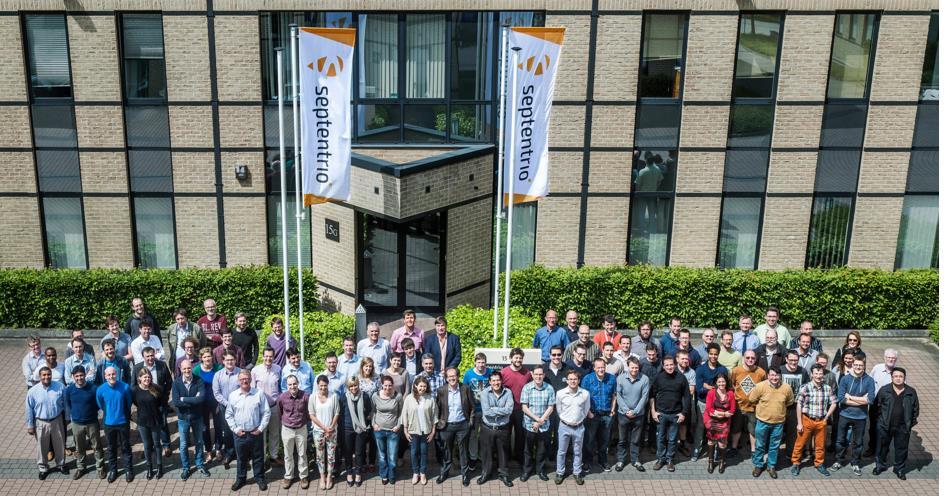
Septentrio Welcome! NEV University of Calgary, April 13th 2016
|
|
|
- Roger Lane
- 6 years ago
- Views:
Transcription
1 Septentrio Welcome! NEV University of Calgary, April 13th May 2016
2 Topics Background Over View of Core Modules Overview of Survey and Machine Control Products Reference Station Products Polarx5 Polarx5S


3 Nice to meet you 3


4 So what is our company name? SEP-10-TRIO sepˈtentriːəʊ with stress on the 2nd syllable 4


5 Why Septentrio? Navigation. Polaris PolaRx ἀστήρ (Aster) AsteRx? 5


6 Mijn thuis is waar mijn Stella staat 6


7 Company history 2000 Septentrio is founded as a spin-off from IMEC, world s premier semiconductor research center and still a strong partner & shareholder ESA selects Septentrio as development partner for Galileo programs. Many firsts on Septentrio receivers, both IOV and FOC, including PRS Altus is founded in Torrance, CA focusing on high end survey applications 2008 Veripos selects Septentrio receivers for its worldwide augmentation services Antoon De Proft hired as new CEO, full acquisition of Altus Selected by Unavco for its reference stations and scientific applications. Septentrio in Confidence 7
8 Altus Merges into Septentrio Jan 2015 Altus Positioning Systems was formed in 2007 Survey receivers based on Septentrio RTK Boards Manufactured in Torrance, previous location Sold around 5000 receivers largest destination China Second Largest Customer Base is Western Canada Altus brand name remains for Survey / GIS products 8

9 Septentrio leadership Global Resources 60+ Engineers ~100 Direct Staff Europe, NA, Asia Septentrio NV Leuven, Belgium - Corporate HQ - R&D, Operations, Sales, Support Septentrio Americas Torrance, California - Americas Sales - Applications Engineering - Technical Support Antoon De Proft - President & CEO Dr. Bruno Bougard R&D Director Jan Van Hees - Business Development Jan Leyssens Product Manager, Commercial Products Ingrid Velghe Operations Manager Dirk Werquin Manager, Avionics & Defense Neil Vancans Vice President, Americas Mo Kapila Director of OEM Sales Dr. Francesca Clemente Manager, Technical Support Eric Albrecht Sales Manager David Feng Applications Engineer Satish Mittal Support Engineer Antoon De Proft Sepentrio NV President & CEO IMEC Chairman, 2005 ADP Vision Managing Dir., 2000 ICOS Vison Systems CEO, Neil Vancans Septentrio Inc., Vice President Leica GPS President, Thales Navigation GM, University College London, Masters Land Surveying Septentrio in Confidence 9


10 Our Products PolaRx Reference receivers for science and networks Altus Smart antennas for GIS and survey AsteRx Rover Receivers and OEM boards for automation and machine control 10
11 Septentrio Technology Leadership Lowest Power Consumption in its class: Single Frequency GNSS mw Dual Frequency GNSS mw Shutdown - 10 µw AIM+ Advanced Interference Monitoring Built-in spectrum analyzer identifies interference Adaptive notch-filter suppresses CW interferers Pulse-blanking suppresses pulsed interferers GLO L2 remapping prevents loss of GPS L2 in cases with severe GLO L2 interference APME+ A Posteriori Multipath Estimation / Mitigation Mitigates both code and carrier short-delay multipath Short-delay is most prevalent and damaging form of multipath Identifies amount of multipath present and can simultaneously provide unaltered data as well as with multipath eliminated Septentrio in Confidence 11
 Best-in-class Measurement Quality High signal-to-noise ratio (SNR), Low Cycle Slips, High Availability See UNAVCO GNSS Receiver Evaluations 2012 (http://facility.unavco.")
12 Septentrio Technology Leadership (cont.) Best-in-class Measurement Quality High signal-to-noise ratio (SNR), Low Cycle Slips, High Availability See UNAVCO GNSS Receiver Evaluations 2012 ( Provides L1P and real raw data (no MP/ smoothing) Lock+: Superior Tracking Robustness Strong vibrations can severly impact tracking continuity, which is lethal for precision RTK (ex: grade control) Special algorithms implemented to maintain lock even during heavy vibrations Septentrio in Confidence 12

 No interference problems with")

13 Unique Value: Robust for Iridium Interference Satellite based correction delivery sensitive to Iridium interference (independent report from Chevron) No interference problems with Septentrio receivers due to special RF design of both GNSS and L-band receiver Septentrio in Confidence 13


14 Septentrio markets: Machine control Marine Construction Mining Logistics Agriculture Autonomous driving 14


15 Septentrio Markets: Survey/Mapping/GIS Survey GIS Mobile Mapping Unmanned Systems 15


16 Septentrio markets: Aerospace and Defense Aerospace Defense 16


17 Septentrio Markets: Reference Stations and Scientific Applications Reference Receivers Space Weather Timing Receivers 17

18 Septentrio is the World Leader in Galileo Receivers Prime Contractor to ESA since 2004 Most important Belgian company on Galileo World s first Galileo receivers Septentrio-made Septentrio leadership recognized worldwide Two critical milestones for Galileo realized with Septentrio receivers Septentrio in Confidence 18
19 Core Modules

20 AsteRx4 OEM Board All frequencies/signals as in 2020 GPS/GLO/GAL/BDS/QZSS Built-in Dual channel L-band receiver Ready for GALILEO E6 CS Unique interference robustness Incl resilience to chirp jammers. 1.4W in GPS/GLO L1/L2 mode, Most advanced multi-constellation RTK, PPP and Heading GPS+GLO+BDS+GAL RTK Ready for triple carrier RTK GAL E1/E2/E6 BDS B1/B2/B3 GPS L1/L2/L5 50Hz RTK + Heading Septentrio in Confidence 20


21 GPS L1 GPS/GL GPS L1/L2 GPS/GL Power consumption (mw) AsteRx-m: Ultra-low Power Ultra-compact OEM board for battery-operated applications, such as buoys and AUV Ultra-low power consumption GPS/GLONASS L1: 300 mw GPS L1/L2: 450 mw GPS/GLONASS L1/L2: 600 mw Shutdown: 10 µw AsteRx-m Comp1 Comp2 Comp3 Septentrio in Confidence Comp4 Comp5 21


22 Integrate Simplicity AsteRx-m UAS 6-30V Power input Onboard data logging 3 serial ports of which one is compatible with pixhawk & Ardupilot Event marker for camerashutter synchronisation Septentrio in Confidence 22

23 CONFIDENTIAL
24 AsterRx 4 Tracks and Uses All Signals in the Sky as in 2020 GPS L1CA, L1C, L2P, L2C, L5 24 Septentrio in Confidence


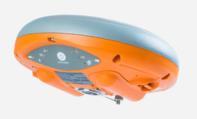
25 Survey/GIS Product Overview APS-3 Dual- Frequency RTK/Terrastar Receiver APS-GeoPod Adds RTK to Mobile Computing Platforms Septentrio in Confidence APS-NR2 Multi-Frequency Network Rover with 3.5G, WiFi, BT and Web Server 25
26 Lock+ : Superior Tracking Robustness Strong vibrations can severly impact tracking continuity, which is lethal for precision RTK, PPP and heading eg : grade control Special algorithms implemented to maintain lock even during heavy vibrations Tracking Lost Lock+ 26
27 PolaRx5 Tracks all visible GNSS signals, incl. E6 Best-in-class Measurement Quality AIM+ Interference Monitoring APME+ Multipath estimation & mitigation Provides unaltered data Low and scalable power consumption 27
28 Septentrio Ref Sta Rx s feature in 28


29 IGS Network Septentrio in Confidence 29

30 EUREF Network Receivers in the EUREF network 30


31 Volcano monitoring Iceland NICE (Part of CGPS network) The Icelandic continuous GPS network monitors Seismic activity and crustal deformation. More info: 31
32 PolaRx5 Started supplying in January Chosen by UNAVCO as their preferred reference Station receiver Also chosen recently by USGS Earhquake Early warning System in CA Numerous Overseas 32
33 We exploit all frequencies and all constellations to maximize accuracy and dependability GPS L1CA, L1P, L2P, L2C, L5 GLONASS L1CA, L2CA, L3 BEIDOU B1, B2, B3 GALILEO E1, E5ab, E5 Altboc, E6 QZSS L1, L2, L3 IRNSS L5 33
 X = Topcon, Y = Trimble Provides GPS L1P and real raw data (no")
34 Best in class measurements High SNR, lowest amount cycle slips, highest availability UNAVCO Evaluation Report: X = Topcon, Y = Trimble Provides GPS L1P and real raw data (no MP/smoothing) 34
")
35 AIM+ Interference Mitigation Interferences Out-of-band In-band Separated filtering for all bands Dedicated digital interference mitigation (3 automatic notch filters, chirp jammer cancellation) 35

36 APME+: Superior Short Delay and Phase Multipath Mitigation Multipath is caused by reflection of satellite signals on nearby Surfaces Short delay multipath is most frequent and most damaging component APME+ Better against short delay multipath Estimates multipath without changing tracking loops Estimates multipath per satellite Indicates amount of multipath error Can be completely disabled! Baseline-Up [m], Phase APME off (above) and on (below) time [s] x 10 5 x
 Configuration Standby mode Power Consumption 250 mw GPS + GLONASS L1 1,70W GPS + GLONASS L1/L2 1,80W GPS L1/L2/L5, GLO L1/L2, GAL E1/E5ab, SBAS L1/L5, BDS B1/B2 1,95W All")
37 Scalable Power Consumption (1,7W 4W typ.) Configuration Standby mode Power Consumption 250 mw GPS + GLONASS L1 1,70W GPS + GLONASS L1/L2 1,80W GPS L1/L2/L5, GLO L1/L2, GAL E1/E5ab, SBAS L1/L5, BDS B1/B2 1,95W All constellations and all signals 2,65W Enabling ethernet Enabling WiFi Enabling REFOUT Enabling internal logging +650mW +450mW +30mW +50mW (1Hz) + 150mW (10Hz) 37
38 PolaRx5 Interfaces 4x Serial RS232 Ethernet, 10/100 Mbps Power-over-ethernet USB client and host for external disk Integrated Wifi xpps-output (Max 100Hz) 10MHz reference input Event marker (2) 16 GB Internal logging 38


39 PolaRx5 Intuitive Webinterface Accessible via USB, Ethernet & WIFI!


40 PolaRx5 Easily Transfer configurations from one receiver to another Human readible (and editable) text file 40


41 PolaRx5 A lot of debug information! Visualise before and after interference mitigation 41
42 GNSS technology designed for easy integration Open architecture Well defined documented user interface Extensive and well documented command interface designed for M2M communication Extensive and open data structure Standard open interfaces (RTCM, NMEA) Septentrio Binary Format (Septentrio designed for completeness and compactness, fully documented and open) Common and stable hardware and software interface between different receiver models Multiple modes of single hardware, SW configurable 42
43 PolaRx Tracks and Uses All Signals in the Sky as in 2020 GLONASS L1CA, L2CA, L3 ready 43 Septentrio in Confidence
44 PolaRx Tracks and Uses All Signals in the Sky as in 2020 GALILEO E1, E5a/b/AltBOC, E6 44 Septentrio in Confidence
45 PolaRx Tracks and Uses All Signals in the Sky as in 2020 BDS B1, B2, B3 45 Septentrio in Confidence
 Form factor same as current PolaRx4 PRO: 234 x 140 x 37 mm (length includes connectors) Septentrio in")
46 The Next-Generation PolaRx Built around AsteRx4 OEM GNSS receiver board Key Features Available interfaces 4 serial ports USB Ethernet Internal memory USB host Power over ethernet Power monitor (voltage monitor) Form factor same as current PolaRx4 PRO: 234 x 140 x 37 mm (length includes connectors) Septentrio in Confidence 46
 2.8W +0.")
47 The Next Generation PolaRx - Scalable Power Consumption Condition Power * GPS/GLO L1/L2, 2.0W no Ethernet, no WiFi All GNSS bands, no ethernet, no WiFi Enabling Ethernet (optional) 2.8W +0.6W * Preliminary results ongoing testing Septentrio in Confidence 47


48 Industry Leading Interference Mitigation Capability - 3 Adaptive Notch Filters (We learn from the field) Tuymen, Russia - Unknown source Hilversum, Netherlands - Amateur Digital packet radio Ostend, Belgium - Amateur TV 48 Septentrio in Confidence
49 Septentrio Open / Transparent Interface Well defined documented user interface Extensive and well documented command interface Extensive and open data structure Standard open interfaces (RTCM including full MSM support, NMEA) RINEX 2.x/3.x support Septentrio Binary Format (fully documented and open) Common and stable hardware and software interface between different receiver models Software tool suite RxTools (Linux and Windows) Fully configurable Free firmware upgrades for life Septentrio in Confidence 49


50 Web Interface, RxControl or Command Line Septentrio in Confidence 50


51 Septentrio in Confidence Web Interface, RxControl or Command Line 51
52 PolaRx5S All-in-view ionosphere monitoring, incl. E6 & B3 Best-in-class Measurement Quality AIM+ Interference Monitoring APME+ Multipath estimation & mitigation Provides unaltered data Real-time TEC & Scintillation Indices output Low and scalable power consumption 52


53 What is scintillation? Short-term variations of the GNSS signal amplitude and phase Caused by scattering and diffraction in small-scale irregular structures ( bubbles ) in the ionosphere 60 PRN15, L1 C/A, Presidente Prudente, Brazil, Sept 25, 2011 Amplitude scintillation [db] Time [hours] Phase scintillation [cycles] Time [hours] 53

54 PolaRx5S: Multi-Constellation for Maximum Observability of the Ionosphere All GPS, GLONASS, GALILEO, BEIDOU, IRNSS, QZSS and SBAS satellites used to maximize the number of piercing points May 2,


55 We exploit all frequencies and all constellations to maximize accuracy and dependability GPS L1CA, L1P, L2P, L2C, L5 GLONASS L1CA, L2CA, L3 BEIDOU B1, B2, B3 GALILEO E1, E5ab, E5 Altboc, E6 QZSS L1, L2, L5 IRNSS L5 55
 Available for these signals: GPS: L1CA, L2C, L5 GLO: L1CA, L2CA GAL: E1, E5a, E5b BDS: B1, B2, B3 (new on PolaRx5S) QZSS:L1CA, L2C, L5 SBAS:L1CA, L5 Have a look at our Insight about")
56 Scintillation Parameters S4 -> Amplitude variation (Standard deviation of the raw signal power normalized to the average signal power Phi60 -> Phase variation (Standard deviation of (detrended) carrier phase) Available for these signals: GPS: L1CA, L2C, L5 GLO: L1CA, L2CA GAL: E1, E5a, E5b BDS: B1, B2, B3 (new on PolaRx5S) QZSS:L1CA, L2C, L5 SBAS:L1CA, L5 Have a look at our Insight about scintillation: 56

57 Support of ISMR output files ISMR = Ionospheric Scintillation Monitoring Records Format used by old Novatel GSV400B Scintillation receiver which became the standard file format used for scintillation monitoring Generated by RxTools (sbf2ismr.exe): 57


58 TEC Total Electron Content Output in Real-time (SBF), plot available in RxControl. TEC is the total number of electrons integrated between two points, along a tube of one meter squared cross section ( (STEC = Slanted TEC) 58

59 TEC Total Electron Content 2pm 10pm 6pm 59
60 Questions?
61 Mo Kapila Director of OEM Sales (M) Europe Greenhill Campus Interleuvenlaan 15G, 3001 Leuven Belgium Americas Hawthorne Blvd. Suite 200, Torrance, CA USA Asia-Pacific Level 901 The Lee Gardens 33, Hysan Avenue, Causeway Bay Hong Kong

62 Backup Slides
63 Next-Generation PolaRx with 3 Self-adaptive Notch Filters Septentrio in Confidence 63


 Septentrio in")
64 Best in High Quality Measurements Consistently lowest phase noise (red = SSN) Consistently lowest multipath Even with APME disabled Consistently lowest cycle slips Crucial for phase processing (PPP and RTK) Septentrio in Confidence 64
 satellites 60 PRN15, L1 C/A, PolaRxS @ Presidente Prudente, Brazil, Sept 25, 2011")
65 IONO+ against ionospheric disturbances Ionospheric disturbances impact both tracking (signal measurement availability) and positioning accuracy Scintillation : quick variation of signal amplitude and phase Causes loss of lock and cycle slips Can last for minutes or hours Affects all signals from (subset of) satellites 60 PRN15, L1 C/A, Presidente Prudente, Brazil, Sept 25, 2011 Amplitude scintillation [db] Time [hours] Phase scintillation [cycles] Time [hours] Special tracking algorithms provide tracking under difficult environments Result from and proven in ionosphere monitors in Brazil 65 Septentrio in Confidence
66 IONO+ Effectiveness proven in the field Receivers co-located at Presidente Prudente, SP, Brazil PRU1 : State-of-the-art PRU2 : Septentrio PRU1 PRU2 Phi60 L1 availability [%] SVID (<=32: GPS; >32: GLONASS) Even during the post-sunset period 66 Septentrio in Confidence

67 Quality Indicators Graphic indicators and special messages for Problem detection by operator First line trouble shooting 67 SEPTENTRIO IN CONFIDENCE
Professional GNSS solutions in challenging environments
 Professional GNSS solutions in challenging environments Company history 2000 Septentrio is founded as a spin-off from IMEC, world s premier semiconductor research center and still a strong partner & shareholder.
Europe s Premier Professional GNSS Receiver Manufacturer
 Europe s Premier Professional GNSS Receiver Manufacturer MundoGEO#Connect LatinAmerica 2013 June 18 to 20 São Paulo (SP) Brazil ir. Peter A. GROGNARD Founder& CEO, Septentrio Septentrio Company Introduction
Assessment of GNSS Ionospheric Scintillation and TEC Monitoring Using the Multi-constellation GPStation-6 Receiver
 Assessment of GNSS Ionospheric Scintillation and TEC Monitoring Using the Multi-constellation GPStation-6 Receiver Rod MacLeod Regional Manager Asia/Pacific NovAtel Australia Pty Ltd Outline Ionospheric
Leica Spider Infrastructure HW Solutions Introducing: Leica GR30 & GR50
 Leica Spider Infrastructure HW Solutions Introducing: Leica GR30 & GR50 Reliable solutions for today and tomorrow Leica Spider Integrated Solutions Introducing: Leica GR30 & GR50 Outline Introducing Leica
Alberding solutions for GNSS infrastructure operators
 Tamás Horváth Alberding solutions for GNSS infrastructure operators 21.11.2017 1/35 Alberding solutions for GNSS infrastructure operators Tamás Horváth Alberding GmbH 4 th EUPOS Technical Meeting 21-22
Analysis of GNSS Receiver Biases and Noise using Zero Baseline Techniques
 1 Analysis of GNSS Receiver Biases and Noise using Zero Baseline Techniques Ken MacLeod, Simon Banville, Reza Ghoddousi-Fard and Paul Collins Canadian Geodetic Survey, Natural Resources Canada Plenary
Leica GRX1200 Series High Performance GNSS Reference Receivers
 Leica GRX1200 Series High Performance GNSS Reference Receivers Leica GRX1200 Series For permanent reference stations The Leica GRX1200 Series, part of Leica s new System 1200, is designed specifically
Motion & Navigation Solution
 Navsight Land & Air Solution Motion & Navigation Solution FOR SURVEYING APPLICATIONS Motion, Navigation, and Geo-referencing NAVSIGHT LAND/AIR SOLUTION is a full high performance inertial navigation solution
Leica GRX1200+ Series High Performance GNSS Reference Receivers
 Leica GRX1200+ Series High Performance GNSS Reference Receivers Leica GRX1200+ Series For permanent reference stations The Leica GRX1200+ Series, part of Leica's future proof System 1200, is designed specifically
NCS TITAN. The most powerful GNSS Simulator available. NCS TITAN Datasheet. Scalability. Extendability. In co-operation with
 NCS TITAN The most powerful GNSS Simulator available Scalability Fidelity Reliability Usability Extendability Flexibility Upgradability Features Signal Capabilities Support of all global (GNSS) and regional
One Source for Positioning Success
 novatel.com One Source for Positioning Success RTK, PPP, SBAS OR DGNSS. NOVATEL CORRECT OPTIMIZES ALL CORRECTION SOURCES, PUTTING MORE POWER, FLEXIBILITY AND CONTROL IN YOUR HANDS. NovAtel CORRECT is the
Indian Institute of Technology Kanpur Department of Civil Engineering
 Indian Institute of Technology Kanpur Department of Civil Engineering Inquiry No- CE/JNM/2013-14/R-10 30 December, 2013 Subject: Quotation for supply of Integrated System/Smart System Reflectorless Robotic
GPS Application. Global Positioning System. We provide GPS module ODM / OEM service, any GPS receiver you want, we can provide customized services.
 GPS Application Global Positioning System We provide GPS module ODM / OEM service, any GPS receiver you want, we can provide customized services. www.win-tec.com.tw sales@win-tec.com.tw GNSS Receiver WGM-303
al T TD ) ime D Faamily Products The RTD Family of products offers a full suite of highprecision GPS sensor positioning and navigation solutions for:
 ime D Faamily Products The RTD Family of products offers a full suite of highprecision GPS sensor positioning and navigation solutions for:") Reeal ynnamics al T amics (R TD ) ime D RTD) Time Dy Faamily mily ooff P roducts Products The RTD Family of products offers a full suite of highprecision GPS sensor positioning and navigation solutions
Reeal ynnamics al T amics (R TD ) ime D RTD) Time Dy Faamily mily ooff P roducts Products The RTD Family of products offers a full suite of highprecision GPS sensor positioning and navigation solutions
Relative positioning with Galileo E5 AltBOC code measurements
 Relative positioning with Galileo E5 AltBOC code measurements Dissertation submitted to the University of Liège in requirements for a Master s degree in Geomatics and Geometrology Cécile Deprez PhD Candidate
MGA Webinar Series : 1 Very Cheap RTK Receivers: Changing the Landscape of Positioning Services
 MGA Webinar Series : 1 Very Cheap RTK Receivers: Changing the Landscape of Positioning Services Dinesh Manandhar Center for Spatial Information Science The University of Tokyo Contact Information: dinesh@iis.u-tokyo.ac.jp
Trimble NetR9 Reference Receiver Series: Frequently Asked Questions
 July 2010 Trimble NetR9 Reference Receiver Series: Frequently Asked Questions What is the Trimble NetR9 GNSS reference receiver? The Trimble NetR9 GNSS (Global Navigation Satellite System) reference receiver
SLX-1 Multi-Application GNSS Receiver
 SLX-1 Multi-Application GNSS Receiver w w w.sa tla b g p s. c o m SLX-1 Multi-Application GNSS Receiver Designed for CORS Ready for Anything European Standards GPS GLONASS BEIDOU GALILEO SBAS QZSS Long
Webinar. 9 things you should know about centimeter-level GNSS accuracy
 Webinar 9 things you should know about centimeter-level GNSS accuracy Webinar agenda 9 things you should know about centimeter-level GNSS accuracy 1. High precision GNSS challenges 2. u-blox F9 technology
Facility. Development and Testing. What s Next? GNSS Modernization and Next Generation Hardware for the UNAVCO Community
 Facility Development and Testing What s Next? GNSS Modernization and Next Generation Hardware for the UNAVCO Community Frederick Blume UNAVCO Science Workshop, 9 March, 2010 Motivation Last formal hardware
SL800 GNSS RTK System User Manual
 SL800 GNSS RTK System User Manual User Manual Revision SatLab SL800 GNSS Receiver Revision Date Revision Number Description 1 st Nov 2017 1 SL800 User Manual (Release V1.0) 1 Table of Contents Introduction...
The added value of new GNSS to monitor the ionosphere
 The added value of new GNSS to monitor the ionosphere R. Warnant 1, C. Deprez 1, L. Van de Vyvere 2 1 University of Liege, Liege, Belgium. 2 M3 System, Wavre, Belgium. Monitoring TEC for geodetic applications
Receiver Technology CRESCENT OEM WHITE PAPER AMY DEWIS JENNIFER COLPITTS
 CRESCENT OEM WHITE PAPER AMY DEWIS JENNIFER COLPITTS With offices in Kansas City, Hiawatha, Calgary and Scottsdale, Hemisphere GPS is a global leader in designing and manufacturing innovative, costeffective,
Performance Evaluation of Differential Global Navigation Satellite System with RTK Corrections
 IOSR Journal of Electronics and Communication Engineering (IOSR-JECE) e-issn: 2278-2834,p- ISSN: 2278-8735.Volume 9, Issue 2, Ver. VI (Mar - Apr. 2014), PP 43-47 Performance Evaluation of Differential
BeiDou Next Generation Signal Design and Expected Performance
 International Technical Symposium on Navigation and Timing ENAC, 17 Nov 2015 BeiDou Next Generation Signal Design and Expected Performance Challenges and Proposed Solutions Zheng Yao Tsinghua University
GNSS Low-Cost High-Accuracy Receiver (L-CHAR)
") GNSS Low-Cost High-Accuracy Receiver (L-CHAR) Dinesh Manandhar Center for Spatial Information Science The University of Tokyo Contact Information: dinesh@iis.u-tokyo.ac.jp Slide : 1 High Accuracy Receivers
GNSS Low-Cost High-Accuracy Receiver (L-CHAR) Dinesh Manandhar Center for Spatial Information Science The University of Tokyo Contact Information: dinesh@iis.u-tokyo.ac.jp Slide : 1 High Accuracy Receivers
Development of an Open Source Multi GNSS Data Processing Software
 2nd Asia Oceania Regional Workshop on GNSS 2010 Development of an Open Source Multi GNSS Data Processing Software Tomoji TAKASU Tokyo University of Marine Science and Technology Contents Introduction Issues
Future GNSS Precision Applications. Stuart Riley
 Future GNSS Precision Applications Stuart Riley Major Trimble Precision Markets Survey Mostly person portable equipment Construction Machine control and person carried equipment Includes Marine applications
Galileo Time Receivers
 Galileo Time Receivers by Stefan Geissler, PPM GmbH, Penzberg Germany Workshop "T&F Services with Galileo" 5/6 December 2005 Galileo Time Receivers by Stefan Geissler, PPM GmbH, Penzberg Germany Workshop
POLARX2, A NEW GPS RECEIVER FOR GEODETIC APPLICATIONS. Table of Contents
 POLARX2, A NEW GPS RECEIVER FOR GEODETIC APPLICATIONS Andrew Simsky(Septentrio, Belgium a.simsky@septentrio.com), Jean-Marie Sleewaegen (Septentrio, Belgium jm.sleewaegen@septentrio.com), and Carine Bruyninx
Technical Specifications Document. for. Satellite-Based Augmentation System (SBAS) Testbed
 Testbed") Technical Specifications Document for Satellite-Based Augmentation System (SBAS) Testbed Revision 3 13 June 2017 Table of Contents Acronym Definitions... 3 1. Introduction... 4 2. SBAS Testbed Realisation...
Technical Specifications Document for Satellite-Based Augmentation System (SBAS) Testbed Revision 3 13 June 2017 Table of Contents Acronym Definitions... 3 1. Introduction... 4 2. SBAS Testbed Realisation...
Field experience with future GNSS ranging signals (a review). A.Simsky, J.-M. Sleewaegen, W. De Wilde Septentrio, Belgium
. A.Simsky, J.-M. Sleewaegen, W. De Wilde Septentrio, Belgium") Field experience with future GNSS ranging signals (a review). A.Simsky, J.-M. Sleewaegen, W. De Wilde Septentrio, Belgium Technical University of Munich June 07 2010 Contents Septentrio: company profile
Field experience with future GNSS ranging signals (a review). A.Simsky, J.-M. Sleewaegen, W. De Wilde Septentrio, Belgium Technical University of Munich June 07 2010 Contents Septentrio: company profile
High Precision Applications with BeiDou
 High Precision Applications with BeiDou Lei HUANG Unicore Communications, Inc May 14, 2013 Contents 1 2 3 4 Background Overview of BeiDou high precision products Applications of BeiDou high precision products
POWERGPS : A New Family of High Precision GPS Products
 POWERGPS : A New Family of High Precision GPS Products Hiroshi Okamoto and Kazunori Miyahara, Sokkia Corp. Ron Hatch and Tenny Sharpe, NAVCOM Technology Inc. BIOGRAPHY Mr. Okamoto is the Manager of Research
Inertial Navigation System
 Apogee Series ULTIMATE ACCURACY MEMS Inertial Navigation System INS MRU AHRS ITAR Free 0.005 RMS Motion Sensing & Georeferencing APOGEE SERIES makes high accuracy affordable for all surveying companies.
CHC MINING DEFORMATION MONITORING SOLUTION
 CHC MINING DEFORMATION MONITORING SOLUTION Safety is first in mining. CHC offers solutions designed to improve safety for personnel on the ground and in the cab with 24/7 precision positioning for automatic
A FAMILY OF SOLUTIONS BASED ON THE srx-10, A SW DEFINED MULTICONSTELLATION GNSS RECEIVER
 ION GNSS+ 2014, Session A5 A FAMILY OF SOLUTIONS BASED ON THE srx-10, A SW DEFINED MULTICONSTELLATION GNSS RECEIVER Teresa Ferreira, Manuel Toledo, José María López, GMV Property of GMV All rights reserved
Specifications. Trimble BX982 Modular GNSS Heading Receiver
 Name Configuration Option Base and Rover interchangeability Rover position update rate Rover maximum range from base radio Rover operation within a VRS network Heading and Moving Base operation Factory
Intro to GNSS & Teseo-LIV3F Module for IoT Positioning
 Intro to GNSS & Teseo-LIV3F Module for IoT Positioning Agenda 2 Presentation Speaker GPS Signal Overview GNSS Constellations Mike Slade Teseo3 Chipset Overview Multi-Constellation Benefit Teseo-LIV3F Module
UNAVCO GNSS RFP Evaluation Report
 1 UNAVCO GNSS RFP Evaluation Report Public Version: September 22, 2105 Originally submitted in confidence: May 18, 2015 Prepared by the RFP Evaluation Committee: Dr. Frederick Blume Project Manager, Development
Next Generation Positioning Infrastructure
 Next Generation Positioning Infrastructure The GNSS Network in the 21 st Century Joel VAN CRANENBROECK & Partners Beyond East & West GeoSensing Community 1 INFRASTRUCTURE "The installations that form the
Civil Applications of Galileo. Brussels, June 12, 2006 Ir. Peter A. Grognard Founder and CEO, Septentrio nv
 Civil Applications of Galileo Brussels, June 12, 2006 Ir. Peter A. Grognard Founder and CEO, Septentrio nv Company overview Founded January 21, 2000 in Leuven, Belgium Spin-off of Interuniversity MicroElectronics
NovAtel SPAN and Waypoint. GNSS + INS Technology
 NovAtel SPAN and Waypoint GNSS + INS Technology SPAN Technology SPAN provides continual 3D positioning, velocity and attitude determination anywhere satellite reception may be compromised. SPAN uses NovAtel
Weathering the Storm GNSS and the Solar Maximum Next Generation GNSS Ionospheric Scintillation and TEC Monitoring
 Weathering the Storm GNSS and the Solar Maximum Next Generation GNSS Ionospheric Scintillation and TEC Monitoring NovAtel White Paper March 2012 Overview This paper addresses the concerns caused by the
Global Navigation Satellite System for IE 5000
 Global Navigation Satellite System for IE 5000 Configuring GNSS 2 Information About GNSS 2 Guidelines and Limitations 4 Default Settings 4 Configuring GNSS 5 Configuring GNSS as Time Source for PTP 6 Verifying
GPS-Aided INS Datasheet Rev. 3.0
 1 GPS-Aided INS The Inertial Labs Single and Dual Antenna GPS-Aided Inertial Navigation System INS is new generation of fully-integrated, combined GPS, GLONASS, GALILEO, QZSS, BEIDOU and L-Band navigation
TRIUMPH-LS. The Ultimate RTK Land Survey Machine
 The Ultimate RTK Land Survey Machine Introducing GUIDE data collection in the. Visual Stake-out, navigation, six parallel RTK engines, over 3,000 coordinate conversions, advanced CoGo features, rich attribute
Preparing for the Future The IGS in a Multi-GNSS World
 Preparing for the Future The IGS in a Multi-GNSS World O. Montenbruck DLR/GSOC 1 The International GNSS Service is a federation of more than 200 institutions and organizations worldwide a Service of the
PPS usable by timing applications via serial port emulation
 Timing & Navigation Module z051 USB GNSS Dongle with PPS* PPS usable by timing applications via serial port emulation * The Pulse Per Second (PPS) is an electrical signal that very precisely indicates
Article Number: 457 Rating: Unrated Last Updated: Wed, Sep 2, 2009 at 3:46 PM
 T opcon GB-1000 - Receiver Board Firmware Version 3.4 Article Number: 457 Rating: Unrated Last Updated: Wed, Sep 2, 2009 at 3:46 PM Topcon has recently released GNSS receiver board firmware version 3.4
Precise positioning in multi-gnss mode
 Precise positioning in multi-gnss mode Novembre 2017 ± Compatibilities between GNSS Lower L-Band Upper L-Band E5a+b E1 E5a E5b E6 L1 L5 B2 B2 L2 B3 B1 B1 Frequency (Mhz) GPS Galileo BeiDou BeiDou BeiDou
TRIUMPH TECHNOLOGY. Javad Ashjaee
 TRIUMPH TECHNOLOGY Javad Ashjaee JAVAD GNSS www.javad.com International SatelliteNavigation Forum Moscow, April 7, 2008 TRIUMPH WE ARE BACK TO LEAD With TRIUMPH! 2 TRIUMPH Technology At the heart of our
Ct-G551. Connectec. SiRF V GPS Module. Specifications Sheet V0.1. Features: Ct-G551 V0.1 Specification Sheet
 SiRF V GPS Module Ct-G551 Specifications Sheet V0.1 Features: SiRF StarV ultra low power chipset GPS, GLONASS, Galileo and SBAS reception for high GNSS availability and accuracy Compact module size for
Future of GNSS Receivers. Éamonn Glennon
 Future of GNSS Receivers Éamonn Glennon Future of GNSS Receivers? What have we got now? What do customers want? What does government want? What are the problems with current receivers? What type of receivers?
RELEASE NOTES. Introduction. Trimble Infrastructure GNSS Series Receivers
 RELEASE NOTES Trimble Infrastructure GNSS Series Receivers These release notes describe the latest improvements made to the Trimble NetR9 GNSS Infrastructure series receivers. Introduction New Features
Enclosures PwrPak7D COMPACT DUAL ANTENNA ENCLOSURE DELIVERS SCALABLE POSITIONING PERFORMANCE WITH INTERNAL STORAGE FEATURES
 Enclosures PwrPak7D COMPACT DUAL ANTENNA ENCLOSURE DELIVERS SCALABLE POSITIONING PERFORMANCE WITH INTERNAL STORAGE FUTURE PROOFED SCALABILITY Capable of tracking all present and upcoming Global Navigation
GNSS analysis software GSILIB for utilizing Multi- GNSS data
 Technical Seminar Reference Frame in Practice, GNSS analysis software GSILIB for utilizing Multi- GNSS data *Satoshi Kawamoto, Naofumi Takamatsu Geospatial Information Authority of Japan Sponsors: Geospatial
Bring satellites into your lab: GNSS simulators from the T&M expert.
 Bring satellites into your lab: GNSS simulators from the T&M expert. www.rohde-schwarz.com/gnss-solutions Your challenge GNSS receiver tests can only be conclusive when they are performed under realistic
Bring satellites into your lab
 Bring satellites into your lab GNSS simulators from the T&M expert 5215.5042.32 02.01 PDP 1 en www.rohde-schwarz.com/gnss-solutions GNSS-Simulators--------Bring-satellites_fly_5215-5042-32_v0201.indd 7
User Trajectory (Reference ) Vitual Measurement Synthesiser. Sig Gen Controller SW. Ethernet. Steering Commands. IO-Controller
 Vitual Measurement Synthesiser. Sig Gen Controller SW. Ethernet. Steering Commands. IO-Controller") Performance Evaluation of the Multi-Constellation and Multi-Frequency GNSS RF Navigation Constellation Simulator NavX -NCS Guenter Heinrichs, Markus Irsigler, and Robert Wolf, IFEN GmbH Guenther Prokoph,
Performance Evaluation of the Multi-Constellation and Multi-Frequency GNSS RF Navigation Constellation Simulator NavX -NCS Guenter Heinrichs, Markus Irsigler, and Robert Wolf, IFEN GmbH Guenther Prokoph,
Prospect for Global Positioning Augmentation Service by QZSS
 Prospect for Global Positioning Augmentation Service by QZSS Global Positioning Augmentation Service Corporation Director, Yoshikatsu Iotake Feb. 6, 2018 Copyright 2018 Global Positioning Augmentation
The Evolution of GPS Ionosphere Scintillation Monitoring Over the Last 25 Years
 The Evolution of GPS Ionosphere Scintillation Monitoring Over the Last 25 Years Dr. A.J. Van Dierendonck, AJ Systems 21-23 May 2014 CSNC 2014 - ION Panel 1 36-40 Years Ago 1978 to 1982! Even before GPS,
C94-M8P Application Board Setup Guide
 C94-M8P Application Board Setup Guide locate, communicate, accelerate UBX-16009722 R02 C94-M8P Board Connections and Interfaces J1 J10 J2 J3 J1: RS232 UART M8P/Radio J2: USB M8P J3: External battery /
When do you expect Athena to be available for VS330? This is currently being beta-tested and will be released in the very near future.
 Why Athena? Athena GNSS Engine What improvements does Athena offer over the RTK firmware I m running now? Compared to the Hemisphere firmware most users are currently using (Qf4), there are significant
Specifications. Trimble SPS985 GNSS Smart Antenna
 Receiver Name Configuration Option Base and Rover interchangeability Rover position update rate Rover maximum range from base radio Rover operation within a VRS network Heading and Moving Base operation
UB370. SupportBDS/GPS/GLONASSSatellites,andcan. morereliableandaccuratepositioningresult. LatestTri-System&Tri-frequencyRTK Engine
 Brief Introduction UB370 BDS/GPS/GLONASS Tri-System Hepta-Frequency High Precision OEM Board UB370isBDS/GPS/GLONASSTri-systemHepta-FrequencyOEMBoarddeveloped byunicorebasedonitsmaturebeidoucompatiblemulti-systemgnsssoc.ub370
GNSS Training for ITS Developers. 1 - GNSS Principles
 GNSS Training for ITS Developers 1 - GNSS Principles Table of Content Introduction to Satellite Navigation Systems Basics on GNSS Receivers Galileo, the European GNSS EGNOS, the European Augmentation System
SLX-1 NG Multi-Application GNSS Receiver
 SLX-1 NG Multi-Application GNSS Receiver w w w.sa tla b g p s. c o m SLX-1 NG Multi-Application GNSS Receiver Designed for CORS Ready for Anything European Standards GPS GLONASS BEIDOU GALILEO SBAS QZSS
Inertial Navigation System
 Apogee Marine Series ULTIMATE ACCURACY MEMS Inertial Navigation System INS MRU AHRS ITAR Free 0.005 RMS Navigation, Motion & Heave Sensing APOGEE SERIES makes high accuracy affordable for all surveying
RELEASE NOTES. Trimble. SPS Series Receivers. Introduction. New features and changes
 RELEASE NOTES Trimble SPS Series Receivers Introduction New features and changes Version 4.42 Revision A June 2011 F Corporate office Trimble Navigation Limited Engineering and Construction group 5475
NovAtel SPAN and Waypoint GNSS + INS Technology
 NovAtel SPAN and Waypoint GNSS + INS Technology SPAN Technology SPAN provides real-time positioning and attitude determination where traditional GNSS receivers have difficulties; in urban canyons or heavily
Inertial Sensors. Ellipse 2 Series MINIATURE HIGH PERFORMANCE. Navigation, Motion & Heave Sensing IMU AHRS MRU INS VG
 Ellipse 2 Series MINIATURE HIGH PERFORMANCE Inertial Sensors IMU AHRS MRU INS VG ITAR Free 0.1 RMS Navigation, Motion & Heave Sensing ELLIPSE SERIES sets up new standard for miniature and cost-effective
MHz. Figure 1: spectrum plot of the L1 band without interference with the GPS L1C/A central frequency indicated
 White paper Internet or Positioning? Abstract Centimetre-level RTK or PPP positioning requires high quality GNSS measurements. By virtue of their low power however, GNSS signals are prone to interference
GNSS MONITORING NETWORKS
 SPACE GNSS MONITORING NETWORKS Satellite communications, earth observation, navigation and positioning and control stations indracompany.com GNSS MONITORING NETWORKS GNSS MONITORING NETWORKS Indra s solutions
Configuring the Global Navigation Satellite System
 Configuring the Global Navigation Satellite System uses a satellite receiver, also called the global navigation satellite system (GNSS), as a new timing interface. In typical telecom networks, synchronization
NavX -NCS The first Galileo/GPS full RF Navigation Constellation Simulator
 NavX -NCS The first Galileo/GPS full RF Navigation Constellation Simulator Guenter Heinrichs, IFEN GmbH Markus Irsigler, IFEN GmbH Robert Wolf, IFEN GmbH Jón Winkel, IFEN GmbH Günther Prokoph, Work Microwave
Precise Positioning with NovAtel CORRECT Including Performance Analysis
 Precise Positioning with NovAtel CORRECT Including Performance Analysis NovAtel White Paper April 2015 Overview This article provides an overview of the challenges and techniques of precise GNSS positioning.
SPECTRACOM ecall Compliance Tool
 SPECTRACOM ecall GSG SIMULATOR configuration PROVIDED BY SPECTRACOM for ecall GNSS DEVICE TESTING European Standard regulation for ecall (ANNEX VI GNSS testing) Spectracom solution provides GSG simulators
Radio Navigation Laboratory (TOS-ETL) European Space Agency (ESA)
 European Space Agency (ESA)") Radio Navigation Laboratory (TOS-ETL) European Space Agency (ESA) Simon Johns (ESA) Michel Tossaint (ESA) Receiver Technical Workshop 3 rd July 2003 Paris 09/07/2003 1 Objectives of the Navigation Laboratory
Radio Navigation Laboratory (TOS-ETL) European Space Agency (ESA) Simon Johns (ESA) Michel Tossaint (ESA) Receiver Technical Workshop 3 rd July 2003 Paris 09/07/2003 1 Objectives of the Navigation Laboratory
GPS-Aided INS Datasheet Rev. 2.7
 1 The Inertial Labs Single and Dual Antenna GPS-Aided Inertial Navigation System INS is new generation of fully-integrated, combined GPS, GLONASS, GALILEO, QZSS and BEIDOU navigation and highperformance
A Tallysman Accutenna TW2710 / TW2712 Magnet Mount Multi-Constellation Antenna
 A Tallysman Accutenna TW2710 / TW2712 Magnet Mount Multi-Constellation Antenna The TW2710 / TW2712 employs Tallysman s unique Accutenna technology covering the BeiDou B1, Galileo E1, GPS L1, GLONASS L1
Guide to GNSS Base stations
 Guide to GNSS Base stations Outline Introduction Example of a base station (TUMSAT) Preparation for setting up a base station Procedure for setting up a base station Examples at two other universities
Report of the Working Group B: Enhancement of Global Navigation Satellite Systems (GNSS) Services Performance
 Services Performance") Report of the Working Group B: Enhancement of Global Navigation Satellite Systems (GNSS) Services Performance 1. The Working Group on Enhancement of Global Navigation Satellite Systems (GNSS) Service Performance
Report of the Working Group B: Enhancement of Global Navigation Satellite Systems (GNSS) Services Performance 1. The Working Group on Enhancement of Global Navigation Satellite Systems (GNSS) Service Performance
Quick Start. Tersus GNSS Center. Configuration Tools for Tersus GNSS RTK Systems.
 Quick Start Tersus GNSS Center Configuration Tools for Tersus GNSS RTK Systems www.tersus-gnss.com July, 2016 1. Quick Start Guide of Tersus GNSS Center This quick start guide provides the basic information
Fast convergence of Trimble CenterPoint RTX by regional augmentation
 Fast convergence of Trimble CenterPoint RTX by regional augmentation Dr. Ralf Drescher Trimble Terrasat GmbH, Munich EGU General Assembly 2015, Vienna Thursday, 16 April 2015 Outline Introduction CenterPoint
Role of Manufacturers to support Geodetic Infrastructure
 FIG / UN-GGIM-AP / JUPEM Geospatial and GNSS CORS Infrastructure Forum Kuala Lumpur, Malaysia 16-17 Oct 2016 Role of Manufacturers to support Geodetic Infrastructure Neil Ashcroft Leica Geosystems Information
Inertial Sensors. Ellipse Series MINIATURE HIGH PERFORMANCE. Navigation, Motion & Heave Sensing IMU AHRS MRU INS VG
 Ellipse Series MINIATURE HIGH PERFORMANCE Inertial Sensors IMU AHRS MRU INS VG ITAR Free 0.2 RMS Navigation, Motion & Heave Sensing ELLIPSE SERIES sets up new standard for miniature and cost-effective
It s a noisy, crowded world out there!
 GNSS Interference 1 ESA-Pierre Carril "The Full Operational Capability phase of the Galileo programme is managed and fully funded by the European Union. The Commission and ESA have signed a delegation
Understanding GPS/GNSS
 Understanding GPS/GNSS Principles and Applications Third Edition Contents Preface to the Third Edition Third Edition Acknowledgments xix xxi CHAPTER 1 Introduction 1 1.1 Introduction 1 1.2 GNSS Overview
Configuring the Global Navigation Satellite System
 Configuring the Global Navigation Satellite System Effective Cisco IOS-XE Release 3.17, the Cisco ASR 903 (with RSP3 module) and Cisco ASR 907 router uses a satellite receiver, also called the global navigation
Interference Mitigation and Preserving Multi-GNSS Performance
 International Global Navigation Satellite Systems Association IGNSS Conference 2016 Colombo Theatres, Kensington Campus, UNSW Australia 6 8 December 2016 Interference Mitigation and Preserving Multi-GNSS
The GNSS-CONTROL System has been designed in house by Position-Control and is the result of over 15 years experience using different Sensor Systems.
 GNSS Control BASE 1 Robust fanless GNSS System The GNSS-CONTROL System has been designed in house by Position-Control and is the result of over 15 years experience using different Sensor Systems. GNSS-CONTROL
Monitoring Station for GNSS and SBAS
 Monitoring Station for GNSS and SBAS Pavel Kovář, Czech Technical University in Prague Josef Špaček, Czech Technical University in Prague Libor Seidl, Czech Technical University in Prague Pavel Puričer,
MOBNET Presentation to Inachus Group (MOBile NETwork for people s location in natural and man-made disasters)
") MOBNET Presentation to Inachus Group (MOBile NETwork for people s location in natural and man-made disasters) Project Framework Kick-off January 2016 Duration 26 months Customer GSA EC/H2020 Galileo SME
MOBNET Presentation to Inachus Group (MOBile NETwork for people s location in natural and man-made disasters) Project Framework Kick-off January 2016 Duration 26 months Customer GSA EC/H2020 Galileo SME
Precise Point Positioning (PPP) using
 using") Precise Point Positioning (PPP) using Product Technical Notes // May 2009 OnPOZ is a product line of Effigis. EZSurv is a registered trademark of Effigis. All other trademarks are registered or recognized
Precise Point Positioning (PPP) using Product Technical Notes // May 2009 OnPOZ is a product line of Effigis. EZSurv is a registered trademark of Effigis. All other trademarks are registered or recognized
FieldGenius Technical Notes GPS Terminology
 FieldGenius Technical Notes GPS Terminology Almanac A set of Keplerian orbital parameters which allow the satellite positions to be predicted into the future. Ambiguity An integer value of the number of
ALIGN TM Feature for Heading Applications
 Introducing NovAtel s ALIGN TM Feature for Heading Applications Precise thinking 2008 NovAtel Inc. All rights reserved. Printed in Canada. D12599 www.novatel.com 1-800-NOVATEL (U.S. & Canada) or 403-295-4900
Integrity of Satellite Navigation in the Arctic
 Integrity of Satellite Navigation in the Arctic TODD WALTER & TYLER REID STANFORD UNIVERSITY APRIL 2018 Satellite Based Augmentation Systems (SBAS) in 2018 2 SBAS Networks in 2021? 3 What is Meant by Integrity?
GNSS POST-PROCESSING SOFTWARE
 GNSS POST-PROCESSING SOFTWARE Product Overview // July 2018 EZSURV POST-PROCESSING SOFTWARE EZSurv software is designed to edit, process and analyze raw GNSS (Global Navigation Satellite System) data to
PPP with Ambiguity Resolution (AR) using RTCM-SSR
 using RTCM-SSR") PPP with Ambiguity Resolution (AR) using RTCM-SSR Gerhard Wübbena, Martin Schmitz, Andreas Bagge Geo++ GmbH 30827 Garbsen Germany www.geopp.de PPP with Ambiguity Resolution (AR) using RTCM-SSR Abstract
PPP with Ambiguity Resolution (AR) using RTCM-SSR Gerhard Wübbena, Martin Schmitz, Andreas Bagge Geo++ GmbH 30827 Garbsen Germany www.geopp.de PPP with Ambiguity Resolution (AR) using RTCM-SSR Abstract