Current GPS Monitoring Activities in Thailand and Total Electron Content (TEC) Study at Chumphon and Bangkok, Thailand
|
|
|
- Bryce Lewis
- 5 years ago
- Views:
Transcription

1 EIWACS 2010 The 2nd ENRI International Workshop on ATM/CNS November, 2010, Tokyo, Japan Current GPS Monitoring Activities in Thailand and Total Electron Content (TEC) Study at Chumphon and Bangkok, Thailand Sarawoot Rungraengwajiake 1 Assoc.Prof. Dr. Pornchai Supnithi 2 Dr. Takuya Tsugawa 3 (1), (2) Faculty of Engineering, King Mongkut s Institute of Technology Ladkrabang, Thailand (3) Space Environment Group, National Institute of Information and Communications Technology, Japan
2 Acknowledgements I would like to thank the EIWACS 2010 organizers and ENRI for the invitation to attend this exciting workshop. In addition, acknowledgements to KMITL, Thailand CU (Chulalongkorn University), Thailand ENRI, Japan NICT, Japan Kyoto University Meteorology Department, Thailand Aeronautical Radio of Thailand City Planning Dapartment, Thailand Phuket Technical College, Thailand Talang Technical College, Thailand
3 Outline Introduction Current GPS networks in Thailand TEC Basics Data and analysis method Results and discussions Conclusions 3

4 Introduction Total electron content (TEC) is an important ionospheric parameter which directly affects the radio waves propagating through the ionosphere. It is well-known that at the low latitude regions, a characteristic of the ionosphere is symmetric peaks in electron density known as Equatorial Ionospheric Anomaly (EIA)

5 Some interesting locations near the equator
6 Introduction The availability of TEC measurement data are required for the development of ionospheric models such as the International Reference Ionosphere (IRI). (IRI 2007 website - iri_vitmo.php ) Recent increase in availability of TEC data has largely come from a rapid increase in the number of Global Position System TEC data (GPS TEC) over land. At the EIA regions, TEC is enhanced and peaks around from the magnetic equator. For the equatorial region, differential TEC contributes to the plasma bubble study.
7 Introduction Augmentations are necessary for the use of satellitebased navigation in aeronautical applications One of the important sources of positional error is due to the ionospheric effects on the navigational signals. The ionospheric conditions vary depending on locations, time of year, solar activity and others, hence, they need to be well studied. The International Civil Aviation Organization (ICAO) has realized the importance of ionospheric effects on the global navigation satellite system (GNSS).
8 Objectives Overview available GPS networks in Thailand Study the diurnal and seasonal variations of total electron content (TEC) for different seasons at the equatorial magnetic latitude at Chumphon and Bangkok, Thailand during Both locations are near the magnetic equator. Analyze the slant TEC is converted into the delay in terms of distance relevant to aeronautical applications. 8
")

9 World GPS Networks GPS Earth Observation Network (GEONET) International GPS Service (IGS) Continuously Operating Reference Stations (CORS)
10 SouthEast Asia Low-latitude SouthEast Asia IOnospheric Network (SEALION) 4 STATIONS Station Chiangmai (CMU) Bangkok (KMI) Chumpon (CPN) Phuket (PTC) GPS Receiver Javad TPS Legacy Javad TPS Legacy Javad TPS Legacy Javad TPS Legacy Type of observation C1 P1 P2 L1 L2 D1 D2 C1 P1 P2 L1 L2 D1 D2 C1 P1 P2 L1 L2 D1 D2 C1 P1 P2 L1 L2 D1 D2 Interval (s) RINEX Version

, Thailand 11")
11 Department of Public Works and Town & Country Planning (DPT), Thailand 11 STATIONS
12 Department of Public Works and Town & Country Planning (DPT) Station GPS Receiver Type of observation Interval (s) RINEX Version Chiangmai (CHMA) Leica GRX1200 Pro C1 L1 P2 L Uttaradit (UTTD) Leica GRX1200 Pro C1 L1 P2 L Udonthani (UDON) Leica GRX1200 Pro C1 L1 P2 L Nakhonsawan (NKSW) Leica GRX1200 Pro C1 L1 P2 L Sisaket (SISK) Leica GRX1200 Pro C1 L1 P2 L Nakhonratchasima (NKRM) Leica GRX1200 Pro C1 L1 P2 L Bangkok (DPT9) Leica GRX1200 Pro C1 L1 P2 L Chanthaburi (CHAN) Leica GRX1200 Pro C1 L1 P2 L Prachuapkhirikhan (PJRK) Leica GRX1200 Pro C1 L1 P2 L Suratthani (SRTN) Leica GRX1200 Pro C1 L1 P2 L Songkla (SOKA) Leica GRX1200 Pro C1 L1 P2 L *** Total = 11 stations
 L1 L2 P2 C1 1 2.1 L1 L2 P2 C1 1 2.1 L1 L2 P2 C1 1 2.1 L1 L2 P2 C1 Manual Manual * CU = Chulalongkorn University 1 2.")
13 KMITL& CU Network Nongkai Station Srisamrong Ubonratchathani Pimai Bangkok Phuket In collaboration with Kyoto University 6 STATIONS GPS Receiver Trimble 5700 Trimble 5700 Trimble 5700 Trimble 5700 Type of Interval RINEX Version observation (s) L1 L2 P2 C L1 L2 P2 C L1 L2 P2 C L1 L2 P2 C1 Manual Manual * CU = Chulalongkorn University 1 2.1


14 Stations Phuket Sukhothai Nongkhai Phimai


15 TEC Basics TEC GPS Satellite 1 TECU = 1 x el/m 2 Depending on place & time. Receiver

16 TEC Basics Time dependent 24 December 2007 Location dependent Chumphon station 00h30LT
17 Solar Cycle Monthly averages 11-year cycle Current cycle: 24 Source:
18 Slant TEC Slant TEC can be computed from the pseudorange P1, P2 or the carrier phase L1,L2 (Blewitt, 1990) 2 ff STEC - k f f P P ff STEC - k f f L L Need cycle slip correction for the ambiguity of the cycle number
19 19 Vertical TEC (VTEC) IPP VTEC STEC cos RO O. hro where =arcsin R E R cos E + h where = the zenith angle R E = the mean radian of the Earth = the elevation angle of GPS h = the height of the ionosphere
20 Bias computation I II III Satellite and receiver bias is lumped into one The biases are computed by The MMSE method Satellite bias and receiver bias are determined from MMSE method Satellite bias is determined Receiver bias is determined from minimum variance method These techniques have been developed and verified for a network with many receiver stations
21 21 Receiver bias estimation TEC=(STEC - b - b ) cos χ s r b s - the satellite bias b r - the receiver bias b r = 0.5 ns Minimum Variance Method Select the receiver bias that gives the minimum variance Slant TEC
22 Ionospheric Delay The measured distance (in meters) can be expressed as d d c w 0 ion tropos * t The ionospheric delay d 0 - an actual distance ion - ionospheric errors tropos tropospheric errors t - hardware clock error w - the noise. ion f ATEC (m) For the L1 frequency at GHz, 1 TECU is about 16 cm delay.
 21 June 2009 (Summer solstice) 8 October 2009 (Autumnal equinox)")
23 Data and Methodology Chumphon (10.72 ºN, ºE) Bangkok (13.73 ºN, ºE Seasons 20 March 2009 (March equinox) 21 June 2009 (Summer solstice) 8 October 2009 (Autumnal equinox) 21 December 2009 (Winter solstice),


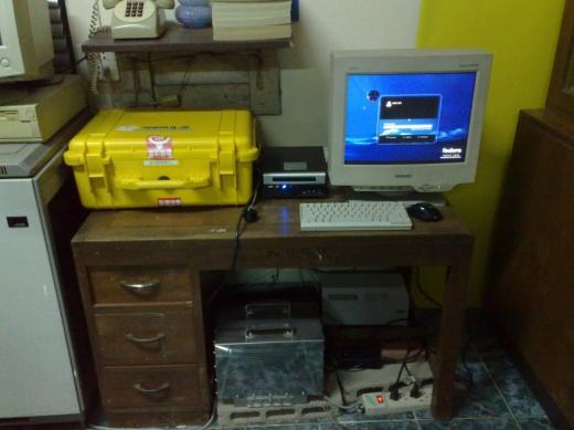
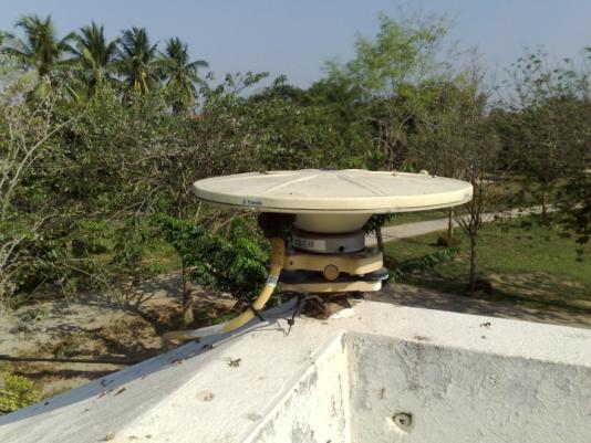
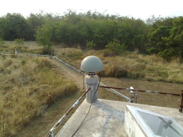
24 24 Observation Setup Choke-ring antenna Amplifier GPS Receiver Computer Unit Rinex files every 30 seconds
")
 Receiver Bias TEC MAP T-B2ATEC Orbit Absolute Slant")
25 TEC Computation RINEX OBS RNX2TEC TEC2GRD Orbit File Slant TEC Include Bias TEC, ROTI plot TEC GRID Data (Vertical TEC) TEC2GRD TEC2BIAS Time Satellite Bias plot Bias (Satellite + Receiver) Receiver Bias TEC MAP T-B2ATEC Orbit Absolute Slant TEC Orbit VTEC
26 Diurnal variation of VTEC at Chumphon station VTEC (TECU) 25 Vernal Equinox 20 Summer Solstice 15 Autumnal Equinox Winter Solstice Time (UTC)
27 VTEC (TECU) Diurnal variation of VTEC at Bangkok station Vernal Equinox Summer Solstice Autumnal Equinox Winter Solstice Time (UTC)
28 STEC (x10 16 electron/m 2 ) STEC (x10 16 electron/m 2 ) STEC (x10 16 electron/m 2 ) STEC (x10 16 electron/m 2 ) Slant TEC of Bangkok station in STEC max STEC max 70 STEC mean 50 STEC mean Time (UTC) (a) Vernal equinox Time (UTC) (b) Summer Solstice STEC max STEC max 70 STEC mean 70 STEC mean Time (UTC) (c) Autumnal equinox Time (UTC) (d) Winter solstice
29 STEC (x10 16 electron/m 2 ) STEC (x10 16 electron/m 2 ) STEC (x10 16 electron/m 2 ) STEC (x10 16 electron/m 2 ) Slant TEC of Chumphon station in STEC max STEC max 70 STEC mean 50 STEC mean Time (UTC) 80 (a) Vernal equinox Time (UTC) 70 (b) Summer Solstice STEC max STEC max 70 STEC mean 60 STEC mean (c) Time (UTC) (c) Autumnal equinox Time (UTC) (d) Winter solstice
30 d ion (m) d ion (m) Ionospheric delay time of Bangkok station in 2009 d ion (m) d ion (m) 14 d ion,max 9 12 d ion,mean 8 d ion,max d ion,mean Time (UTC) 14 (a) Vernal equinox d ion,max Time (UTC) 14 (b) Summer Solstice 12 d ion,mean 12 d ion,max d ion,mean Time (UTC) Time (UTC) (c) Autumnal equinox (d) Winter solstice
31 d ion (m) Ionospheric delay time of Bangkok station in 2009 d ion (m) d ion (m) d ion (m) 14 9 d ion,max 12 d ion,mean 8 d ion,max d ion,mean Time (UTC) Time (UTC) (a) Vernal equinox (b) Summer Solstice 12 d ion,max d ion,mean 10 d ion,max d ion,mean Time (UTC) (c) Autumnal equinox Time (UTC) (d) Winter solstice
32 Future works TEC Gradient investigation around Suvarnabhumi airport Partners: KMITL, ENRI, Aeronautical Thailand Co. Cooperation on the data collection and analysis in the low-latitude and equatorial regions for the upcoming solar maximum period.
33 Non-uniform ionospheric delay distribution Reference station * Working Paper: CNS/MET SG/14 WP/43, July 2010, Jakarta, Indonesia

34 Dual-frequency GPS Data Collection 7 km HIGH SCHOOL KMITL 3-4 km AIRPORT


35 Thank You 35
36 BACKUP
37
38
39
40
41
A study of the ionospheric effect on GBAS (Ground-Based Augmentation System) using the nation-wide GPS network data in Japan
 using the nation-wide GPS network data in Japan") A study of the ionospheric effect on GBAS (Ground-Based Augmentation System) using the nation-wide GPS network data in Japan Takayuki Yoshihara, Electronic Navigation Research Institute (ENRI) Naoki Fujii,
A study of the ionospheric effect on GBAS (Ground-Based Augmentation System) using the nation-wide GPS network data in Japan Takayuki Yoshihara, Electronic Navigation Research Institute (ENRI) Naoki Fujii,
Current status and future plan of NICT s ionospheric observations in the Southeast Asia by SEALION and GNSS-TEC
 Current status and future plan of NICT s ionospheric observations in the Southeast Asia by SEALION and GNSS-TEC Takuya Tsugawa 1, Michi Nishioka 1, Hiromitsu Ishibashi 1, Takashi Maruyama 1, Pornchai Supnithi
An Investigation of Local-Scale Spatial Gradient of Ionospheric Delay Using the Nation-Wide GPS Network Data in Japan
 An Investigation of Local-Scale Spatial Gradient of Ionospheric Delay Using the Nation-Wide GPS Network Data in Japan Takayuki Yoshihara, Takeyasu Sakai and Naoki Fujii, Electronic Navigation Research
DATA AND PRODUCT EXCHANGE IN THE CONTEXT OF WIS. ITU discussions on ionospheric products and formats. (Submitted by the WMO Secretariat)
") WORLD METEOROLOGICAL ORGANIZATION COMMISSION FOR BASIC SYSTEMS COMMISSION FOR AERONAUTICAL METEOROLOGY INTER-PROGRAMME COORDINATION TEAM ON SPACE WEATHER ICTSW-5/Doc. 6.2 (28.X.2014) ITEM: 6.2 FIFTH SESSION
WORLD METEOROLOGICAL ORGANIZATION COMMISSION FOR BASIC SYSTEMS COMMISSION FOR AERONAUTICAL METEOROLOGY INTER-PROGRAMME COORDINATION TEAM ON SPACE WEATHER ICTSW-5/Doc. 6.2 (28.X.2014) ITEM: 6.2 FIFTH SESSION
CONVERGENCE TIME IMPROVEMENT OF PRECISE POINT POSITIONING
 CONVERGENCE TIME IMPROVEMENT OF PRECISE POINT POSITIONING Mohamed Elsobeiey and Ahmed El-Rabbany Department of Civil Engineering (Geomatics Option) Ryerson University, CANADA Outline Introduction Impact
[EN-107] Impact of the low latitude ionosphere disturbances on GNSS studied with a three-dimensional ionosphere model
![[EN-107] Impact of the low latitude ionosphere disturbances on GNSS studied with a three-dimensional ionosphere model](/thumbs/86/93972301.jpg "[EN-107] Impact of the low latitude ionosphere disturbances on GNSS studied with a three-dimensional ionosphere model") ENRI Int. Workshop on ATM/CNS. Tokyo, Japan (EIWAC21) [EN-17] Impact of the low latitude ionosphere disturbances on GNSS studied with a three-dimensional ionosphere model + S. Saito N. FUjii Communication
ENRI Int. Workshop on ATM/CNS. Tokyo, Japan (EIWAC21) [EN-17] Impact of the low latitude ionosphere disturbances on GNSS studied with a three-dimensional ionosphere model + S. Saito N. FUjii Communication
Ionospheric delay gradient monitoring for GBAS by GPS stations near Suvarnabhumi airport, Thailand
 PUBLICATIONS RESEARCH ARTICLE Key Points: Ionospheric delay gradient observed in Thailand during plasma bubble occurrences Data analysis procedure for ionospheric delay gradient estimation Correspondence
Development of a GAST-D ground subsystem prototype and its performance evaluation with a long term-data set
 Development of a GAST-D ground subsystem prototype and its performance evaluation with a long term-data set T. Yoshihara, S. Saito, A. Kezuka, K. Hoshinoo, S. Fukushima, and S. Saitoh Electronic Navigation
Space Weather and the Ionosphere
 Dynamic Positioning Conference October 17-18, 2000 Sensors Space Weather and the Ionosphere Grant Marshall Trimble Navigation, Inc. Note: Use the Page Down key to view this presentation correctly Space
Modelling GPS Observables for Time Transfer
 Modelling GPS Observables for Time Transfer Marek Ziebart Department of Geomatic Engineering University College London Presentation structure Overview of GPS Time frames in GPS Introduction to GPS observables
The added value of new GNSS to monitor the ionosphere
 The added value of new GNSS to monitor the ionosphere R. Warnant 1, C. Deprez 1, L. Van de Vyvere 2 1 University of Liege, Liege, Belgium. 2 M3 System, Wavre, Belgium. Monitoring TEC for geodetic applications
Comparative analysis of the effect of ionospheric delay on user position accuracy using single and dual frequency GPS receivers over Indian region
 Indian Journal of Radio & Space Physics Vol. 38, February 2009, pp. 57-61 Comparative analysis of the effect of ionospheric delay on user position accuracy using single and dual frequency GPS receivers
Detection of ionospheric spatial and temporal gradients for ground based augmentation system applications
 Indian Journal of Radio & Space Physics Vol 45, March 2016, pp 11-19 Detection of ionospheric spatial and temporal gradients for ground based augmentation system applications Swapna Raghunath 1,$ & D Venkata
GNSS IONOSPHERIC SCINTILLATION STUDIES IN SINGAPORE DHIMAS SENTANU MURTI SCHOOL OF ELECTRICAL AND ELECTRONIC ENGINEERING
 GNSS IONOSPHERIC SCINTILLATION STUDIES IN SINGAPORE DHIMAS SENTANU MURTI SCHOOL OF ELECTRICAL AND ELECTRONIC ENGINEERING 2015 GNSS IONOSPHERIC SCINTILLATION STUDIES IN SINGAPORE DHIMAS SENTANU MURTI SCHOOL
Effects of magnetic storms on GPS signals
 Effects of magnetic storms on GPS signals Andreja Sušnik Supervisor: doc.dr. Biagio Forte Outline 1. Background - GPS system - Ionosphere 2. Ionospheric Scintillations 3. Experimental data 4. Conclusions
3D electron density estimation in the ionosphere by using IRI-Plas model and GPS-TEC measurements
 3D electron density estimation in the ionosphere by using IRI-Plas model and GPS-TEC measurements HAKAN TUNA, ORHAN ARIKAN, FEZA ARIKAN Bilkent University, Ankara, Turkey htuna@bilkent.edu.tr, oarikan@ee.bilkent.edu.tr
Impact of the low latitude ionosphere disturbances on GNSS studied with a three-dimensional ionosphere model
 Impact of the low latitude ionosphere disturbances on GNSS studied with a three-dimensional ionosphere model Susumu Saito and Naoki Fujii Communication, Navigation, and Surveillance Department, Electronic
EFFECTS OF IONOSPHERIC SMALL-SCALE STRUCTURES ON GNSS
 EFFECTS OF IONOSPHERIC SMALL-SCALE STRUCTURES ON GNSS G. Wautelet, S. Lejeune, R. Warnant Royal Meteorological Institute of Belgium, Avenue Circulaire 3 B-8 Brussels (Belgium) e-mail: gilles.wautelet@oma.be
Estimation Method of Ionospheric TEC Distribution using Single Frequency Measurements of GPS Signals
 Estimation Method of Ionospheric TEC Distribution using Single Frequency Measurements of GPS Signals Win Zaw Hein #, Yoshitaka Goto #, Yoshiya Kasahara # # Division of Electrical Engineering and Computer
GBAS safety assessment guidance. related to anomalous ionospheric conditions
 INTERNATIONAL CIVIL AVIATION ORGANIZATION ASIA AND PACIFIC OFFICE GBAS safety assessment guidance Edition 1.0 September 2016 Adopted by APANPIRG/27 Intentionally left blank Edition 1.0 September 2016 2
Present and future IGS Ionospheric products
 Present and future IGS Ionospheric products Andrzej Krankowski, Manuel Hernández-Pajares, Joachim Feltens, Attila Komjathy, Stefan Schaer, Alberto García-Rigo, Pawel Wielgosz Outline Introduction IGS IONO
4 Ionosphere and Thermosphere
 4 Ionosphere and Thermosphere 4-1 Derivation of TEC and Estimation of Instrumental Biases from GEONET in Japan This paper presents a method to derive the ionospheric total electron content (TEC) and to
Spatial and Temporal Variations of GPS-Derived TEC over Malaysia from 2003 to 2009
 Spatial and Temporal Variations of GPS-Derived TEC over Malaysia from 2003 to 2009 Leong, S. K., Musa, T. A. & Abdullah, K. A. UTM-GNSS & Geodynamics Research Group, Infocomm Research Alliance, Faculty
An Assessment of Mapping Functions for VTEC Estimation using Measurements of Low Latitude Dual Frequency GPS Receiver
 An Assessment of Mapping Functions for VTEC Estimation using Measurements of Low Latitude Dual Frequency GPS Receiver Mrs. K. Durga Rao 1 Asst. Prof. Dr. L.B.College of Engg. for Women, Visakhapatnam,
LEO GPS Measurements to Study the Topside Ionospheric Irregularities
 LEO GPS Measurements to Study the Topside Ionospheric Irregularities Irina Zakharenkova and Elvira Astafyeva 1 Institut de Physique du Globe de Paris, Paris Sorbonne Cité, Univ. Paris Diderot, UMR CNRS
NAVIGATION SYSTEMS PANEL (NSP) NSP Working Group meetings. Impact of ionospheric effects on SBAS L1 operations. Montreal, Canada, October, 2006
 NSP Working Group meetings. Impact of ionospheric effects on SBAS L1 operations. Montreal, Canada, October, 2006") NAVIGATION SYSTEMS PANEL (NSP) NSP Working Group meetings Agenda Item 2b: Impact of ionospheric effects on SBAS L1 operations Montreal, Canada, October, 26 WORKING PAPER CHARACTERISATION OF IONOSPHERE
NAVIGATION SYSTEMS PANEL (NSP) NSP Working Group meetings Agenda Item 2b: Impact of ionospheric effects on SBAS L1 operations Montreal, Canada, October, 26 WORKING PAPER CHARACTERISATION OF IONOSPHERE
Bernese GPS Software 4.2
 Bernese GPS Software 4.2 Introduction Signal Processing Geodetic Use Details of modules Bernese GPS Software 4.2 Highest Accuracy GPS Surveys Research and Education Big Permanent GPS arrays Commercial
Real-time ionosphere monitoring by three-dimensional tomography over Japan
 Real-time ionosphere monitoring by three-dimensional tomography over Japan 1* Susumu Saito, 2, Shota Suzuki, 2 Mamoru Yamamoto, 3 Chia-Hun Chen, and 4 Akinori Saito 1 Electronic Navigation Research Institute,
Measuring Total Electron Content. Investigation of Two Different Techniques
 Measuring Total Electron Content with GNSS: Investigation of Two Different Techniques Benoît Bidaine 1 F.R.S. FNRS B.Bidaine@ulg.ac.be Prof. René Warnant 1,2 R.Warnant@oma.be 1 University of Liège (Unit
Influence of Major Geomagnetic Storms Occurred in the Year 2011 On TEC Over Bangalore Station In India
 International Journal of Electronics and Communication Engineering. ISSN 0974-2166 Volume 6, Number 1 (2013), pp. 105-110 International Research Publication House http://www.irphouse.com Influence of Major
Asia Oceania Regional Workshop on GNSS Precise Point Positioning Experiment by using QZSS LEX
 Asia Oceania Regional Workshop on GNSS 2010 Precise Point Positioning Experiment by using QZSS LEX Tomoji TAKASU Tokyo University of Marine Science and Technology Contents Introduction of QZSS LEX Evaluation
[EN A 78] Development of a CAT III GBAS (GAST D) ground subsystem prototype and its performance evaluation with a long term data set
![[EN A 78] Development of a CAT III GBAS (GAST D) ground subsystem prototype and its performance evaluation with a long term data set](/thumbs/96/128212036.jpg "[EN A 78] Development of a CAT III GBAS (GAST D) ground subsystem prototype and its performance evaluation with a long term data set") [EN A 78] Development of a CAT III GBAS (GAST D) ground subsystem prototype and its performance evaluation with a long term data set (EIWAC 2017) + T. Yoshihara*, S. Saito*, A. Kezuka*, K. Hoshinoo*, S.
[EN A 78] Development of a CAT III GBAS (GAST D) ground subsystem prototype and its performance evaluation with a long term data set (EIWAC 2017) + T. Yoshihara*, S. Saito*, A. Kezuka*, K. Hoshinoo*, S.
Global Variations of Ionospheric Total Electron Content (TEC) Derived from GPS Global Ionospheric Maps
 Derived from GPS Global Ionospheric Maps") Research Article http://dx.doi.org/10.4314/mejs.v9i2.2 Global Variations of Ionospheric Total Electron Content (TEC) Derived from GPS Global Ionospheric Maps Hintsa Gebreselasse and Gebregiorgis Abraha*
Research Article http://dx.doi.org/10.4314/mejs.v9i2.2 Global Variations of Ionospheric Total Electron Content (TEC) Derived from GPS Global Ionospheric Maps Hintsa Gebreselasse and Gebregiorgis Abraha*
GNSS Ionosphere Analysis at CODE
 GNSS Ionosphere Analysis at CODE Stefan Schaer 2004 IGS Workshop Berne, Switzerland March 1-5 Time Series of Global Mean TEC Covering Nearly One Solar Cycle as Generated at CODE 1 Exceptionally High TEC
Ionospheric regional forecasting using statistical method for GPS application
 1 2016 the 4 th AOSWA Workshop, Asia Oceania Space Weather Alliance, 24-27 October 2016, Jeju, Korea Ionospheric regional forecasting using statistical method for GPS application M. Abdullah 1,2, N.A.
Space Weather influence on satellite based navigation and precise positioning
 Space Weather influence on satellite based navigation and precise positioning R. Warnant, S. Lejeune, M. Bavier Royal Observatory of Belgium Avenue Circulaire, 3 B-1180 Brussels (Belgium) What this talk
Tajul Ariffin Musa. Tajul A. Musa. Dept. of Geomatics Eng, FKSG, Universiti Teknologi Malaysia, Skudai, Johor, MALAYSIA.
 Tajul Ariffin Musa Dept. of Geomatics Eng, FKSG, Universiti Teknologi Malaysia, 81310 Skudai, Johor, MALAYSIA. Phone : +6075530830;+6075530883; Mobile : +60177294601 Fax : +6075566163 E-mail : tajul@fksg.utm.my
Multipath and Atmospheric Propagation Errors in Offshore Aviation DGPS Positioning
 Multipath and Atmospheric Propagation Errors in Offshore Aviation DGPS Positioning J. Paul Collins, Peter J. Stewart and Richard B. Langley 2nd Workshop on Offshore Aviation Research Centre for Cold Ocean
Combined global models of the ionosphere
 Combined global models of the ionosphere S. Todorova (1), T. Hobiger (2), H. Schuh (1) (1) Institute of Geodesy and Geophysics (IGG), Vienna University of Technology (2) Space-Time Standards Group, Kashima
ESTIMATION OF IONOSPHERIC DELAY FOR SINGLE AND DUAL FREQUENCY GPS RECEIVERS: A COMPARISON
 ESTMATON OF ONOSPHERC DELAY FOR SNGLE AND DUAL FREQUENCY GPS RECEVERS: A COMPARSON K. Durga Rao, Dr. V B S Srilatha ndira Dutt Dept. of ECE, GTAM UNVERSTY Abstract: Global Positioning System is the emerging
ROTI Maps: a new IGS s ionospheric product characterizing the ionospheric irregularities occurrence
 3-7 July 2017 ROTI Maps: a new IGS s ionospheric product characterizing the ionospheric irregularities occurrence Iurii Cherniak Andrzej Krankowski Irina Zakharenkova Space Radio-Diagnostic Research Center,
Using GPS Receivers to Study the Upper Atmosphere
 Using GPS Receivers to Study the Upper Atmosphere Jonathan J. Makela University of Illinois at Urbana-Champaign jmakela@illinois.edu With a big THANKS to Anthea Coster for providing some very useful slides!
The impact of low-latency DORIS data on near real-time VTEC modeling
 The impact of low-latency DORIS data on near real-time VTEC modeling Eren Erdogan, Denise Dettmering, Michael Schmidt, Andreas Goss 2018 IDS Workshop Ponta Delgada (Azores Archipelago), Portugal, 24-26
Trimble Business Center:
 Trimble Business Center: Modernized Approaches for GNSS Baseline Processing Trimble s industry-leading software includes a new dedicated processor for static baselines. The software features dynamic selection
Satellite Navigation Science and Technology for Africa. 23 March - 9 April, The African Ionosphere
 2025-28 Satellite Navigation Science and Technology for Africa 23 March - 9 April, 2009 The African Ionosphere Radicella Sandro Maria Abdus Salam Intern. Centre For Theoretical Physics Aeronomy and Radiopropagation
Methodology and Case Studies of Signal-in-Space Error Calculation
 Methodology and Case Studies of Signal-in-Space Error Calculation Top-down Meets Bottom-up Grace Xingxin Gao *, Haochen Tang *, Juan Blanch *, Jiyun Lee +, Todd Walter * and Per Enge * * Stanford University,
Derivation of TEC and estimation of instrumental biases from GEONET in Japan
 Derivation of TEC and estimation of instrumental biases from GEONET in Japan G Ma, T Maruyama To cite this version: G Ma, T Maruyama Derivation of TEC and estimation of instrumental biases from GEONET
Ionospheric Range Error Correction Models
 www.dlr.de Folie 1 >Ionospheric Range Error Correction Models> N. Jakowski and M.M. Hoque 27/06/2012 Ionospheric Range Error Correction Models N. Jakowski and M.M. Hoque Institute of Communications and
To Estimate The Regional Ionospheric TEC From GEONET Observation
 To Estimate The Regional Ionospheric TEC From GEONET Observation Jinsong Ping(Email: jsping@miz.nao.ac.jp) 1,2, Nobuyuki Kawano 2,3, Mamoru Sekido 4 1. Dept. Astronomy, Beijing Normal University, Haidian,
Comparison of GPS TEC measurements with IRI TEC prediction at the equatorial latitude station, Chumphon, Thailand
 Earth Planets Space, 63, 365 370, 2011 Comparison of GPS TEC measurements with IRI TEC prediction at the equatorial latitude station, Chumphon, Thailand P. Kenpankho 1, K. Watthanasangmechai 1, P. Supnithi
Ionospheric Data Processing and Analysis
 Ionospheric Data Processing and Analysis Dr. Charles Carrano 1 Dr. Keith Groves 2 1 Boston College, Institute for Scientific Research 2 Air Force Research Laboratory, Space Vehicles Directorate Workshop
AIRPORT MULTIPATH SIMULATION AND MEASUREMENT TOOL FOR SITING DGPS REFERENCE STATIONS
 AIRPORT MULTIPATH SIMULATION AND MEASUREMENT TOOL FOR SITING DGPS REFERENCE STATIONS ABSTRACT Christophe MACABIAU, Benoît ROTURIER CNS Research Laboratory of the ENAC, ENAC, 7 avenue Edouard Belin, BP
PRECISE POINT POSITIONING USING COMBDINE GPS/GLONASS MEASUREMENTS
 PRECISE POINT POSITIONING USING COMBDINE GPS/GLONASS MEASUREMENTS Mohamed AZAB, Ahmed EL-RABBANY Ryerson University, Canada M. Nabil SHOUKRY, Ramadan KHALIL Alexandria University, Egypt Outline Introduction.
Integrity of Satellite Navigation in the Arctic
 Integrity of Satellite Navigation in the Arctic TODD WALTER & TYLER REID STANFORD UNIVERSITY APRIL 2018 Satellite Based Augmentation Systems (SBAS) in 2018 2 SBAS Networks in 2021? 3 What is Meant by Integrity?
Outline. GPS RO Overview. COSMIC Overview. COSMIC-2 Overview. Summary 9/29/16
 Bill Schreiner and UCAR/COSMIC Team UCAR COSMIC Program Observation and Analysis Opportunities Collaborating with the ICON and GOLD Missions Sept 27, 216 GPS RO Overview Outline COSMIC Overview COSMIC-2
Fast convergence of Trimble CenterPoint RTX by regional augmentation
 Fast convergence of Trimble CenterPoint RTX by regional augmentation Dr. Ralf Drescher Trimble Terrasat GmbH, Munich EGU General Assembly 2015, Vienna Thursday, 16 April 2015 Outline Introduction CenterPoint
Introduction to DGNSS
 Introduction to DGNSS Jaume Sanz Subirana J. Miguel Juan Zornoza Research group of Astronomy & Geomatics (gage) Technical University of Catalunya (UPC), Spain. Web site: http://www.gage.upc.edu Hanoi,
THE MONITORING OF THE IONOSPHERIC ACTIVITY USING GPS MEASUREMENTS
 THE MONITORING OF THE IONOSPHERIC ACTIVITY USING GPS MEASUREMENTS R. Warnant*, S. Stankov**, J.-C. Jodogne** and H. Nebdi** *Royal Observatory of Belgium **Royal Meteorological Institute of Belgium Avenue
GNSS Buoy Array in the Ocean for a Synthetic Geohazards Monitoring System
 GNSS Buoy Array in the Ocean for a Synthetic Geohazards Monitoring System Teruyuki Kato, Earthq. Res. Inst., Univ. Tokyo, Japan Yukihiro Terada, Nat. Inst. Tech., Kochi Col., Japan Keiichi Tadokoro, Grad.
Kalman Filter Based Integer Ambiguity. Ionosphere and Troposphere Estimation
 ION GNSS 2010 Kalman Filter Based Integer Ambiguity Resolution Strategy t for Long Baseline RTK with Ionosphere and Troposphere Estimation Tokyo University of Marine Science and Technology Tomoji jitakasu
GNSS data and ionospheric studies. Prof. Andrzej Krankowski
 GNSSdataandionosphericstudies Prof. Andrzej Krankowski University of Warmia and Mazury in Olsztyn, Poland Space Radio-Diagnostics Research Centre (SRRC/UWM) Email : kand@uwm.edu.pl Outline Agenda Introduction.
Determination of Regional TEC Values by GNSS Measurements, A Case Study: Central Anatolia Sample, Turkey
 Presented at the FIG Working Week 2017, May 29 - June 2, 2017 in Helsinki, Finland Determination of Regional TEC Values by GNSS Measurements, A Case Study: Central Anatolia Sample, Turkey Fuat BAŞÇİFTÇİ,
Plasma effects on transionospheric propagation of radio waves II
 Plasma effects on transionospheric propagation of radio waves II R. Leitinger General remarks Reminder on (transionospheric) wave propagation Reminder of propagation effects GPS as a data source Some electron
BDS Real-time Precise Products from WHU and its application in NBASS
 BDS Real-time Precise Products from WHU and its application in NBASS Shi C., Lou YD., Li M., Gu SF., Zhang WX., Zheng F., Li XJ., Song WW., Dai XL., Yi WT. GNSS Research Center of Wuhan University, GRC
Tropospheric Delay Correction in L1-SAIF Augmentation
 International Global Navigation Satellite Systems Society IGNSS Symposium 007 The University of New South Wales, Sydney, Australia 4 6 December, 007 Tropospheric Delay Correction in L1-SAIF Augmentation
Effiziente Umsetzung der Integration der Elektronendichte innerhalb der Ionosphäre entlang des Signalweges
 Effiziente Umsetzung der Integration der Elektronendichte innerhalb der Ionosphäre entlang des Signalweges (DFG-Projekt MuSIK) Marco Limberger 1, Urs Hugentober 1, Michael Schmidt 2, Denise Dettmering
Monitoring the Ionosphere and Neutral Atmosphere with GPS
 Monitoring the Ionosphere and Neutral Atmosphere with GPS Richard B. Langley Geodetic Research Laboratory Department of Geodesy and Geomatics Engineering University of New Brunswick Fredericton, N.B. Division
Global Positioning System: what it is and how we use it for measuring the earth s movement. May 5, 2009
 Global Positioning System: what it is and how we use it for measuring the earth s movement. May 5, 2009 References Lectures from K. Larson s Introduction to GNSS http://www.colorado.edu/engineering/asen/
Study of small scale plasma irregularities. Đorđe Stevanović
 Study of small scale plasma irregularities in the ionosphere Đorđe Stevanović Overview 1. Global Navigation Satellite Systems 2. Space weather 3. Ionosphere and its effects 4. Case study a. Instruments
Space geodetic techniques for remote sensing the ionosphere
 Space geodetic techniques for remote sensing the ionosphere Harald Schuh 1,2, Mahdi Alizadeh 1, Jens Wickert 2, Christina Arras 2 1. Institute of Geodesy and Geoinformation Science, Technische Universität
High Precision Navigation Capabilities(L1-SAIF) and Applications Using Japanese Quasi-Zenith Satellite System (QZSS)
 and Applications Using Japanese Quasi-Zenith Satellite System (QZSS)") High Precision Navigation Capabilities(L1-SAIF) and Applications Using Japanese Quasi-Zenith Satellite System (QZSS) ICG WG-B Application SG Meeting Munich, Germany March 12, 2012 Satellite Positioning
High Precision Navigation Capabilities(L1-SAIF) and Applications Using Japanese Quasi-Zenith Satellite System (QZSS) ICG WG-B Application SG Meeting Munich, Germany March 12, 2012 Satellite Positioning
Improvement GPS Time Link in Asia with All in View
 Improvement GPS Time Link in Asia with All in View Tadahiro Gotoh National Institute of Information and Communications Technology 1, Nukui-kita, Koganei, Tokyo 18 8795 Japan tara@nict.go.jp Abstract GPS
3-2-2 Effects of Transequatorial Thermospheric Wind on Plasma Bubble Occurrences
 3-2-2 Effects of Transequatorial Thermospheric Wind on Plasma Bubble Occurrences Data from the ionosonde chain in Southeast Asia (Kototabang, Indonesia (0.2 S, 100.3 E), Chumphon, Thailand (10.7 N, 99.4
Improved Ambiguity Resolution by an Equatorial Ionospheric Differential Correction for Precise Positioning
 Improved Ambiguity Resolution by an Equatorial Ionospheric Differential Correction for Precise Positioning NORSUZILA YA ACOB 1, MARDINA ABDULLAH,* MAHAMOD ISMAIL,* AND AZAMI ZAHARIM 3,** 1 Faculty of Electrical
E. Calais Purdue University - EAS Department Civil 3273
 E. Calais Purdue University - EAS Department Civil 373 ecalais@purdue.edu GPS signal propagation GPS signal (= carrier phase modulated by satellite PRN code) sent by satellite. About 66 msec (0,000 km)
Three-dimensional and numerical ray tracing on a phenomenological ionospheric model
 Three-dimensional and numerical ray tracing on a phenomenological ionospheric model Lung-Chih Tsai 1, 2, C. H. Liu 3, T. Y. Hsiao 4, and J. Y. Huang 1 (1) Center for Space and Remote Sensing research,
Convergence Time Improvement of Precise Point Positioning
 , Canada Key words: GPS, Precise Point Positioning, satellite orbit, clock corrections, ionosphere SUMMARY Presently, precise point positioning (PPP) requires about 30 minutes or more to achieve centimetreto
Ionospheric Corrections for GNSS
 Ionospheric Corrections for GNSS The Atmosphere and its Effect on GNSS Systems 14 to 16 April 2008 Santiago, Chile Ing. Roland Lejeune Overview Ionospheric delay corrections Core constellations GPS GALILEO
Introduction to GNSS Base-Station
 Introduction to GNSS Base-Station Dinesh Manandhar Center for Spatial Information Science The University of Tokyo Contact Information: dinesh@iis.u-tokyo.ac.jp Slide : 1 Introduction GPS or GNSS observation
Ionospheric Effects on Aviation
 Ionospheric Effects on Aviation Recent experience in the observation and research of ionospheric irregularities, gradient anomalies, depletion walls, etc. in USA and Europe Stan Stankov, René Warnant,
James M Anderson. in collaboration with Jan Noordam and Oleg Smirnov. MPIfR, Bonn, 2006 Dec 07
 Ionospheric Calibration for Long-Baseline, Low-Frequency Interferometry in collaboration with Jan Noordam and Oleg Smirnov Page 1/36 Outline The challenge for radioastronomy Introduction to the ionosphere
GPS based total electron content (TEC) anomalies and their association with large magnitude earthquakes occurred around Indian region
 anomalies and their association with large magnitude earthquakes occurred around Indian region") Indian Journal of Radio & Space Physics Vol 42, June 2013, pp 131-135 GPS based total electron content (TEC) anomalies and their association with large magnitude earthquakes occurred around Indian region
Indian Journal of Radio & Space Physics Vol 42, June 2013, pp 131-135 GPS based total electron content (TEC) anomalies and their association with large magnitude earthquakes occurred around Indian region
1. Terrestrial propagation
 Rec. ITU-R P.844-1 1 RECOMMENDATION ITU-R P.844-1 * IONOSPHERIC FACTORS AFFECTING FREQUENCY SHARING IN THE VHF AND UHF BANDS (30 MHz-3 GHz) (Question ITU-R 218/3) (1992-1994) Rec. ITU-R PI.844-1 The ITU
ABSOLUTE CALIBRATION OF TIME RECEIVERS WITH DLR'S GPS/GALILEO HW SIMULATOR
 ABSOLUTE CALIBRATION OF TIME RECEIVERS WITH DLR'S GPS/GALILEO HW SIMULATOR S. Thölert, U. Grunert, H. Denks, and J. Furthner German Aerospace Centre (DLR), Institute of Communications and Navigation, Oberpfaffenhofen,
Effect of Quasi Zenith Satellite (QZS) on GPS Positioning
 on GPS Positioning") Effect of Quasi Zenith Satellite (QZS) on GPS ing Tomoji Takasu 1, Takuji Ebinuma 2, and Akio Yasuda 3 Laboratory of Satellite Navigation, Tokyo University of Marine Science and Technology 1 (Tel: +81-5245-7365,
Effect of Quasi Zenith Satellite (QZS) on GPS ing Tomoji Takasu 1, Takuji Ebinuma 2, and Akio Yasuda 3 Laboratory of Satellite Navigation, Tokyo University of Marine Science and Technology 1 (Tel: +81-5245-7365,
magicgnss: QUALITY DATA, ALGORITHMS AND PRODUCTS FOR THE GNSS USER COMMUNITY
 SEMANA GEOMATICA 2009 magicgnss: QUALITY DATA, ALGORITHMS AND PRODUCTS FOR THE GNSS USER COMMUNITY MARCH 3, 2009 BARCELONA, SPAIN SESSION: GNSS PRODUCTS A. Mozo P. Navarro R. Píriz D. Rodríguez March 3,
CNTEC: A regional ionospheric TEC mapping technique over China and adjacent areas
 CNTEC: A regional ionospheric TEC mapping technique over China and adjacent areas Ercha Aa, Wengeng Huang, Yanhong Chen, and Hua Shen National Space Science Center, Chinese Academy of Sciences Outline
WHU's Developments for the GPS Ultra-Rapid Products and the COMPASS Precise Products
 WHU's Developments for the GPS Ultra-Rapid Products and the COMPASS Precise Products C. Shi; Q. Zhao; M. Li; Y. Lou; H. Zhang; W. Tang; Z. Hu; X. Dai; J. Guo; M.Ge; J. Liu 2012 International GNSS Workshop
Methods and other considerations to correct for higher-order ionospheric delay terms in GNSS
 Methods and other considerations to correct for higher-order ionospheric delay terms in GNSS M. Hernández-Pajares(1), M.Fritsche(2), M.M. Hoque(3), N. Jakowski (3), J.M. Juan(1), S. Kedar(4), A. Krankowski(5),
Swarm L2 TEC Product Description
 Swarm Expert Support Laboratories Swarm L2 TEC Product Description British Geological Survey (BGS) National Space Institute DTU Space (DTU) Delft Institute of Earth Observation and Space Systems (DUT)
Detection of Abnormal Ionospheric Activity from the EPN and Impact on Kinematic GPS positioning
 Detection of Abnormal Ionospheric Activity from the EPN and Impact on Kinematic GPS positioning N. Bergeot, C. Bruyninx, E. Pottiaux, S. Pireaux, P. Defraigne, J. Legrand Royal Observatory of Belgium Introduction
Global Correction Services for GNSS
 Global Correction Services for GNSS Hemisphere GNSS Whitepaper September 5, 2015 Overview Since the early days of GPS, new industries emerged while existing industries evolved to use position data in real-time.
Comparison of Ionosphere at Middle Latitude Zone during Solar Maximum and Solar Minimum
 Comparison of Ionosphere at Middle Latitude Zone during Solar Maximum and Solar Minimum Tharapong Sukcharoen, Jingnong Weng, Teetat Charoenkalunyuta, and Falin Wu Abstract The impact of the satellite-based
1. INTRODUCTION. Longitude, deg In contrast to the global systems such as GPS, GLONASS and
 SPECIAL REPORT Highly-Accurate Positioning Experiment Using QZSS at ENRI Ken Ito Electronic Navigation Research Institute (ENRI) 1. INTRODUCTION P ositioning with GPS is widely used in Japan in the area
Analysis of equatorial ionospheric irregularities based on a two high rate GNSS station setup
 Analysis of equatorial ionospheric irregularities based on a two high rate GNSS station setup Jens Berdermann 1,Norbert Jakowski 1, Martin Kriegel 1, Hiroatsu Sato 1, Volker Wilken 1, Stefan Gewies 1,
Significant of Earth s Magnetic Field and Ionospheric Horizontal Gradient to GPS Signals
 Proceeding of the 2013 IEEE International Conference on Space Science and Communication (IconSpace), 1-3 July 2013, Melaka, Malaysia Significant of Earth s Magnetic Field and Ionospheric Horizontal Gradient
Chapter 2 Analysis of Polar Ionospheric Scintillation Characteristics Based on GPS Data
 Chapter 2 Analysis of Polar Ionospheric Scintillation Characteristics Based on GPS Data Lijing Pan and Ping Yin Abstract Ionospheric scintillation is one of the important factors that affect the performance
Second and Third Order Ionospheric Effect on Global Positioning System (GPS) Signals along Equatorial International Geodetic Services (Igs) Stations
 Signals along Equatorial International Geodetic Services (Igs) Stations") Second and Third Order Ionospheric Effect on Global Positioning System (GPS) Signals along Equatorial International Geodetic Services (Igs) Stations Asmamaw CHANIE, Ethiopia Keywords: GPS, Ionospheric
Second and Third Order Ionospheric Effect on Global Positioning System (GPS) Signals along Equatorial International Geodetic Services (Igs) Stations Asmamaw CHANIE, Ethiopia Keywords: GPS, Ionospheric
The Atmosphere and its Effect on GNSS Systems 14 to 16 April 2008 Santiago, Chile
 Description of a Real-Time Algorithm for Detecting Ionospheric Depletions for SBAS and the Statistics of Depletions in South America During the Peak of the Current Solar Cycle The Atmosphere and its Effect
Generation of Klobuchar Coefficients for Ionospheric Error Simulation
 Research Paper J. Astron. Space Sci. 27(2), 11722 () DOI:.14/JASS..27.2.117 Generation of Klobuchar Coefficients for Ionospheric Error Simulation Chang-Moon Lee 1, Kwan-Dong Park 1, Jihyun Ha 2, and Sanguk