100 Island Challenge Cruise Report Windward Caribbean Nov 6-16, 2016
|
|
|
- Erin Campbell
- 5 years ago
- Views:
Transcription

1 100 Island Challenge Cruise Report Windward Caribbean Nov 6-16, 2016 Contributing Authors Dr. Stuart Sandin, Scripps Institution of Oceanography Dr. Brian Zgliczynski, Scripps Institution of Oceanography Lindsay Bonito, Scripps Institution of Oceanography Report prepared on 29 November 2016 Photo credit: Ralph Pace


2 Expedition Team Ruleo Camacho, Department of Environment, Antigua & Barbuda Amelia Bird, Department of Environment, Antigua & Barbuda Melanie Meijer zu Schlochtern, St. Maarten Nature Foundation Erik Houtepen, St. Eustatius National Parks Foundation (STENAPA) Tadzio Bervoets, Nature Foundation of Sint Maarten Jens Odinga, Saba Bank National Park Andy Estep, Waitt Institute Ramón de León, Reef Support BV, Bonaire Dr. Mark Vermeij, Carmabi Foundation, Curaçao Ralph Pace, Photographer Lindsay Bonito, Scripps Institution of Oceanography Nicole Pedersen, Scripps Institution of Oceanography Dr. Brian Zgliczynski, Scripps Institution of Oceanography Dr. Stuart Sandin, Scripps Institution of Oceanography Collaborators

.")

3 Executive Summary The Waitt Institute and Dr. Stuart Sandin s laboratory at Scripps Institution of Oceanography collaborated to organize an expedition to conduct a rapid scientific assessment of the coral reefs around the windward Caribbean islands, namely Sint Maarten, Sint Eustatius, Saba, Redonda, and a submarine atoll, Saba Bank. To complement these efforts, the expedition was supported by the Government of Antigua and partners in the nearby Dutch-affiliated islands (St Eustatius, Saba, and St Maarten). The collaboration is part of a larger effort to establish a regional scale perspective of coral reef health, investigating how reefs are structured, how they change over time, and how we can better manage them in the face of global change. The research conducted during thiscruise aimed to investigate the independent and interactive effects of oceanography and human activities in affecting the structure and dynamics of coral reef communities. The survey design controls for within-island variables by conducting the core surveys within the same habitat type forereef habitat at 7-15m depth. To assess the benthic and reef fish communities, the GCRMN methodology was utilized in conjunction with large-area photomosaics to quantify the structure and the workings of each coral reef community at 1-2 km intervals surrounding each island. To complement the ecological data colelcted, two sea temperature recorders (HOBO Pro v2 Logger) were deployed around each island. The temperature recorders were programmed to record the seawater temperature at an interval of thirty minutes. We expect to retrieve these recorders and download the temperature record in approximately 2 years. Across the 4 islands and submarine atoll, 65 sites were surveyed. This effort resulted in a total of 325 fish and benthic transects, following the GCRMN guidelines. Additionally 38 photomosaics were imaged: 6 on Redonda, 11 on Sint Eustatius, 11 on Sint Maarten, 8 on Saba, and 2 on the Saba Bank.
4 The Windward Caribbean Islands Figure 1. Map of the windward Caribbean islands surveyed in November, Surveyed islands include Sint Maarten, Sint Eustatius, Saba, Saba Bank, and Redonda.


 Sint Eustatius Island Type: High island,")
 Saba Island Type: High island,")
5 Island Highlights The Lesser Antilles, also known as the Windward Islands, extend in a curve about 500 miles between Puerto Rico and Trinidad. Most of the islands were formed by volcanic activity, and when combines with the Greater Antilles and Lucayan Archipelago, are known as the West Indies. Redonda Island Type: High island; remnant of an ancient extinct volcano Island Size: 1.6 km long and 0.5 km wide (between 1.6 and 2.6 km 2 ) Population: uninhabited Sint Maarten Island Type: High island Island Size: 34 km 2 Population: ~39,000 (2011 census) Sint Eustatius Island Type: High island, dormant volcano. Island Size: 21 km 2 Population: ~4,000 (2013 data) Saba Island Type: High island, potentially active volcano Island Size: 13 km 2 Population: ~2,000 (2013 data) Saba Bank Island Type: Submarine atoll Size: ~ 2200 km² Population: uninhabited


6 100 Island Challenge Description: This research initiative employs novel approaches for studying coral reef community dynamics through the application of underwater photomosaic technology. Working with colleagues from the University of Miami, we have built a camera system that allows us to capture images of large swaths of the reef surface. Further, by revisiting exact locations multiple times and replicating photography, we have an unprecedented opportunity to track the dynamics of corals and algae. Particularly, with advanced image analysis we can track how a reef community changes, addressing questions of coral growth, death, and competition that are currently unresolved. We have field-trialed this photomosaic equipment and are developing a reliable image analysis protocol. We are now poised to apply this tool to generate the large-scale data of reef community dynamics that have, to date, been unavailable. Further, by combining these image-based data with reliable information about the composition of the fish community, the general oceanography, and the human situation of each location, we can begin to elucidate the conditions that are more (or less) conducive to the maintenance of growing and so-called healthy coral reefs. Application to the Windward Caribbean: By linking the fates of these reefs to the oceanographic conditions and to the local activities of people, we will be able to start understanding cause-and- effect pathways for reef change. Given that local-scale marine managers consistently seek information on the state of their coral reef, looking for comparisons to help guide local management. Further, by making the data that describe each reef readily available and easy to visualize, there is a terrific opportunity to increase the dialogue between the science and management communities, as well as independently among the managers looking for tangible information to improve their self-management. By working side-by- side with regional managers and partners in local NGOs (e.g., the Nature Conservancy, Conservation International), we will expand the scientific insights into the state and future of their reef areas. For more information, visit
7 Survey Metadata Table 1. Sites surveyed to assess and monitor the fish and benthic communities (GCRMN) and collect photomosaic imagery (Mosaic). Project Island Site ID Latitude Longitude Local Name GCRMN Redonda R GCRMN Redonda R GCRMN Redonda R GCRMN Redonda R GCRMN Redonda R GCRMN Redonda R GCRMN Redonda R GCRMN Redonda R Mosaic Redonda R Mosaic Redonda R Mosaic Redonda R Mosaic Redonda R Mosaic Redonda R Mosaic Redonda R GCRMN Saba SB GCRMN Saba SB GCRMN Saba SB GCRMN Saba SB GCRMN Saba SB GCRMN Saba SB6B GCRMN Saba SB GCRMN Saba SB GCRMN Saba SBA GCRMN Saba SBB GCRMN Saba SBC GCRMN Saba SBD GCRMN Saba SBE GCRMN Saba SBG Mosaic Saba SB Mosaic Saba SB Mosaic Saba SB Mosaic Saba SB Mosaic Saba SB6b Mosaic Saba SB Mosaic Saba SB
8 Project Island Site ID Latitude Longitude Local Name Mosaic Saba SB8b GCRMN Saba Bank SBB GCRMN Saba Bank SBB GCRMN Saba Bank SBB Mosaic Saba Bank SBB Mosaic Saba Bank SBB GCRMN St Eustatius SE GCRMN St Eustatius SE GCRMN St Eustatius SE Barracuda Reef GCRMN St Eustatius SE Safety First GCRMN St Eustatius SE Mushroom Gardens GCRMN St Eustatius SE Five Fingers GCRMN St Eustatius SE GCRMN St Eustatius SE GCRMN St Eustatius SE GCRMN St Eustatius SE GCRMN St Eustatius SE GCRMN St Eustatius SE GCRMN St Eustatius SE GCRMN St Eustatius SE GCRMN St Eustatius SE GCRMN St Eustatius SE GCRMN St Eustatius SE GCRMN St Eustatius SE GCRMN St Eustatius SE GCRMN St Eustatius SE Mosaic St Eustatius SE Mosaic St Eustatius SE Double Wreck Mosaic St Eustatius SE Safety First Mosaic St Eustatius SE Mosaic St Eustatius SE Mosaic St Eustatius SE Mosaic St Eustatius SE Mosaic St Eustatius SE Mosaic St Eustatius SE Mosaic St Eustatius SE GCRMN St Maarten SM Pelican Reef N GCRMN St Maarten SM Pelican Reef S GCRMN St Maarten SM Molly Beday
9 Project Island Site ID Latitude Longitude Local Name GCRMN St Maarten SM Mike's Maze W GCRMN St Maarten SM Coralita GCRMN St Maarten SM Fishbowl GCRMN St Maarten SM GCRMN St Maarten SM Long Bay SE GCRMN St Maarten SM Long Bay NW GCRMN St Maarten SM Gregory GCRMN St Maarten SM Moonscape GCRMN St Maarten SM Frenchman GCRMN St Maarten SM Hen & Chicks E GCRMN St Maarten SM GCRMN St Maarten SM GCRMN St Maarten SM GCRMN St Maarten SM GCRMN St Maarten SM Mosaic St Maarten SM Cow & Calf Mosaic St Maarten SM Hen & Chicks Mosaic St Maarten SM Molly Beday Mosaic St Maarten SM Mike's Maze E Mosaic St Maarten SM Proselyte Reef Mosaic St Maarten SM Fishbowl Mosaic St Maarten SM The Bridge Mosaic St Maarten SM Mosaic St Maarten SM Mosaic St Maarten SM
 guidelines for ecological monitoring.")

10 Survey Methods Fish & Macro-Invertebrate Surveys Fish Assemblage Survey Methods Estimates of fish abundance and biomass were completed using methods consistent with the Global Coral Reef Monitoring Network - Caribbean (GCRMN) guidelines for ecological monitoring. In summary, All fish present (of all species) are counted and sized within a belt transect (30m length x 2m width), with the survey time limited to approximately 6 minutes per transect. At each site, at least 5 transects are surveyed and the data are pooled to provide an average estimate of the density and size structure of all fishes at the site. Fish are classified by size to the nearest 5cm bin. Key Macro-Invertebrate Survey Methods The densities of the long-spined sea urchin (Diadema antillarum), other sea urchins, and all sea cucumbers were recorded in situ by the fish diver. Within 3 of the benthic transect lines, the diver counted invertebrates in a 2m wide belt, giving a total area of 60m 2. Benthic Surveys Benthic Survey Methods Similar to the fish survey methods, Benthic communities were characterized using a photoquadrat method, consistent with the Global Coral Reef Monitoring Network - Caribbean (GCRMN) guidelines for ecological monitoring. Digital photographs of the reef surface were taken in standardized quadrat areas (0.9m x 0.6m). Photographs are taken along each of the 5 transect lines set for counting fish, with 3 images captured per 30m transect line (i.e., one image taken at every 10m on the transect tape). In total, 15


11 benthic photographs were collected at each site (5 transect lines x 3 photographs per line). Images will be analyzed by overlaying 25 random points and identifying each organism or habitat feature associated with each point to the finest level of resolution possible (genus level for hard and soft corals, functional group for algal turfs and crustose coralline algae, and species level for macroalgae and macroinvertebrates when possible). Photoquadrat images will be analyzed for coral disease as well, in addition to in situ presence/absence surveys of disease within the transects. Coral recruitment was data in situ, with the goal of estimating the density of young corals that are likely to contribute to the next generation of adult corals on the reef. Coral recruits are defined operationally for this assessment as any stony coral that is greater than 0.5 cm and up to 4.0 cm. Estimates of coral recruit density were recorded from replicate 25cm x 25cm (625 cm 2 ) quadrats. A total of 3 quadrats were surveyed along each of transect used for benthic and fish surveys. The coral recruit quadrats will be placed at 10-meter intervals along the transect line, resulting in a total of 15 quadrats surveys per site, each 625 cm 2 in area. Within each quadrat, each coral within the target size range ( 0,5 4.0 cm) will be recorded to the finest taxonomic level possible (family, genus, or species). Benthic Photomosaic Survey Methods To complement the transect-based benthic surveys, benthic photomosaics were completed to collect a permanent record of reef habitat on a larger scale (100m 2 ). The benthic photomosaic system consists of a diver operating a camera system including dual SLR cameras and video camera mounted to a custom frame. The first still camera is setup to use a wide-angle 18 mm focal length lens to sure high overlap among adjacent images while the second still camera uses a 55 mm focal length lens to capture images with sub-cm resolution. The high-resolution wide-angle video camera serves as a backup in the event that images from the still cameras are compromised. To obtain the large image covering 10m x10m the diver operating the camera system swims a gridded pattern approximately 1.5 m above the benthos recording images at 1 sec intervals throughout the plot. A pair of lasers is mounted within the frame of the 55


, data is exported and run through")
12 mm camera to provide scale in the high-resolution imagery. Images are later stitched together analytically using custom algorithms to create a single image file representative of the 100m 2 plot. Figure 2. Photomosaic Data Collection Method. Each mosaic is stitched together from ~2000 photos acquired by swimming back and forth over the reef in the pattern on the left. Figure 3. Photomosaic Processing Method. Once stitched, each mosaic is ecologically post-processed by tracing individual coral colonies and algae species of interest. Once individual colonies are traced and identified (E), data is exported and run through custom algorithms to evaluate both standard metrics including percent coral cover and more complex spatial statistics.
13 Summary Findings Figure 3. Sites surveyed during the November 2016 expedition.


14 Fish Survey Results The Sandin Lab at Scripps Institution of Oceanography are analyzing all fish data collected during this expedition. An updated trip report will be circulated once all fish data have been analyzed. Benthic Survey Results The Smith Lab at Scripps Institution of Oceanography are analyzing all photoquadrats collected during this expedition. An updated trip report will be circulated once all benthic data has been analyzed. Photomosaic Results & Products All mosaic products will be available online both on the 100 Island Challenge website and through our public Google Drive. Below is a link to the first photomosaic processed from the expedition, which is available for digital download. 2D Orthophotos St Maarten (Mike s Maze E) Orthophoto Mosaic 2D orthophotos and 3D models were in the process of being created at the time of writing this report. All products will be available for view and download via the public Google Drive and our YouTube channel.
 Date: November 2016 Habitat Type: forereef Protection Status:")
15 Sample Photomosaic Island: Sint Maarten Site: SM105 (Mike s Maze E) Date: November 2016 Habitat Type: forereef Protection Status: MPA


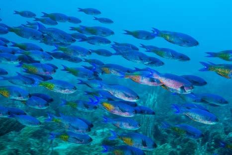
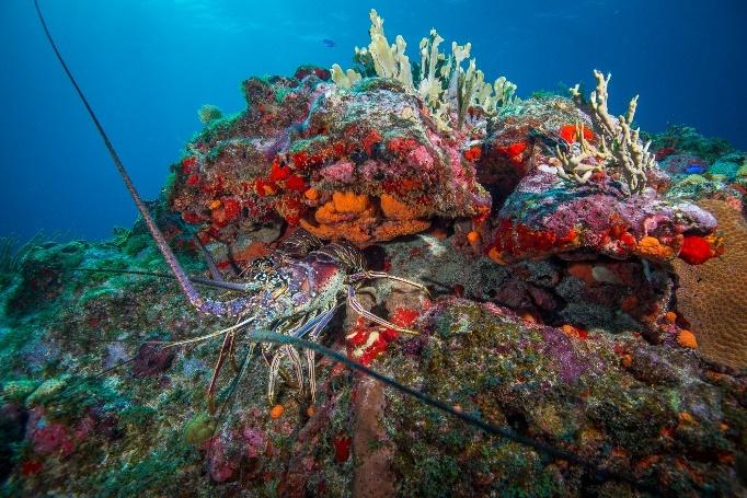
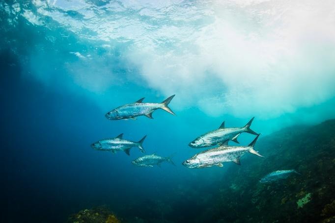
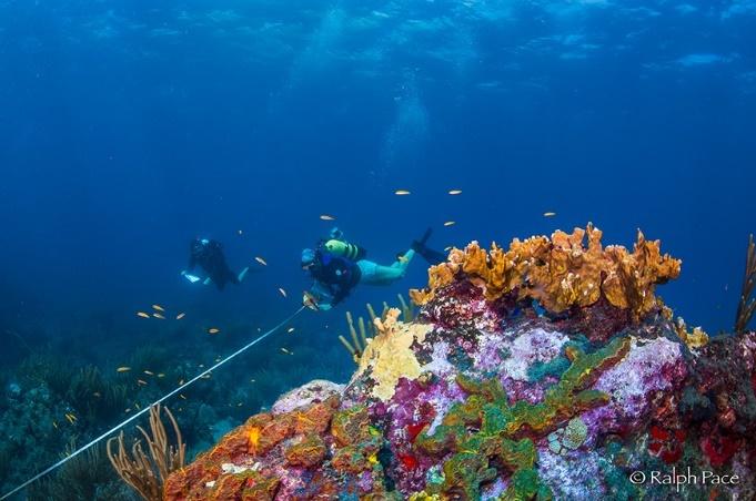
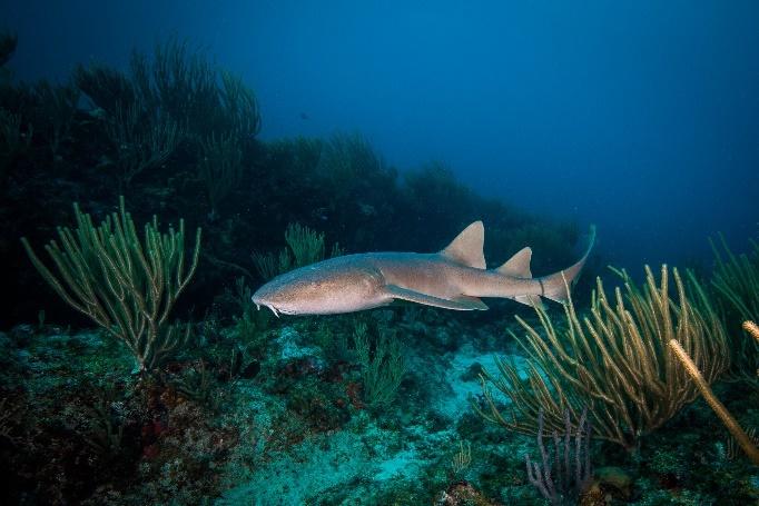
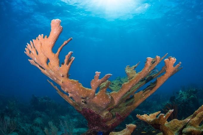
16 Landscape of the Windward Islands
100 Island Challenge Cruise Report Windward Caribbean Nov 6-16, 2016
 1 Island Challenge Cruise Report Windward Caribbean Nov 6-16, 216 Contributing Authors Dr. Stuart Sandin, Scripps Institution of Oceanography Dr. Brian Zgliczynski, Scripps Institution of Oceanography
Cruise Report Mo orea, French Polynesia
 Cruise Report Mo orea, French Polynesia February 26 March 7, 2017 Contributing Authors Dr. Stuart Sandin 1 Dr. Brian Zgliczynski 1 Lindsay Bonito 1 1 Scripps Institution of Oceanography www.100islandchallenge.org
Cruise Report ASRAMP 2018 May 31 August 19, 2018
 Cruise Report ASRAMP 2018 May 31 August 19, 2018 Contributing Authors Dr. Stuart Sandin 1 Dr. Brian Zgliczynski 1 Lindsay Bonito 1 1 Scripps Institution of Oceanography www.100islandchallenge.org Report
A Final Report to. The New Hampshire Estuaries Project. Submitted by
 OYSTER (CRASSOSTREA VIRGINICA) REEF MAPPING IN THE GREAT BAY ESTUARY, NEW HAMPSHIRE - 2003 A Final Report to The New Hampshire Estuaries Project Submitted by Raymond E. Grizzle and Melissa Brodeur University
Status of the Coral Reef of Swains Island 1998
 Status of the Coral Reef of Swains Island 1998 Mike Page and Alison Green Department of Marine and Wildlife Resources Government of American Samoa P.O. Box 3730 American Samoa 96799 Swains Island - showing
Application of Soft Classification Algorithm In Increasing Per Class Classification Accuracy Of Coral Habitat. Aidy M Muslim
 Application of Soft Classification Algorithm In Increasing Per Class Classification Accuracy Of Coral Habitat Aidy M Muslim INTRODUCTION Coral reefs play an essential role to our ecosystem and offer the
Second-Generation Landscape Mosaics of Coral Reefs
 Proceedings of the 11 th International Coral Reef Symposium, Ft. Lauderdale, Florida, 7-11 July 2008 Session number 16 Second-Generation Landscape Mosaics of Coral Reefs B. Gintert 1, N. Gracias 2, A.C.R.
USING UNMANNED AERIAL VEHICLES (UAV'S) TO MEASURE JELLYFISH AGGREGATIONS: AN INTER
 TO MEASURE JELLYFISH AGGREGATIONS: AN INTER") USING UNMANNED AERIAL VEHICLES (UAV'S) TO MEASURE JELLYFISH AGGREGATIONS: AN INTER COMPARISON WITH NET SAMPLING BRIAN P. V. HUNT University of British Columbia Institute for the Oceans and Fisheries Schaub,
USING UNMANNED AERIAL VEHICLES (UAV'S) TO MEASURE JELLYFISH AGGREGATIONS: AN INTER COMPARISON WITH NET SAMPLING BRIAN P. V. HUNT University of British Columbia Institute for the Oceans and Fisheries Schaub,
Coral Reef Remote Sensing
 Coral Reef Remote Sensing Spectral, Spatial, Temporal Scaling Phillip Dustan Sensor Spatial Resolutio n Number of Bands Useful Bands coverage cycle Operation Landsat 80m 2 2 18 1972-97 Thematic 30m 7
Page 1. Abstract: History
 GIS in the Virgin Islands National Park & the Coral Reef National Monument Christy Loomis Virgin Islands National Park ESRI Federal User Conference January 31- February 2, 2006 Abstract: The Virgin Islands
Population assessment of staghorn ( Acropora cervicornis ) and elkhorn corals ( A. palmata
 and elkhorn corals ( A. palmata") Population assessment of staghorn (Acropora cervicornis) and elkhorn corals (A. palmata) in the upper Keys region of the Florida Keys National Marine Sanctuary Principal Investigator Steven L. Miller,
Population assessment of staghorn (Acropora cervicornis) and elkhorn corals (A. palmata) in the upper Keys region of the Florida Keys National Marine Sanctuary Principal Investigator Steven L. Miller,
AKUMAL REEF MONITORING PROJECT
 AKUMAL REEF MONITORING PROJECT 1994 2001 A Capstone Project Presented to the Faculty of Earth Systems Science and Policy in the Center for Science, Technology, and Information Resources at California State
Use of Estuarine, Intertidal, and Subtidal Habitats by Seabirds Within the MLPA South Coast Study Region. Final Plan of Work.
 Use of Estuarine, Intertidal, and Subtidal Habitats by Seabirds Within the MLPA South Coast Study Region Final Plan of Work Project Leaders: Daniel P. Robinette and Jaime Jahncke (PRBO Conservation Science)
COMPILED BY: JEREMIAH PLASS-JOHNSON
 TINIAN MARINE SANCTUARY PRELIMINARY REPORT FISHERIES RESEARCH PROGRAM, PROJECT B REEF FISH STOCK STATUS, JOB MONITORING AND ASSESSMENT OF MARINE SANCTUARIES COMPILED BY: JEREMIAH PLASS-JOHNSON INTRODUCTION
Acropora Species Status and Trends in Dry Tortugas National Park
 Acropora Species Status and Trends in Dry Tortugas National Park Douglas Morrison 1, Meredith Meyers 2, Jim Kidney 3, Dustin Johnson 3, Rob Ruzicka 3, Mike Colella 3, Michael Callahan 3, Vanessa Brinkhuis
CLME+ SOMEE CREATE AWARENESS TRIGGER ACTION INFORM MEASURE PROGRESS
 CLME+ SOMEE INFORM CREATE AWARENESS TRIGGER ACTION MEASURE PROGRESS CLME+ Strategic Action Programme 2015-2025 Origin and concept Start 2025 -. Monitor and Evaluate results of the implementation Evaluate
Preliminary study of the seagrasses in Middle Tampa Bay between Apollo Beach and Simmons Park
 University of South Florida Scholar Commons Reports Tampa Bay Area Study Group Project 9-3-1986 Preliminary study of the seagrasses in Middle Tampa Bay between Apollo Beach and Simmons Park Mangrove Systems,
POPULAT A ION DYNAMICS
 POPULATION DYNAMICS POPULATIONS Population members of one species living and reproducing in the same region at the same time. Community a number of different populations living together in the one area.
Coconut Crab (Birgus Latro) Survey on Diego Garcia. Prepared by Mr. Scott Vogt NAVFAC Pacific. September 2004
 Survey on Diego Garcia. Prepared by Mr. Scott Vogt NAVFAC Pacific. September 2004") Coconut Crab (Birgus Latro) Survey on Diego Garcia Prepared by Mr. Scott Vogt NAVFAC Pacific September 24 Appendix G INTRODUCTION The Coconut or Robber Crab (Birgus latro) has a wide distribution ranging
Coconut Crab (Birgus Latro) Survey on Diego Garcia Prepared by Mr. Scott Vogt NAVFAC Pacific September 24 Appendix G INTRODUCTION The Coconut or Robber Crab (Birgus latro) has a wide distribution ranging
Photo Scale The photo scale and representative fraction may be calculated as follows: PS = f / H Variables: PS - Photo Scale, f - camera focal
 Scale Scale is the ratio of a distance on an aerial photograph to that same distance on the ground in the real world. It can be expressed in unit equivalents like 1 inch = 1,000 feet (or 12,000 inches)
MARINE ENVIRONMENTAL TECHNOLOGY
 MARINE ENVIRONMENTAL TECHNOLOGY To earn an AS in MET, students must earn sixty two (62) credits. Students must complete fifteen (15) credit hours of general education courses, thirty-five (35) credit hours
Simon Says WHAT S INSIDE PROTECTED AREAS IN THE SANCTUARY HOW IS SIMON INVOLVED?
 Simon Says TRACKING THE HEALTH OF OUR SANCTUARY Monterey Bay National Marine Sanctuary INSIDE 1 Introduction 2 MPAs 3 Seasonal Upwelling 4 Habitat 5 biodiversity 6 Synopsis 8 SIMoN Web Site Welcome to
CATLIN SEAVIEW SURVEY PUBLISHES GAME- CHANGING VISUAL RECORD OF GREAT BARRIER REEF
 PRESS RELEASE For immediate release CATLIN SEAVIEW SURVEY PUBLISHES GAME- CHANGING VISUAL RECORD OF GREAT BARRIER REEF IMAGES ALSO RELEASED IN STREET VIEW IN GOOGLE MAPS More than 100,000 images spanning
MONITORING IN SHARK BAY MARINE PARK WESTERN AUSTRALIA
 MONITORING IN SHARK BAY MARINE PARK WESTERN AUSTRALIA Kevin P Bancro< 1, 2 Simone S Strydom 1, 3 George Shedrawi 1 Thomas Holmes 1 Kathy Murray 4 Bart Huntley 4 1 Marine Science Program, Department of
Error and precision of photogrammetry in the deep-sea
 Error and precision of photogrammetry in the deep-sea Samantha Peart, North Carolina State University, Raleigh, NC Mentors: Katherine Dunlop and Brian Schlining Summer 2015 Keywords: deep-sea ecology,
Work Plan for Pre-Construction Avian and Bat Surveys
 Work Plan for Pre-Construction Avian and Bat Surveys, Steuben County, New York Prepared For: EverPower Wind Holdings, Inc. 1251 Waterfront Place, 3rd Floor Pittsburgh, PA 15222 Prepared By: Stantec Consulting
MULTI-TEMPORAL SATELLITE IMAGES WITH BATHYMETRY CORRECTION FOR MAPPING AND ASSESSING SEAGRASS BED CHANGES IN DONGSHA ATOLL
 MULTI-TEMPORAL SATELLITE IMAGES WITH BATHYMETRY CORRECTION FOR MAPPING AND ASSESSING SEAGRASS BED CHANGES IN DONGSHA ATOLL Chih -Yuan Lin and Hsuan Ren Center for Space and Remote Sensing Research, National
Marine Reserve Science and Monitoring Workshop Oregon Department of Fish and Wildlife, February 3, 2012
 Marine Reserve Science and Monitoring Workshop Oregon Department of Fish and Wildlife, February 3, 2012 Meeting Purpose The purpose of this meeting was to seek expert feedback on current and future ecological
2007 Quick Look Report
 2007 Quick Look Report Large-scale assessment of Acropora corals, coral species richness, urchins and Coralliophila snails in the Florida Keys National Marine Sanctuary and Biscayne National Park December
SUPPLEMENTAL MATERIALS Abbott, R. (1996). Seashells of North America: A guide to field identification. New York: St. Martin's Press.
. Seashells of North America: A guide to field identification. New York: St. Martin's Press.") Exercise 6 Bivalve Species Richness, Diversity and Size class distribution: First Landing State Park This exercise focuses on community structure of bivalves in a sandy beach habitat. The students will
Exercise 6 Bivalve Species Richness, Diversity and Size class distribution: First Landing State Park This exercise focuses on community structure of bivalves in a sandy beach habitat. The students will
High Resolution Optical Imaging for Deep Water Archaeology
 High Resolution Optical Imaging for Deep Water Archaeology Hanumant Singh 1, Christopher Roman 1, Oscar Pizarro 2, Brendan Foley 1, Ryan Eustice 1, Ali Can 3 1 Dept of Applied Ocean Physics and Engineering,
Photo-mosaic Coral Bleaching Analysis at Cheeca Rocks
 Photo-mosaic Coral Bleaching Analysis at Cheeca Rocks Brooke Gintert University of Miami/RSMAS-Coral Reef Imaging Lab With: R. Carlton, G. Kolodziej, P. Jones, I. Enochs, A. Gleason, N. Gracias, P. Reid,
South Atlantic Bight Synoptic Offshore Observational Network
 South Atlantic Bight Synoptic Offshore Observational Network Charlie Barans Marine Resources Division South Carolina Department of Natural Resources P.O. Box 12559 Charleston, SC 29422 phone: (843) 762-5084
Figure 3: Map showing the extension of the six surveyed areas in Indonesia analysed in this study.
 5 2. METHODOLOGY The present study consisted of two phases. First a test study was conducted to evaluate whether Landsat 7 images could be used to identify the habitat of humphead wrasse in Indonesia.
SEABED MAPPING IN THE NATIONAL MARINE SANCTUARIES. Bradley W. Barr, NOAA s National Marine Sanctuary Program. Abstract
 SEABED MAPPING IN THE NATIONAL MARINE SANCTUARIES Bradley W. Barr, NOAA s National Marine Sanctuary Program Abstract Seabed maps are an essential tool in the coastal and ocean resource manager s toolbox,
Coastal Benthic Optical Properties Fluorescence Imaging Laser Line Scan Sensor
 Coastal Benthic Optical Properties Fluorescence Imaging Laser Line Scan Sensor Dr. Michael P. Strand Naval Surface Warfare Center Coastal Systems Station, Code R22 6703 West Highway 98, Panama City, FL
FLIGHT SUMMARY REPORT
 FLIGHT SUMMARY REPORT Flight Number: 97-011 Calendar/Julian Date: 23 October 1996 297 Sensor Package: Area(s) Covered: Wild-Heerbrugg RC-10 Airborne Visible and Infrared Imaging Spectrometer (AVIRIS) Southern
2. Survey Methodology
 Analysis of Butterfly Survey Data and Methodology from San Bruno Mountain Habitat Conservation Plan (1982 2000). 2. Survey Methodology Travis Longcore University of Southern California GIS Research Laboratory
Biological Inventories
 Field Lab 1 Urban Ecology Center Biological Inventories Introduction In order to begin work on our semester research project, this week we will be conducting biological inventories at a moderately disturbed
Fugro Worldwide Fugro Environmental
 1 2 Fugro Worldwide The Fugro group of companies is an international consulting company that provides measurements and interpretations of data related to the earth's surface and the soils and rocks beneath.
IDENTIFICATION AND MAPPING OF HAWAIIAN CORAL REEFS USING HYPERSPECTRAL REMOTE SENSING
 IDENTIFICATION AND MAPPING OF HAWAIIAN CORAL REEFS USING HYPERSPECTRAL REMOTE SENSING Jessica Frances N. Ayau College of Education University of Hawai i at Mānoa Honolulu, HI 96822 ABSTRACT Coral reefs
Before and After in Belize: Testing a Marine Reserve 2012 FIELD REPORT
 Before and After in Belize: Testing a Marine Reserve 2012 FIELD REPORT Background Information Lead PI: John A. Cigliano Project scientists: Dr. John A. Cigliano and Dr. Richard Kliman Report completed
DISTRIBUTION AND ABUNDANCE OF SEA DUCKS AND DIVING DUCKS ON LAKE ST. CLAIR AND W. LAKE ERIE
 DISTRIBUTION AND ABUNDANCE OF SEA DUCKS AND DIVING DUCKS ON LAKE ST. CLAIR AND W. LAKE ERIE Dave Luukkonen, Michigan DNR and Michigan State University Importance of Lake St. Clair and western Lake Erie
Roberts Bank Terminal 2 Project Field Studies Information Sheet
 July 2012 Port Metro Vancouver is continuing field studies in July as part of ongoing environmental and technical work for the proposed Roberts Bank Terminal 2 Project. Roberts Bank Terminal 2 Project
MPA Baseline Program. Annual Progress Report. Use of Estuarine, Intertidal, and Subtidal Habitats by Seabirds Within the MLPA South Coast Study Region
 MPA Baseline Program Annual Progress Report Principal Investigators - please use this form to submit your MPA Baseline Program project annual report, including an update on activities completed over the
Impacts of sharks on coral reef ecosystems
 Impacts of sharks on coral reef ecosystems } Do healthy reefs need sharks? This is one of the most misunderstood questions in coral reef ecology. Shark populations are declining due to habitat loss, overfishing,
The Pitcairn Islands Marine Reserve A global benchmark in marine protection
 A fact sheet from March 2015 The Pitcairn Islands Marine Reserve A global benchmark in marine protection Overview In September 2016, the United Kingdom created a fully protected marine reserve spanning
Coastal Benthic Optical Properties Fluorescence Imaging Laser Line Scan Sensor
 Coastal Benthic Optical Properties Fluorescence Imaging Laser Line Scan Sensor Dr. Michael P. Strand Naval Surface Warfare Center Coastal Systems Station, Code R22 6703 West Highway 98, Panama City, FL
Beacon Island Report / Notes
 Beacon Island Report / Notes Paul Bourke, ivec@uwa, 17 February 2014 During my 2013 and 2014 visits to Beacon Island four general digital asset categories were acquired, they were: high resolution panoramic
Trinity River Bird and Vegetation Monitoring: 2015 Report Card
 Trinity River Bird and Vegetation Monitoring: 2015 Report Card Ian Ausprey 2016 KBO 2016 Frank Lospalluto 2016 Frank Lospalluto 2016 Background The Trinity River Restoration Program (TRRP) was formed in
UNDERWATER PHOTOGRAPHY WORKSHOP.
 UNDERWATER PHOTOGRAPHY WORKSHOP www.images-underwater.net ANY QUESTIONS SHOUT! RICHARD BAILEY richard@images-underwater.net ALL IMAGES COPYRIGHT ENVIRONMENT TECHY BIT BASIC TIPS TYPES OF SHOT COMPOSITION
Exploring the Depth Coral Reefs, Mapping and Monitoring
 Exploring the Depth Coral Reefs, Mapping and Monitoring Dr Chris Roelfsema School Of Geography, Planning and Environmental Management Our Aim To introduce you to the world of coral reef monitoring on the
Project Number: H Project Title:
 Project Number: 3-H Project Title: PWS Herring Survey: Seasonal and Interannual Trends in Seabird Predation on Juvenile Herring PI Name: Dr. Mary Anne Bishop and Dr. Kathy Kuletz Time period covered: FY
Development of a Shallow Water Ambient Noise Database
 Development of a Shallow Water Ambient Noise Database Tan Soo Pieng, Koay Teong Beng, P. Venugopalan, Mandar A Chitre and John R. Potter Acoustic Research Laboratory, Tropical Marine Science Institute
MLPA NCSR Baseline Seabird Nearshore Foraging and Feeding Flock Monitoring Protocol Point Blue Conservation Science
 MLPA NCSR Baseline Seabird Nearshore Foraging and Feeding Flock Monitoring Protocol 2014-2015 Point Blue Conservation Science OVERVIEW This document provides instructions for collecting data within the
The sound of sediments : acoustic sensing in uncertain environments van Leijen, A.V.
 UvA-DARE (Digital Academic Repository) The sound of sediments : acoustic sensing in uncertain environments van Leijen, A.V. Link to publication Citation for published version (APA): van Leijen, A. V. (2010).
Baltic Marine Environment Protection Commission
 Baltic Marine Environment Protection Commission Ad hoc Seal Expert Group Berlin, Germany, 2-4 December 2015 SEAL 9-2015, 5-1 Document title Development of a HELCOM database for seals Code 5-1 Category
Development of Mid-Frequency Multibeam Sonar for Fisheries Applications
 Development of Mid-Frequency Multibeam Sonar for Fisheries Applications John K. Horne University of Washington, School of Aquatic and Fishery Sciences Box 355020 Seattle, WA 98195 phone: (206) 221-6890
General Overview of Data Identified and Review of Existing Datasets/sources
 General Overview of Data Identified and Review of Existing Datasets/sources Regional Workshop on Integration, Mapping and GIS Analysis of Marine Mammal Migration Routes, Critical Habitats and Human Threats
Keywords: off shore, wind farm, monitoring, bird population, aerial survey
 ICES CM 2012/O:18 Not to be cited without prior reference to the author Aerial survey techniques for assessing offshore wind farms Stuart C. Clough 1, Stephanie McGovern 2, David Campbell 3, Mark M. Rehfisch
CalCOFI Marine Mammal Monitoring
 CalCOFI Marine Mammal Monitoring Greg Campbell 1, Lisa Munger 1, Karlina Merkens 1, Dominque Camacho 2, Andrea Havron 2 and John Hildebrand 1 1 Scripps Institution of Oceanography, La Jolla 2 Spatial Ecosystems,
Sandhill Cranes and Waterfowl of the North Platte River Valley: Evaluation of Habitat Selection to Guide Conservation Delivery
 Sandhill Cranes and Waterfowl of the North Platte River Valley: Evaluation of Habitat Selection to Guide Conservation Delivery { Emily Munter, Wildlife Biologist U.S. Fish and Wildlife Service Nebraska
DISTRIBUTION, AND RELATIVE ABUNDANCE OF THE COMMON DOLPHIN DELPHINUS DELPHIS IN THE BAY OF BISCAY
 DISTRIBUTION, AND RELATIVE ABUNDANCE OF THE COMMON DOLPHIN DELPHINUS DELPHIS IN THE BAY OF BISCAY T. M. Brereton 1, A. D. Williams 2, & R. Williams 3 1Biscay Dolphin Research Programme, c/o 20 Mill Street,
INTRACOASTAL WATERWAY DEEPENING BROWARD COUNTY, FLORIDA
 INTRACOASTAL WATERWAY DEEPENING BROWARD COUNTY, FLORIDA APPENDIX J Submerged Aquatic Resources Survey Seagrass Survey Temporary Coral Relocation INTRACOASTAL WATERWAY DEEPENING BROWARD COUNTY, FLORIDA
The Benefits of Transnational Co-operation. operation. Jan van Dalfsen & all
 The Benefits of Transnational Co-operation operation Jan van Dalfsen & all Why co-operate? operate? I am an expert, I know what is best Co-operation needs more planning Find some sort of agreement Less
Wildlife Inventory Plan Alaska Maritime National Wildlife Refuge Protocol #28. Version 1.2. Parameter: Populations
 Wildlife Inventory Plan Alaska Maritime National Wildlife Refuge Protocol #28 Version 1.2 Parameter: Populations Species: Seabirds and marine mammals at Walrus Island PURPOSE To census seabird and marine
Benthic Photo Survey Documentation
 Benthic Photo Survey Documentation Release 1.0.1 Jared Kibele December 18, 2014 Contents 1 Contents 3 1.1 Introduction............................................... 3 1.2 Installation................................................
Introduction to Aerial Photographs and Topographic maps (Chapter 7, 9 th edition) or (chapter 3, 8 th edition)
 or (chapter 3, 8 th edition)") GEOLOGY 306 Laboratory Instructor: TERRY J. BOROUGHS NAME: Introduction to Aerial Photographs and Topographic maps (Chapter 7, 9 th edition) or (chapter 3, 8 th edition) For this assignment you will require:
GEOLOGY 306 Laboratory Instructor: TERRY J. BOROUGHS NAME: Introduction to Aerial Photographs and Topographic maps (Chapter 7, 9 th edition) or (chapter 3, 8 th edition) For this assignment you will require:
AVIAN USE OF ROADSIDE HABITAT IN THE SOUTHERN DRIFT PLAINS OF NORTH DAKOTA AND IMPLICATIONS FOR CATTAIL (TYPHA SPP.) MANAGEMENT
 MANAGEMENT") AVIAN USE OF ROADSIDE HABITAT IN THE SOUTHERN DRIFT PLAINS OF NORTH DAKOTA AND IMPLICATIONS FOR CATTAIL (TYPHA SPP.) MANAGEMENT Bryan D. Safratowich, Department of Biological Sciences, Stevens Hall, North
AVIAN USE OF ROADSIDE HABITAT IN THE SOUTHERN DRIFT PLAINS OF NORTH DAKOTA AND IMPLICATIONS FOR CATTAIL (TYPHA SPP.) MANAGEMENT Bryan D. Safratowich, Department of Biological Sciences, Stevens Hall, North
WWF-Canada - Technical Document
 WWF-Canada - Technical Document Date Completed: September 14, 2017 Technical Document Living Planet Report Canada What is the Living Planet Index Similar to the way a stock market index measures economic
Environment and Natural Resources Trust Fund (ENRTF) M.L ENRTF Work Plan (Main Document)
 M.L ENRTF Work Plan (Main Document)") Environment and Natural Resources Trust Fund (ENRTF) M.L. 2019 ENRTF Work Plan (Main Document) Today s Date: 8/24/2018 Date of Next Status Update Report: May 1, 2020 Date of Work Plan Approval: Project
Environment and Natural Resources Trust Fund (ENRTF) M.L. 2019 ENRTF Work Plan (Main Document) Today s Date: 8/24/2018 Date of Next Status Update Report: May 1, 2020 Date of Work Plan Approval: Project
Roberts Bank Terminal 2 Project Field Studies Information Sheet
 May 2013 Port Metro Vancouver is continuing field studies in May as part of ongoing environmental and technical work for the proposed Roberts Bank Terminal 2 Project. Roberts Bank Terminal 2 Project The
J. van Rijn. Initial Queen conch (Strombus gigas) studies on St. Eustatius
 studies on St. Eustatius") J. van Rijn Initial Queen conch (Strombus gigas) studies on St. Eustatius Abstract The large marine gastropod, Queen conch (Strombus gigas) was studied over a period of 3 months on the island of St. Eustatius.
J. van Rijn Initial Queen conch (Strombus gigas) studies on St. Eustatius Abstract The large marine gastropod, Queen conch (Strombus gigas) was studied over a period of 3 months on the island of St. Eustatius.
WILDLIFE MONITORING FOR THE COLLABORATIVE FOREST RESTORATION PROGRAM Protocols for Monitoring Birds, Turkey, Deer and Elk
 WILDLIFE MONITORING FOR THE COLLABORATIVE FOREST RESTORATION PROGRAM Protocols for Monitoring Birds, Turkey, Deer and Elk David Parsons Melissa Savage January 2008 New Mexico Forest Restoration Series
Marbled Murrelet Effectiveness Monitoring, Northwest Forest Plan
 Marbled Murrelet Effectiveness Monitoring, Northwest Forest Plan 2017 Summary Report Northwest Forest Plan Interagency Regional Monitoring Program Photo credits: S.F. Pearson (top) May 2018 1 Marbled Murrelet
ESTIMATING REEF HABITAT COVERAGE SUITABLE FOR THE HUMPHEAD WRASSE, CHEILINUS UNDULATUS, USING REMOTE SENSING
 FAO Fisheries and Aquaculture Circular No. 1057 FIRF/C1057 (En) ISSN 2070-6065 ESTIMATING REEF HABITAT COVERAGE SUITABLE FOR THE HUMPHEAD WRASSE, CHEILINUS UNDULATUS, USING REMOTE SENSING Copies of FAO
Fisheries-independent data for Hogfish (Lachnolaimus maximus) from reef-fish video surveys on the West Florida Shelf,
 from reef-fish video surveys on the West Florida Shelf,") Fisheries-independent data for Hogfish (Lachnolaimus maximus) from reef-fish video surveys on the West Florida Shelf, 2005-2012. Theodore S. Switzer 1, Sean F. Keenan 1, Robert H. McMichael, Jr. 1, Douglas
Fisheries-independent data for Hogfish (Lachnolaimus maximus) from reef-fish video surveys on the West Florida Shelf, 2005-2012. Theodore S. Switzer 1, Sean F. Keenan 1, Robert H. McMichael, Jr. 1, Douglas
Two Bays Whale Project Summary David Donnelly, Sue Mason, Mikala Peters and Jen McFee
 Two Bays Whale Project Summary 2018 David Donnelly, Sue Mason, Mikala Peters and Jen McFee Project Background The Two Bays Whale Project is a citizen science initiative created through collaboration between
Thanks for invitation to attend this workshop. Michael asked if I would talk about puffins in the UK particularly the studies I ve been involved in
 Thanks for invitation to attend this workshop. Michael asked if I would talk about puffins in the UK particularly the studies I ve been involved in with Mike Harris on the IOM. Pretty big topic going to
STINAPA BONAIRE / WASHINGTON SLAGBAAI NATIONAL PARK BROWN BOOBY MONITORING PROGRAM YEAR REPORT 2008
 STINAPA BONAIRE / WASHINGTON SLAGBAAI NATIONAL PARK BROWN BOOBY MONITORING PROGRAM YEAR REPORT 2008 Written by: Fernando Simal Illustration: Dominique Serafini Bonaire, September 25 th, 2009 ACKNOWLEDGMENTS
Marine Resources of Helen Reef in the Year 2000
 Marine Resources of Helen Reef in the Year 2000 A Summary Report of the Helen Reef Baseline Monitoring Expeditions sponsored by the Hatohobei Natural Resource Management Program, Hatohobei State, Republic
Identifying Ecological Hotspots in the Bering, Chukchi, and Beaufort Seas
 Identifying Ecological Hotspots in the Bering, Chukchi, and Beaufort Seas Esri User Conference July 2018 image: Milo Burcham Erika Knight, Melanie Smith, Max Goldman, & Ben Sullender Audubon Alaska Audubon
MIMO Transceiver Systems on AUVs
 MIMO Transceiver Systems on AUVs Mohsen Badiey 107 Robinson Hall College of Marine and Earth Studies, phone: (302) 831-3687 fax: (302) 831-6521 email: badiey@udel.edu Aijun Song 114 Robinson Hall College
M/C ALYA CENTRAL AND EASTERN ISLANDS 8 DAY / 7 NIGHT CRUISE MONDAY - MONDAY
 M/C ALYA CENTRAL AND EASTERN ISLANDS 8 DAY / 7 NIGHT CRUISE MONDAY - MONDAY DAY BY DAY ISLANDS - San Cristobal - Española - Santa Cruz - North Seymour - Genovesa - Santiago - Bartholome DAY 1 SAN CRISTOBAL
Record of the 12 th Scientific Working Group of the Preparatory Conference of the North Pacific Fisheries Commission Tokyo, Japan March 2014
 Record of the 12 th Scientific Working Group of the Preparatory Conference of the North Pacific Fisheries Commission Tokyo, Japan 17-18 March 2014 1. Welcome and Opening Remarks The SWG meeting was held
Guidelines and stipulations for the use of self-print labs from SimBiotic Software
 Guidelines and stipulations for the use of self-print labs from SimBiotic Software We offer the text that accompanies our computer laboratories in this digital ( self-print ) format to provide instructors
By Chris Roman, Gabrielle Inglis, Ian Vaughn, Clara Smart, Donald Dansereau, Daniel Bongiorno, Matthew Johnson-Roberson, and Mitch Bryson
 New Tools and Methods for Precision Seafloor Mapping By Chris Roman, Gabrielle Inglis, Ian Vaughn, Clara Smart, Donald Dansereau, Daniel Bongiorno, Matthew Johnson-Roberson, and Mitch Bryson The imaging
PRE-LAB for: Introduction to Aerial Photographs and Topographic maps (Ch. 3)
") GEOLOGY 306 Laboratory Instructor: TERRY J. BOROUGHS NAME: PRE-LAB for: Introduction to Aerial Photographs and Topographic maps (Ch. 3) For this assignment you will require: a calculator and metric ruler.
GEOLOGY 306 Laboratory Instructor: TERRY J. BOROUGHS NAME: PRE-LAB for: Introduction to Aerial Photographs and Topographic maps (Ch. 3) For this assignment you will require: a calculator and metric ruler.
Multiplatform Remote Sensing for Coral Reef Community Assessment
 Multiplatform Remote Sensing for Coral Reef Community Assessment Quinta Reunión Nacional de Percepción Remota y Sistemas de Información Geográfica en Puerto Rico September 27, 2007 Roy A. Armstrong, Ph.
R3I Overview Regional Risk Reduction Initiative
 Technical Cooperation workshop for Development of the Caribbean regional Cooperation Programme in Multi-Hazard Early Warning System Barbados 2-5 November 2010 R3I Overview Regional Risk Reduction Initiative
SURVEY OF SEAGRASS BEDS AT PLACEMENT AREA 62, WEST BAY CONTRACT FOR GIWW, TEXAS CAUSEWAY U. S. ARMY CORPS OF ENGINEERS CONTRACT NO.
 SURVEY OF SEAGRASS BEDS AT PLACEMENT AREA 62, WEST BAY CONTRACT FOR GIWW, TEXAS CAUSEWAY U. S. ARMY CORPS OF ENGINEERS CONTRACT NO. W912HY-10-C-0036 Prepared for: RLB CONTRACTING, INC. P.O. Box 1739 Port
Brian Skerry: Below the Surface
 JANUARY 22, 2018 INTERMEDIATE Brian Skerry: Below the Surface Featuring BRIAN SKERRY Brian Skerry A school of bluefin tuna swim inside a massive purse seine fishing net in the Mediterranean Sea off the
Guidance note: Distribution of breeding birds in relation to upland wind farms
 Guidance note: Distribution of breeding birds in relation to upland wind farms December 2009 Summary Impacts of wind farms on bird populations can occur through collisions, habitat loss, avoidance/barrier
2016 Florida 4-H Marine & Aquatic Photography Contest
 2016 Florida 4-H Marine & Aquatic Photography Contest Rules and Guidelines About the Contest The Marine/Aquatic Photography contest provides 4-H youth with opportunities to practice and be recognized for
Environment and Natural Resources Trust Fund 2019 Request for Proposals (RFP)
") Environment and Natural Resources Trust Fund 2019 Request for Proposals (RFP) Project Title: Implementing Conservation Plans for Avian Species of Concern Category: H. Proposals seeking 200,000 or less
Environment and Natural Resources Trust Fund 2019 Request for Proposals (RFP) Project Title: Implementing Conservation Plans for Avian Species of Concern Category: H. Proposals seeking 200,000 or less
A Survey of Native and Introduced Anolis Lizards in Southern Florida
 A Survey of Native and Introduced Anolis Lizards in Southern Florida Regina Honorat 1, Tracy Joseph 2, Amalia Reyes 3, Anthony Clarke 1, Francisco Irizarry 4, and Jabari Smith 5 1 John F. Kennedy Middle
Introduction to Aerial Photographs and Topographic maps (Chapter 3)
") GEOLOGY 306 Laboratory Instructor: TERRY J. BOROUGHS NAME: Introduction to Aerial Photographs and Topographic maps (Chapter 3) For this assignment you will require: a calculator and metric ruler. Objectives:
GEOLOGY 306 Laboratory Instructor: TERRY J. BOROUGHS NAME: Introduction to Aerial Photographs and Topographic maps (Chapter 3) For this assignment you will require: a calculator and metric ruler. Objectives:
New England Marine Energy Development System NEMEDS
 New England Marine Energy Development System NEMEDS INTRODUCTION The New England Marine Energy Development System (NEMEDS) is a series of test sites aiming to satisfy the requirements of Technology Readiness
So many algae, so little time.
 So many algae, so little time. COLLECTIONS MANAGEMENT 1 Collections Management Autoridad Nacional del Ambiente Permits are required to collect marine organisms in Panama STRI is covered by a blanket marine
Ladd Marsh Wildlife Area BCS number: 49-3
 Oregon Coordinated Aquatic Bird Monitoring: Description of Important Aquatic Bird Site Ladd Marsh Wildlife Area BCS number: 49-3 Site description author M. Cathy Nowak, Ladd Marsh Wildlife Area Biologist