Draft Natural Resources Evaluation
|
|
|
- Nancy Snow
- 5 years ago
- Views:
Transcription
 Draft Natural Resources Evaluation D R AF T Work Program Item")


1 Project Development & Environment (PD&E) Study for Replacement of the Northbound Howard Frankland Bridge (I-275/SR 93) Draft Natural Resources Evaluation D R AF T Work Program Item Segment No. : ETDM Project No Pinellas & Hillsborough Counties October 2017 The environmental review, consultation, and other actions required by applicable federal environmental laws for this project are being, or have been, carried out by FDOT pursuant to 23 U.S.C. 327 and a Memorandum of Understanding dated December 14, 2016, and executed by FHWA and FDOT.

2 Draft Natural Resources Evaluation Florida Department of Transportation District Seven Replacement of the Northbound Howard Frankland Bridge (I-275/SR 93) One Mile South of the Bridge to Half-mile North of the Bridge Pinellas and Hillsborough Counties Work Program Item Segment No ETDM Project No The environmental review, consultation, and other actions required by applicable federal environmental laws for this project are being, or have been, carried out by the FDOT pursuant to 23 U.S.C. 327 and a Memorandum of Understating dated December 14, 2016 and executed by the FHWA and FDOT. Kirk Bogen, P.E. FDOT Project Manager October 2017
3 EXECUTIVE SUMMARY The Florida Department of Transportation (FDOT) is conducting a Project Development and Environment (PD&E) study to evaluate alternatives for the replacement of the northbound Howard Frankland Bridge (Bridge No ) on Interstate 275 (I-275/SR 93) over Old Tampa Bay, in Pinellas and Hillsborough Counties. The limits of the PD&E study begin approximately one mile south and end approximately 0.5 mile to the north of the existing three-mile bridge to include portions of the existing causeway. The study was designed to assist the FDOT and the Federal Highway Administration (FHWA) in reaching a decision on the type, location, and conceptual design of the necessary improvements for the replacement of the northbound bridge. A simultaneous Regional Transit Corridor Evaluation was conducted to evaluate premium transit alternatives within the bridge corridor to link the Gateway area in Pinellas County to the Westshore area in Hillsborough County. This PD&E study also evaluated options for inclusion of a future exclusive transit envelope within the Howard Frankland Bridge corridor in addition to accommodations for tolled express lanes. The alignment of I-275 in the project limits runs along a trajectory of southwest-northeast. For purposes of this project and to simplify the discussions involving directionality, I-275 is presumed to run north-south as it extends from the south apex in Manatee County to the north apex in Pasco County and the sides of the roadway/bridge are either on the east or west side. Location alternatives for constructing the new bridge included the west side of the southbound bridge, between the two existing bridges, and east of the existing northbound bridge. The Recommended Build Alternative includes constructing the new bridge to the west side of the existing southbound bridge. The previously proposed build alternative included constructing the new bridge between the two existing bridges. After further evaluation, it was determined that the Recommended Build Alternative would decrease complexity of construction, reduce construction time and decrease potential lane closures associated with maintenance of traffic compared to the previously proposed build alternative. Demolition of the existing northbound bridge is still included as part of the Recommended Build Alternative. The future transit envelope is proposed to be located on the west side of the to-be-constructed new bridge. The new bridge will include one tolled express lane in each direction, the Starter Project for Tampa Bay Next, FDOT s program to modernize Tampa Bay s transportation infrastructure. The tolled express lanes could be used by express bus and Bus Rapid Transit (BRT) vehicles in addition to private motor vehicles. In addition to the build alternatives considered, a No-Build and a Rehabilitation option were also considered during the study process. Based on a life-cycle cost analysis conducted by FDOT in September 2011, it was determined that over an 80-year analysis period, replacing the existing bridge rather than rehabilitating and maintaining it would cost approximately 25 percent less, based on a presentworth analysis. This Draft Natural Resource Evaluation (NRE) was prepared as part of this PD&E study. This report summarizes potential impacts to wetlands, federal- and state-listed species and their habitats, and essential fish habitat. Identification of measures to avoid, minimize and mitigate for any potential Northbound Howard Frankland Bridge Replacement PD&E Study WPI Segment No.: Draft NRE Page i
4 impacts is also discussed. This Draft NRE documents the results of geographic information system (GIS) data reviews, field reviews, coordination with regulatory agencies including comments received through the Efficient Transportation Decision Making (ETDM) process, and aerial interpretation for potential impacts to the resources listed above. The majority of the project corridor consists of spoil material from the construction of the Causeway and waters of Old Tampa Bay. No natural upland habitat and minimal, if any, wetland habitat exists within the project study area. Coordination was conducted with federal and state agencies throughout the study process. Wetlands Pursuant to Executive Order entitled Protection of Wetlands, (May 1977) the U.S. Department of Transportation (USDOT) has developed a policy, Preservation of the Nation s Wetlands (USDOT Order A), dated August 24, 1978, which requires all federally-funded highway projects to protect wetlands to the fullest extent possible. No wetland impacts are anticipated to occur from construction of the Recommended Build Alternative. Surface water impacts will result to waters of Old Tampa Bay by expansion of the existing causeway to accommodate the new bridge. Temporary water quality impacts from construction may occur to waters of Old Tampa Bay; however, best management practices (BMPs) will be utilized during construction. Since there are no wetland impacts anticipated, no wetland mitigation is proposed for the bridge replacement. Seagrasses are identified separately as part of the essential fish habitat assessment. Protected Species and Habitat The project corridor was also assessed for the presence of suitable habitat for federal- and statelisted protected species and U.S. Fish and Wildlife Service (USFWS) Critical Habitat in accordance with 50 Code of Federal Regulations (CFR) Part 402 of the Endangered Species Act (ESA) of 1973, as amended, Chapters 5B-40: Preservation of Native Flora of Florida and 68A-27 Florida Administrative Code (F.A.C.) Rules Relating to Endangered or Threatened Species, the Migratory Bird Treaty Act of 1918 and Part 2, Chapter 16 - Protected Species and Habitat of the FDOT PD&E Manual (June 2017). Species assessed for this project include, but were not limited to, the following: Gulf sturgeon, smalltooth sawfish, West Indian manatee, swimming sea turtles (loggerhead, green, leatherback and Kemp s ridley), piping plover, wood stork, red knot, snowy plover, American oystercatcher, black skimmer, brown pelican, least tern, little blue heron, reddish egret, roseate spoonbill, snowy egret, tricolored heron, white ibis, and osprey. Additionally, review for the de-listed bald eagle was also conducted. Since the start of the study, the following species are no longer listed: brown pelican, snowy egret, white ibis and osprey. Field reviews for protected species and their suitable habitat were conducted within the project study limits. Based on the findings obtained during the field survey efforts, four protected faunal species and no protected floral species were observed within the project study limits. Twenty-two protected species have potential habitat within or adjacent to the project study limits based on database and literature research, and field observations of available habitat. Northbound Howard Frankland Bridge Replacement PD&E Study WPI Segment No.: Draft NRE Page ii
5 A finding of no effect was assigned for the bald eagle and a finding of no involvement was assigned for USFWS Critical Habitat. A finding of may affect, but not likely to adversely affect was assigned for the wood stork, piping plover, red knot, Gulf sturgeon, West Indian manatee, smalltooth sawfish, sea turtles, American oystercatcher, black skimmer, least tern, little blue heron, reddish egret, tricolored heron, roseate spoonbill, and snowy plover. Essential Fish Habitat Estuarine and marine habitats of Old Tampa Bay exist within and adjacent to the project study limits on the east and west side of the Causeway and below the existing bridges. These habitats include seagrasses located at various areas on the east and west side of the Causeway on both the south and north end of the Howard Frankland Bridge. The Gulf Coast Fisheries Management Council (FMC) recognizes seagrasses as essential fish habitat (EFH). According to GIS data from SWFWMD and field reviews, seagrasses exist within the proposed project area. The construction of the Recommended Build Alternative will result in approximately 9.5 acres of seagrass impacts. Northbound Howard Frankland Bridge Replacement PD&E Study WPI Segment No.: Draft NRE Page iii
6 TABLE OF CONTENTS SECTION 1 INTRODUCTION PD&E Study Purpose Project Description Project Purpose and Need Report Purpose SECTION 2 EXISTING ENVIRONMENTAL CONDITIONS Existing Land Use Natural and Biological Features Methodology Upland Communities Wetlands and Surface Water Communities Special Designations Future Land Use SECTION 3 PROTECTED SPECIES AND HABITAT Methodology Agency Coordination General Corridor Survey Results Federally-listed Species Wood Stork West Indian Manatee Piping Plover Gulf Sturgeon Smalltooth Sawfish Sea Turtles Red Knot Non-Listed, Federally Protected Species State-Listed Species Critical Habitat SECTION 4 WETLAND AND SURFACE WATER IMPACTS Evaluated Alignments Impact evaluation Coordination with Permitting Agencies SECTION 5 ESSENTIAL FISH HABITAT Magnuson-Stevens Act EFH Involvement Existing Conditions Field Surveys Northbound Howard Frankland Bridge Replacement PD&E Study WPI Segment No.: Draft NRE Page iv
7 5.5 Results Analysis of Effects on EFH Proposed Mitigation SECTION 6 CONCLUSIONS AND COMMITMENTS Wetlands Protected Species & Habitat Essential Fish Habitat Commitments SECTION 7 REFERENCES APPENDICES Appendix A Agency Coordination Appendix B Agency Marine Wildlife Watch Plans Appendix C Recommended Build Alternative Concept Plans and Seagrass Impacts Appendix D Project Photographs Appendix E Original Concept Plans and Seagrass Data LIST OF FIGURES AND TABLES Figures Page Figure 1-1 Project Study Area Map Figure 1-2 Existing Typical Sections Figure 1-3 Bridge Alignment Options Figure 1-4 Recommended Bridge Build Alternative Typical Section Figure 1-5 Recommended Build Alternative for Bridge Roadway Approaches Figure 2-1 Existing Land Use Map Figure 3-1 Documented Species Occurrence: Non-Avian Species Figure 3-2 Documented Species Occurrence: Avian Species Figure 4-1 Bridge Replacement Alignments Tables Page Table 3-1 Potentially Occurring Listed Wildlife Species Northbound Howard Frankland Bridge Replacement PD&E Study WPI Segment No.: Draft NRE Page v
8 SECTION 1 INTRODUCTION 1.1 PD&E STUDY PURPOSE The objective of this Project Development and Environment (PD&E) study is to assist the Florida Department of Transportation (FDOT) and the Federal Highway Administration (FHWA) in reaching a decision on the type, location, and conceptual design of the necessary improvements for the replacement of the northbound Howard Frankland Bridge (HFB) on Interstate 275 (I-275/SR 93). This bridge opened to traffic in 1960 and is nearing the end of its serviceable life. The PD&E study satisfies all applicable requirements, including the National Environmental Policy Act (NEPA), in order for this project to qualify for federal-aid funding of subsequent development phases. A simultaneous Regional Transit Corridor Evaluation is being conducted to evaluate premium transit alternatives within the bridge corridor to link the Gateway area in Pinellas County to the Westshore area in Hillsborough County. This project was evaluated through the FDOT s Efficient Transportation Decision Making (ETDM) process (ETDM project no ). Based on the Environmental Technical Advisory Team s (ETAT) review comments, the FHWA determined that this project qualifies as a Type 2 Categorical Exclusion (CE). The FHWA accepted this class of action on February 28, PROJECT DESCRIPTION The proposed project involves the replacement of the four-lane northbound I-275 HFB (Bridge No ) over Old Tampa Bay, in Pinellas and Hillsborough Counties. The limits of the PD&E study extend approximately one mile south and 0.5 mile north of the existing three-mile bridge to include portions of the existing causeway (Figure 1-1). In addition to the proposed northbound bridge replacement, this study also considers reserving space for a future transit envelope within the existing I-275 right of way (ROW). The proposed transit improvements will be consistent with the Tampa Bay Area Regional Transportation Authority (TBARTA) Master Plan, adopted in August 2015, and are being evaluated in conjunction with local premium transit initiatives such as the Pinellas Alternatives Analysis which evaluated premium transit service between Clearwater and St. Petersburg with an extension across Tampa Bay to Tampa across the I-275 corridor. The replacement bridge is also planned to include two tolled express lane in each direction and a shared use path ( trail ), generally located within the project area, as part of Tampa Bay Next, FDOT s program to modernize Tampa Bay s transportation infrastructure. The project limits fall within Township 29S, Range 17E, and Sections 32-33; Township 29S, Range 18E, and Section 19; and Township 31S, Range 19E and Section 21. Northbound Howard Frankland Bridge Replacement PD&E Study Draft NRE WPI Segment No.: Page 1-1
9 ?ò Courtney Campbell Cswy Columbus Dr Ü FEATHER SOUND 118th Ave Miles Aã %&g( HILLSBOROUGH COUNTY PINELLAS COUNTY 4th Street N Gandy Blvd Northbound Howard Frankland Bridge (I-275/SR 93) Replacement PD&E Study WPI Segment No Pinellas & Hillsborough Counties O l d T a m p a B a y PD&E Study Limits AÍ %&g( Howard Frankland Bridge (Northbound) Source:FGDL )z TAMPA Westshore Blvd Lois Ave?ò Dale Mabry Hwy Project Study Area Map Figure 1-1
10 Existing Structure - The existing northbound span of the HFB (Bridge No ) is a mostly lowlevel, pre-stressed concrete stringer/girder structure. The bridge is 3.01 miles long and 62.3 feet wide, with a maximum (center) span of 98.1 feet. The existing bridge typical section (Figure 1-2) is four lanes with the older (1959) structure serving northbound traffic and the newer (1991) bridge serving southbound traffic. The existing northbound bridge carried two-way traffic until the southbound bridge was built and the northbound bridge was retrofitted to carry only one-way traffic. The navigational clearances for the northbound bridge are 42.9 feet vertical and 72.1 feet horizontal. The existing limited access (LA) ROW is 800 feet wide in most areas. The northbound bridge includes both 11 and 12-foot lane widths (as shown in Figure 1-2) in addition to a 4-foot inside shoulder and a 10-foot outside shoulder. Existing Roadway Approaches The roadway approaches include four 12-foot lanes, 10-foot paved inside and outside shoulders, and concrete barrier walls within the 22-foot median (Figure 1-2). One of the travel lanes serves as an auxiliary lane that begins at the I-275 interchange with SR 686 (Roosevelt Boulevard) in Pinellas County and ends at the SR 60 interchange in Hillsborough County. The causeways near the bridge ends include seawalls/barrier walls located approximately 40 feet from the outside edge of pavement. Both causeway ends include emergency access roadways which run underneath the bridge ends. Evaluated Alignments Build alternatives considered for replacement of the northbound bridge with a structure similar to the existing southbound bridge, were originally evaluated for the following three alignments: A centered alignment between the two existing bridges ( Option A ), A new bridge on the west side of the existing southbound bridge ( Option B ), and A new bridge on the east side of the existing northbound bridge ( Option C ). The above-mentioned alternatives are shown in Figure 1-3, and the alternative concept plans created for these original alignments are shown in Appendix E. The proposed replacement of the northbound HFB will be constructed within the existing FDOT I-275 ROW. The originally proposed bridge (2013) was to be slightly wider (75-foot) than the existing 71-foot wide southbound bridge due to current design standards and the potential need to convert the inside lane to an express lane in the future. The originally proposed (2013) build alternative included constructing the new bridge between the two existing bridges (Option A) to avoid seagrass impacts. After further evaluation, it was determined that the west alignment (Option B) was recommended since it would decrease complexity of construction, reduce construction time and reduce potential lane closures associated with maintenance of traffic compared to the previously proposed alignment. Option B was also chosen due to lower seagrass quality located on the west side of the HFB within Old Tampa Bay. The acreage of seagrass impacts was about the same for Option B and Option C (approximately 3 acres). Northbound Howard Frankland Bridge Replacement PD&E Study Draft NRE WPI Segment No.: Page 1-3
11 Proposed Improvements The 2013 and 2016 Recommended Build Alternatives included a 75-foot wide, four-lane bridge with the capability to convert one lane to a tolled express lane; however, based on public response and comments in October 2016, the FDOT decided to reevaluate the proposed bridge replacement concept. Based on public input and further analysis of alternative, in January 2017, the FDOT announced a revised plan to construct a new bridge which would include four general use lanes and a tolled express lane in each direction. As a result, this bridge would be 56 feet wider than the previous alternatives to accommodate the additional lanes, shoulders and barrier separations. In October 2017, the FDOT revised the bridge again, based on coordination with agencies and continued public outreach, to provide an additional express lane in each direction as well as the addition of a shared use path, generally located within the project area. The October 2017 Recommended Build Alternative for the proposed northbound HFB replacement includes constructing the new bridge to the west side of the existing southbound bridge as shown in Figure 1-4 and Figure 1-5. The proposed bridge will include four 12-foot general use lanes (same as the existing bridges), two 12-foot tolled express lanes in each direction and a 12-foot shared use path, generally located within the project area, as part of Tampa Bay Next, FDOT s program to modernize Tampa Bay s transportation infrastructure. The tolled express lanes will be barrier separated from the general use lanes and also barrier separated between each direction of travel. The shared use path will be barrier separated from the general use lanes. The tolled express lanes could be used by express bus and Bus Rapid Transit (BRT) vehicles in addition to private motor vehicles. The overall width of the bridge will be approximately 170 feet. Demolition of the existing northbound bridge is still included as part of the bridge construction. In addition to the build alternatives considered, a No-Build and a Rehabilitation option were also considered during the study process. Northbound Howard Frankland Bridge Replacement PD&E Study Draft NRE WPI Segment No.: Page 1-4
 (Applies for about 1400 ft")
 Rev 9/2/16 Northbound Howard Frankland Bridge (I-275/SR 93) Replacement")
12 Aux. Lane Aux. Lane Existing Howard Frankland Bridges over Old Tampa Bay Aux. Lane Aux. Lane Roadway Approaches Near Bridge Ends (Looking North) (Applies for about 1400 ft near the south bridge end and a maximum of 1500 ft +/- near the north bridge end) Aux. Lane Aux. Lane Roadway Approaches on the Causeway (Looking North) (The existing right of way on the causeway and bridge is 2,000 feet wide) Rev 9/2/16 Northbound Howard Frankland Bridge (I-275/SR 93) Replacement PD&E Study WPI Segment No Pinellas & Hillsborough Counties Existing Typical Sections Figure 1-2
13 Notes: All dimensions are rounded to the nearest foot. The existing right of way width is 800 feet on the bridge and causeway. *Additional width would be required if express lanes were to be added to the new bridge. Rev. 7/24/12 Northbound Howard Frankland Bridge (I-275/SR 93) Replacement PD&E Study WPI Segment No Pinellas & Hillsborough Counties Bridge Alignment Options Figure 1-3

14 T AF R D Northbound Howard Frankland Bridge (I-275/SR 93) Replacement PD&E Study WPI Segment No Pinellas & Hillsborough Counties Recommended Bridge Build Alternative Typical Section Figure 1-4


15 T AF D R South Approach Near Bridge End Causeway Approach South of the Bridge Rev. 10/23/17 Northbound Howard Frankland Bridge (I-275/SR 93) Replacement PD&E Study WPI Segment No Pinellas & Hillsborough Counties Recommended Build Alternative for Bridge Roadway Approaches Figure 1-5
16 1.3 PROJECT PURPOSE AND NEED The purpose of the proposed project is to replace the northbound span of the HFB due to the existing structure nearing the end of its useful life and to provide additional traffic capacity by adding express lanes to the bridge corridor to enable a future connection on I-275 on either side of Old Tampa Bay. The need for the proposed project is explained below. Structural Condition - An inspection conducted on the existing HFB in September 2010 resulted in a sufficiency rating of 61.8 classifying the bridge as structurally deficient. The FDOT performed repairs that improved the sufficiency rating to 79.8 in the September 2016 inspection. The existing northbound HFB is not presently classified as structurally deficient. In the 1950 s, when this bridge was originally designed, normal practice was to design bridges for a 50-year life span. While that duration has now been exceeded and the bridge is located in a harsh saltwater environment, major past rehabilitation projects have helped to extend the life of the structure. System Linkage and Regional Connectivity - I-275 at the HFB is a vital link in the local and regional transportation network and one of only three crossings between Pinellas and Hillsborough Counties over Old Tampa Bay and the crossing which carries the most traffic. In addition to being an Interstate highway and part of the National Highway System, I-275 is part of the Strategic Intermodal System (SIS) that provides for the high-speed movement of people and goods. The SIS is a statewide network of highways, railways, waterways and transportation hubs that handle the bulk of Florida s passenger and freight traffic. Consistency with Transportation Plans FDOT has designated the proposed project as a Pinellas County project for work program purposes since bridge projects are not stopped on the structure regardless of the county line location. The proposed bridge replacement is included in the Pinellas County MPO s Transportation Improvement Program (TIP) as a design-build project for FY 2019/20 (FPN ). The companion segment in Hillsborough County is designated as FPN The proposed transit envelope within the HFB corridor is included in the Pinellas County MPO s Cost Feasible ( ) Long Range Transportation Plan (LRTP) as an unfunded project. The transit envelope is also consistent with the TBARTA s 2040 Regional Transit Projects Map which shows both regional commuter and premium transit in the I-275 HFB corridor. Emergency Evacuation and Safety - The HFB is a critical evacuation route for portions of Pinellas County and is shown on the Florida Division of Emergency Management s evacuation route network. I-275 is also designated as an emergency evacuation route by the Hillsborough County Emergency Management Office and the Pinellas County Emergency Management Office. For the 5-year period 2011 through 2015, a total of 404 crashes were reported for the northbound direction (3-mile bridge plus a mile on either end) involving 1 fatality and 256 injuries. The resulting economic loss associated with these crashes is estimated to be approximately $ 46.8 million, based on 2015 National Safety Council unit costs. For just the 3-mile bridge limits, 163 crashes were reported on the northbound bridge compared to 93 crashes on the southbound bridge for this same Northbound Howard Frankland Bridge Replacement PD&E Study Draft NRE WPI Segment No.: Page 1-9
17 time period. The crash rate was estimated to be about 75 percent higher on the northbound bridge compared to the newer southbound bridge. The difference in crash rates might be related to the differences in the designs of the older and newer bridges. The vertical alignment on the existing northbound bridge does not meet current design standards for stopping sight distance for a design speed of 70 miles per hour (mph) on an Interstate highway. Based on the as-built plans, the estimated design speed is between 50 and 55 mph, while the bridge is posted with 65 mph speed limit signs (current standards require 70 mph design speed). This lower design speed results in shorter stopping sight distances for motorists travelling over the hump near the center of the bridge, which could be a contributing factor in some of the reported rear-end collisions on the bridge. In addition, the left 4-foot shoulder is less than the 10-foot standard, and two of the lanes are 11-feet wide which do not meet current Interstate design standards. Transportation Demand The 2016 annual average daily traffic (AADT) on the bridge was 157,500 vehicles per day (VPD) based on the FDOT s 2016 Florida Traffic Online, with approximately half of the traffic in each direction. Based on the existing daily traffic volume, the existing level of service (LOS) is E based on the 2013 FDOT Quality/Level of Service Handbook. The Tampa Bay Regional Transit Model for Managed Lanes indicates that the total AADT in 2040 is expected to increase to 229,800 VPD. The projected 2040 two-way AADT of 229,800 VPD would result in LOS F traffic conditions without any additional traffic lanes being added to the bridge. Transit & Multimodal Accommodations - The Pinellas Suncoast Transit Authority (PSTA) operates one express bus route which utilizes the HFB in providing service between Pinellas and Hillsborough Counties. Route 300X provides a connection between the Ulmerton Road Park-N-Ride in Largo and downtown Tampa, with service primarily in the peak periods and with limited intermediate stops. The Hillsborough Area Regional Transit Authority (HART) does not currently operate any buses on the HFB. Various motorcoach services use HFB/I-275 as part of their regional network; for example, Amtrak s Thruway motorcoach service connects Tampa s Union Station to Pinellas Park-St. Petersburg, Bradenton, Sarasota, Port Charlotte, and Ft. Myers. Accommodations for premium transit are provided in two ways. The planned tolled express lanes will accommodate express buses and bus rapid transit (BRT) vehicles if local governments implement BRT in the future. In addition, an envelope for a future light rail transit (or other technology) system will be provided on the west side of the to-be-constructed new bridge should local governments implement such a system in the longer-range future. I-275 is part of the highway network that provides access to regional intermodal facilities such as the Tampa International Airport, the St. Petersburg-Clearwater International Airport, several general aviation airports, MacDill Air Force Base, the Port of Tampa, Hookers Point, the Port of St. Petersburg, transit stations, cruise ship terminals and major CSX intermodal rail facilities. As noted earlier, I-275 is part of the SIS and is also part of TBARTA s regional freight network, which is considered the backbone of the goods movement system for the TBARTA region. Improvements to the HFB/I-275 within the project limits will maintain access to freight activity centers in the area and facilitate the movement of freight in the greater Tampa Bay region. Northbound Howard Frankland Bridge Replacement PD&E Study Draft NRE WPI Segment No.: Page 1-10
18 1.4 REPORT PURPOSE This Draft Natural Resource Evaluation (NRE) is one of several documents that were prepared as part of this PD&E study. This report documents the proposed project s wetlands and protected species involvement. Pursuant to Presidential Executive Order entitled Protection of Wetlands, (May 1977) the U.S. Department of Transportation (USDOT) has developed a policy, Preservation of the Nation s Wetlands (USDOT Order A), dated August 24, 1978, which requires all federally-funded highway projects to protect wetlands to the fullest extent possible. In accordance with this policy, as well as Part 2, Chapter 9 Wetlands and Other Surface Waters of the FDOT PD&E Manual (June 2017), four (4) project alternatives (3 Build and 1 No-Build) were assessed as part of the 2013 concept for each of the alignments discussed in Section 1.2 above, to determine potential impacts to wetlands and other surface waters associated with construction of each alternative. Two additional evaluated alternatives include the January 2017 bridge concept (approximately 131 feet wide) and the October 2017 Recommended Build Alternative (approximately 170 feet wide). This report also documents existing wildlife resources and habitat types found within the project area for potential occurrences of federal- and state-listed protected plant and animal species and their suitable habitat in accordance with Part 2, Chapter 16 - Protected Species and Habitat of the FDOT PD&E Manual (June 2017). Potential impacts to protected species and habitats that may support these species are also addressed in this report. An Essential Fish Habitat (EFH) Assessment is also included as part of this report in accordance with Part 2, Chapter 17 Essential Fish Habitat of the FDOT PD&E Manual (June 2017) and the requirements of the Magnuson-Stevens Fishery Conservation and Management Act (Magnuson- Stevens Act) of This assesses waters and substrate necessary to fish for spawning, breeding, feeding, and development to maturity. Northbound Howard Frankland Bridge Replacement PD&E Study Draft NRE WPI Segment No.: Page 1-11
19 SECTION 2 EXISTING ENVIRONMENTAL CONDITIONS 2.1 EXISTING LAND USE Existing land use along the project study limits was determined utilizing a variety of resources including the National Wetlands Inventory (NWI), the Natural Resources Conservation Service s (NRCS) Soil Surveys for Pinellas and Hillsborough Counties, U.S. Geological Survey (USGS) topographical maps, aerial photographs ( ), land use mapping from the Southwest Florida Water Management District (SWFWMD, 2011), and field verification during habitat and species reviews. Figure 2-1 provides a map of existing land use for the project corridor. The land uses discussed below are identified by the Florida Land Use, Cover and Forms Classification System (FLUCCS) classification followed by the FLUCCS Code identified in parentheses. According to FLUCCS data from SWFWMD (2011), the entire causeway area on either end of the bridge is identified as transportation (8100) with the exception of a small area on the north end identified as beaches other than swimming beaches (7100). The areas beneath the bridge and adjacent to the causeway are classified as bays and estuaries (5400) Old Tampa Bay. Within portions of Old Tampa Bay adjacent to the project corridor, there are also areas classified as seagrasses (9110). The seagrass areas are separated into two classifications, seagrass discontinuous (9113) and seagrass continuous (9116). To the south and north of the project study limits there are mangrove swamps (6120) and saltwater marshes (6420). Also located near the northern end of the project study limits are land uses identified as open land (1900), residential high density (1300) and commercial and services (1400). These areas are not directly within the study limits but are noted due to close proximity to the project study area. 2.2 NATURAL AND BIOLOGICAL FEATURES The project is located along manmade causeway and over open waters of Old Tampa Bay adjacent to the existing Howard Frankland bridges. The proposed bridge will traverse open waters of Old Tampa Bay and will include a new independent structure to replace the existing northbound bridge. No wetlands or mangroves were identified with the project limits. Seagrass beds are identified adjacent to the causeway on the east and west sides of I-275. No seagrasses were identified in the open waters between the existing causeway sections or under the existing bridges. 2.3 METHODOLOGY A variety of resources including the NWI maps, Soil Surveys for Pinellas and Hillsborough Counties, USGS topographical maps, and aerial photographs were utilized to identify the wetland communities that occur within the study area. Field reviews were also conducted to verify information from these resources as well as make any necessary adjustments. Qualitative seagrass surveys were conducted in June 2011 and July Detailed seagrass surveys were conducted in early September Northbound Howard Frankland Bridge Replacement PD&E Study Draft NRE WPI Segment No.: Page 2-1
20 Legend Seagrass-Continuous Open Land Seagrass-Discontinuous Bays and Estuaries Other Surface Waters Recreational TAMPA Beaches other than Swimming Residential Commercial and Services Industrial Mangrove Swamps Ü Miles Transportation Upland Forested Wetlands O l d T a m p a B a y PD&E Study Limits %&g( Howard Frankland Bridge (Northbound) PINELLAS COUNTY HILLSBOROUGH COUNTY Westshore Blvd 4th Street N Northbound Howard Frankland Bridge (I-275/SR 93) Replacement PD&E Study WPI Segment No Pinellas & Hillsborough Counties Source: SWFWMD, Seagrass (field surveys) Existing Land Use Map Figure 2-1
21 2.4 UPLAND COMMUNITIES Transportation (FLUCCS 8100) Transportation facilities are utilized for the movement of people and goods and as a result are major influences on land and define many land use boundaries. The transportation corridor for I-275 consists of mainly spoil material that was brought in to construct the causeway. The portion of the causeway within the project study limits (approximately one mile to the south and 0.5 mile to the north of the bridge) includes only field grasses with a seawall and barrier wall on both sides. No natural upland vegetation or quality upland habitat is located within the project study limits. Riprap is located waterward of the seawall. Beaches other than Swimming Beaches (7100) This land use is typically identified by strands of open, non-vegetated sandy areas along coastal regions. These areas are typically on islands or fringes that are not accessible. The beaches within the project study limits are located at the far north end of the project on the east side of the causeway. The beach is located adjacent to the limited access ROW and is not accessible other than by boat. Based on aerial and field reviews, this land use will not be impacted by the proposed bridge replacement. 2.5 WETLANDS AND SURFACE WATER COMMUNITIES The project involves open waters of Old Tampa Bay in Pinellas and Hillsborough Counties. No wetlands or mangroves were identified within the project study limits. Seagrasses were identified in shallow water adjacent to the existing causeway. No seagrasses or submerged aquatic vegetation (SAV) was identified in the deep water habitat under or between the existing Howard Frankland Bridges. Bays and Estuaries (FLUCCS 5400) According to the Classification of Wetland and Deepwater Habitats of the United States, this land use is identified as Estuarine Subtidal Open Water (E1OW). The FLUCCS manual describes this community as inlets or arms of the sea that extend into the land and are included within the land mass of Florida. Bays and estuaries for this project include Old Tampa Bay. The Causeway traverses Old Tampa Bay from Pinellas County to Hillsborough County with two bridge structures located within the project limits. Seagrass beds were identified in portions of the Bay located to the east and west of the Causeway. Seagrass discontinuous (FLUCCS 9113) and Seagrass continuous (FLUCCS 9116) Seagrasses were observed east and west of the existing causeway and were documented as both continuous and discontinuous. The seagrass species observed include primarily shoal grass (Halodule wrightii), but also include turtle grass (Thalassia testudinum) and manatee grass (Syringodium filiforme). Northbound Howard Frankland Bridge Replacement PD&E Study Draft NRE WPI Segment No.: Page 2-3
22 2.6 SPECIAL DESIGNATIONS The project is located within waters of Old Tampa Bay within Pinellas and Hillsborough Counties. The portions of Old Tampa Bay within Pinellas County are part of the Pinellas County Aquatic Preserve and are designated as Outstanding Florida Waters (OFWs). This project will be located within existing FDOT ROW. 2.7 FUTURE LAND USE The City of Tampa Adopted 2040 Future Land Use Map, effective August 16, 2016, and the City of St. Petersburg online GIS Future Land Use Map identify the causeway areas adjacent to the proposed bridge as Transportation/ROW. Other areas within the project limits are identified as Water. The project is located within open waters of Old Tampa Bay and FDOT transportation ROW. No changes in land use would occur if the proposed project is to be implemented within or near the project study limits. Northbound Howard Frankland Bridge Replacement PD&E Study Draft NRE WPI Segment No.: Page 2-4
23 SECTION 3 PROTECTED SPECIES AND HABITAT The project study limits were assessed for the presence of suitable habitat for federal and statelisted protected species and USFWS Critical Habitat in accordance with 50 Code of Federal Regulation (CFR) Part 402 of the Endangered Species Act (ESA) of 1973, as amended, Chapters 5B 40 and 68A 27 F.A.C., and Part 2, Chapter 16 Protected Species and Habitat of the FDOT PD&E Manual. 3.1 METHODOLOGY Literature reviews, agency database searches and coordination, analysis of geographic information system (GIS) data, and preliminary field reviews were conducted in order to determine protected species and potential critical habitat that exists within the project study limits. The SWFWMD land use data and recent aerial photographs were reviewed to assist in determining habitat types occurring within and adjacent to the project study limits. Information sources and databases utilized include the following: FDOT Efficient Transportation Decision Making (ETDM) Final Programming Screen Summary Report (Project #12539), Florida Fish and Wildlife Conservation Commission (FWC) data, including the Eagle Nest Locator, U.S. Fish and Wildlife Service (USFWS) data, National Marine Fisheries Service (NMFS) data, Florida Geographic Data Library (FGDL), Florida Natural Areas Inventory (FNAI) data, Southwest Florida Water Management District (SWFWMD) data, National Wetlands Inventory (NWI) data, SWFWMD 2010 seagrass data, and Land Boundary Information System (LABINS). Figures 3-1 and 3 2 provide documented species occurrences and protected habitat results from the database searches. Project scientists conducted general wildlife and seagrass field reviews during the months of June 2011 and July Additional field inspections were conducted as needed throughout the project timeframe as new data suggested a need for additional surveys. Field surveys for seagrasses were conducted in September 2016 to the west of the existing southbound bridge. These surveys were conducted as part of the early permit coordination that is ongoing with the SWFWMD and USACE. Appropriate habitat in and immediately adjacent to the project ROW was visually scanned for evidence of protected species and general wildlife. Given the particular project landscape of the waters of Old Tampa Bay, the entire project study limits were considered potential habitat. Bay waters were examined for the presence/absence of listed and protected avian species, sea turtles, and marine mammals, as well as aquatic plant species. Northbound Howard Frankland Bridge Replacement PD&E Study Draft NRE WPI Segment No.: Page 3-1
24 Ü ?ò HILLSBOROUGH COUNTY PINELLAS COUNTY Miles [ [ %&g( [ [ [ [ FEATHER SOUND [ [ Aã [ [ [ [ [ [ [ 118th Ave )z [ Sea Turtle Stranding [ AÍ [ %&g( [ [ Northbound Howard Frankland Bridge [ (I-275/SR 93) Replacement PD&E Study Documented Species Occurrence Non-Avian Species [ WPI Segment No Pinellas & Hillsborough Counties Source: NOAA, FWC [ [ 4th Street N [ [ [ O l d T a m p a B a y Courtney Campbell Cswy Gandy Blvd PD&E Study Limits Howard Frankland Bridge (Northbound) TAMPA Westshore Blvd Legend Columbus Dr Lois Ave?ò Dale Mabry Hwy Manatee Synoptic Surveys 1991-Present & Observations West Indian Manatee Stranding Slow Speed Manatee Protection Zone Figure 3-1 [
25 [«[«[«Ü Miles FEATHER SOUND [ [ [b [«Miles 118th Ave [ Aã %&g( [b [ [ Northbound Howard Frankland Bridge (I-275/SR 93) Replacement PD&E Study [ [ [?ò HILLSBOROUGH COUNTY PINELLAS COUNTY 4th Street N [«WPI Segment No Pinellas & Hillsborough Counties Courtney Campbell Cswy O l d T a m p a B a y [«[«[«[ Gandy Blvd PD&E Study Limits AÍ [«Documented Species Occurrence Avian Species Source: FWC [«%&g( Howard Frankland Bridge (Northbound) )z [«[ [ [«[«[«[«[«[ [ [ [«[«[«[«[«[«[«[«[ [ [ Columbus Dr TAMPA Westshore Blvd [ [b [«[«[ Lois Ave?ò Dale Mabry Hwy Legend Wading Bird Rookery Bald Eagle Nest American Oystercatcher Black Skimmer Least Tern Figure 3-2
26 The ETDM Final Programming Screen Summary Report (PSSR) was used as a reference to review agency comments provided during the programming screen process and also provide focal species identified by the reviewing agencies. The ETDM Final PSSR was used to address reviewing agencies comments. An excerpt from the ETDM Final PSSR, published March 1, 2013, is located in Appendix A. A list of potentially occurring protected species was developed, and each species was assigned a low, moderate or high likelihood for occurrence within habitats found on the project corridor. Table 3 1 lists the federal- and state-listed wildlife species with the potential to occur within the project corridor, based on potential availability of suitable habitat and known ranges. Definitions for likelihood of occurrence are provided below: Low Species with a low likelihood of occurrence within the project corridor are defined as those species that are known to occur in Pinellas and Hillsborough Counties or within the region, but preferred habitat is limited on the project corridor and no species were observed during field observations or documented in agency databases. Moderate Species with a moderate likelihood for occurrence are those species known to occur in Pinellas and Hillsborough Counties or nearby counties, and for which suitable habitat is well represented on the project corridor, but no observations or positive indications exist to verify their presence. High Species with a high likelihood for occurrence are suspected within the project corridor based on known ranges and existence of sufficient preferred habitat on the corridor, are known to occur adjacent to the corridor, or have been previously observed or documented in the vicinity. Northbound Howard Frankland Bridge Replacement PD&E Study Draft NRE WPI Segment No.: Page 3-4
27 Table 3-1 Potentially Occurring Listed Wildlife Species SPECIES FISH COMMON NAME STATE LISTING (FWC) FEDERAL LISTING (USFWS) Acipenser oxyrinchus desotoi Gulf sturgeon T T Pristis pectinata REPTILES Caretta caretta Smalltooth sawfish Loggerhead sea turtle Chelonia mydas Green sea turtle T T Dermochelys coriacia Lepidochelys kempii BIRDS Leatherback sea turtle Kemp s Ridley sea turtle HABITAT Marine/Estuarine primarily Spawn in freshwater rivers PROBABILITY OF PRESENCE OR OCCURRENCE E E Marine/Estuarine Low T E E T E E Marine Nesting on beaches Marine Nesting on beaches Marine Nesting on beaches Marine Nesting on beaches Low Moderate Low Low Moderate Ajaia ajaja Roseate spoonbill T Marine, estuarine, palustrine, mangroves Moderate Calidris canutus rufa Red knot T T sandy beaches, tidal mudflats, saltmarshes, brackish lagoons, mangroves Moderate Charadrius alexandrinus Snowy plover T Dry, sandy beaches or salt/mudflats Moderate Charadrius melodus Piping plover T T Open, sandy beaches and tidal mudflats and sandflats Moderate Egretta caerulea Little blue heron T Estuarine, lacustrine, riverine, tidal marsh, tidal swamp Moderate Egretta rufescens Reddish egret T Tidal Marsh, unconsolidated substrate, mangrove island, barren sands, mudflats, estuarine Moderate Egretta tricolor Tricolored heron T Estuarine, lacustrine, riverine, tidal marsh, tidal swamp Moderate Northbound Howard Frankland Bridge Replacement PD&E Study Draft NRE WPI Segment No.: Page 3-5
28 SPECIES Haematopus palliatus Table 3-1 COMMON NAME American oystercatcher Potentially Occurring Listed Wildlife Species (Continued) STATE LISTING (FWC) FEDERAL LISTING (USFWS) Haliaeetus leucocephalus Bald eagle ** Mycteria americana Wood stork T T T HABITAT Beach dune, exposed marine and estuarine substrate, mudflat, beach, sandbar Estuarine, lacustrine, riverine, tidal marsh, tidal swamp Estuarine tidal swamps/marshes, lacustrine, seepage stream, ditches, ruderal PROBABILITY OF PRESENCE OR OCCURRENCE High Moderate Moderate Pandion haliaetus Osprey ** Estuarine, lacustrine, riverine Moderate Rynchops niger Black skimmer T Sterna antillarum Least tern T MAMMALS Richechus manatus (Trichechus manatus latirostris) West Indian Manatee T T Beach dune, tidal marsh, beaches, sand dunes, large lakes in Central & South FL Beach dune, coastal grassland, tidal marsh, lacustrine, sandy beaches Alluvial stream, blackwater stream, spring fed stream, estuarine, marine T = Threatened, E = Endangered ** No longer listed but protected under Migratory Birds Program per the Migratory Bird Treaty Act (MBTA) and Bald and Golden Eagle Protection Act (BGEPA) Low/Moderate High High Northbound Howard Frankland Bridge Replacement PD&E Study Draft NRE WPI Segment No.: Page 3-6
29 3.2 AGENCY COORDINATION Agency coordination was conducted early as part of the ETDM final programming screen and Advance Notification review processes initiated in February The ETDM process was used to become aware of any issues noted by the commenting agencies. ETDM coordination was conducted with the USFWS, NMFS, FWC, and SWFWMD, amongst other agencies. Much of the coordination for potential species occurrence was conducted electronically utilizing databases from USFWS, FWC, SWFWMD and FNAI. In addition to comments received as part of the ETDM process, agency comments were received based on the initial findings provided in the Draft Wetlands Evaluation and Biological Assessment Report (WEBAR) and coordination was conducted throughout the PD&E study process. Comments were received for the 2013 Recommended Build Alternative from NMFS on October 11, 2013, USFWS on December 16, 2013, and FWC on October 30, Additional concurrence letters approving Draft WEBAR updates were received from USFWS and NMFS on September 30, 2015, and November 3, 2015, respectively. After further evaluation in late 2015/early 2016, it was determined that the west alignment (Option B) was preferred since it would decrease complexity of construction, reduce construction time and reduce potential lane closures associated with maintenance of traffic compared to the previously proposed alignment. Option B was also chosen due to lower seagrass quality located on the west side of the HFB within Old Tampa Bay. The acreage of seagrass impacts was about the same for Option B and Option C (approximately 3 acres). An updated Draft WEBAR was sent to agencies for review through ETDM on September 13, Correspondence/concurrence for this document update was received from USFWS, NMFS and FWC on October 13, 2016, September 22, 2016, and October 3, 2016, respectively. Based on public response and comments in October 2016, the FDOT decided to reevaluate the proposed bridge replacement concept. The January 2017 Recommended Build Alternative would include four 12-foot general use lanes (same as the existing bridges) and one 12-foot tolled express lane in each direction. The overall width of the bridge was to be 131 feet. Demolition of the existing northbound bridge was included as part of the bridge construction. A coordination meeting was held with NMFS on June 19, 2017, and with USFWS on August 9, 2017, to discuss this proposed bridge alternative and typical section. In October 2017, the FDOT revised the bridge again, as a result of coordination with agencies and continued public outreach, to provide an additional express lane in each direction as well as the addition of a shared use path, generally located within the project area. Demolition of the existing northbound bridge is included as part of the bridge construction. A coordination meeting was held with NMFS on October 3, 2017, to discuss this proposed bridge alternative and typical section. As a result of the meeting, two additional commitments have been added to the project: provide lownoise travel corridors and make sure pile driving is conducted using a ramp-up procedure. It was noted that impacts to seagrass are still proposed to be mitigated utilizing the Upper Tampa Bay Water Quality Improvement Project. A meeting with USFWS is being scheduled. Northbound Howard Frankland Bridge Replacement PD&E Study Draft NRE WPI Segment No.: Page 3-7
30 The ETDM Final PSSR excerpt, all letters from agencies, agency correspondence and information from agency databases can be found in Appendix A, and a summary of the agency findings during the PD&E study process is provided below: USFWS During the ETDM screening, the USFWS identified three potential species within the project area: West Indian (Florida) manatee (Trichechus manatus latirostris), wood stork (Mycteria americana), and piping plover (Charadrius melodus). In-water construction will follow the standard in-water construction conditions and at least two dedicated, experienced, manatee observers will be present at all times. No nighttime in-water work will be done in areas with high manatee use. A current sea grass survey, conducted during the growing season (June-September), and estimate of impacts to submerged aquatic vegetation should be submitted within two years before the construction start date. If blasting is required, formal consultation will be required with USFWS for the manatee. The project is located within the Core Foraging Area (CFA) of several active nesting colonies of the endangered wood stork. To minimize adverse effects to the wood stork and other wetland dependent species, USFWS recommended that impacts to suitable foraging habitat be avoided. The USFWS did not anticipate impacts to suitable foraging habitat at the time of the ETDM screening. The piping plover can be seen foraging in Florida almost ten months out of the year. No Critical Habitat has been designated for this species within the footprint of the project but critical habitat has been identified in Tampa Bay. Unless onshore foraging habitat is modified in some way, this project is not likely to adversely affect piping plovers. USFWS provided comments on the Draft WEBAR for the 2013 Recommended Build Alternative specific to the Florida manatee, wood stork, piping plover and Gulf Sturgeon (Acipenser oxyrinchus desotoi). The USFWS concurred with a finding of may affect, but not likely to adversely affect for the manatee as long as special conditions are implemented. The conditions are included as commitments in Section 6.4. It is also identified that the eastern portion of the project, in Hillsborough County, falls within an Important Manatee Area (IMA). No critical habitat has been designated within Old Tampa Bay. The USFWS did not concur with the initial finding of no effect for the wood stork, piping plover and Gulf Sturgeon; however, the USFWS did concur with a finding of may affect, but not likely to adversely affect for these species as long as the conditions outlined in this report are followed during future phases of this project. Early coordination letters from USFWS from December 2013 and September 2015 are included in Appendix A. Follow-up coordination was conducted with USFWS via teleconference on July 11, It was explained that the starter project would involve replacing the Northbound Howard Frankland Bridge to the west of the existing southbound bridge. This was identified as Option B, the 2016 Recommended Build Alternative, which included the approximately 75-foot wide bridge. It was discussed that this bridge replacement option would result in approximately 2.3 acres of seagrass impacts. The Master Plan, that includes the proposed express lanes, and the Master Plan with Future Premium Transit were also described to USFWS. It was discussed that the Master Plan would result in approximately 7.0 acres of seagrass impacts (including starter project) and the Master Plan Northbound Howard Frankland Bridge Replacement PD&E Study Draft NRE WPI Segment No.: Page 3-8
31 with Future Premium Transit would result in approximately 6.5 acres of additional seagrass impact. The USFWS requested that commitments be included to address anticipated seagrass impacts associated with the Master Plan and Future Premium Transit options, as well as the in-water commitments already included. USFWS also requested that all known manatee data be updated and included in the documents. At the time of the meeting, it was not certain if the starter project or Master Plan would receive approval as part of the PD&E process; however, since that time, it was determined that the PD&E study would seek approval for the starter project. The updated Draft WEBAR was sent to USFWS through ETDM on September 13, 2016, and concurrence from USFWS was received on October 13, 2016, and is documented in Appendix A. A coordination teleconference was held with USFWS on August 9, 2017, to discuss the January 2017 Recommended Build Alternative and the updated typical section based on public comments and outreach. It was noted that the bridge width had changed from 75 feet to 131 feet. There are no major changes to the project with the exception of the bridge width to address public comments regarding the previous typical section. It was explained to USFWS that seagrass impacts would increase based on the wider bridge; however, the intent is to utilize the Upper Tampa Bay Water Quality Improvement Project for mitigation to seagrass impacts. At the time of the meeting it was discussed that seagrass impacts were estimated at approximately five acres based on the seagrass surveys conducted in September Since the meeting with USFWS, the impact acreage was refined based on the September 2016 surveys and was approximately 4.6 acres. A coordination phone call was held between FDOT staff and USFWS on October 19, 2017, to discuss the October 2017 Recommended Build Alternative. It was stated that the proposed Recommended Build Alternative would result in approximately 9.5 acres of seagrass impacts. USFWS wanted to make sure that coordination was also ongoing with NMFS regarding the proposed updates, and it was noted that a meeting was held with NMFS at the District office. All coordination and correspondence with USFWS is documented in Appendix A. NMFS During the ETDM screening, the NMFS staff acknowledged that the project could impact seagrasses and/or mangroves. NMFS recommended that FDOT staff conduct a seagrass/benthic resource survey during the prime growing season (June-September). Although it was not indicated within the ETDM 500-foot buffer, NMFS staff observed mangroves along the shorelines of the bridge s causeways. NMFS noted certain estuarine habitats within the project area are designated as EFH as identified in the 2005 generic amendment of the Fishery Management Plans for the Gulf of Mexico. Seagrasses have been identified as EFH for juvenile and subadult penaeid shrimp, postlarval/juvenile, subadult and adult red drum (Sciaenops ocellatus), juvenile and adult schoolmaster and mutton snapper (Lutijanus apodus and analis), juvenile gag grouper (Mycteroperca microlepis), goliath grouper (Epinephelus itajara), red grouper (Epinephelus morio), black grouper (Mycteroperca bonaci), yellowfin grouper(mycteroperca venenosa), Nassau grouper (Epinephelus striatus), lane snapper (Lutjanus synagris), dog snapper (Lutjanus jocu), yellowtail snapper (Ocyurus chrysurus), cubera snapper (Lutjanus cyanopterus), and hogfish (Lachnolaimus Northbound Howard Frankland Bridge Replacement PD&E Study Draft NRE WPI Segment No.: Page 3-9
32 maximus). Mangroves have been identified as EFH for postlarval/juvenile, subadult, and adult red drum and gray snapper (Lutjanus griseus), juvenile schoolmaster, cubera snapper, mutton snapper, lane snapper, yellowtail snapper, dog snapper, and goliath grouper by the Gulf of Mexico Fishery Management Council under provisions of the Magnuson-Stevens Act. The NMFS recommended that an Endangered Species Act Section 7 consultation be conducted for Gulf sturgeon, smalltooth sawfish (Pristis pectinata), and swimming sea turtles even though the project does not lie within designated critical habitat of these species. NMFS originally agreed with the selection of Option A as the Recommended Build Alternative (2013). NMFS did not concur with the initial no effect determination for the smalltooth sawfish, and recommended an effect determination of may affect, but not likely to adversely affect. The NMFS principal concern for sawfish is the potential effects of noise in the water column associated with pile driving may have on the species. These pile driving noise effects may include injury or behavioral modifications. NMFS also requested that monitoring to determine the noise levels due to pile driving be conducted at the test pile driving stage or at the beginning of actual bridge construction. A meeting was held with NMFS on November 7, 2013, to discuss the potential options for hydroacoustic analysis and the potential impacts on swimming sea turtles and the smalltooth sawfish. A commitment was previously added to this report to continue coordination for hydroacoustic analysis for pile driving during future project phases; however, this commitment has been removed since the Department has conducted hydroacoutic analyses and the findings have been coordination with the appropriate agencies. coordination from October/December 2013 and a letter from November 2015 are provided in Appendix A. Follow-up coordination was conducted with NMFS at FDOT District 7 office on June 28, It was explained that the starter project would involve replacing the Northbound Howard Frankland Bridge to the west of the existing southbound bridge. This was identified as Option B, the early 2016 Recommended Build Alternative. It was discussed that Option B would result in approximately 2.3 acres of seagrass impacts. The Master Plan, including the proposed express lanes and the Master Plan with Future Premium Transit were also described to NMFS. It was discussed that the Master Plan would result in approximately 7.0 acres of seagrass impacts (including starter project) and the Master Plan with Future Premium Transit would result in approximately 6.5 acres of additional seagrass impact. The NMFS requested that a commitment be included to address potential projects being considered for mitigation of anticipated seagrass impacts associated with the Master Plan and Future Premium Transit options. At the time of the meeting, it was not certain which alternative would receive approval as part of the PD&E process; however, after the meeting, it had been determined that the PD&E study would seek approval for the starter project. The updated Draft WEBAR was sent to NMFS through ETDM on September 13, 2016, and further coordination from NMFS was received on September 22, 2016, and is documented in Appendix A. The principal EFH issue for NMFS was the identification and verification of appropriate and adequate compensatory mitigation for the loss of 2.3 acres of seagrass. Northbound Howard Frankland Bridge Replacement PD&E Study Draft NRE WPI Segment No.: Page 3-10
33 A coordination meeting was held with NMFS on June 19, 2017, to discuss the January 2017 Recommended Build Alternative and the updated typical section based on public comments and outreach. It was noted that the bridge width had changed from 75 feet to 131 feet. There were no major changes to the project with the exception of the bridge width to address public comments regarding the previous typical section. It was explained to NMFS that seagrass impacts will increase based on the wider bridge; however, the intent was to utilize the Upper Tampa Bay Water Quality Improvement Project as mitigation for seagrass impacts. At the time of the meeting it was discussed that seagrass impacts were estimated at approximately eight acres. Since the meeting with NMFS, the impact acreage had been refined based on the September 2016 seagrass surveys and was approximately 4.6 acres. A coordination meeting was held with NMFS on October 3, 2017, at the FDOT District 7 office to discuss the October 2017 Recommended Build Alternative. The proposed bridge will include four 12-foot general use lanes (same as the existing bridges), two 12-foot tolled express lanes in each direction and a 12-foot shared use path, generally located within the project area. It was noted that the project would impact approximately 8.8 (less than 9) acres of seagrasses but would be updated once the concepts were finalized, and mitigation would be provided utilizing the Upper Tampa Bay Water Quality Improvement Project. Since the time of the meeting, it has been determined that the project will impact approximately 9.5 acres based on the proposed concept plans. Commitments were also discussed and recommendations made to add additional commitments. The potential hydroacoustic impacts were discussed based on the studies the Department has conducted on similar project within the area. It was determined that a cumulative 4,000 feet of quiet space/corridor is required at all times across the bay, with a minimum individual quiet corridor not to be less than 1,000 feet. Commitments have been added for the project based on the meeting. All coordination and correspondence with NMFS is documented in Appendix A. FWC During the ETDM screening, the FWC identified two land cover types within the project area: High Impact Urban for the bridge and the adjacent narrow causeway, and the open water of Tampa Bay. They identified numerous federal- and state-endangered and threated species as well as species of special concern that may exist within the project corridor. FWC noted the project site is within USFWS Consultation Areas for the West Indian manatee and piping plover, and within the CFA for three wood stork colonies. The greatest potential for adverse impacts is associated with in-water work required for bridge demolition and reconstruction. It will be important to avoid and minimize effects on the Florida manatee and sea turtles during removal of the old bridge structure and construction of the new bridge. Possible manatee protection measures that may be required by the FWC include Standard Manatee Conditions for In-Water Work, restrictions on blasting, monitoring of turbidity barriers, exclusionary grating on culverts, presence of manatee observers during in-water work, a defined or limited construction window, and no nighttime work. If blasting is to be considered as a method used in construction, it is important to perform the blasting during specific Northbound Howard Frankland Bridge Replacement PD&E Study Draft NRE WPI Segment No.: Page 3-11
34 times of the year, if possible and an extensive blast plan and marine species watch plan would need to be developed and submitted to the FWC for approval as early as possible. The FWC commented on Option A, the 2013 Recommended Build Alternative, in October The FWC favors bridge lights that meet dark sky standards to minimize visibility from marine turtle nesting beaches as well as contribution to cumulative sky glow. The FWC also encouraged FDOT to include artificial reefing as one of the selected options for materials associated with demolition of the existing northbound bridge. The FWC supports an offsite compensatory mitigation plan for improvement of water quality in Old Tampa Bay and staff biologists will be available to provide technical assistance and work on an inter-agency team to address potential stormwater runoff. A coordination letter from October 2013 is provided in Appendix A. As explained above, in late 2015/early 2016 it was determined that the west alignment (Option B) was preferred. The updated Draft WEBAR was sent to FWC through ETDM on September 13, 2016, and further coordination from FWC was received on October 3, The FWC agreed with the species affect determinations and supported the project commitments. This coordination is documented in Appendix A. The NRE will be sent to FWC for review and any comments will be provided in this section. SWFWMD During the ETDM screening, the SWFWMD identified the following potential species that may be located within the project area: smalltooth sawfish, Gulf sturgeon, bald eagle (Haliaeetus leucocephalus) and the West Indian manatee. They also stated that there are seagrass beds within Old Tampa Bay along the causeways associated with the east and west boundaries of the bridge. These seagrass beds are particularly vulnerable to increased turbidity and sedimentation. Impacts to seagrasses will need to be mitigated in a manner which would offset the habitat loss. The West Indian Manatee is a listed threatened species and will require additional measures to be in place in order to protect this mammal during the construction process for this site. A Specific Condition will be used in the Environmental Resource Permit (ERP) outlining the standard operating procedure during the demolition of the old bridge and construction of the replacement bridge. SWFWMD advised that stormwater outfall pipes and structures extending below the Mean High Water Line (MHWL), exceeding 8 inches in diameter, will require manatee grating to be installed over the waterward end to ensure no manatees can become entrapped. 3.3 GENERAL CORRIDOR SURVEY RESULTS The project study limits traverse mainly open waters of Old Tampa Bay. Habitat communities consist of mostly subtidal, but also some intertidal areas. The subtidal area includes the bridge span region while the intertidal areas are located adjacent to the existing bridge embankments and seawalls. Seagrasses are present adjacent to portions of the existing causeway; seagrasses are discussed in detail in Section 5 below. Northbound Howard Frankland Bridge Replacement PD&E Study Draft NRE WPI Segment No.: Page 3-12
35 Based on the findings obtained during field survey efforts, four protected faunal species and no protected floral species were observed within the project corridor. Twenty protected species have potential habitat within or adjacent to the project corridor based on database and literature research, and field observations of available habitat. Figures 3-1 and 3-2 above show the approximate location of protected species observations or previously documented occurrences. Sections 3.4 and 3.5 provide a discussion of the protected species that are either known to occur in the project area or for which there is a special concern identified in the project area. As well as the potential for protected listed species within the corridor, the following non-listed species were observed during field reviews: common bottlenose dolphin (Tursiops truncatus), mullet (Liza spp.), laughing gull (Leucophaeus atricilla), cormorant (Phalacrocorax auritus), great egret (Butorides virescens), green heron (Ardea alba), common grackle (Butorides virescens), brown pelican (Pelecanus occidentalis), snowy egret (Egretta thula), sting ray (Dasyatis spp.), cow-nosed ray (Rhinoptera bonasus), and jelly fish (Chrysaora spp.). Associated commensal fish (species unknown) were also observed during the field review. Barnacles and oysters were observed on the bridge piles and on the riprap. 3.4 FEDERALLY-LISTED SPECIES Federally-listed faunal species which have been identified in the vicinity of the study limits or that may have potential to occur include the wood stork, West Indian manatee, piping plover, gulf sturgeon, smalltooth sawfish, several species of sea turtles (loggerhead, green, leatherback and Kemp s Ridley) and the red knot (Calidris canutus rufa) Wood Stork Wood storks are listed as threatened by both the USFWS and FWC. They are large white wading birds with black on the underside of the wings and the tail. Wood storks utilize freshwater and estuarine habitats for nesting, foraging, and roosting. Wood storks are typically colonial nesters and construct their nests in medium to tall trees located within inundated forested wetlands including cypress swamps, mixed hardwood swamps, mangroves, and sloughs. No rookeries were observed during field surveys. There are three wood stork rookeries (Sheldon Rd, East Lake/Bellows Lake, & ) documented within 15.0 miles of the project corridor. Fifteen miles is the core foraging area (CFA) radius for wood stork colonies in central Florida. As defined by the USFWS, suitable foraging habitat (SFH) includes wetlands and surface waters which have areas of water that are relatively calm, uncluttered by dense thickets of aquatic vegetation, and have permanent or seasonal water depth between 2 and 15 inches. Wetlands and surface waters that meet the criteria of SFH generally include herbaceous and saltwater marshes, herbaceous ditches/swales, ponds, and riverine systems. Minimal SFH exists within the project area, specifically because water depths in the project area exceed 15 inches during normal tidal conditions. No impact to potential SFH for wood storks is therefore anticipated for the Recommended Build Alternative. If unavoidable wetland impacts occur, they will be mitigated as appropriate during design. Due to no impacts to wetlands with water depths between 2 15 inches with the Northbound Howard Frankland Bridge Replacement PD&E Study Draft NRE WPI Segment No.: Page 3-13
36 Recommend Build Alternative and the bridge largely spanning deeper areas of open water, the project may affect, but not likely to adversely affect the wood stork West Indian Manatee The West Indian (Florida) manatee is listed as threatened by both USFWS and FWC. West Indian manatees utilize coastal waters, bays, estuaries, rivers and occasionally lakes. The project is located within the USFWS Consultation Area for the West Indian manatee. While the project is not located within USFWS Critical Habitat for the species, waters just east of the project are located within a manatee protection area, categorized as a slow speed zone as per 68C (2)(d)3.b; this area is depicted in Figure 3-1. Mortality locations and synoptic points from were obtained from the FWC Fish and Wildlife Research Institute and are also provided in Figure 3 1. The USFWS Consultation Area is extensive and covers the entire Pinellas and Hillsborough coastlines and waters of Old Tampa Bay within the project area, as well as along the bridge embankments and causeways so that data is therefore not included in the figure. The Standard Manatee Conditions for In Water Work will be implemented and these guidelines will be utilized when the project is constructed. Current provisions (2011) are provided in Appendix B. However, the most current provisions will be followed during construction. Movement and foraging within Old Tampa Bay will not be limited by construction or by the new structure. Approximately 9.5 acres of impacts to seagrasses will occur with the construction of the Recommended Build Alternative (potential seagrass impacts are described in more detail in Section 5). Mitigation for seagrass impacts will be provided and coordinated with all necessary agencies, and commitments have been included that address potential mitigation. The Old Tampa Bay Water Quality Improvement Project is anticipated as mitigation to offset proposed seagrass impacts. Since the Standard Manatee Conditions for In Water Work will be followed during construction, mitigation will be provided for seagrass impacts, and construction impacts will be temporary in nature, this project may affect, but not likely to adversely affect the West Indian manatee Piping Plover The piping plover is listed as threatened by both the USFWS and FWC. This species is found on open, sandy beaches as well as tidalflats and mudflats. They are found on both the Atlantic and Gulf coasts, but are more common on the Gulf coast. This project is located within the USFWS Consultation Area for the piping plover, but no USFWS Critical Habitat is identified within the project study limits. Since there are no proposed impacts to sandy beaches or tidal flats for the Recommended Build Alternative, this project may affect, but not likely to adversely affect the piping plover Gulf Sturgeon The gulf sturgeon is listed as threatened by both the USFWS and FWC. The sturgeon forages in the Gulf of Mexico and spawns in most coastal rivers, specifically in northern Florida. This species is more common in Gulf waters and rivers near the Panhandle over to Mississippi, but has been seen Northbound Howard Frankland Bridge Replacement PD&E Study Draft NRE WPI Segment No.: Page 3-14
37 as far south as Florida Bay. No USFWS Critical Habitat is documented within the project area. The FDOT will commit to watching for this species during construction of the project and adhere to the Construction Special Conditions for the Protection of the Gulf Sturgeon (Appendix B). Therefore, this project may affect, but not likely to adversely affect the gulf sturgeon Smalltooth Sawfish The smalltooth sawfish is listed as endangered by both the USFWS and FWC. Smalltooth sawfish normally inhabit shallow, tropical coastal waters and estuarine habitats such as seagrass beds, mangroves, and inshore bars. They can be found in sheltered bays, estuaries, and mouths of rivers; some sawfish are even known to go upstream into fresh water in larger riverine systems. This species was historically found throughout most of the Gulf of Mexico and the Atlantic Ocean, but is now confined to peninsular Florida and only relatively common in areas of south Florida near the Everglades. The NMFS has designated coastal waters near Fort Myers and the Everglades as Critical Habitat for the smalltooth sawfish. Sandy bottom with seagrasses exists in the project area, which provides potential habitat for the smalltooth sawfish. The Recommended Build Alternative will impact approximately 13.1 acres of sandy bottom habitat within Old Tampa Bay, approximately 9.5 acres of which contains seagrass. Hydroacoustic analysis was conducted as part of pile driving at the Bayway Bridge ( ) in Boca Ciega Bay and at the western portion of the SR 60 (Courtney Campbell Causeway) Pedestrian/Bicycle Trail ( ) within Old Tampa Bay, and the results of the analyses were coordinated with NMFS. Given the unlikelihood of species presence in the project area, the commitment to continue coordination with NMFS on potential impacts associated with pile driving activities, mitigation will be provided for proposed impacts to seagrass and coordinated with all necessary agencies, and that the FDOT will adhere to the NMFS s Sea Turtle and Smalltooth Sawfish Construction Conditions (Appendix B) during construction of the project, the project may affect, but not likely to adversely affect the smalltooth sawfish Sea Turtles Sea turtles that have the potential to exist within the project corridor include the loggerhead (Caretta caretta), green turtle (Chelonia mydas), leatherback (Dermochelys coriacea) and Kemp s Ridley (Lepidochelys kempii). The green sea turtle and loggerhead are listed as threatened both federally and at the state level; the leatherback and Kemp s Ridley turtles are listed as endangered both federally and at the state level. These marine turtles are often found in the Gulf of Mexico and the coastal waters of Florida, although leatherbacks are rarely seen in coastal waters except when hatchlings are dispersing from nesting beaches. Sea turtles generally nest on sandy beaches near the dune lines, away from areas that are disturbed by tidal influences. These four sea turtles are known to nest more commonly on the east coast of Florida, with Kemp s Ridley rarely nesting in Florida. No nesting habitat exists within the project study limits for these sea turtles; however, swimming sea turtles have the potential to exist within the project construction area. Juvenile green turtles, Kemp s Ridley and loggerheads are known to frequent bays or inlets. Juvenile sea turtles have the potential to exist within the project study limits, where they may seek calmer Northbound Howard Frankland Bridge Replacement PD&E Study Draft NRE WPI Segment No.: Page 3-15
38 waters and forage in seagrass beds. Movement and foraging within Old Tampa Bay will not be limited by construction or by the new bridge structure. The FDOT will implement BMPs and will adhere to the NMFS s Sea Turtle and Smalltooth Sawfish Construction Conditions (Appendix B) during construction. As mentioned above in Section 3.4.5, hydroacoustic analysis was conducted and the results of the analyses were coordinated with NMFS. The Recommended Build Alternative will result in approximately 9.5 acres of seagrass impacts; however, mitigation will be provided for these proposed impacts using the Upper Tampa Bay Water Quality Improvement Project and coordinated with all necessary agencies. Due to the implementation of the construction precautions and mitigation provided for proposed seagrass impacts, this project may affect, but not likely to adversely affect sea turtles Red Knot The red knot is listed as threatened by the USFWS and FWC. This species is a medium-sized shorebird that breeds in Artic Canada and migrates thousands of miles between its breeding grounds and wintering areas as far south as the tip of South America. The migration stops of red knots are mainly along the Atlantic coast of South America and the Atlantic and Gulf of Mexico coasts of North America. According to the USFWS, the core of the Southeast wintering area for the red knot is thought to shift from Florida (particularly the central Gulf coast), Georgia and South Carolina. This species is most commonly observed in Florida in April and then again in August through October, but has been documented throughout the year. Habitats used by red knots within Florida include sandy beaches, tidal mudflats, saltmarshes, brackish lagoons or impoundments, and mangroves. Feeding typically occurs on beaches and mudflats. These habitat types are located within the vicinity of the proposed HFB improvements; however, no direct impacts are anticipated. Due to no habitat impacts by the proposed improvements, the project may affect, but not likely to adversely affect the red knot Non-Listed, Federally Protected Species Although the bald eagle is no longer afforded protection by the ESA of 1973, protection for the species is provided through the Migratory Birds Program per the Migratory Bird Treaty Act (MBTA) and Bald and Golden Eagle Protection Act (BGEPA). Bald eagles are also no longer listed by the FWC. Bald eagles most commonly inhabit areas near the coast, bays, rivers, lakes or other open bodies of water. They nest in tall trees, typically live pines, which usually have open views to their surroundings. Eagles are also known to utilize artificial structures and other types of tall trees for nesting. There are no documented nests within 660 feet of the project study limits according to the FWC Eagle Nest Locator. No nests were identified within the project study limits during field reviews. The USFWS determined that construction activities greater than 660 feet away from bald eagle nests have no documented negative effects that would halt construction activities during the nesting season. Monitoring of construction and nesting activities is therefore no longer warranted for projects involving construction beyond 660 feet of an active bald eagle nest during nesting Northbound Howard Frankland Bridge Replacement PD&E Study Draft NRE WPI Segment No.: Page 3-16
39 season. Nesting season in Florida is from October 1 through May 15, although nesting may occur earlier or later than this period, especially in areas of south Florida. The USFWS Monitoring Guidelines shall be followed if any nests are observed within the project s limits of construction; however, no nesting trees or other potential nesting sites are located within 660 feet of the project study limits. The project will not adversely impact the bald eagle. 3.5 STATE-LISTED SPECIES State-listed species which were identified in the vicinity of the corridor or which have high potential to occur are a variety of wetland dependent avian species including the little blue heron (Egretta caerulea), reddish egret (Egretta refescens), tricolored heron (Egretta tricolor), roseate spoonbill (Ajaia ajaja), American oystercatcher (Haematopus palliatus), black skimmer (Rynchops niger), least tern (Sterna antillarum), and snowy plover (Charadrius alexandrinus). These species are state-listed as threatened. They utilize a combination of freshwater, brackish and saltwater habitats for feeding, mainly in shallow waters. Nesting occurs in a variety of habitats from freshwater forested wetlands to mangrove islands, with the majority of the listed species utilizing larger trees. Four wetland-dependent bird species were observed during field reviews and include the brown pelican, American oystercatcher, snowy egret and the least tern. The brown pelican and snowy egret are no longer state-listed species. FWC data indicates that there is one wading bird rookery (Atlas #615010) located approximately 3.5 miles north of the project study limits and another rookery (Atlas #615335) is located approximately 6.6 miles north of the project study limits. There are no species records for Atlas #615010, and this rookery is listed as inactive by FWC. Documented species for Atlas # include snowy egret, little blue heron, tricolored heron, and reddish egret, among others. The locations of rookery # as well as species occurrence of other avian species can be seen in Figure 3 2. The Atlas was last updated in Documented Atlas # was last active in the 1970 s and Atlas # was active in the 1990 s. No rookeries were identified during field surveys, including Atlas # Wetlands and surface waters that provide foraging potential for these species include freshwater marshes, saltwater marshes, herbaceous ditches/swales, tidal flats, shallow estuarine waters, ponds, and riverine systems. There would be no impacts to wetlands used for foraging based on implementing the Recommended Build Alternative. For this alternative, there would be 23.1 acres of fill within Old Tampa Bay, 9.5 acres of which includes seagrass. Seagrass impacts as a result of implementing the project will be mitigated using the Upper Tampa Bay Water Quality Improvement Project. The project may affect, but not likely to adversely affect these wetland-dependent avian species. 3.6 CRITICAL HABITAT The project corridor was assessed for Critical Habitat designated by Congress in 17 CFR Review of the USFWS s available GIS data indicates there is no Critical Habitat within the project limits or surrounding areas; therefore, the proposed bridge replacement will have no involvement with Critical Habitat. Northbound Howard Frankland Bridge Replacement PD&E Study Draft NRE WPI Segment No.: Page 3-17
40 SECTION 4 WETLAND AND SURFACE WATER IMPACTS 4.1 EVALUATED ALIGNMENTS Build Alternatives originally considered for replacement of the northbound bridge structure with a structure similar to the existing southbound bridge structure, were evaluated on one of three alternative alignments: A centered alignment between the two existing bridges ( Option A ), A new bridge on the west side of the existing southbound bridge ( Option B ), and A new bridge on the east side of the existing northbound bridge ( Option C ). The above-mentioned alignments and original bridge replacement concepts are shown in Figure 4-1, and the alternative concept plans originally created for these alignments are shown in Appendix E. The proposed replacement of the northbound Howard Frankland Bridge will be constructed within the existing FDOT I-275 ROW. The bridge was to be slightly wider due to current design standards and the potential to convert the inside lane to an express lane in the future. 4.2 IMPACT EVALUATION Option A was originally selected as the Recommended Build Alternative since there were no impacts to seagrass. Option B was later selected as the Recommended Build Alternative. It was determined that Option B, the west alignment, would decrease complexity of construction, reduce construction time and reduce potential lane closures associated with maintenance of traffic compared to the previously proposed alignment. Option B was also chosen due to lower seagrass quality located on the west side of the HFB within Old Tampa Bay as compared to the east side. The construction of this previously proposed Recommended Build Alternative was anticipated to result in no impacts to wetlands or mangroves; however, approximately 2.3 acres of seagrass impacts were anticipated. No seagrass impacts would occur for the construction of Option A, and approximately 3.1 acres of seagrass impact would occur from the construction of Option C. Based on public outreach and coordination efforts, the proposed bridge typical section will be approximately 131-feet wide, as compared to the previously proposed 75-foot wide structure. The proposed bridge will include one tolled express lane in each direction, the Starter Project for Tampa Bay Next, FDOT s program to modernize Tampa Bay s transportation infrastructure. The Recommended Build Alternative would result in approximately 9.5 acres of seagrass impact. Based on the typical section of the proposed bridge with the Recommended Build Alternative, Option A was no longer a viable option since the proposed bridge is too wide to be constructed between the existing bridges. Seagrass impacts are discussed in more detail below in Section 5. Mitigation for impacts to seagrasses is anticipated using credits from the Old Tampa Bay Water Quality Improvement Project. Northbound Howard Frankland Bridge Replacement PD&E Study Draft NRE WPI Segment No.: Page 4-18
 Replacement PD&E Study WPI Segment No.")
41 Notes: All dimensions are rounded to the nearest foot. The existing right of way width is 800 feet on the bridge and causeway. *Additional width would be required if express lanes were to be added to the new bridge. Rev. 7/24/12 Northbound Howard Frankland Bridge (I-275/SR 93) Replacement PD&E Study WPI Segment No Pinellas & Hillsborough Counties Bridge Replacement Alignments Figure 4-1
42 4.3 COORDINATION WITH PERMITTING AGENCIES Environmental permits, authorizations and consultation activities will be required for this project from the following agencies: U.S. Army Corps of Engineers (USACE) U.S. Fish and Wildlife Service (USFWS) National Marine Fisheries Service (NMFS) U.S. Coast Guard (USCG) Southwest Florida Water Management District (SWFWMD) Florida Department of Environmental Protection (FDEP) Florida Fish and Wildlife Conservation Commission (FWC) Tampa Port Authority (TPA) Coordination was conducted with many of these agencies as part of the Efficient Transportation Decision Making (ETDM) programming screen process for this project. An excerpt from the ETDM Final PSSR is included in Appendix A. Agency comments were provided during the ETDM programming screen process and were addressed as part of this report. Further coordination will be conducted prior to construction of the planned bridge replacement. Northbound Howard Frankland Bridge Replacement PD&E Study Draft NRE WPI Segment No.: Page 4-20
43 SECTION 5 ESSENTIAL FISH HABITAT This EFH Assessment is included as part of this report in accordance with Part 2, Chapter 17 Essential Fish Habitat of the FDOT PD&E Manual and the requirements of the Magnuson-Stevens Act of EFH includes all types of aquatic habitat, such as open waters, wetlands, seagrasses and substrate, necessary to fish for spawning, breeding, feeding, and development to maturity. Fishery Biologist Dr. David Rydene of the National Oceanic and Atmospheric Administration (NOAA) NMFS (Habitat Conservation Division) Gulf Coast provided input on the EFH assessment content for this project during the ETDM screening (February 2012). Further coordination was conducted with NMFS throughout the PD&E study. A summary of the coordination to date can be found above in Section 3.2, and all agency correspondence, including a copy of the ETDM Final PSSR, is located in Appendix A. 5.1 MAGNUSON-STEVENS ACT Under the requirements of the Magnuson-Stevens Act of 1996, an EFH Assessment is required for the proposed project. EFH is defined as those waters and substrate necessary to fish for spawning, breeding, feeding, and development to maturity. The Magnuson-Stevens Act created conservation and management standards established through Fishery Management Councils (FMCs) to implement the national standards in the Fishery Management Plans (FMP). The 1996 amendments to the Magnuson Stevens Act set forth a number of mandates for the NMFS, eight regional FMCs, and other federal agencies to identify and protect important marine and anadromous fish habitat. The FMCs, with assistance from NMFS, are required to identify and delineate EFH for all managed species. Federal action agencies that fund, permit, or carry out activities that may adversely impact EFH are required to consult with NMFS regarding the potential effects of their actions on EFH and to respond in writing to the NMFS s recommendations. 5.2 EFH INVOLVEMENT The objective of the EFH Assessment is to describe how the actions associated with the proposed northbound Howard Frankland Bridge replacement may affect EFH designated by the NMFS and Gulf Coast FMC within Old Tampa Bay estuarine systems. Land development activities may adversely affect EFH either directly or indirectly (i.e. loss of prey items), and this activity, either sitespecific or habitat-wide, is to be identified and evaluated individually and cumulatively. In response to the EFH assessment, NMFS and the FMC may provide recommendations and/or comments to the responsible federal permitting agency. The information provided by NMFS is considered by the permitting agency, and may be included in the recommendations as part of the Section 404 permit conditions. According to NOAA guidelines for EFH (1998), EFH assessments must include: A description of the proposed action; Northbound Howard Frankland Bridge Replacement PD&E Study Draft NRE WPI Segment No.: Page 5-1
44 An analysis of the effects, including cumulative effects, of the action on EFH, the managed species, and associated species by life history stage; The federal agency s reviews regarding the effects of the action on EFH; and Proposed mitigation, if applicable. The sections below include the description of the proposed activity, EFH existing conditions, analysis of effects, and the federal agency s reviews regarding those effects on the EFH. 5.3 EXISTING CONDITIONS Estuarine and marine habitats within Old Tampa Bay exist along the Howard Frankland Bridge and its causeway approaches. Field surveys were conducted to confirm the presence/absence of mangroves within the project study limits, and to refine where needed, the 2010 & 2012 seagrass data obtained from the SWFWMD. Updated SWFWMD 2012 seagrass data had also been reviewed and was consistent with the field findings. 5.4 FIELD SURVEYS Qualitative seagrass surveys were conducted in June 2011 and July 2013, to field verify the presence/absence of previously mapped seagrass beds as provided by the SWFWMD s 2010 and 2012 seagrass data. According to SWFWMD s data, previously mapped seagrass beds located in the project area were categorized as FLUCCS 9116 (Seagrass Continuous) and FLUCCS 9113 (Seagrass - Discontinuous). Survey activities were conducted by boat throughout the project area. A map of the seagrasses within the project is included in Appendix C. Seagrass beds are typically characterized as expansive stands of vascular plants. This community occurs in subtidal zones in clear, coastal waters. Attached to seagrass leaf blades are numerous species of epiphytic algae and invertebrates. Together, seagrasses and its epiphytes serve as important food sources for manatees, marine turtles, and many fish. Dense seagrasses can also serve as shelter or nursery grounds for many invertebrates and fish. Qualitative and quantitative field surveys for seagrasses were conducted in September 2016 to the west of the existing southbound bridge. These surveys were conducted as part of the early permit coordination that is ongoing with the SWFWMD and USACE. These seagrass limits are shown on the concept plans for the Recommended Build Alternative (Appendix C). 5.5 RESULTS No mangrove communities exist within the project study limits. Seagrasses and marine algae (Caulerpa spp.), interspersed with bare sand patches, were identified within the project study limits. The seagrass species observed include shoal grass primarily, but also included turtle grass and manatee grass. As part of the June 2011 seagrass surveys, there were some minor exceptions of identifying small areas where seagrass coverage was more continuous than previously documented in the SWFWMD data. During the July 2013, seagrass surveys, it was documented that some recession of seagrasses had occurred within the project study area over the approximate two-year Northbound Howard Frankland Bridge Replacement PD&E Study Draft NRE WPI Segment No.: Page 5-2
45 period from June 2011 to July Overall, seagrass survey results concurred with the existing 2010 and 2012 SWFWMD mapped seagrass data. The September 2016 seagrass surveys identified the limits of seagrass within the proposed project area and are shown on the concept plans for the Recommended Build Alternative (Appendix C). In general, surface waters immediately adjacent to the bridge embankments are a few feet deep. This plateau, or shelf, continues outward from the embankment approximately feet. Where the plateau drops off and surface waters are deeper, seagrasses are not present. However, on the plateaus adjacent to both the south and north bridge embankments, there are adequate substrate and water depths for seagrasses. Immediately adjacent to the bridge embankments, there is typically a 5-10 foot gap of bare sand; it is anticipated that the wave action excludes seagrasses from growing here. The following briefly describes the cover of seagrasses in the project area. Appendix C depicts an aerial map with seagrass coverage. Southeast quadrant (east side of the southern bridge embankment and causeway): seagrasses were observed to be continuous on the northern portion of the plateau, with the exception of immediately adjacent to the bridge embankment and causeway (and rip-rap, where present) due to wave action. Seagrasses are sparse further to the south, where the plateau eventually drops down and deeper water is present. Southwest quadrant (west side of the southern bridge embankment and causeway): seagrasses were observed to be continuous on the plateau, but sparse immediately adjacent to the bridge embankment and causeway (and rip-rap, where present). Northwest quadrant (west side of northern bridge embankment and causeway): Seagrasses were observed to be continuous on the plateau, but sparse immediately adjacent to the bridge embankment and causeway (and rip-rap, where present). Waters are deep at the end of the embankment so seagrasses are not present there, but occurs further to the east. Northeast quadrant (east side of northern bridge embankment and causeway): Seagrasses were observed to be continuous on the plateau with an interruption of a linear, bare patch, and was sparse immediately adjacent to the bridge embankment and causeway (and rip-rap, where present). Unlike other quadrants where the seagrasses were not observed in deeper waters off the plateau, seagrasses were seen on the slope of the plateau in this area. There are FMP s for the following species, known to exist in Tampa Bay: Red Drum (Sciaenops ocellatus) is found throughout Florida estuaries within the Gulf of Mexico in primarily euryhaline waters. Adults are common in Tampa Bay and juveniles are common to abundant. Red drum is estuarine dependent. After hatching, larvae are carried into the shallow water of bays and estuaries with the tide. Once in an estuarine area they seek the shelter of grassy covers, tidal flats and lagoons for protection. Juveniles prefer shallow, protected, open waters of estuary covers and secondary bays with depths up to 3.0 meters. Adults are found in littoral and shallow nearshore waters off beaches and off shore in depths from 40 to 70 meters (130 to 230 feet). Northbound Howard Frankland Bridge Replacement PD&E Study Draft NRE WPI Segment No.: Page 5-3
46 Pink Shrimp (Farfantepenaeus duorarum) distribution is associated with seagrasses in general, and shoal grass in particular. They are distributed throughout the west coast of Florida and are common as juveniles in the Tampa Bay area. The juveniles occur in oligohaline to euhalhaline estuaries and bays. They seek the shelter of dense seagrasses with smaller juveniles preferring shoal grass and the adults preferring the refuge of turtle grass. Adults inhabit deep offshore marine waters commonly nine to 44 meters (145 feet) deep and inhabit substrates including shell-sand, sand, coral-mud and mud. Spiny Lobster (Panulirus argus) occurs throughout the Caribbean Sea, along the shelf waters of the southeastern United States north to North Carolina, in Bermuda, and south to Brazil and the Gulf of Mexico. They are found from just below the water surface to depths of 500 meters (1,650 feet). The spawning season occurs from April through September in the southeastern U.S. and throughout the year in the Caribbean and the Florida Keys on offshore reefs. Adults move along shore and offshore seasonally. stresses of the cold and turbid waters. Caribbean spiny lobsters migrate to deeper water in order to evade the Coastal Migratory Pelagics EFH consists of Gulf of Mexico waters and substrates extending from the U.S./Mexico border to the boundary between the areas covered by the Gulf of Mexico FMC and the South Atlantic FMC from estuarine waters out to depths of 100 fathoms (600 feet). Cero (Scomberomorus regalis), cobia (Rachycentron canadum), king mackerel (Scomberomorus cavalla), little tunny (Euthynnus alletteratus), and Spanish mackerel (Scomberomorus maculates) are species managed by the South Atlantic FMC. Spanish mackerel is known to occur within or near the project area. Spanish mackerel are prevalent throughout Florida waters inshore, offshore and nearshore. The species is frequently found over grass beds and reefs. Spanish mackerel are migratory fish that swim to the north in the spring and return to southern waters when the temperatures drop below 70 degrees Fahrenheit. Reef Fish EFH consists of Gulf of Mexico waters and substrates extending from the U.S./Mexico border to the boundary between the areas covered by the Gulf of Mexico FMC and the South Atlantic FMC from estuarine waters out to depths of 100 fathoms (600 feet). The Gulf of Mexico reef fish primarily consists of grouper and snapper species. Gray Snapper (Lutjanus griseus) is a tropical, marine reef fish that occur from the U.S. mid-atlantic south to Rio de Janeiro, Brazil. Juveniles are common to inshore waters throughout Florida, and adults are found in areas of moderate to high relief on the continental shelf. Spawning occurs during summer (June September) in offshore waters around reefs, wrecks, and other bottom structures. Adult gray snapper are nocturnal predators that forage away from their reef habitats. Juveniles feed diurnally among seagrass beds and feed primarily on penaeid shrimp and crabs. Adult gray snappers feed on fish (largely grunts), shrimp, and crabs. 5.6 ANALYSIS OF EFFECTS ON EFH During past consultation with NMFS for projects in Old Tampa Bay as well as comments received during the ETDM process, the project area wetlands are identified as EFH. These wetlands include Northbound Howard Frankland Bridge Replacement PD&E Study Draft NRE WPI Segment No.: Page 5-4
47 the open waters of Old Tampa Bay, the estuarine water column and submerged aquatic vegetation (SAV), including seagrasses. While impacts to the water column would result from the new bridge pilings and fill for causeway expansion, this displacement of the water column would be considered minimal and have no adverse effects on Old Tampa Bay. No net loss of the water column is therefore anticipated. According to field surveys, the construction of the bridge is anticipated to result in no impacts to mangroves; however, based on seagrass surveys conducted in September 2016, approximately 9.5 acres of seagrass impacts are anticipated with the construction of the Recommended Build Alternative. Seagrass coverage may change prior to implementation of this project as seagrass coverage is known to change over time in Tampa Bay, sometimes dramatically. Final seagrass impacts will be determined in conjunction with the permit submittal and approval process. Temporary impacts may also result depending on how the project is constructed. In addition, secondary impacts could be assessed by the permitting agencies and will be handled during the permitting process. Degradation of water quality resulting from construction of the project or excess pollutant loading of stormwater runoff from the project has the potential to adversely affect project waters. Impacts to water quality from construction activities will be avoided and minimized through the use of BMPs. BMPs generally include phased construction, turbidity screens, silt fences, hay bales, cofferdams, and other construction techniques approved by the regulatory agencies. Seagrasses will be delineated, and buoys, turbidity barriers or other methods may be used during construction to delineate locations of seagrasses in the field. 5.7 PROPOSED MITIGATION It is anticipated the Recommended Build Alternative will result in approximately 9.5 acres of impacts to seagrasses. Mitigation proposed at this time includes use of the Old Tampa Bay Water Quality Improvement Project. If any changes are made during project implementation that may result in other mitigation options being utilized for proposed impacts to seagrasses, mitigation options will be further coordinated with the NMFS, USFWS and other appropriate agencies. Northbound Howard Frankland Bridge Replacement PD&E Study Draft NRE WPI Segment No.: Page 5-5
48 SECTION 6 CONCLUSIONS AND COMMITMENTS 6.1 WETLANDS The Recommended Build Alternative for the replacement of the northbound Howard Frankland Bridge will occur within the existing FDOT ROW. The new bridge will be constructed to the west of the existing southbound bridge. No wetland impacts are anticipated by the Recommended Build Alternative for the proposed replacement of the northbound Howard Frankland Bridge. Surface water impacts will result to waters of Old Tampa Bay by expansion of the existing causeway to accommodate the new bridges. Temporary water quality impacts from construction may occur to waters of Old Tampa Bay; however, BMPs will be utilized during construction. Since there are no wetland impacts anticipated, no wetland mitigation is proposed for the bridge replacement. Seagrasses are identified separately as part of the essential fish habitat assessment. 6.2 PROTECTED SPECIES & HABITAT Species assessed for this project include, but were not limited to, the following: Gulf sturgeon, smalltooth sawfish, West Indian manatee, sea turtles, piping plover, wood stork, snowy plover, American oystercatcher, black skimmer, brown pelican, least tern, little blue heron, reddish egret, roseate spoonbill, snowy egret, tricolored heron, white ibis, and osprey. Additionally, review for the de-listed bald eagle was also conducted. Since the start of the study, the following species are no longer listed: brown pelican, snowy egret, white ibis and osprey. Field reviews for protected species and their suitable habitat were conducted within the project corridor. Based on the findings obtained during corridor field survey efforts, four protected faunal species and no protected floral species were observed within the project corridor. Twenty-two protected species have potential habitat within or adjacent to the project corridor based on database and literature research, and field observations of available habitat. A finding of no effect was assigned for the bald eagle and a finding of no involvement was assigned for USFWS Critical Habitat. A finding of may affect, but not likely to adversely affect was assigned for the wood stork, piping plover, red knot, Gulf sturgeon, West Indian manatee, smalltooth sawfish, sea turtles, American oystercatcher, black skimmer, least tern, little blue heron, reddish egret, tricolored heron, roseate spoonbill, and snowy plover. Agency coordination and concurrence of these findings is found above in Section ESSENTIAL FISH HABITAT Estuarine and marine habitats of Old Tampa Bay exist within and adjacent to the project study limits on the east and west side of the causeway sections and below the existing bridges. These habitats include seagrasses located at various areas on the east and west side of the Causeway on both the south and north end of the Howard Frankland Bridge. The construction of the Recommended Build Northbound Howard Frankland Bridge Replacement PD&E Study Draft NRE WPI Segment No.: Page 6-1
49 Alternative will result in approximately 9.5 acres of seagrass impacts. Mitigation proposed at this time includes use of the Old Tampa Bay Water Quality Improvement Project. 6.4 COMMITMENTS In order to assure that adverse impacts to listed species and suitable habitat within the project s construction limits will not occur, the FDOT will abide by standard protection measures in addition to the following commitments: The FDOT will conduct benthic surveys during the seagrass growing season (June- September), in order to support the permit approval process. The FDOT proposes utilizing the Old Tampa Bay Water Quality Improvement Project as mitigation for seagrass impacts. Coordination with USFWS, NMFS, USACE and SWFWMD will continue as seagrass mitigation progresses or other options are proposed. The size/style of piles, quantity of piles, number of piles driven per day, number of strikes per pile, and other information needed in order to determine potential hydroacoustic impacts to the smalltooth sawfish and sea turtles is unknown at this time. Further information will be provided once a design-build team is selected and more details regarding design and construction related to pile driving activities is known. Informal Endangered Species Act Section 7 consultation will be re-initiated with the National Marine Fisheries Service (NMFS) for smalltooth sawfish and swimming sea turtles during future project phases once more detailed information listed above is known for this project. The FDOT will continue coordination with NMFS on potential impacts associated with pile driving activities. The FDOT will require the contractor to minimize potential impacts of multiple pile driving operations by maintaining a minimum 4,000 feet over the length of the bridge opening as a low-noise travel corridor. This corridor should be continuous to the extent feasible, but no individual component of the corridor will be less than 1,000 feet. Low noise corridors are defined as areas where noise levels are below injury and behavioral disturbance thresholds. This commitment will provide aquatic fauna a sufficiently wide low-noise corridor or corridors through the project area without injury or disturbance. The contractor will be required to use a ramp-up procedure during the installation of piles. This procedure allows for a gradual increase in noise level in order to give sensitive species ample time to flee prior to initiation of full noise levels. This approach can also reduce the likelihood of any secondary or sub-lethal effects from sound impulses associated with pile driving. The FDOT will adhere to the NMFS s Sea Turtle and Smalltooth Sawfish Construction Conditions (Appendix B) during construction of the project. The FDOT will continue informal Endangered Species Act Section 7 consultation with the USFWS for the Gulf sturgeon and manatee during future project phases. Northbound Howard Frankland Bridge Replacement PD&E Study Draft NRE WPI Segment No.: Page 6-2
50 FDOT will incorporate the Construction Special Conditions for the protection of the Gulf Sturgeon (Appendix B). To assure the protection of wildlife during construction, the FDOT will implement a Marine Wildlife Watch Plan (MWWP), which will include the most current version of the FWC Standard Manatee Conditions for In-Water Work. The FDOT will require the construction contractor to abide by these guidelines during construction. Appendix B provides an example of the most current Standard Manatee Conditions for In-Water Work (2011). No nighttime in-water work will be performed. In-water work can be conducted from official sunrise until official sunset times. Special conditions for manatees will be addressed during construction and include the following: o Two dedicated (minimum one primary), experienced manatee observers will be present when in-water work is performed. Primary observers should have experience observing manatees in the wild on construction projects similar to this one; o All siltation barriers or coffer dams should be checked at least twice a day, in the morning and in the evening, for manatees that may become entangled or entrapped at the site. o Barges will be equipped with fender systems that provide a minimum standoff distance of four feet between wharves, bulkheads and vessels moored together to prevent crushing manatees. All existing slow speed or no wake zones will apply to all work boats and barges associated with construction; and o Although culverts are unlikely for this project, any culverts larger than eight inches and less than eight feet in diameter should be grated to prevent manatee entrapment. The spacing between the bridge pilings will be at least 60 inches to allow for manatee movement in between the pilings. If a minimum of 60-inch spacing is not provided between piles, further coordination will be conducted with the USFWS. No blasting is proposed for this project. If blasting is required, formal Section 7 Consultation will be initiated with the USFWS for the manatee and with the NMFS for swimming sea turtles and the smalltooth sawfish. A blast plan and MWWP would be developed and submitted to the USFWS, NMFS and FWC for their approval prior to beginning blasting activities. No dredging is proposed for this project. If dredging is required, Section 7 Consultation will be re-initiated with the USFWS for the manatee. Northbound Howard Frankland Bridge Replacement PD&E Study Draft NRE WPI Segment No.: Page 6-3
51 SECTION 7 REFERENCES Cowardin, L.M., Carter, V., Golet, F.C., and LaRoe, E.T Classification of Deepwater Habitats of the United States, FWS/OBS-79/31. U.S. Fish and Wildlife Service. Washington, D.C. Environmental Laboratory Corps of Engineers Interim Regional Supplement to the Corps of Engineers Wetland Delineation Manual: Atlantic and Gulf Coastal Plain Region, US Army Engineer Research and Development Center, Vicksburg, MS., 154 pp. Florida Association of Environmental Soil Scientists Hydric Soils of Florida Handbook, 4th Edition, Gainesville, FL. Florida Department of Transportation. January Florida Land Use, Cover and Forms Classification System. Surveying and Mapping Thematic Mapping Section. Tallahassee, Florida. 91 pp. Florida Fish and Wildlife Conservation Commission. November Florida s Endangered Species, Threatened Species, and Species of Special Concern. Florida Fish and Wildlife Conservation Commission. Tallahassee, Florida. 7 pp. Florida Natural Areas Inventory and Florida Department of Natural Resources, Guide to the Natural Communities of Florida. Tallahassee, FL. Southwest Florida Water Management District Environmental Resource Permitting Information Manual. Southwest Florida Water Management District. Brooksville, Florida. Southwest Florida Water Management District GIS Land Use Mapping. Located at U.S. Army Corps of Engineers (Jacksonville District) Corps of Engineers Wetlands Delineation Manual, Technical Report Y US Army Corps of Engineers. Jacksonville, Florida. 319 pp. U.S. Department of Agriculture and Soil Surveys Pinellas and Hillsborough Counties, Florida. Soil Conservation Service. Florida. U.S. Department of the Interior Fish and Wildlife Service National Wetlands Inventory. Atlanta, Georgia. U.S. Department of the Interior Fish and Wildlife Service. Last updated June 28, Bald Eagle Management Guidelines and Conservation Measures. Located at Northbound Howard Frankland Bridge Replacement PD&E Study Draft NRE WPI Segment No.: Page 7-1
52 PD&E Study for Replacement of the Northbound Howard Frankland Bridge Appendix A Agency Coordination Natural Resource Evaluation WPI Segment No
53 Salicco, Christopher From: Rhinesmith, Robin Sent: Friday, October 18, :34 AM To: Salicco, Christopher Cc: Bogen, Kirk; Novotny, Jeffrey S. Subject: FW: NMFS comments on the I-275 Howard Frankland Bridge WEBAR Attachments: NMFS response to Howard Frankland WEBAR.docx Hey Chris, Got this last week from David. Sincerely, Robin M. Rhinesmith Environmental Administrator Intermodal Systems Development District Seven (813) phone (813) fax From: David Rydene - NOAA Federal [mailto:david.rydene@noaa.gov] Sent: Friday, October 11, :09 PM To: Rhinesmith, Robin Subject: NMFS comments on the I-275 Howard Frankland Bridge WEBAR Hi Robin, My comments are attached. Thanks, Dave -- David Rydene, Ph.D. Fish Biologist National Marine Fisheries Service Habitat Conservation Division th Avenue South St. Petersburg, FL Office (727) Cell (813) Fax (727)
54 NMFS staff has reviewed the draft Wetland Evaluation Biological Assessment Report (part of the Project Development and Environment Study) for the Northbound I 275/SR 93 Howard Frankland Bridge replacement. NMFS offers the following comments to the Florida Department of Transportation District Seven (FDOT). NMFS agrees with the selection of Option A as the project s preferred alternative as this option results in the smallest impacts to Essential Fish Habitat (EFH) in Tampa Bay. If FDOT s final determination (verified by NMFS before construction) is that no seagrass, mangroves, or salt marsh will be impacted, then NMFS will not request any compensatory mitigation for EFH. NMFS does however disagree with the no effect determination for smalltooth sawfish under Section 7 of the Endangered Species Act (ESA). Smalltooth sawfish have been documented to occur in the Tampa Bay system. Although Tampa Bay is not designated critical habitat for the species, impacts to sawfish habitat in Tampa Bay still get consideration under the ESA. Potential sawfish habitat includes the water column. NMFS principal concern for sawfish is the potential effects that noise in the water column that is associated with pile driving may have on the species. These pile driving noise effects may include injury or behavioral modifications. NMFS recommends that the ESA Section 7 determination for smalltooth sawfish be changed to may affect, not likely to adversely affect and that an informal Section 7 consultation with NMFS be undertaken for the species (in addition to sea turtle consultation already requested by FDOT) when sufficient information about bridge design, materials, and construction methods are available. NMFS also requests that monitoring to determine the noise levels due to pile driving be conducted at the test pile driving stage or the beginning of actual bridge construction. Site specific data regarding pile driving noise levels will help NMFS determine if noise attenuation measures or other mitigation will be necessary to reach a not likely to affect conclusion for sawfish and sea turtles. If it is determined that explosive demolition (i.e. blasting) is necessary to demolish parts of the existing northbound bridge when the new bridge is completed, then an ESA Section 7 consultation will be needed for that activity. In addition to technical information from the blast contractor, a marine wildlife watch plan for the blast(s) should also be assembled for review. NMFS can provide technical assistance regarding pile driving noise monitoring and blast plan details. In the Commitments section of the document (Section 6.4) it states that informal consultation under Section 7 of the ESA will be undertaken with NMFS for Gulf sturgeon. This is incorrect. If FDOT requests Section 7 consultation for Gulf sturgeon in Tampa Bay (as the designated non federal representative for the Federal Highway Administration), then that consultation would be undertaken with the US Fish and Wildlife Service. Thank you for the opportunity to comments on this draft Wetland Evaluation Biological Assessment Report.
55 Salicco, Christopher From: Sent: To: Cc: Subject: Rhinesmith, Robin Tuesday, December 17, :41 AM David Rydene - NOAA Federal Salicco, Christopher; Novotny, Jeffrey S.; Bogen, Kirk; Adair, Rick RE: FW: HFB WEBAR Commitments 10-4 David. Thank you for the review -- I appreciate your help. Sincerely, Robin M. Rhinesmith Environmental Administrator Intermodal Systems Development District Seven (813) phone (813) fax robin.rhinesmith@dot.state.fl.us From: David Rydene NOAA Federal [mailto:david.rydene@noaa.gov] Sent: Friday, December 13, :48 PM To: Rhinesmith, Robin Subject: Re: FW: HFB WEBAR Commitments Hi Robin, I would say that it looks fine for the pile driving monitoring component. The only addition I have is that, in the event that blasting is necessary, you would have to consult with NMFS also (for sea turtles and sawfish). -Dave On Thu, Dec 12, 2013 at 1:14 PM, Rhinesmith, Robin <Robin.Rhinesmith@dot.state.fl.us> wrote: Good afternoon David, We have been putting together some commitment language to include in our Type II categorical exclusion for the Howard Frankland Bridge Replacement project. Would you mind reviewing the attachment and let me know if you concur with our approach? Sincerely, Robin M. Rhinesmith Environmental Administrator 1
56 Intermodal Systems Development District Seven (813) phone (813) fax -----Original Message----- From: Salicco, Christopher Sent: Thursday, December 12, :37 AM To: Rhinesmith, Robin Cc: Adair, Rick Subject: HFB WEBAR Commitments Hey Robin, Attached are the commitments from the HFB WEBAR. I am sending this mainly for you to look at the new commitment (highlighted in yellow) for the hydroacoustic analysis for NMFS. There were also a few changes based on other comments from NMFS. Also, any update to the status of USFWS comments? Thanks, Chris Christopher Salicco Environmental Scientist/GIS Analyst American Consulting Professionals, LLC 2818 Cypress Ridge Blvd., Suite 200 Wesley Chapel, FL (Direct) (Cell) (Fax) csalicco@acp-fl.com -- David Rydene, Ph.D. Fish Biologist National Marine Fisheries Service Habitat Conservation Division th Avenue South St. Petersburg, FL Office (727) Cell (813) Fax (727)
57 UNITED STATES DEPARTMENT OF COMMERCE National Oceanic and Atmospheric Administration NATIONAL MARINE FISHERIES SERVICE Southeast Regional Office th Avenue South St. Petersburg, Florida F/SER46:DR November 3, 2015 Ms. Nicole Selly Environmental Specialist Intermodal Systems Development Florida Department of Transportation District North Malcolm McKinley Drive Tampa, Florida Ref.: Work Program Item Segment Number (ETDM Number 12539), Florida Department of Transportation District 7, (SR 93) Howard Frankland Northbound Bridge replacement, Pinellas County and Hilisborough County, Florida Dear Ms. Selly: The Florida Department of Transportation District 7 (FDOT) proposes the replacement of the existing (SR 93) Howard Frankland Northbound Bridge. You have requested that the National Marine Fisheries Service (NMFS) review the project s Final Wetland Evaluation and Biological Assessment Report, dated September NMFS has reviewed the report and believes that FDOT has addressed the NMFS s comments and concerns related to the project. NMFS also believes that the commitments made by tdot are in line with those requested by NMFS. Some aspects of the project, such as the potential need for hydroacoustic monitoring of pile-driving noise, will be determined when design details (e.g., the size and type of new bridge s piles) are determined. We look forward to continued coordination with FDOT on this project. If you have any questions regarding this letter, please contact me at (727) , or by at David.Rydene@noaa.gov. Sincerely, David Rydene, Ph.D. Fishery Biologist
58 From: To: Cc: Subject: Date: Selly, Nicole Salicco, Christopher Rhinesmith, Robin; Yassin, Menna FW: Document Review Confirmation for Howard Frankland Bridge Replacement Wetland Evaluation and Biological Assessment Report (WEBAR) Thursday, September 22, :35:49 AM From: Sent: Thursday, September 22, :29 AM To: Cc: Selly, Nicole Subject: Document Review Confirmation for Howard Frankland Bridge Replacement Wetland Evaluation and Biological Assessment Report (WEBAR) A review was received for the following: Event: Howard Frankland Bridge Replacement WEBAR Review 2016 Howard Frankland Bridge Replacement Wetland Evaluation and Biological Document: Assessment Report (WEBAR) Submitted David Rydene By: Global: Yes Comments: NOAA's National Marine Fisheries Service (NMFS) has reviewed the information contained in the Wetland Evaluation and Biological Assessment Report (WEBAR) for ETDM Project # (Work Program Item Segment Number ), dated September The Florida Department of Transportation (FDOT) District 7 has conducted a Project Development and Environment (PD&E) study to evaluate the replacement of the northbound I-275 (SR 93) Howard Frankland Bridge in Hillsborough County and Pinellas County, Florida. The existing bridge is a four-lane, pre-stressed concrete stringer/girder structure. NMFS staff conducted a site inspection of the project area on September 22, 2016, to assess potential concerns regarding living marine resources within Old Tampa Bay. The areas adjacent to the proposed project are principally the bridges' causeway shorelines and estuarine waters of Old Tampa Bay. NMFS staff has verified that no mangrove or salt marsh occurs within the PD&E study limits. Therefore, based on the Preferred Alternative identified in the September 2016 WEBAR (Option B - a new bridge on the west side of the existing southbound bridge), the principal Essential Fish Habitat issue for NMFS will be the identification and verification of appropriate and adequate compensatory mitigation for the loss of 2.3 acres of seagrasses due to the bridge replacement project. Any modifications that will further minimize seagrass impacts are encouraged. In terms of the Endangered Species Act (ESA) Section 7 consultation for smalltooth sawfish and swimming sea turtles, the main issue will be assuring that pile driving noise will not have
59 adverse effects on these ESA-listed species. Further coordination with NMFS will need to proceed as the design process moves forward and details regarding pile driving are determined. However, NMFS recommends that the Section 7 consultation not include leatherback sea turtles. We do not believe that leatherback sea turtles will be present or affected because of their very specific life history, sheltering, and foraging requirements, which are not met in or near the project's action area. Leatherbacks are a deepwater, pelagic species. Hatchlings may be found in nearshore waters near nesting beaches shortly after hatching, but there are no nesting beaches in the vicinity of the project. It is not clear at this point whether stormwater will be directed off the new bridge for treatment before discharge into Old Tampa Bay or not. If stormwater will be directly discharged into the Old Tampa Bay, then an offsite project to compensate for new bridge's stormwater effects (i.e., degradation of water quality) must be identified and approved.
60
61
62
63

64

65


66

67


68

69


70

71 AF T R D

72 AF T R D
73 AF T R D
74 From: Selly, Nicole To: Yassin, Menna; Salicco, Christopher Cc: Novotny, Jeffrey S. Subject: FW: Document Review Confirmation for Howard Frankland Bridge Replacement Wetland Evaluation and Biological Assessment Report (WEBAR) Date: Monday, October 03, :17:27 PM From: Sent: Monday, October 03, :11 PM To: Cc: Selly, Nicole Subject: Document Review Confirmation for Howard Frankland Bridge Replacement Wetland Evaluation and Biological Assessment Report (WEBAR) A review was received for the following: Event: Howard Frankland Bridge Replacement WEBAR Review 2016 Howard Frankland Bridge Replacement Wetland Evaluation and Biological Document: Assessment Report (WEBAR) Submitted Jennifer Goff By: Global: Yes Comments: The Florida Fish and Wildlife Conservation Commission (FWC) staff has reviewed the Draft Wetland Evaluation and Biological Assessment Report (WEBAR) for the above-referenced project, prepared as part of the Project Development and Environment (PD&E) Study. We have previously reviewed this project via the Efficient Transportation Decision Making process as ETDM # We provide the following comments and recommendations for your consideration in accordance with Chapter 379, Florida Statutes and Rule 68A-27, Florida Administrative Code (F.A.C.). The project involves an evaluation of alternatives for the replacement of the northbound Howard Frankland Bridge on I-275 over Old Tampa Bay. The limits of the PD&E Study begin approximately one mile south and end approximately one-half mile north of the existing three-mile-long bridge. The previously proposed recommended alternative involved constructing the new bridge between the two existing bridges, however the new Recommended Build Alternative involves constructing the new bridge to the west of the existing southbound bridge. The project corridor consists of spoil material from the construction of the causeway, and the waters of Old Tampa Bay. No wetland impacts are anticipated with this project, but the Recommended Build Alternative would result in approximately 2.3 acres of seagrass impacts. The WEBAR evaluated potential project impacts to 20 wildlife species classified under the Endangered Species Act as Federally Endangered (FE) or Threatened (FT), or by the State of
75 Florida as Threatened (ST) or Species of Special Concern (SSC). Listed species were evaluated based on range and potential appropriate habitat or because the project is within a U.S. Fish and Wildlife Service (USFWS) Consultation Area. Included were: Gulf sturgeon (FT), smalltooth sawfish (FE), loggerhead sea turtle (FT), green sea turtle (FE), leatherback sea turtle (FE), Kemp's ridley sea turtle, wood stork (FE), Florida manatee (FE), snowy plover (ST), American oystercatcher (SSC), black skimmer (SSC).brown pelican (SSC), least tern (ST), roseate spoonbill (SSC), snowy egret (SSC), reddish egret (SSC), little blue heron (SSC), tricolored heron (SSC), and white ibis (SSC). Also evaluated were the bald eagle, which was delisted by state and federal agencies, but remains governed by Section 68A , F.A. C. and by the federal Bald and Golden Eagle Protection Act (16 U.S.C d), and the osprey, which is protected under the Migratory Bird Treaty Act. Project biologists made a finding of "no effect" for the bald eagle due to a lack of suitable nesting habitat for this species within the project area. The biologists determined that the project "may affect, but is not likely to adversely affect" all the other species. We agree with these determinations. We support the project commitments for protected species, which include the following. 1. The FDOT will conduct seagrass surveys during the June - August growing season in order to support the permit approval process. Seagrass mitigation is proposed through the use of the Old Tamp Bay Water Quality Improvement Project. If other seagrass mitigation options are proposed, such as seagrass planting, please include FWC in the interagency coordination. Seagrass planting projects frequently yield less than the desired results, often because of avoidable problems with project design. The FWC's Fish and Wildlife Research Institute has evaluated seagrass restoration techniques, and can provide technical assistance in the design of a mitigation project. The Seagrass Research Team in St. Petersburg can be contacted at (727) , or technical assistance can be provided by staff identified at the close of this memo. 2. The FDOT will coordinate with the National Marine Fisheries Service (NMFS) on potential impacts associated with pile driving activities. For concrete pile driving activities, please also coordinate with our agency. For technical assistance and coordination on manatees and sea turtles during pile driving activities, please
76 contact our Imperiled Species Management Section in Tallahassee at or (850) The FDOT will adhere to the most current Sea Turtle and Smalltooth Sawfish Construction Conditions and the most current Construction Special Conditions for the Protection of the Gulf Sturgeon. 4. The FDOT will implement a Marine Wildlife Watch Plan (MWWP) and adhere to the Standard Manatee and Marine Turtle Conditions for In-Water Work. Although a number of specific manatee protection procedures are included in the project commitments, further coordination with our agency will be necessary in order to determine specific measures for this project. For technical assistance and coordination on manatees and sea turtles, please contact our Imperiled Species Management Section in Tallahassee. 5. Although no blasting is authorized, if blasting is required, formal consultation will be initiated with USFWS and NMFS. A blasting plan would be submitted to FWC, USFWS, and NMFS for approval prior to initiation of blasting activities. 6. Dredging is also not authorized, but if dredging is required, formal consultation for the manatee will be re-initiated with the USFWS. We appreciate the opportunity to provide input on highway design and the conservation of fish and wildlife resources. Please contact Brian Barnett at (772) or brian.barnett@myfwc.com to initiate the process for further overall coordination on this project.
77 American Consulting Professionals, LLC American Consulting Engineers of Florida, LLC 2818 Cypress Ridge Blvd, Suite 200 Wesley Chapel, Florida Tel Fax MEETING MINUTES Meeting Date: June 28, 2016 Date Issued: July 21, 2016 Location: Project Name: Purpose: FDOT District 7 Office Howard Frankland Bridge Northbound Bridge Replacement PD&E Study NMFS Coordination for Starter and Ultimate Project Construction Notes by: Chris Salicco American Project #: Copies to: File Attendees Representing Phone Fax or Nicole Selly FDOT District nicole.selly@dot.state.fl.us David Rydene NMFS david.rydene@noaa.gov Jeff Novotny American Consulting jnovotny@acp-fl.com Chris Salicco American Consulting csalicco@acp-fl.com The following notes reflect our understanding of the discussions and decisions made at this meeting. If you have any questions, additions or comments, please contact us at the above address. We will consider the minutes to be accurate unless written notice is received within 10 working days of the date issued. The meeting was held to discuss the starter and ultimate project for the Howard Frankland Bridge with National Marine Fisheries Service (NMFS) prior to updates to the Wetland Evaluation Biological Assessment Report (WEBAR). Summary/outline is provided below: - To date, the PD&E study limits for the project have been one mile south of the Howard Frankland Bridge to one mile north of the bridge. - An overview of the starter project was provided, which currently consists of replacing the northbound Howard Frankland Bridge to the west (north) of the existing southbound bridge. Once construction is completed, the existing southbound traffic will be diverted to the new bridge and the northbound traffic will be diverted to the existing southbound bridge. The existing northbound bridge will be demolished. - It was discussed that a portion of the southern (Pinellas side) causeway may be opened with a bridge to help restore flushing within Old Tampa Bay, similar to the project being evaluated on the Courtney Campbell Causeway to the north. - Based on the current Draft Concept Plans for the Howard Frankland Bridge, the starter project will result in approximately 2.3 acres of seagrass impacts and the Master Plan project will result in approximately 7 acres of seagrass impacts, depending on the logical termini on the north (Hillsborough side). The south side limits should remain as one mile south of the bridge as originally studied. The newly created impact table that was provided at the meeting will likely be incorporated into the report and updated to reflect the project limits. - For the starter project, the FDOT already has credits available at Fort DeSoto for seagrass mitigation. These impacts would occur on the west (north) side of the bridge, where the seagrass is less dense and poorer quality than the east (south) side. - The future transit component may result in an additional approximately 6.5 acres of seagrass acres. The future transit alignment runs from the Gateway area in Pinellas to Westshore area in "A Culture of Professional Excellence"
78 Meeting Minutes Project Name September 1, 2016 Page 2 Hillsborough County and the 6.5 acres of seagrass impacts is based on the study limits from one mile south to one mile north of the bridge. - A commitment should be included in the WEBAR to address the potential projects being considered for mitigation to seagrass impacts and improvements to Old Tampa Bay. o Demonstrate new projects being considered and document in report o Get outcome of Courtney Campbell Causeway project currently being coordinated with U.S. Army Corps of Engineers by FDOT permitting staff o Commitments will be coordinated with NMFS prior to submittal of updated WEBAR - Updated seagrass surveys are being conducted by the FDOT permitting department - MANLAA determination is still anticipated for smalltooth sawfish and sea turtles.
79 American Consulting Professionals, LLC American Consulting Engineers of Florida, LLC 2818 Cypress Ridge Blvd, Suite 200 Wesley Chapel, Florida Tel Fax Meeting Date: June 19, 2017 Location: Project Name: Purpose: NMFS Office St. Petersburg MEETING MINUTES Howard Frankland Bridge Northbound Bridge Replacement PD&E Study NMFS Coordination for Updated Typical Section Notes by: Chris Salicco American Project #: Copies to: File Attendees Representing Phone Fax or Nicole Selly FDOT District nicole.selly@dot.state.fl.us David Rydene NMFS david.rydene@noaa.gov Chris Salicco American Consulting csalicco@acp-fl.com The following notes reflect our understanding of the discussions and decisions made at this meeting. If you have any questions, additions or comments, please contact us at the above address. We will consider the minutes to be accurate unless written notice is received within 10 working days of the date issued. The meeting was held to discuss the change in typical section for the Howard Frankland Bridge with National Marine Fisheries Service (NMFS) prior to updating the Natural Resource Evaluation (formerly the Wetland Evaluation Biological Assessment Report). Summary/outline is provided below: - NMFS was informed that the bridge typical section was changing from the four general use lanes (approximately 75-foot wide bridge) to four general use lanes with one express lane in each direction (approximately 131-foot wide bridge). - The bridge would remain to the west (north) of the existing southbound bridge. - No other changes were proposed other than the typical section change and bridge width to address public outreach. - Updated typical sections and draft concept plans were shown to NMFS - It was explained to NMFS that the impacts to seagrass would increase to eight acres - Proposed mitigation for seagrass impacts is the use of the Upper Tampa Bay Water Quality Improvement Project. - NMFS is aware of the Upper Tampa Bay Water Quality Improvement Project and this information needs to be documented in the NRE. - No changes to species impact determinations for listed species were anticipated for the project with the updated typical section and bridge width. "A Culture of Professional Excellence"
80 American Consulting Professionals, LLC American Consulting Engineers of Florida, LLC 2818 Cypress Ridge Blvd, Suite 200 Wesley Chapel, Florida Tel Fax Meeting Date: October 10, 2017 Location: Project Name: Purpose: FDOT District 7 Headquarters MEETING MINUTES Howard Frankland Bridge Northbound Bridge Replacement PD&E Study NMFS Coordination for Updated Typical Section NRE Updates Notes by: Chris Salicco American Project #: Copies to: File Attendees Representing Phone Fax or Nicole Selly FDOT District nicole.selly@dot.state.fl.us Robin Rhinesmith FDOT District robin.rhinesmith@dot.state.fl.us Kirk Bogen FDOT District kirk.bogen@dot.state.fl.us Ashley Henzel FDOT District 7 - GEC ashley.henzel@dot.state.fl.us David Rydene NMFS david.rydene@noaa.gov Nicole Cribbs Faller, Davis and Assoc ncribbs@fallerdavis.com Chip Messencoff HDR chip.messenkopf@hdrinc.com Chris Salicco American Consulting csalicco@acp-fl.com The following notes reflect our understanding of the discussions and decisions made at this meeting. If you have any questions, additions or comments, please contact us at the above address. We will consider the minutes to be accurate unless written notice is received within 10 working days of the date issued. The meeting was held to discuss the change in typical section for the Howard Frankland Bridge with National Marine Fisheries Service (NMFS) prior to updating the Natural Resource Evaluation. Summary/outline is provided below: - NMFS was informed that the bridge typical section was changing from the recently proposed four general use lanes with one express lane in each direction (approximately 131-foot wide bridge) to four general use lanes with two express lanes in each direction (approximately 170- foot wide bridge). - The bridge would remain to the west (north) of the existing southbound bridge. - No other changes were proposed other than the typical section change and bridge width to address public outreach and agency coordination. - Updated typical sections were shown to NMFS. - It was explained to NMFS that the impacts to seagrass would be approximately 8.8 (anticipated less than 9) acres. Impact acreage would be updated once the draft concept plans are completed to be able to evaluate actual impacts. - Proposed mitigation for seagrass impacts is the use of the Upper Tampa Bay Water Quality Improvement Project. - NMFS is aware of the Upper Tampa Bay Water Quality Improvement Project and this information needs to be documented in the NRE. - Commitments regarding potential impacts to species, specifically the Gulf sturgeon, smalltooth sawfish and sea turtles were discussed. It was noted that the current commitments include further coordination with NMFS once more information related to pile driving is known, "A Culture of Professional Excellence"
81 Meeting Minutes Project Name October 23, 2017 Page 2 continued coordination/consultation, and use of appropriate species special conditions to be followed during construction, among others previously reviewed. - Potential hydroacoustic impacts were discussed with NMFS from pile driving activities. Discussions included providing low-noise/quiet noise corridors for marine wildlife passage within the construction zone. The overall goal was to determine how many areas construction could be underway at one time without causing physical or behavioral impacts to marine wildlife. The Pensacola Bay Bridge in District 3 was used as a reference, which required maintaining 5,000 feet over the length of the project and no individual component less than 1,500 feet. For this project, NMFS stated that cumulative 4,000 feet over the length of the project with minimum 1,000-foot low-noise corridors are sufficient since neither the Gulf sturgeon nor the smalltooth sawfish are as likely within Tampa Bay as other parts of the state and there is no designated critical habitat. - Two commitments will be added to the NRE o Pile driving operations in relation to the low-noise corridors o Ramp-up procedure used for installation of piles - No changes to species impact determinations for listed species were anticipated for the project with the updated typical section and bridge width.
82 American Consulting Professionals, LLC American Consulting Engineers of Florida, LLC 2818 Cypress Ridge Blvd, Suite 200 Wesley Chapel, Florida Tel Fax MEETING MINUTES Meeting Date: July 11, 2016 Date Issued: July 21, 2016 Location: Project Name: Purpose: FDOT District 7 Office Howard Frankland Bridge Northbound Bridge Replacement PD&E Study USFWS Coordination for Starter and Ultimate Project Construction (PD&E Update) Notes by: Chris Salicco American Project #: Copies to: File Attendees Representing Phone Fax or Nicole Selly FDOT District nicole.selly@dot.state.fl.us Menna Yassin FDOT District menna.yassin@dot.state.fl.us Lourdes Mena USFWS lourdes_mena@fws.gov Jeff Novotny American Consulting jnovotny@acp-fl.com Chris Salicco American Consulting csalicco@acp-fl.com The following notes reflect our understanding of the discussions and decisions made at this meeting. If you have any questions, additions or comments, please contact us at the above address. We will consider the minutes to be accurate unless written notice is received within 10 working days of the date issued. The meeting was held to discuss the starter and ultimate project for the Howard Frankland Bridge with U.S. Fish and Wildlife Service (USFWS) prior to updates to the Wetland Evaluation Biological Assessment Report (WEBAR). Summary/outline is provided below: - To date, the PD&E study limits for the project have been one mile south of the Howard Frankland Bridge to one mile north of the bridge. - An overview of the starter project was provided, which currently consists of replacing the northbound Howard Frankland Bridge to the west (north) of the existing southbound bridge. Once construction is completed, the existing southbound traffic will be diverted to the new bridge and the northbound traffic will be diverted to the existing southbound bridge. The existing northbound bridge will be demolished. - Further detail was provided regarding the Master Plan project that includes the proposed express lanes as well as the Ultimate Construction which would eventually add a transit component across Old Tampa Bay. The proposed bridge constructed for this project will ultimately become the transit bridge, and a new bridge would be constructed at the location of the existing northbound bridge as part of the Ultimate Construction. The transit component for the remainder of the causeway will be addressed separately and may be included as a footnote in the impact table. - Based on the current Draft Concept Plans for the Howard Frankland Bridge, the starter project will result in approximately 2.3 acres of seagrass impacts and the Master Plan project will result in approximately 7 acres of seagrass impacts, depending on the logical termini on the north (Hillsborough side). The south side limits should remain as one mile south of the bridge as originally studied. The newly created impact table that was provided at the meeting will likely be incorporated into the report and updated to reflect the project limits. "A Culture of Professional Excellence"
83 Meeting Minutes Northbound HFB PD&E USFWS Coordination September 1, 2016 Page 2 - For the starter project, the FDOT already has credits available at Fort DeSoto for seagrass mitigation. These impacts would occur on the west (north) side of the bridge, where the seagrass is less dense and poorer quality than the east (south) side. - The future transit component may result in an additional approximately 6.5 acres of seagrass acres. The future transit alignment runs from the Gateway area in Pinellas to Westshore area in Hillsborough County and the 6.5 acres of seagrass impacts is based on the study limits from one mile south to one mile north of the bridge. - USFWS advised that in-water commitments for the manatee shall remain as provided in the original PD&E. - Commitments for future express lane expansion should be added and include the following: o Anticipated seagrass impact o Same in-water commitments already documented - The commitments for the express lanes should cover consultation for the future express lane project. - It was discussed during the meeting that updated seagrass surveys are being conducted by the FDOT permitting department. - MANLAA determination is still anticipated for the Florida manatee. - USFWS requested that known manatee data within the project area be documented in the WEBAR all available GIS data and other resources will be reviewed and updated in the current WEBAR. - It was discussed that a portion of the southern (Pinellas side) causeway may be opened with a bridge to help restore flushing within Old Tampa Bay, similar to the project being evaluated on the Courtney Campbell Causeway to the north.
84 American Consulting Professionals, LLC American Consulting Engineers of Florida, LLC 2818 Cypress Ridge Blvd, Suite 200 Wesley Chapel, Florida Tel Fax Meeting Date: August 9, 2017 Location: Project Name: Purpose: MEETING MINUTES FDOT District 7 Headquarters Teleconference with USFWS Howard Frankland Bridge Northbound Bridge Replacement PD&E Study USFWS Coordination for Updated Typical Section Notes by: Chris Salicco American Project #: Copies to: File Attendees Representing Phone Fax or Nicole Selly FDOT District nicole.selly@dot.state.fl.us Zakia Williams USFWS zakia_williams@fws.gov Chris Salicco American Consulting csalicco@acp-fl.com The following notes reflect our understanding of the discussions and decisions made at this meeting. If you have any questions, additions or comments, please contact us at the above address. We will consider the minutes to be accurate unless written notice is received within 10 working days of the date issued. The meeting was held to discuss the change in typical section for the Howard Frankland Bridge with U.S. Fish and Wildlife Service (USFWS) prior to updating the Natural Resource Evaluation (formerly the Wetland Evaluation Biological Assessment Report). Summary/outline is provided below: - USFWS was informed that the bridge typical section was changing from the four general use lanes (approximately 75-foot wide bridge) to four general use lanes with one express lane in each direction (approximately 131-foot wide bridge). - The bridge would remain to the west (north) of the existing southbound bridge. - No other changes were proposed other than the typical section change and bridge width to address public outreach. - Description of the typical section was described to USFWS via GoTo Meeting. - It was explained to USFWS that the impacts to seagrass would increase to approximately five acres. - Proposed mitigation for seagrass impacts is the use of the Upper Tampa Bay Water Quality Improvement Project. - USFWS is aware of the Upper Tampa Bay Water Quality Improvement Project and this information needs to be documented in the NRE. - No changes to species impact determinations for listed species were anticipated for the project with the updated typical section and bridge width. "A Culture of Professional Excellence"
85 From: To: Subject: Date: Selly, Nicole Salicco, Christopher HFB USFWS coordination Thursday, October 19, :57:31 AM I just spoke with Zakia. Phone Call Minutes: Objective: Howard Frankland Bridge Project Updates Date: 10/19/2017 Time: 9:30 am Attendees: Nicole Selly (FDOT), Zakia Williams (USFWS) Nicole described the newest project updates, including four express lanes and a trail. She also informed Zakia that the new seagrass impact estimate is 9.5 acres. Zakia asked if FDOT had coordinated with the National Marine Fisheries Service, and Nicole noted that a meeting was held with Dave Rydene at the district. Zakia is awaiting the NRE for review. Nicole Selly Environmental Specialist III District Seven - PLEMO (813) phone (813) fax nicole.selly@dot.state.fl.us
86 PD&E Study for Replacement of the Northbound Howard Frankland Bridge Appendix B Agency Marine Wildlife Watch Plans Natural Resource Evaluation WPI Segment No
87 STANDARD MANATEE CONDITIONS FOR IN-WATER WORK 2011 The permittee shall comply with the following conditions intended to protect manatees from direct project effects: a. All personnel associated with the project shall be instructed about the presence of manatees and manatee speed zones, and the need to avoid collisions with and injury to manatees. The permittee shall advise all construction personnel that there are civil and criminal penalties for harming, harassing, or killing manatees which are protected under the Marine Mammal Protection Act, the Endangered Species Act, and the Florida Manatee Sanctuary Act. b. All vessels associated with the construction project shall operate at "Idle Speed/No Wake at all times while in the immediate area and while in water where the draft of the vessel provides less than a four-foot clearance from the bottom. All vessels will follow routes of deep water whenever possible. c. Siltation or turbidity barriers shall be made of material in which manatees cannot become entangled, shall be properly secured, and shall be regularly monitored to avoid manatee entanglement or entrapment. Barriers must not impede manatee movement. d. All on-site project personnel are responsible for observing water-related activities for the presence of manatee(s). All in-water operations, including vessels, must be shutdown if a manatee(s) comes within 50 feet of the operation. Activities will not resume until the manatee(s) has moved beyond the 50-foot radius of the project operation, or until 30 minutes elapses if the manatee(s) has not reappeared within 50 feet of the operation. Animals must not be herded away or harassed into leaving. e. Any collision with or injury to a manatee shall be reported immediately to the Florida Fish and Wildlife Conservation Commission (FWC) Hotline at Collision and/or injury should also be reported to the U.S. Fish and Wildlife Service in Jacksonville ( ) for north Florida or in Vero Beach ( ) for south Florida, and ed to FWC at ImperiledSpecies@myFWC.com. f. Temporary signs concerning manatees shall be posted prior to and during all in-water project activities. All signs are to be removed by the permittee upon completion of the project. Temporary signs that have already been approved for this use by the FWC must be used. One sign which reads Caution: Boaters must be posted. A second sign measuring at least 8½ " by 11" explaining the requirements for Idle Speed/No Wake and the shut down of in-water operations must be posted in a location prominently visible to all personnel engaged in water-related activities. These signs can be viewed at Questions concerning these signs can be forwarded to the address listed above.
88
89
90
91
92 PD&E Study for Replacement of the Northbound Howard Frankland Bridge Appendix C Recommended Build Alternative Concept Plans and Seagrass Impacts Natural Resource Evaluation WPI Segment No


93


94


95

96

97


98
99
100 PD&E Study for Replacement of the Northbound Howard Frankland Bridge Appendix D Project Photographs Natural Resource Evaluation WPI Segment No

101 Photo 1. View of bridge embankment and seawall. Photo 2. View of bridge embankment and seawall with riprap.


102 Photo 3. View of terminus of bridge embankment. Photo 4. View of bridge piers.

103 Photo 5. View of habitat between bridge spans. Photo 6. View of seagrass (note darker signature in water).
104 PD&E Study for Replacement of the Northbound Howard Frankland Bridge Appendix E Original Concept Plans and Seagrass Data Natural Resource Evaluation WPI Segment No
105 Bridge Replacement Option A


106


107


108


109


110


111


112
113 Bridge Replacement Option B

114


115

116
117


118


119
120
121 Bridge Replacement Option C


122


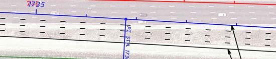


123


124


125


126


127


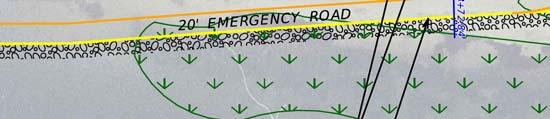


128


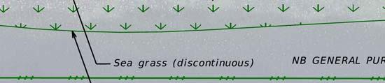


129
Picayune Strand Restoration Project in Southwest Florida A Landscape Perspective
 U.S. Fish and Wildlife Service Restoring America s Everglades-Recovering Multiple Species Picayune Strand Restoration Project in Southwest Florida A Landscape Perspective Kim Dryden U.S. Fish and Wildlife
City of St. Petersburg Planning & Visioning Commission October 11, 2011
 Pinellas Alternatives Analysis Speakers Bureau City of St. Petersburg Planning & Visioning Commission October 11, 2011 Pinellas Alternatives Analysis Project Purpose A study identifying transit options
%&g( %&g( ) Bridge Projects DRAFT
 Bridge Projects DRAFT") BELCHER RD 66TH ST N DRAFT 09-18-14 GULF BLVD Dunedin Causeway 16 Gulf of Mexico WEST BAY DR WALSINGHAM RD Beckett Bridge 102ND AVE N 26 27 S MYRTLE AVE 113TH ST N EDGEWATER DR BAYSHORE BLVD S MISSOURI
BELCHER RD 66TH ST N DRAFT 09-18-14 GULF BLVD Dunedin Causeway 16 Gulf of Mexico WEST BAY DR WALSINGHAM RD Beckett Bridge 102ND AVE N 26 27 S MYRTLE AVE 113TH ST N EDGEWATER DR BAYSHORE BLVD S MISSOURI
Draft Biological Assessment Report Design Update Technical Memorandum I-75 (SR 93) at SR 884 (Colonial Blvd) Interchange Lee County, Florida
 at SR 884 (Colonial Blvd) Interchange Lee County, Florida") Draft Biological Assessment Report Design Update I-75 (SR 93) at SR 884 (Colonial Blvd) Interchange Lee County, Florida Financial Project ID No. 413065-1-32-01 Prepared for: Florida Department of Transportation
Draft Biological Assessment Report Design Update I-75 (SR 93) at SR 884 (Colonial Blvd) Interchange Lee County, Florida Financial Project ID No. 413065-1-32-01 Prepared for: Florida Department of Transportation
Backcountry Management. Anne Morkill Wildlife Refuge Manager U.S. Fish & Wildlife Service
 Backcountry Management Anne Morkill Wildlife Refuge Manager U.S. Fish & Wildlife Service Florida Keys National Marine Sanctuary Advisory Council Duck Key, FL February 21, 2012 Overview of National Wildlife
COASTAL MANAGEMENT ELEMENT
 COASTAL MANAGEMENT ELEMENT of the PINELLAS COUNTY COMPREHENSIVE PLAN Prepared By: The Pinellas County Planning Department as staff to the LOCAL PLANNING AGENCY for THE BOARD OF COUNTY COMMISSIONERS OF
State Road A1A North Bridge over ICWW Bridge
 Final Report State Road A1A North Bridge over ICWW Bridge Draft Design Traffic Technical Memorandum Contract Number: C-9H13 TWO 5 - Financial Project ID 249911-2-22-01 March 2016 Prepared for: Florida
Matagorda Island Marsh Restoration An Adaptive Management Approach by Coastal Bend Bays & Estuaries Program
 Matagorda Island Marsh Restoration An Adaptive Management Approach by Coastal Bend Bays & Estuaries Program 1957: After Levees 1930: Before Levees Matagorda Island: Site Location Texas Coastal Bend Calhoun
Collaboration and Planning to Implement the South San Diego Bay Restoration and Enhancement Project
 Collaboration and Planning to Implement the South San Diego Bay Restoration and Enhancement Project Carolyn Lieberman Coastal Program Coordinator for Southern California U.S. Fish and Wildlife Service
Marine Corps Support Facility-Blount Island: Integrated Natural Resources Program Successes. E2S2 Conference May 12, 2011
 Marine Corps Support Facility-Blount Island: Integrated Natural Resources Program Successes E2S2 Conference May 12, 2011 Shari Kennedy, MCSF-BI Robert Price, CH2M HILL Location Mission The mission of Marine
Tiered Species Habitats (Terrestrial and Aquatic)
") Tiered Species Habitats (Terrestrial and Aquatic) Dataset Description Free-Bridge Area Map The Department of Game and Inland Fisheries (DGIF s) Tiered Species Habitat data shows the number of Tier 1, 2
Tiered Species Habitats (Terrestrial and Aquatic) Dataset Description Free-Bridge Area Map The Department of Game and Inland Fisheries (DGIF s) Tiered Species Habitat data shows the number of Tier 1, 2
Division: Habitat and Species Conservation Authors: Claire Sunquist Blunden and Brad Gruver
 Division: Habitat and Species Conservation Authors: Claire Sunquist Blunden and Brad Gruver Report date: December 13, 2018 All photos by FWC unless otherwise acknowledged Presenting 6 new guidelines 1
As a federal action, the TIGER 2016 grant commits the Pease Development Authority Division of Ports
 PEASE I N T E R N AT I 0 N A L 556 Market Street. Suite 1 Portsmouth, NH 03801 PORTS AND HARBORS April 25, 2016 The Honorable Anthony R. Foxx Secretary U.S. Department of Transportation 1200 New Jersey
Pinellas County Proposed Roadway Projects for the 2040 LRTP DRAFT %&g( %&g( Legend. SR686 Inset Map HILLSBOROUGH COUNTY.
 BELCHER RD 66TH ST N DRAFT 05-08-14 61 60 40 39 52 38 53 37 EAST LAKE RD KEYSTONE RD Pinellas County Proposed Roadway s for the 2040 LRTP Legend GULF BLVD 67 Gulf of Mexico WEST BAY DR WALSINGHAM RD µ
Northeast Florida Coastal Wetland Restoration Program A Partnership Based Regional Approach for Estuary Habitat Restoration
 Northeast Florida Coastal Wetland Restoration Program A Partnership Based Regional Approach for Estuary Habitat Restoration Paul Haydt Restore America s Estuaries November 15, 2010 St Johns River Water
Species Conclusions Table
 Project Manager: Melissa Nash Project Name: Sandbridge Road/Nimmo VII-A Project Description:City of Virginia Beach safety improvements to Sandbridge Rd from McClanan s Curve to one mile east of intersection
Geographic Response Plan Map: SFL-31. Bradley. Map continued Key on: SFL-34. Key. Murray Key XXX SFL Clive Key XXX. SFL31-06 Clive Key
 ! 1550 1450 81 0'0"W # [\ m [] Geographic Response Plan Map: SFL-31 Bradley Map continued on: SFL-34 Jow Kemp Florida Bay 80 52'30"W 25 7'30"N 1550 1350 SFL31-01 Conchie Channel SFL31-02 Oyster Oyster
United States Department of the Interior
 United States Department of the Interior Mickey T. Sugg Wilmington Regulatory Field Office U. S. Army Corps of Engineers 69 Darlington Ave. Wilmington, North Carolina 28403 FISH AND WILDLIFE SERVICE Raleigh
Stay Out Zones and Boom Priorities for Shorebirds in Franklin County
 Stay Out Zones and Boom Priorities for Shorebirds in Franklin County C All the Coastal Beaches that are Publically Owned (State and Federal) have use by nesting birds. These areas are posted. BMPs for
Environmental Protection
 Myakka Wild and Scenic River Program 2017 Annual Report 1 A. Permitting & Regulatory issues 1. Construction continues at the bridge replacement at C.R. 780. MRP030314 was issued to Sarasota County on March
Preliminary Environmental Site Assessment Report
 Science Working For You Preliminary Environmental Site Assessment Report Wetland and Wildlife Survey Volusia County Parcel 06-19-32-00-00-0030 Prepared for: Orange Blossom Trail Orlando LLC 8650-12 Old
M E M O R A N D U M. Dianne Rosensweig, Scheda Ecological Associates, Inc. Environmental Assessment and Jurisdictional Determination
 M E M O R A N D U M TO: FROM: RE: Stephen Suau, P.E. Dianne Rosensweig, Scheda Ecological Associates, Inc. Environmental Assessment and Jurisdictional Determination Palmer Ranch Proposed Infill Project
Sauvie Island Wildlife Area BCS number: 47-28
 Sauvie Island Wildlife Area BCS number: 47-28 Site description author(s) Mark Nebeker, Oregon Department of Fish and Wildlife, Sauvie Island Wildlife Area Manager Primary contact for this site Mark Nebeker,
FWC and Florida s Imperiled Species Management Laura DiGruttolo Florida Fish and Wildlife Conservation Commission Division of Habitat and Species
 FWC and Florida s Imperiled Species Management Laura DiGruttolo Florida Fish and Wildlife Conservation Commission Division of Habitat and Species Conservation Imperiled Species Management Goal With broad
Instructions for Joining the Webinar.
 New Recovery Plan Review from the Gulf of Mexico Alliance Caroline Gorga, Wildlife Legacy Biologist, Florida Fish & Wildlife Conservation Commission Julia Lightner, Fisheries Biologist, Louisiana Department
SENATE CONCURRENT RESOLUTION No. 158 STATE OF NEW JERSEY. 217th LEGISLATURE INTRODUCED JUNE 26, 2017
 SENATE CONCURRENT RESOLUTION No. STATE OF NEW JERSEY th LEGISLATURE INTRODUCED JUNE, 0 Sponsored by: Senator JEFF VAN DREW District (Atlantic, Cape May and Cumberland) Senator ROBERT M. GORDON District
Relicensing Study 3.5.1
 Relicensing Study 3.5.1 BASELINE INVENTORY OF WETLAND, RIPARIAN AND LITTORAL HABITAT IN THE TURNERS FALLS IMPOUNDMENT, AND ASSESSMENT OF OPERATIONAL IMPACTS ON SPECIAL-STATUS SPECIES Updated Study Report
Florida Keys National Wildlife Refuge Complex. Key West NWR Great White Heron NWR National Key Deer NWR Crocodile Lake NWR
 Florida Keys National Wildlife Refuge Complex Key West NWR Great White Heron NWR National Key Deer NWR Crocodile Lake NWR Key West NWR Marquesas Keys and 13 other keys Mission as a preserve and protect
Oregon Dunes National Recreation Area BCS Number: 47-5
 Oregon Dunes National Recreation Area BCS Number: 47-5 ***NOTE: We were unable to determine all necessary information for this site description. If you would like to contribute the needed information to
Jackson Bottom Wetlands Preserve BCS Number: 47-14
 Jackson Bottom Wetlands Preserve BCS Number: 47-14 Site description author(s) Greg Gillson, Jackson Bottom Wetlands Preserve Primary contact for this site Ed Becker, Natural Resources Manager, Jackson
18. Endangered Species
 Northern Branch Corridor SDEIS March 207 8. Endangered Species 8.. Chapter Overview 8... Introduction This chapter discusses the changes to the potential for project improvements to adversely affect threatened
Siletz Bay BCS number: 47-29
 Siletz Bay BCS number: 47-29 ***NOTE: We were unable to determine all necessary information for this site description. If you would like to contribute the needed information to this description, please
Tahkenitch Creek Estuary BCS number: 47-35
 Tahkenitch Creek Estuary BCS number: 47-35 ***NOTE: We were unable to determine all necessary information for this site description. If you would like to contribute the needed information to this description,
Humboldt Bay NWR BCS number: 86-4
 Humboldt Bay NWR BCS number: 86-4 ***NOTE: We were unable to determine all necessary information for this site description. If you would like to contribute the needed information to this description, please
SPECIAL PUBLIC NOTICE
 SPECIAL PUBLIC NOTICE Draft Map and Drawing Standards for the South Pacific Division Regulatory Program March 5, 2012 Comment period: ends April 5, 2012 Corps contact: Thomas Cavanaugh (415) 503-6574 (Thomas.J.Cavanaugh@usace.army.mil)
Wulfert Bayous Land Acquisition Campaign. Preserve. Protect. Inspire. Ding Darling Wildlife Society
 Wulfert Bayous Land Acquisition Campaign Preserve. Protect. Inspire. Ding Darling Wildlife Society Project Overview Wulfert Bayous is the largest unprotected property on Sanibel Island, and is adjacent
Coastal Wildlife Conservation Initiative
 Coastal Wildlife Conservation Initiative What is the Coastal Wildlife Conservation Initiative? A partnership strategy to address coastal issues that impact wildlife and their habitats USFWS CWCI Vision
United States Department of the Interior
 United States Department of the Interior FISH AND WILDLIFE SERVICE New England Field Office 70 Commercial Street, Suite 300 Concord, Nil 03301-5087 http://www.fws. gov/newengland Environmental Division
U.S. Fish & Wildlife Service. My project. IPaC Trust Resource Report. Generated May 07, :40 AM MDT
 U.S. Fish & Wildlife Service My project Generated May 07, 2015 10:40 AM MDT US Fish & Wildlife Service Project Description NAME My project PROJECT CODE LOCATION Prince William County, Virginia No description
Charlton/Oxford Route 20 Reconstruction Project
 Public Informational Meeting February 1, 2017 Oxford High School Charlton/Oxford Route 20 Reconstruction Project Project File No. 602659 2014 HDR, Inc., all rights reserved. Public Informational Meeting
Roberts Bank Terminal 2 Project Field Studies Information Sheet
 May 2013 Port Metro Vancouver is continuing field studies in May as part of ongoing environmental and technical work for the proposed Roberts Bank Terminal 2 Project. Roberts Bank Terminal 2 Project The
Dare County DEIS Position Statement
 Dare County DEIS Position Statement SUMMARY The Dare County Board of Commissioners strongly supports open and accessible beaches for the Cape Hatteras National Seashore Recreational Area. We believe in
PUBLIC NOTICE. Permit Application No. SAJ (IP-MJD)
") DEPARTMENT OF THE ARMY JACKSONVILLE DISTRICT CORPS OF ENGINEERS FORT MYERS REGULATORY OFFICE 1520 ROYAL PALM SQUARE BOULEVARD, SUITE 310 FORT MYERS, FLORIDA 33919 Regulatory Division South Permits Branch/West
DEPARTMENT OF THE ARMY JACKSONVILLE DISTRICT CORPS OF ENGINEERS FORT MYERS REGULATORY OFFICE 1520 ROYAL PALM SQUARE BOULEVARD, SUITE 310 FORT MYERS, FLORIDA 33919 Regulatory Division South Permits Branch/West
Roberts Bank Terminal 2 Project Field Studies Information Sheet
 January 2013 Port Metro Vancouver is continuing field studies in January as part of ongoing environmental and technical work for the proposed. The is a proposed new multi berth container terminal which
Smith River Mouth BCS number: 86-6
 Smith River Mouth BCS number: 86-6 ***NOTE: We were unable to determine all necessary information for this site description. If you would like to contribute the needed information to this description,
Exit 61 I-90 Interchange Modification Justification Study
 Exit 61 I-90 Interchange Modification Justification Study Introduction Exit 61 is a diamond interchange providing the connection between Elk Vale Road and I-90. Figure 1 shows the location of Exit 61.
SPECIES PROTECTION CONSTRUCTION Protective Radius
 SPECIES PROTECTION Attention is directed to the existence of environmental work restrictions that require special precautions to be taken by the Contractor to protect the species of concern in conforming
FWC Proposed CWA s in Southwest Florida Could Impact Boa;ng
 FWC Proposed CWA s in Southwest Florida Could Impact Boa;ng CWAs (Cri)cal Wildlife Area s) are established by FWC to protect important concentra)ons of wildlife and manage human ac)vi)es to minimize and
King Mill Lambert DRI# 2035 Henry County, Georgia
 Transportation Analysis King Mill Lambert DRI# 2035 Henry County, Georgia Prepared for: The Alter Group, Ltd. Prepared by: Kimley-Horn and Associates, Inc. Norcross, GA Kimley-Horn and Associates, Inc.
Enrique Gonzalez-Velez Civil and Environmental Engineering University of South Florida
 Enrique Gonzalez-Velez Civil and Environmental Engineering University of South Florida Background Objective Introduction Roadway Lighting Literature Review Study Area Data Illuminance, Crash, and Roadway
Roberts Bank Terminal 2 Project Field Studies Information Sheet
 July 2012 Port Metro Vancouver is continuing field studies in July as part of ongoing environmental and technical work for the proposed Roberts Bank Terminal 2 Project. Roberts Bank Terminal 2 Project
STATEMENT OF WORK Environmental Assessment for the Red Cliffs/Long Valley Land Exchange in Washington County, Utah
 I. Introduction STATEMENT OF WORK Environmental Assessment for the Red Cliffs/Long Valley Land Exchange in Washington County, Utah The Bureau of Land Management s (BLM) St. George Field Office (SGFO) requires
Ladd Marsh Wildlife Area BCS number: 49-3
 Oregon Coordinated Aquatic Bird Monitoring: Description of Important Aquatic Bird Site Ladd Marsh Wildlife Area BCS number: 49-3 Site description author M. Cathy Nowak, Ladd Marsh Wildlife Area Biologist
Coos Bay BCS number: 47-8
 Coos Bay BCS number: 47-8 ***NOTE: The completion of this site description is still in progress by our Primary Contact (listed below). However, if you would like to contribute additional information to
Geographic Response Plan Map: SC-56. Map Continued on SC-50 XXX. Fripps Inlet. Raptor Nesting Area. Recreational Fishing. Sea Turtles.
 32 22'30"N Map Continued on SC-55 80 30'0"W X ull et SC56-01 Story/Harbor River Junction Story River!h!S(!d Old House Creek 1050 [ 400 1000 SC56-03 Old House Creek «Geographic Response Plan Map: SC-56
Palm Beach County. Estuarine Habitat Mapping
 Palm Beach County Estuarine Habitat Mapping Coastal Habitat Integrated Mapping and Monitoring Program (CHIMMP) April 29, 2014 Eric Anderson, Environmental Analyst Palm Beach County Department of Environmental
Geographic [x Response Plan Map: GA-12 [r. Map Continued on GA-8 XXX. GA12-01 Green Island Sound. OSSABAW ISLAND WMA Raccoon Key XXX
 Charles Ogeechee River tal Waterway 31 52'30"N Little Ogeechee River Harveys Island 81 7'30"W Charles Rush Charles 950 Ogeechee River Geographic Response Plan Map: GA-12 Map Continued on GA-8 Green Island
APPENDIX E: CIP Maps
 APPENDIX E: CIP Maps 175 ALT 19 PARK ST 49TH ST N. EAST LAKE RD BEGINNING YEAR OF CONSTRUCTION: ALT 19 TARPON AVE KEYSTONE RD FY 2010 FY 2011 FY 2012 FY 2013 FY 2014 FY 2015 FY 2016 FY 2017 KLOSTERMAN
THE MERSEY GATEWAY PROJECT (MERSEY GATEWAY BRIDGE) AVIAN ECOLOGY SUMMARY PROOF OF EVIDENCE OF. Paul Oldfield
 AVIAN ECOLOGY SUMMARY PROOF OF EVIDENCE OF. Paul Oldfield") HBC/14/3S THE MERSEY GATEWAY PROJECT (MERSEY GATEWAY BRIDGE) AVIAN ECOLOGY SUMMARY PROOF OF EVIDENCE OF Paul Oldfield 1 1 DESCRIPTION OF THE BIRDLIFE IN THE UPPER MERSEY ESTUARY LOCAL WILDLIFE SITE 1.1
HBC/14/3S THE MERSEY GATEWAY PROJECT (MERSEY GATEWAY BRIDGE) AVIAN ECOLOGY SUMMARY PROOF OF EVIDENCE OF Paul Oldfield 1 1 DESCRIPTION OF THE BIRDLIFE IN THE UPPER MERSEY ESTUARY LOCAL WILDLIFE SITE 1.1
Expansion Work Has Begun The perimeter dike for Cell 7 is now visible
 Summer/Fall 2017 In This Issue Poplar Island Expansion Wetland Cell 5AB Development Wildlife Update Birding tours on Poplar Island Expansion Work Has Begun The perimeter dike for Cell 7 is now visible
National Fish and Wildlife Foundation Executive Summary for the American Oystercatcher Business Plan
 National Fish and Wildlife Foundation Executive Summary for the American Oystercatcher Business Plan October 26, 2008 AMOY Exec Sum Plan.indd 1 8/11/09 5:24:00 PM Colorado Native Fishes Upper Green River
Cat Island Chain Restoration Project Brown County Port & Resource Recovery Department
 Cat Island Chain Restoration Project Brown County Port & Resource Recovery Department February 2, 2015 Fox River and Lower Green Bay Cat Island Chain - 1938 Cat Island Brown County Aerial Photography,
Work Plan for Pre-Construction Avian and Bat Surveys
 Work Plan for Pre-Construction Avian and Bat Surveys, Steuben County, New York Prepared For: EverPower Wind Holdings, Inc. 1251 Waterfront Place, 3rd Floor Pittsburgh, PA 15222 Prepared By: Stantec Consulting
USFWS Migratory Bird Program
 USFWS Migratory Bird Program Updates for the Bird Conservation Committee North American Wildlife & Natural Resources Conference Norfolk, Va. ~ March 28, 2018 Presented by Sarah Mott & Ken Richkus U.S.
BV-24A DMMA Florida Scrub-Jay Survey Brevard County
 REPORT BV-24A DMMA Florida Scrub-Jay Survey Brevard County Submitted to: David L. Stites, Ph.D. Director of Environmental Services Taylor Engineering, Inc. 10199 Southside Blvd Suite 310 Jacksonville,
Bald Eagle Annual Report February 1, 2016
 Bald Eagle Annual Report 2015 February 1, 2016 This page intentionally blank. PROJECT SUMMARY Project Title: Bald Eagle HCP Monitoring Subject Area: Habitat Conservation Plan (HCP) monitoring Date initiated:
Appendix G. Visual Simulations and Illustrations
 Appendix G Visual Simulations and Illustrations 5TH AVE AV E N View ewshe ed 5 SHORELINE N 185TH ST egment B gment A 26 NE 185th Street Station (A1, A3, A5, A7, A10, A11) 25 24 23 22 21 NE 180TH ST 99
The following draft Agreement supplements, but does not replace, the MOU by and between the Bureau of Land Management (BLM) and the California
 and the California") The following draft Agreement supplements, but does not replace, the MOU by and between the Bureau of Land Management (BLM) and the California Department of Fish and Wildlife (CDFW), which was entered
The following draft Agreement supplements, but does not replace, the MOU by and between the Bureau of Land Management (BLM) and the California Department of Fish and Wildlife (CDFW), which was entered
Siuslaw River Estuary BCS number 47-32
 Siuslaw River Estuary BCS number 47-32 Site description author(s) Daphne E. Swope, Research and Monitoring Team, Klamath Bird Observatory Primary contact for this site Liz Vollmer, Siuslaw Watershed Council
MOTE NUUUNE LABORATORY MANATEE RESEARCH ACTIVITIES.
 MOTE NUUUNE LABORATORY MANATEE RESEARCH ACTIVITIES. First Progress Report: August 25, 2008 M MARINE LABORATORY Includes three reports: Photo-Identification Studies on Manatees in Southwestern Florida By:
Study Description. November 29, Overpass Road Alternatives Public Workshop
 Overpass Road Alternatives Public Workshop November 29, 2012 Welcome to the Alternatives Public Workshop for proposed improvements to Overpass Road in Pasco County. Pasco County (the County), in coordination
DEPARTMENT OF THE ARMY JACKSONVILLE DISTRICT CORPS OF ENGINEERS PRINCESS PALM AVENUE, SUITE 120 TAMPA, FLORIDA
 DEPARTMENT OF THE ARMY JACKSONVILLE DISTRICT CORPS OF ENGINEERS 10117 PRINCESS PALM AVENUE, SUITE 120 TAMPA, FLORIDA 33610 REPLY TO ATTENTION OF October 12, 2012 Tampa Permits Section SAJ-2011-00551 (IP-TEH)
National Audubon Society. Coastal Bird Conservation Program
 National Audubon Society Coastal Bird Conservation Program Coastal Bird Conservation Program This presentation contains original photos and data. For any use of this information, data, maps, or photographs
McKay Creek National Wildlife Refuge BCS number: 48-19
 Oregon Coordinated Aquatic Bird Monitoring: Description of Important Aquatic Bird Site McKay Creek National Wildlife Refuge BCS number: 48-19 Site description author(s) Howard Browers, Supervisory Wildlife
SUBMITTAL REQUIREMENTS RCV D REJECT PENDING
 1 of 5 SUBMITTAL REQUIREMENTS RCV D REJECT PENDING 1. General Information. 1.1 Applicant s name, address and contact numbers. 1.2 Project name, type, address and legal description of the property. 1.3
RECENT CHANGES TO THE ILLINOIS SMCRA THREATENED AND ENDANGERED SPECIES (T&E) REQUIREMENTS
 REQUIREMENTS") RECENT CHANGES TO THE ILLINOIS SMCRA THREATENED AND ENDANGERED SPECIES (T&E) REQUIREMENTS William O Leary, M.S. and Amanda Pankau, M.S. HDR Engineering Murphysboro, IL ILLINOIS SMCRA T&E HISTORY 1983 2009
RECENT CHANGES TO THE ILLINOIS SMCRA THREATENED AND ENDANGERED SPECIES (T&E) REQUIREMENTS William O Leary, M.S. and Amanda Pankau, M.S. HDR Engineering Murphysboro, IL ILLINOIS SMCRA T&E HISTORY 1983 2009
SPECIAL PUBLIC NOTICE
 SPECIAL PUBLIC NOTICE Draft Map and Drawing Standards for the South Pacific Division Regulatory Program August 6, 2012 Corps contacts: Sacramento District: Michael Finan (916) 557-5324 (Michael.C.Finan@usace.army.mil)
Update on American Oystercatcher Reseach and Conservation in New Jersey
 Update on American Oystercatcher Reseach and Conservation in New Jersey - 2007 Todd Pover, New Jersey Division of Fish and Wildlife - Endangered and Nongame Species Program Tom Virzi, PhD Candidate Department
Appendix B. Responses to Comments. on the Draft Environmental Assessment. for Rehabilitation of. Dredged Material Containment Area 1N (Onslow Island)
") Appendix B Responses to Comments on the Draft Environmental Assessment for Rehabilitation of Dredged Material Containment Area 1N (Onslow Island) Savannah Harbor Navigation Project Chatham County, Georgia
Appendix B Responses to Comments on the Draft Environmental Assessment for Rehabilitation of Dredged Material Containment Area 1N (Onslow Island) Savannah Harbor Navigation Project Chatham County, Georgia
APPENDIX L1. U.S. FISH AND WILDLIFE SERVICE LETTER
 APPENDIX L1. U.S. FISH AND WILDLIFE SERVICE LETTER Environmental Assessment May 2016 South Central Light Rail Extension This page is intentionally left blank. Environmental Assessment May 2016 South Central
SURVEY OF SEAGRASS BEDS AT PLACEMENT AREA 62, WEST BAY CONTRACT FOR GIWW, TEXAS CAUSEWAY U. S. ARMY CORPS OF ENGINEERS CONTRACT NO.
 SURVEY OF SEAGRASS BEDS AT PLACEMENT AREA 62, WEST BAY CONTRACT FOR GIWW, TEXAS CAUSEWAY U. S. ARMY CORPS OF ENGINEERS CONTRACT NO. W912HY-10-C-0036 Prepared for: RLB CONTRACTING, INC. P.O. Box 1739 Port
Fernhill Wetlands BCS number: 47-13
 Fernhill Wetlands BCS number: 47-13 ***NOTE: We were unable to determine all necessary information for this site description. If you would like to contribute the needed information to this description,
NORTH CAROLINA STATEWIDE PROGRAMMATIC BIOLOGICAL OPINION BEACH SAND PLACEMENT EXECUTIVE SUMMARY August 28, 2017
 INTRODUCTION NORTH CAROLINA STATEWIDE PROGRAMMATIC BIOLOGICAL OPINION BEACH SAND PLACEMENT EXECUTIVE SUMMARY August 28, 2017 A biological opinion (BO) is the document that states the opinion of the U.S.
Preliminary study of the seagrasses in Middle Tampa Bay between Apollo Beach and Simmons Park
 University of South Florida Scholar Commons Reports Tampa Bay Area Study Group Project 9-3-1986 Preliminary study of the seagrasses in Middle Tampa Bay between Apollo Beach and Simmons Park Mangrove Systems,
The implementation of Ramsar Convention in Lebanon
 The implementation of Ramsar Convention in Lebanon Nabil Assaf Ramsar Focal point Ministry of Environment Regional meeting, LAS Cairo 22-25 June 2009 Date of Ratification: 16 August, 1999 4 Ramsar sites
Distribution of Piping Plover and Coastal Birds in Relation to Federal Activities on the Southern Coast of Long Island
 U.S. U.S. Fish Fish & Wildlife & Wildlife Service Service Distribution of Piping Plover and Coastal Birds in Relation to Federal Activities on the Southern Coast of Long Island Implications for Project
Attachment #2 PPW133-07
 Attachment #2 PPW133-07 Pg. 1 EXECUTIVE SUMMARY Environmental Assessment Study In January 2005, Regional staff retained to commence a Schedule C Environmental Assessment Study to identify the improvements
CHECKLIST PRELIMINARY SUBDIVISION AND PRELIMINARY SITE PLAN
 N/A Waiver (1) Four (4) copies of application form. (2) Fifteen (15) copies of plan (3) Subdivision/site plan application fee & professional review escrow deposit (4) Variance application fee & professional
THE GULF COAST VULNERABILITY ASSESSMENT:
 THE GULF COAST VULNERABILITY ASSESSMENT: Amanda Watson GCVA Coordinator Mississippi State University Gulf Coast Prairie LCC June 3, 2015 Webinar Why? Changing Conditions Conservation is increasingly challenging
Michael Rikard/CALO/NPS Thayer Jon Jerald
 0025457 From: To: Cc: Subject: Date: Attachments: Thayer Broili Tyler Bogardus; Britta Muiznieks Mike Murray; Darrell Echols Fw: Experimental Fence Research/Demonstration for CWB Protection at Bodie Island
Florida Field Naturalist
 Florida Field Naturalist PUBLISHED BY THE FLORIDA ORNITHOLOGICAL SOCIETY VOL. 29, NO. 3 SEPTEMBER 2001 PAGES 75-112 Florida Field Naturalist 29(3):75-80, 2001. AMERICAN OYSTERCATCHERS NEST ON GRAVEL-COVERED
1.0 Performance Measure Title Wetland Trophic Relationships Wading Bird Nesting Patterns. 2.0 Justification
 1.0 Performance Measure Title Wetland Trophic Relationships Wading Bird Nesting Patterns Last Date Revised: December 2006 2.0 Justification Over the past several decades, wading bird reproduction in the
Baskett Slough National Wildlife Refuge BCS number: 47-4
 Baskett Slough National Wildlife Refuge BCS number: 47-4 Site description author(s) Daphne E. Swope, Research and Monitoring Team, Klamath Bird Observatory Primary contact for this site N/A Location (UTM)
Resilient Birds, Devoted Advocates 2016 Coastal Bird Conservation Results. Spring American Oystercatcher Photo by Matt Filosa
 Resilient Birds, Devoted Advocates 2016 Coastal Bird Conservation Results Spring 2017 American Oystercatcher Photo by Matt Filosa Florida s coastal birds face long odds, but Audubon support gives them
Endangered Species Monitoring - Northern Coastline of New Jersey
 Endangered Species Monitoring - Northern Coastline of New Jersey By: Mark H. Burlas, Sr. Wildlife Biologist U.S. Army Corps of Engineers New York District Planning Division Presentation Format Project
Erie County Van Trip. Pipe Creek Wildlife Area
 Erie County Van Trip ***See red markings on maps indicating the best birding options at each location. Please note that you are not limited to these areas, they are just the areas we feel will be most
2012 Wading Bird Nesting in the Everglades
 Wading Bird Nesting in the Everglades Large scale Restoration Needed to Recover Wading Bird Populations Introduction The annual South Florida Wading Bird Report 1 provides an overview of wading bird nesting
Site Plan/Building Permit Review
 Part 6 Site Plan/Building Permit Review 1.6.01 When Site Plan Review Applies 1.6.02 Optional Pre- Application Site Plan/Building Permit Review (hereafter referred to as Site Plan Review) shall be required
Deer Island. a Sportsman s Paradise 90 +/- Acres 0.8 +/- Mile of Gulf of Mexico White Sand Beach 0.8 +/- Mile of Waterfront Facing the Mainland
 Deer Island a Sportsman s Paradise 90 +/- Acres 0.8 +/- Mile of Gulf of Mexico White Sand Beach 0.8 +/- Mile of Waterfront Facing the Mainland 2 Photos of Subject Property Deer Island A Sportsman s Paradise
Public School Facilities Element
 Public School Facilities Element GOAL 1: THROUGH PARTNERSHIPS AND EFFECTIVE COLLABORATION AMONG LOCAL GOVERNMENTS AND THE PINELLAS COUNTY SCHOOL DISTRICT, AND BECAUSE OF A SHARED COMMITMENT TO EDUCATIONAL