GPS/GNSS What is it? How Does it Work? What are its Applications?
|
|
|
- Abel Fleming
- 5 years ago
- Views:
Transcription
1 GPS/GNSS What is it? How Does it Work? What are its Applications?
2 Historic Navigation Reference points in the sky used for navigation The Sun The Pole Star / North Star Southern Cross Gives Direction, but not position Add a sextant to give latitude And a clock to give longitude

3 GNSS Principles GNSS satellites in the sky are the new reference points If my GNSS receiver "sees" 4 or more satellites, it can compute my position "see" means track and process navigation signals


4 Satellites as Accurate Reference Points GNSS signals contain information about the satellites' positions very accurate reference points Measure the distance from the satellites to the receiver Knowing at least three distances from three reference points gives position

5 How do you measure distance? speed = distance / time distance = speed x time radio waves travel at light speed "c" 300,000km in 1 second 300km in 1ms (1/1000 th ) 300m in 1μs (1/millionth) 300mm in 1ns satellite signals contain 'time stamps' time = t sent t received
6 Compute position distance = speed x time speed = 3x10 8 m/s time = t sent t received but, receiver time not accurately known so the time stamp from a fourth satellite is measured compensates for the missing receiver time

7 Example GNSS Signal radio frequency at "L-band" typically 1575MHz at satellite: signal energy spread by a code at receiver: spread signal energy is unlocked and refocused "code gain" allows simple antennas to receive low power signals and to share the frequency with other satellites/systems

8 Position relative to? A position is pointless without having a ground reference A world reference is used, eg WGS84 World Geodetic System 1984 Allows position fix to be placed on a World grid Maps can be referenced to the same grid you can determine where you are on a map
9 What is GNSS used for? PNT Positioning surveying and mapping location based services air traffic management search and rescue Navigation a given. cars, ships, cranes remember GNSS gives position, you still need reliable/up-to-date maps and routing software Timing?... most large networks synchronised telecoms electricity distribution banking microseconds matter for transactions!
10 What about? Monitoring sea/lake/snow levels uses GNSS reflections seen into a fixed receiver Atmospheric measurements GNSS signals change as they pass through atmosphere: air quality, gaseous content, etc Space weather monitoring measuring changes in the ionosphere Soil and vegetation moisture measurements Volcanic plume density measurements atmospheric ash uncertainty after eruptions Sea surface roughness, wind direction and more Earthquake/tsunami monitoring. etc, etc
11 Thank You Questions? 17
12 GNSS History 1
13 Satellite Navigation in the 1950s Oct 1957 Sputnik I Launched Dec 1958 The U.S. Navy Navigation Satellite System (Transit) Approved and Funded 2
 5 Dec 1963 First Operational Satellite Jan 1964 Transit Became")

14 Satellite Navigation in the 1960s (1 of 3) April 1960 First Successful Transit Experimental Satellite (1B) 5 Dec 1963 First Operational Satellite Jan 1964 Transit Became Operational Other Successful Experimental Satellites: 2A, 22 Jun B, 21 Feb A, 29 Jun B, 15 Nov 1961 July 1967 Transit Released for Commercial Use Establishing U.S. Dual Use SatNav Policy Operational Transit Satellite 3

 1968 World s First Portable")

15 Satellite Navigation in the 1960s (2 of 3) World s First Surface Ship Satellite Navigator AN/SRN-9 (XN-5) 1968 World s First Portable Satellite Doppler Geodetic Surveyor AN/PRR-14 Geoceiver 1969 World s First Commercial Oceanographic Navigator 4
16 Satellite Navigation in the 1960s (3 of 3) First Steps Toward GPS; Air Force 621B Program; World s First Spread Spectrum Navigation Receiver, MX-450 5
 1975 First Concept Validation GPS Navigator, the GPS")
17 Satellite Navigation in the 1970s April 1973 Formation of the GPS Joint Program Office (JPO) 1978 GPS Launches 22 Feb, 13 May, 7 Oct, 11 Dec 1971 First Timation Receiver for the Naval Research Lab (NRL) 1975 First Concept Validation GPS Navigator, the GPS X-Set 6

18 Original 7


19 GPS Launch Plans National policy was to launch all operational GPS satellites with the space shuttle The Atlas Booster launched all Block I GPS Satellites The January 28, 1986 Challenger disaster forced a change 8


20 Satellite Navigation in the 1980s Oct 85 Last Block I Launch 28 Jan 86 Challenger Disaster 14 Feb 89 Launches Resume 1984 Commercial 5 Channel GPS Navigator 1985 GPS + Transit + Omega Channel GPS Navigator 1986 WM101 GPS Satellite Surveying Set 9
21 GPS Selective Availability, IOC, and FOC Number of Operational GPS Satellites /04/91 9/10/2008 SA turned on 12/08/93 IOC Declared 04/27/95 FOC Declared 05/01/00 SA turned off 09/18/07 SA Ended SA On IOC FOC SA Off SA End /01/78 01/01/82 01/01/86 01/01/90 01/01/94 01/01/98 01/01/02 01/01/06 10


22 Satellite Navigation in the 1990s Apr 91 SA Turned On 8 Dec 93 GPS IOC 27 Apr 95 GPS FOC 1990 GPS/GLONASS Navigator Channel GPS Engine 26 Dec 91 Dissolution of the Soviet Union Enacted 1991 Compact GPS Surveyor 1996 Professional Marine DGPS Navigator 1997 Machine Control, 10 Hz, 30 ms, 1 cm 11
23 Modernization and GNSS Initiatives Number of Operational GPS Satellites /30/98 9/10/2008 Announce Civil L2 01/25/99 Announce Civil L5 05/01/00 SA set to zero 05/26/02 Galileo Approved 06/26/04 U.S./EU Agreement 04/10/07 GLONASS Memo 07/26/07 MBOC Agreement 04/08/08 GLONASS CDMA /01/78 01/01/82 01/01/86 01/01/90 01/01/94 01/01/98 01/01/02 01/01/06 L2C L5 SA Off Galileo GLONASS CDMA GLONASS Memo EU-US MBOC 12
24 Satellite Navigation in the 2000s May 00 SA set to zero 26 May 02 Galileo Approved 26 Jun 04 U.S./EU Agreement 18 Sep 07 SA Ended 10 Apr 07 GPS/GLONASS Cooperation Memo 26 Sep 05 IIR-M Launch with L2C 8 Apr 08 GLONASS CDMA Announced November 2004, Qualcomm announced successful tests of assisted GPS for mobile phones. 1-2 Dec 05 ICG-1 Vienna 13
25 Satellite Navigation in the 2010s May 10 IIF Launch with L5 11 Sep 10 QZSS Launch 21 Oct 11 Operational Galileo Launch 2-6 Oct 15 ICG-10 Boulder, CO 6-11 Nov 16 ICG-11 Sochi, Russia Approaching a new GNSS Golden Era Many more satellites (GPS, Galileo, BeiDou, QZSS) with L1 and L5 interoperable signals Much better availability, accuracy, integrity, e.g., enabling ARAIM Anticipating CDMA signals from GLONASS What does the future hold? 2-7 Dec 17 ICG-12 Kyoto, Japan 14
 is exploding")
26 Who Anticipated GPS in Cell Phones? More than a Billion Cell Phone GPS Users Sparked by the E911 requirement Use of Location Based Services (LBS) is exploding Improved by Assisted GPS (A-GPS) Better accuracy Location in seconds Turn-by-turn navigation 15


27 Who Anticipated Precision Agriculture? One to 10 cm accuracy Far better productivity, efficiency, and protection of the environment Enabled, e.g., by MSS signals for the John Deere StarFire Service and several others Automatic Steering Automatic Spray Control 16
28 Thank You Questions? 17


29 GPS Program Status Future Plans Augmentations Applications
 IRNSS/NAVIC (7) Satellite-Based Augmentations WAAS (3) MSAS (2) EGNOS (3) GAGAN (3) SDCM (3) BDSBAS (3) KASS (2)")
30 GNSS: A Global Navigation Satellite System of Systems Global Constellations GPS (24+3) GLONASS (24+) GALILEO (24+3) BDS/BEIDOU (27+3 IGSO + 5 GEO) Regional Constellations QZSS (4+3) IRNSS/NAVIC (7) Satellite-Based Augmentations WAAS (3) MSAS (2) EGNOS (3) GAGAN (3) SDCM (3) BDSBAS (3) KASS (2) 2
31 GPS Economic Benefits Assessment ( U.S. Only) Application Range of Benefits ($B) Mid-Range Benefits ($B) Precision agriculture: grain Construction: earthmoving w/ machine guidance Surveying Air transportation Rail transportation: positive train control Maritime transportation: private sector use of nautical charts and related information Road: fleet vehicle connected telematics Road: consumer and other non-fleet vehicles Timing TOTAL
32 U.S. National Space Policy Space-Based PNT Guideline: Maintain leadership in the service, provision, and use of GNSS Provide civil GPS services, free of direct user charges Available on a continuous, worldwide basis Maintain constellation consistent with published performance standards and interface specifications Foreign PNT services may be used to complement services from GPS Encourage global compatibility and interoperability with GPS Promote transparency in civil service provision Enable market access to industry Support international activities to detect and mitigate harmful interference 4
 Launched 1997 to 2004 Block IIR-M - 7 Operational, 1 Residual 7.")
33 GPS Constellation Status 35 Total Satellites / 31 Operational (Set Healthy) (Baseline Constellation: 24) Four Generations of Operational Satellites Block IIA - 3 Residual 7.5 year design life Launched 1990 to 1997 Block IIR - 12 Operational 7.5 year design life (oldest operational satellite is 19 years old) Launched 1997 to 2004 Block IIR-M - 7 Operational, 1 Residual 7.5 year design life Launched 2005 to 2009 Added 2nd civil navigation signal (L2C) Block IIF - 12 Operational 12 year design life Launched 2010 to 2016 Added 3rd civil navigation signal (L5) 5

34 GPS III: Newest Block of GPS Satellites 4 civil signals: L1 C/A, L1C, L2C, L5 First satellites to broadcast common L1C signal 4 military signals: L1/L2 P(Y), L1/L2M 3 improved Rubidium atomic clocks Better User Range Error than IIF Satellites Increased availability Increased integrity 15 year design life First GPS III Launch Expected Later in
 software capabilities Increasing Cyber security enhancements Next Generation Operational Control")

35 GPS Ground Segment Current Operational Control Segment (OCS) Flying GPS constellation using Architecture Evolution Plan (AEP) and Launch and Early Orbit, Anomaly, and Disposal Operations (LADO) software capabilities Increasing Cyber security enhancements Next Generation Operational Control System (OCX) Modernized command and control system - replaces legacy system and adds modern features Modern civil signal monitoring and improved PNT performance Robust cyber security infrastructure New capabilities including civil signal performance monitoring capability Monitor Station Ground Antenna 7


36 Modernized GPS Civil Signals Second civil signal L2C Designed to meet commercial needs Broadcast since 2005 Currently 19 satellites broadcasting L2C Third civil signal L5 Meets transportation safety of life requirements Uses Aeronautical Radio Navigation Service band Enables triple-frequency positioning techniques Currently 12 satellites broadcasting L5 Fourth civil signal L1C Designed for GNSS interoperability Specification developed in cooperation with industry Improved performance in challenged environments Launches with GPS III in 2018 Continuous Broadcast of the new civil navigation CNAV message on L2C and L5 began April 28,
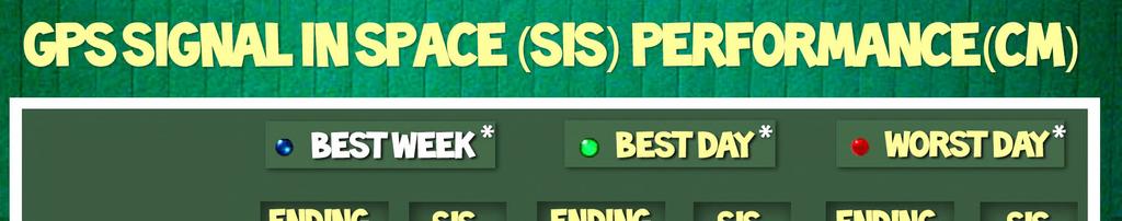


37 GPS SIS Performance Scoreboard
38 Wide Area Augmentation System (WAAS) Satellite Based Augmentation System (SBAS) Designed for aviation use, but available and used by many GPS users today Localizer Performance with Vertical Guidance (LPV)-200 approach is comparable to ILS Category I Provides the capability for increased availability and accuracy in position reporting, allowing more time for uniform and high quality air traffic management. Provides service for all classes of aircraft in all phases of flight 10
39 WAAS/SBAS Aviation Benefits Increased Runway Access More direct en route flight paths New precision approach services Reduced and simplified equipment on board aircraft Potential elimination of some ground-based navigation aids (NDB, VOR, ILS) can provide a cost saving to air navigation service provider 11


40 Wide Area Augmentation System (WAAS) Architecture 38 Reference Stations 3 Master Stations 6 Ground Earth Stations 3 Geostationary Satellite Links 2 Operational Control Centers 12
41 GEO Constellation GEO 5/6 Satellite Acquisition GEO 5 EUTELSAT 117 West B (ex SatMex 9) satellite Provides full coverage of CONUS and Alaska Integration activities started, expected operational 2018 GEO 6 Host satellite is SES-15, planned for 129 West In-Orbit Testing completed December 2017 Expected Operational in mid-2019 GEO 7 Satellite acquisition Multiple IDIQ contracts awarded September 2017 Targeting early 2018 to award task order for delivery of GEO 7 to one vendor Legend Milestone Satellite Option Years FY13 FY14 FY15 FY16 FY17 FY18 FY19 FY20 FY21 FY22 FY23 FY24 AMR 11/17 CRW Lease End 7/19 7/20 Base Option GEOs CRE GEO 5 4/18 7/21 Base 7/20 Option 1 Option 2 7/22 GEO 6 6/19 GEO


42 Current WAAS Performance LPV RNP 0.3 LPV More detailed information available at 14
43 WAAS Dual Frequency Service WAAS has implemented system changes to enable a L1/L5 user Upgraded reference station receivers to receive L5 Upgraded communication network to handle additional data (Dec 2017) New safety computer with improved processor performance (Sep 2019) Minimum Operational Performance Standards (MOPS) and Standards And Recommended Practices (SARPS) requirements development is underway Significant additional work needed to implement a dual frequency WAAS Service Preparing for FAA investment decision in 2019 Have also installed non-operational test receivers at 6 WAAS reference sites to record Galileo data Currently being collected for research purposes only 15


44 Benefits of Dual Frequency Operations Dual frequency L1/L5 service improves availability and continuity L1 L1, L5 Simulation 16


")


45 Procedures and Users Depending on WAAS Approach Procedures 4527 WAAS Procedures published (as of Jan 2018) 3872 Localizer Performance with Vertical guidance (LPV) procedures 655 Localizer Performance (LP) procedures Users Over 91,000 WAAS/SBAS equipped aircraft All aircraft classes served in all phases of flight WAAS/SBAS is enabling technology for FAA NextGen Automatic Dependent Surveillance Broadcast (ADS-B) Performance Based Navigation (PBN) 17

46 For Additional Information 18
47 Thank You Questions? 17
GPS/WAAS Program Update
 GPS/WAAS Program Update UN/Argentina Workshop on the Applications of GNSS 19-23 March 2018 Cordoba, Argentina GNSS: A Global Navigation Satellite System of Systems Global Constellations GPS (24+3) GLONASS
Global Positioning Systems Directorate
 Space and Missile Systems Center Global Positioning Systems Directorate GPS Program Update to 8 th Stanford PNT Symposium 30 Oct 2014 Col Matt Smitham Deputy Director, GPS Directorate Global Positioning
GPS Civil Service Update & U.S. International GNSS Activities
 GPS Civil Service Update & U.S. International GNSS Activities International GNSS (IGNSS) Conference Sydney, Australia Jeffrey Auerbach Office of Space and Advanced Technology U.S. Department of State 06
Wide Area Augmentation System (WAAS)
") Wide Area Augmentation System (WAAS) Ionospheric Effects Symposium By: Jason Burns Technology Evolution Lead Date: Agenda WAAS Overview Ionospheric Effects on WAAS Future Plans User Segment Update 2 WAAS
Wide Area Augmentation System (WAAS) Ionospheric Effects Symposium By: Jason Burns Technology Evolution Lead Date: Agenda WAAS Overview Ionospheric Effects on WAAS Future Plans User Segment Update 2 WAAS
Aviation Benefits of GNSS Augmentation
 Aviation Benefits of GNSS Augmentation Workshop on the Applications of GNSS Chisinau, Moldova 17-21 May 2010 Jeffrey Auerbach Advisor on GNSS Affairs Office of Space and Advanced Technology U.S. Department
Space and Missile Systems Center
 Space and Missile Systems Center Global Positioning Systems Directorate GPS Status & Modernization Progress: Service, Satellites, Control Segment, and Military GPS User Equipment 3 Nov 2016 Col Steve Whitney,
The last 25 years - GPS to multi-gnss: from a military tool to the most widely used civilian positioning solution
 1 The last 25 years - GPS to multi-gnss: from a military tool to the most widely used civilian positioning solution B. Hofmann-Wellenhof Institute of Geodesy / Navigation, Graz University of Technology
GPS Modernization and Program Update
 GPS Modernization and Program Update GPS Update to ION Southern California Chapter 22 Feb 2011 Colonel Bernie Gruber Director Global Positioning Systems Directorate Contents Current Constellation Modernization
Satellite-Based Augmentation System (SBAS) Integrity Services
 Integrity Services") Satellite-Based Augmentation System (SBAS) Integrity Services Presented To: Munich, Germany Date: March 8, 2010 By: Leo Eldredge, Manager GNSS Group, FAA FAA Satellite Navigation Program 2 Wide Area Augmentation
Satellite-Based Augmentation System (SBAS) Integrity Services Presented To: Munich, Germany Date: March 8, 2010 By: Leo Eldredge, Manager GNSS Group, FAA FAA Satellite Navigation Program 2 Wide Area Augmentation
The topic we are going to see in this unit, the global positioning system, is not directly related with the computer networks we use everyday, but it
 The topic we are going to see in this unit, the global positioning system, is not directly related with the computer networks we use everyday, but it is indeed a kind of computer network, as the specialised
GPS Status and Modernization
 GPS Status and Modernization Nov 2011 Colonel Harold Martin PNT Command Lead AFSPC A3P "This briefing is for information only. No US Government commitment to sell, loan, lease, co-develop or co-produce
Challenges and Solutions for GPS Receiver Test
 Challenges and Solutions for GPS Receiver Test Presenter: Mirin Lew January 28, 2010 Agenda GPS technology concepts GPS and GNSS overview Assisted GPS (A-GPS) Basic tests required for GPS receiver verification
GNSS: CNS Dependencies
 GNSS: CNS Dependencies Lendina Smaja DATM/RDS/NAV 10 March 2015 Agenda The Future Technical Environment GNSS GNSS Supporting CNS Loss of Signal Impact GNSS: CNS Dependencies 2 Original FANS CNS/ATM Concept
Nigerian Communications Satellite Ltd. (NIGCOMSAT)
") OVERVIEW OF NIGERIAN SATELLITE AUGMENTATION SYSTEM COMMENCING WITH PILOT DEMONSTRATION TO VALIDATE NATIONAL WORK PLAN presented by Dr. Lawal Lasisi Salami, NIGERIAN COMMUNICATIONS SATELLITE LTD UNDER FEDERAL
OVERVIEW OF NIGERIAN SATELLITE AUGMENTATION SYSTEM COMMENCING WITH PILOT DEMONSTRATION TO VALIDATE NATIONAL WORK PLAN presented by Dr. Lawal Lasisi Salami, NIGERIAN COMMUNICATIONS SATELLITE LTD UNDER FEDERAL
ORBITAL NAVIGATION SYSTEMS PRESENT AND FUTURE TENDS
 ORBITAL NAVIGATION SYSTEMS PRESENT AND FUTURE TENDS CONTENT WHAT IS COVERED A BRIEF HISTORY OF SYSTEMS PRESENT SYSTEMS IN USE PROBLEMS WITH SATELLITE SYSTEMS PLANNED IMPROVEMENTS CONCLUSION CONTENT WHAT
Lecture-1 CHAPTER 2 INTRODUCTION TO GPS
 Lecture-1 CHAPTER 2 INTRODUCTION TO GPS 2.1 History of GPS GPS is a global navigation satellite system (GNSS). It is the commonly used acronym of NAVSTAR (NAVigation System with Time And Ranging) GPS (Global
SBAS solution GCC, Yemen and Iraq System baseline and performance
 SBAS solution GCC, Yemen and Iraq System baseline and performance ACAC Workshop Rabat 7 & 8 November 2017 1 2017 Thales Alenia Space PROPRIETARY C O M MINFORMATION E R C I A L I N THALES C O ALENIA N F
Where Next for GNSS?
 Where Next for GNSS? Professor Terry Moore Professor of Satellite Navigation Nottingham The University of Nottingham Where Next for GNSS Back to the Future? Professor Terry Moore Professor of Satellite
Multi GNSS Current Status and Future Session 2.3 Multi GNSS Environment
 Multi GNSS Current Status and Future Session 2.3 Multi GNSS Environment Larry D. Hothem Senior Advisor for GPS/GNSS Technical Issues Member US Delegation to the ICG DOI Lead Member, GPS International Working
GBAS FOR ATCO. June 2017
 GBAS FOR ATCO June 2017 Disclaimer This presentation is for information purposes only. It should not be relied on as the sole source of information, and should always be used in the context of other authoritative
Radio Navigation Aids Flight Test Seminar
 Radio Navigation Aids Flight Test Seminar FLIGHT INSPECTION IN THE NEW MILLENNIUM Curt Keedy FAA Flight Inspection Policy and Standards Change, Challenge, and Opportunity CHANGES Global Positioning system
DEFINING THE FUTURE OF SATELLITE SURVEYING WITH TRIMBLE R-TRACK TECHNOLOGY
 DEFINING THE FUTURE OF SATELLITE SURVEYING WITH TRIMBLE R-TRACK TECHNOLOGY EDMOND NORSE, GNSS PORTFOLIO MANAGER, TRIMBLE SURVEY DIVISION WESTMINSTER, CO USA ABSTRACT In September 2003 Trimble introduced
Precise Positioning... what does it mean? Precise GNSS Positioning Not just a niche technology. Chris Rizos 15/12/15
 Precise GNSS Positioning Not just a niche technology Chris Rizos Precise Positioning... what does it mean? 1 Precise Positioning... a spectrum of users... Few mm 1cm 2cm < dm 1dm sub-m Precision agriculture
Global Navigation Satellite System (GNSS) GPS Serves Over 400 Million Users Today. GPS is used throughout our society
 GPS Serves Over 400 Million Users Today. GPS is used throughout our society") Global avigation Satellite System (GSS) For freshmen at CKU AA December 10th, 2009 by Shau-Shiun Jan ICA & IAA, CKU Global avigation Satellite System (GSS) GSS (Global Positioning System, GPS) Basics Today
Global avigation Satellite System (GSS) For freshmen at CKU AA December 10th, 2009 by Shau-Shiun Jan ICA & IAA, CKU Global avigation Satellite System (GSS) GSS (Global Positioning System, GPS) Basics Today
CONSIDERATIONS FOR GNSS MEASUREMENTS
 CONSIDERATIONS FOR GNSS MEASUREMENTS Cornel PĂUNESCU 1, Cristian VASILE 2, Cosmin CIUCULESCU 3 1 PhD University of Bucharest, e-mail: cornelpaun@gmail.com 2 Lecturer PhD University of Craiova, cristi_vasile_4you@yahoo.com
Understanding GPS: Principles and Applications Second Edition
 Understanding GPS: Principles and Applications Second Edition Elliott Kaplan and Christopher Hegarty ISBN 1-58053-894-0 Approx. 680 pages Navtech Part #1024 This thoroughly updated second edition of an
King AbdulAziz University. Faculty of Environmental Design. Geomatics Department. Mobile GIS GEOM 427. Lecture 3
 King AbdulAziz University Faculty of Environmental Design Geomatics Department Mobile GIS GEOM 427 Lecture 3 Ahmed Baik, Ph.D. Email: abaik@kau.edu.sa Eng. Fisal Basheeh Email: fbasaheeh@kau.edu.sa GNSS
ICAO policy on GNSS, GNSS SARPs and global GNSS developments. Jim Nagle Chief, Communication, Navigation and Surveillance Section ICAO
 ICAO policy on GNSS, GNSS SARPs and global GNSS developments Jim Nagle Chief, Communication, Navigation and Surveillance Section ICAO Presentation overview Introduction GNSS developments in ICAO ICAO policy
Status of COMPASS/BeiDou Development
 Status of COMPASS/BeiDou Development Stanford s 2009 PNT Challenges and Opportunities Symposium October 21-22,2009 Cao Chong China Technical Application Association for GPS Contents 1. Basic Principles
SATELLITE BASED AUGMENTATION SYSTEM (SBAS) FOR AUSTRALIA
 FOR AUSTRALIA") SATELLITE BASED AUGMENTATION SYSTEM (SBAS) FOR AUSTRALIA AN AIN POSITION PAPER SUBMITTED TO VARIOUS GOVERNMENT DEPARTMENTS BY MR KYM OSLEY AM, CSC, EXEC SECRETARY AIN What are GNSS Augmentation Systems?
SATELLITE BASED AUGMENTATION SYSTEM (SBAS) FOR AUSTRALIA AN AIN POSITION PAPER SUBMITTED TO VARIOUS GOVERNMENT DEPARTMENTS BY MR KYM OSLEY AM, CSC, EXEC SECRETARY AIN What are GNSS Augmentation Systems?
PRELIMINARY PROGRAMME
 ICG EXPERTS MEETING: GLOBAL NAVIGATION SATELLITE SYSTEMS SERVICES 14-18 December 2015 Vienna International Centre, Vienna, Austria Organized by International Committee on Global Navigation Satellite Systems
Understanding GPS/GNSS
 Understanding GPS/GNSS Principles and Applications Third Edition Contents Preface to the Third Edition Third Edition Acknowledgments xix xxi CHAPTER 1 Introduction 1 1.1 Introduction 1 1.2 GNSS Overview
Report of the Working Group B: Enhancement of Global Navigation Satellite Systems (GNSS) Services Performance
 Services Performance") Report of the Working Group B: Enhancement of Global Navigation Satellite Systems (GNSS) Services Performance 1. The Working Group on Enhancement of Global Navigation Satellite Systems (GNSS) Service Performance
Report of the Working Group B: Enhancement of Global Navigation Satellite Systems (GNSS) Services Performance 1. The Working Group on Enhancement of Global Navigation Satellite Systems (GNSS) Service Performance
Global Navigation Satellite Systems (GNSS)
") Global Navigation Satellite Systems (GNSS) Pat Norris MRAeS, FRIN LogicaCMG Business Development Manager Chairman, RAeS Space Group LogicaCMG 2006. All rights reserved 2 Global Navigation Satellite Systems
Global Navigation Satellite Systems (GNSS) Pat Norris MRAeS, FRIN LogicaCMG Business Development Manager Chairman, RAeS Space Group LogicaCMG 2006. All rights reserved 2 Global Navigation Satellite Systems
Galileo & EGNOS Programmes Status
 Galileo & EGNOS Programmes Status Ugo Celestino, European Commission EURO-MEDITERRANEAN TRANSPORT FORUM GNSS WORKING GROUP 16 th October 2012 17 October, 2012 The European GNSS Programmes 2 Table of contents
GNSS Technology Update
 GNSS Technology Update Speaker: Eric Gakstatter Contributing Editor GPS World Editor - Geospatial Solutions Presented at: Association of Petroleum Surveying & Geomatics Houston, TX April 7, 2015 Agenda
BeiDou: Bring the World and China to Your Doorstep
 IGS Workshop 2012-ICG Working Group A BeiDou: Bring the World and China to Your Doorstep China Satellite Navigation Office 2012.7.25 Olsztyn, Poland 1 Contents I. Development Schemes II. Performance III.
Protection Augmentation Toughness and Alternatives of GNSS. Melaha 2016 Concord Al-Salam Hotel Cairo, April 25,2016 Refaat Rashad
 Protection Augmentation Toughness and Alternatives of GNSS Melaha 2016 Concord Al-Salam Hotel Cairo, April 25,2016 Refaat Rashad Road Map of the Presentation 1- How Good are GNSS 2- How Vulnerable are
European GNSS Evolution
 Ref. Ares(204)902599 - /06/204 European GNSS Evolution Hermann Ebner Galileo and EGNOS Programme Management DG Enterprise and Industry Content Introduction 2 2 Major Challenges for EGNSS Evolution 3 EGNSS
Overview of the global GNSS market and status of Galileo
 2012 GNSS.asia workshop Overview of the global GNSS market and status of Galileo 6 November, 2012 Taipei Justyna Redelkiewicz, European GNSS Agency European GNNS Agency supports European Commission in
Update on BeiDou Navigation Satellite System
 Update on BeiDou Navigation Satellite System 1 BDS Development 2 Near-term Plans BD-2 System FOC services from December, 2012 (5GEO+5IGSO+4MEO) Two on-orbit backup satellites launched in 2016 (1 IGSO+1
GA and NextGen How technologies like WAAS and ADS-B will change your flying! Presented By Claire Kultgen
 GA and NextGen How technologies like WAAS and ADS-B will change your flying! Presented By Claire Kultgen Overview 1. TIS 2. ADS-B FIS-B TIS-B ADS-R 3. WAAS 4. T-Routes and GPS MEAs Questions Chat Pilot
ICG GNSS Interoperability Workshop A Civil Aviation Perspective
 Approved for Public Release; Distribution Unlimited. 13-1907. ICG GNSS Interoperability Workshop A Civil Aviation Perspective C h r i s t o p h e r J. H e g a r t y A p r i l 2 0 1 3 Disclaimer: The contents
Current status of Quasi-Zenith Satellite System. Japan Aerospace Exploration Agency QZSS Project Team
 Current status of Quasi-Zenith Satellite System Japan Aerospace Exploration Agency QZSS Project Team 1 Quasi-Zenith Satellite System The QZSS is a regional space-based PNT (Positioning, Navigation and
Indian GNSS Industry Overview Challenges and future prospects
 Indian GNSS Industry Overview Challenges and future prospects Expert Presentation By Dr. S.V. Kibe Consultant, SATCOM & GNSS, Bangalore, India (Former Programme Director, SATNAV,ISRO HQ) On February 20,2013
The Future of Global Navigation Satellite Systems
 The Future of Global Navigation Satellite Systems Chris RIZOS School of Surveying & Spatial Information Systems University of New South Wales Sydney, NSW 2052, AUSTRALIA E-mail: c.rizos@unsw.edu.au Abstract
Geoscience & Positioning, Navigation and Timing Services for Canadians
 Geoscience & Positioning, Navigation and Timing Services for Canadians Calvin Klatt, Ph.D. Director and Chief Geodesist Natural Resources Canada / Directeur et géodésien principal Ressources naturelles
GNSS 101 Bringing It Down To Earth
 GNSS 101 Bringing It Down To Earth Steve Richter Frontier Precision, Inc. UTM County Coordinates NGVD 29 State Plane Datums Scale Factors Projections Session Agenda GNSS History & Basic Theory Coordinate
Update on GNSS Time Creation and Distribution - How well does it really work?
 Update on GNSS Time Creation and Distribution - How well does it really work? ITSF November 1, 2016 Prague Marc A. Weiss, Ph.D. Consultant for National Institute of Standards and Technology marcweissconsulting@gmail.com
Proceedings of Al-Azhar Engineering 7 th International Conference Cairo, April 7-10, 2003.
 Proceedings of Al-Azhar Engineering 7 th International Conference Cairo, April 7-10, 2003. MODERNIZATION PLAN OF GPS IN 21 st CENTURY AND ITS IMPACTS ON SURVEYING APPLICATIONS G. M. Dawod Survey Research
ESA/CNES/ARIANESPACE-Service Optique CSG, S. Martin ABUJA, OCTOBER 2018
 ESA/CNES/ARIANESPACE-Service Optique CSG, S. Martin ABUJA, OCTOBER 2018 GALILEO - SOME KEY FEATURES CIVIL Not managed by Defence DUAL FREQUENCY (L1/L5 ) Less impact from solar conditions/ionosphere DIGITAL
Special Committee SC-159 Navigation Equipment Using the Global Navigation Satellite System (GNSS) (Version 11)
 (Version 11)") RTCA Paper No. 094-18/PMC-1737 March 22, 2018 TERMS OF REFERENCE Special Committee SC-159 Navigation Equipment Using the Global Navigation Satellite System (GNSS) (Version 11) REQUESTOR: Organization Person
RTCA Paper No. 094-18/PMC-1737 March 22, 2018 TERMS OF REFERENCE Special Committee SC-159 Navigation Equipment Using the Global Navigation Satellite System (GNSS) (Version 11) REQUESTOR: Organization Person
GLONASS Status and Modernization
 GLONASS Status and Modernization Ekaterina Oleynik Central Research Institute of Roscosmos Federal Space Agency United Nations/Latvia Workshop on the Applications of Global Navigation Satellite Systems
GLObal Navigation Satellite System (GLONASS)
") FEDERAL SPACE AGENCY GLObal Navigation Satellite System (GLONASS) Sergey Revnivykh Deputy Director General Central Research Institute of Machine Building Head of PNT Center 4-th meeting of International
FEDERAL SPACE AGENCY GLObal Navigation Satellite System (GLONASS) Sergey Revnivykh Deputy Director General Central Research Institute of Machine Building Head of PNT Center 4-th meeting of International
Special Committee SC-159 Navigation Equipment Using the Global Navigation Satellite System (GNSS) (Version 13)
 (Version 13)") RTCA Paper No. 307-18/PMC-1839 December 13, 2018 TERMS OF REFERENCE Special Committee SC-159 Navigation Equipment Using the Global Navigation Satellite System (GNSS) (Version 13) REQUESTOR: Organization
RTCA Paper No. 307-18/PMC-1839 December 13, 2018 TERMS OF REFERENCE Special Committee SC-159 Navigation Equipment Using the Global Navigation Satellite System (GNSS) (Version 13) REQUESTOR: Organization
CONCEPT OF OPERATIONS (CONOPS) FOR DUAL-FREQUENCY MULTI-CONSTELLATION (DFMC) GLOBAL NAVIGATION SATELLITE SYSTEM (GNSS)
 FOR DUAL-FREQUENCY MULTI-CONSTELLATION (DFMC) GLOBAL NAVIGATION SATELLITE SYSTEM (GNSS)") CONCEPT OF OPERATIONS (CONOPS) FOR DUAL-FREQUENCY MULTI-CONSTELLATION (DFMC) GLOBAL NAVIGATION SATELLITE SYSTEM (GNSS) Prepared by the ICAO Navigation Systems Panel CONOPS V6.4 Page 1 of 49 27 April 2018
CONCEPT OF OPERATIONS (CONOPS) FOR DUAL-FREQUENCY MULTI-CONSTELLATION (DFMC) GLOBAL NAVIGATION SATELLITE SYSTEM (GNSS) Prepared by the ICAO Navigation Systems Panel CONOPS V6.4 Page 1 of 49 27 April 2018
السلطة البحرية االردنية Jordan Maritime Authority
 السلطة البحرية االردنية السلطة البحرية االردنية Humans have always been interested in where things are السلطة البحرية االردنية One of the basic questions have always been where I am? which leads to where
GNSS Programme. Overview and Status in Europe
 GNSS Programme Overview and Status in Europe Inaugural Forum Satellite Positioning Research and Application Center 23 April 2007 Tokyo Presented by Thomas Naecke (European Commission) Prepared by Daniel
SDCM present status and future. GLONASS signals development.
 The Eighth Meeting of the International Committee on Global Navigation Satellite Systems, November 9 14, 2013, Dubai SDCM present status and future. GLONASS signals development. Prof. Grigory Stupak, Dr.
Status of the European EGNOS and Galileo Programmes. Frank Udnaes Galileo policy and Infrastructure group EC DG-TREN. June 2008
 Status of the European EGNOS and Galileo Programmes Frank Udnaes Galileo policy and Infrastructure group EC DG-TREN EUROPEAN COMMISSION z June 2008 Galileo An infrastructure 30 satellite Constellation
The Mid-term Review of the European Satellite Radio Navigation Programmes Galileo and EGNOS: Questions and Answers
 MEMO/11/26 Brussels, 18 th January 2011 The Mid-term Review of the European Satellite Radio Navigation Programmes Galileo and EGNOS: Questions and Answers See also IP/11/42 For the full text of the Communication
One Source for Positioning Success
 novatel.com One Source for Positioning Success RTK, PPP, SBAS OR DGNSS. NOVATEL CORRECT OPTIMIZES ALL CORRECTION SOURCES, PUTTING MORE POWER, FLEXIBILITY AND CONTROL IN YOUR HANDS. NovAtel CORRECT is the
Integrity of Satellite Navigation in the Arctic
 Integrity of Satellite Navigation in the Arctic TODD WALTER & TYLER REID STANFORD UNIVERSITY APRIL 2018 Satellite Based Augmentation Systems (SBAS) in 2018 2 SBAS Networks in 2021? 3 What is Meant by Integrity?
GPS (GNSS) Telecom Time Now and Future 2011 Telcordia-NIST-ATIS Workshop on Synchronization in Telecommunications Systems May 10-12, 2011
 Telecom Time Now and Future 2011 Telcordia-NIST-ATIS Workshop on Synchronization in Telecommunications Systems May 10-12, 2011") GPS (GNSS) Telecom Time Now and Future 2011 Telcordia-NIST-ATIS Workshop on Synchronization in Telecommunications Systems May 10-12, 2011 Marc A. Weiss, Ph.D. Time and Frequency Division National Institute
GPS (GNSS) Telecom Time Now and Future 2011 Telcordia-NIST-ATIS Workshop on Synchronization in Telecommunications Systems May 10-12, 2011 Marc A. Weiss, Ph.D. Time and Frequency Division National Institute
Fast convergence of Trimble CenterPoint RTX by regional augmentation
 Fast convergence of Trimble CenterPoint RTX by regional augmentation Dr. Ralf Drescher Trimble Terrasat GmbH, Munich EGU General Assembly 2015, Vienna Thursday, 16 April 2015 Outline Introduction CenterPoint
Indian Regional Navigation Satellite System (IRNSS) / Navigation with Indian Constellation (NavIC) and GPS Aided Geo Augmented Navigation (GAGAN)
 / Navigation with Indian Constellation (NavIC) and GPS Aided Geo Augmented Navigation (GAGAN)") Indian Regional Navigation Satellite System (IRNSS) / Navigation with Indian Constellation (NavIC) and GPS Aided Geo Augmented Navigation (GAGAN) IRNSS-1A Gsat-8 IRNSS 7 November, 2016 Nilesh M. Desai
Indian Regional Navigation Satellite System (IRNSS) / Navigation with Indian Constellation (NavIC) and GPS Aided Geo Augmented Navigation (GAGAN) IRNSS-1A Gsat-8 IRNSS 7 November, 2016 Nilesh M. Desai
ASSEMBLY 37TH SESSION
 International Civil Aviation Organization WORKING PAPER A37-WP/195 1 22/9/10 (Information paper) ASSEMBLY 37TH SESSION TECHNICAL COMMISSION Agenda Item 35: The Global Air Traffic Management (ATM) System
Report on a Multi-GNSS Demonstration project in the Asia/Oceania region
 Report on a Multi-GNSS Demonstration project in the Asia/Oceania region - Asia Oceania is the Showcase of New GNSS Era - Japan Aerospace Exploration Agency ICG 5@Turin, Italy October 19, 2010 1 Back Ground
Principal Investigator Co-Principal Investigator Co-Principal Investigator Prof. Talat Ahmad Vice-Chancellor Jamia Millia Islamia Delhi
 Subject Paper No and Title Module No and Title Module Tag Geology Remote Sensing and GIS Concepts of Global Navigation Satellite RS & GIS XXXIII Principal Investigator Co-Principal Investigator Co-Principal
ICAO Global Provisions and Regional Developments related to GNSS
 ICAO Global Provisions and Regional Developments related to GNSS Mohamed Smaoui ICAO Deputy Regional Director, Middle East Office, Cairo, Egypt Rabat, Morocco, 7 8 November 2017 OUTLINE Introduction GNSS
Global Positioning System Policy and Program Update
 Global Positioning System Policy and Program Update Inaugural Forum Satellite Positioning Research and Application Center Tokyo, Japan 23 April 2007 James J. Miller, Senior GPS Technologist Space Communications
The International Scene: How Precise Positioning Will Underpin Critical GNSS Applications
 The International Scene: How Precise Positioning Will Underpin Critical GNSS Applications School of Civil & Environmental Engineering, UNSW, Sydney, Australia Chris Rizos Member of the IGS Governing Board
Development of BeiDou Navigation Satellite System
 The 8 th Meeting of the International Committee on GNSS Development of BeiDou Navigation Satellite System China Satellite Navigation Office Dubai, UAE November, 2013 Contents Contents 1. Objectives and
Experience with Radio Navigation Satellite Service (RNSS)
") Experience with Radio Navigation Satellite Service (RNSS) International Satellite Communication Symposium International Telecommunication Union (ITU) Geneva, 13-14 June 2016 MITOME, Takahiro Co-Chair of
Experience with Radio Navigation Satellite Service (RNSS) International Satellite Communication Symposium International Telecommunication Union (ITU) Geneva, 13-14 June 2016 MITOME, Takahiro Co-Chair of
Introduction to Global Navigation Satellite System (GNSS) Module: 1
 Module: 1") Introduction to Global Navigation Satellite System (GNSS) Module: 1 Dinesh Manandhar Center for Spatial Information Science The University of Tokyo Contact Information: dinesh@iis.u-tokyo.ac.jp Slide :
Introduction to Global Navigation Satellite System (GNSS) Module: 1 Dinesh Manandhar Center for Spatial Information Science The University of Tokyo Contact Information: dinesh@iis.u-tokyo.ac.jp Slide :
The EU Satellite Navigation programmes status Applications for the CAP
 The EU Satellite Navigation programmes status Applications for the CAP Michaël MASTIER European Commission DG ENTR GP3 GNSS Applications, Security and International aspects GPS Workshop 2010 Montpellier
GLOBAL POSITIONING SYSTEMS. Knowing where and when
 GLOBAL POSITIONING SYSTEMS Knowing where and when Overview Continuous position fixes Worldwide coverage Latitude/Longitude/Height Centimeter accuracy Accurate time Feasibility studies begun in 1960 s.
System Status and Performance Improvement Prospects
 Communication Геодезия Navigation GLOBAL NAVIGATION SATELLITE SYSTEM (GLONASS): System Status and Performance Improvement Prospects Viktor KOSENKO, First Deputy General Designer First Deputy General Director
The European Satellite Radio Navigation Programmes Galileo and EGNOS: Questions and Answers
 MEMO/11/326 Brussels, 23 May 2011 The European Satellite Radio Navigation Programmes Galileo and EGNOS: Questions and Answers What is satellite navigation? Satellite navigation is based on the principle
GLOBAL POSITIONING SYSTEMS
 GLOBAL POSITIONING SYSTEMS GPS & GIS Fall 2017 Global Positioning Systems GPS is a general term for the navigation system consisting of 24-32 satellites orbiting the Earth, broadcasting data that allows
Introduction to Total Station and GPS
 Introduction to Total Station and GPS Dr. P. NANJUNDASWAMY Professor of Civil Engineering J S S Science and Technology University S J College of Engineering Mysuru 570 006 Introduction History GPS Overview
An Introduction to Airline Communication Types
 AN INTEL COMPANY An Introduction to Airline Communication Types By Chip Downing, Senior Director, Aerospace & Defense WHEN IT MATTERS, IT RUNS ON WIND RIVER EXECUTIVE SUMMARY Today s global airliners use
Report of Working Group B: Enhancement of Global Navigation Satellite Systems Services Performance
 Report of : Enhancement of Global Navigation Satellite Systems Services Performance 1. The Working Group on Enhancement of Global Navigation Satellite Systems (GNSS) Service Performance (WG-B) of the International
IMPLEMENTATION OF GNSS BASED SERVICES
 International Civil Aviation Organization IMPLEMENTATION OF GNSS BASED SERVICES Julio Siu Communications, Navigation and Surveillance Regional Officer ICAO NACC Regional Office ICAO Workshop on PBN Airspace
GLONASS PROGRAMME UPDATE
 GLONASS PROGRAMME UPDATE Ivan Revnivykh Roscosmos State Space Corporation 11 th Meeting of the International Committee on Global Navigation Satellite System November 7, 2016 Sochi, Russian Federation CONTENTS
Effect of Quasi Zenith Satellite (QZS) on GPS Positioning
 on GPS Positioning") Effect of Quasi Zenith Satellite (QZS) on GPS ing Tomoji Takasu 1, Takuji Ebinuma 2, and Akio Yasuda 3 Laboratory of Satellite Navigation, Tokyo University of Marine Science and Technology 1 (Tel: +81-5245-7365,
Effect of Quasi Zenith Satellite (QZS) on GPS ing Tomoji Takasu 1, Takuji Ebinuma 2, and Akio Yasuda 3 Laboratory of Satellite Navigation, Tokyo University of Marine Science and Technology 1 (Tel: +81-5245-7365,
Supplement to. Global navigation satellite systems (GNSS) L E C T U R E. Zuzana Bělinová. TELEMATIC SYSTEMS AND THEIR DESIGN part Systems Lecture 5
 L E C T U R E. Zuzana Bělinová. TELEMATIC SYSTEMS AND THEIR DESIGN part Systems Lecture 5") Zuzana Bělinová L E C T U R E 5 Supplement to Global navigation satellite systems (GNSS) Recapitulation Satellite navigation systems Zuzana Bělinová History of satellite navigation USA USA 1960 TRANSIT
Zuzana Bělinová L E C T U R E 5 Supplement to Global navigation satellite systems (GNSS) Recapitulation Satellite navigation systems Zuzana Bělinová History of satellite navigation USA USA 1960 TRANSIT
FAA GNSS Programs & GPS Evolutionary Architecture Study (GEAS) Status
 Status") FAA GNSS Programs & GPS Evolutionary Architecture Study (GEAS) Status Presented to: By: Date: Leo Eldredge, FAA Agenda Wide Area Augmentation System (WAAS) Status Local Area Augmentation System (LAAS)
FAA GNSS Programs & GPS Evolutionary Architecture Study (GEAS) Status Presented to: By: Date: Leo Eldredge, FAA Agenda Wide Area Augmentation System (WAAS) Status Local Area Augmentation System (LAAS)
Global Navigation Satellite System (GLONASS): Status and Development
: Status and Development") Global Navigation Satellite System (GLONASS): Status and Development Tatiana Mirgorodskaya Information and Analysis Center for Positioning, Navigation and Timing Roscosmos State Corporation UN-Nepal Workshop
Global Navigation Satellite System (GLONASS): Status and Development Tatiana Mirgorodskaya Information and Analysis Center for Positioning, Navigation and Timing Roscosmos State Corporation UN-Nepal Workshop
Mobile Security Fall 2015
 Mobile Security Fall 2015 Patrick Tague #8: Location Services 1 Class #8 Location services for mobile phones Cellular localization WiFi localization GPS / GNSS 2 Mobile Location Mobile location has become
Technical Specifications Document. for. Satellite-Based Augmentation System (SBAS) Testbed
 Testbed") Technical Specifications Document for Satellite-Based Augmentation System (SBAS) Testbed Revision 3 13 June 2017 Table of Contents Acronym Definitions... 3 1. Introduction... 4 2. SBAS Testbed Realisation...
Technical Specifications Document for Satellite-Based Augmentation System (SBAS) Testbed Revision 3 13 June 2017 Table of Contents Acronym Definitions... 3 1. Introduction... 4 2. SBAS Testbed Realisation...
Satellite navigation applications: opportunities from the European GNSS. Fiammetta Diani Deputy Head of Market Development European GNSS Agency
 Satellite navigation applications: opportunities from the European GNSS Fiammetta Diani Deputy Head of Market Development European GNSS Agency FP7 success story in Lithuania COSUDEC Coastal Surveying of
HORIZONTAL ARAIM AVAILABILITY FOR CIVIL AVIATION OPERATIONS. ARAIM Outreach event
 HORIZONTAL ARAIM AVAILABILITY FOR CIVIL AVIATION OPERATIONS ARAIM Outreach event Moses1978 copyright April 7, 2017 H-ARAIM availability for civil aviation operations 07/04/2017 1 INTRODUCTION Space Segment
GLOBAL POSITIONING SYSTEMS
 GLOBAL POSITIONING SYSTEMS Maps & Geospatial Concepts Fall 2015 Before GPS Historical look at navigation Giant concrete arrows that point your way across America What are these giant arrows? Some kind
European Radio Navigation Plan. Gilles LEQUEUX, European Commission Policy Development and Strategies
 European Radio Navigation Plan Gilles LEQUEUX, European Commission Policy Development and Strategies CONTEXT - BENEFITS Space Strategy for Europe Introduction of EGNSS in EU sectoral policies Better strategic
GNSS Modernisation and Its Effect on Surveying
 Lawrence LAU and Gethin ROBERTS, China/UK Key words: GNSS Modernisation, Multipath Effect SUMMARY GPS and GLONASS modernisation is being undertaken. The current GPS modernisation plan is expected to be
GE 113 REMOTE SENSING
 GE 113 REMOTE SENSING Topic 9. Introduction to Global Positioning Systems (GPS) and Other GNSS Technologies Lecturer: Engr. Jojene R. Santillan jrsantillan@carsu.edu.ph Division of Geodetic Engineering
School of Civil & Environmental Engineering, UNSW, Sydney, Australia. Chris Rizos. President Australian Institute of Navigation
 The Threat to Space Based Service (for PNT applications) School of Civil & Environmental Engineering, UNSW, Sydney, Australia Chris Rizos President Australian Institute of Navigation Outline GNSS... a
Tracking New Signals from Space GPS Modernization and Trimble R-Track Technology
 Tracking New Signals from Space GPS Modernization and Trimble R-Track Technology Edmond T. Norse Trimble Integrated Surveying Group, Westminster, Colorado U.S. TRIMBLE 2 Tracking New Signals from Space
GNSS Status and Vulnerabilities
 GNSS Status and Vulnerabilities ITSF 2011 1-3 November 2011 Marc A. Weiss, Ph.D. Time and Frequency Division National Institute of Standards and Technology mweiss@boulder.nist.gov/ ++1-303-497-3261 This