PAZ Product Definition
|
|
|
- Buck Berry
- 6 years ago
- Views:
Transcription

1 PAZ Product Definition CALVAL Centre Juan Manuel Cuerda Muñoz, Javier del Castillo Mena, Adolfo López Pescador, Nuria Gimeno Martínez, Nuria Casal Vázquez, Patricia Cifuentes Revenga, Marcos García Rodríguez, María José González Bonilla. 30/10/2015 Pag.: 1
2 OUTLINE PAZ Operational Concept Imaging Modes Product Tree L1B Format CALVAL In-Flight Test Plan Product Definition Plan Parameters identification Performance Assessment Test Approach Data Takes Plan Reflector Deployment Workflow Development L1B Product Analysis Tool Test results 30/10/2015 Pag.: 2
3 PAZ INSTRUMENT Dual System: Commercial / scientific SAR system Security and defence / civil users Main Applications: Security/defence, marine, land use, hydrology, pollution, natural hazards, science, etc. SAR System Parameters Incidence angle range for Stripmap/ ScanSAR / Spotlight Antenna length Nominal antenna look direction Antenna width 20º-45º (full performance) 15º-60º (accessible) 4.8 m right 0.7 m Attitude and Orbit Parameters Number of Stripmap/ScanSAR/SpotLight elevation beams up to 256 Nominal height at equator: 514 km Number of spotlight azimuth beams up to 256 Orbits per day /11 Nominal radar duty cycle 13% - 18% Polarization PRF Range Bandwidth Radar carrier frequency Radiated RF power H/V Single, Dual Hz 100/150/300 MHz 9.65 GHz 2 KW Inclination 97.4º LTAN Total zero Doppler steering 18:00 ± 0.25 h (local time) Yes 3

4 OPERATIONAL CONCEPT. IMAGING MODES PDS -PSP- STRIPMAP PSP Raw Product Data Provided by Raw DLR-TSX Data Provided by DLR- TSX INTA GERMANY Stripmap Single Pag.: 4
 [km] Slant Range Resolution [m] Azimuth Resolution [m] Single 50 x 30 1.2 3.")
5 OPERATIONAL CONCEPT. IMAGING MODES PDS -PSP- STRIPMAP - Basic SAR imaging mode - Elevation and Azimuth beams fixed during the data take. Raw Data Provided by DLR-TSX SSC MGD SE RE GEC SE RE Polarization Scene Size (Azimuth x Range) [km] Slant Range Resolution [m] Azimuth Resolution [m] Single 50 x HH VV Polarization Channels Dual 50 x HHVV HHHV VVVH EEC SE RE Pag.: 5

6 OPERATIONAL CONCEPT. IMAGING MODES PDS -PSP- SCANSAR PSP Product INTA Raw Data Provided by DLR- TSX ARTIC ScanSAR Single EEC-RE Pag.: 6
7 OPERATIONAL CONCEPT. IMAGING MODES PDS -PSP- SCANSAR - Imaging mode oriented to increase ground swath reducing resolution - Elevation beam steering used to cover swathes with different elevation angles that are processed as a single image Raw Data Provided by MGD RE GEC RE DLR-TSX Polarization Scene Size (Azimuth x Range) [km] Slant Range Resolution [m] Azimuth Resolution [m] Single 150 x HH VV Polarization Channels EEC RE Pag.: 7


8 OPERATIONAL CONCEPT. IMAGING MODES PDS -PSP- SPOTLIGHT PSP Product INTA Raw Data Provided by DLR-TSX Raw Data Provided by PSP Product INTA Raw Data Provided by DLR-TSX DLR-TSX ALGECIRAS Spotlight Single GEC-RE NEUSTRELITZ Spotlight Dual SSC Pag.: 8
9 OPERATIONAL CONCEPT. IMAGING MODES PDS -PSP- SPOTLIGHT - Imaging mode oriented to increase azimuth resolution decreasing scene size. - Azimuth Beam Steering is used to increase illumitation time over swath. Raw Data Provided by SSC MGD SE RE DLR-TSX Polarization Scene Size (Azimuth x Range) [km] Slant Range Resolution [m] Azimuth Resolution [m] Single 10 x HH VV Polarization Channels Dual 10 x HHVV GEC SE RE EEC SE RE Pag.: 9


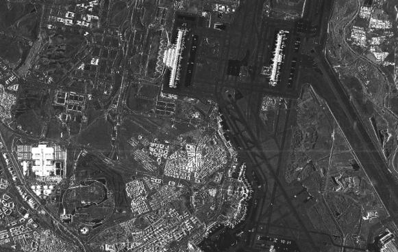
10 OPERATIONAL CONCEPT. IMAGING MODES PDS -PSP- HIGH RESOLUTION SPOTLIGHT PSP Product INTA Raw Data Provided by DLR-TSX PSP Product INTA Raw Data Provided by DLR-TSX Raw Data Provided by DLR-TSX BARAJAS High Resolution Single SSC Size: 5 x 10 km GOERZIG High Resolution Dual EEC-RE Size: 5 x 10 km Pag.: 10
11 OPERATIONAL CONCEPT. IMAGING MODES PDS -PSP- Raw Data Provided by HIGH RESOLUTION SPOTLIGHT - Imaging mode oriented to increase azimuth resolution decreasing scene size. - Azimuth Beam Steering is used to increase illumitation time over swath. SSC MGD SE RE DLR-TSX Polarization Scene Size (Azimuth x Range) [km] Slant Range Resolution [m] Azimuth Resolution [m] Single 5 x HH VV Polarization Channels Dual 5x HHVV GEC SE RE EEC SE RE Pag.: 11
12 OPERATIONAL CONCEPT. PRODUCT TREE Level-0 Products Instrument source packets and annotations L1B Products Complex SSC: Single look Slant range Complex representation Detected MGD: Multilook Ground range Detected representation RE Radiometrically Enhanced SE Spatially Enhanced GEC: Geocoded Ellipsoid Corrected RE Radiometrically Enhanced SE Spatially Enhanced EEC: Enhanced Ellipsoid Corrected RE Radiometrically Enhanced SE Spatially Enhanced 30/10/2015 Pag.: 12

13 L1B FORMAT ANNOTATION PAZ SAR Processor (PSP) is a DLR development for PAZ PAZ L1B product format compliant with TSX and TDX AUXRASTER IMAGEDATA PREVIEW SUPPORT 13
14 CALVAL IN-FLIGHT TEST PLAN Plan development Pre - launch checkpoint Launch In - Flight Tests First System Validation Product Definition Data Takes Plan E 2 E Configuration SAR System Operation Requirements Verification Product Specification Deployment Plan Characterization Calibration Status Conditioning and Characterization Reflector Orientation Plan Performance Assessment Internal Calibration Test Procedures Product Definition External Calibration Tests Plan Risks Analysis 10/30/2015 Pag.: 14
15 Product Definition Product definition parameters identified Product Assessment Test defined All data takes Corner Reflectors data takes Distributed Targets data takes Data extraction for measurements External Calibration measurements Product annotations Data Analysis Tool 30/10/2015 Pag.: 15
16 PRODUCT DEFINITION PARAMETERS IDENTIFIED IRF Analysis Azimuth Resolution Slant Range Resolution PSLR ISLR Point Target Dynamic Range Phase Stability Radiometric Analysis Radiometric Resolution Equivalent Number Of Looks Radiometric Stability Absolute Radiometric Accuracy Relative Radiometric Accuracy NESZ Distributed Target Dynamic Range Geometric Analysis Ground Range Resolution Range Pixel Spacing Azimuth Pixel Spacing Pixel Location Accuracy Product Coverage Location Accuracy Instrument Specification Data Collection Angle Rate Full Performance Angle Rate Minimum Swath Overlap 30/10/2015 Pag.: 16


17 PERFORMANCE ASSESSMENT Complete SAR system performances: Instrument + SAR configuration Ground Segment developed under the assumption Space Segment is recurrent from TerraSAR-X. Instrument Commanding, PAZ SAR Processor, CALVAL AMT acquired from DLR E2e configuration coherent to Instrument Commanding and PAZ SAR Processor Specific assessments carried out over CALVAL Reference Antenna Model Patterns. 30/10/2015 Pag.: 17
18 STRIPMAP MODE SM-S Reference Value SM-D Reference Value SSC Detected SSC Detected SE RE SE RE Ambiguity Ratio ISLR PSLR NESZ Absolute Radiometric Accuracy Relative Radiometric Accuracy Radiometric Stability Slant Range Resolution Ground Range Resolution Azimuth Resolution Range Pixel Spacing Azimuth Pixel Spacing Pixel Localization Accuracy Radiometric Resolution Equivalent Number Of Looks /10/2015 Pag.: 18
19 SPOTLIGHT MODE SL-S Reference Value SL-D Reference Value SSC Detected SSC Detected SE RE SE RE Ambiguity Ratio ISLR PSLR NESZ Absolute Radiometric Accuracy Relative Radiometric Accuracy Radiometric Stability Slant Range Resolution Ground Range Resolution Azimuth Resolution Range Pixel Spacing Azimuth Pixel Spacing Pixel Localization Accuracy Radiometric Resolution Equivalent Number Of Looks /10/2015 Pag.: 19
20 HIGH RESOLUTION SPOTLIGHT MODE HS-S Reference Value HS-D Reference Value SSC Detected SSC Detected SE RE SE RE Ambiguity Ratio ISLR PSLR NESZ Absolute Radiometric Accuracy Relative Radiometric Accuracy Radiometric Stability Slant Range Resolution Ground Range Resolution Azimuth Resolution Range Pixel Spacing Azimuth Pixel Spacing Pixel Localization Accuracy Radiometric Resolution Equivalent Number Of Looks /10/2015 Pag.: 20
21 SCANSAR MODE SC Reference Value SSC Detected RE Ambiguity Ratio -17 ISLR -18 PSLR -25 NESZ -19 Absolute Radiometric Accuracy 1.5 Relative Radiometric Accuracy 0.50 Radiometric Stability 0.50 Slant Range Resolution 1.2 Ground Range Resolution Azimuth Resolution Range Pixel Spacing Azimuth Pixel Spacing Pixel Localization Accuracy 8.5 Radiometric Resolution Equivalent Number Of Looks /10/2015 Pag.: 21
22 PRODUCT DEFINITION APPROACH Abs. and Relative Radiometric Accuracy Calibration Radiometric Geometric Cal. Factor vs. Swath Pos Cal. Factor vs. Beam_Id Abs. Cal. Factor vs. Beam_Id Abs. Cal. Factor vs. Swath Position Point Target Definition Point Target Analysis and Geometric Correction Geometric Calibration Absolute Calibration Factor Calculation L1B Product Tables Generation Distributed Target Analysis Image Analysis Workspace Generation Distributed Target Definition Internal Delay Azimuth Shift Absolute Calibration Factor Geometric Calibration Polarimetric Calibration Test Procedures Calibration Test Cases Image Quality and Product Definition Features Under Test RQ-3512 PSLR RQ-3514 ISLR RQ-3516 RASR RQ-3517 AASR RQ-3518 DTAR RQ-3519 NESZ RQ-3510 Resolution Product Spec. System Reqs Acceptation System Requirements Acceptation Measurements Assessment Basic Product Specification Abs. and Rel. Rad.Accuracy Slant Range Resolution Azimuth Resolution PSLR Relative Rad. Accuracy NESZ Abs. Rad. Accuracy Pixel Spacing Localization Accuracy Radiometric Resolution ISLR RQ-3522 Swath / Scene Size RQ-3524 Minimum Swath Overlap RQ-3540 Radiometric Stability RQ-3542 Coverage Location Accuracy Point Target Dynamic Range Distributed Target Dynamic Range RQ-3542 Absolute Radiometric Accuracy RQ-3544 Relative Radiometric Accuracy RQ-3545 Radiometric Resolution RQ-3546 ENL RQ-3547 Approx. Range Pixel Spacing RQ-3547 Approx. Azimuth Pixel Spacing RQ-3520 Pixel Location Accuracy RQ-3500 L1B Product 30/10/2015 Pag.: 22

23 DATA TAKES PLAN 30/10/2015 Pag.: 23


24 DATA TAKES PLAN 13 DTS OVER CORNER REFLECTOR PER CYCLE 30/10/2015 Pag.: 24


25 ANALYSIS WORKFLOW <query> CR products By ingestiontime L1B PRODUCTS LIST DTID LTDB <create_workspace> CALIBRATION POINT TARGETS FILES L1B Products <copy> L1B PRODUCTS <query> xcal params xcal file LTDB xcal params 30/10/2015 Pag.: 25
26 L1B ANALYSIS TOOL 30/10/2015 Pag.: 26


27 L1B ANALYSIS TOOL 30/10/2015 Pag.: 27


28 TDX-PAZGS TDS ANALYSIS 30/10/2015 Pag.: 28


29 30/10/2015 Pag.: 29
PAZ Mission CalVal Centre
 PAZ Mission CalVal Centre In-Flight Campaigns Design CASAL, N., CIFUENTES, P., CUERDA, J.M., DEL CASTILLO, J., CORES, J.F., GARCIA, M., GIMENO N., GOMEZ, B., GONZALEZ, M.J., LOPEZ, A. 30/10/2015 Pag.:
TerraSAR-X Calibration Status 2 Years in Flight
 2 Years in Flight Dirk Schrank, Marco Schwerdt, Markus Bachmann, Björn Döring, Clemens Schulz November 2009 CEOS 09 VG 1 Calibration Tasks Performed 2009 Introduction Challenge Schedule Re-Calibration
Polarisation Capabilities and Status of TerraSAR-X
 Polarisation Capabilities and Status of TerraSAR-X Irena Hajnsek, Josef Mittermayer, Stefan Buckreuss, Kostas Papathanassiou German Aerospace Center Microwaves and Radar Institute irena.hajnsek@dlr.de
GMES Sentinel-1 Transponder Development
 GMES Sentinel-1 Transponder Development Paul Snoeij Evert Attema Björn Rommen Nicolas Floury Malcolm Davidson ESA/ESTEC, European Space Agency, Noordwijk, The Netherlands Outline 1. GMES Sentinel-1 overview
TerraSAR-X Image Product Guide
 [Texte] TerraSAR-X Image Product Guide Page 1 of 24 Ref.: OP00xxxxxxxxxx Commercial in Confidence 1 Introduction TerraSAR-X and TanDEM-X are commercial German Synthetic Aperture Radar (SAR) Earth observation
TerraSAR-X Mission: Application and Data Access
 TerraSAR-X Mission: Application and Data Access Irena Hajnsek & TSX TEAM German Aerospace Center Microwaves and Radar Institute Pol-InSAR Research Group 2 years in Orbit (since June 2007) irena.hajnsek@dlr.de
ALOS and PALSAR. Masanobu Shimada
 ALOS and PALSAR Masanobu Shimada Earth Observation Research Center, National Space Development Agency of Japan, Harumi 1-8-10, Harumi island triton square office tower X 22, Chuo-Ku, Tokyo-To, Japan, 104-6023,
S1-B N-Cyclic Performance Report Cycles 43 to 46 (03-July-2017 to 20-August-2017)
") S-1 MPC Cycles 43 to 46 (03-July-2017 to 20-August-2017) Reference: Nomenclature: MPC-0356 DI-MPC-NPR Issue: 2017-03. 5 Date: 2017,Sep.01 FORM-NT-GB-10-0 2017,Sep.01 i.1 Chronology Issues: Issue: Date:
S-1 MPC Cycles 43 to 46 (03-July-2017 to 20-August-2017) Reference: Nomenclature: MPC-0356 DI-MPC-NPR Issue: 2017-03. 5 Date: 2017,Sep.01 FORM-NT-GB-10-0 2017,Sep.01 i.1 Chronology Issues: Issue: Date:
TanDEM-X: Mission Status & Scientific Contribution
 TanDEM-X: Mission Status & Scientific Contribution Irena Hajnsek 1/2, Gerhard Krieger 1, Kostas Papathanassiou 1, Stefan Baumgartner 1, Marc Rodriguez-Cassola 1, Pau Prats 1, Maria Sanjuan Ferrer 1, Florian
TerraSAR-X Applications Guide
 TerraSAR-X Applications Guide Extract: Maritime Monitoring: Ship Detection April 2015 Airbus Defence and Space Geo-Intelligence Programme Line Maritime Monitoring: Ship Detection Issue Maritime security
TerraSAR-X Applications Guide
 TerraSAR-X Applications Guide Extract: Change Detection and Monitoring: Geospatial / Image Intelligence April 2015 Airbus Defence and Space Geo-Intelligence Programme Line Change Detection and Monitoring:
SARscape 4.1 Supported Sensors/Products (October 2008)
") SARscape 4.1 Supported Sensors/Products (October 2008) ALOS PALSAR (provided by JAXA) In case of RAW (level 1.0) data, import is carried out within the Focusing Module. PALSAR RAW data in CEOS standard
SARscape 4.1 Supported Sensors/Products (October 2008) ALOS PALSAR (provided by JAXA) In case of RAW (level 1.0) data, import is carried out within the Focusing Module. PALSAR RAW data in CEOS standard
Sentinel-1 System Overview
 Sentinel-1 System Overview Dirk Geudtner, Rámon Torres, Paul Snoeij, Malcolm Davidson European Space Agency, ESTEC Global Monitoring for Environment and Security (GMES) EU-led program aiming at providing
UAVSAR in Africa. Quality Assurance and Preliminary Results. Brian Hawkins, UAVSAR Team
 Photo by Sassan Saatchi UAVSAR in Africa Quality Assurance and Preliminary Results Brian Hawkins, UAVSAR Team CEOS SAR Cal/Val Workshop 2016 Copyright 2016 California Institute of Technology. Government
7.7 TerraSAR-X & TanDEM-X
 7.7 TerraSAR-X & TanDEM-X Two Innovative Remote Sensing Stars for space-borne Earth Observation Vorlesung Wolfgang Keydel Microwaves and Radar Institute, German Aerospace Research Center (DLR), D-82230
Calibration Concepts for Future Low Frequency SAR Systems. Jens Reimann, Marco Schwerdt, Sravan Kumar Aitha and Manfred Zink
 Calibration Concepts for Future Low Frequency SAR Systems Jens Reimann, Marco Schwerdt, Sravan Kumar Aitha and Manfred Zink DLR.de Chart 2 Low Frequency SAR Missions OHB DLR.de Chart 3 BIOMASS - Facts
Biomass, a polarimetric interferometric P-band SAR mission
 Biomass, a polarimetric interferometric P-band SAR mission M. Arcioni, P. Bensi, M. Fehringer, F. Fois, F. Heliere, N. Miranda, K. Scipal Fringe 2015, ESRIN 27/03/2015 The Biomass Mission 1. Biomass was
Prague - 29 June 2009 A. COLETTA COLETTA. COSMO-SkyMed Mission: COSMO-SkyMed Mission. Application and Data Access
 A. A. COLETTA COLETTA COSMO-SkyMed COSMO-SkyMed Mission Mission Manager Manager ITALIAN ITALIAN SPACE SPACE AGENCY AGENCY COSMO-SkyMed Mission: Application and Data Access The COSMO-SkyMed PROGRAMME The
SAOCOM Calibration Strategy
 COMISION NACIONAL DE ACTIVIDADES ESPACIALES (The Argentinean National Commission of Space Activities) M. Azcueta, J. Giardini, J. P. Cuesta González, M. Thibeault, T. Zajc November 7-9, 20 October 20 8
The Current Status and Brief Results of Engineering Model for PALSAR-2 onboard ALOS-2 and Science Project
 The Current Status and Brief Results of Engineering Model for PALSAR-2 onboard ALOS-2 and Science Project + The 16 th KC meeting Japan Aerospace Exploration Agency Masanobu Shimada, Yukihiro KANKAKU The
THE NASA/JPL AIRBORNE SYNTHETIC APERTURE RADAR SYSTEM. Yunling Lou, Yunjin Kim, and Jakob van Zyl
 THE NASA/JPL AIRBORNE SYNTHETIC APERTURE RADAR SYSTEM Yunling Lou, Yunjin Kim, and Jakob van Zyl Jet Propulsion Laboratory California Institute of Technology 4800 Oak Grove Drive, MS 300-243 Pasadena,
RADARSAT-2 Image Quality and Calibration Update
 RADARSAT-2 Image Quality and Calibration Update by Dan Williams, Yiman Wang, Marielle Chabot, Pierre Le Dantec, Ron Caves, Yan Wu, Kenny James, Alan Thompson, Cathy Vigneron www.mdacorporation.com Image
TerraSAR-X and TanDEM-X: Revolution in Spaceborne Radar
 TerraSAR-X and TanDEM-X: Revolution in Spaceborne Radar Ralf Düring, Fifamè N. Koudogbo, and Marco Weber, Infoterra GmbH, 88039 Friedrichshafen, Germany INTRODUCTION While Earth Observation from space
KOMPSAT-5 Image Quality Measurement in 2017
 Korea Aerospace Research Institute Program Office 169-84 Gwahangno Yuseong-gu Daejeon, 305-806, Korea Image Quality Measurement in 2017 08 Nov 2017 Korea Aerospace Research Institute Horyung Jeong, Donghyun
DLR contribution and perspectives for JECAM
 DLR contribution and perspectives for JECAM Dr. Helmut Staudenrausch 1, Dr. Achim Roth 2 1 DLR Space Administration, Earth Observations helmut.staudenrausch@dlr.de 2 DLR, German Remote Sensing Data Center
Sentinel-1A Radiometric Calibration
 Sentinel-1A Radiometric Calibration Peter Meadows 1, Alan Pilgrim 1, Riccardo Piantanida 2, Davide Riva 2, Nuno Miranda 3 (1) BAE Systems Applied Intelligence, West Hanningfield Road, Great Baddow, Chelmsford,
Calibration Concepts of Multi-Channel Spaceborne SAR
 DLR.de Chart 1 > CEOS Workshop 2016 > Tobias Rommel > September 7 th, 2016 Calibration Concepts of Multi-Channel Spaceborne SAR T. Rommel, F. Queiroz de Almeida, S. Huber, M. Jäger, G. Krieger, C. Laux,
Spaceborne Active Phased Array Antenna Calibration Using an Accurate Antenna Model
 Spaceborne Active Phased Array Antenna Calibration Using an Accurate Antenna Model Markus Bachmann, Marco Schwerdt, Benjamin Bräutigam German Aerospace Center (DLR), Oberpfaffenhofen, 82234 Wessling, Germany,
TanDEM-X Mission Status & Commissioning Phase Overview
 TanDEM-X Mission Status & Commissioning Phase Overview M. Zink TanDEM-X Ground Segment Manager 17-February-2011 TanDEM-X Science Team Meeting 17-Feb-2011 - OP TerraSAR-X-Add-on for Digital Elevation Measurements
TanDEM-X SAR System Verification
 TanDEM-X SAR System Verification Mathias Weigt, Ulrich Steinbrecher, Thomas Kraus, Johannes Böer, Benjamin Bräutigam 07-09 November 2011 Overview Monostatic Commissioning Phase Verification of Power/Thermal
Final Results of the Efficient TerraSAR-X Calibration Method
 Final Results of the Efficient TerraSAR-X Calibration Method M. Schwerdt, B. Bräutigam, M. Bachmann, B. Döring, Dirk Schrank and Jaime Hueso Gonzalez Microwave and Radar Institute of the German Aerospace
Exploring the Potential Pol-InSAR Techniques at X-Band: First Results & Experiments from TanDEM-X
 Exploring the Potential Pol-InSAR Techniques at X-Band: First Results & Experiments from TanDEM-X K. Papathanassiou, F. Kugler, J-S. Kim, S-K. Lee, I. Hajnsek Microwaves and Radar Institute (DLR-HR) German
TerraSAR-X. Value Added Product Specification
 Doc. No.: 0009 Page: 1 / 26 TerraSAR-X Value Added Doc. No.: 0009 Page: 2 / 26 TABLE OF CONTENTS 1 INTRODUCTION... 4 1.1 Objective... 4 1.2 Reference Documents... 4 1.3 Definitions and Abbreviations...
ENVISAT ASAR MONTHLY REPORT MARCH 2012
 ENVISAT ASAR MONTHLY REPORT MARCH 2012 PUBLIC SUMMARY prepared by/préparé par IDEAS SAR Team reference/réference ENVI-CLVL-EOPG-TN-04-0009 issue/édition 73 revision/révision 0 date of issue/date d édition
The Biomass Mission, status of the satellite system
 The Biomass Mission, status of the satellite system M. Arcioni, P. Bensi, M. Fehringer, F. Fois, F. Heliere, K. Scipal PolInSAR/Biomass Meeting 2015, ESRIN 29/01/2015 1. Key facts (lifetime, duty cycle
Nadir Margins in TerraSAR-X Timing Commanding
 CEOS SAR Calibration and Validation Workshop 2008 1 Nadir Margins in TerraSAR-X Timing Commanding S. Wollstadt and J. Mittermayer, Member, IEEE Abstract This paper presents an analysis and discussion of
Sentinel-1A Tile #11 Failure
 MPC-S1 Reference: Nomenclature: MPC-0324 OI-MPC-ACR Issue: 1. 2 Date: 2016,Oct.13 FORM-NT-GB-10-1 MPC-0324 OI-MPC-ACR V1.2 2016,Oct.13 i.1 Chronology Issues: Issue: Date: Reason for change: Author 1.0
Commissioning the TanDEM-X Ground Segment An Interim Commissioning Phase Perspective
 Commissioning the TanDEM-X Ground Segment An Interim Commissioning Phase Perspective B. Schättler, R. Kahle, R. Metzig, T. Fritz, U. Steinbrecher, M. Wermuth, M. Zink, and TanDEM-X Ground Segment Team
Sentinel-1 Overview. Dr. Andrea Minchella
 Dr. Andrea Minchella 21-22/01/2016 ESA SNAP-Sentinel-1 Training Course Satellite Applications Catapult - Electron Building, Harwell, Oxfordshire Contents Sentinel-1 Mission Sentinel-1 SAR Modes Sentinel-1
RADARSAT-2 PRODUCT DESCRIPTION
 RADARSAT-2 PRODUCT DESCRIPTION Summary: This document defines the characteristics of RADARSAT-2 products. IMPORTANT NOTES: This document describes the characteristics of RADARSAT-2 Products. The product
TanDEM-X. 1. Mission Overview. Science Meeting No SAR Imaging Modes & Performance 3. Satellite Design Overview 4. Launcher 5.
 TanDEM-X Science Meeting No. 1 Dresden 15.5.2006 Wolfgang Pitz EADS Astrium GmbH D-88039 Friedrichshafen 1. Mission Overview 2. SAR Imaging Modes & Performance 3. Satellite Design Overview 4. Launcher
ERS-2 SAR CYCLIC REPORT
 28TH SEPTEMBER 2009-2ND NOVEMBER 2009 (CYCLE 151) PUBLIC SUMMARY prepared by/préparé par IDEAS SAR Team reference/réference IDEAS-BAE-OQC-REP-0245 issue/édition 9 revision/révision 0 date of issue/date
RADARSAT-2 Program Update Daniel De Lisle Canadian Space Agency
 RADARSAT-2 Program Update Daniel De Lisle Canadian Space Agency Presentation outline RADARSAT-1 Update RADARSAT-2 Mission description Mission Objectives System Characteristics Data Commercialization/Allocation
SCANSAR AND SPOTLIGHT IMAGING OPERATION STUDY FOR SAR SATELLITE MISSION
 SCANSAR AND SPOTLIGHT IMAGING OPERATION STUDY FOR SAR SATELLITE MISSION Bor-Han Wu, Meng-Che Wu and Ming-Hwang Shie National Space Organization, National Applied Research Laboratory, Taiwan *Corresponding
The Sentinel-1 Constellation
 The Sentinel-1 Constellation Evert Attema, Sentinel-1 Mission & System Manager AGRISAR and EAGLE Campaigns Final Workshop 15-16 October 2007 ESA/ESTECNoordwijk, The Netherlands Sentinel-1 Programme Sentinel-1
NovaSAR-S - Bringing Radar Capability to the Disaster Monitoring Constellation
 Changing the economics of space NovaSAR-S - Bringing Radar Capability to the Disaster Monitoring Constellation SSTL: Philip Davies, Phil Whittaker, Rachel Bird, Luis Gomes, Ben Stern, Prof Sir Martin Sweeting
Introduction Active microwave Radar
 RADAR Imaging Introduction 2 Introduction Active microwave Radar Passive remote sensing systems record electromagnetic energy that was reflected or emitted from the surface of the Earth. There are also
Detection of traffic congestion in airborne SAR imagery
 Detection of traffic congestion in airborne SAR imagery Gintautas Palubinskas and Hartmut Runge German Aerospace Center DLR Remote Sensing Technology Institute Oberpfaffenhofen, 82234 Wessling, Germany
SAOCOM MISSION OVERVIEW
 COMISION NACIONAL DE ACTIVIDADES ESPACIALES (The Argentinean National Commission of Space Activities) SAOCOM MISSION OVERVIEW Laura Frulla, J. Medina, J. Milovich, G. R. Ortega, Marc Thibeault CONAE November
Affordable space based radar for homeland security
 Changing the economics of space Affordable space based radar for homeland security Adam Baker Brent Abbott Phil Whittaker Rachel Bird Luis Gomes Summary Why Radar? However: Radar data is expensive Users
Review. Guoqing Sun Department of Geography, University of Maryland ABrief
 Review Guoqing Sun Department of Geography, University of Maryland gsun@glue.umd.edu ABrief Introduction Scattering Mechanisms and Radar Image Characteristics Data Availability Example of Applications
Eva Vega - Instituto Nacional de Técnica Aeroespacial (INTA) Juan Ureña - Centro para el Desarrollo Tecnológico Industrial (CDTI)
 Juan Ureña - Centro para el Desarrollo Tecnológico Industrial (CDTI)") Ingenio and PAZ Ground Segment Interoperability Programa Nacional de Observación de la Tierra por Satélite - PNOTS (Spanish Earth Observation Satellite Programme) Eva Vega - Instituto Nacional de Técnica
Ingenio and PAZ Ground Segment Interoperability Programa Nacional de Observación de la Tierra por Satélite - PNOTS (Spanish Earth Observation Satellite Programme) Eva Vega - Instituto Nacional de Técnica
COSMO-skymed, TerraSAR-X, and RADARSAT-2 geolocation accuracy after compensation for earth-system effects
 Zurich Open Repository and Archive University of Zurich Main Library Strickhofstrasse 9 CH-857 Zurich www.zora.uzh.ch Year: COSMO-skymed, TerraSAR-X, and RADARSAT- geolocation accuracy after compensation
Improvement and Validation of Ranging Accuracy with YG-13A
 Article Improvement and Validation of Ranging Accuracy with YG-13A Mingjun Deng 1, Guo Zhang 2, *, Ruishan Zhao 3, Jiansong Li 1, Shaoning Li 2 1 School of Remote Sensing and Information Engineering, Wuhan
SAR Interferometry Capabilities of Canada's planned SAR Satellite Constellation
 SAR Interferometry Capabilities of Canada's planned SAR Satellite Constellation Dirk Geudtner, Guy Séguin,, Ralph Girard Canadian Space Agency RADARSAT Follow-on Program CSA is in the middle of a Phase
Ka-Band Systems and Processing Approaches for Simultaneous High-Resolution Wide-Swath SAR Imaging and Ground Moving Target Indication
 Ka-Band Systems and Processing Approaches for Simultaneous High-Resolution Wide-Swath SAR Imaging and Ground Moving Target Indication Advanced RF Sensors and Remote Sensing Instruments 2014 Ka-band Earth
RADARSAT-1: An End-of-Mission Review of the Imaging and Calibration Performance of a Magnificent Canadian Instrument
 RADARSAT-1: An End-of-Mission Review of the Imaging and Calibration Performance of a Magnificent Canadian Instrument S. Cote, S. Srivastava Canadian Space Agency S. Muir Calian Technologies Ltd 1 RADARSAT-1
The German Satellite Mission TerraSAR-X
 The German Satellite Mission TerraSAR-X S. Buckreuss 1, R. Werninghaus 2, W. Pitz 3 1 Microwaves and Radar Institute, German Aerospace Center (DLR) 2 Space Flight Management, German Aerospace Center (DLR)
MULTI-CHANNEL SAR EXPERIMENTS FROM THE SPACE AND FROM GROUND: POTENTIAL EVOLUTION OF PRESENT GENERATION SPACEBORNE SAR
 3 nd International Workshop on Science and Applications of SAR Polarimetry and Polarimetric Interferometry POLinSAR 2007 January 25, 2007 ESA/ESRIN Frascati, Italy MULTI-CHANNEL SAR EXPERIMENTS FROM THE
PAYLOAD OVERVIEW. 1. Payload Architecture for both concepts
 PAYLOAD OVERVIEW F. Hélière, F. Fois, C-C Lin, M. Aloisio, K. Van t Klooster 1. Payload Architecture for both concepts 2. Technology and Pre-developments a. Ku-band feed and High Power Switch b. High Power
TerraSAR-X Calibration Ground Equipment
 86 Proceedings of WFMN07, Chemnitz, Germany TerraSAR-X Calibration Ground Equipment Björn J. Döring, Marco Schwerdt, Robert Bauer Microwaves and Radar Institute German Aerospace Center (DLR) Oberpfaffenhofen,
SAR Remote Sensing (Microwave Remote Sensing)
") iirs SAR Remote Sensing (Microwave Remote Sensing) Synthetic Aperture Radar Shashi Kumar shashi@iirs.gov.in Electromagnetic Radiation Electromagnetic radiation consists of an electrical field(e) which
iirs SAR Remote Sensing (Microwave Remote Sensing) Synthetic Aperture Radar Shashi Kumar shashi@iirs.gov.in Electromagnetic Radiation Electromagnetic radiation consists of an electrical field(e) which
Sentinel-1 Calibration and Performance
 Sentinel-1 Calibration and Performance Paul Snoeij Evert Attema Björn Rommen Nicolas Floury Berthyl Duesmann Malcolm Davidson Ramon Torres European Space Agency Sentinel-1 Mission Objectives Component
SAR Imagery: Airborne or Spaceborne? Presenter: M. Lorraine Tighe PhD
 SAR Imagery: Airborne or Spaceborne? Presenter: M. Lorraine Tighe PhD Introduction The geospatial community has seen a plethora of spaceborne SAR imagery systems where there are now extensive archives
Dual Polarized Radiometers DPR Series RPG DPR XXX. Applications. Features
 Dual Polarized Radiometers Applications Soil moisture measurements Rain observations Discrimination of Cloud Liquid (LWC) and Rain Liquid (LWR) Accurate LWP measurements during rain events Cloud physics
The Radar Ortho Suite is an add-on to Geomatica. It requires Geomatica Core or Geomatica Prime as a pre-requisite.
 Technical Specifications Radar Ortho Suite The Radar Ortho Suite includes rigorous and rational function models developed to compensate for distortions and produce orthorectified radar images. Distortions
TerraSAR-X: Status Report & Polarimetric Data Exploitation
 TerraAR-X: tatus Report & Polarimetric Data Exploitation Alberto Moreira & Irena Hajnsek German Aerospace Center (DLR) Folie irena.hajnsek@dlr.de - 5.0.007 TerraAR-X: A National cience Mission with Commercial
Low frequency SAR data-dome collection with the Bright Sapphire II instrument
 Low frequency SAR data-dome collection with the Bright Sapphire II instrument Specialists meeting on Remote Intelligence of Building Interiors Sam DOODY May 2017 Low Frequency Airborne SAR Justification
Introduction to KOMPSAT
 Introduction to KOMPSAT September, 2016 1 CONTENTS 01 Introduction of SIIS 02 KOMPSAT Constellation 03 New : KOMPSAT-3 50 cm 04 New : KOMPSAT-3A 2 KOMPSAT Constellation KOMPSAT series National space program
KOMPSAT Constellation. November 2012 Satrec Initiative
 KOMPSAT Constellation November 2012 Satrec Initiative KOMPSAT Constellation KOMPSAT National program Developed and operated by KARI (Korea Aerospace Research Institute) Dual use : Government & commercial
Design and Performance Simulation of a Ku-Band Rotating Fan-Beam Scatterometer
 Design and Performance Simulation of a Ku-Band Rotating Fan-Beam Scatterometer Xiaolong DONG, Wenming LIN, Di ZHU, (CSSAR/CAS) PO Box 8701, Beijing, 100190, China Tel: +86-10-62582841, Fax: +86-10-62528127
China. France Oceanography S A T. Overview of the near-real time wave products of the CFOSAT mission. e l l i t e
 China Overview of the near-real time wave products of the CFOSAT mission C. Tison (1), D. Hauser (2), S. Guibert (1), T. Amiot (1), L. Aouf (3), J.M. Lefèvre (3), B. Chapron (5), N. Corcoral (1), P. Castillan
THE ENVISAT ASAR MISSION: A LOOK BACK AT 10 YEARS OF OPERATION
 THE ENVISAT ASAR MISSION: A LOOK BACK AT 10 YEARS OF OPERATION N. Miranda (1), B. Rosich (1), P.J. Meadows (2), K. Haria (3), D. Small (4), A. Schubert (4), M. Lavalle (5), F. Collard (6), H. Johnsen (7),
SARscape Modules for ENVI
 Visual Information Solutions SARscape Modules for ENVI Read, process, analyze, and output products from SAR data. ENVI. Easy to Use Tools. Proven Functionality. Fast Results. DEM, based on TerraSAR-X-1
ENVISAT ASAR DATA PROCESSING
 ASAR data processing with GAMMA Software, Version of 20-Jun-2003 GAMMA SOFTWARE VALIDATION REPORT: ENVISAT ASAR DATA PROCESSING Urs Wegmüller, Tazio Strozzi, Charles Werner and Andreas Wiesmann Gamma Remote
Adaptive SAR Results with the LiMIT Testbed
 Adaptive SAR Results with the LiMIT Testbed Gerald Benitz Adaptive Sensor Array Processing Workshop 7 June 2005 999999-1 Outline LiMIT collection platform SAR sidelobe recovery Electronic Protection (EP)
Chapter 6 Spaceborne SAR Antennas for Earth Science
 Chapter 6 Spaceborne SAR Antennas for Earth Science Yunjin Kim and Rolando L. Jordan 6.1 Introduction Before the development of the first synthetic aperture radar (SAR) antenna flown in space, Jet Propulsion
Ocean SAR altimetry. from SIRAL2 on CryoSat2 to Poseidon-4 on Jason-CS
 Ocean SAR altimetry from SIRAL2 on CryoSat2 to Poseidon-4 on Jason-CS Template reference : 100181670S-EN L. Phalippou, F. Demeestere SAR Altimetry EGM NOC, Southampton, 26 June 2013 History of SAR altimetry
 Performance Comparison between Dual Polarimetric and Fully Polarimetric data for DInSAR Subsidence monitoring Dani Monells, Jordi J. Mallorquí Universitat Politècnica de Catalunya, Departament de Teoria
KONGSBERG SATELLITE SERVICES 2017 Line Steinbakk, Director Programs. Himmel og hav - Ålesund 3. Oktober 2017
 KONGSBERG SATELLITE SERVICES 2017 Line Steinbakk, Director Programs Himmel og hav - Ålesund 3. Oktober 2017 KSAT HQ IN TROMSØ 69N Established in 1967 Kongsberg Satellite Services since 2002 World leading
KEY TECHNOLOGY DEVELOPMENT FOR THE ADVENACED LAND OBSERVING SATELLITE
 KEY TECHNOLOGY DEVELOPMENT FOR THE ADVENACED LAND OBSERVING SATELLITE Takashi HAMAZAKI, and Yuji OSAWA National Space Development Agency of Japan (NASDA) hamazaki.takashi@nasda.go.jp yuji.osawa@nasda.go.jp
Detection of Multipath Propagation Effects in SAR-Tomography with MIMO Modes
 Detection of Multipath Propagation Effects in SAR-Tomography with MIMO Modes Tobias Rommel, German Aerospace Centre (DLR), tobias.rommel@dlr.de, Germany Gerhard Krieger, German Aerospace Centre (DLR),
VenSAR: A MULTI-FUNCTIONAL S-BAND RADAR FOR THE EnVision MISSION TO VENUS
 VenSAR: A MULTI-FUNCTIONAL S-BAND RADAR FOR THE EnVision MISSION TO VENUS Richard Ghail (1) and David Hall (2) (1) Civil and Environmental Engineering, Imperial College London, London SW7 2AZ, United Kingdom
S1-A Annual Performance Report for 2015
 S-1 MPC Reference: Nomenclature: MPC-0139 DI-MPC-APR Issue: 1. 0 Date: 2016,Mar.29 FORM-NT-GB-10-0 MPC-0139 DI-MPC-APR V1.0 2016,Mar.29 i.1 Chronology Issues: Issue: Date: Reason for change: Author 1.0
COMPARATIVE ANALYSIS OF INSAR DIGITAL SURFACE MODELS FOR TEST AREA BUCHAREST
 COMPARATIVE ANALYSIS OF INSAR DIGITAL SURFACE MODELS FOR TEST AREA BUCHAREST Iulia Dana (1), Valentin Poncos (2), Delia Teleaga (2) (1) Romanian Space Agency, 21-25 Mendeleev Street, 010362, Bucharest,
The Role of RADARSAT-2 for Flood and Agriculture Monitoring
 The Role of RADARSAT-2 for Flood and Agriculture Monitoring Gordon Staples MDA Richmond, BC, CANADA gstaples@mda.ca RESTRICTION ON USE, PUBLICATION OR DISCLOSURE OF PROPRETIARY INFORMATION This document
Development Status of Compact X-band Synthetic Aperture Radar Compatible with a100kg-class SAR Satellite and Its Future Plan.
 SSC17-IX-01 Development Status of Compact X-band Synthetic Aperture Radar Compatible with a100kg-class SAR Satellite and Its Future Plan Hirobumi Saito Japan Aerospace Exploration Agency (JAXA), Institute
Towards a polarimetric SAR processor for airborne sensor
 1 Towards a polarimetric SAR processor for airborne sensor H. M.J. Cantalloube 1, B. Fromentin-Denoziere 1, and C. E. Nahum 2 1 ONERA (Office National d Études et Recherches Aérospatiales) Palaiseau, France
Concept of the future L-band SAR mission for wide swath SAR observation
 Concept of the future SAR mission for wide swath SAR observation A.Karasawa 1, Y.Okada 1, Y.Yokota 1, S.Nakamura 1 1) Mitsubishi Electric Corporation 1 Outline 1:Development of SAR systems in MELCO 2:Development
Feasibility Study of EO SARs as Opportunity Illuminators in Passive Radars: PAZ-Based Case Study
 Sensors 2015, 15, 29079-29106; doi:10.3390/s151129079 OPEN ACCESS sensors ISSN 1424-8220 www.mdpi.com/journal/sensors Article Feasibility Study of EO SARs as Opportunity Illuminators in Passive Radars:
7.7.2 TerraSAR-X-Add-on for Digital Elevation Measurements
 7.7.2 TerraSAR-X-Add-on for Digital Elevation Measurements TDX launched on June 21, 2010 18 Overview of the TanDEM-X overall system architecture (image credit: DLR) Figure 10: Overview of the TanDEM-X
Report on CEOS WGCV SAR Subgroup Activities
 Report on CEOS WGCV SAR Subgroup Activities CEOS WGCV 37 th Plenary ESRIN, Frascati/Italy February 17-20, 2014 M. Zink Chair CEOS WGCV SAR Subgroup German Aerospace Center (DLR) manfred.zink@dlr.de http://sarcv.ceos.org
KONGSBERG SATELLITE SERVICES Earth Observation for Maritime Operations Current Capabilities and Future Potential
 KONGSBERG SATELLITE SERVICES 2017 Earth Observation for Maritime Operations Current Capabilities and Future Potential Andreas Hay Kaljord Project Manager KSAT HQ IN TROMSØ - 69N WELCOME TO TROMSØ Established
Introduction to Radar
 National Aeronautics and Space Administration ARSET Applied Remote Sensing Training http://arset.gsfc.nasa.gov @NASAARSET Introduction to Radar Jul. 16, 2016 www.nasa.gov Objective The objective of this
PALSAR SCANSAR SCANSAR Interferometry
 PALSAR SCANSAR SCANSAR Interferometry Masanobu Shimada Japan Aerospace Exploration Agency Earth Observation Research Center ALOS PI symposium, Greece Nov. 6 2008 1 Introduction L-band PALSAR strip mode
ERS/ENVISAT ASAR Data Products and Services
 ERS/ENVISAT ASAR Data Products and Services Andrea Celentano Business Manager celentan@eurimage.com What is Eurimage? Founded in 1989 Current shareholders: Since 1989 Commercial Partner of the European
Digital Beamforming Architecture and Techniques for a Spaceborne Interferometric Ka-Band Mission
 Digital Beamforming Architecture and Techniques for a Spaceborne Interferometric Ka-Band Mission Marwan Younis, Paco López-Dekker, Anton Patyuchenko, and Gerhard Krieger German Aerospace Center (DLR),
Consideration of Inter-Pulse and Intra-Pulse Satellite Motion in Zero Doppler SAR Processing
 DLR.de Chart 1 Consideration of Inter-Pulse and Intra-Pulse Satellite Motion in Zero Doppler SAR Processing Ulrich Balss, Helko Breit, Michael Eineder Remote Sensing Technology Institute (IMF) German Aerospace
Towards Sentinel-1 Soil Moisture Data Services: The Approach taken by the Earth Observation Data Centre for Water Resources Monitoring
 Towards Sentinel-1 Soil Moisture Data Services: The Approach taken by the Earth Observation Data Centre for Water Resources Monitoring Wolfgang Wagner wolfgang.wagner@geo.tuwien.ac.at Department of Geodesy
AN OPTIMAL ANTENNA PATTERN SYNTHESIS FOR ACTIVE PHASED ARRAY SAR BASED ON PARTICLE SWARM OPTIMIZATION AND ADAPTIVE WEIGHT- ING FACTOR
 Progress In Electromagnetics Research C, Vol. 10, 129 142, 2009 AN OPTIMAL ANTENNA PATTERN SYNTHESIS FOR ACTIVE PHASED ARRAY SAR BASED ON PARTICLE SWARM OPTIMIZATION AND ADAPTIVE WEIGHT- ING FACTOR S.