7.7.2 TerraSAR-X-Add-on for Digital Elevation Measurements
|
|
|
- Philip Bertram Ross
- 6 years ago
- Views:
Transcription

1 7.7.2 TerraSAR-X-Add-on for Digital Elevation Measurements TDX launched on June 21,
 http://www.eoportal.org/directory/pres_tandemxterrasarxaddonfordigitalelevationmeasurement.")
2 Overview of the TanDEM-X overall system architecture (image credit: DLR) Figure 10: Overview of the TanDEM-X overall system architecture (image credit: DLR) 19

3 DTED/HRTI Level Primary Mission Goal: Generation of a global HRTI-3 DEM 20

4 Standards for Digital Elevation Models Spatial Resolution Absolute Vertical Accuracy Relative Vertical Accuracy (90%) (point-to-point in 1 cell, 90%) DTED-1 90 m x 90 m < 30 m < 20 m DTED-2 30 m x 30 m < 18 m < 12 m TanDEM-X 12 m x 12 m < 10 m <2m Level-4 6mx6m <5m < 0.8 m Definition of 90% point-to-point errors: 1 1 relative height error h ~ absolute height error h single point errors (90% confidence interval) 2 h point-to-point errors (90% confidence interval) h 90% 2.33 h 21
5 TanDEM X HRTI-3 Spezification relative vertical accuracy 2 m (90% linear point-to-point error over 1 x 1 cell), absolute vertical accuracy 10 m (90% linear error), absolute horizontal accuracy 10 m (90% circular error), post spacing 12 m x 12 m TanDEM-X provides a configurable SAR Interferometry Platform for Demonstrating new SAR Techniques & Applications 22

6 Comparison of DTED/HRTI-Levels: Example DTED-2 SRTM / X-SAR HRTI-3 E-SAR 23


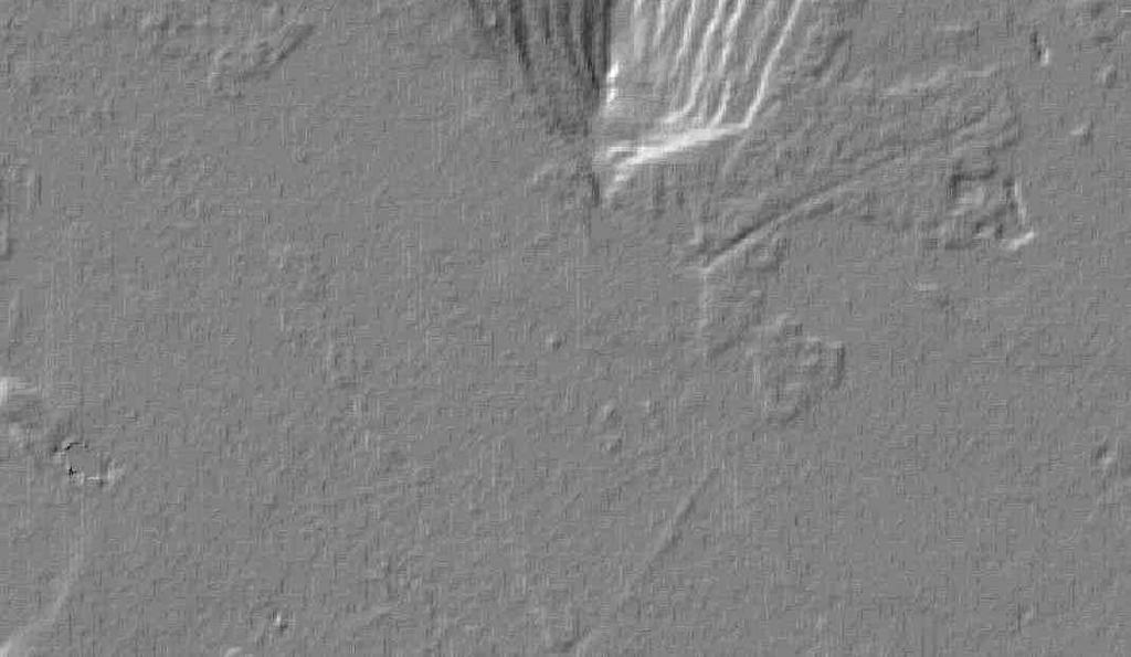
7 Ätna 24


8 SRTM TanDEM-X Coal Mine Hambach - Germany 25


9 Ziel der TanDEM-X-Mission: Dreidimensionale Vermessung der gesamten Erdoberfläche,150 Millionen km2 als Grundlage für ein breites Anwendungsspektrum: Umweltforschung, Entwicklung moderner Navigationssysteme etc. Beispiel für die extremen Anforderungenxtreme Anforderungen Aufnahmezeit im Orbit auf drei Minuten limitiert wegen Überhitzug des Satelleiten. Das globale Geländemodells erfordert weitere 30 Sekunden. Das erbrachte bereits in der Planung eine Simulation mit exakter Modllierung des Satelliten Aracar Vulkan im chilenisch-argentinischem Grenzgebiet 26
10 TanDEM-X an HR-driven Mission Internal operational Control System (IOCS) extensions TanDEM-X Acquisition Planner defines Helix parameters generates acquisition timeline on data take level including the thermal balance, etc. Bistatic commanding including synchronization pulse exchange Definition of exclusion zones and sync warning opportunities Step 1: First acquisition timeline DT DL DT DL TanDEM -X limit Feasible acquisitions Timeline (1 year) Step 2: Detailed Planning TanDEM -X limit Recalc. with real timing Timeline (1 year) Satellite memory consumption DL DT Satellite memory consumption Satellite memory consumption DT Step 3: Performance optimization TanDEM -X limit Performance optimized Timeline (1 year) DT in Orbit principally allowed during 3 min only due to heating up the Satellite Necessary 30 sec more Exact Simulation of the Temperature Profile leads to respective gain 27

11 TanDEM-X an HR-driven Mission Definition of interferometric modes Pursuit Monostatic both satellites transmit and receive independently temporal decorrelation & atmospheric disturbances backup solution Bistatic Alternating Bistatic one satellite transmits and both satellites receive simultaneously transmitter alternates between PRF pulses dual use of signal energy enables synchronisation, calibration & verification requires synchronisation provides two baselines Design of the synchronisation system and of algorithms for evaluating synchronisation pulses 28


12 Previous Civilian SAR Sensors 20 m Resolution TerraSAR-X 1 m Resolution 29
 Scientific user requirements established (more than 100 scientists involved) Coordination of more than 700 scientists")
 New Techniques t Large Scale Velocity Fields (ocean currents, ice drift, )")
 Moving Object Detection Digital Beamforming (HRWS, ) High Resolution SAR Images Wolfgang Keydelel, DLR Microwaves and Radar")
13 TanDEM-X an HR-driven Mission Mission proposal initiated jointly with Astrium (PI: A. Moreira) Scientific user requirements established (more than 100 scientists involved) Coordination of more than 700 scientists from 35 countries (>15000 requests in response to the 1st AO) Cross-Track Interferometry Along-Track Interferometry r+ r r t+ t Digital Elevation Models Spatial Coherence (forest, ) New Techniques t Large Scale Velocity Fields (ocean currents, ice drift, ) 4 Phase Center MTI (traffic, ) PolInSAR (vegetation height, ) Double DInSAR (change maps,..) Moving Object Detection Digital Beamforming (HRWS, ) High Resolution SAR Images Wolfgang Keydelel, DLR Microwaves and Radar Institute, Vorlesung Temporal Coherence Maps Bistatic Imaging (classification,..)30


14 TanDEM-X an HR-driven Mission Helix formation - patented by HR 31


15 Tandem-X Elliptical Helix Orbit Configuration 32


16 TanDEM-X an HR-driven Mission Mutual Irradiation Exclusion Zones TSX may not transmit in asc. orbit 65 H EL IX TDX TSX DEM TSX 50 exclusion zones 30 TDX (example) 0 DEM TSX side-lobes exclusion zone all beam main lobes defined by IOCS TDX TDX may not transmit in desc. orbit 33
17 TanDEM-X an HR-driven Mission Calibration of the bistatic Interferometer Baseline Calibration: TSX estimation of baseline bias by dedicated data takes in near and far range USO 200 USO LAA Sync Link TRM Internal Calibration Star Tracker DGPS TSX CE CE LAA Internal Calibration TRMs GPS m- TDX TDX m SAR Antenna Internal calibration Nominal calibration points Baseline Calibration pulses only Interpolated curve Instrument Phase Calibration: - calibration pulse measurement - SAR antenna phase pattern 34
18 TanDEM-X an HR-driven Mission Delay Calibration enables resolving 2 -ambiguity intervall using radargrammetry - residual internal delay differences - relativistic effects - bandwidth dependency - sync horn dependency - receiver gain dependency radial rbi 300 m [mm] TDX TSX 600 m alongtrack TSX Master 10 arglat TDX Master rbi B vs 14mm (B 600m) c Ambiguity Interval all delays successfully calibrated radargrammetry works! 35
19 TanDEM-X an HR-driven Mission Performance Monitoring Mean offset to SRTM for 89% of all processed scenes within ±10m 36
 baselines + acquisition of scientific radar data products DEM data takes for difficult terrain with different viewing geometry + radar data products")
20 TanDEM-X an HR-driven Mission Acquisition Schedule Commissioning Phase 1 global DEM acquisition with small baselines + acquisition of scientific radar data products t months 6 months 1 global DEM acquisition with scaled (larger) baselines + acquisition of scientific radar data products DEM data takes for difficult terrain with different viewing geometry + radar data products radar data products and high res. DEMs with large interferometric baselines Mid 2014: DEM processing finished (90%) 37
21 Summary The Institute plays a central role in TerraSAR-X. TanDEM-X mission proposal initiated by the Institute jointly with Astrium. The Institute was the driving force in the design, implementation and is leading operation and scientific exploitation of TanDEM-X. Combining SAR system engineering, calibration and verification, and the development of the IOCS are key factors to the success of the missions. TanDEM-X is a milestone in remote sensing and demonstrates Germany s expertise in spaceborne radar technology. Programmatic continuity was a precondition to reach this level and has to be guaranteed in the future. 38
TanDEM-X: Mission Status & Scientific Contribution
 TanDEM-X: Mission Status & Scientific Contribution Irena Hajnsek 1/2, Gerhard Krieger 1, Kostas Papathanassiou 1, Stefan Baumgartner 1, Marc Rodriguez-Cassola 1, Pau Prats 1, Maria Sanjuan Ferrer 1, Florian
TanDEM-X SAR System Verification
 TanDEM-X SAR System Verification Mathias Weigt, Ulrich Steinbrecher, Thomas Kraus, Johannes Böer, Benjamin Bräutigam 07-09 November 2011 Overview Monostatic Commissioning Phase Verification of Power/Thermal
TanDEM-X Mission Status & Commissioning Phase Overview
 TanDEM-X Mission Status & Commissioning Phase Overview M. Zink TanDEM-X Ground Segment Manager 17-February-2011 TanDEM-X Science Team Meeting 17-Feb-2011 - OP TerraSAR-X-Add-on for Digital Elevation Measurements
Exploring the Potential Pol-InSAR Techniques at X-Band: First Results & Experiments from TanDEM-X
 Exploring the Potential Pol-InSAR Techniques at X-Band: First Results & Experiments from TanDEM-X K. Papathanassiou, F. Kugler, J-S. Kim, S-K. Lee, I. Hajnsek Microwaves and Radar Institute (DLR-HR) German
7.7 TerraSAR-X & TanDEM-X
 7.7 TerraSAR-X & TanDEM-X Two Innovative Remote Sensing Stars for space-borne Earth Observation Vorlesung Wolfgang Keydel Microwaves and Radar Institute, German Aerospace Research Center (DLR), D-82230
Overview Research and Projects
 Overview Research and Projects Alberto Moreira Microwaves and Radar Institute (HR) Microwaves and Radar Institute Research Profile: passive and active microwave systems Sensor concept, design and simulation
MULTI-CHANNEL SAR EXPERIMENTS FROM THE SPACE AND FROM GROUND: POTENTIAL EVOLUTION OF PRESENT GENERATION SPACEBORNE SAR
 3 nd International Workshop on Science and Applications of SAR Polarimetry and Polarimetric Interferometry POLinSAR 2007 January 25, 2007 ESA/ESRIN Frascati, Italy MULTI-CHANNEL SAR EXPERIMENTS FROM THE
Motion Detection Using TanDEM-X Along-Track Interferometry
 Motion Detection Using TanDEM-X Along-Track Interferometry Steffen Suchandt and Hartmut Runge German Aerospace Center, Remote Sensing Technology Institute TanDEM-X Science Meeting, June 12th, 2013 Outline
TanDEM-X. 1. Mission Overview. Science Meeting No SAR Imaging Modes & Performance 3. Satellite Design Overview 4. Launcher 5.
 TanDEM-X Science Meeting No. 1 Dresden 15.5.2006 Wolfgang Pitz EADS Astrium GmbH D-88039 Friedrichshafen 1. Mission Overview 2. SAR Imaging Modes & Performance 3. Satellite Design Overview 4. Launcher
Commissioning the TanDEM-X Ground Segment An Interim Commissioning Phase Perspective
 Commissioning the TanDEM-X Ground Segment An Interim Commissioning Phase Perspective B. Schättler, R. Kahle, R. Metzig, T. Fritz, U. Steinbrecher, M. Wermuth, M. Zink, and TanDEM-X Ground Segment Team
Interferometric Cartwheel 1
 The Interferometric CartWheel A wheel of passive radar microsatellites for upgrading existing SAR projects D. Massonnet, P. Ultré-Guérard (DPI/EOT) E. Thouvenot (DTS/AE/INS/IR) Interferometric Cartwheel
FIRST DATA ACQUISITION AND PROCESSING CONCEPTS FOR THE TANDEM-X MISSION
 FIRST DATA ACQUISITION AND PROCESSING CONCEPTS FOR THE TANDEM-X MISSION M. Eineder, G. Krieger, A. Roth German Aerospace Center DLR 82234 Wessling, Oberpfaffenhofen, Germany KEY WORDS: Earth Observation,
Principles of Remote Sensing. Shuttle Radar Topography Mission S R T M. Michiel Damen. Dept. Earth Systems Analysis
 Principles of Remote Sensing Shuttle Radar Topography Mission S R T M Michiel Damen Dept. Earth Systems Analysis Contents Present problems with DEMs Advantage of SRTM Cell size Mission and system Radar
TerraSAR-X/TanDEM-X Mission Planning. Handling Satellites in Close Formation. Dr. Michael P. Geyer, Dr. Falk Mrowka, Christoph Lenzen
 TerraSAR-X/TanDEM-X Mission Planning Handling Satellites in Close Formation Dr. Michael P. Geyer, Dr. Falk Mrowka, Christoph Lenzen German Space Operations Center, DLR Oberpfaffenhofen, 82234 Wessling,
Polarisation Capabilities and Status of TerraSAR-X
 Polarisation Capabilities and Status of TerraSAR-X Irena Hajnsek, Josef Mittermayer, Stefan Buckreuss, Kostas Papathanassiou German Aerospace Center Microwaves and Radar Institute irena.hajnsek@dlr.de
DLR contribution and perspectives for JECAM
 DLR contribution and perspectives for JECAM Dr. Helmut Staudenrausch 1, Dr. Achim Roth 2 1 DLR Space Administration, Earth Observations helmut.staudenrausch@dlr.de 2 DLR, German Remote Sensing Data Center
The Tandem-L Formation
 The Tandem-L Formation G. Krieger, I. Hajnsek, K. Papathanassiou, M. Eineder, M. Younis, F. De Zan, P. Prats, S. Huber, M. Werner, A. Freeman +, P. Rosen +, S. Hensley +, W. Johnson +, L. Veilleux +, B.
SAOCOM-CS Mission and ESA Airborne Campaign Data
 SAOCOM-CS Mission and ESA Airborne Campaign Data Malcolm Davidson Head of the EOP Campaign Section Malcolm.Davidson@esa.int Objectives of presentation Introduce a new type of ESA SAR mission with Polarimetrice,
HEMERA Constellation of passive SAR-based micro-satellites for a Master/Slave configuration
 HEMERA Constellation of passive SAR-based micro-satellites for a Master/Slave HEMERA Team Members: Andrea Bellome, Giulia Broggi, Luca Collettini, Davide Di Ienno, Edoardo Fornari, Leandro Lucchese, Andrea
Earth Observation and Sensing Technologies: a focus on Radar Imaging Developments. Riccardo Lanari
 Earth Observation and Sensing Technologies: a focus on Radar Imaging Developments Riccardo Lanari Institute for Electromagnetic Sensing of the Environment (IREA) National Research Council of Italy (CNR)
TanDEM-X: Mission Performance and Product Definition
 TanDEM-X: Mission Perforance and Product Definition Gerhard Krieger First TanDEM-X Science Tea Meeting 15-May-2006, Dresden Capabilities of TanDEM-X Cross-Track Interferoetry Along-Track Interferoetry
COMPARATIVE ANALYSIS OF INSAR DIGITAL SURFACE MODELS FOR TEST AREA BUCHAREST
 COMPARATIVE ANALYSIS OF INSAR DIGITAL SURFACE MODELS FOR TEST AREA BUCHAREST Iulia Dana (1), Valentin Poncos (2), Delia Teleaga (2) (1) Romanian Space Agency, 21-25 Mendeleev Street, 010362, Bucharest,
Calibration Concepts for Future Low Frequency SAR Systems. Jens Reimann, Marco Schwerdt, Sravan Kumar Aitha and Manfred Zink
 Calibration Concepts for Future Low Frequency SAR Systems Jens Reimann, Marco Schwerdt, Sravan Kumar Aitha and Manfred Zink DLR.de Chart 2 Low Frequency SAR Missions OHB DLR.de Chart 3 BIOMASS - Facts
Ka-Band Systems and Processing Approaches for Simultaneous High-Resolution Wide-Swath SAR Imaging and Ground Moving Target Indication
 Ka-Band Systems and Processing Approaches for Simultaneous High-Resolution Wide-Swath SAR Imaging and Ground Moving Target Indication Advanced RF Sensors and Remote Sensing Instruments 2014 Ka-band Earth
TANDEM-X MISSION STATUS
 TANDEM-X MISSION STATUS M. Zink DLR, Microwaves and Radar Institute, 82234 Wessling, Germany manfred.zink@dlr.de Commission VI, WG VI/4 KEY WORDS: TanDEM-X, bistatic SAR formation, SAR interferometry,
Specificities of Near Nadir Ka-band Interferometric SAR Imagery
 Specificities of Near Nadir Ka-band Interferometric SAR Imagery Roger Fjørtoft, Alain Mallet, Nadine Pourthie, Jean-Marc Gaudin, Christine Lion Centre National d Etudes Spatiales (CNES), France Fifamé
TerraSAR-X Calibration Status 2 Years in Flight
 2 Years in Flight Dirk Schrank, Marco Schwerdt, Markus Bachmann, Björn Döring, Clemens Schulz November 2009 CEOS 09 VG 1 Calibration Tasks Performed 2009 Introduction Challenge Schedule Re-Calibration
The Biomass Mission, status of the satellite system
 The Biomass Mission, status of the satellite system M. Arcioni, P. Bensi, M. Fehringer, F. Fois, F. Heliere, K. Scipal PolInSAR/Biomass Meeting 2015, ESRIN 29/01/2015 1. Key facts (lifetime, duty cycle
Environmental Impact Assessment of Mining Subsidence by Using Spaceborne Radar Interferometry
 Environmental Impact Assessment of Mining Subsidence by Using Spaceborne Radar Interferometry Hsing-Chung CHANG, Linlin GE and Chris RIZOS, Australia Key words: Mining Subsidence, InSAR, DInSAR, DEM. SUMMARY
Automation challenges of the Mission Planning System and the Ground Station Network within the TerraSAR-X/TanDEM-X Ground Segment
 DLR.de Chart 1 Automation challenges of the Mission Planning System and the Ground Station Network within the TerraSAR-X/TanDEM-X Ground Segment F. Mrowka, R. Metzig, B. Schättler, R. Kahle, C. Lenzen,
RADAR INTERFEROMETRY FOR SAFE COAL MINING IN CHINA
 RADAR INTERFEROMETRY FOR SAFE COAL MINING IN CHINA L. Ge a, H.-C. Chang a, A. H. Ng b and C. Rizos a Cooperative Research Centre for Spatial Information School of Surveying & Spatial Information Systems,
WIDE-SWATH imaging and high azimuth resolution pose
 260 IEEE GEOSCIENCE AND REMOTE SENSING LETTERS, VOL 1, NO 4, OCTOBER 2004 Unambiguous SAR Signal Reconstruction From Nonuniform Displaced Phase Center Sampling Gerhard Krieger, Member, IEEE, Nicolas Gebert,
Nadir Margins in TerraSAR-X Timing Commanding
 CEOS SAR Calibration and Validation Workshop 2008 1 Nadir Margins in TerraSAR-X Timing Commanding S. Wollstadt and J. Mittermayer, Member, IEEE Abstract This paper presents an analysis and discussion of
MODULE 7 LECTURE NOTES 3 SHUTTLE RADAR TOPOGRAPHIC MISSION DATA
 MODULE 7 LECTURE NOTES 3 SHUTTLE RADAR TOPOGRAPHIC MISSION DATA 1. Introduction Availability of a reasonably accurate elevation information for many parts of the world was once very much limited. Dense
Biomass, a polarimetric interferometric P-band SAR mission
 Biomass, a polarimetric interferometric P-band SAR mission M. Arcioni, P. Bensi, M. Fehringer, F. Fois, F. Heliere, N. Miranda, K. Scipal Fringe 2015, ESRIN 27/03/2015 The Biomass Mission 1. Biomass was
Digital Beamforming Architecture and Techniques for a Spaceborne Interferometric Ka-Band Mission
 Digital Beamforming Architecture and Techniques for a Spaceborne Interferometric Ka-Band Mission Marwan Younis, Paco López-Dekker, Anton Patyuchenko, and Gerhard Krieger German Aerospace Center (DLR),
SARscape Modules for ENVI
 Visual Information Solutions SARscape Modules for ENVI Read, process, analyze, and output products from SAR data. ENVI. Easy to Use Tools. Proven Functionality. Fast Results. DEM, based on TerraSAR-X-1
GMES Sentinel-1 Transponder Development
 GMES Sentinel-1 Transponder Development Paul Snoeij Evert Attema Björn Rommen Nicolas Floury Malcolm Davidson ESA/ESTEC, European Space Agency, Noordwijk, The Netherlands Outline 1. GMES Sentinel-1 overview
Nazemeh Ashrafianfar, Hans-Peter Hebel and Wolfgang Busch
 MONITORING OF MINING INDUCED LAND SUBSIDENCE - DIFFERENTIAL SAR INTERFEROMETRY AND PERSISTENT SCATTERER INTERFEROMETRY USING TERRASAR-X DATA IN COMPARISON WITH ENVISAT DATA ABSTRACT Nazemeh Ashrafianfar,
The TanDEM-X mission: overview and interferometric performance
 International Journal of Microwave and Wireless Technologies, page 1 of 11. # Cambridge University Press and the European Microwave Association, 2010 doi:10.1017/s1759078710000437 The TanDEM-X mission:
DEMS BASED ON SPACE IMAGES VERSUS SRTM HEIGHT MODELS. Karsten Jacobsen. University of Hannover, Germany
 DEMS BASED ON SPACE IMAGES VERSUS SRTM HEIGHT MODELS Karsten Jacobsen University of Hannover, Germany jacobsen@ipi.uni-hannover.de Key words: DEM, space images, SRTM InSAR, quality assessment ABSTRACT
All rights reserved. ENVI, IDL and Jagwire are trademarks of Exelis, Inc. All other marks are the property of their respective owners.
 SAR Analysis Made Easy with SARscape 5.1 All rights reserved. ENVI, IDL and Jagwire are trademarks of Exelis, Inc. All other marks are the property of their respective owners. 2014, Exelis Visual Information
RESERVOIR MONITORING USING RADAR SATELLITES
 RESERVOIR MONITORING USING RADAR SATELLITES Alain Arnaud, Johanna Granda, Geraint Cooksley ALTAMIRA INFORMATION S.L., Calle Córcega 381-387, E-08037 Barcelona, Spain. Key words: Reservoir monitoring, InSAR,
THE NASA/JPL AIRBORNE SYNTHETIC APERTURE RADAR SYSTEM. Yunling Lou, Yunjin Kim, and Jakob van Zyl
 THE NASA/JPL AIRBORNE SYNTHETIC APERTURE RADAR SYSTEM Yunling Lou, Yunjin Kim, and Jakob van Zyl Jet Propulsion Laboratory California Institute of Technology 4800 Oak Grove Drive, MS 300-243 Pasadena,
The Current Status and Brief Results of Engineering Model for PALSAR-2 onboard ALOS-2 and Science Project
 The Current Status and Brief Results of Engineering Model for PALSAR-2 onboard ALOS-2 and Science Project + The 16 th KC meeting Japan Aerospace Exploration Agency Masanobu Shimada, Yukihiro KANKAKU The
In-Orbit Relative Amplitude and Phase Antenna Pattern Calibration for Tandem-L
 In-Orbit Relative Amplitude and Phase Antenna Pattern Calibration for Tandem-L Gerhard Krieger Sigurd Huber Marwan Younis Alberto Moreira Jens Reimann Patrick Klenk Manfred Zink Michelangelo Villano Felipe
Introduction Active microwave Radar
 RADAR Imaging Introduction 2 Introduction Active microwave Radar Passive remote sensing systems record electromagnetic energy that was reflected or emitted from the surface of the Earth. There are also
Session I: Status Reports on Ongoing and Future Missions Chairs: M.Shimada (JAXA) and P. Snoeij (ESA)
 and P. Snoeij (ESA)") Session I: Status Reports on Ongoing and Future Missions Chairs: M.Shimada (JAXA) and P. Snoeij (ESA) Canadian Radarsat Mission status-s. Cote Operating far beyond design lifetime (RSAT-1: 16 years, ASAR:
Session I: Status Reports on Ongoing and Future Missions Chairs: M.Shimada (JAXA) and P. Snoeij (ESA) Canadian Radarsat Mission status-s. Cote Operating far beyond design lifetime (RSAT-1: 16 years, ASAR:
MERLIN Mission Status
 MERLIN Mission Status CNES/illustration David DUCROS, 2016 G. Ehret 1, P. Bousquet 2, B. Millet 3, M. Alpers 1, C. Deniel 3, A. Friker 1, C. Pierangelo 3 1 Deutsches Zentrum für Luft- und Raumfahrt (DLR)
Spaceborne Active Phased Array Antenna Calibration Using an Accurate Antenna Model
 Spaceborne Active Phased Array Antenna Calibration Using an Accurate Antenna Model Markus Bachmann, Marco Schwerdt, Benjamin Bräutigam German Aerospace Center (DLR), Oberpfaffenhofen, 82234 Wessling, Germany,
Microwave Remote Sensing (1)
") Microwave Remote Sensing (1) Microwave sensing encompasses both active and passive forms of remote sensing. The microwave portion of the spectrum covers the range from approximately 1cm to 1m in wavelength.
Microwave Remote Sensing (1) Microwave sensing encompasses both active and passive forms of remote sensing. The microwave portion of the spectrum covers the range from approximately 1cm to 1m in wavelength.
Final Results of the Efficient TerraSAR-X Calibration Method
 Final Results of the Efficient TerraSAR-X Calibration Method M. Schwerdt, B. Bräutigam, M. Bachmann, B. Döring, Dirk Schrank and Jaime Hueso Gonzalez Microwave and Radar Institute of the German Aerospace
THREE-DIMENSIONAL MAPPING USING BOTH AIRBORNE AND SPACEBORNE IFSAR TECHNOLOGIES ABSTRACT INTRODUCTION
 THREE-DIMENSIONAL MAPPING USING BOTH AIRBORNE AND SPACEBORNE IFSAR TECHNOLOGIES Trina Kuuskivi Manager of Value Added Products and Services, Intermap Technologies Corp. 2 Gurdwara Rd, Suite 200, Ottawa,
COSMO-SkyMed Mission Status Presented by Fabrizio BATTAZZA (ASI)
") COSMO-SkyMed Mission Status Presented by Fabrizio BATTAZZA (ASI) COSMO-1 & COSMO-2 LAUNCHES FIRST SATELLITE OF THE CONSTELLATION SUCCESSFULLY LAUNCHED 08 June 2007 03:35 (GMT) Vandenberg U.S.A. Air Force
COSMO-SkyMed Mission Status Presented by Fabrizio BATTAZZA (ASI) COSMO-1 & COSMO-2 LAUNCHES FIRST SATELLITE OF THE CONSTELLATION SUCCESSFULLY LAUNCHED 08 June 2007 03:35 (GMT) Vandenberg U.S.A. Air Force
KONGSBERG SATELLITE SERVICES 2017 Line Steinbakk, Director Programs. Himmel og hav - Ålesund 3. Oktober 2017
 KONGSBERG SATELLITE SERVICES 2017 Line Steinbakk, Director Programs Himmel og hav - Ålesund 3. Oktober 2017 KSAT HQ IN TROMSØ 69N Established in 1967 Kongsberg Satellite Services since 2002 World leading
Detection of traffic congestion in airborne SAR imagery
 Detection of traffic congestion in airborne SAR imagery Gintautas Palubinskas and Hartmut Runge German Aerospace Center DLR Remote Sensing Technology Institute Oberpfaffenhofen, 82234 Wessling, Germany
TerraSAR-X Applications Guide
 TerraSAR-X Applications Guide Extract: Maritime Monitoring: Ship Detection April 2015 Airbus Defence and Space Geo-Intelligence Programme Line Maritime Monitoring: Ship Detection Issue Maritime security
GNSS Reflectometry and Passive Radar at DLR
 ACES and FUTURE GNSS-Based EARTH OBSERVATION and NAVIGATION 26./27. May 2008, TU München Dr. Thomas Börner, Microwaves and Radar Institute, DLR Overview GNSS Reflectometry a joined proposal of DLR and
PALSAR SCANSAR SCANSAR Interferometry
 PALSAR SCANSAR SCANSAR Interferometry Masanobu Shimada Japan Aerospace Exploration Agency Earth Observation Research Center ALOS PI symposium, Greece Nov. 6 2008 1 Introduction L-band PALSAR strip mode
Active and Passive Microwave Remote Sensing
 Active and Passive Microwave Remote Sensing Passive remote sensing system record EMR that was reflected (e.g., blue, green, red, and near IR) or emitted (e.g., thermal IR) from the surface of the Earth.
TerraSAR-X & TanDEM-X
 TerraSAR-X & TanDEM-X David Miller DLR - Raumfahrt-Industrietage in Friedrichshafen 13./14. Mai 2009 Missions Overview TerraSAR-X & TanDEM-X Satellites with X-Band (9.65GHz) Synthetic Aperture Radar using
An Introduction to Geomatics. Prepared by: Dr. Maher A. El-Hallaq خاص بطلبة مساق مقدمة في علم. Associate Professor of Surveying IUG
 An Introduction to Geomatics خاص بطلبة مساق مقدمة في علم الجيوماتكس Prepared by: Dr. Maher A. El-Hallaq Associate Professor of Surveying IUG 1 Airborne Imagery Dr. Maher A. El-Hallaq Associate Professor
MONITORING SEA LEVEL USING GPS
 38 MONITORING SEA LEVEL USING GPS Hasanuddin Z. Abidin* Abstract GPS (Global Positioning System) is a passive, all-weather satellite-based navigation and positioning system, which is designed to provide
SAR Imagery: Airborne or Spaceborne? Presenter: M. Lorraine Tighe PhD
 SAR Imagery: Airborne or Spaceborne? Presenter: M. Lorraine Tighe PhD Introduction The geospatial community has seen a plethora of spaceborne SAR imagery systems where there are now extensive archives
Principles of Space- Time Adaptive Processing 3rd Edition. By Richard Klemm. The Institution of Engineering and Technology
 Principles of Space- Time Adaptive Processing 3rd Edition By Richard Klemm The Institution of Engineering and Technology Contents Biography Preface to the first edition Preface to the second edition Preface
Configuration, Capabilities, Limitations, and Examples
 FUGRO EARTHDATA, Inc. Introduction to the New GeoSAR Interferometric Radar Sensor Bill Sharp GeoSAR Regional Director - Americas Becky Morton Regional Manager Configuration, Capabilities, Limitations,
TerraSAR-X Mission: Application and Data Access
 TerraSAR-X Mission: Application and Data Access Irena Hajnsek & TSX TEAM German Aerospace Center Microwaves and Radar Institute Pol-InSAR Research Group 2 years in Orbit (since June 2007) irena.hajnsek@dlr.de
Executive Summary. Development of a Functional Model
 Development of a Functional Model Deutsches Zentrum für Luft- und Raumfahrt e.v. Institut für Hochfrequenztechnik und Radarsysteme Oberpfaffenhofen, Germany January 2001 Page 1 of 17 Contents 1 Introduction
School of Rural and Surveying Engineering National Technical University of Athens
 Laboratory of Photogrammetry National Technical University of Athens Combined use of spaceborne optical and SAR data Incompatible data sources or a useful procedure? Charalabos Ioannidis, Dimitra Vassilaki
The Shuttle Radar Topography Mission: A Global DEM
 The Shuttle Radar Topography Mission: A Global DEM Tom G. Farr, Mike Kobrick Jet Propulsion Laboratory California Institute of Technology Pasadena, CAUSA Digital topographic data are critical for a variety
ESA Radar Remote Sensing Course ESA Radar Remote Sensing Course Radar, SAR, InSAR; a first introduction
 Radar, SAR, InSAR; a first introduction Ramon Hanssen Delft University of Technology The Netherlands r.f.hanssen@tudelft.nl Charles University in Prague Contents Radar background and fundamentals Imaging
MEthane Remote sensing LIdar mission COPUOS, Vienna June 2013
 CNES CNES/Photon/ill.Michel Regy, 2013 MEthane Remote sensing LIdar mission COPUOS, Vienna 12.-21. June 2013 1 MERLIN COPUOS, Vienna 12.-21. June 2013 CNES Climate Change Temperature Increase over the
Microwave Remote Sensing
 Provide copy on a CD of the UCAR multi-media tutorial to all in class. Assign Ch-7 and Ch-9 (for two weeks) as reading material for this class. HW#4 (Due in two weeks) Problems 1,2,3 and 4 (Chapter 7)
Calibration Concepts of Multi-Channel Spaceborne SAR
 DLR.de Chart 1 > CEOS Workshop 2016 > Tobias Rommel > September 7 th, 2016 Calibration Concepts of Multi-Channel Spaceborne SAR T. Rommel, F. Queiroz de Almeida, S. Huber, M. Jäger, G. Krieger, C. Laux,
4-10 Development of the CRL Okinawa Bistatic Polarimetric Radar
 4-10 Development of the CRL Okinawa Bistatic Polarimetric Radar NAKAGAWA Katsuhiro, HANADO Hiroshi, SATOH Shinsuke, and IGUCHI Toshio Communications Research Laboratory (CRL) has developed a new C-band
PAZ Product Definition
 PAZ Product Definition CALVAL Centre Juan Manuel Cuerda Muñoz, Javier del Castillo Mena, Adolfo López Pescador, Nuria Gimeno Martínez, Nuria Casal Vázquez, Patricia Cifuentes Revenga, Marcos García Rodríguez,
STUDY ON CONCEPTS FOR RADAR INTERFEROMETRY FROM SATELLITES FOR OCEAN (AND LAND) APPLICATIONS
 APPLICATIONS") STDY ON CONCEPTS FOR RADAR INTERFEROMETRY FROM SATELLITES FOR OCEAN (AND LAND) APPLICATIONS Studie zu Konzepten für Radar-Interferometrie über Ozeanen (und Land) im Rahmen zukünftiger Satellitenmissionen
STDY ON CONCEPTS FOR RADAR INTERFEROMETRY FROM SATELLITES FOR OCEAN (AND LAND) APPLICATIONS Studie zu Konzepten für Radar-Interferometrie über Ozeanen (und Land) im Rahmen zukünftiger Satellitenmissionen
RECOMMENDATION ITU-R SA.1624 *
 Rec. ITU-R SA.1624 1 RECOMMENDATION ITU-R SA.1624 * Sharing between the Earth exploration-satellite (passive) and airborne altimeters in the aeronautical radionavigation service in the band 4 200-4 400
PROGRESS IN ADDRESSING SCIENCE GOALS FOR GLACIER OBSERVATIONS BY MEANS OF SAR. Frank Paul & Thomas Nagler
 PROGRESS IN ADDRESSING SCIENCE GOALS FOR GLACIER OBSERVATIONS BY MEANS OF SAR Frank Paul & Thomas Nagler SAR Coordination Working Group Meeting, 13/11/2016 Observed glacier products and sensors Product
Fringe 2015 Workshop
 Fringe 2015 Workshop On the Estimation and Interpretation of Sentinel-1 TOPS InSAR Coherence Urs Wegmüller, Maurizio Santoro, Charles Werner and Oliver Cartus Gamma Remote Sensing AG - S1 IWS InSAR and
Detection of a Point Target Movement with SAR Interferometry
 Journal of the Korean Society of Remote Sensing, Vol.16, No.4, 2000, pp.355~365 Detection of a Point Target Movement with SAR Interferometry Jung-Hee Jun* and Min-Ho Ka** Agency for Defence Development*,
TerraSAR-X Calibration Ground Equipment
 86 Proceedings of WFMN07, Chemnitz, Germany TerraSAR-X Calibration Ground Equipment Björn J. Döring, Marco Schwerdt, Robert Bauer Microwaves and Radar Institute German Aerospace Center (DLR) Oberpfaffenhofen,
Sub-Mesoscale Imaging of the Ionosphere with SMAP
 Sub-Mesoscale Imaging of the Ionosphere with SMAP Tony Freeman Xiaoqing Pi Xiaoyan Zhou CEOS Workshop, ASF, Fairbanks, Alaska, December 2009 1 Soil Moisture Active-Passive (SMAP) Overview Baseline Mission
National Aeronautics and Space Administration Jet Propulsion Laboratory California Institute of Technology
 QuikSCAT Mission Status QuikSCAT Follow-on Mission 2 QuikSCAT instrument and spacecraft are healthy, but aging June 19, 2009 will be the 10 year launch anniversary We ve had two significant anomalies during
Principles of Pulse-Doppler Radar p. 1 Types of Doppler Radar p. 1 Definitions p. 5 Doppler Shift p. 5 Translation to Zero Intermediate Frequency p.
 Preface p. xv Principles of Pulse-Doppler Radar p. 1 Types of Doppler Radar p. 1 Definitions p. 5 Doppler Shift p. 5 Translation to Zero Intermediate Frequency p. 6 Doppler Ambiguities and Blind Speeds
SAOCOM Calibration Strategy
 COMISION NACIONAL DE ACTIVIDADES ESPACIALES (The Argentinean National Commission of Space Activities) M. Azcueta, J. Giardini, J. P. Cuesta González, M. Thibeault, T. Zajc November 7-9, 20 October 20 8
Ocean current with DopSCA
 Ocean current with DopSCA New results, April 2018 Peter Hoogeboom, p.hoogeboom@tudelft.nl Ad Stofelen, Paco Lopez Dekker 1 Context ESA DopScat study 10 years ago suggested a dual chirp signal for ocean
EARTH OBSERVATION WITH SMALL SATELLITES
 EARTH OBSERVATION WITH SMALL SATELLITES AT THE FUCHS-GRUPPE B. Penné, C. Tobehn, M. Kassebom, H. Lübberstedt OHB-System GmbH, Universitätsallee 27-29, D-28359 Bremen, Germany www.fuchs-gruppe.com ABSTRACT
Report on CEOS WGCV SAR Subgroup Activities
 Report on CEOS WGCV SAR Subgroup Activities CEOS WGCV 37 th Plenary ESRIN, Frascati/Italy February 17-20, 2014 M. Zink Chair CEOS WGCV SAR Subgroup German Aerospace Center (DLR) manfred.zink@dlr.de http://sarcv.ceos.org
COSMO-skymed, TerraSAR-X, and RADARSAT-2 geolocation accuracy after compensation for earth-system effects
 Zurich Open Repository and Archive University of Zurich Main Library Strickhofstrasse 9 CH-857 Zurich www.zora.uzh.ch Year: COSMO-skymed, TerraSAR-X, and RADARSAT- geolocation accuracy after compensation
ERS-2 SAR CYCLIC REPORT
 ERS-2 SAR CYCLIC REPORT C YCLE 90 24-November-2003-29-December-2003 Prepared by: PCS SAR TEAM Issue: 1.0 Reference: Date of Issue Status: Document type: Technical Note Approved by: T A B L E L E O F C
OVERVIEW OF THE ALOS SATELLITE SYSTEM
 OVERVIEW OF THE ALOS SATELLITE SYSTEM Presented to The Symposium for ALOS Data Application Users @Kogakuin University, Tokyo, Japan Mar. 27, 2001 Takashi Hamazaki Senior Engineer ALOS Project National
Radar and Satellite Remote Sensing. Chris Allen, Associate Director Technology Center for Remote Sensing of Ice Sheets The University of Kansas
 Radar and Satellite Remote Sensing Chris Allen, Associate Director Technology Center for Remote Sensing of Ice Sheets The University of Kansas 2of 43 Outline Background ice sheet characterization Radar
Currents in Rivers Observed by Spaceborne Along-Track InSAR CuRiOSATI
 DISTRIBUTION STATEMENT A: Approved for public release; distribution is unlimited. Currents in Rivers Observed by Spaceborne Along-Track InSAR CuRiOSATI Roland Romeiser and Hans C. Graber Division of Applied
Microwave Sensors Subgroup (MSSG) Report
 Report") Microwave Sensors Subgroup (MSSG) Report Feb 17-20, 2014, ESA ESRIN, Frascati, Italy DONG, Xiaolong, MSSG Chair National Space Science Center Chinese Academy of Sciences (MiRS,NSSC,CAS) Email: dongxiaolong@mirslab.cn
Microwave Sensors Subgroup (MSSG) Report Feb 17-20, 2014, ESA ESRIN, Frascati, Italy DONG, Xiaolong, MSSG Chair National Space Science Center Chinese Academy of Sciences (MiRS,NSSC,CAS) Email: dongxiaolong@mirslab.cn
The TerraSAR-L Interferometric Mission Objectives
 The TerraSAR-L Interferometric Mission Objectives Manfred Zink TerraSAR Project, ESA-ESTEC Keplerlaan 1, 2200 AG, Noordwijk, The Netherlands Tel: +31 71565 3038, Fax: +31 71565 3191, Email: Manfred.Zink@esa.int
Copernicus Introduction Lisbon, Portugal 13 th & 14 th February 2014
 Copernicus Introduction Lisbon, Portugal 13 th & 14 th February 2014 Contents Introduction GMES Copernicus Six thematic areas Infrastructure Space data An introduction to Remote Sensing In-situ data Applications
Compact High Resolution Imaging Spectrometer (CHRIS) siraelectro-optics
 siraelectro-optics") Compact High Resolution Imaging Spectrometer (CHRIS) Mike Cutter (Mike_Cutter@siraeo.co.uk) Summary CHRIS Instrument Design Instrument Specification & Performance Operating Modes Calibration Plan Data
Compact High Resolution Imaging Spectrometer (CHRIS) Mike Cutter (Mike_Cutter@siraeo.co.uk) Summary CHRIS Instrument Design Instrument Specification & Performance Operating Modes Calibration Plan Data
Introduction to Microwave Remote Sensing
 Introduction to Microwave Remote Sensing lain H. Woodhouse The University of Edinburgh Scotland Taylor & Francis Taylor & Francis Group Boca Raton London New York A CRC title, part of the Taylor & Francis
Detection of Multipath Propagation Effects in SAR-Tomography with MIMO Modes
 Detection of Multipath Propagation Effects in SAR-Tomography with MIMO Modes Tobias Rommel, German Aerospace Centre (DLR), tobias.rommel@dlr.de, Germany Gerhard Krieger, German Aerospace Centre (DLR),