The Tandem-L Formation
|
|
|
- Helen Todd
- 6 years ago
- Views:
Transcription


1 The Tandem-L Formation G. Krieger, I. Hajnsek, K. Papathanassiou, M. Eineder, M. Younis, F. De Zan, P. Prats, S. Huber, M. Werner, A. Freeman +, P. Rosen +, S. Hensley +, W. Johnson +, L. Veilleux +, B. Grafmueller *, R. Werninghaus, R. Bamler, A. Moreira German Aerospace Center (DLR), * EADS Astrium GmbH, + Jet Propulsion Laboratory


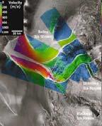
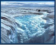
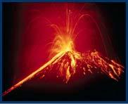
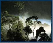
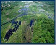
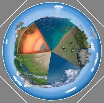
2 Main Mission Objectives: Mapping the Dynamic Earth Biosphere 3-D vegetation monitoring measurement of forest height and structure global inventory of above ground forest biomass vegetation disturbances and biomass changes Geo/Lithosphere deformation measurements understanding earthquake and volcano eruption cycles quantifying the magnitude of events determination and forecasting the probability of events Hydro/Cryosphere observation of ice structure and its changes measurement of soil moisture and surface water changes monitoring of ocean currents and wave field dynamics 2
 ~")

")

3 3D Structure Mode Polarimetric SAR Interferometry (Pol-InSAR/single-pass) ~ 30 m Estimation of the vertical structure of volume scatterers: Vertical structure components are resolved by means of their polarimetric signature; The (height) location of the resolved structural components is estimated by interferometric measurements. 3
 k z = 0.2 rad/m (h amb = 31.4 m) k z = 0.")

4 Performance Prediction: 3-D Structure Mode (Pol-InSAR) k z = 0.05 rad/m (h amb = m) k z = 0.2 rad/m (h amb = 31.4 m) k z = 0.1 rad/m (h amb = 62.8 m) Model Model = RVoG RVoG = db/m db/m sys 0.9 sys = 0.9 N look 30 look = 30 multiple acquisitions with different baselines 4
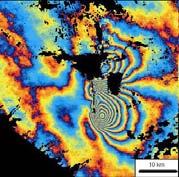
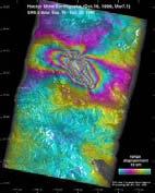
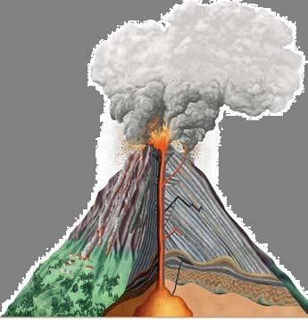
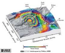
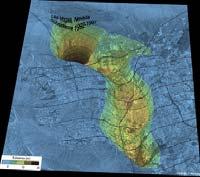
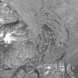
5 Deformation Mode Earthquakes measurement of deformations of mm cm Volcanoes λ/2 12 cm Subsidence Land & Sea Ice systematic multi-temporal acquisitions (image stacks) 5


 as many data takes as")
6 Performance Example: Deformation Mode combined error T T = 8 days days = days days a 10 mm a = 10 mm SNR SNR = db db N look 32 look = 32 Conclusions: SNR temporal decorrelation atmosphere as many looks as possible (high res.) as many data takes as possible SNR not so critical (e.g. coarse quant.) 6
7 Mission and System Requirements measurement of 3-D structures (vegetation) & their evolution monitoring of geo-dynamics (deformation) with high temporal resolution L-band SAR single-pass interferometry (satellite formation) full polarimetry wide-swath and highresolution SAR imaging high downlink capacity (e.g. Ka-band network, geostationary relay, ) 7
8 Mission Concept two complementary imaging modes in alternating operation polarimetric cross-track interferometry differential repeat-pass interferometry 8

9 Mission Concept 9
10 Equator: Horizontal Baselines (Bistatic Mode) h=800 km h=700 km h=600 km k z =0.2 rad/m (h amb = 31.4 m) B h = m k z =0.1 rad/m (h amb = 62.8 m) k z =0.05 rad/m (h amb = m) 10
11 Ascending Node Drift by Different Inclinations (h=700km) Δi 2 km (Δv<2.4 m/s) 1 km (Δv<1.2 m/s) 500 m (Δv<0.6 m/s) ΔΩ 200 m (Δv<0.3 m/s) mission concept with varying baselines by slight inclination shifts 11
 radial baseline Δe use of alternating bistatic (monostatic baseline) narrower swaths: optimum positioning vs.")
12 Baselines at high latitudes (bistatic mode) inclination differences between the orbital planes Δi horizontal baseline vertical component from eccentricity vector differences (limited) radial baseline Δe use of alternating bistatic (monostatic baseline) narrower swaths: optimum positioning vs. incidence 12
13 Tandem benefits for repeat-pass interferometry frozen orbit satellite variable orbit satellite use (zero baseline) looking right looking right DEM from single-pass (L-band!) right-looking series looking right looking left, baseline fixed for 2 repeat-pass cycles uninterrupted rightlooking series interferogram from leftlooking geom. (3D) looking left looking left time series from leftlooking geom. (3D) DEM from single-pass looking right, reduced bandwidth, full swath looking right, large bandwidth, reduced swath conflict resolution with other applications 13


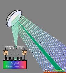
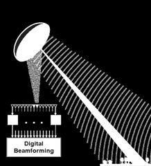
14 Digital Beamforming with Reflector Antennas Digital Control & Processing digital feed array with T/R modules 14

15 Digital Beamforming with Reflector Antennas digital feed array with T/R modules 15


16 Digital Beamforming with Reflector Antennas digital feed array with T/R modules 16

17 Digital Beamforming with Reflector Antennas 17

18 Digital Beamforming with Reflector Antennas Rx Tx + Rx Tx A D DBF / VQ A D Large Large reflector aperture enables: very very high high sensitivity improved range range ambiguity suppression less less losses losses at at swath swath border border efficient implementation of of advanced DBF DBF modes modes 18

 use e.g. 2nd pass to fill in blind ranges 19")
19 Multiple Swath Imaging increased simultaneous coverage gaps gaps within within the the wide wide swath swath blind ranges swath echo h=760km A D A D A D A D A D A D A D blind ranges (for fixed PRF) use e.g. 2nd pass to fill in blind ranges 19


20 Multiple Swath Imaging without Gaps slow slow PRF PRF variation: longer longer burst burst lengths lengths improved performance assumes nadir nadir suppression by by DBF DBF blind ranges move across swath! h=750km burst length 20

21 Systematic Shift of Blind Ranges blind ranges 21


22 Large mapping capability TanDEM-X 1 global acquisition / year Tandem-L 2 global acquisitions / week Swath Swath width: width: km km Acquisition Acquisition time: time: 3 min min // Orbit Orbit Day Swath Swath width: width: km km Acquisition Acquisition time: time: min min // Orbit Orbit 22
23 Tandem-L provides an innovative and highly capable SAR instrument that could in principle satisfy all science requirements in a single SAR mode 350 km quad 85 high resolution (~ x 25 m 2 ) - huge data rate: R 1.1*85 MHz * (8+8) bit/sample * 2 channels * 4 beams 12 Gbit/s - huge data volume (mapping of all landmasses: ~ 30% duty cycle) V 12 Gbit/s * 24h * 30% * 2 SAT 78 TByte/day optimize science return for a given data rate & volume priority areas trades (BAQ quantization vs. resolution vs. number of acquisitions) hybrid SAR modes 23
24 Conflicting areas (Vegetation & Deformation) 100m 75m 50m 25m 0m 24
25 Conflicting areas (Vegetation & Deformation) 100m 75m 50m 25m 0m 25
 100m 75m 50m 25m 0m")
26 Conflicting areas (Vegetation & Deformation) 100m 75m 50m 25m 0m 26


")
27 Hybrid SAR Modes to resolve contradicting user requirements Tx - Spectrum f high resolution quad pol (Pol-InSAR) low resolution single pol (D-InSAR InSAR) 27


28 Tandem-L Summary Abholzung Aufforstung Waldbiomassenänderung Biosphäre - global monitoring of bio-, geo-, cryo-, and hydrosphere processes with high temporal and spatial resolution Vulkanismus Erdbeben Hangrutschungen Geo/Lithosphäre Eisausdehnung Bodenfeuchte Überschwemmungen Hydro/Cryosphäre - tandem satellite formation for the measurement of 3-D structures and their spatiotemporal evolution - systematic data acquisition strategy with complementary imaging modes - employment of highly innovative radar techniques to improve coverage, resolution, and repetition frequency 28


29 29
30 Backup Slides 30


")


31 full bandwidth (e.g. 85 MHz) for high resolution fault imaging low bandwidth (e.g MHz) for uninterrupted large scale deformation time series Peripheral Vision wide swath with low to medium resolution Foveal Vision narrow swath with high resolution 31

 Commercial Utilization")
 Wide Range")


 - monitoring of land subsidence -")

32 Tandem-L: Further Potentials Digital Terrain Model acquisition of a global DEM that is complementary to the X-band DEM (digital terrain and surface model) Commercial Utilization derivation of advanced higher-level products & synergy with X-band data (Infoterra) Wide Range of Additional Applications (Selection) - measurement of soil moisture and surface roughness - observation of thaw and freeze cycles - determination of ice volume structures and their change - measurement of annual changes in ice mass balance - measurements of sea ice thickness - measurement of ocean currents and wave heights - water level measurements beneath the vegetation - detection of embankment and dike damages - desertification and wetland deterioration - land classification (vegetation, land use, ) - monitoring of land subsidence - observation and prediction of land slides - agriculture (vitality, growth,...) - surveillance of logging and reforestation - detection of forest damages (storm, fire, ) 32
33 Biosphere Geo-/Lithosphere Science Product Forest Height Above Ground Biomass Vertical Forest Structure Coverage all forest areas Product Resolution 50 m (global) 20 m (local) 100 m (global) 50 m (regional) 50 m (global) 20 m (local) Product Accuracy ~ 10 % ~ 20 % (or 20 t/ha) 3 layers Underlying Topography 50 m < 4 m Plate Tectonics Volcanoes all risk areas all land volcanoes 100 m (global) < 20 m (fault) 1 mm/year (after 5 y) m 5 mm/week Landslides risk areas 5 20 m 5 mm/week Subsidence urban areas 5 20 m 1 mm/year Cryo- & Hydrosphere Glacier Flow main glaciers m 5 50 m/year Soil Moisture selected areas 50 m 5 10 % Water Level Change regional 50 m 10 cm Snow Water Equivalent local (exp.) m % Ice Structure Changes local (exp.) 100 m > 1 layer Ocean Currents prio. areas ~ 100 m < 1 m/s All Digital Terrain & Surface Model global ~ 20 m (bare) ~ 50 m (forest) 2 m (bare) 4 m (veg.) 33
Tandem-L: A Highly Innovative Bistatic SAR Mission for Global Observation of Dynamic Processes on the Earth s Surface
 Tandem-L: A Highly Innovative Bistatic SAR Mission for Global Observation of Dynamic Processes on the Earth s Surface Alberto Moreira, Gerhard Krieger, Irena Hajnsek*, Konstantinos Papathanassiou, Marwan
TanDEM-X: Mission Status & Scientific Contribution
 TanDEM-X: Mission Status & Scientific Contribution Irena Hajnsek 1/2, Gerhard Krieger 1, Kostas Papathanassiou 1, Stefan Baumgartner 1, Marc Rodriguez-Cassola 1, Pau Prats 1, Maria Sanjuan Ferrer 1, Florian
Exploring the Potential Pol-InSAR Techniques at X-Band: First Results & Experiments from TanDEM-X
 Exploring the Potential Pol-InSAR Techniques at X-Band: First Results & Experiments from TanDEM-X K. Papathanassiou, F. Kugler, J-S. Kim, S-K. Lee, I. Hajnsek Microwaves and Radar Institute (DLR-HR) German
Sentinel-1 System Overview
 Sentinel-1 System Overview Dirk Geudtner, Rámon Torres, Paul Snoeij, Malcolm Davidson European Space Agency, ESTEC Global Monitoring for Environment and Security (GMES) EU-led program aiming at providing
MULTI-CHANNEL SAR EXPERIMENTS FROM THE SPACE AND FROM GROUND: POTENTIAL EVOLUTION OF PRESENT GENERATION SPACEBORNE SAR
 3 nd International Workshop on Science and Applications of SAR Polarimetry and Polarimetric Interferometry POLinSAR 2007 January 25, 2007 ESA/ESRIN Frascati, Italy MULTI-CHANNEL SAR EXPERIMENTS FROM THE
Digital Beamforming Architecture and Techniques for a Spaceborne Interferometric Ka-Band Mission
 Digital Beamforming Architecture and Techniques for a Spaceborne Interferometric Ka-Band Mission Marwan Younis, Paco López-Dekker, Anton Patyuchenko, and Gerhard Krieger German Aerospace Center (DLR),
Calibration Concepts for Future Low Frequency SAR Systems. Jens Reimann, Marco Schwerdt, Sravan Kumar Aitha and Manfred Zink
 Calibration Concepts for Future Low Frequency SAR Systems Jens Reimann, Marco Schwerdt, Sravan Kumar Aitha and Manfred Zink DLR.de Chart 2 Low Frequency SAR Missions OHB DLR.de Chart 3 BIOMASS - Facts
SAR Interferometry Capabilities of Canada's planned SAR Satellite Constellation
 SAR Interferometry Capabilities of Canada's planned SAR Satellite Constellation Dirk Geudtner, Guy Séguin,, Ralph Girard Canadian Space Agency RADARSAT Follow-on Program CSA is in the middle of a Phase
Biomass, a polarimetric interferometric P-band SAR mission
 Biomass, a polarimetric interferometric P-band SAR mission M. Arcioni, P. Bensi, M. Fehringer, F. Fois, F. Heliere, N. Miranda, K. Scipal Fringe 2015, ESRIN 27/03/2015 The Biomass Mission 1. Biomass was
The Biomass Mission, status of the satellite system
 The Biomass Mission, status of the satellite system M. Arcioni, P. Bensi, M. Fehringer, F. Fois, F. Heliere, K. Scipal PolInSAR/Biomass Meeting 2015, ESRIN 29/01/2015 1. Key facts (lifetime, duty cycle
Ka-Band Systems and Processing Approaches for Simultaneous High-Resolution Wide-Swath SAR Imaging and Ground Moving Target Indication
 Ka-Band Systems and Processing Approaches for Simultaneous High-Resolution Wide-Swath SAR Imaging and Ground Moving Target Indication Advanced RF Sensors and Remote Sensing Instruments 2014 Ka-band Earth
SARscape Modules for ENVI
 Visual Information Solutions SARscape Modules for ENVI Read, process, analyze, and output products from SAR data. ENVI. Easy to Use Tools. Proven Functionality. Fast Results. DEM, based on TerraSAR-X-1
The TerraSAR-L Interferometric Mission Objectives
 The TerraSAR-L Interferometric Mission Objectives Manfred Zink TerraSAR Project, ESA-ESTEC Keplerlaan 1, 2200 AG, Noordwijk, The Netherlands Tel: +31 71565 3038, Fax: +31 71565 3191, Email: Manfred.Zink@esa.int
SAR Multi-Temporal Applications
 SAR Multi-Temporal Applications 83230359-DOC-TAS-EN-001 Contents 2 Advantages of SAR Remote Sensing Technology All weather any time Frequencies and polarisations Interferometry and 3D mapping Change Detection
THE NASA/JPL AIRBORNE SYNTHETIC APERTURE RADAR SYSTEM. Yunling Lou, Yunjin Kim, and Jakob van Zyl
 THE NASA/JPL AIRBORNE SYNTHETIC APERTURE RADAR SYSTEM Yunling Lou, Yunjin Kim, and Jakob van Zyl Jet Propulsion Laboratory California Institute of Technology 4800 Oak Grove Drive, MS 300-243 Pasadena,
In-Orbit Relative Amplitude and Phase Antenna Pattern Calibration for Tandem-L
 In-Orbit Relative Amplitude and Phase Antenna Pattern Calibration for Tandem-L Gerhard Krieger Sigurd Huber Marwan Younis Alberto Moreira Jens Reimann Patrick Klenk Manfred Zink Michelangelo Villano Felipe
FIRST DATA ACQUISITION AND PROCESSING CONCEPTS FOR THE TANDEM-X MISSION
 FIRST DATA ACQUISITION AND PROCESSING CONCEPTS FOR THE TANDEM-X MISSION M. Eineder, G. Krieger, A. Roth German Aerospace Center DLR 82234 Wessling, Oberpfaffenhofen, Germany KEY WORDS: Earth Observation,
DESDynI A NASA Mission for Ecosystems, Solid Earth and Cryosphere Science
 DESDynI A NASA Mission for Ecosystems, Solid Earth and Cryosphere Science Tony Freeman (with a lot of help from the DESDynI team, especially Paul Rosen, Bill Johnson, Rolando Jordan, Yuyshen Shen) Jet
Polarisation Capabilities and Status of TerraSAR-X
 Polarisation Capabilities and Status of TerraSAR-X Irena Hajnsek, Josef Mittermayer, Stefan Buckreuss, Kostas Papathanassiou German Aerospace Center Microwaves and Radar Institute irena.hajnsek@dlr.de
Interferometric Cartwheel 1
 The Interferometric CartWheel A wheel of passive radar microsatellites for upgrading existing SAR projects D. Massonnet, P. Ultré-Guérard (DPI/EOT) E. Thouvenot (DTS/AE/INS/IR) Interferometric Cartwheel
The TerraSAR-L System and Mission Objectives
 The TerraSAR-L System and Mission Objectives Manfred Zink & Ramon Torres TerraSAR Project, ESA-ESTEC Keplerlaan 1, 2200 AG, Noordwijk, The Netherlands Tel: +31 71565 3038, Fax: +31 71565 3191, Email: Manfred.Zink@esa.int
SAOCOM-CS Mission and ESA Airborne Campaign Data
 SAOCOM-CS Mission and ESA Airborne Campaign Data Malcolm Davidson Head of the EOP Campaign Section Malcolm.Davidson@esa.int Objectives of presentation Introduce a new type of ESA SAR mission with Polarimetrice,
7.7.2 TerraSAR-X-Add-on for Digital Elevation Measurements
 7.7.2 TerraSAR-X-Add-on for Digital Elevation Measurements TDX launched on June 21, 2010 18 Overview of the TanDEM-X overall system architecture (image credit: DLR) Figure 10: Overview of the TanDEM-X
Introduction to Microwave Remote Sensing
 Introduction to Microwave Remote Sensing lain H. Woodhouse The University of Edinburgh Scotland Taylor & Francis Taylor & Francis Group Boca Raton London New York A CRC title, part of the Taylor & Francis
Overview Research and Projects
 Overview Research and Projects Alberto Moreira Microwaves and Radar Institute (HR) Microwaves and Radar Institute Research Profile: passive and active microwave systems Sensor concept, design and simulation
Sub-Mesoscale Imaging of the Ionosphere with SMAP
 Sub-Mesoscale Imaging of the Ionosphere with SMAP Tony Freeman Xiaoqing Pi Xiaoyan Zhou CEOS Workshop, ASF, Fairbanks, Alaska, December 2009 1 Soil Moisture Active-Passive (SMAP) Overview Baseline Mission
Specificities of Near Nadir Ka-band Interferometric SAR Imagery
 Specificities of Near Nadir Ka-band Interferometric SAR Imagery Roger Fjørtoft, Alain Mallet, Nadine Pourthie, Jean-Marc Gaudin, Christine Lion Centre National d Etudes Spatiales (CNES), France Fifamé
HEMERA Constellation of passive SAR-based micro-satellites for a Master/Slave configuration
 HEMERA Constellation of passive SAR-based micro-satellites for a Master/Slave HEMERA Team Members: Andrea Bellome, Giulia Broggi, Luca Collettini, Davide Di Ienno, Edoardo Fornari, Leandro Lucchese, Andrea
7.7 TerraSAR-X & TanDEM-X
 7.7 TerraSAR-X & TanDEM-X Two Innovative Remote Sensing Stars for space-borne Earth Observation Vorlesung Wolfgang Keydel Microwaves and Radar Institute, German Aerospace Research Center (DLR), D-82230
DLR contribution and perspectives for JECAM
 DLR contribution and perspectives for JECAM Dr. Helmut Staudenrausch 1, Dr. Achim Roth 2 1 DLR Space Administration, Earth Observations helmut.staudenrausch@dlr.de 2 DLR, German Remote Sensing Data Center
DIGITAL BEAM-FORMING ANTENNA OPTIMIZATION FOR REFLECTOR BASED SPACE DEBRIS RADAR SYSTEM
 DIGITAL BEAM-FORMING ANTENNA OPTIMIZATION FOR REFLECTOR BASED SPACE DEBRIS RADAR SYSTEM A. Patyuchenko, M. Younis, G. Krieger German Aerospace Center (DLR), Microwaves and Radar Institute, Muenchner Strasse
TanDEM-X. 1. Mission Overview. Science Meeting No SAR Imaging Modes & Performance 3. Satellite Design Overview 4. Launcher 5.
 TanDEM-X Science Meeting No. 1 Dresden 15.5.2006 Wolfgang Pitz EADS Astrium GmbH D-88039 Friedrichshafen 1. Mission Overview 2. SAR Imaging Modes & Performance 3. Satellite Design Overview 4. Launcher
Microwave Remote Sensing (1)
") Microwave Remote Sensing (1) Microwave sensing encompasses both active and passive forms of remote sensing. The microwave portion of the spectrum covers the range from approximately 1cm to 1m in wavelength.
Microwave Remote Sensing (1) Microwave sensing encompasses both active and passive forms of remote sensing. The microwave portion of the spectrum covers the range from approximately 1cm to 1m in wavelength.
ANALYSIS OF SRTM HEIGHT MODELS
 ANALYSIS OF SRTM HEIGHT MODELS Sefercik, U. *, Jacobsen, K.** * Karaelmas University, Zonguldak, Turkey, ugsefercik@hotmail.com **Institute of Photogrammetry and GeoInformation, University of Hannover,
Introduction to Radar
 National Aeronautics and Space Administration ARSET Applied Remote Sensing Training http://arset.gsfc.nasa.gov @NASAARSET Introduction to Radar Jul. 16, 2016 www.nasa.gov Objective The objective of this
VenSAR: A MULTI-FUNCTIONAL S-BAND RADAR FOR THE EnVision MISSION TO VENUS
 VenSAR: A MULTI-FUNCTIONAL S-BAND RADAR FOR THE EnVision MISSION TO VENUS Richard Ghail (1) and David Hall (2) (1) Civil and Environmental Engineering, Imperial College London, London SW7 2AZ, United Kingdom
Review. Guoqing Sun Department of Geography, University of Maryland ABrief
 Review Guoqing Sun Department of Geography, University of Maryland gsun@glue.umd.edu ABrief Introduction Scattering Mechanisms and Radar Image Characteristics Data Availability Example of Applications
Sentinel-1 Overview. Dr. Andrea Minchella
 Dr. Andrea Minchella 21-22/01/2016 ESA SNAP-Sentinel-1 Training Course Satellite Applications Catapult - Electron Building, Harwell, Oxfordshire Contents Sentinel-1 Mission Sentinel-1 SAR Modes Sentinel-1
How accurately can current and futureinsar missions map tectonic strain?
 How accurately can current and futureinsar missions map tectonic strain? Outline: How accurately do we need to measure strain? InSAR missions Error budget for InSAR Ability of current, planned and proposed
Radar and Satellite Remote Sensing. Chris Allen, Associate Director Technology Center for Remote Sensing of Ice Sheets The University of Kansas
 Radar and Satellite Remote Sensing Chris Allen, Associate Director Technology Center for Remote Sensing of Ice Sheets The University of Kansas 2of 43 Outline Background ice sheet characterization Radar
Earth Observation and Sensing Technologies: a focus on Radar Imaging Developments. Riccardo Lanari
 Earth Observation and Sensing Technologies: a focus on Radar Imaging Developments Riccardo Lanari Institute for Electromagnetic Sensing of the Environment (IREA) National Research Council of Italy (CNR)
ASAR Training Course, Hanoi, 25 February 7 March 2008 Introduction to Radar Interferometry
 Introduction to Radar Interferometry Presenter: F.Sarti (ESA/ESRIN) 1 Imaging Radar : reminder 2 Physics of radar Potentialities of radar All-weather observation system (active system) Penetration capabilities
An Improved DBF Processor with a Large Receiving Antenna for Echoes Separation in Spaceborne SAR
 Progress In Electromagnetics Research C, Vol. 67, 49 57, 216 An Improved DBF Processor a Large Receiving Antenna for Echoes Separation in Spaceborne SAR Hongbo Mo 1, *,WeiXu 2, and Zhimin Zeng 1 Abstract
Wide Swath Simultaneous Measurements of Winds and Ocean Surface Currents
 Wide Swath Simultaneous Measurements of Winds and Ocean Surface Currents Ernesto Rodriguez Jet Propulsion Laboratory California Institute of Technology 1 Thanks! The JPL DFS/ERM team for design of the
PALSAR SCANSAR SCANSAR Interferometry
 PALSAR SCANSAR SCANSAR Interferometry Masanobu Shimada Japan Aerospace Exploration Agency Earth Observation Research Center ALOS PI symposium, Greece Nov. 6 2008 1 Introduction L-band PALSAR strip mode
Concept Design of Space-Borne Radars for Tsunami Detection
 Concept Design of Space-Borne Radars for Tsunami Detection DLR German Aerospace Agency +Microwaves and Radar Institute *Remote Sensing Institute +Michele Galletti +Gerhard Krieger +Nicolas Marquart +Thomas
The TanDEM-X mission: overview and interferometric performance
 International Journal of Microwave and Wireless Technologies, page 1 of 11. # Cambridge University Press and the European Microwave Association, 2010 doi:10.1017/s1759078710000437 The TanDEM-X mission:
TANDEM-X MISSION STATUS
 TANDEM-X MISSION STATUS M. Zink DLR, Microwaves and Radar Institute, 82234 Wessling, Germany manfred.zink@dlr.de Commission VI, WG VI/4 KEY WORDS: TanDEM-X, bistatic SAR formation, SAR interferometry,
RADAR INTERFEROMETRY FOR SAFE COAL MINING IN CHINA
 RADAR INTERFEROMETRY FOR SAFE COAL MINING IN CHINA L. Ge a, H.-C. Chang a, A. H. Ng b and C. Rizos a Cooperative Research Centre for Spatial Information School of Surveying & Spatial Information Systems,
Detection of Multipath Propagation Effects in SAR-Tomography with MIMO Modes
 Detection of Multipath Propagation Effects in SAR-Tomography with MIMO Modes Tobias Rommel, German Aerospace Centre (DLR), tobias.rommel@dlr.de, Germany Gerhard Krieger, German Aerospace Centre (DLR),
All rights reserved. ENVI, IDL and Jagwire are trademarks of Exelis, Inc. All other marks are the property of their respective owners.
 SAR Analysis Made Easy with SARscape 5.1 All rights reserved. ENVI, IDL and Jagwire are trademarks of Exelis, Inc. All other marks are the property of their respective owners. 2014, Exelis Visual Information
GNSS Reflectometry and Passive Radar at DLR
 ACES and FUTURE GNSS-Based EARTH OBSERVATION and NAVIGATION 26./27. May 2008, TU München Dr. Thomas Börner, Microwaves and Radar Institute, DLR Overview GNSS Reflectometry a joined proposal of DLR and
RADAR REMOTE SENSING
 RADAR REMOTE SENSING Jan G.P.W. Clevers & Steven M. de Jong Chapter 8 of L&K 1 Wave theory for the EMS: Section 1.2 of L&K E = electrical field M = magnetic field c = speed of light : propagation direction
DEMS BASED ON SPACE IMAGES VERSUS SRTM HEIGHT MODELS. Karsten Jacobsen. University of Hannover, Germany
 DEMS BASED ON SPACE IMAGES VERSUS SRTM HEIGHT MODELS Karsten Jacobsen University of Hannover, Germany jacobsen@ipi.uni-hannover.de Key words: DEM, space images, SRTM InSAR, quality assessment ABSTRACT
School of Rural and Surveying Engineering National Technical University of Athens
 Laboratory of Photogrammetry National Technical University of Athens Combined use of spaceborne optical and SAR data Incompatible data sources or a useful procedure? Charalabos Ioannidis, Dimitra Vassilaki
European Space Agency and IPY
 European Space Agency and IPY ESA supports IPY 2007-2008 activities: First ESA step was a dedicated Announcement Opportunity (AO) for EO data provision in support IPY, released in 2006, with data provision
TerraSAR-X: Status Report & Polarimetric Data Exploitation
 TerraAR-X: tatus Report & Polarimetric Data Exploitation Alberto Moreira & Irena Hajnsek German Aerospace Center (DLR) Folie irena.hajnsek@dlr.de - 5.0.007 TerraAR-X: A National cience Mission with Commercial
Environmental Impact Assessment of Mining Subsidence by Using Spaceborne Radar Interferometry
 Environmental Impact Assessment of Mining Subsidence by Using Spaceborne Radar Interferometry Hsing-Chung CHANG, Linlin GE and Chris RIZOS, Australia Key words: Mining Subsidence, InSAR, DInSAR, DEM. SUMMARY
SAR Remote Sensing (Microwave Remote Sensing)
") iirs SAR Remote Sensing (Microwave Remote Sensing) Synthetic Aperture Radar Shashi Kumar shashi@iirs.gov.in Electromagnetic Radiation Electromagnetic radiation consists of an electrical field(e) which
iirs SAR Remote Sensing (Microwave Remote Sensing) Synthetic Aperture Radar Shashi Kumar shashi@iirs.gov.in Electromagnetic Radiation Electromagnetic radiation consists of an electrical field(e) which
Microwave remote sensing. Rudi Gens Alaska Satellite Facility Remote Sensing Support Center
 Microwave remote sensing Alaska Satellite Facility Remote Sensing Support Center 1 Remote Sensing Fundamental The entire range of EM radiation constitute the EM Spectrum SAR sensors sense electromagnetic
TerraSAR-X Mission: Application and Data Access
 TerraSAR-X Mission: Application and Data Access Irena Hajnsek & TSX TEAM German Aerospace Center Microwaves and Radar Institute Pol-InSAR Research Group 2 years in Orbit (since June 2007) irena.hajnsek@dlr.de
High resolution ground deformations monitoring by COSMO-SkyMed PSP SAR interferometry
 High resolution ground deformations monitoring by COSMO-SkyMed PSP SAR interferometry Mario Costantini e-geos - an ASI/Telespazio Company, Rome, Italy mario.costantini@e-geos.it Summary COSMO-SkyMed satellite
Remote sensing radio applications/ systems for environmental monitoring
 Remote sensing radio applications/ systems for environmental monitoring Alexandre VASSILIEV ITU Radiocommunication Bureau phone: +41 22 7305924 e-mail: alexandre.vassiliev@itu.int 1 Source: European Space
RADAR (RAdio Detection And Ranging)
") RADAR (RAdio Detection And Ranging) CLASSIFICATION OF NONPHOTOGRAPHIC REMOTE SENSORS PASSIVE ACTIVE DIGITAL CAMERA THERMAL (e.g. TIMS) VIDEO CAMERA MULTI- SPECTRAL SCANNERS VISIBLE & NIR MICROWAVE Real
RADAR (RAdio Detection And Ranging) CLASSIFICATION OF NONPHOTOGRAPHIC REMOTE SENSORS PASSIVE ACTIVE DIGITAL CAMERA THERMAL (e.g. TIMS) VIDEO CAMERA MULTI- SPECTRAL SCANNERS VISIBLE & NIR MICROWAVE Real
Index 275. K Ka-band, 250, 259 Knowledge-based concepts, 110
 Index A Acquisition planning, 225 Across-track, 30, 41, 88, 90 93 Across-track interferometry, 30 Along-track, 3, 10, 19, 41, 88, 90, 91, 93, 94, 103 Along-track interferometry, 41 Ambiguous elevation
Sentinel-1 Calibration and Performance
 Sentinel-1 Calibration and Performance Paul Snoeij Evert Attema Björn Rommen Nicolas Floury Berthyl Duesmann Malcolm Davidson Ramon Torres European Space Agency Sentinel-1 Mission Objectives Component
ESA Radar Remote Sensing Course ESA Radar Remote Sensing Course Radar, SAR, InSAR; a first introduction
 Radar, SAR, InSAR; a first introduction Ramon Hanssen Delft University of Technology The Netherlands r.f.hanssen@tudelft.nl Charles University in Prague Contents Radar background and fundamentals Imaging
The Shuttle Radar Topography Mission: A Global DEM
 The Shuttle Radar Topography Mission: A Global DEM Tom G. Farr, Mike Kobrick Jet Propulsion Laboratory California Institute of Technology Pasadena, CAUSA Digital topographic data are critical for a variety
RESERVOIR MONITORING USING RADAR SATELLITES
 RESERVOIR MONITORING USING RADAR SATELLITES Alain Arnaud, Johanna Granda, Geraint Cooksley ALTAMIRA INFORMATION S.L., Calle Córcega 381-387, E-08037 Barcelona, Spain. Key words: Reservoir monitoring, InSAR,
ACTIVE SENSORS RADAR
 ACTIVE SENSORS RADAR RADAR LiDAR: Light Detection And Ranging RADAR: RAdio Detection And Ranging SONAR: SOund Navigation And Ranging Used to image the ocean floor (produce bathymetic maps) and detect objects
Design and Performance Simulation of a Ku-Band Rotating Fan-Beam Scatterometer
 Design and Performance Simulation of a Ku-Band Rotating Fan-Beam Scatterometer Xiaolong DONG, Wenming LIN, Di ZHU, (CSSAR/CAS) PO Box 8701, Beijing, 100190, China Tel: +86-10-62582841, Fax: +86-10-62528127
Principles of Remote Sensing. Shuttle Radar Topography Mission S R T M. Michiel Damen. Dept. Earth Systems Analysis
 Principles of Remote Sensing Shuttle Radar Topography Mission S R T M Michiel Damen Dept. Earth Systems Analysis Contents Present problems with DEMs Advantage of SRTM Cell size Mission and system Radar
Integration of InSAR and GPS for precise deformation mapping
 Integration of InSAR and GPS for precise deformation mapping Zhenhong Li (COMET, University of Glasgow, UK) Eric J. Fielding (Jet Propulsion Laboratory, Caltech, USA) 30 November 2009 Contents Two major
Dynamics and Control Issues for Future Multistatic Spaceborne Radars
 Dynamics and Control Issues for Future Multistatic Spaceborne Radars Dr Stephen Hobbs Space Research Centre, School of Engineering, Cranfield University, UK Abstract Concepts for future spaceborne radar
SYNTHETIC aperture radar (SAR) is a remote sensing
 is a remote sensing") IEEE GEOSCIENCE AND REMOTE SENSING LETTERS 1 Nadir Echo Removal in Synthetic Aperture Radar via Waveform Diversity and Dual-Focus Postprocessing Michelangelo Villano, Member, IEEE, Gerhard Krieger, Fellow,
IEEE GEOSCIENCE AND REMOTE SENSING LETTERS 1 Nadir Echo Removal in Synthetic Aperture Radar via Waveform Diversity and Dual-Focus Postprocessing Michelangelo Villano, Member, IEEE, Gerhard Krieger, Fellow,
Fringe 2015 Workshop
 Fringe 2015 Workshop On the Estimation and Interpretation of Sentinel-1 TOPS InSAR Coherence Urs Wegmüller, Maurizio Santoro, Charles Werner and Oliver Cartus Gamma Remote Sensing AG - S1 IWS InSAR and
Monitoring the Earth Surface from space
 Monitoring the Earth Surface from space Picture of the surface from optical Imagery, i.e. obtained by telescopes or cameras operating in visual bandwith. Shape of the surface from radar imagery Surface
Introduction to radar. interferometry
 Introduction to radar Introduction to Radar Interferometry interferometry Presenter: F.Sarti (ESA/ESRIN) With kind contribution by the Radar Department of CNES All-weather observation system (active system)
The Sentinel-1 Constellation
 The Sentinel-1 Constellation Evert Attema, Sentinel-1 Mission & System Manager AGRISAR and EAGLE Campaigns Final Workshop 15-16 October 2007 ESA/ESTECNoordwijk, The Netherlands Sentinel-1 Programme Sentinel-1
Synthetic Aperture Radar Interferometry (InSAR) Technique (Lecture I- Tuesday 11 May 2010)
 Technique (Lecture I- Tuesday 11 May 2010)") Synthetic Aperture Radar Interferometry () Technique (Lecture I- Tuesday 11 May 2010) ISNET/CRTEAN Training Course on Synthetic Aperture Radar (SAR) Imagery: Processing, Interpretation and Applications
Synthetic Aperture Radar Interferometry () Technique (Lecture I- Tuesday 11 May 2010) ISNET/CRTEAN Training Course on Synthetic Aperture Radar (SAR) Imagery: Processing, Interpretation and Applications
Envisat and ERS missions: data and services
 FRINGE 2005 Workshop Envisat and ERS missions: and services Henri LAUR Envisat Mission Manager Our top objective: ease access to Earth Observation Common objective for all missions handled by ESA: Envisat,
Commissioning the TanDEM-X Ground Segment An Interim Commissioning Phase Perspective
 Commissioning the TanDEM-X Ground Segment An Interim Commissioning Phase Perspective B. Schättler, R. Kahle, R. Metzig, T. Fritz, U. Steinbrecher, M. Wermuth, M. Zink, and TanDEM-X Ground Segment Team
USE OF EGNOS AND GALILEO FOR SCIENTIFIC APPLICATIONS & INNOVATIVE APPLICATIONS IN NEW DOMAINS
 USE OF EGNOS AND GALILEO FOR SCIENTIFIC APPLICATIONS & INNOVATIVE APPLICATIONS IN NEW DOMAINS Carmen Aguilera Market Development Project Officer European GNSS Supervisory Authority 1 1 GALILEO TECHNICAL
EE 529 Remote Sensing Techniques. Introduction
 EE 529 Remote Sensing Techniques Introduction Course Contents Radar Imaging Sensors Imaging Sensors Imaging Algorithms Imaging Algorithms Course Contents (Cont( Cont d) Simulated Raw Data y r Processing
Multistatic Observations of Surface Wind and Current Vectors with STEREOID. Paco López-Dekker and others
 Multistatic Observations of Surface Wind and Current Vectors with STEREOID Paco López-Dekker and others 1 STEREOID for Earth Explorer 10 Lead Investigator Lopez-Dekker, Paco, Associate Professor LeadInvestigator
WIDE-SWATH imaging and high azimuth resolution pose
 260 IEEE GEOSCIENCE AND REMOTE SENSING LETTERS, VOL 1, NO 4, OCTOBER 2004 Unambiguous SAR Signal Reconstruction From Nonuniform Displaced Phase Center Sampling Gerhard Krieger, Member, IEEE, Nicolas Gebert,
COMPARATIVE ANALYSIS OF INSAR DIGITAL SURFACE MODELS FOR TEST AREA BUCHAREST
 COMPARATIVE ANALYSIS OF INSAR DIGITAL SURFACE MODELS FOR TEST AREA BUCHAREST Iulia Dana (1), Valentin Poncos (2), Delia Teleaga (2) (1) Romanian Space Agency, 21-25 Mendeleev Street, 010362, Bucharest,
URBAN MONITORING USING PERSISTENT SCATTERER INSAR AND PHOTOGRAMMETRY
 URBAN MONITORING USING PERSISTENT SCATTERER INSAR AND PHOTOGRAMMETRY Junghum Yu *, Alex Hay-Man Ng, Sungheuk Jung, Linlin Ge, and Chris Rizos. School of Surveying and Spatial Information Systems, University
Nadir Margins in TerraSAR-X Timing Commanding
 CEOS SAR Calibration and Validation Workshop 2008 1 Nadir Margins in TerraSAR-X Timing Commanding S. Wollstadt and J. Mittermayer, Member, IEEE Abstract This paper presents an analysis and discussion of
Motion Detection Using TanDEM-X Along-Track Interferometry
 Motion Detection Using TanDEM-X Along-Track Interferometry Steffen Suchandt and Hartmut Runge German Aerospace Center, Remote Sensing Technology Institute TanDEM-X Science Meeting, June 12th, 2013 Outline
Session I: Status Reports on Ongoing and Future Missions Chairs: M.Shimada (JAXA) and P. Snoeij (ESA)
 and P. Snoeij (ESA)") Session I: Status Reports on Ongoing and Future Missions Chairs: M.Shimada (JAXA) and P. Snoeij (ESA) Canadian Radarsat Mission status-s. Cote Operating far beyond design lifetime (RSAT-1: 16 years, ASAR:
Session I: Status Reports on Ongoing and Future Missions Chairs: M.Shimada (JAXA) and P. Snoeij (ESA) Canadian Radarsat Mission status-s. Cote Operating far beyond design lifetime (RSAT-1: 16 years, ASAR:
ATS 351 Lecture 9 Radar
 ATS 351 Lecture 9 Radar Radio Waves Electromagnetic Waves Consist of an electric field and a magnetic field Polarization: describes the orientation of the electric field. 1 Remote Sensing Passive vs Active
Persistent Scatterer InSAR
 Persistent Scatterer InSAR Andy Hooper University of Leeds Synthetic Aperture Radar: A Global Solution for Monitoring Geological Disasters, ICTP, 2 Sep 2013 Good Interferogram 2011 Tohoku earthquake Good
Radio Frequency Sensing from Space
 Radio Frequency Sensing from Space Edoardo Marelli ITU-R WP 7C Chairman ITU-R Seminar Manta (Ecuador) 20 September 2012 Why observing the Earth from space? Satellites orbiting around the Earth offer an
remote sensing? What are the remote sensing principles behind these Definition
 Introduction to remote sensing: Content (1/2) Definition: photogrammetry and remote sensing (PRS) Radiation sources: solar radiation (passive optical RS) earth emission (passive microwave or thermal infrared
The Current Status and Brief Results of Engineering Model for PALSAR-2 onboard ALOS-2 and Science Project
 The Current Status and Brief Results of Engineering Model for PALSAR-2 onboard ALOS-2 and Science Project + The 16 th KC meeting Japan Aerospace Exploration Agency Masanobu Shimada, Yukihiro KANKAKU The
Remote Sensing. Ch. 3 Microwaves (Part 1 of 2)
") Remote Sensing Ch. 3 Microwaves (Part 1 of 2) 3.1 Introduction 3.2 Radar Basics 3.3 Viewing Geometry and Spatial Resolution 3.4 Radar Image Distortions 3.1 Introduction Microwave (1cm to 1m in wavelength)
Remote Sensing Ch. 3 Microwaves (Part 1 of 2) 3.1 Introduction 3.2 Radar Basics 3.3 Viewing Geometry and Spatial Resolution 3.4 Radar Image Distortions 3.1 Introduction Microwave (1cm to 1m in wavelength)
A Global System for Detecting Dangerous Seas Using GNSS Bi-static Radar Technology
 A Global System for Detecting Dangerous Seas Using GNSS Bi-static Radar Technology Scott Gleason, Ka Bian, Alex da Silva Curiel Stephen Mackin and Martin Sweeting 20 th AIAA/USU Smallsat Conference, Logan,
Introduction Active microwave Radar
 RADAR Imaging Introduction 2 Introduction Active microwave Radar Passive remote sensing systems record electromagnetic energy that was reflected or emitted from the surface of the Earth. There are also
COSMO-SkyMed Mission Status Presented by Fabrizio BATTAZZA (ASI)
") COSMO-SkyMed Mission Status Presented by Fabrizio BATTAZZA (ASI) COSMO-1 & COSMO-2 LAUNCHES FIRST SATELLITE OF THE CONSTELLATION SUCCESSFULLY LAUNCHED 08 June 2007 03:35 (GMT) Vandenberg U.S.A. Air Force
COSMO-SkyMed Mission Status Presented by Fabrizio BATTAZZA (ASI) COSMO-1 & COSMO-2 LAUNCHES FIRST SATELLITE OF THE CONSTELLATION SUCCESSFULLY LAUNCHED 08 June 2007 03:35 (GMT) Vandenberg U.S.A. Air Force