High resolution ground deformations monitoring by COSMO-SkyMed PSP SAR interferometry
|
|
|
- Gwendoline Morris
- 5 years ago
- Views:
Transcription
1 High resolution ground deformations monitoring by COSMO-SkyMed PSP SAR interferometry Mario Costantini e-geos - an ASI/Telespazio Company, Rome, Italy mario.costantini@e-geos.it
2 Summary COSMO-SkyMed satellite constellation Synthetic aperture radar (SAR) interferometry principles and applications E-GEOS PSP-IFSAR processing technology and products/services Validation and comparison between ERS/Envisat and COSMO-SkyMed Examples of applications: Buildings and structures stability monitoring Subsidence and extraction sites monitoring Landslides monitoring Earthquakes and volcanoes A national scale project: analysis of the whole Italian territory with ERS/Envisat SAR data Conclusions Page 2
3 COSMO-SkyMed satellite constellation Page 3

 sensors Cosmo")


4 COSMO-SkyMed constellation Four satellites equipped with high resolution X-band synthetic aperture radar (SAR) sensors Cosmo 1 launch June 8, :34 GMT Cosmo 2 launch December 9, :31 GMT Cosmo 3 launch October 25, :28 GMT Cosmo 4 launch November 6, :20 GMT Page 4

5 COSMO-SkyMed imaging modes Flight Direction Swath HUGEREGION WIDEREGION HIMAGE PINGPONG MODE-2 Resolution 100 m 30 m 3 m 15 m 1 m Swath 200 km 100 km 40 km 30 km 10 x 10 km Strip length ~2,000 km ~2,000 km ~2,000 km ~2,000 km SCANSAR STRIPMAP SPOTLIGHT Page 5
6 Reliability & Continuity COSMO-SkyMed X-band CSK-1 launched 8 June 2007 CSK-2 launched 9 December 2007 CSK-3 launched 25 October 2008 CSK-4 launched 6 November 2010 COSMO 2 nd Generation Page 6
7 SAR interferometry principles and applications Page 7


8 SAR interferometry basic principles Synthetic aperture radar (SAR) interferometry is a powerful technique to determine the topography of the observed scene and possible slow surface movements due to subsidence, landslides, seismic and volcanic phenomena. ΔR top 1 st acquisition 2 nd acquisition R1 Δt 35 days (ERS/ENVISAT) Δt 1 days (COSMO-SkyMed) (8 acquisitions per month) R2 Extraction of this information requires a complex The technology: interferometric phase between the two SAR images contains three contributions: The sparse points with coherent signal Contribution related to the three-dimesional location (corresponding of the target to buildings, w.r.t. the rocks, two bare known soil) must observation be found as positions. part of the processing A SAR provides a twodimensional image of the scene (along track position and range sensor-target coordinates). The phase contributions corresponding to Contribution related to the atmospheric propagation atmosphere, delays target position and displacement must be separated using several acquisitions Contribution related to the terrain displacement The phase is along measured the line ambiguously of sight (modulo 2p) and must be unwrapped ΔR disp Area subject to a deformation. Page 8


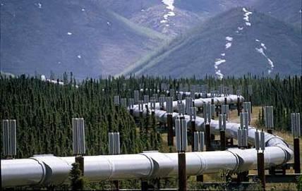


9 SAR interferometry applications Pipelines Building Critical sites Railway infrastructures Dams Analysis and monitoring of ground deformations Subsidence phenomena Landslides Critical structures Oil&Gas Mining activities Earthquakes Highways Volcanic phenomena Page 9
10 PSP technology and e-geos products/services Page 10
11 PSP- IFSAR technology We have developed a proprietary advanced processing technology (PSP-IFSAR) with original algorithms, among which: Persistent scatterer pair (PSP) method for selection and analysis of coherent points Exploiting only the relative signals between pairs of nearby points, it is intrinsically not affected by atmosphere Redundant finite difference integration and phase unwrapping Exploiting highly redundant information from a non-planar graph (2D or multitemporal 3D), guarantees more reliable and accurate solutions The processing chain runs on a parallel high performance computer (HPC) system Successfully validated and used in massive productions, with ERS/Envisat and high resolution COSMO-SkyMed SAR data Page 11
12 COSMO SkyMed for persistent scatterer interferometry High resolution X-band SAR proved to be very good for persistent scatterer interferometry: Very high density of persistent scatterers (tens of thousands per km 2 in urban areas already with StripMap images) Measurement of differential displacements within the same structure (i.e. a building, a bridge, a dam) High sensitivity to displacements (short wavelength) COSMO-SkyMed constellation of 4 satellites has some unique capabilities: Very good revisit time (up to 8 acquisitions per month with the same look angle necessary for interferometry) Measurement of fast movements Long series of acquisitions in a short time High acquisition capabilities (up to 2000 images per day) Page 12
13 SAR interferometry e-geos portfolio - e-geos SAR interferometry portfolio includes: SAR data High level products: database of ground deformation measurements (to be integrated in GIS environment for analysis and interpretation of the results by the final user) Services: analysis and monitoring of the ground deformations, including analysis and interpretation of the observed phenomena Satellite acquisition Ground deformation measurements PSP-IFSAR processing Ground deformation analysis service SAR data High Level Products: SAR derived data Services: Integrated data & analysis reports Product Fruition (Image processing applications or GoogleEarth/GIS ready data WebGis access) Page 13
14 Validation and comparison between ERS/Envisat and COSMO-SkyMed Page 14

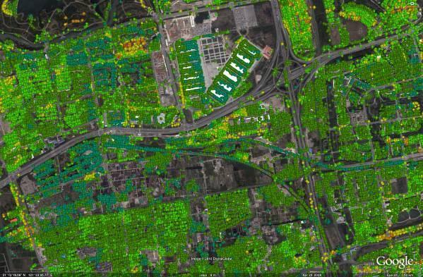
15 Beijing, China ENVISAT PSP-IFSAR analysis Page 15

16 COSMO-SkyMed vs ENVISAT PSP-IFSAR analysis Page 16
 Page")
17 Displacement (mm) COSMO-SkyMed vs ENVISAT PS mean velocities: area 1 CSK vs ENVISAT displacement ENVISAT COSMO /14/07 02/22/08 06/01/08 09/09/08 12/18/08 03/28/09 07/06/09 10/14/09 01/22/10 05/02/10 08/10/10 Time (days) Page 17


18 Beijing subsidence COSMO-SkyMed PSP-IFSAR analysis 2132 analysis --January 2009November 2010 months analysis -January January 2009August months months analysis 2009October 2009 Contour levels showing the displacement evolution Page 18

19 Beijing subsidence 3D view COSMO-SkyMed PSP-IFSAR analysis Page 19
20 Validation with optical leveling from Beijing Institute of Surveying and Mapping No. Leveling (mm) PSP (mm) Leveling-PSP (mm) Comparison between PSP- IFSAR and optical levelling measurements march march Mean = -1.2 mm, Std dev. = 1.9 mm Velocity accuracy: 0,5 mm/year in 4 years COSMO-SkyMed PSP-IFSAR ground deformation measurements: Millimetric accuracy (almost an order of magnitude more precise than with C-band Envisat data) Up to more than 30 thousand PS/km 2 with stripmap data (two orders of magnitude more than with Envisat data) Page 20
 Descending")
21 Comparison ERS/COSMO-SkyMed PSP-IFSAR processing - ERS data ( ) Descending pass PSP-IFSAR processing - CSK StripMap data ( ) Descending pass Page 21


22 Comparison Envisat/COSMO-SkyMed A3- Napoli- Salerno Interferometric analysis performed by COSMO- SkyMed StripMap data Ascending acquisition mode A3- Napoli- Salerno Interferometric analysis performed by ENVISAT data Ascending acquisition mode Page 22


23 Displacement (mm) Volcanic bradyseism, Naples region, Italy PSP-IFSAR analysis and validation Mean velocity (mm/year) < Levelling > ERS ENVISAT Mean velocity (mm/year) < ERS /07/90 01/31/93 10/28/95 07/24/98 04/19/01 01/14/04 10/10/06 07/06/09 04/01/ Time > ENVISAT Page 23
24 Examples of buildings and structures stability monitoring Page 24


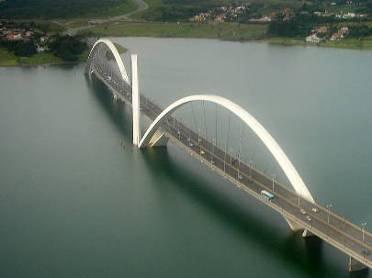
25 The bridge is completely designed by the PSs. It allows to monitor its displacement in several points of the structure. PSP analysis of a bridge, 3D view COSMO-SkyMed StripMap February December 2010 Railway Page 25

26 Subsidence along the Shanghai subway line 9 COSMO-SkyMed PSP-IFSAR analysis Xiaonanmen Lujiabang Road Page 26


27 Railway tracks e-geos is monitoring railways tracks for Russian Railway company (NIIAS/RZD) by COSMO-SkyMed PSP SAR interferometry Black Sea Area of interest COSMO-SkyMed Stripmap coverage of the area of interest Page 27

28 Landslides along the railway line PSP-IFSAR analysis 3D view Areas affected by landslides Railway Page 28


29 Landslides PS mean velocities 3D view Railway Page 29
")
 G.R.A.")
30 Highway stability analysis PSP-IFSAR ENVISAT ( ) Highway Rome-Fiumicino Mean velocity (mm/year) G.R.A. Page 30

31 Tuapse Harbor COSMO-SkyMed StripMap Dec Oct 2010 Page 31

32 Industrial site, Tuapse, Russia Cosmo-SkyMed PSP-IFSAR analysis Page 32


33 PSP analysis of an industrial site Page 33


34 PSP-IFSAR analysis of an antenna COSMO-SkyMed data- December 2008-October 2010 The high PSs density allows to define completely the antenna structure. For each point a displacement measurement estimation is provided Tuapse, Russia Page 34
 30 20 10 0-10 -20-30 -40-50 -60-70 1/9/2002 14/1/2004 28/5/2005 10/10/2006")
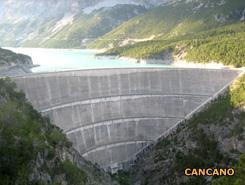
35 Displacement (mm/year) Displacement (mm/year) Dam monitoring ENVISAT ( ) PSP-IFSAR analysis Landslide system detected close to the dam /9/ /1/ /5/ /10/ /2/2008 6/7/2009 Time (days) /9/ /1/ /5/ /10/ /2/2008 6/7/2009 Time (days) Page 35


36 Displacement (mm) Shanghai, China COSMO-SkyMed PSP-IFSAR analysis for building stability High density of Measurement points over a single building /02/ /06/ /09/ /12/ /03/ /07/ /10/ /01/2010 Time (day) Page 36

37 The China World Trade Center,Beijing COSMO-SkyMed PSP-IFSAR analysis 3D view Page 37
38 Subsidence and extraction sites monitoring Page 38

39 Romagna, Italy, subsidence monitoring ENVISAT PSP-IFSAR analysis Gas extraction ERS ASC Offshore platforms Water extraction Page 39
.")
40 Subsidence due to Gas Extraction activities Ravenna, Italy. Terrain stability analysis performed by ENVISAT data ( ). Monitoring of terrain displacement due to gas extraction activities: subsidence effect along the coastal area. Page 40
41 Extraction area in Emilia Romagna, Italy Envisat Emilia Romagna extraction area Page 41


42 Gas extraction sites in Emilia Romagna, Italy PS mean velocities, Envisat Page 42

43 Gas extraction sites of Cotignola, Ravenna - Italy PS mean velocities, Envisat Page 43


44 Gas extraction sites of Formigine, Modena - Italy PS mean velocities, Envisat Page 44


45 Oil & Gas extraction sites of Correggio, Reggio Emilia - Italy PS mean velocities, Envisat Page 45
46 Extraction area in Sicilia, Italy Envisat Sicilia extraction area Page 46

47 Oil extraction sites of Gela, Caltanissetta - Italy PS mean velocities, Envisat Page 47

48 Extraction area in Basilicata, Italy Envisat Basilicata extraction area Page 48

49 Oil extraction site Tempa d Emma, Potenza - Italy PS mean velocities, Envisat Page 49

50 Gas extraction site Appia, Matera - Italy PS mean velocities, Envisat Page 50

51 Gas extraction sites of Policoro, Matera - Italy PS mean velocities, Envisat Non-active gas site Extraction sites Page 51

52 Oil & Gas extraction sites of Pisticci, Matera - Italy PS mean velocities, Envisat Page 52

53 Travertine quarry, Guidonia (Rm): ENVISAT ascending data Guidonia, Rome. Envisat ( ) Page 53
54 Landslides monitoring Page 54

55 Lazarevdkoye, Russia, landslide COSMO-SkyMed PSP-IFSAR analysis Mean velocity (mm/year) < > 17.5 Page 55

56 Tuapse, Russia, landslide COSMO-SkyMed PSP-IFSAR analysis Page 56

57 Valdisotto valley, Alps, Italy ERS PSP-IFSAR landslide analysis Valdisotto valley, Alps, Italy. Page 57
 two components of the ground displacement are measured, and vertical and east-west displacements can be determined.")
58 PSP-IFSAR landslide analysis ENVISAT ASC ENVISAT DESC Using two acquisition geometries (ascending and descending) two components of the ground displacement are measured, and vertical and east-west displacements can be determined. Page 58
59 Earthquakes & Volcanes Page 59
 PSP-IFSAR")
60 Etna volcano ENVISAT ( ) PSP-IFSAR analysis Page 60


61 Christchurch (New Zealand) earthquake, 2011 co-seismic interferometric analysis In the city of Christchurch, there are many incoherente points due to the damages of the earthquake In the image, it is evident the fault line near the city. The co-seismic interferogram can be used to know the earthquake mathematical model Christchurch area, ~40 x 40 km 2 COSMO-SkyMed HIMAGE SAR data: Ascending geometry Positive displacement Ground resolution: 3x3 m 2 images: 19 Feb Feb 2011 Multilook factor: 5x5 Negative displacement -π 0 < π > 24 [rad] [cm] < > 24 [cm] Page 61
62 PSP-IFSAR analysis massive productions Page 62
63 Some examples from a nation-wide PSI analysis project The PST-A/2 project, commissioned by the Italian Ministry of the Environment, is a huge project aimed at providing terrain displacement measurements by SAR interferometry over an entire national territory (Italy, 300,000 Km 2 ) Analysis of the whole period covered by data available for interferometry: (ERS) and (Envisat) Processing of the whole ESA ERS/Envisat archive over Italy (about 15,000 images), by TRE and e-geos TO BE EXTENDED WITH COSMO-SKYMED DATA Page 63
64 Italy ERS descending data Page 64

65 Italy ERS ascending data Page 65
66 Italy ENVISAT descending data (to be completed by beginning 2012) Page 66
 Page")
67 Italy ENVISAT ascending data (to be completed by beginning 2012) Page 67
68 Conclusions (1 of 2) COSMO-SkyMed satellite constellation SAR interferometry principles and applications E-GEOS PSP-IFSAR processing technology: Persistent scatterer pair (PSP) technique: an advanced approach to persistent scatterer pair interferometry Redundant LP finite difference integration and phase unwrapping: improved accuracy and reliability of results High performance parallel processing system: large scale productions E-GEOS SAR interferometry product portfolio SAR data PSP-IFSAR data ready for analysis on GIS / Google Earth Ground deformation analysis service Validation and examples and of application of PSP-IFSAR analysis for monitoring of building and structures, subsidence and extraction sites, landslides, earthquakes and volcanoes, a national scale project Page 68
69 Conclusions (2 of 2) COSMO-SkyMed SAR interferometry enables ground deformations measurements with: High temporal frequency up to 8 measurements per months with COSMO-SkyMed constellation Unprecedented spatial density tens of thousand measurements per km 2 with stripmap COSMO-SkyMed data and up to one million per km 2 with spotlight PSP-IFSAR technology proved to guarantee: Accurate deformation measurements Accurate 3D localization of the measurements High density of measurements Reliability and robustness to noise and outliers Massive automatic productions Page 69
Earth Observation and Sensing Technologies: a focus on Radar Imaging Developments. Riccardo Lanari
 Earth Observation and Sensing Technologies: a focus on Radar Imaging Developments Riccardo Lanari Institute for Electromagnetic Sensing of the Environment (IREA) National Research Council of Italy (CNR)
SARscape Modules for ENVI
 Visual Information Solutions SARscape Modules for ENVI Read, process, analyze, and output products from SAR data. ENVI. Easy to Use Tools. Proven Functionality. Fast Results. DEM, based on TerraSAR-X-1
Radar remote sensing from space for monitoring deformations affecting urban areas and infrastructures
 Radar remote sensing from space for monitoring deformations affecting urban areas and infrastructures Riccardo Lanari IREA-CNR Napoli EGU2014, Vienna 30 April, 2014 Why Radar (SAR) Imaging from space?
COSMO-SkyMed Mission Status Presented by Fabrizio BATTAZZA (ASI)
") COSMO-SkyMed Mission Status Presented by Fabrizio BATTAZZA (ASI) COSMO-1 & COSMO-2 LAUNCHES FIRST SATELLITE OF THE CONSTELLATION SUCCESSFULLY LAUNCHED 08 June 2007 03:35 (GMT) Vandenberg U.S.A. Air Force
COSMO-SkyMed Mission Status Presented by Fabrizio BATTAZZA (ASI) COSMO-1 & COSMO-2 LAUNCHES FIRST SATELLITE OF THE CONSTELLATION SUCCESSFULLY LAUNCHED 08 June 2007 03:35 (GMT) Vandenberg U.S.A. Air Force
COSMO-SkyMed Mission Status Presented by Giovanni VALENTINI (ASI)
") COSMO-SkyMed Mission Status Presented by Giovanni VALENTINI (ASI) FIRST SATELLITE FIRST SATELLITE OF THE CONSTELLATION SUCCESSFULLY LAUNCHED 08 June 2007 03:35 (GMT) Vandenberg U.S.A. Air Force Base SECOND
COSMO-SkyMed Mission Status Presented by Giovanni VALENTINI (ASI) FIRST SATELLITE FIRST SATELLITE OF THE CONSTELLATION SUCCESSFULLY LAUNCHED 08 June 2007 03:35 (GMT) Vandenberg U.S.A. Air Force Base SECOND
SAR Multi-Temporal Applications
 SAR Multi-Temporal Applications 83230359-DOC-TAS-EN-001 Contents 2 Advantages of SAR Remote Sensing Technology All weather any time Frequencies and polarisations Interferometry and 3D mapping Change Detection
Prague - 29 June 2009 A. COLETTA COLETTA. COSMO-SkyMed Mission: COSMO-SkyMed Mission. Application and Data Access
 A. A. COLETTA COLETTA COSMO-SkyMed COSMO-SkyMed Mission Mission Manager Manager ITALIAN ITALIAN SPACE SPACE AGENCY AGENCY COSMO-SkyMed Mission: Application and Data Access The COSMO-SkyMed PROGRAMME The
Environmental Impact Assessment of Mining Subsidence by Using Spaceborne Radar Interferometry
 Environmental Impact Assessment of Mining Subsidence by Using Spaceborne Radar Interferometry Hsing-Chung CHANG, Linlin GE and Chris RIZOS, Australia Key words: Mining Subsidence, InSAR, DInSAR, DEM. SUMMARY
RADAR INTERFEROMETRY FOR SAFE COAL MINING IN CHINA
 RADAR INTERFEROMETRY FOR SAFE COAL MINING IN CHINA L. Ge a, H.-C. Chang a, A. H. Ng b and C. Rizos a Cooperative Research Centre for Spatial Information School of Surveying & Spatial Information Systems,
Change detection in cultural landscapes
 9-11 November 2015 ESA-ESRIN, Frascati (Rome), Italy 3 rd ESA-EARSeL Course on Remote Sensing for Archaeology Day 3 Change detection in cultural landscapes DeodatoTapete (1,2) & Francesca Cigna (1,2) (1)
RESERVOIR MONITORING USING RADAR SATELLITES
 RESERVOIR MONITORING USING RADAR SATELLITES Alain Arnaud, Johanna Granda, Geraint Cooksley ALTAMIRA INFORMATION S.L., Calle Córcega 381-387, E-08037 Barcelona, Spain. Key words: Reservoir monitoring, InSAR,
URBAN MONITORING USING PERSISTENT SCATTERER INSAR AND PHOTOGRAMMETRY
 URBAN MONITORING USING PERSISTENT SCATTERER INSAR AND PHOTOGRAMMETRY Junghum Yu *, Alex Hay-Man Ng, Sungheuk Jung, Linlin Ge, and Chris Rizos. School of Surveying and Spatial Information Systems, University
The Sentinel-1 Constellation
 The Sentinel-1 Constellation Evert Attema, Sentinel-1 Mission & System Manager AGRISAR and EAGLE Campaigns Final Workshop 15-16 October 2007 ESA/ESTECNoordwijk, The Netherlands Sentinel-1 Programme Sentinel-1
Deformation Monitoring with Terrestrial SAR Interferometry
 Lisbon, 12 October 2009 Deformation Monitoring with Terrestrial SAR Interferometry Michele Crosetto Institute of Geomatics Castelldefels (Barcelona) michele.crosetto@ideg.es 1 Content Introduction: Satellite-based
A Combined Multi-Temporal InSAR Method: Incorporating Persistent Scatterer and Small Baseline Approaches. Andy Hooper University of Iceland
 A Combined Multi-Temporal InSAR Method: Incorporating Persistent Scatterer and Small Baseline Approaches Andy Hooper University of Iceland Time Multi-Temporal InSAR Same area imaged each time Multi-Temporal
Warren Cartwright, Product Manager MDA Geospatial Services, Canada
 Advanced InSAR Techniques for Urban Infrastructure Monitoring Warren Cartwright, Product Manager MDA Geospatial Services, Canada www.mdacorporation.com RESTRICTION ON USE, PUBLICATION OR DISCLOSURE OF
PSInSAR VALIDATION BY MEANS OF A BLIND EXPERIMENT USING DIHEDRAL REFLECTORS
 PSInSAR VALIDATION BY MEANS OF A BLIND EXPERIMENT USING DIHEDRAL REFLECTORS G. Savio (1), A. Ferretti (1) (2), F. Novali (1), S. Musazzi (3), C. Prati (2), F. Rocca (2) (1) Tele-Rilevamento Europa T.R.E.
COSMO-skymed, TerraSAR-X, and RADARSAT-2 geolocation accuracy after compensation for earth-system effects
 Zurich Open Repository and Archive University of Zurich Main Library Strickhofstrasse 9 CH-857 Zurich www.zora.uzh.ch Year: COSMO-skymed, TerraSAR-X, and RADARSAT- geolocation accuracy after compensation
HIGH RESOLUTION DIFFERENTIAL INTERFEROMETRY USING TIME SERIES OF ERS AND ENVISAT SAR DATA
 HIGH RESOLUTION DIFFERENTIAL INTERFEROMETRY USING TIME SERIES OF ERS AND ENVISAT SAR DATA Javier Duro 1, Josep Closa 1, Erlinda Biescas 2, Michele Crosetto 2, Alain Arnaud 1 1 Altamira Information C/ Roger
IMPACT OF BAQ LEVEL ON INSAR PERFORMANCE OF RADARSAT-2 EXTENDED SWATH BEAM MODES
 IMPACT OF BAQ LEVEL ON INSAR PERFORMANCE OF RADARSAT-2 EXTENDED SWATH BEAM MODES Jayson Eppler (1), Mike Kubanski (1) (1) MDA Systems Ltd., 13800 Commerce Parkway, Richmond, British Columbia, Canada, V6V
Outline. From AGEA-JRC I (2007) to AGEA-JRC II ( ) COSMO-SkyMed constellation for Earth observation and applications
 to AGEA-JRC II ( ) COSMO-SkyMed constellation for Earth observation and applications") Outline From AGEA-JRC I (2007) to AGEA-JRC II (2008-09) COSMO-SkyMed constellation for Earth observation and applications COSMO-SkyMed GeoAccuracy assessment o Geometric o Parcels measurements performances
Outline From AGEA-JRC I (2007) to AGEA-JRC II (2008-09) COSMO-SkyMed constellation for Earth observation and applications COSMO-SkyMed GeoAccuracy assessment o Geometric o Parcels measurements performances
Comparison between SAR atmospheric phase screens at 30 by means of ERS and ENVISAT data
 Fringe 2007 - ESA-ESRIN - Frascati, November 28, 2007 Comparison between SAR atmospheric phase screens at 30 by means of ERS and ENVISAT data D. Perissin Politecnico di Milano Tele-Rilevamento Europa -
Persistent Scatterer InSAR
 Persistent Scatterer InSAR Andy Hooper University of Leeds Synthetic Aperture Radar: A Global Solution for Monitoring Geological Disasters, ICTP, 2 Sep 2013 Good Interferogram 2011 Tohoku earthquake Good
School of Rural and Surveying Engineering National Technical University of Athens
 Laboratory of Photogrammetry National Technical University of Athens Combined use of spaceborne optical and SAR data Incompatible data sources or a useful procedure? Charalabos Ioannidis, Dimitra Vassilaki
Earth Observation from a Moon based SAR: Potentials and Limitations
 Earth Observation from a Moon based SAR: Potentials and Limitations F. Bovenga 1, M. Calamia 2,3, G. Fornaro 5, G. Franceschetti 4, L. Guerriero 1, F. Lombardini 5, A. Mori 2 1 Politecnico di Bari - Dipartimento
Introduction to radar. interferometry
 Introduction to radar Introduction to Radar Interferometry interferometry Presenter: F.Sarti (ESA/ESRIN) With kind contribution by the Radar Department of CNES All-weather observation system (active system)
Study of Low Cost InSAR for SAGD Steam Chamber Monitoring
 Study of Low Cost InSAR for SAGD Steam Chamber Monitoring LOOKNorth Report R-15-033-6055 Prepared for: Revision 2.1 2015-07-07 Captain Robert A. Bartlett Building Morrissey Road St. John s, NL Canada A1B
Sentinel-1 System Overview
 Sentinel-1 System Overview Dirk Geudtner, Rámon Torres, Paul Snoeij, Malcolm Davidson European Space Agency, ESTEC Global Monitoring for Environment and Security (GMES) EU-led program aiming at providing
MULTI-CHANNEL SAR EXPERIMENTS FROM THE SPACE AND FROM GROUND: POTENTIAL EVOLUTION OF PRESENT GENERATION SPACEBORNE SAR
 3 nd International Workshop on Science and Applications of SAR Polarimetry and Polarimetric Interferometry POLinSAR 2007 January 25, 2007 ESA/ESRIN Frascati, Italy MULTI-CHANNEL SAR EXPERIMENTS FROM THE
TerraSAR-X Applications Guide
 TerraSAR-X Applications Guide Extract: Maritime Monitoring: Ship Detection April 2015 Airbus Defence and Space Geo-Intelligence Programme Line Maritime Monitoring: Ship Detection Issue Maritime security
ASAR Training Course, Hanoi, 25 February 7 March 2008 Introduction to Radar Interferometry
 Introduction to Radar Interferometry Presenter: F.Sarti (ESA/ESRIN) 1 Imaging Radar : reminder 2 Physics of radar Potentialities of radar All-weather observation system (active system) Penetration capabilities
Multiscale Monitoring and Health Assessment for Effective Management of Flood-Control Infrastructure Systems
 Multiscale Monitoring and Health Assessment for Effective Management of Flood-Control Infrastructure Systems Tarek Abdoun Rensselaer Polytechnic Institute Levees Everywhere 3 Vision SAR Satellite 4 SAR
SARscape for ENVI. A Complete SAR Analysis Solution
 SARscape for ENVI A Complete SAR Analysis Solution IDL and ENVI A Foundation for SARscape IDL The Data Analysis & Visualization Platform Data Access: IDL supports virtually every data format, type and
Synthetic Aperture Radar Interferometry (InSAR) Technique (Lecture I- Tuesday 11 May 2010)
 Technique (Lecture I- Tuesday 11 May 2010)") Synthetic Aperture Radar Interferometry () Technique (Lecture I- Tuesday 11 May 2010) ISNET/CRTEAN Training Course on Synthetic Aperture Radar (SAR) Imagery: Processing, Interpretation and Applications
Synthetic Aperture Radar Interferometry () Technique (Lecture I- Tuesday 11 May 2010) ISNET/CRTEAN Training Course on Synthetic Aperture Radar (SAR) Imagery: Processing, Interpretation and Applications
Terrain Motion and Persistent Scatterer InSAR
 Terrain Motion and Persistent Scatterer InSAR Andy Hooper University of Leeds ESA Land Training Course, Gödöllő, Hungary, 4-9 th September, 2017 Good Interferogram 2011 Tohoku earthquake Good correlation
Use of Synthetic Aperture Radar images for Crisis Response and Management
 2012 IEEE Global Humanitarian Technology Conference Use of Synthetic Aperture Radar images for Crisis Response and Management Gerardo Di Martino, Antonio Iodice, Daniele Riccio, Giuseppe Ruello Department
EE 529 Remote Sensing Techniques. Introduction
 EE 529 Remote Sensing Techniques Introduction Course Contents Radar Imaging Sensors Imaging Sensors Imaging Algorithms Imaging Algorithms Course Contents (Cont( Cont d) Simulated Raw Data y r Processing
Client: Statens vegvesen, Region midt County: Sør Trondelag
 Geological Survey of Norway N-7441 Trondheim, Norway REPORT Report no.: 2004.043 ISSN 0800-3416 Grading: Open Title: Preliminary analysis of InSAR data over Trondheim with respect to future road development
Sentinel-1 Overview. Dr. Andrea Minchella
 Dr. Andrea Minchella 21-22/01/2016 ESA SNAP-Sentinel-1 Training Course Satellite Applications Catapult - Electron Building, Harwell, Oxfordshire Contents Sentinel-1 Mission Sentinel-1 SAR Modes Sentinel-1
KOMPSAT Constellation. November 2012 Satrec Initiative
 KOMPSAT Constellation November 2012 Satrec Initiative KOMPSAT Constellation KOMPSAT National program Developed and operated by KARI (Korea Aerospace Research Institute) Dual use : Government & commercial
Monitoring of railroad infrastructure with the use of differential interferometric techniques of SAR data processing
 A.S.Vasileisky, R.I.Shuvalov Monitoring of railroad infrastructure with the use of differential interferometric techniques of SAR data processing From Imagery to Map Digital Photogrammetric Technologies
Review. Guoqing Sun Department of Geography, University of Maryland ABrief
 Review Guoqing Sun Department of Geography, University of Maryland gsun@glue.umd.edu ABrief Introduction Scattering Mechanisms and Radar Image Characteristics Data Availability Example of Applications
TerraSAR-X Applications Guide
 TerraSAR-X Applications Guide Extract: Change Detection and Monitoring: Geospatial / Image Intelligence April 2015 Airbus Defence and Space Geo-Intelligence Programme Line Change Detection and Monitoring:
Microwave remote sensing. Rudi Gens Alaska Satellite Facility Remote Sensing Support Center
 Microwave remote sensing Alaska Satellite Facility Remote Sensing Support Center 1 Remote Sensing Fundamental The entire range of EM radiation constitute the EM Spectrum SAR sensors sense electromagnetic
Nazemeh Ashrafianfar, Hans-Peter Hebel and Wolfgang Busch
 MONITORING OF MINING INDUCED LAND SUBSIDENCE - DIFFERENTIAL SAR INTERFEROMETRY AND PERSISTENT SCATTERER INTERFEROMETRY USING TERRASAR-X DATA IN COMPARISON WITH ENVISAT DATA ABSTRACT Nazemeh Ashrafianfar,
COMPARATIVE ANALYSIS OF INSAR DIGITAL SURFACE MODELS FOR TEST AREA BUCHAREST
 COMPARATIVE ANALYSIS OF INSAR DIGITAL SURFACE MODELS FOR TEST AREA BUCHAREST Iulia Dana (1), Valentin Poncos (2), Delia Teleaga (2) (1) Romanian Space Agency, 21-25 Mendeleev Street, 010362, Bucharest,
PSInSAR validation by means of a blind experiment using dihedral reflectors
 PSInSAR validation by means of a blind experiment using dihedral reflectors A.Ferretti( 1 )( 2 ), S. Musazzi( 3 ), F.Novali ( 2 ), C. Prati( 1 ), F. Rocca( 1 ), G. Savio ( 2 ) ( 1 ) Politecnico di Milano
Playa del Rey, California InSAR Ground Deformation Monitoring Interim Report H
 Playa del Rey, California InSAR Ground Deformation Monitoring Interim Report H Ref.: RV-14524 Doc.: CM-168-01 January 31, 2013 SUBMITTED TO: Southern California Gas Company 555 W. Fifth Street (Mail Location
How accurately can current and futureinsar missions map tectonic strain?
 How accurately can current and futureinsar missions map tectonic strain? Outline: How accurately do we need to measure strain? InSAR missions Error budget for InSAR Ability of current, planned and proposed
21-Sep-11. Outline. InSAR monitoring of CO2 sequestration - Complications. Enhanced solution (novel spatiotemporal atmospheric filtering)
") Pushing the accuracy limit for CO2 sequestration monitoring: Statistically optimal spatio-temporal removal of the atmospheric component from InSAR Networks Bernhard Rabus Jayson Eppler MacDonald Dettwiler
Pushing the accuracy limit for CO2 sequestration monitoring: Statistically optimal spatio-temporal removal of the atmospheric component from InSAR Networks Bernhard Rabus Jayson Eppler MacDonald Dettwiler
Urban tunneling and the advantages of using InSAR SPN satellite technology to detect and monitor surface deformation effects
 Urban tunneling and the advantages of using InSAR SPN satellite technology to detect and monitor surface deformation effects María de Faragó 1, Geraint Cooksley 1 1 Altamira Information, Spain ABSTRACT
DISPLACEMENT AND DEFORMATION MEASUREMENT USING GROUND RADAR INTERFEROMETRY TECHNIQUE
 JOURNAL OF APPLIED ENGINEERING SCIENCES Article Number: 124_VOL. 1(16), issue 1_2013, pp.111-118 ISSN 2247-3769 ISSN-L 2247-3769 (Print) / e-issn:2284-7197 DISPLACEMENT AND DEFORMATION MEASUREMENT USING
ANALYZING TERRASAR-X AND COSMO-SKYMED HIGH-RESOLUTION SAR DATA OF URBAN AREAS
 ANALYZING TERRASAR-X AND COSMO-SKYMED HIGH-RESOLUTION SAR DATA OF URBAN AREAS Mingsheng Liao*, Timo Balz, Lu Zhang, Yuanyuan Pei, Houjun Jiang State Key Laboratory of Information Engineering in Surveying,
EKATERINA TYMOFYEYEVA GMTSAR BATCH PROCESSING
 EKATERINA TYMOFYEYEVA GMTSAR BATCH PROCESSING THANK YOU! Xiaopeng Tong Xiaohua (Eric) Xu David Sandwell Yuri Fialko OUTLINE Batch processing scripts in GMTSAR (focus on Sentinel-1) SBAS: a method for calculating
WHAT IS NEXT IN EARTH OBSERVATION. SkyMed Mission
 WHAT IS NEXT IN EARTH OBSERVATION COSMO-SkyMed SkyMed Mission Paolo Ammendola Italian Space Agency Florence, Sept. 19, 2001 ammendola@asi asi.it THE NEEDS Market studies indicate that the value of the
RADAR REMOTE SENSING
 RADAR REMOTE SENSING Jan G.P.W. Clevers & Steven M. de Jong Chapter 8 of L&K 1 Wave theory for the EMS: Section 1.2 of L&K E = electrical field M = magnetic field c = speed of light : propagation direction
Use of ground based radar to monitor the effect of increased axle loading on rail bridges. Evgeny Shilov. IDS GeoRadar
 Use of ground based radar to monitor the effect of increased axle loading on rail bridges aa Evgeny Shilov IDS GeoRadar Background of Techniques All rights reserved to IDS GeoRadar 2 Radar technology Radar
ANALYSIS OF SRTM HEIGHT MODELS
 ANALYSIS OF SRTM HEIGHT MODELS Sefercik, U. *, Jacobsen, K.** * Karaelmas University, Zonguldak, Turkey, ugsefercik@hotmail.com **Institute of Photogrammetry and GeoInformation, University of Hannover,
The Tandem-L Formation
 The Tandem-L Formation G. Krieger, I. Hajnsek, K. Papathanassiou, M. Eineder, M. Younis, F. De Zan, P. Prats, S. Huber, M. Werner, A. Freeman +, P. Rosen +, S. Hensley +, W. Johnson +, L. Veilleux +, B.
All rights reserved. ENVI, IDL and Jagwire are trademarks of Exelis, Inc. All other marks are the property of their respective owners.
 SAR Analysis Made Easy with SARscape 5.1 All rights reserved. ENVI, IDL and Jagwire are trademarks of Exelis, Inc. All other marks are the property of their respective owners. 2014, Exelis Visual Information
SAOCOM-CS Mission and ESA Airborne Campaign Data
 SAOCOM-CS Mission and ESA Airborne Campaign Data Malcolm Davidson Head of the EOP Campaign Section Malcolm.Davidson@esa.int Objectives of presentation Introduce a new type of ESA SAR mission with Polarimetrice,
European Space Agency and IPY
 European Space Agency and IPY ESA supports IPY 2007-2008 activities: First ESA step was a dedicated Announcement Opportunity (AO) for EO data provision in support IPY, released in 2006, with data provision
IBIS range. GeoRadar Division. GeoRadar Division. Static and Dynamic Monitoring of Civil Engineering Structures by Microwave Interferometry
 Static and Dynamic Monitoring of Civil Engineering Structures by Microwave Interferometry Garry Spencer and Mark Bell 1 PRODUCTS IBIS range APPLICATIONS IBIS - FL LANDSLIDE & DAM MONITORING IBIS - FM SLOPE
Introduction to Radar
 National Aeronautics and Space Administration ARSET Applied Remote Sensing Training http://arset.gsfc.nasa.gov @NASAARSET Introduction to Radar Jul. 16, 2016 www.nasa.gov Objective The objective of this
Biomass, a polarimetric interferometric P-band SAR mission
 Biomass, a polarimetric interferometric P-band SAR mission M. Arcioni, P. Bensi, M. Fehringer, F. Fois, F. Heliere, N. Miranda, K. Scipal Fringe 2015, ESRIN 27/03/2015 The Biomass Mission 1. Biomass was
Specificities of Near Nadir Ka-band Interferometric SAR Imagery
 Specificities of Near Nadir Ka-band Interferometric SAR Imagery Roger Fjørtoft, Alain Mallet, Nadine Pourthie, Jean-Marc Gaudin, Christine Lion Centre National d Etudes Spatiales (CNES), France Fifamé
KONGSBERG SATELLITE SERVICES 2017 Line Steinbakk, Director Programs. Himmel og hav - Ålesund 3. Oktober 2017
 KONGSBERG SATELLITE SERVICES 2017 Line Steinbakk, Director Programs Himmel og hav - Ålesund 3. Oktober 2017 KSAT HQ IN TROMSØ 69N Established in 1967 Kongsberg Satellite Services since 2002 World leading
ASAR WIDE-SWATH SINGLE-LOOK COMPLEX PRODUCTS: PROCESSING AND EXPLOITATION POTENTIAL
 ASAR WIDE-SWATH SINGLE-LOOK COMPLEX PRODUCTS: PROCESSING AND EXPLOITATION POTENTIAL Ralph Cordey (1), Tim Pearson (2), Yves-Louis Desnos (3), Betlem Rosich-Tell (3) (1) European Space Agency, ESTEC, Keplerlaan
Assessment of Slow Deformations and Rapid Motions by Radar Interferometry
 'Photogrammetric Week 05' Dieter Fritsch, Ed. Wichmann Verlag, Heidelberg 2005. Bamler et al. 111 Assessment of Slow Deformations and Rapid Motions by Radar Interferometry RICHARD BAMLER, BERT KAMPES,
Monitoring of Bridge Deformation with InSAR: An Experimental Study
 XXIV FIG International Congress 2010 11-16 April 2010 Sydney, Australia Monitoring of Bridge Deformation with InSAR: An Experimental Study Lei Zhang 1, Xiaoli Ding 1 and Zhong Lu 2 1 Department of Land
Dynamics and Control Issues for Future Multistatic Spaceborne Radars
 Dynamics and Control Issues for Future Multistatic Spaceborne Radars Dr Stephen Hobbs Space Research Centre, School of Engineering, Cranfield University, UK Abstract Concepts for future spaceborne radar
Post-seismic infrastructure damage assessment using high-resolution SAR satellite data
 Post-seismic infrastructure damage assessment using high-resolution SAR satellite data Timo Balz *a, Daniele Perissin b, Uwe Soergel c, Lu Zhang a, Mingsheng Liao a a State Key Laboratory of Information
OPTIMIZATION OF SATELLITE INSAR TECHNIQUES FOR MONITORING OF SUBSIDENCE IN THE SURROUNDINGS OF KARVINÁ MINE: LAZY PLANT
 Acta Geodyn. Geomater., Vol. 10, No. 1 (169), 51 55, 2013 OPTIMIZATION OF SATELLITE INSAR TECHNIQUES FOR MONITORING OF SUBSIDENCE IN THE SURROUNDINGS OF KARVINÁ MINE: LAZY PLANT Milan LAZECKÝ * and Eva
Synthetic Aperture Radar for Rapid Flood Extent Mapping
 National Aeronautics and Space Administration ARSET Applied Remote Sensing Training http://arset.gsfc.nasa.gov @NASAARSET Synthetic Aperture Radar for Rapid Flood Extent Mapping Sang-Ho Yun ARIA Team Jet
TanDEM-X: Mission Status & Scientific Contribution
 TanDEM-X: Mission Status & Scientific Contribution Irena Hajnsek 1/2, Gerhard Krieger 1, Kostas Papathanassiou 1, Stefan Baumgartner 1, Marc Rodriguez-Cassola 1, Pau Prats 1, Maria Sanjuan Ferrer 1, Florian
The Biomass Mission, status of the satellite system
 The Biomass Mission, status of the satellite system M. Arcioni, P. Bensi, M. Fehringer, F. Fois, F. Heliere, K. Scipal PolInSAR/Biomass Meeting 2015, ESRIN 29/01/2015 1. Key facts (lifetime, duty cycle
SAR Interferometry Capabilities of Canada's planned SAR Satellite Constellation
 SAR Interferometry Capabilities of Canada's planned SAR Satellite Constellation Dirk Geudtner, Guy Séguin,, Ralph Girard Canadian Space Agency RADARSAT Follow-on Program CSA is in the middle of a Phase
GeoRadar Division. Geosystems BU A HISTORY OF PROVIDING HIGH TECHNOLOGY. IDS s Pisa Headquarters
 A HISTORY OF PROVIDING HIGH TECHNOLOGY IDS s Pisa Headquarters Geology and Environment IBIS-FL and IBIS-FMT, a dedicated configuration to enter into monitoring of landslides and mining market IBIS-FL:
ACTIVE SENSORS RADAR
 ACTIVE SENSORS RADAR RADAR LiDAR: Light Detection And Ranging RADAR: RAdio Detection And Ranging SONAR: SOund Navigation And Ranging Used to image the ocean floor (produce bathymetic maps) and detect objects
Development of the Technology of Utilization of Airborne Synthetic Aperture Radar (SAR)
") Development of the Technology of Utilization of Airborne Synthetic Aperture Radar (SAR) Mamoru Koarai, Kouichi Moteki, Nobuyuki Watanabe, Takaki Okatani,Youko Yamada and Kaoru Matsuo Geographical Survey
Development of the Technology of Utilization of Airborne Synthetic Aperture Radar (SAR) Mamoru Koarai, Kouichi Moteki, Nobuyuki Watanabe, Takaki Okatani,Youko Yamada and Kaoru Matsuo Geographical Survey
SARscape s Coherent Changes Detection Tutorial
 SARscape s Coherent Changes Detection Tutorial Version 1.0 April 2018 1 Index Introduction... 3 Setting Preferences... 4 Data preparation... 5 Input data... 5 DEM Extraction... 5 Single Panels processing...
KONGSBERG SATELLITE SERVICES Earth Observation for Maritime Operations Current Capabilities and Future Potential
 KONGSBERG SATELLITE SERVICES 2017 Earth Observation for Maritime Operations Current Capabilities and Future Potential Andreas Hay Kaljord Project Manager KSAT HQ IN TROMSØ - 69N WELCOME TO TROMSØ Established
Radio Frequency Sensing from Space
 Radio Frequency Sensing from Space Edoardo Marelli ITU-R WP 7C Chairman ITU-R Seminar Manta (Ecuador) 20 September 2012 Why observing the Earth from space? Satellites orbiting around the Earth offer an
SAR Remote Sensing (Microwave Remote Sensing)
") iirs SAR Remote Sensing (Microwave Remote Sensing) Synthetic Aperture Radar Shashi Kumar shashi@iirs.gov.in Electromagnetic Radiation Electromagnetic radiation consists of an electrical field(e) which
iirs SAR Remote Sensing (Microwave Remote Sensing) Synthetic Aperture Radar Shashi Kumar shashi@iirs.gov.in Electromagnetic Radiation Electromagnetic radiation consists of an electrical field(e) which
Principles of Remote Sensing. Shuttle Radar Topography Mission S R T M. Michiel Damen. Dept. Earth Systems Analysis
 Principles of Remote Sensing Shuttle Radar Topography Mission S R T M Michiel Damen Dept. Earth Systems Analysis Contents Present problems with DEMs Advantage of SRTM Cell size Mission and system Radar
ERS/ENVISAT ASAR Data Products and Services
 ERS/ENVISAT ASAR Data Products and Services Andrea Celentano Business Manager celentan@eurimage.com What is Eurimage? Founded in 1989 Current shareholders: Since 1989 Commercial Partner of the European
9/13/2011. Training Course Remote Sensing Basic Theory & Image Processing Methods September 2011
 Training Course Remote Sensing Basic Theory & Image Processing Methods 19 23 September 2011 DIGITAL TERRAIN MODELS Introduction Michiel Damen (April 2011) damen@itc.nl 1 Digital Elevation and Terrain Models
Interferometric Cartwheel 1
 The Interferometric CartWheel A wheel of passive radar microsatellites for upgrading existing SAR projects D. Massonnet, P. Ultré-Guérard (DPI/EOT) E. Thouvenot (DTS/AE/INS/IR) Interferometric Cartwheel
Copernicus Introduction Lisbon, Portugal 13 th & 14 th February 2014
 Copernicus Introduction Lisbon, Portugal 13 th & 14 th February 2014 Contents Introduction GMES Copernicus Six thematic areas Infrastructure Space data An introduction to Remote Sensing In-situ data Applications
Co-ReSyF RA lecture: Vessel detection and oil spill detection
 This project has received funding from the European Union s Horizon 2020 Research and Innovation Programme under grant agreement no 687289 Co-ReSyF RA lecture: Vessel detection and oil spill detection
Damage detection in the 2015 Nepal earthquake using ALOS-2 satellite SAR imagery
 Proceedings of the Tenth Pacific Conference on Earthquake Engineering Building an Earthquake-Resilient Pacific 6-8 November 2015, Sydney, Australia Damage detection in the 2015 Nepal earthquake using ALOS-2
Index 275. K Ka-band, 250, 259 Knowledge-based concepts, 110
 Index A Acquisition planning, 225 Across-track, 30, 41, 88, 90 93 Across-track interferometry, 30 Along-track, 3, 10, 19, 41, 88, 90, 91, 93, 94, 103 Along-track interferometry, 41 Ambiguous elevation
INSAR RADARGRAMMETRY : A SOLUTION TO THE PHASE INTEGER AMBIGUITY PROBLEM FOR SINGLE INTERFEROGRAMS
 INSAR RADARGRAMMETRY : A SOLUTION TO THE PHASE INTEGER AMBIGUITY PROBLEM FOR SINGLE INTERFEROGRAMS ABSTRACT Andrew Sowter (), John Bennett () () IESSG, University of Nottingham, University Park, Nottingham
Generation of Fine Resolution DEM at Test Areas in Alaska Using ERS SAR Tandem Pairs and Precise Orbital Data *
 Generation of Fine Resolution DEM at Test Areas in Alaska Using ERS SAR Tandem Pairs and Precise Orbital Data * O. Lawlor, T. Logan, R. Guritz, R. Fatland, S. Li, Z. Wang, and C. Olmsted Alaska SAR Facility
Towards Sentinel-1 Soil Moisture Data Services: The Approach taken by the Earth Observation Data Centre for Water Resources Monitoring
 Towards Sentinel-1 Soil Moisture Data Services: The Approach taken by the Earth Observation Data Centre for Water Resources Monitoring Wolfgang Wagner wolfgang.wagner@geo.tuwien.ac.at Department of Geodesy
Fringe 2015 Workshop
 Fringe 2015 Workshop On the Estimation and Interpretation of Sentinel-1 TOPS InSAR Coherence Urs Wegmüller, Maurizio Santoro, Charles Werner and Oliver Cartus Gamma Remote Sensing AG - S1 IWS InSAR and
Spectral coherence applied to vessel tracking
 Spectral coherence applied to vessel tracking Christian Barbier (cbarbier@ulg.ac.be) Dominique Derauw (dderauw@ulg.ac.be) Centre Spatial de Liège 2 Wide-band potential Recent sensors use wide band signals
EVALUATING THE EFFECT OF THE OBSERVATION TIME ON THE DISTRIBUTION OF SAR PERMANENT SCATTERERS
 EVALUATING THE EFFECT OF THE OBSERVATION TIME ON THE DISTRIBUTION OF SAR PERMANENT SCATTERERS Alessandro Ferretti (), Carlo Colesanti (), Daniele Perissin (), Claudio Prati (), and Fabio Rocca () () Tele-Rilevamento
RADAR ANALYST WORKSTATION MODERN, USER-FRIENDLY RADAR TECHNOLOGY IN ERDAS IMAGINE
 RADAR ANALYST WORKSTATION MODERN, USER-FRIENDLY RADAR TECHNOLOGY IN ERDAS IMAGINE White Paper December 17, 2014 Contents Introduction... 3 IMAGINE Radar Mapping Suite... 3 The Radar Analyst Workstation...
Figure 1: C band and L band (SIR-C/X-SAR images of Flevoland in Holland). color scheme: HH: red, HV:green, VV: blue
. color scheme: HH: red, HV:green, VV: blue") L-band PS analysis: JERS-1 results and TerraSAR L predictions Kenji Daito (1), Alessandro Ferretti (), Shigeki Kuzuoka (3),Fabrizio Novali (), Pietro Panzeri (), Fabio Rocca (4) (1) Daido Institute of
L-band PS analysis: JERS-1 results and TerraSAR L predictions Kenji Daito (1), Alessandro Ferretti (), Shigeki Kuzuoka (3),Fabrizio Novali (), Pietro Panzeri (), Fabio Rocca (4) (1) Daido Institute of