Hitchhiker s s Guide Global Position System. Global Position System
|
|
|
- Eugene Stafford
- 5 years ago
- Views:
Transcription

")
1 Hitchhiker s s Guide Global Position System Myles Sutherland Craig Greenwald Mike Shaw John Rogers Hitchhiker s s Guide Global Position System (GPS)
2 Myles Sutherland - ESRI Craig Greenwald ESRI John Rogers - Trimble Mike Shaw - ESRI

3 Key topics in today s s session Global Navigation Satellite Systems GIS Solutions Receiver Technologies Data Capture Best Practices Demonstrations

4 Global Navigation Satellite Systems
5 Global Navigation Satellite Systems Global Positioning System Differential GPS Systems GLONASS Galileo Positioning System
6 Global Positioning System (GPS) Unanswered question of Where am I? US Department of Defense project Worldwide radio-navigation system Explosion of Civil sector adoption
7 How do these man-made made stars work? Control Segment - Ground stations Control and position satellites in orbit Space segment Satellites Broadcast radio signal PRN code and orbit position User segment Receivers Measure distance and calculate positions

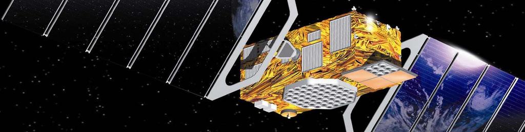
8 Space Segment Segment User Segment Control Segment

9 Control Segment Provides worldwide coverage and control 365/24/7 Master Control station Colorado Four support stations Hawaii Kwajalein Diego Garcia Ascension Island
10 Space Segment GPS satellite constellation 24 satellites Replenishment occurring Satellite design Lifetime 7.3 years 16 satellites over 9 years old 28 Satellites in GPS Constellation Number Under Age (Years)

11 User Segment Equipment produced by Military and Private companies Receives signal and computes Position Time Velocity
12 How do we position ourselves? Simple Geometry Velocity times travel time Determine Radio Wave Time Travel Accurate timing Measure Distances Known orbit locations Trilateration Distances not angles

13 Sources of Positioning Error Environment and Multipath Ionosphere and Troposphere Ephemeris Data Satellite Clock Bias Receiver Issues
14 Differential GPS Four or more satellites viewed by two receivers Rover adds error to its measured position to obtain the corrected position Error data is sent to rover with radio Reference station - a high performance GPS receiver placed in a fixed location whose position is accurately known. The GPS measured position is compared sec by sec against the known position, and an error calculated. Autonomous GPS = 10 meters Differential GPS = 1 meter This error is assumed to be the same error at the rover, and is sent to the rover as a differential correction.
15 Differential Systems Postprocessing Systems Online File Servers NGS CORS Realtime Systems National Differential GPS Program Satellite-based Augmentation Systems TCP/IP Networks

16 NGS CORS Programs


17 Coast Guard NDGPS Program

18 FAA Wide Area Augmentation System
19 TCP/IP Networks Virtual Reference Systems (VRS) Network of web-enabled enabled receivers Central server processing corrections TCP/IP broadcast of corrections Data Services over cellular networks

20 Galileo Positioning System European Satellite Navigation System Worldwide availability Complementary to GPS 27 satellites Fully operational 2008 onwards Free of charge
21 Advantages for Civil Users Galileo + GPS Double Number of Satellites Improved Urban Canyon reception Increased Signal Strength Improved reception under foliage Three Signals Instantaneous RTK positioning

22 GPS Satellite Visibility

23 GPS + Galileo Satellite Visibility
24 GLONASS Russian Navigation System Very similar to GPS In a state of disrepair 11 Satellites most with lifespan of 3 years Investment planned 24 Satellites by 2010

25 GPS Products
26 Mapping and GIS solutions Broad range of products Black box receivers Pole and Backpack receivers Integrated GPS handhelds Targeted at GIS industry Moderate to High cost Designed for the field Highly accurate

27 Black box receivers Products Accuracy Trimble ProXH Trimble ProXT Subfoot to Submeter Filter multipathed and weak signals Ensures quality positions Ruggedness and Reliability IP54 plus All day batteries GIS use-case Critical layers Data collection and maintenance Long term deployment strategy

28 Pole and backpack receivers Products Accuracy Trimble ProXT Trimble ProXH Trimble ProXRS Topcon GMS 110 Sokkia Axis3 Subfoot to Submeter Filter multipathed and weak signals Ensures quality positions Ruggedness and Reliability IP54 plus All day batteries GIS use-case Critical layers Data collection and maintenance Long term deployment strategy

29 Integrated GPS Handhelds Products Accuracy Trimble GeoXH Trimble GeoXT Trimble ReconGPS Subfoot to Submeter Filter multipathed and weak signals Ensures quality positions Ruggedness and Reliability IP54 plus All day batteries Operating System Data Storage Windows Mobile 2005 Onboard Add-in GIS use-case Critical layers Data collection and maintenance Long term deployment strategy
30 In-car navigation solutions Expanding range of products Black box receivers Integrated GPS handhelds Targeted at in-car navigation market Very inexpensive Designed for the car


31 Black box receivers Products Accuracy Holux GPSlim236 Garmin GPS10 Many others Five to twenty meters Highly smoothed when in dynamic mode Repeatedly reports same position when static Ruggedness and Reliability Non-existent GIS use-case Non-critical layer data collection Inspection and incident reporting applications Throw away deployment strategy


32 Integrated GPS handhelds Products Accuracy Garmin ique Mitac Mio168 Pharos Traveller GPS 525 Holux GPSmile60 Five to twenty meters Highly smoothed when in dynamic mode Repeatedly reports same position when static Ruggedness and Reliability Non-existent Operating System Data Storage Windows Mobile 2003 Onboard Add-in GIS use-case Non-critical layer data collection Inspection and incident reporting applications Throw away deployment strategy
33 Receiver Technologies
34 Positioning Engines Calculate and report positions End-use determines how positions calculated Low-end Navigation products Smoothing of positions in a dynamic mode Filtering of positions in static mode Precise data!!! High-end Mapping and GIS products Filtering of multipath signals Filtering of weak signals (SNR) Accurate data!!!
35 Scatter Plot Navigation product HRMS: VRMS: Bias: Std dev: CEP: Max Error:
36 Scatter Plot Mapping and GIS product HRMS: VRMS: Bias: Std dev: CEP: Max Error:
37 Position by Position Shootout Recreational vs Professional DGPS distance from truth location in open static environment Distance from truth in meters Trimble GeoXT Garmin Map Position Count

38 Best Practices
39 Accuracy vs Precision Accuracy Measurement vs. Known Truth Strong dependency on environment Precision Relative accuracy Consistency of data
40 Environment is a very big deal Both in accuracy... and how accuracy improves with occupation time Accuracy vs Occupation Time RMS Error (m) RMS Error (Open) RMS Error (Canopy) Occupation Time (s)
41 How is Accuracy Related to Yield? Yield = actual positions / potential positions In poor environment you must choose Precision / Accuracy and Yield If you filter out lower quality positions Accuracy improves Yield declines

42 How is Accuracy Related to Yield? When is yield important Collecting line / area features Avoid cutting corners In tough environments Avoid waiting too long When is accuracy important Averaging point features 30 good measurements are preferred to 120 okay measurements
43 Is DOP an error source? Dilution of Precision is a metric for accessing satellite constellation DOP is not an error source - it is an error multiplier!!! Poor DOP equals decreased accuracy Accuracy vs PDOP RMS Error (m) PDOP RMS Error (Open) RMS Error(Canopy)
44 An Accuracy vs Yield tip Use PDOP mask of 6 for 3D Use HDOP mask 4 for 2D If you don t t care about height precision Gives better yield for similar horizontal precision PDOP 2 = HDOP 2 + VDOP % 90.0% 80.0% 70.0% 60.0% 50.0% 40.0% 30.0% 20.0% 10.0% 0.0% PDOP yield PDOP precision HDOP yield HDOP precision
45 Demonstrations ArcPad ArcGIS GPS Analyst Extension ArcGIS Server Mobile ADF
46 ArcPad: Where is GPS used? GPS support is ubiquitous Navigation to a location How far am I from my target? What direction do I travel to reach my destination? Tracklog Where have I been? Data capture/maintenance Capture a new feature using the GPS location Update an existing feature/vertex to the GPS location Averaging, streaming, offsets
47 What is exposed to developers? GPS Extensions (plug-in modules) GPS Object GPS Capture/Editing commands
48 GPS Extensions Written in C/C++, compiled as DLLs Support additional GPS Protocols Control the GPS port or let ArcPad manage it Log raw data for post processing (DGPS) GPScorrect is an example Support additional NMEA sentences Several complete examples included with ArcPad Application Builder SONY IPS1000, SONY IPS3000, NMEA-0182, STF ArcPad GPSOpen( GPSParse( GPSClose( Extension DLL HGPS GPSOpen( LRESULT GPSParse( LRESULT GPSClose(

49 GPS Object Exposed to scripts (VBS / JS) Fires events as GPS status changes Reports position and quality status Two way communication with GPS receivers Activation and deactivation Access to NMEA sentences as they arrive
50 GPS Commands GPS Point GPS Vertex GPS Streaming Vertices Select at GPS location Activate / Deactivate GPS Center map on GPS location
51 DEMO


52 What is the GPS Analyst extension? ArcGIS Desktop extension that allows you to work directly with GPS data in the office and in the field MB
53 GPS Analyst Key Features View, edit, and analyze GPS data inside ArcMap and ArcCatalog Improve productivity by eliminating extra file conversions and processing steps outside ArcGIS Improve GPS position accuracy by differentially correcting data from supported Trimble GPS receivers Store detailed quality information for GPS data Set up and run validation on GPS positions to ensure features meet the required accuracy
54 GPS Analyst Key Features Collect features and GPS data directly into the geodatabase with Trimble or NMEA receivers Built with ArcObjects and GPS Analyst Objects customize GPS Analyst workflows and data processing develop extensions to support other GPS receivers develop field data collection UI to meet your needs
55 GPS Analyst Demo Built-in in vs. Custom Field Data Collection
56 Server Technology Mobile ADF Mobile and Desktop Clients Released with ArcGIS 9.2 Developer Kit Components Object Classes Samples Easy to Use Drag and Drop SmartClient Occasionally Connected
57 Mobile ADF Pairs input from GPS receiver with a Serial Port Supports the NMEA standard GpsDisplay buddies with the Map Current Location based on Pdop Number of Satellites being Tracked Trail and Length Components FileGpsConnection SerialPortGpsConnection
58 Mobile ADF GPS Demo
59 Session Evaluations Reminder Session Attendees: Please turn in your session evaluations.... Thank you
Introduction to the Global Positioning System
 GPS for Fire Management - 2004 Introduction to the Global Positioning System Pre-Work Pre-Work Objectives Describe at least three sources of GPS signal error, and identify ways to mitigate or reduce those
GPS Pathfinder ProXH and ProXT Customer FAQs
 7 December 2009 GPS Pathfinder ProXH and ProXT Customer FAQs What is the GPS Pathfinder ProXH receiver? The GPS Pathfinder ProXH receiver is a fully integrated receiver, antenna and battery unit with Trimble
GLOBAL POSITIONING SYSTEMS. Knowing where and when
 GLOBAL POSITIONING SYSTEMS Knowing where and when Overview Continuous position fixes Worldwide coverage Latitude/Longitude/Height Centimeter accuracy Accurate time Feasibility studies begun in 1960 s.
What is a GPS How does GPS work? GPS Segments GPS P osition Position Position Accuracy Accuracy Accuracy GPS A pplications Applications Applications
 What is GPS? What is a GPS How does GPS work? GPS Segments GPS Position Accuracy GPS Applications What is GPS? The Global Positioning System (GPS) is a precise worldwide radio-navigation system, and consists
Introduction to the Global Positioning System
 GPS for ICS - 2003 Introduction to the Global Positioning System Pre-Work Pre-Work Objectives Describe at least three sources of GPS signal error, and ways to mitigate or reduce those errors. Identify
NR402 GIS Applications in Natural Resources
 NR402 GIS Applications in Natural Resources Lesson 5 GPS/GIS integration Global Positioning System (GPS)..a global navigation system that everyone can use What is GPS? How does it work? How accurate is
Resection. We can measure direction in the real world! Lecture 10: Position Determination. Resection Example: Isola, Slovenia. Professor Keith Clarke
 Geography 12: Maps and Spatial Reasoning Lecture 10: Position Determination We can measure direction in the real world! Professor Keith Clarke Resection Resection Example: Isola, Slovenia Back azimuth
FieldGenius Technical Notes GPS Terminology
 FieldGenius Technical Notes GPS Terminology Almanac A set of Keplerian orbital parameters which allow the satellite positions to be predicted into the future. Ambiguity An integer value of the number of
Introduction to NAVSTAR GPS
 Introduction to NAVSTAR GPS Charlie Leonard, 1999 (revised 2001, 2002) The History of GPS Feasibility studies begun in 1960 s. Pentagon appropriates funding in 1973. First satellite launched in 1978. System
The Global Positioning System
 The Global Positioning System 5-1 US GPS Facts of Note DoD navigation system First launch on 22 Feb 1978, fully operational in 1994 ~$15 billion (?) invested to date 24 (+/-) Earth-orbiting satellites
GPS Milestones, cont. GPS Milestones. The Global Positioning Sytem, Part 1 10/10/2017. M. Helper, GEO 327G/386G, UT Austin 1. US GPS Facts of Note
 The Global Positioning System US GPS Facts of Note DoD navigation system First launch on 22 Feb 1978, fully operational in 1994 ~$15 billion (?) invested to date 24 (+/-) Earth-orbiting satellites (SVs)
The Global Positioning System II Field Experiments. 10/10/2013 GEO327G/386G, UT Austin 5-1
 The Global Positioning System II Field Experiments 10/10/2013 GEO327G/386G, UT Austin 5-1 Mexico DGPS Field Campaign Cenotes in Tamaulipas, MX, near Aldama 10/10/2013 GEO327G/386G, UT Austin 5-2 Are Cenote
GEOGRAPHIC INFORMATION SYSTEMS Lecture 22: Field Mapping with GPS
 GEOGRAPHIC INFORMATION SYSTEMS Lecture 22: Field Mapping with GPS GPS Receivers - there are many GPS receivers on the market today - some receivers are relatively inexpensive (recreational grade receivers)
Global Positioning Systems (GPS) Trails: the achilles heel of mapping from the air / satellites
 Trails: the achilles heel of mapping from the air / satellites") Global Positioning Systems (GPS) Trails: the achilles heel of mapping from the air / satellites Google maps updated regularly by local users using GPS Also: http://openstreetmaps.org GPS applications
Global Positioning Systems (GPS) Trails: the achilles heel of mapping from the air / satellites Google maps updated regularly by local users using GPS Also: http://openstreetmaps.org GPS applications
What is it? History. Other systems. How does it work? Trilateration GEOG 201 4/28/2010. Instructor: Pesses 1. {06} The Global Positioning System
 What is it? {06} The Global Positioning System G.P.S. = Global Positioning System Different from G.I.S. (Geographic Information Systems) Map Interpretation & GPS Spring 2010 M. Pesses History Conceived
Best field practices for GIS Data collection: Presented by, Jacob Wittenberg Frontier Precision, Inc.
 Best field practices for GIS Data collection: Presented by, Jacob Wittenberg Frontier Precision, Inc. Agenda What is GNSS Code and Carrier Data H-Star Processing Best Practices Code and Carrier Solutions
Introduction to Geographic Information Science. Last Lecture. Today s Outline. Geography 4103 / GNSS/GPS Technology
 Geography 4103 / 5103 Introduction to Geographic Information Science GNSS/GPS Technology Last Lecture Geoids Ellipsoid Datum Projection Basics Today s Outline GNSS technology How satellite based navigation
GeoExplorer 6000 series: Customer FAQs
 16 July 2012 GeoExplorer 6000 series: Customer FAQs This document includes information about the Trimble GeoExplorer 6000 series GeoXH and GeoXT handhelds. For information about the Trimble GeoXR Network
GPS Errors. Figure 1. Four satellites are required to determine a GPS position.
 Expl ai ni nggps:thegl obalposi t i oni ngsyst em since a minimum of four satellites is required to calculate a position (Fig 1). However, many newer GPS receivers are equipped to receive up to 12 satellite
GPS: What do I need to collect Application Appropriate location data?
 GPS: What do I need to collect Application Appropriate location data? Bob Goodwin, GISP GIS/Remote Sensing Analyst Remote Sensing & GIS Research and Outreach Services, MSU http://www.rsgis.msu.edu 2005
What is GPS? GPS Position Accuracy. GPS Applications. What is a GPS. How does GPS work? GPS Segments
 What is GPS? What is a GPS How does GPS work? GPS Segments GPS Position Accuracy GPS Applications 1 What is GPS? The Global Positioning System (GPS) is a precise worldwide radio-navigation system, and
Line and polygon features can be created via on-screen digitizing.
 This module explains how GPS works, sources of error, and error correction using real time or post processing differential correction. Cost and accuracy of different grades of GPS units are also part of
TEST YOUR SATELLITE NAVIGATION PERFORMANCE ON YOUR ANDROID DEVICE GLOSSARY
 TEST YOUR SATELLITE NAVIGATION PERFORMANCE ON YOUR ANDROID DEVICE GLOSSARY THE GLOSSARY This glossary aims to clarify and explain the acronyms used in GNSS and satellite navigation performance testing
METIS Second Master Training & Seminar. Augmentation Systems Available in Egypt
 METIS Second Master Training & Seminar Augmentation Systems Available in Egypt By Eng. Ramadan Salem M. Sc. Surveying and Geodesy Email: ramadan_salem@link.net Page 1 Augmentation Systems Available in
GPS Accuracy Comparison. Tom Biernacki Florida Department of Environmental Protection
 GPS Accuracy Comparison Tom Biernacki Florida Department of Environmental Protection What Effects the accuracy of GPS? Atmospheric delay Multipath bounce Weak receiver algorithms Atmospheric Delay Signal
GNSS 101 Bringing It Down To Earth
 GNSS 101 Bringing It Down To Earth Steve Richter Frontier Precision, Inc. UTM County Coordinates NGVD 29 State Plane Datums Scale Factors Projections Session Agenda GNSS History & Basic Theory Coordinate
GPS Performance in Southern Hardwood Forests Pete Bettinger Warnell School of Forestry and Natural Resources University of Georgia
 GPS Performance in Southern Hardwood Forests Pete Bettinger Warnell School of Forestry and Natural Resources University of Georgia Introduction In forests, vegetation plays a significant role in obstructing
DYNAMIC POSITIONING CONFERENCE October 7-8, Sensors II. Redundancy in Dynamic Positioning Systems Based on Satellite Navigation
 Return to Session Directory DYNAMIC POSITIONING CONFERENCE October 7-8, 2008 Sensors II Redundancy in Dynamic Positioning Systems Based on Satellite Navigation Ole Ørpen, Tor Egil Melgård, Arne Norum Fugro
GNSS & Coordinate Systems
 GNSS & Coordinate Systems Matthew McAdam, Marcelo Santos University of New Brunswick, Department of Geodesy and Geomatics Engineering, Fredericton, NB May 29, 2012 Santos, 2004 msantos@unb.ca 1 GNSS GNSS
Errors in GPS. Errors in GPS. Geodetic Co-ordinate system. R. Khosla Fall Semester
 Errors in GPS Errors in GPS GPS is currently the most accurate positioning system available globally. Although we are talking about extreme precision and measuring distances by speed of light, yet there
GPS Performance in Southern Hardwood Forests
 GPS Performance in Southern Hardwood Forests Pete Bettinger Warnell School of Forestry and Natural Resources University of Georgia In forests, vegetation plays a significant role in obstructing signals
Global Positioning Systems -GPS
 Global Positioning Systems -GPS GPS Why? What is it? How does it work? Differential GPS How can it help me? GPS Why?? Where am I? How do I get there? Where are you, and how do I get to You? WHO CARES???
Appendix D Brief GPS Overview
 Appendix D Brief GPS Overview Global Positioning System (GPS) Theory What is GPS? The Global Positioning System (GPS) is a satellite-based navigation system, providing position information, accurate to
GPS: The Basics. Darrell R. Dean, Jr. Civil and Environmental Engineering West Virginia University. Expected Learning Outcomes for GPS
 GPS: The Basics Darrell R. Dean, Jr. Civil and Environmental Engineering West Virginia University Expected Learning Outcomes for GPS Explain the acronym GPS Name 3 important tdt dates in history of GPS
ACCURACIES OF VARIOUS GPS ANTENNAS UNDER FORESTED CONDITIONS
 ACCURACIES OF VARIOUS GPS ANTENNAS UNDER FORESTED CONDITIONS Brian H. Holley and Michael D. Yawn LandMark Systems, 122 Byrd Way Warner Robins, GA 31088 ABSTRACT GPS accuracy is much more variable in forested
Utilizing A GNSS Network Solution for Utility Applications
 Utilizing A GNSS Network Solution for Utility Applications David Newcomer, PE, PLS GPServ, Inc. newcomer@ (407) 601-5816 AGENDA Types and accuracies of data collection o Autonomous o Meter + o Sub-meter
ENGI 3703 Surveying and Geomatics
 Satellite Geometry: Satellites well spread out in the sky have a much stronger solution to the resection type problem (aka trilateration) then satellite that are grouped together. Since the position of
Experiences with Fugro's Real Time GPS/GLONASS Orbit/Clock Decimeter Level Precise Positioning System
 Return to Session Directory DYNAMIC POSITIONING CONFERENCE October 13-14, 2009 Sensors Experiences with Fugro's Real Time GPS/GLONASS Orbit/Clock Decimeter Level Precise Positioning System Ole Ørpen and
ENGRG Introduction to GIS
 ENGRG 59910 Introduction to GIS Michael Piasecki December 01, 2017 Lecture 12: GPS Systems Lecture 7: Introduction To GPS November 27, 2017 ENGRG 59910 Intro to GIS 2 November 27, 2017 ENGRG 59910 Intro
Using GPS in Embedded Applications Pascal Stang Stanford University - EE281 November 28, 2000
 Using GPS in Embedded Applications Pascal Stang Stanford University - EE281 INTRODUCTION Brief history of GPS Transit System NavStar (what we now call GPS) Started development in 1973 First four satellites
Effect of Quasi Zenith Satellite (QZS) on GPS Positioning
 on GPS Positioning") Effect of Quasi Zenith Satellite (QZS) on GPS ing Tomoji Takasu 1, Takuji Ebinuma 2, and Akio Yasuda 3 Laboratory of Satellite Navigation, Tokyo University of Marine Science and Technology 1 (Tel: +81-5245-7365,
Effect of Quasi Zenith Satellite (QZS) on GPS ing Tomoji Takasu 1, Takuji Ebinuma 2, and Akio Yasuda 3 Laboratory of Satellite Navigation, Tokyo University of Marine Science and Technology 1 (Tel: +81-5245-7365,
GNSS Signal Structures
 GNSS Signal Structures Tom Stansell Stansell Consulting Tom@Stansell.com Bangkok, Thailand 23 January 2018 S t a n s e l l C o n s u l t i n g RL Introduction It s a pleasure to speak with you this morning.
Understanding GPS: Principles and Applications Second Edition
 Understanding GPS: Principles and Applications Second Edition Elliott Kaplan and Christopher Hegarty ISBN 1-58053-894-0 Approx. 680 pages Navtech Part #1024 This thoroughly updated second edition of an
GPS (Introduction) References. Terms
 References. Terms") GPS (Introduction) WCOM2, GPS, 1 Terms NAVSTAR GPS ( Navigational Satellite Timing and Ranging - Global Positioning System) is a GNSS (Global Navigation Satellite System), developed by the US-DoD in 197x
GPS (Introduction) WCOM2, GPS, 1 Terms NAVSTAR GPS ( Navigational Satellite Timing and Ranging - Global Positioning System) is a GNSS (Global Navigation Satellite System), developed by the US-DoD in 197x
Trimble GNSS Infrastructure
 Trimble GNSS Infrastructure A History of Innovation Trimble, the first company to offer commercial GPS products company to integrate GPS with communications technology RTK system in the market in 1994
GPS Pathfinder Office Software or GPS Analyst Extension for ESRI ArcGIS Software: Resolving the NAD 83 Datum Transformation Issue
 13 June 2011 GPS Pathfinder Office Software or GPS Analyst Extension for ESRI ArcGIS Software: Resolving the NAD 83 Datum Transformation Issue Summary The current realizations of the North American Datum
GPS for GIS Data Collection - 101
 GPS for GIS Data Collection - 101 Speaker: Eric Gakstatter, Editor of GPS World s Survey Scene Newsletter & Geospatial Solutions Guest Commentator: Craig Greenwald, Technical Director, GeoMobile Innovations,
Global Navigation Satellite Systems II
 Global Navigation Satellite Systems II AERO4701 Space Engineering 3 Week 4 Last Week Examined the problem of satellite coverage and constellation design Looked at the GPS satellite constellation Overview
ProMark 3 RTK. White Paper
 ProMark 3 RTK White Paper Table of Contents 1. Introduction... 1 2. ProMark3 RTK Operational Environment... 2 3. BLADE TM : A Unique Magellan Technology for Quicker Convergence... 3 4. ProMark3 RTK Fixed
Lecture 04. Elements of Global Positioning Systems
 Lecture 04 Elements of Global Positioning Systems Elements of GPS: During the last lecture class we talked about Global Positioning Systems and its applications. With so many innumerable applications of
Lab Assignment #3 ASE 272N/172G Satellite Navigation Prof. G. Lightsey Assigned: October 28, 2003 Due: November 11, 2003 in class
 The University of Texas at Austin Department of Aerospace Engineering and Engineering Mechanics Lab Assignment #3 ASE 272N/172G Satellite Navigation Prof. G. Lightsey Assigned: October 28, 2003 Due: November
Mark s MobileMapper 120, ProMark 120, ProMark 220 Notes
 1 Mark s MobileMapper 120, ProMark 120, ProMark 220 Notes By: Mark Silver, ms@igage.com, +1 801-412-0011 Updated: 19 November 2012 All of the MobileMapper and ProMark products, software and accessories
GPS Pathfinder Office Software or the GPS Analyst Extension for ESRI ArcGIS Software: Resolving the NAD 83 Datum Transformation Issue
 Mapping & GIS Support Note 5 May 2005 GPS Pathfinder Office Software or the GPS Analyst Extension for ESRI ArcGIS Software: Resolving the NAD 83 Datum Transformation Issue Summary The current realizations
GPS PERFORMANCE EVALUATION OF THE HUAWEI MATE 9 WITH DIFFERENT ANTENNA CONFIGURATIONS
 GPS PERFORMANCE EVALUATION OF THE HUAWEI MATE 9 WITH DIFFERENT ANTENNA CONFIGURATIONS AND P10 IN THE FIELD Gérard Lachapelle & Research Team PLAN Group, University of Calgary (http://plan.geomatics.ucalgary.ca)
al T TD ) ime D Faamily Products The RTD Family of products offers a full suite of highprecision GPS sensor positioning and navigation solutions for:
 ime D Faamily Products The RTD Family of products offers a full suite of highprecision GPS sensor positioning and navigation solutions for:") Reeal ynnamics al T amics (R TD ) ime D RTD) Time Dy Faamily mily ooff P roducts Products The RTD Family of products offers a full suite of highprecision GPS sensor positioning and navigation solutions
Reeal ynnamics al T amics (R TD ) ime D RTD) Time Dy Faamily mily ooff P roducts Products The RTD Family of products offers a full suite of highprecision GPS sensor positioning and navigation solutions
GNSS Low-Cost High-Accuracy Receiver (L-CHAR)
") GNSS Low-Cost High-Accuracy Receiver (L-CHAR) Dinesh Manandhar Center for Spatial Information Science The University of Tokyo Contact Information: dinesh@iis.u-tokyo.ac.jp Slide : 1 High Accuracy Receivers
GNSS Low-Cost High-Accuracy Receiver (L-CHAR) Dinesh Manandhar Center for Spatial Information Science The University of Tokyo Contact Information: dinesh@iis.u-tokyo.ac.jp Slide : 1 High Accuracy Receivers
The Role of F.I.G. in Leading the Development of International Real-Time Positioning Guidelines
 The Role of F.I.G. in Leading the Development of International Real-Time Positioning Guidelines, USA Key Words: RTN, real-time, GNSS, Guidelines SUMMARY The rapid growth of real-time reference station
Global Positioning Systems - GPS
 Global Positioning Systems - GPS GPS Why? What is it? How does it work? Differential GPS How can it help me? GPS Why?? Where am I? How do I get there? Where are you, and how do I get to You? WHO CARES???
Automated Quality Control of Global Navigation Satellite System (GNSS) Data
 Data") P-315 Automated Quality Control of Global Navigation Satellite System (GNSS) Data S.Senthil Kumar* & Arun Kumar Chauhan, ONGC Summary Global Navigation Satellite System (GNSS), includes GPS, GLONASS and
P-315 Automated Quality Control of Global Navigation Satellite System (GNSS) Data S.Senthil Kumar* & Arun Kumar Chauhan, ONGC Summary Global Navigation Satellite System (GNSS), includes GPS, GLONASS and
Introduction. Global Positioning System. GPS - Intro. Space Segment. GPS - Intro. Space Segment - Contd..
 Introduction Global Positioning System Prof. D. Nagesh Kumar Dept. of Civil Engg., IISc, Bangalore 560 012, India URL: http://www.civil.iisc.ernet.in/~nagesh GPS is funded and controlled by U. S. Department
Understanding the Evolution of WGS 84 and NAD 83
 Summary Both WGS 84, the datum used by GPS,, commonly used in North America, have been redefined several times since their beginning. Parallel to this, there have also been several realizations of the
Using RTK GNSS Wisely
 Using RTK GNSS Wisely February 017 Autonomous Positioning Differential Positioning Concept: Detect and cancel identical errors with simultaneous observation. F + E = G + E 1 Static & RTK Computations Static
Introduction to Total Station and GPS
 Introduction to Total Station and GPS Dr. P. NANJUNDASWAMY Professor of Civil Engineering J S S Science and Technology University S J College of Engineering Mysuru 570 006 Introduction History GPS Overview
COMPARISON OF RELATIVE AND ABSOLUTE PRECISION OF OHIO S WIDE AREA GPS NETWORK INCLUDING THE COMPARISON WITH ALTERNATIVE METHODS.
 COMPARISON OF RELATIVE AND ABSOLUTE PRECISION OF OHIO S WIDE AREA GPS NETWORK INCLUDING THE COMPARISON WITH ALTERNATIVE METHODS A Thesis Presented in Partial Fulfillment of the Requirements for the Degree
ArcGIS Apps and GPS GNSS Connections. By: Colin Lawrence and Kiersten Hudson
 ArcGIS Apps and GPS GNSS Connections By: Colin Lawrence and Kiersten Hudson Agenda ArcGIS Apps and high accuracy data The importance of high accuracy data Making connections to external receivers Bringing
NJDEP GPS Data Collection Standards for GIS Data Development
 NJDEP GPS Data Collection Standards for GIS Data Development Bureau of Geographic Information Systems Office of Information Resource Management April 24 th, 2017 Table of Contents 1.0 Introduction... 3
The GLOBAL POSITIONING SYSTEM James R. Clynch February 2006
 The GLOBAL POSITIONING SYSTEM James R. Clynch February 2006 I. Introduction What is GPS The Global Positioning System, or GPS, is a satellite based navigation system developed by the United States Defense
GBAS FOR ATCO. June 2017
 GBAS FOR ATCO June 2017 Disclaimer This presentation is for information purposes only. It should not be relied on as the sole source of information, and should always be used in the context of other authoritative
LAB 1 METHODS FOR LOCATING YOUR FIELD DATA IN GEOGRAPHIC SPACE. Geog 315 / ENSP 428
 LAB 1 METHODS FOR LOCATING YOUR FIELD DATA IN GEOGRAPHIC SPACE Geog 315 / ENSP 428 Lab 1 Schedule Introduction to bio-physical field data collection (8:00-8:20am) Locating your data on the earth: NAVSTAR
GLOBAL NAVIGATION SATELLITE SYSTEMS (GNSS) ECE 2526E Tuesday, 24 April 2018
 ECE 2526E Tuesday, 24 April 2018") GLOBAL NAVIGATION SATELLITE SYSTEMS (GNSS) ECE 2526E Tuesday, 24 April 2018 MAJOR GLOBAL NAVIGATION SATELLITE SYSTEMS (GNSS) Global Navigation Satellite System (GNSS) includes: 1. Global Position System
GLOBAL NAVIGATION SATELLITE SYSTEMS (GNSS) ECE 2526E Tuesday, 24 April 2018 MAJOR GLOBAL NAVIGATION SATELLITE SYSTEMS (GNSS) Global Navigation Satellite System (GNSS) includes: 1. Global Position System
Sources of Geographic Information
 Sources of Geographic Information Data properties: Spatial data, i.e. data that are associated with geographic locations Data format: digital (analog data for traditional paper maps) Data Inputs: sampled
Fundamentals of GPS Navigation
 Fundamentals of GPS Navigation Kiril Alexiev 1 /76 2 /76 At the traditional January media briefing in Paris (January 18, 2017), European Space Agency (ESA) General Director Jan Woerner explained the knowns
Asian Journal of Science and Technology Vol. 08, Issue, 11, pp , November, 2017 RESEARCH ARTICLE
 Available Online at http://www.journalajst.com ASIAN JOURNAL OF SCIENCE AND TECHNOLOGY ISSN: 0976-3376 Asian Journal of Science and Technology Vol. 08, Issue, 11, pp.6697-6703, November, 2017 ARTICLE INFO
UNIT 1 - introduction to GPS
 UNIT 1 - introduction to GPS 1. GPS SIGNAL Each GPS satellite transmit two signal for positioning purposes: L1 signal (carrier frequency of 1,575.42 MHz). Modulated onto the L1 carrier are two pseudorandom
GPS for. Land Surveyors. Jan Van Sickle. Fourth Edition. CRC Press. Taylor & Francis Group. Taylor & Francis Croup, an Informa business
 GPS for Land Surveyors Fourth Edition Jan Van Sickle CRC Press Taylor & Francis Group Boca Raton London New York CRC Press is an imprint of the Taylor & Francis Croup, an Informa business Contents Preface
Performance Evaluation of Differential Global Navigation Satellite System with RTK Corrections
 IOSR Journal of Electronics and Communication Engineering (IOSR-JECE) e-issn: 2278-2834,p- ISSN: 2278-8735.Volume 9, Issue 2, Ver. VI (Mar - Apr. 2014), PP 43-47 Performance Evaluation of Differential
GIS Mapping with SiReNT Real-time Differential GPS
 GIS Mapping with SiReNT Real-time Differential GPS Victor KHOO Hock Soon ABSTRACT Singapore Land Authority No.8, Shenton Way #26-01 Singapore 068811 Email: Victor_khoo@sla.gov.sg Accurate and up-to-date
The Global Positioning System II Field Experiments
 The Global Positioning System II Field Experiments 5-1 Mexico DGPS Field Campaign Cenotes in Tamaulipas, MX, near Aldama 5-2 Are Cenote Water Levels Related? 5-3 DGPS Static Survey of Cenote Water Levels
Differential GPS Positioning over Internet
 Abstract Differential GPS Positioning over Internet Y. GAO AND Z. LIU Department of Geomatics Engineering The University of Calgary 2500 University Drive N.W. Calgary, Alberta, Canada T2N 1N4 Email: gao@geomatics.ucalgary.ca
Localization. of mobile devices. Seminar: Mobile Computing. IFW C42 Tuesday, 29th May 2001 Roger Zimmermann
 Localization of mobile devices Seminar: Mobile Computing IFW C42 Tuesday, 29th May 2001 Roger Zimmermann Overview Introduction Why Technologies Absolute Positioning Relative Positioning Selected Systems
TSC1 - Asset Surveyor Operation
 TSC1 - Asset Surveyor Operation Menu Icons (current choice is highlighted) Data collection File manager Main menu Navigation GPS Position Battery Status PC Card (if used) Real-Time Status Number of Satellites
Lecture 8: GIS Data Error & GPS Technology
 Lecture 8: GIS Data Error & GPS Technology A. Introduction We have spent the beginning of this class discussing some basic information regarding GIS technology. Now that you have a grasp of the basic terminology
DYNAMIC RT TECHNOLOGY
 DYNAMIC RT TECHNOLOGY GLOBAL NAVIGATION SATELLITE SYSTEMS (GNSS) POTENTIAL FUTURE DEVELOPMENTS(2005 2017?) GPS MODERNIZATION BLOCK IIF & III GLONASS ENHANCEMENTS (K & M) EUROPEAN UNION - GALILEO CHINA
Addressing Issues with GPS Data Accuracy and Position Update Rate for Field Traffic Studies
 Addressing Issues with GPS Data Accuracy and Position Update Rate for Field Traffic Studies THIS FEATURE VALIDATES INTRODUCTION Global positioning system (GPS) technologies have provided promising tools
King AbdulAziz University. Faculty of Environmental Design. Geomatics Department. Mobile GIS GEOM 427. Lecture 3
 King AbdulAziz University Faculty of Environmental Design Geomatics Department Mobile GIS GEOM 427 Lecture 3 Ahmed Baik, Ph.D. Email: abaik@kau.edu.sa Eng. Fisal Basheeh Email: fbasaheeh@kau.edu.sa GNSS
The Impact of an Integrated GPS and GLONASS Satellite Geometry in the Precision of Positioning
 The Impact of an Integrated GPS and GLONASS Satellite Geometry in the Precision of Positioning Oluropo OLAJUGBA and Chika OKOROCHA, Nigeria Keywords: Integrated, GPS, GLONASS, Geometry, Positioning SUMMARY
Sources of Error in Satellite Navigation Positioning
 http://www.transnav.eu the International Journal on Marine Navigation and Safety of Sea Transportation Volume 11 Number 3 September 2017 DOI: 10.12716/1001.11.03.04 Sources of Error in Satellite Navigation
GE 113 REMOTE SENSING
 GE 113 REMOTE SENSING Topic 9. Introduction to Global Positioning Systems (GPS) and Other GNSS Technologies Lecturer: Engr. Jojene R. Santillan jrsantillan@carsu.edu.ph Division of Geodetic Engineering
All you wanted to know about High Accuracy Data Collection Eric Muncy Precision Products Mapping-GIS Division
 All you wanted to know about High Accuracy Data Collection Eric Muncy Precision Products Mapping-GIS Division Tell me your name What School / Organization Any experience with GPS equipment What would you
DEFINING THE FUTURE OF SATELLITE SURVEYING WITH TRIMBLE R-TRACK TECHNOLOGY
 DEFINING THE FUTURE OF SATELLITE SURVEYING WITH TRIMBLE R-TRACK TECHNOLOGY EDMOND NORSE, GNSS PORTFOLIO MANAGER, TRIMBLE SURVEY DIVISION WESTMINSTER, CO USA ABSTRACT In September 2003 Trimble introduced
GPS (Introduction) References. Terms
 References. Terms") GPS (Introduction) MSE, Rumc, GPS, 1 Terms NAVSTAR GPS ( Navigational Satellite Timing and Ranging - Global Positioning System) is a GNSS (Global Navigation Satellite System), developed by the US-DoD in
GPS (Introduction) MSE, Rumc, GPS, 1 Terms NAVSTAR GPS ( Navigational Satellite Timing and Ranging - Global Positioning System) is a GNSS (Global Navigation Satellite System), developed by the US-DoD in
SERVIR: The Portuguese Army CORS Network for RTK
 SERVIR: The Portuguese Army CORS Network for RTK António Jaime Gago AFONSO, Rui Francisco da Silva TEODORO and Virgílio Brito MENDES, Portugal Key words: GNSS, RTK, VRS, Network ABSTRACT Traditionally
The Impact of Performance Parameters over a DGPS Satellite Navigation System
 Australian Journal of Basic and Applied Sciences, 3(4): 4711-4719, 2009 ISSN 1991-8178 The Impact of Performance Parameters over a DGPS Satellite Navigation System 1 Madad Ali Shah, 2 Noor Ahmed Shaikh,
The Global Positioning Sytem II 10/19/2017
 The Global Positioning System II Field Experiments 10/19/2017 5-1 Mexico DGPS Field Campaign Cenotes in Tamaulipas, MX, near Aldama 10/19/2017 5-2 Are Cenote Water Levels Related? 10/19/2017 5-3 M. Helper,
GPS and Recent Alternatives for Localisation. Dr. Thierry Peynot Australian Centre for Field Robotics The University of Sydney
 GPS and Recent Alternatives for Localisation Dr. Thierry Peynot Australian Centre for Field Robotics The University of Sydney Global Positioning System (GPS) All-weather and continuous signal system designed
GeoMax GNSS Zenith10 & Zenith20 Series
 GeoMax GNSS Zenith10 & Zenith20 Series GeoMax About Us At GeoMax we provide a com- group with strong market At GeoMax, we concentrate on prehensive portfolio of inte- positions within measurement providing
GLOBAL POSITIONING SYSTEM (GPS) PERFORMANCE APRIL TO JUNE 2017 QUARTERLY REPORT
 PERFORMANCE APRIL TO JUNE 2017 QUARTERLY REPORT") GLOBAL POSITIONING SYSTEM (GPS) PERFORMANCE APRIL TO JUNE 2017 QUARTERLY REPORT Name Responsibility Date Signature Prepared by M Pattinson (NSL) 06/07/17 Checked by L Banfield (NSL) 06/07/17 Authorised
GLOBAL POSITIONING SYSTEM (GPS) PERFORMANCE APRIL TO JUNE 2017 QUARTERLY REPORT Name Responsibility Date Signature Prepared by M Pattinson (NSL) 06/07/17 Checked by L Banfield (NSL) 06/07/17 Authorised
GLOBAL POSITIONING SYSTEM (GPS) PERFORMANCE JANUARY TO MARCH 2016 QUARTERLY REPORT
 PERFORMANCE JANUARY TO MARCH 2016 QUARTERLY REPORT") GLOBAL POSITIONING SYSTEM (GPS) PERFORMANCE JANUARY TO MARCH 2016 QUARTERLY REPORT Name Responsibility Date Signature Prepared by M Pattinson (NSL) 22/04/16 Checked by L Banfield (NSL) 22/04/16 Authorised
GLOBAL POSITIONING SYSTEM (GPS) PERFORMANCE JANUARY TO MARCH 2016 QUARTERLY REPORT Name Responsibility Date Signature Prepared by M Pattinson (NSL) 22/04/16 Checked by L Banfield (NSL) 22/04/16 Authorised
Evaluation of RTKLIB's Positioning Accuracy Using low-cost GNSS Receiver and ASG-EUPOS
 http://www.transnav.eu the International Journal on Marine Navigation and Safety of Sea Transportation Volume 7 Number 1 March 2013 DOI: 10.12716/1001.07.01.10 Evaluation of RTKLIB's Positioning Accuracy
GNSS POST-PROCESSING SOFTWARE
 GNSS POST-PROCESSING SOFTWARE Product Overview // July 2018 EZSURV POST-PROCESSING SOFTWARE EZSurv software is designed to edit, process and analyze raw GNSS (Global Navigation Satellite System) data to