Channel Modeling ETIN10. Wireless Positioning
|
|
|
- Chad Manning
- 5 years ago
- Views:
Transcription
1 Channel Modeling ETIN10 Lecture no: 10 Wireless Positioning Fredrik Tufvesson Department of Electrical and Information Technology Fredrik Tufvesson - ETIN10 1
2 Overview Motivation: why wireless positioning? Core principles for wireless positioning Satellite positioning systems GPS Summary Fredrik Tufvesson - ETIN10 2
3 Why are we interested in wireless positioning? Because there are a multitude of applications: Network organization, e.g., self-organizing sensor networks Location-specific services, e.g., billing, advertisement Guiding applications, e.g., augmented reality Tracking applications, e.g., players in sports Automation and control, e.g., forklifts in industry To mention a few Fredrik Tufvesson - ETIN10 3
4 Core principles for wireless positioning Fredrik Tufvesson - ETIN10 4

5 Classical navigation Fredrik Tufvesson - ETIN10 5
6 Errors in angle translate to position error Fredrik Tufvesson - ETIN10 6
7 Self- and remote-positioning Starting point: Several units with fixed positions and a single mobile unit with unknown coordinates Self-(contained) positioning Fixed units transmit mobile unit measures Pros: Works with existing wireless networks; integrity Cons: Accuracy limited by complexity of mobile unit Remote positioning Mobile unit transmit fixed units measure Pros: Mobile device can be small and cheap Cons: Requires backbone network; integrity There are also indirect versions of both (position estimated at one side then shared with the other) Fredrik Tufvesson - ETIN10 7
8 Techniques for wireless positioning Three main measurement principles: Angle-of-arrival (AOA) Received signal strength (RSS) Propagation-time: Time-of-arrival (TOA) Roundtrip-time-of-flight (RTOF) Time-difference-of-arrival (TDOA) These differ both in terms of system requirements and in accuracy Fredrik Tufvesson - ETIN10 8
9 Angle-of-arrival (AOA) based positioning Fixed unit Fixed unit α β Based on bearing estimation followed by intersection of different direction pointers Requires antenna arrays or directive antennas at measuring side: requires complex hardware Accuracy limited by size of antenna array or directivity No requirements on synchronization Mobile unit Fredrik Tufvesson - ETIN10 9
10 Received signal strength (RSS) based positioning Fixed unit P(d 1 ) P(d 2 ) Fixed unit Based on propagation-loss equations Propagation-loss is often more complex than free-space (1/d^2) loss, e.g., indoors Advanced models required Mobile unit Fingerprinting (learn actual field strength from measuerements) Feasible implementation: Most radio modules already provide an RSS indicator Fredrik Tufvesson - ETIN10 10
11 Time-based positioning: Time-of-arrival (TOA) Fixed unit τ 1 τ 2 Fixed unit Mobile unit Based on one-way propagation time Requires precise synchronization of all involved units (time synchronization directly affects accuracy) Ex. A 1 ns clock drift implies a distance error of 0.3 m Bandwidth dependent (accuracy inversely proportional to bandwidth) Can provide higher accuracy than AOA and RSS methods Fredrik Tufvesson - ETIN10 11
12 Time-based positioning: Roundtrip-time-of-flight (RTOF) Fixed unit 2τ 1 2τ 2 Fixed unit Mobile unit Based on roundtrip time (RTT) Lower requirements on synchronization than TOA, but depends on delay/processing time of responder Ex. Processing time of 1 ms can lead to an error of several meters Bandwidth dependent Fredrik Tufvesson - ETIN10 12
13 Time-based positioning: Time-difference-of-arrival (TDOA) Fixed unit Backbone network τ 1 +δ τ 1 Fixed unit Based on the difference in time-of-arrival measured in several pairs of measuring units Only receive units needs to be synchronized Handled by backbone network for remote-positioning Bandwidth dependent Mobile unit Fredrik Tufvesson - ETIN10 13

14 GPS Fredrik Tufvesson - ETIN10 14
.")
15 GPS Global Positioning System Started in 1978 Operational in 1993 Each satellite continually transmits messages that include the time the message was transmitted precise orbital information the general system health and rough orbits of all GPS satellites (the almanac) Fredrik Tufvesson - ETIN10 15

16 Satellites 24 sattelites at km above earth Orbits with a period of 11 hours 58 minutes, in order to always follow the same track on the earth surface Fredrik Tufvesson - ETIN10 16

17 Satellite track Fredrik Tufvesson - ETIN10 17

18 Fredrik Tufvesson - ETIN10 18
19 Solution: We need 4 satellites to get a position in three dimensions. If we have access to more signals, we can correct for errors in the local clock Fredrik Tufvesson - ETIN10 19
20 Uncertainty in position: Dilution of precision (DOP) Fredrik Tufvesson - ETIN10 20
21 Error PDF (Probability Density function) Probability(Error < Distance) Measured distribution 30 days data Fix every 2 seconds MEASURED AND MODELED DISTRIBUTION OF HORIZONTAL ERRORS Garmin emap (GA-27C antenna) Modeled distribution (based on measured 4.01 m RMS error) Error Meas. Pred. 50% (CEP) 2.9 m 3.3 m Mean 3.3 m 3.6 m RMS 4.0 m (meas.) 95% 6.9 m 7.0 m 99% 10.1 m 8.6 m Distance [meters] Fredrik Tufvesson - ETIN10 21


22 Indoor GPS Fredrik Tufvesson - ETIN10 22

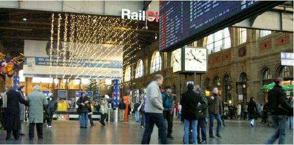
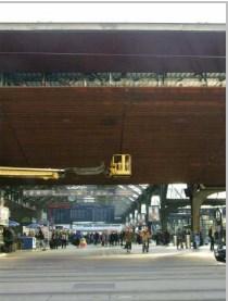
23 Train station Fredrik Tufvesson - ETIN10 23

24 Local transmitters: Fredrik Tufvesson - ETIN10 24

25 L1 L2 L3 L4 L MHz MHz MHz MHz MHz Fredrik Tufvesson - ETIN10 25
26 Link Budget example Satellite TX: 14.3 dbw ( 27 W) Satellite antenna gain: db Polarization mismatch loss: 3.4 db Path loss: db Atmospheric attenuation: 2.0 db Recieve antenna gain: 3.0 db Power at reciever input: -160 dbw (10-16 W) Fredrik Tufvesson - ETIN10 26
27 Spectral power density of recieved signal Fredrik Tufvesson - ETIN10 27
28 Fredrik Tufvesson - ETIN10 28

29 Code acquisition Satellite speed: 7000 km/h Doppler shift: to Hz Fredrik Tufvesson - ETIN10 29
30 Spectral power density of corr. signal Fredrik Tufvesson - ETIN10 30

31 Fredrik Tufvesson - ETIN10 31

32 Base station positioning Fredrik Tufvesson - ETIN10 32

33 WiFi positioning Fredrik Tufvesson - ETIN10 33


34 GPS risks Fredrik Tufvesson - ETIN10 35
Mobile Positioning in Wireless Mobile Networks
 Mobile Positioning in Wireless Mobile Networks Peter Brída Department of Telecommunications and Multimedia Faculty of Electrical Engineering University of Žilina SLOVAKIA Outline Why Mobile Positioning?
SPREAD SPECTRUM CHANNEL MEASUREMENT INSTRUMENT
 SPACE SPREAD SPECTRUM CHANNEL MEASUREMENT INSTRUMENT Satellite communications, earth observation, navigation and positioning and control stations indracompany.com SSCMI SPREAD SPECTRUM CHANNEL MEASUREMENT
GPS (Introduction) References. Terms
 References. Terms") GPS (Introduction) WCOM2, GPS, 1 Terms NAVSTAR GPS ( Navigational Satellite Timing and Ranging - Global Positioning System) is a GNSS (Global Navigation Satellite System), developed by the US-DoD in 197x
GPS (Introduction) WCOM2, GPS, 1 Terms NAVSTAR GPS ( Navigational Satellite Timing and Ranging - Global Positioning System) is a GNSS (Global Navigation Satellite System), developed by the US-DoD in 197x
Indoor Positioning using IMU and Radio Reciever
 1 / 30 Mannesson et al., Indoor Positioning using IMU and Radio Reciever Indoor Positioning using IMU and Radio Reciever Anders Mannesson 1 Muhammad Atif Yaqoob 2 Bo Bernhardsson 1 Fredrik Tufvesson 2
MOBILE COMPUTING 1/28/18. Location, Location, Location. Overview. CSE 40814/60814 Spring 2018
 MOBILE COMPUTING CSE 40814/60814 Spring 018 Location, Location, Location Location information adds context to activity: location of sensed events in the physical world location-aware services location
Channel modelling repetition
 Channel Modelling ETIM10 Lecture no: 11 Channel modelling repetition Fredrik Tufvesson Department of Electrical and Information Technology Lund University, Sweden Fredrik.Tufvesson@eit.lth.se 011-03-01
Channel Modelling ETI 085
 Channel Modelling ETI 085 Lecture no: 7 Directional channel models Channel sounding Why directional channel models? The spatial domain can be used to increase the spectral efficiency i of the system Smart
Localization. of mobile devices. Seminar: Mobile Computing. IFW C42 Tuesday, 29th May 2001 Roger Zimmermann
 Localization of mobile devices Seminar: Mobile Computing IFW C42 Tuesday, 29th May 2001 Roger Zimmermann Overview Introduction Why Technologies Absolute Positioning Relative Positioning Selected Systems
Bluetooth positioning. Timo Kälkäinen
 Bluetooth positioning Timo Kälkäinen Background Bluetooth chips are cheap and widely available in various electronic devices GPS positioning is not working indoors Also indoor positioning is needed in
Channel Modelling ETIN10. Directional channel models and Channel sounding
 Channel Modelling ETIN10 Lecture no: 7 Directional channel models and Channel sounding Ghassan Dahman / Fredrik Tufvesson Department of Electrical and Information Technology Lund University, Sweden 2014-02-17
Localization in Wireless Sensor Networks
 Localization in Wireless Sensor Networks Part 2: Localization techniques Department of Informatics University of Oslo Cyber Physical Systems, 11.10.2011 Localization problem in WSN In a localization problem
Global Navigation Satellite Systems II
 Global Navigation Satellite Systems II AERO4701 Space Engineering 3 Week 4 Last Week Examined the problem of satellite coverage and constellation design Looked at the GPS satellite constellation Overview
Indoor Positioning by the Fusion of Wireless Metrics and Sensors
 Indoor Positioning by the Fusion of Wireless Metrics and Sensors Asst. Prof. Dr. Özgür TAMER Dokuz Eylül University Electrical and Electronics Eng. Dept Indoor Positioning Indoor positioning systems (IPS)
UWB Channel Modeling
 Channel Modeling ETIN10 Lecture no: 9 UWB Channel Modeling Fredrik Tufvesson & Johan Kåredal, Department of Electrical and Information Technology fredrik.tufvesson@eit.lth.se 2011-02-21 Fredrik Tufvesson
GPS (Introduction) References. Terms
 References. Terms") GPS (Introduction) MSE, Rumc, GPS, 1 Terms NAVSTAR GPS ( Navigational Satellite Timing and Ranging - Global Positioning System) is a GNSS (Global Navigation Satellite System), developed by the US-DoD in
GPS (Introduction) MSE, Rumc, GPS, 1 Terms NAVSTAR GPS ( Navigational Satellite Timing and Ranging - Global Positioning System) is a GNSS (Global Navigation Satellite System), developed by the US-DoD in
Mobile Security Fall 2015
 Mobile Security Fall 2015 Patrick Tague #8: Location Services 1 Class #8 Location services for mobile phones Cellular localization WiFi localization GPS / GNSS 2 Mobile Location Mobile location has become
Channel Modelling ETIM10. Channel models
 Channel Modelling ETIM10 Lecture no: 6 Channel models Fredrik Tufvesson Department of Electrical and Information Technology Lund University, Sweden Fredrik.Tufvesson@eit.lth.se 2012-02-03 Fredrik Tufvesson
Localization in WSN. Marco Avvenuti. University of Pisa. Pervasive Computing & Networking Lab. (PerLab) Dept. of Information Engineering
 Dept. of Information Engineering") Localization in WSN Marco Avvenuti Pervasive Computing & Networking Lab. () Dept. of Information Engineering University of Pisa m.avvenuti@iet.unipi.it Introduction Location systems provide a new layer
Localization in WSN Marco Avvenuti Pervasive Computing & Networking Lab. () Dept. of Information Engineering University of Pisa m.avvenuti@iet.unipi.it Introduction Location systems provide a new layer
Narrow- and wideband channels
 RADIO SYSTEMS ETIN15 Lecture no: 3 Narrow- and wideband channels Ove Edfors, Department of Electrical and Information technology Ove.Edfors@eit.lth.se 27 March 2017 1 Contents Short review NARROW-BAND
t =1 Transmitter #2 Figure 1-1 One Way Ranging Schematic
 1.0 Introduction OpenSource GPS is open source software that runs a GPS receiver based on the Zarlink GP2015 / GP2021 front end and digital processing chipset. It is a fully functional GPS receiver which
UNIT Derive the fundamental equation for free space propagation?
 UNIT 8 1. Derive the fundamental equation for free space propagation? Fundamental Equation for Free Space Propagation Consider the transmitter power (P t ) radiated uniformly in all the directions (isotropic),
High Speed Data Downlink for NSF Space Weather CubeSats
 High Speed Data Downlink for NSF Space Weather CubeSats National Science Foundation Meeting Monday August 31, 2009 Charles Swenson Satellite Data Flow Onboard Instruments R collected Spacecraft Memory
Satellite Navigation (and positioning)
") Satellite Navigation (and positioning) Picture: ESA AE4E08 Instructors: Sandra Verhagen, Hans van der Marel, Christian Tiberius Course 2010 2011, lecture 1 Today s topics Course organisation Course contents
Satellite Navigation (and positioning) Picture: ESA AE4E08 Instructors: Sandra Verhagen, Hans van der Marel, Christian Tiberius Course 2010 2011, lecture 1 Today s topics Course organisation Course contents
The Radio Channel. COS 463: Wireless Networks Lecture 14 Kyle Jamieson. [Parts adapted from I. Darwazeh, A. Goldsmith, T. Rappaport, P.
 The Radio Channel COS 463: Wireless Networks Lecture 14 Kyle Jamieson [Parts adapted from I. Darwazeh, A. Goldsmith, T. Rappaport, P. Steenkiste] Motivation The radio channel is what limits most radio
Narrow- and wideband channels
 RADIO SYSTEMS ETIN15 Lecture no: 3 Narrow- and wideband channels Ove Edfors, Department of Electrical and Information technology Ove.Edfors@eit.lth.se 2012-03-19 Ove Edfors - ETIN15 1 Contents Short review
Indoor Localization Alessandro Redondi
 Indoor Localization Alessandro Redondi Introduction Indoor localization in wireless networks Ranging and trilateration Practical example using python 2 Localization Process to determine the physical location
RECOMMENDATION ITU-R S *
 Rec. ITU-R S.1339-1 1 RECOMMENDATION ITU-R S.1339-1* Rec. ITU-R S.1339-1 SHARING BETWEEN SPACEBORNE PASSIVE SENSORS OF THE EARTH EXPLORATION-SATELLITE SERVICE AND INTER-SATELLITE LINKS OF GEOSTATIONARY-SATELLITE
NR402 GIS Applications in Natural Resources
 NR402 GIS Applications in Natural Resources Lesson 5 GPS/GIS integration Global Positioning System (GPS)..a global navigation system that everyone can use What is GPS? How does it work? How accurate is
Positioning Architectures in Wireless Networks
 Lectures 1 and 2 SC5-c (Four Lectures) Positioning Architectures in Wireless Networks by Professor A. Manikas Chair in Communications & Array Processing References: [1] S. Guolin, C. Jie, G. Wei, and K.
Modelling GPS Observables for Time Transfer
 Modelling GPS Observables for Time Transfer Marek Ziebart Department of Geomatic Engineering University College London Presentation structure Overview of GPS Time frames in GPS Introduction to GPS observables
Channel Modeling ETI 085
 Channel Modeling ETI 085 Overview Lecture no: 9 What is Ultra-Wideband (UWB)? Why do we need UWB channel models? UWB Channel Modeling UWB channel modeling Standardized UWB channel models Fredrik Tufvesson
Space Frequency Coordination Group
 Space Frequency Coordination Group Report SFCG 38-1 POTENTIAL RFI TO EESS (ACTIVE) CLOUD PROFILE RADARS IN 94.0-94.1 GHZ FREQUENCY BAND FROM OTHER SERVICES Abstract This new SFCG report analyzes potential
Radar Reprinted from "Waves in Motion", McGourty and Rideout, RET 2005
 Radar Reprinted from "Waves in Motion", McGourty and Rideout, RET 2005 What is Radar? RADAR (Radio Detection And Ranging) is a way to detect and study far off targets by transmitting a radio pulse in the
Relative Navigation, Timing & Data. Communications for CubeSat Clusters. Nestor Voronka, Tyrel Newton
 Relative Navigation, Timing & Data Communications for CubeSat Clusters Nestor Voronka, Tyrel Newton Tethers Unlimited, Inc. 11711 N. Creek Pkwy S., Suite D113 Bothell, WA 98011 425-486-0100x678 voronka@tethers.com
LOCALIZATION WITH GPS UNAVAILABLE
 LOCALIZATION WITH GPS UNAVAILABLE ARES SWIEE MEETING - ROME, SEPT. 26 2014 TOR VERGATA UNIVERSITY Summary Introduction Technology State of art Application Scenarios vs. Technology Advanced Research in
Real-Time Spectrum Monitoring System Provides Superior Detection And Location Of Suspicious RF Traffic
 Real-Time Spectrum Monitoring System Provides Superior Detection And Location Of Suspicious RF Traffic By Malcolm Levy, Vice President, Americas, CRFS Inc., California INTRODUCTION TO RF SPECTRUM MONITORING
Introduction to Global Navigation Satellite System (GNSS) Signal Structure
 Signal Structure") Introduction to Global Navigation Satellite System (GNSS) Signal Structure Dinesh Manandhar Center for Spatial Information Science The University of Tokyo Contact Information: dinesh@iis.u-tokyo.ac.jp
Introduction to Global Navigation Satellite System (GNSS) Signal Structure Dinesh Manandhar Center for Spatial Information Science The University of Tokyo Contact Information: dinesh@iis.u-tokyo.ac.jp
Appendix D Brief GPS Overview
 Appendix D Brief GPS Overview Global Positioning System (GPS) Theory What is GPS? The Global Positioning System (GPS) is a satellite-based navigation system, providing position information, accurate to
1 V NAME. Clock Pulse. Unipolar NRZ NRZ AMI NRZ HDB3
 NAME ES 442 Homework #9 (Spring 208 Due May 7, 208 ) Print out homework and do work on the printed pages.. Problem High Density Bipolar 3 (HDB3) (20 points) HDB3 is a line code developed to avoid long
Antennas and Propagation
 Antennas and Propagation Chapter 5 Introduction An antenna is an electrical conductor or system of conductors Transmission - radiates electromagnetic energy into space Reception - collects electromagnetic
Low Power Gelocation Solution. Stéphane BOUDAUD CTO Abeeway Jonathan DAVID Polytech Student
 Low Power Gelocation Solution Stéphane BOUDAUD CTO Abeeway Jonathan DAVID Polytech Student Disruptive radio technologies is taking off for IoT 2 An estimated 50 billions of connected objects by 2020 [CISCO]
Multi-Path Fading Channel
 Instructor: Prof. Dr. Noor M. Khan Department of Electronic Engineering, Muhammad Ali Jinnah University, Islamabad Campus, Islamabad, PAKISTAN Ph: +9 (51) 111-878787, Ext. 19 (Office), 186 (Lab) Fax: +9
UNIT 1 - introduction to GPS
 UNIT 1 - introduction to GPS 1. GPS SIGNAL Each GPS satellite transmit two signal for positioning purposes: L1 signal (carrier frequency of 1,575.42 MHz). Modulated onto the L1 carrier are two pseudorandom
Chapter 1 Introduction
 Wireless Information Transmission System Lab. Chapter 1 Introduction National Sun Yat-sen University Table of Contents Elements of a Digital Communication System Communication Channels and Their Wire-line
UWB based Positioning
 Master s Thesis UWB based Positioning by Chunguang Jiang and Jiao Pan Department of Electrical and Information Technology Faculty of Engineering, LTH, Lund University SE-221 00 Lund, Sweden Abstract Radio-based
Range Sensing strategies
 Range Sensing strategies Active range sensors Ultrasound Laser range sensor Slides adopted from Siegwart and Nourbakhsh 4.1.6 Range Sensors (time of flight) (1) Large range distance measurement -> called
Channel. Muhammad Ali Jinnah University, Islamabad Campus, Pakistan. Multi-Path Fading. Dr. Noor M Khan EE, MAJU
 Instructor: Prof. Dr. Noor M. Khan Department of Electronic Engineering, Muhammad Ali Jinnah University, Islamabad Campus, Islamabad, PAKISTAN Ph: +9 (51) 111-878787, Ext. 19 (Office), 186 (Lab) Fax: +9
IoT. Indoor Positioning with BLE Beacons. Author: Uday Agarwal
 IoT Indoor Positioning with BLE Beacons Author: Uday Agarwal Contents Introduction 1 Bluetooth Low Energy and RSSI 2 Factors Affecting RSSI 3 Distance Calculation 4 Approach to Indoor Positioning 5 Zone
Channel models and antennas
 RADIO SYSTEMS ETIN15 Lecture no: 4 Channel models and antennas Anders J Johansson, Department of Electrical and Information Technology anders.j.johansson@eit.lth.se 29 March 2017 1 Contents Why do we need
Analysis on GNSS Receiver with the Principles of Signal and Information
 Analysis on GNSS Receiver with the Principles of Signal and Information Lishu Guo 1,2, Xuyou Li 1, Xiaoying Kong 2 1. College of Automation, Harbin Engineering University, Harbin, China 2. School of Computing
Lab S-1: Complex Exponentials Source Localization
 DSP First, 2e Signal Processing First Lab S-1: Complex Exponentials Source Localization Pre-Lab: Read the Pre-Lab and do all the exercises in the Pre-Lab section prior to attending lab. Verification: The
Link Budgets International Committee on GNSS Working Group A Torino, Italy 19 October 2010
 Link Budgets International Committee on GNSS Working Group A Torino, Italy 19 October 2010 Dr. John Betz, United States Background Each GNSS signal is a potential source of interference to other GNSS signals
Satellite Navigation Principle and performance of GPS receivers
 Satellite Navigation Principle and performance of GPS receivers AE4E08 GPS Block IIF satellite Boeing North America Christian Tiberius Course 2010 2011, lecture 3 Today s topics Introduction basic idea
GLOBAL POSITIONING SYSTEMS. Knowing where and when
 GLOBAL POSITIONING SYSTEMS Knowing where and when Overview Continuous position fixes Worldwide coverage Latitude/Longitude/Height Centimeter accuracy Accurate time Feasibility studies begun in 1960 s.
Integration of GPS with a Rubidium Clock and a Barometer for Land Vehicle Navigation
 Integration of GPS with a Rubidium Clock and a Barometer for Land Vehicle Navigation Zhaonian Zhang, Department of Geomatics Engineering, The University of Calgary BIOGRAPHY Zhaonian Zhang is a MSc student
DRONACHARYA GROUP OF INSTITUTIONS, GREATER NOIDA. SATELLITE COMMUNICATIONS (EEC 021) QUESTION BANK
 QUESTION BANK") DRONACHARYA GROUP OF INSTITUTIONS, GREATER NOIDA. SATELLITE COMMUNICATIONS (EEC 021) QUESTION BANK 1. Write the advantages and disadvantages of Satellite Communication. 2. Distinguish between active and
DRONACHARYA GROUP OF INSTITUTIONS, GREATER NOIDA. SATELLITE COMMUNICATIONS (EEC 021) QUESTION BANK 1. Write the advantages and disadvantages of Satellite Communication. 2. Distinguish between active and
GNSS Ocean Reflected Signals
 GNSS Ocean Reflected Signals Per Høeg DTU Space Technical University of Denmark Content Experimental setup Instrument Measurements and observations Spectral characteristics, analysis and retrieval method
WIRELESS COMMUNICATIONS PRELIMINARIES
 WIRELESS COMMUNICATIONS Preliminaries Radio Environment Modulation Performance PRELIMINARIES db s and dbm s Frequency/Time Relationship Bandwidth, Symbol Rate, and Bit Rate 1 DECIBELS Relative signal strengths
RECOMMENDATION ITU-R SA (Question ITU-R 131/7) a) that telecommunications between the Earth and stations in deep space have unique requirements;
 a) that telecommunications between the Earth and stations in deep space have unique requirements;") Rec. ITU-R SA.1014 1 RECOMMENDATION ITU-R SA.1014 TELECOMMUNICATION REQUIREMENTS FOR MANNED AND UNMANNED DEEP-SPACE RESEARCH (Question ITU-R 131/7) Rec. ITU-R SA.1014 (1994) The ITU Radiocommunication
Rec. ITU-R SA.1014 1 RECOMMENDATION ITU-R SA.1014 TELECOMMUNICATION REQUIREMENTS FOR MANNED AND UNMANNED DEEP-SPACE RESEARCH (Question ITU-R 131/7) Rec. ITU-R SA.1014 (1994) The ITU Radiocommunication
Channel Modelling ETIM10. Propagation mechanisms
 Channel Modelling ETIM10 Lecture no: 2 Propagation mechanisms Ghassan Dahman \ Fredrik Tufvesson Department of Electrical and Information Technology Lund University, Sweden 2012-01-20 Fredrik Tufvesson
EXAM QUESTION EXAMPLES
 EXAM QUESTION EXAMPLES ETIN10, CHANNEL MODELING FOR WIRELESS COMMUNICATIONS, 2017 Question 1 This question is regarding the concepts of large-scale and small-scale fading: a) Please give a brief physical
EITN85, FREDRIK TUFVESSON, JOHAN KÅREDAL ELECTRICAL AND INFORMATION TECHNOLOGY. Why do we need UWB channel models?
 Wireless Communication Channels Lecture 9:UWB Channel Modeling EITN85, FREDRIK TUFVESSON, JOHAN KÅREDAL ELECTRICAL AND INFORMATION TECHNOLOGY Overview What is Ultra-Wideband (UWB)? Why do we need UWB channel
Channel models and antennas
 RADIO SYSTEMS ETIN15 Lecture no: 4 Channel models and antennas Ove Edfors, Department of Electrical and Information Technology Ove.Edfors@eit.lth.se 2012-03-21 Ove Edfors - ETIN15 1 Contents Why do we
Opportunistic Vehicular Networks by Satellite Links for Safety Applications
 1 Opportunistic Vehicular Networks by Satellite Links for Safety Applications A.M. Vegni, C. Vegni, and T.D.C. Little Outline 2 o o o Opportunistic Networking as traditional connectivity in VANETs. Limitation
Prof. Maria Papadopouli
 Lecture on Positioning Prof. Maria Papadopouli University of Crete ICS-FORTH http://www.ics.forth.gr/mobile 1 Roadmap Location Sensing Overview Location sensing techniques Location sensing properties Survey
Principles of the Global Positioning System Lecture 08
 12.540 Principles of the Global Positioning System Lecture 08 Prof. Thomas Herring http://geoweb.mit.edu/~tah/12.540 Summary Review: Examined methods for measuring distances Examined GPS codes that allow
GNSS Technologies. GNSS integration with other positioning methods
 GNSS Technologies GNSS integration with other positioning methods 1 29.3.2017 Content Location system alternatives RF types and classifications Locationing using RF signals Cellular positioning DTV-signal
ALPS: A Bluetooth and Ultrasound Platform for Mapping and Localization
 ALPS: A Bluetooth and Ultrasound Platform for Mapping and Localization Patrick Lazik, Niranjini Rajagopal, Oliver Shih, Bruno Sinopoli, Anthony Rowe Electrical and Computer Engineering Department Carnegie
Proceedings Statistical Evaluation of the Positioning Error in Sequential Localization Techniques for Sensor Networks
 Proceedings Statistical Evaluation of the Positioning Error in Sequential Localization Techniques for Sensor Networks Cesar Vargas-Rosales *, Yasuo Maidana, Rafaela Villalpando-Hernandez and Leyre Azpilicueta
Quasi-Zenith Satellite System Interface Specification Positioning Technology Verification Service (IS-QZSS-TV-001)
") Quasi-Zenith Satellite System Interface Specification Positioning Technology Verification Service (IS-QZSS-TV-001) (April 13, 2018) Cabinet Office Disclaimer of Liability The Cabinet Office, Government
Quasi-Zenith Satellite System Interface Specification Positioning Technology Verification Service (IS-QZSS-TV-001) (April 13, 2018) Cabinet Office Disclaimer of Liability The Cabinet Office, Government
Modern Navigation. Thomas Herring
 12.215 Modern Navigation Thomas Herring Summary of Last class Satellite Orbits Treat the basic description and dynamics of satellite orbits Major perturbations on GPS satellite orbits Sources of orbit
WLAN Location Methods
 S-7.333 Postgraduate Course in Radio Communications 7.4.004 WLAN Location Methods Heikki Laitinen heikki.laitinen@hut.fi Contents Overview of Radiolocation Radiolocation in IEEE 80.11 Signal strength based
Deep Space Communication The further you go, the harder it gets. D. Kanipe, Sept. 2013
 Deep Space Communication The further you go, the harder it gets D. Kanipe, Sept. 2013 Deep Space Communication Introduction Obstacles: enormous distances, S/C mass and power limits International Telecommunications
EENG473 Mobile Communications Module 3 : Week # (12) Mobile Radio Propagation: Small-Scale Path Loss
 Mobile Radio Propagation: Small-Scale Path Loss") EENG473 Mobile Communications Module 3 : Week # (12) Mobile Radio Propagation: Small-Scale Path Loss Introduction Small-scale fading is used to describe the rapid fluctuation of the amplitude of a radio
EENG473 Mobile Communications Module 3 : Week # (12) Mobile Radio Propagation: Small-Scale Path Loss Introduction Small-scale fading is used to describe the rapid fluctuation of the amplitude of a radio
GPS and Recent Alternatives for Localisation. Dr. Thierry Peynot Australian Centre for Field Robotics The University of Sydney
 GPS and Recent Alternatives for Localisation Dr. Thierry Peynot Australian Centre for Field Robotics The University of Sydney Global Positioning System (GPS) All-weather and continuous signal system designed
Written Exam Channel Modeling for Wireless Communications - ETIN10
 Written Exam Channel Modeling for Wireless Communications - ETIN10 Department of Electrical and Information Technology Lund University 2017-03-13 2.00 PM - 7.00 PM A minimum of 30 out of 60 points are
Overview on Data Collection systems: case of low orbiting satellites
 ITU Seminar for Americas Region Overview on Data Collection systems: case of low orbiting satellites Jean PLA, Frequency Management CNES, Toulouse, FRANCE jean.pla@cnes.fr Michel SARTHOU, ARGOS project
SATELLITE LINK DESIGN
 1 SATELLITE LINK DESIGN Networks and Communication Department Dr. Marwah Ahmed Outlines 2 Introduction Basic Transmission Theory System Noise Temperature and G/T Ratio Design of Downlinks Satellite Communication
Research Article Simulation and Performance Evaluations of the New GPS L5 and L1 Signals
 Hindawi Wireless Communications and Mobile Computing Volume 27, Article ID 749273, 4 pages https://doi.org/.55/27/749273 Research Article Simulation and Performance Evaluations of the New GPS and L Signals
Protection criteria for Cospas-Sarsat local user terminals in the band MHz
 Recommendation ITU-R M.1731-2 (01/2012) Protection criteria for Cospas-Sarsat local user terminals in the band 1 544-1 545 MHz M Series Mobile, radiodetermination, amateur and related satellite services
Locating- and Communication Technologies for Smart Objects
 Locating- and Communication Technologies for Smart Objects Thomas von der Grün, 25.09.2014 Fraunhofer IIS Wireless Positioning and Communication Technologies 130 scientists/engineers in Nuremberg provide:
Selected answers * Problem set 6
 Selected answers * Problem set 6 Wireless Communications, 2nd Ed 243/212 2 (the second one) GSM channel correlation across a burst A time slot in GSM has a length of 15625 bit-times (577 ) Of these, 825
Advanced geolocation capabilities
 Advanced geolocation capabilities White Paper Advanced geolocation capabilities In this paper, we are going to look at how standard AOA (Angle of Arrival), TDOA (Time Difference on Arrival) and POA (Power
TEST YOUR SATELLITE NAVIGATION PERFORMANCE ON YOUR ANDROID DEVICE GLOSSARY
 TEST YOUR SATELLITE NAVIGATION PERFORMANCE ON YOUR ANDROID DEVICE GLOSSARY THE GLOSSARY This glossary aims to clarify and explain the acronyms used in GNSS and satellite navigation performance testing
GNSS Technologies. GNSS Acquisition Dr. Zahidul Bhuiyan Finnish Geospatial Research Institute, National Land Survey
 GNSS Acquisition 25.1.2016 Dr. Zahidul Bhuiyan Finnish Geospatial Research Institute, National Land Survey Content GNSS signal background Binary phase shift keying (BPSK) modulation Binary offset carrier
Abderrahim Benslimane, Professor of Computer Sciences Coordinator of the Faculty of Engineering Head of the Informatic Research Center (CRI)
") Wireless Sensor Networks for Smart Environments: A Focus on the Localization Abderrahim Benslimane, Professor of Computer Sciences Coordinator of the Faculty of Engineering Head of the Informatic Research
Wireless Sensor Networks for Smart Environments: A Focus on the Localization Abderrahim Benslimane, Professor of Computer Sciences Coordinator of the Faculty of Engineering Head of the Informatic Research
Mobile Wireless Communications - Overview
 S. R. Zinka srinivasa_zinka@daiict.ac.in October 16, 2014 First of all... Which frequencies we can use for wireless communications? Atmospheric Attenuation of EM Waves 100 % Gamma rays, X-rays and ultraviolet
Signals, and Receivers
 ENGINEERING SATELLITE-BASED NAVIGATION AND TIMING Global Navigation Satellite Systems, Signals, and Receivers John W. Betz IEEE IEEE PRESS Wiley CONTENTS Preface Acknowledgments Useful Constants List of
Antennas: Problems and exercises: Answers
 adio echnology Metropolia/A. Koivumäki Antennas: Problems and exercises: Answers 1. he maximum transmit power of a.4 GHz WLAN base station is 13 dbm and the gain of the transmit antenna is 3.5 dbi. Find
(650536) Prerequisite: Digital Communications (610533) Instructor: Dr. Abdel-Rahman Al-Qawasmi
 Prerequisite: Digital Communications (610533) Instructor: Dr. Abdel-Rahman Al-Qawasmi") Communications & Electronics Engineering Dept. Part 6 Satellite Communications Communication Networks (650536) Prerequisite: Digital Communications (610533) Instructor: Dr. Abdel-Rahman Al-Qawasmi Text
Communications & Electronics Engineering Dept. Part 6 Satellite Communications Communication Networks (650536) Prerequisite: Digital Communications (610533) Instructor: Dr. Abdel-Rahman Al-Qawasmi Text
Ad hoc and Sensor Networks Chapter 9: Localization & positioning
 Ad hoc and Sensor Networks Chapter 9: Localization & positioning Holger Karl Computer Networks Group Universität Paderborn Goals of this chapter Means for a node to determine its physical position (with
Mitigate Effects of Multipath Interference at GPS Using Separate Antennas
 Mitigate Effects of Multipath Interference at GPS Using Separate Antennas Younis H. Karim AlJewari #1, R. Badlishah Ahmed *2, Ali Amer Ahmed #3 # School of Computer and Communication Engineering, Universiti
Short-Range Ultra- Wideband Systems
 Short-Range Ultra- Wideband Systems R. A. Scholtz Principal Investigator A MURI Team Effort between University of Southern California University of California, Berkeley University of Massachusetts, Amherst
An Experiment Study for Time Synchronization Utilizing USRP and GNU Radio
 GNU Radio Conference 2017, September 11-15th, San Diego, USA An Experiment Study for Time Synchronization Utilizing USRP and GNU Radio Won Jae Yoo, Kwang Ho Choi, JoonHoo Lim, La Woo Kim, Hyoungmin So
Interference criteria for meteorological aids operated in the MHz and MHz bands
 Recommendation ITU-R RS.1263-1 (01/2010) Interference criteria for meteorological aids operated in the and 1 668.4-1 700 MHz bands RS Series Remote sensing systems ii Rec. ITU-R RS.1263-1 Foreword The
IOT GEOLOCATION NEW TECHNICAL AND ECONOMICAL OPPORTUNITIES
 IOT GEOLOCATION NEW TECHNICAL AND ECONOMICAL OPPORTUNITIES Florian LECLERE f.leclere@kerlink.fr EOT Conference Herning 2017 November 1st, 2017 AGENDA 1 NEW IOT PLATFORM LoRa LPWAN Platform Geolocation
RECOMMENDATION ITU-R SA.1624 *
 Rec. ITU-R SA.1624 1 RECOMMENDATION ITU-R SA.1624 * Sharing between the Earth exploration-satellite (passive) and airborne altimeters in the aeronautical radionavigation service in the band 4 200-4 400
SECTION 2 BROADBAND RF CHARACTERISTICS. 2.1 Frequency bands
 SECTION 2 BROADBAND RF CHARACTERISTICS 2.1 Frequency bands 2.1.1 Use of AMS(R)S bands Note.- Categories of messages, and their relative priorities within the aeronautical mobile (R) service, are given
Position Tracking for Static Target using Burst Signals with Time Difference of Arrival Method
 Position Tracking for Static Target using Burst Signals with Time Difference of Arrival Method Romi Wiryadinata, Alia Shaliha Amany, Imamul Muttakin Department of Electrical Engineering University of Sultan
Principles of Global Positioning Systems Spring 2008
 MIT OpenCourseWare http://ocw.mit.edu 12.540 Principles of Global Positioning Systems Spring 2008 For information about citing these materials or our Terms of Use, visit: http://ocw.mit.edu/terms. 12.540