GPS and E-911: An Update on the Technology
|
|
|
- Emma Davis
- 6 years ago
- Views:
Transcription
1 GPS and E-911: An Update on the Technology Richard B. Langley Geodetic Research Laboratory Department of Geodesy and Geomatics Engineering University of New Brunswick Fredericton, N.B. NB Service Stakeholders Forum Fredericton, N.B., 30 January 2001
2 Outline Introduction to GPS Current status Receiver technology GPS Capabilities Uses E-911 requirements GPS and E-911 GPS-equipped phones The future

3 GPS Segments

4 GPS Constellation Altitude: 10,900 nmi Orbital Period: 12 hrs (semi-synchronous) Orbital Plane: 55 degrees Number of Planes: 6 Vehicles per plane: 4-5 Constellation size: >24 satellites
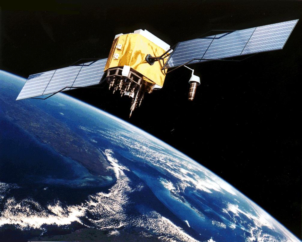
5 GPS Satellites
6 Block I Block II Generations of Satellites Prototype (test) satellites. 10 launched between 1978 and All retired. Initial operational satellites. 9 launched between 1989 and still functioning. Block IIA Slightly modified Block IIs. 19 launched between 1990 and still functioning. Block IIR Replenishment satellites. 6 launched to date. First in C/A code on L2 plus higher power on last 12 satellites launched from 2003 onwards. Block IIF Follow-on satellites. New civil signal at MHz. First launch expected in Block III Conceptual.

7 Satellite Launch Previous launch: IIR-6, SVN 41, PRN November 2000 Latest launch: IIR-7 Last night!
8 GPS Signals 24-satellite (nominal) constellation Navigation Message (Spacecraft Time and Position) Ground Antenna Monitor Station P(Y)-code C/A -code Master Control Station (Schriever AFB) Receiver Calculates 3-D Location and Time L MHz L MHz
9 Signal Modernization C/A Present Signal P(Y) P(Y) C/A C/A Civil Non-Aviation Signal (>2003) P(Y) P(Y) Civil Aviation & New Military Signals (>2005) P(Y) M C/A M P(Y) C/A 1176 MHz L MHz 1575 MHz L2 L1
10 GPS History Consolidation of several U.S. DoD developmental programs into the Navstar Global Positioning System First prototype satellites launched Korean Airlines Flight 007 shot down. President Reagan reafirms U.S. policy on civil use of GPS First operational satellites launched Initial Operational Capability (24 satellites) Full Operational Capability Selective Availability turned off
11 Positioning Accuracy Accuracy Method Relative Cost m Single receiver $ - $$ 1-10 m Differential code $ - $$ (Simple receiver) 10 cm - 1 m Differential code $$ 1-10 cm Differential phase $$$$ (Real-time kinematic) 2-5 mm Differential phase $$ (single frequency) 2-5 mm Differential phase $$$$$ (dual frequency)

12 Selective Availability Switched Off
13 GPS Benefits 24-hour, all weather, worldwide service Extremely accurate, three-dimensional location information (providing latitude, longitude, and altitude) Extremely accurate velocity information Precise timing services A worldwide common spatial reference frame (WGS 84) that is easily converted to any local frame, e.g., NAD 83 (CSRS) Continuous real-time information Accessibility to an unlimited number of worldwide users
14 GPS Difficulties GPS signals relatively weak (actually buried in background noise) Signals cannot penetrate into concrete and steel buildings or underground Signals can be blocked by buildings and other structures Susceptible to interference or jamming Reflected signals (multipath) cause position error


15 Signal Blockage Tall buildings can block GPS satellite signals Reduced satellite visibility increases geometrical dilution of precision resulting in reduced positioning accuracy

16 The Incredible Shrinking GPS Receiver First commercially available GPS receivers, circa 1980, consisted of two 19-inch racks of electronics In 1982, first portable receiver introduced; weighed 25 kg and consumed 110 watts of power First large handheld receivers introduced in : multi-chip module prototype 1999: GPS watch

17 Casio Satellite Navi Watch PAT-1GP first generation version introduced in 1999 PAT-2GP second generation version introduced last year More compact and lighter Rechargable lithium-ion battery PC interface $ (U.S.)
18 Two Chip GPS Receiver Digital signal processor Active antenna CPU RAM Bandpass filter Low noise amplifier Mixer RF/IF front end A/D converter GPS correlator bank ROM Bandpass filter RF amplifier Bandpass filter IF amplifier Local oscillator Real time clock I/O functions Serial I/O

19 AxiomNavigation Swift B1 OEM Receiver OEM module Based on SiRF 2nd generation chip set


20 itrax02 GPS Receiver Module mm mm
21 Differential GPS Increases stand-alone GPS receiver accuracy Several commercial and public broadcast systems in use or under development: - Coast Guard LF beacons (public) - FM sub-carrier (commercial) - Satellite L-band (commercial) - Wide Area Augmentation System (public) - Canada-wide DGPS Service (public) Private systems also used
22 GPS Benefits to Public Safety Rapid response and dispatch of emergency services Decreased response time to exact locations Search and rescue Emergency vehicle tracking/reporting
23 GPS Tracking Systems Many commercial products on the market Systems tailored to trucking, taxi, public service, and emergency vehicle fleets Variety of communication systems and protocols in use: Terrestrial VHF and UHF dedicated links Piggy-backing over existing communication channels Cellular telephone network Satellite links


24 UNB s Home Brew GPS Tracking System
25 FCC E-911 Requirements FCC issued a Report and Order in October 1996 requiring U.S. network operators to implement an E-911 location capability by October 2001 Phase I: Pass caller s phone number, cell-site, and cellsector location information to public safety answering point (PSAP) by April 1998 Phase II: Provide caller s location (latitude and longitude) to appropriate PSAP by October 2001 automatic location identification (ALI) 2 major solution technologies: network-based and handset-based
26 Networked-based Location Technologies provides the location of wireless 911 callers using hardware and/or software in the wireless network and/or another fixed infrastructure does not require the use of special location determining hardware and/or software in the caller s portable or mobile phone e.g., time-difference of arrival (TDOA), angle of arrival (AOA), hybrid systems, RF fingerprinting
27 Handset-based Location Technologies provides the location of wireless 911 callers using special location-determining hardware and/or software in the caller s portable or mobile phone may employ additional location-determining hardware and/or software in the wireless network and/or another fixed infrastructure e.g., GPS, Loran-C GPS: standalone and network-assisted (e.g. SnapTrack)
28 Phase II Accuracy Standards For network-based solutions: 100 metres for 67% of calls; 300 meters for 95% of calls For handset-based solutions: 50 metres for 67% of calls; 150 metres for 95% of calls
29 GPS-capable Handsets First sets introduced in 1999 Several manufacturers currently selling GPS-equipped handsets, mostly in Europe (GSM) SiRF Technology recently signed major contracts with both Nokia and Ericsson
 also available NavTalk II GSM phone (4th Q,")
30 Garmin NavTalk Garmin Corporation, Olathe, KS NavTalk Pilot: first GPS-equipped cellular telephone (1999) Advanced Mobile Phone System Moving-map display First Assist one-touch emergency service Standard version (NavTalk) also available NavTalk II GSM phone (4th Q, 2001)

31 Tendler Cellular FoneFinder GPS receiver add-on to conventional cellular phone Emergency button Position information sent in synthesized voice announcement
32 Airbiquity GPS Accessory Airbiguity Inc., Bainbridge Island, WA Adds GPS capability to existing Nokia 5100, 6100, and 7100 series phones 12-channel, SiRF chip set based Axiom GPS receiver built into phone battery pack Single button transmission of position Data port for Palm OS PDAs
 GPS receiver Flip-up GPS antenna Short Message Service Mobile Phone Telematics Protocol Emergency")
33 Benefon Track GSM+GPS Phone Benefon Oyj, Salo, Finland Professional telematics phone GSM phone + GPS 12-channel (all-in-view) GPS receiver Flip-up GPS antenna Short Message Service Mobile Phone Telematics Protocol Emergency dialing
 Benefon Oyj, Salo, Finland Personal navigation phone GSM phone + GPS 12-channel")
34 Benefon Esc! Personal Navigation Phone (1) Benefon Oyj, Salo, Finland Personal navigation phone GSM phone + GPS 12-channel (all-in-view) GPS receiver Flip-up GPS antenna 100 x 160 pixel screen Map display External antenna and NMEA connectors
 Personal organizer E-mail and Web access Short")
35 Benefon Esc! Personal Navigation Phone (2) Personal organizer and Web access Short Message Service Mobile Phone Telematics Protocol Mobile Map Service Protocol
36 The Future Further miniaturization of the technology (smaller and smaller) Integration of GPS receivers into PDAs, cameras, sports equipment, etc., etc. Pet, child, and disabled tracking systems and services Bluetooth (short range RF) connectivity between GPS receivers and other Bluetooth-equipped devices (GPS + Bluetooth = positioning inside buildings?) New GPS signals; higher power signals GPS + GLONASS + Galileo
37 Further Information
38 Acknowledgements Thanks to the following organizations for providing images for this presentation: United States Air Force NASA Jet Propulsion Laboratory United States Coast Guard Florida Today Mitre Corporation Ashtech MCA Universal Tendler Cellular Airbiguity Inc. Benefon Oyj Casio Axiom Navigation itrax Garmin
Monitoring the Ionosphere and Neutral Atmosphere with GPS
 Monitoring the Ionosphere and Neutral Atmosphere with GPS Richard B. Langley Geodetic Research Laboratory Department of Geodesy and Geomatics Engineering University of New Brunswick Fredericton, N.B. Division
Understanding GPS: Principles and Applications Second Edition
 Understanding GPS: Principles and Applications Second Edition Elliott Kaplan and Christopher Hegarty ISBN 1-58053-894-0 Approx. 680 pages Navtech Part #1024 This thoroughly updated second edition of an
GPS: The Basics. Darrell R. Dean, Jr. Civil and Environmental Engineering West Virginia University. Expected Learning Outcomes for GPS
 GPS: The Basics Darrell R. Dean, Jr. Civil and Environmental Engineering West Virginia University Expected Learning Outcomes for GPS Explain the acronym GPS Name 3 important tdt dates in history of GPS
Resection. We can measure direction in the real world! Lecture 10: Position Determination. Resection Example: Isola, Slovenia. Professor Keith Clarke
 Geography 12: Maps and Spatial Reasoning Lecture 10: Position Determination We can measure direction in the real world! Professor Keith Clarke Resection Resection Example: Isola, Slovenia Back azimuth
Using GPS in Embedded Applications Pascal Stang Stanford University - EE281 November 28, 2000
 Using GPS in Embedded Applications Pascal Stang Stanford University - EE281 INTRODUCTION Brief history of GPS Transit System NavStar (what we now call GPS) Started development in 1973 First four satellites
The Global Positioning System
 The Global Positioning System 5-1 US GPS Facts of Note DoD navigation system First launch on 22 Feb 1978, fully operational in 1994 ~$15 billion (?) invested to date 24 (+/-) Earth-orbiting satellites
GLOBAL NAVIGATION SATELLITE SYSTEMS (GNSS) ECE 2526E Tuesday, 24 April 2018
 ECE 2526E Tuesday, 24 April 2018") GLOBAL NAVIGATION SATELLITE SYSTEMS (GNSS) ECE 2526E Tuesday, 24 April 2018 MAJOR GLOBAL NAVIGATION SATELLITE SYSTEMS (GNSS) Global Navigation Satellite System (GNSS) includes: 1. Global Position System
GLOBAL NAVIGATION SATELLITE SYSTEMS (GNSS) ECE 2526E Tuesday, 24 April 2018 MAJOR GLOBAL NAVIGATION SATELLITE SYSTEMS (GNSS) Global Navigation Satellite System (GNSS) includes: 1. Global Position System
GPS Milestones, cont. GPS Milestones. The Global Positioning Sytem, Part 1 10/10/2017. M. Helper, GEO 327G/386G, UT Austin 1. US GPS Facts of Note
 The Global Positioning System US GPS Facts of Note DoD navigation system First launch on 22 Feb 1978, fully operational in 1994 ~$15 billion (?) invested to date 24 (+/-) Earth-orbiting satellites (SVs)
What is a GPS How does GPS work? GPS Segments GPS P osition Position Position Accuracy Accuracy Accuracy GPS A pplications Applications Applications
 What is GPS? What is a GPS How does GPS work? GPS Segments GPS Position Accuracy GPS Applications What is GPS? The Global Positioning System (GPS) is a precise worldwide radio-navigation system, and consists
GPS and Recent Alternatives for Localisation. Dr. Thierry Peynot Australian Centre for Field Robotics The University of Sydney
 GPS and Recent Alternatives for Localisation Dr. Thierry Peynot Australian Centre for Field Robotics The University of Sydney Global Positioning System (GPS) All-weather and continuous signal system designed
Proceedings of Al-Azhar Engineering 7 th International Conference Cairo, April 7-10, 2003.
 Proceedings of Al-Azhar Engineering 7 th International Conference Cairo, April 7-10, 2003. MODERNIZATION PLAN OF GPS IN 21 st CENTURY AND ITS IMPACTS ON SURVEYING APPLICATIONS G. M. Dawod Survey Research
DYNAMICALLY RECONFIGURABLE SOFTWARE DEFINED RADIO FOR GNSS APPLICATIONS
 DYNAMICALLY RECONFIGURABLE SOFTWARE DEFINED RADIO FOR GNSS APPLICATIONS Alison K. Brown (NAVSYS Corporation, Colorado Springs, Colorado, USA, abrown@navsys.com); Nigel Thompson (NAVSYS Corporation, Colorado
Localization. of mobile devices. Seminar: Mobile Computing. IFW C42 Tuesday, 29th May 2001 Roger Zimmermann
 Localization of mobile devices Seminar: Mobile Computing IFW C42 Tuesday, 29th May 2001 Roger Zimmermann Overview Introduction Why Technologies Absolute Positioning Relative Positioning Selected Systems
Global Positioning System
 Global Positioning System Ms. Namami Varshney, Dr. Ambuj kumar Agarwal CCSIT, TMU, BAGADPUR MORADABAD U.P. 244001 namamivarshney249@gmail.com ambuj4u@gmail.com Abstract Where am I? where am I going? where
Introduction to Geographic Information Science. Last Lecture. Today s Outline. Geography 4103 / GNSS/GPS Technology
 Geography 4103 / 5103 Introduction to Geographic Information Science GNSS/GPS Technology Last Lecture Geoids Ellipsoid Datum Projection Basics Today s Outline GNSS technology How satellite based navigation
GNSS 101 Bringing It Down To Earth
 GNSS 101 Bringing It Down To Earth Steve Richter Frontier Precision, Inc. UTM County Coordinates NGVD 29 State Plane Datums Scale Factors Projections Session Agenda GNSS History & Basic Theory Coordinate
PRINCIPLES AND FUNCTIONING OF GPS/ DGPS /ETS ER A. K. ATABUDHI, ORSAC
 PRINCIPLES AND FUNCTIONING OF GPS/ DGPS /ETS ER A. K. ATABUDHI, ORSAC GPS GPS, which stands for Global Positioning System, is the only system today able to show you your exact position on the Earth anytime,
GNSS & Coordinate Systems
 GNSS & Coordinate Systems Matthew McAdam, Marcelo Santos University of New Brunswick, Department of Geodesy and Geomatics Engineering, Fredericton, NB May 29, 2012 Santos, 2004 msantos@unb.ca 1 GNSS GNSS
Basics of Satellite Navigation an Elementary Introduction Prof. Dr. Bernhard Hofmann-Wellenhof Graz, University of Technology, Austria
 Basics of Satellite Navigation an Elementary Introduction Prof. Dr. Bernhard Hofmann-Wellenhof Graz, University of Technology, Austria CONCEPT OF GPS Prof. Dr. Bernhard Hofmann-Wellenhof Graz, University
Module Introduction. Purpose The intent of this module is to provide you with an overview of the Global Positioning System.
 Purpose The intent of this module is to provide you with an overview of the Global Positioning System. Objectives Explain the basic concept of GPS. Identify various applications of GPS. Describe how GPS
UNITED NATIONS UNIVERSITY Institute for Environment & Human Security (UNU-EHS) Bonn, Germany
 Bonn, Germany") UNITED NATIONS UNIVERSITY Institute for Environment & Human Security (UNU-EHS) Bonn, Germany Introduction to GPS technology Prof. Dr. Jörg Szarzynski Education Programme Director Head of Section EduSphere
UNITED NATIONS UNIVERSITY Institute for Environment & Human Security (UNU-EHS) Bonn, Germany Introduction to GPS technology Prof. Dr. Jörg Szarzynski Education Programme Director Head of Section EduSphere
Introduction. Global Positioning System. GPS - Intro. Space Segment. GPS - Intro. Space Segment - Contd..
 Introduction Global Positioning System Prof. D. Nagesh Kumar Dept. of Civil Engg., IISc, Bangalore 560 012, India URL: http://www.civil.iisc.ernet.in/~nagesh GPS is funded and controlled by U. S. Department
Mitigate Effects of Multipath Interference at GPS Using Separate Antennas
 Mitigate Effects of Multipath Interference at GPS Using Separate Antennas Younis H. Karim AlJewari #1, R. Badlishah Ahmed *2, Ali Amer Ahmed #3 # School of Computer and Communication Engineering, Universiti
GPS (Introduction) References. Terms
 References. Terms") GPS (Introduction) WCOM2, GPS, 1 Terms NAVSTAR GPS ( Navigational Satellite Timing and Ranging - Global Positioning System) is a GNSS (Global Navigation Satellite System), developed by the US-DoD in 197x
GPS (Introduction) WCOM2, GPS, 1 Terms NAVSTAR GPS ( Navigational Satellite Timing and Ranging - Global Positioning System) is a GNSS (Global Navigation Satellite System), developed by the US-DoD in 197x
Global Positioning Systems (GPS) Trails: the achilles heel of mapping from the air / satellites
 Trails: the achilles heel of mapping from the air / satellites") Global Positioning Systems (GPS) Trails: the achilles heel of mapping from the air / satellites Google maps updated regularly by local users using GPS Also: http://openstreetmaps.org GPS applications
Global Positioning Systems (GPS) Trails: the achilles heel of mapping from the air / satellites Google maps updated regularly by local users using GPS Also: http://openstreetmaps.org GPS applications
High Gain Advanced GPS Receiver
 High Gain Advanced GPS Receiver NAVSYS Corporation 14960 Woodcarver Road, Colorado Springs, CO 80921 Introduction The NAVSYS High Gain Advanced GPS Receiver (HAGR) is a digital beam steering receiver designed
ORBITAL NAVIGATION SYSTEMS PRESENT AND FUTURE TENDS
 ORBITAL NAVIGATION SYSTEMS PRESENT AND FUTURE TENDS CONTENT WHAT IS COVERED A BRIEF HISTORY OF SYSTEMS PRESENT SYSTEMS IN USE PROBLEMS WITH SATELLITE SYSTEMS PLANNED IMPROVEMENTS CONCLUSION CONTENT WHAT
GPS (Introduction) References. Terms
 References. Terms") GPS (Introduction) MSE, Rumc, GPS, 1 Terms NAVSTAR GPS ( Navigational Satellite Timing and Ranging - Global Positioning System) is a GNSS (Global Navigation Satellite System), developed by the US-DoD in
GPS (Introduction) MSE, Rumc, GPS, 1 Terms NAVSTAR GPS ( Navigational Satellite Timing and Ranging - Global Positioning System) is a GNSS (Global Navigation Satellite System), developed by the US-DoD in
Tracking New Signals from Space GPS Modernization and Trimble R-Track Technology
 Tracking New Signals from Space GPS Modernization and Trimble R-Track Technology Edmond T. Norse Trimble Integrated Surveying Group, Westminster, Colorado U.S. TRIMBLE 2 Tracking New Signals from Space
Entity Tracking and Surveillance using the Modified Biometric System, GPS-3
 Advance in Electronic and Electric Engineering. ISSN 2231-1297, Volume 3, Number 9 (2013), pp. 1115-1120 Research India Publications http://www.ripublication.com/aeee.htm Entity Tracking and Surveillance
Lecture-1 CHAPTER 2 INTRODUCTION TO GPS
 Lecture-1 CHAPTER 2 INTRODUCTION TO GPS 2.1 History of GPS GPS is a global navigation satellite system (GNSS). It is the commonly used acronym of NAVSTAR (NAVigation System with Time And Ranging) GPS (Global
The GLOBAL POSITIONING SYSTEM James R. Clynch February 2006
 The GLOBAL POSITIONING SYSTEM James R. Clynch February 2006 I. Introduction What is GPS The Global Positioning System, or GPS, is a satellite based navigation system developed by the United States Defense
GPS Global Positioning System
 GPS Global Positioning System 10.04.2012 1 Agenda What is GPS? Basic consept History GPS receivers How they work Comunication Message format Satellite frequencies Sources of GPS signal errors 10.04.2012
Global Navigation Satellite Systems (GNSS): GPS, GLONASS, GALILEO
: GPS, GLONASS, GALILEO") Global Navigation Satellite Systems ():,, Dr Guergana Guerova Marie Curie Fellow Department of Meteorology and Geophysics Physics Faculty, Sofia University National Culture High School, 13 November 2012,
Global Navigation Satellite Systems ():,, Dr Guergana Guerova Marie Curie Fellow Department of Meteorology and Geophysics Physics Faculty, Sofia University National Culture High School, 13 November 2012,
GPS based data acquisition system for mobile applications
 GPS based data acquisition system for mobile applications D. Covaciu, I. Preda, Gh. Ciolan Transilvania University of Brasov, Romania e-mail: dinu.covaciu@unitbv.ro, pion@unitbv.ro, cgicu@unitbv.ro Abstract:
Global Navigation Satellite Systems (GNSS): GPS, GLONASS, GALILEO
: GPS, GLONASS, GALILEO") Global Navigation Satellite Systems ():,, Dr Guergana Guerova Marie Curie Fellow Department of Meteorology and Geophysics Physics Faculty, Sofia University Actual topics in the modern physics, Sofia University,
Global Navigation Satellite Systems ():,, Dr Guergana Guerova Marie Curie Fellow Department of Meteorology and Geophysics Physics Faculty, Sofia University Actual topics in the modern physics, Sofia University,
King AbdulAziz University. Faculty of Environmental Design. Geomatics Department. Mobile GIS GEOM 427. Lecture 3
 King AbdulAziz University Faculty of Environmental Design Geomatics Department Mobile GIS GEOM 427 Lecture 3 Ahmed Baik, Ph.D. Email: abaik@kau.edu.sa Eng. Fisal Basheeh Email: fbasaheeh@kau.edu.sa GNSS
GLOBAL POSITIONING SYSTEMS. Knowing where and when
 GLOBAL POSITIONING SYSTEMS Knowing where and when Overview Continuous position fixes Worldwide coverage Latitude/Longitude/Height Centimeter accuracy Accurate time Feasibility studies begun in 1960 s.
t =1 Transmitter #2 Figure 1-1 One Way Ranging Schematic
 1.0 Introduction OpenSource GPS is open source software that runs a GPS receiver based on the Zarlink GP2015 / GP2021 front end and digital processing chipset. It is a fully functional GPS receiver which
FieldGenius Technical Notes GPS Terminology
 FieldGenius Technical Notes GPS Terminology Almanac A set of Keplerian orbital parameters which allow the satellite positions to be predicted into the future. Ambiguity An integer value of the number of
NASA Search and Rescue Cospas-Sarsat MEOSAR, Second Generation Beacons, and DF Receiver with UAS March 23, 2017
 NASA Search and Rescue Cospas-Sarsat MEOSAR, Second Generation Beacons, and DF Receiver with UAS March 23, 2017 Dr. Lisa Mazzuca Mission Manager NASA Search and Rescue Office Goddard Space Flight Center
GNSS Signal Structures
 GNSS Signal Structures Tom Stansell Stansell Consulting Tom@Stansell.com Bangkok, Thailand 23 January 2018 S t a n s e l l C o n s u l t i n g RL Introduction It s a pleasure to speak with you this morning.
Computer Aided Earthmoving System
 Computer Aided Earthmoving System CAES for Landfills Landfill Compactors Track-Type Tractors Wheel Tractor Scrapers Motor Graders System Components Communications Radio GPS Antenna GPS Receiver In-Cab
Global Positioning Systems Directorate
 Space and Missile Systems Center Global Positioning Systems Directorate GPS Program Update to 8 th Stanford PNT Symposium 30 Oct 2014 Col Matt Smitham Deputy Director, GPS Directorate Global Positioning
Introduction to Global Navigation Satellite System (GNSS) Module: 1
 Module: 1") Introduction to Global Navigation Satellite System (GNSS) Module: 1 Dinesh Manandhar Center for Spatial Information Science The University of Tokyo Contact Information: dinesh@iis.u-tokyo.ac.jp Slide :
Introduction to Global Navigation Satellite System (GNSS) Module: 1 Dinesh Manandhar Center for Spatial Information Science The University of Tokyo Contact Information: dinesh@iis.u-tokyo.ac.jp Slide :
2. GPS and GLONASS Basic Facts
 2. GPS and GLONASS Basic Facts In 1973 the U.S. Department of Defense decided to establish, develop, test, acquire, and deploy a spaceborne Global Positioning System (GPS). The result of this decision
What is GPS? GPS Position Accuracy. GPS Applications. What is a GPS. How does GPS work? GPS Segments
 What is GPS? What is a GPS How does GPS work? GPS Segments GPS Position Accuracy GPS Applications 1 What is GPS? The Global Positioning System (GPS) is a precise worldwide radio-navigation system, and
L76-L GNSS Module Presentation
 L76-L GNSS Module Presentation May, 2016 Quectel Wireless Solutions Co., Ltd. All rights reserved www.quectel.com Contents Highlights Advanced Features Quectel L76-L vs. Competitor s Product Support Package
The last 25 years - GPS to multi-gnss: from a military tool to the most widely used civilian positioning solution
 1 The last 25 years - GPS to multi-gnss: from a military tool to the most widely used civilian positioning solution B. Hofmann-Wellenhof Institute of Geodesy / Navigation, Graz University of Technology
1998: A YEAR OF INNOVATION IN (THE)
") 1998: A YEAR OF INNOVATION IN (THE) Richard B. Langley Geodetic Research Laboratory University of New Brunswick Invited presentation at the Association of New Brunswick Land Surveyors Annual General Meeting,
1998: A YEAR OF INNOVATION IN (THE) Richard B. Langley Geodetic Research Laboratory University of New Brunswick Invited presentation at the Association of New Brunswick Land Surveyors Annual General Meeting,
GPS Errors. Figure 1. Four satellites are required to determine a GPS position.
 Expl ai ni nggps:thegl obalposi t i oni ngsyst em since a minimum of four satellites is required to calculate a position (Fig 1). However, many newer GPS receivers are equipped to receive up to 12 satellite
TRIUMPH TECHNOLOGY. Javad Ashjaee
 TRIUMPH TECHNOLOGY Javad Ashjaee JAVAD GNSS www.javad.com International SatelliteNavigation Forum Moscow, April 7, 2008 TRIUMPH WE ARE BACK TO LEAD With TRIUMPH! 2 TRIUMPH Technology At the heart of our
DEFINING THE FUTURE OF SATELLITE SURVEYING WITH TRIMBLE R-TRACK TECHNOLOGY
 DEFINING THE FUTURE OF SATELLITE SURVEYING WITH TRIMBLE R-TRACK TECHNOLOGY EDMOND NORSE, GNSS PORTFOLIO MANAGER, TRIMBLE SURVEY DIVISION WESTMINSTER, CO USA ABSTRACT In September 2003 Trimble introduced
Principal Investigator Co-Principal Investigator Co-Principal Investigator Prof. Talat Ahmad Vice-Chancellor Jamia Millia Islamia Delhi
 Subject Paper No and Title Module No and Title Module Tag Geology Remote Sensing and GIS Concepts of Global Navigation Satellite RS & GIS XXXIII Principal Investigator Co-Principal Investigator Co-Principal
GPS for. Land Surveyors. Jan Van Sickle. Fourth Edition. CRC Press. Taylor & Francis Group. Taylor & Francis Croup, an Informa business
 GPS for Land Surveyors Fourth Edition Jan Van Sickle CRC Press Taylor & Francis Group Boca Raton London New York CRC Press is an imprint of the Taylor & Francis Croup, an Informa business Contents Preface
Ct-G551. Connectec. SiRF V GPS Module. Specifications Sheet V0.1. Features: Ct-G551 V0.1 Specification Sheet
 SiRF V GPS Module Ct-G551 Specifications Sheet V0.1 Features: SiRF StarV ultra low power chipset GPS, GLONASS, Galileo and SBAS reception for high GNSS availability and accuracy Compact module size for
MOBILE COMPUTING 1/28/18. Location, Location, Location. Overview. CSE 40814/60814 Spring 2018
 MOBILE COMPUTING CSE 40814/60814 Spring 018 Location, Location, Location Location information adds context to activity: location of sensed events in the physical world location-aware services location
Wireless systems. includes issues of
 Wireless systems includes issues of hardware processors, storage, peripherals, networks,... representation of information, analog vs. digital, bits & bytes software applications, operating system organization
High Precision GNSS in Automotive
 High Precision GNSS in Automotive Jonathan Auld, VP Engineering and Safety 6, March, 2018 2 Global OEM Positioning Solutions and Services for Land, Sea, and Air. GNSS in Automotive Today Today the primary
Mobile Security Fall 2015
 Mobile Security Fall 2015 Patrick Tague #8: Location Services 1 Class #8 Location services for mobile phones Cellular localization WiFi localization GPS / GNSS 2 Mobile Location Mobile location has become
GLOBAL POSITIONING SYSTEMS
 GLOBAL POSITIONING SYSTEMS GPS & GIS Fall 2017 Global Positioning Systems GPS is a general term for the navigation system consisting of 24-32 satellites orbiting the Earth, broadcasting data that allows
GPS Modernization and Program Update
 GPS Modernization and Program Update GPS Update to ION Southern California Chapter 22 Feb 2011 Colonel Bernie Gruber Director Global Positioning Systems Directorate Contents Current Constellation Modernization
METIS Second Master Training & Seminar. Augmentation Systems Available in Egypt
 METIS Second Master Training & Seminar Augmentation Systems Available in Egypt By Eng. Ramadan Salem M. Sc. Surveying and Geodesy Email: ramadan_salem@link.net Page 1 Augmentation Systems Available in
GPS1240 Rugged Sensor Data sheet
 GPS1240 Rugged Sensor Data sheet Features 12-channel GPS receiver for an all-in-view solution with very high accuracy IP67 waterproof housing standard NMEA 0183 (v2) data output optimised for best performance
GR-87 GPS Receiver Module
 GR-87 GPS Receiver Module 1. Main Feature Build on high performance SiRF StarIII chipset. Average Cold Start time and under 45 seconds. Low power consumption 20 channels All-in-View tracking. 200,000+
IMO WORLDWIDE RADIONAVIGATION SYSTEM (WWRNS) Study on Communication Techniques for High Accuracy DGPS in the Republic of Korea
 Study on Communication Techniques for High Accuracy DGPS in the Republic of Korea") INTERNATIONAL MARITIME ORGANIZATION E IMO SUB-COMMITTEE ON SAFETY OF NAVIGATION 52nd session Agenda item 12 NAV 52/INF.8 12 May 2006 ENGLISH ONLY WORLDWIDE RADIONAVIGATION SYSTEM (WWRNS) Study on Communication
INTERNATIONAL MARITIME ORGANIZATION E IMO SUB-COMMITTEE ON SAFETY OF NAVIGATION 52nd session Agenda item 12 NAV 52/INF.8 12 May 2006 ENGLISH ONLY WORLDWIDE RADIONAVIGATION SYSTEM (WWRNS) Study on Communication
GM-270. CF GPS Receiver. User s Guide
 GM-270 CF GPS Receiver User s Guide Jul 05, 2002 TABLE OF CONTENTS 1. Introduction.. 3 1.1 Overview.. 3 1.2 Features.. 3 2. Brief Information. 5 2.1 Hardware Interface 5 2.2 Software Interface 6 3. Functional
Performance Evaluation of Differential Global Navigation Satellite System with RTK Corrections
 IOSR Journal of Electronics and Communication Engineering (IOSR-JECE) e-issn: 2278-2834,p- ISSN: 2278-8735.Volume 9, Issue 2, Ver. VI (Mar - Apr. 2014), PP 43-47 Performance Evaluation of Differential
UNIT 1 - introduction to GPS
 UNIT 1 - introduction to GPS 1. GPS SIGNAL Each GPS satellite transmit two signal for positioning purposes: L1 signal (carrier frequency of 1,575.42 MHz). Modulated onto the L1 carrier are two pseudorandom
Challenges and Solutions for GPS Receiver Test
 Challenges and Solutions for GPS Receiver Test Presenter: Mirin Lew January 28, 2010 Agenda GPS technology concepts GPS and GNSS overview Assisted GPS (A-GPS) Basic tests required for GPS receiver verification
Universal Acquisition and Tracking Apparatus for Global Navigation Satellite System (GNSS) Signals: Research Patent Introduction (RPI)
 Signals: Research Patent Introduction (RPI)") Universal Acquisition and Tracking Apparatus for Global Navigation Satellite System (GNSS) Signals: Research Patent Introduction (RPI) 27/01/2014 PAR R.JR. LANDRY, M.A. FORTIN ET J.C. GUAY 0 An RPI is
Universal Acquisition and Tracking Apparatus for Global Navigation Satellite System (GNSS) Signals: Research Patent Introduction (RPI) 27/01/2014 PAR R.JR. LANDRY, M.A. FORTIN ET J.C. GUAY 0 An RPI is
Primer on GPS Operations
 MP Rugged Wireless Modem Primer on GPS Operations 2130313 Rev 1.0 Cover illustration by Emma Jantz-Lee (age 11). An Introduction to GPS This primer is intended to provide the foundation for understanding
Chapter 4 DGPS REQUIREMENTS AND EQUIPMENT SELECTION
 Chapter 4 DGPS REQUIREMENTS AND EQUIPMENT SELECTION 4.1 INTRODUCTION As discussed in the previous chapters, accurate determination of aircraft position is a strong requirement in several flight test applications
CH GPS/GLONASS/GALILEO/SBAS Signal Simulator. General specification Version 0.2 Eng. Preliminary
 CH-380 GPS/GLONASS/GALILEO/SBAS Signal Simulator General specification Version 0.2 Eng Preliminary Phone: +7 495 665 648 Fax: +7 495 665 649 navis@navis.ru NAVIS-UKRAINE Mazura str. 4 Smela, Cherkassy
ESTIMATION OF IONOSPHERIC DELAY FOR SINGLE AND DUAL FREQUENCY GPS RECEIVERS: A COMPARISON
 ESTMATON OF ONOSPHERC DELAY FOR SNGLE AND DUAL FREQUENCY GPS RECEVERS: A COMPARSON K. Durga Rao, Dr. V B S Srilatha ndira Dutt Dept. of ECE, GTAM UNVERSTY Abstract: Global Positioning System is the emerging
GALILEO AND EGNOS VALUE PROPOSITION FOR E112
 Ref. Ares(2014)1665692-22/05/2014 GALILEO AND EGNOS VALUE PROPOSITION FOR E112 Fiammetta Diani, Justyna REDELKIEWICZ European GNSS Agency (GSA) Brussels, 07/05/2014 Agenda European GNSS Agency at a glance
BENEFITS OF A SPACE-BASED AUGMENTATION SYSTEM FOR EARLY IMPLEMENTATION OF GPS MODERNIZATION SIGNALS
 BENEFITS OF A SPACE-BASED AUGMENTATION SYSTEM FOR EARLY IMPLEMENTATION OF GPS MODERNIZATION SIGNALS Alison Brown and Sheryl Atterberg, NAVSYS Corporation BIOGRAPHY Alison Brown is the President and CEO
GPS SMART ANTENNA (GWG4287SX)
") GPS SMART ANTENNA (GWG4287SX) SiRFSTARIII /LPx Specifications are subject to change without notice KOREA ELECTRIC TERMINAL CO., LTD. All right reserved http://www.ket.com 1. Introduction 1.1 Over view
GPS SMART ANTENNA (GWG4287SX) SiRFSTARIII /LPx Specifications are subject to change without notice KOREA ELECTRIC TERMINAL CO., LTD. All right reserved http://www.ket.com 1. Introduction 1.1 Over view
Lecture 04. Elements of Global Positioning Systems
 Lecture 04 Elements of Global Positioning Systems Elements of GPS: During the last lecture class we talked about Global Positioning Systems and its applications. With so many innumerable applications of
Raveon M7 GX Frequently Asked Questions
 Technical Brief AN134Rev A3 Raveon M7 GX Frequently Asked Questions By John Sonnenberg Raveon Technologies Corp How far will a 5-watt UHF radio communicate? An excellent question, but very difficult to
Understanding GPS/GNSS
 Understanding GPS/GNSS Principles and Applications Third Edition Contents Preface to the Third Edition Third Edition Acknowledgments xix xxi CHAPTER 1 Introduction 1 1.1 Introduction 1 1.2 GNSS Overview
36. Global Positioning System
 36. Introduction to the Global Positioning System (GPS) Why do we need GPS? Position: a basic need safe sea travel, crowed skies, resource management, legal questions Positioning: a challenging job local
Real-Time Data Flow and Product Generation for GNSS. Jet Propulsion Laboratory. California Institute of Technology. Natural Resources Canada
 Real-Time Data Flow and Product Generation for GNSS Ronald J. Muellerschoen rjm @ mailhost4.jpl.nasa.gov Abstract Jet Propulsion Laboratory California Institute of Technology Mark Caissy caissy @NRCan.gc.ca
Global Navigation Satellite System (GNSS) GPS Serves Over 400 Million Users Today. GPS is used throughout our society
 GPS Serves Over 400 Million Users Today. GPS is used throughout our society") Global avigation Satellite System (GSS) For freshmen at CKU AA December 10th, 2009 by Shau-Shiun Jan ICA & IAA, CKU Global avigation Satellite System (GSS) GSS (Global Positioning System, GPS) Basics Today
Global avigation Satellite System (GSS) For freshmen at CKU AA December 10th, 2009 by Shau-Shiun Jan ICA & IAA, CKU Global avigation Satellite System (GSS) GSS (Global Positioning System, GPS) Basics Today
Multi GNSS Current Status and Future Session 2.3 Multi GNSS Environment
 Multi GNSS Current Status and Future Session 2.3 Multi GNSS Environment Larry D. Hothem Senior Advisor for GPS/GNSS Technical Issues Member US Delegation to the ICG DOI Lead Member, GPS International Working
GNSS Technology Update
 GNSS Technology Update Speaker: Eric Gakstatter Contributing Editor GPS World Editor - Geospatial Solutions Presented at: Association of Petroleum Surveying & Geomatics Houston, TX April 7, 2015 Agenda
Precise Positioning with NovAtel CORRECT Including Performance Analysis
 Precise Positioning with NovAtel CORRECT Including Performance Analysis NovAtel White Paper April 2015 Overview This article provides an overview of the challenges and techniques of precise GNSS positioning.
GPS Pathfinder ProXH and ProXT Customer FAQs
 7 December 2009 GPS Pathfinder ProXH and ProXT Customer FAQs What is the GPS Pathfinder ProXH receiver? The GPS Pathfinder ProXH receiver is a fully integrated receiver, antenna and battery unit with Trimble
Indian Institute of Technology Kanpur Department of Civil Engineering
 Indian Institute of Technology Kanpur Department of Civil Engineering Inquiry No- CE/JNM/2013-14/R-10 30 December, 2013 Subject: Quotation for supply of Integrated System/Smart System Reflectorless Robotic
Agenda Motivation Systems and Sensors Algorithms Implementation Conclusion & Outlook
 Overview of Current Indoor Navigation Techniques and Implementation Studies FIG ww 2011 - Marrakech and Christian Lukianto HafenCity University Hamburg 21 May 2011 1 Agenda Motivation Systems and Sensors
An Introduction to Airline Communication Types
 AN INTEL COMPANY An Introduction to Airline Communication Types By Chip Downing, Senior Director, Aerospace & Defense WHEN IT MATTERS, IT RUNS ON WIND RIVER EXECUTIVE SUMMARY Today s global airliners use
GPS Case ESD.85. Angela Ho Alex Mozdzanowska Christine Ng. Illustration by Leo Cronin. October 31, ESD.85 GPS Case 1.
 GPS Case ESD.85 October 31, 2005 Angela Ho Alex Mozdzanowska Christine Ng Illustration by Leo Cronin October 31, 2005 ESD.85 GPS Case 1 What is GPS? Global Positioning System Used for timing, positioning,
NR402 GIS Applications in Natural Resources
 NR402 GIS Applications in Natural Resources Lesson 5 GPS/GIS integration Global Positioning System (GPS)..a global navigation system that everyone can use What is GPS? How does it work? How accurate is
LOCALIZATION WITH GPS UNAVAILABLE
 LOCALIZATION WITH GPS UNAVAILABLE ARES SWIEE MEETING - ROME, SEPT. 26 2014 TOR VERGATA UNIVERSITY Summary Introduction Technology State of art Application Scenarios vs. Technology Advanced Research in
Dimov Stojče Ilčev. CNS Systems
 Stratospheric Platform Systems (SPS) Presentation by: Dimov Stojče Ilčev Durban University of Technology (DUT) Space Science Centre (SSC) CNS Systems August 2011 SPS for Mobile CNS Applications Stratospheric
Nigerian Communications Satellite Ltd. (NIGCOMSAT)
") OVERVIEW OF NIGERIAN SATELLITE AUGMENTATION SYSTEM COMMENCING WITH PILOT DEMONSTRATION TO VALIDATE NATIONAL WORK PLAN presented by Dr. Lawal Lasisi Salami, NIGERIAN COMMUNICATIONS SATELLITE LTD UNDER FEDERAL
OVERVIEW OF NIGERIAN SATELLITE AUGMENTATION SYSTEM COMMENCING WITH PILOT DEMONSTRATION TO VALIDATE NATIONAL WORK PLAN presented by Dr. Lawal Lasisi Salami, NIGERIAN COMMUNICATIONS SATELLITE LTD UNDER FEDERAL
Digital Surveillance Devices?
 Technology Framework Tracking Technologies Don Mason Associate Director Digital Surveillance Devices? Digital Surveillance Devices? Secure Continuous Remote Alcohol Monitor SCRAM Page 1 Location Tracking
Where Next for GNSS?
 Where Next for GNSS? Professor Terry Moore Professor of Satellite Navigation Nottingham The University of Nottingham Where Next for GNSS Back to the Future? Professor Terry Moore Professor of Satellite
Space and Missile Systems Center
 Space and Missile Systems Center Global Positioning Systems Directorate GPS Status & Modernization Progress: Service, Satellites, Control Segment, and Military GPS User Equipment 3 Nov 2016 Col Steve Whitney,
Satellite Navigation Science and Technology for Africa. 23 March - 9 April, Satellite Navigation
 2025-45 Satellite Navigation Science and Technology for Africa 23 March - 9 April, 2009 Satellite Navigation MISRA Pratap The MITRE Corporation 202 Burlington Rd. / Rte 62 Bedford MA 01730-1420 U.S.A.