Satellite Navigation Science and Technology for Africa. 23 March - 9 April, Satellite Navigation
|
|
|
- Todd Hutchinson
- 6 years ago
- Views:
Transcription
1 Satellite Navigation Science and Technology for Africa 23 March - 9 April, 2009 Satellite Navigation MISRA Pratap The MITRE Corporation 202 Burlington Rd. / Rte 62 Bedford MA U.S.A.


2 Satellite Navigation Science and Technology for Africa The Abdus Salam International Center for Theoretical Physics, Trieste, Italy 23 March 9 April 2009 An Overview of Satellite Navigation Pratap Misra GPS Satellite (Block IIF)
3 Objectives To convey: A broad understanding of the scientific and engineering principles of satellite navigation The rudiments of GPS: System Signals and measurements Performance An outline of global navigation satellite systems under development: GLONASS, Galileo, Beidou Comprehensive discussions of these topics (and more) to follow later this week 2


4 3


5 -1 Space age began with the launch of Sputnik I by the Soviet Union on 4 October 1957 Beeps heard on short- wave radios tuned to 20 MHz or 40 MHz, Doppler shifted as the satellite moved in the sky* Within days, the idea of using radio signals from space for positioning on the earth was born * 4
6 Doppler Effect A A B B C C Dop ppler Freq quency Time Doppler frequency shift = - range rate/ wavelength _13.PPT PNM
7 Doppler Positioning A Conceptual Exercise C B A A B C Dopple er Freque ency Time Record time when Doppler shift went through zero Along-track position - From train s schedule - Error sources: Watch off, train off schedule Cross-track position - From Doppler profile - Ambiguity: Which side of the track? Doppler frequency shift = - range rate/ wavelength _13.PPT PNM

8 A Global Satellite Navigation System based on Doppler Positioning Satellite transmits Frequency-stable signal Time, orbital parameters, clock parameters Receiver measures Doppler frequencies and records transmitted data for an entire pass Determine coordinates of the point on the ground track corresponding to the point of closest approach Determine offset from the ground track Error Sources Satellite clock frequency stability over min User velocity (x o,y o,z o ) X (x o,y o )X x o (x o + x o,y o ) Doppler Shift Time = 45 o = 90 o Adapted from Marine Electronic Navigation by Appleyard et al. 7


9 4-7 satellites in 1100-km, circular, polar orbits One satellite in view at a time A satellite pass lasted min; up to 100-min wait between passes Satellite weight: 50 Kg (160 Kg) Signals at 150 MHz & 400 MHz Signal power: 1 watt 2-D Positioning accuracy (for a stationary users): 25 m ~ 10,000 receiver sets in 1980, cost: ~$25,000 Transit ( ) 8
10 Satellite Navigation Overview Outline Principles of Satellite Navigation GPS Overview: System, Signals and measurements, Performance Applications and Performance Metrics Potential Partners/Rivals: GLONASS, Galileo, BeiDou/Compass, 9


11 Triangulation Method of determining the position of a fixed point from the angles to it from two fixed reference points a known distance apart from Trigonometry Surveying and Navigation by G.A.Wentworth 10


12 Triangulation Method of determining the position of a fixed point from the angles to it from two fixed reference points a known distance apart Trilateration Measure lengths of the sides of a triangle rather than angles from Trigonometry Surveying and Navigation by G.A.Wentworth Surveyor s chain from A chain = 100 links = 66 feet long, 80 chains make a mile. A "rod" or "pole" is 1/4 of a chain, or 16-1/2 feet long. Thus "40 rods" is 10 chains, or 1/8 of a mile. 11

13 12 2-D Trilateration
14 Trilateration Satellite Navigation Enabling Technologies Stable space platforms with predictable orbits 13
15 GPS Baseline Satellite Constellation since 1980 E2 A4 D3 B4 E3 F1 B3 C3 F2 C2 Satellites: 24 Orbital planes: 6 D4 B2 A3 C4 E1 A1 D2 Inclination: 55 deg Altitude: 20,000 km Period: 11 h, 58 min E4 F4 D1 A2 C1 B1 F3 Actual number of satellites has exceeded 24 since 1995, and is currently 29 U.S. Government intends to maintain at least 22 satellites in their nominal slots 14
16 Trilateration Satellite Navigation Enabling Technologies Stable space platforms with predictable orbits Global coordinate frame (Earth-centered, Earth-fixed) 15

17 Global and Regional Coordinate Frames Global Reference Meridian z h (x, y, z). Regional Regional Ellipsoid ~ P Geoid x y Geocentric Ellipsoid Misra 1999 Geodetic latitude defined relative to a geocentric ellipsoid ~ Geodetic latitude defined relative to a regional ellipsoid 16
18 Trilateration Satellite Navigation Enabling Technologies Stable space platforms with predictable orbits Global coordinate frame (Earth-centered, Earth-fixed) Ultra-stable clocks aboard satellites to transmit synchronized signals Frequency stability of 1 part in /day: f f Timekeeping error Timeinterval Timekeeping error : ~10 ns/day 17


 Ultra-stable clocks")

19 Trilateration Satellite Navigation Enabling Technologies Receiver Clock Bias Stable space platforms with predictable orbits Global coordinate frame (Earth-centered, Earth-fixed) Ultra-stable clocks aboard satellites to transmit synchronized signals, but inexpensive clocks in receivers 18
20 Relativistic Effects: Circular 12-h Orbit Atomic clock drift: f f Second-order Doppler shift (time dilation) f f = v 2 1x (negative) 2c 2 v Gravitational frequency shift f 5 x 10 = -10 (positive) f c 2 26,560 km 19 PM112905U-p4
21 Relativistic Effects: Circular 12-h Orbit Atomic clock drift: f f Second-order Doppler shift (time dilation) 2 f v 1x 10 = -10 (negative) f 2c 2 v Gravitational frequency shift f f = 5x10⁻¹⁰ (positive) c 2 26,560 km 6 x GPS Geostationary f f f 0 Combined effect accounted for by factory offset of satellite clock by f = x f -2 PM112905U-p4 Shuttle x10 3 Orbit radius (km)
22 21
23 Trilateration Satellite Navigation Enabling Technologies Receiver Clock Bias Stable space platforms with predictable orbits Global coordinate frame (Earth-centered, Earth-fixed) Ultra-stable clocks aboard satellites to transmit synchronized signals, but inexpensive clocks in receivers Integrated circuits: Compact, light, inexpensive receivers 22


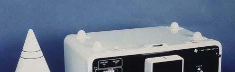
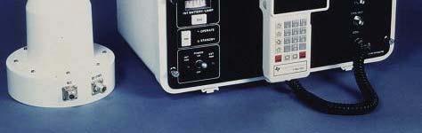
24 Evolution of GPS Receivers from 10 Kg to 100 g, 100 watts to 1 watt, $ 100k to $ 100 Early 1980s 2005 USAF photo TI
25 Satellite Navigation Position Estimation by Trilateration (x k, y k, z k ) R K R k R 1 Error Sources Ephemeris Satellite Clock Propagation through Ionosphere Troposphere Multipath Receiver Noise b (x, y, z) Measurements: Pseudoranges {R k } Given: Satellite Positions {(x k, y k, z k )} R k = (x k x) 2 + (y k y) 2 + (z k z) 2 b, k = 1, 2,, K Unknown: User Position (x, y, z) Receiver Clock Bias b 24
26 Satellite Navigation Position Estimation by Trilateration R K R k (x k, y k, z k ) b R 1 (x, y, z) Your position coordinates are (in meters): x y z
27 Satellite Navigation Objectives To provide estimates of Position [~10 m] Velocity [~0.1 m/s] Time [~0.1 ms] Instantaneously Continuously Globally Cheaply, etc. To any number of users Misra
![Satellite Navigation Objectives To provide estimates of Position [~10 m] Velocity [~0.1 m/s] Time [~0.1 s] Instantaneously, t continuously, globally, cheaply, etc.](/docs-images/75/72825683/images/28-2.jpg "To any number of users Misra 1999 GPS Joint Program Office motto (Ca.")
28 Satellite Navigation Objectives To provide estimates of Position [~10 m] Velocity [~0.1 m/s] Time [~0.1 s] Instantaneously, t continuously, globally, cheaply, etc. To any number of users Misra 1999 GPS Joint Program Office motto (Ca. 1975) The mission i of this Program is: (1) Drop 5 bombs b in the same hole, and (2) build a cheap set that navigates (< $10,000), and don t you forget it! 27
29 Satellite Navigation Overview Outline Principles of Satellite Navigation GPS Overview: System, Signals and measurements, Performance Applications and Performance Metrics Potential Partners/Rivals: GLONASS, Galileo, BeiDou/Compass, 28
30 GPS at a Glance Development began in early 1970s First prototype satellite launched in 1978 Estimated number of receivers required: 27,000 (!) Target cost of a receiver: $10,000 (!) Operational System First operational satellite launched in 1989 System declared operational in 1995 Expenditure U.S. taxpayer investment (through 2007): $ 32b Annual O&M costs: $ 1b Users: Millions Most widely used military radio, albeit one way Civil receivers manufactured annually: > 1 million Annual commerce in GPS products & services > $10 b 29
31 Services U.S. Policy on GPS Standard Positioning Service (SPS) available to all Precise Positioning i Service (PPS) for authorized users Selective Availability (SA) Purposeful degradation of the civil signal throughout 1990s, SPS horizontal positioning accuracy (95%): ~60 m Discontinued by Presidential Order (2000) Foresworn for GPS III by Presidential Order (2007) Governance DoD (until 1996), Inter-Agency GPS Executive Board ( ), U.S. National Space-Based Positioning, Navigation, and Timing Executive Committee (2004- ) 30


32 GPS Segments Space Segment User segment: civil and military Ground control segment 31
33 GPS Signals in mid-2005 L MHz L MHz P(Y) Code Encrypted Specifications Precise Positioning Service (PPS) P(Y) Code Encrypted Horizontal Error (95%) 22 m < 10* 100 m Vertical Error (95%) 27 < 15* 156 C/A Code Civil use Degraded Standard Positioning Service (SPS) 32 PNM 3/31/01 * Since 2 May 2000 (empirical)
 L Code x(t)")
")
![x(t)] : Mod 2 Sum : Biphase](/docs-images/75/72825683/images/34-4.jpg "Modulation ~ 0 1 20 40 Time (ms)")
34 Satellite Signal GPS C/A-Code Carrier f t cos(2 ) L Code x(t) () Data D(t) Transit Time Time ~ Satellite Signal: [D(t) x(t)] : Mod 2 Sum : Biphase Modulation ~ Time (ms) cos(2 ft ) L 33
35 Spread Spectrum Signaling Unmodulated Carrier Two bits from data Stream D(t) 1st data bit = +1 2nd data bit = 1 Two repeats of a code with 4 chips per data bit -1 x(t) Carrier modulated by code and data Source: Prof. Per Enge, Stanford University 34 Transmitted Signal s ( t) 2 P D( t) x( t)cos(2 f t) T T L
 t 2 P")
 t 2 P D")
 and")
 :Nav")
, f : Carrier frequency, f :")
36 A Generic GPS Signal Transmitted Signal s () t 2 P D () t x()cos(2 t ( f t ) T T L Received Signal s () t 2 P D ( t ) x ( t )cos 2 f f t R R L D Estimate delay ( ) and Doppler ( f ) Range = c ; Range rate = f D D Dt ( ) :Nav data ( 1), xt ( ) : PRN code( 1), f : Carrier frequency, f : Doppler frequency L D 35
37 Amplitude Spectrum of GPS Signals 1 November 2005 P(Y) C/A P(Y) f L2 : MHz f L1 : MHz Source: Prof. Per Enge, Stanford University 36
 ~ 20,000 km PSD (d dbw/mhz) -120-140 -160-180")
 - 160 dbw (10-16 W) P T G T G R 2 P R = 4 R 2")
38 GPS Signals are Extremely Weak-1 Freq: MHz (L1) Power: ~ 27 W (C/A-Code) ~ 20,000 km PSD (d dbw/mhz) Thermal Noise GPS Signal Frequency (GHz) dbw (10-16 W) P T G T G R 2 P R = 4 R
 ~27 W")


 ~ 10 km - 160 dbw")

39 GPS Signals are Extremely Weak-2 Freq: Power: MHz (L1) ~27 W (C/A-Code) PSD (dbw/mhz) Interference GPS Signal Freq: MHz Power: 2000 kw FCC: Out-of-band < - 60 db Second harmonics: MHz Power: ~ 2 W ~ 20,000 km Frequency (GHz) ~ 10 km dbw (10-16 watts dbw (10-12 watts) WHUB 66 Hudson, Ma. P T G T G R 2 P R = 4 R Based on paper by Philip W. Ward, P.E.
40 Basic GPS Receiver Architecture-1 Power (dbw/ /MHz) Thermal Noise GPS Signal (C/A) Frequency (GHz) Navigation filter Pseudoranges, pseudorange rates Correlators Replica signal generator Commands: Speed up/ Slow down Mismatch Acquisition Grid Search ƒ D ƒ D Loop filter Position (P) Velocity (V) Time (T) 39 PM082304U-p45
 Replica signal 1.568 1.572 1.576 1.")
 Navigation filter Commands: Speed up/ Slow down t Mismatch Acquisition Grid Search")
41 Basic GPS Receiver Architecture-2 Power (dbw W/MHz) Power after Thermal Noise Pseudoranges, pseudorange rates Correlators correlator GPS Signal (C/A) Replica signal generator Frequency (GHz) Navigation filter Commands: Speed up/ Slow down t Mismatch Acquisition Grid Search ƒ D ƒ D Loop filter Processing Gain = BW RF / DataRate BPS Position (P) Velocity (V) Time (T) 40 PM082304U-p45

 Separate")

 Report")
42 Receiver Functions Condition input signal Bandpass filter to suppress OOB interference Down-convert Digitize (A/D conversion) Separate signals from individual SVs Acquire and Track Signals Demodulate navigation data Calculate position, velocity, and time (PVT) Report results through user interface 41

43 GPS Receiver Functional Diagram 42 Courtesy: Prof. Per Enge, Stanford University
44 43 Code and Carrier Phase Measurements A Conceptual Exercise
45 Code and Carrier Phase Measurements Precision vs. Accuracy Carrier phase can be measured with a precision of millimeters, code phase with decimeters e e Pseudoranges from each are affected by the same error sources, and the error in each can be several meters 44


 1 2 m 0 3 1 1 3")
46 GPS Error Sources Multipath Pseudorange Error Source Satellite clock/orbit Ionosphere error Troposphere Mis-modeled ionospheric delay Mis-Modeled tropospheric delay Multipath Receiver noise Pseudorange Error: Horizontal position Error: Size (typical) 1 2 m < m 2 5 m 45
47 GPS-based Position Estimates (SPS) Sampled over 24 hours (post-sa)* (m5 Nort th Error ) $100 Receiver (L1 C/A-code only) (1-minute samples) * N<5 5<N<25 25<N Error: 95% (empirical) Horizontal position 10 m Vertical position 15 m Time 30 ns East Error (m) N: # points in a cell *Source: MIT Lincoln laboratory 46
48 GPS Augmentations Why augment? For better accuracy: Mitigate measurement errors For robustness: Mitigate effects of RFI (intentional or not) signal attenuation due to blockage (e.g., by foliage or building), or temporary loss of signal (e.g., going under a bridge or through a tunnel) How augment? Transmit corrections for errors that are correlated spatially and temporally Local Area Differential GPS Space-Based Augmentation Systems (SBAS): WAAS, EGNOS, MSAS Assist GPS receiver with complementary technologies (e.g., inertial), signals of opportunity (e.g., eloran), or by offloading some functions (e.g., to a cell tower in E911) 47

 1 2 m 1 3 1 1 3 < 1 Pseudorange error: Horizontal position error: Spatially and")
")
49 Differential GPS (DGPS) Mitigation of Error Sources Multipath Reference Receiver Position Known Ionosphere Troposphere Differential Corrections Pseudorange Error Source Satellite clock/orbit error Mis-modeled ionospheric delay Mis-modeled tropospheric delay Multipath Receiver noise Size (typical) 1 2 m < 1 Pseudorange error: Horizontal position error: Spatially and Temporally Correlated? 2 5 m 2 5 m Yes Yes Yes No No Differentially Corrected (~10 km from reference receiver) Pseudorange error: < 1 m Horizontal position error: 1 2 m _P_2Y.ppt PNM

50 Local Area Differential GPS (DGPS) Mitigation of Correlated Measurement Errors Differentiali Corrections DGPS Positioning Accuracy: m 49
51 National DGPS Coverage (2005) In the Lower 48, single coverage: 87%, dual coverage: 55% 50
52 Satellite Navigation Overview Outline Principles of Satellite Navigation GPS Overview: System, Signals and measurements, Performance Applications and Performance Metrics Potential Partners/Rivals: GLONASS, Galileo, BeiDou/Compass, 51
53 Performance Metrics Accuracy How good are the estimates? RMS error Error Bounds Your error is no worse than x (with probability ) Integrity of Signals The signals on which your estimates are based are genuine. (Probability) Availability of Service Consistent with your requirements. (Probability) Continuity of Service For the next x seconds, consistent with your requirements. (Probability) 52
54 Positioning Accuracy Hierarchy GPS and Its Augmentations Au utonomous SPS (2000 ) PPS SPS ( ) WADGPS Di ifferential Surveying & Geodesy Relative Navigation DGPS 1 mm 1 cm 10 cm 1 m 10 m 100 m Position Error Carrier Phase Measurements Code Phase Measurements 53 PM112905U-p3
55 Real-Time Position Estimates from GPS (1997)* Position Error (m) GPS / SPS (1997) Misra/1997 DGPS Code L DGPS 3Carrier-Smoothed Code L1 4 DGPS Carrier Phase L1 & L2 Time (hours) *Source: MIT Lincoln Laboratory 54


56 55 GPS Applications
57 Assisted GPS (AGPS) Assistance : Time, Navigation data 56
58 Satellite Navigation Overview Outline Principles of Satellite Navigation GPS Overview: System, Signals and measurements, Performance Applications and Performance Metrics Potential Partners/Rivals: GLONASS, Galileo, BeiDou/Compass, 57
59 Evolution of GPS Signals P(Y) C/A P(Y) Block II / IIA / IIR M L2C M Block IIR-M Starting in 2005 L5 Block IIF Starting in MHz MHz MHz 58


60 Frequency Plans* *Adapted from T. Grelier et al., Inside GNSS, May/June

61 History GLONASS Developed by Soviet Union, first launch: 1982 Declined under Russia, but newly revived Similar to GPS: Passive, one-way ranging working satellites over the past 5 of years, currently 16 No significant user base Constellation 24 satellites in 3 orbital planes, 64.8º inclination 19,100 km altitude, 11 ¼ hour period Signals 3 allocated bands: G1 (1602 MHz), G2: (1245 MHz), G3 (?) C/A-like code: 511 chips, 1 ms code period, 50 bps data All SVs use same PRN with frequency division multiple access (FDMA) using 16 frequency channels, reused for antipodal SVs Plans: 18 SVs in 2008, full constellation in 2011 (?) 60
62 GPS+GLONASS Satellite Visibility GLONASS-21 GPS+GLONASS (2x21) lity (%) Probabil Satellites Visible lity (%) Probabil HDOP VDOP Dilution of Precision (DOP) GLONASS-21 GPS+GLONASS (2x21) Misra/
63 62 GPS & GLONASS Position Estimates* 1-Minute Samples, 15 June 1996

64 63 GPS & GLONASS Position Estimates* 1-Minute Samples, 15 June 1996


65 European-owned: planned publicprivate partnership didn t work out Seen as a civil system, but military role may emerge 5 services Free: Open Service For a Fee: Commercial Service Safety-of-Life Service Public Regulated Service Search & Rescue Service Galileo 30 MEOs in 3 planes inclined at 56 First experimental satellite launched in 2005 Appears to have recovered from recent setbacks; system operational around


66 BeiDou/Compass Chinese BeiDou: Regional System Active system 2-3 geostationary satellites orbited in Compass: GNSS 1 MEO launched in
67 Summary: Take-Away Points Satellite navigation systems exploit basic properties of radio waves: Transit exploited the Doppler effect, GPS exploits the known speed of propagation GPS is based on the old idea of trilateration, but implemented with the technology of the second-half of the 20 th century: space-based radio transmitters, ultra-stable clocks, and spread spectrum signals AGPS receiver measures pseudoranges to the satellites by measuring pseudo-transit times of radio signals. It takes 4 satellites (i.e., 4 pseudoranges) in order to estimate position (x, y, z) and time t With a clear view of the sky, it s easy to get positioning accuracy of several meters with a $100 GPS receiver, or relative positioning accuracy of millimeters with a pair of $1000 receivers. GPS satellites are 20-watt transmitters 20,000 km away, so the signals reaching the earth are very weak and, therefore susceptible to interference. The success and breadth of GPS applications is attributable largely to the chip. The VLSI revolution was well-timed for GPS 66
Resection. We can measure direction in the real world! Lecture 10: Position Determination. Resection Example: Isola, Slovenia. Professor Keith Clarke
 Geography 12: Maps and Spatial Reasoning Lecture 10: Position Determination We can measure direction in the real world! Professor Keith Clarke Resection Resection Example: Isola, Slovenia Back azimuth
The last 25 years - GPS to multi-gnss: from a military tool to the most widely used civilian positioning solution
 1 The last 25 years - GPS to multi-gnss: from a military tool to the most widely used civilian positioning solution B. Hofmann-Wellenhof Institute of Geodesy / Navigation, Graz University of Technology
Understanding GPS: Principles and Applications Second Edition
 Understanding GPS: Principles and Applications Second Edition Elliott Kaplan and Christopher Hegarty ISBN 1-58053-894-0 Approx. 680 pages Navtech Part #1024 This thoroughly updated second edition of an
Local Area Differential GPS (DGPS) Mitigation of Correlated Measurement Errors
 Mitigation of Correlated Measurement Errors") Local Area Differential GPS (DGPS) Mitigation of Correlated Measurement Errors Differential Corrections DGPS Positioning Accuracy: 1-3 m 53 Sendai Earthquake of 11 March 2011 Displacement of the IGS Station
Local Area Differential GPS (DGPS) Mitigation of Correlated Measurement Errors Differential Corrections DGPS Positioning Accuracy: 1-3 m 53 Sendai Earthquake of 11 March 2011 Displacement of the IGS Station
GPS and Recent Alternatives for Localisation. Dr. Thierry Peynot Australian Centre for Field Robotics The University of Sydney
 GPS and Recent Alternatives for Localisation Dr. Thierry Peynot Australian Centre for Field Robotics The University of Sydney Global Positioning System (GPS) All-weather and continuous signal system designed
Proceedings of Al-Azhar Engineering 7 th International Conference Cairo, April 7-10, 2003.
 Proceedings of Al-Azhar Engineering 7 th International Conference Cairo, April 7-10, 2003. MODERNIZATION PLAN OF GPS IN 21 st CENTURY AND ITS IMPACTS ON SURVEYING APPLICATIONS G. M. Dawod Survey Research
GPS: The Basics. Darrell R. Dean, Jr. Civil and Environmental Engineering West Virginia University. Expected Learning Outcomes for GPS
 GPS: The Basics Darrell R. Dean, Jr. Civil and Environmental Engineering West Virginia University Expected Learning Outcomes for GPS Explain the acronym GPS Name 3 important tdt dates in history of GPS
t =1 Transmitter #2 Figure 1-1 One Way Ranging Schematic
 1.0 Introduction OpenSource GPS is open source software that runs a GPS receiver based on the Zarlink GP2015 / GP2021 front end and digital processing chipset. It is a fully functional GPS receiver which
Fundamentals of GPS Navigation
 Fundamentals of GPS Navigation Kiril Alexiev 1 /76 2 /76 At the traditional January media briefing in Paris (January 18, 2017), European Space Agency (ESA) General Director Jan Woerner explained the knowns
Understanding GPS/GNSS
 Understanding GPS/GNSS Principles and Applications Third Edition Contents Preface to the Third Edition Third Edition Acknowledgments xix xxi CHAPTER 1 Introduction 1 1.1 Introduction 1 1.2 GNSS Overview
GLOBAL NAVIGATION SATELLITE SYSTEMS (GNSS) ECE 2526E Tuesday, 24 April 2018
 ECE 2526E Tuesday, 24 April 2018") GLOBAL NAVIGATION SATELLITE SYSTEMS (GNSS) ECE 2526E Tuesday, 24 April 2018 MAJOR GLOBAL NAVIGATION SATELLITE SYSTEMS (GNSS) Global Navigation Satellite System (GNSS) includes: 1. Global Position System
GLOBAL NAVIGATION SATELLITE SYSTEMS (GNSS) ECE 2526E Tuesday, 24 April 2018 MAJOR GLOBAL NAVIGATION SATELLITE SYSTEMS (GNSS) Global Navigation Satellite System (GNSS) includes: 1. Global Position System
GLOBAL POSITIONING SYSTEMS. Knowing where and when
 GLOBAL POSITIONING SYSTEMS Knowing where and when Overview Continuous position fixes Worldwide coverage Latitude/Longitude/Height Centimeter accuracy Accurate time Feasibility studies begun in 1960 s.
The Global Positioning System
 The Global Positioning System 5-1 US GPS Facts of Note DoD navigation system First launch on 22 Feb 1978, fully operational in 1994 ~$15 billion (?) invested to date 24 (+/-) Earth-orbiting satellites
Global Positioning System: what it is and how we use it for measuring the earth s movement. May 5, 2009
 Global Positioning System: what it is and how we use it for measuring the earth s movement. May 5, 2009 References Lectures from K. Larson s Introduction to GNSS http://www.colorado.edu/engineering/asen/
GPS (Introduction) References. Terms
 References. Terms") GPS (Introduction) WCOM2, GPS, 1 Terms NAVSTAR GPS ( Navigational Satellite Timing and Ranging - Global Positioning System) is a GNSS (Global Navigation Satellite System), developed by the US-DoD in 197x
GPS (Introduction) WCOM2, GPS, 1 Terms NAVSTAR GPS ( Navigational Satellite Timing and Ranging - Global Positioning System) is a GNSS (Global Navigation Satellite System), developed by the US-DoD in 197x
Principal Investigator Co-Principal Investigator Co-Principal Investigator Prof. Talat Ahmad Vice-Chancellor Jamia Millia Islamia Delhi
 Subject Paper No and Title Module No and Title Module Tag Geology Remote Sensing and GIS Concepts of Global Navigation Satellite RS & GIS XXXIII Principal Investigator Co-Principal Investigator Co-Principal
GPS Milestones, cont. GPS Milestones. The Global Positioning Sytem, Part 1 10/10/2017. M. Helper, GEO 327G/386G, UT Austin 1. US GPS Facts of Note
 The Global Positioning System US GPS Facts of Note DoD navigation system First launch on 22 Feb 1978, fully operational in 1994 ~$15 billion (?) invested to date 24 (+/-) Earth-orbiting satellites (SVs)
FieldGenius Technical Notes GPS Terminology
 FieldGenius Technical Notes GPS Terminology Almanac A set of Keplerian orbital parameters which allow the satellite positions to be predicted into the future. Ambiguity An integer value of the number of
GPS for. Land Surveyors. Jan Van Sickle. Fourth Edition. CRC Press. Taylor & Francis Group. Taylor & Francis Croup, an Informa business
 GPS for Land Surveyors Fourth Edition Jan Van Sickle CRC Press Taylor & Francis Group Boca Raton London New York CRC Press is an imprint of the Taylor & Francis Croup, an Informa business Contents Preface
King AbdulAziz University. Faculty of Environmental Design. Geomatics Department. Mobile GIS GEOM 427. Lecture 3
 King AbdulAziz University Faculty of Environmental Design Geomatics Department Mobile GIS GEOM 427 Lecture 3 Ahmed Baik, Ph.D. Email: abaik@kau.edu.sa Eng. Fisal Basheeh Email: fbasaheeh@kau.edu.sa GNSS
ORBITAL NAVIGATION SYSTEMS PRESENT AND FUTURE TENDS
 ORBITAL NAVIGATION SYSTEMS PRESENT AND FUTURE TENDS CONTENT WHAT IS COVERED A BRIEF HISTORY OF SYSTEMS PRESENT SYSTEMS IN USE PROBLEMS WITH SATELLITE SYSTEMS PLANNED IMPROVEMENTS CONCLUSION CONTENT WHAT
GPS Glossary Written by Carl Carter SiRF Technology 2005
 GPS Glossary Written by Carl Carter SiRF Technology 2005 This glossary provides supplementary information for students of GPS Fundamentals. While many of the terms can have other definitions from those
Challenges and Solutions for GPS Receiver Test
 Challenges and Solutions for GPS Receiver Test Presenter: Mirin Lew January 28, 2010 Agenda GPS technology concepts GPS and GNSS overview Assisted GPS (A-GPS) Basic tests required for GPS receiver verification
UNIT 1 - introduction to GPS
 UNIT 1 - introduction to GPS 1. GPS SIGNAL Each GPS satellite transmit two signal for positioning purposes: L1 signal (carrier frequency of 1,575.42 MHz). Modulated onto the L1 carrier are two pseudorandom
GNSS Signal Structures
 GNSS Signal Structures Tom Stansell Stansell Consulting Tom@Stansell.com Bangkok, Thailand 23 January 2018 S t a n s e l l C o n s u l t i n g RL Introduction It s a pleasure to speak with you this morning.
GPS (Introduction) References. Terms
 References. Terms") GPS (Introduction) MSE, Rumc, GPS, 1 Terms NAVSTAR GPS ( Navigational Satellite Timing and Ranging - Global Positioning System) is a GNSS (Global Navigation Satellite System), developed by the US-DoD in
GPS (Introduction) MSE, Rumc, GPS, 1 Terms NAVSTAR GPS ( Navigational Satellite Timing and Ranging - Global Positioning System) is a GNSS (Global Navigation Satellite System), developed by the US-DoD in
Global Navigation Satellite Systems (GNSS)Part I EE 570: Location and Navigation
Part I EE 570: Location and Navigation") Lecture Global Navigation Satellite Systems (GNSS)Part I EE 570: Location and Navigation Lecture Notes Update on April 25, 2016 Aly El-Osery and Kevin Wedeward, Electrical Engineering Dept., New Mexico
Lecture Global Navigation Satellite Systems (GNSS)Part I EE 570: Location and Navigation Lecture Notes Update on April 25, 2016 Aly El-Osery and Kevin Wedeward, Electrical Engineering Dept., New Mexico
Introduction to Global Navigation Satellite System (GNSS) Module: 1
 Module: 1") Introduction to Global Navigation Satellite System (GNSS) Module: 1 Dinesh Manandhar Center for Spatial Information Science The University of Tokyo Contact Information: dinesh@iis.u-tokyo.ac.jp Slide :
Introduction to Global Navigation Satellite System (GNSS) Module: 1 Dinesh Manandhar Center for Spatial Information Science The University of Tokyo Contact Information: dinesh@iis.u-tokyo.ac.jp Slide :
Sources of Error in Satellite Navigation Positioning
 http://www.transnav.eu the International Journal on Marine Navigation and Safety of Sea Transportation Volume 11 Number 3 September 2017 DOI: 10.12716/1001.11.03.04 Sources of Error in Satellite Navigation
Modelling GPS Observables for Time Transfer
 Modelling GPS Observables for Time Transfer Marek Ziebart Department of Geomatic Engineering University College London Presentation structure Overview of GPS Time frames in GPS Introduction to GPS observables
TEST YOUR SATELLITE NAVIGATION PERFORMANCE ON YOUR ANDROID DEVICE GLOSSARY
 TEST YOUR SATELLITE NAVIGATION PERFORMANCE ON YOUR ANDROID DEVICE GLOSSARY THE GLOSSARY This glossary aims to clarify and explain the acronyms used in GNSS and satellite navigation performance testing
Global Navigation Satellite System (GNSS) GPS Serves Over 400 Million Users Today. GPS is used throughout our society
 GPS Serves Over 400 Million Users Today. GPS is used throughout our society") Global avigation Satellite System (GSS) For freshmen at CKU AA December 10th, 2009 by Shau-Shiun Jan ICA & IAA, CKU Global avigation Satellite System (GSS) GSS (Global Positioning System, GPS) Basics Today
Global avigation Satellite System (GSS) For freshmen at CKU AA December 10th, 2009 by Shau-Shiun Jan ICA & IAA, CKU Global avigation Satellite System (GSS) GSS (Global Positioning System, GPS) Basics Today
GPS Global Positioning System
 GPS Global Positioning System 10.04.2012 1 Agenda What is GPS? Basic consept History GPS receivers How they work Comunication Message format Satellite frequencies Sources of GPS signal errors 10.04.2012
Lecture-1 CHAPTER 2 INTRODUCTION TO GPS
 Lecture-1 CHAPTER 2 INTRODUCTION TO GPS 2.1 History of GPS GPS is a global navigation satellite system (GNSS). It is the commonly used acronym of NAVSTAR (NAVigation System with Time And Ranging) GPS (Global
Satellite Navigation (and positioning)
") Satellite Navigation (and positioning) Picture: ESA AE4E08 Instructors: Sandra Verhagen, Hans van der Marel, Christian Tiberius Course 2010 2011, lecture 1 Today s topics Course organisation Course contents
Satellite Navigation (and positioning) Picture: ESA AE4E08 Instructors: Sandra Verhagen, Hans van der Marel, Christian Tiberius Course 2010 2011, lecture 1 Today s topics Course organisation Course contents
Global Positioning Systems (GPS) Trails: the achilles heel of mapping from the air / satellites
 Trails: the achilles heel of mapping from the air / satellites") Global Positioning Systems (GPS) Trails: the achilles heel of mapping from the air / satellites Google maps updated regularly by local users using GPS Also: http://openstreetmaps.org GPS applications
Global Positioning Systems (GPS) Trails: the achilles heel of mapping from the air / satellites Google maps updated regularly by local users using GPS Also: http://openstreetmaps.org GPS applications
NovAtel Precise Thinking Makes it Possible
 NovAtel Precise Thinking Makes it Possible Advantages of Multi-Frequency Multi-Constellation GNSS Thomas Morley, Product Manager Outline Who am I? What is GNSS? Where are we today with respect to GNSS?
The GLOBAL POSITIONING SYSTEM James R. Clynch February 2006
 The GLOBAL POSITIONING SYSTEM James R. Clynch February 2006 I. Introduction What is GPS The Global Positioning System, or GPS, is a satellite based navigation system developed by the United States Defense
Introduction to Geographic Information Science. Last Lecture. Today s Outline. Geography 4103 / GNSS/GPS Technology
 Geography 4103 / 5103 Introduction to Geographic Information Science GNSS/GPS Technology Last Lecture Geoids Ellipsoid Datum Projection Basics Today s Outline GNSS technology How satellite based navigation
One Source for Positioning Success
 novatel.com One Source for Positioning Success RTK, PPP, SBAS OR DGNSS. NOVATEL CORRECT OPTIMIZES ALL CORRECTION SOURCES, PUTTING MORE POWER, FLEXIBILITY AND CONTROL IN YOUR HANDS. NovAtel CORRECT is the
S a t e l l i t e T i m e a n d L o c a t i o n. N o v e m b e r John Fischer VP Advanced R&D
 STL - S a t e l l i t e T i m e a n d L o c a t i o n N o v e m b e r 2 0 1 7 John Fischer VP Advanced R&D jfischer@orolia.com 11/28/201 1 7 WHY AUGMENT GNSS? Recent UK Study Economic Input to UK of a
Introduction to Global Navigation Satellite System (GNSS) Signal Structure
 Signal Structure") Introduction to Global Navigation Satellite System (GNSS) Signal Structure Dinesh Manandhar Center for Spatial Information Science The University of Tokyo Contact Information: dinesh@iis.u-tokyo.ac.jp
Introduction to Global Navigation Satellite System (GNSS) Signal Structure Dinesh Manandhar Center for Spatial Information Science The University of Tokyo Contact Information: dinesh@iis.u-tokyo.ac.jp
PRINCIPLES AND FUNCTIONING OF GPS/ DGPS /ETS ER A. K. ATABUDHI, ORSAC
 PRINCIPLES AND FUNCTIONING OF GPS/ DGPS /ETS ER A. K. ATABUDHI, ORSAC GPS GPS, which stands for Global Positioning System, is the only system today able to show you your exact position on the Earth anytime,
GNSS 101 Bringing It Down To Earth
 GNSS 101 Bringing It Down To Earth Steve Richter Frontier Precision, Inc. UTM County Coordinates NGVD 29 State Plane Datums Scale Factors Projections Session Agenda GNSS History & Basic Theory Coordinate
What is a GPS How does GPS work? GPS Segments GPS P osition Position Position Accuracy Accuracy Accuracy GPS A pplications Applications Applications
 What is GPS? What is a GPS How does GPS work? GPS Segments GPS Position Accuracy GPS Applications What is GPS? The Global Positioning System (GPS) is a precise worldwide radio-navigation system, and consists
Errors in GPS. Errors in GPS. Geodetic Co-ordinate system. R. Khosla Fall Semester
 Errors in GPS Errors in GPS GPS is currently the most accurate positioning system available globally. Although we are talking about extreme precision and measuring distances by speed of light, yet there
DEFINING THE FUTURE OF SATELLITE SURVEYING WITH TRIMBLE R-TRACK TECHNOLOGY
 DEFINING THE FUTURE OF SATELLITE SURVEYING WITH TRIMBLE R-TRACK TECHNOLOGY EDMOND NORSE, GNSS PORTFOLIO MANAGER, TRIMBLE SURVEY DIVISION WESTMINSTER, CO USA ABSTRACT In September 2003 Trimble introduced
Basics of Satellite Navigation an Elementary Introduction Prof. Dr. Bernhard Hofmann-Wellenhof Graz, University of Technology, Austria
 Basics of Satellite Navigation an Elementary Introduction Prof. Dr. Bernhard Hofmann-Wellenhof Graz, University of Technology, Austria Basic principles 1.1 Definitions Satellite geodesy (SG) comprises
Global Navigation Satellite Systems II
 Global Navigation Satellite Systems II AERO4701 Space Engineering 3 Week 4 Last Week Examined the problem of satellite coverage and constellation design Looked at the GPS satellite constellation Overview
DYNAMIC POSITIONING CONFERENCE October 7-8, Sensors II. Redundancy in Dynamic Positioning Systems Based on Satellite Navigation
 Return to Session Directory DYNAMIC POSITIONING CONFERENCE October 7-8, 2008 Sensors II Redundancy in Dynamic Positioning Systems Based on Satellite Navigation Ole Ørpen, Tor Egil Melgård, Arne Norum Fugro
EE 570: Location and Navigation
 EE 570: Location and Navigation Global Navigation Satellite Systems (GNSS) Part I Aly El-Osery Kevin Wedeward Electrical Engineering Department, New Mexico Tech Socorro, New Mexico, USA In Collaboration
Global Positioning Systems - GPS
 Global Positioning Systems - GPS GPS Why? What is it? How does it work? Differential GPS How can it help me? GPS Why?? Where am I? How do I get there? Where are you, and how do I get to You? WHO CARES???
Worst-Case GPS Constellation for Testing Navigation at Geosynchronous Orbit for GOES-R
 Worst-Case GPS Constellation for Testing Navigation at Geosynchronous Orbit for GOES-R Kristin Larson, Dave Gaylor, and Stephen Winkler Emergent Space Technologies and Lockheed Martin Space Systems 36
Introduction to the Global Positioning System
 GPS for Fire Management - 2004 Introduction to the Global Positioning System Pre-Work Pre-Work Objectives Describe at least three sources of GPS signal error, and identify ways to mitigate or reduce those
The topic we are going to see in this unit, the global positioning system, is not directly related with the computer networks we use everyday, but it
 The topic we are going to see in this unit, the global positioning system, is not directly related with the computer networks we use everyday, but it is indeed a kind of computer network, as the specialised
Signals, and Receivers
 ENGINEERING SATELLITE-BASED NAVIGATION AND TIMING Global Navigation Satellite Systems, Signals, and Receivers John W. Betz IEEE IEEE PRESS Wiley CONTENTS Preface Acknowledgments Useful Constants List of
Monitoring the Ionosphere and Neutral Atmosphere with GPS
 Monitoring the Ionosphere and Neutral Atmosphere with GPS Richard B. Langley Geodetic Research Laboratory Department of Geodesy and Geomatics Engineering University of New Brunswick Fredericton, N.B. Division
Basics of Satellite Navigation an Elementary Introduction Prof. Dr. Bernhard Hofmann-Wellenhof Graz, University of Technology, Austria
 Basics of Satellite Navigation an Elementary Introduction Prof. Dr. Bernhard Hofmann-Wellenhof Graz, University of Technology, Austria CONCEPT OF GPS Prof. Dr. Bernhard Hofmann-Wellenhof Graz, University
Integrity of Satellite Navigation in the Arctic
 Integrity of Satellite Navigation in the Arctic TODD WALTER & TYLER REID STANFORD UNIVERSITY APRIL 2018 Satellite Based Augmentation Systems (SBAS) in 2018 2 SBAS Networks in 2021? 3 What is Meant by Integrity?
Global Positioning Systems -GPS
 Global Positioning Systems -GPS GPS Why? What is it? How does it work? Differential GPS How can it help me? GPS Why?? Where am I? How do I get there? Where are you, and how do I get to You? WHO CARES???
Introduction. Global Positioning System. GPS - Intro. Space Segment. GPS - Intro. Space Segment - Contd..
 Introduction Global Positioning System Prof. D. Nagesh Kumar Dept. of Civil Engg., IISc, Bangalore 560 012, India URL: http://www.civil.iisc.ernet.in/~nagesh GPS is funded and controlled by U. S. Department
Perspective of Eastern Global Satellite Navigation Systems
 POSTER 2015, PRAGUE MAY 14 1 Perspective of Eastern Global Satellite Navigation Systems Jiří SVATOŇ Dept. of Radioengineering, Czech Technical University, Technická 2, 166 27 Praha, Czech Republic svatoji2@fel.cvut.cz
Nigerian Communications Satellite Ltd. (NIGCOMSAT)
") OVERVIEW OF NIGERIAN SATELLITE AUGMENTATION SYSTEM COMMENCING WITH PILOT DEMONSTRATION TO VALIDATE NATIONAL WORK PLAN presented by Dr. Lawal Lasisi Salami, NIGERIAN COMMUNICATIONS SATELLITE LTD UNDER FEDERAL
OVERVIEW OF NIGERIAN SATELLITE AUGMENTATION SYSTEM COMMENCING WITH PILOT DEMONSTRATION TO VALIDATE NATIONAL WORK PLAN presented by Dr. Lawal Lasisi Salami, NIGERIAN COMMUNICATIONS SATELLITE LTD UNDER FEDERAL
GLOBAL POSITIONING SYSTEMS
 GLOBAL POSITIONING SYSTEMS GPS & GIS Fall 2017 Global Positioning Systems GPS is a general term for the navigation system consisting of 24-32 satellites orbiting the Earth, broadcasting data that allows
The Wide Area Augmentation System
 The Wide Area Augmentation System Stanford University http://waas.stanford.edu What is Augmentation? 2 Add to GNSS to Enhance Service Improve integrity via real time monitoring Improve availability and
The Global Positioning System
 The Global Positioning System Principles of GPS positioning GPS signal and observables Errors and corrections Processing GPS data GPS measurement strategies Precision and accuracy E. Calais Purdue University
Where Next for GNSS?
 Where Next for GNSS? Professor Terry Moore Professor of Satellite Navigation Nottingham The University of Nottingham Where Next for GNSS Back to the Future? Professor Terry Moore Professor of Satellite
METIS Second Master Training & Seminar. Augmentation Systems Available in Egypt
 METIS Second Master Training & Seminar Augmentation Systems Available in Egypt By Eng. Ramadan Salem M. Sc. Surveying and Geodesy Email: ramadan_salem@link.net Page 1 Augmentation Systems Available in
GBAS FOR ATCO. June 2017
 GBAS FOR ATCO June 2017 Disclaimer This presentation is for information purposes only. It should not be relied on as the sole source of information, and should always be used in the context of other authoritative
BeiDou Next Generation Signal Design and Expected Performance
 International Technical Symposium on Navigation and Timing ENAC, 17 Nov 2015 BeiDou Next Generation Signal Design and Expected Performance Challenges and Proposed Solutions Zheng Yao Tsinghua University
Integration of GPS with a Rubidium Clock and a Barometer for Land Vehicle Navigation
 Integration of GPS with a Rubidium Clock and a Barometer for Land Vehicle Navigation Zhaonian Zhang, Department of Geomatics Engineering, The University of Calgary BIOGRAPHY Zhaonian Zhang is a MSc student
UNITED NATIONS UNIVERSITY Institute for Environment & Human Security (UNU-EHS) Bonn, Germany
 Bonn, Germany") UNITED NATIONS UNIVERSITY Institute for Environment & Human Security (UNU-EHS) Bonn, Germany Introduction to GPS technology Prof. Dr. Jörg Szarzynski Education Programme Director Head of Section EduSphere
UNITED NATIONS UNIVERSITY Institute for Environment & Human Security (UNU-EHS) Bonn, Germany Introduction to GPS technology Prof. Dr. Jörg Szarzynski Education Programme Director Head of Section EduSphere
CHAPTER 22 SATELLITE NAVIGATION
 CHAPTER 22 SATELLITE NAVIGATION INTRODUCTION 2200. Development The idea that led to development of the satellite navigation systems dates back to 1957 and the first launch of an artificial satellite into
Introduction to the Global Positioning System
 GPS for ICS - 2003 Introduction to the Global Positioning System Pre-Work Pre-Work Objectives Describe at least three sources of GPS signal error, and ways to mitigate or reduce those errors. Identify
Introduction to GNSS
 Introduction to GNSS Dimitrios Bolkas, Ph.D. Department of Surveying Engineering, Pennsylvania State University, Wilkes Barre Campus PSLS Surveyor s Conference Hershey, PA Global Navigation Satellite System
Global Positioning Systems Directorate
 Space and Missile Systems Center Global Positioning Systems Directorate GPS Program Update to 8 th Stanford PNT Symposium 30 Oct 2014 Col Matt Smitham Deputy Director, GPS Directorate Global Positioning
2. GPS and GLONASS Basic Facts
 2. GPS and GLONASS Basic Facts In 1973 the U.S. Department of Defense decided to establish, develop, test, acquire, and deploy a spaceborne Global Positioning System (GPS). The result of this decision
Introduction to NAVSTAR GPS
 Introduction to NAVSTAR GPS Charlie Leonard, 1999 (revised 2001, 2002) The History of GPS Feasibility studies begun in 1960 s. Pentagon appropriates funding in 1973. First satellite launched in 1978. System
Introduction to GNSS
 Introduction to GNSS Dimitrios Bolkas, Ph.D. Department of Surveying Engineering, Pennsylvania State University, Wilkes Barre Campus PSLS Surveyor s Conference January 21-24, 2018 Hershey, PA Global Navigation
Precise Positioning with NovAtel CORRECT Including Performance Analysis
 Precise Positioning with NovAtel CORRECT Including Performance Analysis NovAtel White Paper April 2015 Overview This article provides an overview of the challenges and techniques of precise GNSS positioning.
The Global Positioning System II Field Experiments
 The Global Positioning System II Field Experiments 5-1 Mexico DGPS Field Campaign Cenotes in Tamaulipas, MX, near Aldama 5-2 Are Cenote Water Levels Related? 5-3 DGPS Static Survey of Cenote Water Levels
Introduction to Total Station and GPS
 Introduction to Total Station and GPS Dr. P. NANJUNDASWAMY Professor of Civil Engineering J S S Science and Technology University S J College of Engineering Mysuru 570 006 Introduction History GPS Overview
2 INTRODUCTION TO GNSS REFLECTOMERY
 2 INTRODUCTION TO GNSS REFLECTOMERY 2.1 Introduction The use of Global Navigation Satellite Systems (GNSS) signals reflected by the sea surface for altimetry applications was first suggested by Martín-Neira
Future GNSS: Improved Signals and Constellations
 Future GNSS: Improved Signals and Constellations Guillermo Martínez Morán 1 1 Airbus Defense & Space. Paseo John Lennon s/n 28096 Getafe (Madrid Spain) Guillermo.M.Martinez@military.airbus.com Abstract:
Arctic Navigation Issues. e-nav conference Nordic Institute of Navigation Bergen, March 5 th 2009
 Arctic Navigation Issues e-nav conference Nordic Institute of Navigation Bergen, March 5 th 2009 by Anna B.O. Jensen - AJ Geomatics Jean-Paul Sicard - Rovsing A/S March 2009 1 Outline Reduction of ice
Aircraft Landing Systems Based on GPS & Galileo
 Aircraft Landing Systems Based on GPS & Galileo for the Czech Technical University by Per Enge Thursday 4 August, 2005 Future Aircraft Landing Systems: Outline 1. Today: Global Positioning System (GPS)
Assessment of GNSS Ionospheric Scintillation and TEC Monitoring Using the Multi-constellation GPStation-6 Receiver
 Assessment of GNSS Ionospheric Scintillation and TEC Monitoring Using the Multi-constellation GPStation-6 Receiver Rod MacLeod Regional Manager Asia/Pacific NovAtel Australia Pty Ltd Outline Ionospheric
GNSS Programme. Overview and Status in Europe
 GNSS Programme Overview and Status in Europe Inaugural Forum Satellite Positioning Research and Application Center 23 April 2007 Tokyo Presented by Thomas Naecke (European Commission) Prepared by Daniel
Bernhard Hofnlann-Wellenhof Herbert Lichtenegger Elmar Wasle. GNSS - Global Navigation Satellite Systenls. GPS, GLONASS, Galileo, and nl0re
 Bernhard Hofnlann-Wellenhof Herbert Lichtenegger Elmar Wasle GNSS - Global Navigation Satellite Systenls GPS, GLONASS, Galileo, and nl0re SpringerWienNewYork Contents Abbreviations xxi 1 Introduction 1
CONSIDERATIONS FOR GNSS MEASUREMENTS
 CONSIDERATIONS FOR GNSS MEASUREMENTS Cornel PĂUNESCU 1, Cristian VASILE 2, Cosmin CIUCULESCU 3 1 PhD University of Bucharest, e-mail: cornelpaun@gmail.com 2 Lecturer PhD University of Craiova, cristi_vasile_4you@yahoo.com
GNSS & Coordinate Systems
 GNSS & Coordinate Systems Matthew McAdam, Marcelo Santos University of New Brunswick, Department of Geodesy and Geomatics Engineering, Fredericton, NB May 29, 2012 Santos, 2004 msantos@unb.ca 1 GNSS GNSS
Mobile Positioning in Wireless Mobile Networks
 Mobile Positioning in Wireless Mobile Networks Peter Brída Department of Telecommunications and Multimedia Faculty of Electrical Engineering University of Žilina SLOVAKIA Outline Why Mobile Positioning?
GPS/WAAS Program Update
 GPS/WAAS Program Update UN/Argentina Workshop on the Applications of GNSS 19-23 March 2018 Cordoba, Argentina GNSS: A Global Navigation Satellite System of Systems Global Constellations GPS (24+3) GLONASS
Foreword by Glen Gibbons About this book Acknowledgments List of abbreviations and acronyms List of definitions
 Table of Foreword by Glen Gibbons About this book Acknowledgments List of abbreviations and acronyms List of definitions page xiii xix xx xxi xxv Part I GNSS: orbits, signals, and methods 1 GNSS ground
36. Global Positioning System
 36. Introduction to the Global Positioning System (GPS) Why do we need GPS? Position: a basic need safe sea travel, crowed skies, resource management, legal questions Positioning: a challenging job local
Data Acquisition Experiment using NovAtel Dual Frequency GPS Receiver
 Data Acquisition Experiment using NovAtel Dual Frequency GPS Receiver Dhiraj Sunehra Jawaharlal Nehru Technological University Hyderabad, Andhra Pradesh, India Abstract The advent of very large scale integration
The Global Positioning Sytem II 10/19/2017
 The Global Positioning System II Field Experiments 10/19/2017 5-1 Mexico DGPS Field Campaign Cenotes in Tamaulipas, MX, near Aldama 10/19/2017 5-2 Are Cenote Water Levels Related? 10/19/2017 5-3 M. Helper,
Using GPS in Embedded Applications Pascal Stang Stanford University - EE281 November 28, 2000
 Using GPS in Embedded Applications Pascal Stang Stanford University - EE281 INTRODUCTION Brief history of GPS Transit System NavStar (what we now call GPS) Started development in 1973 First four satellites
Satellite Navigation Principle and performance of GPS receivers
 Satellite Navigation Principle and performance of GPS receivers AE4E08 GPS Block IIF satellite Boeing North America Christian Tiberius Course 2010 2011, lecture 3 Today s topics Introduction basic idea
GNSS Training for ITS Developers. 1 - GNSS Principles
 GNSS Training for ITS Developers 1 - GNSS Principles Table of Content Introduction to Satellite Navigation Systems Basics on GNSS Receivers Galileo, the European GNSS EGNOS, the European Augmentation System