NHC 59th meeting Agenda item NHC59-9A April 14-15, 2015 Reykjavik - Iceland. New national ENC service for leisure craft users
|
|
|
- Virgil Owens
- 6 years ago
- Views:
Transcription


1 NHC 59th meeting Agenda item NHC59-9A April 14-15, 2015 Reykjavik - Iceland New national ENC service for leisure craft users
2 The aim of the new ENC service The aim of the new ENC service is to enhance safety at sea among leisure craft mariners by providing an official alternative to paper charts as the primary means of navigation. The new ENC service should be seen as an official alternative to our official paper charts for the leisure market. Using an ECS system will fulfil the requirement and therefore the use of ECDIS is not require for the leisure market. The new ENC service should be seen as an offer/possibility for the leisure market not a requirement. Availability We will make the service available to the open market, and expect that it will be taken up by a number of qualified distributors. To be a qualified distributors you have to fulfil some predefined requirement e.g.. the establishment of an quality assurance system and be able to pass an audit.
3
4
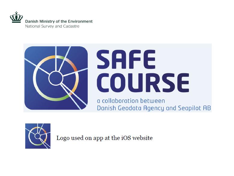
5 Our pilot project Our decision to launch the new leisure market ENC service draws from our recent experience with a pilot project arranged cooperatively by DGA, the Danish Maritime Authority, the Swedish Maritime Administration and the Swedish private company Seapilot AB. The pilot project tested an ENC service for leisure craft navigation and involved 132 test subjects, all of whom were experienced leisure craft mariners. The project tested the use of updated Danish and Swedish ENCs aboard the participating leisure craft. The ENCs were displayed on a tablet through a software solution developed by the participating Swedish company, and were used as the primary aid for navigation. Regular updates to the ENCs online were a perfunctory element of the technical system. The service and the technical setup proved to be a success in the pilot project.
6 Considerations with regards to the new ENC service National regulations and guidelines will not be revised even though they do not include any text regarding the use of ECS with official ENCs as primary means for navigation. No current recommendations regarding back-up arrangement if a ECS with official ENCs is applied as primary means of navigation. ENC will be available for 2 ECS on board the leisure craft. European standard EN with additional national requirements to be applied if the ECS is used as primary means of navigation. Certification of ECS software - Prerequisite that ECS software have been certified by a notified body. IHO S63 encryption / SENC encryption. Frequency of updates of the Danish ENCs National ENC folios and pricing
7 The implementation plan The initiative about the new ENC service will be implemented in close cooperation with the Danish Maritime Authority. We have been in contact with the leisure craft organizations in Denmark and they support the initiative about the new ENC service. The new ENC service will be implemented in close cooperation with the Danish leisure craft organizations. In the second half of 2015 we will initiate a dialogue with current and potential business partners and invite them to start an application process with the aim of become distributors of the new ENC service. The new Danish ENC should be operational from the beginning of 2016.


8 The coverage of the new ENC service The 3 arears are expected to cover all relevant ENC for the area.

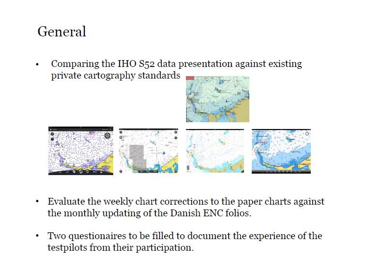
9 IHO standard: S52 cartography

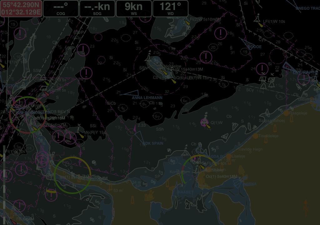
10 Day Dusk Night

11 New possibilities for the distributors AIS data Weather data


12 Missing elements for the new Danish ENC service More than 200 harbour plans 22 military- and 49 civilian shooting arears at sea have to be incorporated

13 Planed requirement to the distributor SIDE

14 Planed requirement to the distributor SIDE


15 Planed requirement to the distributor Some examples from the EULA SIDE

16 Planed requirement to the distributor SIDE
17 Draft overview of our maritime products from 2016 Segment 1 Segment 2 Segment 3 Users SOLAS ships, Commercial ships, Segment 2 and 3 Leisure crafts (below 24 meters) For non navigation Digital data ENC provided by IC-ENC VAR and ECDIS New ENC service provided by certified distributors Digital data provided by GST Analog data Official paper charts provided by GST and UKHO Official paper charts for the leisure market provided by certified distributors -
Nordic Hydrographic Commission 60th Conference - Stavanger - Norway April New national ENC service for leisure craft users
 Nordic Hydrographic Commission 60th Conference - Stavanger - Norway 11-13 April 2016 New national ENC service for leisure craft users New national ENC service for leisure craft users The aim of the new
56 th NHC Meeting May 21-23, 2012 Copenhagen, Denmark. Draft Minutes. [May 23, 2012]
![56 th NHC Meeting May 21-23, 2012 Copenhagen, Denmark. Draft Minutes. [May 23, 2012]](/thumbs/91/107654306.jpg "56 th NHC Meeting May 21-23, 2012 Copenhagen, Denmark. Draft Minutes. [May 23, 2012]") NHC/56 Draft Minutes 56 th NHC Meeting May 21-23, 2012 Copenhagen, Denmark Draft Minutes [May 23, 2012] Venue: Chair: Secretary: Participants: The Danish Royal Academy of Sciences and Letters, Klasseværelset
NHC/56 Draft Minutes 56 th NHC Meeting May 21-23, 2012 Copenhagen, Denmark Draft Minutes [May 23, 2012] Venue: Chair: Secretary: Participants: The Danish Royal Academy of Sciences and Letters, Klasseværelset
Appendix: References and glossary
 Appendix: References and glossary Facts about electronic charts and carriage requirements 2nd edition 2007 V/1 CONTENTS OF SECTION 5 Appendix: References and glossary References...................................................
DEVELOPMENT OF A DEFINITION FOR MSPS AND CONSIDERATION FOR THE HARMONIZATION OF THE FORMAT AND STRUCTURE OF MSPS
 INTERNATIONAL HYDROGRAPHIC ORGANIZATION E IMO/IHO HARMONIZATION GROUP ON DATA MODELLING Agenda item 5 15 September 2017 ENGLISH ONLY DEVELOPMENT OF A DEFINITION FOR MSPS AND CONSIDERATION FOR THE HARMONIZATION
63rd Meeting of the Nordic Hydrographic Commission Meeting 9 11 April 2019, Helsinki, Finland
 Agenda item D4. Denmark 63rd Meeting of the Nordic Hydrographic Commission Meeting 9 11 April 2019, Helsinki, Finland Paper for Consideration by NHC63 Digital products for the leisure market 1. Introduction
The human touch in technology. ECDIS ECS Conning screen Ship speed info system
 The human touch in technology ECDIS ECS Conning screen Ship speed info system Alphatron ALPHACHART T ECDIS Type approved ECDIS system powered by TRANSAS The ALPHACHART T is an advanced Electronic Chart
Korea s Strategy for e-navigation. SMART-Navigation. Presented by. Bu Young, Kim. 28 May Ministry of Oceans and Fisheries Republic of Korea
 Korea s Strategy for e-navigation SMART-Navigation Presented by Bu Young, Kim 28 May 2014 Ministry of Oceans and Fisheries Republic of Korea 1 2 3 4 5 6 1. SMART- Navigation? SMART-Navigation Korea s
MBSHC (Mediterranean and Black Seas Hydrographic Commission) XVII. conference, Greece Jun. 2011
 XVII. conference, Greece Jun. 2011") MBSHC (Mediterranean and Black Seas Hydrographic Commission) XVII. conference, Greece 01. 03. Jun. 2011 National report of SLOVENIA 01. May 2011 MBSHC report - SLOVENIA 1 0 Index 0 Index... 2 1 Hydrographic
MBSHC (Mediterranean and Black Seas Hydrographic Commission) XVII. conference, Greece 01. 03. Jun. 2011 National report of SLOVENIA 01. May 2011 MBSHC report - SLOVENIA 1 0 Index 0 Index... 2 1 Hydrographic
INTERNATIONAL STANDARD
 INTERNATIONAL STANDARD IEC 61174 Second edition 2001-10 Maritime navigation and radiocommunication equipment and systems Electronic chart display and information system (ECDIS) Operational and performance
GUIDELINES ON THE DESIGN AND USE OF PORTABLE PILOT UNITS INTERNATIONAL MARITIME PILOTS ASSOCIATION
 GUIDELINES ON THE DESIGN AND USE OF PORTABLE PILOT UNITS INTERNATIONAL MARITIME PILOTS ASSOCIATION WITH TECHNICAL INPUT FROM Comité International Radio-Maritime (CIRM) 2 FOREWORD With the increasing use
GUIDANCE FOR THE PRESENTATION AND DISPLAY OF AIS APPLICATION-SPECIFIC MESSAGES INFORMATION
 E 4 ALBERT EMBANKMENT LONDON SE1 7SR Telephone: +44 (0)20 7735 7611 Fax: +44 (0)20 7587 3210 Ref. T2-OSS/2.7.1 SN.1/Circ.290 2 June 2010 GUIDANCE FOR THE PRESENTATION AND DISPLAY OF AIS APPLICATION-SPECIFIC
NEW ZEALAND CHARTING AND NOTICES TO MARINERS
 General Information 1. In accordance with agreements between New Zealand, Australia (AUS) and the British Admiralty (BA) for reducing duplication in charting activities, New Zealand has a defined Charting
The ship RV Timba repairs are now almost complete and it is expected that come September 2014 the ship will be fully operational.
 Malawi National Report 2014 1 Malawi Hydrographic Office The assembly of the 70 ton ship RV Timba with the assistance of the French government in 1989 ushered in the commencement of modern hydrographic
Digital broadcasting systems under development within ITU-R of interest for the maritime community
 Digital broadcasting systems under development within ITU-R of interest for the maritime community Christian RISSONE ANFR rissone@anfr.fr IHO, WWNWS 5 Monaco, 2 nd October 2013 1 Background for the 500
USE OF THE RCDS MODE OF ECDIS (Submissions by Australia and Norway to IMO MSC/78)
") IHB File No. S3/8152 CIRCULAR LETTER 21/2004 22 March 2004 USE OF THE RCDS MODE OF ECDIS (Submissions by Australia and Norway to IMO MSC/78) Ref: 1. WEND Letter 1/2004, dated 1 st February 2004 2. IMO
IHB File No. S3/8152 CIRCULAR LETTER 21/2004 22 March 2004 USE OF THE RCDS MODE OF ECDIS (Submissions by Australia and Norway to IMO MSC/78) Ref: 1. WEND Letter 1/2004, dated 1 st February 2004 2. IMO
National Report of Finland
 National Report of Finland [31 August 2010] Executive Summary This Report gives an overview of the main activities of the Finnish Hydrographic Office (FHO) since the previous BSHC 14 th Conference. The
ROUTEING OF SHIPS, SHIP REPORTING AND RELATED MATTERS. New traffic separation schemes and two-way routes in Norra Kvarken
 E SUB-COMMITTEE ON SAFETY OF NAVIGATION 57th session Agenda item 3 NAV 57/3/7 11 March 2011 Original: ENGLISH ROUTEING OF SHIPS, SHIP REPORTING AND RELATED MATTERS New traffic separation schemes and two-way
National Report of Finland
 National Report of Finland 1. Finnish Hydrographic Office The Finnish Hydrographic Office is organized under The Finnish Transport Agency. The Finnish Transport Agency is responsible for the Finnish roads,
A Survey of Mariners' Opinions on Using Electronic Charts
 s i l s Note A Survey of Mariners' Opinions on Using Electronic Charts Igor Karnicnik, M.Sc., Geodetic Institute of Slovenia, Slovenia. A new component of modern shipborne navigation equipment is the Electronic
Challenges and opportunities in the e-navigation Development. Actual projects.
 Challenges and opportunities in the e-navigation Development. Actual projects. John Erik Hagen, Regional Director Oslo, September 2018 What is e-navigation? Efficient transfer of marine information and
17 th CHRIS Meeting Rostock, Germany, 5-9 September Report of IHO-IEC Harmonization Group on Marine Information Objects (HGMIO
 17 th CHRIS Meeting Rostock, Germany, 5-9 September 2004 CHRIS17-7A rev.1 Report of IHO-IEC Harmonization Group on Marine Information Objects (HGMIO Lee Alexander, University of New Hampshire (Chair, HGMIO)
Draft performance standards for shipborne "BeiDou" BDS receiver equipment
 IMO NAV 59 Summary Report Introduction The 59th session of the IMO Sub-Committee on Safety of Navigation (NAV 59) was held from 2nd to 6th September 2013, at the IMO headquarters in London. This briefing
JCG GMDSS Symposium NAVDAT : Navigational Data
 JCG GMDSS Symposium 2013 NAVDAT : Navigational Data - System Presentation - Pascal OLIVIER NAVDAT Presentation Page 1/35 From analog to digital in maritime radio communications The current analog radio
e-navigation Progress and trends: the IHO perspective
 International Hydrographic Organization e-navigation Progress and trends: the IHO perspective Gilles Bessero Director, IHO International Hydrographic Organization Intergovernmental consultative and technical
UK Radio Interface Requirement 2020 for Radar 9 GHz (non-solas) in the maritime radionavigation service
 in the maritime radionavigation service") UK Radio Interface Requirement 2020 for Radar 9 GHz (non-solas) in the maritime radionavigation service (Version 1.0) 98/34/EC Notification Number: 2000/246/UK Published: 4 January 2001 Page 1 References
UK Radio Interface Requirement 2020 for Radar 9 GHz (non-solas) in the maritime radionavigation service (Version 1.0) 98/34/EC Notification Number: 2000/246/UK Published: 4 January 2001 Page 1 References
THE ELECTRONIC CHART DISPLAY AND INFORMATION SYSTEM (ECDIS) IN CHINA
 IN CHINA") International Hydrographic 'Review, Monaco, LXIX(2), September 1992 THE ELECTRONIC CHART DISPLAY AND INFORMATION SYSTEM (ECDIS) IN CHINA by The Research Group on ECDIS 1 Abstract This paper presents a
International Hydrographic 'Review, Monaco, LXIX(2), September 1992 THE ELECTRONIC CHART DISPLAY AND INFORMATION SYSTEM (ECDIS) IN CHINA by The Research Group on ECDIS 1 Abstract This paper presents a
RESOLUTION MSC.230(82) (adopted on 5 December 2006) ADOPTION OF AMENDMENTS TO THE EXISTING MANDATORY SHIP REPORTING SYSTEM "IN THE STOREBÆLT (GREAT
 (adopted on 5 December 2006) ADOPTION OF AMENDMENTS TO THE EXISTING MANDATORY SHIP REPORTING SYSTEM IN THE STOREBÆLT (GREAT") MSC 82/24/Add.2 RESOLUTION MSC.230(82) MANDATORY SHIP REPORTING SYSTEM IN THE STOREBÆLT (GREAT BELT) TRAFFIC AREA THE MARITIME SAFETY COMMITTEE, RECALLING Article 28(b) of the Convention on the International
MSC 82/24/Add.2 RESOLUTION MSC.230(82) MANDATORY SHIP REPORTING SYSTEM IN THE STOREBÆLT (GREAT BELT) TRAFFIC AREA THE MARITIME SAFETY COMMITTEE, RECALLING Article 28(b) of the Convention on the International
E-BOOK / MARITIME PLOTTING STUDY USER MANUAL
 27 December, 2017 E-BOOK / MARITIME PLOTTING STUDY USER MANUAL Document Filetype: PDF 435.34 KB 0 E-BOOK / MARITIME PLOTTING STUDY USER MANUAL National Open University of Nigeria University Village Plot
There is also need to acquire equipment such as GPS, Echo-Sounder and update data acquisition and processing software among other requirements.
 Malawi National Report 2016 1 Malawi Hydrographic Office The mandate of the Hydrographic office is to carry out surveys of Lake Malawi including the lesser lakes of Malombe, Chilwa and Chiuta as well as
RESOLUTION MSC.21(59) (adopted on 22 May 1991)
 (adopted on 22 May 1991)") Title RESOLUTIONs / MSC Resolutions / Res.MSC.21(59) RESOLUTION MSC.21(59) (adopted on 22 May 1991) ADOPTION OF AMENDMENTS TO THE INTERNATIONAL CONVENTION ON STANDARDS OF TRAINING, CERTIFICATION AND WATCHKEEPING
Title RESOLUTIONs / MSC Resolutions / Res.MSC.21(59) RESOLUTION MSC.21(59) (adopted on 22 May 1991) ADOPTION OF AMENDMENTS TO THE INTERNATIONAL CONVENTION ON STANDARDS OF TRAINING, CERTIFICATION AND WATCHKEEPING
INTERNATIONAL STANDARD
 INTERNATIONAL STANDARD IEC 61174 Edition 4.0 2015-08 colour inside Maritime navigation and radiocommunication equipment and systems Electronic chart display and information system (ECDIS) Operational and
Technology evolution for future radiocommunication and navigation
 Technology evolution for future radiocommunication and navigation Frances Baskerville (Secretary General) Richard Doherty (Deputy Secretary General) CIRM Who we are and what we do What is CIRM? The Worldwide
Myanmar Naval Hydrographic Centre. National Report for 13 th North Indian Ocean Hydrographic Commission Meeting
 Myanmar Naval Hydrographic Centre National Report for 13 th North Indian Ocean Hydrographic Commission Meeting Yangon, Myanmar 19 th 22 nd February 2013 CONTENT 1. Myanmar Naval Hydrographic Centre 2.
United States-Canada Hydrographic Commission (USCHC) Meeting
 Meeting") International Hydrographic Organization United States - Canada Hydrographic Commission International Hydrographic Organization (IHO) United States-Canada Hydrographic Commission (USCHC) Meeting 16 May
International Hydrographic Organization United States - Canada Hydrographic Commission International Hydrographic Organization (IHO) United States-Canada Hydrographic Commission (USCHC) Meeting 16 May
FOREWORD. IHO S-100 Working Group
 IHO International Hydrographic Organization KHOA Korea Hydrographic and Oceanographic Agency MUCH MORE THAN JUST NAUTICAL CHARTS IHO UNIVERSAL HYDROGRAPHIC data MODEL This document was produced with the
Potential Markets for Electronic Charts
 Potential Markets for Electronic Charts Captain Evgeny Komrakov, Transas Marine Ltd Two main components are required before paper charts can be replaced on a ship's bridge with their digital equivalents.
Introductory remarks
 Introductory remarks This document is a draft of a permit for Gaz System to construct a natural gas pipeline on the Danish continental shelf in the Baltic Sea. It should be emphasised that it has not yet
CLIA Member Experience Implementation of the Polar Code. Kierstin M. Del Valle February 22, 2018
 CLIA Member Experience Implementation of the Polar Code Kierstin M. Del Valle February 22, 2018 Overview Nature of operations General feedback Specific considerations Experience from V.Ships Leisure Next
IHO Colours & Symbols Maintenance Working Group (C&SMWG) 15th Meeting, BSH, Rostock, Germany, 2-4 May 2005
 15th Meeting, BSH, Rostock, Germany, 2-4 May 2005") CSMWG15-INF2 IHO Colours & Symbols Maintenance Working Group (C&SMWG) 15th Meeting, BSH, Rostock, Germany, 2-4 May 2005 Ref: HA405/004/033-01 NOTE: this is an internal document of the UKHO and is supplied
CSMWG15-INF2 IHO Colours & Symbols Maintenance Working Group (C&SMWG) 15th Meeting, BSH, Rostock, Germany, 2-4 May 2005 Ref: HA405/004/033-01 NOTE: this is an internal document of the UKHO and is supplied
World-Wide Navigational Warning Service Sub-Committee WWNWS-5 Monaco, 1-4 October S-100 Basics Background Brief
 International Hydrographic Organization World-Wide Navigational Warning Service Sub-Committee WWNWS-5 Monaco, 1-4 October 2013 S-100 Basics Background Brief Gilles Bessero 15:29 1 S-100 Basics S-100 -
Marine business, TransponderTech Security and Traffic Management. Peter Bergljung 22 may 2012 European Maritime Day (EMD 2012), Issue A
, Issue A") Marine business, TransponderTech Security and Traffic Management Peter Bergljung 22 may 2012 European Maritime Day (EMD 2012), Issue A Agenda Innovations in Maritime Traffic Management Saabs perspective
Marine business, TransponderTech Security and Traffic Management Peter Bergljung 22 may 2012 European Maritime Day (EMD 2012), Issue A Agenda Innovations in Maritime Traffic Management Saabs perspective
MARINE ELECTRONIC HIGHWAY IN STRAITS OF MALACCA AND SINGAPORE. Development of Supporting Element for Future & Sustainable Operation
 COOPERATION FORUM UNDER THE COOPERATIVE MECHANISM ON SAFETY OF NAVIGATION AND ENVIRONMENTAL PROTECTION IN THE STRAITS OF MALACCA AND SINGAPORE 7th SESSION Agenda Item... CF 7/... 22-23 September 2014 Original.
A guideline for establishing feature and symbol standard management system for national HOs
 A guideline for establishing feature and symbol standard management system for national HOs Joint 26th TSMAD and 5th DIPWG Meeting Silver Spring, Maryland, USA(10-14 June 2013) Republic of Korea (ROK)
Maritime Administration of Latvia (MAL) Hydrographic Service National Report to Baltic Sea Hydrographic Commission
 Hydrographic Service National Report to Baltic Sea Hydrographic Commission") Maritime Administration of Latvia (MAL) Hydrographic Service National Report to Baltic Sea Hydrographic Commission Executive summary 2016 The Report gives an overview of the main activities of Hydrographic
Maritime Administration of Latvia (MAL) Hydrographic Service National Report to Baltic Sea Hydrographic Commission Executive summary 2016 The Report gives an overview of the main activities of Hydrographic
... Salient Ocean Issues that have arisen during 2002
 ... As reported in paragraph 62 of the resolution Oceans and the law of the seas, we are especially pleased with the focus for this meeting, given that protecting vulnerable marine ecosystems and safety
This document describes the IMO e-navigation strategy and recommends a Danish strategy for e-navigation and associated action plan.
 Strategy and action plan for e-navigation This document describes the IMO e-navigation strategy and recommends a Danish strategy for e-navigation and associated action plan. Our reference: JKJ/MAF Case
COMMUNICATIONS FOR MARITIME SAFETY AND EFFICIENCY. Francis Zachariae, Secretary-General, IALA
 COMMUNICATIONS FOR MARITIME SAFETY AND EFFICIENCY Francis Zachariae, Secretary-General, IALA IALA and its Purpose Non profit, international technical association established in 1957 Two Goals aimed at
EGYPTIAN HYDROGRAPHIC DEPARTMENT THE EGYPTIAN HYDROGRAPHIC FRAMEWORK
 gvt THE EGYPTIAN HYDROGRAPHIC FRAMEWORK The roles of a national Hydrographic Service can be summarized in collecting georeferenced data through systematic surveys at sea and along the coast related to:
RESOLUTION MSC.116(73) (adopted on 1 December 2000) PERFORMANCE STANDARDS FOR MARINE TRANSMITTING HEADING DEVICES (THDs)
 (adopted on 1 December 2000) PERFORMANCE STANDARDS FOR MARINE TRANSMITTING HEADING DEVICES (THDs)") MSC 73/21/Add.3 RESOLUTION MSC.116(73) THE MARITIME SAFETY COMMITTEE, RECALLING Article (28(b) of the Convention on the International Maritime Organization concerning the functions of the Committee, RECALLING
MSC 73/21/Add.3 RESOLUTION MSC.116(73) THE MARITIME SAFETY COMMITTEE, RECALLING Article (28(b) of the Convention on the International Maritime Organization concerning the functions of the Committee, RECALLING
UNITED KINGDOM NATIONAL REPORT
 UNITED KINGDOM NATIONAL REPORT TO THE 10 TH MACHC HYDROGRAPHIC COMMISSION MEETING Barbados 4 5 th November 2009 This report supplements the UK Generic National Report 2009, posted on the UKHO website (www.ukho.gov.uk),
Service instance description for the Baltic Navigational Warning Service
 Service instance description for the Baltic Navigational Warning Service 2018-01-18 Document status Authors Name Björn Andreasson Mikael Olofsson Organisation Swedish Maritime Administration Swedish Maritime
11 th CHRIS MEETING IHB, Monaco, November Draft - - -
 CHRIS/11/16A 11 th CHRIS MEETING IHB, Monaco, 16-18 November 1999 - - - Draft - - - Workshop on Development of Marine Information Objects (MIO) for ECDIS Burlington, Ontario, Canada 8-9 November 1999 Record
IHO S-100 FRAMEWORK - BASELINE STANDARD FOR E- NAVIGATION MARITIME SERVICES
 UNDERWAY (24 26 January 2018) IHO S-100 FRAMEWORK - BASELINE STANDARD FOR E- NAVIGATION MARITIME SERVICES Abri Kampfer Director, IHO Copenhagen, Denmark (24 26 January 2018) What is the?. intergovernmental
IMO. Resolution A.977(24) Adopted on 1 December 2005 (Agenda item 9) SHIPS ROUTEING
 Adopted on 1 December 2005 (Agenda item 9) SHIPS ROUTEING") INTERNATIONAL MARITIME ORGANIZATION E IMO ASSEMBLY 24th session Agenda item 9 A 24/Res.977 27 January 2006 Original: ENGLISH Resolution A.977(24) Adopted on 1 December 2005 (Agenda item 9) SHIPS ROUTEING
INTERNATIONAL MARITIME ORGANIZATION E IMO ASSEMBLY 24th session Agenda item 9 A 24/Res.977 27 January 2006 Original: ENGLISH Resolution A.977(24) Adopted on 1 December 2005 (Agenda item 9) SHIPS ROUTEING
Maritime Administration of Latvia Hydrographic Service National Report to Baltic Sea Hydrographic Commission
 Maritime Administration of Latvia Hydrographic Service National Report to Baltic Sea Hydrographic Commission Executive summary 2017 The Report gives an overview of the main activities of Hydrographic Service
INTERNATIONAL STANDARD
 INTERNATIONAL STANDARD IEC 60936-2 First edition 1998-10 Maritime navigation and radiocommunication equipment and systems Radar Part 2: Shipborne radar for high-speed craft (HSC) Methods of testing and
The Present Status of Small Scale ENC Coverage with Respect to the Allocation of cells to Usage Bands 1 (Overview) and 2 (General).
 and 2 (General).") CHRIS19-06.1E 19 th CHRIS MEETING Rotterdam, Netherlands, 5-9 November 2007 The Present Status of Small Scale ENC Coverage with Respect to the Allocation of cells to Usage Bands 1 (Overview) and 2 (General).
CHRIS19-06.1E 19 th CHRIS MEETING Rotterdam, Netherlands, 5-9 November 2007 The Present Status of Small Scale ENC Coverage with Respect to the Allocation of cells to Usage Bands 1 (Overview) and 2 (General).
ITU matters, including Radiocommunication ITU-R Study Group matters (Agenda item 5)
") IMO NAV 59 Agenda preview Introduction The 59th session of the IMO Sub-Committee on Safety of Navigation (NAV 59) will be held from 2nd to 6th September 2013, at the IMO headquarters in London. This briefing
IMO NAV 59 Agenda preview Introduction The 59th session of the IMO Sub-Committee on Safety of Navigation (NAV 59) will be held from 2nd to 6th September 2013, at the IMO headquarters in London. This briefing
Production of Electronic Chart using updated survey data for EL-Arish harbor
 ARAB ACADEMY FOR SCIENCE AND TECHNOLOGY AND MARITIME TRANSPORT Alexandria, Egypt Production of Electronic Chart using updated survey data for EL-Arish harbor Submitted By ASHRAF NABIL HASSAN EL-ASSAL B.SC.
E-Navigation: Opening the door to the future
 International Association of Marine Aids to Navigation and Lighthouse Authorities E-Navigation: Opening the door to the future E-Navigation Underway North America November 2018 Secretary-General Francis
MesoAmerican - Caribbean Sea Hydrographic Commission. International Hydrographic Organization DRAFT AGENDA DAY 1
 International Hydrographic Organization MesoAmerican-Caribbean Sea Hydrographic Commission DAY 1 DRAFT AGENDA MesoAmerican - Caribbean Sea Hydrographic Commission ELECTRONIC CHART WORKING GROUP MEETING
GUIDANCE ON THE COSPAS-SARSAT INTERNATIONAL 406 MHz BEACON REGISTRATION DATABASE
 E ALBERT EMBANKMENT LONDON SE1 7SR Telephone: +44 (0)20 7735 7611 Fax: +44 (0)20 7587 3210 GUIDANCE ON THE COSPAS-SARSAT INTERNATIONAL 406 MHz BEACON REGISTRATION DATABASE MSC.1/Circ.1210/Rev.1 21 November
IMO ACTIVITIES AFFECTING HSSC
 HSSC1-04.2A rev3 1 st HSSC MEETING Singapore, 22-24 October 2009 Paper for Consideration by HSSC IMO ACTIVITIES AFFECTING HSSC Submitted by: Executive Summary: Related Documents: IHB This paper summarizes
MSI SELF ASSESSMENT - Baltic Sea Sub-area (BALTICO) of Navarea I, Submitted by Sweden
 of Navarea I, Submitted by Sweden") IHO Commission on the Promulgation of Radio Navigational Warnings (CPRNW) International Hydrographic Bureau, Monaco 11 14 Sep 2007 CPRNW 9-3.2.1-I-subarea Origin: Sweden MSI SELF ASSESSMENT - Baltic Sea
IHO Commission on the Promulgation of Radio Navigational Warnings (CPRNW) International Hydrographic Bureau, Monaco 11 14 Sep 2007 CPRNW 9-3.2.1-I-subarea Origin: Sweden MSI SELF ASSESSMENT - Baltic Sea
About BALTICO. Contact The BALTICO-office could be contacted as follows:
 1 (5) Operations Administrator, Telephone Svante Håkansson, +46 11 19 10 07 Your date erence Your reference BALTICO MEETING 2004 About BALTICO Tasks The BALTICO-office at the Swedish Maritime Administration
This is a preview - click here to buy the full publication INTERNATIONAL. Edition 1:1999 consolidated with amendment 1:2002
 INTERNATIONAL IEC STANDARD 60936-1 Edition 1.1 2002-08 Edition 1:1999 consolidated with amendment 1:2002 Maritime navigation and radiocommunication equipment and systems Radar Part 1: Shipborne radar Performance
Paper for Consideration by S-100WG3. Report on S-100 Sea trial of KHOA
 S-100WG3-8.1 Paper for Consideration by S-100WG3 Report on S-100 Sea trial of KHOA Submitted by: Executive Summary: Related Documents: Related Projects: Republic of Korea (KHOA) This paper reports the
UNITED KINGDOM NATIONAL REPORT
 Page 1 of 9 UNITED KINGDOM NATIONAL REPORT TO THE 11 th MEETING OF THE MESO AMERICAN AND CARIBBEAN SEA HYDROGRAPHIC COMMISSION Paramaribo, Suriname 8 th 12 th November 2010 NOTE: This report supplements
REGIONAL HYDROGRAPHIC COMMISSIONS CAPACITY BUILDING NSHC NHC BSHC USCHC USCHC EAtHC MBSHC RSAHC EAHC MACHC NIOHC SWPHC SEPHC (SWAtHC) SAIHC SWPHC HCA
 SAIHC SWPHC HCA") CONTENT THE VALUE of HYDROGRAPHIC INFORMATION and its INFLUENCE By THE INTERNATIONAL HYDROGRAPHIC ORGANIZATION I.II.III.IV.V.- INTRODUCTION HYDROGRAPHIC INFORMATION OF MAIN VALUE ACTIVITIES THAT BENEFIT
CONTENT THE VALUE of HYDROGRAPHIC INFORMATION and its INFLUENCE By THE INTERNATIONAL HYDROGRAPHIC ORGANIZATION I.II.III.IV.V.- INTRODUCTION HYDROGRAPHIC INFORMATION OF MAIN VALUE ACTIVITIES THAT BENEFIT
Introducing The World s First DGPS/AIS Navigation System!
 Introducing The World s First DGPS/AIS Navigation System! MX420 Navigation System: The Most Advanced DGPS/AIS Navigation Solution. MX420AIS Pioneering The Future Standards Of Navigation All navigation
DOWNLOAD OR READ : THE NAUTICAL CHART PDF EBOOK EPUB MOBI
 DOWNLOAD OR READ : THE NAUTICAL CHART PDF EBOOK EPUB MOBI Page 1 Page 2 the nautical chart the nautical chart pdf the nautical chart NOAA ENCs (ENC): Vector files of chart features and available in S-57
CPMR MARITIME AGENDA. CPMR Political Bureau. 12 June 2015 Heraklion
 CPMR MARITIME AGENDA CPMR Political Bureau 12 June 2015 Heraklion CPMR maritime guidelines Based on Umea statement (September 2014) Updated now : see CPMR maritime agenda (version June 2015) Sea-basin
IMO. Resolution A.954(23) Adopted on 5 December 2003 (Agenda item 17) PROPER USE OF VHF CHANNELS AT SEA
 Adopted on 5 December 2003 (Agenda item 17) PROPER USE OF VHF CHANNELS AT SEA") INTERNATIONAL MARITIME ORGANIZATION E IMO ASSEMBLY 23rd session Agenda item 17 A 23/Res.954 26 February 2004 Original: ENGLISH Resolution A.954(23) Adopted on 5 December 2003 (Agenda item 17) PROPER USE
INTERNATIONAL MARITIME ORGANIZATION E IMO ASSEMBLY 23rd session Agenda item 17 A 23/Res.954 26 February 2004 Original: ENGLISH Resolution A.954(23) Adopted on 5 December 2003 (Agenda item 17) PROPER USE
(P.27)
") (P.27) 27 7 210 120 8 * Navigation and Anchoring Prohibited Area has been changed since June, 2017. 9 Port of Osaka The Guidelines of Measures for preventing Typhoon Disaster ( Objective )
(P.27) 27 7 210 120 8 * Navigation and Anchoring Prohibited Area has been changed since June, 2017. 9 Port of Osaka The Guidelines of Measures for preventing Typhoon Disaster ( Objective )
IALA S WORK IN E-NAVIGATION. Michael Card
 IALA S WORK IN E-NAVIGATION Michael Card e-navigation origins The early work of IALA on e-navigation Multiple Initiatives EfficienSea 2 STM Validation IHO S-100 and IALA S-200 Smart Navigation VDES development
Market strategy update in Maritime segment. This presentation can be interpreted only together with the oral comments accompanying it
 Market strategy update in Maritime segment This presentation can be interpreted only together with the oral comments accompanying it 2 Market sub-segments and applications Recreational navigation: GNSS
1 st MEETING OF THE IHO COUNCIL
 C1-3.1 1 st MEETING OF THE IHO COUNCIL Monaco, 17-19 October 2017 REPORT OF THE IHO HYDROGRAPHIC SERVICES AND STANDARDS COMMITTEE C1-3.1 - P a g e 3 REPORT OF THE HYDROGRAPHIC STANDARDS AND SERVICES COMMITTEE
EUROPEAN COMMISSION DIRECTORATE-GENERAL FOR MOBILITY AND TRANSPORT PASSENGER SHIP SAFETY EXPERT SUB-GROUP
 EUROPEAN COMMISSION DIRECTORATE-GENERAL FOR MOBILITY AND TRANSPORT i Directorate D - Logistics, maritime & land transport and passenger rights D.2 - Maritime safety Brussels, MOVE D2 (2016) PASSENGER SHIP
COUNTRIES SURVEY QUESTIONNAIRE
 COUNTRIES SURVEY QUESTIONNAIRE The scope of part A of this questionnaire is to give an opportunity to the respondents to provide overall (generic) details on their experience in the safety investigation
Government Agency Perspectives & Initiatives Canadian Coast Guard Laurent Tardif, Director, Safe Shipping
 Unclassified Government Agency Perspectives & Initiatives Canadian Coast Guard Laurent Tardif, Director, Safe Shipping Mariner s Workshop January 23, 2019 1 Overview 1 Context 2 Marine Fees 3 4 5 Update
MARITIME SAFETY INFORMATION
 Introduction 1. Maritime Safety Information (MSI) is defined as navigational and meteorological warnings, meteorological forecasts, and other urgent safety-related messages. This information is of vital
COMDTPUB P16700A NVIC September 2001 NAVIGATION AND VESSEL INSPECTION CIRCULAR NO Subj: APPROVAL OF NAVIGATION EQUIPMENT FOR SHIPS
 U.S. Department of Transportation,.f;'fiiif.'Ii United States Coast Guard Commandant, United States Coast Guard 2100 Second Street, S.W. Washington, DC 20593-0001 Staff Symbol: (G-MSE-4) Phone: (202) 267-1444
ECDIS ENC Accuracy. Contents. Introduction LOSS PREVENTION BRIEFING FOR NORTH MEMBER SHIPS / MAY Introduction... 1
 LOSS PREVENTION BRIEFING FOR NORTH MEMBER SHIPS / MAY 2017 ECDIS ENC Accuracy Contents Introduction... 1 ECDIS Specific Familiarisation... 2 IHO S-57... 2 ENC Data Source... 2 CATZOC and M_QUAL... 2 CATZOC
IMO RESOLUTION A.1001(25) Adopted on 29 November 2007 (Agenda item 9)
 Adopted on 29 November 2007 (Agenda item 9)") INTERNATIONAL MARITIME ORGANIZATION E IMO ASSEMBLY 25th session Agenda item 9 A 25/Res.1001 3 January 2008 Original: ENGLISH RESOLUTION A.1001(25) Adopted on 29 November 2007 (Agenda item 9) CRITERIA FOR
INTERNATIONAL MARITIME ORGANIZATION E IMO ASSEMBLY 25th session Agenda item 9 A 25/Res.1001 3 January 2008 Original: ENGLISH RESOLUTION A.1001(25) Adopted on 29 November 2007 (Agenda item 9) CRITERIA FOR
TECHNICAL COMMITTEE 80: MARITIME NAVIGATION AND RADIOCOMMUNICATION EQUIPMENT AND SYSTEMS INTERNATIONAL ELECTROTECHNICAL COMMISSION
 TECHNICAL COMMITTEE 80: MARITIME NAVIGATION AND RADIOCOMMUNICATION EQUIPMENT AND SYSTEMS INTERNATIONAL ELECTROTECHNICAL COMMISSION IEC TECHNICAL COMMITTEE 80: MARITIME NAVIGATION AND RADIOCOMMUNICATION
TRANSAS. the first resident of Special Economic Zone NEUDORF
 TRANSAS the first resident of Special Economic Zone NEUDORF Transas Group Transas Group was founded in 1990 The number of Transas employees exceeds 1200 people worldwide The Company s annual turnover exceeds
PROGRESS UPDATE AND FUTURE DIRECTIONS OF THE MARINE ELECTRONIC HIGHWAY (MEH)
") PROGRESS UPDATE AND FUTURE DIRECTIONS OF THE MARINE ELECTRONIC HIGHWAY (MEH) BACKGROUND 1. The Marine Electronic Highway Demonstration Project (MEH DP) was a 4- year regional project in the Straits of
PROGRESS UPDATE AND FUTURE DIRECTIONS OF THE MARINE ELECTRONIC HIGHWAY (MEH) BACKGROUND 1. The Marine Electronic Highway Demonstration Project (MEH DP) was a 4- year regional project in the Straits of
INTERNATIONAL STANDARD
 INTERNATIONAL STANDARD IEC 61924 First edition 2006-05 Maritime navigation and radiocommunication equipment and systems Integrated navigation systems Operational and performance requirements, methods of
The 2 nd Meeting of the Arctic Shipping Best Practice Information Forum May, 208 Irish Cultural Centre, London, UK
 The 2 nd Meeting of the Arctic Shipping Best Practice Information Forum 14-15 May, 208 Irish Cultural Centre, London, UK Meeting Summary The 2 nd Meeting of the Arctic Shipping Best Practice Information
ETSI Workshop "Future Evolution of Marine Communication Radar evolution for inland waterways navigation Mario Walterfang
 Mario Walterfang Fachstelle der WSV für Verkehrstechniken (FVT) Federal German Waterways and Shipping Administration Sophia Antipolis, France, November 7th, 2017 Overview Milestones in river radar evolution
Lecture-1 CHAPTER 2 INTRODUCTION TO GPS
 Lecture-1 CHAPTER 2 INTRODUCTION TO GPS 2.1 History of GPS GPS is a global navigation satellite system (GNSS). It is the commonly used acronym of NAVSTAR (NAVigation System with Time And Ranging) GPS (Global
12808/16 PG/cb 1 DG G 3 C
 Council of the European Union Brussels, 30 September 2016 (OR. en) 12808/16 ESPACE 46 RECH 283 COMPET 515 TRANS 368 TELECOM 184 'I/A' ITEM NOTE From: To: Subject: General Secretariat of the Council Permanent
IALA Guideline No. XXXX. The establishment of AIS as an Aid to Navigation. Edition 1.3. [Date] Working vs / Working 7.
![IALA Guideline No. XXXX. The establishment of AIS as an Aid to Navigation. Edition 1.3. [Date] Working vs / Working 7.](/thumbs/74/71399138.jpg "IALA Guideline No. XXXX. The establishment of AIS as an Aid to Navigation. Edition 1.3. [Date] Working vs / Working 7.") ANM12/Output/10 International Association of Marine Aids to Navigation and Lighthouse Authorities AISM Association of Internationale de Signalisation Maritime IALA IALA Guideline No. XXXX On The establishment
ANM12/Output/10 International Association of Marine Aids to Navigation and Lighthouse Authorities AISM Association of Internationale de Signalisation Maritime IALA IALA Guideline No. XXXX On The establishment
GENERAL DESCRIPTION OF THE CMC SERVICES
 STANDARD FOR CERTIFICATION No.1.1 GENERAL DESCRIPTION OF THE CMC SERVICES MAY 2007 FOREWORD (DNV) is an autonomous and independent foundation with the objectives of safeguarding life, property and the
E-NAVIGATION AND BEYOND
 E-NAVIGATION AND BEYOND The Work of IALA e-navigation Committee and Future CDR. Hideki NOGUCHI, Chair, IALA ENAV Committee e-navigation (ENAV) Committee Established in 2010 by merging R-NAV and AIS Committee
Mathematics Success Grade 6
 T428 Mathematics Success Grade 6 [OBJECTIVE] The students will plot ordered pairs containing rational values to identify vertical and horizontal lengths between two points in order to solve real-world
PRODUCTS AND SERVICES FOR THE MARITIME COMMUNITY. Ed Martin, Chief Customer Affairs Branch Navigation Services Division Monday, 27 October, 2008
 PRODUCTS AND SERVICES FOR THE MARITIME COMMUNITY Ed Martin, Chief Customer Affairs Branch Navigation Services Division Monday, 27 October, 2008 Coral Reef Conservation International Collaboration Marine
MONTHLY MEETING REPORTS JANUARY 2018
 8 th e-navigation Underway International Conference MS Pearl Seaways, at Sea, 24 to 26 January Contribution to the IHO Work Programme 2018 Task 2.1.6.1 E navigation Underway International 2018 The 8 th
ESA IAP Blue Belt demonstration project:
 Page 1 ESA IAP Blue Belt demonstration project: supporting the European Maritime Safety Agency (EMSA) Blue Belt Project, by providing a service based on satellite based AIS data complementing the terrestrial
The Pros and Cons of using ECDIS as Primary Means of Navigation
 Sections 1 2 Company introduction The PROS of Using ECDIS and ENCs 3 The CONS of Using ECDIS and ENCs 4 Why we have choose NAVTOR Company Introduction Corporate Overview. is a Ship Management Company established