EnMAP Research, Mission Synergies & Future Perspectives
|
|
|
- Charlotte Flynn
- 5 years ago
- Views:
Transcription
1 EnMAP Research, Mission Synergies & Future Perspectives Luis Guanter German Research Centre for Geosciences (GFZ) Helmholtz Centre Potsdam Section 1.4: Remote Sensing

2 Imaging Spectroscopy (aka Hyperspectral Remote Sensing) Spectroscopy study of the interaction between matter and radiated energy specifically looking at what wavelengths of light are emitted or absorbed by an object in order to characterize materials. Remote sensing & imaging spectroscopy: airborne or spaceborne imaging spectrometers measuring the spectrum of solar radiation reflected by Earth materials.


3 Image Formation in Hyperspectral Remote Sensing Pushbroom Imaging Principle Dispersive element Grating 2-D Detector Array + + Prism Hyperspectral 3-D Cube Pre-processing

4 Imaging Spectroscopy & Science Quantitative mapping for a wide range of research fields Great potential for new (and unexpected!) applications
5 International Scenario of Spaceborne Imaging Spectroscopy The not-so-happy story of spaceborne imaging spectroscopy for Earth observation: Current missions So-called technology demonstrators Low data quality and limited acquisition capability Examples: EO-1 Hyperion (USA NASA, 2000) & CHRIS/PROBA (UK/ESA, 2001), designed for a 1-year lifetime!
: Launched in 2001, still operating Conceived as a Technology")
 per acquisition 13 km swath, up")
6 Space-based imaging spectroscopy CHRIS-PROBA The CHRIS/PROBA system (UK/ESA): Launched in 2001, still operating Conceived as a Technology Demonstrator Hyperspectral/multiangular system VNIR: nm, up to 62 bands 5 Observation angles (0, ±36, ±55 ) per acquisition 13 km swath, up to 17 m per pixel
7 EO-1 Hyperion Technology demonstration project operated by NASA- GSFC and USGS. Launched in 2000, still operating. Operations are likely to be stopped in Specifications: Swath = 7.5 km Ground sampling distance = 30m Spectral sampling ~10nm Spectral coverage bands 70 VNIR nm 172 SWIR nm Nominal SNR: 160 VNIR, 40 SWIR Only spaceborne imaging spectrometer ever providing VNIR-SWIR data!!

8 EO-1 Hyperion, Acquisitions Hyperion Imagery in the USGS EDC Archive Jan 1, 2001 through April 21, 2005 Since June 2009 Open data policy, acquisitions on-demand at no-cost
 There are more imaging spectrometers for planetary observation than for Earth observation!")
9 International Scenario of Spaceborne Imaging Spectroscopy The not-so-happy story of spaceborne imaging spectroscopy for Earth observation: Most of imaging spectroscopy applications rely on airborne spectrometers heritage from AVIRIS (NASA-JPL, since 1987) There are more imaging spectrometers for planetary observation than for Earth observation! EnMAP (launch 2018) expected to fill this gap in operational spaceborne imaging spectroscopy


10 The EnMAP Program EnMAP: Environmental Mapping and Analysis Program Spaceborne mission aimed at reducing current limitations in global imaging spectroscopy data Open data policy Core funding from the German Federal Ministry of Economics and Technology Currently under construction phase, launch end 2018

11 EnMAP Main Mission Parameters Guanter et al., Remote Sensing, 2015 Push-broom imaging spectrometer Sun-synchronous orbit, 11h LTDN Spectral range VNIR: 420 nm to 1000 nm SWIR: 900 nm to 2450 nm Spectral sampling distance VNIR ~6.5 nm SWIR ~10 nm Ground sampling distance 30 m Data acquisition Swath width 30 km 1000 km/orbit 5000 km/day Revisit time 27 d nadir 4 d with 30º across-track pointing Mission lifetime 5 years

12 Key mission characteristics for scientific use of EnMAP Up to 4 days revisit time with tilted obs. Ground segment distributing geometrically-corrected reflectance data Co-existence with Sentinel-2 & Landsat-8 From 30 to 1000 km Open data policy FWHM ~7 nm FWHM ~12 nm 30 m pixel 30 km swath High-performance imaging spectroscopy system for Earth observation

 Calibrated Radiance Geographical projection Surface")
13 EnMAP Data Products User products Level 0 data - digital number data Radiometric correction Level 1B data - radiometrically calibrated radiance data Geometric correction Level 1C data - radiometrically calibrated radiance data in a map projection Atmospheric correction Level 2 data Surface reflectance data in a map projection Raw data (digital numbers) Calibrated Radiance Geographical projection Surface reflectance
14 EnMAP acquisition plan EnMAP Acquisitions: Restricted to 1000 km/orbit and 5000 km/day Based on user requests Daily acquisition plan driven by priorities and cloud probability


15 GFZ Potsdam EnMAP Science Advisory Group (EnSAG) DLR Bonn Christian Chlebek Godela Roßner Stefanie Schrader Luis Guanter Hermann Kaufmann LMU München Karl Segl Saskia Förster Uni Trier Christian Rogass Theres Küster Sabine Chabrillat Scientific leadership + Soils and Geology André Hollstein DLR Oberpfaffenhofen Sebastian Fischer Christoph Straif ESA U. Lethb. Wolfram Mauser Tobias Hank Agriculture HU Berlin Joachim Hill Forests Henning Buddenbaum Andreas Müller HZG Geesthacht Tobias Storch Uta Heiden Ground segment + Urban Mike Rast Karl Staenz Scientific advisory International members Robert O. Green (NASA JPL) Patrick Hostert Pedro Leitão Sebastian v. d. Linden Andreas Rabe Natural Ecosystems and Ecosystem Transitions Hajo Krasemann Roland Doerffer Hong Yan Xi Coastal and inland waters Cindy Ong (CSIRO) Jose Moreno (U. Valencia)

16 EnMAP Science Plan Content Research context and significance General mission framework EnMAP perspectives and impact Scientific exploitation strategy

17 EnMAP preparatory activities Main research lines (EnSAG): Agriculture Forest Ecosystems Soils & Geology Coastal and inland waters Focus on the development of algorithms for the EnMAP-Box: Software for the pre-processing and scientific exploitation of EnMAP data Free, open source and platform independent Download from
18 EnMAP end-to-end scene simulations Objectives: 1) Optimization of instrument design - Refinement of instrument specifications - Impact of instrumental effects on Digital Numbers 2) Generating a data base for algorithm development, validation and calibration - Reflectance and radiance for scientific applications - Digital Numbers for Ground Segment Onboard Calibration Non-linearity Dark Signal Absolute Calibration Segl et al., IEEE JSTARS, 2012 Forward Simulation Sensor Data (DN) EnMAP Scene Simulator Radiometric Module Spectral Module Spatial Module Atmospheric Module L1 Processor (DN->Radiance) L2 Processors (Radiance-> Reflectance) Co-registration Atmospheric Correction Orthorectification Backward Simulation Input Data (Reflectance) Output Data (Reflectance)
19 EnMAP end-to-end scene simulations Simulation of (i) EnMAP-like TOA radiance images and (ii) L2 surface reflectance after pre-processing Many simulated EnMAP data sets already available


20 EnMAP retrievals and simulations: methane point sources Plume detection algorithm based on fitting of CH4 and H2O absorption features around 2300 nm AVIRIS-NG airborne spectroscopic measurements from the US Four- Corners campaign used as a test bench for potential satellite-based CH4 retrievals (Hollstein et al., in preparation)


21 AVIRIS & EnMAP: CH4 Retrieval AVIRIS-NG EnMAP spatial EnMAP spatial & spectral Simple cubic interpolation non-physical interpolation Spatial and spectral resolution of EnMAP seems to be sufficient for the detection of large anthropogenic plumes Spectral resampling from AVIRIS NG to EnMAP was performed through cubic interpolation, which inevitably leads to spectral artifacts Simulation of SNR and radiometric accuracy needs to be further investigated

22 EnMAP-flight campaigns Airborne hyperspectral images and associated in-situ data provided free of charge to science community under CC BY-SA Licence Search metadata portal at data Datasets published as data publications (with DOI) Technical Report will be provided with each dataset (documentation of data acquisition, processing, quality etc.)


")

23 Arbeitspakete Schools & Young EnMAP Trier (September 2010) Munich (April 2011) Berlin (September 2012) Lauenburg (March 2015)

24 Schools & Young EnMAP For posting an to the YoungEnMAP list, use the address
25 Potential EnMAP synergies Potential synergetic use of EnMAP and other EO missions with emphasis on land monitoring: 1. Other spaceborne imaging spectroscopy missions 2. Optical multispectral missions: Sentinel-2 & Landsat 3. ESA s Fluorescence Explorer (FLEX)
26 Potential EnMAP synergies Potential synergetic use of EnMAP and other EO missions with emphasis on land monitoring: 1. Other spaceborne imaging spectroscopy missions 2. Optical multispectral missions: Sentinel-2 & Landsat 3. ESA s Fluorescence Explorer (FLEX)
 Prisma (Italian Space Agency) 400-1010 nm & 920-2500 nm, 10 nm res.")
 SHALOM (Italy / Israel) 400-1010 nm & 920-2500 nm, 10 nm res.")
27 Planned spaceborne imaging spectroscopy missions DESIS (DLR Germany & Teledyne USA) nm, 3.3 nm resolution ~30m GSD & ~30 km swath Expected launch 2017 (Onboard ISS) Prisma (Italian Space Agency) nm & nm, 10 nm res. + PAN nm 30 m GSD & 30 km swath (HSI) Expected launch 2018 (???) HISUI (JAXA Japan) nm & nm, 10 nm & 12.5 nm resolution 30 m GSD & 30 km swath Expected launch 2018 (Onboard ISS) SHALOM (Italy / Israel) nm & nm, 10 nm res. + PAN nm 10 m GSD & 10 km swath (HSI) Two comercial hyperspectral satellites, no launch date set yet HyspIRI (NASA JPL / GSFC USA) nm, <10 nm resolution + TIR bands 185 km swath Extremely high uniformity, one single detector array Expected launch???
28 Potential EnMAP synergies Potential synergetic use of EnMAP and other EO missions with emphasis on land monitoring: 1. Other spaceborne imaging spectroscopy missions 2. Optical multispectral missions: Sentinel-2 & Landsat 3. ESA s Fluorescence Explorer (FLEX)

29 Europe s Sentinel-2A multispectral mission launched in June 2015 Series of two satellites: European s Landsat high expectation because of better spatio-temporal resolution and spectral coverage than Landsat
 A huge amount of data with high spatial, and temporal")
30 Sentinel-2 Main Applications Part of the EU Copernicus programme (6 different Sentinel systems) S-2 focused on high resolution land monitoring: land cover maps maps of biogeophysical variables such as leaf chlorophyll content acquisition and rapid delivery of images to support disaster relief efforts (flood, volcanoes, earthquakes, ) A huge amount of data with high spatial, and temporal resolution and a good spectral coverage (VIS- NIR-SWIR)


31 Sentinel-2 Flight Segment Orbit Parameters o Orbit mean altitude / Type o Equator crossing time o Coverage o Swath width o Repeat period o Mission life time 786 km / sun-synchronous LTDN 84 o N / 56 o S 290 km 5 days based on two satellites 7 years
32 Sentinel-2 Band setting Ground sampling distance of 10, 20 or 60 m depending on spectral channel: atmospheric correction, vegetation studies and Landsat/SPOT continuity, resp. GSD
33 EnMAP & Sentinel-2 Sentinel-2: (+) wide spatial coverage, high spatial and temporal resolution (-) limited spectral information EnMAP: (+) spectral information (-) medium spatial resolution, poor spatial coverage and temporal resolution Calls for synergetic use of both missions: 1. Data fusion to produce high spatial resolution hyperspectral data through sharpening-like methods 2. Hyperspectral data as a microscope for enhanced information over overlap areas in the multispectral images Hyperspectral EnMAP: 30 km width & 30 m pixel Multispectral: Sentinel-2: 290 km width & m pixel

34 Potential synergies of EnMAP with other EO missions Advanced methods for data fusion needed! Example: Yokoya et al., RS, 2016: Potential of Resolution-Enhanced Hyperspectral Data for Mineral Mapping Using Simulated EnMAP and Sentinel-2 Images EnMAP res. 10 m Nearest Neighbor EnMAP res. 10 m Bicubic Sharpening of EnMAP data to 10 m through S-2 for mineral mapping EnMAP res. 10 m S-2 enhancement Color composite images of continuum-removed data using spectral channels potential affected by mineral absorptions (R: 2201 nm, G: 2159 nm, B: 2115 nm) Input 10 m
35 Potential EnMAP synergies Potential synergetic use of EnMAP and other EO missions with emphasis on land monitoring: 1. Other spaceborne imaging spectroscopy missions 2. Optical multispectral missions: Sentinel-2 & Landsat 3. ESA s Fluorescence Explorer (FLEX)
36 FLEX selected as ESA's Earth Explorer 8 in November 2015
 is an electromagnetic signal emitted by the")


37 Sun-induced chlorophyll fluorescence (SIF) Sun-induced chlorophyll fluorescence (SIF) is an electromagnetic signal emitted by the photosynthetic machinery of green plants that can be linked to instantaneous photosynthesis. +10 year of SIF measurements from insitu and airborne spectrometers; first global measurements from satellites available since De-excitation path ways
38 SIF retrieval: in-filling of solar and atmospheric lines Absorption features shorten with an additive signal (e.g. SIF) band infilling due to SIF High spectral resolution (ideally <0.3 nm) needed to resolve solar and atmospheric lines for SIF retrieval Example FD: Fractional depth, =ratio bottom/continuum FD (SIF=0)= Li/Lo =3/20= 0.15 FD (SIF=1)=(Li+SIF)/(Lo+SIF) =4/21= 0.19 SIF modifies FD of absorption features
 with 0.25 nm (FWHM) and 0.11 nm (SSI) Owned and operated by FZ Jülich Rascher et al.")
39 HyPlant: a high performance airborne spectrometer for SIF monitoring Module 1: Imaging spectrometer ( nm) with 3 nm (VIS) and 10nm (SWIR) spectral resolution; 1-3 meters spatial resolution Module 2: Fluorescence module ( nm) with 0.25 nm (FWHM) and 0.11 nm (SSI) Owned and operated by FZ Jülich Rascher et al., GCB, 2015

40 SIF vs Greenness Guanter et al., GRL, 2007 SIF and Greenness both driven by canopy chlorophyll content and structure, but not redundant

41 Validation : are we really measuring SIF? HyFLEX airborne campaign Grassland experiment The application of Duron treatment on 9 th Sept. caused an increase of SIF at 760nm up to 5 mw m -2 sr -1 nm -1, more than the double of natural SIF values Duron blocks energy transfer in photosysnthesis without changing the pigments. Excess energy dissipated as fluorescence Rossini et al., GRL, Sept Sept 2012


42 Chlorophyll fluorescence as an indicator of plant biochemistry Example: Duron herbicide applied to a grassland carpet blocks energy transfer in photosynthesis without changing the pigments; excess energy dissipated as fluorescence Fluorescence provides information on plant biochemical processes Greenness Fluorescence


43 First global maps of sun-induced fluorescence (SIF) in 2011 Frankenberg et al. ( 2011)

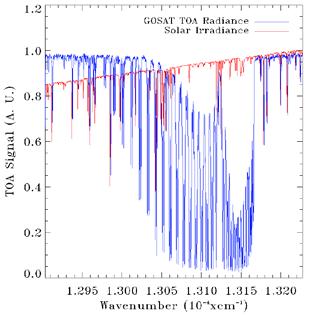
44 Global SIF data sets GOSAT SIF at 757 nm GOME-2 SIF at 737 nm croplands between W, N
, ~end 2016 ESA Earth Explorer 8th FLEX,")
45 Upcoming missions with potential for SIF retrieval Bottleneck so far: coarse spatial resolution of global composites; best: MetOp/GOME-2, 0.5º~50km/pixel. Promising scenario for fluorescence monitoring in the near future: Sentinel-5 Precursor (ESA/Copernicus/KNMI/SRON), ~end 2016 ESA Earth Explorer 8th FLEX, launch >2022
. Features: High spectral resolution spectrometer (FWHM~0.")
46 FLEX: ESA s Fluorescence Explorer First EO mission designed to measure and exploit fluorescence data. Goal: full characterization of terrestrial photosynthetic processes through SIF and ancillary measurements (PRI, pigments, temperature, ). Features: High spectral resolution spectrometer (FWHM~0.3-3 nm) in nm 300 m pixel & 100 km swath Expected launch ~2022 (if co-existing!) A fusion of FLEX and EnMAP data could be used for sub-pixel analysis of vegetation biochemical parameters Potential for down-scaling of products from 300 to 30 m.
47 A look into the future of imaging spectroscopy: Contribution to operational EO programmes and topics of direct societal impact
 Geology and soils Mineral composition and abundance Organic content in soils Inland")
 Industrial CH4 emissions Pollutants (e.g.")
48 Potential contribution of imaging spectroscopy to operational EO programmes Added-value HSI wrt MSI Land-cover/Land-use mapping Vegetation Productivity & photosynthetic Plant functional types & ecosystem composition Plant biochemistry (pigments, liquid water content) Geology and soils Mineral composition and abundance Organic content in soils Inland and coastal waters Chlorophyll and secondary pigments Phytoplankton composition Hazards Hydrocarbon content (plastic debris, oil spills) Industrial CH4 emissions Pollutants (e.g. acid mine waste) Volcanic lava flow Cryosphere snow composition Urban materials & energy Current Copernicus Land & Emergency Management Services GEOSS Societal Benefit Areas
: Earth observation data products providing key information for a number of society-relevant areas.")

49 A look into the future of imaging spectroscopy Mid-term objective: hyperspectral remote sensing to replace/complement multispectral systems for operational monitoring services. Operational monitoring services (e.g. EC Copernicus Earth Observation programme): Earth observation data products providing key information for a number of society-relevant areas. High spatial and temporal resolution measurements required (and hence enormous amount of data): bottleneck for hyperspectral technology First steps to investigate technical feasibility started in Germany and Europe. Copernicus Sentinel-2 first image, 29 June 2015 Hyperspectral EnMAP: 30 km width & 30 m pixel Multispectral: Sentinel-2: 290 km width & m pixel Projection of expected amount of data from existing and future EO missions
50 Summary Imaging spectroscopy: state-of-the-art technology for the monitoring of the Earth s land surface. Enables mapping of key bio-geophysical and geochemical parameters in a wide range of disciplines including geology, water, vegetation and hazards. EnMAP has become the most promising mission for the international community. Large potential for synergies with Sentinel-2 and FLEX missions. Big expectations for imaging spectroscopy to contribute to operational Copernicus services in the near future.

51 Summary Imaging spectroscopy: state-of-the-art technology for the monitoring of the Earth s land surface. Enables mapping of key bio-geophysical and geochemical parameters in a wide range of disciplines including geology, water, vegetation and hazards. EnMAP has become the most promising mission for the international community. Large potential for synergies with Sentinel-2 and FLEX missions. Big expectations for imaging spectroscopy to contribute to operational Copernicus services in the near future. Thank you for your attention!!
ENMAP RADIOMETRIC INFLIGHT CALIBRATION, POST-LAUNCH PRODUCT VALIDATION, AND INSTRUMENT CHARACTERIZATION ACTIVITIES
 ENMAP RADIOMETRIC INFLIGHT CALIBRATION, POST-LAUNCH PRODUCT VALIDATION, AND INSTRUMENT CHARACTERIZATION ACTIVITIES A. Hollstein1, C. Rogass1, K. Segl1, L. Guanter1, M. Bachmann2, T. Storch2, R. Müller2,
REVIEW OF ENMAP SCIENTIFIC POTENTIAL AND PREPARATION PHASE
 REVIEW OF ENMAP SCIENTIFIC POTENTIAL AND PREPARATION PHASE H. Kaufmann 1, K. Segl 1, L. Guanter 1, S. Chabrillat 1, S. Hofer 2, H. Bach 3, P. Hostert 4, A. Mueller 5, and C. Chlebek 6 1 Helmholtz Centre
ISIS TC Meeting. International Spaceborne Imaging Spectroscopy (ISIS) GRSS Technical Committee Meeting, 16/07/2014, IGARSS 2014
 GRSS Technical Committee Meeting, 16/07/2014, IGARSS 2014") ISIS TC Meeting International Spaceborne Imaging Spectroscopy (ISIS) GRSS Technical Committee Meeting, 16/07/2014, IGARSS 2014 Andreas Müller (DLR) Cindy Ong (CSIRO) Uta Heiden (DLR) Agenda Hyperspectral
ISIS TC Meeting International Spaceborne Imaging Spectroscopy (ISIS) GRSS Technical Committee Meeting, 16/07/2014, IGARSS 2014 Andreas Müller (DLR) Cindy Ong (CSIRO) Uta Heiden (DLR) Agenda Hyperspectral
EnMAP Environmental Mapping and Analysis Program
 EnMAP Environmental Mapping and Analysis Program www.enmap.org Mathias Schneider Mission Objectives Regular provision of high-quality calibrated hyperspectral data Precise measurement of ecosystem parameters
IKONOS High Resolution Multispectral Scanner Sensor Characteristics
 High Spatial Resolution and Hyperspectral Scanners IKONOS High Resolution Multispectral Scanner Sensor Characteristics Launch Date View Angle Orbit 24 September 1999 Vandenberg Air Force Base, California,
Five more talks to the wiskey tasting! Folie 1
 Five more talks to the wiskey tasting! Folie 1 EnMAP Environmental Mapping Programme Germanys Hyperspectral Earth Observation Mission Godela Roßner, Christian Chlebek, Christoph Straif, Albrecht von Bargen
Technical Committee Report International Spaceborne Imaging Spectroscopy
 Slide 1 Geoscience and Remote Sensing Society Technical Committee Report International Spaceborne Imaging Spectroscopy Cindy Ong, CSIRO Andreas Mueller, DLR, Uta Heiden, DLR GRSS AdCom Meeting Washington,
QUANTITATIVE GLOBAL MAPPING OF TERRESTRIAL VEGETATION PHOTOSYNTHESIS: THE FLUORESCENCE EXPLORER (FLEX) MISSION
 MISSION") 2017 IEEE International Geoscience and Remote Sensing Symposium July 23 28, 2017 Fort Worth, Texas, USA Session MO3.L12 - International Spaceborne Imaging Spectroscopy Missions: Updates and News I QUANTITATIVE
2017 IEEE International Geoscience and Remote Sensing Symposium July 23 28, 2017 Fort Worth, Texas, USA Session MO3.L12 - International Spaceborne Imaging Spectroscopy Missions: Updates and News I QUANTITATIVE
DESIS Applications & Processing Extracted from Teledyne & DLR Presentations to JACIE April 14, Ray Perkins, Teledyne Brown Engineering
 DESIS Applications & Processing Extracted from Teledyne & DLR Presentations to JACIE April 14, 2016 Ray Perkins, Teledyne Brown Engineering 1 Presentation Agenda Imaging Spectroscopy Applications of DESIS
Textbook, Chapter 15 Textbook, Chapter 10 (only 10.6)
") AGOG 484/584/ APLN 551 Fall 2018 Concept definition Applications Instruments and platforms Techniques to process hyperspectral data A problem of mixed pixels and spectral unmixing Reading Textbook, Chapter
AGOG 484/584/ APLN 551 Fall 2018 Concept definition Applications Instruments and platforms Techniques to process hyperspectral data A problem of mixed pixels and spectral unmixing Reading Textbook, Chapter
On the use of water color missions for lakes in 2021
 Lakes and Climate: The Role of Remote Sensing June 01-02, 2017 On the use of water color missions for lakes in 2021 Cédric G. Fichot Department of Earth and Environment 1 Overview 1. Past and still-ongoing
ESA's activities in space-borne Imaging Spectroscopy for Earth Observation CHII, June 2016, Graz, Austria
 ESA's activities in space-borne Imaging Spectroscopy for Earth Observation CHII, 15-16 June 2016, Graz, Austria Michael Rast, ESA Observation Principle of Imaging Spectrometer The telescope images the
Sentinel-2 Products and Algorithms
 Sentinel-2 Products and Algorithms Ferran Gascon (Sentinel-2 Data Quality Manager) Workshop Preparations for Sentinel 2 in Europe, Oslo 26 November 2014 Sentinel-2 Mission Mission Overview Products and
NON-PHOTOGRAPHIC SYSTEMS: Multispectral Scanners Medium and coarse resolution sensor comparisons: Landsat, SPOT, AVHRR and MODIS
 NON-PHOTOGRAPHIC SYSTEMS: Multispectral Scanners Medium and coarse resolution sensor comparisons: Landsat, SPOT, AVHRR and MODIS CLASSIFICATION OF NONPHOTOGRAPHIC REMOTE SENSORS PASSIVE ACTIVE DIGITAL
The studies began when the Tiros satellites (1960) provided man s first synoptic view of the Earth s weather systems.
 provided man s first synoptic view of the Earth s weather systems.") Remote sensing of the Earth from orbital altitudes was recognized in the mid-1960 s as a potential technique for obtaining information important for the effective use and conservation of natural resources.
Remote sensing of the Earth from orbital altitudes was recognized in the mid-1960 s as a potential technique for obtaining information important for the effective use and conservation of natural resources.
SHALOM: SPACEBORNE HYPERSPECTRAL APPLICATIVE LAND AND OCEAN MISSION: A JOINT PROJECT OF ASI-ISA AN UPDTAE FOR 2014
 SHALOM: SPACEBORNE HYPERSPECTRAL APPLICATIVE LAND AND OCEAN MISSION: A JOINT PROJECT OF ASI-ISA AN UPDTAE FOR 2014 Eyal Ben Dor Tel Aviv University Avia Kafri Israel Space Agency (ISA) Giancarlo Varacalli
Lecture 6: Multispectral Earth Resource Satellites. The University at Albany Fall 2018 Geography and Planning
 Lecture 6: Multispectral Earth Resource Satellites The University at Albany Fall 2018 Geography and Planning Outline SPOT program and other moderate resolution systems High resolution satellite systems
From Proba-V to Proba-MVA
 From Proba-V to Proba-MVA Fabrizio Niro ESA Sensor Performances Products and Algorithm (SPPA) ESA UNCLASSIFIED - For Official Use Proba-V extension in the Copernicus era Proba-V was designed with the main
746A27 Remote Sensing and GIS. Multi spectral, thermal and hyper spectral sensing and usage
 746A27 Remote Sensing and GIS Lecture 3 Multi spectral, thermal and hyper spectral sensing and usage Chandan Roy Guest Lecturer Department of Computer and Information Science Linköping University Multi
An Introduction to Remote Sensing & GIS. Introduction
 An Introduction to Remote Sensing & GIS Introduction Remote sensing is the measurement of object properties on Earth s surface using data acquired from aircraft and satellites. It attempts to measure something
Japan's Greenhouse Gases Observation from Space
 1 Workshop on EC CEOS Priority on GHG Monitoring Japan's Greenhouse Gases Observation from Space 18 June, 2018@Ispra, Italy Masakatsu NAKAJIMA Japan Aerospace Exploration Agency Development and Operation
Introduction of Satellite Remote Sensing
 Introduction of Satellite Remote Sensing Spatial Resolution (Pixel size) Spectral Resolution (Bands) Resolutions of Remote Sensing 1. Spatial (what area and how detailed) 2. Spectral (what colors bands)
Copernicus Hyperspectral Mission
 YOUR HUB FOR GEOSPATIAL APPLICATIONS Copernicus Hyperspectral Mission Primo Workshop Nazionale Data Exploitation della missione PRISMA, precursore delle missioni iperspettrali nazionali Agenzia Spaziale
Sensor resolutions from space: the tension between temporal, spectral, spatial and swath. David Bruce UniSA and ISU
 Sensor resolutions from space: the tension between temporal, spectral, spatial and swath David Bruce UniSA and ISU 1 Presentation aims 1. Briefly summarize the different types of satellite image resolutions
Lecture 7 Earth observation missions
 Remote sensing for agricultural applications: principles and methods (2013-2014) Instructor: Prof. Tao Cheng (tcheng@njau.edu.cn). Nanjing Agricultural University Lecture 7 Earth observation missions May
Update on Landsat Program and Landsat Data Continuity Mission
 Update on Landsat Program and Landsat Data Continuity Mission Dr. Jeffrey Masek LDCM Deputy Project Scientist NASA GSFC, Code 923 November 21, 2002 Draft LDCM Implementation Phase RFP Overview Page 1 Celebrate!
Int n r t o r d o u d c u ti t on o n to t o Remote Sensing
 Introduction to Remote Sensing Definition of Remote Sensing Remote sensing refers to the activities of recording/observing/perceiving(sensing)objects or events at far away (remote) places. In remote sensing,
EnMAP Flight Campaigns Technical Report
 EnMAP Flight Campaigns Technical Report Donnersberg, 2014-07-03 An EnMAP Preparatory Flight Campaign Henning Buddenbaum, Sandra Dotzler, Joachim Hill Recommended citation of the report: Buddenbaum, H.;
Copernicus Introduction Lisbon, Portugal 13 th & 14 th February 2014
 Copernicus Introduction Lisbon, Portugal 13 th & 14 th February 2014 Contents Introduction GMES Copernicus Six thematic areas Infrastructure Space data An introduction to Remote Sensing In-situ data Applications
Hyperspectral Systems: Recent Developments and Low Cost Sensors. 56th Photogrammetric Week in Stuttgart, September 11 to September 15, 2017
 Hyperspectral Systems: Recent Developments and Low Cost Sensors 56th Photogrammetric Week in Stuttgart, September 11 to September 15, 2017 Ralf Reulke Humboldt-Universität zu Berlin Institut für Informatik,
NEC s EO Sensors and Data Applications
 NEC s EO Sensors and Data Applications Second Singapore Space Symposium 30 September, 2015 Nanyang Technological University, Singapore Shimpei Kondo Space Technologies Department, Space System Division,
Airborne hyperspectral data over Chikusei
 SPACE APPLICATION LABORATORY, THE UNIVERSITY OF TOKYO Airborne hyperspectral data over Chikusei Naoto Yokoya and Akira Iwasaki E-mail: {yokoya, aiwasaki}@sal.rcast.u-tokyo.ac.jp May 27, 2016 ABSTRACT Airborne
REMOTE SENSING. Topic 10 Fundamentals of Digital Multispectral Remote Sensing MULTISPECTRAL SCANNERS MULTISPECTRAL SCANNERS
 REMOTE SENSING Topic 10 Fundamentals of Digital Multispectral Remote Sensing Chapter 5: Lillesand and Keifer Chapter 6: Avery and Berlin MULTISPECTRAL SCANNERS Record EMR in a number of discrete portions
NORMALIZING ASTER DATA USING MODIS PRODUCTS FOR LAND COVER CLASSIFICATION
 NORMALIZING ASTER DATA USING MODIS PRODUCTS FOR LAND COVER CLASSIFICATION F. Gao a, b, *, J. G. Masek a a Biospheric Sciences Branch, NASA Goddard Space Flight Center, Greenbelt, MD 20771, USA b Earth
Atmospheric interactions; Aerial Photography; Imaging systems; Intro to Spectroscopy Week #3: September 12, 2018
 GEOL 1460/2461 Ramsey Introduction/Advanced Remote Sensing Fall, 2018 Atmospheric interactions; Aerial Photography; Imaging systems; Intro to Spectroscopy Week #3: September 12, 2018 I. Quick Review from
Rapideye (2008 -> ) Not just another high resolution satellite sensor. 5 satellites RapidEye constellation. 5 million km² daily collection capacity
 Not just another high resolution satellite sensor. 5 satellites RapidEye constellation. 5 million km² daily collection capacity") Rapideye (2008 -> ) Not just another high resolution satellite sensor 5 satellites RapidEye constellation 5 million km² daily collection capacity Price: $1.40 / sq km ($2.50 rectified) Orbit: http://www.youtube.com/watch?feature=player_embedded&v=ovpulctoqgs
Rapideye (2008 -> ) Not just another high resolution satellite sensor 5 satellites RapidEye constellation 5 million km² daily collection capacity Price: $1.40 / sq km ($2.50 rectified) Orbit: http://www.youtube.com/watch?feature=player_embedded&v=ovpulctoqgs
OVERVIEW OF THE PRISMA SPACE AND GROUND SEGMENT AND ITS HYPERSPECTRAL PRODUCTS
 IEEE International Geoscience and Remote Sensing Symposium OVERVIEW OF THE PRISMA SPACE AND GROUND SEGMENT AND ITS HYPERSPECTRAL PRODUCTS Rocchina Guarini, Rosa Loizzo, Francesco Longo, Silvia Mari, Tiziana
Remote Sensing Exam 2 Study Guide
 Remote Sensing Exam 2 Study Guide Resolution Analog to digital Instantaneous field of view (IFOV) f ( cone angle of optical system ) Everything in that area contributes to spectral response mixels Sampling
1. Theory of remote sensing and spectrum
 1. Theory of remote sensing and spectrum 7 August 2014 ONUMA Takumi Outline of Presentation Electromagnetic wave and wavelength Sensor type Spectrum Spatial resolution Spectral resolution Mineral mapping
The studies began when the Tiros satellites (1960) provided man s first synoptic view of the Earth s weather systems.
 provided man s first synoptic view of the Earth s weather systems.") Remote sensing of the Earth from orbital altitudes was recognized in the mid-1960 s as a potential technique for obtaining information important for the effective use and conservation of natural resources.
Remote sensing of the Earth from orbital altitudes was recognized in the mid-1960 s as a potential technique for obtaining information important for the effective use and conservation of natural resources.
1. INTRODUCTION. GOCI : Geostationary Ocean Color Imager
 1. INTRODUCTION The Korea Ocean Research and Development Institute (KORDI) releases an announcement of opportunity (AO) to carry out scientific research for the utilization of GOCI data. GOCI is the world
Satellite Remote Sensing: Earth System Observations
 Satellite Remote Sensing: Earth System Observations Land surface Water Atmosphere Climate Ecosystems 1 EOS (Earth Observing System) Develop an understanding of the total Earth system, and the effects of
National Aeronautics and Space Administration. Landsat Update. Jeff Masek, NASA GSFC Jim Irons, NASA GSFC. April 3, 2012 LCLUC Meeting.
 National Aeronautics and Space Administration Landsat Update Jeff Masek, NASA GSFC Jim Irons, NASA GSFC April 3, 2012 LCLUC Meeting www.nasa.gov Agenda Landsat-5/7 Update LDCM / Landsat-8 Mission Status
THE NEW HYPERSPECTRAL SENSOR DESIS ON THE MULTI-PAYLOAD PLATFORM MUSES INSTALLED ON THE ISS
 The International Archives of the Photogrammetry, Remote Sensing and Spatial Information Sciences, Volume LI-B1, 2016 III ISPRS Congress, 12 19 July 2016, Prague, Czech Republic THE NEW HYPERSPECTRAL SENSOR
Compact High Resolution Imaging Spectrometer (CHRIS) siraelectro-optics
 siraelectro-optics") Compact High Resolution Imaging Spectrometer (CHRIS) Mike Cutter (Mike_Cutter@siraeo.co.uk) Summary CHRIS Instrument Design Instrument Specification & Performance Operating Modes Calibration Plan Data
Compact High Resolution Imaging Spectrometer (CHRIS) Mike Cutter (Mike_Cutter@siraeo.co.uk) Summary CHRIS Instrument Design Instrument Specification & Performance Operating Modes Calibration Plan Data
3/31/03. ESM 266: Introduction 1. Observations from space. Remote Sensing: The Major Source for Large-Scale Environmental Information
 Remote Sensing: The Major Source for Large-Scale Environmental Information Jeff Dozier Observations from space Sun-synchronous polar orbits Global coverage, fixed crossing, repeat sampling Typical altitude
Landsat 8 and Sentinel 2 higher order products: input to S2DUP. Chris Justice (UMD) Curtis Woodcock (BU), Martin Claverie (UMD/GSFC)
 Curtis Woodcock (BU), Martin Claverie (UMD/GSFC)") Landsat 8 and Sentinel 2 higher order products: input to S2DUP Chris Justice (UMD) Curtis Woodcock (BU), Martin Claverie (UMD/GSFC) MODIS Land Products Energy Balance Product Suite Surface Reflectance
Landsat 8 and Sentinel 2 higher order products: input to S2DUP Chris Justice (UMD) Curtis Woodcock (BU), Martin Claverie (UMD/GSFC) MODIS Land Products Energy Balance Product Suite Surface Reflectance
Monitoring Natural Disasters with Small Satellites Smart Satellite Based Geospatial System for Environmental Protection
 Monitoring Natural Disasters with Small Satellites Smart Satellite Based Geospatial System for Environmental Protection Krištof Oštir, Space-SI, Slovenia Contents Natural and technological disasters Current
The CarbonSat candidate mission - Radiometric and Spectral Performances over Spatially Heterogeneous Scenes
 The CarbonSat candidate mission - Radiometric and Spectral Performances over Spatially Heterogeneous Scenes J. Caron, B. Sierk, J.-L. Bézy, A. Loescher, Y. Meijer ESA-Estec (Netherlands) Earth Observation
GMES Sentinel-2. The Optical High Resolution Mission for GMES Operational Services
 GMES Sentinel-2 The Optical High Resolution Mission for GMES Operational Services Philippe Martimort GMES Sentinel-2 Mission and Payload Manager, ESA/ESTEC 15 October 2007, AGRISAR Workshop, Noordwijk
Upcoming European Missions
 Upcoming European Missions Carsten Brockmann Brockmann Consult GmbH With contributions from Criag Donlon, Peter Regner, Bianca Hoersch, Ferran Gascon (all ESA) Charly Kaufmann (GFZ Potsdam), Godela Rossner
Calibration Validation For Imaging Spectroscopy, Hyperspectral, Spectroradiometers. Cindy Ong
 Calibration Validation For Imaging Spectroscopy, Hyperspectral, Spectroradiometers Cindy Ong Main Interna*onal Imaging Spectroscopy Community Of Prac*ces European Associa.on of Remote Sensing Laboratories
USGS Welcome. 38 th CEOS Working Group on Calibration and Validation Plenary (WGCV-38)
") Landsat 5 USGS Welcome Prepared for 38 th CEOS Working Group on Calibration and Validation Plenary (WGCV-38) Presenter Tom Cecere International Liaison USGS Land Remote Sensing Program Elephant Butte Reservoir
Landsat 5 USGS Welcome Prepared for 38 th CEOS Working Group on Calibration and Validation Plenary (WGCV-38) Presenter Tom Cecere International Liaison USGS Land Remote Sensing Program Elephant Butte Reservoir
Spectral Signatures. Vegetation. 40 Soil. Water WAVELENGTH (microns)
") Spectral Signatures % REFLECTANCE VISIBLE NEAR INFRARED Vegetation Soil Water.5. WAVELENGTH (microns). Spectral Reflectance of Urban Materials 5 Parking Lot 5 (5=5%) Reflectance 5 5 5 5 5 Wavelength (nm)
Spectral Signatures % REFLECTANCE VISIBLE NEAR INFRARED Vegetation Soil Water.5. WAVELENGTH (microns). Spectral Reflectance of Urban Materials 5 Parking Lot 5 (5=5%) Reflectance 5 5 5 5 5 Wavelength (nm)
Fundamentals of Remote Sensing
 Climate Variability, Hydrology, and Flooding Fundamentals of Remote Sensing May 19-22, 2015 GEO-Latin American & Caribbean Water Cycle Capacity Building Workshop Cartagena, Colombia 1 Objective To provide
remote sensing? What are the remote sensing principles behind these Definition
 Introduction to remote sensing: Content (1/2) Definition: photogrammetry and remote sensing (PRS) Radiation sources: solar radiation (passive optical RS) earth emission (passive microwave or thermal infrared
Not just another high resolution satellite sensor
 Global Forest Change Published by Hansen, Potapov, Moore, Hancher et al. http://earthenginepartners.appspot.com/science-2013-global-forest Rapideye Not just another high resolution satellite sensor 5 satellites
An NDVI image provides critical crop information that is not visible in an RGB or NIR image of the same scene. For example, plants may appear green
 Normalized Difference Vegetation Index (NDVI) Spectral Band calculation that uses the visible (RGB) and near-infrared (NIR) bands of the electromagnetic spectrum NDVI= + An NDVI image provides critical
WHAT IS NEXT IN EARTH OBSERVATION. SkyMed Mission
 WHAT IS NEXT IN EARTH OBSERVATION COSMO-SkyMed SkyMed Mission Paolo Ammendola Italian Space Agency Florence, Sept. 19, 2001 ammendola@asi asi.it THE NEEDS Market studies indicate that the value of the
Remote Sensing Platforms
 Types of Platforms Lighter-than-air Remote Sensing Platforms Free floating balloons Restricted by atmospheric conditions Used to acquire meteorological/atmospheric data Blimps/dirigibles Major role - news
Remote Sensing and GIS
 Remote Sensing and GIS Atmosphere Reflected radiation, e.g. Visible Emitted radiation, e.g. Infrared Backscattered radiation, e.g. Radar (λ) Visible TIR Radar & Microwave 11/9/2017 Geo327G/386G, U Texas,
9/12/2011. Training Course Remote Sensing Basic Theory & Image Processing Methods September 2011
 Training Course Remote Sensing Basic Theory & Image Processing Methods 19 23 September 2011 Popular Remote Sensing Sensors & their Selection Michiel Damen (September 2011) damen@itc.nl 1 Overview Low resolution
Coral Reef Remote Sensing
 Coral Reef Remote Sensing Spectral, Spatial, Temporal Scaling Phillip Dustan Sensor Spatial Resolutio n Number of Bands Useful Bands coverage cycle Operation Landsat 80m 2 2 18 1972-97 Thematic 30m 7
Kazuhiro TANAKA GCOM project team/jaxa April, 2016
 Kazuhiro TANAKA GCOM project team/jaxa April, 216 @ SPIE Asia-Pacific 216 at New Dehli, India 1 http://suzaku.eorc.jaxa.jp/gcom_c/index_j.html GCOM mission and satellites SGLI specification and IRS overview
Outline for today. Geography 411/611 Remote sensing: Principles and Applications. Remote sensing: RS for biogeochemical cycles
 Geography 411/611 Remote sensing: Principles and Applications Thomas Albright, Associate Professor Laboratory for Conservation Biogeography, Department of Geography & Program in Ecology, Evolution, & Conservation
Global hot spot monitoring with Landsat 8 and Sentinel-2. Soushi Kato Atsushi Oda Ryosuke Nakamura (AIST)
") Global hot spot monitoring with Landsat 8 and Sentinel-2 Soushi Kato Atsushi Oda Ryosuke Nakamura (AIST) Motivation for Detecting Hot Spots Hotspot detection using satellite data To monitor wildfire and
Global hot spot monitoring with Landsat 8 and Sentinel-2 Soushi Kato Atsushi Oda Ryosuke Nakamura (AIST) Motivation for Detecting Hot Spots Hotspot detection using satellite data To monitor wildfire and
MERIS instrument. Muriel Simon, Serco c/o ESA
 MERIS instrument Muriel Simon, Serco c/o ESA Workshop on Sustainable Development in Mountain Areas of Andean Countries Mendoza, Argentina, 26-30 November 2007 ENVISAT MISSION 2 Mission Chlorophyll case
Evaluation of Sentinel-2 bands over the spectrum
 Evaluation of Sentinel-2 bands over the spectrum S.E. Hosseini Aria, M. Menenti, Geoscience and Remote sensing Department Delft University of Technology, Netherlands 1 outline ointroduction - Concept odata
Ground Truth for Calibrating Optical Imagery to Reflectance
 Visual Information Solutions Ground Truth for Calibrating Optical Imagery to Reflectance The by: Thomas Harris Whitepaper Introduction: Atmospheric Effects on Optical Imagery Remote sensing of the Earth
Status of the CNES / MicroCarb small
 Status of the CNES / MicroCarb small satellite for CO 2 measurements D. Jouglet on behalf of the MicroCarb team (F. Buisson, D. Pradines, V. Pascal, C. Pierangelo, C. Buil, S. Gaugain, C. Deniel, F.M.
typical spectral signatures of photosynthetically active and non-photosynthetically active vegetation (Beeri et al., 2007)
") typical spectral signatures of photosynthetically active and non-photosynthetically active vegetation (Beeri et al., 2007) Xie, Y. et al. J Plant Ecol 2008 1:9-23; doi:10.1093/jpe/rtm005 Copyright restrictions
typical spectral signatures of photosynthetically active and non-photosynthetically active vegetation (Beeri et al., 2007) Xie, Y. et al. J Plant Ecol 2008 1:9-23; doi:10.1093/jpe/rtm005 Copyright restrictions
Lesson 3: Working with Landsat Data
 Lesson 3: Working with Landsat Data Lesson Description The Landsat Program is the longest-running and most extensive collection of satellite imagery for Earth. These datasets are global in scale, continuously
Radiometric Use of WorldView-3 Imagery. Technical Note. 1 WorldView-3 Instrument. 1.1 WorldView-3 Relative Radiance Response
 Radiometric Use of WorldView-3 Imagery Technical Note Date: 2016-02-22 Prepared by: Michele Kuester This technical note discusses the radiometric use of WorldView-3 imagery. The first two sections briefly
Introduction to Remote Sensing
 Introduction to Remote Sensing Daniel McInerney Urban Institute Ireland, University College Dublin, Richview Campus, Clonskeagh Drive, Dublin 14. 16th June 2009 Presentation Outline 1 2 Spaceborne Sensors
DLR contribution and perspectives for JECAM
 DLR contribution and perspectives for JECAM Dr. Helmut Staudenrausch 1, Dr. Achim Roth 2 1 DLR Space Administration, Earth Observations helmut.staudenrausch@dlr.de 2 DLR, German Remote Sensing Data Center
PLANET IMAGERY PRODUCT SPECIFICATIONS PLANET.COM
 PLANET IMAGERY PRODUCT SPECIFICATIONS SUPPORT@PLANET.COM PLANET.COM LAST UPDATED JANUARY 2018 TABLE OF CONTENTS LIST OF FIGURES 3 LIST OF TABLES 4 GLOSSARY 5 1. OVERVIEW OF DOCUMENT 7 1.1 Company Overview
Advanced satellite image fusion techniques for estimating high resolution Land Surface Temperature time series
 COMECAP 2014 e-book of proceedings vol. 2 Page 267 Advanced satellite image fusion techniques for estimating high resolution Land Surface Temperature time series Mitraka Z., Chrysoulakis N. Land Surface
OVERVIEW OF KOMPSAT-3A CALIBRATION AND VALIDATION
 OVERVIEW OF KOMPSAT-3A CALIBRATION AND VALIDATION DooChun Seo 1, GiByeong Hong 1, ChungGil Jin 1, DaeSoon Park 1, SukWon Ji 1 and DongHan Lee 1 1 KARI(Korea Aerospace Space Institute), 45, Eoeun-dong,
Remote Sensing 1 Principles of visible and radar remote sensing & sensors
 Remote Sensing 1 Principles of visible and radar remote sensing & sensors Nick Barrand School of Geography, Earth & Environmental Sciences University of Birmingham, UK Field glaciologist collecting data
Two-linear-polarization measurement of O 2 A band with TANSO-FTS onboard GOSAT
 Remote sensing in the O 2 A band Two-linear-polarization measurement of O 2 A band with TANSO-FTS onboard GOSAT July 7, 2016, De Bilt Akihiko Kuze, Hiroshi Suto, Kei Shiomi, Nobuhiro Kikuchi, Makiko Hashimoto
University of Texas at San Antonio EES 5053 Term Project CORRELATION BETWEEN NDVI AND SURFACE TEMPERATURES USING LANDSAT ETM + IMAGERY NEWFEL MAZARI
 University of Texas at San Antonio EES 5053 Term Project CORRELATION BETWEEN NDVI AND SURFACE TEMPERATURES USING LANDSAT ETM + IMAGERY NEWFEL MAZARI Introduction and Objectives The present study is a correlation
The use of satellite images to forecast agricultural
 The use of satellite images to forecast agricultural Luxembourg, 12.03.2014 r. Tomasz Milewski NUTS for Poland: NUTS 1 macro-regions (grup of province, voivodships) (6), NUTS 2 - regions (province,
of the Small Satellite Mission Systematic Image Processing Eckehard Lorenz, DLR Berlin Ilmenau, Klaus Briess, TU Berlin 49th IWK
 Ilmenau, 27.-30.09. 2004 49th IWK Eckehard Lorenz, DLR Berlin Klaus Briess, TU Berlin Astro- und Feinwerktechnik Adlershof GmbH Systematic Image Processing of the Small Satellite Mission BIRD Optical Information
Remote Sensing. Odyssey 7 Jun 2012 Benjamin Post
 Remote Sensing Odyssey 7 Jun 2012 Benjamin Post Definitions Applications Physics Image Processing Classifiers Ancillary Data Data Sources Related Concepts Outline Big Picture Definitions Remote Sensing
GIS Data Collection. Remote Sensing
 GIS Data Collection Remote Sensing Data Collection Remote sensing Introduction Concepts Spectral signatures Resolutions: spectral, spatial, temporal Digital image processing (classification) Other systems
FloX: A System for Automatic Long Term Measurements of Top of Canopy Sun Induced Chlorophyll Fluorescence
 FloX: A System for Automatic Long Term Measurements of Top of Canopy Sun Induced Chlorophyll Fluorescence Julitta, Tommaso; Burkart, Andreas; Rossini, Micol; Schickling, Anke; Colombo, Roberto; Rascher,
Lecture 2. Electromagnetic radiation principles. Units, image resolutions.
 NRMT 2270, Photogrammetry/Remote Sensing Lecture 2 Electromagnetic radiation principles. Units, image resolutions. Tomislav Sapic GIS Technologist Faculty of Natural Resources Management Lakehead University
Spotlight on Hyperspectral
 Spotlight on Hyperspectral From analyzing eelgrass beds in the Pacific Northwest to identifying pathfinder minerals for geological exploration, hyperspectral imagery and analysis is proving its worth for
Sommersemester Prof. Dr. Christoph Kleinn Institut für Waldinventur und Waldwachstum Arbeitsbereich Fernerkundung und Waldinventur.
 Basics of Remote Sensing Some literature references Franklin, SE 2001 Remote Sensing for Sustainable Forest Management Lewis Publishers 407p Lillesand, Kiefer 2000 Remote Sensing and Image Interpretation
OPAL Optical Profiling of the Atmospheric Limb
 OPAL Optical Profiling of the Atmospheric Limb Alan Marchant Chad Fish Erik Stromberg Charles Swenson Jim Peterson OPAL STEADE Mission Storm Time Energy & Dynamics Explorers NASA Mission of Opportunity
Compact Multispectral and Hyperspectral Imagers based on a Wide Field of View TMA
 Compact Multispectral and Hyperspectral Imagers based on a Wide Field of View TMA M. Taccola (AOES),S. Grabarnik (AOES), L. Maresi (ESA/ESTEC), V. Moreau (AMOS), L. de Vos (OIP), Y. Versluys (OIP), G.
The Development of Imaging Spectrometry of the Coastal Ocean
 SU_8/2/2006_Davis.1 The Development of Imaging Spectrometry of the Coastal Ocean Curtiss O. Davis College of Oceanic and Atmospheric Sciences, Oregon State University, Corvallis, OR 97331 cdavis@coas.oregonstate.edu
The Global Imager (GLI)
") The Global Imager (GLI) Launch : Dec.14, 2002 Initial check out : to Apr.14, 2003 (~L+4) First image: Jan.25, 2003 Second image: Feb.6 and 7, 2003 Calibration and validation : to Dec.14, 2003(~L+4) for
The Global Imager (GLI) Launch : Dec.14, 2002 Initial check out : to Apr.14, 2003 (~L+4) First image: Jan.25, 2003 Second image: Feb.6 and 7, 2003 Calibration and validation : to Dec.14, 2003(~L+4) for
Introduction to Remote Sensing
 Introduction to Remote Sensing Spatial, spectral, temporal resolutions Image display alternatives Vegetation Indices Image classifications Image change detections Accuracy assessment Satellites & Air-Photos
Application of GIS to Fast Track Planning and Monitoring of Development Agenda
 Application of GIS to Fast Track Planning and Monitoring of Development Agenda Radiometric, Atmospheric & Geometric Preprocessing of Optical Remote Sensing 13 17 June 2018 Outline 1. Why pre-process remotely
Sea to Sky: The NASA Plankton, Aerosol, Cloud, ocean Ecosystem (PACE) mission
 mission") Sea to Sky: The NASA Plankton, Aerosol, Cloud, ocean Ecosystem (PACE) mission Jeremy Werdell PACE Project Scientist NASA Goddard Space Flight Center Robert H. Goddard Memorial Symposium 9 March 2017, Greenbelt,
Sea to Sky: The NASA Plankton, Aerosol, Cloud, ocean Ecosystem (PACE) mission Jeremy Werdell PACE Project Scientist NASA Goddard Space Flight Center Robert H. Goddard Memorial Symposium 9 March 2017, Greenbelt,
Chapter 5. Preprocessing in remote sensing
 Chapter 5. Preprocessing in remote sensing 5.1 Introduction Remote sensing images from spaceborne sensors with resolutions from 1 km to < 1 m become more and more available at reasonable costs. For some
A Canadian Hyperspectral Spaceborne Mission Applications and User Requirements 1
 A Canadian Hyperspectral Spaceborne Mission Applications and User Requirements 1 K. Staenz a and A. Hollinger b a Canada Centre for Remote Sensing, Natural Resources Canada, 588 Booth Street, Ottawa, Ontario,
Geospatial Vision and Policies Korean Industry View 26 November, 2014 SI Imaging Services
 Geospatial Vision and Policies Korean Industry View 26 November, 2014 SI Imaging Services Distribution Limitation, SI Imaging Services Proprietary Data : The data contained in this document, without the
Introduction to KOMPSAT
 Introduction to KOMPSAT September, 2016 1 CONTENTS 01 Introduction of SIIS 02 KOMPSAT Constellation 03 New : KOMPSAT-3 50 cm 04 New : KOMPSAT-3A 2 KOMPSAT Constellation KOMPSAT series National space program