Rectifying the Planet USING SPACE TO HELP LIFE ON EARTH
|
|
|
- Jasmine Dean
- 6 years ago
- Views:
Transcription


1 Rectifying the Planet USING SPACE TO HELP LIFE ON EARTH

2 About Me Computer Science (BS) Ecology (PhD, almost ) I write programs that process satellite data Scientific Computing! Land Cover Classification & Deforestation Detection GPU computing & Artificial Intelligence Working with Plant Labs for 2.5 years
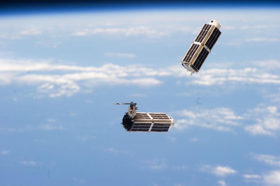
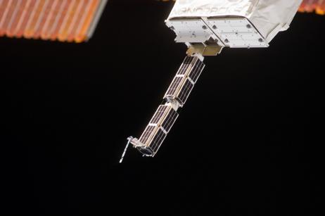
3 Requirements Mission 1: Image Everywhere, everyday, for everybody. 100s of satellites, each with an 11 Mpix camera ~10x15 km view area, 3-5 meter resolution Move Fast & Break Things - IN SPACE! (As fun as it sounds) Orthorectify ~1 million images per day
4
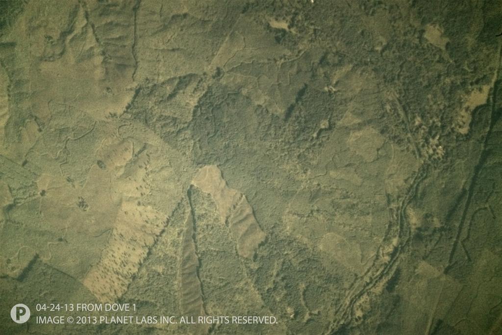
5 Using RGB, what is our initial strength? Time series data analysis! What will I need for time series analysis? Imagery correctly rectified through time! (i.e. trees that don t move) So, we need the best spatial precision (& accuracy) Using space hardware that takes shortcuts In the fastest time
6 Experimentation Published prior work?? Started with inspiration from GDAL-Correlator Google Summer of Code 2012 project Danger: SURF is patented! Use OpenCV instead Make a GRASS GIS module Fast(er) experimentation in C++ Easy built-in geo vector & raster handling Further analysis can be done in the same environment
7 Spec also says: meters initial spatial error JUST KIDDING (hardware issues) 100 km initial spatial error
8
9 How is rectify formed? Minimal interpolation/resampling steps Therefore RAW to orthorectified in one sample Unknown initial location + topography We must use some sort iterative refinement And, to future proof, it must be parallelizable
10 Rectification Stack For each pixel, we must adjust for: Bayer masking Telescope geometry Orbital geometry Satellite pointing accuracy Topography Listed in sensor-to-ground order We can calculate the first three with a rigorous model Last two must be iterated over Samples calculated from ground location to satellite sensor

.")
11 Demosaicing RAW (RGGB) More difficult than simple bilinear interpolation High frequencies must match across colors Malvar, Henrique S., Li-wei He, and Ross Cutler. "High-quality linear interpolation for demosaicing of Bayer-patterned color images." Acoustics, Speech, and Signal Processing, Proceedings.(ICASSP'04). IEEE International Conference on. Vol. 3. IEEE, Highly parallelizable!
12 Optical correction Found to be inconsequential with current telescope NO OP (for now)
13 Orbital Correction Warp the scene to the curvature of the Earth Use PROJ.4 s +proj=tpers Tilted Perspective Simulates a perspective view from a height Input coords in whatever the working projection is Generally UTM
14 Georectification Originally very human-intensive A three step process pl.area search km -> 1 km pl.rectify - 1 km -> 20 m OSM snapping - 20 m -> ~5 m (?) Reference imagery: Landsat 8 Automatic tie point extraction Explanation To Be Continued
15 Orthorectification We *think* we know where the image belongs now So use PROJ.4 again! Calculate intersection angles using XYZ space +proj=geocent Adjust to SRTM, as processed by CGIAR-CSI Relative to average control point elevation
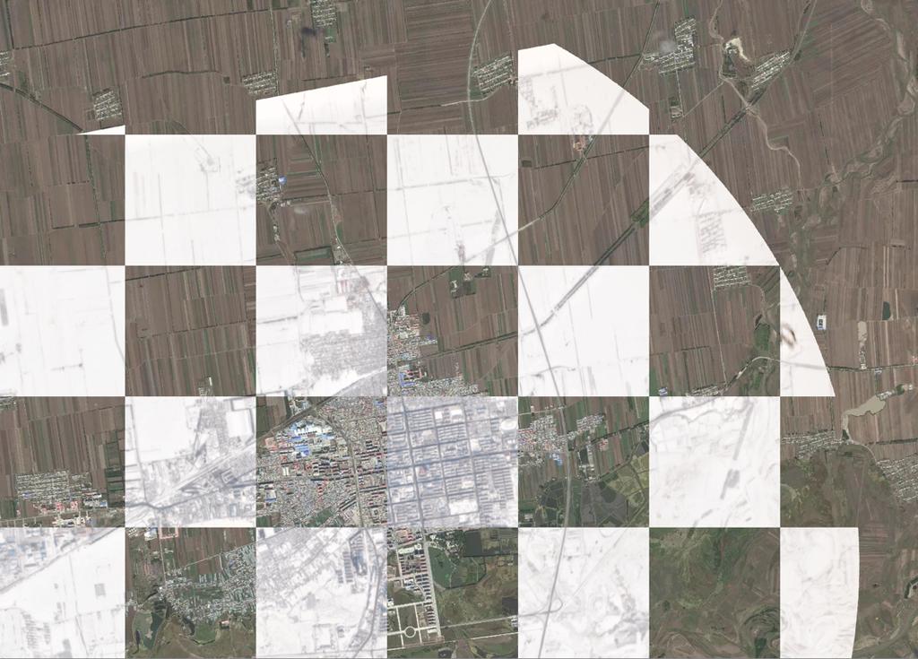
16 Auto-geo-rectification
17 Rectification In Depth Automatic ground control point collection Keypoint detection and description - Computer Vision We use OpenCV - STAR & FREAK Agrawal, M. and Konolige, K. and Blas, M.R. CenSurE: Center Surround Extremas for Realtime Feature Detection and Matching, ECCV08, 2008 A. Alahi, R. Ortiz, and P. Vandergheynst. FREAK: Fast Retina Keypoint. In IEEE Conference on Computer Vision and Pattern Recognition, CVPR 2012 Open Source Award Winner. Both are relatively fast and simple ~50,000 points collected per 10 x 10 km patch of land 10,000 matching points can t be wrong!
 instruction In SSE 4.2 or OpenCL 1.")
18 Point Descriptors 512-bit vector Information dense Sensitive to rotation & scale Can be compared in hardware with the popcnt() instruction In SSE 4.2 or OpenCL 1.2 (AKA Hamming Distance)
 resolution tiles Clouds masked out with the QA band High spatial accuracy (~18 m) Storey, James, Michael Choate, and Kenton Lee.")
19 Index Tiles Precompute reference descriptors into an index Reproject Landsat 8 into working UTM zone Uses FLANN (Fast Library for Approximate Nearest Neighbors) Any number of Landsat 8 panchromatic scenes Year round imagery in each index file 15 m (& 3 m) resolution tiles Clouds masked out with the QA band High spatial accuracy (~18 m) Storey, James, Michael Choate, and Kenton Lee. "Landsat 8 Operational Land Imager On-Orbit Geometric Calibration and Performance." Remote Sensing 6.11 (2014):
20 Currently +10 million descriptor points on a tile Query 50,000 points in approximately one second with FLANN LZ4 compressed index & database files for file size and I/O speed
21 Keypoint Match Noise ~150 of 512 bits of the vector may not match Leads to many incorrect tie point pairs RANSAC RANdom SAmple Consensus Create random transforms until one explains most of the data Works with ~50% error PairPare Assume a set of point pairs shouldn t rotate or scale relative to each other If they do, one (or both) of the pairs in the set is a bad match Randomize all matches to create a null hypothesis Similar to RANSAC, but works with ~95% error
22 Area Search First pass generates a corse match Rectification works at ~3 km max Look for potential matching sets of points in each tile Search is linear in the number of index tiles Also search multiple rotations FREAK keypoints are accurate to +/- 10 degrees of rotation


23 OSM Snapping Extract lines from the satellite raster SELECT all lines that can be seen from space Target lines the size of two lane roads Create more tiles For each vertex in each OSM line Measure Mutual Information score Compare rasterized OSM and extracted lines Add each matching point pair to the larger key point collection Continue with Landsat 8 rectification
24 Transformation Equation Develop a set of correction equations x = A + B*x + C*y y = E + F*x + G*y (+ D*z) (+ H*z) Solve the coefficients with OpenCV function cv::solve() 1st order equations work better than 2nd or 3rd order Corrects relative to the average CP elevation for proper orthorectification later Coefficents are saved for fast re-rectification from RAW
25 Thank you PLANET.COM Seth
PLANET IMAGERY PRODUCT SPECIFICATION: PLANETSCOPE & RAPIDEYE
 PLANET IMAGERY PRODUCT SPECIFICATION: PLANETSCOPE & RAPIDEYE LAST UPDATED OCTOBER 2016 SALES@PLANET.COM PLANET.COM Table of Contents LIST OF FIGURES 3 LIST OF TABLES 3 GLOSSARY 5 1. OVERVIEW OF DOCUMENT
ENVI Tutorial: Orthorectifying Aerial Photographs
 ENVI Tutorial: Orthorectifying Aerial Photographs Table of Contents OVERVIEW OF THIS TUTORIAL...2 ORTHORECTIFYING AERIAL PHOTOGRAPHS IN ENVI...2 Building the interior orientation...3 Building the exterior
Planet Labs Inc 2017 Page 2
 SKYSAT IMAGERY PRODUCT SPECIFICATION: ORTHO SCENE LAST UPDATED JUNE 2017 SALES@PLANET.COM PLANET.COM Disclaimer This document is designed as a general guideline for customers interested in acquiring Planet
Remote sensing image correction
 Remote sensing image correction Introductory readings remote sensing http://www.microimages.com/documentation/tutorials/introrse.pdf 1 Preprocessing Digital Image Processing of satellite images can be
Image Fusion. Pan Sharpening. Pan Sharpening. Pan Sharpening: ENVI. Multi-spectral and PAN. Magsud Mehdiyev Geoinfomatics Center, AIT
 1 Image Fusion Sensor Merging Magsud Mehdiyev Geoinfomatics Center, AIT Image Fusion is a combination of two or more different images to form a new image by using certain algorithms. ( Pohl et al 1998)
Color image Demosaicing. CS 663, Ajit Rajwade
 Color image Demosaicing CS 663, Ajit Rajwade Color Filter Arrays It is an array of tiny color filters placed before the image sensor array of a camera. The resolution of this array is the same as that
[GEOMETRIC CORRECTION, ORTHORECTIFICATION AND MOSAICKING]
![[GEOMETRIC CORRECTION, ORTHORECTIFICATION AND MOSAICKING]](/thumbs/78/78211997.jpg "[GEOMETRIC CORRECTION, ORTHORECTIFICATION AND MOSAICKING]") 2013 Ogis-geoInfo Inc. IBEABUCHI NKEMAKOLAM.J [GEOMETRIC CORRECTION, ORTHORECTIFICATION AND MOSAICKING] [Type the abstract of the document here. The abstract is typically a short summary of the contents
2013 Ogis-geoInfo Inc. IBEABUCHI NKEMAKOLAM.J [GEOMETRIC CORRECTION, ORTHORECTIFICATION AND MOSAICKING] [Type the abstract of the document here. The abstract is typically a short summary of the contents
Demosaicing Algorithms
 Demosaicing Algorithms Rami Cohen August 30, 2010 Contents 1 Demosaicing 2 1.1 Algorithms............................. 2 1.2 Post Processing.......................... 6 1.3 Performance............................
TEMPORAL ANALYSIS OF MULTI EPOCH LANDSAT GEOCOVER IMAGES IN ZONGULDAK TESTFIELD
 TEMPORAL ANALYSIS OF MULTI EPOCH LANDSAT GEOCOVER IMAGES IN ZONGULDAK TESTFIELD Şahin, H. a*, Oruç, M. a, Büyüksalih, G. a a Zonguldak Karaelmas University, Zonguldak, Turkey - (sahin@karaelmas.edu.tr,
PLANET IMAGERY PRODUCT SPECIFICATION: PLANETSCOPE & RAPIDEYE
 PLANET IMAGERY PRODUCT SPECIFICATION: PLANETSCOPE & RAPIDEYE LAST UPDATED FEBRUARY 2017 SALES@PLANET.COM PLANET.COM Table of Contents LIST OF FIGURES 3 LIST OF TABLES 3 GLOSSARY 5 1. OVERVIEW OF DOCUMENT
PLANET IMAGERY PRODUCT SPECIFICATIONS PLANET.COM
 PLANET IMAGERY PRODUCT SPECIFICATIONS SUPPORT@PLANET.COM PLANET.COM LAST UPDATED JANUARY 2018 TABLE OF CONTENTS LIST OF FIGURES 3 LIST OF TABLES 4 GLOSSARY 5 1. OVERVIEW OF DOCUMENT 7 1.1 Company Overview
The Airphoto Ortho Suite is an add-on to Geomatica. It requires Geomatica Core or Geomatica Prime as a pre-requisite.
 Airphoto Ortho Suite The Airphoto Ortho Suite includes rigorous models used to correct the geometry of analogue and digital/video cameras and to produce orthorectified air photos. These models compensate
GEOMETRIC RECTIFICATION OF EUROPEAN HISTORICAL ARCHIVES OF LANDSAT 1-3 MSS IMAGERY
 GEOMETRIC RECTIFICATION OF EUROPEAN HISTORICAL ARCHIVES OF LANDSAT -3 MSS IMAGERY Torbjörn Westin Satellus AB P.O.Box 427, SE-74 Solna, Sweden tw@ssc.se KEYWORDS: Landsat, MSS, rectification, orbital model
Automatic geo-registration of satellite imagery
 Fjärranalysdagarna 10-11 mars 2009 Automatic geo-registration of satellite imagery Torbjörn Westin Lars-Åke Edgardh Ian Spence Spacemetric AB www.spacemetric.com Keystone Image Server Keystone is an automatic
ANNEX IV ERDAS IMAGINE OPERATION MANUAL
 ANNEX IV ERDAS IMAGINE OPERATION MANUAL Table of Contents 1. TOPIC 1 DATA IMPORT...1 1.1. Importing SPOT DATA directly from CDROM... 1 1.2. Importing SPOT (Panchromatic) using GENERIC BINARY... 7 1.3.
Application of GIS to Fast Track Planning and Monitoring of Development Agenda
 Application of GIS to Fast Track Planning and Monitoring of Development Agenda Radiometric, Atmospheric & Geometric Preprocessing of Optical Remote Sensing 13 17 June 2018 Outline 1. Why pre-process remotely
Geomatica OrthoEngine v10.2 Tutorial DEM Extraction of GeoEye-1 Data
 Geomatica OrthoEngine v10.2 Tutorial DEM Extraction of GeoEye-1 Data GeoEye 1, launched on September 06, 2008 is the highest resolution commercial earth imaging satellite available till date. GeoEye-1
Midterm Examination CS 534: Computational Photography
 Midterm Examination CS 534: Computational Photography November 3, 2015 NAME: SOLUTIONS Problem Score Max Score 1 8 2 8 3 9 4 4 5 3 6 4 7 6 8 13 9 7 10 4 11 7 12 10 13 9 14 8 Total 100 1 1. [8] What are
Real Time Word to Picture Translation for Chinese Restaurant Menus
 Real Time Word to Picture Translation for Chinese Restaurant Menus Michelle Jin, Ling Xiao Wang, Boyang Zhang Email: mzjin12, lx2wang, boyangz @stanford.edu EE268 Project Report, Spring 2014 Abstract--We
Demosaicing and Denoising on Simulated Light Field Images
 Demosaicing and Denoising on Simulated Light Field Images Trisha Lian Stanford University tlian@stanford.edu Kyle Chiang Stanford University kchiang@stanford.edu Abstract Light field cameras use an array
Geomatica OrthoEngine Orthorectifying SPOT6 data
 Geomatica OrthoEngine Orthorectifying SPOT6 data On September 9, 2012, SPOT 6 was launched adding to the constellation of Earthimaging satellites designed to provide 1.5m high-resolution data. The architecture
Preparing Remote Sensing Data for Natural Resources Mapping (image enhancement, rectifications )
") Preparing Remote Sensing Data for Natural Resources Mapping (image enhancement, rectifications ) Why is this important What are the major approaches Examples of digital image enhancement Follow up exercises
Preparing Remote Sensing Data for Natural Resources Mapping (image enhancement, rectifications ) Why is this important What are the major approaches Examples of digital image enhancement Follow up exercises
Separation of crop and vegetation based on Digital Image Processing
 Separation of crop and vegetation based on Digital Image Processing Mayank Singh Sakla 1, Palak Jain 2 1 M.TECH GEOMATICS student, CEPT UNIVERSITY 2 M.TECH GEOMATICS student, CEPT UNIVERSITY Word Limit
GEO/EVS 425/525 Unit 9 Aerial Photograph and Satellite Image Rectification
 GEO/EVS 425/525 Unit 9 Aerial Photograph and Satellite Image Rectification You have seen satellite imagery earlier in this course, and you have been looking at aerial photography for several years. You
Satellite Ortho Suite
 Technical Specifications Satellite Ortho Suite The Satellite Ortho Suite includes rigorous and rational function models developed to compensate for distortions and produce orthorectified satellite images
SAR Othorectification and Mosaicking
 White Paper SAR Othorectification and Mosaicking John Wessels: Senior Scientist PCI Geomatics SAR Othorectification and Mosaicking This study describes the high-speed orthorectification and mosaicking
Lecture 13: Remotely Sensed Geospatial Data
 Lecture 13: Remotely Sensed Geospatial Data A. The Electromagnetic Spectrum: The electromagnetic spectrum (Figure 1) indicates the different forms of radiation (or simply stated light) emitted by nature.
Satellite/Aircraft Imaging Systems Imaging Sensors Standard scanner designs Image data formats
 CEE 6150: Digital Image Processing 1 Satellite/Aircraft Imaging Systems Imaging Sensors Standard scanner designs Image data formats CEE 6150: Digital Image Processing 2 CEE 6150: Digital Image Processing
GEO 428: DEMs from GPS, Imagery, & Lidar Tuesday, September 11
 GEO 428: DEMs from GPS, Imagery, & Lidar Tuesday, September 11 Global Positioning Systems GPS is a technology that provides Location coordinates Elevation For any location with a decent view of the sky
The Radar Ortho Suite is an add-on to Geomatica. It requires Geomatica Core or Geomatica Prime as a pre-requisite.
 Technical Specifications Radar Ortho Suite The Radar Ortho Suite includes rigorous and rational function models developed to compensate for distortions and produce orthorectified radar images. Distortions
The studies began when the Tiros satellites (1960) provided man s first synoptic view of the Earth s weather systems.
 provided man s first synoptic view of the Earth s weather systems.") Remote sensing of the Earth from orbital altitudes was recognized in the mid-1960 s as a potential technique for obtaining information important for the effective use and conservation of natural resources.
Remote sensing of the Earth from orbital altitudes was recognized in the mid-1960 s as a potential technique for obtaining information important for the effective use and conservation of natural resources.
Sentinel-2 Products and Algorithms
 Sentinel-2 Products and Algorithms Ferran Gascon (Sentinel-2 Data Quality Manager) Workshop Preparations for Sentinel 2 in Europe, Oslo 26 November 2014 Sentinel-2 Mission Mission Overview Products and
CanImage. (Landsat 7 Orthoimages at the 1: Scale) Standards and Specifications Edition 1.0
 Standards and Specifications Edition 1.0") CanImage (Landsat 7 Orthoimages at the 1:50 000 Scale) Standards and Specifications Edition 1.0 Centre for Topographic Information Customer Support Group 2144 King Street West, Suite 010 Sherbrooke, QC
CanImage (Landsat 7 Orthoimages at the 1:50 000 Scale) Standards and Specifications Edition 1.0 Centre for Topographic Information Customer Support Group 2144 King Street West, Suite 010 Sherbrooke, QC
Remote Sensing. The following figure is grey scale display of SPOT Panchromatic without stretching.
 Remote Sensing Objectives This unit will briefly explain display of remote sensing image, geometric correction, spatial enhancement, spectral enhancement and classification of remote sensing image. At
INTEGRATED DEM AND PAN-SHARPENED SPOT-4 IMAGE IN URBAN STUDIES
 INTEGRATED DEM AND PAN-SHARPENED SPOT-4 IMAGE IN URBAN STUDIES G. Doxani, A. Stamou Dept. Cadastre, Photogrammetry and Cartography, Aristotle University of Thessaloniki, GREECE gdoxani@hotmail.com, katerinoudi@hotmail.com
Interframe Coding of Global Image Signatures for Mobile Augmented Reality
 Interframe Coding of Global Image Signatures for Mobile Augmented Reality David Chen 1, Mina Makar 1,2, Andre Araujo 1, Bernd Girod 1 1 Department of Electrical Engineering, Stanford University 2 Qualcomm
INCREASING THE DETAIL OF LAND USE CLASSIFICATION: THE IOWA 2002 LAND COVER PRODUCT INTRODUCTION
 INCREASING THE DETAIL OF LAND USE CLASSIFICATION: THE IOWA 2002 LAND COVER PRODUCT R. Peter Kollasch, Remote Sensing Analyst Iowa Geological Survey Iowa Department of Natural Resources 109 Trowbridge Hall
Appendix 2: Worked example using GPS
 Appendix 2: Worked example using GPS This appendix will talk the reader through how to use a GPS, get data out of the unit and use that data in the expedition GIS. The specific example used is a simple
Introduction to image processing for remote sensing: Practical examples
 Università degli studi di Roma Tor Vergata Corso di Telerilevamento e Diagnostica Elettromagnetica Anno accademico 2010/2011 Introduction to image processing for remote sensing: Practical examples Dr.
Sensors and Sensing Cameras and Camera Calibration
 Sensors and Sensing Cameras and Camera Calibration Todor Stoyanov Mobile Robotics and Olfaction Lab Center for Applied Autonomous Sensor Systems Örebro University, Sweden todor.stoyanov@oru.se 20.11.2014
Demosaicing Algorithm for Color Filter Arrays Based on SVMs
 www.ijcsi.org 212 Demosaicing Algorithm for Color Filter Arrays Based on SVMs Xiao-fen JIA, Bai-ting Zhao School of Electrical and Information Engineering, Anhui University of Science & Technology Huainan
USE OF COLOR IN REMOTE SENSING
 1 USE OF COLOR IN REMOTE SENSING (David Sandwell, Copyright, 2004) Display of large data sets - Most remote sensing systems create arrays of numbers representing an area on the surface of the Earth. The
INTRODUCTION TO REMOTE SENSING AND ITS APPLICATIONS
 INTRODUCTION TO REMOTE SENSING AND ITS APPLICATIONS Prof. Dr. Abudeif A. Bakheit Geology Department. Faculty of Science Assiut University This representation was prepared from different power point representations
LONG STRIP MODELLING FOR CARTOSAT-1 WITH MINIMUM CONTROL
 LONG STRIP MODELLING FOR CARTOSAT-1 WITH MINIMUM CONTROL Amit Gupta a, *, Jagjeet Singh Nain a, Sanjay K Singh a, T P Srinivasan a, B Gopala Krishna a, P K Srivastava a a Space Applications Centre, Indian
Geometric Quality Assessment of CBERS-2. Julio d Alge Ricardo Cartaxo Guaraci Erthal
 Geometric Quality Assessment of CBERS-2 Julio d Alge Ricardo Cartaxo Guaraci Erthal Contents Monitoring CBERS-2 scene centers Satellite orbit control Band-to-band registration accuracy Detection and control
Lab #10 Digital Orthophoto Creation (Using Leica Photogrammetry Suite)
") Lab #10 Digital Orthophoto Creation (Using Leica Photogrammetry Suite) References: Leica Photogrammetry Suite Project Manager: Users Guide, Leica Geosystems LLC. Leica Photogrammetry Suite 9.2 Introduction:
Lab #10 Digital Orthophoto Creation (Using Leica Photogrammetry Suite) References: Leica Photogrammetry Suite Project Manager: Users Guide, Leica Geosystems LLC. Leica Photogrammetry Suite 9.2 Introduction:
Spatial Analyst is an extension in ArcGIS specially designed for working with raster data.
 Spatial Analyst is an extension in ArcGIS specially designed for working with raster data. 1 Do you remember the difference between vector and raster data in GIS? 2 In Lesson 2 you learned about the difference
Book Cover Recognition Project
 Book Cover Recognition Project Carolina Galleguillos Department of Computer Science University of California San Diego La Jolla, CA 92093-0404 cgallegu@cs.ucsd.edu Abstract The purpose of this project
Using Imagery for Intelligence Analysis. Jim Michel Renee Bernstein
 Using Imagery for Intelligence Analysis Jim Michel Renee Bernstein Deriving Value from GIS and Imagery Capabilities Evolved Along Separate but Parallel Paths GIS Imagery brings value Imagery Contextual
Abstract Quickbird Vs Aerial photos in identifying man-made objects
 Abstract Quickbird Vs Aerial s in identifying man-made objects Abdullah Mah abdullah.mah@aramco.com Remote Sensing Group, emap Division Integrated Solutions Services Department (ISSD) Saudi Aramco, Dhahran
Introduction to Remote Sensing Fundamentals of Satellite Remote Sensing. Mads Olander Rasmussen
 Introduction to Remote Sensing Fundamentals of Satellite Remote Sensing Mads Olander Rasmussen (mora@dhi-gras.com) 01. Introduction to Remote Sensing DHI What is remote sensing? the art, science, and technology
Monitoring of Mosul Reservoir Using Remote Sensing Techniques For the Period After ISIS Attack in 9 June Muthanna Mohammed Abdulhameed AL Bayati
 For the Period After ISIS Attack in 9 June 2014 Lecture: University of Technology Baghdad- Building and Construction Dept 1- Introduction The Mosul Dam is the fourth largest dam in the Middle East,(1)established
High Fidelity 3D Reconstruction
 High Fidelity 3D Reconstruction Adnan Ansar, California Institute of Technology KISS Workshop: Gazing at the Solar System June 17, 2014 Copyright 2014 California Institute of Technology. U.S. Government
Computer Vision Slides curtesy of Professor Gregory Dudek
 Computer Vision Slides curtesy of Professor Gregory Dudek Ioannis Rekleitis Why vision? Passive (emits nothing). Discreet. Energy efficient. Intuitive. Powerful (works well for us, right?) Long and short
(Presented by Jeppesen) Summary
 Summary") International Civil Aviation Organization SAM/IG/6-IP/06 South American Regional Office 24/09/10 Sixth Workshop/Meeting of the SAM Implementation Group (SAM/IG/6) - Regional Project RLA/06/901 Lima, Peru,
International Civil Aviation Organization SAM/IG/6-IP/06 South American Regional Office 24/09/10 Sixth Workshop/Meeting of the SAM Implementation Group (SAM/IG/6) - Regional Project RLA/06/901 Lima, Peru,
KOMPSAT-2 DIRECT SENSOR MODELING AND GEOMETRIC CALIBRATION/VALIDATION
 KOMPSAT-2 DIRECT SENSOR MODELING AND GEOMETRIC CALIBRATION/VALIDATION Doo Chun Seo a, *, Ji Yeon Yang a, Dong Han Lee a, Jeong Heon Song a, Hyo Suk Lim a a KARI, Satellite Information Research Institute,
Remote Sensing. Odyssey 7 Jun 2012 Benjamin Post
 Remote Sensing Odyssey 7 Jun 2012 Benjamin Post Definitions Applications Physics Image Processing Classifiers Ancillary Data Data Sources Related Concepts Outline Big Picture Definitions Remote Sensing
White Paper. Medium Resolution Images and Clutter From Landsat 7 Sources. Pierre Missud
 White Paper Medium Resolution Images and Clutter From Landsat 7 Sources Pierre Missud Medium Resolution Images and Clutter From Landsat7 Sources Page 2 of 5 Introduction Space technologies have long been
CHARACTERISTICS OF REMOTELY SENSED IMAGERY. Spatial Resolution
 CHARACTERISTICS OF REMOTELY SENSED IMAGERY Spatial Resolution There are a number of ways in which images can differ. One set of important differences relate to the various resolutions that images express.
REGISTRATION OF OPTICAL AND SAR SATELLITE IMAGES BASED ON GEOMETRIC FEATURE TEMPLATES
 REGISTRATION OF OPTICAL AND SAR SATELLITE IMAGES BASED ON GEOMETRIC FEATURE TEMPLATES N. Merkle, R. Müller, P. Reinartz German Aerospace Center (DLR), Remote Sensing Technology Institute, Oberpfaffenhofen,
Satellite Imagery and Remote Sensing. DeeDee Whitaker SW Guilford High EES & Chemistry
 Satellite Imagery and Remote Sensing DeeDee Whitaker SW Guilford High EES & Chemistry whitakd@gcsnc.com Outline What is remote sensing? How does remote sensing work? What role does the electromagnetic
MREAK : Morphological Retina Keypoint Descriptor
 MREAK : Morphological Retina Keypoint Descriptor Himanshu Vaghela Department of Computer Engineering D. J. Sanghvi College of Engineering Mumbai, India himanshuvaghela1998@gmail.com Manan Oza Department
Development of Indian Coin based automatic shoe Polishing Machine using Raspberry pi with Open CV
 Development of Indian Coin based automatic shoe Polishing Machine using Raspberry pi with Open CV D.Srihari 1, B.Ravi Kumar 2, K.Yuvaraj 3 Assistant Professor, Department of ECE, S V College of Engineering,
ASTER GDEM Readme File ASTER GDEM Version 1
 I. Introduction ASTER GDEM Readme File ASTER GDEM Version 1 The Advanced Spaceborne Thermal Emission and Reflection Radiometer (ASTER) Global Digital Elevation Model (GDEM) was developed jointly by the
Geomatica OrthoEngine v10.2 Tutorial Orthorectifying ALOS PRISM Data Rigorous and RPC Modeling
 Geomatica OrthoEngine v10.2 Tutorial Orthorectifying ALOS PRISM Data Rigorous and RPC Modeling ALOS stands for Advanced Land Observing Satellite and was developed by the Japan Aerospace Exploration Agency
Embedding Artificial Intelligence into Our Lives
 Embedding Artificial Intelligence into Our Lives Michael Thompson, Synopsys D&R IP-SOC DAYS Santa Clara April 2018 1 Agenda Introduction What AI is and is Not Where AI is being used Rapid Advance of AI
Our Quality Promise WHITE PAPER
 Our Quality Promise www.digitalglobe.com Corporate (U.S.) +1.303.684.4561 or +1.800.496.1225 London +44.20.8899.6801 Singapore +65.6389.4851 To ensure your success, we put quality at our core At DigitalGlobe,
OMR Auto Grading System
 OMR Auto Grading System Nithin T. nithint_11484@aitpune.edu.in Md Nasim mdnasim_11720@aitpune.edu.in T. Raj Shekhar t.rajshekhar_11684@aitpune.edu.in Omendra Singh Gautam omendrsinghgautam_11667@aitpune.edu.in
Field size estimation, past and future opportunities
 Field size estimation, past and future opportunities Lin Yan & David Roy Geospatial Sciences Center of Excellence South Dakota State University February 13-15 th 2018 Advances in Emerging Technologies
Geomatica OrthoEngine V10.3 Tutorial. Orthorectifying AVNIR-2 Data Rigorous and RPC Modeling
 Geomatica OrthoEngine V10.3 Tutorial Orthorectifying AVNIR-2 Data Rigorous and RPC Modeling AVNIR-2 stands for Advanced Visible and Near Infrared Radiometer Type 2. It is a successor of AVNIR-1 and is
Visualizing a Pixel. Simulate a Sensor s View from Space. In this activity, you will:
 Simulate a Sensor s View from Space In this activity, you will: Measure and mark pixel boundaries Learn about spatial resolution, pixels, and satellite imagery Classify land cover types Gain exposure to
9/12/2011. Training Course Remote Sensing Basic Theory & Image Processing Methods September 2011
 Training Course Remote Sensing Basic Theory & Image Processing Methods 19 23 September 2011 Introduction to Remote Sensing Michiel Damen (September 2011) damen@itc.nl 1 Overview Some definitions Remote
Natalia Vassilieva HP Labs Russia
 Content Based Image Retrieval Natalia Vassilieva nvassilieva@hp.com HP Labs Russia 2008 Hewlett-Packard Development Company, L.P. The information contained herein is subject to change without notice Tutorial
Correcting topography effects on terrestrial radar maps
 Correcting topography effects on terrestrial radar maps M. Jaud, R. Rouveure, P. Faure, M-O. Monod, L. Moiroux-Arvis UR TSCF Irstea, National Research Institute of Science and Technology for Environment
White paper brief IdahoView Imagery Services: LISA 1 Technical Report no. 2 Setup and Use Tutorial
 White paper brief IdahoView Imagery Services: LISA 1 Technical Report no. 2 Setup and Use Tutorial Keith T. Weber, GISP, GIS Director, Idaho State University, 921 S. 8th Ave., stop 8104, Pocatello, ID
SEN3APP Stakeholder Workshop, Helsinki Yrjö Rauste/VTT Kaj Andersson/VTT Eija Parmes/VTT
 Optical Products from Sentinel-2 and Suomi- NPP/VIIRS SEN3APP Stakeholder Workshop, Helsinki 19.11.2015 Yrjö Rauste/VTT Kaj Andersson/VTT Eija Parmes/VTT Structure of Presentation High-resolution data
Hyper-spectral, UHD imaging NANO-SAT formations or HAPS to detect, identify, geolocate and track; CBRN gases, fuel vapors and other substances
 Hyper-spectral, UHD imaging NANO-SAT formations or HAPS to detect, identify, geolocate and track; CBRN gases, fuel vapors and other substances Arnold Kravitz 8/3/2018 Patent Pending US/62544811 1 HSI and
Geomatica OrthoEngine v10.2 Tutorial DEM Extraction of WorldView-1 Data
 Geomatica OrthoEngine v10.2 Tutorial DEM Extraction of WorldView-1 Data WorldView 1, launched on September 18, 2007, offers a panchromatic imagery at a very high resolution of 50 cm at nadir. The key benefits
Image Processing & Projective geometry
 Image Processing & Projective geometry Arunkumar Byravan Partial slides borrowed from Jianbo Shi & Steve Seitz Color spaces RGB Red, Green, Blue HSV Hue, Saturation, Value Why HSV? HSV separates luma,
Sample Copy. Not For Distribution.
 Photogrammetry, GIS & Remote Sensing Quick Reference Book i EDUCREATION PUBLISHING Shubham Vihar, Mangla, Bilaspur, Chhattisgarh - 495001 Website: www.educreation.in Copyright, 2017, S.S. Manugula, V.
Sources of Geographic Information
 Sources of Geographic Information Data properties: Spatial data, i.e. data that are associated with geographic locations Data format: digital (analog data for traditional paper maps) Data Inputs: sampled
Multi-sensor Super-Resolution
 Multi-sensor Super-Resolution Assaf Zomet Shmuel Peleg School of Computer Science and Engineering, The Hebrew University of Jerusalem, 9904, Jerusalem, Israel E-Mail: zomet,peleg @cs.huji.ac.il Abstract
Baldwin and Mobile Counties, AL Orthoimagery Project Report. Submitted: March 23, 2016
 2015 Orthoimagery Project Report Submitted: Prepared by: Quantum Spatial, Inc 523 Wellington Way, Suite 375 Lexington, KY 40503 859-277-8700 Page i of iii Contents Project Report 1. Summary / Scope...
The availability of cloud free Landsat TM and ETM+ land observations and implications for global Landsat data production
 14475 The availability of cloud free Landsat TM and ETM+ land observations and implications for global Landsat data production *V. Kovalskyy, D. Roy (South Dakota State University) SUMMARY The NASA funded
Application of Satellite Imagery for Rerouting Electric Power Transmission Lines
 Application of Satellite Imagery for Rerouting Electric Power Transmission Lines T. LUEMONGKOL 1, A. WANNAKOMOL 2 & T. KULWORAWANICHPONG 1 1 Power System Research Unit, School of Electrical Engineering
Mobile Cognitive Indoor Assistive Navigation for the Visually Impaired
 1 Mobile Cognitive Indoor Assistive Navigation for the Visually Impaired Bing Li 1, Manjekar Budhai 2, Bowen Xiao 3, Liang Yang 1, Jizhong Xiao 1 1 Department of Electrical Engineering, The City College,
Example of Analysis of Yield or Landsat Data Based on Assessing the Consistently Lowest 20 Percent by Using
 GIS Ag Maps www.gisagmaps.com Example of Analysis of Yield or Landsat Data Based on Assessing the Consistently Lowest 20 Percent by Using Soil Darkness, Flow Accumulation, Convex Areas, and Sinks Two aspects
Mapping Open Water Bodies with Optical Remote Sensing
 Mapping Open Water Bodies with Optical Remote Sensing M. O Donnell 1,2 and E. Podest 1 1.Jet Propulsion Laboratory, California Institute of Technology 2 Alliance Gertz-Ressler High School, Los Angeles,
What is Photogrammetry
 Photogrammetry What is Photogrammetry Photogrammetry is the art and science of making accurate measurements by means of aerial photography: Analog photogrammetry (using films: hard-copy photos) Digital
Land Cover Analysis to Determine Areas of Clear-cut and Forest Cover in Olney, Montana. Geob 373 Remote Sensing. Dr Andreas Varhola, Kathry De Rego
 1 Land Cover Analysis to Determine Areas of Clear-cut and Forest Cover in Olney, Montana Geob 373 Remote Sensing Dr Andreas Varhola, Kathry De Rego Zhu an Lim (14292149) L2B 17 Apr 2016 2 Abstract Montana
Tonemapping and bilateral filtering
 Tonemapping and bilateral filtering http://graphics.cs.cmu.edu/courses/15-463 15-463, 15-663, 15-862 Computational Photography Fall 2018, Lecture 6 Course announcements Homework 2 is out. - Due September
Landsat Products, Algorithms and Processing (MSS, TM & ETM+)
") Landsat Products, Algorithms and Processing Author(s) : Sébastien Saunier (Magellium) Amy Northrop, Sam Lavender (Telespazio VEGA UK) IDEAS+-MAG-SRV-REP-2266 7 May 2015 Page 2 of 13 AMENDMENT RECORD SHEET
Landsat Products, Algorithms and Processing Author(s) : Sébastien Saunier (Magellium) Amy Northrop, Sam Lavender (Telespazio VEGA UK) IDEAS+-MAG-SRV-REP-2266 7 May 2015 Page 2 of 13 AMENDMENT RECORD SHEET
DEM GENERATION WITH WORLDVIEW-2 IMAGES
 DEM GENERATION WITH WORLDVIEW-2 IMAGES G. Büyüksalih a, I. Baz a, M. Alkan b, K. Jacobsen c a BIMTAS, Istanbul, Turkey - (gbuyuksalih, ibaz-imp)@yahoo.com b Zonguldak Karaelmas University, Zonguldak, Turkey
Pixel Discontinuity Repairing for Push-Broom Orthorectified Images
 Journal of Software Engineering and Applications, 2013, 6, 24-29 http://dx.doi.org/10.4236/jsea.2013.64a004 Published Online April 2013 (http://www.scirp.org/journal/jsea) Pixel Discontinuity Repairing
Module 3 Introduction to GIS. Lecture 8 GIS data acquisition
 Module 3 Introduction to GIS Lecture 8 GIS data acquisition GIS workflow Data acquisition (geospatial data input) GPS Remote sensing (satellites, UAV s) LiDAR Digitized maps Attribute Data Management Data
DEMS BASED ON SPACE IMAGES VERSUS SRTM HEIGHT MODELS. Karsten Jacobsen. University of Hannover, Germany
 DEMS BASED ON SPACE IMAGES VERSUS SRTM HEIGHT MODELS Karsten Jacobsen University of Hannover, Germany jacobsen@ipi.uni-hannover.de Key words: DEM, space images, SRTM InSAR, quality assessment ABSTRACT
An Efficient Color Image Segmentation using Edge Detection and Thresholding Methods
 19 An Efficient Color Image Segmentation using Edge Detection and Thresholding Methods T.Arunachalam* Post Graduate Student, P.G. Dept. of Computer Science, Govt Arts College, Melur - 625 106 Email-Arunac682@gmail.com
PLANET SURFACE REFLECTANCE PRODUCT
 PLANET SURFACE REFLECTANCE PRODUCT FEBRUARY 2018 SUPPORT@PLANET.COM PLANET.COM VERSION 1.0 TABLE OF CONTENTS 3 Product Description 3 Atmospheric Correction Methodology 5 Product Limitations 6 Product Assessment
Lesson 3: Working with Landsat Data
 Lesson 3: Working with Landsat Data Lesson Description The Landsat Program is the longest-running and most extensive collection of satellite imagery for Earth. These datasets are global in scale, continuously
PLANET: IMAGING THE EARTH EVERY DAY
 PLANET: IMAGING THE EARTH EVERY DAY Benjamin Trigona-Harany Mailiao Refinery, Taiwan May 31, 2016 To image the whole world every day, making change visible, accessible and actionable. HONG KONG January