Real-time Earthquake and Tsunami Early Warning System
|
|
|
- Regina Marsh
- 5 years ago
- Views:
Transcription


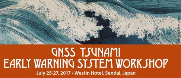
1 Real-time Earthquake and Tsunami Early Warning System Dr. Gerald Bawden NASA Mike Angove, Dr. Charles McCreery, Dr. Paul Huang NOAA Dr. Timothy Melbourne Central Washington University Dr. Yehuda Bock UC San Diego Dr. David Green NASA Headquarters Tim Stough, Dr. Attila Komjathy, Dr. Tony Song Jet Propulsion Laboratory Plus many many more. Japan, March 11, 2011
.")
2 The Significant Earthquakes Triggered Tsunamis ( Energy flux for trans-oceanic mega-tsunamis historically known. Insert figure distribution of fatalities over the tsunami propagation time ( up to 85% fatalities occur during the first hour). Calculations are made in ICT SB RAS by means of MGC numerical package for tsunami modeling (Chubarov, Babailov, Beisel, 2011). Ref: Gusiakov et al, 2015
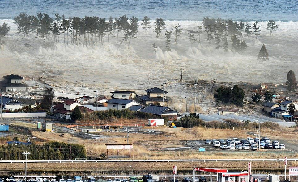
3 The Banda Aceh earthquake and tsunami claimed 250,000 lives without warning Phuket Island, Thailand December 26, 2004
4 What questions are asked when there is an earthquake in tsunami prone regions? Where was the earthquake? Lat/Lon/Depth How large was it? Accurate Magnitude Could the earthquake generate a tsunami? Nature of earthquake thrust, normal, strike-slip, oblique Was there a tsunami? DART buoys, other How much time do communities have before the tsunami makes landfall? Tsunami energy modeling How far will the tsunami come onshore? How deep will the water be? Subsidence measurements and inundation modeling
5 Real-time GNSS can help address many of these questions for most earthquakes Phuket Island, Thailand Where was the earthquake? Lat/Lon/Depth How large was it? Accurate Magnitude Could the earthquake generate a tsunami? Nature of earthquake thrust, normal, strike-slip, oblique Was there a tsunami? DART buoys, other How much time do communities have before the tsunami makes landfall? Tsunami energy modeling How far will the tsunami come onshore? How deep will the water be? Subsidence measurements and inundation modeling Measurement of the land surface deformation Measurement perturbations in the ionosphere Improves latency and accuracy of models Next 03 December - generation , 2004 models include coastal ICG 12 Kyoto, Japan subsidence Real-Time GNSS


6 Seismic Data Alone Underestimated Earthquake Size Fast and Accurate Magnitude Determination Is Essential OT+ 3 minutes M7.9 OT+ 13 hours M9.0 Japan seismic data => magnitude => tsunami impact based on precomputed database Japanese Meteorological Agency Source - Ozaki et al, 2011, EPS Japan seismic data & teleseismic data => magnitude => tsunami impact based on precomputed database Japanese Meteorological Agency

7 GNSS Earthquake and Tsunami Early Warning Data courtesy of the Geospatial Information Authority of Japan GSI GEONET GPS Array Great East Japan Earthquake and Tsunami Maximum GPS displacement ~5 meters

8 GSI GEONET GPS Array Earthquake Displacement Pattern Ronni Grapenthin

9 GSI GEONET GPS Array Earthquake Displacement Pattern Maximum Horizontal 5.3 meters Maximum Vertical Subsidence -1.2 meters Ronni Grapenthin

10 Real-Time GNSS for Rapid Earthquake Magnitude Determination and Fault Slip Distribution S. E. Minson et al, 2013 JGR


11 Current real-time GNSS data streams to NASA partners Prototype capability will be operational at NOAA s Tsunami Warning Centers Early 2018 Prototype running in real-time on a fixed fault surface Current real-time GNSS data streams


12 GNSS Earthquake Source Model for a Predefined Fault Prototype TEW System is currently active on 20 of 30 subduction zone segments Prototype running in real-time on a fixed fault surface M 8.8 earthquake Maule, Chile m tsunami Earthquakes in the past week Subduction zone segments blue = active/ black insufficient data

13 Emerging new technology for detection and tracking tsunamis: GSI s GEONET Captured the Ionospheric Coupled Waves By 2020 > 110 GNSS satellites Ionospheric Response to Mw 9.0 Tohoku Earthquake and Tsunami in Japan on March 11, 2011, A.Komjathy, D.A.Galvan, M.P Hickey, P.Stephens, Mark Butala, and A.Mannucci, (


14 GNSS Earthquake and Tsunami Early Warning


15 Sendai rtgnss Workshop Findings 1: Data / Networks We need to promote the open sharing of rtgnss data for early warning and hazard assessment. Goal is to save lives. Where are the holes in real-time GNSS coverage? Earthquake detection Earthquake/tsunami modeling Tsunami wave propagation detection and tracking. We need to develop a strategy to establish rtgnss capability at existing continuous sites. Upgrade existing sites to real-time. Increase bandwidth We need to develop a strategy to fill in data gaps such that there is global coverage? I.e. World Bank.


16 Sendai rtgnss Workshop Findings 2: Data streaming for early warning We need to develop a plan for data streaming/ restreaming that is optimized for each region. I.e. is there sufficient bandwidth and acceptable data latency We need to develop a strategy for data streaming redundancy. If one area is impacted by an event, then there should be sufficient data mirroring to provide rtgnss early warning capabilities. Who is responsible for data archiving?


17 Sendai rtgnss Workshop Findings SENDAI FRAMEWORK FOR DISASTER RISK REDUCTION A real-time GNSS network would support a number of goals described the Sendai Framework Data sharing supports the UN s Sendai Framework for Disaster Risk Reduction specific items Item 14: here is a need to enhance international cooperation. Item 18 (g): Substantially increase the availability of and access to multi-hazard early warning systems and disaster risk information and assessments Scientific to people by Research Item 20: Priorities for actions: Priority #1 Understanding disaster risk. Item 22: concerted international cooperation, an enabling international environment and means of implementation are needed to stimulate and contribute to developing the knowledge, capacities and motivation for disaster risk reduction at all levels, in particular for developing countries. Item 23 Policies and practices for disaster risk management should be based on an understanding of disaster risk Item 24a: To promote the collection, analysis, management and use of relevant data and practical information and ensure its dissemination GNSS 99.99% of the time

18 Known and Publically Accessible Continuous GNSS sites 14,667
19 Known and Publically Accessible Real-Time GNSS sites 2, December ICG 12 Kyoto, Japan

20 GNSS Earthquake and Tsunami Early Warning Expanding the earthquake and tsunami early warning globally requires access to shared real-time GNSS data in areas that are: Seismically active Coastal communities that may be impacted by a tsunami Partnership with regional/national tsunami and earthquake early warning Centers. The GNSS Early Warning approach enhances current capabilities Partnerships with the International GNSS and Earth Observation s communities ICG UN International Committee on Global Navigation Satellite Systems + UNOOSA IGS International GNSS Service GGOS Global Geodetic Observing System GEO Group on Earth Observations CEOS Committee on Earth Observation Satellites GGOS/IGS Real- TimeNetwork


21 Gerald Bawden


22 The Tsunami Generated Displacement of the Ocean Surface Couples to the Ionosphere From Artru et al., 2005
The Promise and Challenges of Accurate Low Latency GNSS for Environmental Monitoring and Response
 Technical Seminar Reference Frame in Practice, The Promise and Challenges of Accurate Low Latency GNSS for Environmental Monitoring and Response John LaBrecque Geohazards Focus Area Global Geodetic Observing
A GNSS Based Tsunami Warning System Augmentation for the Indo-Pacific Region
 A GNSS Based Tsunami Warning System Augmentation for the Indo-Pacific Region John LaBrecque GGOS Geohazards Monitoring Focus Area IUGG GeoRisk Commission Japan, March 11, 2011 1 The Tsunami Warning System
GNSS (GPS) buoy array in the Pacific for natural disaster mitigation. Teruyuki KATO Earthquake Research Institute the University of Tokyo, Japan
 buoy array in the Pacific for natural disaster mitigation. Teruyuki KATO Earthquake Research Institute the University of Tokyo, Japan") GNSS (GPS) buoy array in the Pacific for natural disaster mitigation Teruyuki KATO Earthquake Research Institute the University of Tokyo, Japan 1 (Modified from Oki & Koketsu, 2011) Historical megaquakes
GNSS (GPS) buoy array in the Pacific for natural disaster mitigation Teruyuki KATO Earthquake Research Institute the University of Tokyo, Japan 1 (Modified from Oki & Koketsu, 2011) Historical megaquakes
GNSS buoy array in the ocean for natural hazard mitigation. Teruyuki KATO Earthquake Research Institute the University of Tokyo, Japan
 GNSS buoy array in the ocean for natural hazard mitigation Teruyuki KATO Earthquake Research Institute the University of Tokyo, Japan 1 GNSS applications in Earth science From static to high-rate observations
The READI Working Group
 Real time GNSS for natural hazards: Early warning and monitoring systems Yehuda Bock Institute of Geophysics and Planetary Physics Scripps Institution of Oceanography & The READI Working Group IGS Workshop
GEONET -CORS Network of japan-
 GEONET -CORS Network of japan- Basara Miyahara Geospatial Information Authority of Japan Geospatial and GNSS CORS Infrastructure Forum Kuala Lumpur - Malaysia Geospatial Information Authority of Japan
Precise Instantaneous Network Positioning
 Precise Instantaneous Network Positioning Direct and Inverse Network RTK Approaches Yehuda Bock, Jeff Fayman, David Honcik, Paul de Jonge, Lydia Bock Geodetics, Inc. La Jolla, California ION GNSS 2005
Detecting Ionospheric TEC Perturbations Generated by Natural Hazards Using a Real-Time Network of GPS Receivers
 Detecting Ionospheric TEC Perturbations Generated by Natural Hazards Using a Real-Time Network of GPS Receivers Attila Komjathy, Yu-Ming Yang, and Anthony J. Mannucci Jet Propulsion Laboratory California
GNSS Buoy Array in the Ocean for a Synthetic Geohazards Monitoring System
 GNSS Buoy Array in the Ocean for a Synthetic Geohazards Monitoring System Teruyuki Kato, Earthq. Res. Inst., Univ. Tokyo, Japan Yukihiro Terada, Nat. Inst. Tech., Kochi Col., Japan Keiichi Tadokoro, Grad.
A study of the ionospheric effect on GBAS (Ground-Based Augmentation System) using the nation-wide GPS network data in Japan
 using the nation-wide GPS network data in Japan") A study of the ionospheric effect on GBAS (Ground-Based Augmentation System) using the nation-wide GPS network data in Japan Takayuki Yoshihara, Electronic Navigation Research Institute (ENRI) Naoki Fujii,
A study of the ionospheric effect on GBAS (Ground-Based Augmentation System) using the nation-wide GPS network data in Japan Takayuki Yoshihara, Electronic Navigation Research Institute (ENRI) Naoki Fujii,
The technical contribution of QZSS and GNSS to Tsunami early warning system
 0/17 Tsunami Workshop by Sentinel Asia @Sendai International Center Meeting Room 5 The technical contribution of QZSS and GNSS to Tsunami early warning system July 3, 2012 K. Mutoh, J. Yamashita, and S.
High Precision Navigation Capabilities(L1-SAIF) and Applications Using Japanese Quasi-Zenith Satellite System (QZSS)
 and Applications Using Japanese Quasi-Zenith Satellite System (QZSS)") High Precision Navigation Capabilities(L1-SAIF) and Applications Using Japanese Quasi-Zenith Satellite System (QZSS) ICG WG-B Application SG Meeting Munich, Germany March 12, 2012 Satellite Positioning
High Precision Navigation Capabilities(L1-SAIF) and Applications Using Japanese Quasi-Zenith Satellite System (QZSS) ICG WG-B Application SG Meeting Munich, Germany March 12, 2012 Satellite Positioning
Tsunami detection in the ionosphere
 Tsunami detection in the ionosphere [by Juliette Artru (Caltech, Pasadena, USA), Philippe Lognonné, Giovanni Occhipinti, François Crespon, Raphael Garcia (IPGP, Paris, France), Eric Jeansou, Noveltis (Toulouse,
Developments of GNSS Buoy for a Synthetic Geohazards Monitoring System
 ICG12 in Kyoto (1 Dec., 2017) Developments of GNSS Buoy for a Synthetic Geohazards Monitoring System Teruyuki Kato, Earthq. Res. Inst., Univ. Tokyo, Japan Yukihiro Terada, Nat. Inst. Tech., Kochi Col.,
Geodetic Reference Frame Theory
 Technical Seminar Reference Frame in Practice, Geodetic Reference Frame Theory and the practical benefits of data sharing Geoffrey Blewitt University of Nevada, Reno, USA http://geodesy.unr.edu Sponsors:
UNAVCO's Community Planning for real-time GPS in Earthscope's Plate Boundary Observatory
 Click to edit Master slide title UNAVCO's Community Planning for real-time GPS in Earthscope's Plate Boundary Observatory Chuck Meertens (presenting Author) David Mencin William Hammond John Langbein Bob
Determination of tsunami sources using deep ocean wave records
 Bull. Nov. Comp. Center, Math. Model. in Geoph., 11 (26), 53 63 c 26 NCC Publisher Determination of tsunami sources using deep ocean wave records A.Yu. Bezhaev, M.M. Lavrentiev (jr.), An.G. Marchuk, V.V.
New Approach for Tsunami Detection Based on RTK-GNSS Using Network of Ships
 New Approach for Tsunami Detection Based on RTK-GNSS Using Network of Ships Tokyo University of Marine Science and Technology Ryuta Nakaosone Nobuaki Kubo Background After the Indian Ocean Tsunami on 2004,
Ionospheric Signatures of Tohoku-Oki Tsunami of March 11, 2011: Model Comparisons Near the Epicenter
 Publications 7-12-2012 Ionospheric Signatures of Tohoku-Oki Tsunami of March 11, 2011: Model Comparisons Near the Epicenter David A. Galvan RAND Corporation Attila Komjathy Jet Propulsion Laboratory, California
EXPERIMENTAL RESULTS OF LEX CORRECTIONS USING FARMING MACHINE
 Sixth Meeting of the International Committee on Global Navigation Satellite Systems (ICG) EXPERIMENTAL RESULTS OF LEX CORRECTIONS USING FARMING MACHINE Masayuki Kanzaki Hitachi Zosen Corporation Prof.
KNOWLEDGE NOTE 5-3. Risk Communication. CLUSTER 5: Hazard and Risk Information and Decision Making. Risk Communication
 KNOWLEDGE NOTE 5-3 CLUSTER 5: Hazard and Risk Information and Decision Making 1 Prepared by Rajib Shaw, Yukiko Takeuchi, and Shohei Matsuura, Kyoto University; and Keiko Saito, World Bank 2 KNOWLEDGE NOTE
ITU Radiocommunication Sector (ITU-R) and Climate Change. Alexandre VASSILIEV ITU Radiocommunication Bureau
 and Climate Change. Alexandre VASSILIEV ITU Radiocommunication Bureau") ITU Radiocommunication Sector (ITU-R) and Climate Change Alexandre VASSILIEV ITU Radiocommunication Bureau WSIS FORUM 2009, Geneva, 18-22 May 2009 Radio and Information Society Today radio technologies
ITU Radiocommunication Sector (ITU-R) and Climate Change Alexandre VASSILIEV ITU Radiocommunication Bureau WSIS FORUM 2009, Geneva, 18-22 May 2009 Radio and Information Society Today radio technologies
Developing a National Real-time CORS Network in New Zealand
 Dave COLLETT, New Zealand Key words: GNSS, Positioning, CORS, New Zealand, Infrastructure SUMMARY Land Information New Zealand administers PositioNZ - New Zealand's national CORS network. This network
Athanassios Ganas, Research Director, NOA
 Advanced GNSS techniques for earthquake assessment and monitoring Athanassios Ganas, aganas@noa.gr Research Director, NOA NOA GPS Project http://www.gein.noa.gr/gps.html Hemus NET Project http://www.hemus-net.org/
The International GNSS Service (IGS): Product and Services
: Product and Services") The International GNSS Service (IGS): Product and Services Ruth E. Neilan 1, Chris Rizos 2 1 Director, IGS Central Bureau, NASA/JPL, Pasadena, USA 2 VP IAG, IGS Governing Board, UNSW, Sydney, Australia
The International GNSS Service (IGS): Product and Services Ruth E. Neilan 1, Chris Rizos 2 1 Director, IGS Central Bureau, NASA/JPL, Pasadena, USA 2 VP IAG, IGS Governing Board, UNSW, Sydney, Australia
Geoscience & Positioning, Navigation and Timing Services for Canadians
 Geoscience & Positioning, Navigation and Timing Services for Canadians Calvin Klatt, Ph.D. Director and Chief Geodesist Natural Resources Canada / Directeur et géodésien principal Ressources naturelles
PageNET: In Support of the Surveying Community
 Philippine Active Geodetic Network : In Support of the Surveying Community ICG Experts Meeting: Global Navigation Satellite Systems Services Vienna International Center, Vienna, Austria December 14-18,
Computers Watching Tsunamis DEEP- O C E A N A S S E S S M E N T A N D R E P O R T I N G ( D A R T I I )
") Computers Watching Tsunamis DEEP- O C E A N A S S E S S M E N T A N D R E P O R T I N G ( D A R T I I ) Origins of Tsunamis 1 Origins of Tsunamis 1 Energy density I(r) in terms of energy, E, and distance,
Computers Watching Tsunamis DEEP- O C E A N A S S E S S M E N T A N D R E P O R T I N G ( D A R T I I ) Origins of Tsunamis 1 Origins of Tsunamis 1 Energy density I(r) in terms of energy, E, and distance,
Ionospheric multiple stratifications and irregularities induced by the 2011 off the Pacific coast of Tohoku Earthquake
 LETTER Earth Planets Space, 63, 869 873, 2011 Ionospheric multiple stratifications and irregularities induced by the 2011 off the Pacific coast of Tohoku Earthquake Takashi Maruyama 1, Takuya Tsugawa 1,
Recent Developments in NOAA s Real- Time Coastal Observing Systems for Safe and Efficient Maritime Transportation
 Recent Developments in NOAA s Real- Time Coastal Observing Systems for Safe and Efficient Maritime Transportation Rich Edwing, Director NOAA Center for Operational Oceanographic Products and Services CMTS
GPS-TEC : a new versatile sensor of the Earth
 2006 Jun. VI Hotine-Marussi Symp. Theor. Computational Geodesy GPS-TEC : a new versatile sensor of the Earth Kosuke Heki (Hokkaido Univ., Sapporo, Japan) Ionospheric disturbances can be measured with GPS
Application of Satellite Communication System to Tsunami Early Warning System Satoru Ozawa
 Application of Satellite Communication System to Tsunami Early Warning System Satoru Ozawa Space Applications Program Systems Engineering Office Space Applications Mission Directorate Japan Aerospace Exploration
Remote sensing radio applications/ systems for environmental monitoring
 Remote sensing radio applications/ systems for environmental monitoring Alexandre VASSILIEV ITU Radiocommunication Bureau phone: +41 22 7305924 e-mail: alexandre.vassiliev@itu.int 1 Source: European Space
GNSS in Remote Sensing and Earth Science
 GNSS in Remote Sensing and Earth Science James L Garrison School of Aeronau:cs and Astronau:cs Division of Environmental and Ecological Engineering School of Electrical and Computer Engineering (courtesy)
Sub-Mesoscale Imaging of the Ionosphere with SMAP
 Sub-Mesoscale Imaging of the Ionosphere with SMAP Tony Freeman Xiaoqing Pi Xiaoyan Zhou CEOS Workshop, ASF, Fairbanks, Alaska, December 2009 1 Soil Moisture Active-Passive (SMAP) Overview Baseline Mission
Establishment of New Low-Cost and High-Resolution Real-Time Continuous Strong Motion Observation Network by CEORKA
 Establishment of New Low-Cost and High-Resolution Real-Time Continuous Strong Motion Observation Network by CEORKA T. Akazawa Geo-Research Institute, Japan M. Araki alab Inc., Japan S. Sawada & Y. Hayashi
GNSS CORS in the Pacific
 GNSS CORS in the Pacific FIG References Frame in Practice Seminar Operational Aspects of GNSS CORS Technical Workshop Holiday Inn, Suva - Fiji PGSC Partnership Desk, GEM Division, Pacific Community (SPC)
1.Earthquake Early Warning System. Japan Meteorological Agency
 1 st Process 1.Earthquake Early Warning System Estimation Estimation of of Hypocenter, Hypocenter, Magnitude Magnitude and and Seismic Seismic Intensity Intensity Dissemination Dissemination 2. 2. Present
International Committee on Global Navigation Satellite Systems (ICG) and its Programme on Global Navigation Satellite Systems (GNSS) Applications
 and its Programme on Global Navigation Satellite Systems (GNSS) Applications") and its Programme on Global Navigation Satellite Systems (GNSS) Applications Sharafat Gadimova ICG Executive Secretariat Office for Outer Space Affairs United Nations Office at Vienna a forum to discuss
and its Programme on Global Navigation Satellite Systems (GNSS) Applications Sharafat Gadimova ICG Executive Secretariat Office for Outer Space Affairs United Nations Office at Vienna a forum to discuss
Advances in Planetary Seismology Using Infrasound and Airglow Signatures on Venus
 Advances in Planetary Seismology Using Infrasound and Airglow Signatures on Venus 1 Attila Komjathy, 1 Siddharth Krishnamoorthy 1 James Cutts, 1 Michael Pauken,, 1 Sharon Kedar, 1 Suzanne Smrekar, 1 Jeff
System development and performance of the Deep-ocean Assessment and Reporting of Tsunamis (DART) system from
 system from") ITS 2001 Proceedings, NHTMP Review Session, Paper R-24 317 System development and performance of the Deep-ocean Assessment and Reporting of Tsunamis (DART) system from 1997 2001 Christian Meinig, Marie
ITS 2001 Proceedings, NHTMP Review Session, Paper R-24 317 System development and performance of the Deep-ocean Assessment and Reporting of Tsunamis (DART) system from 1997 2001 Christian Meinig, Marie
GNSS and M2M for Automated Driving in Japan Masao FUKUSHIMA SIP Sub-Program Director ITS Technical Consultant, NISSAN MOTOR CO.,LTD May. 15.
 ICT SPRING EUROPE 2018 GNSS and M2M for Automated Driving in Japan Masao FUKUSHIMA SIP Sub-Program Director ITS Technical Consultant, NISSAN MOTOR CO.,LTD May. 15. 2018 SIP : Cross-Ministerial Strategic
Use of Satellite Remote Sensing in Tsunami Damage Assessment
 Japan-Peru Workshop on Earthquake Disaster Mitigation, Lima 2005 Use of Satellite Remote Sensing in Tsunami Damage Assessment August 10, 2005 Fumio Yamazaki Chiba University, Chiba, Japan 1 World Tsunami
PADANG. Determination of Hazard from National Level GENERAL INFORMATION
 Determination of Hazard from National Level PADANG Padang with approximately one million citizens is one of the most prawn areas in the world and threatened by possible coming big Earthquakes and Tsunami.
International Committee on Global Navigation Satellite Systems (ICG): Building a System of Systems
: Building a System of Systems") International Committee on Global Navigation Satellite Systems (ICG): Building a System of Systems Outline of Presentation Executive Secretariat of the ICG United Nations Office for Outer Space Affairs
International Committee on Global Navigation Satellite Systems (ICG): Building a System of Systems Outline of Presentation Executive Secretariat of the ICG United Nations Office for Outer Space Affairs
The Three-dimensional Propagation of Tsunami-Generated Internal Waves in the Atmosphere
 The Three-dimensional Propagation of Tsunami-Generated Internal Waves in the Atmosphere Yue Wu, Stefan G. Llewellyn Smith, James W. Rottman, Dave Broutman and Jean-Bernard H. Minster Abstract Department
BeiDou: Bring the World and China to Your Doorstep
 IGS Workshop 2012-ICG Working Group A BeiDou: Bring the World and China to Your Doorstep China Satellite Navigation Office 2012.7.25 Olsztyn, Poland 1 Contents I. Development Schemes II. Performance III.
GNSS Reflectometry and Passive Radar at DLR
 ACES and FUTURE GNSS-Based EARTH OBSERVATION and NAVIGATION 26./27. May 2008, TU München Dr. Thomas Börner, Microwaves and Radar Institute, DLR Overview GNSS Reflectometry a joined proposal of DLR and
RAPID MAGITUDE DETERMINATION FOR TSUNAMI WARNING USING LOCAL DATA IN AND AROUND NICARAGUA
 RAPID MAGITUDE DETERMINATION FOR TSUNAMI WARNING USING LOCAL DATA IN AND AROUND NICARAGUA Domingo Jose NAMENDI MARTINEZ MEE16721 Supervisor: Akio KATSUMATA ABSTRACT The rapid magnitude determination of
1. INTRODUCTION. Longitude, deg In contrast to the global systems such as GPS, GLONASS and
 SPECIAL REPORT Highly-Accurate Positioning Experiment Using QZSS at ENRI Ken Ito Electronic Navigation Research Institute (ENRI) 1. INTRODUCTION P ositioning with GPS is widely used in Japan in the area
The International Scene: How Precise Positioning Will Underpin Critical GNSS Applications
 The International Scene: How Precise Positioning Will Underpin Critical GNSS Applications School of Civil & Environmental Engineering, UNSW, Sydney, Australia Chris Rizos Member of the IGS Governing Board
To Estimate The Regional Ionospheric TEC From GEONET Observation
 To Estimate The Regional Ionospheric TEC From GEONET Observation Jinsong Ping(Email: jsping@miz.nao.ac.jp) 1,2, Nobuyuki Kawano 2,3, Mamoru Sekido 4 1. Dept. Astronomy, Beijing Normal University, Haidian,
Global Printing Summit Forum
 Global Printing Summit Forum November 13 th, 2011 Shanghai, China The Japanese Printing Industry s Challenges - Recovery from the Earthquake Disaster- - Green Practices- -Creation of a New Market- Satoshi
Proposal. ITU/PITA RRS-16 for Asia & Pacific Emergency Communications: The Role of Satellites
 ITU/PITA RRS-16 for Asia & Pacific Emergency Communications: Proposal The Role of Satellites Raquib Masashi PRAMANIK SKY Perfect JSAT Corporation JAPAN 21 September 2016 JSAT Background Largest Satellite
General Assembly. United Nations A/AC.105/946
 United Nations A/AC.105/946 General Assembly Distr.: General 16 November 2009 Original: English Committee on the Peaceful Uses of Outer Space Report on the United Nations/Azerbaijan/United States of America/European
Determining Accurate Elevations: Datums & Tools, Today & Tomorrow
 Determining Accurate Elevations: Datums & Tools, Today & Tomorrow Association of State Floodplain Managers Annual Meeting Grand Rapids, MI Christine Gallagher June 21, 2016 Overview NGS Mission Important
Quasi-Zenith Satellite System (QZSS)
") Transmission of Augmentation Corrections using the Japanese QZSS for Real-Time Precise Point Positioning in Australia Ken Harima 1, Suelynn Choy 1, Mazher Choudhury 2, Chris Rizos 2, Satoshi Kogure 3 1
Transmission of Augmentation Corrections using the Japanese QZSS for Real-Time Precise Point Positioning in Australia Ken Harima 1, Suelynn Choy 1, Mazher Choudhury 2, Chris Rizos 2, Satoshi Kogure 3 1
SIMULATION OF EARTHQUAKES AND TSUNAMI THROUGH GSM NETWORK
 PROCEEDINGS OF ICETECT 2011 SIMULATION OF EARTHQUAKES AND TSUNAMI THROUGH GSM NETWORK G.SARADHA B.TECH-IT(FINAL YEAR) MOOKAMBIGAI COLLEGE OF ENGINEERING, PUDUKKOTTAI-622 502, TAMILNADU, INDIA. saradhagunasekaran@gmail.com
Research Activities and Education in TUMSAT
 Research Activities and Education in TUMSAT 2011/09/07 @ ICG-6 Akio Yasuda Tokyo University of Marine Science & Technology 1 Content Tokyo University of Marine Science and Technology Etchujima Campus of
Low-cost densification of permanent GPS networks for natural hazard mitigation: First tests on GSI s GEONET network
 LETTER Earth Planets Space, 52, 867 871, 2000 Low-cost densification of permanent GPS networks for natural hazard mitigation: First tests on GSI s GEONET network Chris Rizos 1, Shaowei Han 1, Linlin Ge
Geo++ White Paper. Comparison and Analysis of BLOCK II/IIA Offsets from Antenna Field Calibrations
 Geo++ White Paper Comparison and Analysis of BLOCK II/IIA Offsets from Antenna Field Calibrations Gerhard Wübbena, Martin Schmitz Geo++ Gesellschaft für satellitengestützte geodätische und navigatorische
Update on the International Terrestrial Reference Frame (ITRF)
") Update on the International Terrestrial Reference Frame (ITRF) Zuheir Altamimi Head of the IERS ITRF Product Center Institut National de l Information Géographique et Forestière IGN, France E-mail: zuheir.altamimi@ign.fr
Update on the International Terrestrial Reference Frame (ITRF) Zuheir Altamimi Head of the IERS ITRF Product Center Institut National de l Information Géographique et Forestière IGN, France E-mail: zuheir.altamimi@ign.fr
GSI Research and Development Basic Plan
 15 Abstract Aiming to define the basic direction for research and development (R&D) to be performed by the Geospatial Information Authority of Japan (GSI), this plan clarifies what kind of R&D should be
Real-Time and Multi-GNSS Key Projects of the International GNSS Service
 Real-Time and Multi-GNSS Key Projects of the International GNSS Service Urs Hugentobler, Chris Rizos, Mark Caissy, Georg Weber, Oliver Montenbruck, Ruth Neilan EUREF 2013 Symposium Budapest, Hungary, May
The present 5-year cycle of U.S. Argo implementation began in July 2015, and extends through June 2020.
 U.S. Argo National Report to AST-18, March 2017. Organization of U.S. Argo: The U.S. Argo Program is supported with major funding provided by the National Oceanic and Atmospheric Administration (NOAA),
International Committee on Global Navigation Satellite Systems
 International Committee on Global Navigation Satellite Systems Training Course on Global Navigation Satellite Systems 14 18 January 2019, Asian Institute of Technology, Bangkok, Thailand Sharafat Gadimova
Development of BeiDou Navigation Satellite System
 The 8 th Meeting of the International Committee on GNSS Development of BeiDou Navigation Satellite System China Satellite Navigation Office Dubai, UAE November, 2013 Contents Contents 1. Objectives and
Regional Tsunami Seminars 2013
 Regional Tsunami Seminars 2013 PROGRAMME 1. Review of Tsunami Hazard in New Zealand 2013 Update: Dr William Power 2. Tsunami warning in New Zealand Process: David Coetzee; Dr Ken Gledhill 3. Sirens standard
MEDLAB Mediterranean Living Lab for Territorial Innovation. Panagiotis Georgopoulos Region of Central Macedonia
 Mediterranean Living Lab for Territorial Innovation Panagiotis Georgopoulos Region of Central Macedonia panos@rcm.gr Policy Context ERDF 2007-2013 Territorial Cooperation MED Programme: competitiveness
Developing systems for ionospheric data assimilation
 Developing systems for ionospheric data assimilation Making a quantitative comparison between observations and models A.C. Bushell, 5 th European Space Weather Week, Brussels, 20 th November 2008 Collaborators
Addressable Radios for Emergency Alert (AREA): WorldSpace Satellite Radio
: WorldSpace Satellite Radio") Addressable Radios for Emergency Alert (AREA): A WorldSpace solution for effective delivery of alerts S.Rangarajan, Jerome Soumagne and Jean-Luc Vignaud WorldSpace Satellite Radio srangarajan@worldspace.com,
Addressable Radios for Emergency Alert (AREA): A WorldSpace solution for effective delivery of alerts S.Rangarajan, Jerome Soumagne and Jean-Luc Vignaud WorldSpace Satellite Radio srangarajan@worldspace.com,
Earthquake Early Warning Research and Development in California, USA
 Earthquake Early Warning Research and Development in California, USA Hauksson E., Boese M., Heaton T., Seismological Laboratory, California Ins>tute of Technology, Pasadena, CA, Given D., USGS, Pasadena,
The U.S. West Coast and Alaska Tsunami Warning Center
 ITS 2001 Proceedings, NTHMP Review Session, Paper R-23 229 The U.S. West Coast and Alaska Tsunami Warning Center Thomas J. Sokolowski West Coast and Alaska Tsunami Warning Center, Palmer, Alaska, U.S.A.
Development of a GAST-D ground subsystem prototype and its performance evaluation with a long term-data set
 Development of a GAST-D ground subsystem prototype and its performance evaluation with a long term-data set T. Yoshihara, S. Saito, A. Kezuka, K. Hoshinoo, S. Fukushima, and S. Saitoh Electronic Navigation
Contents of Presentation
 Outline of Collaborative R&D Project on Network of Research Institutes in Earthquake Prone Areas in Asia supported by Ministry of Education, Culture, Sports, Science and Technology (MEXT) Tokyo International
ISTANBUL EARTHQUAKE RAPID RESPONSE AND THE EARLY WARNING SYSTEM. M. Erdik Department of Earthquake Engineering aziçi University,, Istanbul
 ISTANBUL EARTHQUAKE RAPID RESPONSE AND THE EARLY WARNING SYSTEM M. Erdik Department of Earthquake Engineering Boğazi aziçi University,, Istanbul ISTANBUL THREATENED BY MAIN MARMARA FAULT ROBABILITY OF
Space Weather as a Global Challenge
 Space Weather as a Global Challenge IMPC DLR Neustrelitz and Expert Service Centre Ionospheric Weather (I-ESC) Dr. Juergen Drescher DLR Washington Office German Aerospace Center jd@dlr.org German Aerospace
International Cooperation Research Center, China Satellite Navigation Office
 International Cooperation Research Center, ICG-8, Nov 10, 2013 Dubai Overview BeiDou Navigation Satellite System (hereinafter referred to as BDS") has provide regional service by the end of 2012, which
Report on a Multi-GNSS Demonstration project in the Asia/Oceania region
 Report on a Multi-GNSS Demonstration project in the Asia/Oceania region - Asia Oceania is the Showcase of New GNSS Era - Japan Aerospace Exploration Agency ICG 5@Turin, Italy October 19, 2010 1 Back Ground
Current GPS Monitoring Activities in Thailand and Total Electron Content (TEC) Study at Chumphon and Bangkok, Thailand
 Study at Chumphon and Bangkok, Thailand") EIWACS 2010 The 2nd ENRI International Workshop on ATM/CNS 10-12 November, 2010, Tokyo, Japan Current GPS Monitoring Activities in Thailand and Total Electron Content (TEC) Study at Chumphon and Bangkok,
EIWACS 2010 The 2nd ENRI International Workshop on ATM/CNS 10-12 November, 2010, Tokyo, Japan Current GPS Monitoring Activities in Thailand and Total Electron Content (TEC) Study at Chumphon and Bangkok,
Overview of Tides and Water Levels
 Overview of Tides and Water Levels www.tidesandcurrents.noaa.gov New Orleans, Baton Rouge, Lafayette, LA March 2009 Gerald Hovis, NOAA - National Ocean Service William Sweet, NOAA - National Ocean Service
Originally published as:
 Originally published as: Li, X., Ge, M., Guo, B., Wickert, J., Schuh, H. (2013): Temporal point positioning approach for realtime GNSS seismology using a single receiver. Geophysical Research Letters,
Recent progress of NICT ionospheric observations in Japan
 Recent progress of NICT ionospheric observations in Japan T. Tsugawa, M. Nishioka, H. Kato, H. Jin, and M. Ishii National Institute of Information and Communications Technology (NICT), Japan NICT ionospheric
Challenges and Methods for Integrity Assurance in Future GNSS
 Challenges and Methods for Integrity Assurance in Future GNSS Igor Mozharov Division Head, Information and Analytical Center for PNT, Central Research Institute for Machine Building, Roscosmos igor.mozharov@mcc.rsa.ru
Correlation Analysis for Total Electron Content Anomalies on 11th March, 2011
 arxiv:166.78v [physics.geo-ph] 1 Jun 16 Correlation Analysis for Total Electron Content Anomalies on 11th March, 11 Takuya Iwata, Ken Umeno Iwata and Umeno Department of Applied Mathematics and Physics,
GPS Accuracy in Urban Environments Using Post-Processed CORS Data
 GPS Accuracy in Urban Environments Using Post-Processed CORS Data Knute A. Berstis, Gerald L. Mader NOAA, NOS, National Geodetic Survey Silver Spring, MD Aaron Jensen US Census Bureau Washington, DC Presentation
Overview of New Datums NOAA s National Geodetic Survey
 Overview of New Datums NOAA s National Geodetic Survey February 3, 2015 1 NGS s Mission and Role NGS Mission: To define, maintain, and provide access to the National Spatial Reference System to meet our
Current status and future plan of NICT s ionospheric observations in the Southeast Asia by SEALION and GNSS-TEC
 Current status and future plan of NICT s ionospheric observations in the Southeast Asia by SEALION and GNSS-TEC Takuya Tsugawa 1, Michi Nishioka 1, Hiromitsu Ishibashi 1, Takashi Maruyama 1, Pornchai Supnithi
International Committee on Global Navigation Satellite Systems (ICG)
") International Committee on Global Navigation Satellite Systems (ICG) A forum to discuss global navigation satellite systems to benefit people around the world Sharafat Gadimova United Nations Office for
International Committee on Global Navigation Satellite Systems (ICG) A forum to discuss global navigation satellite systems to benefit people around the world Sharafat Gadimova United Nations Office for
EUREF Permanent GNSS Network Carine Royal Observatory of Belgium
 ENEON first workshop Observing Europe: Networking the Earth Observation Networks in Europe EUREF Permanent GNSS Network Carine Bruyninx/C.Bruyninx@oma.be Royal Observatory of Belgium 1. About your network
SOME ASPECT AND PERSPECTIVES OF IMPLEMENTATION OF THE NATIONAL POLICY IN THE FIELD OF EXPLORATION AND PEACEFUL USES OF OUTER SPACE
 SOME ASPECT AND PERSPECTIVES OF IMPLEMENTATION OF THE NATIONAL POLICY IN THE FIELD OF EXPLORATION AND PEACEFUL USES OF OUTER SPACE 1 Folie 1 NKS Raumfahrt, Dr. Adrian klein Background National Academy
Improvement of Reachability and Promptness of an Augmentation-Signal-Based Early Warning System Using Multiple Satellites of the QZSS Constellation
 ISBN 978-93-84468-20-0 Proceedings of 2015 International Conference on Future Computational Technologies (ICFCT'2015) Singapore, March 29-30, 2015, pp. 15-26 Improvement of Reachability and Promptness
DELIVERING THE INDUSTRY S FIRST DISASTER AND SAFETY AUTOMATIONS
 DELIVERING THE INDUSTRY S FIRST DISASTER AND SAFETY AUTOMATIONS About Us - Only Disaster Automations company in existence with our extensive partnerships and capabilities - Covering 98% of the US population
EXPERT GROUP MEETING ON CONTEMPORARY PRACTICES IN CENSUS MAPPING AND USE OF GEOGRAPHICAL INFORMATION SYSTEMS New York, 29 May - 1 June 2007
 EXPERT GROUP MEETING ON CONTEMPORARY PRACTICES IN CENSUS MAPPING AND USE OF GEOGRAPHICAL INFORMATION SYSTEMS New York, 29 May - 1 June 2007 STATEMENT OF DR. PAUL CHEUNG DIRECTOR OF THE UNITED NATIONS STATISTICS
Note that some are my own photos, comments, and opinions - Not necessary reflecting WB GFDRR s views
 1 Session 7: The Recovery Process Note that some are my own photos, comments, and opinions - Not necessary reflecting WB GFDRR s views Yuichi Ono Professor, International and Regional Cooperation Office
THE CURRENT STATUS OF ASIA OCEANIA MULTI-GNSS DEMONSTRATION CAMPAIGN
 THE CURRENT STATUS OF ASIA OCEANIA MULTI-GNSS DEMONSTRATION CAMPAIGN 1 Multi-GNSS Asia Secretariat July 25, 2012 UN ICG WG-A intersession Mtg. Session4 @UWM Olstzyn, Poland ASIA OCEANIA MULTI-GNSS DEMONSTRATION
Microsatellite Ionospheric Network in Orbit
 Changing the economics of space Microsatellite Ionospheric Network in Orbit Dr Stuart Eves Lead Mission Concepts Engineer SSTL s.eves@sstl.co.uk In tribute to Mino Freund 1962-2012 Introduction Objective
Asia Disaster Reduction Science and Technology Forum on December 4, 2006 BPPT Building II, Jakarta, Indonesia. Tatsuo Narafu
 Outline of Collaborative R&D Project on Network of Research Institutes in Earthquake Prone Areas in Asia supported by Ministry of Education, Culture, Sports, Science and Technology (MEXT) Asia Disaster
DYNAMIC RT TECHNOLOGY
 DYNAMIC RT TECHNOLOGY GLOBAL NAVIGATION SATELLITE SYSTEMS (GNSS) POTENTIAL FUTURE DEVELOPMENTS(2005 2017?) GPS MODERNIZATION BLOCK IIF & III GLONASS ENHANCEMENTS (K & M) EUROPEAN UNION - GALILEO CHINA
Jun Shen International Cooperation Center. China Satellite Navigation Office
 Jun Shen (shenjun@beidou.gov.cn) International Cooperation Center Tenth Meeting of the International Committee on Global Navigation Satellite Systems (ICG) November 1-6, 2015 1 Introduction and Background